ESOC s Multi-GNSS Processing
|
|
|
- Edward Barker
- 6 years ago
- Views:
Transcription
1 ESOC s Multi-GNSS Processing Cristina Garcia-Serrano, Tim Springer, Florian Dilssner, Claudia Flohrer, Erik Schönemann, Werner Enderle ESOC - Navigation Support Office, Darmstadt, Germany IGS Workshop 2016, Sydney, Australia Hobart, Mt. Pleasant Radio Observatory
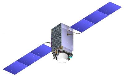
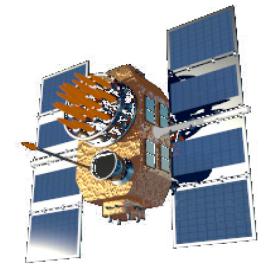
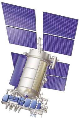
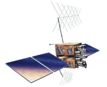
2 Multi-GNSS data processing ESA and MGEX sites GPS-IIA GLONASS-M Galileo GPS-IIR/RM ~68-75 satellites QZSS GPS-IIF BeiDou
3 Multi-GNSS Challenges 1. Lot of issues with new and additional frequencies and signals a. Will be ignored in this presentation. IGS not ready!? 2. Integer Ambiguity Resolution a. GPS L1-L2 P/C understood but how are the other signals b. How about the other systems Galileo, GLONASS, BeiDou, QZSS 3. Satellite Attitude a. Eclipse phases b. Orbit normal mode for BeiDou and QZSS c. Transition point/epoch from one mode to the other 4. Satellite Radiation Modelling (mainly Solar Radiation) a. Simple box-wing b. Elaborate satellite models 5. Satellite Transmitter Phase Centre a. Location (PCO) b. Variation as function of elevation and azimuth (PCV) ESOC is systematically working to address all these issues
4 Integer Ambiguity Resolution Histogram of narrow lane fractionals
5 Integer Ambiguity Resolution Histogram of narrow lane fractionals
6 Integer Ambiguity Resolution 1. GPS L1 C/P L2 C/P understood a. But how about L5C There are issues with compatibility of the L1, L2, and L5 signals 2. How about the other systems a. GLONASS Only CODE does ambiguity resolution? b. Galileo Looks quite promising c. BeiDou Not working for us as MelWub fractionals not very good Elevation dependent code biases part of the reason d. QZSS May be treated as a normal GPS satellite

7 BeiDou attitude model Potential attitude model improvement à Attitude transition from yaw steering to orbit normal mode Phase residuals show improvement Dedicated SLR tracking for transition periods could help to validate the attitude model Standard attitude mode switch Refined attitude mode switch

8 BeiDou attitude model Transition Issues
9 Solar radiation pressure Direct SRP force (D). X Z Projected box area A in direct Sun direction X min area. Z X X Z max area. -X Z Z Acceleration due to direct SRP is assumed to be: constant for the wings (A W = const) but varying for the box (A B = f(t))
10 Box-Wing model Surface areas used in NAPEOS Box [m 2 ] Wing [m 2 ] ±X ±Y ±Z ± GPS-IIA 1) GPS-IIR/RM 1) GPS-IIF 1) GLONASS-M 1) Galileo-1 (IOV) 2) BeiDou 2) QZSS 2) ) public data 2) Guestimated data β=20 β= 4 Transition between: - yaw steering - orbit normal mode
11 Surface areas max-min [m 2 ] Rank Mass [kg] Impact factor Rank GPS-IIA GPS-IIR/RM GPS-IIF GLONASS-M Galileo-1 (IOV) BeiDou QZSS min box max box wings [m 2 ]
12 Approx. surface area changes Not absorbed by ECOM parameters max-min [m 2 ] Mass [kg] Impact Sensitivity GPS-IIA GPS-IIR/RM GPS-IIF GLONASS-M Galileo-1 (IOV) BeiDou-M QZSS
13 Validate orbit models with SLR without box-wing with box-wing Orbit difference Which orbit is better??-?! SLR can tell! (mainly in radial direction)
14 Number of SLR data (NP) in GPS-IIA (1/2) GLONASS-M (22/27) Galileo-1 (4/4) BeiDou (4/14) QZSS (1/1) MEO (1/4) IGSO (2/5) GEO (1/5)

15 Radial orbit difference GLONASS-M with box-wing minus without box-wing [mm]
16 SLR residuals (2-way) GLONASS-M without box-wing [m]


17 SLR residuals (2-way) GLONASS-M with box-wing [m]

18 QZSS Radial Orbit Differences Effect of orbit normal mode phase

19 QZSS Radial Orbit Differences No Box-Wing versus Box-Wing
20 Impact of analytical SRP models (box-wing) QZSS-01 difference of est. clock to linear fit (daily) Orbit error mapped to clock Still issues in transition phase and in orbit normal mode

21 SLR Residuals without Box-Wing

22 SLR Residuals with Box-Wing
")
23 Satellite Attitude and Radiation Model Orbit Overlap: Radial (mm)

24 Satellite Attitude and Radiation Model Orbit Overlap: Along Track (mm)

25 Satellite Attitude and Radiation Model Orbit Overlap: Cross-Track (mm)
26 Satellite Attitude and Radiation Model 1. Eclipse phases a. Block II/IIA for reprocessing b. Continuing IIF issues c. Galileo and GLONASS rather similar attitude behaviour Some older GLONASS satellites have issues 2. Orbit normal mode for BeiDou and QZSS a. BeiDou MEO and IGSO when beta < 4 degrees b. QZSS when beta < 20 degrees c. BeiDou GEO always d. Neither ECOM nor ECOM2 model works very well for this mode e. Transition point/epoch from one mode to the other needed to be understood and modelled properly f. Good radiation pressure models for these satellites are needed
27 Satellite Attitude and Radiation Model 1. Orbit normal mode for BeiDou and QZSS: a. BeiDou MEO and IGSO when beta < 4 degrees b. QZSS when beta < 20 degrees c. BeiDou GEO always Neither ECOM nor ECOM2 model works very well for this mode 1. Transition point/epoch from one mode to the other needed to be understood and modelled properly 2. Good radiation pressure models for these satellites are needed 2. Every satellite type handles the eclipse phase differently: a. Block II/IIA/IIR b. Block IIF (which have also unexpected behaviour even outside eclipse) c. GLONASS and Galileo rather similar Some older GLONASS satellites have issues
28 PCV Estimation
29 Multi-GNSS Conclusions Significant Efforts Needed for: 1. Integer Ambiguity Resolution Concepts a. BeiDou and GLONASS b. How about inter-system ambiguity resolution? 2. Satellite Attitude a. GPS IIF issues b. BeiDou and QZSS attitude transition 3. Satellite Radiation Modelling a. Very important for QZSS and Galileo b. Crucial for BeiDou and QZSS when in orbit normal mode 4. Transmit Antenna PCO/PCV a. Estimates needed from different ACs b. Also need to start worrying because of more than 2 freq s
30 Announcement! 1. All our multignss results will be made publicly available 2. ESA/ESOC is planning to start producing routine multignss products a. Will need RINEX-3 as official IGS products 3. Either as dedicated rapid product a. We currently do not have a real rapid product, it is just our Ultra product from 00 hours b. Depends on timely availability of RINEX-3 files 4. Or it will replace our final product a. Depends on sufficient RF stations with multignss receivers b. No adverse effects of remaining modelling issues In particular BeiDou and QZSS Radiation Pressure Model PCO/PCV values MultiGNSS Rapid Solution Preferred way forward
31 THANK YOU Cristina Garcia-Serrano Tim Springer
WHU s developments for the MGEX precise products and the GNSS ultra-rapid products
 IGS Workshop 2016 WHU s developments for the MGEX precise products and the GNSS ultra-rapid products Chuang Shi; Qile Zhao; Min Li; Jing Guo; Jingnan Liu Presented by Jianghui Geng GNSS Research Center,
Multi-technique combination at observation level with NAPEOS
 Multi-technique combination at observation level with NAPEOS Michiel Otten, Claudia Flohrer, Tim Springer, Werner Enderle EGU General Assembly 2012 Vienna Austria 27/04/2012 Introduction Combination of
GFZ Analysis Centre: Multi-GNSS Processing and Products
 GFZ Analysis Centre: Multi-GNSS Processing and Products Mathias Fritsche, Zhiguo Deng, Maik Uhlemann,Thomas Nischan, Markus Bradke, Markus Ramatschi, Andre Brand, Gerda Beeskow DeutschesGeoforschungsZentrum
Preparing for the Future The IGS in a Multi-GNSS World
 Preparing for the Future The IGS in a Multi-GNSS World O. Montenbruck DLR/GSOC 1 The International GNSS Service is a federation of more than 200 institutions and organizations worldwide a Service of the
VLBI processing at ESOC
 VLBI processing at ESOC Claudia Flohrer, Erik Schönemann, Tim Springer, René Zandbergen, Werner Enderle ESOC - Navigation Support Office (OPS-GN), Darmstadt, Germany 9th IVS General Meeting Johannesburg
Multi-GNSS / Multi-Signal code bias determination from raw GNSS observations
 Multi-GNSS / Multi-Signal code bias determination from raw GNSS observations F. Reckeweg, E. Schönemann, T. Springer, M. Becker, W. Enderle Geodätische Woche 2016 InterGEO 11.-13. October 2016 Hamburg,
Multi-Technique Reprocessing and Combination using Space-Ties
 Multi-Technique Reprocessing and Combination using Space-Ties Tim Springer, Florian Dilssner, Diego Escobar, Michiel Otten, Ignacio Romero, John Dow AGU 2009, San Francisco, CA, USA 14/12/2009 ESOC Reprocessing
Phase Centre Calibration of the Galileo Satellite Navigation Antenna
 Phase Centre Calibration of the Galileo Satellite Navigation Antenna IGS workshop 2017, Paris (France) Antennas & Biases Session F. Gonzalez (ESA) M. Söllner (Airbus) E. Schönemann (ESA) F. Dilssner (ESA)
BeiDou Orbit Determination Processes and Products in JPL's GDGPS System
 BeiDou Orbit Determination Processes and Products in JPL's GDGPS System Ant Sibthorpe, Yoaz Bar-Sever, Willy Bertiger, Wenwen Lu, Robert Meyer, Mark Miller and Larry Romans Outline GNSS (GPS/BDS) with
Phase Centre Calibration of the Galileo Satellite Navigation Antenna
 Phase Centre Calibration of the Galileo Satellite Navigation Antenna IGS workshop 2017, Paris (France) Antennas & Biases Session F. Gonzalez (ESA) M. Söllner (Airbus) E. Schönemann (ESA) F. Dilssner (ESA)
COMPARISON BETWEEN BROADCAST AND PRECISE ORBITS: GPS GLONASS GALILEO AND BEIDOU. A. Caporali and L. Nicolini University of Padova, Italy
 COMPARISON BETWEEN BROADCAST AND PRECISE ORBITS: GPS GLONASS GALILEO AND BEIDOU A. Caporali and L. Nicolini University of Padova, Italy Summary Previous works Input data and method used Comparison between
Quality of GRACE Orbits Using the Reprocessed IGS Products
 Quality of GRACE Orbits Using the Reprocessed IGS Products Z. Kang, B. Tapley, S. Bettadpur, H. Save Center for Space Research 3925 W Braker Lane Suite 200, Austin TX 78759 USA 2009 AGU Fall Meeting GRACE
VLBI and DDOR activities at ESOC
 VLBI and DDOR activities at ESOC Claudia Flohrer 1, Mattia Mercolino 2, Erik Schönemann 1, Tim Springer 1, Joachim Feltens 1, René Zandbergen 1, Werner Enderle 1, Trevor Morley 3 1) Navigation Support
The last 25 years - GPS to multi-gnss: from a military tool to the most widely used civilian positioning solution
 1 The last 25 years - GPS to multi-gnss: from a military tool to the most widely used civilian positioning solution B. Hofmann-Wellenhof Institute of Geodesy / Navigation, Graz University of Technology
WHU's Developments for the GPS Ultra-Rapid Products and the COMPASS Precise Products
 WHU's Developments for the GPS Ultra-Rapid Products and the COMPASS Precise Products C. Shi; Q. Zhao; M. Li; Y. Lou; H. Zhang; W. Tang; Z. Hu; X. Dai; J. Guo; M.Ge; J. Liu 2012 International GNSS Workshop
Real-Time and Multi-GNSS Key Projects of the International GNSS Service
 Real-Time and Multi-GNSS Key Projects of the International GNSS Service Urs Hugentobler, Chris Rizos, Mark Caissy, Georg Weber, Oliver Montenbruck, Ruth Neilan EUREF 2013 Symposium Budapest, Hungary, May
MGEX Clock Determination at CODE
 source: http://boris.unibe.ch/74079/ downloaded: 13.3.2017 MGEX Clock Determination at CODE E. Orliac, L. Prange, R. Dach, S. Schaer and A. Jäggi Astronomical Institute of University of Bern (AIUB) Bern,
magicgnss: QUALITY DATA, ALGORITHMS AND PRODUCTS FOR THE GNSS USER COMMUNITY
 SEMANA GEOMATICA 2009 magicgnss: QUALITY DATA, ALGORITHMS AND PRODUCTS FOR THE GNSS USER COMMUNITY MARCH 3, 2009 BARCELONA, SPAIN SESSION: GNSS PRODUCTS A. Mozo P. Navarro R. Píriz D. Rodríguez March 3,
Fast convergence of Trimble CenterPoint RTX by regional augmentation
 Fast convergence of Trimble CenterPoint RTX by regional augmentation Dr. Ralf Drescher Trimble Terrasat GmbH, Munich EGU General Assembly 2015, Vienna Thursday, 16 April 2015 Outline Introduction CenterPoint
Where Next for GNSS?
 Where Next for GNSS? Professor Terry Moore Professor of Satellite Navigation Nottingham The University of Nottingham Where Next for GNSS Back to the Future? Professor Terry Moore Professor of Satellite
Issues Related to the Use of Absolute GPS/GLONASS PCV Models
 Bundesamt für Landestopografie Office fédéral de topographie Ufficio federale di topografia Uffizi federal da topografia Issues Related to the Use of Absolute GPS/GLONASS PCV Models S. Schaer 1, U. Hugentobler
MULTI-GNSS TIME TRANSFER
 MULTI-GNSS TIME TRANSFER Pascale Defraigne Royal Observatory of Belgium 1 OUTLINE Introduction GNSS Time Transfer Concept Instrumental aspect Multi-GNSS Requirements GPS-GLONASS experiment Galileo, Beidou:
Guorong Hu & Michael Moore Geodesy Section, Geoscience Australia
 Influence of using individual GPS receiver antenna calibrations on high precision geodetic positioning, case study: Northern Surat Basin Queensland 2015 GPS campaign Guorong Hu & Michael Moore Geodesy
MAGICGNSS RTCM-BASED SERVICE, A LEAP FORWARD TOWARDS MULTI- GNSS HIGH ACCURACY REAL-TIME PROCESSING
 ION GNSS 2015 MAGICGNSS RTCM-BASED SERVICE, A LEAP FORWARD TOWARDS MULTI- GNSS HIGH ACCURACY REAL-TIME PROCESSING SEPTEMBER 16 TH, 2015 - ION GNSS 2015, TAMPA, FLORIDA, USA SESSION E2A: NEXT GENERATION
GNSS Integrity Monitoring
 www.dlr.de Chart 1 GNSS Integrity Monitoring Martini - Rome, 22 June 2017 GNSS Integrity Monitoring Dr. Ilaria Martini Institute of Communications and Navigation German Aerospace Center Rome, 22.06.2017
GNSS Analysis with Galileo Observations in the Subnetwork of the BEK Analysis Centre
 GNSS Analysis with Galileo Observations in the Subnetwork of the BEK Analysis Centre Christof Völksen Bavarian Academy of Sciences and Humanities (BAdW) Tomasz Liwosz Warsaw University of Technology, Warsaw,
Multi-Constellation GNSS Precise Point Positioning using GPS, GLONASS and BeiDou in Australia
 International Global Navigation Satellite Systems Society IGNSS Symposium 2015 Multi-Constellation GNSS Precise Point Positioning using GPS, GLONASS and BeiDou in Australia Xiaodong Ren 1,Suelynn Choy
CALIBRATING GNSS SATELLITE ANTENNA GROUP-DELAY VARIATIONS USING SPACE AND GROUND RECEIVERS
 IGS WORKSHOP 2014 CALIBRATING GNSS SATELLITE ANTENNA GROUP-DELAY VARIATIONS USING SPACE AND GROUND RECEIVERS June 23-27, 2014 - PASADENA, CALIFORNIA Plenary PY06: Infrastructure and Calibration David CALLE
Splinter Meeting of the IGS Antenna Working Group
 Splinter Meeting of the IGS Antenna Working Group Ralf Schmid Deutsches Geodätisches Forschungsinstitut der Technischen Universität München (DGFI-TUM) Munich, Germany e-mail: schmid@tum.de 1. Satellite
Assessment of GNSS Ionospheric Scintillation and TEC Monitoring Using the Multi-constellation GPStation-6 Receiver
 Assessment of GNSS Ionospheric Scintillation and TEC Monitoring Using the Multi-constellation GPStation-6 Receiver Rod MacLeod Regional Manager Asia/Pacific NovAtel Australia Pty Ltd Outline Ionospheric
ANTEX Considerations for Multi-GNSS Work
 ANTEX Considerations for Multi-GNSS Work O.Montenbruck, DLR/GSOC Slide 1 Naming Issues ANTEX provides cross-reference of variable and static spacecraft identifiers PRN (SP3 vehicle ID, RINEX satellite
Zero difference GPS ambiguity resolution at CNES-CLS IGS Analysis Center
 Zero difference GPS ambiguity resolution at CNES-CLS IGS Analysis Center S. Loyer, F. Perosanz, F. Mercier, H. Capdeville, J.C. Marty, F. Fund, P. Gegout 3, R. Biancale 08// G 0 ENSG, Marne-la-Vallée November
GLONASS Precise Orbit Determination
 GLONASS Precise Orbit Determination Ignacio, Romero. GMV (at ESA/ESOC), Isaac Newton 11, PTM, Tres Cantos, E-28760, Madrid, Spain. Carlos, Garcia. GMV (at ESA/ESOC), Isaac Newton 11, PTM, Tres Cantos,
Evaluation of Potential Systematic Bias in GNSS Orbital Solutions
 Evaluation of Potential Systematic Bias in GNSS Orbital Solutions Graham M. Appleby Space Geodesy Facility, Natural Environment Research Council Monks Wood, Abbots Ripton, Huntingdon PE28 2LE, UK Toshimichi
The added value of new GNSS to monitor the ionosphere
 The added value of new GNSS to monitor the ionosphere R. Warnant 1, C. Deprez 1, L. Van de Vyvere 2 1 University of Liege, Liege, Belgium. 2 M3 System, Wavre, Belgium. Monitoring TEC for geodetic applications
Combined Multi System GNSS Analysis for Time and Frequency Transfer
 Combined Multi System GNSS Analysis for Time and Frequency Transfer R. Dach, U. Hugentobler, T. Schildknecht, and A. Gaede rolf.dach@aiub.unibe.ch Astronomical Institute, University of Bern, Sidlerstrasse
GNSS Ionosphere Analysis at CODE
 GNSS Ionosphere Analysis at CODE Stefan Schaer 2004 IGS Workshop Berne, Switzerland March 1-5 Time Series of Global Mean TEC Covering Nearly One Solar Cycle as Generated at CODE 1 Exceptionally High TEC
An Industry View on Realistic Benefits for High Precision GNSS Applications due to GNSS Modernisation The Future of High Precision GNSS
 An Industry View on Realistic Benefits for High Precision GNSS Applications due to GNSS Modernisation The Future of High Precision GNSS Bernhard Richter GNSS Business Director at Leica Geosystems 1 Content
Modelling GPS Observables for Time Transfer
 Modelling GPS Observables for Time Transfer Marek Ziebart Department of Geomatic Engineering University College London Presentation structure Overview of GPS Time frames in GPS Introduction to GPS observables
Principles of the Global Positioning System Lecture 19
 12.540 Principles of the Global Positioning System Lecture 19 Prof. Thomas Herring http://geoweb.mit.edu/~tah/12.540 GPS Models and processing Summary: Finish up modeling aspects Rank deficiencies Processing
IGS workshop 2018 Multi-GNSS through Global Collaboration Datum: 29 October - 2 November 2018 Plats: Wuhan, China Deltagare: Tong Ning (I0101)
") 2018-11-19 RESERAPPORT IGS workshop 2018 Multi-GNSS through Global Collaboration Datum: 29 October - 2 November 2018 Plats: Wuhan, China Deltagare: Tong Ning (I0101) Syfte med mötet The workshop programme
2018-11-19 RESERAPPORT IGS workshop 2018 Multi-GNSS through Global Collaboration Datum: 29 October - 2 November 2018 Plats: Wuhan, China Deltagare: Tong Ning (I0101) Syfte med mötet The workshop programme
Update on the International Terrestrial Reference Frame (ITRF)
") Update on the International Terrestrial Reference Frame (ITRF) Zuheir Altamimi Head of the IERS ITRF Product Center Institut National de l Information Géographique et Forestière IGN, France E-mail: zuheir.altamimi@ign.fr
Update on the International Terrestrial Reference Frame (ITRF) Zuheir Altamimi Head of the IERS ITRF Product Center Institut National de l Information Géographique et Forestière IGN, France E-mail: zuheir.altamimi@ign.fr
Principal Investigator Co-Principal Investigator Co-Principal Investigator Prof. Talat Ahmad Vice-Chancellor Jamia Millia Islamia Delhi
 Subject Paper No and Title Module No and Title Module Tag Geology Remote Sensing and GIS Concepts of Global Navigation Satellite RS & GIS XXXIII Principal Investigator Co-Principal Investigator Co-Principal
Progress of igmas and
 2017 ICG-12 Progress of igmas and IGMA Joint Trial Project igmas TEAM Kyoto Japan 2th Dec. 2017 Contents 1. Introduction 2. Progress of IGMA Joint Trial Project 3. Reference for Monitoring and Assessment
The Promise and Challenges of Accurate Low Latency GNSS for Environmental Monitoring and Response
 Technical Seminar Reference Frame in Practice, The Promise and Challenges of Accurate Low Latency GNSS for Environmental Monitoring and Response John LaBrecque Geohazards Focus Area Global Geodetic Observing
PPP with Ambiguity Resolution (AR) using RTCM-SSR
 using RTCM-SSR") PPP with Ambiguity Resolution (AR) using RTCM-SSR Gerhard Wübbena, Martin Schmitz, Andreas Bagge Geo++ GmbH 30827 Garbsen Germany www.geopp.de PPP with Ambiguity Resolution (AR) using RTCM-SSR Abstract
PPP with Ambiguity Resolution (AR) using RTCM-SSR Gerhard Wübbena, Martin Schmitz, Andreas Bagge Geo++ GmbH 30827 Garbsen Germany www.geopp.de PPP with Ambiguity Resolution (AR) using RTCM-SSR Abstract
GLObal Navigation Satellite System (GLONASS)
") FEDERAL SPACE AGENCY GLObal Navigation Satellite System (GLONASS) Sergey Revnivykh Deputy Director General Central Research Institute of Machine Building Head of PNT Center 4-th meeting of International
FEDERAL SPACE AGENCY GLObal Navigation Satellite System (GLONASS) Sergey Revnivykh Deputy Director General Central Research Institute of Machine Building Head of PNT Center 4-th meeting of International
CODE. L. Prange, R. Dach, S. Schaer, S. Lutz, A. Jäggi
 source: https://doi.org/10.7892/boris.44252 downloaded: 13.3.2017 Experiences with IGS MGEX data analysis at CODE. L. Prange, R. Dach, S. Schaer, S. Lutz, A. Jäggi Astronomical Institute, University of
International GNSS Monitoring & Assessment Service for OS (igmas) ICG September 2011, Tokyo, Japan
 ICG September 2011, Tokyo, Japan") Presentation on igmas FOR WORKING GROUP A International GNSS Monitoring & Assessment Service for OS (igmas) by Xurong Dong International Cooperation Research Centre, CSNO ICG 6 5 9 September 2011, Tokyo,
Presentation on igmas FOR WORKING GROUP A International GNSS Monitoring & Assessment Service for OS (igmas) by Xurong Dong International Cooperation Research Centre, CSNO ICG 6 5 9 September 2011, Tokyo,
Future GNSS Precision Applications. Stuart Riley
 Future GNSS Precision Applications Stuart Riley Major Trimble Precision Markets Survey Mostly person portable equipment Construction Machine control and person carried equipment Includes Marine applications
Asia Oceania Regional Workshop on GNSS Precise Point Positioning Experiment by using QZSS LEX
 Asia Oceania Regional Workshop on GNSS 2010 Precise Point Positioning Experiment by using QZSS LEX Tomoji TAKASU Tokyo University of Marine Science and Technology Contents Introduction of QZSS LEX Evaluation
GAVIN DOCHERTY & CRAIG ROBERTS School of Surveying & Spatial Information Systems. University of NSW
 FIG2010, Sydney, Australia 15 April 2010 The impact of Solar Cycle 24 on Network RTK in Australia GAVIN DOCHERTY & CRAIG ROBERTS School of Surveying & Spatial Information Systems University of NSW School
IGS Activities for Improving its Contribution to ITRF
 IGS Activities for Improving its Contribution to ITRF G. P. R. J. I. P. Gendt Fang Ferland Ray Romero Steigenberger (GeoForschungsZentrum, Potsdam, Germany) (San Diego, USA ) (Natural Resources, Canada
Precise Point Positioning with BeiDou
 Precise Point Positioning with BeiDou Ole Ørpen Fugro Satellite Positioning AS Geodesi- og Hydrografidagene Stavanger, 12-13 Nov. 2014 Fugro 2013 Contents The G2 service Galileo Testing 2013 BeiDou Testing
Impact of GLONASS in a rigorous combination with GPS
 Fakultät Umweltwissenschaften Professur für Geodätische Erdsystemforschung source: https://doi.org/10.7892/boris.44677 downloaded: 13.3.2017 Session 1.2a Strength, Weakness, Modeling Standards and Processing
GPS-Galileo Time Offset (GGTO) Galileo Implementation Status and Performance. Jörg Hahn
 Galileo Implementation Status and Performance. Jörg Hahn") GPS-Galileo Time Offset (GGTO) Galileo Implementation Status and Performance Jörg Hahn GGTO Galileo Summary Galileo-GPS Timing Offset (GGTO) as a System contribution to achieve tighter interoperability
GPS-Galileo Time Offset (GGTO) Galileo Implementation Status and Performance Jörg Hahn GGTO Galileo Summary Galileo-GPS Timing Offset (GGTO) as a System contribution to achieve tighter interoperability
Positioning Techniques. João F. Galera Monico - UNESP Tuesday 12 Sep
 Positioning Techniques João F. Galera Monico - UNESP Tuesday 12 Sep Positioning methods Absolute Positioning Static and kinematic SPP and PPP Relative Positioning Static Static rapid Semi kinematic Kinematic
GNSS Accuracy Improvements through Multipath Mitigation with New Signals and services
 GNSS Accuracy Improvements through Multipath Mitigation with New Signals and services Andrey Veytsel, Ph.D Moscow Technical University 10 Meeting of the International Committee on Global Navigation Satellite
King AbdulAziz University. Faculty of Environmental Design. Geomatics Department. Mobile GIS GEOM 427. Lecture 3
 King AbdulAziz University Faculty of Environmental Design Geomatics Department Mobile GIS GEOM 427 Lecture 3 Ahmed Baik, Ph.D. Email: abaik@kau.edu.sa Eng. Fisal Basheeh Email: fbasaheeh@kau.edu.sa GNSS
GALILEO COMMON VIEW: FORMAT, PROCESSING, AND TESTS WITH GIOVE
 GALILEO COMMON VIEW: FORMAT, PROCESSING, AND TESTS WITH GIOVE Pascale Defraigne Royal Observatory of Belgium (ROB) Avenue Circulaire, 3, B-1180 Brussels, Belgium e-mail: p.defraigne@oma.be M. C. Martínez-Belda
BeiDou: Bring the World and China to Your Doorstep
 IGS Workshop 2012-ICG Working Group A BeiDou: Bring the World and China to Your Doorstep China Satellite Navigation Office 2012.7.25 Olsztyn, Poland 1 Contents I. Development Schemes II. Performance III.
MULTI-GNSS TIME TRANSFER
 MULTI-GNSS TIME TRANSFER P. DEFRAIGNE Royal Observatory of Belgium Avenue Circulaire, 3, 118-Brussels e-mail: p.defraigne@oma.be ABSTRACT. Measurements from Global Navigation Satellite Systems (GNSS) are
The Stability Analysis of GNSS Satellite DCB
 The Stability Analysis of GNSS Satellite DCB Shuli Song, Junchen Xue, Zhengbiao Zou ShangHai Astronomical Observatory 216-2-12 Sydeny Outline l Introduction l GPS DCB analysis l GLONASS DCB analysis l
Analysis of GNSS Receiver Biases and Noise using Zero Baseline Techniques
 1 Analysis of GNSS Receiver Biases and Noise using Zero Baseline Techniques Ken MacLeod, Simon Banville, Reza Ghoddousi-Fard and Paul Collins Canadian Geodetic Survey, Natural Resources Canada Plenary
Geodetic Reference via Precise Point Positioning - RTK
 2012 Geo++ GmbH Geodetic Reference via Precise Point Positioning - RTK Gerhard Wübbena Geo++ GmbH 30827 Garbsen Germany www.geopp.de 2012 Geo++ GmbH Contents Terms and Abbreviations GNSS Principles GNSS
Recommendation 16-A for Committee Decision
 Recommendation 16-A for Committee Decision Information on the works related to the proposed redefinition of UTC (revision of Recommendation 16 (2012) Considering that: the navigation systems have unique
Trimble Business Center:
 Trimble Business Center: Modernized Approaches for GNSS Baseline Processing Trimble s industry-leading software includes a new dedicated processor for static baselines. The software features dynamic selection
Real-time challenges of an. Australian National Positioning Infrastructure
 Real-time challenges of an Australian National Positioning Infrastructure S. Melachroinos 1, T. Li 2,1, T. Papanikolaou 2,1, and J. Dawson 1 1 Geoscience Australia Geodesy Section GSM Group CSEM Division
Fugro Marinestar Improvements
 Fugro Marinestar Improvements Hans Visser Fugro Intersite B.V. Improvements in Marinestar Positioning Hydro 2016 Warnemünde, 10 November 2016 Overview of presentation The Marinestar GNSS Networks The supplied
Global and Regional Real-Time Infrastructure for open access use
 Global and Regional Real-Time Infrastructure for open access use Axel Rülke Federal Agency for Cartography and Geodesy Branch Office Leipzig, Germany Tutorial on (Open) Real-Time Infrastructure and Applications
Triple Frequency precise point positioning with multi-constellation GNSS
 International Global Navigation Satellite Systems Association IGNSS Conference 2016 Colombo Theatres, Kensington Campus, UNSW Australia 6 8 December 2016 Triple Frequency precise point positioning with
Posicionamento por ponto com. Posicionamento por satélite UNESP PP 2017 Prof. Galera
 Posicionamento por ponto com multiconstelação GNSS Posicionamento por satélite UNESP PP 2017 Prof. Galera Single-GNSS Observation Equations Considering j = 1; : : : ; f S the frequencies of a certain GNSS
GAMIT/GLOBK for GNSS. Material from R. W. King, T. A. Herring, M. A. Floyd (MIT) and S. C. McClusky (now at ANU)
 and S. C. McClusky (now at ANU)") GAMIT/GLOBK for GNSS M. A. Floyd Massachusetts Institute of Technology, Cambridge, MA, USA GPS Data Processing and Analysis with GAMIT/GLOBK and track GNS Science, Lower Hutt, New Zealand 26 February 2
GAMIT/GLOBK for GNSS M. A. Floyd Massachusetts Institute of Technology, Cambridge, MA, USA GPS Data Processing and Analysis with GAMIT/GLOBK and track GNS Science, Lower Hutt, New Zealand 26 February 2
Originally published as:
 Originally published as: Ge, Y., Zhou, F., Sun, B., Wang, S., Shi, B. (2017): The Impact Satellite Time Group Delay Inter- Frequency Differential Code Bias Corrections on Multi-GNSS Combined Positioning.
Assessment of the Contribution of QZSS Combined GPS/BeiDou Positioning in Asia-Pacific Areas
 Assessment of the Contribution of QZSS Combined GPS/BeiDou Positioning in Asia-Pacific Areas Yize Zhang, Nobuaki Kubo, Junping Chen, Hu Wang and Jiexian Wang Abstract Three QZSS satellites are launched
GNSS analysis software GSILIB for utilizing Multi- GNSS data
 Technical Seminar Reference Frame in Practice, GNSS analysis software GSILIB for utilizing Multi- GNSS data *Satoshi Kawamoto, Naofumi Takamatsu Geospatial Information Authority of Japan Sponsors: Geospatial
Time and frequency transfer methods based on GNSS. LIANG Kun, National Institute of Metrology(NIM), China
, China") Time and frequency transfer methods based on GNSS LIANG Kun, National Institute of Metrology(NIM), China Outline Remote time and frequency transfer GNSS time and frequency transfer methods Data and results
Time and frequency transfer methods based on GNSS LIANG Kun, National Institute of Metrology(NIM), China Outline Remote time and frequency transfer GNSS time and frequency transfer methods Data and results
Chapter 8 Accuracy Analyses of Precise Orbit Determination and Timing for COMPASS/Beidou-2 4GEO/ 5IGSO/4MEO Constellation
 Chapter 8 Accuracy Analyses of Precise Orbit Determination and Timing for COMPASS/Beidou-2 4GEO/ 5IGSO/4MEO Constellation Shanshi Zhou, Xiaogong Hu, Jianhua Zhou, Junping Chen, Xiuqiang Gong, Chengpan
Current status of Quasi-Zenith Satellite System. Japan Aerospace Exploration Agency QZSS Project Team
 Current status of Quasi-Zenith Satellite System Japan Aerospace Exploration Agency QZSS Project Team 1 Quasi-Zenith Satellite System The QZSS is a regional space-based PNT (Positioning, Navigation and
The International GNSS Service (IGS): Product and Services
: Product and Services") The International GNSS Service (IGS): Product and Services Ruth E. Neilan 1, Chris Rizos 2 1 Director, IGS Central Bureau, NASA/JPL, Pasadena, USA 2 VP IAG, IGS Governing Board, UNSW, Sydney, Australia
The International GNSS Service (IGS): Product and Services Ruth E. Neilan 1, Chris Rizos 2 1 Director, IGS Central Bureau, NASA/JPL, Pasadena, USA 2 VP IAG, IGS Governing Board, UNSW, Sydney, Australia
Processing 20 years of SLR observations to GNSS satellites
 Processing 20 years of SLR observations to GNSS satellites K. Sośnica (1, 2), R. Dach (1), D. Thaller (3), A. Jäggi (1), G. Beutler (1), D. Arnold (1) (1) Astronomical Institute, University of Bern, Sidlerstrasse
RTCM State Space Representation (SSR) Overall Concepts Towards PPP-RTK
 Overall Concepts Towards PPP-RTK") RTCM State Space Representation (SSR) Overall Concepts Towards PPP-RTK Gerhard Wübbena Geo++ GmbH 30827 Garbsen Germany www.geopp.de Contents Terms and Abbreviations RTCM-SSR Working Group GNSS Error Sources
RTCM State Space Representation (SSR) Overall Concepts Towards PPP-RTK Gerhard Wübbena Geo++ GmbH 30827 Garbsen Germany www.geopp.de Contents Terms and Abbreviations RTCM-SSR Working Group GNSS Error Sources
An Empirical Solar Radiation Pressure Model for Autonomous GNSS Orbit Prediction
 Myrtle Beach, South Carolina 24-26.4.2012 An Empirical Solar Radiation Pressure Model for Autonomous GNSS Orbit Prediction Juha Ala-Luhtala, Mari Seppänen & Robert Piché Tampere University of Technology
Introduction to Global Navigation Satellite System (GNSS) Signal Structure
 Signal Structure") Introduction to Global Navigation Satellite System (GNSS) Signal Structure Dinesh Manandhar Center for Spatial Information Science The University of Tokyo Contact Information: dinesh@iis.u-tokyo.ac.jp
Introduction to Global Navigation Satellite System (GNSS) Signal Structure Dinesh Manandhar Center for Spatial Information Science The University of Tokyo Contact Information: dinesh@iis.u-tokyo.ac.jp
CCTF 2015: Report of the Royal Observatory of Belgium
 CCTF 2015: Report of the Royal Observatory of Belgium P. Defraigne Royal Observatory of Belgium Clocks and Time scales: The Precise Time Facility (PTF) of the Royal Observatory of Belgium (ROB) contains
GPS for. Land Surveyors. Jan Van Sickle. Fourth Edition. CRC Press. Taylor & Francis Group. Taylor & Francis Croup, an Informa business
 GPS for Land Surveyors Fourth Edition Jan Van Sickle CRC Press Taylor & Francis Group Boca Raton London New York CRC Press is an imprint of the Taylor & Francis Croup, an Informa business Contents Preface
Developments in Satellite Navigation and Wireless Spectrum
 Developments in Satellite Navigation and Wireless Spectrum Chris Hegarty 14 June 2010 Christopher J. Hegarty, D.Sc. The MITRE Corporation chegarty@mitre.org 781-271-2127 (Tel) The contents of this material
Geo++ White Paper. Comparison and Analysis of BLOCK II/IIA Offsets from Antenna Field Calibrations
 Geo++ White Paper Comparison and Analysis of BLOCK II/IIA Offsets from Antenna Field Calibrations Gerhard Wübbena, Martin Schmitz Geo++ Gesellschaft für satellitengestützte geodätische und navigatorische
Satellite Bias Corrections in Geodetic GPS Receivers
 Satellite Bias Corrections in Geodetic GPS Receivers Demetrios Matsakis, The U.S. Naval Observatory (USNO) Stephen Mitchell, The U.S. Naval Observatory Edward Powers, The U.S. Naval Observatory BIOGRAPHY
Sounding the Atmosphere Ground Support for GNSS Radio-Occultation Processing
 Sounding the Atmosphere Ground Support for GNSS Radio-Occultation Processing Atmospheric Sounding René Zandbergen & John M. Dow Navigation Support Office, Ground Systems Engineering Department, Directorate
GPS (GNSS) Telecom Time Now and Future 2011 Telcordia-NIST-ATIS Workshop on Synchronization in Telecommunications Systems May 10-12, 2011
 Telecom Time Now and Future 2011 Telcordia-NIST-ATIS Workshop on Synchronization in Telecommunications Systems May 10-12, 2011") GPS (GNSS) Telecom Time Now and Future 2011 Telcordia-NIST-ATIS Workshop on Synchronization in Telecommunications Systems May 10-12, 2011 Marc A. Weiss, Ph.D. Time and Frequency Division National Institute
GPS (GNSS) Telecom Time Now and Future 2011 Telcordia-NIST-ATIS Workshop on Synchronization in Telecommunications Systems May 10-12, 2011 Marc A. Weiss, Ph.D. Time and Frequency Division National Institute
ESA Proposal for Multi GNSS Ensemble Time MGET. Werner Enderle Erik Schoenemann
 ESA Proposal for Multi GNSS Ensemble Time MGET Werner Enderle Erik Schoenemann Overview Introduction - Multi GNSS Ensemble Time (MGET) Impact on User - PVT and POD Impact on System Level Who could provide
Integrity of Satellite Navigation in the Arctic
 Integrity of Satellite Navigation in the Arctic TODD WALTER & TYLER REID STANFORD UNIVERSITY APRIL 2018 Satellite Based Augmentation Systems (SBAS) in 2018 2 SBAS Networks in 2021? 3 What is Meant by Integrity?
The IGS Real-time Pilot Project
 The IGS Real-time Pilot Project The Development of Real-time IGS Correction Products for Precise Point Positioning Mark Caissy, Georg Weber, Loukis Agrotis, Gerhard Wübbena, and Manuel Hernández-Pajares
IONEX: The IONosphere Map EXchange Format Version 1.1
 IONEX: The IONosphere Map EXchange Format Version 1.1 Stefan Schaer, Werner Gurtner Astronomical Institute, University of Berne, Switzerland stefan.schaer@aiub.unibe.ch Joachim Feltens ESA/ESOC, Darmstadt,
INTEROPERABILITY OF THE GNSS'S FOR POSITIONING AND TIMING. A. Caporali, L. Nicolini University of Padova, Italy
 INTEROPERABILITY OF THE GNSS'S FOR POSITIONING AND TIMING A. Caporali, L. Nicolini University of Padova, Italy Outlook Monitor 31 European GNSS sites with 5 different receivers (Javad, Leica, Septentrio,
ProMark 500 White Paper
 ProMark 500 White Paper How Magellan Optimally Uses GLONASS in the ProMark 500 GNSS Receiver How Magellan Optimally Uses GLONASS in the ProMark 500 GNSS Receiver 1. Background GLONASS brings to the GNSS
The Geodetic Reference Antenna in Space (GRASP): A Mission to Enhance the Terrestrial Reference Frame
: A Mission to Enhance the Terrestrial Reference Frame") The Geodetic Reference Antenna in Space (GRASP): A Mission to Enhance the Terrestrial Reference Frame Yoaz Bar-Sever, R. Steven Nerem, and the GRASP Team The Most Complete Geodesy Mission Collocate all
The Geodetic Reference Antenna in Space (GRASP): A Mission to Enhance the Terrestrial Reference Frame Yoaz Bar-Sever, R. Steven Nerem, and the GRASP Team The Most Complete Geodesy Mission Collocate all
Basics of Satellite Navigation an Elementary Introduction Prof. Dr. Bernhard Hofmann-Wellenhof Graz, University of Technology, Austria
 Basics of Satellite Navigation an Elementary Introduction Prof. Dr. Bernhard Hofmann-Wellenhof Graz, University of Technology, Austria CONCEPT OF GPS Prof. Dr. Bernhard Hofmann-Wellenhof Graz, University
Positioning with Single and Dual Frequency Smartphones Running Android 7 or Later
 Positioning with Single and Dual Frequency Smartphones Running Android 7 or Later * René Warnant, *Laura Van De Vyvere, + Quentin Warnant * University of Liege Geodesy and GNSS + Augmenteo, Plaine Image,