Innovation Never Stops. Tactical Aerostat System
|
|
|
- Angela Elliott
- 5 years ago
- Views:
Transcription

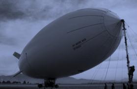
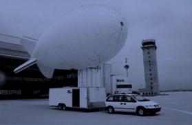
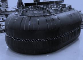
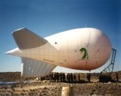
1 Tactical Aerostat System
![Benefits & Features Sky crow [Skahy- kroh] noun Small, tethered lighter- than- air (LTA)](/docs-images/94/119246845/images/2-3.jpg "sta;onary pla=orms that can support a variety of payloads, including mul;- spectral")


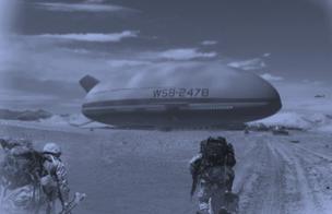
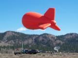
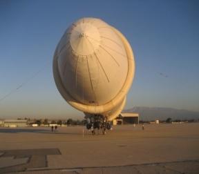
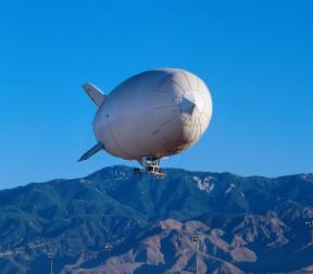
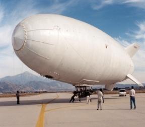
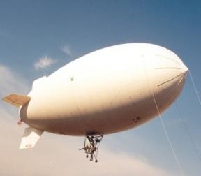
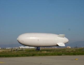
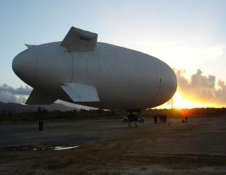
2 Benefits & Features Sky crow [Skahy- kroh] noun Small, tethered lighter- than- air (LTA) sta;onary pla=orms that can support a variety of payloads, including mul;- spectral imaging systems and communica;on relays, up to 20 lbs. Bene$its include: Cost- Effec;ve Mobility Persistent Surveillance Early Warning High- Resolu;on Imagery Geo- Mapped Data Expanded Communica;on Capabili;es Features: Easily field operated Rapid deployment Low maintenance Extended life cycle Persistent Surveillance Cost Effec5ve ISR Planes and helicopters are expensive to operate, and drone opera;ons remain highly restricted. Mission flexibility Time on sta;on/mission Low manpower requirements Low maintenance Extended Lifecycle Easy Ground Installa5on
 16 Days Ground Installa;on 1,000 ft Altitude Persistent Monitoring Receive Video and Data by WiFi Precise Geo- location Maximum Operating Wind: 45 kts Time on Station 14-16 days Stable Platform")
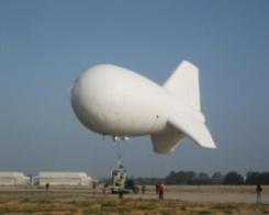
3 Solu5on Specs Sky Crow Speci-ications Weight Al;tude Size Time on Sta;on Set Up Up to 20 lbs Up to 305 m (1,000 [) 10.3 m length x 4 m dia. (34[ x [) 16 Days Ground Installa;on 1,000 ft Altitude Persistent Monitoring Receive Video and Data by WiFi Precise Geo- location Maximum Operating Wind: 45 kts Time on Station days Stable Platform for EO/ IR System Provides Situational Awareness to Air and Ground Support Cost- Effective Aerial Reconnaissance

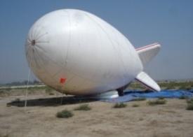
4 Security Opera5ons Tac5cal Mission Flexibility: Intelligence, Surveillance, Reconnaissance, Research, Monitoring, Communica;ons and Response Asset PROBLEM: Patrolling the skies is a challenge in the 21 st Century. Planes and helicopters are expensive to operate, and drone operations are highly restricted. Aerostats are the most Tlexible and persistent ISR platform, offering convenient situational awareness solutions with cost- effective persistence SOLUTION: Engineered for extreme stability as a tactical platform for multi- role mission s in varied environments. Incorporates advanced materials and production processes to ensure reliability Can be transported, deployed and monitored by one person, Tlexibility supports electro- optics, thermal imaging, electronic intelligence, surveillance radar, or INS technologies successfully proven in OCONUS deployment enhancing mission success, security and operational Tlexibility


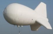
5 Applica5ons Intelligence, Surveillance, and Reconnaissance (ISR) Missions Stable Pla=orm for Long Range EO/IR Systems Perimeter/Border Surveillance and Monitoring Geospa;al Imaging Chemical/Gas Detec;on & Monitoring Aerial Videos & Photography 1,000 ft Altitude Persistent Monitoring Receive Video and Data by WiFi Precise Geo- location Maximum Operating Wind: 45 kts Time on Station days Stable Platform for EO/IR System Provides Situational Awareness to Air and Ground Support Cost- Effective Aerial Reconnaissance
 Target Imaging/Classifica5on ISAR Range Profiling High Resolu5on Ground Mapping Moving Target")
6 Customiza5on flexibility supports electro- op;cs, thermal imaging, electronic intelligence, surveillance radar, or INS technologies Surface surveillance Long Ranch Search Priority Track Small Target Mode Naviga5on Real Beam Ground Map Weather Detec;on Beacon Detec5on Search and Rescue Transponder (SART) Target Imaging/Classifica5on ISAR Range Profiling High Resolu5on Ground Mapping Moving Target Detec5on GMTI Full 1080P HD- SDI digital performance Advanced SWIR band sensor High defini;on low light color 120x zoom ra;o View, track, and mark ground loca;ons Follow moving targets with the robust mul;- mode Autotracker Day/Night Observa5on with Digital Recording for Post Mission Analysis Digital Moving Map Display Integrated with Flight Data for Precise Geo Loca;ng Surveillance Missions Equipped Cabin Console for Operator Data Links LOS to 150 Km BLOS u;lizing SATCOM links Integrate to C4I Network Coordinates With Other Assets Radio Direc5on Finding System Very accurate direc;on finding (~3 RMS error) Real- ;me monitoring and recording


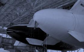


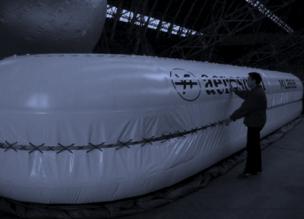
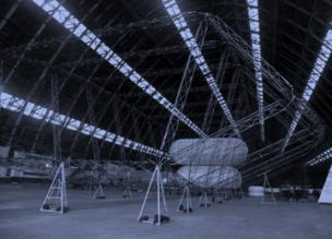


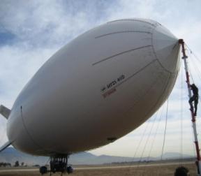
7 About Aeros AEROS AEROSTATS Aeros has excelled in designing and manufacturing Airships and Aerostat products, as well as research and development, and rapid prototyping. Aeros Airships and Aerostat products service commercial and military customers around the world. Track record for producing high quality products, and we operate under an FAA (Federal Avia;on Administra;on) Produc;on Cer;ficate. Aeros 1170 Aeros 25M HQ, engineering and manufacturing facility Los Angeles, CA Aeros 21M Assembly and flight test base Tus5n, CA Aeros 18M Aeros ELASS


8 Produc5on Model Specs AEROS 21M AEROS 1170 AEROS 3200 Aerostat Length 39M Nominal Altitude 1,500M 300Kg Max Sustained Operating Wind 25M/S Duration w/o Service Recovery 21 Days Aerostat Length 25M Nominal Altitude 1,200M 100Kg Max Sustained Operating Wind 20M/S Duration w/o Service Recovery 21 Days Aerostat Length 21M Nominal Altitude 600M 112Kg Max Sustained Operating Wind 20M/S Duration w/o Service Recovery 7-9 Days SKYCROW Aerostat Length Nominal Altitude Max Sustained Operating Wind Duration w/o Service Recovery 10.3 M 305M 10 Kg 20M/S 16 Days SKYCOBRA Aerostat Length Nominal Altitude Max Sustained Operating Wind Duration w/o Service Recovery 6M 121M 2.25 KG 20M/S 3 Days


9 Aeros Airships Aeros 40D- MSN19 Aeros 40B- MSN16 Aeros 40D- MSN20 Aeros 40B- MSN17 Aeros 40D- MSN21 Aeros 40B- MSN18 Aeros 40D- COSH Aeros 40A Aeros 40X Aeros 50
 201-8377 e. mario.pantuso@aeroscra[.")
10 Contacts: Chris-na Eaves Sales Associate d. (323) e. Joshua Goldapp Sales Associate d. (323) e. Mario Pantuso Sr. LTA Program Manager Development Manager d. (323) e. Worldwide Aeros: 1734 Aeros Way Montebello, California Hangar Assembly & Test Facility - Tus;n, California
2012 PRODUCT INFORMATION SHEET. EagleEye 350 Multi-Role, Special Missions Aerial Surveillance Platform
 2012 PRODUCT INFORMATION SHEET EagleEye 350 Multi-Role, Special Missions Aerial Surveillance Platform The EagleEye 350 is a unique, highly-capable Airborne Multi-Role, Multi-Sensor, Special Missions -
MSRC Tactical Oil Spill Surveillance and Remote Sensing
 MSRC Tactical Oil Spill Surveillance and Remote Sensing Industry Technical Advisory Committee for Oil spill Response October 25, 2016 0 Historical Perspective -- Oil Spill Surveillance in U.S Exxon Valdez
P2006T MRI SURVEILLANCE SYSTEM
 P2006T MRI SURVEILLANCE SYSTEM Cost effective Airborne System for Maritime Surveillance indracompany.com p2006t mri P2006T MRI SURVEILLANCE SYSTEM Maritime Surveillance Maritime Surveillance is the effective
MANNED AIRBORNE REAL-TIME SURVEILLANCE OBSERVATION SYSTEM
 MARSO WWW.MARSO.AERO MANNED AIRBORNE REAL-TIME SURVEILLANCE OBSERVATION & SYSTEM THE MARSO SYSTEM is a versatile surveillance system for a large class of missions ranging from large area ship detection
HALS-H1 Ground Surveillance & Targeting Helicopter
 ARATOS-SWISS Homeland Security AG & SMA PROGRESS, LLC HALS-H1 Ground Surveillance & Targeting Helicopter Defense, Emergency, Homeland Security (Border Patrol, Pipeline Monitoring)... Automatic detection
The Future of Land-Based EW Eyal Danan, VP General Manager EW SIGINT & Comm. Division. unclassified Proprietary Information of IAI Slide 1
 The Future of Land-Based EW Eyal Danan, VP General Manager EW SIGINT & Comm. Division Proprietary Information of IAI Slide 1 The Dual Nature of Conflicts Clear, Defined, Limited Battlefield Saturated Civilian
Combining Ground Radars with Imaging Multisensors
 Combining Ground Radars with Imaging Multisensors FMV Sensors Symposium 2014 Anders GM Dahlberg Business Development Support & Key Account Manager anders.gm.dahlberg@flir.se Area surveillance day and night
RECONNAISSANCE PAYLOADS FOR RESPONSIVE SPACE
 3rd Responsive Space Conference RS3-2005-5004 RECONNAISSANCE PAYLOADS FOR RESPONSIVE SPACE Charles Cox Stanley Kishner Richard Whittlesey Goodrich Optical and Space Systems Division Danbury, CT Frederick
Mission Solution 300
 Mission Solution 300 Standard configuration for point defence Member of the Thales Mission Solution family Standard configuration of integrated sensors, effectors, CMS, communication system and navigation
WHITE PAPER LIGHTWEIGHT AEROSTAT SYSTEM (LAS) Models 11M3 and 24M3
 Models 11M3 and 24M3") WHITE PAPER LIGHTWEIGHT AEROSTAT SYSTEM (LAS) Models 11M3 and 24M3 Persistent Surveillance and Communications Capability For Military And Homeland Security Operations Low Cost Long Mission Duration Minimum
WHITE PAPER LIGHTWEIGHT AEROSTAT SYSTEM (LAS) Models 11M3 and 24M3 Persistent Surveillance and Communications Capability For Military And Homeland Security Operations Low Cost Long Mission Duration Minimum
MULTI-MODE MULTI MISSION RADAR
 MULTI-MODE MULTI MISSION RADAR leonardocompany.com For more information please email infomarketing@leonardocompany.com Leonardo S.p.a. Via Tiburtina, Km 12.400-00131 Rome - Italy - Tel: +39 06 41501 -
TRINITY Standard configuration for littoral defence
 Standard configuration for littoral defence Member of the Thales Mission Solution family Unrivalled tracking and fire control solution for small manoeuvring targets Innovative approach and easy to install
Mission Solution 100
 Mission Solution 100 Standard configuration for littoral security Member of the Thales Mission Solution family Standard configuration of integrated sensors, effectors, CMS, communication system and navigation
RPAS & MANNED AIRCRAFT
 RPAS & MANNED AIRCRAFT Satcom Relay for Manned and Unmanned Airborne Platforms Unmanned aerial vehicles and manned aircrafts are increasingly being used as vehicles to capture intelligence data for defense,
Phantom Dome - Advanced Drone Detection and jamming system
 Phantom Dome - Advanced Drone Detection and jamming system *Picture for illustration only 1 1. The emanating threat of drones In recent years the threat of drones has become increasingly vivid to many
Customer Showcase > Defense and Intelligence
 Customer Showcase Skyline TerraExplorer is a critical visualization technology broadly deployed in defense and intelligence, public safety and security, 3D geoportals, and urban planning markets. It fuses
Remote Sensing Platforms
 Types of Platforms Lighter-than-air Remote Sensing Platforms Free floating balloons Restricted by atmospheric conditions Used to acquire meteorological/atmospheric data Blimps/dirigibles Major role - news
PEGASUS : a future tool for providing near real-time high resolution data for disaster management. Lewyckyj Nicolas
 PEGASUS : a future tool for providing near real-time high resolution data for disaster management Lewyckyj Nicolas nicolas.lewyckyj@vito.be http://www.pegasus4europe.com Overview Vito in a nutshell GI
PRODUCT OVERVIEW FOR THE. Corona 350 II FLIR SYSTEMS POLYTECH AB
 PRODUCT OVERVIEW FOR THE Corona 350 II FLIR SYSTEMS POLYTECH AB Table of Contents Table of Contents... 1 Introduction... 2 Overview... 2 Purpose... 2 Airborne Data Acquisition and Management Software (ADAMS)...
Remote Sensing Platforms
 Remote Sensing Platforms Remote Sensing Platforms - Introduction Allow observer and/or sensor to be above the target/phenomena of interest Two primary categories Aircraft Spacecraft Each type offers different
RUGGED. MARINIZED. LOW MAINTENANCE.
 RUGGED. MARINIZED. LOW MAINTENANCE. MWIR LWIR SWIR NIGHT VISION DAY / LOW LIGHT LASER DAZZLER / LRF FULL SPECTRUM EO / IR SYSTEMS Series NN 1000 NN 2000 NN 6000 NN 6000 NN 7000 MODEL NN 1045 NN HSC NN
Stratollites set to provide persistent-image capability
 Stratollites set to provide persistent-image capability [Content preview Subscribe to Jane s Intelligence Review for full article] Persistent remote imaging of a target area is a capability previously
Wide-Area Motion Imagery for Multi-INT Situational Awareness
 Bernard V. Brower (U.S.) Jason Baker (U.S.) Brian Wenink (U.S.) Harris Corporation Harris Corporation Harris Corporation bbrower@harris.com JBAKER27@harris.com bwenink@harris.com 332 Initiative Drive 800
MMW communication for High-altitude,
 DARPA developing milimmter wave wireless communications to connect dismounted warfighters using UAVs and provide 100 Gb/s RF Backbone (100G)using High-altitude, long-endurance platforms. Modern expeditionary
Ronald Driggers Optical Sciences Division Naval Research Laboratory. Infrared Imaging in the Military: Status and Challenges
 Ronald Driggers Optical Sciences Division Infrared Imaging in the Military: Status and Challenges Outline Military Imaging Bands Lets Orient Ourselves Primary Military Imaging Modes and Challenges Target
Tailored Tactical Surveillance
 Mr. Tim Clark Program Manager Special Projects Office At our last DARPATech, the Special Projects Office (SPO) discussed the need for persistent global and theater surveillance and how, by advancing the
On January 14, 2004, the President announced a new space exploration vision for NASA
 Exploration Conference January 31, 2005 President s Vision for U.S. Space Exploration On January 14, 2004, the President announced a new space exploration vision for NASA Implement a sustained and affordable
Shared Networks and the Evolu;on towards 5G
 Shared Networks and the Evolu;on towards 5G Luiz DaSilva Professor of Telecommunica:ons, Trinity College ICNC 2018 Maui, HI, 5-8 March 2018 Trinity College Dublin CONNECT Future Communica:ons and Networks
Tactical Cellular Positioning. Tactical Enablers for Operational and Intelligence Units
 Tactical Cellular Positioning Tactical Enablers for Operational and Intelligence Units Agenda Company Overview Septier Tactical Cellular Location Solution Solution Components Operational Scenarios Summary
DJI Corporate Purchase Buying Guides
 DJI Corporate Purchase Buying Guides First Choice for Aerial Photography Infinite Possibilities for Limited Budgets Launch Date: May 2017 Launch Date: January 2018 Launch Date: September 2017 Individual
The C2/C4ISR Systems Market
 4.4 Global C2/C4ISR Systems Land Based Submarket Table 4.4 Global C2/C4ISR Systems Land Based Submarket Forecast 213-2 ($bn, AGR, CAGR, Cumulative) 212 213 214 21 216 217 218 219 22 221 222 2 213- Sales
MSPO 2017: POLISH RADAR CAPABILITIES
 aut. Maksymilian Dura 08.09.2017 MSPO 2017: POLISH RADAR CAPABILITIES MSPO International Defence Industry Exhibition organized in Kielce is yet another occasion for the PIT-RADWAR company to show that
Wide-area Motion Imagery for Multi-INT Situational Awareness
 Wide-area Motion Imagery for Multi-INT Situational Awareness Bernard V. Brower Jason Baker Brian Wenink Harris Corporation TABLE OF CONTENTS ABSTRACT... 3 INTRODUCTION WAMI HISTORY... 4 WAMI Capabilities
DHS/U.S. Customs and Border Protection -
 DHS/U.S. Customs and Border Protection - Technology Solutions Program Office (TSPO) DHS/ Unmanned Aircraft System (UAS) October 31, 2006 1 Purpose Provide overall UAS program overview Program Description
BUILDING SITUATIONAL AWARENESS
 BUILDING SITUATIONAL AWARENESS OBSERVE ORIENT DECIDE ACT Cmd Pontus Djerf (Ret.) Head of Operations Nordic & Baltic, Surface Radar Solutions This document and the information contained herein is the property
High Altitude Communications Platforms
 High Altitude Communications Platforms - new Opportunities in Air Space Management Alan C Smith ATN2004 - The ATC Data Link Conference at the Institution of Electrical Engineers, London 15th September,
Low Cost Conformal Transmit/Receive SATCOM Antenna for Military Patrol Aircraft
 Low Cost Conformal Transmit/Receive SATCOM Antenna for Military Patrol Aircraft 9160 Red Branch Road Columbia, MD 21045-2002 Contact: Mr. Steve Gemeny Phone: (410) 884-0500 x205 Email: Steve.Gemeny@SyntonicsCorp.com
Targeting a Safer World
 Targeting a Safer World INTRODUCTION Accipiter Radar is a global provider of high performance radar surveillance solutions built upon its patented Radar Intelligence Network (RIN) Platform Technology.
LIGHTWEIGHT AEROSTAT SYSTEM (LAS) A New Concept In Security Surveillance and Communications Relay
 A New Concept In Security Surveillance and Communications Relay") LIGHTWEIGHT AEROSTAT SYSTEM (LAS) A New Concept In Security Surveillance and Communications Relay Low Cost Long Mission Duration Minimum Manpower Carolina Unmanned Vehicles, Inc. 4105 Graham-Newton Road
LIGHTWEIGHT AEROSTAT SYSTEM (LAS) A New Concept In Security Surveillance and Communications Relay Low Cost Long Mission Duration Minimum Manpower Carolina Unmanned Vehicles, Inc. 4105 Graham-Newton Road
TRACS A-B-C Acquisition and Processing and LandSat TM Processing
 TRACS A-B-C Acquisition and Processing and LandSat TM Processing Mark Hess, Ocean Imaging Corp. Kevin Hoskins, Marine Spill Response Corp. TRACS: Level A AIRCRAFT Ocean Imaging Corporation Multispectral/TIR
Networked Targeting Technology
 Networked Targeting Technology Stephen Welby Next Generation Time Critical Targeting Future Battlespace Dominance Requires the Ability to Hold Opposing Forces at Risk: At Any Time In Any Weather Fixed,
Rochester Institute of Technology. Wildfire Airborne Sensor Program (WASP) Project Overview
 Project Overview") Rochester Institute of Technology Wildfire Airborne Sensor Program (WASP) Project Overview Introduction The following slides describe a program underway at RIT The sensor system described herein is being
Rochester Institute of Technology Wildfire Airborne Sensor Program (WASP) Project Overview Introduction The following slides describe a program underway at RIT The sensor system described herein is being
GPS. La*tude Longitude. Global Posi*oning Systems
 GPS La*tude Longitude Global Posi*oning Systems Two topics today La*tude and Longitude Loca*ng things on the surface of the earth with coordinates GPS Global Posi*oning System Using satellites and receivers
ISTAR Concepts & Solutions
 ISTAR Concepts & Solutions CDE Call Presentation Cardiff, 8 th September 2011 Today s Brief Introduction to the programme The opportunities ISTAR challenges The context Requirements for Novel Integrated
Feb 7, 2018 A potential new Aeronautical Mobile Satellite Route Service system in the 5 GHz band for the RPAS C2 link ICAO WRC19 Workshop, Mexico
 Feb 7, 2018 A potential new Aeronautical Mobile Satellite Route Service system in the 5 GHz band for the RPAS C2 link ICAO WRC19 Workshop, Mexico City, Mexico Command and Control (C2) link 2 RPA Command
The Detect & Avoid Requirements and Technologies for small RPAS
 Royal Aeronautical Society Detect & Avoid Workshop 2015 31 March, 2015 The Detect & Avoid Requirements and Technologies for small RPAS Dr Joseph Barnard joseph.barnard@barnardmicrosystems.com Barnard Microsystems
An Introduction to Airline Communication Types
 AN INTEL COMPANY An Introduction to Airline Communication Types By Chip Downing, Senior Director, Aerospace & Defense WHEN IT MATTERS, IT RUNS ON WIND RIVER EXECUTIVE SUMMARY Today s global airliners use
Sikorsky S-70i BLACK HAWK Training
 Sikorsky S-70i BLACK HAWK Training Serving Government and Military Crewmembers Worldwide U.S. #15-S-0564 Updated 11/17 FlightSafety offers pilot and maintenance technician training for the complete line
Point of Contacts. Star Tower Marketing Near Space Systems, Inc.
 Point of Contacts Star Tower Marketing Near Space Systems, Inc. Thank You Star Tower Best Flight Performance Highly Transportable Small Footprint, Minimum Site Preparation Improves Sensor Performance Star
MUSIC. MUlti Spectral Infrared Countermeasure. Andrew Lovett M.Sc, MBA Senior Director Lasers and EOCM Division
 MUlti Spectral Infrared Countermeasure MUSIC Andrew Lovett M.Sc, MBA Senior Director Lasers and EOCM Division 1 Elbit Systems Electro-Optics Proprietary Information MUSIC MUSIC is a fiber laser-based Directed
UAV CRAFT CRAFT CUSTOMIZABLE SIMULATOR
 CRAFT UAV CRAFT CUSTOMIZABLE SIMULATOR Customizable, modular UAV simulator designed to adapt, evolve, and deliver. The UAV CRAFT customizable Unmanned Aircraft Vehicle (UAV) simulator s design is based
Over the Horizon Wireless Power Transmission (OTH-WPT)
") Over the Horizon Wireless Power Transmission (OTH-WPT) A Low Cost Precursor for Space Solar Power Stephen Blank, IBE Systems & NYIT Paul Jaffe, NRL Overview Background Laser SSP Concepts Laser Power Beaming
Over the Horizon Wireless Power Transmission (OTH-WPT) A Low Cost Precursor for Space Solar Power Stephen Blank, IBE Systems & NYIT Paul Jaffe, NRL Overview Background Laser SSP Concepts Laser Power Beaming
tethered balloons stratospheric balloons equipped envelope for Stratobus TM airships thermal protections for satellites
 tethered balloons stratospheric balloons equipped envelope for Stratobus TM airships thermal protections for satellites RELIABLE. PERSISTENT. MULTIPURPOSE. ADAPTABLE. airstar aerospace products ranges
Mini Market Study Report August 2011
 Naval Surface Warfare Center (NAVSEA) Crane Division Two Band Imaging System (US Patent No. 6,969,856) Mini Market Study Report August 2011 Sponsored by: Integrated Technology Transfer Network, California
Helicopter Aerial Laser Ranging
 Helicopter Aerial Laser Ranging Håkan Sterner TopEye AB P.O.Box 1017, SE-551 11 Jönköping, Sweden 1 Introduction Measuring distances with light has been used for terrestrial surveys since the fifties.
HIGH ALTITUDE PLATFORM STATIONS FOR AUSTRALIA
 WIRELESS BROADBAND HIGH ALTITUDE PLATFORM STATIONS FOR AUSTRALIA Les Davey, Sky Station, Australia Richard (Dick) Butler, Sky Station, Australia Richard Buchanan, Vice President Systems Integration, StratoComm
ILA Berlin Air Show 2016
 http://www.tencate.com/emea/images/milipol_paris_201328-2402328-25603.jpgv ILA Berlin Air Show 2016 Dear Customers and Business Partners, June 1 to 4, 2016 Berlin ExpoCenter Airport Hall 2, booth 319 The
SERVICES ENABLED BY HIGN ALTITUDE PSEUDO SATELLITES (HAPS) COMPLEMENTED BY SATELLITES : Webinar
 COMPLEMENTED BY SATELLITES : Webinar") Ref. ESA-TIAA-HO-2017-1162 SERVICES ENABLED BY HIGN ALTITUDE PSEUDO SATELLITES (HAPS) COMPLEMENTED BY SATELLITES : Webinar 15/09/2017 Rita Rinaldo, Laurence Duquerroy Downstream Business Applications Department
Ref. ESA-TIAA-HO-2017-1162 SERVICES ENABLED BY HIGN ALTITUDE PSEUDO SATELLITES (HAPS) COMPLEMENTED BY SATELLITES : Webinar 15/09/2017 Rita Rinaldo, Laurence Duquerroy Downstream Business Applications Department
tethered balloons stratospheric balloons equipped envelope for Stratobus TM airships thermal protections for satellites
 tethered balloons stratospheric balloons equipped envelope for Stratobus TM airships thermal protections for satellites RELIABLE. PERSISTENT. MULTIPURPOSE. ADAPTABLE. airstar aerospace products ranges
TopSat: Brief to Ground Segment Coordination. Presenter Ian Pilling. By : W.A. Levett. Co author: E.J. Baxter.
 TopSat: Brief to Ground Segment Coordination Board Presenter Ian Pilling By : W.A. Levett Co author: E.J. Baxter Contents Space Division overview The TopSat mission Overview Development Programme Launch
Development of a Sense and Avoid System
 Infotech@Aerospace 26-29 September 2005, Arlington, Virginia AIAA 2005-7177 Development of a Sense and Avoid System Mr. James Utt * Defense Research Associates, Inc., Beavercreek, OH 45431 Dr. John McCalmont
Development of a Compact, Pulsed, 2-Micron, Coherent- Detection, Doppler Wind Lidar Transceiver
 Development of a Compact, Pulsed, 2-Micron, Coherent- Detection, Doppler Wind Lidar Transceiver Michael J. Kavaya, Upendra N. Singh, Grady J. Koch, Jirong Yu, Bo C. Trieu NASA Langley Research Center,
HYPERCUBE: Hyperspectral Imaging Using a CUBESAT
 HYPERCUBE: Hyperspectral Imaging Using a CUBESAT Ian S. Robinson Senior Engineering Fellow Raytheon Certified Architect Ian.Robinson@Raytheon.com Customer Success Is Our Mission Copyright 2011 Raytheon
USE OF IMPROVISED REMOTELY SENSED DATA FROM UAV FOR GIS AND MAPPING, A CASE STUDY OF GOMA CITY, DR CONGO
 USE OF IMPROVISED REMOTELY SENSED DATA FROM UAV FOR GIS AND MAPPING, A CASE STUDY OF GOMA CITY, DR CONGO Cung Chin Thang United Nations Global Support Center, Brindisi, Italy, Email: thang@un.org KEY WORDS:
Incorporating a Test Flight into the Standard Development Cycle
 into the Standard Development Cycle Authors: Steve Wichman, Mike Pratt, Spencer Winters steve.wichman@redefine.com mike.pratt@redefine.com spencer.winters@redefine.com 303-991-0507 1 The Problem A component
Supporting the Warfighter from Space
 Dr. Michael Zatman Program Manager, Special Projects Office Space Activities Supporting the Warfighter from Space Why is space so important to our future capabilities? To appreciate this, we should review
Model-Based Design for Sensor Systems
 2009 The MathWorks, Inc. Model-Based Design for Sensor Systems Stephanie Kwan Applications Engineer Agenda Sensor Systems Overview System Level Design Challenges Components of Sensor Systems Sensor Characterization
The Challenge. SPOT Vegetation. miniaturization. Proba Vegetation. Technology assessment:
 The Challenge Spot-5 lifetime expires in 2012. The next French satellite, Pleiades, is solely dedicated to HiRes. The Belgian Federal Science Policy Office (BELSPO) declared their interest to develop an
Using Unmanned Aircraft Systems for Communications Support
 A NPSTC Public Safety Communications Report Using Unmanned Aircraft Systems for Communications Support NPSTC Technology and Broadband Committee Unmanned Aircraft Systems and Robotics Working Group National
Riza Muhida. Presented at he 22nd Session of the Asia Pacific Regional Space Agency Forum (APRSAF 22), Bali, Indonesia, December 1 4, 2015
, Bali, Indonesia, December 1 4, 2015") Riza Muhida Presented at he 22nd Session of the Asia Pacific Regional Space Agency Forum (APRSAF 22), Bali, Indonesia, December 1 4, 2015 1 Presentation Outline Abstract Background Objective Project Scope
Riza Muhida Presented at he 22nd Session of the Asia Pacific Regional Space Agency Forum (APRSAF 22), Bali, Indonesia, December 1 4, 2015 1 Presentation Outline Abstract Background Objective Project Scope
Intermediate Systems Acquisition Course. Lesson 2.2 Selecting the Best Technical Alternative. Selecting the Best Technical Alternative
 Selecting the Best Technical Alternative Science and technology (S&T) play a critical role in protecting our nation from terrorist attacks and natural disasters, as well as recovering from those catastrophic
Copyright 2016 Raytheon Company. All rights reserved. Customer Success Is Our Mission is a registered trademark of Raytheon Company.
 Make in India Paradigm : Roadmap for a Future Ready Naval Force Session 9: Coastal Surveillance, Response Systems and Platforms Nik Khanna, President, India April 19, 2016 "RAYTHEON PROPRIETARY DATA THIS
Reconnaissance Payloads for Responsive Space
 4th Responsive Space Conference RS4-2006-5003 Reconnaissance Payloads for Responsive Space Stanley Kishner, David Flynn, Charles Cox Goodrich Optical and Space Systems Division Danbury, CT 4th Responsive
CHAPTER 12 NAVAL AIRCREWMEN (AW) NAVPERS G CH-62
 NAVPERS G CH-62") CHAPTER 12 NAVAL AIRCREWMEN (AW) NAVPERS 18068-12G CH-62 Updated: April 2015 TABLE OF CONTENTS NAVAL AIRCREWMEN (TACTICAL HELICOPTER) (AWR) SCOPE OF RATING GENERAL INFORMATION TACTICAL MULTI-SENSOR OPERATOR
CHAPTER 12 NAVAL AIRCREWMEN (AW) NAVPERS 18068-12G CH-62 Updated: April 2015 TABLE OF CONTENTS NAVAL AIRCREWMEN (TACTICAL HELICOPTER) (AWR) SCOPE OF RATING GENERAL INFORMATION TACTICAL MULTI-SENSOR OPERATOR
Advanced Technologies Group programs aim to improve security
 Advanced Technologies Group programs aim to improve security Dr. Brian Lemoff The Robert H. Mollohan Research Center, located in Fairmont's I 79 Technology Park, is home to the WVHTC Foundation's Advanced
Consultation Paper on Using a Portion of the Band GHz for Tactical Common Data Link (TCDL) Systems
 Systems") December 2008 Spectrum Management and Telecommunications Consultation Paper on Using a Portion of the Band 14.5-15.35 GHz for Tactical Common Data Link (TCDL) Systems Aussi disponible en français Department
December 2008 Spectrum Management and Telecommunications Consultation Paper on Using a Portion of the Band 14.5-15.35 GHz for Tactical Common Data Link (TCDL) Systems Aussi disponible en français Department
Part 1: Introduc.on to RLS 1.1 Spec. Part 2: Introduc.on to RoIS 1.0 Spec. Part 3: Introduc.on of UNR Pla<orm
 Part 1: Introduc.on to RLS 1.1 Spec. Part 2: Introduc.on to RoIS 1.0 Spec. Part 3: Introduc.on of UNR Pla
The Evolution of the USU Research Foundation and the Space Dynamics Lab
 The Evolution of the USU Research Foundation and the Space Dynamics Lab January 28, 2015 1 Research Foundation Trustees Richard L. Shipley Robert T. Behunin David A. Bell David T. Cowley Jeffery B. Edwards
All About Drone Photography
 All About Drone Photography What is Drone? Originally Drones were developed and used by the military and used for reconnaissance, targe
Airborne demonstrators: a small step from space?
 Airborne demonstrators: a small step from space? Mick Johnson Director of CEOI With inputs from: Ray Dunster, Tony Sephton, Martin Cohen (Astrium) Brian Moyna (STFC/RAL) Paul Davey (QinetiQ) Objective
ABSOLUTE : Aerial Base Stations with Opportunistic Links for Unexpected & Temporary Events
 ABSOLUTE : Aerial Base Stations with Opportunistic Links for Unexpected & Temporary Events www.absolute-project.com Isabelle Bucaille Project Coordinator Thales Communications & Security Secured Wireless
Upper Air Measurements
 Upper Air Measurements Upper Air Measurements Measurements above the surface become increasingly difficult with al;tude Balloons, airplanes and rockets have all been used to carry instruments alo? to make
Drafting Committee for the Asia Pacific Plan of Action for Space Applications for Sustainable Development ( ) Republic of Korea
 Republic of Korea") Drafting Committee for the Asia Pacific Plan of Action for Space Applications for Sustainable Development (2018 2030) Republic of Korea Bangkok, Thailand 31 May 1 June 2018 김 1 KARI Introduction Government
Drafting Committee for the Asia Pacific Plan of Action for Space Applications for Sustainable Development (2018 2030) Republic of Korea Bangkok, Thailand 31 May 1 June 2018 김 1 KARI Introduction Government
Sensor Networking for Enhanced Airspace Monitoring
 Sensor Networking for Enhanced Airspace Monitoring Scott. A, Remillard Sensis Corporation 5793 Widewaters Parkway DeWitt, New York 13214 Tel: 315-445-5056 Fax: 315-445-9401 Internet: www.sensis.com Email:
Aerial efficiency, photogrammetric accuracy
 Aerial efficiency, photogrammetric accuracy Why sensefly 3 reasons to choose the ebee Plus Large coverage for optimal efficiency The ebee Plus can map more square kilometres per flight, than any drone
Organizational Culture in Aviation Fire Suppression
 Organizational Culture in Aviation Fire Suppression A lessons learned overview of emerging issues and challenges in a multi-agency aviation fire suppression program DENNIS HULBERT Regional Aviation Officer
Sensors, Tools and the Common Operating Picture. Sensors, Tools and the Common Operating Picture 14 th April Middleburg
 Sensors, Tools and the Common Operating Picture 14 th April 2015 - Middleburg Aptomar Established in 2005 Owned by Statoil, Investinor, Proventure Seed, Verdane Capitol Have developed and control all IPR
The DARPA 100Gb/s RF Backbone Program
 The DARPA 100Gb/s RF Backbone Program Dr. Ted Woodward Program Manager, DARPA/STO Briefing Prepared for NSF mmw RCN workshop Madison, WI 19 July 2017 1 100 Gb/s RF Backbone (100G) Objective: Capacity AND
Iridium NEXT SensorPODs: Global Access For Your Scientific Payloads
 Iridium NEXT SensorPODs: Global Access For Your Scientific Payloads 25 th Annual AIAA/USU Conference on Small Satellites August 9th 2011 Dr. Om P. Gupta Iridium Satellite LLC, McLean, VA, USA Iridium 1750
Innovation in the Aerospace & Defence Industry - A European Perspective
 Innovation in the Aerospace & Defence Industry - A European Perspective Daniel DEVILLER EADS Chief Technology Officer Yokohama, September 1, 2004 About Innovation It is not the strongest of the species
 The most advanced technology in mobile lighting Glare Free, Daylight Quality High Performance, 360 Contrast - Definition - Clarity Turns Night into Day Infrared Option DEFENCE RECOGNISED SUPPLIER Department
DEFENCE AND SPACE Security Solutions. STYRIS Coastal Surveillance Systems
 DEFENCE AND SPACE Security Solutions STYRIS Coastal Surveillance Systems Enforcing Border Integrity Maritime Domain Awareness through the provision of: Advanced Radar Processing for small targets Multi
Targeting a Safer World. Public Safety & Security
 Targeting a Safer World Public Safety & Security WORLD S MOST EFFECTIVE AND AFFORDABLE WIDE-AREA SITUATIONAL AWARENESS Accipiter provides the world s most effective and affordable wide-area situational
Inmarsat L-TAC. Supports both UHF and VHF tactical radios. U.S. GOVERNMENT > Product > L-TAC
 Inmarsat L-TAC Supports both UHF and VHF tactical radios U.S. GOVERNMENT > Product > L-TAC Inmarsat L-TAC UHF and VHF Beyond line of sight communications. Mobile communications in the field Designed with
P-8 8Programs. Chuck Dabundo. Rob Elliott. June 8, Boeing Vice President, P-8 Program Manager. Boeing BCA P-8 Program Manager MEDIA TOUR
 MEDIA TOUR P-8 8Programs Chuck Dabundo Boeing Vice President, P-8 Program Manager Rob Elliott Boeing BCA P-8 Program Manager June 8, 2011 Copyright 2011 Boeing. All rights reserved. 1 P-8A Poseidon The
Aerial Image Acquisition and Processing Services. Ron Coutts, M.Sc., P.Eng. RemTech, October 15, 2014
 Aerial Image Acquisition and Processing Services Ron Coutts, M.Sc., P.Eng. RemTech, October 15, 2014 Outline Applications & Benefits Image Sources Aircraft Platforms Image Products Sample Images & Comparisons
SPACE-BASED SOLUTIONS & ANALYTICS
 SPACE-BASED SOLUTIONS & ANALYTICS Enable development and optimisation of airspace use, and no aircraft to be lost again wherever on Earth C N S S y m p o s i u m E u r o c o n t r o l 2 & 3 O c t o b e
Company Profile Amertec Systems is a leading private manufacturer of electronic systems for the defense sector, having more than 20 years of experienc
 Company Profile Amertec Systems is a leading private manufacturer of electronic systems for the defense sector, having more than 20 years of experience in system engineering, mechanical and electronic
SECOND OPEN SKIES REVIEW CONFERENCE (OSRC) 2010
 2010") OSCC.RC/40/10 9 June 2010 Open Skies Consultative Commission ENGLISH only US Chair of the OSCC Review Conference SECOND OPEN SKIES REVIEW CONFERENCE (OSRC) 2010 7 to 9 June 2010 Working Session 2 Exploring
OSCC.RC/40/10 9 June 2010 Open Skies Consultative Commission ENGLISH only US Chair of the OSCC Review Conference SECOND OPEN SKIES REVIEW CONFERENCE (OSRC) 2010 7 to 9 June 2010 Working Session 2 Exploring
AOptix Technologies. IntelliMax MB Multi-Gigabit Wireless Solutions. January 11 th, Bruce Carpenter
 AOptix Technologies IntelliMax MB-2000 Multi-Gigabit Wireless Solutions January 11 th, 2012 Bruce Carpenter bcarpenter@aoptix.com 703 973-0773 AOptix Technologies Founded in Hawaii in 2000 to exploit unique