UAS Photogrammetry Best Practices
|
|
|
- Merry Beverly Lee
- 5 years ago
- Views:
Transcription


1 UAS Photogrammetry Best Practices Pennsylvania Society of Land Surveyors January 15, 2019 Bryan Baker Certified Mapping Scientist (UAS) Bryan Baker UAS Sales Manager Leica Geosystems Reality Capture Team Geospatial Instrument Industry 35 years. ASPRS Certified Mapping Scientist (CMS-UAS) Commercial Pilot Instrument Rated Remote Pilot Small UAS Factory Certified UAS Trainer FAA Safety Team (FAASTeam) Field Representative 2 1

2 Agenda ASPRS Digital Image Processing Standard Basic Photogrammetry Principles 3 ASPRS Positional Accuracy Standards for Digital Geospatial Data Positional_Accuracy_Standards.pdf 4 2
3 New ASPRS Positional Accuracy Standards for Digital Geospatial Data Replaces: ASPRS Accuracy Standards for Large-Scale Maps (1990) ASPRS Guidelines, Vertical Accuracy Reporting for Lidar Data (2004) Developed by: ASPRS Map Accuracy Standards Working Group, PAD, PDAD and LIDAR joint committee for map accuracy standard update In Final Approved Version REVISION 7, VERSION 1, Nov. 14, 2014 Approved and adopted by ASPRS during the board meeting on Monday Nov. 17, 2014 in Denver during ASPRS 2014 PECORA conference 5 New Standard for a New Era Motivation Behind the New Standard: Legacy map accuracy standards, such as the ASPRS 1990 standard and the NMAS of 1947, are outdated. (over 30 years since ASPRS1990 was written) Many of the data acquisition and mapping technologies that these standards were based on are no longer used. More recent advances in mapping technologies can now produce better quality and higher accuracy geospatial products and maps. Legacy map accuracy standards were designed to deal with plotted or drawn maps as the only medium to represent geospatial data. 6 3
4 New Standard for a New Era Within the past two decades (during the transition period between the hardcopy and softcopy mapping environments), most standard measures for relating GSD and map scale to the final mapping accuracy were inherited from photogrammetric practices using scanned film. New mapping processes and methodologies have become much more sophisticated with advances in technology and advances in our knowledge of mapping processes and mathematical modeling. Mapping accuracy can no longer be associated with the camera geometry and flying altitude alone (focal length, xp, yp, B/H ratio, etc.). 7 New Standard for a New Era New map accuracy is influenced by many factors such as: the quality of camera calibration parameters; quality and size of a Charged Coupled Device (CCD) used in the digital camera CCD array; amount of imagery overlap; quality of parallax determination or photo measurements; quality of the GPS signal; quality and density of ground controls; quality of the aerial triangulation solution; capability of the processing software to handle GPS drift and shift; capability of the processing software to handle camera self-calibration, the digital terrain model used for the production of orthoimagery. 8. 4
5 New Standard for a New Era These factors can vary widely from project to project, depending on the sensor used and specific methodology. For these reasons, existing accuracy measures based on map scale, film scale, GSD, c-factor and scanning resolution no longer apply to current geospatial mapping practices. Elevation products from the new technologies and active sensors such as lidar and IFSAR are not considered by the legacy mapping standards. New accuracy standards are needed to address elevation products derived from these technologies. 9 ASPRS Positional Accuracy Standards for Digital Geospatial Data Applicability: Defines specific accuracy classes and associated RMSE thresholds for digital orthoimagery, digital planimetric data, and digital elevation data Intended to be technology independent Limited to accuracy thresholds and testing methodologies for any mapping applications, and to meet immediate shortcomings in the outdated 1990 and 2004 standards Is not intended to cover classification accuracy of thematic maps Does not specify the best practices or methodologies needed to meet the accuracy thresholds Includes: Glossary, Symbols, examples, conversion to legacy standards 10 5
6 New Standard Highlights Positional Accuracy Thresholds which are independent of published GSD, map scale or contour interval digital orthoimagery digital elevation data Additional Accuracy Measures aerial triangulation accuracy, Ground controls accuracy, orthoimagery seam lines accuracy, lidar relative swath-to-swath accuracy, recommended minimum Nominal Pulse Density (NPD) horizontal accuracy of elevation data, delineation of low confidence areas for vertical data required number and spatial distribution of QA/QC check points based on project area. 11 Standard Deviation vs. RMSE Standard deviation is used to measure the spread of data around the mean. (Control Points) RMSE is used to measure distance between some values and prediction for those values. (Check Points) 12 6

7 New Standard Highlights It is All Metric! Unlimited Horizontal Accuracy Classes: Horizontal Accuracy Standards for Geospatial Data Horizontal Accuracy Class RMSE x and RMSE y RMSEr Horizontal Accuracy at 95% Confidence Level Orthoimagery Mosaic Seamline Mismatch X-cm X 1.41*X 2.45*X 2*X
8 15 Horizontal Accuracy Class RMSE x and RMSE y RMSE r Orthoimage Mosaic Seamline Maximum Mismatch Horizontal Accuracy at the 95% Confidence Level Common Horizontal Accuracy Classes according to the new standard [1]
9 Common Orthoimagery Pixel Sizes Associated Map Scale ASPRS 1990 Accuracy Class Associated Horizontal Accuracy According to Legacy ASPRS 1990 Standard RMSE x and RMSE y RMSE x and RMSE y in terms of pixels Examples on Horizontal Accuracy for Digital Orthoimagery interpreted from ASPRS 1990 Legacy Standard cm 1: cm 1: cm 1:200 5 cm 1: cm 1: cm 1:1, pixels pixels pixels pixels pixels pixels pixels pixels pixels pixels pixels pixels pixels pixels pixels pixels pixels pixels 17 Common Orthoimagery Pixel Sizes Recommended Horizontal Accuracy Class RMSE x and RMSE y Orthoimage RMSE x and RMSE y in terms of pixels Recommended use pixel Highest accuracy work Digital Orthoimagery Accuracy Examples for Current Large and Medium Format Metric Cameras 1.25 cm 2.5 cm 5 cm 7.5 cm 15 cm pixels Standard Mapping and GIS work pixels Visualization and less accurate work pixel Highest accuracy work pixels Standard Mapping and GIS work pixels Visualization and less accurate work pixel Highest accuracy work pixels Standard Mapping and GIS work pixels Visualization and less accurate work pixel Highest accuracy work pixels Standard Mapping and GIS work pixels Visualization and less accurate work pixel Highest accuracy work pixels Standard Mapping and GIS work pixels Visualization and less accurate work 18 9
10 Horizontal Accuracy/Quality Examples for High Accuracy Digital Planimetric Data ASPRS 2014 Equivalent to map scale in Horizontal Accuracy Class RMSE x and RMSE y RMSE r Horizontal Accuracy at the 95% Confidence Level Approximate GSD of Source Imagery ASPRS 1990 Class 1 ASPRS 1990 Class 2 Equivalent to map scale in NMAS to :25 1:12.5 1: to :50 1:25 1: to 2.5 1:100 1:50 1: to 5.0 1:200 1:100 1: to 7.5 1:300 1:150 1: to :400 1:200 1: to12.5 1:500 1:250 1: to :600 1:300 1: to :700 1:350 1: to :800 1:400 1: to :900 1:450 1: to :1000 1:500 1: to :1100 1:550 1: to :1200 1:600 1: New Standard Highlights Unlimited Vertical Accuracy Classes: Vertical Accuracy Standards for Digital Elevation Data Vertical Accuracy Class RMSE z Non- Vegetated Absolute Accuracy NVA at 95% Confidence Level VVA at 95 th Percentile Relative Accuracy (where applicable) Within- Swath Hard Surface Repeatability (Max Diff) Swath-to- Swath Non-Vegetated Terrain (RMSD z ) Swath-to- Swath Non-Vegetated Terrain (Max Diff) X-cm X 1.96*X 3.00*X 0.60*X 0.80*X 1.60*X 20 10
11 Vertical Accuracy/Quality Examples for Digital Elevation Data Vertical Accuracy Class RMSE z Non-Vegetated Absolute Accuracy NVA at 95% Confidence Level VVA at 95 th Percentile Within-Swath Hard Surface Repeatability (Max Diff) Relative Accuracy (where applicable) Swath-to-Swath Non-Veg Terrain (RMSD z ) Swath-to-Swath Non-Veg Terrain (Max Diff) 1-cm cm cm cm cm cm cm cm cm cm Vertical accuracy of the new ASPRS 2014 standard compared with legacy standards Vertical Accuracy Class RMSE z Non-Vegetated Equivalent Class 1 contour interval per ASPRS 1990 Equivalent Class 2 contour interval per ASPRS 1990 Equivalent contour interval per NMAS 1-cm cm cm cm cm cm cm cm cm cm
12 Examples on Vertical Accuracy and Recommended Lidar Point Density for Digital Elevation Data according to the new ASPRS 2014 standard Vertical Accuracy Class RMSE z Non-Vegetated Absolute Accuracy NVA at 95% Confidence Level Recommended Minimum NPD (pts/m 2 ) Recommended Maximum NPS 7 (m) 1-cm cm cm cm cm cm cm cm cm cm Horizontal accuracy requirements for elevation data Photogrammetric elevation data:, the horizontal accuracy equates to the horizontal accuracy class that would apply to planimetric data or digital orthoimagery produced from the same source imagery, using the same aerial triangulation/ins solution. Lidar elevation data: use the following formula: = + tan( )
13 Accuracy requirements for aerial triangulation and INS-based sensor orientation of digital imagery Accuracy of aerial triangulation designed for digital planimetric data (orthoimagery and/or digital planimetric map) only: RMSE x(at) or RMSE y(at) = ½ * RMSE x(map) or RMSE y(map) RMSE z(at) = RMSE x(map) or RMSE y(map) of orthoimagery Accuracy of aerial triangulation designed for elevation data, or planimetric data (orthoimagery and/or digital planimetric map) and elevation data production: RMSE x(at), RMSE y(at) or RMSE z(at) = ½ * RMSE x(map), RMSE y(map) or RMSE z(dem) 25 Accuracy requirements for ground control used for aerial triangulation Accuracy of ground controls designed for planimetric data (orthoimagery and/or digital planimetric map)production only: RMSE x or RMSE y = ¼ * RMSE x(map) or RMSE y(map), RMSE z = ½ * RMSE x(map) or RMSE y(map) Accuracy of ground controls designed for elevation data, or planimetric data and elevation data production: RMSE x, RMSE y or RMSE z = ¼ * RMSE x(map), RMSE y(map) or RMSE z(dem) 26 13
14 Examples on Aerial Triangulation and Ground Control Accuracy Product Accuracy (RMSE x, RMSE y ) Aerial Triangulation and Ground Control Accuracy Requirements, Orthoimagery and/or Planimetric Data Only RMSE x and RMSE y A/T Accuracy RMSE z Ground Control Accuracy RMSE x and RMSE y RMSE z Product Accuracy (RMSE x, RMSE y, or RMSE z ) RMSE x and RMSE y A/T Accuracy RMSE z Ground Control Accuracy RMSE x and RMSE y RMSE z Aerial Triangulation and Ground Control Accuracy Requirements, Orthoimagery and/or Planimetric Data and Elevation Data 27 Reporting Horizontal Accuracy This data set was tested to meet ASPRS Positional Accuracy Standards for Digital Geospatial Data (2014) for a RMSE x / RMSE y Horizontal Accuracy Class. Actual positional accuracy was found to be RMSE x = and RMSE y = cm which equates to +/- at 95% confidence level. This data set was produced to meet ASPRS Positional Accuracy Standards for Digital Geospatial Data (2014) for a RMSE x / RMSE y Horizontal Accuracy Class which equates to +/- cm at a 95% confidence level
15 Reporting Vertical Accuracy This data set was tested to meet ASPRS Positional Accuracy Standards for Digital Geospatial Data (2014) for a RMSE z Vertical Accuracy Class. Actual NVA accuracy was found to be RMSE z = cm, equating to +/- at 95% confidence level. Actual VVA accuracy was found to be +/- cm at the 95% percentile. This data set was produced to meet ASPRS Positional Accuracy Standards for Digital Geospatial Data (2014) for a cm RMSE z Vertical Accuracy Class equating to NVA =+/- cm at 95% confidence level and VVA =+/- cm at the 95% percentile 29 Recommended Number of Check Points Based on Area Project Area (Square Kilometers) Horizontal Accuracy Testing of Orthoimagery and Planimetrics Total Number of Static 2D/3D Check Points (clearly-defined points) Vertical and Horizontal Accuracy Testing of Elevation Data sets Number of Static 3D Check Points in NVA Number of Static 3D Check Points in VVA Total Number of Static 3D Check Points


16 Why ASPRS Mapping Standards To bring Survey Grade data reliability ASPRS positional accuracy standards used for reporting Using classical aerial photogrammetry checks Infinity Point Cloud Agisoft Point Cloud 31 Surface Flatness Analysis 32 16


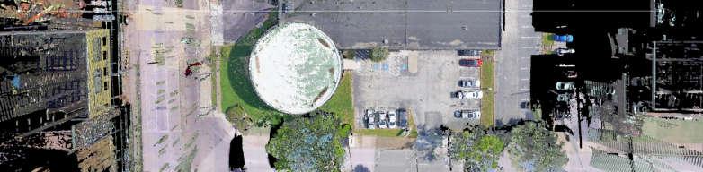


17 Infinity Point Cloud Agisoft Point Cloud


18 35 Example on Applying the New Standard 36 No RMSEr 18


19 Example on Applying the New Standard 37 10cm RMSEr Example on Applying the New Standard 38 3cm RMSEr 19
20 Basic Photogrammetry Principles 39 Photogrammetry Definition Photogrammetry is science of taking reliable measurements from photography
21 Advantages of UAS Photogrammetry Photos provide a permanent record of what existed at the instant the pictures were taken. Photos are easily interpreted without the need for special training. Photos can be used for multiple purposes (i.e. inspection, measurement, dense point clouds, and ortho-rectified images). Terrain models and ortho-rectified images can be created relatively quickly and generally at a lower cost than ground surveying methods. UAS photogrammetry can be used to measure areas that would be difficult, dangerous, or even impossible to access from the ground. 41 Disadvantages of UAS Photogrammetry Photo acquisition limited by weather, time of day, and lighting conditions. Limited foliage penetration. You need to have the same location imaged in at least two photos in order to create a 3D Point. Advance permission required to commercially fly UAS in certain air space. Some locations completely off limits. Additional safety related restrictions like not flying UAS over non-participants or moving vehicles and line-of-sight limitations
22 Vertical vs. Oblique Photos Vertical Photograph A photo taken with the camera axis vertical or nearly so. Oblique Photo A photo taken with the camera axis intentionally tilted between vertical and horizontal. High Oblique Photo An oblique photo where the horizon is visible in the photograph. 43 Photogrammetry basics Pinhole Camera Model Image space Image plane For planning calculations, we can treat the camera lens system as a simple pinhole camera. Object space Reflective Surface Light emanating from the sun strikes the surface and reflected. Part of the reflected light enters the camera, passes through the focal center of the camera, and strikes the image plane
23 Photogrammetry Basics Photo Scale f By similar triangles d = = h H f : focal length H : Flying height d : sensor width/height D : footprint width/height D 45 Photogrammetry Basics Ground Sample Distance (GSD) p f H The Ground Sample Distance (GSD) is the dimension of the image pixel projected onto the ground. The same equation can be applied to calculate the GSD = = h GSD f : focal length H : Flying height p : pixel size GSD : Ground Sample Distance 46 23

24 Photogrammetry Basics Footprint size and GSD example = = 6 Camera: Sony alpha 7R II Focal Length: 28 mm Sensor size: 6000 x 4000 pixels Sensor dimensions: 35.8 x 23.9 mm Flying Height: 100 m h = h h = = = 21.4 = = 85.4 For your camera/lens combination, it s good to memorize these ratios so that you can quickly estimate the footprint size and GSD in the field for a given flying height. 47 Photogrammetry Basics Image Block Base Distance Interline Distance Flight Line Exposure Station 48 24
25 Photogrammetry Basics Image block In order to successfully orient a block of overlapping images so that a point cloud or ortho-rectified mosaic can be produced, the images must overlap by certain minimum amounts. Along the direction of flight, the images must overlap by a minimum of 60%. Between flight lines, the images must overlap by a minimum of 30%. For an added margin of safety to account for small terrain variations and imprecise camera positioning, minimum forward and side overlaps should be more like 70% and 40% respectively. Planned forward and side overlaps should not exceed 85% to 90%. 49 Photogrammetry Basics Base and Interline Distance Calculation B We can view this diagram as either two consecutive photos along a flight line or as looking down the ends of two adjoining flight lines. = 1 % = 1 % B %OV D 50 25
26 Photogrammetry Basics Base and Interline Distance Calculation Example Camera: Sony alpha 7R II Focal Length: 28 mm Sensor size: 6000 x 4000 pixels Sensor dimensions: 35.8 x 23.9 mm Flying Height: 100 m Forward overlap: 70% Side overlap: 40% = 100 = % = % = Mission Planning Image Overlap and Terrain Height Variation Decreased Image Overlap Terrain Variation Launch Elevation Flying over terrain that s rising up towards the copter causes a decrease in the planned image overlap to the point where downstream processing can be negatively affected. This overlap issue with upward terrain variations can be compensated for by increasing the planned percent forward and side overlap and/or increasing the flying altitude
27 Mission Planning Image Overlap and Terrain Height Variation Example Problem: Assuming a constant interline distance, what upward change in terrain height will cause the percent side overlap to decrease from 40% to the minimum 30%? H ΔH % = ( ) (1 30%) (1 40%) (1 30%) = Oblique Photo Geometry d/2 f α f: Camera focal length. d: Image frame dimension. α: Field of view angle. β: Depression Angle. H: Camera height. tan = 2 H β 1 = tan 2 = tan + L1 L
28 Oblique Photo Example = tan = 23 Camera: Sony alpha 7R II Focal Length: 28 mm Sensor size: 6000 x 4000 pixels Sensor dimensions: 35.8 x 23.9 mm Flying Height: 100 m Depression Angle (deg.) L1 L Relative vs. Network Accuracy Relative (aka Local) accuracy refers to the accuracy of distance measurements. A volumetric analysis can be performed as long as no external data needs to be incorporated such as a model of the underlying surface beneath a stock pile. Network (aka Absolute) accuracy refers to knowing the location of a point relative to an external reference system/datum like state plane or possibly a local reference system. Good network accuracy is required for analyzing changes over time and more generally when measurements must be integrated with existing data. Sometimes trying determine the coordinate system and datum of the data to be tied into is easier said than done 56 28


29 Ground Control Distribution Bounding the Project Area Project area bound by control. Project area not bound by control. For larger areas, be sure to scatter additional control points throughout the interior of the project to reduce warping of the point cloud. 57 Control Point Distribution Step 1 Bound the project area Place control points just to the outside of the project area at the inside and outside corners of the project. These control points should bound your project area


 overlap.")


30 Control Point Distribution Step 2 Fill In Additional Control Place additional control points throughout the interior of the project making sure that the areas of influence of the control (yellow circles) overlap. Depending on the accuracy requirements of the project, whether GNSS photo positioning is used, its quality, and the quality of the camera sensor, the radius of the areas of influence may range from approximately 150 to 500 feet or more. At a bare minimum, there should be at least five control points well distributed throughout your project. 59 Ground Control Layout for Corridors Step 1 Set control on either side of corridor towards the edge of the photos at the ends of the flight lines and at major bends. Do not just place control down the centerline! The control must be placed so that so that it will fall in at least two photos


31 Ground Control Layout for Corridors Step 2 Fill in Additional Control Place additional control along the length of the project corridor alternating from side to side making sure that the areas of influence of the control (yellow circles) overlap. The control should be placed so that it falls towards the edge of the photo. Depending on the accuracy requirements of the project, whether GNSS photo positioning is used, its quality, and the quality of the camera sensor, the radius of influence may range from 150 to 500 feet. 61 Corridor Flight Planning Alternative Mission Plan Instead of flying just down the centerline of the corridor, consider flying along each side it such that the photos overlap side to side down the corridor. This keeps the aircraft from flying over traffic and at the same time improves the adjustment results because the two flights help support each other eliminating any side to side tilt that can happen along the flight line when only a single flight line is flown. The photos should have a side overlap of anywhere from 60 to 85%
32 Ground Control Target Design Target Size: Minimum of 5 to 10 times the nominal image GSD. Avoid targets that are so large as to be difficult to measure precisely on the photos. Color: Avoid unnatural, neon colors as these colors tend to bloom in the resulting images. It s best to stick to black and white targets for highest contrast. Recommended Target: 9 or 12 inch white or light gray ceramic tile with an X drawn on it and the opposing quadrants painted in black. They re durable, reusable, heavy enough not to get blown around, and no matter the flying height the center can easily be measured. 63 Natural Ground Control Targets Pro s: Positions can be recorded after the mission photos have been collected. Can be used to supplement targeted ground control or as check points. Don t leave any lasting marks like a painted target. Con s: Generally less accurate than targeted control. Can be more difficult to accurately locate. Natural ground control targets need to be Uniquely identifiable. Precisely locatable. Lie flat on the ground. Immovable. Visible from the air. Tip: In the field, take a photo of the control location to aid in identifying it s position when back in the office
33 Check Points Check points provide an independent check on the accuracy of the photo adjustment. They are typically collected at the same time as the control using similar criteria for placement, but they are not used as part of the adjustment process. Minimum of five required for a statistically significant sampling. Should be located half way between the control points. Do not place them right beside the control points. If only the vertical accuracy of the adjustment is to be evaluated, they do not necessarily need to be targeted but still located on a hard surface. 65 Camera Calibration Camera calibration is the process of precisely determining the internal characteristics of a camera system that can impact metric accuracy. These include the camera s focal length, optical center of the camera s sensor array, and geometric distortion of the lens system. These parameters can usually be automatically calculated by the orientation software. Caution should be exercised as these parameters, especially focal length, can be highly correlated with external factors. Without significant differences in the elevation of the ground control points within the project, the computed focal length may not be correct which can cause vertical scaling errors. Whenever possible, vary the height of the control points throughout the project area

34 Mission Planning Sun location and time of day The pilot should always position themselves with respect to the project area so that at no time during the flight does the copter get lost in the glare of the sun. A sun angle of between 30 and 60 degrees above the horizon is optimal. Sun angles lower than 30 degrees create long, deep shadows. Sun angles greater that 60 degrees create texturally flat images. 67 Mission Planning Wind Direction It s recommended that missions be planned such that the wind helps to bring the copter back towards its landing location on its last/return legs. At the end of a mission, the battery voltage is low and allowing the wind to help bring the copter back, extending the battery life, and increasing the odds of a safe return. Launch/recovery location Wind Direction Wind assisting on return legs
35 Mission Planning Using Every Leg Launch/recovery location Every leg of the mission should be utilized for collecting data. Instead of a wasted leg Launch/recovery location Increase the side overlap between flight lines and utilize all four legs. 69 Photography Basics Exposure Aperture Depth of Field A photo s exposure determines how light or dark an image will appear when captured. Exposure is dependent on just three camera settings aperture, shutter speed, and ISO. EXPOSURE ISO Image Noise Shutter Speed Motion Blur 70 35


36 Photography Basics Camera Settings Aperture: Controls the area over which light can enter the camera. Shutter Speed: Controls the amount of time light can enter the camera. ISO: Controls the camera sensors sensitivity. 71 Photography Basics Aperture Shallower Depth of Field Deeper The larger the f-number, the smaller the hole, and the deeper the depth of field. At the flying heights area based missions are typically flown, the camera is focused at infinity. The hyper focal distance will typically be much less than the flying height at all apertures so aperture is not a primary concern
37 Hyperfocal Distance H : Hyperfocal distance f : Lens focal length N : f-number c : Circle of confusion limit (0.03mm typically used). Hyper Focal Distance [m] The hyper focal distance is the distance beyond which all objects are acceptably sharp for a lens focused at infinity. Focal Length [mm] f-number Depth of Focus + s : subject distance. H : Hyperfocal distance. D N : Near focus distance. D F : Far focus distance. Example: An inspection flight is to be conducted with the camera focused at the planned image-object distance of 5 meters. The camera focal length is 50mm and the aperture is set to f/8 (Hyperfocal distance: 10.4 m) = = 9.6 Given the above, objects from 3.4 m to 9.6 m will be in acceptable focus


38 Photography Basics ISO Sweet Spot The quality of camera sensors vary, but typically ISO should be held to 800 or less. 75 Photography Basics Shutter Speed The faster the shutter speed, the less image blur due to motion

39 Photography Basics Forward Motion Blur Forward motion blur is caused by the aircraft s movement while the camera shutter is open. This effect can be reduced by increasing the shutter speed. h 2 For area mapping, the camera shutter speed should typically be 1/800s or faster. 77 Photography Basics Forward Motion Blur Example = = = = 3.2 Camera: Sony alpha 7R II Pixel Size: 6 microns Focal Length: 28 mm Flying Height: 70 m Shutter Speed: 1/500 s Aircraft Speed: 4 m/s Forward motion blur in this example would be just over half a pixel which would likely be visible in the image
40 Photography Basics Lens Focal Length Longer focal length lenses: Great for inspection flights because they allow the pilot to fly farther away from an object. Require more precise flying and good vibration dampening due to the narrower field of view. Shorter focal length lenses: Great for area mapping because they allow a larger area to be covered in a single frame. Too short of focal length can create excessive fisheye distortion. 79 Photography Basics Prime vs. Variable Focal Length Lenses Prime Better image quality. Lower light (faster). Simpler to use and set up. Lower cost. Smaller size and less weight. Variable Zoom More versatile
41 Sony Camera Comparison Camera Alpha 6000 Sony A7R Sony A7R II Image Sensor Width [mm] Image Sensor Height [mm] Pixel Size [um] Max Exposure Rate [frames/sec.] Sensor Width [pixels] Sensor Height [pixels] Pixels per square meter Processing Desnity.5cm GSD 1cm GSD 2cm GSD 3cm GSD 5cm GSD Full (High) 40,000 10,000 2,500 1, Half (Medium) 10,000 2, Quarter (Low) 2, Eighth (Lowest) Per square ft = PSM /


42 Semi-Global Matching (SGM) Introduced in 2005 by Heiko Hirchmueller from the DLR. A method of stereo matching on a pair of images using known intrinsic and extrinsic orientation of the cameras. A very robust algorithm used today in a wide range of computer vision applications, including navigation of autonomous vehicles. In addition to encoding the point cloud with RGB information, it can also be encoded with NDVI and NIR as well. Can generate very dense point clouds in which a 3D point can be generated from each pixel in the input images. 83 SGM Considerations Image Exposure SGM depends on the information contained in the imagery to perform its matching. Over and under exposed imagery creates noise in the resulting point cloud. Camera System Low quality lens systems can have excessive distortion which can carry through to the resulting point cloud. Lighting and Time of Day Subject A sun angle of between 30 and 60 degrees above the horizon is optimal. Sun angles lower than 30 degrees create long, deep shadows. Sun angles greater that 60 degrees create texturally flat images. Subjects that have little image texture or subjects with repeating patterns like farm field furrows can cause the image matching to generate excessive noise and mismatches

43 SGM Workflow Image Capture Care required to capture sufficiently overlapping Imagery to cover the project area. SGM Processing Well distributed ground control and/or GNSS positioning of the copter required to orient the imagery to the project coordinate system. Image Alignment Matching results improved with proper focus, exposure, and a shutter speed sufficient to minimize any image blur due to image motion. 85 Semi-Global Matching Increased point noise due to lack of image texture SGM Generated: 4cm spread Leica P50 Scanner: 0.4cm spread SGM Generated: 20cm spread 86 43


44 Semi-Global Matching Increased point noise due to poor exposure 87 Questions?? THANK YOU!! Bryan Baker Leica Geosystems Inc
AIRPORT MAPPING JUNE 2016 EXPLORING UAS EFFECTIVENESS GEOSPATIAL SLAM TECHNOLOGY FEMA S ROMANCE WITH LIDAR VOLUME 6 ISSUE 4
 VOLUME 6 ISSUE 4 JUNE 2016 AIRPORT MAPPING 18 EXPLORING UAS EFFECTIVENESS 29 GEOSPATIAL SLAM TECHNOLOGY 36 FEMA S ROMANCE WITH LIDAR Nearly 2,000 U.S. landfill facilities stand to gain from cost-effective
2019 NYSAPLS Conf> Fundamentals of Photogrammetry for Land Surveyors
 2019 NYSAPLS Conf> Fundamentals of Photogrammetry for Land Surveyors George Southard GSKS Associates LLC Introduction George Southard: Master s Degree in Photogrammetry and Cartography 40 years working
VisionMap Sensors and Processing Roadmap
 Vilan, Gozes 51 VisionMap Sensors and Processing Roadmap YARON VILAN, ADI GOZES, Tel-Aviv ABSTRACT The A3 is a family of digital aerial mapping cameras and photogrammetric processing systems, which is
Volume 1 - Module 6 Geometry of Aerial Photography. I. Classification of Photographs. Vertical
 RSCC Volume 1 Introduction to Photo Interpretation and Photogrammetry Table of Contents Module 1 Module 2 Module 3.1 Module 3.2 Module 4 Module 5 Module 6 Module 7 Module 8 Labs Volume 1 - Module 6 Geometry
RPAS Photogrammetric Mapping Workflow and Accuracy
 RPAS Photogrammetric Mapping Workflow and Accuracy Dr Yincai Zhou & Dr Craig Roberts Surveying and Geospatial Engineering School of Civil and Environmental Engineering, UNSW Background RPAS category and
Sample Copy. Not For Distribution.
 Photogrammetry, GIS & Remote Sensing Quick Reference Book i EDUCREATION PUBLISHING Shubham Vihar, Mangla, Bilaspur, Chhattisgarh - 495001 Website: www.educreation.in Copyright, 2017, S.S. Manugula, V.
Validation of the QuestUAV PPK System
 Validation of the QuestUAV PPK System 3cm in xy, 400ft, no GCPs, 100Ha, 25 flights Nigel King 1, Kerstin Traut 2, Cameron Weeks 3 & Ruairi Hardman 4 1 Director QuestUAV, 2 Data Analyst QuestUAV, 3 Production
Phase One 190MP Aerial System
 White Paper Phase One 190MP Aerial System Introduction Phase One Industrial s 100MP medium format aerial camera systems have earned a worldwide reputation for its high performance. They are commonly used
Leica ADS80 - Digital Airborne Imaging Solution NAIP, Salt Lake City 4 December 2008
 Luzern, Switzerland, acquired at 5 cm GSD, 2008. Leica ADS80 - Digital Airborne Imaging Solution NAIP, Salt Lake City 4 December 2008 Shawn Slade, Doug Flint and Ruedi Wagner Leica Geosystems AG, Airborne
Phase One ixu-rs1000 Accuracy Assessment Report Yu. Raizman, PhaseOne.Industrial, Israel
 17 th International Scientific and Technical Conference FROM IMAGERY TO DIGITAL REALITY: ERS & Photogrammetry Phase One ixu-rs1000 Accuracy Assessment Report Yu. Raizman, PhaseOne.Industrial, Israel 1.
accuracy. You even hear the terms subcentimeter or even millimeter absolute accuracy during some of these
 Question: I would like to get your expert opinion on a dataset I just received. It is UAS-based imagery collected to produce a 50cm Digital Elevation Models (DEM) and 5cm resolution true color orthos.
Basics of Photogrammetry Note#6
 Basics of Photogrammetry Note#6 Photogrammetry Art and science of making accurate measurements by means of aerial photography Analog: visual and manual analysis of aerial photographs in hard-copy format
PHOTOGRAMMETRY STEREOSCOPY FLIGHT PLANNING PHOTOGRAMMETRIC DEFINITIONS GROUND CONTROL INTRODUCTION
 PHOTOGRAMMETRY STEREOSCOPY FLIGHT PLANNING PHOTOGRAMMETRIC DEFINITIONS GROUND CONTROL INTRODUCTION Before aerial photography and photogrammetry became a reliable mapping tool, planimetric and topographic
Camera Calibration Certificate No: DMC III 27542
 Calibration DMC III Camera Calibration Certificate No: DMC III 27542 For Peregrine Aerial Surveys, Inc. #201 1255 Townline Road Abbotsford, B.C. V2T 6E1 Canada Calib_DMCIII_27542.docx Document Version
Acquisition of Aerial Photographs and/or Satellite Imagery
 Acquisition of Aerial Photographs and/or Satellite Imagery Acquisition of Aerial Photographs and/or Imagery From time to time there is considerable interest in the purchase of special-purpose photography
IMAGE ACQUISITION GUIDELINES FOR SFM
 IMAGE ACQUISITION GUIDELINES FOR SFM a.k.a. Close-range photogrammetry (as opposed to aerial/satellite photogrammetry) Basic SfM requirements (The Golden Rule): minimum of 60% overlap between the adjacent
High Resolution Sensor Test Comparison with SPOT, KFA1000, KVR1000, IRS-1C and DPA in Lower Saxony
 High Resolution Sensor Test Comparison with SPOT, KFA1000, KVR1000, IRS-1C and DPA in Lower Saxony K. Jacobsen, G. Konecny, H. Wegmann Abstract The Institute for Photogrammetry and Engineering Surveys
Introduction to Photogrammetry
 Introduction to Photogrammetry Presented By: Sasanka Madawalagama Geoinformatics Center Asian Institute of Technology Thailand www.geoinfo.ait.asia Content Introduction to photogrammetry 2D to 3D Drones
Aerial photography: Principles. Frame capture sensors: Analog film and digital cameras
 Aerial photography: Principles Frame capture sensors: Analog film and digital cameras Overview Introduction Frame vs scanning sensors Cameras (film and digital) Photogrammetry Orthophotos Air photos are
EXAMPLES OF TOPOGRAPHIC MAPS PRODUCED FROM SPACE AND ACHIEVED ACCURACY CARAVAN Workshop on Mapping from Space, Phnom Penh, June 2000
 EXAMPLES OF TOPOGRAPHIC MAPS PRODUCED FROM SPACE AND ACHIEVED ACCURACY CARAVAN Workshop on Mapping from Space, Phnom Penh, June 2000 Jacobsen, Karsten University of Hannover Email: karsten@ipi.uni-hannover.de
HIGH RESOLUTION COLOR IMAGERY FOR ORTHOMAPS AND REMOTE SENSING. Author: Peter Fricker Director Product Management Image Sensors
 HIGH RESOLUTION COLOR IMAGERY FOR ORTHOMAPS AND REMOTE SENSING Author: Peter Fricker Director Product Management Image Sensors Co-Author: Tauno Saks Product Manager Airborne Data Acquisition Leica Geosystems
Photogrammetry. Lecture 4 September 7, 2005
 Photogrammetry Lecture 4 September 7, 2005 What is Photogrammetry Photogrammetry is the art and science of making accurate measurements by means of aerial photography: Analog photogrammetry (using films:
Geometry of Aerial Photographs
 Geometry of Aerial Photographs Aerial Cameras Aerial cameras must be (details in lectures): Geometrically stable Have fast and efficient shutters Have high geometric and optical quality lenses They can
UAV PHOTOGRAMMETRY COMPARED TO TRADITIONAL RTK GPS SURVEYING
 UAV PHOTOGRAMMETRY COMPARED TO TRADITIONAL RTK GPS SURVEYING Brad C. Mathison and Amber Warlick March 20, 2016 Fearless Eye Inc. Kansas City, Missouri www.fearlesseye.com KEY WORDS: UAV, UAS, Accuracy
MSB Imagery Program FAQ v1
 MSB Imagery Program FAQ v1 (F)requently (A)sked (Q)uestions 9/22/2016 This document is intended to answer commonly asked questions related to the MSB Recurring Aerial Imagery Program. Table of Contents
not to be republished NCERT Introduction To Aerial Photographs Chapter 6
 Chapter 6 Introduction To Aerial Photographs Figure 6.1 Terrestrial photograph of Mussorrie town of similar features, then we have to place ourselves somewhere in the air. When we do so and look down,
Camera Calibration Certificate No: DMC II
 Calibration DMC II 140-036 Camera Calibration Certificate No: DMC II 140-036 For Midwest Aerial Photography 7535 West Broad St, Galloway, OH 43119 USA Calib_DMCII140-036.docx Document Version 3.0 page
Acquisition of Aerial Photographs and/or Imagery
 Acquisition of Aerial Photographs and/or Imagery Acquisition of Aerial Photographs and/or Imagery From time to time there is considerable interest in the purchase of special-purpose photography contracted
Overview. Objectives. The ultimate goal is to compare the performance that different equipment offers us in a photogrammetric flight.
 Overview At present, one of the most commonly used technique for topographic surveys is aerial photogrammetry. This technique uses aerial images to determine the geometric properties of objects and spatial
Processing of stereo scanner: from stereo plotter to pixel factory
 Photogrammetric Week '03 Dieter Fritsch (Ed.) Wichmann Verlag, Heidelberg, 2003 Bignone 141 Processing of stereo scanner: from stereo plotter to pixel factory FRANK BIGNONE, ISTAR, France ABSTRACT With
Suveying Lectures for CE 498
 Suveying Lectures for CE 498 SURVEYING CLASSIFICATIONS Surveying work can be classified as follows: 1- Preliminary Surveying In this surveying the detailed data are collected by determining its locations
Leica - 3 rd Generation Airborne Digital Sensors Features / Benefits for Remote Sensing & Environmental Applications
 Leica - 3 rd Generation Airborne Digital Sensors Features / Benefits for Remote Sensing & Environmental Applications Arthur Rohrbach, Sensor Sales Dir Europe, Middle-East and Africa (EMEA) Luzern, Switzerland,
Camera Calibration Certificate No: DMC II
 Calibration DMC II 230 015 Camera Calibration Certificate No: DMC II 230 015 For Air Photographics, Inc. 2115 Kelly Island Road MARTINSBURG WV 25405 USA Calib_DMCII230-015_2014.docx Document Version 3.0
Baldwin and Mobile Counties, AL Orthoimagery Project Report. Submitted: March 23, 2016
 2015 Orthoimagery Project Report Submitted: Prepared by: Quantum Spatial, Inc 523 Wellington Way, Suite 375 Lexington, KY 40503 859-277-8700 Page i of iii Contents Project Report 1. Summary / Scope...
Camera Calibration Certificate No: DMC IIe
 Calibration DMC IIe 230 23522 Camera Calibration Certificate No: DMC IIe 230 23522 For Richard Crouse & Associates 467 Aviation Way Frederick, MD 21701 USA Calib_DMCIIe230-23522.docx Document Version 3.0
MINNESOTA DEPARTMENT OF TRANSPORTATION OFFICE OF LAND MANAGEMENT SURVEYING AND MAPPING SECTION PHOTOGRAMMETRY UNIT
 SEP. 2011 MINNESOTA DEPARTMENT OF TRANSPORTATION OFFICE OF LAND MANAGEMENT SURVEYING AND MAPPING SECTION PHOTOGRAMMETRY UNIT SPECIAL PROVISIONS FOR: GROUP 1: AERIAL PHOTOGRAPHY/PHOTOGRAMMETRIC LAB SERVICES
Five Sensors, One Day: Unmanned vs. Manned Logistics and Accuracy
 Five Sensors, One Day: Unmanned vs. Manned Logistics and Accuracy ASPRS UAS Mapping Technical Symposium Sept 13 th, 2016 Presenter: David Day, CP, GISP Keystone Aerial Surveys, Inc. Summary of activities
Aperture & ƒ/stop Worksheet
 Tools and Program Needed: Digital C. Computer USB Drive Bridge PhotoShop Name: Manipulating Depth-of-Field Aperture & stop Worksheet The aperture setting (AV on the dial) is a setting to control the amount
Camera Calibration Certificate No: DMC II
 Calibration DMC II 140-005 Camera Calibration Certificate No: DMC II 140-005 For Midwest Aerial Photography 7535 West Broad St, Galloway, OH 43119 USA Calib_DMCII140-005.docx Document Version 3.0 page
Criteria for Optical Systems: Optical Path Difference How do we determine the quality of a lens system? Several criteria used in optical design
 Criteria for Optical Systems: Optical Path Difference How do we determine the quality of a lens system? Several criteria used in optical design Computer Aided Design Several CAD tools use Ray Tracing (see
Camera Calibration Certificate No: DMC II
 Calibration DMC II 230 027 Camera Calibration Certificate No: DMC II 230 027 For Peregrine Aerial Surveys, Inc. 103-20200 56 th Ave Langley, BC V3A 8S1 Canada Calib_DMCII230-027.docx Document Version 3.0
PROPERTY OF THE LARGE FORMAT DIGITAL AERIAL CAMERA DMC II
 PROPERTY OF THE LARGE FORMAT DIGITAL AERIAL CAMERA II K. Jacobsen a, K. Neumann b a Institute of Photogrammetry and GeoInformation, Leibniz University Hannover, Germany jacobsen@ipi.uni-hannover.de b Z/I
CALIBRATING THE NEW ULTRACAM OSPREY OBLIQUE AERIAL SENSOR Michael Gruber, Wolfgang Walcher
 CALIBRATING THE NEW ULTRACAM OSPREY OBLIQUE AERIAL SENSOR Michael Gruber, Wolfgang Walcher Microsoft UltraCam Business Unit Anzengrubergasse 8/4, 8010 Graz / Austria {michgrub, wwalcher}@microsoft.com
Camera Calibration Certificate No: DMC II Aero Photo Europe Investigation
 Calibration DMC II 250 030 Camera Calibration Certificate No: DMC II 250 030 For Aero Photo Europe Investigation Aerodrome de Moulins Montbeugny Yzeure Cedex 03401 France Calib_DMCII250-030.docx Document
MEDIUM FORMAT CAMERA EVALUATION BASED ON THE LATEST PHASE ONE TECHNOLOGY
 MEDIUM FORMAT CAMERA EVALUATION BASED ON THE LATEST PHASE ONE TECHNOLOGY T.Tölg a, G. Kemper b, D. Kalinski c a Phase One / Germany tto@phaseone.com b GGS GmbH, Speyer / Germany kemper@ggs-speyer.de c
Camera Calibration Certificate No: DMC II
 Calibration DMC II 230 020 Camera Calibration Certificate No: DMC II 230 020 For MGGP Aero Sp. z o.o. ul. Słowackiego 33-37 33-100 Tarnów Poland Calib_DMCII230-020.docx Document Version 3.0 page 1 of 40
11/25/2009 CHAPTER THREE INTRODUCTION INTRODUCTION (CONT D) THE AERIAL CAMERA: LENS PHOTOGRAPHIC SENSORS
 THE AERIAL CAMERA: LENS PHOTOGRAPHIC SENSORS") INTRODUCTION CHAPTER THREE IC SENSORS Photography means to write with light Today s meaning is often expanded to include radiation just outside the visible spectrum, i. e. ultraviolet and near infrared
INTRODUCTION CHAPTER THREE IC SENSORS Photography means to write with light Today s meaning is often expanded to include radiation just outside the visible spectrum, i. e. ultraviolet and near infrared
ASPECTS OF DEM GENERATION FROM UAS IMAGERY
 ASPECTS OF DEM GENERATION FROM UAS IMAGERY A. Greiwea,, R. Gehrke a,, V. Spreckels b,, A. Schlienkamp b, Department Architecture, Civil Engineering and Geomatics, Fachhochschule Frankfurt am Main, Germany
Orthoimagery Standards. Chatham County, Georgia. Jason Lee and Noel Perkins
 1 Orthoimagery Standards Chatham County, Georgia Jason Lee and Noel Perkins 2 Table of Contents Introduction... 1 Objective... 1.1 Data Description... 2 Spatial and Temporal Environments... 3 Spatial Extent
CALIBRATION OF OPTICAL SATELLITE SENSORS
 CALIBRATION OF OPTICAL SATELLITE SENSORS KARSTEN JACOBSEN University of Hannover Institute of Photogrammetry and Geoinformation Nienburger Str. 1, D-30167 Hannover, Germany jacobsen@ipi.uni-hannover.de
VisionMap A3 Edge A Single Camera for Multiple Solutions
 Photogrammetric Week '15 Dieter Fritsch (Ed.) Wichmann/VDE Verlag, Belin & Offenbach, 2015 Raizman, Gozes 57 VisionMap A3 Edge A Single Camera for Multiple Solutions Yuri Raizman, Adi Gozes, Tel-Aviv ABSTRACT
CSI: Rombalds Moor Photogrammetry Photography
 Photogrammetry Photography Photogrammetry Training 26 th March 10:00 Welcome Presentation image capture Practice 12:30 13:15 Lunch More practice 16:00 (ish) Finish or earlier What is photogrammetry 'photo'
PHOTOGRAMMETRIC RESECTION DIFFERENCES BASED ON LABORATORY vs. OPERATIONAL CALIBRATIONS
 PHOTOGRAMMETRIC RESECTION DIFFERENCES BASED ON LABORATORY vs. OPERATIONAL CALIBRATIONS Dean C. MERCHANT Topo Photo Inc. Columbus, Ohio USA merchant.2@osu.edu KEY WORDS: Photogrammetry, Calibration, GPS,
Chapters 1 & 2. Definitions and applications Conceptual basis of photogrammetric processing
 Chapters 1 & 2 Chapter 1: Photogrammetry Definitions and applications Conceptual basis of photogrammetric processing Transition from two-dimensional imagery to three-dimensional information Automation
NEWS FROM THE ULTRACAM CAMERA LINE-UP INTRODUCTION
 NEWS FROM THE ULTRACAM CAMERA LINE-UP Alexander Wiechert, Michael Gruber Vexcel Imaging Austria / Microsoft Photogrammetry Anzengrubergasse 8/4, 8010 Graz / Austria {alwieche, michgrub}@microsoft.com ABSTRACT
UltraCam and UltraMap Towards All in One Solution by Photogrammetry
 Photogrammetric Week '11 Dieter Fritsch (Ed.) Wichmann/VDE Verlag, Belin & Offenbach, 2011 Wiechert, Gruber 33 UltraCam and UltraMap Towards All in One Solution by Photogrammetry ALEXANDER WIECHERT, MICHAEL
LENSES. INEL 6088 Computer Vision
 LENSES INEL 6088 Computer Vision Digital camera A digital camera replaces film with a sensor array Each cell in the array is a Charge Coupled Device light-sensitive diode that converts photons to electrons
ANALYSIS OF SRTM HEIGHT MODELS
 ANALYSIS OF SRTM HEIGHT MODELS Sefercik, U. *, Jacobsen, K.** * Karaelmas University, Zonguldak, Turkey, ugsefercik@hotmail.com **Institute of Photogrammetry and GeoInformation, University of Hannover,
Calibration Certificate
 Calibration Certificate Digital Mapping Camera (DMC) DMC Serial Number: DMC01-0053 CBU Serial Number: 0100053 For MPPG AERO Sp. z. o. o., ul. Kaczkowskiego 6 33-100 Tarnow Poland System Overview Flight
SFR 406 Spring 2015 Lecture 7 Notes Film Types and Filters
 SFR 406 Spring 2015 Lecture 7 Notes Film Types and Filters 1. Film Resolution Introduction Resolution relates to the smallest size features that can be detected on the film. The resolving power is a related
CALIBRATION OF IMAGING SATELLITE SENSORS
 CALIBRATION OF IMAGING SATELLITE SENSORS Jacobsen, K. Institute of Photogrammetry and GeoInformation, University of Hannover jacobsen@ipi.uni-hannover.de KEY WORDS: imaging satellites, geometry, calibration
HD aerial video for coastal zone ecological mapping
 HD aerial video for coastal zone ecological mapping Albert K. Chong University of Otago, Dunedin, New Zealand Phone: +64 3 479-7587 Fax: +64 3 479-7586 Email: albert.chong@surveying.otago.ac.nz Presented
Opto Engineering S.r.l.
 TUTORIAL #1 Telecentric Lenses: basic information and working principles On line dimensional control is one of the most challenging and difficult applications of vision systems. On the other hand, besides
POTENTIAL OF LARGE FORMAT DIGITAL AERIAL CAMERAS. Dr. Karsten Jacobsen Leibniz University Hannover, Germany
 POTENTIAL OF LARGE FORMAT DIGITAL AERIAL CAMERAS Dr. Karsten Jacobsen Leibniz University Hannover, Germany jacobsen@ipi.uni-hannover.de Introduction: Digital aerial cameras are replacing traditional analogue
UltraCam and UltraMap An Update
 Photogrammetric Week '13 Dieter Fritsch (Ed.) Wichmann/VDE Verlag, Belin & Offenbach, 2013 Wiechert 37 UltraCam and UltraMap An Update ALEXANDER WIECHERT, Graz ABSTRACT When UltraCam D was presented first
EnsoMOSAIC Aerial mapping tools
 EnsoMOSAIC Aerial mapping tools Jakarta and Kuala Lumpur, 2013 Contents MosaicMill MM Application examples Software introduction System introduction Rikola HS sensor UAV platform examples SW Syst HS UAV
GEO 428: DEMs from GPS, Imagery, & Lidar Tuesday, September 11
 GEO 428: DEMs from GPS, Imagery, & Lidar Tuesday, September 11 Global Positioning Systems GPS is a technology that provides Location coordinates Elevation For any location with a decent view of the sky
Exercise questions for Machine vision
 Exercise questions for Machine vision This is a collection of exercise questions. These questions are all examination alike which means that similar questions may appear at the written exam. I ve divided
An Introduction to Geomatics. Prepared by: Dr. Maher A. El-Hallaq خاص بطلبة مساق مقدمة في علم. Associate Professor of Surveying IUG
 An Introduction to Geomatics خاص بطلبة مساق مقدمة في علم الجيوماتكس Prepared by: Dr. Maher A. El-Hallaq Associate Professor of Surveying IUG 1 Airborne Imagery Dr. Maher A. El-Hallaq Associate Professor
Structure from Motion (SfM) Photogrammetry Field Methods Manual for Students
 Photogrammetry Field Methods Manual for Students") Structure from Motion (SfM) Photogrammetry Field Methods Manual for Students Written by Katherine Shervais (UNAVCO) Introduction to SfM for Field Education The purpose of the Analyzing High Resolution
Structure from Motion (SfM) Photogrammetry Field Methods Manual for Students Written by Katherine Shervais (UNAVCO) Introduction to SfM for Field Education The purpose of the Analyzing High Resolution
6.098 Digital and Computational Photography Advanced Computational Photography. Bill Freeman Frédo Durand MIT - EECS
 6.098 Digital and Computational Photography 6.882 Advanced Computational Photography Bill Freeman Frédo Durand MIT - EECS Administrivia PSet 1 is out Due Thursday February 23 Digital SLR initiation? During
UltraCam Eagle Prime Aerial Sensor Calibration and Validation
 UltraCam Eagle Prime Aerial Sensor Calibration and Validation Michael Gruber, Marc Muick Vexcel Imaging GmbH Anzengrubergasse 8/4, 8010 Graz / Austria {michael.gruber, marc.muick}@vexcel-imaging.com Key
DEMS BASED ON SPACE IMAGES VERSUS SRTM HEIGHT MODELS. Karsten Jacobsen. University of Hannover, Germany
 DEMS BASED ON SPACE IMAGES VERSUS SRTM HEIGHT MODELS Karsten Jacobsen University of Hannover, Germany jacobsen@ipi.uni-hannover.de Key words: DEM, space images, SRTM InSAR, quality assessment ABSTRACT
Project Planning and Cost Estimating
 CHAPTER 17 Project Planning and Cost Estimating 17.1 INTRODUCTION Previous chapters have outlined and detailed technical aspects of photogrammetry. The basic tasks and equipment required to create various
OLC Turnbull. wsidata.com
 OLC Turnbull wsidata.com August 26, 2013 Base station set up over control TURN_03 Data collected for: Department of Geology and Mineral Industries 800 NE Oregon Street Suite 965 Portland, OR 97232 Prepared
GeoSAR P-band and X-band Performance In Southern California and Colombia, South America
 GeoSAR P-band and X-band Performance In Southern California and Colombia, South America ISPRS International WG 1/2 Workshop 2005 James J Reis, EarthData Technologies Dr. Scott Hensley, Jet Propulsion Laboratory
DEM Generation Using a Digital Large Format Frame Camera
 DEM Generation Using a Digital Large Format Frame Camera Joachim Höhle Abstract Progress in automated photogrammetric DEM generation is presented. Starting from the procedures and the performance parameters
Camera Requirements For Precision Agriculture
 Camera Requirements For Precision Agriculture Radiometric analysis such as NDVI requires careful acquisition and handling of the imagery to provide reliable values. In this guide, we explain how Pix4Dmapper
Airborne or Spaceborne Images for Topographic Mapping?
 Advances in Geosciences Konstantinos Perakis, Editor EARSeL, 2012 Airborne or Spaceborne Images for Topographic Mapping? Karsten Jacobsen Leibniz University Hannover, Institute of Photogrammetry and Geoinformation,
Lecture 7. Leica ADS 80 Camera System and Imagery. Ontario ADS 80 FRI Imagery. NRMT 2270, Photogrammetry/Remote Sensing
 NRMT 2270, Photogrammetry/Remote Sensing Lecture 7 Leica ADS 80 Camera System and Imagery. Ontario ADS 80 FRI Imagery. Tomislav Sapic GIS Technologist Faculty of Natural Resources Management Lakehead University
Vexcel Imaging GmbH Innovating in Photogrammetry: UltraCamXp, UltraCamLp and UltraMap
 Photogrammetric Week '09 Dieter Fritsch (Ed.) Wichmann Verlag, Heidelberg, 2009 Wiechert, Gruber 27 Vexcel Imaging GmbH Innovating in Photogrammetry: UltraCamXp, UltraCamLp and UltraMap ALEXANDER WIECHERT,
Following are the geometrical elements of the aerial photographs:
 Geometrical elements/characteristics of aerial photograph: An aerial photograph is a central or perspective projection, where the bundles of perspective rays meet at a point of origin called perspective
Abstract Quickbird Vs Aerial photos in identifying man-made objects
 Abstract Quickbird Vs Aerial s in identifying man-made objects Abdullah Mah abdullah.mah@aramco.com Remote Sensing Group, emap Division Integrated Solutions Services Department (ISSD) Saudi Aramco, Dhahran
UltraCam and UltraMap An Update
 Photogrammetric Week '15 Dieter Fritsch (Ed.) Wichmann/VDE Verlag, Belin & Offenbach, 2015 Wiechert, Gruber 45 UltraCam and UltraMap An Update Alexander Wiechert, Michael Gruber, Graz ABSTRACT When UltraCam
CEE 6100 / CSS 6600 Remote Sensing Fundamentals 1 Topic 4: Photogrammetry
 CEE 6100 / CSS 6600 Remote Sensing Fundamentals 1 PHOTOGRAMMETRY DEFINITION (adapted from Manual of Photographic Interpretation, 2 nd edition, Warren Philipson, 1997) Photogrammetry and Remote Sensing:
Image Formation. Dr. Gerhard Roth. COMP 4102A Winter 2015 Version 3
 Image Formation Dr. Gerhard Roth COMP 4102A Winter 2015 Version 3 1 Image Formation Two type of images Intensity image encodes light intensities (passive sensor) Range (depth) image encodes shape and distance
Lesson 4: Photogrammetry
 This work by the National Information Security and Geospatial Technologies Consortium (NISGTC), and except where otherwise Development was funded by the Department of Labor (DOL) Trade Adjustment Assistance
Aerial Triangulation Radiometry Essentials Dense Matching Ortho Generation
 Radiometry Aerial Triangulation Essentials Dense Matching Ortho Generation Highly advanced photogrammetric workflow system for UltraCam images. Microsoft UltraMap is a state-of-the-art, end-to-end, complete
USE OF IMPROVISED REMOTELY SENSED DATA FROM UAV FOR GIS AND MAPPING, A CASE STUDY OF GOMA CITY, DR CONGO
 USE OF IMPROVISED REMOTELY SENSED DATA FROM UAV FOR GIS AND MAPPING, A CASE STUDY OF GOMA CITY, DR CONGO Cung Chin Thang United Nations Global Support Center, Brindisi, Italy, Email: thang@un.org KEY WORDS:
Digital Aerial Photography UNBC March 22, Presented by: Dick Mynen TDB Consultants Inc.
 Digital Aerial Photography UNBC March 22, 2011 Presented by: Dick Mynen TDB Consultants Inc. Airborne Large Scale Digital Photography Who is using the technology in today s environment Options available
Camera Requirements For Precision Agriculture
 Camera Requirements For Precision Agriculture Radiometric analysis such as NDVI requires careful acquisition and handling of the imagery to provide reliable values. In this guide, we explain how Pix4Dmapper
Unmanned Aerial Vehicle Data Acquisition for Damage Assessment in. Hurricane Events
 Unmanned Aerial Vehicle Data Acquisition for Damage Assessment in Hurricane Events Stuart M. Adams a Carol J. Friedland b and Marc L. Levitan c ABSTRACT This paper examines techniques for data collection
On spatial resolution
 On spatial resolution Introduction How is spatial resolution defined? There are two main approaches in defining local spatial resolution. One method follows distinction criteria of pointlike objects (i.e.
CHARLES MONDELLO PAST PRESIDENT PDC ASPRS FELLOW
 SMALL UNMANNED AERIAL SYSTEMS (SUAS) IN EMERGENCY MANAGEMENT RANDY FRANK MARION COUNTY DIRECTOR EMERGENCY MANAGEMENT CHARLES MONDELLO PAST PRESIDENT PDC ASPRS FELLOW SUAS OR DRONE OR UAV 1) Small Unmanned
MONITORING RUBBLE-MOUND COASTAL STRUCTURES WITH PHOTOGRAMMETRY
 ,. CETN-III-21 2/84 MONITORING RUBBLE-MOUND COASTAL STRUCTURES WITH PHOTOGRAMMETRY INTRODUCTION: Monitoring coastal projects usually involves repeated surveys of coastal structures and/or beach profiles.
Ground Control Configuration Analysis for Small Area UAV Imagery Based Mapping
 Ground Control Configuration Analysis for Small Area UAV Imagery Based Mapping ASPRS IGTF 2017, Baltimore, MD March 15 th, 2017 Presenter: David Day, CP, GISP Wes Weaver Keystone Aerial Surveys, Inc. Summary
NREM 345 Week 2, Material covered this week contributes to the accomplishment of the following course goal:
 NREM 345 Week 2, 2010 Reading assignment: Chapter. 4 and Sec. 5.1 to 5.2.4 Material covered this week contributes to the accomplishment of the following course goal: Goal 1: Develop the understanding and
Govt. Engineering College Jhalawar Model Question Paper Subject- Remote Sensing & GIS
 Govt. Engineering College Jhalawar Model Question Paper Subject- Remote Sensing & GIS Time: Max. Marks: Q1. What is remote Sensing? Explain the basic components of a Remote Sensing system. Q2. What is
APPLICATIONS AND LESSONS LEARNED WITH AIRBORNE MULTISPECTRAL IMAGING
 APPLICATIONS AND LESSONS LEARNED WITH AIRBORNE MULTISPECTRAL IMAGING James M. Ellis and Hugh S. Dodd The MapFactory and HJW Walnut Creek and Oakland, California, U.S.A. ABSTRACT Airborne digital frame
TELLS THE NUMBER OF PIXELS THE TRUTH? EFFECTIVE RESOLUTION OF LARGE SIZE DIGITAL FRAME CAMERAS
 TELLS THE NUMBER OF PIXELS THE TRUTH? EFFECTIVE RESOLUTION OF LARGE SIZE DIGITAL FRAME CAMERAS Karsten Jacobsen Leibniz University Hannover Nienburger Str. 1 D-30167 Hannover, Germany jacobsen@ipi.uni-hannover.de