NovAtel s GNSS Vulnerability Mitigation (including Anti jam antennas)
|
|
|
- Matilda Spencer
- 6 years ago
- Views:
Transcription
 Rod")

1 NovAtel s GNSS Vulnerability Mitigation (including Anti jam antennas) Rod MacLeod Regional Manager South Asia/Australia rod.macleod@novatel.com
2 Contents NovAtel Corporate Overview GNSS Vulnerabilities NovAtel Mitigation Solutions Ionospheric Scintillation Monitoring Electronic Protection (EP) 1. NovAtel multi GNSS Receivers 2. NovAtel SPAN 3. NovAtel GAJT Electronic Support (ES) NovAtel Firehose Electronic Attack (EA) NovAtel NEAT Military only Summary
3 Corporate Overview


4 NovAtel World s #1 GNSS OEM supplier Based in Canada with offices around the world High accuracy, high precision Brand synonymous with quality, innovation and customer support Unsurpassed breadth of product line in vertical markets like: Anti Jam Heading Positioning Smooth Positioning Relative Positioning Velocity Aerospace Marine Agriculture Mobile Mapping Construction, Mining GNSS Signal & Industrial Monitoring Survey Defence Timing Unmanned Systems Timing Attitude Integrity & Augmentation


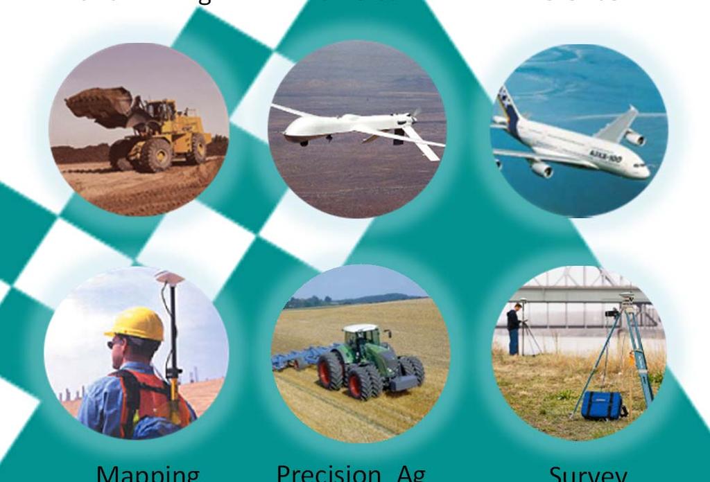


5 Market Focus High Construction and Mining Unmanned Vehicles Aerospace & Defence Reliability Cellular Phone Mapping Precision Ag Survey Car Navigation Vehicle Tracking Low Accuracy High


6 Product Line Mapping Defense/ Military Survey/ Mapping Precision Agriculture Machine Control Marine Timing Aerospace/ Science Receiver Cards SPAN / IMU Antenna Enclosure Ground Reference Receivers


 These threats affect both civil")

7 GNSS is Vulnerable Precision GNSS market Predicted to double by 2016 Agriculture, machining, construction, GIS/Survey and military Major threats Ionosphere (worst case magnetic equatorial regions) Interference (anywhere) These threats affect both civil and military systems Precision GNSS has witnessed exponential growth since last Solar maximum LBS research study
 Electronic Attack Signal Jamming: intentional and non intentional Signal Spoofing : intentional (sophisticated)")
8 GNSS Vulnerability Electronic and Non Electronic Non Electronic Obstructions : Mostly Random and temporary Atmospherics (effectively Ionospheric effects) Electronic Attack Signal Jamming: intentional and non intentional Signal Spoofing : intentional (sophisticated)
9 Ionospheric Effects on GNSS Dispersive medium Refraction: change in propagation delay (ray bending) Scintillation: rapid fluctuations in amplitude and phase Refraction Code delay and phase advance Total Electron Content (TEC) unit Scintillation Amplitude (S 4 ) and phase ( ) Deep signal fades (Loss of lock) Stress PLL loops Frequent cycle slips Degraded navigation data Carrier phase positioning L1 C/A tracking amplitude scintillation L2 P(Y) amplitude & phase scintillation
10 Mitigation of Ionospheric Effects on GNSS Refraction Measuring L1 and L2 allows real time determination and removal for the PVT solution Scintillation Cannot be detected by using standard receivers Need Specific Monitor receiver Most useful if in real time
 (limits to 5 m or less) Code minus carrier output Specialized software Dedicated receiver commands and kindling")
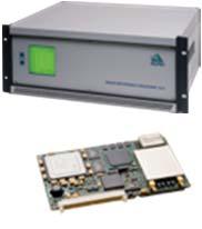
11 GPStation 6 Real time Scintillation Monitor Ultra stable low noise OCXO Ensures accurate phase scintillation measurement Facilitates narrow loop bandwidths Augments local base station and base station networks Proprietary multipath mitigation Pulse aperture correlation (PAC) (limits to 5 m or less) Code minus carrier output Specialized software Dedicated receiver commands and kindling Configurable loop bandwidths Detrending algorithms Comprehensive real time measurements Tracks all GNSS Constellations Raw amplitude and phase (50 Hz) S 4,, code and carrier TEC

 Correct part of the year and time Early")
12 Equatorial Scintillation Study (2012) To investigate reported extended periods of degraded RTK performance in the precise positioning required for mine machine operations. Scintillation suspected as it was Correct geographic location Calama, Chile (~ 22 0 Latitude) Correct solar cycle period Approaching Solar Max (2013) Correct part of the year and time Early summer Post sunset period
13 GPS Block IIF PRN 25 GPS PRN 01, 25 broadcast GPS L5 besides L1 and L2C signal Measured C/N 0 (db-hz) :00 22:00 23:00 00:00 01:00 Local Time (Hrs) GPS PRN 25 L1 C/A L2-CL L5-Q All 3 frequencies show same scintillation trends, but S 4 and not always correlated. Amplitude Scintillation Index (S 4 ) Phase Scintillation Index ( ) (60-seconds) (rad) L1 C/A L2-CL L5-Q GPS PRN :00 22:00 23:00 00:00 01:00 Local GPS Time PRN (Hrs) L1 C/A 0.6 L2-CL L5-Q :00 22:00 23:00 00:00 01:00 Local Time (Hrs)
, while")
 Electronic Protection (EP) OEM6 Multi")
 Firehose Sea Land Air & small platforms Electronic")
14 Electronic NovAtel Covers the NAVWAR Bases "NAVWAR ensures that friendly forces have unfettered access to position, navigation and time (PNT), while denying adversarial use of the same." (US JP 3 14, Space Operations; 2009) Electronic Protection (EP) OEM6 Multi GNSS and SAASM SPAN: Integrated Navigation GAJT: GPS Anti Jam Technology Electronic Support (ES) Firehose Sea Land Air & small platforms Electronic Attack (EA) NEAT: NAVWAR Electronic Attack Trainer
15 Electronic Protection 1. GNSS Receivers
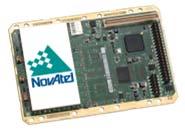
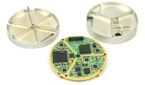
16 Multi Constellation, High Precision GNSS Receivers Use all current and upcoming GPS, GLONASS, Galileo and BeiDou satellite signals. Field upgradeable to maximize satellite availability and optimize GNSS signal usage. OEM 638 Triple frequency GNSS Triple frequency + L Band 240 Channels OEM 628 Triple frequency GNSS Triple frequency + L Band Configurable interface OEM 615 Compact dual frequency GNSS NovAtel s smallest dual frequency GNSS receiver Low power consumption OEM 625S SAASM RTK GPS L1, L2 (+ GLONASS) SAASM: L 3 IEC XFACTOR SPAN (INS GNSS) option RTK (SAASM & Civil) <2 cm OEM625S Schematic RF Civil IF MINOS ASIC Military IF NovAtel μ processor SAASM 24 pin connector 16 pin connector Open Signal RTK SAASM RTK
17 Electronic Protection 2. SPAN
 RAIM")


18 SPAN Real time GNSS/INS Synchronous Position, Attitude, Navigation Tightly coupled GNSS receivers with inertial measurement units (IMU) RAIM implemented NovAtel engine and IMUs from a range of vendors in various accuracies. ISTAR & intelligence applications, mobile and airborne mapping. Real Time Heading ALIGN precise heading in high dynamic applications Heading and pitch angles for real time navigation Heading, pitch, relative separation and position

19 SPAN: Automated Flight Control System Helicopter SPAN SE D dual antenna GNSS/INS receivers Honeywell HG1700 AG58 IMU Video: Web page: Paper: in action/automated flight control/ Ship Two NovAtel 702GL antennas. Northrop Grumman LN200 IMU
20 Electronic Protection 3. GAJT: GPS Anti Jam Technology


21 Electronic Attack Jamming Threat GPS and other GNSS signals are weak and susceptible: North Korea korean jamming gps shows systems weakness/?page=all Newark Airport 2009 & Continuing problem: five events per day. UK Sentinel "We believe there's between 50 and 450 occurrences in the UK every day", Charles Curry, Chronos Technology What is at risk? Navigation. Loss of signal, plus hazardous and misleading effects. Timing. GPS timing for communications and critical infrastructure. 100 mw personal protection jammer Advanced professional jammers critical infrastructure sectors are increasingly at risk from a growing dependency on GPS for positioning, navigation, and timing (PNT) services. Such dependencies are not always apparent NRE public summary.pdf

22 Interference types Continuous Wave (CW) Captures the PLL Easier to detect than noise jammers All energy concentrated in one frequency Broadband Noise Overpowers receiver by increasing the noise floor Harder to detect Simple to produce Pulsed Radars at L2 and DMEs at L5 Swept Personal protection devices See ION GNSS 2011 paper by Psiaki, et al Hopping Hard to detect Unclassified


23 Mitigation - Controlled Reception Antenna Arrays (CRPA) Multiple antenna elements allow spatial processing Adjust gain and phase from each element to change overall effective antenna gain pattern Analog or digital implementations Creates nulls in the direction of jammer N 1 degrees of freedom Unclassified

24 Jammers overpower GPS receivers, blocking the satellite signals Unclassified

25 GAJT creates nulls, or blind spots, in the direction of the jammers Unclassified


26 Ideal CRPA nulling pattern Unclassified


27 Ideal CRPA nulling pattern Unclassified
28 GPS Jamming Threat Theoretical Range Jammer Power (W) 100 kw 10 kw 1 kw 100 W 10 W 1 W 100 mw 10 mw Protected by GAJT Unprotected Receivers GAJT advantage: at least 40 db cancellation e.g.: C/A Code track against 100 mw Jammer Jammer normally effective to many km can now be approached within metres


29 Anti-jam products exist Large, expensive, export restrictions,..for large air/sea platforms, or prototypes 29 - Unclassified


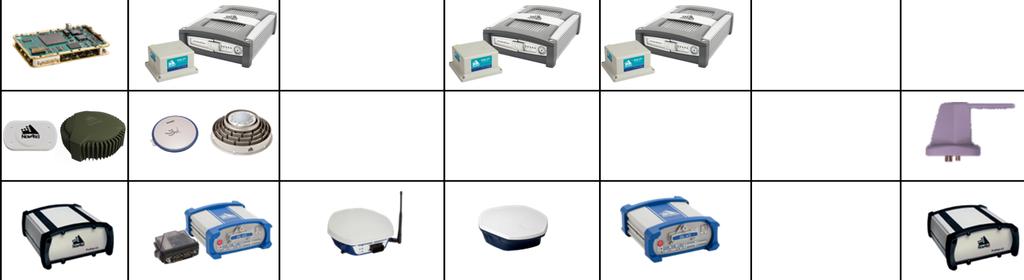
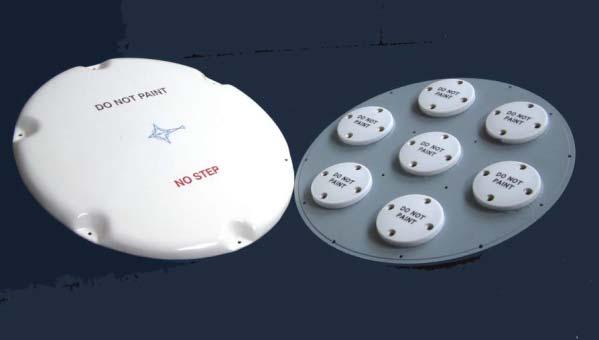
30 GAJT: GPS Anti Jam Technology GAJT 700ML Large vehicles & fixed installations Integrated 7 element CRPA & electronics Single enclosure for direct fit to platforms GAJT 700MS Maritime Integrated 7 element CRPA & electronics Single enclosure and optional marine mount Meets stringent above deck standards GAJT AE UAS, other small platforms Compact ACU for 4 element CRPA Configured in enclosure or as OEM boards GPS L1 or L1/L2, and narrow or broad band 89 mm 290 mm GAJT 700ML GAJT 700MS GAJT AE

31 GAJT GPS Anti-Jam Technology GAJT 700ML Integrated 7 element CRPA & electronics Ruggedly Design Singleenclosure for direct fit to platforms Simple to install For Vehicles, fixed installations Available now Unclassified

32 GAJT-700ML is a complete off-the-shelf solution Shock, vibe and temp designed to MIL STD 810G Jammer mitigation 40 db or higher of jamming protection with single interferers Simultaneous L1 and L2 protection GAJT output is a protected RF signal on a single TNC connector Modular design Mounting customizable to customer vehicle variants 290 mm Unclassified

33 GAJT-700ML functional schematic Signal Reflections Interferer 7 L1 and L2 Analog RF Signals Antenna Array Environment RF/IF Processing Component Protected RF Output Calibration Signal Protected L1 & L2 IF MHz 7 L1 and 7 L2 Analog IF Signals Power Communication Signals Digital Processing Component Communication Input Power Interface & Connectors Unclassified

34 GAJT-700ML Status 7 Element CRPA design Digital Null forming GAJT 700ML performance is independent and additional to your receiver s internal protection Direct replacement of existing GPS antenna No configuration or optimization needed use as is, out of the box, just add power cable Proven with DAGR and civil receivers in field trials and anechoic chamber tests to provide >40dB additional protection Unclassified

. We recommend CRPAs from Antcom Inc.")

35 GAJT AE N: Enclosure GAJT AE: OEM Hardware Supplied in an enclosure or as cards for users own integration. Will work with any standard 4 element controlled reception pattern antenna (CRPA). We recommend CRPAs from Antcom Inc., our subsidiary ( GAJT-AE-N Enclosure GAJT-AE OEM Boards GAJT AE and Antcom Antennas (shown with Rockwell Collins DAGR for scale)
36 GAJT-700ML vs GAJT-AE GAJT-700ML 7 element Qualified for land vehicles 18W 7.2kg LED output signals on data connector TNC RF output GAJT-AE 4 element Pre development <13W <1.2kg External LED on enclosure SMA RF input (4) & output (1) Unclassified
37 GAJT-700ML vs GAJT-AE applications GAJT-700ML Land vehicles Counter IDE Systems (1pps protection) DGPS Base stations Timing systems GAJT-AE UAV s Aircraft and Helicopters Possible OEM integration to existing GNSS systems Unclassified
 For all classes from capital ships to boats, including Mine Hunters (non ferrous) Designed")

38 GAJT 700MS For Maritime Use Based on the successful GAJT 700ML Self contained 7 element CRPA Digital null forming >40 db cancellation (typical) For all classes from capital ships to boats, including Mine Hunters (non ferrous) Designed for the highest US and UK above deck environmental and EMC standards Custom mounting option provides: Power management Cable management Mounting to ship's structure Corrosion resistance GAJT 700MS at sea on the CTruk THOR offshore raiding craft
39 Electronic Support Locating and Characterising Jammers


40 Firehose Digital Antenna Concept Interference detection & location. Prototype (TRL 6) L1 & L2 up to 20 MHz BW Sampling at 100 MHz, 12 Bits L1 and L2 I&Q Selectable mix of signals & bandwidth Local PC to buffer data and for local storage Output to via Gigabit LAN CSAC to survive jamming actively steered by OEMV1DF FireHose CSAC PC Can also act as GNSS SW receiver front end.

41 Firehose jammer location results dynamic jammer Mobile jammers located to sub metre accuracy Firehose units
42 Electronic Attack... Jamming
43 NEAT NAVWAR Electronic Attack Trainer Developed for Defense Research and Technology Canada (DRDC) NovAtel commercializing under license Pre production prototype: Independent control of L1 and L2 Narrow band Wide band Continuous wave Chirp Other Provisions for radio for remote control 8 hours operation with 4 AA batteries 100 mw power output Very simple interface Approved Defence customers only
44 Summary NovAtel: an OEM precise navigation specialist. To Civil and the Military we provide: Open signal products special products for Mitigating GNSS Vulnerabilities Anti Jam Positioning Relative Positioning NovAtel can address GNSS Vulnerabilities Ionospheric Monitoring all 3 aspects of electronic issues (ES, EP, EA) Heading Smooth Positioning Velocity NovAtel has become the first company to offer Anti jam antennas to approved civil users L1 4MHz narrow band L1 L2 24MHz wide band Timing Attitude Integrity & Augmentation
45 Success has a secret ingredient...
Assessment of GNSS Ionospheric Scintillation and TEC Monitoring Using the Multi-constellation GPStation-6 Receiver
 Assessment of GNSS Ionospheric Scintillation and TEC Monitoring Using the Multi-constellation GPStation-6 Receiver Rod MacLeod Regional Manager Asia/Pacific NovAtel Australia Pty Ltd Outline Ionospheric
NovAtel SPAN and Waypoint. GNSS + INS Technology
 NovAtel SPAN and Waypoint GNSS + INS Technology SPAN Technology SPAN provides continual 3D positioning, velocity and attitude determination anywhere satellite reception may be compromised. SPAN uses NovAtel
NovAtel SPAN and Waypoint GNSS + INS Technology
 NovAtel SPAN and Waypoint GNSS + INS Technology SPAN Technology SPAN provides real-time positioning and attitude determination where traditional GNSS receivers have difficulties; in urban canyons or heavily
SPAN Tightly Coupled GNSS+INS Technology Performance for Exceptional 3D, Continuous Position, Velocity & Attitude
 SPAN Tightly Coupled GNSSINS Technology Performance for Exceptional 3D, Continuous Position, Velocity & Attitude SPAN Technology NOVATEL S SPAN TECHNOLOGY PROVIDES CONTINUOUS 3D POSITIONING, VELOCITY AND
NovAtel OEM7 Interference Toolkit
 NovAtel OEM7 Interference Toolkit Richard Gutteling 31 January 2018 1 1 Who/what is NovAtel? Agriculture Geospatial Geosystems Manufacturing Intelligence Mining Positioning Intelligence PPM (post-processing
NovAtel s. Performance Analysis October Abstract. SPAN on OEM6. SPAN on OEM6. Enhancements
 NovAtel s SPAN on OEM6 Performance Analysis October 2012 Abstract SPAN, NovAtel s GNSS/INS solution, is now available on the OEM6 receiver platform. In addition to rapid GNSS signal reacquisition performance,
Weathering the Storm GNSS and the Solar Maximum Next Generation GNSS Ionospheric Scintillation and TEC Monitoring
 Weathering the Storm GNSS and the Solar Maximum Next Generation GNSS Ionospheric Scintillation and TEC Monitoring NovAtel White Paper March 2012 Overview This paper addresses the concerns caused by the
Inertial Sensors. Ellipse 2 Series MINIATURE HIGH PERFORMANCE. Navigation, Motion & Heave Sensing IMU AHRS MRU INS VG
 Ellipse 2 Series MINIATURE HIGH PERFORMANCE Inertial Sensors IMU AHRS MRU INS VG ITAR Free 0.1 RMS Navigation, Motion & Heave Sensing ELLIPSE SERIES sets up new standard for miniature and cost-effective
Adaptive Array Technology for Navigation in Challenging Signal Environments
 Adaptive Array Technology for Navigation in Challenging Signal Environments November 15, 2016 Point of Contact: Dr. Gary A. McGraw Technical Fellow Communications & Navigation Systems Advanced Technology
TEST RESULTS OF A HIGH GAIN ADVANCED GPS RECEIVER
 TEST RESULTS OF A HIGH GAIN ADVANCED GPS RECEIVER ABSTRACT Dr. Alison Brown, Randy Silva, Gengsheng Zhang,; NAVSYS Corporation. NAVSYS High Gain Advanced GPS Receiver () uses a digital beam-steering antenna
The Evolution of GPS Ionosphere Scintillation Monitoring Over the Last 25 Years
 The Evolution of GPS Ionosphere Scintillation Monitoring Over the Last 25 Years Dr. A.J. Van Dierendonck, AJ Systems 21-23 May 2014 CSNC 2014 - ION Panel 1 36-40 Years Ago 1978 to 1982! Even before GPS,
HIGH GAIN ADVANCED GPS RECEIVER
 ABSTRACT HIGH GAIN ADVANCED GPS RECEIVER NAVSYS High Gain Advanced () uses a digital beam-steering antenna array to enable up to eight GPS satellites to be tracked, each with up to dbi of additional antenna
Navigation für herausfordernde Anwendungen Robuste Satellitennavigation für sicherheitskritische Anwendungen
 www.dlr.de Chart 1 Navigation für herausfordernde Anwendungen Robuste Satellitennavigation für sicherheitskritische Anwendungen PD Dr.-Ing. habil. Michael Meurer German Aerospace Centre (DLR), Oberpfaffenhofen
Understanding GPS: Principles and Applications Second Edition
 Understanding GPS: Principles and Applications Second Edition Elliott Kaplan and Christopher Hegarty ISBN 1-58053-894-0 Approx. 680 pages Navtech Part #1024 This thoroughly updated second edition of an
Inertial Sensors. Ellipse Series MINIATURE HIGH PERFORMANCE. Navigation, Motion & Heave Sensing IMU AHRS MRU INS VG
 Ellipse Series MINIATURE HIGH PERFORMANCE Inertial Sensors IMU AHRS MRU INS VG ITAR Free 0.1 RMS Navigation, Motion & Heave Sensing ELLIPSE SERIES sets up new standard for miniature and cost-effective
Future Dual Systems for Landing. The DGNSS PALS opportunity Marco Donfrancesco Intelligence & Cyber EW Sales & Mktg
 Future Dual Systems for Landing. The DGNSS PALS opportunity Marco Donfrancesco Intelligence & Cyber EW Sales & Mktg SG-175 DGNSS PALS study The study shall provide technical advice on the data link capabilities
One Source for Positioning Success
 novatel.com One Source for Positioning Success RTK, PPP, SBAS OR DGNSS. NOVATEL CORRECT OPTIMIZES ALL CORRECTION SOURCES, PUTTING MORE POWER, FLEXIBILITY AND CONTROL IN YOUR HANDS. NovAtel CORRECT is the
Three Wishes. and an elaboration. For Reception of. Professor Bradford Parkinson Stanford University. (these are my personal views)
") Three Wishes and an elaboration For Reception of Professor Bradford Parkinson Stanford University (these are my personal views) Three Wishes - Dr, Parkinson 2017 1 Good News: World-wide dependency on GNSS
Three Wishes and an elaboration For Reception of Professor Bradford Parkinson Stanford University (these are my personal views) Three Wishes - Dr, Parkinson 2017 1 Good News: World-wide dependency on GNSS
POWERGPS : A New Family of High Precision GPS Products
 POWERGPS : A New Family of High Precision GPS Products Hiroshi Okamoto and Kazunori Miyahara, Sokkia Corp. Ron Hatch and Tenny Sharpe, NAVCOM Technology Inc. BIOGRAPHY Mr. Okamoto is the Manager of Research
Jamming and Spoofing of GNSS Signals An Underestimated Risk?!
 Jamming and Spoofing of GNSS Signals An Underestimated Risk?! Alexander Rügamer Dirk Kowalewski Fraunhofer IIS NavXperience GmbH Fraunhofer IIS 1 Source: http://securityaffairs.co/wordpress/wpcontent/uploads/2012/02/spoofing.jpg
Inertial Sensors. Ellipse Series MINIATURE HIGH PERFORMANCE. Navigation, Motion & Heave Sensing IMU AHRS MRU INS VG
 Ellipse Series MINIATURE HIGH PERFORMANCE Inertial Sensors IMU AHRS MRU INS VG ITAR Free 0.2 RMS Navigation, Motion & Heave Sensing ELLIPSE SERIES sets up new standard for miniature and cost-effective
Europe s Premier Professional GNSS Receiver Manufacturer
 Europe s Premier Professional GNSS Receiver Manufacturer MundoGEO#Connect LatinAmerica 2013 June 18 to 20 São Paulo (SP) Brazil ir. Peter A. GROGNARD Founder& CEO, Septentrio Septentrio Company Introduction
GPS-Aided INS Datasheet Rev. 2.7
 1 The Inertial Labs Single and Dual Antenna GPS-Aided Inertial Navigation System INS is new generation of fully-integrated, combined GPS, GLONASS, GALILEO, QZSS and BEIDOU navigation and highperformance
TECHNICAL PAPER: Performance Analysis of Next-Generation GNSS/INS System from KVH and NovAtel
 TECHNICAL PAPER: Performance Analysis of Next-Generation GNSS/INS System from KVH and NovAtel KVH Industries, Inc. 50 Enterprise Center Middletown, RI 02842 USA KVH Contact Information Phone: +1 401-847-3327
S a t e l l i t e T i m e a n d L o c a t i o n. N o v e m b e r John Fischer VP Advanced R&D
 STL - S a t e l l i t e T i m e a n d L o c a t i o n N o v e m b e r 2 0 1 7 John Fischer VP Advanced R&D jfischer@orolia.com 11/28/201 1 7 WHY AUGMENT GNSS? Recent UK Study Economic Input to UK of a
Bring satellites into your lab: GNSS simulators from the T&M expert.
 Bring satellites into your lab: GNSS simulators from the T&M expert. www.rohde-schwarz.com/gnss-solutions Your challenge GNSS receiver tests can only be conclusive when they are performed under realistic
Bring satellites into your lab
 Bring satellites into your lab GNSS simulators from the T&M expert 5215.5042.32 02.01 PDP 1 en www.rohde-schwarz.com/gnss-solutions GNSS-Simulators--------Bring-satellites_fly_5215-5042-32_v0201.indd 7
GPS-Aided INS Datasheet Rev. 3.0
 1 GPS-Aided INS The Inertial Labs Single and Dual Antenna GPS-Aided Inertial Navigation System INS is new generation of fully-integrated, combined GPS, GLONASS, GALILEO, QZSS, BEIDOU and L-Band navigation
High Precision GNSS in Automotive
 High Precision GNSS in Automotive Jonathan Auld, VP Engineering and Safety 6, March, 2018 2 Global OEM Positioning Solutions and Services for Land, Sea, and Air. GNSS in Automotive Today Today the primary
RACELOGIC Antenna and Mount Options
 Antenna Options Your choice of antenna is critical to the accuracy of measurement. Racelogic provide a number of different antenna options, depending upon the measurement system, the type of vehicle being
Motion & Navigation Solution
 Navsight Land & Air Solution Motion & Navigation Solution FOR SURVEYING APPLICATIONS Motion, Navigation, and Geo-referencing NAVSIGHT LAND/AIR SOLUTION is a full high performance inertial navigation solution
NCS TITAN. The most powerful GNSS Simulator available. NCS TITAN Datasheet. Scalability. Extendability. In co-operation with
 NCS TITAN The most powerful GNSS Simulator available Scalability Fidelity Reliability Usability Extendability Flexibility Upgradability Features Signal Capabilities Support of all global (GNSS) and regional
Time Firewall: Securing the GNSS receivers against Spoofing/Jamming. Shemi Prazot AccuBeat
 Time Firewall: Securing the GNSS receivers against Spoofing/Jamming Shemi Prazot AccuBeat 1 The need The GNSS systems are widely used for both navigation and timing in civilian infrastructures and military
Applying Defence-in-depth to counter RF interferences over GNSS
 Applying Defence-in-depth to counter RF interferences over GNSS IET 5th Oct. 2011 Xavier Bertinchamps - GSA Objective of this presentation Understand Jamming threat on GNSS Propose a comprehensive strategy
Precise Positioning with NovAtel CORRECT Including Performance Analysis
 Precise Positioning with NovAtel CORRECT Including Performance Analysis NovAtel White Paper April 2015 Overview This article provides an overview of the challenges and techniques of precise GNSS positioning.
Current Challenges (and Solutions) in Satellite Navigation. Omar García Crespillo Institute of Communication and Navigation
 in Satellite Navigation. Omar García Crespillo Institute of Communication and Navigation") Current Challenges (and Solutions) in Satellite Navigation Omar García Crespillo Institute of Communication and Navigation Satellite Navigation Application Fields Navigation: automotive, aircrafts, shipping,
Current Challenges (and Solutions) in Satellite Navigation Omar García Crespillo Institute of Communication and Navigation Satellite Navigation Application Fields Navigation: automotive, aircrafts, shipping,
Inertial Navigation System
 Apogee Series ULTIMATE ACCURACY MEMS Inertial Navigation System INS MRU AHRS ITAR Free 0.005 RMS Motion Sensing & Georeferencing APOGEE SERIES makes high accuracy affordable for all surveying companies.
School of Civil & Environmental Engineering, UNSW, Sydney, Australia. Chris Rizos. President Australian Institute of Navigation
 The Threat to Space Based Service (for PNT applications) School of Civil & Environmental Engineering, UNSW, Sydney, Australia Chris Rizos President Australian Institute of Navigation Outline GNSS... a
Enclosures PwrPak7D COMPACT DUAL ANTENNA ENCLOSURE DELIVERS SCALABLE POSITIONING PERFORMANCE WITH INTERNAL STORAGE FEATURES
 Enclosures PwrPak7D COMPACT DUAL ANTENNA ENCLOSURE DELIVERS SCALABLE POSITIONING PERFORMANCE WITH INTERNAL STORAGE FUTURE PROOFED SCALABILITY Capable of tracking all present and upcoming Global Navigation
The Case for Recording IF Data for GNSS Signal Forensic Analysis Using a SDR
 The Case for Recording IF Data for GNSS Signal Forensic Analysis Using a SDR Professor Gérard Lachapelle & Dr. Ali Broumandan PLAN Group, University of Calgary PLAN.geomatics.ucalgary.ca IGAW 2016-GNSS
Effects of magnetic storms on GPS signals
 Effects of magnetic storms on GPS signals Andreja Sušnik Supervisor: doc.dr. Biagio Forte Outline 1. Background - GPS system - Ionosphere 2. Ionospheric Scintillations 3. Experimental data 4. Conclusions
Interference Mitigation and Preserving Multi-GNSS Performance
 International Global Navigation Satellite Systems Association IGNSS Conference 2016 Colombo Theatres, Kensington Campus, UNSW Australia 6 8 December 2016 Interference Mitigation and Preserving Multi-GNSS
Inertial Systems. Ekinox Series TACTICAL GRADE MEMS. Motion Sensing & Navigation IMU AHRS MRU INS VG
 Ekinox Series TACTICAL GRADE MEMS Inertial Systems IMU AHRS MRU INS VG ITAR Free 0.05 RMS Motion Sensing & Navigation AEROSPACE GROUND MARINE EKINOX SERIES R&D specialists usually compromise between high
Receiver Technology CRESCENT OEM WHITE PAPER AMY DEWIS JENNIFER COLPITTS
 CRESCENT OEM WHITE PAPER AMY DEWIS JENNIFER COLPITTS With offices in Kansas City, Hiawatha, Calgary and Scottsdale, Hemisphere GPS is a global leader in designing and manufacturing innovative, costeffective,
Inertial Navigation System
 Apogee Marine Series ULTIMATE ACCURACY MEMS Inertial Navigation System INS MRU AHRS ITAR Free 0.005 RMS Navigation, Motion & Heave Sensing APOGEE SERIES makes high accuracy affordable for all surveying
KINEMATIC TEST RESULTS OF A MINIATURIZED GPS ANTENNA ARRAY WITH DIGITAL BEAMSTEERING ELECTRONICS
 KINEMATIC TEST RESULTS OF A MINIATURIZED GPS ANTENNA ARRAY WITH DIGITAL BEAMSTEERING ELECTRONICS Alison Brown, Keith Taylor, Randy Kurtz and Huan-Wan Tseng, NAVSYS Corporation BIOGRAPHY Alison Brown is
Chapter 4 DGPS REQUIREMENTS AND EQUIPMENT SELECTION
 Chapter 4 DGPS REQUIREMENTS AND EQUIPMENT SELECTION 4.1 INTRODUCTION As discussed in the previous chapters, accurate determination of aircraft position is a strong requirement in several flight test applications
GAJET, a DRDC Evaluation Testbed for Navigation Electronic Warfare. Michel Clénet
 GAJET, a DRDC Evaluation Testbed for Navigation Electronic Warfare Michel Clénet Outline Introduction CRPA project at DRDC Ottawa GAJET: An Evaluation Test bed for GPS Anti-Jam System An AJ simulation
Precise GNSS Positioning for Mass-market Applications
 Precise GNSS Positioning for Mass-market Applications Yang GAO, Canada Key words: GNSS, Precise GNSS Positioning, Precise Point Positioning (PPP), Correction Service, Low-Cost GNSS, Mass-Market Application
PROTECTING GPS/GNSS-RELIANT MILITARY SYSTEMS
 PROTECTING GPS/GNSS-RELIANT MILITARY SYSTEMS John Fischer VP Advanced R&D Jon Sinden Product Manager, Rugged PNT 6/21/2018 ABOUT OROLIA A world leader in assured positioning, navigation and timing (PNT)
CHAPTER 6 EMI EMC MEASUREMENTS AND STANDARDS FOR TRACKED VEHICLES (MIL APPLICATION)
") 147 CHAPTER 6 EMI EMC MEASUREMENTS AND STANDARDS FOR TRACKED VEHICLES (MIL APPLICATION) 6.1 INTRODUCTION The electrical and electronic devices, circuits and systems are capable of emitting the electromagnetic
147 CHAPTER 6 EMI EMC MEASUREMENTS AND STANDARDS FOR TRACKED VEHICLES (MIL APPLICATION) 6.1 INTRODUCTION The electrical and electronic devices, circuits and systems are capable of emitting the electromagnetic
Protection Augmentation Toughness and Alternatives of GNSS. Melaha 2016 Concord Al-Salam Hotel Cairo, April 25,2016 Refaat Rashad
 Protection Augmentation Toughness and Alternatives of GNSS Melaha 2016 Concord Al-Salam Hotel Cairo, April 25,2016 Refaat Rashad Road Map of the Presentation 1- How Good are GNSS 2- How Vulnerable are
GPS Receiver Protection Requirement for Unmanned Ariel Vehicle
 I J C International Journal of lectrical, lectronics ISSN No. (Online) : 2277-2626 and Computer ngineering 1(2): 55-59(2012) GPS Receiver Protection Requirement for Unmanned Ariel Vehicle M.L.S.N. Swarajya
Integrity of Satellite Navigation in the Arctic
 Integrity of Satellite Navigation in the Arctic TODD WALTER & TYLER REID STANFORD UNIVERSITY APRIL 2018 Satellite Based Augmentation Systems (SBAS) in 2018 2 SBAS Networks in 2021? 3 What is Meant by Integrity?
April - 1 May, Evolution to Modernized GNSS Ionospheric Scintillation and TEC Monitoring
 2333-1 Workshop on Science Applications of GNSS in Developing Countries (11-27 April), followed by the: Seminar on Development and Use of the Ionospheric NeQuick Model (30 April-1 May) 11 April - 1 May,
CODEVINTEC. Miniature and accurate IMU, AHRS, INS/GNSS Attitude and Heading Reference Systems
 45 27 39.384 N 9 07 30.145 E Miniature and accurate IMU, AHRS, INS/GNSS Attitude and Heading Reference Systems Aerospace Land/Automotive Marine Subsea Miniature inertial sensors 0.1 Ellipse Series New
GSS8000. Highlights of the GSS8000 series. Multiple Signals Combined. Comprehensive Modelling. Unmatched Pedigree and Support
 GSS8000 SERIES GSS8000 Highlights of the GSS8000 series The GSS8000 series has been designed to meet all the demanding requirements of research and development teams involved in satellite navigation and
Location, Location, Location Antenna Installation
 Location, Location, Location Antenna Installation Sensors I Session Dr. David Russell Technical Sales Manager GNSS Antenna Design Presentation Overview Presentation Overview Antenna Installation Interference
Technical Specifications Document. for. Satellite-Based Augmentation System (SBAS) Testbed
 Testbed") Technical Specifications Document for Satellite-Based Augmentation System (SBAS) Testbed Revision 3 13 June 2017 Table of Contents Acronym Definitions... 3 1. Introduction... 4 2. SBAS Testbed Realisation...
Technical Specifications Document for Satellite-Based Augmentation System (SBAS) Testbed Revision 3 13 June 2017 Table of Contents Acronym Definitions... 3 1. Introduction... 4 2. SBAS Testbed Realisation...
GPS TSPI for Ultra High Dynamics. Use of GPS L1/L2/L5 Signals for TSPI UNCLASSIFIED. ITEA Test Instrumentation Workshop, May 15 th 18 th 2012
 GPS TSPI for Ultra High Dynamics Use of GPS L1/L2/L5 Signals for TSPI ITEA Test Instrumentation Workshop, May 15 th 18 th 2012 For further information please contact Tony Pratt: Alex Macaulay: Nick Cooper:
Surviving and Operating Through GPS Denial and Deception Attack. Nathan Shults Kiewit Engineering Group Aaron Fansler AMPEX Intelligent Systems
 Surviving and Operating Through GPS Denial and Deception Attack Nathan Shults Kiewit Engineering Group Aaron Fansler AMPEX Intelligent Systems How GPS Works GPS Satellite sends exact time (~3 nanoseconds)
GPS-Aided INS Datasheet Rev. 2.6
 GPS-Aided INS 1 GPS-Aided INS The Inertial Labs Single and Dual Antenna GPS-Aided Inertial Navigation System INS is new generation of fully-integrated, combined GPS, GLONASS, GALILEO and BEIDOU navigation
Canadian Coast Guard Review to Implement a Resilient Position, Navigation and Timing Solution for Canada. Mariners Workshop January 31 st, 2018
 Canadian Coast Guard Review to Implement a Resilient Position, Navigation and Timing Solution for Canada Mariners Workshop January 31 st, 2018 Outline Overview of GNSS use in the marine sector CCG Activities
Understanding GPS/GNSS
 Understanding GPS/GNSS Principles and Applications Third Edition Contents Preface to the Third Edition Third Edition Acknowledgments xix xxi CHAPTER 1 Introduction 1 1.1 Introduction 1 1.2 GNSS Overview
Extreme space weather: Geomagnetic storms, GNSS disruptions and the impact on vital functions in society
 Extreme space weather: Geomagnetic storms, GNSS disruptions and the impact on vital functions in society Fredrik Marsten Eklöf FOI, Informationssystem fredrik.eklof@foi.se, 0709-277426 Global Navigation
Phantom Dome - Advanced Drone Detection and jamming system
 Phantom Dome - Advanced Drone Detection and jamming system *Picture for illustration only 1 1. The emanating threat of drones In recent years the threat of drones has become increasingly vivid to many
Miniaturized GPS Antenna Array Technology and Predicted Anti-Jam Performance
 Miniaturized GPS Antenna Array Technology and Predicted Anti-Jam Performance Dale Reynolds; Alison Brown NAVSYS Corporation. Al Reynolds, Boeing Military Aircraft And Missile Systems Group ABSTRACT NAVSYS
Testing Military Navigation Equipment
 Mr Darren Fisher Mr John Pottle Mr Bruno Denjean Spirent Communications plc Aspen Way, Paignton, Devon TQ4 7QR UK darren.fisher@spirent.com TESTING MILITARY NAVIGATION EQUIPMENT. Accuracy, integrity and
Black Swans and White Elephants GPS Jamming and Resilient PNT
 Black Swans and White Elephants GPS Jamming and Resilient PNT Charles Curry BEng, CEng, FIET Managing Director Chronos Technology Ltd ITSF 2014 4-6 th Nov 2014 Budapest, Hungary Black Swan Events Nassim
The Effect of Radio Frequency Interference on GNSS Signals and Mitigation Techniques Presented by Dr. Tarek Attia
 International Conference and Exhibition Melaha2016 GNSS WAY Ahead 25-27 April2016, Cairo, Egypt The Effect of Radio Frequency Interference on GNSS Signals and Mitigation Techniques Presented by Dr. Tarek
Webinar. 9 things you should know about centimeter-level GNSS accuracy
 Webinar 9 things you should know about centimeter-level GNSS accuracy Webinar agenda 9 things you should know about centimeter-level GNSS accuracy 1. High precision GNSS challenges 2. u-blox F9 technology
RFI Impact on Ground Based Augmentation Systems (GBAS)
") RFI Impact on Ground Based Augmentation Systems (GBAS) Nadia Sokolova SINTEF ICT, Dept. Communication Systems SINTEF ICT 1 GBAS: General Concept - improves the accuracy, provides integrity and approach
RFI Impact on Ground Based Augmentation Systems (GBAS) Nadia Sokolova SINTEF ICT, Dept. Communication Systems SINTEF ICT 1 GBAS: General Concept - improves the accuracy, provides integrity and approach
Test Solutions for Simulating Realistic GNSS Scenarios
 Test Solutions for Simulating Realistic GNSS Scenarios Author Markus Irsigler, Rohde & Schwarz GmbH & Co. KG Biography Markus Irsigler received his diploma in Geodesy and Geomatics from the University
High Gain Advanced GPS Receiver
 High Gain Advanced GPS Receiver NAVSYS Corporation 14960 Woodcarver Road, Colorado Springs, CO 80921 Introduction The NAVSYS High Gain Advanced GPS Receiver (HAGR) is a digital beam steering receiver designed
Black Swans, White Elephants and Delivering a New National Timescale with eloran
 Black Swans, White Elephants and Delivering a New National Timescale with eloran Charles Curry BEng, CEng, FIET Managing Director Chronos Technology Ltd SFR, Paris 18 th July 2014 PNT First Experiences
CHC MINING DEFORMATION MONITORING SOLUTION
 CHC MINING DEFORMATION MONITORING SOLUTION Safety is first in mining. CHC offers solutions designed to improve safety for personnel on the ground and in the cab with 24/7 precision positioning for automatic
GPS-Aided INS Datasheet Rev. 2.3
 GPS-Aided INS 1 The Inertial Labs Single and Dual Antenna GPS-Aided Inertial Navigation System INS is new generation of fully-integrated, combined L1 & L2 GPS, GLONASS, GALILEO and BEIDOU navigation and
Cooperative navigation: outline
 Positioning and Navigation in GPS-challenged Environments: Cooperative Navigation Concept Dorota A Grejner-Brzezinska, Charles K Toth, Jong-Ki Lee and Xiankun Wang Satellite Positioning and Inertial Navigation
A Tallysman Accutenna TW2710 / TW2712 Magnet Mount Multi-Constellation Antenna
 A Tallysman Accutenna TW2710 / TW2712 Magnet Mount Multi-Constellation Antenna The TW2710 / TW2712 employs Tallysman s unique Accutenna technology covering the BeiDou B1, Galileo E1, GPS L1, GLONASS L1
GNSS RFI/Spoofing: Detection, Localization, & Mitigation
 GNSS RFI/Spoofing: Detection, Localization, & Mitigation Stanford's 2012 PNT Challenges and Opportunities Symposium 14 - November - 2012 Dennis M. Akos University of Colorado/Stanford University with contributions
Integrated Navigation System
 Integrated Navigation System Adhika Lie adhika@aem.umn.edu AEM 5333: Design, Build, Model, Simulate, Test and Fly Small Uninhabited Aerial Vehicles Feb 14, 2013 1 Navigation System Where am I? Position,
MHz. Figure 1: spectrum plot of the L1 band without interference with the GPS L1C/A central frequency indicated
 White paper Internet or Positioning? Abstract Centimetre-level RTK or PPP positioning requires high quality GNSS measurements. By virtue of their low power however, GNSS signals are prone to interference
TEST RESULTS OF A DIGITAL BEAMFORMING GPS RECEIVER FOR MOBILE APPLICATIONS
 TEST RESULTS OF A DIGITAL BEAMFORMING GPS RECEIVER FOR MOBILE APPLICATIONS Alison Brown, Huan-Wan Tseng, and Randy Kurtz, NAVSYS Corporation BIOGRAPHY Alison Brown is the President and CEO of NAVSYS Corp.
GPS Application. Global Positioning System. We provide GPS module ODM / OEM service, any GPS receiver you want, we can provide customized services.
 GPS Application Global Positioning System We provide GPS module ODM / OEM service, any GPS receiver you want, we can provide customized services. www.win-tec.com.tw sales@win-tec.com.tw GNSS Receiver WGM-303
Trustworthy Positioning for Next Generation Intelligent Transport Systems Ahmed El-Mowafy
 Trustworthy Positioning for Next Generation Intelligent Transport Systems Ahmed El-Mowafy Contents Background on ITS and C-ITS Requirements Challenges RAIM Test and Results Utilisation Workshop, Sydney,
Test Results from a Digital P(Y) Code Beamsteering Receiver for Multipath Minimization Alison Brown and Neil Gerein, NAVSYS Corporation
 Code Beamsteering Receiver for Multipath Minimization Alison Brown and Neil Gerein, NAVSYS Corporation") Test Results from a Digital P(Y) Code Beamsteering Receiver for ultipath inimization Alison Brown and Neil Gerein, NAVSYS Corporation BIOGRAPHY Alison Brown is the President and CEO of NAVSYS Corporation.
Test Results from a Digital P(Y) Code Beamsteering Receiver for ultipath inimization Alison Brown and Neil Gerein, NAVSYS Corporation BIOGRAPHY Alison Brown is the President and CEO of NAVSYS Corporation.
Specifications. Trimble BX982 Modular GNSS Heading Receiver
 Name Configuration Option Base and Rover interchangeability Rover position update rate Rover maximum range from base radio Rover operation within a VRS network Heading and Moving Base operation Factory
Assessing & Mitigation of risks on railways operational scenarios
 R H I N O S Railway High Integrity Navigation Overlay System Assessing & Mitigation of risks on railways operational scenarios Rome, June 22 nd 2017 Anja Grosch, Ilaria Martini, Omar Garcia Crespillo (DLR)
GPS Signal Degradation Analysis Using a Simulator
 GPS Signal Degradation Analysis Using a Simulator G. MacGougan, G. Lachapelle, M.E. Cannon, G. Jee Department of Geomatics Engineering, University of Calgary M. Vinnins, Defence Research Establishment
ORBITAL NAVIGATION SYSTEMS PRESENT AND FUTURE TENDS
 ORBITAL NAVIGATION SYSTEMS PRESENT AND FUTURE TENDS CONTENT WHAT IS COVERED A BRIEF HISTORY OF SYSTEMS PRESENT SYSTEMS IN USE PROBLEMS WITH SATELLITE SYSTEMS PLANNED IMPROVEMENTS CONCLUSION CONTENT WHAT
FieldGenius Technical Notes GPS Terminology
 FieldGenius Technical Notes GPS Terminology Almanac A set of Keplerian orbital parameters which allow the satellite positions to be predicted into the future. Ambiguity An integer value of the number of
GNSS for UAV Navigation. Sandy Kennedy Nov.15, 2016 ITSNT
 GNSS for UAV Navigation Sandy Kennedy Nov.15, 2016 ITSNT Sounds Easy Enough Probably clear open sky conditions?» Maybe not on take off and landing Straight and level flight?» Not a valid assumption for
Applanix Products and Solutions for Hydrographic Survey & Marine Applications Maximize Your Productivity!
 Applanix Products and Solutions for Hydrographic Survey & Marine Applications Maximize Your Productivity! Applanix technology and support gives you the advantage: lower costs of deployment, faster times
EFFECTS OF SCINTILLATIONS IN GNSS OPERATION
 - - EFFECTS OF SCINTILLATIONS IN GNSS OPERATION Y. Béniguel, J-P Adam IEEA, Courbevoie, France - 2 -. Introduction At altitudes above about 8 km, molecular and atomic constituents of the Earth s atmosphere
Arctic Navigation Issues. e-nav conference Nordic Institute of Navigation Bergen, March 5 th 2009
 Arctic Navigation Issues e-nav conference Nordic Institute of Navigation Bergen, March 5 th 2009 by Anna B.O. Jensen - AJ Geomatics Jean-Paul Sicard - Rovsing A/S March 2009 1 Outline Reduction of ice
GPS and Recent Alternatives for Localisation. Dr. Thierry Peynot Australian Centre for Field Robotics The University of Sydney
 GPS and Recent Alternatives for Localisation Dr. Thierry Peynot Australian Centre for Field Robotics The University of Sydney Global Positioning System (GPS) All-weather and continuous signal system designed
First Measurements of Ionospheric TEC and GPS Scintillations from an Unmanned Marine Vehicle
 First Measurements of Ionospheric TEC and GPS Scintillations from an Unmanned Marine Vehicle Irfan Azeem, Geoff Crowley, and Adam Reynolds ASTRA 5777 Central Ave., Suite 221 Boulder, CO 80301 USA ABSTRACT
GPS Jamming Quantifying the Threat
 GPS Jamming Quantifying the Threat GNSS Vulnerability Countering the Threat 13 th Feb 2013 Prof. Charles Curry B.Eng, C.Eng, FIET Managing Director Chronos Technology Ltd NPL, Teddington, London Presentation
A Review of Vulnerabilities of ADS-B
 A Review of Vulnerabilities of ADS-B S. Sudha Rani 1, R. Hemalatha 2 Post Graduate Student, Dept. of ECE, Osmania University, 1 Asst. Professor, Dept. of ECE, Osmania University 2 Email: ssrani.me.ou@gmail.com