Preliminary results from the Arecibo Heating EXperiment (HEX): From HF to GPS
|
|
|
- Madison Cain
- 5 years ago
- Views:
Transcription

:")


1 Preliminary results from the Arecibo Heating EXperiment (HEX): From HF to GPS CEDAR Workshop 2017 Keystone, Co Dr Natasha Jackson-Booth 21 st June 2017
2 Collaborators and Acknowledgements QinetiQ Richard Penney, Poppy Martin, Rachel Buckland, Thomas Morton-Orr U.S. Naval Research Laboratory (NRL) Paul Bernhardt, Stan Briczinski Arecibo Eliana Nossa, Christiano Brum, Mike Sulzer, Alfredo Santoni, Carlos Perez Applied Physics Laboratory (APL), Johns Hopkins University Ethan Miller Air Force Research Laboratory (AFRL) Acknowledgements This work was funded by the UK Ministry of Defence The Trinidad deployment was facilitated by the Trinidad and Tobago Defence Force


3 HEX overview
4 HEX summary The Heating EXperiment (HEX) was designed to help further our understanding of the phenomena caused by artificially heating the ionosphere, using the Arecibo facility in Puerto Rico This was achieved by utilizing a HF measurement experiment spread over 3500 km and the deployment of a small scale travelling ionospheric disturbance (TID) network near the heater Arecibo was in operation 16:00 (LT) on 13 th March to 06:00 (LT) on 20 th March 2017 and 11:30 (LT) on 21 st May to 08:00 (LT) on 26 th May TID network deployed around Arecibo on 15 th February 2017 Network left running to collect background statistics Transmissions from ROTHR sites on mainland USA and Puerto Rico

5 HEX overview ROTHR transmitted from Virginia, Texas and Puerto Rico Transmissions passed through heated region of the ionosphere Transmissions recorded in Puerto Rico and Trinidad Arecibo operated throughout the week and throughout the day Used both and 5.1 MHz Used both CW and pulses
6 Deployment overview TID monitor near Arecibo ROTHR in VA, TX and PR 1x RX (Trinidad) 1x APL RX near Arecibo (Culebra) 1x NRL RX Camuy e-pop satellite ISR to provide Ion lines Plasma lines Enhanced ion line plasma

7 HF results

8 Receivers : IRIS2 Comprises a 4 channel receiver module Can receive 4 paths simultaneously and do wideband (40 MHz) data capture Deployed in Trinidad Chaguaramas TTDF base Received FMCW chirps from VA, TX and PR. Recorded CW signals from VA, TX, PR and Arecibo.

9 Structure generated
10 15 th March 19:32 UT CW at MHz
11 15 th March 19:44 UT heater off
12 15 th March 19:56 UT 1/3 pulse at MHz
13 15 th March 21:05 2min/2min pulse
14 15 th March 21:20 UT HF just turned off
15 15 th March 21:32 UT HF turned off 2 mins prior to start of recording
16 18 th March 19:05 UT Heater on 3/1 pulse
17 18 th March 19:19 UT Heater on 3/1 pulse (after 10 min off)
18 18 th March 19:43 UT Heater on 2/2 pulse
19 18 th March 19:55 UT Heater off
20 18 th March 20:07 UT Heater off
21 18 th March 20:19 UT Heater on 3/1 pulse
22 18 th March 20:31 UT Heater on 3/1 pulse

23 GNSS Network
24 Ionospheric heating and GNSS systems Ionospheric heating could create disturbances that might affect satellite systems such as GPS Bulk changes in electron density, and spatio-temporal variations may delay or refract GNSS signals Variability in heating intensity or environmental factors may create scintillation Physical mechanisms are not currently well understood A network of 3 multi-constellation GNSS receivers has been deployed to monitor ionospheric effects on RF signals around 1-2 GHz Provides dual-frequency monitoring of GPS, GLONASS, Galileo and BeiDou at 10Hz samplerate GNSS time-series data allows monitoring of ionospheric scintillation (S4) and travelling ionospheric disturbances (TIDs) Short timescale (<60 s) fluctuations in received signal power allow computation of S4 Medium timescale (~1 hr) fluctuations in TEC give indication of TID presence Time-delay between TEC waveforms on different receivers gives indication of TID motion

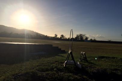
25 TEMPLAR GPS network Project goals include: Live ionospheric monitoring from small dedicated GPS arrays Detection and characterisation of TID activity over UK R&D on TID analysis & forecasting techniques Compact network of 3 GPS receivers deployed Semi-autonomous recording, with 3.4 km baseline Each receiver station comprises: Navigation-grade COTS dual-band GPS receiver GPS antenna 3G WiFi dongle Rubidium atomic clock Control laptop + external hard drive

26 TID velocity estimates Combining GPS data from multiple receivers allows TID speed & heading to be estimated Many open challenges in repurposing navigation device as an ionospheric measuring system South-easterly TID motion at ~150 m/s is common over the UK Simulation results confirm that other TID headings are correctly estimated Combination of TID footprint and velocity provides basic forecasting of TID effects Timescale of hours, lengthscale of ~500 km [Penney & Jackson-Booth, R.Sci., 2015]


27 Receivers: 3x Septentrio TID network to be set up round Arecibo 3 x Septentrio PolaRx4Pro_SCI 3.8 km 3 km 4.5 km 19 km


28 Satellite orbits All GNSS ionospheric measurements are constrained by the geometry of satellite orbits GPS GLONASS Combination of GPS+GLONASS+Galileo+BeiDou gives fairly good coverage around Puerto Rico All constellations have gaps in coverage due North of Arecibo Galileo BeiDou Plots show trajectories of ionospheric piercepoint at 250 km altitude around 18/19 March

29 GPS orbits above Arecibo HEX ionospheric effects may be quite localized over the Arecibo transmitter Most GNSS orbits do not pass immediately overhead Some satellites do fortuitously pass intermittently within 10 of boresight Around 20 minutes per day for small subset of satellites e.g. G04, G10, G11, G13, G18, G27, G28 Tools have been developed to identify these magic time-windows May show clearest evidence of scintillation linked to heating

30 Environmental factors All three GNSS receivers show much poorer data quality than observed in the UK Drop-outs are much more common Maintaining satellite lock over >30 minutes is challenging Significant differences in noise-levels are observed between the three sites Q12Q significantly worse, despite many equipment changes between sites Inter-sample times frequently differ significantly from nominal 0.1 s, especially on Q12Q Gaps of 10 s are quite common Effect is not limited to satellites at low-elevations Unreliable track acquisition Long gaps within track
31 Scintillation for overhead GPS Satellites that pass directly over Arecibo provide best chance of observing heating-induced scintillation Brief periods may not coincide with actual heating events Possible weak effect seen on G18 around 8am 19 th March (UTC) Not clear whether this is statistically significant


32 Ion Line Data Over Arecibo, 19 March 2017

33 Travelling Ionospheric Disturbances (TIDs) - March TEC time-series have been analysed to find evidence of wave-like ionospheric disturbances Oscillatory deviations from background trend give indication of presence of TID TID amplitudes typically largest around midday local-time TID activity is significantly larger than observed over the UK Again, little obvious signs of effects from Arecibo heater from first campaign
34 HEX waveform optimization Initial analysis shows little sign of enhanced TID activity from first set of HEX trials Original HEX heating waveform has most energy around 1-minute periods Optimal pseudo-random waveform has been designed which is more likely to excite TIDs Orders of magnitude more energy around periods of 10s of minutes


35 TID activity week before and week of May campaign

36 21 st May 2017

37 22 nd May 2017
38 Conclusions Initial results shows correlation with heating and new HF links Large volumes of multi-constellation GNSS data has been analysed for signs of ionospheric disturbances relevant to GPS or similar satellite systems ~300 GB of data in ~2500 files covering ~66 satellites Scintillation and TEC oscillations have been analysed for gross indicators of the effects of ionospheric heating New waveform may be generating disturbances observable with GNSS
39 Questions?
Detection and Characterization of Travelling Ionospheric Disturbances Using a compact GPS network
 Detection and Characterization of Travelling Ionospheric Disturbances Using a compact GPS network Dr. Richard Penney Joseph Reid Dr. Natasha Jackson-Booth Luke Selzer 1 Overview Compact GPS network in
Study of small scale plasma irregularities. Đorđe Stevanović
 Study of small scale plasma irregularities in the ionosphere Đorđe Stevanović Overview 1. Global Navigation Satellite Systems 2. Space weather 3. Ionosphere and its effects 4. Case study a. Instruments
The Largest Ionospheric Disturbances Produced by the HAARP HF Facility
 The Largest Ionospheric Disturbances Produced by the HAARP HF Facility Paul A. Bernhardt 1, Carl L. Seifring 1, Stanley J. Briczinski 2, Elizabeth A. kendall 3, Brenton J. Watkins 4, William Bristow 4,
The Evolution of GPS Ionosphere Scintillation Monitoring Over the Last 25 Years
 The Evolution of GPS Ionosphere Scintillation Monitoring Over the Last 25 Years Dr. A.J. Van Dierendonck, AJ Systems 21-23 May 2014 CSNC 2014 - ION Panel 1 36-40 Years Ago 1978 to 1982! Even before GPS,
Introduction to Global Navigation Satellite System (GNSS) Signal Structure
 Signal Structure") Introduction to Global Navigation Satellite System (GNSS) Signal Structure Dinesh Manandhar Center for Spatial Information Science The University of Tokyo Contact Information: dinesh@iis.u-tokyo.ac.jp
Introduction to Global Navigation Satellite System (GNSS) Signal Structure Dinesh Manandhar Center for Spatial Information Science The University of Tokyo Contact Information: dinesh@iis.u-tokyo.ac.jp
Detection and Characterization of Traveling Ionospheric Disturbances (TIDs) with GPS and HF sensors
 with GPS and HF sensors") Ionospheric Effects Symposium 12-14 May 2015 Alexandria, VA Detection and Characterization of Traveling Ionospheric Disturbances (TIDs) with GPS and HF sensors Keith Groves, Vadym Paznukhov, Eileen MacKenzie
Ionospheric Effects Symposium 12-14 May 2015 Alexandria, VA Detection and Characterization of Traveling Ionospheric Disturbances (TIDs) with GPS and HF sensors Keith Groves, Vadym Paznukhov, Eileen MacKenzie
The added value of new GNSS to monitor the ionosphere
 The added value of new GNSS to monitor the ionosphere R. Warnant 1, C. Deprez 1, L. Van de Vyvere 2 1 University of Liege, Liege, Belgium. 2 M3 System, Wavre, Belgium. Monitoring TEC for geodetic applications
Integrity of Satellite Navigation in the Arctic
 Integrity of Satellite Navigation in the Arctic TODD WALTER & TYLER REID STANFORD UNIVERSITY APRIL 2018 Satellite Based Augmentation Systems (SBAS) in 2018 2 SBAS Networks in 2021? 3 What is Meant by Integrity?
Assessment of GNSS Ionospheric Scintillation and TEC Monitoring Using the Multi-constellation GPStation-6 Receiver
 Assessment of GNSS Ionospheric Scintillation and TEC Monitoring Using the Multi-constellation GPStation-6 Receiver Rod MacLeod Regional Manager Asia/Pacific NovAtel Australia Pty Ltd Outline Ionospheric
Effects of magnetic storms on GPS signals
 Effects of magnetic storms on GPS signals Andreja Sušnik Supervisor: doc.dr. Biagio Forte Outline 1. Background - GPS system - Ionosphere 2. Ionospheric Scintillations 3. Experimental data 4. Conclusions
The First Results from the Scintillation and Ionospheric TEC Receiver in Space (CITRIS) Instrument on STPSat1
 Instrument on STPSat1") The First Results from the Scintillation and Ionospheric TEC Receiver in Space (CITRIS) Instrument on STPSat1 Carl L. Siefring and Paul A. Bernhardt Plasma Physics Division, Naval Research Laboratory Washington,
The First Results from the Scintillation and Ionospheric TEC Receiver in Space (CITRIS) Instrument on STPSat1 Carl L. Siefring and Paul A. Bernhardt Plasma Physics Division, Naval Research Laboratory Washington,
Ground based measurements of ionospheric turbulence manifestations induced by the VLF transmitter ABSTRACT
 Ground based measurements of ionospheric turbulence manifestations induced by the VLF transmitter Dmitry S. Kotik, 1 Fedor I. Vybornov, 1 Alexander V. Ryabov, 1 Alexander V. Pershin 1 and Vladimir A. Yashnov
Radio-science experiments with the Enhanced Polar Outflow Probe satellite payload using its RRI, GAP and CERTO instruments
 Radio-science experiments with the Enhanced Polar Outflow Probe satellite payload using its RRI, GAP and CERTO instruments H.G. James, CRC, Ottawa, Canada P.A. Bernhardt, NRL, Washington, U.S.A. R.B. Langley,
HF Signal Geolocation vs. Ionospheric Structure: An Engineering Solution Approach
 HF Signal Geolocation vs. Ionospheric Structure: An Engineering Solution Approach IES May 2015 Thomas Gaussiran, Roy Calfas, Amy Fleischmann David Munton, Dave Rainwater, Jake Reinhold Applied Research
The Role of Ground-Based Observations in M-I I Coupling Research. John Foster MIT Haystack Observatory
 The Role of Ground-Based Observations in M-I I Coupling Research John Foster MIT Haystack Observatory CEDAR/GEM Student Workshop Outline Some Definitions: Magnetosphere, etc. Space Weather Ionospheric
EFFECTS OF SCINTILLATIONS IN GNSS OPERATION
 - - EFFECTS OF SCINTILLATIONS IN GNSS OPERATION Y. Béniguel, J-P Adam IEEA, Courbevoie, France - 2 -. Introduction At altitudes above about 8 km, molecular and atomic constituents of the Earth s atmosphere
2 INTRODUCTION TO GNSS REFLECTOMERY
 2 INTRODUCTION TO GNSS REFLECTOMERY 2.1 Introduction The use of Global Navigation Satellite Systems (GNSS) signals reflected by the sea surface for altimetry applications was first suggested by Martín-Neira
Space Weather and the Ionosphere
 Dynamic Positioning Conference October 17-18, 2000 Sensors Space Weather and the Ionosphere Grant Marshall Trimble Navigation, Inc. Note: Use the Page Down key to view this presentation correctly Space
ABSOLUTE CALIBRATION OF TIME RECEIVERS WITH DLR'S GPS/GALILEO HW SIMULATOR
 ABSOLUTE CALIBRATION OF TIME RECEIVERS WITH DLR'S GPS/GALILEO HW SIMULATOR S. Thölert, U. Grunert, H. Denks, and J. Furthner German Aerospace Centre (DLR), Institute of Communications and Navigation, Oberpfaffenhofen,
First Measurements of Ionospheric TEC and GPS Scintillations from an Unmanned Marine Vehicle
 First Measurements of Ionospheric TEC and GPS Scintillations from an Unmanned Marine Vehicle Irfan Azeem, Geoff Crowley, and Adam Reynolds ASTRA 5777 Central Ave., Suite 221 Boulder, CO 80301 USA ABSTRACT
FieldGenius Technical Notes GPS Terminology
 FieldGenius Technical Notes GPS Terminology Almanac A set of Keplerian orbital parameters which allow the satellite positions to be predicted into the future. Ambiguity An integer value of the number of
First Results from the 2014 Coordinated Measurements Campaign with HAARP and CASSIOPE/ePOP
 First Results from the 2014 Coordinated Measurements Campaign with HAARP and CASSIOPE/ePOP Carl L. Siefring, Paul A. Bernhardt, Stanley J. Briczinski, and Michael McCarrick Naval Research Laboratory Matthew
Implementing a Wide Area High Accuracy UTC Service via eloran
 Implementing a Wide Area High Accuracy UTC Service via eloran ION PTTI, Boston, MA December 3, 2014 Dr. Gerard Offermans Overview Basis for consideration of eloran as a source of precise time, frequency,
NAVIGATION SYSTEMS PANEL (NSP) NSP Working Group meetings. Impact of ionospheric effects on SBAS L1 operations. Montreal, Canada, October, 2006
 NSP Working Group meetings. Impact of ionospheric effects on SBAS L1 operations. Montreal, Canada, October, 2006") NAVIGATION SYSTEMS PANEL (NSP) NSP Working Group meetings Agenda Item 2b: Impact of ionospheric effects on SBAS L1 operations Montreal, Canada, October, 26 WORKING PAPER CHARACTERISATION OF IONOSPHERE
NAVIGATION SYSTEMS PANEL (NSP) NSP Working Group meetings Agenda Item 2b: Impact of ionospheric effects on SBAS L1 operations Montreal, Canada, October, 26 WORKING PAPER CHARACTERISATION OF IONOSPHERE
RADIOTOMOGRAPHIC IMAGING OF THE ARTIFICIALLY DISTURBED MIDLATITUDE IONOSPHERE WITH CASSIOPE AND PARUS SATELLITES
 RADIOTOMOGRAPHIC IMAGING OF THE ARTIFICIALLY DISTURBED MIDLATITUDE IONOSPHERE WITH CASSIOPE AND PARUS SATELLITES Vyacheslav E. Kunitsyn, Elena S. Andreeva, Artem M. Padokhin, Lomonosov Moscow State University,
Outline. GPS RO Overview. COSMIC Overview. COSMIC-2 Overview. Summary 9/29/16
 Bill Schreiner and UCAR/COSMIC Team UCAR COSMIC Program Observation and Analysis Opportunities Collaborating with the ICON and GOLD Missions Sept 27, 216 GPS RO Overview Outline COSMIC Overview COSMIC-2
Challenges and Solutions for GPS Receiver Test
 Challenges and Solutions for GPS Receiver Test Presenter: Mirin Lew January 28, 2010 Agenda GPS technology concepts GPS and GNSS overview Assisted GPS (A-GPS) Basic tests required for GPS receiver verification
Experiences with Fugro's Real Time GPS/GLONASS Orbit/Clock Decimeter Level Precise Positioning System
 Return to Session Directory DYNAMIC POSITIONING CONFERENCE October 13-14, 2009 Sensors Experiences with Fugro's Real Time GPS/GLONASS Orbit/Clock Decimeter Level Precise Positioning System Ole Ørpen and
Fast convergence of Trimble CenterPoint RTX by regional augmentation
 Fast convergence of Trimble CenterPoint RTX by regional augmentation Dr. Ralf Drescher Trimble Terrasat GmbH, Munich EGU General Assembly 2015, Vienna Thursday, 16 April 2015 Outline Introduction CenterPoint
Using GNSS Tracking Networks to Map Global Ionospheric Irregularities and Scintillation
 Using GNSS Tracking Networks to Map Global Ionospheric Irregularities and Scintillation Xiaoqing Pi Anthony J. Mannucci Larry Romans Yaoz Bar-Sever Jet Propulsion Laboratory, California Institute of Technology
IDA3D: An Ionospheric Data Assimilative Three Dimensional Tomography Processor
 IDA3D: An Ionospheric Data Assimilative Three Dimensional Tomography Processor Dr. Gary S. Bust Applied Research Laboratories, The University of Texas at Austin 10000 Burnet Austin Texas 78758 phone: 512-835-3623
Assimilation Ionosphere Model
 Assimilation Ionosphere Model Robert W. Schunk Space Environment Corporation 399 North Main, Suite 325 Logan, UT 84321 phone: (435) 752-6567 fax: (435) 752-6687 email: schunk@spacenv.com Award #: N00014-98-C-0085
ESTIMATION OF IONOSPHERIC DELAY FOR SINGLE AND DUAL FREQUENCY GPS RECEIVERS: A COMPARISON
 ESTMATON OF ONOSPHERC DELAY FOR SNGLE AND DUAL FREQUENCY GPS RECEVERS: A COMPARSON K. Durga Rao, Dr. V B S Srilatha ndira Dutt Dept. of ECE, GTAM UNVERSTY Abstract: Global Positioning System is the emerging
GPS Global Positioning System
 GPS Global Positioning System 10.04.2012 1 Agenda What is GPS? Basic consept History GPS receivers How they work Comunication Message format Satellite frequencies Sources of GPS signal errors 10.04.2012
Alternative Positioning, Navigation and Timing (APNT) for Performance Based Navigation (PBN)
 for Performance Based Navigation (PBN)") DLR.de Chart 1 Alternative Positioning, Navigation and Timing (APNT) for Performance Based Navigation (PBN) Presented by Boubeker Belabbas Prepared by : Nicolas Schneckenburger, Elisabeth Nossek, Dmitriy
DLR.de Chart 1 Alternative Positioning, Navigation and Timing (APNT) for Performance Based Navigation (PBN) Presented by Boubeker Belabbas Prepared by : Nicolas Schneckenburger, Elisabeth Nossek, Dmitriy
Integration of GPS with a Rubidium Clock and a Barometer for Land Vehicle Navigation
 Integration of GPS with a Rubidium Clock and a Barometer for Land Vehicle Navigation Zhaonian Zhang, Department of Geomatics Engineering, The University of Calgary BIOGRAPHY Zhaonian Zhang is a MSc student
The Significance of GNSS for Radio Science
 Space Weather Effects on the Wide Area Augmentation System (WAAS) The Significance of GNSS for Radio Science Patricia H. Doherty Vice Chair, Commission G International Union of Radio Science www.ursi.org
Evaluation of Potential Systematic Bias in GNSS Orbital Solutions
 Evaluation of Potential Systematic Bias in GNSS Orbital Solutions Graham M. Appleby Space Geodesy Facility, Natural Environment Research Council Monks Wood, Abbots Ripton, Huntingdon PE28 2LE, UK Toshimichi
Simulation Results of Alternative Methods for Formation Separation Control
 Simulation Results of Alternative Methods for Formation Separation Control Thomas Heine, Charles Bussy-Virat, Mark Moldwin, Aaron Ridley Department of Climate and Space Sciences and Engineering University
Worst-Case GPS Constellation for Testing Navigation at Geosynchronous Orbit for GOES-R
 Worst-Case GPS Constellation for Testing Navigation at Geosynchronous Orbit for GOES-R Kristin Larson, Dave Gaylor, and Stephen Winkler Emergent Space Technologies and Lockheed Martin Space Systems 36
Analysis of equatorial ionospheric irregularities based on a two high rate GNSS station setup
 Analysis of equatorial ionospheric irregularities based on a two high rate GNSS station setup Jens Berdermann 1,Norbert Jakowski 1, Martin Kriegel 1, Hiroatsu Sato 1, Volker Wilken 1, Stefan Gewies 1,
2. GPS and GLONASS Basic Facts
 2. GPS and GLONASS Basic Facts In 1973 the U.S. Department of Defense decided to establish, develop, test, acquire, and deploy a spaceborne Global Positioning System (GPS). The result of this decision
Some of the proposed GALILEO and modernized GPS frequencies.
 On the selection of frequencies for long baseline GALILEO ambiguity resolution P.J.G. Teunissen, P. Joosten, C.D. de Jong Department of Mathematical Geodesy and Positioning, Delft University of Technology,
PORTABLE GNSS MONITORING STATION (PGMS)
") SPACE PORTABLE GNSS MONITORING STATION (PGMS) Satellite communications, earth observation, navigation and positioning and control stations indracompany.com PORTABLE GNSS MONITORING STATION (PGMS) PORTABLE
SPACE PORTABLE GNSS MONITORING STATION (PGMS) Satellite communications, earth observation, navigation and positioning and control stations indracompany.com PORTABLE GNSS MONITORING STATION (PGMS) PORTABLE
Future of the HAARP Facility. Bob McCoy Director, Geophysical Institute University of Alaska Fairbanks
 Future of the HAARP Facility Bob McCoy Director, Geophysical Institute University of Alaska Fairbanks rpmccoy@alaska.edu 1 US Chairmanship 2015-2017 Future Space Research in Alaska: Integrated networks
Monitoring the Ionosphere and Neutral Atmosphere with GPS
 Monitoring the Ionosphere and Neutral Atmosphere with GPS Richard B. Langley Geodetic Research Laboratory Department of Geodesy and Geomatics Engineering University of New Brunswick Fredericton, N.B. Division
Daily and seasonal variations of TID parameters over the Antarctic Peninsula
 Daily and seasonal variations of TID parameters over the Antarctic Peninsula A. Zalizovski 1, Y. Yampolski 1, V. Paznukhov 2, E. Mishin 3, A. Sopin 1 1. Institute of Radio Astronomy, National Academy of
Arctic Navigation Issues. e-nav conference Nordic Institute of Navigation Bergen, March 5 th 2009
 Arctic Navigation Issues e-nav conference Nordic Institute of Navigation Bergen, March 5 th 2009 by Anna B.O. Jensen - AJ Geomatics Jean-Paul Sicard - Rovsing A/S March 2009 1 Outline Reduction of ice
Report of the Working Group B: Enhancement of Global Navigation Satellite Systems (GNSS) Services Performance
 Services Performance") Report of the Working Group B: Enhancement of Global Navigation Satellite Systems (GNSS) Services Performance 1. The Working Group on Enhancement of Global Navigation Satellite Systems (GNSS) Service Performance
Report of the Working Group B: Enhancement of Global Navigation Satellite Systems (GNSS) Services Performance 1. The Working Group on Enhancement of Global Navigation Satellite Systems (GNSS) Service Performance
Using GPS Receivers to Study the Upper Atmosphere
 Using GPS Receivers to Study the Upper Atmosphere Jonathan J. Makela University of Illinois at Urbana-Champaign jmakela@illinois.edu With a big THANKS to Anthea Coster for providing some very useful slides!
Modelling GPS Observables for Time Transfer
 Modelling GPS Observables for Time Transfer Marek Ziebart Department of Geomatic Engineering University College London Presentation structure Overview of GPS Time frames in GPS Introduction to GPS observables
GNSS: orbits, signals, and methods
 Part I GNSS: orbits, signals, and methods 1 GNSS ground and space segments Global Navigation Satellite Systems (GNSS) at the time of writing comprise four systems, two of which are fully operational and
PARIS Ocean Altimeter
 PARIS Ocean Altimeter M. Martín-Neira, S. D Addio (TEC-ETP) European Space Agency Acknowledgment: C. Buck (TEC-ETP) N. Floury, R. Prieto (TEC-EEP) GNSS-R10 Workshop, UPC, Barcelona, 21-22 October 2010
Analysis of GNSS Receiver Biases and Noise using Zero Baseline Techniques
 1 Analysis of GNSS Receiver Biases and Noise using Zero Baseline Techniques Ken MacLeod, Simon Banville, Reza Ghoddousi-Fard and Paul Collins Canadian Geodetic Survey, Natural Resources Canada Plenary
PRINCIPLES AND FUNCTIONING OF GPS/ DGPS /ETS ER A. K. ATABUDHI, ORSAC
 PRINCIPLES AND FUNCTIONING OF GPS/ DGPS /ETS ER A. K. ATABUDHI, ORSAC GPS GPS, which stands for Global Positioning System, is the only system today able to show you your exact position on the Earth anytime,
An Assessment of Mapping Functions for VTEC Estimation using Measurements of Low Latitude Dual Frequency GPS Receiver
 An Assessment of Mapping Functions for VTEC Estimation using Measurements of Low Latitude Dual Frequency GPS Receiver Mrs. K. Durga Rao 1 Asst. Prof. Dr. L.B.College of Engg. for Women, Visakhapatnam,
HAARP-induced Ionospheric Ducts
 HAARP-induced Ionospheric Ducts Gennady Milikh, University of Maryland in collaboration with: Dennis Papadopoulos, Chia-Lee Chang, Hira Shroff, BAE systems Evgeny Mishin, AFRL/RVBXI, Hanscom AFB Michel
SKA Site Characterisation and Array Configuration; Overview and Status WP Rob Millenaar, SPDO
 SKA Site Characterisation and Array Configuration; Overview and Status WP2 2011 Rob Millenaar, SPDO Site Characterisation 1. Intro SKA Site Characterisation/Selection 2. Request for Information 1. In situ
Existing and future networks of ionospheric radars in polar regions &
 Existing and future networks of ionospheric radars in polar regions & EoI#159:ISPAM EISCAT Scientific Association Existing networks SuperDarn Middle atmosphere radars Incoherent Scatter Radars SuperDARN
Bring satellites into your lab: GNSS simulators from the T&M expert.
 Bring satellites into your lab: GNSS simulators from the T&M expert. www.rohde-schwarz.com/gnss-solutions Your challenge GNSS receiver tests can only be conclusive when they are performed under realistic
Developing systems for ionospheric data assimilation
 Developing systems for ionospheric data assimilation Making a quantitative comparison between observations and models A.C. Bushell, 5 th European Space Weather Week, Brussels, 20 th November 2008 Collaborators
Sounding the Atmosphere Ground Support for GNSS Radio-Occultation Processing
 Sounding the Atmosphere Ground Support for GNSS Radio-Occultation Processing Atmospheric Sounding René Zandbergen & John M. Dow Navigation Support Office, Ground Systems Engineering Department, Directorate
EISCAT_3D The next generation European Incoherent Scatter radar system Introduction and Brief Background
 EISCAT_3D The next generation European Incoherent Scatter radar system Introduction and Brief Background The high latitude environment is of increasing importance, not only for purely scientific studies,
Determination of the correlation distance for spaced antennas on multipath HF links and implications for design of SIMO and MIMO systems.
 Determination of the correlation distance for spaced antennas on multipath HF links and implications for design of SIMO and MIMO systems. Hal J. Strangeways, School of Electronic and Electrical Engineering,
Solar Radar Experiments
 Solar Radar Experiments Paul Rodriguez Plasma Physics Division Naval Research Laboratory Washington, DC 20375 phone: (202) 767-3329 fax: (202) 767-3553 e-mail: paul.rodriguez@nrl.navy.mil Award # N0001498WX30228
CH GPS/GLONASS/GALILEO/SBAS Signal Simulator. General specification Version 0.2 Eng. Preliminary
 CH-380 GPS/GLONASS/GALILEO/SBAS Signal Simulator General specification Version 0.2 Eng Preliminary Phone: +7 495 665 648 Fax: +7 495 665 649 navis@navis.ru NAVIS-UKRAINE Mazura str. 4 Smela, Cherkassy
Problem Areas of DGPS
 DYNAMIC POSITIONING CONFERENCE October 13 14, 1998 SENSORS Problem Areas of DGPS R. H. Prothero & G. McKenzie Racal NCS Inc. (Houston) Table of Contents 1.0 ABSTRACT... 2 2.0 A TYPICAL DGPS CONFIGURATION...
Modeling of Ionospheric Refraction of UHF Radar Signals at High Latitudes
 Modeling of Ionospheric Refraction of UHF Radar Signals at High Latitudes Brenton Watkins Geophysical Institute University of Alaska Fairbanks USA watkins@gi.alaska.edu Sergei Maurits and Anton Kulchitsky
RECENT TIMING ACTIVITIES AT THE U.S. NAVAL RESEARCH LABORATORY
 RECENT TIMING ACTIVITIES AT THE U.S. NAVAL RESEARCH LABORATORY Ronald Beard, Jay Oaks, Ken Senior, and Joe White U.S. Naval Research Laboratory 4555 Overlook Ave. SW, Washington DC 20375-5320, USA Abstract
Satellite Bias Corrections in Geodetic GPS Receivers
 Satellite Bias Corrections in Geodetic GPS Receivers Demetrios Matsakis, The U.S. Naval Observatory (USNO) Stephen Mitchell, The U.S. Naval Observatory Edward Powers, The U.S. Naval Observatory BIOGRAPHY
RECOMMENDATION ITU-R SF.1719
 Rec. ITU-R SF.1719 1 RECOMMENDATION ITU-R SF.1719 Sharing between point-to-point and point-to-multipoint fixed service and transmitting earth stations of GSO and non-gso FSS systems in the 27.5-29.5 GHz
Supplement to. Global navigation satellite systems (GNSS) L E C T U R E. Zuzana Bělinová. TELEMATIC SYSTEMS AND THEIR DESIGN part Systems Lecture 5
 L E C T U R E. Zuzana Bělinová. TELEMATIC SYSTEMS AND THEIR DESIGN part Systems Lecture 5") Zuzana Bělinová L E C T U R E 5 Supplement to Global navigation satellite systems (GNSS) Recapitulation Satellite navigation systems Zuzana Bělinová History of satellite navigation USA USA 1960 TRANSIT
Zuzana Bělinová L E C T U R E 5 Supplement to Global navigation satellite systems (GNSS) Recapitulation Satellite navigation systems Zuzana Bělinová History of satellite navigation USA USA 1960 TRANSIT
RECOMMENDATION ITU-R F.1337*
 Rec. ITU-R F.1337 1 RECOMMENDATION ITU-R F.1337* Rec. ITU-R F.1337 FREQUENCY MANAGEMENT OF ADAPTIVE HF RADIO SYSTEMS AND NETWORKS USING FMCW OBLIQUE-INCIDENCE SOUNDING (Question ITU-R 205/9) (1997) The
 Page 1 of 8 Search Contact NRL Personnel Locator Human Resources Public Affairs Office Visitor Info Planning a Visit Directions Maps Weather & Traffic Field Sites Stennis Monterey VXS-1 Chesapeake Bay
Radio wave power distribution at HF frequencies as modelled for the Radio Receiver Instrument (RRI) on the epop satellite mission
 on the epop satellite mission") Radio wave power distribution at HF frequencies as modelled for the Radio Receiver Instrument (RRI) on the epop satellite mission G. C. Hussey, R. G. Gillies, G. J. Sofko, and H. G. James SuperDARN Workshop
Radio wave power distribution at HF frequencies as modelled for the Radio Receiver Instrument (RRI) on the epop satellite mission G. C. Hussey, R. G. Gillies, G. J. Sofko, and H. G. James SuperDARN Workshop
Enhancing space situational awareness using passive radar from space based emitters of opportunity
 Tracking Space Debris Craig Benson School of Engineering and IT Enhancing space situational awareness using passive radar from space based emitters of opportunity Space Debris as a Problem Debris is fast
EFFECTS OF IONOSPHERIC SMALL-SCALE STRUCTURES ON GNSS
 EFFECTS OF IONOSPHERIC SMALL-SCALE STRUCTURES ON GNSS G. Wautelet, S. Lejeune, R. Warnant Royal Meteorological Institute of Belgium, Avenue Circulaire 3 B-8 Brussels (Belgium) e-mail: gilles.wautelet@oma.be
CDAAC Ionospheric Products
 CDAAC Ionospheric Products Stig Syndergaard COSMIC Project Office COSMIC retreat, Oct 13 14, 5 COSMIC Ionospheric Measurements GPS receiver: { Total Electron Content (TEC) to all GPS satellites in view
PRECISE RECEIVER CLOCK OFFSET ESTIMATIONS ACCORDING TO EACH GLOBAL NAVIGATION SATELLITE SYSTEMS (GNSS) TIMESCALES
 TIMESCALES") ARTIFICIAL SATELLITES, Vol. 52, No. 4 DOI: 10.1515/arsa-2017-0009 PRECISE RECEIVER CLOCK OFFSET ESTIMATIONS ACCORDING TO EACH GLOBAL NAVIGATION SATELLITE SYSTEMS (GNSS) TIMESCALES Thayathip Thongtan National
ARTIFICIAL SATELLITES, Vol. 52, No. 4 DOI: 10.1515/arsa-2017-0009 PRECISE RECEIVER CLOCK OFFSET ESTIMATIONS ACCORDING TO EACH GLOBAL NAVIGATION SATELLITE SYSTEMS (GNSS) TIMESCALES Thayathip Thongtan National
Bring satellites into your lab
 Bring satellites into your lab GNSS simulators from the T&M expert 5215.5042.32 02.01 PDP 1 en www.rohde-schwarz.com/gnss-solutions GNSS-Simulators--------Bring-satellites_fly_5215-5042-32_v0201.indd 7
GNSS in the Arctic. by Arne Rinnan, Kongsberg Seatex AS. WORLD CLASS through people, technology and dedication
 GNSS in the Arctic by Arne Rinnan, Kongsberg Seatex AS WORLD CLASS through people, technology and dedication Outline Introduction Weather conditions Satellite coverage Aurora impact GNSS corrections Test
The Precision Expandable Radar Calibration Sphere (PERCS) With Applications for Laser Imaging and Ranging
 With Applications for Laser Imaging and Ranging") The Precision Expandable Radar Calibration Sphere (PERCS) With Applications for Laser Imaging and Ranging Paul A. Bernhardt 1, Andy Nicholas 2, Linda Thomas 3, Mark Davis 3 1 Plasma Physics Division, 2
The Precision Expandable Radar Calibration Sphere (PERCS) With Applications for Laser Imaging and Ranging Paul A. Bernhardt 1, Andy Nicholas 2, Linda Thomas 3, Mark Davis 3 1 Plasma Physics Division, 2
Multi Band Passive Forward Scatter Radar
 Multi Band Passive Forward Scatter Radar S. Hristov, A. De Luca, M. Gashinova, A. Stove, M. Cherniakov EESE, University of Birmingham Birmingham, B15 2TT, UK m.cherniakov@bham.ac.uk Outline Multi-Band
Ionospheric Propagation Effects on W de Bandwidth Sig Si nals Dennis L. Knepp NorthWest Research NorthW Associates est Research Monterey California
 Ionospheric Propagation Effects on Wide Bandwidth Signals Dennis L. Knepp NorthWest Research Associates 2008 URSI General Assembly Chicago, August 2008 Ionospheric Effects on Propagating Signals Mean effects:
Observations of Ionosphere/Troposphere Coupling as Observed by COSMIC
 Observations of Ionosphere/Troposphere Coupling as Observed by COSMIC K. F. Dymond, C. Coker, D. E. Siskind, A. C. Nicholas, S. A. Budzien, S. E. McDonald, and C. E. Dymond * Space Science Division, Naval
Ionospheric Effects on Aviation
 Ionospheric Effects on Aviation Recent experience in the observation and research of ionospheric irregularities, gradient anomalies, depletion walls, etc. in USA and Europe Stan Stankov, René Warnant,
An Experiment Study for Time Synchronization Utilizing USRP and GNU Radio
 GNU Radio Conference 2017, September 11-15th, San Diego, USA An Experiment Study for Time Synchronization Utilizing USRP and GNU Radio Won Jae Yoo, Kwang Ho Choi, JoonHoo Lim, La Woo Kim, Hyoungmin So
GAMIT/GLOBK for GNSS. Material from R. W. King, T. A. Herring, M. A. Floyd (MIT) and S. C. McClusky (now at ANU)
 and S. C. McClusky (now at ANU)") GAMIT/GLOBK for GNSS M. A. Floyd Massachusetts Institute of Technology, Cambridge, MA, USA GPS Data Processing and Analysis with GAMIT/GLOBK and track GNS Science, Lower Hutt, New Zealand 26 February 2
GAMIT/GLOBK for GNSS M. A. Floyd Massachusetts Institute of Technology, Cambridge, MA, USA GPS Data Processing and Analysis with GAMIT/GLOBK and track GNS Science, Lower Hutt, New Zealand 26 February 2
On the GNSS integer ambiguity success rate
 On the GNSS integer ambiguity success rate P.J.G. Teunissen Mathematical Geodesy and Positioning Faculty of Civil Engineering and Geosciences Introduction Global Navigation Satellite System (GNSS) ambiguity
Satellite Navigation Principle and performance of GPS receivers
 Satellite Navigation Principle and performance of GPS receivers AE4E08 GPS Block IIF satellite Boeing North America Christian Tiberius Course 2010 2011, lecture 3 Today s topics Introduction basic idea
Bistatic Radar Receiver for CubeSats: The RAX Payload
 Bistatic Radar Receiver for CubeSats: The RAX Payload John Buonocore Hasan Bahcivan SRI International 7 th Annual CubeSat Developer s Workshop 22 April 2010 Cal Poly San Luis Obispo SRI Proprietary RAX
Performance Assessment of Single and Dual-Frequency, Commercial-based GPS Receiver for LEO orbit
 1 Performance Assessment of Single and Dual-Frequency, Commercial-based GPS Receiver for LEO orbit Keisuke Yoshihara, Shinichiro Takayama, Toru yamamoto, Yoshinori Kondoh, Hidekazu Hashimoto Japan Aerospace
A Bistatic HF Radar for Current Mapping and Robust Ship Tracking
 A Bistatic HF Radar for Current Mapping and Robust Ship Tracking Dennis Trizna Imaging Science Research, Inc. V. 703-801-1417 dennis @ isr-sensing.com www.isr-sensing.com Objective: Develop methods for
Study of GPS Scintillation during Solar Maximum at Malaysia
 1 st International Conference of Recent Trends in Information and Communication Technologies Study of GPS Scintillation during Solar Maximum at Malaysia Emad Fathi Aon 1,2*, Redhwan Qasem Shaddad 3,4,Abdul
GNSS Programme. Overview and Status in Europe
 GNSS Programme Overview and Status in Europe Inaugural Forum Satellite Positioning Research and Application Center 23 April 2007 Tokyo Presented by Thomas Naecke (European Commission) Prepared by Daniel
t =1 Transmitter #2 Figure 1-1 One Way Ranging Schematic
 1.0 Introduction OpenSource GPS is open source software that runs a GPS receiver based on the Zarlink GP2015 / GP2021 front end and digital processing chipset. It is a fully functional GPS receiver which
Understanding GPS/GNSS
 Understanding GPS/GNSS Principles and Applications Third Edition Contents Preface to the Third Edition Third Edition Acknowledgments xix xxi CHAPTER 1 Introduction 1 1.1 Introduction 1 1.2 GNSS Overview
Measuring GALILEOs multipath channel
 Measuring GALILEOs multipath channel Alexander Steingass German Aerospace Center Münchnerstraße 20 D-82230 Weßling, Germany alexander.steingass@dlr.de Co-Authors: Andreas Lehner, German Aerospace Center,
GPS and Recent Alternatives for Localisation. Dr. Thierry Peynot Australian Centre for Field Robotics The University of Sydney
 GPS and Recent Alternatives for Localisation Dr. Thierry Peynot Australian Centre for Field Robotics The University of Sydney Global Positioning System (GPS) All-weather and continuous signal system designed
TIME TRANSFER EXPERIMENT BY TCE ON THE ETS-VIII SATELLITE
 TIME TRANSFER EXPERIMENT BY TCE ON THE ETS-VIII SATELLITE Fumimaru Nakagawa, Yasuhiro Takahashi, Jun Amagai, Ryo Tabuchi, Shin ichi Hama, and Mizuhiko Hosokawa National Institute of Information and Communications