E-Series Display Operating Guide
|
|
|
- Terence Johns
- 5 years ago
- Views:
Transcription

1 E-Series Display Operating Guide PAGE ACTIVE WPTS MOB DATA MENU General Operation OK OUT RANGE IN CANCEL The control panel Using the controls Setting up the display Using CompactFlash cards Card 1 Card 2 Card 3 Card 4 What can I see? Understanding the chart Using the chart Displaying additional information Displaying additional information (continued) Understanding the 3D chart Using the 3D chart Basic Navigation Working with waypoints How do I get to a point? What is around me? Understanding the radar Avoiding a collision Using MARPA AIS Card 5 Card 6 Card 7 Card 8 Card 9 Card 10 Card 11 Card 12 Card 13 Card 14 Card 15 Card 16 Where am I going? Monitoring a course Card 17 What's under the boat? Understanding the fishfinder Using the fishfinder Other functions Monitoring data and engines Viewing video images Navtex and Sirius Weather Data Sirius Weather Data (continued) Operating a networked E-Series Display Card 18 Card 19 Card 20 Card 20 Card 21 Card 22 Card 23
2 PAGE General Operation The control panel Card No. 1 DATA Press to access ruler, chart vectors, archive & transfer and data bar on/off functions. ACTIVE When multiple windows are open: - Press to select required window. - Press and hold to maximize current window. - Press again to return to multiple windows. ACTIVE DATA WPTS MOB PAGE Press to scroll through available pages. Press and hold to select different page set or customise your own layout. WPTS/MOB Press to display the waypoint soft keys. Press again to place waypoint at your boat's position. Press and hold to place a Man Overboard (MOB) marker at your current position. Press and hold again to exit MOB. MENU OUT MENU Press to access the set up menus. Press and hold to access help information. RANGE IN OK CANCEL Rotary control Use to edit alpha-numeric values, and scroll through lists. Turn clockwise to increase value and counter-clockwise to decrease value. Press to move the cursor to the next character when editing text. Use to edit symbology (VRM/EBL etc). Softkeys Press to select the corresponding function identified by the onscreen label Power Press once to turn ON. Press again to access backlight functions and scanner controls. Press and hold to turn the display OFF. RANGE Press to change the display scale so that a smaller or larger area can be seen on the screen. Chart Card slot Open the cover to install CompactFlash cards. Trackpad Used to control the on-screen cursor and to scroll through menu items. Press the corresponding edge of the trackpad to move the cursor horizontally, vertically or diagonally. Press and hold to move rapidly over larger distances. CANCEL Press to cancel the selected on-screen option when editing data; also used to return to the previous soft key set or menu. OK Press to select an on-screen option, or return to the previous set of soft keys or menu. WARNING: NAVIGATION AID This unit is only an aid to navigation. Its accuracy can be affected by many factors, including equipment failure or defects, environmental conditions, and improper handling or use. It is the User's responsibility to exercise common prudence and navigational judgements. This unit should not be relied upon as a substitute for such prudence and judgement. Always keep a proper look-out. D7523_1
3 General Operation Using the controls Card No. 2 How do the controls work? Buttons Access system functions or change what you see on-screen. Within the text of this document they are written in bold capitals e.g. WPTS/MOB. Press and hold to access short cuts - see individual buttons on facing page. ACTIVE DATA PAGE WPTS/ MOB MENU Example: This example shows the series of button and soft key presses required to change the waypoint default symbol or group. Soft keys They change depending on application or function being performed. WAYPOINT AT CURSOR WAYPOINT AT VESSEL WAYPOINT AT LAT/LONG... GO TO WAYPOINT OPTIONS REVIEW AND EDIT WAYPOINTS Press and hold MENU to display help information for the currently displayed soft keys. Press the corresponding key (below the screen) to select. ERASE WAYPOINT SORT LIST SET DEFAULT SYM & GROUP... WAYPOINT GROUPS... VIEW AND EDIT DETAILS Further soft keys may be displayed. If a key has several options, each press will highlight the next option. If a key displays a single value or a slider above, use the rotary control to adjust. SET UP DEFAULT SYMB GROUP EDIT DEFAULT Within the text of this document they are written in capitals e.g. SORT LIST. This process of pressing buttons and soft keys to navigate to the required function, is simplified within this guide and represented by a strip e.g. WPTS/ MOB REVIEW AND EDIT WAYPOINTS... SET DEFAULT SYM & GROUP... SET UP DEFAULT SYMB GROUP The Cursor D The Cursor appears on the screen as a white cross. To make it easier to locate on screen, the cursor changes to a circle with a cross in it, when it is moved after a 10 second period of inactivity. WPT The cursor is context-sensitive. When it is placed over an object e.g. a waypoint or chart feature, it changes color and a label or information associated with the object is displayed. When you place the cursor over certain items, the soft keys change to enable you to access related operations. Simulator: To practice using your Display without data from a GPS scanner or fishfinder, switch on the simulator via the System Setup menu. D6762_3


4 General Operation Setting up the display Card No. 3 How do I select how the applications are displayed? The applications are shown using a combination of page sets, pages and windows. There are five page sets each containing five pages with a combination of windows and applications in each. These sets can be edited to define the combination that suits your particular needs. Any changes you make will be saved to the system. You can change these preferences as many times as you wish. Page (1, 2, 3 or 4 windows) Window How do I select the Page Set? To confirm... OK PAGE Or Press and hold Highlight required page set. Note: Alternatively you can display the Select Page Set screen via the Menu key. To customise... EDIT PAGE SET Follow on-screen instructions How do I select a Page? PAGE Soft keys reflect current page set. Displayed option highlighted Note: Alternatively, repeatedly press PAGE until the required page is highlighted. SOFT KEY Press appropriate soft key How do I select a Window? To temporarily maximise active window: ACTIVE ACTIVE The active window is bordered in red Press to move highlight to next window Press and hold Press ACTIVE again to return to multiple windows mode.? More information - See the 'General Operation' chapter of the Reference Manual D8990_1
5 General Operation Using CompactFlash cards Card No. 4 CAUTION CompactFlash Card In order to protect your E-Series Display and CompactFlash cards from irreparable damage, please adhere to the following: Fit the card the correct way around. DO NOT force. Ensure card door is firmly closed at all times. DO NOT use a metallic instrument (e.g. screwdriver or pliers) to aid card removal. Follow the correct procedure for removing a card (see below). DO NOT remove card during either a read or write operation. How do I insert a CompactFlash card? 1. Check that you are using the correct type of card. Raymarine recommend Navionics Chart cards or SANDISK CompactFlash cards. Narrow Groove Open the chart card door, located on the front left of the display. Insert the card as shown, with the lip of the card facing inwards. It should position easily. If it does not, DO NOT force it, check the direction in which the lip is facing. Lip 4. Gently press the card home and then firmly click the chart card door shut. How do I remove a CompactFlash card? with the unit powered Press MENU. The Setup menu is displayed.... with the unit powered down 1. Open the chart card door. 2. Use trackpad (up/down) to highlight and then (right) to select CF CARD REMOVAL. The system will now complete its checks. 2. Grip the card and pull to remove it from its slot. 3. Firmly click the chart card door shut. 3. When instructed to do so, open the chart card door and remove the card. 4. Firmly click the chart door shut and press OK twice.? More information... See the 'General Operation' chapter of the Reference Manual. D6724_3


6 What can I see? Understanding the chart Card No. 5 What can I use the chart for? FIND SHIP CURSOR GOTO ROUTES TRACKS PRESENTATION Find where you are. Interpret your surroundings. Place waypoints at specific locations. Navigate to a specific point. Monitor where you are going. Record where you have been. Measure the distance between two points. Build and follow routes. Manage and edit routes and tracks. Distinguish between fixed & moving objects (radar overlay). View photographs of ports and marinas. View information normally contained in an almanac. Display an aerial photo overlay. Chart range Chart orientation Motion mode Chart view 4nm North-Up (Relative Motion) Local Status bar Chart boundary Portside Gully Ridge Route Port point Creek point Cursor Waypoint Active waypoint Current position How do I move around the chart? Cartographic object Track To change the scale: OUT RANGE IN Press RANGE (OUT) to see a larger area of the chart. Press RANGE (IN) to see a smaller area in more detail. To pan the chart: Moves cursor. When cursor reaches window edge, chart pans to a different area. Press and hold to pan larger areas. How do I find where I am on the chart? The boat symbol indicates your position. If you cannot find your boat symbol : The screen automatically pans to your boat's position and re-activiates the FIND motion mode (see below - 'How do I SHIP CURSOR change how my boat moves on the chart').? More information... See 'Using the Chart' chapter of the E-Series Reference Manual D8978_1


7 What can I see? Using the chart... Card No. 6 Viewing detail on the chart FIND SHIP CURSOR GOTO ROUTES TRACKS PRESENTATION Display additional information on a cartographic feature: To show/hide individual cartographic features: MENU OK Setup Chart Setup Cartography Setup... OFF ON OK For more information To show/hide pre-set cartographic features: PRESENTATION... DECLUTTER ON OFF How do I change the chart orientation? The orientation of the chart refers to the relationship between the chart and the direction you are travelling in. It is used in conjunction with motion mode (see below) to control how your boat and chart relate to one another and how they are displayed on screen. The default mode is North Up (N-UP). This displays your chart with true north upwards. As your heading changes the boat symbol moves accordingly. If desired, you can change the orientation mode to: Head Up (H-Up) - displays chart with boat's current heading upwards. As heading changes, boat symbol remains fixed Course Up (C-Up) - chart picture stabilized, current course upwards. Boat symbol moves as heading changes. To change the orientation mode: PRESENTATION... CHART MODE AND ORIENTATION... ORIENTATION H-UP N-UP C-UP Toggle as required How do I change how my boat moves on the chart? How your boat moves on the screen is referred to as the motion mode. The default setting for the chart is Relative Motion. This means that your boat is fixed on the screen and the chart moves relative to your boat i.e. If desired, you can change the motion mode to: True (TM) - the chart is fixed and the boat moves in true perspective to fixed landmasses on the screen. Autorange (AR) - selects and maintains the largest possible scale of chart that will display both the boat and the target waypoint This option is not available when radar/chart symchronization is ON. To change the orientation mode: CHART MODE AND ORIENTATION... PRESENTATION... MOTION MODE TM RM AR NOTE: When you pan the chart or toggle FIND SHIP/CURSOR to CURSOR, the motion mode is suspended.? More information... See 'Using the Chart' chapter of the Reference Manual D6740_3

8

9
10


11 What can I see? Using the 3D chart... FIND SHIP GOTO ADJUST ON EYE CENTRE ADJUST ROTATE PITCH PRESENTATION Card No. 10 How do I find where I am on the 3D chart? Your position: Or If you cannot see your boat symbol: FIND SHIP The 3D chart automatically redraws with the boat in forward looking view at your current position. How do I change the motion mode? Using aerial photographs Active motion mode Default mode when 3D chart opened and there is a valid fix. Shows aerial view from above your boat. Planning mode: To view an area of the chart you are not currently in. The boat may not remain on the screen. To change to planning mode and pan to the area of the 3D chart you want to view: Turn Or The aerial photograph overlay helps you to interpret features in your environment. This option is accessed via the 3D Chart Setup menu. Synchronize 3D chart with 2D chart Note: When multiple windows are displayed and the current window is set to SYSTEM, changes made to the chart are reflected in all windows. If set to LOCAL no other window is affected. 3D location Eye point With a 2D chart window active, synchronise 3D to 2D chart: PRESENTATION... CHART MODE AND ORIENTATION... CHART SYNC RDR 3D OFF? More information... See 'Using the 3D Chart' chapter of the Reference Manual. D8736_1
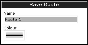
12 Basic Navigation Working with Waypoints WAYPOINT AT CURSOR WAYPOINT AT VESSEL WAYPOINT AT LAT/LON GO TO WAYPOINT OPTIONS REVIEW AND EDIT WAYPOINTS Card No. 11 What is a waypoint? A waypoint is a position marked on a chart, radar or fishfinder screen to indicate a site (for fishing, diving etc), or as a position to go to. You can place a waypoint at the cursor or your boat's position or at a specified position. Waypoints are represented in chart or radar applications as an 'X' (default) and by a vertical line labeled WPT in Fishfinder. Active waypoints are displayed on 3D Chart and CDI windows. The details of each waypoint are stored in a waypoint list. Waypoints can be renamed, edited, grouped, or erased, as necessary. To make full use of waypoint features, ensure your display is receiving heading and position data. We recommend that you regularly back-up your waypoints by archiving them to a CompactFlash card. Waypoints can also be transferred to another NMEA compatible instrument. Waypoint Networked systems If you have networked two or more E-Series Displays, the waypoints are stored on the master display and transferred to other displays via the SeaTalk High Speed network. How do I place a waypoint?... at the cursor?... at the vessel? Move cursor to position WPTS/ MOB WAYPOINT AT CURSOR How do I navigate to a point? WPT WPTS/ MOB WAYPOINT AT VESSEL Alternatively, press WPTS/MOB twice. Move cursor to position GOTO... GOTO CURSOR How do I navigate to a waypoint?...using the waypoint list? WPTS/ MOB GO TO WAYPOINT OPTIONS... Name: Waypoint 1 Waypoint 2 Waypoint 3 Waypoint list Group: Position: Rng/Brg: CAUTION Always check that your route to a waypoint is safe before travelling towards it. My Waypoint o N o W 284 o 4.315nm GO TO WAYPOINT...using the cursor? Temperature: Depth: Date: Time: O F ---.-ft 05/11/ :59:11 Highlight required waypoint To stop navigation to a waypoint: WPT Place cursor over waypoint. Can I edit a waypoint? GO TO WAYPOINT GOTO... Move cursor to required position Once a waypoint has been placed it can be edited in as variety of ways. You can: Change the waypoint details Move a waypoint. Change the default group or symbol OR: WPT STOP GOTO Erase a waypoint? More information... See the 'Working with Waypoints' chapter of the Reference Manual D6729_3
13

14 What is around me? Understanding the radar VRM/EBL TARGET TRACKING GAIN ENHANCE ECHOES... PRESENTATION Card No. 13 What does the radar show me?... Orientation Motion mode Range ring spacing Data bar Range 3nm Head-Up Relative Motion Rings ½nm Icon confirming radar connection Range ring Boat's position Landmass Ship's heading marker Surface vessel Waypoint VRM/EBL... TARGET GAIN... ENHANCE PRESENTATION... TRACKING... ECHOES... Typically your boat's position is at the centre of the display, and its dead ahead bearing is indicated by a vertical heading line, known as the Ship's Heading Marker (SHM). Remember that the radar picture may vary from visual observations that you make; a nearby small object may appear the same size on the screen as a distant large object. However, with experience the approximate size of different objects can be determined by the relative size and brightness of the echoes. How do I measure distances, ranges and bearings with the radar? VRMs Align a VRM on a target to display its range from your boat: e.g. Combined VRM/EBL Combine a VRM and EBL to measure range and bearing of specified target. e.g. ADJUST VRM 1.800nm ADJUST VRM 1.800nm ADJUST EBL S Rings 1 / 2nm EBLs Align an EBL on a target to display its bearing relative to your boat's heading: e.g. ADJUST EBL S Range rings Use the range rings to gauge the approximate distances between two points or from your boat. Note: Range/bearing also displayed when VRM/EBL selected with the cursor.? More information... See the 'Using the Radar' chapter of the Reference Manual D6731-3
15
 functions are used for target tracking and risk analysis.")
16 What is around me? Using MARPA... MONITOR IN ZONES ACQUIRE TARGET MARPA & AIS OPTIONS MARPA LIST AIS LIST Card No. 15 What is MARPA? Mini Automatic Radar Plotting Aid (MARPA) functions are used for target tracking and risk analysis. MARPA improves your standards of collision avoidance by obtaining detailed information for up to 10 targets, and provides continuous and rapid situation evaluation. MARPA tracks the selected targets and calculates target bearing, range, true speed, course, Closest Point of Approach (CPA), and Time to Closest Point of Approach (TCPA). Each tracked target can be displayed with a CPA graphic depicting the approximate target speed (vector length) and course (vector direction). Alternatively, move the cursor over the target to display the range and CPA. You can now access bearing and speed. Each target is continually assessed. An alarm sounds if a target becomes dangerous or lost. NOTE: For MARPA to operate, fast heading data is required. How do I set up the MARPA functions? TARGET TRACKING... MARPA & AIS OPTIONS... OK Highlight and select Select value How do I acquire a MARPA target? TARGET TRACKING... ACQUIRE TARGET T 2.3kt Repeat to acquire further targets (10 max) Move cursor over target to acquire The target is acquired - this takes a few seconds MARPA target symbols Target being acquired Safe target Dangerous target How do I view details of MARPA targets? MARPA LIST ID Bearing Range True Course True Speed CPA TCPA TARGET TRACKING... MARPA LIST o T 274 o T 086 o T 247 o T 1.739nm 3.242nm 1.305nm 1.774nm 342 o T 335 o T 276 o T 321 o T 9.9kt 68.4kt 9.4kt 22.7kt 1.739nm 3.242nm 1.305nm 1.774nm 00h00m00s 00h00m00s 00h00m00s 00h00m00s How do I cancel MARPA target(s)? Tracked targets with data listed. CANCEL TARGET Or: MARPA LIST... CANCEL ALL TARGETS CANCEL TARGET? More information... See the 'Using the radar' chapter of the Reference Manual. D6733_3
17 What is around me? Using AIS AIS VECTOR ON OFF AIS DATA AUTO ON OFF VIEW FULL AIS DATA Card No. 16 What is AIS? AIS uses digital radio signals to broadcast realtime information between vessels and shore based stations via dedicated VHF frequencies. This information is used to identify and track vessels in the surrounding area and to provide collision avoidance data. AIS will augment your radar application, as it can operate in radar blind spots. In order to use the AIS feature, you will need a GPS and compass for timing and position information together with data from a suitable AIS receiver. How do I display AIS? On chart windows: PRESENTATION... On radar windows: PRESENTATION... CHART LAYERS... AIS LAYER ON OFF Toggle as required AIS LAYER ON OFF Toggle as required How is AIS data displayed? The AIS system displays other AIS equipped vessels in the surrounding area as targets overlaid on a chart or radar window. Up to 100 targets are displayed and are scaled according to the size of the vessel. A vector indicates the direction of travel of the vessel. As the vessel s status changes, the symbol for the target will change accordingly. You can view detailed AIS data, safety critical target information, alarm messages (ALR) and safety related messages (SRM). You can also set up a safe zone. AIS target symbols Sleeping target Target not activated, dangerous or lost. Activated target Target activated i.e. AIS vector displayed. Vector line (optional) shows predicted distance travelled within given time. Selected target Target selected with cursor. Can activate the target and view detailed data. Dangerous target Targets within specified distance (CPA) or time (TCPA). Dangerous target alarm sounds and target flashes. Uncertain target Calculated CPA/TCPA value uncertain. Lost target When signal of a dangerous AIS target not received for 10 seconds. Target orientated in COG or CSE direction as appropriate. Alarm sounds and target flashes COG/SOG vector Direction of turn Heading AIS How do I view target information? AIS DATA AUTO ON OFF How do I view detailed AIS data? 125 o T 7.7kt 01.30nm 12h15m30s WARNING: Smaller vessels do not have to be fitted with AIS and whilst it is mandatory for larger commercial vessels to carry AIS, its use is not. You should not assume that your AIS will display ALL vessels in your area. MNSI 6 AIS Target info: Sim Target 6 COG 142oT VIEW FULL AIS DATA Name Call sign Last seen Lat Lon Hdg Length Beam Draught Sim Target 6 01/01/ :13:21AM O W 080o18'.702W 159oT --,---ft --,---nm --,---ft --ft SOG CPA TCPA IMO No Dest ETA Status Type 25,7kt --,---nm --h--m--s --/--/ :--:--AM Under Way Using Engine Normal? More information... See the 'AIS' chapter of the reference manual for data classes and how to customise this feature. D8809_1
. Use the Course Deviation Indicator (CDI).")

18 Where am I? Monitoring a course... Card No. 17 How do I monitor my course?... Your course is shown on the chart application whilst motion mode is active. Using COG and heading vectors (Press DATA - CHART VECTORS - COG/HDG VECTORS). Use the Course Deviation Indicator (CDI). With your display receiving accurate heading and position information, you can monitor your course and accurately steer to a target waypoint. What does the CDI show me?... The CDI gives a graphical representation of your boat's course. This 'rolling road' format represents a width of sea equal to the Cross Track Error (XTE) limits that you have specified in the Setup menu. As you travel towards the target waypoint, the checkered pattern moves down the screen to simulate movement at a rate proportional to your boat's speed. Direction of next waypoint Target waypoint Correction arrow Direction to steer Target waypoint name On course line What do the steering instructions tell me? On course XTE 0.000nm 0ff course XTE 0.027nm Boat on center line. Zero XTE Boat off center line. Correction arrow(s) indicate direction to steer to maintain course to target waypoint. The greater the XTE, the more arrows.? More information... See the 'Using the CDI' chapter of the Reference Manual D6734_3
19
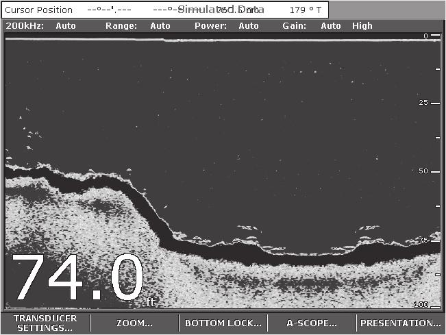
20 What's under the boat? Using the fishfinder... Card No. 19 FISHFINDER SETTINGS ZOOM BOTTOM LOCK A-SCOPE PRESENTATION How do I change the range or shift the image? Your system automatically adjusts the display depth range, selecting the shallowest depth that keeps the bottom on the lower half of the window. You can however, set this manually if required and move the image within the selected page up or down. Using the range controls will affect all fishfinder windows. OUT RANGE IN D RANGE AUTO MAN OUT RANGE IN D RANGE SHIFT xx FT Turn Press RANGE (IN or OUT) IN - decrease depth. OUT - increase depth. Turn to alter shift value. How do I change the operating frequency? Auto mode - automatically selects 50 khz or 200 khz. This is the default mode. Manual (MAN) - Single or dual 200 khz - for maximum definition in shallow water. 50 khz - for maximum depth penetration in deep water. Both khz & 50 khz displayed simultaneously. Only available if FREQ MODE set to DUAL. FISHFINDER SETTINGS... FREQUENCY AUTO MAN FREQ MODE SINGLE DUAL SELECT FREQ BOTH Select MAN Select DUAL frequency mode Select required frequency How do I change the gain mode? The system automatically adjusts the gain control to display the sharpest image. If required, you can select the gain level to suit your fishing mode: Low - when cruising Med - when trolling High - when fishing FISHFINDER SETTINGS... GAIN... GAIN MODE AUTO MAN AUTO GAIN LO MED HIGH Select gain level To define the gain mode still further, select manual gain mode and then adjust the level using the rotary control. How do I zoom in on an area of the screen? To see more detail of the bottom structure, target images etc, zoom in and enlarge a portion of the image. Zoom On - zooms fishfinder image Split - displays zoomed image and standard fishfinder image simultaneously. ZOOM... ZOOM ON SPLIT OFF ZOOM FACTOR x2 x3 x4 xr OK Toggle as required Select zoom level? More information... See the 'Using the Fishfinder' chapter of the Reference Manual. D6736_3

21 Monitoring data and engines Viewing video images Card No. 20 How do I monitor data?... NAVIGATION WAYPOINT ROUTE FISHING SAILING The data application enables you to view numeric data generated by the system or by instruments available on NMEA 0183, SeaTalk, SeaTalk 2, NMEA 2000 and SeaTalk hs. This information is displayed in a series of panels which contain data relating to a particular function or activity. These can be reconfigured to your needs. Press the appropriate soft key to select the panel of your choice How do I monitor the engine(s)?... ENGINE ENGINE & FUEL FUEL RESOURCES ENGINE & RESOURCES TWIN ENGINE The engine monitor application enables you to view data from up to three compatible engines. The information is displayed in a series of panels which contain data relating to engine, fuel and fuel resources. These can be reconfigured to your needs. Press the appropriate soft key to select the panel of your choice. To view data from 3 engines, change the 'No. of engine' setting in the Panel Setup Menu How do I view video images?... VIDEO 1 VIDEO 2 VIDEO 3 VIDEO 4 PRESENTATION The video application enables you to view images from a saterlite TV, video or DVD player or on-board camera. Press the appropriate soft key, to select the video input of your choice or set CYCLE VIDEO to ON (via the PRESENTATION key), to cycle through the video inputs. Note: Video images can only be viewed on the display to which the video source is connected. They cannot be networked to other Displays.? More information... See the appropriate chapter of the Reference Manual. D7521_3
22 Navtex and Sirius Weather Data Card No. 21 Navtex If connected to a Navtex receiver, you can use your display to view navigation, meteorological and search and rescue alerts. You can choose which category of alerts will automatically be displayed when one is received by your display. After you have read the message you can either erase it or save it to the database (100 maximum). You can view the list of saved messages at any time. Messages are viewed and alerts set-up via the Setup Menu option Navtex Messages. Viewing saved messages 1. MENU Setup Chart Setup... Cartography Setup AIS Layer Setup... Navtex Messages... Highlight and select Navtex messages Highlight required item in list Navtex Message List Navtex Message List 2. Date Time Message ID Message Date Time Message ID Message Associated message displayed in message box Move control to message box Scroll through message (if applicable) The Sirius Weather application (USA only) To run the Sirius Weather application you will need to purchase an SR100 weather receiver and a subscription to Sirius weather. Once connected, the weather application superimposes historical, current and forecasted weather graphics and environmental conditions on the world map and provides textual forecasts and warnings. These help you to determine the actual conditions in your vicinity or at a particular location. As in the chart application, use the cursor to move around the map and view different locations, and the range button to zoom in and out. To re-center the map on your boat use the FIND SHIP soft key. Range Surface observation stations Marine zone Time data Wave heights Signal strength 2400 nm 12:00 22/11 Medium Note: As with all weather services, the information presented is advisory only and you should be aware that errors may occur. FIND SHIP DISPLAY GRAPHICS... ANIMATE WEATHER... Weather soft keys WEATHER REPORTS... PRESENTATION...? More information... See the appropriate chapter for the Reference Manual. D8932_1
23 Sirius Weather Data (continued) FIND SHIP DISPLAY GRAPHICS ANIMATE WEATHER WEATHER REPORTS PRESENTATION Card No. 22 By default, all weather graphics are set to OFF. To display the required weather graphic: Weather symbols (USA only) DISPLAY GRAPHICS... Weather Graphics NOWRad Storm Cast Sea Surface Temp Canadian Radar OFF OFF OFF OFF Highlight, select and switch graphic on/off as required OFF ON Florida Or Storm cast Cuba Waves (blues-green-red) Canadian radar (light green- dark red) Lightning (light-med-dark yellow) Wind (see below for details) Florida NWS Buoy C-man WST Sea surface temperature (blue-green-yellow -orange-red) Surface observation station (pink) Cities (grey) Rain (green-yellow-red) Snow (blues) Mixture (pinks) Marine zones Surface pressure High pressure (blue) High pressure (red) Warm front (red) Cold front (blue) Occluded front (purple) Stationary front (red-blue) Trough (brown) Squall line (red) Dry line (brown) Isobars (grey) Storm Tracks symbols Shown in three different colours: Grey - historical Red - current Orange - forecast Note: Highlight the symbol for additional information Hurricane (Category 1-5) Tropical storm Tropical disturbance or tropical depression Wind speed symbols (knots) etc ? More information... See the Weather (USA only) chapter of the Reference Manual. D8810_1
24 D8487_1 Operating a networked E-Series Display Card No. 23 What does a networked system do? If you have connected two or more E-Series Displays (via either a crossover coupler or SeaTalk High Speed Switch), all system data (from NMEA 0183, SeaTalk, SeaTalk 2, NMEA 2000, SeaTalk hs waypoints, routes etc) can be transferred across the network enabling you to input, view and maintain data across all your displays irrespective of the Display from which the data originated (excepting Video Input). How is the network controlled? The display that has been installed and nominated as the master, should always be switched on (preferably first). The master display maintains the waypoint, route and track lists as well as data from NMEA and SeaTalk. Each time the master display detects a change on any display e.g. waypoint, route or track added or edited, the data is copied to the database which in turn is copied to all other Displays that are switched on. If the system does not detect a master, either because it is not switched on or because a master has not been selected, an alarm will sound and you will be prompted to set a master display. How do I change the master display? MENU Setup Chart Setup... Cartogrphy Setup... AIS setup... System Setup... Alarm Setup... GPS Status... Highlight System Setup Select System Setup Menu Position Mode... TD Setup... Simulator Bearing Mode MOD Data Type Variation Source Manual Variation Language Extended Character Set Ground Trip Reset... Settings Reset... Settings and Data Reset... Date/Time Setup... Unit Setup... System Intregration... Waypoint Password Setup... Lat/Long ON True Position Auto(05 o W) 00 o E English (US) OFF System Integration setup Menu DCM Message Seatalk Data Master Bridge NMEA Heading NMEA Output Setup... ON ON ON OFF Highlight Data Master Select Select ON OFF ON Highlight System Ingregration Select Raymarine Ltd Quay Point Northarbour Road, Portsmouth, Hampshire England PO6 3TD +44 (0) Raymarine Inc. 21 Manchester Street, Merrimack, NH USA Document No 86114_2
R2009/R3016 Radar system Quick Reference Card
 R2009/R3016 Radar system Quick Reference Card EN ¼¼ Note: This document covers the products: R2009 Radar system with 9 portrait display, paired with Halo, 3G, 4G or HD radar sensors. R3016 Radar system
NC Models. CP390i - GPS Chart Plotters. Addendum to Owner s Manual Issue C to update to Software Version (*)
") CP390i - GPS Chart Plotters (*) NC Models to Owner s Manual Issue 16.50 C 300311 to update to Software Version 16.70 BUILT-IN CHARTS ARE NOT INSTALLED The following paragraphs/pictures are not applicable:
CP390i - GPS Chart Plotters (*) NC Models to Owner s Manual Issue 16.50 C 300311 to update to Software Version 16.70 BUILT-IN CHARTS ARE NOT INSTALLED The following paragraphs/pictures are not applicable:
HSB Series LCD Display Owner s Handbook
 HSB Series LCD Display Owner s Handbook Document number: 81163_1 Date: 1st September 1999 Preface i HSB Series LCD Display Owner s Handbook September 1999 SAFETY NOTICES This radar equipment must be installed
GPSMAP 500/700 Series and echomap 50/70 Series Owner s Manual
 GPSMAP 500/700 Series and echomap 50/70 Series Owner s Manual February 2013 190-01556-00_0A Printed in Taiwan All rights reserved. Under the copyright laws, this manual may not be copied, in whole or in
AQUAMAP 80/100 Series Owner s Manual
 AQUAMAP 80/100 Series Owner s Manual April 2014 190-01657-00_0B Printed in Taiwan All rights reserved. Under the copyright laws, this manual may not be copied, in whole or in part, without the written
GPSMAP 700 series owner s manual
 GPSMAP 700 series owner s manual Introduction Introduction WARNING See the Important Safety and Product Information guide in the product box for product warnings and other important information. This manual
GPSMAP. 4000/5000 series owner s manual
 GPSMAP 4000/5000 series owner s manual 2009 Garmin Ltd. or its subsidiaries All rights reserved. Except as expressly provided herein, no part of this manual may be reproduced, copied, transmitted, disseminated,
Introduction...2 Content...2 Multi-Function Display Software Update...2 AIS Overview...2
 SKIPPERS NOTES Yacht Sea Essay of Hamble Newsletter No 02/16 Introduction This is an occasional document issued by the Yacht Secretary, which will be placed on the CSD website and/or sent to all CSSA approved
SL72 and SL72RC PLUS Pathfinder Radar and Radar/Chartplotter Owner s Handbook. Document number: 81204_1 Date:18th January 2002
 Distributed by Any reference to Raytheon or RTN in this manual should be interpreted as Raymarine. The names Raytheon and RTN are owned by the Raytheon Company. SL72 and SL72RC PLUS Pathfinder Radar and
Simulator. Demo mode. Simulator source files. 102 Simulator HDS Gen3 Operator Manual
 13 Simulator The simulation feature lets you see how the unit works in a stationary position and without being connected to sensors or other devices. Demo mode In this mode the unit automatically runs
echomap CHIRP 40/50/70/90 Series Owner s Manual
 echomap CHIRP 40/50/70/90 Series Owner s Manual January 2016 190-01951-00_0B All rights reserved. Under the copyright laws, this manual may not be copied, in whole or in part, without the written consent
STRIKER Series. Owner s Manual
 STRIKER Series Owner s Manual Table of Contents Introduction...1 Device Keys... 1 Contacting Garmin Product Support... 1 Selecting the Transducer Type... 1 Zooming on the STRIKER 4... 1 Panning on the
2017 Garmin Ltd. or its subsidiaries All rights reserved. Under the copyright laws, this manual may not be copied, in whole or in part, without the
 Owner's Manual 2017 Garmin Ltd. or its subsidiaries All rights reserved. Under the copyright laws, this manual may not be copied, in whole or in part, without the written consent of Garmin. Garmin reserves
GPSMAP. 400/500 series. owner s manual
 GPSMAP 400/500 series owner s manual 2011 Garmin Ltd. or its subsidiaries All rights reserved. Except as expressly provided herein, no part of this manual may be reproduced, copied, transmitted, disseminated,
GPSMAP. 400/500 series. owner s manual
 GPSMAP 400/500 series owner s manual 2010 11 Garmin Ltd. or its subsidiaries Garmin International, Inc. 1200 East 151st Street, Olathe, Kansas 66062, USA Tel. (913) 397.8200 or (800) 800.1020 Fax (913)
GPSMAP. 6000/7000 series owner s manual
 GPSMAP 6000/7000 series owner s manual 2010 Garmin Ltd. or its subsidiaries Garmin International, Inc. 1200 East 151 st Street, Olathe, Kansas 66062, USA Tel. (913) 397.8200 or (800) 800.1020 Fax (913)
Table of Contents. Downloading Garmin Quickdraw Community Maps Garmin Quickdraw Contours Settings... 10
 Owner s Manual Table of Contents Introduction...1 Device Overview... 1 Keys... 1 Tips and Shortcuts... 1 Getting More Information... 1 Inserting Memory Cards... 1 Software Update... 1 Loading the New Software
GPSMAP 800/1000 Series Owner s Manual
 GPSMAP 800/1000 Series Owner s Manual June 2014 190-01658-00_0B Printed in Taiwan All rights reserved. Under the copyright laws, this manual may not be copied, in whole or in part, without the written
Q Panel General Guide
 Q Panel General Guide Contents Q Panel General Guide Welcome to Q Experience! Available applications Tech overview Overview Quick Start Applications Elements: Sidebar Sidebar: Modes Elements: Main menu
GPSMAP 7400/7600 Series
 GPSMAP 7400/7600 Series Owner s Manual Table of Contents Introduction...1 Device Overview... 1 Using the Touchscreen... 1 On-Screen Buttons... 1 Tips and Shortcuts... 1 Locking and Unlocking the Touchscreen...
GPSMAP 800/1000 Series
 GPSMAP 800/1000 Series Owner s Manual 2014 2017 Garmin Ltd. or its subsidiaries All rights reserved. Under the copyright laws, this manual may not be copied, in whole or in part, without the written consent
echomap CHIRP 40/50/70/90 Series Owner s Manual
 echomap CHIRP 40/50/70/90 Series Owner s Manual 2016 2017 Garmin Ltd. or its subsidiaries All rights reserved. Under the copyright laws, this manual may not be copied, in whole or in part, without the
ECHOMAP 40/60/70/90 SERIES. Owner s Manual
 ECHOMAP 40/60/70/90 SERIES Owner s Manual 2017 Garmin Ltd. or its subsidiaries All rights reserved. Under the copyright laws, this manual may not be copied, in whole or in part, without the written consent
GPSMAP 702/902 SERIES. Owner s Manual
 GPSMAP 702/902 SERIES Owner s Manual 2016 2018 Garmin Ltd. or its subsidiaries All rights reserved. Under the copyright laws, this manual may not be copied, in whole or in part, without the written consent
ARGUS RADAR Quick Reference Card
 ARGUS RADAR Quick Reference Card Own Ship Activated ERBL AIS Symbol ERBL 1 and 2 Helm or Antenna Position Ref. Parallel Index Status/Setup Display Presentation Transceiver Status Tuning Bar Presentation
echomap CHIRP 40/50/70/90 Series Owner s Manual
 echomap CHIRP 40/50/70/90 Series Owner s Manual September 2016 190-01951-10_0A All rights reserved. Under the copyright laws, this manual may not be copied, in whole or in part, without the written consent
GPSMAP 8400/8600 Series
 GPSMAP 8400/8600 Series Owner s Manual Table of Contents Introduction...1 Device Overview... 1 Using the Touchscreen... 1 On-Screen Buttons... 1 Tips and Shortcuts... 1 Locking and Unlocking the Touchscreen...
Explorer 660 Chartplotter and Fishfinder Installation and Operation Manual
 Explorer 660 Chartplotter and Fishfinder Installation and Operation Manual www.northstarnav.com IMPORTANT SAFETY INFORMATION Please read carefully before installation and use. DANGER! WARNING! CAUTION
GPSMAP 1000/1200 SERIES. Owner s Manual
 GPSMAP 1000/1200 SERIES Owner s Manual 2016 Garmin Ltd. or its subsidiaries All rights reserved. Under the copyright laws, this manual may not be copied, in whole or in part, without the written consent
GPSMAP. 7400/7600 Series. Owner s Manual. June 2015 Printed in Taiwan _0C
 GPSMAP 7400/7600 Series Owner s Manual June 2015 Printed in Taiwan 190-01841-00_0C All rights reserved. Under the copyright laws, this manual may not be copied, in whole or in part, without the written
Installation and Operation Manual
 NAVMAN Tracker 5507/ 5607 Installation and Operation Manual Chartplot ters w w w. n a v m a n. c o m IMPORTANT SAFETY INFORMATION Please read carefully before installation and use. DANGER! WARNING! CAUTION
G142C and G142CFD INSTRUCTION MANUAL.
 G142C and G142CFD INSTRUCTION MANUAL www.gme.net.au Important It is the owner s sole responsibility to install and use the unit in a manner that will not cause accidents, personal injury or property damage.
STRIKER Series. Owner s Manual
 STRIKER Series Owner s Manual June 2016 190-01950-26 Rev. C All rights reserved. Under the copyright laws, this manual may not be copied, in whole or in part, without the written consent of Garmin. Garmin
GPSMAP 7400/7600 Series
 GPSMAP 7400/7600 Series Owner s Manual 2014 2017 Garmin Ltd. or its subsidiaries All rights reserved. Under the copyright laws, this manual may not be copied, in whole or in part, without the written consent
GMI 10. quick start manual
 GMI 10 quick start manual Introduction The GMI 10 allows you to quickly view important information about your boat provided by connected sensors. Connected sensors transmit data to the GMI 10 using NMEA
Manual. Simrad NX40/45 NavStation. English Sw. 2.7
 Manual Simrad NX40/45 NavStation English Sw. 2.7 www.simrad-yachting.com A brand by Navico - Leader in Marine Electronics Warning It is your sole responsibility to install and use the instrument and transducer(s)
Explorer 657. Fishfinder and Chartplotter Installation and Operation Manual.
 Explorer 657 Fishfinder and Chartplotter Installation and Operation Manual www.northstarnav.com IMPORTANT SAFETY INFORMATION Please read carefully before installation and use. DANGER! WARNING! CAUTION
GPSMAP 8000/8500 SERIES. Owner s Manual
 GPSMAP 8000/8500 SERIES Owner s Manual 2013 2017 Garmin Ltd. or its subsidiaries All rights reserved. Under the copyright laws, this manual may not be copied, in whole or in part, without the written consent
GPSMAP. 400/500 series. owner s manual
 GPSMAP 400/500 series owner s manual 2010 2011 Garmin Ltd. or its subsidiaries Garmin International, Inc. 1200 East 151st Street, Olathe, Kansas 66062, USA Tel. (913) 397.8200 or (800) 800.1020 Fax (913)
AIS6 / MFR6 User Manual
 AIS6 / MFR6 User Manual Important Features at a glance Below you will find a brief summary of the main features of your Seatec AIS6 / MFR6. Your Seatec AIS6 / MFR6 will be your reliable partner for a safe
GPSMAP 7400/7600 Series
 GPSMAP 7400/7600 Series Owner s Manual 2014 2017 Garmin Ltd. or its subsidiaries All rights reserved. Under the copyright laws, this manual may not be copied, in whole or in part, without the written consent
Owners. manual VOLVO PENTA GLASS COCKPIT
 Owners manual VOLVO PENTA GLASS COCKPIT 2013 2017 Garmin Ltd. or its subsidiaries All rights reserved. Under the copyright laws, this manual may not be copied, in whole or in part, without the written
GPSMAP 702/902 SERIES. Owner s Manual
 GPSMAP 702/902 SERIES Owner s Manual 2016 2017 Garmin Ltd. or its subsidiaries All rights reserved. Under the copyright laws, this manual may not be copied, in whole or in part, without the written consent
GPSMAP 1000/1200 SERIES. Owner s Manual
 GPSMAP 1000/1200 SERIES Owner s Manual 2016 2018 Garmin Ltd. or its subsidiaries All rights reserved. Under the copyright laws, this manual may not be copied, in whole or in part, without the written consent
HDS 4.1 Software Upgrade for- HDS GEN1
 HDS 4.1 Software Upgrade for- HDS GEN1 Sonar Charting Enhancements Bug Fixes Ease of Use AVAILABLE FEBRUARY 2012 Sonar performance Improved bottom tracking at high speeds Enhanced deep water (>1000 feet)
GMR 20/40 Marine Radar Owner s Manual
 GMR 20/40 Marine Radar Owner s Manual Copyright 2005 Garmin Ltd. or its subsidiaries Garmin International, Inc. 1200 East 151 st Street, Olathe, Kansas 66062, U.S.A. Tel. 913/397.8200 or 800/800.1020 Fax
JMA-3300 Radar. Semi-Constaview digital signal processing inch ultra bright LCD New System-on-Chip technology
 JMA-3300 Radar JRC s new radar incorporates the latest leading technologies 10.4-inch ultra bright LCD New System-on-Chip technology Semi-Constaview digital signal processing AIS and MARPA+ as standard
AIS Training. AIS Technology in Digital Yacht Products Explained. Digital Yacht Ltd TEL
 AIS Training AIS Technology in Digital Yacht Products Explained Digital Yacht Ltd www.digitalyacht.co.uk TEL + 44 1179 554474 What is AIS? The Automatic Identification System (AIS) is the biggest advance
INSTRUCTION MANUAL. MARINE RADAR MR-1200R (Radome type) MR-1200T (Open array type; 4 kw) MR-1200T (Open array type; 6 kw)
 MR-1200T (Open array type; 4 kw) MR-1200T (Open array type; 6 kw)") INSTRUCTION MANUAL MARINE RADAR MR-1200R (Radome type) MR-1200T (Open array type; 4 kw) MR-1200T (Open array type; 6 kw) SYSTEM COMPONENTS MODEL NAME LCD DISPLAY SCANNER UNIT MR-1200RII MR-1200TII MR-1200TIII
INSTRUCTION MANUAL MARINE RADAR MR-1200R (Radome type) MR-1200T (Open array type; 4 kw) MR-1200T (Open array type; 6 kw) SYSTEM COMPONENTS MODEL NAME LCD DISPLAY SCANNER UNIT MR-1200RII MR-1200TII MR-1200TIII
Saab TransponderTech
 Saab TransponderTech R4 Combined AIS & Navigation System This page is intentionally empty Copyright The content of this document and its attachments shall remain our property. They may not without our
Addendum 1.4_2. (Addendum to MX420 Operator s Manual)
") _2 (Addendum to MX420 ) September, 2007 Table of Contents About this document..1 MX575 Heading & Rate of Turn 2 MX575 as a D/GPS Compass only 2 MX575 as a D/GPS Compass with Navigation Functionality.....4
_2 (Addendum to MX420 ) September, 2007 Table of Contents About this document..1 MX575 Heading & Rate of Turn 2 MX575 as a D/GPS Compass only 2 MX575 as a D/GPS Compass with Navigation Functionality.....4
GPSMAP 4000 Series. owner s manual
 GPSMAP 4000 Series owner s manual 2008 Garmin Ltd. or its subsidiaries Garmin International, Inc. 1200 East 151st Street, Olathe, Kansas 66062, USA Tel. (913) 397.8200 or (800) 800.1020 Fax (913) 397.8282
Owners. manual VOLVO PENTA GLASS COCKPIT
 Owners manual VOLVO PENTA GLASS COCKPIT 2016 2017 Garmin Ltd. or its subsidiaries All rights reserved. Under the copyright laws, this manual may not be copied, in whole or in part, without the written
R2009/R3016 User Manual
 R2009/R3016 User Manual ENGLISH navico-commercial.com Preface Disclaimer As Navico is continuously improving this product, we retain the right to make changes to the product at any time which may not
R4 AIS Class A Transponder System
 Saab TransponderTech R4 AIS Class A Transponder System Operator Manual This page is intentionally empty i Copyright The entire contents of this manual and its appendices, including any future updates and
GPSMAP 5000 Series. owner s manual
 GPSMAP 5000 Series owner s manual 2007 Garmin Ltd. or its subsidiaries Garmin International, Inc. 1200 East 151 st Street, Olathe, Kansas 66062, USA Tel. (913) 397.8200 or (800) 800.1020 Fax (913) 397.8282
GPSMAP 4000/5000 Series. owner s manual
 GPSMAP 4000/5000 Series owner s manual 2008 Garmin Ltd. or its subsidiaries Garmin International, Inc. 1200 East 151st Street, Olathe, Kansas 66062, USA Tel. (913) 397.8200 or (800) 800.1020 Fax (913)
Simrad CE40/42/50 MKII DGPS ChartSounder
 Simrad CE40/42/50 MKII DGPS ChartSounder 183.0100.202 English 01154.05 Note! Insert or remove C-MAP cartridges ONLY through CHART menu or when unit is off. All electronic navigation equipment is subject
INSTRUCTION MANUAL. MARINE RADAR MR-1200R (Radome type) MR-1200T (Open array type; 4 kw) MR-1200T (Open array type; 6 kw)
 MR-1200T (Open array type; 4 kw) MR-1200T (Open array type; 6 kw)") INSTRUCTION MANUAL MARINE RADAR MR-1200R (Radome type) MR-1200T (Open array type; 4 kw) MR-1200T (Open array type; 6 kw) SYSTEM COMPONENTS MODEL NAME LCD DISPLAY SCANNER UNIT MR-1200RII MR-1200TII MR-1200TIII
INSTRUCTION MANUAL MARINE RADAR MR-1200R (Radome type) MR-1200T (Open array type; 4 kw) MR-1200T (Open array type; 6 kw) SYSTEM COMPONENTS MODEL NAME LCD DISPLAY SCANNER UNIT MR-1200RII MR-1200TII MR-1200TIII
GPS Tracker. User Manual
 GPS Tracker User Manual LICENSE AGREEMENT Magellan grants you, the purchaser, the right to use the software supplied in and with MAGELLAN GPS products (the "SOFTWARE") in the normal operation of the equipment.
User Manual code: (D e)
") MDS 1 Radome 0.9 Feet MDS 8 Radome 1.5 Feet MDS 9 Radome 1.8 Feet MDS 10 Open 4 or 5 Feet Copyright 2008 Seiwa - Hong Kong All rights reserved. Printed in Italy. No part of this publication may be reproduced
MDS 1 Radome 0.9 Feet MDS 8 Radome 1.5 Feet MDS 9 Radome 1.8 Feet MDS 10 Open 4 or 5 Feet Copyright 2008 Seiwa - Hong Kong All rights reserved. Printed in Italy. No part of this publication may be reproduced
GMR 21/41 marine radar. Owner s Manual
 GMR 21/41 marine radar Owner s Manual Copyright 2006 Garmin Ltd. or its subsidiaries Garmin International, Inc. 1200 East 151 st Street, Olathe, Kansas 66062, U.S.A. Tel. 913/397.8200 or 800/800.1020 Fax
GR16 GPS Receiver Accessory Manual _B
 GR16 GPS Receiver Accessory Manual 531478-1_B Thank You! Thank you for choosing Humminbird, America's #1 name in fishfinders. Humminbird has built its reputation by designing and manufacturing top-quality,
ICS NAV6 range. User Guide
 ICS NAV6 range User Guide Important Information This equipment is not approved for use by SOLAS convention vessels within the Global Maritime Distress and Safety System (GMDSS) It is intended for use by
AccuWeather.com Premium v3.0. User Manual
 AccuWeather.com Premium v3.0 User Manual Contents About AccuWeather, Inc....3 Overview of AccuWeather.com Premium v3.0...3 Initial Download and Installation...4 Using and Navigating the Application...5
Raystar 112LP GPS Transducer
 Distributed by Any reference to Raytheon or RTN in this manual should be interpreted as Raymarine. The names Raytheon and RTN are owned by the Raytheon Company. Raystar 112LP GPS Transducer Installation
echo 100 and echo 150 owner s manual
 echo 100 and echo 150 owner s manual Introduction Introduction Warning See the Important Safety and Product Information guide in the product box for product warnings and other important information. This
The Captains F O R U M
 The Captains F O R U M THE HUMAN-CENTRED DESIGN FORUM In December last year, the International Maritime Organization (IMO) adopted Performance Standards and approved Guidelines the combined effect of which
CAST Application User Guide
 CAST Application User Guide for DX900+ Electromagnetic Multilog Sensor U.S. Patent No. 7,369,458. UK 2 414 077. Patents Pending 17-630-01-rev.b 05/24/17 1 Copyright 2017 Airmar Technology Corp. All rights
Installation and Operation Manual
 www.navman.com Tracker 5430/5430i Pilot 3380 C H A RA TU PT LO OP T I TL EO R T Installation and Operation Manual FCC Statement Note: This equipment has been tested and found to comply with the limits
Raymarine AIS250 Receiver User s Guide
 Raymarine AIS250 Receiver User s Guide Document Number: 81286_1 Date: February 2007 Trademarks and registered trademarks Autohelm, HSB, Raymarine, RayTech, Sail Pilot, SeaTalk and Sportpilot are registered
dkart Navigator 9010
 dkart Navigator 9010 dkart Navigator - purpose dkart Navigator is an electronic navigation chart system specially designed to facilitate all the navigational tasks of mariner's day-to-day practice. Along
COMAND Operator, s Manual
 Order-No. DaimlerChrysler 6515 6635 13 Blaupunkt 8 622 402 630 Index B Parts-No. 203 584 01 93 USA Edition A 2002 203/463 Operator, s Manual COMAND COMAND Operator, s Manual As a result of new improvements
NAV6 V2 User Guide NAV6 V2 NAV6plus V2 NAV6repeater V2
 NAV6 V2 User Guide NAV6 V2 NAV6plus V2 NAV6repeater V2 NAV6 enavtex Receiver MAN 3030.00 Issue 4.0, March 2013. ICS Electronics Limited Unit V, Rudford Industrial Estate Ford, Arundel, West Sussex BN18
CHART PLOTTER NAME DESCRIPTION SOFTWARE
 CHART PLOTTER NAME DESCRIPTION SOFTWARE S-50.0 5" Sunlight Readable Vertical Color Display S4xgTM5vc External Smart GPS Receiver S-55.0 5" Sunlight Readable Vertical Color Display S4xgTM5vc Internal GPS
Explorer 710 VHF VHF Marine Radio Operation and Installation Manual
 Explorer 710 VHF VHF Marine Radio Operation and Installation Manual www.northstarnav.com IMPORTANT SAFETY INFORMATION Please read carefully before installation and use. This is the safety alert symbol.
HEAVY-DUTY HIGH PERFORMANCE RASTERSCAN RADARS/ARPAS
 Complying with IMO and IEC standards for installation after 1.1.1999 HEAVY-DUTY HIGH PERFORMANCE RASTERSCAN RADARS/ARPAS Models FR/FAR-28x5 series The future today with FURUNO's electronics technology.
User Manual code: (A e)
") CHART PLOTTER NAME DESCRIPTION SOFTWARE EC5E 5" Sunlight Readable Vertical Color Display S4x2SW5vc External Smart GPS Receiver EC5I 5" Sunlight Readable Vertical Color Display S4x2SW5vc Internal GPS Receiver
CHART PLOTTER NAME DESCRIPTION SOFTWARE EC5E 5" Sunlight Readable Vertical Color Display S4x2SW5vc External Smart GPS Receiver EC5I 5" Sunlight Readable Vertical Color Display S4x2SW5vc Internal GPS Receiver
NSE EXPERT NSE12. Rotary controller: Perfectly intuitive for fine or course control of gain, zoom and menu with push to enter functionality
 NSE EXPERT Simrad NSE 8- and 12-inch multifunctional displays provide professional-level performance with sophisticated charting, radar and echosounder technology. With powerful networking and vessel integration
CHIRP RADAR. HELIX Operations Manual EN_A
 CHIRP RADAR HELIX Operations Manual 532547-1EN_A THANK YOU! Thank you for choosing Humminbird, the #1 name in marine electronics. Humminbird has built its reputation by designing and manufacturing top
TECHNICAL SPECIFICATION. VisionMaster FT Radar & Chart Radar Features CAT1 and ECAT2
 TECHNICAL SPECIFICATION VisionMaster FT Radar & Chart Radar Features CAT1 and ECAT2 The following specifications relate to release 4.1.3 series of VisionMaster FT (IEC62388 version) RADAR SYSTEM PERFORMANCE
Table of Contents. Installing to the Main Body.103
 Table of Contents 1. GPS Overview...2 2. Features...3 1. GPS Antenna & Receiver...4 2. Main Unit Features & Functions...4 3. Standard Scope of Supply...7 3. Device & Display...8 1. Display Device...8 2.
2000 by UPS Aviation Technologies, Inc. All rights reserved. Printed in the U.S.A.
 No part of this document may be reproduced in any form or by any means without the express written consent of UPS Aviation Technologies, Inc. UPS Aviation Technologies, Inc., II Morrow, and Apollo are
CONTENTS. INTRODUCTION 1 INTRODUCTION TO GPSPlus 3
 CONTENTS INTRODUCTION 1 INTRODUCTION TO GPSPlus 3 OPERATION OF GPSPlus 5 INTRODUCTION 6 SWITCHING ON 6 INITIAL DISPLAYS 6 USING THE LIGHTS KEY 7 NOTES ABOUT ENTERING DATA 7 USING THE POS KEY 8 USING WAYPOINTS
CHART PLOTTER NAME DESCRIPTION SOFTWARE
 CHART PLOTTER NAME DESCRIPTION SOFTWARE CHART MASTER V6 5.7" Sunlight Readable Color Display S3egIN7vc External Smart GPS Receiver CHART MASTER V6i 5.7" Sunlight Readable Color Display S3igIN7vc Internal
Ray49E Marine VHF Radio Owner s Handbook. Document number: Date: June 2007
 Ray49E Marine VHF Radio Owner s Handbook Document number: 81297-1 Date: June 2007 3 Contents Trademarks and registered trademarks... 2 About this Handbook...9 Intended Use... 9 Conventions Used... 9 Technical
GPS Receiver _B
 GPS Receiver 531478-2_B Thank You! Thank you for choosing Humminbird, America's #1 name in Fishfinders. Humminbird has built its reputation by designing and manufacturing top-quality, thoroughly reliable
GPS Chart Plotters CP " WAAS GPS Chart Plotter. Owner's Manual
 GPS Chart Plotters CP500 12" WAAS GPS Chart Plotter Owner's Manual WARNING!!! Electronic charts displayed by the GPS Chart Plotter are believed to be accurate and reliable, but are not intended to be a
User Manual code: (e e)
") CHART PLOTTER NAME DESCRIPTION SOFTWARE MURENA 5.6" Sunlight Readable Color Display S3egSW7vc External Smart GPS Receiver MURENA igps 5.6" Sunlight Readable Color Display S3igSW7vc Internal GPS Receiver
CHART PLOTTER NAME DESCRIPTION SOFTWARE MURENA 5.6" Sunlight Readable Color Display S3egSW7vc External Smart GPS Receiver MURENA igps 5.6" Sunlight Readable Color Display S3igSW7vc Internal GPS Receiver
rino 600 series quick start manual
 rino 600 series quick start manual Getting Started Keys warning See the Important Safety and Product Information guide in the product box for product warnings and other important information. When using
The Impact of IT on the. Marine Navigator. Andrew Eccleston. University of Plymouth
 The Impact of IT on the Marine Navigator Andrew Eccleston University of Plymouth Marine Navigators with local connections Sir Francis Drake Sir Francis Chichester Tasksfor the Marine Navigator Navigation
NMEA 2000 Parameter Group Numbers and Description as of August 2007 NMEA 2000 DB Ver
 Category General & or Mandatory ISO Acknowledgment This message is provided by ISO 11783 for a handshake mechanism between transmitting and receiving devices. This message is the possible response to acknowledge
The FA-50 offers accurate information for collision avoidance
 The FA-50 offers accurate information for collision avoidance with GPS antenna GPA-017S FURUNO s FA-50 class-b AIS transponder receives navigation data from AIS-equipped vessels nearby that can be utilized
Link-5 VHF. User Guide ENGLISH. lowrance.com
 Link-5 VHF User Guide ENGLISH lowrance.com Copyright 2012 Navico All rights reserved. Lowrance is a registered trademark of Navico No part of this manual may be copied, reproduced, republished, transmitted
KMD 550/850. Traffic Avoidance Function (TCAS/TAS/TIS) Pilot s Guide Addendum. Multi-Function Display. For Software Version 01/13 or later
 Pilot s Guide Addendum. Multi-Function Display. For Software Version 01/13 or later") N B KMD 550/850 Multi-Function Display Traffic Avoidance Function (TCAS/TAS/TIS) Pilot s Guide Addendum For Software Version 01/13 or later Revision 3 Jun/2004 006-18238-0000 The information contained
N B KMD 550/850 Multi-Function Display Traffic Avoidance Function (TCAS/TAS/TIS) Pilot s Guide Addendum For Software Version 01/13 or later Revision 3 Jun/2004 006-18238-0000 The information contained
The FA-30 delivers Real-Time AIS information to navigation systems providing critical collision avoidance information
 The FA-30 delivers Real-Time AIS information to navigation systems providing critical collision avoidance information Acquisition and tracking of traffic around your vessel is absolutely necessary for
Baudrate Conversion Options For Brookhouse NMEA multiplexers models AIS and AISC
 Baudrate Conversion Options For Brookhouse NMEA multiplexers models AIS and AISC Three baudrate conversion options are offered in the multiplexer setup menu (menu options 5, 6 and 7 for baudrate conversion
Models FRS-1000A/1000B/1000C
 Integrated navigation package RADAR / PLOTTER / SOUNDER Models FRS-1000A/1000B/1000C The future today with FURUNO's electronics technology. FURUNO ELECTRIC CO., LTD. 9-52 Ashihara-cho, Nishinomiya City,
NMEA2000- Par PGN. Mandatory Request, Command, or Acknowledge Group Function Receive/Transmit PGN's
 PGN Number Category Notes - Datum Local geodetic datum and datum offsets from a reference datum. T The Request / Command / Acknowledge Group type of 126208 - NMEA - Request function is defined by first
GNS 430 Basic Usage. VFR GPS Usage
 GNS 430 Basic Usage VFR GPS Usage Disclaimer This briefing is to designed to give an introductory overview so that as you read the GNS 430 Pilot s Guide and Reference you will have a basic understanding