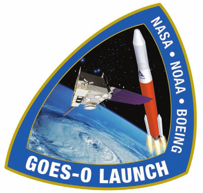
GOES-O Mission Overview
|
|
|
- Imogene Barrett
- 5 years ago
- Views:
Transcription

1
2
3 Introduction The Boeing Company and United Launch Alliance are pleased to launch the GOES-O satellite, the second spacecraft in a new series of Geostationary Operational Environmental Satellites that will provide advanced Earth observation technology to enhance America s safety and economic security. The launch of GOES-O is the culmination of a strong partnership among Boeing Integrated Defense Systems, NASA, United Launch Alliance, and the National Oceanic and Atmospheric Administration (NOAA). The GOES team includes thousands of people across the country who have dedicated a substantial portion of their careers to making this program a success. The multimission GOES series will be a vital contributor to weather, solar, and space operations and science. On board GOES-O will be a highly advanced attitude control system that will foster enhanced instrument performance for improved weather service quality. GOES-O data will add to the global climate change databases of knowledge, embracing many civil and Government environmental forecasting organizations that work to benefit people everywhere and help save lives. GOES-O will be launched aboard a Delta IV Medium+ (4,2) configuration launch vehicle from Space Launch Complex 37B at Cape Canaveral Air Force Station (CCAFS), Fla., and will be the fourth flight of this configuration and the tenth flight of the Delta IV family of launch vehicles. United Launch Alliance provides the Delta IV launch vehicle and mission services under a commercial contract administered by Boeing Launch Services. The GOES-O satellite is manufactured by Boeing s Space and Intelligence Systems. GOES-O will be the second NASA spacecraft to launch on the Delta IV launch vehicle family. Our congratulations to the entire Boeing, ULA, NASA, and NOAA team for your dedicated efforts in achieving this milestone and our thanks to NASA for selecting Boeing. Ken Heinly Director, Boeing Launch Products & Services The Boeing Company Michael Gass President and Chief Executive Officer United Launch Alliance 1
 Goddard Space Flight Center selected Boeing s satellite manufacturing business, located in El Segundo, Calif., for the GOES N P contract award.")
4 GOES-O Mission Overview The multimission Geostationary Operational Environmental Satellites (GOES) series N through P will be a vital contributor to weather, solar, and space operations and science. The National Aeronautics and Space Administration (NASA) Goddard Space Flight Center selected Boeing s satellite manufacturing business, located in El Segundo, Calif., for the GOES N P contract award. NASA and the National Oceanic and Atmospheric Administration (NOAA) are actively engaged in a cooperative program to expand the existing GOES system, beginning with the launch of the GOES-N satellite. Goddard is responsible for procuring, developing, and testing the spacecraft, instruments, and unique ground equipment for the next generation of Earth-observation satellites. NOAA is responsible for the overall program, funding, system in-orbit operation, and identification of satellite replacement needs. NOAA has operational responsibility for the ground system needed to process and disseminate data from the GOES-O satellite sensors. 2
 configuration launch vehicle.")
5 GOES-O Mission Overview Continued The second of the next-generation GOES space systems, the GOES-O NASA and NOAA mission represents the best of mission integration as Boeing Space & Intelligence Systems and Boeing Launch Services launch the Boeing 601 satellite on board a United Launch Alliance Delta IV Medium+ (4,2) configuration launch vehicle. GOES-O will provide more accurate prediction and tracking of severe storms and other weather phenomena, resulting in earlier and more precise warnings to the public. Supporting NOAA and NASA scientists collecting and analyzing real-time environmental data, as well as the US Coast Guard searching the open seas, GOES-O stands ready as the most advanced multimission weather and Earth-observation satellite ever built for NOAA geosynchronous operations. 3

6 GOES-O Mission Overview Continued GOES-O will provide enhanced weather monitoring and prediction capability, communications subsystems to rebroadcast data, and space environmental monitoring instruments and sensors from an operational orbital slot of 75 deg or 135 deg West. In addition, the satellite will provide more accurate location of severe storms and other weather phenomena, resulting in earlier and more precise warnings to the public. 4

7 Search and Rescue GOES-O is designed with links that include a search-and-rescue capability to detect distress signals from maritime vessels and aircraft. The added capability allows emergency responders to obtain accurate, real-time information quickly and enables them to deploy appropriate resources to save lives. 5

8 GOES-O Satellite The three-axis Boeing 601 body-stabilized spacecraft design is equipped to enable the GOES-O primary sensors to stare at Earth, allowing the instruments to continuously image clouds and monitor Earth s surface and atmospheric temperatures. The satellite capability of the Boeing 601 enables tracking of atmospheric phenomena, ensuring real-time coverage of short-lived dynamic events, such as severe local storms and tropical hurricanes and cyclones, two types of meteorological events that directly affect public safety, property, and ultimately, economic health and development. 6
9 GOES-O Satellite Continued Payload Power S-Band L-Band UHF One downlink Five uplinks Seven downlinks One downlink Two uplinks Solar Beginning of life End of life Panels 2.3 kw 2 kw One wing, with one panel of dual-junction, gallium arsenide solar cells Batteries 24-cell NiH 2, 123 Ah Propulsion Liquid apogee motor 110 lbf (490 N) Stationkeeping thruster 12 x 2 lbf (9 N) (bipropellant) Antennas Two S-band, cup-shaped with dipole One Omni antenna (aft) One UHF, cup-shaped with dipole 2 L-band cup-shaped with dipole One S-band horn Dimensions In Orbit L, solar array: 26 ft 9 in (8.2 m) W, antenna: 7 ft 4 in x 11 ft (2.25 m x 3.37 m) Stowed H: 12 ft (3.63 m) W: 7 ft 4 in x 11 ft (2.25 m x 3.37 m) Weights Launch 7,080 lb (3,211 kg) In orbit 4,805 lb (2,180 kg) (beginning of life) 7
10 Spacecraft Instruments Imager The terrestrial imager is a multispectral five-channel instrument that produces visible and infrared images of Earth s surface, oceans, cloud cover, and severe storm developments. Sounder The multispectral sounder provides vertical temperature and moisture profiles of the atmosphere, augmenting data from the imager. Sounder data are also used in computer models, which produce mid- and long-range weather forecasts. Solar X-ray Imager In addition to the terrestrial imager, GOES-O incorporates a sophisticated solar X-ray imager that will monitor the Sun s X-rays for the early detection of solar flares and other phenomena. This early warning is important because solar flares affect not only the safety of humans in high-altitude missions, such as human spaceflight, but also military and commercial satellite communications. Space Environmental Monitoring The GOES-O satellite is equipped with space environmental monitoring instruments, which monitor X-rays, extreme ultraviolet, and particle emissions including solar protons, alpha particles, and electrons. These space environmental monitoring instruments include a magnetometer that samples the Earth s magnetosphere. 8

11 Star Tracker The GOES O spacecraft will improve image accuracy by a factor of four using a geosynchronous star sensor attitude determination and control system. The star trackers act like small cameras. Two primary sensors and one backup, angled wide (approximately 120 deg) apart, constantly observe their portion of the sky and select the five brightest stars in view. Every 1/10th sec, the trackers send their current collection of five stars to the spacecraft s onboard computer. Factoring the time of day, the computer identifies the readings from its catalog of 5,000 known stars and determines the exact spacecraft position. The onboard computer calculates the difference between the reported star positions and their predicted positions. The computer applies this difference, along with angular rate information from the inertial reference units, to direct speed changes in the four reaction wheels that reorient the spacecraft to the precise desired attitude. The result is a steady, precisely pointed observation bench that enables the instruments to achieve maximum pointing accuracy. 9
 LH 2 tank LO 2 tank Interstage Composite fairing LH 2 tank Solid rocket motors (GEM-60)")
12 Delta IV M+ (4,2) Launch Vehicle Composite fairing GOES-O Second stage, 4-m diameter (RL10B-2 engine) LO 2 tank Avionics PAF First stage (RS-68 engine) LH 2 tank LO 2 tank Interstage Composite fairing LH 2 tank Solid rocket motors (GEM-60) 10
13 GOES-O Mission Description Launch date... June/July 2009 GOES-O final orbit target Orbit apogee altitude... 18,994 nm Orbit perigee altitude... 3,576 nm Inclination deg Launch window (EDT)... Date Open Close Duration Date Open Close Duration 6/26/ :14 19:14 1:00 7/14/ :16 19:16 1:00 6/27/ :14 19:14 1:00 7/15/ :17 19:17 1:00 6/28/ :15 19:15 1:00 7/16/ :17 19:17 1:00 6/29/ :15 19:15 1:00 7/17/ :18 19:18 1:00 6/30/ :15 19:15 1:00 7/18/ :18 19:18 1:00 7/1/ :15 19:15 1:00 7/19/ :18 19:18 1:00 7/2/ :15 19:15 1:00 7/20/ :19 19:19 1:00 7/3/ :15 19:15 1:00 7/21/ :20 19:20 1:00 7/4/ :15 19:15 1:00 7/22/ :20 19:20 1:00 7/5/ :15 19:15 1:00 7/23/ :20 19:20 1:00 7/6/ :15 19:15 1:00 7/24/ :21 19:21 1:00 7/7/ :15 19:15 1:00 7/25/ :22 19:22 1:00 7/8/ :15 19:15 1:00 7/26/ :22 19:22 1:00 7/9/ :15 19:15 1:00 7/27/ :23 19:23 1:00 7/10/ :15 19:15 1:00 7/28/ :23 19:23 1:00 7/11/ :15 19:15 1:00 7/29/ :24 19:24 1:00 7/12/ :15 19:15 1:00 7/30/ :24 19:24 1:00 7/13/ :16 19:16 1:00 7/31/ :25 19:25 1:00 11
14 Flight Mode Description Liftoff to SECO-1 The GOES-O spacecraft will be launched from the Eastern Range Space Launch Complex 37B at Cape Canaveral Air Force Station Flight azimuth of 95 deg Direct flight azimuth mode employed (combined pitch/yaw) Both GEMs ignited at liftoff Boost trajectory designed to meet controllability, structural, and environmental constraints while maximizing performance RS-68 engine begins to throttle down at 210 sec The time duration to throttle from 102 to 57% is 5 sec 3.99 g s nominal Main engine cutoff occurs at propellant depletion; approximately sec after liftoff Payload fairing jettisoned ~10 sec after second-stage ignition Free molecular heating rate is much less than maximum allowable Second-stage first burn inserts vehicle into a by nm orbit with an inclination of 28.4 deg at SECO-1 Total first burn time of ~470 sec Elevation angle from Antigua tracking station is 2.0 deg Slant range from Antigua tracking station is 808 nm 12
15 Sequence of Events Liftoff to SECO-1 Event Stage I Liftoff Begin Near-Zero Angle-of-Attack Flight Mach Number = 1.05 Maximum Dynamic Pressure (Two) GEM-60 Burnout (TVC Nozzle) Jettison (Two) GEM-60 Casings (TVC Nozzle) End Near-Zero Angle-of-Attack Flight Maximum Fairing Skin Temperature Initiate Booster Throttle-Down Maximum Axial Acceleration Booster Throttle at Minimum Power Level (MPL) FMHR = 360 Btu/ft 2 /hr Main Engine Cutoff End Main Engine Tailoff Stage I-II Separation Begin Prestart Chilldown Stage II Ignition Signal End Prestart Chilldown Jettision Fairing Ivory Coast IIP Standoff Longitude Last Point of IIP Trace Begin Post-SECO-1 Hydrazine Settling First Cutoff Stage II (SECO-1) Time (hr:min:sec) 00:00: :00: :00: :01: :01: :01: :02: :03: :03: :03: :03: :04: :04: :04: :04: :04: :04: :04: :04: :11: :12: :12: :12:37.4 Time (sec)
16 Flight Mode Description SECO-1 to SECO-2 Two hydrazine settling thrusters are on during the 568-sec coast period Continuous Venting System (CVS) is on from 2 sec after SECO-1 until 133 sec prior to first restart ignition (begin repressurization) Coast guidance mode reorients launch vehicle for first restart The first restart ignition occurs 628 sec after SECO-1 Pitch maneuver begins 6 sec into restart burn The first restart burn duration is ~243 sec, placing the vehicle in a nm by 18,459 nm orbit at 26.6-deg inclination 14
17 Sequence of Events SECO-1 to SECO-2 Event Time (hr:min:sec) Time (sec) First Cutoff Stage II (SECO-1) Begin LH 2 Boiloff/Propulsive Venting Hydrazine Settling Two Thrusters Off Begin Restart Burn Attitude Maneuver End LH 2 Boiloff/Propulsive Venting Hydrazine Settling All Four Thrusters On End Restart Burn Attitude Maneuver Begin Prestart Chilldown First Restart Stage II End Prestart Chilldown End Post-SECO-1 Hydrazine Settling Begin Stage II Restart 1 Pitch Program End Stage II Restart 1 Pitch Program Begin Post-SECO-2 Hydrazine Settling Second Cutoff Stage II (SECO-2) 00:12: :12: :13: :13: :20: :22: :22: :22: :23: :23: :23: :23: :27: :27: :27:
18 Flight Mode Description SECO-2 to SECO-3 Following SECO-2, vehicle reoriented to the required 90 +5/-15 deg with respect to (wrt) Sun line Passive Thermal Control (PTC) attitude Barbeque roll rate of deg/s for 6,039.5-sec duration followed 5 sec later by a barbeque roll rate of -1.3 deg/s for 6,033.5 sec 10 sec after the end of the PTC maneuver, a roll-pitch-yaw rate sequence is initiated to orient the vehicle to the second restart burn attitude Second restart ignition occurs at 15,001.0 sec after liftoff, within view of Diego Garcia and Guam tracking stations Second restart burn duration is ~56 sec, placing the vehicle in a 3,547 nm by 18,992 nm orbit at 12.1-deg inclination 16
19 Sequence of Events SECO-2 to SECO-3 Event Time (hr:min:sec) Time (sec) Second Cutoff Stage II (SECO-2) Begin LH 2 Boiloff/Propulsive Venting Hydrazine Settling Two Thrusters Off End Post-SECO-2 Hydrazine Settling End LH 2 Boiloff/Propulsive Venting Begin Coast Phase Roll Program Begin Passive Thermal Control (BBQ) Begin LH 2 Boiloff/Propulsive Venting End First Roll Rate Coast Phase Begin Second Roll Rate Coast Phase End Second Roll Rate Coast Phase Begin Prestart Hydrazine Settling End Passive Thermal Control (BBQ) Begin Restart Burn Attitude Maneuver End LH 2 Boiloff/Propulsive Venting End Restart Burn Attitude Maneuver Begin Prestart Chilldown Hydrazine Settling All Four Thrusters On Second Restart Stage II End Prestart Chilldown End Prestart Hydrazine Settling Begin Post-SECO-3 Hydrazine Settling Third Cutoff Stage II (SECO-3) 00:27: :27: :27: :35: :35: :36: :36: :40: :17: :17: :58: :58: :58: :58: :04: :05: :05: :08: :10: :10: :10: :10: :10:
20 Flight Mode Description SECO-3 to Spacecraft Separation 30 sec after SECO-3, a pitch-yaw maneuver (coast guidance) starts, which begins to orient the vehicle to the required spacecraft separation attitude Maneuver performed under zero axial thrust condition to allow the propellants to float freely and quench the hot tank walls 80.5 sec after SECO-3, a roll-pitch-yaw maneuver (coast guidance) begins to complete reorientation to the required separation attitude Low relief venting is disabled 2.0 sec prior to payload separation; venting was enabled after completion of reorientation maneuver Payload separation occurs 630 sec after SECO-3 at the required attitude and within view of Diego Garcia and Guam tracking stations Time after liftoff: 15, sec Apogee altitude: 18,994 nautical mile (nm) Perigee altitude: 3,576 nm Inclination: 12.0 deg 18
21 Sequence of Events SECO-3 to Spacecraft Separation Event Third Cutoff Stage II (SECO-3) Begin LH 2 Boiloff/Propulsive Venting End Post-SECO-3 Hydrazine Settling End LH 2 Boiloff/Propulsive Venting Begin Separation Attitude Maneuver End Separation Attitude Maneuver Begin Hydrazine Settling Two Thrusters On Begin LH 2 Boiloff/Propulsive Venting Begin Spacecraft Spinup Maneuver Begin Fourth Roll Rate Coast Phase Begin Fifth Roll Rate Coast Phase Begin Sixth Roll Rate Coast Phase Begin Seventh Roll Rate Coast Phase Begin Eighth Roll Rate Coast Phase End LH 2 Boiloff/Propulsive Venting End Hydrazine Settling Spacecraft Separation Time (hr:min:sec) 04:10: :10: :11: :11: :11: :16: :16: :16: :17: :17: :17: :17: :18: :18: :21: :21: :21:26.5 Time (sec)
22 Instantaneous Impact Point Trace 75 N 60 N 45 N Latitude (deg) 30 N 15 N 0 15 S 30 S (MECO) X X 500 X X 729 X 734 X 738 X X (orbit) 45 S 60 S 75 S Flight Time (sec) 90 W 30 W 30 E Longitude (deg) 90 E 150 E 20
 192 kbps (GTS) Major Events 1 MECO (266.7) 2 Stage II Burn 1 Ign (287.1) 3 SECO-1 (757.4) 4 Stage II Burn 2 Ign (1385.1) 5 SECO-2 (1627.")
23 GOES-O Orbit Trace Latitude (deg) 75 N 60 N 45 N 30 N 15 N 0 15 S 30 S 45 S 60 S TEL-4 XX 1,2 ANT 3 X X 4 Telemetry Station Identification TEL-4 Eastern Range KSC ANT Eastern Range Antigua GTS AFSCN Range Guam X MBPS 192 kbps (TDRSS) 192 kbps (GTS) Major Events 1 MECO (266.7) 2 Stage II Burn 1 Ign (287.1) 3 SECO-1 (757.4) 4 Stage II Burn 2 Ign (1385.1) 5 SECO-2 (1627.6) 6 Optimize for GTS (3756.5) 7 2nd Restart Ign ( ) 8 SECO-3 ( ) 9 S/C Separation ( ) 10 S/C at 1st Apogee ( ) GTS AOS 10 X 9 X 87 X 6 X GTS 75 S 90 W 30 W 30 E Longitude (deg) 90 E 150 E 21
24 Second-Stage Ignition t = sec Alt = 86.5 nm Range = nm V = 17,677 ft/s MECO t = sec Alt = 77.6 nm Range = nm V = 17,683 ft/s Liftoff (Ignite both GEM-60s) GOES-O Flight Profile Fairing Jettison t = sec Alt = 90.6 nm Range = nm V = 17,745 ft/s Jettison Two GEM-60s t = sec Alt = 17.2 nm Range = 13.4 nm V = 4,376 ft/s First Restart Ignition t = 1,385.1 sec Alt = nm Range = 4,231.8 nm V = 25,930 ft/s SECO-1 t = sec Alt = nm Range = 1,776.5 nm V = 25,778 ft/s Orbit = 101 x 299 nm at 28.4 deg Spacecraft Separation t = 15,686.0 sec Alt = 17,812.5 nm Range = 9,248.3 nm V = 7,790 ft/s Orbit = 3,576 x 18,994 nm at 12 deg SECO-2 t = 1,627.6 sec Alt = nm Range = 5,310.8 nm V = 33,360 ft/s Orbit = 109 x 18,459 nm at 26.6 deg Second Restart Ignition t = 15,001.0 sec Alt = 17,523.2 nm Range = 9,260.6 nm V = 6,292 ft/s SECO-3 t = 15,056.5 sec Alt = 17,547.7 nm Range = 9,259.5 nm V = 7,954 ft/s 22
25 Delta IV M+ (4,2) GOES-O Mission Profile Begin CCAM t = 16,055 sec (4 hr 27.6 min) GOES-O Separation t = 15,687 sec (4 hr 21.4 min) SECO-3 t = 15,057 sec (4 hr 10.9 min) End CCAM t = 16,195 sec (4 hr 29.9 min) 3,557 x 18,981 nm Inc = 12 deg SECO-1 t = sec (12.6 min) Transfer Orbit 3.7-hr coast SECO-2 t = 1,628 sec (27.1 min) Disposal Orbit 3,559 x 18,981 nm Inc = 12.9 deg Final Orbit 3,576 x 18,994 nm Inc = 12 deg 23
26 Terminal Count, T-0 Day CCAFS GOES-O Mission L-Hour L-8:00 L-7:00 L-6:00 L-5:00 L-4:00 L-3:00 L-2:00 L-1:00 T-00:05 EDT T-Hour T-05:15 T-05:15 T-04:00 T-03:00 T-02:00 T-01:00 T-00:05 8:00 AM 9:00 AM 10:00 AM 11:00 AM 12:00 PM 1:00 PM 2:00 PM 3:00 PM 4:00 PM 5:00 PM 6:00 PM 7:00 PM 8:00 PM 9:00 PM Final Pad Clear (Task 1) Test Initiation Avionics and Data Interrupt Test Hold-Fire Checks Propulsion Preloading Valve Functional 60-min Built-in Hold Weather Briefing C-Band Beacon, Range Interrogation Call to Stations/Pre-Task Briefing Pad Clear (Required) Post-Pad Clear Propellant Loading Prep (Hydraulics On, Low Flow Purge, ECU Bit Test) SS Pre-Loading Purge Cycles CBC and US GHe Bottle Final Pressurization CBC LO 2 Chill CBC LO 2 Fill CBC LO 2 APC, Vent/Relief, and POGO Tests LH 2 Storage Tank Pressurization CBC LH 2 Tank Cold Gas Chilldown CBC LH 2 Slowfill CBC LH 2 Fastfill CBC LH 2 Tank APC/VR Test SS LO 2 Chill SS LO 2 Fill SS LO 2 APC Test SS LH 2 Chill SS LH 2 Fill SS LH 2 APC Test RF Link Checks CRD Open-Loop Testing Flight Slews Load Relief Wind Data Loading 15-min Built-in Hold T-5 T-0 Launch Window (1 hr 0 m)


27 Delta IV Hardware Flow at Eastern Range Delta Mariner delivers CBCs, 4-m upper stage, and 4-m fairings to launch site GEM-60 solid rocket motors transportation to launch pad Horizontal integration and testing of CBC and second stage Transport to launch pad Erect vehicle on launch pad Payload encapsulation in parallel with Delta IV vehicle processing GEM-60s attached to launch vehicle Erect and store fairing Install payload attach fitting on buildup stand Integrate payload to PAF and perform integrated checkout Payload processing facility Prepare fairing bisectors for payload encapsulation Encapsulate payload Transport payload to launch pad Payload lifted by crane and attached to launch vehicle Launch 25
28 Notes: 26
29
30 Boeing Launch Services 5301 Bolsa Avenue, Huntington Beach, CA
MISSION OVERVIEW SLC-37 CCAFS, FL
 MISSION OVERVIEW SLC-37 CCAFS, FL The ULA team is proud to be the launch provider for the U.S. Air Force (USAF) Global Positioning System (GPS) Directorate by delivering replenishment satellites aboard
GPS IIR-18 (M) U.S. Air Force. Delta Launch Vehicle Programs
 U.S. Air Force. Delta Launch Vehicle Programs") GPS IIR-18 (M) U.S. Air Force Delta Launch Vehicle Programs GPS IIR-18 (M) The Delta team is proud to be the launch provider for the Air Force Global Positioning System (GPS) program by delivering replenishment
GPS IIR-18 (M) U.S. Air Force Delta Launch Vehicle Programs GPS IIR-18 (M) The Delta team is proud to be the launch provider for the Air Force Global Positioning System (GPS) program by delivering replenishment
Ocean Surface Topography Mission (OSTM/Jason-2)
") Ocean Surface Topography Mission (OSTM/Jason-2) Mission Overview Delta II 7320 Vandenberg Air Force Base, CA Space Launch Complex-2 West OSTM United Launch Alliance (ULA) is proud to launch the OSTM/Jason-2
Ocean Surface Topography Mission (OSTM/Jason-2) Mission Overview Delta II 7320 Vandenberg Air Force Base, CA Space Launch Complex-2 West OSTM United Launch Alliance (ULA) is proud to launch the OSTM/Jason-2
CubeSat Integration into the Space Situational Awareness Architecture
 CubeSat Integration into the Space Situational Awareness Architecture Keith Morris, Chris Rice, Mark Wolfson Lockheed Martin Space Systems Company 12257 S. Wadsworth Blvd. Mailstop S6040 Littleton, CO
Atlas V Launches WGS SV-1
 Atlas V Launches WGS SV-1 AV-011/WGS SV-1 United Launch Alliance is proud to be a part of the WGS SV-1 mission with the U.S. Air Force Space Command's Space and Missile Systems Center (USAF/SMC). The WGS
CubeSat Proximity Operations Demonstration (CPOD) Mission Update Cal Poly CubeSat Workshop San Luis Obispo, CA
 Mission Update Cal Poly CubeSat Workshop San Luis Obispo, CA") CubeSat Proximity Operations Demonstration (CPOD) Mission Update Cal Poly CubeSat Workshop San Luis Obispo, CA 04-22-2015 Austin Williams VP, Space Vehicles ConOps Overview - Designed to Maximize Mission
CubeSat Proximity Operations Demonstration (CPOD) Mission Update Cal Poly CubeSat Workshop San Luis Obispo, CA 04-22-2015 Austin Williams VP, Space Vehicles ConOps Overview - Designed to Maximize Mission
CubeSat Proximity Operations Demonstration (CPOD) Vehicle Avionics and Design
 Vehicle Avionics and Design") CubeSat Proximity Operations Demonstration (CPOD) Vehicle Avionics and Design August CubeSat Workshop 2015 Austin Williams VP, Space Vehicles CPOD: Big Capability in a Small Package Communications ADCS
CubeSat Proximity Operations Demonstration (CPOD) Vehicle Avionics and Design August CubeSat Workshop 2015 Austin Williams VP, Space Vehicles CPOD: Big Capability in a Small Package Communications ADCS
world leader in capacity, performance and costefficiency.
 Boeing 702 Fleet 01PR 01507 High resolution image available here Satellite operators have responded enthusiastically to the vastly increased capabilities represented by the Boeing 702. Boeing Satellite
Satellite Testing. Prepared by. A.Kaviyarasu Assistant Professor Department of Aerospace Engineering Madras Institute Of Technology Chromepet, Chennai
 Satellite Testing Prepared by A.Kaviyarasu Assistant Professor Department of Aerospace Engineering Madras Institute Of Technology Chromepet, Chennai @copyright Solar Panel Deployment Test Spacecraft operating
The Evolution of Nano-Satellite Proximity Operations In-Space Inspection Workshop 2017
 The Evolution of Nano-Satellite Proximity Operations 02-01-2017 In-Space Inspection Workshop 2017 Tyvak Introduction We develop miniaturized custom spacecraft, launch solutions, and aerospace technologies
CGMS-37, NOAA-WP-33 Prepared by NOAA Agenda Item: IV/1 Discussed in WG IV
 Prepared by NOAA Agenda Item: IV/1 Discussed in WG IV NOAA-WP-33 provides a status of its Geostationary Operational Environmental Satellite Series R (GOES-R). and polar-orbiting satellite constellations.
The Nemo Bus: A Third Generation Nanosatellite Bus for Earth Monitoring and Observation
 The Nemo Bus: A Third Generation Nanosatellite Bus for Earth Monitoring and Observation FREDDY M. PRANAJAYA Manager, Advanced Systems Group S P A C E F L I G H T L A B O R A T O R Y University of Toronto
FRL's Demonstration and Science Experiments (DSX) rogram Quest for the Common Micro Satellite Bus
 rogram Quest for the Common Micro Satellite Bus") FRL's Demonstration and Science Experiments (DSX) rogram Quest for the Common Micro Satellite Bus 21st Annual Conference on Small Satellites August 13-16, 16, 2007 Logan, Utah N. Greg Heinsohn DSX HSB
FRL's Demonstration and Science Experiments (DSX) rogram Quest for the Common Micro Satellite Bus 21st Annual Conference on Small Satellites August 13-16, 16, 2007 Logan, Utah N. Greg Heinsohn DSX HSB
HYDROS Development of a CubeSat Water Electrolysis Propulsion System
 HYDROS Development of a CubeSat Water Electrolysis Propulsion System Vince Ethier, Lenny Paritsky, Todd Moser, Jeffrey Slostad, Robert Hoyt Tethers Unlimited, Inc 11711 N. Creek Pkwy S., Suite D113, Bothell,
Worst-Case GPS Constellation for Testing Navigation at Geosynchronous Orbit for GOES-R
 Worst-Case GPS Constellation for Testing Navigation at Geosynchronous Orbit for GOES-R Kristin Larson, Dave Gaylor, and Stephen Winkler Emergent Space Technologies and Lockheed Martin Space Systems 36
Small Satellites: The Execution and Launch of a GPS Radio Occultation Instrument in a 6U Nanosatellite
 Small Satellites: The Execution and Launch of a GPS Radio Occultation Instrument in a 6U Nanosatellite Dave Williamson Director, Strategic Programs Tyvak Tyvak: Satellite Solutions for Multiple Organizations
NEPTUNE 30. Micro Satellite Launch Vehicle. Interorbital Systems
 NEPTUNE 30 Micro Satellite Launch Vehicle : Mojave California Liquid Rocket Engine Tests IOS Areas of Specialization Orbital Launch Vehicles Sea Star TSAAHTO Micro Satellite Launch Vehicle (MSLV) Neptune
HEMERA Constellation of passive SAR-based micro-satellites for a Master/Slave configuration
 HEMERA Constellation of passive SAR-based micro-satellites for a Master/Slave HEMERA Team Members: Andrea Bellome, Giulia Broggi, Luca Collettini, Davide Di Ienno, Edoardo Fornari, Leandro Lucchese, Andrea
CHAPTER 6 ENVIRONMENTAL CONDITIONS
 CHAPTER 6 ENVIRONMENTAL CONDITIONS 6.1 Summary This Chapter provides the natural environment at Xichang Satellite Launch Center (XSLC), the thermal environment during satellite processing, the thermal
Microsatellite Constellation for Earth Observation in the Thermal Infrared Region
 Microsatellite Constellation for Earth Observation in the Thermal Infrared Region Federico Bacci di Capaci Nicola Melega, Alessandro Tambini, Valentino Fabbri, Davide Cinarelli Observation Index 1. Introduction
This is an example of a Class 3 FAA/AST submittal package.
 This is an example of a Class 3 FAA/AST submittal package. It is ONLY a guideline. It will not guarantee either acceptance or approval by the FAA. Your project may require more or less information based
The STU-2 CubeSat Mission and In-Orbit Test Results
 30 th Annual AIAA/USU Conference on Small Satellite SSC16-III-09 The STU-2 CubeSat Mission and In-Orbit Test Results Shufan Wu, Wen Chen, Caixia Chao Shanghai Engineering Centre for Microsatellites 99
NanoRacks Customer Payloads on Orbital-ATK-9
 NanoRacks Customer Payloads on Orbital-ATK-9 NANORACKS CUBESAT DEPLOYER (INTERNATIONAL SPACE STATION) NASA ELaNa 23, CubeRRT Ohio State University, Columbus, Ohio 6U CubeRRT will be delivered by the Orbital
WHAT IS A CUBESAT? DragonSat-1 (1U CubeSat)
") 1 WHAT IS A CUBESAT? Miniaturized satellites classified according to height (10-30 cm) Purpose is to perform small spacecraft experiments. Use has increased due to relatively low cost DragonSat-1 (1U CubeSat)
1 WHAT IS A CUBESAT? Miniaturized satellites classified according to height (10-30 cm) Purpose is to perform small spacecraft experiments. Use has increased due to relatively low cost DragonSat-1 (1U CubeSat)
INTRODUCTION The validity of dissertation Object of investigation Subject of investigation The purpose: of the tasks The novelty:
 INTRODUCTION The validity of dissertation. According to the federal target program "Maintenance, development and use of the GLONASS system for 2012-2020 years the following challenges were determined:
Sensor Technologies and Sensor Materials for Small Satellite Missions related to Disaster Management CANEUS Indo-US Cooperation
 Sensor Technologies and Sensor Materials for Small Satellite Missions related to Disaster Management CANEUS Indo-US Cooperation Suraj Rawal, Lockheed Martin Space Systems Co., USA G. Mohan Rao, Indian
Proximity Operations Nano-Satellite Flight Demonstration (PONSFD) Overview
 Overview") Proximity Operations Nano-Satellite Flight Demonstration (PONSFD) Overview April 25 th, 2013 Scott MacGillivray, President Tyvak Nano-Satellite Systems LLC 15265 Alton Parkway, Suite 200 Irvine, CA 92618-2606
Proximity Operations Nano-Satellite Flight Demonstration (PONSFD) Overview April 25 th, 2013 Scott MacGillivray, President Tyvak Nano-Satellite Systems LLC 15265 Alton Parkway, Suite 200 Irvine, CA 92618-2606
JWST Functional Flow Diagrams and Schematic Block Diagrams
 CC532 Collaborate System Design Fundamentals of Systems Engineering W6, Spring, 2012 KAIST JWST Functional Flow Diagrams and Schematic Block Diagrams 1 JWST Operational s and System Functional Breakdown
Primary POC: Prof. Hyochoong Bang Organization: Korea Advanced Institute of Science and Technology KAIST POC
 Title: Demonstration of Optical Stellar Interferometry with Near Earth Objects (NEO) using Laser Range Finder by a Nano Satellite Constellation: A Cost effective approach. Primary POC: Prof. Hyochoong
SPASIM: A SPACECRAFT SIMULATOR
 SPASIM: A SPACECRAFT SIMULATOR Carlos A. Liceaga NASA Langley Research Center 8 Langley Blvd., M/S 328 Hampton, VA 23681-0001 c.a.liceaga@larc.nasa.gov ABSTRACT The SPAcecraft SIMulator (SPASIM) simulates
Introduction. Satellite Research Centre (SaRC)
") SATELLITE RESEARCH CENTRE - SaRC Introduction The of NTU strives to be a centre of excellence in satellite research and training of students in innovative space missions. Its first milestone satellite
SATELLITE RESEARCH CENTRE - SaRC Introduction The of NTU strives to be a centre of excellence in satellite research and training of students in innovative space missions. Its first milestone satellite
Microwave Radiometers for Small Satellites
 Microwave Radiometers for Small Satellites Gregory Allan, Ayesha Hein, Zachary Lee, Weston Marlow, Kerri Cahoy MIT STAR Laboratory Daniel Cousins, William J. Blackwell MIT Lincoln Laboratory This work
; ; IR
 MS-2-2.5 SATELLITE The MS-2-2.5 satellite is designed for Earth Remote Sensing with the use of high resolution IR and multi-band imager. The satellite performs natural and man-caused disasters monitoring,
TELEMETRY, TRACKING, COMMAND AND MONITORING SYSTEM IN GEOSTATIONARY SATELLITE
 TELEMETRY, TRACKING, COMMAND AND MONITORING SYSTEM IN GEOSTATIONARY SATELLITE Alish 1, Ritambhara Pandey 2 1, 2 UG, Department of Electronics and Communication Engineering, Raj Kumar Goel Institute of
National Aeronautics and Space Administration Jet Propulsion Laboratory California Institute of Technology
 QuikSCAT Mission Status QuikSCAT Follow-on Mission 2 QuikSCAT instrument and spacecraft are healthy, but aging June 19, 2009 will be the 10 year launch anniversary We ve had two significant anomalies during
Lunar Exploration Communications Relay Microsatellite
 Lunar Exploration Communications Relay Microsatellite Paul Kolodziejski Andrews Space, Inc. 505 5 th Ave South, Suite 300 Seattle WA 98104 719-282-1978 pkolodziejski@andrews-space.com Steve Knowles Andrews
The NASA Optical Communication and Sensor Demonstration Program: An Update
 SSC14-VI-1 The NASA Optical Communication and Sensor Demonstration Program: An Update Siegfried W. Janson and Richard P. Welle The Aerospace Corporation August 5, 2014 2014 The Aerospace Corporation AeroCube-OCSD
AstroBus S, the high performance and competitive Small Satellites platform for Earth Observation
 AstroBus S, the high performance and competitive Small Satellites platform for Earth Observation Dr. Jean Cheganças 10th IAA Symposium on Small Satellites for Earth Observation April 20-24, 2015 Berlin,
B ==================================== C
 Satellite Space Segment Communication Frequencies Frequency Band (GHz) Band Uplink Crosslink Downlink Bandwidth ==================================== C 5.9-6.4 3.7 4.2 0.5 X 7.9-8.4 7.25-7.7575 0.5 Ku 14-14.5
3-Axis Attitude Determination and Control of the AeroCube-4 CubeSats
 3-Axis Attitude Determination and Control of the AeroCube-4 CubeSats Darren Rowen Rick Dolphus The Aerospace Corporation Vehicle Systems Division 10 August 2013 The Aerospace Corporation 2013 Topics AeroCube
Space Debris Mitigation Status of China s Launch Vehicle
 Space Debris Mitigation Status of China s Launch Vehicle SONG Qiang (Beijing Institute of Aerospace Systems Engineering) Abstract: China s launch vehicle has being developed for more than 40 years. Various
Mission Overview ELECTRON LOSSES AND FIELDS INVESTIGATION CubeSat Developers Workshop. University of California, Los Angeles April 25, 2013
 ELECTRON LOSSES AND FIELDS INVESTIGATION Mission Overview 2013 CubeSat Developers Workshop University of California, Los Angeles April 25, 2013 elfin@igpp.ucla.edu 1 Electron Losses and Fields Investigation
Satellite Fleet Operations Using a Global Ground Station Network. Naomi Kurahara Infostellar
 Satellite Fleet Operations Using a Global Ground Station Network Naomi Kurahara Infostellar 1 Japanese university satellites Image via University Space Engineering Consortium, http://unisec.jp/wp/wp-content/uploads/2016/06/unisec_satellites_160120_jp_s.jpg
Next Generation Geostationary Operational Environmental Satellite (GOES-R Series): A Space Segment Overview
: A Space Segment Overview") Next Generation Geostationary Operational Environmental Satellite (GOES-R Series): A Space Segment Overview Alexander Krimchansky a, Dino Machi b, Sandra A. Cauffman a, Martin A. Davis a a NASA Goddard
Next Generation Geostationary Operational Environmental Satellite (GOES-R Series): A Space Segment Overview Alexander Krimchansky a, Dino Machi b, Sandra A. Cauffman a, Martin A. Davis a a NASA Goddard
STRATEGIC CHOICES FOR SMALL AND MIDDLE POWERS
 Chapter Five STRATEGIC CHOICES FOR SMALL AND MIDDLE POWERS SPACE DEVELOPMENT IN KOREA Hong-Yul Paik, Director, Satellite Operation Center, Korea Aerospace Research Institute, South Korea Korea is a young
THE RESEARCH AND DEVELOPMENT OF THE USM NANOSATELLITE FOR REMOTE SENSING MISSION
 THE RESEARCH AND DEVELOPMENT OF THE USM NANOSATELLITE FOR REMOTE SENSING MISSION Md. Azlin Md. Said 1, Mohd Faizal Allaudin 2, Muhammad Shamsul Kamal Adnan 2, Mohd Helmi Othman 3, Nurulhusna Mohamad Kassim
First Results From the GPS Compact Total Electron Content Sensor (CTECS) on the PSSCT-2 Nanosat
 on the PSSCT-2 Nanosat") First Results From the GPS Compact Total Electron Content Sensor (CTECS) on the PSSCT-2 Nanosat Rebecca Bishop 1, David Hinkley 1, Daniel Stoffel 1, David Ping 1, Paul Straus 1, Timothy Burbaker 2 1 The
First Results From the GPS Compact Total Electron Content Sensor (CTECS) on the PSSCT-2 Nanosat Rebecca Bishop 1, David Hinkley 1, Daniel Stoffel 1, David Ping 1, Paul Straus 1, Timothy Burbaker 2 1 The
Polar Communications & Weather (PCW) Mission. Guennadi Kroupnik, Canadian Space Agency
 Mission. Guennadi Kroupnik, Canadian Space Agency") Polar Communications & Weather (PCW) Mission Guennadi Kroupnik, Canadian Space Agency Mission Objectives Reliable communications and navigations services in the high latitudes (North of 70º) to ensure:
Polar Communications & Weather (PCW) Mission Guennadi Kroupnik, Canadian Space Agency Mission Objectives Reliable communications and navigations services in the high latitudes (North of 70º) to ensure:
GLOBAL SATELLITE SYSTEM FOR MONITORING
 MEETING BETWEEN YUZHNOYE SDO AND HONEYWELL, International Astronautical Congress IAC-2012 DECEMBER 8, 2009 GLOBAL SATELLITE SYSTEM FOR MONITORING YUZHNOYE SDO PROPOSALS FOR COOPERATION WITH HONEYWELL EARTH
New Small Satellite Capabilities for Microwave Atmospheric Remote Sensing: The Earth Observing Nanosatellite- Microwave (EON-MW)
") New Small Satellite Capabilities for Microwave Atmospheric Remote Sensing: The Earth Observing Nanosatellite- Microwave (EON-MW) W. Blackwell, D. Cousins, and L. Fuhrman MIT Lincoln Laboratory August 6,
New Small Satellite Capabilities for Microwave Atmospheric Remote Sensing: The Earth Observing Nanosatellite- Microwave (EON-MW) W. Blackwell, D. Cousins, and L. Fuhrman MIT Lincoln Laboratory August 6,
Research by Ukraine of the near Earth space
 MEETING BETWEEN YUZHNOYE SDO AND HONEYWELL, DECEMBER 8, 2009 Research by Ukraine of the near Earth space YUZHNOYE SDO PROPOSALS 50 th session FOR of COOPERATION STSC COPUOS WITH HONEYWELL Vienna 11-22
Amateur Radio Satellites
 Amateur Radio Satellites An Introduction and Demo of AO-85 Eddie Pettis, N5JGK and Russ Tillman, K5NRK Presentation Outline History of Amateur Radio Satellites: Project OSCAR and AMSAT Amateur Radio Satellites
Solar Observing Low-frequency Array for Radio Astronomy (SOLARA)
") Solar Observing Low-frequency Array for Radio Astronomy (SOLARA) Exploring the last frontier of the EM spectrum Mary Knapp, Dr. Alessandra Babuscia, Rebecca Jensen-Clem, Francois Martel, Prof. Sara Seager
Solar Observing Low-frequency Array for Radio Astronomy (SOLARA) Exploring the last frontier of the EM spectrum Mary Knapp, Dr. Alessandra Babuscia, Rebecca Jensen-Clem, Francois Martel, Prof. Sara Seager
Integration and Test of the Microwave Radiometer Technology Acceleration (MiRaTA) CubeSat
 CubeSat") Integration and Test of the Microwave Radiometer Technology Acceleration (MiRaTA) CubeSat Kerri Cahoy, Gregory Allan, Ayesha Hein, Andrew Kennedy, Zachary Lee, Erin Main, Weston Marlow, Thomas Murphy MIT
Integration and Test of the Microwave Radiometer Technology Acceleration (MiRaTA) CubeSat Kerri Cahoy, Gregory Allan, Ayesha Hein, Andrew Kennedy, Zachary Lee, Erin Main, Weston Marlow, Thomas Murphy MIT
THE SPACE TECHNOLOGY RESEARCH VEHICLE 2 MEDIUM WAVE INFRA RED IMAGER
 THE SPACE TECHNOLOGY RESEARCH VEHICLE 2 MEDIUM WAVE INFRA RED IMAGER S J Cawley, S Murphy, A Willig and P S Godfree Space Department The Defence Evaluation and Research Agency Farnborough United Kingdom
Satellite Technology for Future Applications
 Satellite Technology for Future Applications WSRF Panel n 4 Dubai, 3 March 2010 Guy Perez VP Telecom Satellites Programs 1 Commercial in confidence / All rights reserved, 2010, Thales Alenia Space Content
EARTH OBSERVATION CONCEPT INVOLVING PORTABLE DATA RECEIVING AND PROCESSING EQUIPMENTS WOM-8 SYSTEM ABSTRACT
 EARTH OBSERVATION CONCEPT INVOLVING PORTABLE DATA RECEIVING AND PROCESSING EQUIPMENTS WOM-8 SYSTEM D~CIO CASTILHO CEBALLOS BRAZILIAN NATIONAL SPACE RESEARCH INSTITUTE P.O. BOX 515 - S.J. CAMPOS - SP BRAZIL
Dream Chaser Frequently Asked Questions
 Dream Chaser Frequently Asked Questions About the Dream Chaser Spacecraft Q: What is the Dream Chaser? A: Dream Chaser is a reusable, lifting-body spacecraft that provides a flexible and affordable space
Science and Technology SATellite Program of KOREA
 Science and Technology SATellite Program of KOREA November 2, 2004-1- Contents Introduction KITSAT (Korea Institute of Technology SATellite) STSAT (Science and Technology SATellite) KOMPSAT (KOrea( Multi-Purpose
Baumanets student micro-satellite
 Baumanets student micro-satellite Presentation at UNIVERSAT 2006 International Symposium June 28, 2006 Moscow, Russia Victoria Mayorova Director of Youth Space Center of Bauman Moscow State Technical University
AVSS Project. ENAE483 Fall 2012
 AVSS Project ENAE483 Fall 2012 Team D9: Jason Burr Vera Klimchenko Grant McLaughlin Johnathan Pino Link Budget Analysis Maximum Earth-Moon Transmission Distance R M D R M R e Moon 406,700 km Earth Ku Band
Moog CSA Engineering CubeSat Payload Accommodations and Propulsive Adapters. 11 th Annual CubeSat Developer s Workshop 25 April 2014
 Moog CSA Engineering CubeSat Payload Accommodations and Propulsive Adapters 11 th Annual CubeSat Developer s Workshop 25 April 2014 Joe Maly jmaly@moog.com Agenda CubeSat Wafer adapters for small launch
TanDEM-X. 1. Mission Overview. Science Meeting No SAR Imaging Modes & Performance 3. Satellite Design Overview 4. Launcher 5.
 TanDEM-X Science Meeting No. 1 Dresden 15.5.2006 Wolfgang Pitz EADS Astrium GmbH D-88039 Friedrichshafen 1. Mission Overview 2. SAR Imaging Modes & Performance 3. Satellite Design Overview 4. Launcher
EXACTVIEW-9: COMMISSIONING AND ON-ORBIT OPERATION OF A HIGH PERFORMANCE AIS NANOSATELLITE
 EXACTVIEW-9: COMMISSIONING AND ON-ORBIT OPERATION OF A HIGH PERFORMANCE AIS NANOSATELLITE Laura M. Bradbury (1), Nathan G. Orr (1), Maria Short (2), Niels Roth (1), Arunas Macikunas (2), Balaji Kumar (2),
A Technical Background of the ZACUBE-i Satellite Mission Series. Francois Visser
 A Technical Background of the ZACUBE-i Satellite Mission Series Francois Visser Agenda Roadmap In situ monitoring Remote sensing Space weather Enabling Infrastructure Ground station AIT Mission assurance
Satellite Sub-systems
 Satellite Sub-systems Although the main purpose of communication satellites is to provide communication services, meaning that the communication sub-system is the most important sub-system of a communication
PAYLOAD DESIGN FOR A MICROSATELLITE II. Aukai Kent Department of Mechanical Engineering University of Hawai i at Mānoa Honolulu, HI ABSTRACT
 PAYLOAD DESIGN FOR A MICROSATELLITE II Aukai Kent Department of Mechanical Engineering University of Hawai i at Mānoa Honolulu, HI 96822 ABSTRACT Conventional satellites are extremely large, highly expensive,
FORMOSAT-5. - Launch Campaign-
 1 FORMOSAT-5 - Launch Campaign- FORMOSAT-5 Launch Campaign 2 FORMOSAT-5 Launch Campaign Launch Date: 2017.08.24 U.S. Pacific Time Activities 11:50-12:23 Launch Window 13:30-16:00 Reception 3 FORMOSAT-5
CubeSat Solid Rocket Motor Propulsion Systems providing DVs greater than 500 m/s
 CubeSat Solid Rocket Motor Propulsion Systems providing DVs greater than 500 m/s Kevin L. Zondervan, Jerry Fuller, Darren Rowen, Brian Hardy, Chris Kobel, Shin-Hsing Chen, Phillip Morrison, Timothy Smith,
Implementation of three axis magnetic control mode for PISAT
 Implementation of three axis magnetic control mode for PISAT Shashank Nagesh Bhat, Arjun Haritsa Krishnamurthy Student, PES Institute of Technology, Bangalore Prof. Divya Rao, Prof. M. Mahendra Nayak CORI
Chapter 6 Part 3. Attitude Sensors. AERO 423 Fall 2004
 Chapter 6 Part 3 Attitude Sensors AERO 423 Fall 2004 Sensors The types of sensors used for attitude determination are: 1. horizon sensors (or conical Earth scanners), 2. sun sensors, 3. star sensors, 4.
A CubeSat-Based Optical Communication Network for Low Earth Orbit
 A CubeSat-Based Optical Communication Network for Low Earth Orbit Richard Welle, Alexander Utter, Todd Rose, Jerry Fuller, Kristin Gates, Benjamin Oakes, and Siegfried Janson The Aerospace Corporation
Information furnished in conformity with the Convention on Registration of Objects Launched into Outer Space
 United Nations Secretariat Distr.: General 9 September 2003 Original: English Committee on the Peaceful Uses of Outer Space Information furnished in conformity with the Convention on Registration of Objects
IT-SPINS Ionospheric Imaging Mission
 IT-SPINS Ionospheric Imaging Mission Rick Doe, SRI Gary Bust, Romina Nikoukar, APL Dave Klumpar, Kevin Zack, Matt Handley, MSU 14 th Annual CubeSat Dveloper s Workshop 26 April 2017 IT-SPINS Ionosphere-Thermosphere
Challenging, innovative and fascinating
 O3b 2.4m antennas operating in California. Photo courtesy Hung Tran, O3b Networks Challenging, innovative and fascinating The satellite communications industry is challenging, innovative and fascinating.
RAX: The Radio Aurora explorer
 RAX: Matt Bennett University of Michigan CubeSat Workshop Cal Poly, San Luis Obispo April 22 nd, 2009 Background Sponsored by National Science Foundation University of Michigan and SRI International Collaboration
DRONACHARYA GROUP OF INSTITUTIONS, GREATER NOIDA. SATELLITE COMMUNICATIONS (EEC 021) QUESTION BANK
 QUESTION BANK") DRONACHARYA GROUP OF INSTITUTIONS, GREATER NOIDA. SATELLITE COMMUNICATIONS (EEC 021) QUESTION BANK 1. Write the advantages and disadvantages of Satellite Communication. 2. Distinguish between active and
DRONACHARYA GROUP OF INSTITUTIONS, GREATER NOIDA. SATELLITE COMMUNICATIONS (EEC 021) QUESTION BANK 1. Write the advantages and disadvantages of Satellite Communication. 2. Distinguish between active and
X-band CubeSat Communication System Demonstration
 X-band CubeSat Communication System Demonstration Serhat Altunc, Obadiah Kegege, Steve Bundick, Harry Shaw, Scott Schaire, George Bussey, Gary Crum, Jacob C. Burke NASA Goddard Space Flight Center (GSFC)
GPS Field Experiment for Balloon-based Operation Vehicle
 GPS Field Experiment for Balloon-based Operation Vehicle P.J. Buist, S. Verhagen, Delft University of Technology T. Hashimoto, S. Sakai, N. Bando, JAXA p.j.buist@tudelft.nl 1 Objective of Paper This paper
TACSAT-2 Target Indicator Experiment (TIE) AIS Payload Overview
 AIS Payload Overview") TACSAT-2 Target Indicator Experiment (TIE) AIS Payload Overview 2007 Maritime Domain Awareness Forum 29 October 2007 NRL_2007-MDAF-29OCT-TIE.1 Christopher Huffine Technical Staff, Code 8120 Naval Research
TACSAT-2 Target Indicator Experiment (TIE) AIS Payload Overview 2007 Maritime Domain Awareness Forum 29 October 2007 NRL_2007-MDAF-29OCT-TIE.1 Christopher Huffine Technical Staff, Code 8120 Naval Research
From Single to Formation Flying CubeSats: An Update of the Delfi Programme
 From Single to Formation Flying CubeSats: An Update of the Delfi Programme Jian Guo, Jasper Bouwmeester & Eberhard Gill 1 Outline Introduction Delfi-C 3 Mission Delfi-n3Xt Mission Lessons Learned DelFFi
NCUBE: The first Norwegian Student Satellite. Presenters on the AAIA/USU SmallSat: Åge-Raymond Riise Eystein Sæther
 NCUBE: The first Norwegian Student Satellite Presenters on the AAIA/USU SmallSat: Åge-Raymond Riise Eystein Sæther Motivation Build space related competence within: mechanical engineering, electronics,
Sensor & Actuator. Bus system and Mission system
 & Masahiko Yamazaki Department of Aerospace Engineering, College of Science and Technology, Nihon University, Japan. What is sensor & actuator? 2. What is sensor & actuator as a satellite? Use case of
Open Source Design: Corvus-BC Spacecraft. Brian Cooper, Kyle Leveque 9 August 2015
 Open Source Design: Corvus-BC Spacecraft Brian Cooper, Kyle Leveque 9 August 2015 Introduction Corvus-BC 6U overview Subsystems to be open sourced Current development status Open sourced items Future Rollout
High Altitude Communications Platforms
 High Altitude Communications Platforms - new Opportunities in Air Space Management Alan C Smith ATN2004 - The ATC Data Link Conference at the Institution of Electrical Engineers, London 15th September,
CanX-2 and NTS Canada's Smallest Operational Satellites
 CanX-2 and NTS Canada's Smallest Operational Satellites Daniel D. Kekez Space Flight Laboratory University of Toronto Institute for Aerospace Studies 9 August 2008 Overview Introduction to UTIAS/ SFL Mission
Copyright 2012, The Aerospace Corporation, All rights reserved
 The Aerospace Corporation 2012 1 / 22 Aerospace PICOSAT Program Value 2 / 22 Perform Missions - two types: High risk for maximum return Use latest technology Create capability roadmap Risk reduction for
Robotics for Space Exploration Today and Tomorrow. Chris Scolese NASA Associate Administrator March 17, 2010
 Robotics for Space Exploration Today and Tomorrow Chris Scolese NASA Associate Administrator March 17, 2010 The Goal and The Problem Explore planetary surfaces with robotic vehicles Understand the environment
NOAA Satellite and Information Service National Environmental Satellite, Data, and Information Service (NESDIS)
") NOAA Satellite and Information Service National Environmental Satellite, Data, and Information Service (NESDIS) Status of Current and Future Systems (NOAA-WP-33) Presentation to CGMS-40 November 2012;
NOAA Satellite and Information Service National Environmental Satellite, Data, and Information Service (NESDIS) Status of Current and Future Systems (NOAA-WP-33) Presentation to CGMS-40 November 2012;
Analysis of Potential for Venus-Bound Cubesat Scientific Investigations
 Analysis of Potential for Venus-Bound Cubesat Scientific Investigations Image Sources: Earth Science and Remote Sensing Unit, NASA Johnson Space Center; JAXA / ISAS / DARTS / Damia Bouic / Elsevier inc.
On the Guidance and Control System of Epsilon Solid Rocket Launcher
 On the Guidance and Control System of Epsilon Solid Rocket Launcher Y. Morita, M. Tamura, N. Ishii, T. Yamamoto Japan Aerospace Exploration Agency H. Ohtsuka, Y. Segawa and K. Tanaka IHI Aerospace Abstract
Mission requirements and satellite overview
 Mission requirements and satellite overview E. BOUSSARIE 1 Dual concept Users need Defence needs Fulfil the Defence needs on confidentiality and security Civilian needs Fulfillment of the different needs
Nanosat Deorbit and Recovery System to Enable New Missions
 SSC11-X-3 Nanosat Deorbit and Recovery System to Enable New Missions Jason Andrews, Krissa Watry, Kevin Brown Andrews Space, Inc. 3415 S. 116th Street, Ste 123, Tukwila, WA 98168, (206) 342-9934 jandrews@andrews-space.com,
Free-flying Satellite Inspector
 Approved for Public Release (OTR 2017-00263) Free-flying Satellite Inspector In-Space Non-Destructive Inspection Technology Workshop January 31-February 2, 2017 Johnson Space Center, Houston, Tx David
ACTIVITY OF RUSSIAN FEDERATION ON SPACE DEBRIS PROBLEM
 FEDERAL SPACE AGENCY OF RUSSIA CENTRAL RESEARCH INSTITUTE OF MACHINE BUILDING ACTIVITY OF RUSSIAN FEDERATION ON SPACE DEBRIS PROBLEM 46-th session of the Scientific and Technical Subcommittee of the UN
Workshop on Intelligent System and Applications (ISA 17)
") Telemetry Mining for Space System Sara Abdelghafar Ahmed PhD student, Al-Azhar University Member of SRGE Workshop on Intelligent System and Applications (ISA 17) 13 May 2017 Workshop on Intelligent System
Telemetry Mining for Space System Sara Abdelghafar Ahmed PhD student, Al-Azhar University Member of SRGE Workshop on Intelligent System and Applications (ISA 17) 13 May 2017 Workshop on Intelligent System
ExoMars and Beyond. Thales Alenia Space. Feb 28th, 9:00 AM. Follow this and additional works at: https://commons.erau.edu/space-congress-proceedings
 The Space Congress Proceedings 2018 (45th) The Next Great Steps Feb 28th, 9:00 AM ExoMars and Beyond Thales Alenia Space Follow this and additional works at: https://commons.erau.edu/space-congress-proceedings
1. Detect and locate potentially illegal fishing ship using satellite image, AIS data, and external sources.
 Title: Development of Microsatellite to Detect Illegal Fishing MS-SAT Primary Point of Contact (POC) & email: Dr. Ridanto Eko Poetro; ridanto@ae.itb.ac.id Co-authors: Ernest Sebastian C., Bintang A.S.W.A.M.
Utilizing Nano Satellites for Water Monitoring for Nile River
 Utilizing Nano Satellites for Water Monitoring for Nile River November 23 rd, 2013 USER: Ashraf Nabil Rashwan, Cairo University, Egypt DEVELOPER: Ayumu Tokaji, University of Tokyo/Keio University, Japan
The FAST, Affordable, Science and Technology Satellite (FASTSAT) Mission
 Mission") The FAST, Affordable, Science and Technology Satellite (FASTSAT) Mission 27 th Year of AIAA/USU Conference on Small Satellites, Small Satellite Constellations: Strength in Numbers, Session X: Year in Review
The FAST, Affordable, Science and Technology Satellite (FASTSAT) Mission 27 th Year of AIAA/USU Conference on Small Satellites, Small Satellite Constellations: Strength in Numbers, Session X: Year in Review