Oil Spill Detection (OSD) by using X-band radar
|
|
|
- Reynard Kelly
- 6 years ago
- Views:
Transcription
1 Oil Spill Detection (OSD) by using X-band radar Ina Adegeest, Rutter Inc./ OceanWaveS GmbH, Germany


2 Head Office: Rutter Inc. Canadian company Head Office in St. John s, NL, Canada Incorporated in 1998 St. John s, Newfoundland Lunenburg Germany Since October 2012 Sales office in Germany Company specialized in oil spill, ice and small target detection sigma S6 Company specialized in real time wave and current monitoring - WaMoS II By using navigational radar Offering enhanced Radar systems to the Oil & Gas, Maritime Shipping, Seismic, Security sectors
3 sigma S6 applications Rutter Inc. - OceanWaveS GmbH Bonn Agreement Workshop,
4 sigma S6 applications Ice Target Oil Waves
5 sigma S6 application: OSD
6 What is the sigma S6 Radar System High Definition processing & imaging capability Connectable to conventional X-Band radar systems Either horizontally or vertically polarized Advanced clutter/ noise removal algorithms Motion compensation Enhanced display with control interface Stand alone or network capable Output standards/ data sharing for system data integration like command and control centres Data managed on Electronic Chart system

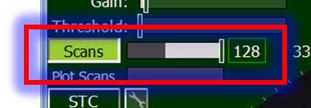
7 sigma S6 enhanced processing Full signal A/D conversion and 12-bit processing Scan-to-Scan Averaging and range of filters for significant clutter reduction (Pulse filtering, Sea/Rain (CFAR), STC) Dynamic Thresholding Enhanced 256 level display with controls interface designed for rapid learning and usage Dual channel Plot Extractor with Tracker for simultaneous tracking of slow and fast moving targets
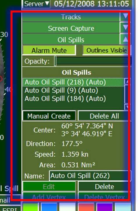
8 sigma S6 Oil Spill Detection Vessel, platform or shore-side installations Vessels can operate at speed with OSD still operating with no degradation Vessel based system can move with slick Oil slick detection: Detection is via signal processing, not image processing Lowers false positives/ alarms Multiple slicks detection Appearance of the sigma S6 interface is similar to that of conventional marine radars -> easy to use
9 sigma S6 Oil Spill Detection Capable of detecting a light ( mm) to silver sheen ( mm) 4 nm range of detection and tracking Minimum detection volume is 5L from oil in water test Maximum detection volume is unknown, but measured 1000L was noted volume during NOFO oil in water exercise
 Auto alerts with alarm Area and user")

10 Why Oil Spill Detection Radar Real-time detection and tracking of surface oil slicks Auto detection, tracking & outlining Tracking slick trajectories (Range, Bearing, Speed, Course) Auto alerts with alarm Area and user managed Volume estimation Day/night/ low visibility => 24/7 Minimal user intervention ESRI outlines sharing for GIS systems Screen capturing IR camera integration Wave and current measurements capable of being integrated
11 Types of Oil Incidents Detected Production Fluids Leaks during transfers Leaks from damaged or grounded vessels Bilge Dumping Leaks around trans-shipment or bunkering areas


12 How Does It Work Small breeze moving over water surface creates capillary waves X-band radars detect capillary waves from backscatter Oil dampens capillary wave formation, dampens backscatter and lowers signal return: surface anomaly


13 Oil Spill Detection & Response Oil slick detection on-board Norwegian Coastal Patrol Vessel KV HARSTAD Recommended Radar Configuration: X-Band, 25 kw, PRF ~ Hz ~1 Beam Width (>8ft), ~ 40 RPM Detection of Oil Spills with Marine Radars: oil is damping capillary waves this attenuates radar signal returns from sea clutter detection is possible from wind speed > 2-3kt out to > 4 NM / > 7 km signals must be motion compensated and averaged over many antenna revolutions oil spills are then presented as dark areas
14 sigma S6, Benefits Detect & track small and difficult to detect targets in sea clutter that standard IMO/Nav radars miss Use existing radar infrastructure where feasible: vessel, platform and shore Operational satisfactory for NOFO mode of operation (NOFO: Norwegian Clean Seas Association for Operating Companies ) Combinable with ICE Detection, Small Target Surveillance Detection (STS), and/or Wave/Surface Current Detection (WaMoS II)
15 sigma S6 Oil Spill Detection Radar Detects and tracks oil spills across the widest range of sea, weather and light conditions. The system incidentally is amazing. Picked up a slick in 5 to 8 foot seas with 35 knot winds and was 50 meters wide and a kilometer long. In the anchorages picks up bilge slicks at a distance of 6 to 8 miles which are invisible to the eye. Amazing. Thanks, Captain, OSRV vessel in Brasil, October 2011


16 sigma S6 system Existing radar sigma S6 Dedicated Radar
17 On-board sigma S6 Configuration
18 Radar Selection X-band radars are required due to wavelength characteristics Short pulse mode is required Platform 360-degree coverage Horizontal and Vertical Polarized Antenna
 Full integration of camera control in sigma S6 radar system Integrated video window Camera control in radar display Automatic target acquisition")
19 Rutter IR Camera Integration Integrate an IR camera into the sigma S6 for verification Either: Target info passed from sigma S6 Radar to IR camera, point camera Works with most any IR camera Or: State of the Art / FLIR IR (Voyager III or M-Series) Full integration of camera control in sigma S6 radar system Integrated video window Camera control in radar display Automatic target acquisition Click target to manually slew camera Slew to detected spill Point to detected spill 2015 FLIR Systems 2015 FLIR Systems

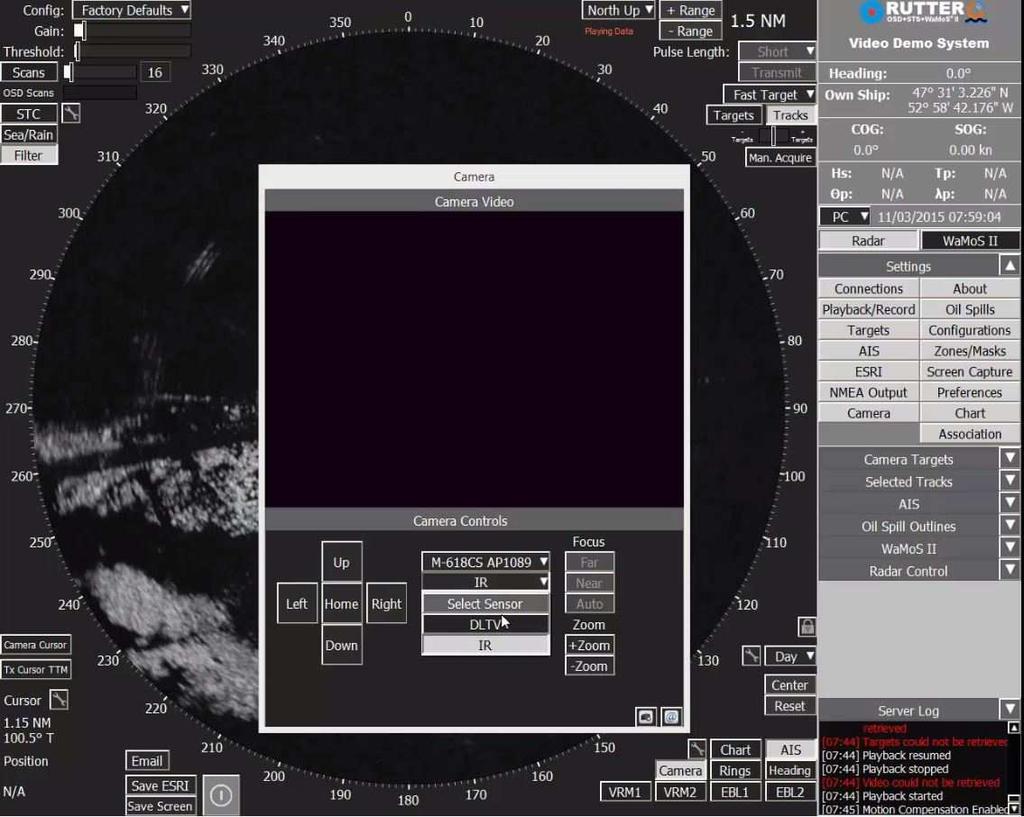
20 Rutter IR Camera Integration


21 Oil Appearance Layer Thickness Oil on Water Thickness < 5 µm 5 50 µm µm > 200 µm Concentration (m 3 / km 2 ) Human Eye < > 200 Sheen / Rainbow Metallic Transitional Dark or True Colour Dark or True Colour Sheen/ rainbow (<5 μm) Sigma S6 OSD w. X-Band Radar - > Visible Visible Visible Visible SECurus IR Camera Not visible grey - black black - white white True Colours (>200 μm) Interval (μm), litres per km²


22 Oil Spill Detection & Response Radar Sensor Signal & Image Processing Infrared & LLTV Sensors Effective Oil Spill Response requires 24 / 7 detection continued operation at night sharing of data and images with other vessels with a control center 2015 FLIR Systems
23 Data sharing/ Web interfacing sigmas6 Version 9.0 to be released June 2015 including system output of geospatial information Includes the following through a web interface: - Radar imaging via ogeotiff ojpeg opng - Targets/Plots, Tracks, Ice Outlines, Oil Spill Outlines, Wave & Current Information and User Annotations via ogml okml odxf oesri shape files


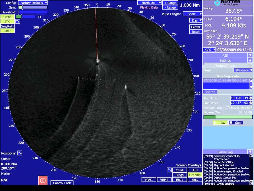
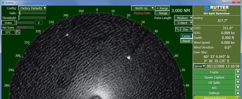
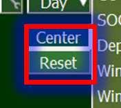
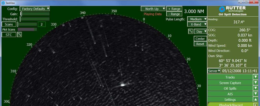
24 Playback Data, all functions are the same as for life operation
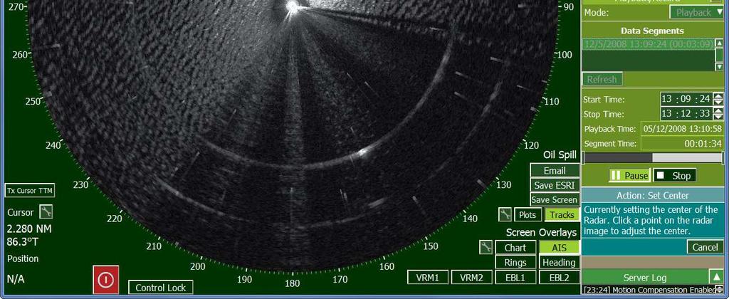
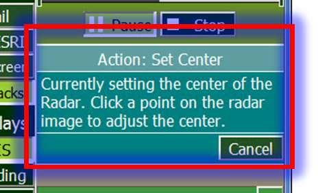
25 Off-Centering
26 Off-Centered

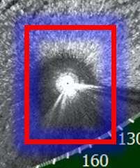
27 Scan Averaging Activated
28 Potential oil spill targets displayed

29 Oil Spill Target confirmed
30 Oil Spill 1 automatically outlined

31 Exclude areas of observation


32 False Alarm Zone generated

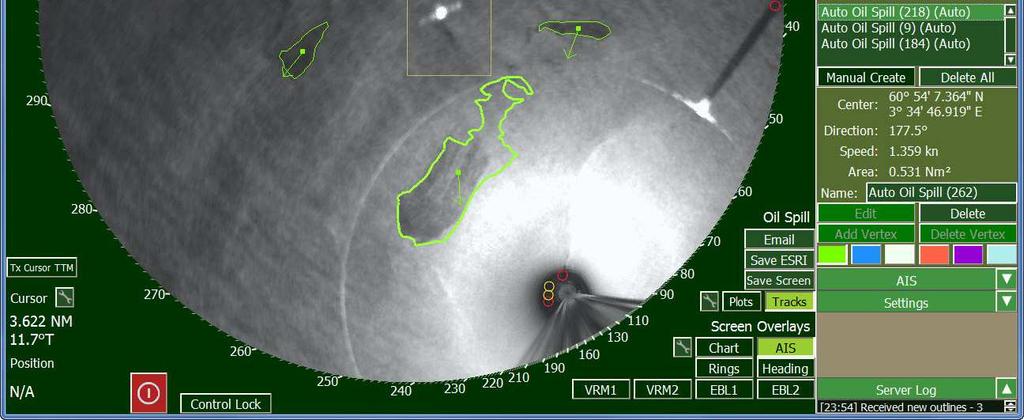
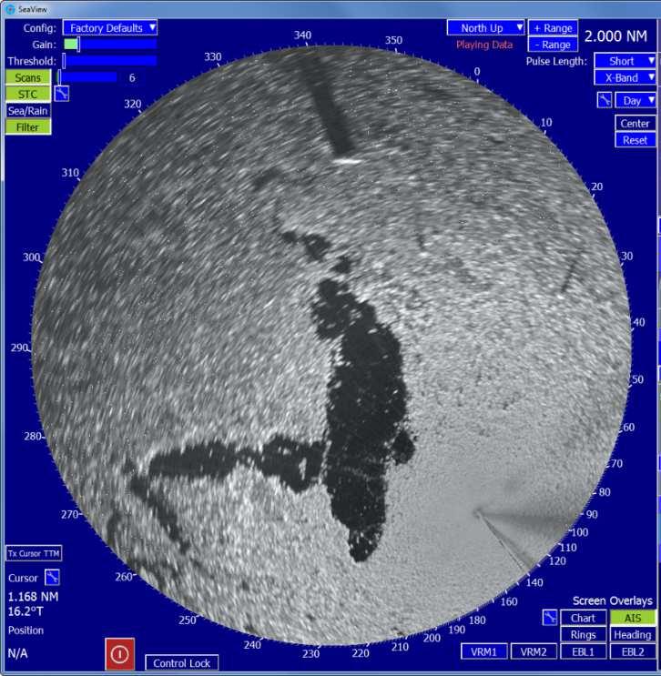
33 Oil Spill Data Display

34 Oil Spill Radar Volumetric Estimation sigma S6 calculates area of slick Detects 8 levels of variation in slick thickness Thickness values with Area gives estimated Volume When oil spill volume estimation is enabled, the area inside each oil spill outline is analyzed and colored according to the parameters set in the Volume Estimation settings window shown.
 and Statoil NOFO states that our OSD system (between others) has been found operational satisfactory and is compliant for NOFO mode of")
35 Sigma S6 Enhanced Radar Processor Oil Spill Detection Trials in Norway 3 Trials 2008, with Norwegian Clean Seas Association for Operating Companies (NOFO) and Statoil NOFO states that our OSD system (between others) has been found operational satisfactory and is compliant for NOFO mode of operation.


36 Sigma S6 Enhanced Radar Processor Oil Spill Detection Trial #1 Client: NOFO Vessel K/V Harstad Date of Spill: April 2008 Location: Conditions: Northern Norwegian Sea Weather fair, some clouds. ENE wind, 7-9 m/s Sea Swell 4-5


37 Sigma S6 Enhanced Radar Processor Oil Spill Detection Trial #1


38 Previous Spill 3 rd Spill 200L


39 sigma S6 Enhanced Radar Processor Oil Spill Detection Trial #2 Client: NOFO Vessel K/V Harstad Date of Spill: June 2008 Location: North Sea

")
40 Spill 1000L (2NM long)

41 sigma S6 Enhanced Radar Processor Oil Spill Detection Trial #3 Client: Statoil Troll C GBS Platform Date of Spill: December 2008 Location: North Sea

42 Three oil slicks detected and outlined for Area, Speed and Direction
43 sigma S6 and WaMoS radar system Integration of four systems on one platform Vessel, Offshore Platforms, Ports, At coastlines Applications across all marine markets: - OSD - ICE - STS - Waves & currents Wave boxes Oil Slicks Vessel Targets
44 Summary: sigma S6 Real time oil spill detection system 24/7 Data is integrable to other system technologies Evidence giving by screen capturing => a system of systems
45 Credentials Norwegian Clean Seas Association for Operating Companies certification: Oil Spill Detection radar Brazil / Petrobras has procured 30+ OSD systems Marine Spill Response Corporation (USA) has deployed 25 sigma S6 OSD systems USA, the Bureau of Ocean Energy Management, Regulation and Enforcement using NOFO standard for OSD radar 80+ sigma S6 Oil Spill Detection systems sold throughout USA, Brazil, Egypt, Turkey, Norway, Azerbaijan, China, etc. ExxonMobil and Rosneft select the combination sigma S6 Ice Navigator and Oil Spill Detection system as input to their Ice Defence System for the Kara Sea (Russia) drilling exploration program in 2014/15. Eighteen sigma S6 Ice Navigator systems deployed. ExxonMobil selects the combination sigma S6 Ice Navigator and Oil Spill Detection system, including SeaFusion, for the Hebron Gravity Base Platform for offshore Newfoundland.
46 Thank you very much for your attention! OceanWaveS GmbH Ina Adegeest Sales Representative of OceanWaveS GmbH Authorized Sales Representatives of Rutter Inc.
Rutter High Resolution Radar Solutions
 Rutter High Resolution Radar Solutions High Resolution Imagery, Target Detection, and Tracking At the core of our enhanced radar capabilities are proprietary radar processing and imaging technologies.
KONGSBERG SATELLITE SERVICES 2017 Line Steinbakk, Director Programs. Himmel og hav - Ålesund 3. Oktober 2017
 KONGSBERG SATELLITE SERVICES 2017 Line Steinbakk, Director Programs Himmel og hav - Ålesund 3. Oktober 2017 KSAT HQ IN TROMSØ 69N Established in 1967 Kongsberg Satellite Services since 2002 World leading
Superior Radar Imagery, Target Detection and Tracking SIGMA S6 RADAR PROCESSOR
 Superior Radar Imagery, Target Detection and Tracking SIGMA S6 S TA N D A R D F E AT U R E S SIGMA S6 Airport Surface Movement Radar Conventional Radar Image of Sigma S6 Ice Navigator Image of Radar Inputs
Co-ReSyF RA lecture: Vessel detection and oil spill detection
 This project has received funding from the European Union s Horizon 2020 Research and Innovation Programme under grant agreement no 687289 Co-ReSyF RA lecture: Vessel detection and oil spill detection
CHAPTER 1 INTRODUCTION
 1 CHAPTER 1 INTRODUCTION In maritime surveillance, radar echoes which clutter the radar and challenge small target detection. Clutter is unwanted echoes that can make target detection of wanted targets
Sensors, Tools and the Common Operating Picture. Sensors, Tools and the Common Operating Picture 14 th April Middleburg
 Sensors, Tools and the Common Operating Picture 14 th April 2015 - Middleburg Aptomar Established in 2005 Owned by Statoil, Investinor, Proventure Seed, Verdane Capitol Have developed and control all IPR
Simrad R5000 IMO/Solas Type Approved Radar Systems
 Simrad R5000 IMO/Solas Type Approved Radar Systems R5000 www.navico.com/commercial R5000 Radar Systems SIMRAD R5000 Radar Systems feature a modular plug & play design making it easy to create a cost effective
OIL SPILLS IN ICE Remote Sensing
 OIL SPILLS IN ICE Remote Sensing Technology Overview and Upcoming JIP Research David Dickins Chevron IOSC2014 Savannah COLLABORATION AMONG TEN COMPANIES International arctic research programme Builds upon
KONGSBERG SATELLITE SERVICES Earth Observation for Maritime Operations Current Capabilities and Future Potential
 KONGSBERG SATELLITE SERVICES 2017 Earth Observation for Maritime Operations Current Capabilities and Future Potential Andreas Hay Kaljord Project Manager KSAT HQ IN TROMSØ - 69N WELCOME TO TROMSØ Established
Satellite data for Maritime Operations. Andreas Hay Kaljord Project Manager Energy, Environment & Security
 Satellite data for Maritime Operations Andreas Hay Kaljord Project Manager Energy, Environment & Security Kongsberg Satellite Services (KSAT) World leading provider within our business area Supports 85
Radar Reprinted from "Waves in Motion", McGourty and Rideout, RET 2005
 Radar Reprinted from "Waves in Motion", McGourty and Rideout, RET 2005 What is Radar? RADAR (Radio Detection And Ranging) is a way to detect and study far off targets by transmitting a radio pulse in the
Joint Industry Program: Development of Improved Ice Management Capabilities for Operations in Arctic and Harsh Environments.
 Joint Industry Program: Development of Improved Ice Management Capabilities for Operations in Arctic and Harsh Environments November 2014 This page is intentionally blank. 2 Introduction Petroleum Research
TRACS A-B-C Acquisition and Processing and LandSat TM Processing
 TRACS A-B-C Acquisition and Processing and LandSat TM Processing Mark Hess, Ocean Imaging Corp. Kevin Hoskins, Marine Spill Response Corp. TRACS: Level A AIRCRAFT Ocean Imaging Corporation Multispectral/TIR
Target intensity is shown in colour shades to assist the operator in differentiating between large and small vessels and weather severity.
 SWR1 - RADAR SCANNER (1 2Kw 24NM 0,9 Feet) maybe the smallest in the Seiwa range of radars but SWR-1 comes with the same host of features as it larger relatives providing a safer navigation in all weather
Combining Ground Radars with Imaging Multisensors
 Combining Ground Radars with Imaging Multisensors FMV Sensors Symposium 2014 Anders GM Dahlberg Business Development Support & Key Account Manager anders.gm.dahlberg@flir.se Area surveillance day and night
KLEIN MARINE SYSTEMS, INC.
 Waterside Security System Concept Protection Requirements Constant monitoring of unattended waterside approaches to critical facilities Detect and identify vessels within the areas of interest surrounding
Surveillanca & Security DIGITAL DUAL BAND ARPA RADAR SYSTEM
 Surveillanca & Security DIGITAL DUAL BAND ARPA RADAR SYSTEM X-band K a -band GEMINI-DB digital dual-band ARPA radar offers operational advantages and flexibility of operations thanks to the simultaneous
RADARSAT-2 Modes and Applications
 RADARSAT-2 Modes and Applications Gordon Staples MDA Geospatial Services February 6, 2017 1 Introduction RADARSAT-2 was developed to meet operational needs via a versatile space segment and a responsive
Author s Name Name of the Paper Session. DYNAMIC POSITIONING CONFERENCE October 10-11, 2017 SENSORS SESSION. Sensing Autonomy.
 Author s Name Name of the Paper Session DYNAMIC POSITIONING CONFERENCE October 10-11, 2017 SENSORS SESSION Sensing Autonomy By Arne Rinnan Kongsberg Seatex AS Abstract A certain level of autonomy is already
The ERS contribution to Oil Spill Monitoring - From R&D towards an operational service -
 The ERS contribution to Oil Spill Monitoring - From R&D towards an operational service - J.P. Pedersen, T.Bauna, L.G. Seljelv, L. Steinbakk, R.T.Enoksen Tromsø Satellite Station, N-9291 Tromsø, Norway
ARGUS RADAR SYSTEM Oil Spill Detection Addendum. English
 ARGUS RADAR SYSTEM Oil Spill Detection Addendum English Record of changes Rev. Date Change requested by A March 1, 2012 N.A. First issue Purpose of change 988-10189-001 2 Rev. A Table of contents Chapter
Arctic Shipping Navigating the Legal Landscape for marine infrastructure and Off-Shore Development
 Arctic Shipping Navigating the Legal Landscape for marine infrastructure and Off-Shore Development Peter G. Pamel Partner Connecticut Maritime Association SHIPPING 2012 Hilton Stamford March 21 st, 2012
SAR Interferometry Capabilities of Canada's planned SAR Satellite Constellation
 SAR Interferometry Capabilities of Canada's planned SAR Satellite Constellation Dirk Geudtner, Guy Séguin,, Ralph Girard Canadian Space Agency RADARSAT Follow-on Program CSA is in the middle of a Phase
Juan GAVIRIA, Sector Leader AFTTR
 Earth Observation in support of the Western Indian Ocean Marine Highway Development and Coastal and Marine Contamination Prevention Project - Oil spill detection & Coral reef monitoring Juan GAVIRIA, Sector
APPLICATION OF REMOTE SENSING DATA FOR OIL SPILL MONITORING IN THE GUANABARA BAY, RIO DE JANEIRO, BRAZIL
 APPLICATION OF REMOTE SENSING DATA FOR OIL SPILL MONITORING IN THE GUANABARA BAY, RIO DE JANEIRO, BRAZIL CRISTINA MARIA BENTZ 1 FERNANDO PELLON DE MIRANDA 1 1 PETROBRAS/CEGEQ (Center of Excellence in Geochemistry
Western Indian Ocean Marine Highway Development and Coastal and Marine Contamination Prevention Project - Oil spill detection & Coral reef monitoring
 Earth Observation in support of the Western Indian Ocean Marine Highway Development and Coastal and Marine Contamination Prevention Project - Oil spill detection & Coral reef monitoring Juan GAVIRIA, Sector
Coastal Surveillance. SCANTER Radar Solutions
 Coastal Surveillance SCANTER Radar Solutions Protecting Your Coastlines and Maritime Domain We provide radar coverage of the coastline to detect and track all types of surface vessels and air targets.
MSRC Tactical Oil Spill Surveillance and Remote Sensing
 MSRC Tactical Oil Spill Surveillance and Remote Sensing Industry Technical Advisory Committee for Oil spill Response October 25, 2016 0 Historical Perspective -- Oil Spill Surveillance in U.S Exxon Valdez
HarborGuard-Pro. Integrated Maritime Security & Surveillance System
 HarborGuard-Pro Integrated Maritime Security & Surveillance System Klein Marine Systems, Inc. 11 Klein Drive, Salem, NH, USA 03079 Web: www.kleinmarinesystems.com This technical data and software is considered
A n I n t e g r a t e d S y s t e m f o r w a v e m o n i t o r i n g a n d s m a l l a n d s l o w t a r g e t s d e t e c t i o n
 A n I n t e g r a t e d S y s t e m f o r w a v e m o n i t o r i n g a n d s m a l l a n d s l o w t a r g e t s d e t e c t i o n Remocean S.p.A. P.IVA e C.F.: 06730281216 - Numero REA: NA - 835413 Registered
Broadband 4G Radar. Reinventing Radar
 2012 Broadband 4G Radar Reinventing Radar Reinventing Radar Simrad Yachting has pioneered a new standard of Dome Radars the first with the award-winning BR24, and more recently, with the Broadband 3G Radar.
Why Ice Detection Radar?
 Past, Present and Future of Ice Radar Detection System in Prince William Sound by Joel Kennedy and Tom Kuckertz Why Ice Detection Radar? Exxon Valdez Spill Overseas Ohio collides with iceberg and suffers
Reinventing Radar SIMRAD-YACHTING.COM
 2012 Broadband 4G Radar Reinventing Radar SIMRAD-YACHTING.COM Reinventing Radar Simrad Yachting has pioneered a new standard of dome radar, first with the award-winning BR24, and more recently with the
IR Laser Illuminators
 Eagle Vision PAN/TILT THERMAL & COLOR CAMERAS - All Weather Rugged Housing resist high humidity and salt water. - Image overlay combines thermal and video image - The EV3000 CCD colour night vision camera
ARCHIVED REPORT. For data and forecasts on current programs please visit or call
 Radar Forecast ARCHIVED REPORT For data and forecasts on current programs please visit www.forecastinternational.com or call +1 203.426.0800 ASR-23SS - Archived 08/2003 Outlook Production complete Procured
Fixed detection devices for oil slick
 Fixed detection devices for oil slick Mikaël Laurent http://www.cedre.fr 715, rue Alain Colas - CS 41836-29218 BREST CEDEX 2 - FRANCE Tél. : +33 2 98 33 10 10 - Fax : +33 2 98 44 91 38 contact@cedre.fr
The Accessible Arctic
 The Accessible Arctic As the Arctic loses its sea ice cover, it becomes ever more accessible, bringing both opportunities and potential conflicts between stakeholders I. Globalization, Climate Change &
The Normal Baseline. Dick Gent Law of the Sea Division UK Hydrographic Office
 The Normal Baseline Dick Gent Law of the Sea Division UK Hydrographic Office 2 The normal baseline for measuring the breadth of the territorial sea is the low water line along the coast as marked on large
TRINITY Standard configuration for littoral defence
 Standard configuration for littoral defence Member of the Thales Mission Solution family Unrivalled tracking and fire control solution for small manoeuvring targets Innovative approach and easy to install
RADAR DEVELOPMENT BASIC CONCEPT OF RADAR WAS DEMONSTRATED BY HEINRICH. HERTZ VERIFIED THE MAXWELL RADAR.
 1 RADAR WHAT IS RADAR? RADAR (RADIO DETECTION AND RANGING) IS A WAY TO DETECT AND STUDY FAR OFF TARGETS BY TRANSMITTING A RADIO PULSE IN THE DIRECTION OF THE TARGET AND OBSERVING THE REFLECTION OF THE
MMW sensors for Industrial, safety, Traffic and security applications
 MMW sensors for Industrial, safety, Traffic and security applications Philip Avery Director, Navtech Radar Ltd. Overview Introduction to Navtech Radar and what we do. A brief explanation of how FMCW radars
Absolute Positioning by Radar
 Absolute Positioning by Radar Dr Nick Ward, Research Director General Lighthouse Authorities of UK & Ireland 14th IAIN Congress 2012, 01-03 October, 2012 - Cairo, Egypt Seamless Navigation (Challenges
MARITIME, AIRBORNE AND LAND RADAR
 Commercial Radar RF POWER MARITIME, AIRBORNE AND LAND RADAR Powering maritime, ground based and airborne radar systems keeping crew, cargo and passengers safe around the world. Commercial Radar RF POWER
Comparison of Two Detection Combination Algorithms for Phased Array Radars
 Comparison of Two Detection Combination Algorithms for Phased Array Radars Zhen Ding and Peter Moo Wide Area Surveillance Radar Group Radar Sensing and Exploitation Section Defence R&D Canada Ottawa, Canada
Active and Passive Microwave Remote Sensing
 Active and Passive Microwave Remote Sensing Passive remote sensing system record EMR that was reflected (e.g., blue, green, red, and near IR) or emitted (e.g., thermal IR) from the surface of the Earth.
Copyright 2016 Raytheon Company. All rights reserved. Customer Success Is Our Mission is a registered trademark of Raytheon Company.
 Make in India Paradigm : Roadmap for a Future Ready Naval Force Session 9: Coastal Surveillance, Response Systems and Platforms Nik Khanna, President, India April 19, 2016 "RAYTHEON PROPRIETARY DATA THIS
LT Matthew Forney, NOAA Navigation Manager Alaska Region Bering Strait MaritimeSymposium. Office of Coast Survey
 NOAA LT Matthew Forney, NOAA Navigation Manager Alaska Region Bering Strait MaritimeSymposium Who is Coast Survey? First science agency of the U.S. Formed in 1807 Responsible for surveying 3.4 million
Ice Radar Processor for Prince William Sound Summary of Configuration and Benefits
 Ice Radar Processor for Prince William Sound Summary of Configuration and Benefits R-07-044-546 Prepared for: December 2007 Captain Robert A. Bartlett Building Morrissey Road St. John s, NL Canada A1B
Overview of the C-NLOPB and the Can-NL Offshore Oil and Gas Industry. Sean Kelly MA, APR, FCPRS May 15, 2017
 Overview of the C-NLOPB and the Can-NL Offshore Oil and Gas Industry Sean Kelly MA, APR, FCPRS May 15, 2017 Safety Moment - Working in the harshest environment in the world demands the highest regard for
Globalization & Economic Interests in the New Maritime Arctic
 Globalization & Economic Interests in the New Maritime Arctic Workshop on Safe Ship Operations in the Arctic Ocean IMO, London ~ 28 February 2014 Lawson W. Brigham, PhD Distinguished Professor, University
Mission Solution 300
 Mission Solution 300 Standard configuration for point defence Member of the Thales Mission Solution family Standard configuration of integrated sensors, effectors, CMS, communication system and navigation
Marine Monitor (M ) A Low Cost Radar Solution for Monitoring Nearshore Marine Protected Areas
 A Low Cost Radar Solution for Monitoring Nearshore Marine Protected Areas") 2 Marine Monitor (M ) A Low Cost Radar Solution for Monitoring Nearshore Marine Protected Areas 1 Problem The number of Marine Protected Areas (MPAs) are increasing globally making it challenging to effectively
2 Marine Monitor (M ) A Low Cost Radar Solution for Monitoring Nearshore Marine Protected Areas 1 Problem The number of Marine Protected Areas (MPAs) are increasing globally making it challenging to effectively
UAV applications for oil spill detection, suspended matter distribution and ice monitoring first tests and trials in Estonia 2015/2016
 UAV applications for oil spill detection, suspended matter distribution and ice monitoring first tests and trials in Estonia 2015/2016 Sander Rikka Marine Systems Institute at TUT 1.11.2016 1 Outlook Introduction
Utilization of Radar data for Maritime Surveillance
 INDESO Project Utilization of Radar data for Maritime Surveillance DENDY MAHABROR MARINE RESEARCH CENTER INDESO RADAR GROUND STATION RADARSAT-2 AND COSMO-SKYMED BALI INDESO satelit VMS satelite radar vessel
Cost Effective Control of your Coastal Waters
 Cost Effective Control of your Coastal Waters Olov Fäst SSC Airborne Systems 2013-07-03 SSC: A comprehensive space industry Founded in 1972 ~650 employees (2012) ~100 M turnover (2012) Since the start
Active and Passive Microwave Remote Sensing
 Active and Passive Microwave Remote Sensing Passive remote sensing system record EMR that was reflected (e.g., blue, green, red, and near IR) or emitted (e.g., thermal IR) from the surface of the Earth.
2011 Capital Markets Day
 2011 Capital Markets Day Geir Håøy President Kongsberg Maritime WORLD CLASS through people, technology and dedication Kongsberg Maritime Introduction Significant market position within the drilling segment
Commercial Marine Shipping in Canada: Understanding the Risks
 Commercial Marine Shipping in Canada: Understanding the Risks Dr. Richard Wiefelspuett Executive Director North Shore Waterfront Liaison Committee June 30, 2016 CENTRE FOR RESPONSIBLE MARINE SHIPPING Outcomes:
AUTONOMOUS MAN-OVERBOARD DETECTION AND TRACKING
 AUTONOMOUS MAN-OVERBOARD DETECTION AND TRACKING THE SYSTEM AUTONOMOUS MAN-OVERBOARD DETECTION & TRACKING The MOBtronic man-overboard system operates autonomously, instantly detecting and classifying a
APPLICATION OF OCEAN RADAR ON THE BALTIC, FEATURES AND LIMITATIONS
 APPLICATION OF OCEAN RADAR ON THE BALTIC, FEATURES AND LIMITATIONS Thomas Helzel, Matthias Kniephoff, Leif Petersen, Markus Valentin Helzel Messtechnik GmbH e-mail: helzel@helzel.com Presentation at Hydro
NZQA registered unit standard version 2 Page 1 of 5
 Page 1 of 5 Title Use marine radar on a restricted limits vessel Level 3 Credits 10 Purpose People credited with this unit standard are able to: relate the operating principles and conditions of marine
Challenges and opportunities in the e-navigation Development. Actual projects.
 Challenges and opportunities in the e-navigation Development. Actual projects. John Erik Hagen, Regional Director Oslo, September 2018 What is e-navigation? Efficient transfer of marine information and
CODAR. Ben Kravitz September 29, 2009
 CODAR Ben Kravitz September 29, 2009 Outline What is CODAR? Doppler shift Bragg scatter How CODAR works What CODAR can tell us What is CODAR? Coastal Ocean Dynamics Application Radar Land-based HF radar
Phone:
 Derek Burrage (P.I. & Technical lead/poc), Sonia Gallegos, Joel Wesson, Richard Gould, and Sean McCarthy Oceanography Division, Ocean Sciences Branch, Naval Research Lab., Stennis Space Center, MS, USA
Microwave Remote Sensing (1)
") Microwave Remote Sensing (1) Microwave sensing encompasses both active and passive forms of remote sensing. The microwave portion of the spectrum covers the range from approximately 1cm to 1m in wavelength.
Microwave Remote Sensing (1) Microwave sensing encompasses both active and passive forms of remote sensing. The microwave portion of the spectrum covers the range from approximately 1cm to 1m in wavelength.
10 Secondary Surveillance Radar
 10 Secondary Surveillance Radar As we have just noted, the primary radar element of the ATC Surveillance Radar System provides detection of suitable targets with good accuracy in bearing and range measurement
AIR ROUTE SURVEILLANCE 3D RADAR
 AIR TRAFFIC MANAGEMENT AIR ROUTE SURVEILLANCE 3D RADAR Supplying ATM systems around the world for more than 30 years indracompany.com ARSR-10D3 AIR ROUTE SURVEILLANCE 3D RADAR ARSR 3D & MSSR Antenna Medium
Identification of Oil Spills from offshore installations.
 Identification of Oil Spills from offshore installations. Presentation of methods and preliminary results from the OSIS, Oil Spill Identification Sensor project. By: Jesper Holst OSIS International Tirsbaekvej
Black Marlin radar systems may be purchased with a flat-top radome for mounting cameras on
 SPECIFICATIONS The Black Marlin is DMT s midrange security radar system. It may be used to search and track threats from land and sea. This radar is an X- Band, pulsed- Doppler system that operates in
Robots at Work The growing role of robotic systems in the Oceans and Subsea Engineering. David Brookes Senior Advisor, Upstream Engineering, BP
 Robots at Work The growing role of robotic systems in the Oceans and Subsea Engineering David Brookes Senior Advisor, Upstream Engineering, BP Synopsis ROV s History Current Capabilities and Examples AUV
Another Eye Guarding the World
 High Sensitivity, WDR Color CCD Camera SHC-721/720 (Day & Night) Another Eye Guarding the World www.samsungcctv.com www.webthru.net Powerful multi-functions, Crystal The SHC-720 and SHC-721 series are
Commercial Marine Shipping in Canada: Understanding the Risks
 Commercial Marine Shipping in Canada: Understanding the Risks Dr. Richard Wiefelspuett Executive Director GREENTECH 2016 Conference, Quebec City June 1, 2016 CENTRE FOR RESPONSIBLE MARINE SHIPPING Overview:
Oil spill detection in the Chinese Seas by spaceborne synthetic aperture radars: challenges and pitfalls (Project: OPAC )
") Oil spill detection in the Chinese Seas by spaceborne synthetic aperture radars: challenges and pitfalls (Project: 10705 OPAC ) Werner Alpers Institute of Oceanography, University of Hamburg, Hamburg,
Oil spill detection in the Chinese Seas by spaceborne synthetic aperture radars: challenges and pitfalls (Project: 10705 OPAC ) Werner Alpers Institute of Oceanography, University of Hamburg, Hamburg,
Wave Sensing Radar and Wave Reconstruction
 Applied Physical Sciences Corp. 475 Bridge Street, Suite 100, Groton, CT 06340 (860) 448-3253 www.aphysci.com Wave Sensing Radar and Wave Reconstruction Gordon Farquharson, John Mower, and Bill Plant (APL-UW)
COOK INLET NAVIGATION CHANNEL
 COOK INLET NAVIGATION CHANNEL 1-5 COOK INLET NAVIGATION CHANNEL, ALASKA (CWIS NO. 10324, 10534) Condition of Improvement 30 September 2011 AUTHORIZATION: (1) Water Resources Development Act of 1996 (Public
Maritime Autonomous Navigation in GPS Limited Environments
 Maritime Autonomous Navigation in GPS Limited Environments 29/06/2017 IIR/University of Portsmouth GPS signal is unreliable Tamper Jam U.S. stealth UAV captured by Iranian government by means of GPS spoofing.
Pipeline Inspection and Environmental Monitoring Using AUVs
 Pipeline Inspection and Environmental Monitoring Using AUVs Bjørn Jalving, Bjørn Gjelstad, Kongsberg Maritime AUV Workshop, IRIS Biomiljø, 7 8 September 2011 WORLD CLASS through people, technology and
ARGUS RADAR Quick Reference Card
 ARGUS RADAR Quick Reference Card Own Ship Activated ERBL AIS Symbol ERBL 1 and 2 Helm or Antenna Position Ref. Parallel Index Status/Setup Display Presentation Transceiver Status Tuning Bar Presentation
OVERVIEW OF RADOME AND OPEN ARRAY RADAR TECHNOLOGIES FOR WATERBORNE APPLICATIONS INFORMATION DOCUMENT
 OVERVIEW OF RADOME AND OPEN ARRAY RADAR TECHNOLOGIES FOR WATERBORNE APPLICATIONS INFORMATION DOCUMENT Copyright notice The copyright of this document is the property of KELVIN HUGHES LIMITED. The recipient
328 IMPROVING POLARIMETRIC RADAR PARAMETER ESTIMATES AND TARGET IDENTIFICATION : A COMPARISON OF DIFFERENT APPROACHES
 328 IMPROVING POLARIMETRIC RADAR PARAMETER ESTIMATES AND TARGET IDENTIFICATION : A COMPARISON OF DIFFERENT APPROACHES Alamelu Kilambi 1, Frédéric Fabry, Sebastian Torres 2 Atmospheric and Oceanic Sciences,
SODAR- sonic detecting and ranging
 Active Remote Sensing of the PBL Immersed vs. remote sensors Active vs. passive sensors RADAR- radio detection and ranging WSR-88D TDWR wind profiler SODAR- sonic detecting and ranging minisodar RASS RADAR
HSE and Quality. Sisimiut, 10th December FING: Arctic Region Oil & Gas Seminar in Training and Education
 HSE and Quality Sisimiut, 10th December 2013 FING: Arctic Region Oil & Gas Seminar in Training and Education 1 Arctic Issues Above ground challenges FING: Arctic Region Oil & Gas Seminar in Training and
Copernicus Introduction Lisbon, Portugal 13 th & 14 th February 2014
 Copernicus Introduction Lisbon, Portugal 13 th & 14 th February 2014 Contents Introduction GMES Copernicus Six thematic areas Infrastructure Space data An introduction to Remote Sensing In-situ data Applications
Radar Cross-Section Modeling of Marine Vessels in Practical Oceanic Environments for High-Frequency Surface-Wave Radar
 Radar Cross-Section Modeling of Marine Vessels in Practical Oceanic Environments for High-Frequency Surface-Wave Radar Symon K. Podilchak 1, Hank Leong, Ryan Solomon 1, Yahia M. M. Antar 1 1 Electrical
ARCTIC OPERATIONS COMMON OPERATIONAL PICTURE
 Working Document of the NPC Study: Arctic Potential: Realizing the Promise of U.S. Arctic Oil and Gas Resources Made Available March 27, 2015 Paper #6-9 ARCTIC OPERATIONS COMMON OPERATIONAL PICTURE Prepared
Radar Environment RF Generation. Dr. Steffen Heuel Technology Manager Aerospace & Defense Rohde & Schwarz Munich, Germany
 Radar Environment RF Generation Dr. Steffen Heuel Technology Manager Aerospace & Defense Rohde & Schwarz Munich, Germany Typical navigation radar scenario Turning navigation radar antenna Tx Tx Tx Tx Rx
Canada's 3rd Generation High Frequency Surface Wave Radar for Persistent Surveillance of the 200 Nautical Mile EEZ
 Canada's 3rd Generation High Frequency Surface Wave Radar for Persistent Surveillance of the 200 Nautical Mile EEZ Tony Ponsford 1, Peter W. Moo 3, Rick Mckerracher 2, Zhen Ding 3, Derek Yee 1 and Maureen
GMDSS communication systems
 GMDSS Basic Concepts A System Overview Functional requirements The GMDSS (Global Maritime Distress and Safety System) is specifically designed to automate a ship's radio distress alerting function, and,
Kongsberg Satellite Services, KSAT
 SvalSat, Earth Station at 78 North Kongsberg Satellite Services, KSAT Making Sense of Space Sigmund Dehli International Sales Manager WORLD CLASS through people, technology and dedication My plan KSAT
RADius, a New Contribution to Demanding. Close-up DP Operations
 Author s Name Name of the Paper Session DYNAMIC POSITIONING CONFERENCE September 28-30, 2004 Sensors RADius, a New Contribution to Demanding Close-up DP Operations Trond Schwenke Kongsberg Seatex AS, Trondheim,
Maritime Electronics Supporting Unmanned Vessels
 EU-Japan Policy Workshop Maritime Electronics Supporting Unmanned Vessels November 11 th, 2016 TAKUO KASHIWA, Ph.D Furuno Electric Co., Ltd. Agenda Positioning Technologies for Vessel s position Technologies
HEAVY-DUTY HIGH PERFORMANCE RASTERSCAN RADARS/ARPAS
 Complying with IMO and IEC standards for installation after 1.1.1999 HEAVY-DUTY HIGH PERFORMANCE RASTERSCAN RADARS/ARPAS Models FR/FAR-28x5 series The future today with FURUNO's electronics technology.
Fuzing Validation. RAeS WS&T Conference November 2012 Jason Cowell. Thales Proprietary LAND DEFENCE
 Fuzing Validation RAeS WS&T Conference November 2012 Jason Cowell 2 / Content Introduction & Background Proximity Fuze Development Challenges for proximity fuzes Advancement in signal process capability
Oil spill leakage avoidance with real time seismic monitoring. Helge Brandsæter, President OCTIO AS
 Oil spill leakage avoidance with real time seismic monitoring Helge Brandsæter, President OCTIO AS Injection wells - Pitfalls Oseberg - Norway Frade Brazil Veslefrikk Norway Tordis - Norway Challenges
Broadband 3G Radar The evolution of the radar revolution.
 Broadband 3G Radar The evolution of the radar revolution. SIMRAD-YACHTING.COM The evolution of the radar revolution. Broadband Radar a.k.a. frequency modulated continuous wave (FMCW) radar is nothing new...
Space Based Vessel Detection - Combining Earth Observation and AIS for Maritime surveillance TEXAS V and C-Σ III
 Space Based Vessel Detection - Combining Earth Observation and AIS for Maritime surveillance TEXAS V and C-Σ III Tony Bauna Director, Product and Service Development, Kongsberg Satellite Services, Tromsø,
Summary. Methodology. Selected field examples of the system included. A description of the system processing flow is outlined in Figure 2.
 Halvor Groenaas*, Svein Arne Frivik, Aslaug Melbø, Morten Svendsen, WesternGeco Summary In this paper, we describe a novel method for passive acoustic monitoring of marine mammals using an existing streamer
Civil Radar Systems.
 Civil Radar Systems www.aselsan.com.tr Civil Radar Systems With extensive radar heritage exceeding 20 years, ASELSAN is a new generation manufacturer of indigenous, state-of-theart radar systems. ASELSAN
The human touch in technology. ECDIS ECS Conning screen Ship speed info system
 The human touch in technology ECDIS ECS Conning screen Ship speed info system Alphatron ALPHACHART T ECDIS Type approved ECDIS system powered by TRANSAS The ALPHACHART T is an advanced Electronic Chart
A bluffer s guide to Radar
 A bluffer s guide to Radar Andy French December 2009 We may produce at will, from a sending station, an electrical effect in any particular region of the globe; (with which) we may determine the relative