CHAPTER 7 Total Station Surveying. CE 316 March 2012
|
|
|
- Brianne Banks
- 6 years ago
- Views:
Transcription


1 CHAPTER 7 Total Station Surveying CE 316 March
.")
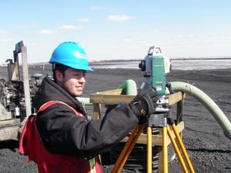
2 7.1 Introduction Total station surveying - defined as the use of electronic survey equipment used to perform horizontal and vertical measurements in reference to a grid system (e.g. UTM, mine grid). 250


")
")
3 7.2 Components Used in Total Station Surveying 1) Total Station (and tripod) 2) Electronic Notebook 251

 Prism (and")
4 7.2 Components Used in Total Station Surveying 3) Prism (and prism pole) 252
5 7.2 Components Used in Total Station Surveying 4) Computer interface 5) Batteries and radios 253
6 7.3 Types of Total Station Surveying Slope Staking Topographic surveys Construction project layout building corners control and offset lines Areas Intersections Point Projections Road (Highway) Surveys Taping from Baseline Leveling Traverse surveys and adjustments Building Face Surveys Resections 254
7 7.4 Advantages of Total Station Surveying Relatively quick collection of information Multiple surveys can be performed at one set-up location. Easy to perform distance and horizontal measurements with simultaneous calculation of project coordinates (Northings, Eastings, and Elevations). Layout of construction site quickly and efficiently. Digital design data from CAD programs can be uploaded to data collector. Daily survey information can also be quickly downloaded into CAD which eliminates data manipulation time required using conventional survey techniques. 255
8 7.5 Disadvantages of Total Station Surveying Vertical elevation accuracy not as accurate as using conventional survey level and rod technique. Horizontal coordinates are calculated on a rectangular grid system. However, the real world should be based on a spheroid and rectangular coordinates must be transformed to geographic coordinates if projects are large scale. Examples : highways, large buildings, etc. As with any computer-based application Garbage in equals Garbage out. However, in the case of inaccurate construction surveys Garbage in equals lawsuits and contractors claims for extras. 256

9 7.6 Total Station A form of an electronic theodolite combined with an electronic distance measuring device (EDM). the primary function is to measure slope distance, vertical angle, and horizontal angle from a setup point to a foresight point. most total stations use a modulated near-infrared light emitting diode which sends a beam from the instrument to a prism. The prism reflects this beam back to the instrument. The portion of the wavelength that leaves the instrument and returns is assessed and calculated. Distance measurements can be related to this measurement. 257
10 7.6 Total Station the accuracy of a total station is dependent on instrument type. Angle Accuracy (Horizontal or Vertical) can range from 2 to 5. Distance Accuracy can range from: +/- ( ppm x D) mm to +/- (3 + 3 ppm x D) mm where D = distance measured Accuracy is highly dependent on leveling the instrument. Thus two leveling bubbles are provided on the instrument and are referred to the circular level and the plate level. Circular level is located on the tribrack while plate level is on horizontal axis of instrument just below scope of the total station. Sensitivity of Circular Level = 10 / 2mm Sensitivity of Plate Level = 30 / 2mm 258
11 7.7 Electronic Notebook the brains of the total station. The notebook will record, calculate, and even manipulate field data automatically saving valuable time and manpower. the electronic notebook records the slope distance, horizontal and vertical angles from the total station and can perform numerous calculations using operating software which is loaded into the unit. SDR 33 is an electronic notebook made by Sokkia. Cost is approximately $4000 and can store up 2MB of readings and analysis. the main menu of the notebook is made up of a number of directories: 1) Function menu 2) Survey menu 3) COGO menu 4) Road menu 5) Level menu 259
12 7.7 Electronic Notebook Function Menu the function menu consists of a series of sub-menus which contain specific input options which may be used during on particular job or may apply to all survey jobs. the function sub-menus in the SDR 33 are: 1) Job - multiple jobs can be stored 2) Instrument type - instrument type, prism constant, orientation (azimuth) 3) Job settings - current job, atmospheric correction, curvature and refraction correction, and sea level correction 4) Configure reading - allows control over how information can be numbered and stored (POS or OBS), single/double angle measurement setting, allows code lists to be activated, as well as compatibility with other instruments (WILD) 5) Tolerances - Hor. And Ver. Angle = 30, EDM = 5mm allows accuracy of duplicate readings to be checked. 260
13 6) Units 7.7 Electronic Notebook Function Menu 7) Communications - downloading or uploading data (SDR, MOSS, DXF) 8) Date and Time 9) Job Deletion 10) Calculator 11) Feature Code List - list to identify survey details 12) Hardware - system info, battery life 13) Upgrade 14) User Program - allows programs to be uploaded 15) Language - English but you can upload more languages 261
14 7.7 Electronic Notebook Survey Menu the survey menu consists of a series of sub-menus which contain specific software to use the raw data recorded from the total station and transform this information into usable survey results. the survey sub-menus in the SDR 33 are: 1) Topography - allows topography of a region to be measured. 2) Traverse Adjustment - allows series of stations used as traverse to be calculated for closure. The program can then calculate the adjustments required in the stations to ensure closure. 262


15 7.7 Electronic Notebook Survey Menu 3) Resection - calculates the coordinates of an unknown or free station by observing a number of unknown stations from the unknown point. 4) Set Collection, Set Review - structured method for collecting multiple sets of information from a station. 5) Building Face Survey - used to survey details of a building including details where the prism cannot be placed. 263
16 7.7 Electronic Notebook Survey Menu 6) Collimation - used to measure error in single angle measurements. 7) Remote Elevation - used to measure elevations of points in which the target can t be placed. (e.g.. Powerline heights, bridge heights). The prism is placed directly below the object and the slope distance to the prism is recorded along with the angle up to the remote elevation. Based on these measurements, the remote elevation point can be calculated. 264
17 7.7 Electronic Notebook COGO Menu COGO is a suite of programs aimed at coordinate geometry problems in civil engineering originally a subsystem of MIT s Integrated Engineering System (ICES) developed in the 1960 s. the COGO menu consists of a series of sub-menus which contain specific software used for coordinate geometry calculations and setting out work in the field. the COGO sub-menus in the SDR 33 are: 1) Setting out Coordinates - allows coordinates to be placed in the field. 265
18 7.7 Electronic Notebook COGO Menu 2) Setting out Line 3) Set out Arc 4) Resection 5) Inverse - allows calculation of point to point info, 6) Areas 7) Intersections 8) Point Projections 9) Taping from Baseline 266

19 7.7 Electronic Notebook Road Menu the Road menu consists of a series of sub-menus which contain specific software used to perform a detailed road or highway survey. the details of the road can be entered into the data collector and the road can be laid out in the field including all appropriate cut and fill information at each point. the cross-section survey sub-menu allows for measurements of earthwork areas which can be uploaded into CAD for earthwork volume calculations. 267
20 7.7 Electronic Notebook Level Menu The level menu consists of a series of sub-menus which contain specific software used to perform a levelling and level adjustment calculations 268


21 7.8 Reflectorless Total Stations The level menu consists of a series of sub-menus which contain specific software used to perform a levelling and level adjustment calculations 269


22 7.8 Reflectorless Total Stations Case History 270

23 7.9 Robotic Total Stations Sokkia SRX The level menu consists of a series of sub-menus which contain specific software used to perform a levelling and level adjustment calculations 271

24 7.9 Robotic Total Stations Topcon 272


25 7.10 Digital Photographic Imaging Topcon Topcon's GPT-7000i is a World's First imaging total station. It contains an integrated camera that allows you to visually map measurements to job site photographs. With additional software you can create 3D point clouds and stereoscopic images. Pinpoint reflectorless measuring up to 250m Single prism measuring up to 3000m GPT-7000i 273

26 7.11 Spatial Imaging Trimble Trimble GX 3D Scanner 274

27 7.12 GPS TOTAL STATIONS Leica SmartStation Total Station with integrated GNSS/GPS World s first, TPS and GPS perfectly combined. High performance total station with powerful GNSS/GPS receiver. No need for control points, long traverses or resections. Just set up SmartStation and let GNSS/GPS determine the position. You survey easier, quicker and with fewer set ups. 275
28 7.13 RTK Positioning Real Time Kinematic Based on the use of carrier phase (GPS, Glonass, Galileo, etc.) Normal compare pseudorandom signal from satellite to internally generated copy of the same signal. Since they do not line up properly, by delaying local signal more and more they eventually line up. Delay is time need for the satellite to reach the receiver. Accuracy is approx. 1% of band with (i.e. C/A code send bit every 0.96 microsecond (3m). Other C/A signal errors can add up to approx. 15 m. RTK same concept, but uses much smaller wavelength carrier signals, not messages within. L1 Carrier MHz l = 0.19m, thus + = 1.9 mm. Resolution of integer ambiguity requires sophisticated statistical software and access to multiple satellites. RTK single base station receiver re-broadcast signals it receives to a number of mobile receivers (UHF most popular). Typical accuracy of dual frequency systems: 1 cm 2ppm horizontally 2 cm 2ppm vertically 276
Indian Institute of Technology Kanpur Department of Civil Engineering
 Indian Institute of Technology Kanpur Department of Civil Engineering Inquiry No- CE/JNM/2013-14/R-10 30 December, 2013 Subject: Quotation for supply of Integrated System/Smart System Reflectorless Robotic
Chapter 8. Electronic Survey Measurement. Dr. Maher A. El-Hallaq Lecturer of Surveying The Islamic University of Gaza
 Chapter 8 Electronic Survey Measurement Dr. Maher A. El-Hallaq Lecturer of Surveying The Islamic University of Gaza Contents Introduction. Parts of a total station. Handling a total station. Total station
TheoDist Series FTD 05 / FTD 02. Compact Total Station
 TheoDist Series FTD 05 / FTD 02 Compact Total Station geo-fennel TheoDist Compact Total Stations The geo-fennel TheoDist Series is an instrument designed to be easy to use and quick to set up on any construction
TOTAL STATION WORKSHOP
 DEPARTMENT OF CIVIL ENGINEERING TOTAL STATION WORKSHOP DATE : 11/03/2017 TIME : 11:00am to 4:30pm Gyanmanjari Institute of Technology, Bhavnagar WORKSHOP ON TOTAL STATION 1 CONTENTS REPORT SUMMERY... 3
TheoDist FTD 05 REFLECTORLESS CONSTRUCTION TACHYMETER
 TheoDist FTD 05 REFLECTORLESS CONSTRUCTION TACHYMETER geo-fennel TheoDist The geo-fennel TheoDist is a new simple and easy to use device. The TheoDist is a combination of an Electronic Theodolite and a
Leica SmartStation Total Station with integrated GNSS
 Leica SmartStation Total Station with integrated GNSS Leica SmartStation Total station with integrated GNSS New revolutionary surveying system. World s first, TPS and GNSS perfectly combined. High performance
Leica SmartStation Total Station with integrated GPS
 Leica SmartStation Total Station with integrated GPS Leica SmartStation Total station with integrated GPS New revolutionary surveying system. World s first, TPS and GPS perfectly combined. High performance
Surveying in the Year 2020
 Surveying in the Year 2020 Johannes Schwarz Leica Geosystems My first toys 2 1 3 Questions Why is a company like Leica Geosystems constantly developing new surveying products and instruments? What surveying
GeoMax Total Station Zoom20 Series
 GeoMax Total Station Zoom20 Series GeoMax About Us GeoMax is an internationally nology group with strong mar- The close cooperation within active company developing, ket positions within measure- the Hexagon
670 10/26/17 SSD: 07/14/16, 09/16/17 Page 1 of 6
 SSD: 07/14/16, 09/16/17 Page 1 of 6 S P E C I A L P R O V I S I O N Section MISCELLANEOUS INCIDENTALS Item.822 - GNSS Construction Inspection Equipment Description SAMPLE PROJECT 12345 10/30/17 1.1 Work
Trimble S6 Robotic Total Station Field Guide Provided by: California Surveying & Drafting Supply Technical Support Services
 Trimble S6 Robotic Total Station Field Guide Provided by: California Surveying & Drafting Supply Technical Support Services Table of Contents: Procedure: Page: Field Checklist 2 Setting Up Your Trimble
FREQUENTLY ASKED QUESTIONS (FAQ)
") FREQUENTLY ASKED QUESTIONS (FAQ) GSR2600 FAQs The following sections provide answers to some of the frequently asked questions about the GSR2600 system. GSR2600 Receiver GSR2600 Compatibility SDR Level
FREQUENTLY ASKED QUESTIONS (FAQ) GSR2600 FAQs The following sections provide answers to some of the frequently asked questions about the GSR2600 system. GSR2600 Receiver GSR2600 Compatibility SDR Level
Connecting a Cadastral Survey to PNG94 using GNSS
 43rd Association of Surveyors PNG Congress, Lae, 12th-15th August 2009 Connecting a Cadastral Survey to PNG94 using GNSS Richard Stanaway QUICKCLOSE Workshop overview Legal requirements to connect surveys
Suveying Lectures for CE 498
 Suveying Lectures for CE 498 SURVEYING CLASSIFICATIONS Surveying work can be classified as follows: 1- Preliminary Surveying In this surveying the detailed data are collected by determining its locations
Department of Civil and Environmental Engineering
 Department of Civil and Environmental Engineering CEE213L Surveying & Introduction to GIS Lab SURVEYING LABORATORY NORTH SOUTH UNIVERSITY Center of Excellence in Higher Education The First Private University
Construction Surveying and Layout
 Construction Surveying and Layout A Field Engineering Methods Manual Third Edition WESLEY G. CRAWFORD.CREATIVE CONSTRUCTION Creative Construction Publishing, Inc. 2720 South River Road West Lafayette,
CHAPTER F IVE ROBOTIC TOTAL STATION
 CHAPTER F IVE ROBOTIC TOTAL STATION 5 ROBOTIC TOTAL STATION 5 OVERVIEW If necessity is the mother of invention, then the invention of the Total Station robotic instrument truly fits the requirements of
350m 1,140ft. Series030R. Reflectorless Range. Take the Lead with Superior EDM Performance and Powerful SDR Software
 SURVEYING INSTRUMENTS Series030R Reflectorless Total Stations with Integrated Data Collectors Take the Lead with Superior EDM Performance and Powerful SDR Software 350m 1,140ft. Reflectorless Range Laser
Connecting a Survey to PNG94 and MSL using GNSS
 45th Association of Surveyors PNG Congress, Madang, 19-22 July 2011 Connecting a Survey to PNG94 and MSL using GNSS Richard Stanaway QUICKCLOSE Workshop overview Legal requirements to connect surveys to
Introduction to Total Station and GPS
 Introduction to Total Station and GPS Dr. P. NANJUNDASWAMY Professor of Civil Engineering J S S Science and Technology University S J College of Engineering Mysuru 570 006 Introduction History GPS Overview
Trimble Business Center:
 Trimble Business Center: Modernized Approaches for GNSS Baseline Processing Trimble s industry-leading software includes a new dedicated processor for static baselines. The software features dynamic selection
Leica GPS900 Equipment List
 Leica GPS900 Equipment List 2 GPS900 Package 1. GPS900 RTK Rover 1.1 GPS900 Controller The controller can be connected to the ATX900 with a Bluetooth connection or can be connected using a cable. 1.1.1
SURVEYORS BOARD OF QUEENSLAND. RTK GNSS for Cadastral Surveys. Guideline
 SURVEYORS BOARD OF QUEENSLAND RTK GNSS for Cadastral Surveys Guideline 30 November 2012 RTK GNSS for Cadastral Surveys General The Surveyors Board of Queensland has recently become aware of some issues
TSA Surveying Course
 TSA Surveying Course with ProQual Level 3 in Engineering Surveying A block by block outline Preamble The TSA Surveying Course comprises six study periods of two weeks each spread over a period of two years
I am confused by the different models, what are the differences?
 GeoMax Robot Notes A Robotic Total Station (RTS) is one of the most important and most expensive equipment purchases that a surveyor will make. These notes are updated to include commonly and recently
ProMark 3 RTK. White Paper
 ProMark 3 RTK White Paper Table of Contents 1. Introduction... 1 2. ProMark3 RTK Operational Environment... 2 3. BLADE TM : A Unique Magellan Technology for Quicker Convergence... 3 4. ProMark3 RTK Fixed
COURSE SYLLABUS SURVEYING I
 Solution Manual for Surveying Fundamentals and Practices 6th Edition by Nathanson Lanzafama Emeritus Link full download: http://testbankcollection.com/download/solution-manual-forsurveying-fundamentals-and-practices-6th-edition-by-nathanson-lanzafamaemeritus/
Asian Journal of Science and Technology Vol. 08, Issue, 11, pp , November, 2017 RESEARCH ARTICLE
 Available Online at http://www.journalajst.com ASIAN JOURNAL OF SCIENCE AND TECHNOLOGY ISSN: 0976-3376 Asian Journal of Science and Technology Vol. 08, Issue, 11, pp.6697-6703, November, 2017 ARTICLE INFO
GPS Accuracies in the Field
 GPS Accuracies in the Field A short and informative talk by A. Richard Vannozzi, PLS Assistant Professor of Civil Technology/Surveying and Mapping Thompson School of Applied Science University of New Hampshire
GNSS CONSTRUCTION INSPECTION EQUIPMENT
 Project: Jamaica-Winhall STP 2904(1) Advertised Date: 5/30/2018 GNSS CONSTRUCTION INSPECTION EQUIPMENT DESCRIPTION. This work shall consist of furnishing, configuring, installing, maintaining, and removing
Version 1.0 English. Leica GS09 Quick Guide
 Version 1.0 English Leica GS09 Quick Guide To use the product in a permitted manner, please refer to the detailed safety instructions in the User Manual. Hardware Real-time reference setup a b c d e f
ENGI 3703 Surveying and Geomatics
 Satellite Geometry: Satellites well spread out in the sky have a much stronger solution to the resection type problem (aka trilateration) then satellite that are grouped together. Since the position of
TOTAL STATION USER GUIDE. Trimble SCS900 Site Controller Software
 TOTAL STATION USER GUIDE Trimble SCS900 Site Controller Software NORTH AMERICA Trimble Construction Division 5475 Kellenburger Road Dayton, Ohio 45424 USA 800-538-7800 (Toll Free) +1-937-245-5600 Phone
Automated Quality Control of Global Navigation Satellite System (GNSS) Data
 Data") P-315 Automated Quality Control of Global Navigation Satellite System (GNSS) Data S.Senthil Kumar* & Arun Kumar Chauhan, ONGC Summary Global Navigation Satellite System (GNSS), includes GPS, GLONASS and
P-315 Automated Quality Control of Global Navigation Satellite System (GNSS) Data S.Senthil Kumar* & Arun Kumar Chauhan, ONGC Summary Global Navigation Satellite System (GNSS), includes GPS, GLONASS and
Geospatial Engineering Competencies
 Name of applicant Narrative Geospatial Engineering Competencies GELS01 The ability to carry out topographic surveys Critical to my work is the identification and understanding of features within a site.
Sokkia GNSS Receiver. Product Portfolio. Price GRX2 GCX2. GHX2 MESA Field Tablet SA300 S-10. Features
 Only from Sokkia GNSS Receiver Price Product Portfolio GRX2 GCX2 S-10 GHX2 MESA Field Tablet SA300 Features Product Overview Smallest and lightest GNSS integrated receiver Innovative and ergonomic shape
al T TD ) ime D Faamily Products The RTD Family of products offers a full suite of highprecision GPS sensor positioning and navigation solutions for:
 ime D Faamily Products The RTD Family of products offers a full suite of highprecision GPS sensor positioning and navigation solutions for:") Reeal ynnamics al T amics (R TD ) ime D RTD) Time Dy Faamily mily ooff P roducts Products The RTD Family of products offers a full suite of highprecision GPS sensor positioning and navigation solutions
Reeal ynnamics al T amics (R TD ) ime D RTD) Time Dy Faamily mily ooff P roducts Products The RTD Family of products offers a full suite of highprecision GPS sensor positioning and navigation solutions
LEICA SR20 GPS RECEIVER USE AND DATA PROCESSING FOR TOPOGRAPHICAL SURVEYING IN ORDER TO REHABILITATE A COMMUNAL ROAD
 LEICA SR20 GPS RECEIVER USE AND DATA PROCESSING FOR TOPOGRAPHICAL SURVEYING IN ORDER TO REHABILITATE A COMMUNAL ROAD Miluț Marius, Călina Jenica, Croitoru Alin, Buzatu Claudiu, Iosif Gheorghe University
Chapter 2 Definitions and Acronyms
 Advanced Materials and Technology Manual TABLE OF CONTENTS.0 Introduction... 1.1 Definitions... FIGURE.1 Schematic of Gridded All Passes Data and Gridded Final Coverage Data.... 4 FIGURE. Schematic of
Technical Notes LAND MAPPING APPLICATIONS. Leading the way with increased reliability.
 LAND MAPPING APPLICATIONS Technical Notes Leading the way with increased reliability. Industry-leading post-processing software designed to maximize the accuracy potential of your POS LV (Position and
COMPARISON OF GPS COMMERCIAL SOFTWARE PACKAGES TO PROCESSING STATIC BASELINES UP TO 30 KM
 COMPARISON OF GPS COMMERCIAL SOFTWARE PACKAGES TO PROCESSING STATIC BASELINES UP TO 30 KM Khaled Mohamed Abdel Mageed Civil Engineering, Cairo, Egypt E-Mail: khaled_mgd@yahoo.com ABSTRACT The objective
8/17/2014. Process of directly or indirectly measuring vertical distances to determine the elevation of points or their differences in elevation
 Process of directly or indirectly measuring vertical distances to determine the elevation of points or their differences in elevation Leveling results are used: To design highways, railroads, canals, sewers,
Automated Machine Guidance
 Design Manual Chapter 5 - Roadway Design 5H - Automated Machine Guidance 5H-1 Automated Machine Guidance A. Concept Automated machine guidance (AMG) for grading is a process in which grading equipment,
Fundamentals of Surveying (LE/ESSE )
") Fundamentals of Surveying (LE/ESSE 2620 3.0) Lecture 4 Distance Measurement Dr.-Ing. Jianguo Wang Geomatics Engineering York University Fall 2017 1 4-1. Introduction 1. Concepts Distance measurements are
Fundamentals of Surveying (LE/ESSE 2620 3.0) Lecture 4 Distance Measurement Dr.-Ing. Jianguo Wang Geomatics Engineering York University Fall 2017 1 4-1. Introduction 1. Concepts Distance measurements are
Using RTK GNSS Wisely
 Using RTK GNSS Wisely February 017 Autonomous Positioning Differential Positioning Concept: Detect and cancel identical errors with simultaneous observation. F + E = G + E 1 Static & RTK Computations Static
Combining Terrestrial and GNSS Technolgies for Geodetic Monitoring. Neil ASHCROFT Leica Geosystems Engineering Segment Manager
 Combining Terrestrial and GNSS Technolgies for Geodetic Monitoring Neil ASHCROFT Leica Geosystems Engineering Segment Manager Structural Monitoring Technolgies Introduction Monitoring Instrumentation Reflectors,
CHAPTER THREE DATA SETUP
 CHAPTER THREE DATA SETUP 3 DATA SETUP 3 OVERVIEW NOTE: Refer to Conventions Used in this Manual, in Chapter 1, for terminology used in this chapter and/or the order of precedence of contract documentation.
Technical Notes FOR MARINE MAPPING APPLICATIONS. Leading the way with increased reliability.
 FOR MARINE MAPPING APPLICATIONS Technical Notes Leading the way with increased reliability. Industry-leading post-processing software designed to maximize the accuracy potential of your POS MV (Position
TDS Ranger Survey Pro CE Version RTK Base on known Control Point. RTK Rover - Localization with Control Points.
 TDS Ranger Survey Pro CE Version 2.1.8 RTK Base on known Control Point. RTK Rover - Localization with Control Points. Pre-load control Coordinates and appropriate NGS Geoid 99/96 data files into the Ranger
The Global Positioning System II Field Experiments. 10/10/2013 GEO327G/386G, UT Austin 5-1
 The Global Positioning System II Field Experiments 10/10/2013 GEO327G/386G, UT Austin 5-1 Mexico DGPS Field Campaign Cenotes in Tamaulipas, MX, near Aldama 10/10/2013 GEO327G/386G, UT Austin 5-2 Are Cenote
FieldGenius Technical Notes GPS Terminology
 FieldGenius Technical Notes GPS Terminology Almanac A set of Keplerian orbital parameters which allow the satellite positions to be predicted into the future. Ambiguity An integer value of the number of
LAB PROCEDURES: TOPCON TOOLS FAMILIARIZATION
 LAB PROCEDURES: TOPCON TOOLS FAMILIARIZATION This lab will cover the basic setup and processing options of Topcon Tools (TT). We will learn how to start a project, upload data and control files, set up
Version 1.0 English. Leica GPS900 QuickGuide
 Version 1.0 English Leica GPS900 QuickGuide To use the product in a permitted manner, please refer to the detailed safety instructions in the User Manual. Hardware Real-time reference setup a b c d e f
3D-MC. Machine Control Systems
 3D-MC Machine Control Systems Dozers Motor Graders Excavators Scrapers Compactors Asphalt Pavers Concrete Pavers Trimmers Curb and Gutter Wheel Loaders 3D-MC Machine Control Systems 3D-MC INDICATE SYSTEM
Testing RTK GPS Horizontal Positioning Accuracy within an Urban Area
 Testing RTK GPS Horizontal Positioning Accuracy within an Urban Area Ismat M Elhassan* Civil Engineering Department, King Saud University, Surveying Engineering Program, Kingdom of Saudi Arabia Research
Chapter 6 GPS Relative Positioning Determination Concepts
 Chapter 6 GPS Relative Positioning Determination Concepts 6-1. General Absolute positioning, as discussed earlier, will not provide the accuracies needed for most USACE control projects due to existing
The Design and Philosophy of the Tunneling Survey for the Klang Valley Underground Mass Rapid Transit Project
 The Design and Philosophy of the Tunneling Survey for the Klang Valley Underground Mass Rapid Transit, Malaysia Keywords: Underground tunnelling survey, surface network, underground network, control traverse.
Version 5.0 Release Notes
 Version 5.0 Release Notes Carlson Software, 2016 Table of Contents Improvements and Resolved Issues By Release 3 3 Improvements And Resolved Issues By Manufacturer 5 GNSS Receivers 5 Altus 6 Carlson 7
2012 PURDUE ROAD SCHOOL Session 56. JW Stanger, P.E. Rieth-Riley Construction Co., Inc.
 2012 PURDUE ROAD SCHOOL Session 56 JW Stanger, P.E. Rieth-Riley Construction Co., Inc. GPS Components Base Stations 3D-GPS Rover Pack 3D-GPS Machine Control 3D-millimeter GPS Truck Mounted GPS Using GPS
HEADS Pro: The Simplest & Versatile software for Highway engg.&
 HEADS Pro: The Simplest & Versatile software for Highway engg.& design with special features for low cost rual & hill roads, tunnels, road widening, strengthening, profile correction, pavement design,
What makes the positioning infrastructure work. Simon Kwok Chairman, Land Surveying Division Hong Kong Institute of Surveyors
 What makes the positioning infrastructure work The experience of the Hong Kong Satellite Positioning Reference Station Network Simon Kwok Chairman, Land Surveying Division Hong Kong Institute of Surveyors
Is neo-cadastral surveying on your smartphone feasible?
 Is neo-cadastral surveying on your smartphone feasible? School of Civil & Environmental Engineering Craig Roberts UNSW Paul Davis-Raiss, David Lofberg, Greg Goodman LandTeam Van der Vlugt, 2012 1 Cadastral
Precise Surveying with L1 RTK
 International Global Navigation Satellite Systems Society IGNSS Symposium 2007 The University of New South Wales, Sydney, Australia 4 6 December, 2007 Precise Surveying with L1 RTK Ian Iredale Mapsoft
Series230RM. Get all this and more in one powerful unit. Reflectorless measurement, autopointing function, plus remote control.
 SURVEYING INSTRUMENTS Auto-Pointing Reflectorless Total Stations Reflectorless measurement, autopointing function, plus remote control. Get all this and more in one powerful unit. Laser beam image is simulated.
COSC 301 Construction Surveying & Layout Activity IX Total Station; Final Site Circuit Survey
 COSC 301 Construction Surveying & Layout Activity IX Total Station; Final Site Circuit Survey Introduction Set Up 1. Review Chapter 8 Total Station & EDM. 2. This activity will test your ability to set
Series130R EXPAND YOUR REACH WITH REFLECTORLESS RANGE FROM 0.3M TO 350M / 1FT. TO 1,140FT. Superior Range, Speed & Accuracy
 SURVEYING INSTRUMENTS Series130R Reflectorless Total Stations Superior Range, Speed & Accuracy EXPAND YOUR REACH WITH REFLECTORLESS RANGE FROM 0.3M TO 350M / 1FT. TO 1,140FT. Laser beam image is simulated.
SOFTWARE DEVELOPMENT FOR GEODETIC TOTAL STATIONS IN MATLAB
 SOFTWARE DEVELOPMENT FOR GEODETIC TOTAL STATIONS IN MATLAB Imrich Lipták Slovak University of Technology in Bratislava, Faculty of Civil Engineering, Department of Surveying Radlinského 11, 813 68 Bratislava
Instrument Setup Manual
 Instrument Setup Manual Revised 6/18/14 http://www.carlsonsw.com http://survce.com Carlson Software, 2014 Table of Contents Instrument Setup by Manufacturer 4 Total Station (Geodimeter/Trimble) 4 Total
The Global Positioning System
 The Global Positioning System 5-1 US GPS Facts of Note DoD navigation system First launch on 22 Feb 1978, fully operational in 1994 ~$15 billion (?) invested to date 24 (+/-) Earth-orbiting satellites
SURVEYING I CENG 383
 SURVEYING I CENG 383 9/21/2011 2 Introduction Definition An art of collecting data for mapping the relative positions of points above, below or on the surface of the earth. Surveying also includes the
Republic of Mauritius Technical Assistance for Grand Baie Sewerage Project Phase 1-B. Final Report Volume2: Report of Topographic Survey
 Republic of Mauritius Mauritius Wastewater Management Authority No. Republic of Mauritius Technical Assistance for Grand Baie Sewerage Project Phase 1-B Final Report Volume2: Report of Topographic Survey
Validation of the QuestUAV PPK System
 Validation of the QuestUAV PPK System 3cm in xy, 400ft, no GCPs, 100Ha, 25 flights Nigel King 1, Kerstin Traut 2, Cameron Weeks 3 & Ruairi Hardman 4 1 Director QuestUAV, 2 Data Analyst QuestUAV, 3 Production
TDS Survey Pro CE Version Setup RTK Base on known NAD83/WGS84 Point: Mapping Plane Geoid99 Modeling.
 TDS Survey Pro CE Version 2.1.8 Setup RTK Base on known NAD83/WGS84 Point: Mapping Plane Geoid99 Modeling. Pre-load known NAD83 State Plane Coordinates and appropriate NGS Geoid 99/96 data files into the
LEVELING. Definitions
 Definitions An elevation of a point : The vertical distance between the point and the reference level surface ( datum ),the most commonly used datum is the mean sea level (MSL ). Leveling : The process
Assessment of the Accuracy of Processing GPS Static Baselines Up To 40 Km Using Single and Dual Frequency GPS Receivers.
 International OPEN ACCESS Journal Of Modern Engineering Research (IJMER) Assessment of the Accuracy of Processing GPS Static Baselines Up To 40 Km Using Single and Dual Frequency GPS Receivers. Khaled
High Precision GNSS for Mapping & GIS Professionals
 High Precision GNSS for Mapping & GIS Professionals Agenda Address your needs for GNSS knowledge. GNSS Basics Satellite Ranging Fundamentals (Code $ Carrier) Differential Corrections (Post Processed $
9/26/2016. Accuracy with GNSS What are you getting? Presented By Tom Bryant PLS Kelly Harris PLS Seiler Instrument
 Accuracy with GNSS What are you getting? Presented By Tom Bryant PLS Kelly Harris PLS Seiler Instrument 1 What We Will Talk About Today What coordinate system should I use in my data collector Site Calibrations-what
GNSS & Coordinate Systems
 GNSS & Coordinate Systems Matthew McAdam, Marcelo Santos University of New Brunswick, Department of Geodesy and Geomatics Engineering, Fredericton, NB May 29, 2012 Santos, 2004 msantos@unb.ca 1 GNSS GNSS
Survey Technical Support Notes December 2015
 Survey Technical Support Notes December 2015 GNSS/GPS- Trimble TSC3 and Trimble Access Changing telemetry radio frequency Overview: This document explains the basic functions on the TSC3 data collector
GPS Milestones, cont. GPS Milestones. The Global Positioning Sytem, Part 1 10/10/2017. M. Helper, GEO 327G/386G, UT Austin 1. US GPS Facts of Note
 The Global Positioning System US GPS Facts of Note DoD navigation system First launch on 22 Feb 1978, fully operational in 1994 ~$15 billion (?) invested to date 24 (+/-) Earth-orbiting satellites (SVs)
APPLICATION OF MARINE GEOGRAPHIC INFORMATION SYSTEM USING ANALYSIS OF CONTROL POINTS IN POST PROCESSING DGPS SURVEYING
 APPLICATION OF MARINE GEOGRAPHIC INFORMATION SYSTEM USING ANALYSIS OF CONTROL POINTS IN POST PROCESSING DGPS SURVEYING In. Joon. Kang a *, Sang. Seok. Kim a, Yong. Gu. Jang b, Byung-Gul Lee c a Dept. of
Modelling GPS Observables for Time Transfer
 Modelling GPS Observables for Time Transfer Marek Ziebart Department of Geomatic Engineering University College London Presentation structure Overview of GPS Time frames in GPS Introduction to GPS observables
Computer Aided Earthmoving System
 Computer Aided Earthmoving System CAES for Landfills Landfill Compactors Track-Type Tractors Wheel Tractor Scrapers Motor Graders System Components Communications Radio GPS Antenna GPS Receiver In-Cab
This firmware is protected and can only be loaded onto instruments with valid firmware (software) Maintenance date.
 Maintenance date.") Products: TS30, TM30, TPS1200, GPS1200, RX1250 From: System 1200 Product Management Date: January 2011 DVD ROM: Leica SmartWorx DVD (Art. No. 755806) Version: SmartWorx v8.10 Download: These Release Notes
Products: TS30, TM30, TPS1200, GPS1200, RX1250 From: System 1200 Product Management Date: January 2011 DVD ROM: Leica SmartWorx DVD (Art. No. 755806) Version: SmartWorx v8.10 Download: These Release Notes
AccuGrade GPS. Grade Control System for Track-Type Tractors. AccuGrade Systems. Machine Compatibility D6N, D6R II, D6R III, D7R II, D8T, D9T
 AccuGrade Grade Control System for Track-Type Tractors AccuGrade Systems for Track-Type Tractors Machine Compatibility Machine Model AccuGrade Laser, AccuGrade GPS D3G, D4G, D5G, D5N, D6K, D6N, D6R II,
TPS - System Version 2.2 English QUICK START 1000Z01
 QUICK START TPS - System 1000 1000Z01 Version 2.2 English The quick way to start with TPS-System 1000. 2 ð ð 1000QS01 1000QS02 1000QS19 To use the equipment in the permitted manner, please refer to the
IAN HUMBY TEACHING. List of Hand-Outs. Levelling
 IAN HUMBY TEACHING List of Hand-Outs Levelling 6-1 Equipment List (Levelling) 11-1 to 11-3 Introduction to Levelling 11-4 Levelling Terminology 12-1 to 12-2 Measuring Height Change by Basic Methods 13-1
Mark s MobileMapper 120, ProMark 120, ProMark 220 Notes
 1 Mark s MobileMapper 120, ProMark 120, ProMark 220 Notes By: Mark Silver, ms@igage.com, +1 801-412-0011 Updated: 19 November 2012 All of the MobileMapper and ProMark products, software and accessories
DTM-952R Windows CE Total Station SMART MAX GEOSYSTEMS CO., LTD
 DTM-952R Windows CE Total Station SMART MAX GEOSYSTEMS CO., LTD Forward... 1 1 Descriptions and functions of components of the instrument... 3 1.1 Component descriptions... 3 1.2 Display... 5 1.2.1 Main
Instrument Setup Manual
 Instrument Setup Manual Revised 9/04/14 http://www.carlsonsw.com http://survce.com Carlson Software, 2014 Table of Contents Instrument Setup by Manufacturer 4 Total Station (Geodimeter/Trimble) 4 Total
14 Technical Data Angle Measurement. Accuracy. Available angular accuracies. Display resolution. Standard deviation Hz, V, ISO
 14 Technical Data 14.1 Angle Measurement Accuracy Available angular accuracies Standard deviation Hz, V, ISO 17123-3 Display resolution ["] [mgon] ["] [ ] [mgon] [mil] 1 0.3 1 0.0001 0.1 0.01 2 0.6 1 0.0001
PRINCIPLES AND FUNCTIONING OF GPS/ DGPS /ETS ER A. K. ATABUDHI, ORSAC
 PRINCIPLES AND FUNCTIONING OF GPS/ DGPS /ETS ER A. K. ATABUDHI, ORSAC GPS GPS, which stands for Global Positioning System, is the only system today able to show you your exact position on the Earth anytime,
FACULTY OF CIVIL ENGINEERING & EARTH RESOURCES ENGINEERING SURVEY FIELDWORK. LEVELING (Standard Of Procedure)
") FACULTY OF CIVIL ENGINEERING & EARTH RESOURCES ENGINEERING SURVEY FIELDWORK LEVELING (Standard Of Procedure) Subject Code Date Group Number Student Name & ID Number Group Member Name & ID Number 1 2 Lecturer
FACULTY OF CIVIL ENGINEERING & EARTH RESOURCES ENGINEERING SURVEY FIELDWORK LEVELING (Standard Of Procedure) Subject Code Date Group Number Student Name & ID Number Group Member Name & ID Number 1 2 Lecturer
Series130R. Expand Your Reach with a 350m 1,140ft. Reflectorless Range. Superior Range, Speed & Accuracy. Reflectorless Total Stations
 SURVEYING INSTRUMENTS Series130R Reflectorless Total Stations Superior Range, Speed & Accuracy Expand Your Reach with a 350m 1,140ft. Reflectorless Range Laser beam image is simulated. Guide Light Unit
S320 and SurvCE RTK Base Unknown Location
 S320 and SurvCE RTK Base Unknown Location Part Number 874-0303-000 Released April 17, 2012 Overview This document describes how to configure the S320 RTK base using SurvCE at an unknown location, perform
The Role of F.I.G. in Leading the Development of International Real-Time Positioning Guidelines
 The Role of F.I.G. in Leading the Development of International Real-Time Positioning Guidelines, USA Key Words: RTN, real-time, GNSS, Guidelines SUMMARY The rapid growth of real-time reference station
GPS: What do I need to collect Application Appropriate location data?
 GPS: What do I need to collect Application Appropriate location data? Bob Goodwin, GISP GIS/Remote Sensing Analyst Remote Sensing & GIS Research and Outreach Services, MSU http://www.rsgis.msu.edu 2005
MEASURING THE DYNAMIC DEFORMATION OF BRIDGES USING A TOTAL STATION
 Proceedings, 11 th FIG Symposium on Deformation Measurements, Santorini, Greece, 23. MEASURING THE DYNAMIC DEFORMATION OF BRIDGES USING A TOTAL STATION Emily Cosser, Gethin W Roberts, Xiaolin Meng, Alan
Instructors Manual for Construction Surveying and Layout Third Edition Part Three - Applications Chapters Prepared by Wesley G.
 Instructors Manual for Construction Surveying and Layout Third Edition Part Three - Applications Chapters 19-22 Prepared by Wesley G. Crawford TABLE OF CONTENTS Chapter 19 - Layout Techniques... 3 Chapter
Series30R. 350m 1,140ft. Reflectorless Range* Cutting-Edge Technologies Packed in a Compact Body. Reflectorless Total Stations SURVEYING INSTRUMENTS
 SURVEYING INSTRUMENTS Series30R Reflectorless Total Stations 350m 1,140ft. Reflectorless Range* Cutting-Edge Technologies Packed in a Compact Body * Class 3R models Laser beam image is simulated. Series30R