2012 STATUS REPORT NJ BEACHES AND INLETS PHILADELPHIA DISTRICT, USACE
|
|
|
- Wilfrid Burns
- 5 years ago
- Views:
Transcription
1 2012 STATUS REPORT NJ BEACHES AND INLETS PHILADELPHIA DISTRICT, USACE Jeff Gebert, Coastal Planning, USACE Philadelphia

2 Philadelphia District Established 1866 Delaware River Basin Parts of 5 states 9 million people 15,000 square miles 125 mile ocean coast 550 miles Federal channels 1.1 M acres of wetlands 5 flood control dams 1.5 M park visitors/yr 3 canals, 5 bridges Philadelphia District Overview


3 Whale Beach - December 1992 LBI March Ocean City - March 1962 STORM DAMAGE REDUCTION Coastal Mission Areas


4 Barnegat Inlet Cape May Inlet Manasquan Inlet NAVIGATION INLETS & NJIWW Coastal Mission Areas
 ECOSYSTEM RESTORATION Coastal Mission")
5 Lower Cape May Meadows, Before Beachfill (1994) After Beachfill (2005) ECOSYSTEM RESTORATION Coastal Mission Areas

6 Sandy Hook to Cape May Point 130 miles 2 Corps Districts (NAN, NAP) 1 Non-Federal Partner NJDEP 4 Coastal Counties 5 Federal Inlets plus NJIWW NAN Shark River NAP Manasquan - Barnegat - Absecon - Cape May 11 Shore Protection Projects 10 Authorized by Congress 8 constructed 2 authorized, not constr yet 1 ongoing study NJ Coast Project Inventory

7 Stew Knows the NJ Coast

8 1985 SEA LEVEL RISE Stockton USACE Collaboration
9 AC 1.3 ft per century The Battery 0.9 ft per century Observed Mean Sea Level
10 NJ BEACH PROFILE NETWORKS USACE Norman-Porter Lines Stockton NJBPN Lines 1986 Stockton USACE Collaboration

11 NON-FEDERAL SPONSOR NJ Department of Environmental Protection Annual Budget Appropriation For Shore Protection $25M Non-Federal Sponsor
12 Whale Beach - December 1992 LBI March Ocean City - March 1962 STORM DAMAGE REDUCTION Coastal Mission Areas


13 Ocean City, October 1991 Cape May Point, October 1991 Coastal Mission Areas
14 WHY SHORE PROTECTION? TWO P S PROTECT PROPERTY & PEOPLE A HIDDEN T TOURISM ECONOMY Why Shore Protection?


15 Monmouth Ocean Atlantic Cape May USACE projects - formulated to reduce storm damages to homes, businesses, hotels....


16 Ocean City, NJ 1988 China, 2000 England, circa 1910 Beaches support coastal tourism


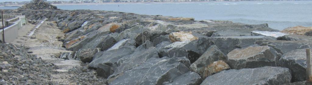
17 PA NY CT 35 million people one of eight people in the United States - live within 100 miles of the NJ shore 25 million (one out of eleven) live within 50 miles of the NJ shore MD NJ DE Population density & affluence create demand & value

18 Annual State Appropriation NJ = $25M FL = $30M Area (sq mi) Population Population Density Miles of Beach People per Mile of Beach NJ 7,420 8,400,000 1, ,300 FL 54,300 17,000, ~1,000 17,000 FL/NJ NJ and Florida Compared


19 Before After Cape May Point


20 Gurney Ave Baltimore Ave Before and After at Cape May


21 Seawalls at Avalon & N. Wildwood
22 NOTE NAN placed ~ 23 MCY From Sea Bright to Manasquan Inlet, NJ Shore Protection Program Beachfills
23 Barnegat Inlet Cape May Inlet Manasquan Inlet NAVIGATION INLETS & NJIWW Coastal Mission Areas

24 Dolos Placement, Manasquan Inlet

25 Before After Barnegat Inlet, New South Jetty

26 Nearshore Placement of Barnegat Inlet Sand at North End LBI, 2003 Beneficial Use of Dredged Material

27 USACE Dredge Geothals, Cape May Inlet, 1974 Beneficial Use of Dredged Material
28 FY 2012 O&M DREDGING MANASQUAN BARNEGAT CAPE MAY NJIWW FY12 Inlet Dredging
29 Lower Cape May Meadows, Before Beachfill (1994) After Beachfill (2005) ECOSYSTEM RESTORATION Coastal Mission Areas


30 Wetland restoration Invasive plant control Beachfill and periodic nourishment Internal hydrology improvements Lower Cape May Meadows Ecosystem Restoration
 Study Phase 2012 NJSP Program")
31 NJ Shore Protection Program 2012 Status Constructed Authorized (Unconstructed) Study Phase 2012 NJSP Program Status
32 130 Miles of Coast, Sandy Hook to Cape May Pt. Inlets 7 miles = 5% Reserves (State, national parks, etc) 25 miles = 19% 50 miles = 38% No USACE beachfill yet as part of NJSPP 48 miles = 37% Beachfill as part of NJSPP 98 miles of developed beach front in NJ NJ Shoreline Categories
33 QUESTIONS....
Dredging, Beach Nourishment and. Bird Conservation Workshop Atlantic Coast Region
 Dredging, Beach Nourishment and US Army Corps Bird Conservation Workshop Atlantic Coast Region Beach Nourishment and Bird Habitat Restoration in Southern New Jersey Shore Protection and Ecosystem Restoration
TABLE OF CONTENTS. Executive Summary 1 Acknowledgements 3 Introduction 3 Storm Recovery and Beach Project Effectiveness 3
 TABLE OF CONTENTS Executive Summary 1 Acknowledgements 3 Introduction 3 Storm Recovery and Beach Project Effectiveness 3 Monmouth County 4 Figures 1a-1d. Monmouth County Station Locations 5 Site Descriptions
Philadelphia District: Cape May County, New Jersey
 ERDC/RSM-DB6, June 2003 Regional Sediment Management (RSM) Demonstration Program Project Brief Philadelphia District: Cape May County, New Jersey ISSUE The Atlantic coast of New Jersey extends from Sandy
New Jersey Dept. of Environmental Protection Shore Protection Program
 New Jersey Dept. of Environmental Protection Benjamin Keiser, Manager 1510 Hooper Avenue, Suite 140 Toms River, New Jersey 08753 1-732-255-0767 New Jersey s State of New Jersey Chris Christie, Governor
New Jersey Regional Sediment Management
 New Jersey Regional Sediment Management RSM Demo: Cape May Inlet / Wildwood Sand Bypassing Project Ocean County N Atlantic Ocean Atlantic County Delaware Bay Cape May County 8 0 8 16 Miles Regional Sediment
State of New Jersey Chris Christie, Governor. Dept. of Environmental Protection Bob Martin, Commissioner
 Cape May Beach 2016/2017 Renourishment Cape May Inlet to Lower Township & Lower Cape May Meadows Cape May Point Cape May County, New Jersey New Jersey Department of Environmental Protection Engineering
New Jersey Dept. of Environmental Protection Shore Protection Program
 New Jersey Dept. of Environmental Protection William Dixon, Acting Manager 1510 Hooper Avenue, Suite 140 Toms River, New Jersey 08753 1-732-255-0767 New Jersey s State of New Jersey Chris Christie, Governor
Economic Values Generated by the New Jersey Shore for Climate Change and Coastal Hazards Conference
 Economic Values Generated by the New Jersey Shore for Climate Change and Coastal Hazards Conference Professor Joseph J. Seneca Bloustein School of Planning and Public Policy, Rutgers University 25 May
Corps Dredge Plan 2016 Emily Hughes Env Resources, USACE BUILDING STRONG
 Corps Dredge Plan 2016 Emily Hughes Env Resources, USACE Goodbye Jeff Richter!! Navigation/Operations USACE Goal/Mission: To maintain safe Navigation in Federal Channels using methods that are most (1)
RESTORE Act Bucket 2 Planning Public Meeting
 RESTORE Act Bucket 2 Planning Public Meeting James C. Gibeaut, Ph.D. Coastal and Marine Geospatial Sciences Harte Research Institute for Gulf of Mexico Studies Texas A&M University Corpus Christi Public
Northeast Florida Coastal Wetland Restoration Program A Partnership Based Regional Approach for Estuary Habitat Restoration
 Northeast Florida Coastal Wetland Restoration Program A Partnership Based Regional Approach for Estuary Habitat Restoration Paul Haydt Restore America s Estuaries November 15, 2010 St Johns River Water
Palm Beach County. Estuarine Habitat Mapping
 Palm Beach County Estuarine Habitat Mapping Coastal Habitat Integrated Mapping and Monitoring Program (CHIMMP) April 29, 2014 Eric Anderson, Environmental Analyst Palm Beach County Department of Environmental
Endangered Species Monitoring - Northern Coastline of New Jersey
 Endangered Species Monitoring - Northern Coastline of New Jersey By: Mark H. Burlas, Sr. Wildlife Biologist U.S. Army Corps of Engineers New York District Planning Division Presentation Format Project
Sector Delaware Bay/District 5NR - Coast Guard Auxiliary Patrol Areas. Eastern Area
 Enclosure (2) to SECDELBAYINST 16790.1F Sector Delaware Bay/District 5NR - Coast Guard Auxiliary Patrol Areas STA Manasquan Inlet: (Div 16) Eastern Area Station (Small) Shark River: AREA 1 Shark River
Ensuring habitat considerations in beach and shoreline management along Delaware Bay a bay wide perspective.
 Ensuring habitat considerations in beach and shoreline management along Delaware Bay a bay wide perspective. Kimberly B. Cole, David B. Carter, Tricia K. Arndt Delaware Coastal Programs Delaware Bay Coastal
Lakes and Rivers Division, David Dale
 Locks and Dams 2, 3, and 4 Monongahela River, PA (Lower Mon Project) Inland Waterways Users Board Lakes and Rivers Division, David Dale November 2014 David Dale, PE, PMP Braddock Dam US Army Corps of Engineers
Navigation RD&T Highlights
 Navigation RD&T Highlights W. Jeff Lillycrop Technical Director, Navigation Engineering Research and Development Center U.S. Army Corps of Engineers 22 July 2014 Vicksburg, MS US Army Corps of Engineers
COASTAL MANAGEMENT ELEMENT
 COASTAL MANAGEMENT ELEMENT of the PINELLAS COUNTY COMPREHENSIVE PLAN Prepared By: The Pinellas County Planning Department as staff to the LOCAL PLANNING AGENCY for THE BOARD OF COUNTY COMMISSIONERS OF
Piping Plovers - An Endangered Beach Nesting Bird, and The Threat of Habitat Loss With. Predicted Sea Level Rise in Cape May County.
 Piping Plovers - An Endangered Beach Nesting Bird, and The Threat of Habitat Loss With Thomas Thorsen May 5 th, 2009 Predicted Sea Level Rise in Cape May County. Introduction and Background Piping Plovers
City of Cape May Master Plan Reexamination. Open House - April 16, 2018
 City of Cape May Master Plan Reexamination Open House - April 16, 2018 2 What is a Master Plan Vision for the municipality Provides direction and guidance for the growth, resource preservation, and land
Chesapeake Bay adaptation Designing marshes for David Curson, National Audubon Society Erik Meyers, The Conservation Fund
 Chesapeake Bay adaptation Designing marshes for 2100 David Curson, National Audubon Society Erik Meyers, The Conservation Fund Blackwater National Wildlife Refuge Maryland s Everglades Biological Resources:
PRESENTATION TITLE. Regional Sediment Management. Common goals for uncommon results. AAPA Facilities Engineering Seminar October 22, 2015
 Regional Sediment Management PRESENTATION TITLE Common goals for uncommon results AAPA Facilities Engineering Seminar October 22, 2015 Presented by: Milan A. Mora, PE Project Manager Water Resources Branch
Old House Channel Bathymetric and Side Scan Survey
 FIELD RESEARCH FACILITY DUCK, NC Old House Channel Bathymetric and Side Scan Survey COASTAL AND HYDRAULICS LABORATORY FIELD DATA COLLECTION AND ANALYSIS BRANCH Michael Forte December 2009 View looking
Richard A. Fischer, Ph.D. U.S. Army Engineer Research and Development Center Environmental Laboratory
 Regional Sediment Management - Beneficial Uses of Dredged Material Along Lake Erie and Tributaries Section 204 of the 1992 Water Resources Development Act Richard A. Fischer, Ph.D. U.S. Army Engineer Research
CCMP Expert Workshops Preliminary Results and Next Steps
 Credit: Mark Houlday Lewes, DE Credit: Sandi Bisgood CCMP Expert Workshops Preliminary Results and Next Steps 2 Workshop Schedule Webinar: 11/7 Recording available online Healthy Waters (1): 11/17 DRBC;
New Jersey PRESERVING OUR WATERFOWLING TRADITION THROUGH HABITAT CONSERVATION!
 New Jersey PRESERVING OUR WATERFOWLING TRADITION THROUGH HABITAT CONSERVATION! he Delaware Bay and the New York Bight watersheds provide a multitude of critical wetland and upland habitats for fish and
Piping Plover Nesting Results in New Jersey: 2017
 Piping Plover Nesting Results in New Jersey: 2017 Prepared by Emily Heiser, Wildlife Biologist Conserve Wildlife Foundation of New Jersey and Christina Davis, Environmental Specialist II New Jersey Division
Lakes and Rivers Division, Mr. David Dale
 Locks and Dams 2, 3, and 4 Monongahela River, PA (Lower Mon Project) Inland Waterways Users Board Lakes and Rivers Division, Mr. David Dale 25 February 2015 Braddock Dam US Army Corps of Engineers Charleroi
Facts about the DuPont Nature Center at Mispillion Harbor Reserve
 Facts about the DuPont Nature Center at Mispillion Harbor Reserve The Center: The DuPont Nature Center at Mispillion Harbor Reserve is a $2.1 million natural history interpretive center and wildlife observatory.
Taking RSM to the Next Level
 Taking RSM to the Next Level Q AVG Jackie Keiser Chief, Coastal and Navigation USACE Jacksonville District Q AVG RSM & EWN In-Progress Review 21 July 2014 US Army Corps of Engineers BUILDING STRONG RSM:
Distribution of Piping Plover and Coastal Birds in Relation to Federal Activities on the Southern Coast of Long Island
 U.S. U.S. Fish Fish & Wildlife & Wildlife Service Service Distribution of Piping Plover and Coastal Birds in Relation to Federal Activities on the Southern Coast of Long Island Implications for Project
ASSEMBLY JOINT RESOLUTION No. 48 STATE OF NEW JERSEY. 218th LEGISLATURE INTRODUCED JANUARY 29, 2018
 ASSEMBLY JOINT RESOLUTION No. STATE OF NEW JERSEY th LEGISLATURE INTRODUCED JANUARY, 0 Sponsored by: Assemblywoman DIANNE C. GOVE District (Atlantic, Burlington Ocean) Assemblyman BRIAN E. RUMPF District
Shore Protection Project Performance Improvement Initiative (S3P2I)
") Shore Protection Project Performance Improvement Initiative (S3P2I) 2005 Tri-Service Infrastructure Conference August 1-5, 2005 St. Louis, MO Presented by: Susan Durden, IWR Authority Military Construction
Shore Protection Project Performance Improvement Initiative (S3P2I) 2005 Tri-Service Infrastructure Conference August 1-5, 2005 St. Louis, MO Presented by: Susan Durden, IWR Authority Military Construction
ODU CEEVC and SAME Fall 2009 Seminar
 NASA/Goddard Space s Wallops Flight Facility ODU CEEVC and SAME Fall 2009 Seminar Paul Bull, P.E. Senior Project Manager 1 Location, Location, Location NASA/ Goddard D.C. Area Pentagon DARPA Missile Defense
Instruction with Hands-on Practice: Creating a Bathymetric Database & Datum Conversion
 Instruction with Hands-on Practice: Creating a Bathymetric Database & Datum Conversion Tanya Beck Coastal and Hydraulics Laboratory Engineer Research and Development Center May 17, 2010 US Army Corps of
Oil Spill Funds and the Opportunities they Present for Galveston Bay
 Oil Spill Funds and the Opportunities they Present for Galveston Bay A presentation to Texas Environmental Grantmakers Group By Bob Stokes, President, Galveston Bay Foundation Friday, October 31, 2014
DREDGED MATERIAL SETTLEMENT FROM MARSH CREATION PROJECTS CONDUCTED IN COASTAL LOUISIANA
 DREDGED MATERIAL SETTLEMENT FROM MARSH CREATION PROJECTS CONDUCTED IN COASTAL LOUISIANA Thomas McGinnis CPRA Operations Division Lafayette Regional Office National Conference on Ecosystem Restoration August
Cat Island Chain Restoration Project Brown County Port & Resource Recovery Department
 Cat Island Chain Restoration Project Brown County Port & Resource Recovery Department February 2, 2015 Fox River and Lower Green Bay Cat Island Chain - 1938 Cat Island Brown County Aerial Photography,
Beach Nourishment in Galveston, Texas A Long Term Plan For Success
 Beach Nourishment in Galveston, Texas A Long Term Plan For Success Reuben Trevino, Director of Operations Galveston Island Park Board of Trustees Parks & Natural Areas (PNA) Sub-Committee Natural Resources
Lower Cape May Meadows Ecological Restoration: Analysis of Economic and Social Benefits
 Lower Cape May Meadows Ecological Restoration: Analysis of Economic and Social Benefits Elizabeth Schuster, Environmental Economist The Nature Conservancy June 2014 Contact Elizabeth Schuster at eschuster@tnc.org
U.S. Army Corps of Engineers Regulatory Program
 U.S. Army Corps of Engineers Regulatory Program Hull Offshore Wind Workshop Hull, Massachusetts 12 May 2011 Presented by: James W. Haggerty Regulatory Program Manager North Atlantic Division US Army Corps
Maryland Coastal Bays Colonial Waterbird and Islands Report 2018
 Maryland Coastal s Colonial Waterbird and Islands Report 2018 THE REPORT This report provides an assessment of the current state of colonial waterbird breeding in the Coastal s of Maryland behind Ocean
1. Qualitative Assessment... II-101
 Table of Contents I. Introduction... I-1 A. Session Law 2009-479 / House Bill 709... I-2 B. Public Consultation... I-3 C. Selection of Study Sites... I-5 D. Limitations of Study... I-8 II. Physical Assessment...
Project Completion Report Subaward # S /S Grant # &
 Project Completion Report Subaward # S3160610/S31606009 Grant # 2003-38500-13505 & 2004-38500-14589 PROJECT CODE: SUBCONTRACT/ACCOUNT NO: Q228901/Q229201 PROJECT TITLE: The Development of a Code of Practice
A Rising Tide: Conserving Shorebirds and Shorebird Habitat within the Columbia River Estuary
 A Rising Tide: Conserving Shorebirds and Shorebird Habitat within the Columbia River Estuary By Vanessa Loverti USFWS Migratory Birds and Habitat Programs, Portland, Oregon May 28, 2014 Outline of Talk
Programmatic Updates & Perspectives Julie Thomas Executive Director, SCCOOS
 Programmatic Updates & Perspectives Julie Thomas Executive Director, SCCOOS Board of Governors Meeting Hyperion Water Reclamation Plant Los Angeles December 3,2015 Southern California Coastal Ocean Observing
Wetland Restoration at Blackwater NWR. Dixie Birch November 2, 2006
 Wetland Restoration at Blackwater NWR Dixie Birch November 2, 2006 Goal: Restore 20,000 acres In Dorchester County including 11,000 at Blackwater Strategic Partnerships Remaining marsh shown in red Blackwater
Management Unit 2: East Beach to West Beach, Selsey
 Management Unit 2: East Beach to West Beach, Selsey Unit limits 4400m from 487200E, 094300N to 484450E, 093100N This Unit also forms Unit 1 of the South Downs SMP. Coastal processes The Selsey peninsula,
Designing Salt Marshes for 2100: Climate Adaptation in the Chesapeake Bay
 THE CONSERVATION FUND Designing Salt Marshes for 2100: Climate Adaptation in the Chesapeake Bay Who We Are Results and Recognition Our Partners Areas of Expertise www.conservationfund.org THE CONSERVATION
Offshore Drilling in the Atlantic January 2018
 Offshore Drilling in the Atlantic January 2018 Scientific evidence and history prove that drilling for oil and gas reserves off the Atlantic coast will unnecessarily imperil wildlife and threaten local
Beach Management Funding Assistance Program
 DEPARTMENT OF ENVIRONMENTAL PROTECTION Division of Water Resource Management January 23, 2014 Fixed Capital Outlay Local Government Funding Requests For FY 2014/2015 TABLE OF CONTENTS Introduction... 4
Kaskaskia River Watershed
 Kaskaskia River Watershed Kaskaskia River Basin Initiative Through Locally Led Efforts Ed Weilbacher, Coordinator, USDA-NRCS Providing technical assistance to the Southwestern Illinois RC&D, Inc. FACTS
NJ Marine Sediment Data from the National Coastal Condition Assessment and 2010
 NJ Marine Sediment Data from the National Coastal Condition Assessment 2000-2006 and 2010 Bob Schuster NJDEP Water Monitoring and Standards Bureau of Marine Water Monitoring NJ Water Monitoring Council
Environmental Stewardship
 Environmental Stewardship Jeff Wingfield Director of Environmental and Public Affairs 1 Environmental Enhancement Antioch Dunes Restoration 2 Dunes History Glacial sand deposits along San Joaquin River
Cleveland Lakefront Nature Preserve: A Unique Urban Wildlife Haven on Lake Erie
 CLEVELAND-CUYAHOGA COUNTY PORT AUTHORITY Cleveland Lakefront Nature Preserve: A Unique Urban Wildlife Haven on Lake Erie 2012 AAPA Environmental Awards Competition May 2012 Contact Brian Lynch Vice President,
Alternative Technologies in Beach Preservation
 Alternative Technologies in Beach Preservation Proceedings of the 7th National Conference on Beach Preservation Technology Hyatt Regency Hotel Tampa, Florida February 9-11,1994 Conference Organizers: Florida
Inland Waterways Users Board #60. Inland Navigation R&D
 Inland Waterways Users Board #60 Inland Navigation R&D 19 February 2009 Vicksburg, MS Agenda 0845-0900 Welcome Dr. Jeff Holland 0900 0920 Agenda & Navigation R&D Overview Mr. Jeff Lillycrop 0920-0940 Mississippi
Great Lakes Coastal Wetland Monitoring: Providing a Basis for Prioritizing and Evaluating Restoration
 Webinar Series 2.14.15 Great Lakes Coastal Wetland Monitoring: Providing a Basis for Prioritizing and Evaluating Restoration Webinar Agenda Coastal Wetland Priorities under the GLRI Kevin O Donnell, U.S.
Directions to Shore Conference Fields
 Directions to Shore Conference Fields MONMOUTH COUNTY ASBURY PARK Field address: Sunset Avenue, Asbury Park Directions: From South -- Parkway Exit 100A. Take Route 66 east to traffic circle. Follow Route
THE SPATIAL AND TEMPORAL DISTRIBUTION OF PIPING PLOVERS IN NEW JERSEY: CHRISTINA LIN KISIEL. A Thesis submitted to the
 THE SPATIAL AND TEMPORAL DISTRIBUTION OF PIPING PLOVERS IN NEW JERSEY: 1987-2007 by CHRISTINA LIN KISIEL A Thesis submitted to the Graduate School-New Brunswick Rutgers, The State University of New Jersey
Lakewide Action and Management Plans - LAMPs Beth Hinchey Malloy & Liz LaPlante, US EPA GLNPO
 Lakewide Action and Management Plans - LAMPs Beth Hinchey Malloy & Liz LaPlante, US EPA GLNPO An Overview Prepared for GL ANS Panel Meeting Nov 7, 2018 Great Lakes Water Quality Purpose is to restore and
Exploring National Marine Sanctuaries
 Each student team researches and reports on one of the National Marine Sanctuaries and completes a thought-provoking worksheet to compare and contrast their sanctuary with the others. SUBJECTS Science,
1. Working with Bathymetry
 1. Working with Bathymetry The CMS setup for Shark River Inlet provides a succinct example for illustrating a number of methods and SMS tools that can be applied to most engineering projects. The area
SENATE CONCURRENT RESOLUTION No. 158 STATE OF NEW JERSEY. 217th LEGISLATURE INTRODUCED JUNE 26, 2017
 SENATE CONCURRENT RESOLUTION No. STATE OF NEW JERSEY th LEGISLATURE INTRODUCED JUNE, 0 Sponsored by: Senator JEFF VAN DREW District (Atlantic, Cape May and Cumberland) Senator ROBERT M. GORDON District
Goal: Effective Decision Making
 Goal: Effective Decision Making Objective 1. Enhance inter-agency coordination Focus on aspects of governmental decision-making (NEPA and other existing siting/regulatory programs) related to marine energy
LOUISIANA NAWCA PROJECTS
 LOUISIANA NAWCA PROJECTS $47,109,174 $123,650,071 64 1,174,349 NAWCA GRANT AMOUNT TOTAL PARTNER CONTRIBUTION NUMBER OF PROJECTS TOTAL ACRES Louisiana currently has 64 NAWCA projects either completed or
INGESTION OF JALBTCX ALB DATASET INTO NOAA'S CHART PRODUCTION
 INGESTION OF JALBTCX ALB DATASET INTO NOAA'S CHART PRODUCTION Shachak Pe eri (JHC/CCOM) and Gretchen Imahori (NOAA) OCS/MCD (NOAA): John Barber, Anthony Klemm, Julia Powell, Mike Brown and John Nyberg
Coastal Wildlife Conservation Initiative
 Coastal Wildlife Conservation Initiative What is the Coastal Wildlife Conservation Initiative? A partnership strategy to address coastal issues that impact wildlife and their habitats USFWS CWCI Vision
Marine Corps Support Facility-Blount Island: Integrated Natural Resources Program Successes. E2S2 Conference May 12, 2011
 Marine Corps Support Facility-Blount Island: Integrated Natural Resources Program Successes E2S2 Conference May 12, 2011 Shari Kennedy, MCSF-BI Robert Price, CH2M HILL Location Mission The mission of Marine
Geographic Response Plan Map: SC-56. Map Continued on SC-50 XXX. Fripps Inlet. Raptor Nesting Area. Recreational Fishing. Sea Turtles.
 32 22'30"N Map Continued on SC-55 80 30'0"W X ull et SC56-01 Story/Harbor River Junction Story River!h!S(!d Old House Creek 1050 [ 400 1000 SC56-03 Old House Creek «Geographic Response Plan Map: SC-56
Expansion Work Has Begun The perimeter dike for Cell 7 is now visible
 Summer/Fall 2017 In This Issue Poplar Island Expansion Wetland Cell 5AB Development Wildlife Update Birding tours on Poplar Island Expansion Work Has Begun The perimeter dike for Cell 7 is now visible
Eco-Tourism and GIS. By: Sharon Mollick, GISP Assistant Planner Cumberland County Department of Planning & Development Bridgeton, New Jersey USA
 Eco-Tourism and GIS By: Sharon Mollick, GISP Assistant Planner Cumberland County Department of Planning & Development Bridgeton, New Jersey 08302 USA Abstract Cumberland County, NJ has an economic situation
Discovery Kick-Off Meeting Southeast Florida Coastal Study. May 30, 2014
 Discovery Kick-Off Meeting Southeast Florida Coastal Study May 30, 2014 Welcome and Introductions FEMA Region IV Mark Vieira Project Manager Christina Lindemer Technical Lead Henrietta Williams Outreach
New Jersey Coastal Zone Management Act Consistency Statement
 1.0 Project Background New Jersey Coastal Zone Management Act Consistency Statement A Coastal Zone Management Act Consistency Statement was prepared as part of the 2000 Environmental Impact Statement (EIS)
National Fish and Wildlife Foundation Executive Summary for the American Oystercatcher Business Plan
 National Fish and Wildlife Foundation Executive Summary for the American Oystercatcher Business Plan October 26, 2008 AMOY Exec Sum Plan.indd 1 8/11/09 5:24:00 PM Colorado Native Fishes Upper Green River
Southeast O ahu (SEO) Regional Sediment Management (RSM) Workshop #2 June 1, 2005 Ko olau Golf Course
 Regional Sediment Management (RSM) Workshop #2 June 1, 2005 Ko olau Golf Course") Southeast O ahu (SEO) Regional Sediment Management (RSM) Workshop #2 June 1, 2005 Ko olau Golf Course 1 June 2005 Southeast O ahu RSM Workshop #2 1 Agenda Welcome and Introductions Mr. Sam Lemmo Summary
Southeast O ahu (SEO) Regional Sediment Management (RSM) Workshop #2 June 1, 2005 Ko olau Golf Course 1 June 2005 Southeast O ahu RSM Workshop #2 1 Agenda Welcome and Introductions Mr. Sam Lemmo Summary
RESEARCH VILLAGE at WHITNEY LABORATORY for MARINE BIOSCIENCE For your consideration
 RESEARCH VILLAGE at WHITNEY LABORATORY for MARINE BIOSCIENCE For your consideration MISSION MISSION The mission of Whitney Laboratory for Marine Bioscience at the University of Florida is to use marine
Eastern Lake Ontario Dunes D-3 Assessment SLELO-PRISM Buckthorn and Swallow-wort Surveillance/Dune Willow Monitoring
 St. Lawrence Eastern Lake Ontario Partnership for Regional Invasive Species Management Eastern Lake Ontario Dunes D-3 Assessment Buckthorn and Swallow-wort Surveillance/Dune Willow Monitoring July 13 &
Ray Allen Executive Director (361)
") Ray Allen Executive Director (361)885-6204 rallen@cbbep.org www.cbbep.org CBBEP History 1987 U.S. Congress established the National Estuary Program (NEP) to promote longterm planning and management of
Ray Allen Executive Director (361)885-6204 rallen@cbbep.org www.cbbep.org CBBEP History 1987 U.S. Congress established the National Estuary Program (NEP) to promote longterm planning and management of
MLG to MLLW Vertical Datum Conversion. Mississippi River Venice, Louisiana to the Gulf of Mexico (Vicinity of Southwest Pass) Louisiana
 Louisiana") Engineering Documentation Report EDR-OD-01 MLG to MLLW Vertical Datum Conversion Mississippi River Venice, Louisiana to the Gulf of Mexico (Vicinity of Southwest Pass) Louisiana Prepared by: US Army Corps
Engineering Documentation Report EDR-OD-01 MLG to MLLW Vertical Datum Conversion Mississippi River Venice, Louisiana to the Gulf of Mexico (Vicinity of Southwest Pass) Louisiana Prepared by: US Army Corps
RSM Program Update. Linda S. Lillycrop RSM Program Manager. Jeff McKee HQ, Proponent Navigation Business Line Manager Q AVG
 Linda S. Lillycrop RSM Program Manager RSM Program Update Jeff McKee HQ, Proponent Navigation Business Line Manager Jeff Lillycrop ERDC Technical Director, Navigation & Civil Works Q AVG Eddie Wiggins
2003 New Jersey Endangered Beach Nesting Bird (Piping Plover, Least Tern and Black Skimmer) Site Management Report
 Site Management Report") 2003 New Jersey Endangered Beach Nesting Bird (Piping Plover, Least Tern and Black Skimmer) Site Report Prepared By C. David Jenkins, Principal Zoologist Todd Pover, Biological Assistant New Jersey Department
2003 New Jersey Endangered Beach Nesting Bird (Piping Plover, Least Tern and Black Skimmer) Site Report Prepared By C. David Jenkins, Principal Zoologist Todd Pover, Biological Assistant New Jersey Department
TENANT REPRESENTATION
 TENANT REPRESENTATION NORTHEAST REGION TENANT REPRESENTATION NORTHEAST REGION TENANT REPRESENTATION Tenant Size Type Territory Contact(s) 3,500-4,500 SF Power & Community Centers New York New Jersey Pennsylvania
Annual Report. Estuary Conservation Association. January 2014
 Annual Report 2013 Estuary Conservation Association Encouraging environmental stewardship for the Cocohatchee estuary that fosters a balance of nature and community through science, education, safe navigation
(CPAC) * * * * * * * * * * * * * * * * * * * * COAST * * * * * * * CONTACT
 * * * * * * * * * * * * * * * * * * * * COAST * * * * * * * CONTACT") 350 South Florida * Acadia Institute of Oceanography * Age of Aquarius * Alaska Wilderness League * American Bird Conservancy * Animal Welfare Institute * Apalachicola Riverkeeper * Assateague Coastal
350 South Florida * Acadia Institute of Oceanography * Age of Aquarius * Alaska Wilderness League * American Bird Conservancy * Animal Welfare Institute * Apalachicola Riverkeeper * Assateague Coastal
ADC The Map People Atlantic County, New Jersey Atlas: Street Map Book (Adc The Map People Atlantic County New Jersey Street Map) READ ONLINE
 READ ONLINE") ADC The Map People Atlantic County, New Jersey Atlas: Street Map Book (Adc The Map People Atlantic County New Jersey Street Map) READ ONLINE New Jersey's online and interactive State Atlas. Smart Growth
ADC The Map People Atlantic County, New Jersey Atlas: Street Map Book (Adc The Map People Atlantic County New Jersey Street Map) READ ONLINE New Jersey's online and interactive State Atlas. Smart Growth
NAVIGATION RD&T UPDATE
 1 NAVIGATION RD&T UPDATE W. Jeff Lillycrop Technical Director Navigation RD&T Needs & Priorities Dredging Optimization Quantifying Ship Movement Dredged Material Placement Data Access and Applications
Making Informed Decisions
 Making Informed Decisions Scientific research is an essential first step to solve environmental problems. However, many other factors must also be considered. How will the proposed solution affect people
Sherkin Island Hotel, Marina & Dún na Long Castle
 FOR SALE BY PRIVATE TREATY KEY FEATURES Site circa 2.2 acres Excellent range of facilities including 21 ensuite bedrooms, bar, lounge, function room & exhibition room 30-berth marina 10 minutes by boat
St. Johns County Fire Rescue. Community Update Presentation
 St. Johns County Fire Rescue Community Update Presentation Introduction Introduction History Overview AOR Missions Stations Apparatus Conclusion Historical perspective Provide an overview of current services
Update on American Oystercatcher Reseach and Conservation in New Jersey
 Update on American Oystercatcher Reseach and Conservation in New Jersey - 2007 Todd Pover, New Jersey Division of Fish and Wildlife - Endangered and Nongame Species Program Tom Virzi, PhD Candidate Department
Meeting Report. PORT ORFORD MARINE ECONOMIC DEVELOPMENT PROJECT TEAM Monday, May 12, 2008 American Legion Hall
 Meeting Report PORT ORFORD MARINE ECONOMIC DEVELOPMENT PROJECT TEAM Monday, May 12, 2008 American Legion Hall Mayor Jim Auborn called the meeting to order at 1 PM. He welcomed everyone and then asked each
Bolsa's biological rebuilding
 Sunday, August 20, 2006 Bolsa's biological rebuilding Newly restored wetlands are set to meet the sea this week for first time in more than 100 years. By PAT BRENNAN The Orange County Register A 30-year
RELATING TO THE MANAGEMENT OF CONSERVATION LANDS LOCATED ON THE SOUTHERN TIP OF THE EASTERN SHORE IN NORTHAMPTON COUNTY, VIRGINIA
 MEMORANDUM OF UNDERSTANDING Between THE U.S. FISH AND WILDLIFE SERVICE, DEPARTMENT OF THE INTERIOR and THE DEPARTMENT OF CONSERVATION AND RECREATION, COMMONWEALTH OF VIRGINIA and THE DEPARTMENT OF GAME
In 1815, the cost of moving goods by land was high. Water transportation was much cheaper, but was limited to the coast or navigable rivers
 Industrialization In 1815, the cost of moving goods by land was high Cost just as much to haul heavy goods by horse-drawn wagons 30 mi. as it did to ship the 3,000 mi. across the Atlantic Ocean Water transportation
Overview and Identification of Introduced Exotic and Native Forms of Common Reed (Phragmites australis)
") Overview and Identification of Introduced Exotic and Native Forms of Common Reed (Phragmites australis) Prepared by Jil M Swearingen, National Park Service June 14, 2006 Description Phragmites is a tall,
Overview and Identification of Introduced Exotic and Native Forms of Common Reed (Phragmites australis) Prepared by Jil M Swearingen, National Park Service June 14, 2006 Description Phragmites is a tall,
Recent Developments in NOAA s Real- Time Coastal Observing Systems for Safe and Efficient Maritime Transportation
 Recent Developments in NOAA s Real- Time Coastal Observing Systems for Safe and Efficient Maritime Transportation Rich Edwing, Director NOAA Center for Operational Oceanographic Products and Services CMTS
MONITORING RUBBLE-MOUND COASTAL STRUCTURES WITH PHOTOGRAMMETRY
 ,. CETN-III-21 2/84 MONITORING RUBBLE-MOUND COASTAL STRUCTURES WITH PHOTOGRAMMETRY INTRODUCTION: Monitoring coastal projects usually involves repeated surveys of coastal structures and/or beach profiles.
GLMTF November 18, 2014 Presentation
 GLMTF November 18, 2014 Presentation Michigan Security Network Founded by major corporations, industry leaders and leading universities in 2008 as a non-profit organization (501c6). MiSN mission is to
Ecological Resilience and Regime Shifts: Evidence for Human and Climate Impacts on Coastal Ecosystems
 Ecological Resilience and Regime Shifts: Evidence for Human and Climate Impacts on Coastal Ecosystems Threshold Session Organizers: Anna Wachnicka 1 & Lynn Wingard 2 1 Florida International University,