Port Security and Technology - the U.S. Perspective. Michael S. Bruno Stevens Institute of Technology March 14, 2012
|
|
|
- Junior Hutchinson
- 5 years ago
- Views:
Transcription


1 Port Security and Technology - the U.S. Perspective Michael S. Bruno Stevens Institute of Technology March 14, 2012

2 CSR A Department of Homeland Security National Center of Excellence for Port Security


3 More than 20 addt l industry collaborators CSR A Department of Homeland Security National Center of Excellence for Port Security
4 Bottom Line Upfront Understand the threat Know the environment Build trust with stakeholders & partners Experiment, experiment CSR A Department of Homeland Security National Center of Excellence for Port Security

5 Maritime Domain Awareness Approach Dual Use Technologies Demonstrate Vessel Detection Global > Approaches > Port University of Miami Global Satellite Coverage, Visible & Microwave Rutgers University Over-the-Horizon Compact High Frequency Radar Networks Stevens Institute of Technology Shallow Underwater Acoustics

6 Global Vessel Traffic Patterns The Center for Secure and Resilient Maritime Commerce (CSR)
7 The Challenge


8 The Challenge

9 The Challenge U.S. 2010: 95,000 miles of coastline; 361 ports $958 billion intl commerce on the MTS 8 million cruise ship and ferry passengers 13 million registered recreational boaters

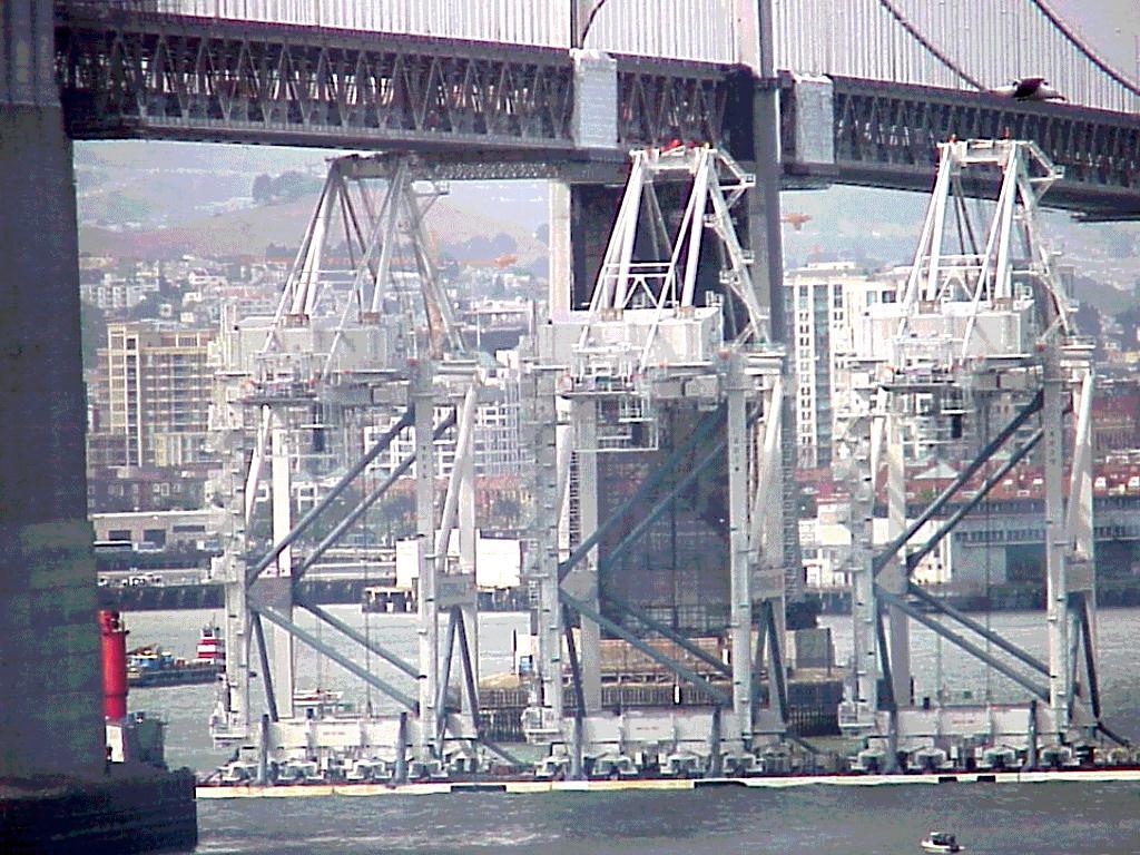
10 Inner New York Harbor (lower right: Verrazano Narrows Bridge visible) Details on ships wakes (speed, heading and course) vessel type (cargo, container, tanker, etc.) ELECTRO-OPTICAL SENSORS FORMOSAT-2-2 M PANCHROMATIC The Center for Secure and Resilient Maritime Commerce (CSR)

11 TerraSAR-X SpotLight Image on 21 JUN 11:11 UTC The Center for Secure and Resilient Maritime Commerce (CSR)
12 Mid-Atlantic HF Radar Network 14 Long-Range HF Radars 7 Medium-Range HF Radars 15 Short-Range HF Radars 36 Total 12 The Center for Secure and Resilient Maritime Commerce (CSR)


13 Mid-Atlantic Bight HF Radar Network 1000 km Alongshore Length Scale Mid-Atlantic HF Radar Network 14 Long-Range HF Radars 7 Medium-Range HF Radars 15 Short-Range HF Radars 36 Total 13 The Center for Secure and Resilient Maritime Commerce (CSR)
14 Bistatic Detections Buoy to Shore The Center for Secure and Resilient Maritime Commerce (CSR)


15 Monostatic and Bistatic Detections on the Amalthea Sea Bright radar and AIS Rx Belmar radar Track of Amalthea from 11:00 to 1:00 AIS data ends 20 km from receiver at Sea Bright Amalthea Ship Type: Tanker Length: 247 m LEAP The Center for Secure and Resilient Maritime Commerce (CSR)
16 (Portable) Stevens Passive Acoustic System

 0")
")
")

17 DEMON Signatures Ferry_B (#3) Speed Boat(#18) Sail Boat (#7)

18 Example of Spiral Development for Small Vessel Detection Small Vessel Security Strategy, 2008; Meetings with NYPD, USN, others Technology Capabilities, Multi-Sensors Detect & track entire range of vessels, incl non-ais November, 2009 How Small is Too Small? Planned: Mona Island, PR Arctic testbed Real-Time Applications NY Harbor July, 2010 & 2011 Netherlands, Oct, 2010 Port of Miami, April, 2011 HF Radar algorithms, acoustic classification, vessels at rest CSR A Department of Homeland Security National Center of Excellence for Port Security


19 Acoustic Tracking of SeaStreak SeaStreak tracking SeaStreak from satellite Detection distance 7 km Speed boat


20 Den Helder, October 11-15, 2010 Examining different environments Port of Miami, April 6-13, 2011

21 Success Stories Technology Making a Difference
22 CSR A Department of Homeland Security National Center of Excellence for Port Security


23 U.S. Coast Guard: Search And Rescue Optimal Planning System National HF Radar Network 151 Sites Mid-Atlantic Operational Data Flow to SAROPS SAROPS 96-Hour Search Area: SAROPS 96-Hour Search Area: HF Radar 12,000 km 2 CSR A Department of Homeland Security National Center of Excellence for Port Security

24
25

26 RADARSAT-2 15 JUN :51 GMT 0.62 m/s maximum speed The Center for Secure and Resilient Maritime Commerce (CSR)
27 (Portable) Stevens Passive Acoustic System

28 DIVER IN STEVENS TOW TANK

29 Diver signal Results of the Newport test Open-circuit SCUBA at ~600m
30 KNOW YOUR ENVIRONMENT!


31 NYHOPS: New York Harbor Observing and Prediction System Integrated system of observing sensors and forecast models TO OBSERVE TO PREDICT TO COMMUNICATE Weather Currents Water Level Salinity Temperature Waves Water Quality One high-resolution 3D model grid: 150,680 water cells. From 7.5km to <50m variable resolution. 7 coastal states.

32 Out to 48 hours


33 UUV Path Planning and Navigation Optimize a path in 4D through a complex field of currents Minimum energy Maximum Speed Maximum Loiter Area coverage 33 3/22/2012 CSR A Department of Homeland Security National Center of Excellence for Port Security

 Adaptive Predictive Controller")


34 Asset Adaptive Control Ocean forecast model Data assimilation, model improvement Event Estimation Threat assessment (environment, intel) Adaptive Predictive Controller Persistent Surveillance Tasking and path planning Sensor Assignment to Datalogger Dataloggers Sensors Dynamic Assignment Adaptive sampling of Static Sensors Adaptive sampling and real-time UUV path planning

35

36


37 An argument for Persistent Surveillance: Black Swans

38 US Airways flight 1549 Photo: Brendan Mcdermid/Reuters Photo: Brendan Mcdermid/Reuters

39 flightpath.wmv

40

41 Stevens forecast January 15, 2009, 1600 hours
42 January 15, 2009, 4:29pm Thank you Professor, I have forwarded your and followed up with our Watch Command Supervisor via telephone regarding this information. As always, we are very appreciative of your continued assistance and support. Michael Lee Director of Watch Command NYC Office of Emergency Management

43 FUTURE DIRECTIONS


44 Ongoing Passive Acoustic System Evolution Partnership with Sonardyne in the development of an integrated underwater senseand-warn system

45


46 HF Radar Testbed at High Latitudes Objective: Test the capability of the SeaSonde HF Radar as a detection and surveillance sensor at high latitudes. Sponsor: Participants: Northwest passage routes Remote Power Module AIS traffic near Barrow The Center for Secure and Resilient Maritime Commerce (CSR)
47 THANK YOU!
Multi Sensor Data Fusion
 Multi Sensor Data Fusion for improved maritime traffic monitoring in the Canadian Arctic Giulia Battistello*, Martin Ulmke*, Javier Gonzalez*, Camilla Mohrdieck** (*) Fraunhofer FKIE Sensor Data and Information
ACOUSTIC RESEARCH FOR PORT PROTECTION AT THE STEVENS MARITIME SECURITY LABORATORY
 ACOUSTIC RESEARCH FOR PORT PROTECTION AT THE STEVENS MARITIME SECURITY LABORATORY Alexander Sutin, Barry Bunin Stevens Institute of Technology, Castle Point on Hudson, Hoboken, NJ 07030, United States
Center for Secure and Resilient Maritime Commerce (CSR) U.S. Department of Homeland Security National Center of Excellence
 U.S. Department of Homeland Security National Center of Excellence") Center for Secure and Resilient Maritime Commerce (CSR) U.S. Department of Homeland Security National Center of Excellence YEAR ONE REPORT 2009 U.S. Department of Homeland Security National Center of Excellence
Center for Secure and Resilient Maritime Commerce (CSR) U.S. Department of Homeland Security National Center of Excellence YEAR ONE REPORT 2009 U.S. Department of Homeland Security National Center of Excellence
Abstract. 1. Introduction
 Title: Satellite surveillance for maritime border monitoring Author: H. Greidanus Number: File: GMOSSBordMon1-2.doc Version: 1-2 Project: GMOSS Date: 25 Aug 2004 Distribution: Abstract Present day remote
Enhanced Maritime Traffic Picture for the Canadian Arctic
 Enhanced Maritime Traffic Picture for the Canadian Arctic Giulia Battistello*, Martin Ulmke*, Camilla Mohrdieck** (*) Fraunhofer FKIE - Sensor Data and Information Fusion Department - Wachtberg, Germany
Recent Developments in NOAA s Real- Time Coastal Observing Systems for Safe and Efficient Maritime Transportation
 Recent Developments in NOAA s Real- Time Coastal Observing Systems for Safe and Efficient Maritime Transportation Rich Edwing, Director NOAA Center for Operational Oceanographic Products and Services CMTS
RESOLUTION MSC.278(85) (adopted on 1 December 2008) ADOPTION OF THE NEW MANDATORY SHIP REPORTING SYSTEM "OFF THE COAST OF PORTUGAL - COPREP"
 (adopted on 1 December 2008) ADOPTION OF THE NEW MANDATORY SHIP REPORTING SYSTEM OFF THE COAST OF PORTUGAL - COPREP") MSC 85/26/Add.1 RESOLUTION MSC.278(85) SYSTEM OFF THE COAST OF PORTUGAL COPREP THE MARITIME SAFETY COMMITTEE, RECALLING Article 28 of the Convention on the International Maritime Organization concerning
MSC 85/26/Add.1 RESOLUTION MSC.278(85) SYSTEM OFF THE COAST OF PORTUGAL COPREP THE MARITIME SAFETY COMMITTEE, RECALLING Article 28 of the Convention on the International Maritime Organization concerning
BookletChart. Intracoastal Waterway Grassy Key to Bahia Honda Key NOAA Chart A reduced-scale NOAA nautical chart for small boaters
 BookletChart Intracoastal Waterway Grassy Key to Bahia Honda Key NOAA Chart 11453 A reduced-scale NOAA nautical chart for small boaters When possible, use the full-size NOAA chart for navigation. Published
Satellite Technologies for Fisheries Monitoring, Control and Surveillance (MCS)
") JRC IPSC Maritime Affairs 1 Satellite Technologies for Fisheries Monitoring, Control and Surveillance (MCS) Juan Cicuendez, Marlene Alvarez JRC Info Day Madrid, 2 June 2010 IPSC - Institute for the Protection
JRC IPSC Maritime Affairs 1 Satellite Technologies for Fisheries Monitoring, Control and Surveillance (MCS) Juan Cicuendez, Marlene Alvarez JRC Info Day Madrid, 2 June 2010 IPSC - Institute for the Protection
Coastal Surveillance. SCANTER Radar Solutions
 Coastal Surveillance SCANTER Radar Solutions Protecting Your Coastlines and Maritime Domain We provide radar coverage of the coastline to detect and track all types of surface vessels and air targets.
The Future in Marine Radio Communication GMDSS. Department of Transportation United States Coast Guard
 The Future in Marine Radio Communication GMDSS Department of Transportation United States Coast Guard Do you use a Maritime Radio System? If so, the new Global Maritime Distress and Safety System (GMDSS)
The RCAF S&T program and the All Domain
 The RCAF S&T program and the All Domain Situational Awareness (ADSA) S&T Program) CADSI AIR FORCE Martin McKinnon Director S&T Air (DSTA-3) Assistant Deputy Minister, Science and Technology Department
MODIFYING AND IMPLEMENTING AN INVERSION ALGORITHM FOR WAVES FROM A BROAD-BEAM HF RADAR NETWORK
 MODIFYING AND IMPLEMENTING AN INVERSION ALGORITHM FOR WAVES FROM A BROAD-BEAM HF RADAR NETWORK Elizabeth Ann Livermont, Jon K. Miller, and Thomas O. Herrington Davidson Laboratory: Stevens Institute of
Stiletto. Maritime Demonstration Program C-UUV Capability Demonstration
 Maritime Demonstration Program C-UUV Capability Demonstration Persistent Aquatic Living Sensors (PALS) Proposers Day Presentation Biological Technologies Office (BTO) Defense Advanced Research Projects
Satellite services for maritime security
 Satellite services for ITS-T Sophia Antipolis 6 June 2007 Jean-Pierre Cauzac, CLS - Collecte Localisation Satellites 35 Are the seas becoming more dangerous? IMB report 2006 shows improvement: 239 piracy
The Nordic Institute of Navigation (NNF)
") The Nordic Institute of Navigation (NNF) www.nornav.org non-profit, independent and a non-political organization for professionals working within the field of navigation. The focus of NNF is on all aspects
The Nordic Institute of Navigation (NNF) www.nornav.org non-profit, independent and a non-political organization for professionals working within the field of navigation. The focus of NNF is on all aspects
LT Matthew Forney, NOAA Navigation Manager Alaska Region Bering Strait MaritimeSymposium. Office of Coast Survey
 NOAA LT Matthew Forney, NOAA Navigation Manager Alaska Region Bering Strait MaritimeSymposium Who is Coast Survey? First science agency of the U.S. Formed in 1807 Responsible for surveying 3.4 million
Using AIS to identify and investigate ferry accidents
 Using AIS to identify and investigate ferry accidents David Hewson Antenna Network Manager Genscape Vesseltracker info@genscape.com DE: +49 (0) 97 07 86 10 EU: +31 20 524 4089 Background Vesseltracker
BookletChart. Sacramento River Andrus Island to Sacramento NOAA Chart A reduced-scale NOAA nautical chart for small boaters
 BookletChart Sacramento River Andrus Island to Sacramento NOAA Chart 18662 A reduced-scale NOAA nautical chart for small boaters When possible, use the full-size NOAA chart for navigation. Included Area
Security Systems Division
 Security Systems Division SIVE A PIONEER MARITIME BORDER SURVEILLANCE SYSTEM. WHAT IS BEYOND? Pros and cons of the SIVE system today in the new coastal and deepwater border scenario and our vision of a
Juan GAVIRIA, Sector Leader AFTTR
 Earth Observation in support of the Western Indian Ocean Marine Highway Development and Coastal and Marine Contamination Prevention Project - Oil spill detection & Coral reef monitoring Juan GAVIRIA, Sector
Western Indian Ocean Marine Highway Development and Coastal and Marine Contamination Prevention Project - Oil spill detection & Coral reef monitoring
 Earth Observation in support of the Western Indian Ocean Marine Highway Development and Coastal and Marine Contamination Prevention Project - Oil spill detection & Coral reef monitoring Juan GAVIRIA, Sector
RESOLUTION MSC.230(82) (adopted on 5 December 2006) ADOPTION OF AMENDMENTS TO THE EXISTING MANDATORY SHIP REPORTING SYSTEM "IN THE STOREBÆLT (GREAT
 (adopted on 5 December 2006) ADOPTION OF AMENDMENTS TO THE EXISTING MANDATORY SHIP REPORTING SYSTEM IN THE STOREBÆLT (GREAT") MSC 82/24/Add.2 RESOLUTION MSC.230(82) MANDATORY SHIP REPORTING SYSTEM IN THE STOREBÆLT (GREAT BELT) TRAFFIC AREA THE MARITIME SAFETY COMMITTEE, RECALLING Article 28(b) of the Convention on the International
MSC 82/24/Add.2 RESOLUTION MSC.230(82) MANDATORY SHIP REPORTING SYSTEM IN THE STOREBÆLT (GREAT BELT) TRAFFIC AREA THE MARITIME SAFETY COMMITTEE, RECALLING Article 28(b) of the Convention on the International
CPRNW. WWNWS9/3/3/3.2 Meeting 9 20 July 2017 Agenda Item Joint MET/NAVAREA XVII and XVIII Client Survey
 CPRNW WWNWS WWNWS9/3/3/3.2 Meeting 9 20 July 2017 Agenda Item 3.3.3.2 Joint MET/NAVAREA XVII and XVIII Client Survey Submitted by Canada, NAVAREA XVII_XVIII SUMMARY Executive Summary: This document describes
OPT Commercialization Update
 OPT Commercialization Update Forward Looking Statements In addition to historical information, this presentation contains forward-looking statements that are within the safe harbor provisions of the Private
e-navigation Underway International February 2016 Kilyong Kim(GMT Co., Ltd.) Co-author : Seojeong Lee(Korea Maritime and Ocean University)
 Co-author : Seojeong Lee(Korea Maritime and Ocean University)") e-navigation Underway International 2016 2-4 February 2016 Kilyong Kim(GMT Co., Ltd.) Co-author : Seojeong Lee(Korea Maritime and Ocean University) Eureka R&D project From Jan 2015 to Dec 2017 15 partners
e-navigation Underway International 2016 2-4 February 2016 Kilyong Kim(GMT Co., Ltd.) Co-author : Seojeong Lee(Korea Maritime and Ocean University) Eureka R&D project From Jan 2015 to Dec 2017 15 partners
CODAR. Ben Kravitz September 29, 2009
 CODAR Ben Kravitz September 29, 2009 Outline What is CODAR? Doppler shift Bragg scatter How CODAR works What CODAR can tell us What is CODAR? Coastal Ocean Dynamics Application Radar Land-based HF radar
BookletChart. Chesapeake Bay Pocomoke and Tangier Sounds NOAA Chart A reduced-scale NOAA nautical chart for small boaters
 BookletChart Chesapeake Bay Pocomoke and Tangier Sounds NOAA Chart 12228 A reduced-scale NOAA nautical chart for small boaters When possible, use the full-size NOAA chart for navigation. Published by the
GMDSS communication systems
 GMDSS Basic Concepts A System Overview Functional requirements The GMDSS (Global Maritime Distress and Safety System) is specifically designed to automate a ship's radio distress alerting function, and,
KONGSBERG SATELLITE SERVICES 2017 Line Steinbakk, Director Programs. Himmel og hav - Ålesund 3. Oktober 2017
 KONGSBERG SATELLITE SERVICES 2017 Line Steinbakk, Director Programs Himmel og hav - Ålesund 3. Oktober 2017 KSAT HQ IN TROMSØ 69N Established in 1967 Kongsberg Satellite Services since 2002 World leading
Mission Solution 100
 Mission Solution 100 Standard configuration for littoral security Member of the Thales Mission Solution family Standard configuration of integrated sensors, effectors, CMS, communication system and navigation
WRC-12 Implications for Terrestrial Services other than Mobile Broadband. John Mettrop BDT Expert. Scope
 WRC-12 Implications for Terrestrial Services other than Mobile Broadband John Mettrop BDT Expert Scope Areas addressed Aeronautical Amateur Maritime Radiodetermination Public protection & disaster relief
BookletChart. Sacramento River Sacramento to Fourmile Bend NOAA Chart A reduced-scale NOAA nautical chart for small boaters
 BookletChart Sacramento River Sacramento to Fourmile Bend NOAA Chart 18664 A reduced-scale NOAA nautical chart for small boaters When possible, use the full-size NOAA chart for navigation. Included Area
Programmatic Updates & Perspectives Julie Thomas Executive Director, SCCOOS
 Programmatic Updates & Perspectives Julie Thomas Executive Director, SCCOOS Board of Governors Meeting Hyperion Water Reclamation Plant Los Angeles December 3,2015 Southern California Coastal Ocean Observing
*For International Stewardship of the Maritime Environment and its Resources. Photo
 *For International Stewardship of the Maritime Environment and its Resources *For Maritime Safety *For Security Photo # Providing Environmental Monitoring* # Increasing Security* # Enabling Safety Efforts*
L AGENCE NATIONALE DES FREQUENCES (ANFR) From Titanic to satellite from Morse to digital Entry in a new era for the maritime community
 From Titanic to satellite from Morse to digital Entry in a new era for the maritime community") L AGENCE NATIONALE DES FREQUENCES (ANFR) From Titanic to satellite from Morse to digital Entry in a new era for the maritime community ITU regional seminar 6-8 June 2018 St-Petersburg, Russian Federation
L AGENCE NATIONALE DES FREQUENCES (ANFR) From Titanic to satellite from Morse to digital Entry in a new era for the maritime community ITU regional seminar 6-8 June 2018 St-Petersburg, Russian Federation
COMMUNICATIONS FOR MARITIME SAFETY AND EFFICIENCY. Francis Zachariae, Secretary-General, IALA
 COMMUNICATIONS FOR MARITIME SAFETY AND EFFICIENCY Francis Zachariae, Secretary-General, IALA IALA and its Purpose Non profit, international technical association established in 1957 Two Goals aimed at
Introduction Objective and Scope p. 1 Generic Requirements p. 2 Basic Requirements p. 3 Surveillance System p. 3 Content of the Book p.
 Preface p. xi Acknowledgments p. xvii Introduction Objective and Scope p. 1 Generic Requirements p. 2 Basic Requirements p. 3 Surveillance System p. 3 Content of the Book p. 4 References p. 6 Maritime
CMRE La Spezia, Italy
 Innovative Interoperable M&S within Extended Maritime Domain for Critical Infrastructure Protection and C-IED CMRE La Spezia, Italy Agostino G. Bruzzone 1,2, Alberto Tremori 1 1 NATO STO CMRE& 2 Genoa
ROUTEING OF SHIPS, SHIP REPORTING AND RELATED MATTERS. Establishment of a Mandatory Ship Reporting System in the
 INTERNATIONAL MARITIME ORGANIZATION E SUB-COMMITTEE ON SAFETY OF NAVIGATION 48th session Agenda item 3 IMO NAV 48/3/2 11 April 2002 Original: ENGLISH ROUTEING OF SHIPS, SHIP REPORTING AND RELATED MATTERS
Downloaded by on April 16, DOI: /
 Polar Epsilon: Joint Space-Based Wide Area Surveillance and Support Project LCdr Robert Quinn Project Director Polar Epsilon Directorate of Space Development Phone: +1(613)945-5212 Quinn.rj2@forces.gc.ca
Dimov Stojče Ilčev. CNS Systems
 Stratospheric Platform Systems (SPS) Presentation by: Dimov Stojče Ilčev Durban University of Technology (DUT) Space Science Centre (SSC) CNS Systems August 2011 SPS for Mobile CNS Applications Stratospheric
FURUNO DEEPSEA WORLD Class-A Universal AIS Automatic Identification System. The future today with FURUNO's electronics technology.
 R FURUNO DEEPSEA WORLD Class-A Universal AIS Automatic Identification System Model FA-100 The AIS improves the safety of navigation by assisting in the efficient navigation of ships, protection of the
Copyright 2016 Raytheon Company. All rights reserved. Customer Success Is Our Mission is a registered trademark of Raytheon Company.
 Make in India Paradigm : Roadmap for a Future Ready Naval Force Session 9: Coastal Surveillance, Response Systems and Platforms Nik Khanna, President, India April 19, 2016 "RAYTHEON PROPRIETARY DATA THIS
INTEGRATED NAVIGATION SYSTEMS
 INTEGRATED NAVIGATION SYSTEMS Basic terms *integrated navigation system *control system *propulsion system *cargo system *digital processing unit *sensor *electronic circuits *sensor output *pulsed input
Demonstrator of a Data Processing Centre (DPC) for satellite-based AIS services
 for satellite-based AIS services") Page 1 Demonstrator of a Data Processing Centre (DPC) for satellite-based AIS services 19/20 April 2012 gfabritius@cls.fr Overview of the presentation Page 2 Introducing CLS Introducing AIS / SAT-AIS Scope
Page 1 Demonstrator of a Data Processing Centre (DPC) for satellite-based AIS services 19/20 April 2012 gfabritius@cls.fr Overview of the presentation Page 2 Introducing CLS Introducing AIS / SAT-AIS Scope
The World s First Triple Nested HF Radar Test Bed for Current Mapping and Ship Detection
 The World s First Triple Nested HF Radar Test Bed for Current Mapping and Ship Detection Hugh Roarty Scott Glenn Josh Kohut Rutgers University Don Barrick Pam Kung CODAR Ocean Sensors FUTURE WORK (ROW4)
Rutter High Resolution Radar Solutions
 Rutter High Resolution Radar Solutions High Resolution Imagery, Target Detection, and Tracking At the core of our enhanced radar capabilities are proprietary radar processing and imaging technologies.
ROUTEING OF SHIPS, SHIP REPORTING AND RELATED MATTERS. New traffic separation schemes and two-way routes in Norra Kvarken
 E SUB-COMMITTEE ON SAFETY OF NAVIGATION 57th session Agenda item 3 NAV 57/3/7 11 March 2011 Original: ENGLISH ROUTEING OF SHIPS, SHIP REPORTING AND RELATED MATTERS New traffic separation schemes and two-way
ESA IAP Blue Belt demonstration project:
 Page 1 ESA IAP Blue Belt demonstration project: supporting the European Maritime Safety Agency (EMSA) Blue Belt Project, by providing a service based on satellite based AIS data complementing the terrestrial
Space Based Vessel Detection - Combining Earth Observation and AIS for Maritime surveillance TEXAS V and C-Σ III
 Space Based Vessel Detection - Combining Earth Observation and AIS for Maritime surveillance TEXAS V and C-Σ III Tony Bauna Director, Product and Service Development, Kongsberg Satellite Services, Tromsø,
GMDSS for Recreational Boaters
 GMDSS for Recreational Boaters OVERVIEW The Global Maritime Distress and Safety System (GMDSS) is an international system using advanced communications technology. Development of GMDSS was initiated by
Integrating Spaceborne Sensing with Airborne Maritime Surveillance Patrols
 22nd International Congress on Modelling and Simulation, Hobart, Tasmania, Australia, 3 to 8 December 2017 mssanz.org.au/modsim2017 Integrating Spaceborne Sensing with Airborne Maritime Surveillance Patrols
Future of Sustained Observations
 Future of Sustained Observations OceanObs 09 identified tremendous opportunities, significant challenges Called for a framework for planning and moving forward with an enhanced global sustained ocean observing
RESOLUTION MSC.229(82) (adopted on 5 December 2006) ADOPTION OF A NEW MANDATORY SHIP REPORTING SYSTEM "IN THE GALAPAGOS PARTICULARLY SENSITIVE SEA
 (adopted on 5 December 2006) ADOPTION OF A NEW MANDATORY SHIP REPORTING SYSTEM IN THE GALAPAGOS PARTICULARLY SENSITIVE SEA") MSC 82/24/Add.2 RESOLUTION MSC.229(82) IN THE GALAPAGOS PARTICULARLY SENSITIVE SEA AREA (PSSA) (GALREP) THE MARITIME SAFETY COMMITTEE, RECALLING Article 28(b) of the Convention on the International Maritime
MSC 82/24/Add.2 RESOLUTION MSC.229(82) IN THE GALAPAGOS PARTICULARLY SENSITIVE SEA AREA (PSSA) (GALREP) THE MARITIME SAFETY COMMITTEE, RECALLING Article 28(b) of the Convention on the International Maritime
TRINITY Standard configuration for littoral defence
 Standard configuration for littoral defence Member of the Thales Mission Solution family Unrivalled tracking and fire control solution for small manoeuvring targets Innovative approach and easy to install
Getting a feel for HF coastal radar
 Monitoring enhancement Getting a feel for HF coastal radar Pia Andersson Philip Axe In the early days The influence of ocean waves on HF radar backscatter was reported by Crombie in 1955. He examined the
Doug Miller Milltech Marine Inc. Milltech Marine 1
 Doug Miller Milltech Marine Inc. www.milltechmarine.com Milltech Marine 1 What I ll Cover What is AIS? AIS Transponders AIS Receivers Typical Usage Scenarios What s new and what s coming Questions Milltech
HarborGuard-Pro. Integrated Maritime Security & Surveillance System
 HarborGuard-Pro Integrated Maritime Security & Surveillance System Klein Marine Systems, Inc. 11 Klein Drive, Salem, NH, USA 03079 Web: www.kleinmarinesystems.com This technical data and software is considered
Targeting a Safer World. Public Safety & Security
 Targeting a Safer World Public Safety & Security WORLD S MOST EFFECTIVE AND AFFORDABLE WIDE-AREA SITUATIONAL AWARENESS Accipiter provides the world s most effective and affordable wide-area situational
PMAR Piracy, Maritime Awareness & Risks
 PMAR Piracy, Maritime Awareness & Risks Maritime Situational Awareness for Counter-Piracy European Commission Joint Research Centre 13 June 2012 GeoMaritime, London 1 MSA for counter-piracy study Key elements
An Introduction to High Frequency Surface Wave Radar
 An Introduction to High Frequency Surface Wave Radar Dr. Hugh Roarty Dr. Scott Glenn Presented by: Trevor Bartleet (Peralex Electronics) The Radar Masters Course at UCT http://radarmasters.co.za/ Set up
JCG GMDSS Symposium NAVDAT : Navigational Data
 JCG GMDSS Symposium 2013 NAVDAT : Navigational Data - System Presentation - Pascal OLIVIER NAVDAT Presentation Page 1/35 From analog to digital in maritime radio communications The current analog radio
Satellite Observations of Nonlinear Internal Waves and Surface Signatures in the South China Sea
 DISTRIBUTION STATEMENT A: Distribution approved for public release; distribution is unlimited Satellite Observations of Nonlinear Internal Waves and Surface Signatures in the South China Sea Hans C. Graber
S a t e l l i t e T i m e a n d L o c a t i o n. N o v e m b e r John Fischer VP Advanced R&D
 STL - S a t e l l i t e T i m e a n d L o c a t i o n N o v e m b e r 2 0 1 7 John Fischer VP Advanced R&D jfischer@orolia.com 11/28/201 1 7 WHY AUGMENT GNSS? Recent UK Study Economic Input to UK of a
Western Region enavigation Sub- Committee Report
 Western Region enavigation Sub- Committee Report Western Region enavigation meeting - Jan 12 18 BC Ferries BC Coast Pilots BCIT Marine Campus Canadian Coast Guard Canadian Hydrographic Services Canadian
ATTACHMENT E. How to Conduct a GMDSS Inspection.
 Page 1 of 7 NOTE: This document is an excerpt from The Report and Order In the Matter of Amendment of the Commission's Rules Concerning the Inspection of Radio Installations on Large Cargo and Small Passenger
«INTRARADAR» Port of Corfu
 «INTRARADAR» Port of Corfu INTERREG IIIA Greece-Italy IMPETUS was the contractor of the Prefecture of Corfu for the INTRARADAR project. The project focused on the provision, installation of hardware/software
APPLICATION OF OCEAN RADAR ON THE BALTIC, FEATURES AND LIMITATIONS
 APPLICATION OF OCEAN RADAR ON THE BALTIC, FEATURES AND LIMITATIONS Thomas Helzel, Matthias Kniephoff, Leif Petersen, Markus Valentin Helzel Messtechnik GmbH e-mail: helzel@helzel.com Presentation at Hydro
SAR Interferometry Capabilities of Canada's planned SAR Satellite Constellation
 SAR Interferometry Capabilities of Canada's planned SAR Satellite Constellation Dirk Geudtner, Guy Séguin,, Ralph Girard Canadian Space Agency RADARSAT Follow-on Program CSA is in the middle of a Phase
Active Towed Array Sonar Outstanding Over-The-Horizon Surveillance
 Active Towed Array Sonar Outstanding Over-The-Horizon Surveillance ACTAS Anti-Submarine Warfare... a sound decision ACTAS Philosophy Background Detect and Attack Effective Sonar Systems for Surface and
FOR MORE INFORMATION ON GMDSS CONTACT:
 FOR MORE INFORMATION ON GMDSS CONTACT: Commanding Officer USCG Navigation Center, MS 7310, 7323 Telegraph Road, Alexandria, VA 20598-7310 Tel:1-703-313-5900 www.navcen.uscg.gov Commandant (CG-652) Spectrum
Utilization of Radar data for Maritime Surveillance
 INDESO Project Utilization of Radar data for Maritime Surveillance DENDY MAHABROR MARINE RESEARCH CENTER INDESO RADAR GROUND STATION RADARSAT-2 AND COSMO-SKYMED BALI INDESO satelit VMS satelite radar vessel
Passages Between Acklins Island, Haiti and Caicos Islands NGA Chart A reduced-scale NGA nautical chart for small boaters
 BookletChart Passages Between Acklins Island, Haiti and Caicos Islands NGA Chart 26260 A reduced-scale NGA nautical chart for small boaters When possible, use the full-size NGA chart or Electronic Nautical
REFERENCES FAO FAO FAO/FishCode Flewwelling, P Flewwelling, P., Cullinan, C., Balton, D. & Reynolds, J.E Gallagher, R Kelleher, K
 40 REFERENCES FAO. 1998. Fish operations. 1. Vessel monitoring systems. FAO Technical Guidelines for Responsible Fisheries No. 1, Suppl. 1. Rome. 58 pp. FAO. 2007. Report of the Expert Consultation on
Satellites and autonomous robots: The future for Arctic observations
 Satellites and autonomous robots: The future for Arctic observations Jeremy Wilkinson British Antarctic Survey jpw28@bas.ac.uk Polarforskningskonferencen 2016 DTU, Oticon Salen, Anker Engelunds Vej 1,
Galileo and GMES Technologies for Maritime Navigation Christoph Günther, DLR
 Galileo and GMES Technologies for Maritime Navigation Christoph Günther, DLR Institut für Kommunikation und Navigation Seite 1 Maritime Safety and Efficiency Avoidance of Collisions based on known position
MARITIME, AIRBORNE AND LAND RADAR
 Commercial Radar RF POWER MARITIME, AIRBORNE AND LAND RADAR Powering maritime, ground based and airborne radar systems keeping crew, cargo and passengers safe around the world. Commercial Radar RF POWER
(P.27)
") (P.27) 27 7 210 120 8 * Navigation and Anchoring Prohibited Area has been changed since June, 2017. 9 Port of Osaka The Guidelines of Measures for preventing Typhoon Disaster ( Objective )
(P.27) 27 7 210 120 8 * Navigation and Anchoring Prohibited Area has been changed since June, 2017. 9 Port of Osaka The Guidelines of Measures for preventing Typhoon Disaster ( Objective )
Arctic Navigation Issues. e-nav conference Nordic Institute of Navigation Bergen, March 5 th 2009
 Arctic Navigation Issues e-nav conference Nordic Institute of Navigation Bergen, March 5 th 2009 by Anna B.O. Jensen - AJ Geomatics Jean-Paul Sicard - Rovsing A/S March 2009 1 Outline Reduction of ice
PASSIVE ACOUSTIC UNDERWATER NOISE MEASUREMENTS IN CONSTANTA PORT AREA
 PASSIVE ACOUSTIC UNDERWATER NOISE MEASUREMENTS IN CONSTANTA PORT AREA Mihail PRICOP 1 Tiberiu PAZARA 2 Codruta PRICOP 3 Dinu ATODIRESEI 4 Ionuț-Cristian SCURTU 5 1 Associate Professor, Mircea cel Batran
RADAR SATELLITES AND MARITIME DOMAIN AWARENESS
 RADAR SATELLITES AND MARITIME DOMAIN AWARENESS J.K.E. Tunaley Corporation, 114 Margaret Anne Drive, Ottawa, Ontario K0A 1L0 (613) 839-7943 Report Documentation Page Form Approved OMB No. 0704-0188 Public
GNSS (GPS) buoy array in the Pacific for natural disaster mitigation. Teruyuki KATO Earthquake Research Institute the University of Tokyo, Japan
 buoy array in the Pacific for natural disaster mitigation. Teruyuki KATO Earthquake Research Institute the University of Tokyo, Japan") GNSS (GPS) buoy array in the Pacific for natural disaster mitigation Teruyuki KATO Earthquake Research Institute the University of Tokyo, Japan 1 (Modified from Oki & Koketsu, 2011) Historical megaquakes
GNSS (GPS) buoy array in the Pacific for natural disaster mitigation Teruyuki KATO Earthquake Research Institute the University of Tokyo, Japan 1 (Modified from Oki & Koketsu, 2011) Historical megaquakes
Stay connected. at sea
 Stay connected at sea 4G system for internet access in coastal areas NeptuLink FAQs by MVG How does it work? Through its two antenna transmitter-receivers NeptuLink by MVG serves as a terminal that connects
ITU Service Publications (maritime) and MARS (Maritime mobile Access and Retrieval System)
 and MARS (Maritime mobile Access and Retrieval System)") ITU Service Publications (maritime) and MARS (Maritime mobile Access and Retrieval System) ITU Radiocommunication Bureau Ms. Sujiva Pinnagoda pinnagoda@itu.int BR/TSD/TPR Another BR activity Radiocommunication
ITU Service Publications (maritime) and MARS (Maritime mobile Access and Retrieval System) ITU Radiocommunication Bureau Ms. Sujiva Pinnagoda pinnagoda@itu.int BR/TSD/TPR Another BR activity Radiocommunication
A Surveillance System of a Military Harbour Using an Automatic Identification System
 A Surveillance System of a Military Harbour Using an Automatic Identification System Leon Rothkrantz Krispijn Scholte Abstract: The goal of our research is the design and implementation of an automated
Mode Of Transmission ID Frequency Area Remote Transmitting Site WT (MF) A 515 khz 13 05'N 80 17'E
 A 515 khz 13 05'N 80 17'E") Maritime Radio Station: Chennai (Madras) 13 05'N 80 17'E VWM Indian Ocean/Arab.Gulf/Red Sea WT (MF) A 515 khz 13 05'N 80 17'E 0548, 1548 A Navigational warning for the ara within 250 n miles of Chennai
Maritime Radio Station: Chennai (Madras) 13 05'N 80 17'E VWM Indian Ocean/Arab.Gulf/Red Sea WT (MF) A 515 khz 13 05'N 80 17'E 0548, 1548 A Navigational warning for the ara within 250 n miles of Chennai
SHIP DETECTION AND SEA CLUTTER CHARACTERISATION USING X&L BAND FULL-POLARIMETRIC AIRBORNE SAR DATA
 SHIP DETECTION AND SEA CLUTTER CHARACTERISATION USING X&L BAND FULL-POLARIMETRIC AIRBORNE SAR DATA S. Angelliaume, Ph. Martineau (ONERA) Ph. Durand, T. Cussac (CNES) Context CNES/ONERA study of Space System
LONG TERM GOALS OBJECTIVES
 A PASSIVE SONAR FOR UUV SURVEILLANCE TASKS Stewart A.L. Glegg Dept. of Ocean Engineering Florida Atlantic University Boca Raton, FL 33431 Tel: (561) 367-2633 Fax: (561) 367-3885 e-mail: glegg@oe.fau.edu
*For International Stewardship of the Maritime Environment and its Resources. Photo
 *For International Stewardship of the Maritime Environment and its Resources *For Maritime Safety *For Security Photo # Providing Environmental Monitoring* # Increasing Security* # Enabling Safety Efforts*
Market strategy update in Maritime segment. This presentation can be interpreted only together with the oral comments accompanying it
 Market strategy update in Maritime segment This presentation can be interpreted only together with the oral comments accompanying it 2 Market sub-segments and applications Recreational navigation: GNSS
APPLICATION OF DDS AND MAGNETIC BARRIER COOPERATING WITH ACOUSTIC BARRIERS AND TETHERED SONOBUOYS FOR HARBOUR AND ANCHORAGE UNDERWATER PROTECTION
 APPLICATION OF DDS AND MAGNETIC BARRIER COOPERATING WITH ACOUSTIC BARRIERS AND TETHERED SONOBUOYS FOR HARBOUR AND ANCHORAGE UNDERWATER PROTECTION ANDRZEJ ELMINOWICZ, LEONARD ZAJ CZKOWSKI OBR Centrum Techniki
Government Agency Perspectives & Initiatives Canadian Coast Guard Laurent Tardif, Director, Safe Shipping
 Unclassified Government Agency Perspectives & Initiatives Canadian Coast Guard Laurent Tardif, Director, Safe Shipping Mariner s Workshop January 23, 2019 1 Overview 1 Context 2 Marine Fees 3 4 5 Update
BookletChart. St. Joseph and Benton Harbor NOAA Chart A reduced-scale NOAA nautical chart for small boaters
 BookletChart St. Joseph and Benton Harbor NOAA Chart 14930 A reduced-scale NOAA nautical chart for small boaters When possible, use the full-size NOAA chart for navigation. Included Area Published by the
KONGSBERG SATELLITE SERVICES Earth Observation for Maritime Operations Current Capabilities and Future Potential
 KONGSBERG SATELLITE SERVICES 2017 Earth Observation for Maritime Operations Current Capabilities and Future Potential Andreas Hay Kaljord Project Manager KSAT HQ IN TROMSØ - 69N WELCOME TO TROMSØ Established
Satellite data for Maritime Operations. Andreas Hay Kaljord Project Manager Energy, Environment & Security
 Satellite data for Maritime Operations Andreas Hay Kaljord Project Manager Energy, Environment & Security Kongsberg Satellite Services (KSAT) World leading provider within our business area Supports 85
BookletChart. Port-au-Prince (Haiti) NGA Chart A reduced-scale NGA nautical chart for small boaters
 NGA Chart A reduced-scale NGA nautical chart for small boaters") BookletChart Port-au-Prince (Haiti) NGA Chart 26186 A reduced-scale NGA nautical chart for small boaters When possible, use the full-size NGA chart or Electronic Nautical Chart (ENC) for navigation. VHF
BookletChart Port-au-Prince (Haiti) NGA Chart 26186 A reduced-scale NGA nautical chart for small boaters When possible, use the full-size NGA chart or Electronic Nautical Chart (ENC) for navigation. VHF
ESSnet pilot AIS data. Anke Consten, Eleni Bisioti and Olav Grøndal (23 February 2017, Sofia)
") ESSnet pilot AIS data Anke Consten, Eleni Bisioti and Olav Grøndal (23 February 2017, Sofia) Overview 1. Introduction 2. Deliverables ESSnet pilot AIS data 3. Data access and handling 4. Quality of AIS
ESSnet pilot AIS data Anke Consten, Eleni Bisioti and Olav Grøndal (23 February 2017, Sofia) Overview 1. Introduction 2. Deliverables ESSnet pilot AIS data 3. Data access and handling 4. Quality of AIS
TACSAT-2 Target Indicator Experiment (TIE) AIS Payload Overview
 AIS Payload Overview") TACSAT-2 Target Indicator Experiment (TIE) AIS Payload Overview 2007 Maritime Domain Awareness Forum 29 October 2007 NRL_2007-MDAF-29OCT-TIE.1 Christopher Huffine Technical Staff, Code 8120 Naval Research
TACSAT-2 Target Indicator Experiment (TIE) AIS Payload Overview 2007 Maritime Domain Awareness Forum 29 October 2007 NRL_2007-MDAF-29OCT-TIE.1 Christopher Huffine Technical Staff, Code 8120 Naval Research
AIS and SATAIS. AIS is a globally available, mandatory and thus unique information source of each sea going
 AIS and SATAIS AIS is a globally available, mandatory and thus unique information source of each sea going vessel above 299 GRT including MMSI, name, position, speed, direction, cargo type, port of destination