sensefly Camera Collection
|
|
|
- Christine Boone
- 5 years ago
- Views:
Transcription

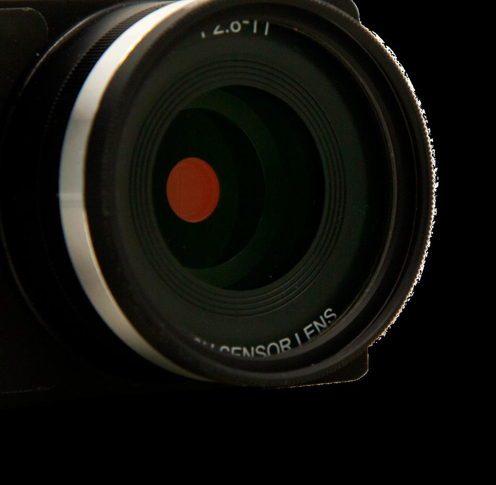

1 Camera Collection A professional sensor for every application

 every time, instead of just one, for a much")
2 Introducing S.O.D.A. 3D 3D mapping, redefined Image: S.O.D.A. 3D oblique image (left) merging into 3D mesh (right). Stunning digital 3D reconstructions in vertically-focused environments such as urban areas, open pit mines and coastlines over larger areas than quadcopters can achieve Vast coverage over flat, homogenous terrain (up to 500 ha / 1,235 ac per 122 m / 400 ft flight*) The S.O.D.A. 3D is a unique innovation a professional drone photogrammetry camera that changes orientation during flight to capture three images (2 oblique, 1 nadir) every time, instead of just one, for a much wider field of view. It is optimised for quick, robust image processing with Pix4Dmapper. * ebee X flight with Endurance Extension. Lens F/2.8-11, 10.6 mm (35 mm Resolution 20 MP 5,472 x 3,648 px (3:2) : JPEG, DNG+JPEG Exposure compensation Urban mapping Mine & quarry mapping Coastline mapping Large area mapping over flat terrain 1/30 1/2000s (sensor) 1/500 1/2000s (user-configurable) White balance cloudy, shady ISO range (sensor) (user-configurable) FOV Total FOV: optical 90 mechanical Direct In-Flight Georeferencing (DIFG) S.O.D.A. 3D s wide field of view ensures excellent 3D results in vertically-focused environments or vast mapping coverage over flat terrain. ebee X
 The Aeria X is a compact drone photogrammetry powerhouse.")


3 Smart Exposure technology Optimised exposure time suits numerous light conditions, including low-light Super sharp, rarely over-exposed images Minimal risk of noise & motion blur Meet the Aeria X The compact marvel of drone photogrammetry Image: Aeria X orthomosaic (1 cm/0.4 in GSD) The Aeria X is a compact drone photogrammetry powerhouse. This rugged innovation offers the perfect blend of size, weight and DSLR-like image quality. It offers stunning image detail and clarity, in virtually all light conditions, allowing you to map for more hours per day than ever before. Its built-in Direct In-Flight Georeferencing meanwhile boosts your efficiency even further by lowering the amount of image overlap required for greater coverage and quicker post-flight image processing. Direct In-Flight Georeferencing (DIFG) Records the GPS position and exact orientation of Aeria X at each capture location Less image overlap is required, enabling greater flight coverage and quicker image processing Improved reconstructions over difficult environments (water, forests etc.) z Surveying & cadastre APS-C Lens F/2.8-16, 18.5mm (28mm equivalent: 35 mm) Resolution 24 MP 6,000 x 4,000 px (3:2) : JPEG, DNG+JPEG Exposure compensation x y Topographic mapping Site digitisation Volume measurement Inspection 1/30 1/4000s (sensor) 1/500 1/2000s (user-configurable) White balance cloudy, shady ISO range (sensor) (user-configurable) FOV 75 (diagonal) HFOV: 64 Direct In-Flight Georeferencing (DIFG) Direct In-Flight Georeferencing automatically records the GPS position and orientation of the camera at each capture location. ebee X
 camera")
 to simplify")
 Resolution Thermal: 640 x 512 px (5:4) : 5,472 x 3,648 px (4:3) Irriga")
4 Presenting Duet T 2 sensors, 1 heat map star Image: Duet T orthomosaic (left) merging into thermal orthomosaic (right). The Duet T is a rugged dual-camera thermal mapping rig. Use it to create geo-accurate thermal maps and digital surface models quickly and easily. The Duet T includes a high-resolution thermal infrared (640 x 512 px) camera and a S.O.D.A. camera. Both image sources can be accessed as and when required, while the rig s built-in Camera Position Synchronisation feature works in sync with Pix4Dmapper photogrammetry software (optional) to simplify the map reconstruction process. Solar panel inspection s Thermal infrared (FLIR): (10.9 mm x 8.7 mm) : lens F/2.8-11, 10.6 mm (35 mm Thermal lens F/1.25, 13 mm (35 mm equivalent: 40 mm) Resolution Thermal: 640 x 512 px (5:4) : 5,472 x 3,648 px (4:3) Irrigation planning & analysis Animal management (e.g. counting & detection) Heat tracking & leak detection Environmental monitoring Thermal: rolling, 30 Hz : 1/500 1/2000s Thermal: R-JPEG : JPEG IMU Synchronized IMU Thermal FOV HFOV: VFOV: DFOV: FOV HFOV: 64 VFOV: 37 DFOV: 74 Duet T concurrently captures data and thermal infrared data, including a temperature reading for each pixel. ebee X

 per pixel at 120 m / 400 ft, composite color images, a global shutter for distortion-free captures and an additional light sensor (DLS 2) for highly-accurate radiometric calibration, making the")
 TIFF RedEdge-MX Plant health analysis Agricultural research / field trials Emergence tracking Disease monitoring Definition of management zones Fertiliser/input planning &")
5 Here s the MicaSense RedEdge-MX The sensor that doesn t compromise Image: MicaSense RedEdge-MX orthomosaic (left) merging into chlorophyll index output (right). The RedEdge-MX is a rugged and precise multispectral sensor for advanced agricultural analysis. It captures both the spectral bands required for crop health indices and an additional blue band for deeper insights into specific issues. The RedEdge-MX features an optimised GSD of 8 cm (3.1 in) per pixel at 120 m / 400 ft, composite color images, a global shutter for distortion-free captures and an additional light sensor (DLS 2) for highly-accurate radiometric calibration, making the RedEdge-MX one of the most powerful crop sensors on the market. DLS 2 sensor Five band multispectral sensor: 1/3 Multispectral sensor Five-band Single-band resolution 1.2 MP 1,280 x 960 px (4:3) TIFF RedEdge-MX Plant health analysis Agricultural research / field trials Emergence tracking Disease monitoring Definition of management zones Fertiliser/input planning & optimisation White balance Multispectral bands ISO range AutoBlue (475 nm ± 20 nm) Auto Green (560 nm ± 20 nm) Red (668 nm ± 10 nm) Red edge (717 nm ± 10 nm) Near infrared (840 nm ± 40 nm) Single-band FOV HFOV: 47 VFOV: 37 DFOV: 58 ebee X


 1/2.3 camera resolution Single-band resolution 16 MP 1.")
6 This is Parrot Sequoia+ Capture the invisible Image: Parrot Sequoia+ NDVI map The Parrot Sequoia+ is the most popular multispectral sensor in agriculture. This lightweight, adaptable and value-packed solution features two types of sensor for the price of one: four multispectral 1.2 MP sensors, with global shutters, and, plus a sunshine sensor. When used with Pix4D software, the Sequoia+ is the first multispectral camera to provide absolute reflectance measurements without the need for a radiometric calibration target. The Sequoia+ is also the only crop sensor to support RTK/PPK workflows for precise georeferenced results. And it offers the largest single-flight coverage of any sensor in its class (nominal coverage of 200 ha / 494 ac with an ebee SQ flown at 120 m / 400 ft). Sunshine sensor Plant health analysis s Multispectral sensor Multispectral sensor: 1/3 Four-band (4.8 x 3.6 camera: mm) 1/2.3 camera resolution Single-band resolution 16 MP 1.2 MP 4,608 x 3,456 px 1,280 x 960 px (4:3) (4:3) Multispectral bands Green (550 nm ± 40 nm) Red (660 nm ± 40 nm) Red edge (735 nm ± 10 nm) Near infrared (790 nm ± 40 nm) Sequoia+ Emergence tracking Disease monitoring Definition of management zones Fertiliser/input planning & optimisation Single-band shutter shutter FOV Single-band FOV ebee X, ebee SQ, ebee Plus, ebee Classic Rolling 6 Hz HFOV: HFOV: VFOV: 50.1 VFOV: DFOV: DFOV: 74 HFOV: VFOV: DFOV:


 1/500 1/2000s")
7 S.O.D.A. Corridor The sensor optimised for drone applications Linear mapping made easy Image: S.O.D.A. orthomosaic Image: S.O.D.A. Corridor orthomosaic The S.O.D.A. is the first camera to be built for professional drone photogrammetry and has quickly become the reference sensor in its field. It captures amazingly sharp aerial images, across light conditions, with which to produce detailed, vivid orthomosaics and ultra-accurate 3D digital surface models. Corridor is a combined S.O.D.A./eMotion software solution that makes corridor mapping easy. With its portrait camera position, Corridor requires 30% fewer images to map the same linear route. This, in turn, means 30% shorter processing times. Surveying & cadastre Topographic mapping Site digitisation Volume measurement Inspection Plant counting Lens F/2.8-11, 10.6 mm (35 mm : JPEG, DNG+JPEG Resolution 5,472 x 3,648 px (3:2) Planning, design & analysis of linear infrastructure River & coastline mapping Irrigation design White balance Exposure compensation ISO range ebee X, ebee Plus, ebee Classic 1/30 1/2000s (sensor) 1/500 1/2000s (User-configurable) cloudy, shady (sensor) (User-configurable) ebee X, ebee Plus
8 Compare cameras S.O.D.A. 3D Aeria X Duet T MicaSense RedEdge-MX Parrot Sequoia+ S.O.D.A. Corridor APS-C Thermal infrared (FLIR) and ( S.O.D.A.) Five band multispectral sensor Multispectral sensor and camera lens F/2.8-11, 10.6 mm (35 mm F/2.8-16, 18.5 mm (28 mm equivalent: 35 mm) F/2.8-11, 10.6 mm (35 mm F/2.8-11, 10.6 mm (35 mm F/2.8-11, 10.6 mm (35 mm resolution 20 MP, 5,472 x 3,648 px (3:2) 24 MP, 6,000 x 4,000 px (3:2) 20 MP, 5,472 x 3,648 px (3:2) 16 MP, 4,608 x 3,456 px (4:3) 20 MP, 5,472 x 3,648 px (3:2) 20 MP, 5,472 x 3,648 px (3:2) Exposure compensation shutter White balance 1/30-1/2000 s 1/30-1/4000 s 1/30-1/2000 s Automatic Rolling, 6 Hz Automatic 1/30-1/2000 s 1/30-1/2000 s ISO range Automatic Automatic FOV Total FOV: 154, 64 optical, 90 mechanical HFOV: 65, VFOV: 46, DFOV: 75 HFOV: 64, VFOV: 45, DFOV: 73 HFOV: 64, VFOV: 50, DFOV: 74 HFOV: 64, VFOV: 45, DFOV: 73 HFOV: 45, VFOV: 64, DFOV: 73 RTK/PPK support No (ebee X) Operating temperature 0 C - 60 C Thermal lens F/1.25, 13 mm (35 mm equivalent: 40 mm) Thermal-IR Thermal resolution Thermal shutter IMU / DIFG DIFG DIFG 640 x 512 px (5:4) Rolling, 30 Hz Synchronized IMU Thermal FOV HFOV: 45, VFOV: 37, DFOV: 56 Multispectral sensor 5-band 4-band Single-band resolution 1.2 MP, 1,280 x 960 px (4:3) 1.2 MP, 1,280 x 960 px (4:3) Multispectral Multispectral bands Single-band shutter Blue (475 nm ± 20 nm) Green (560 nm ± 20 nm) Red (668 nm ± 10 nm) Red edge (717 nm ± 10 nm) Near infrared (840 nm ± 40 nm) Green (550 nm ± 40 nm) Red (660nm ± 40 nm) Red edge (735nm ± 10 nm) Near infrared (790 nm ± 40 nm) Single-band FOV HFOV: 47, VFOV: 37, DFOV: 58 HFOV: 62, VFOV: 49, DFOV: 74 Calibration DLS 2 and included Calibrated Reflectance Panel Automatic radiometric calibration JPEG, DNG+JPEG JPEG, DNG+JPEG JPEG JPEG JPEG, DNG+JPEG JPEG, DNG+JPEG Thermal R-JPEG Multispectral TIFF TIFF Compatible with ebee X ebee X ebee X ebee X ebee X, ebee SQ, ebee Plus, ebee Classic ebee X, ebee Plus, ebee Classic ebee X, ebee Plus


9 Explore the datasets: For more information: At, we believe in using technology to make work safer and more efficient. Our proven drone solutions simplify the collection and analysis of geospatial data, allowing professionals in surveying, agriculture, engineering and humanitarian aid to make better decisions, faster. was founded in 2009 and quickly became the leader in mapping drones. The company is a commercial drone subsidiary of Parrot Group. EN
Capture the invisible
 Capture the invisible A Capture the invisible The Sequoia multispectral sensor captures both visible and invisible images, providing calibrated data to optimally monitor the health and vigor of your crops.
Aerial efficiency, photogrammetric accuracy
 Aerial efficiency, photogrammetric accuracy Why sensefly 3 reasons to choose the ebee Plus Large coverage for optimal efficiency The ebee Plus can map more square kilometres per flight, than any drone
MULTIPURPOSE QUADCOPTER SOLUTION FOR AGRICULTURE
 MULTIPURPOSE QUADCOPTER SOLUTION FOR AGRICULTURE Powered by COVERS UP TO 30HA AT 70M FLIGHT ALTITUDE PER BATTERY PHOTO & VIDEO FULL HD 1080P - 14MP 3-AXIS STABILIZATION INCLUDES NDVI & ZONING MAPS SERVICE
DISCO-PRO AG ALL-IN-ONE DRONE SOLUTION FOR PRECISION AGRICULTURE. 80ha COVERAGE PARROT SEQUOIA INCLUDES MULTI-PURPOSE TOOL SAFE ANALYZE & DECIDE
 DISCO-PRO AG ALL-IN-ONE DRONE SOLUTION FOR PRECISION AGRICULTURE Powered by 80ha COVERAGE AT 120M * FLIGHT ALTITUDE (200AC @ 400FT) MULTI-PURPOSE TOOL PHOTO 14MPX VIDEO 1080P FULL HD PARROT SEQUOIA RGB
Phase One 190MP Aerial System
 White Paper Phase One 190MP Aerial System Introduction Phase One Industrial s 100MP medium format aerial camera systems have earned a worldwide reputation for its high performance. They are commonly used
The survey-grade mapping drone
 The survey-grade mapping drone +380,000 +110,000 +19,000,000 FLIGHTS TO DATE FLIGHT HOURS HA COVERAGE 3 reasons to choose the ebee RTK Survey-grade accuracy Fully integrated workflow Compatible with existing
The drone for precision agriculture
 The drone for precision agriculture Reap the benefits of scouting crops from above If precision technology has driven the farming revolution of recent years, monitoring crops from the sky will drive the
RPAS Photogrammetric Mapping Workflow and Accuracy
 RPAS Photogrammetric Mapping Workflow and Accuracy Dr Yincai Zhou & Dr Craig Roberts Surveying and Geospatial Engineering School of Civil and Environmental Engineering, UNSW Background RPAS category and
Camera Requirements For Precision Agriculture
 Camera Requirements For Precision Agriculture Radiometric analysis such as NDVI requires careful acquisition and handling of the imagery to provide reliable values. In this guide, we explain how Pix4Dmapper
The New Rig Camera Process in TNTmips Pro 2018
 The New Rig Camera Process in TNTmips Pro 2018 Jack Paris, Ph.D. Paris Geospatial, LLC, 3017 Park Ave., Clovis, CA 93611, 559-291-2796, jparis37@msn.com Kinds of Digital Cameras for Drones Two kinds of
Camera Requirements For Precision Agriculture
 Camera Requirements For Precision Agriculture Radiometric analysis such as NDVI requires careful acquisition and handling of the imagery to provide reliable values. In this guide, we explain how Pix4Dmapper
Overview. Objectives. The ultimate goal is to compare the performance that different equipment offers us in a photogrammetric flight.
 Overview At present, one of the most commonly used technique for topographic surveys is aerial photogrammetry. This technique uses aerial images to determine the geometric properties of objects and spatial
LAST GENERATION UAV-BASED MULTI- SPECTRAL CAMERA FOR AGRICULTURAL DATA ACQUISITION
 LAST GENERATION UAV-BASED MULTI- SPECTRAL CAMERA FOR AGRICULTURAL DATA ACQUISITION FABIO REMONDINO, Erica Nocerino, Fabio Menna Fondazione Bruno Kessler Trento, Italy http://3dom.fbk.eu Marco Dubbini,
Geo-localization and Mosaicing System (GEMS): Enabling Precision Image Feature Location and Rapid Mosaicing General:
: Enabling Precision Image Feature Location and Rapid Mosaicing General:") Geo-localization and Mosaicing System (GEMS): Enabling Precision Image Feature Location and Rapid Mosaicing General: info@senteksystems.com www.senteksystems.com 12/6/2014 Precision Agriculture Multi-Spectral
Geo-localization and Mosaicing System (GEMS): Enabling Precision Image Feature Location and Rapid Mosaicing General: info@senteksystems.com www.senteksystems.com 12/6/2014 Precision Agriculture Multi-Spectral
Leica ADS80 - Digital Airborne Imaging Solution NAIP, Salt Lake City 4 December 2008
 Luzern, Switzerland, acquired at 5 cm GSD, 2008. Leica ADS80 - Digital Airborne Imaging Solution NAIP, Salt Lake City 4 December 2008 Shawn Slade, Doug Flint and Ruedi Wagner Leica Geosystems AG, Airborne
Introduction to Photogrammetry
 Introduction to Photogrammetry Presented By: Sasanka Madawalagama Geoinformatics Center Asian Institute of Technology Thailand www.geoinfo.ait.asia Content Introduction to photogrammetry 2D to 3D Drones
Validation of the QuestUAV PPK System
 Validation of the QuestUAV PPK System 3cm in xy, 400ft, no GCPs, 100Ha, 25 flights Nigel King 1, Kerstin Traut 2, Cameron Weeks 3 & Ruairi Hardman 4 1 Director QuestUAV, 2 Data Analyst QuestUAV, 3 Production
The survey-grade mapping drone
 The survey-grade mapping drone 3 reasons to choose the ebee RTK 01. Survey-grade accuracy Absolute orthomosaic / Digital Elevation Model accuracy of down to 3 cm (1.2 in) without the need for GCPs meaning
CALIBRATION OF OPTICAL SATELLITE SENSORS
 CALIBRATION OF OPTICAL SATELLITE SENSORS KARSTEN JACOBSEN University of Hannover Institute of Photogrammetry and Geoinformation Nienburger Str. 1, D-30167 Hannover, Germany jacobsen@ipi.uni-hannover.de
While film cameras still
 aerial perspective by Mathias Lemmens, editor-in-chief, GIM International Digital Aerial Cameras System Configurations and Sensor Architectures Editor s note: This issue includes an extensive product survey
HIGH RESOLUTION COLOR IMAGERY FOR ORTHOMAPS AND REMOTE SENSING. Author: Peter Fricker Director Product Management Image Sensors
 HIGH RESOLUTION COLOR IMAGERY FOR ORTHOMAPS AND REMOTE SENSING Author: Peter Fricker Director Product Management Image Sensors Co-Author: Tauno Saks Product Manager Airborne Data Acquisition Leica Geosystems
White Paper Reaching 1 cm (0.4 in) drone survey accuracy
 drone survey accuracy") White Paper Reaching 1 cm (0.4 in) drone survey accuracy 3x higher absolute accuracy with WingtraOne Latest tests in USA and Switzerland prove that the VTOL WingtraOne drone repeatably reaches the best-in-class
White Paper Reaching 1 cm (0.4 in) drone survey accuracy 3x higher absolute accuracy with WingtraOne Latest tests in USA and Switzerland prove that the VTOL WingtraOne drone repeatably reaches the best-in-class
Vegetation Indexing made easier!
 Remote Sensing Vegetation Indexing made easier! TETRACAM MCA & ADC Multispectral Camera Systems TETRACAM MCA and ADC are multispectral cameras for critical narrow band digital photography. Based on the
Phase One ixu-rs1000 Accuracy Assessment Report Yu. Raizman, PhaseOne.Industrial, Israel
 17 th International Scientific and Technical Conference FROM IMAGERY TO DIGITAL REALITY: ERS & Photogrammetry Phase One ixu-rs1000 Accuracy Assessment Report Yu. Raizman, PhaseOne.Industrial, Israel 1.
White Paper Reaching 1 cm (0.4 in) drone survey accuracy
 drone survey accuracy") White Paper Reaching 1 cm (0.4 in) drone survey accuracy 3x higher absolute accuracy with WingtraOne Latest tests in the USA and Switzerland prove that the VTOL WingtraOne drone repeatedly reaches the
White Paper Reaching 1 cm (0.4 in) drone survey accuracy 3x higher absolute accuracy with WingtraOne Latest tests in the USA and Switzerland prove that the VTOL WingtraOne drone repeatedly reaches the
PRODUCT OVERVIEW FOR THE. Corona 350 II FLIR SYSTEMS POLYTECH AB
 PRODUCT OVERVIEW FOR THE Corona 350 II FLIR SYSTEMS POLYTECH AB Table of Contents Table of Contents... 1 Introduction... 2 Overview... 2 Purpose... 2 Airborne Data Acquisition and Management Software (ADAMS)...
UAV PHOTOGRAMMETRY COMPARED TO TRADITIONAL RTK GPS SURVEYING
 UAV PHOTOGRAMMETRY COMPARED TO TRADITIONAL RTK GPS SURVEYING Brad C. Mathison and Amber Warlick March 20, 2016 Fearless Eye Inc. Kansas City, Missouri www.fearlesseye.com KEY WORDS: UAV, UAS, Accuracy
SMALL UNMANNED AERIAL VEHICLES AND OPTICAL GAS IMAGING
 SMALL UNMANNED AERIAL VEHICLES AND OPTICAL GAS IMAGING A look into the Application of Optical Gas imaging from a suas 4C Conference- 2017 Infrared Training Center, All rights reserved 1 NEEDS ANALYSIS
The intelligent mapping & inspection drone
 The intelligent mapping & inspection drone 3 reasons to choose albris 1 flight, 3 types of imagery With the sensefly albris you can switch between capturing highres still, thermal and video imagery during
Aerial photography: Principles. Frame capture sensors: Analog film and digital cameras
 Aerial photography: Principles Frame capture sensors: Analog film and digital cameras Overview Introduction Frame vs scanning sensors Cameras (film and digital) Photogrammetry Orthophotos Air photos are
MSB Imagery Program FAQ v1
 MSB Imagery Program FAQ v1 (F)requently (A)sked (Q)uestions 9/22/2016 This document is intended to answer commonly asked questions related to the MSB Recurring Aerial Imagery Program. Table of Contents
Monitoring the vegetation success of a rehabilitated mine site using multispectral UAV imagery. Tim Whiteside & Renée Bartolo, eriss
 Monitoring the vegetation success of a rehabilitated mine site using multispectral UAV imagery Tim Whiteside & Renée Bartolo, eriss About the Supervising Scientist Main roles Working to protect the environment
White Paper Reaching 1 cm (0.4 in) drone survey accuracy
 drone survey accuracy") White Paper Reaching 1 cm (0.4 in) drone survey accuracy 3x higher absolute accuracy with WingtraOne Latest tests in USA and Switzerland prove that the VTOL WingtraOne drone repeatably reaches the best-in-class
White Paper Reaching 1 cm (0.4 in) drone survey accuracy 3x higher absolute accuracy with WingtraOne Latest tests in USA and Switzerland prove that the VTOL WingtraOne drone repeatably reaches the best-in-class
CALIBRATION OF IMAGING SATELLITE SENSORS
 CALIBRATION OF IMAGING SATELLITE SENSORS Jacobsen, K. Institute of Photogrammetry and GeoInformation, University of Hannover jacobsen@ipi.uni-hannover.de KEY WORDS: imaging satellites, geometry, calibration
MULTISPECTRAL AGRICULTURAL ASSESSMENT. Normalized Difference Vegetation Index. Federal Robotics INSPECTION & DOCUMENTATION
 MULTISPECTRAL AGRICULTURAL ASSESSMENT Normalized Difference Vegetation Index INSPECTION & DOCUMENTATION Federal Robotics Clearwater Dr. Amherst, New York 14228 716-221-4181 Sales@FedRobot.com www.fedrobot.com
Aerial Triangulation Radiometry Essentials Dense Matching Ortho Generation
 Radiometry Aerial Triangulation Essentials Dense Matching Ortho Generation Highly advanced photogrammetric workflow system for UltraCam images. Microsoft UltraMap is a state-of-the-art, end-to-end, complete
UAV Technologies for 3D Mapping. Rolf Schaeppi Director Geospatial Solutions APAC / India
 UAV Technologies for 3D Mapping Rolf Schaeppi Director Geospatial Solutions APAC / India Some main application areas? Market situation Analyst statements billion dollars 7,3 defense market 2,5 civil market
NOVA S12. Compact and versatile high performance camera system. 1-Megapixel CMOS Image Sensor: 1024 x 1024 pixels at 12,800fps
 NOVA S12 1-Megapixel CMOS Image Sensor: 1024 x 1024 pixels at 12,800fps Maximum Frame Rate: 1,000,000fps Class Leading Light Sensitivity: ISO 12232 Ssat Standard ISO 64,000 monochrome ISO 16,000 color
High Latitude Drone Ecology Network Multispectral Flight Protocol and Guidance Document
 High Latitude Drone Ecology Network Multispectral Flight Protocol and Guidance Document By Jakob Assmann (j.assmann@ed.ac.uk), Jeff Kerby (jtkerb@gmail.com) and Isla Myers-Smith The University of Edinburgh,
IGI Ltd. Serving the Aerial Survey Industry for more than 20 Years
 'Photogrammetric Week 05' Dieter Fritsch, Ed. Wichmann Verlag, Heidelberg 2005. Kremer 33 IGI Ltd. Serving the Aerial Survey Industry for more than 20 Years JENS KREMER, Kreuztal ABSTRACT Since 1982 IGI
VisionMap Sensors and Processing Roadmap
 Vilan, Gozes 51 VisionMap Sensors and Processing Roadmap YARON VILAN, ADI GOZES, Tel-Aviv ABSTRACT The A3 is a family of digital aerial mapping cameras and photogrammetric processing systems, which is
2019 NYSAPLS Conf> Fundamentals of Photogrammetry for Land Surveyors
 2019 NYSAPLS Conf> Fundamentals of Photogrammetry for Land Surveyors George Southard GSKS Associates LLC Introduction George Southard: Master s Degree in Photogrammetry and Cartography 40 years working
EnsoMOSAIC Aerial mapping tools
 EnsoMOSAIC Aerial mapping tools Jakarta and Kuala Lumpur, 2013 Contents MosaicMill MM Application examples Software introduction System introduction Rikola HS sensor UAV platform examples SW Syst HS UAV
Camera Calibration Certificate No: DMC III 27542
 Calibration DMC III Camera Calibration Certificate No: DMC III 27542 For Peregrine Aerial Surveys, Inc. #201 1255 Townline Road Abbotsford, B.C. V2T 6E1 Canada Calib_DMCIII_27542.docx Document Version
Full Waveform Digitizing, Dual Channel Airborne LiDAR Scanning System for Ultra Wide Area Mapping
 Full Waveform Digitizing, Dual Channel Airborne LiDAR Scanning System for Ultra Wide Area Mapping RIEGL LMS-Q56 high laser pulse repetition rate up to 8 khz digitization electronics for full waveform data
Deliverable 5-B: Review and Update on AURA System Requirements, Sensors, and Platforms Supplemental Report
 Deliverable 5-B: Review and Update on AURA System Requirements, Sensors, and Platforms Supplemental Report Focusing on education, research, and development of technology to sense and understand natural
Scaling Up Drone Science for Agriculture & Nature Resources through Cooperative Extension
 Scaling Up Drone Science for Agriculture & Nature Resources through Cooperative Extension Andy Lyons, Maggi Kelly, Sean Hogan, Shane Feirer, Robert Johnson CalGIS 2017, Oakland, CA. May 23, 2017 How and
Baldwin and Mobile Counties, AL Orthoimagery Project Report. Submitted: March 23, 2016
 2015 Orthoimagery Project Report Submitted: Prepared by: Quantum Spatial, Inc 523 Wellington Way, Suite 375 Lexington, KY 40503 859-277-8700 Page i of iii Contents Project Report 1. Summary / Scope...
Photography Basics. Exposure
 Photography Basics Exposure Impact Voice Transformation Creativity Narrative Composition Use of colour / tonality Depth of Field Use of Light Basics Focus Technical Exposure Courtesy of Bob Ryan Depth
MEDIUM FORMAT CAMERA EVALUATION BASED ON THE LATEST PHASE ONE TECHNOLOGY
 MEDIUM FORMAT CAMERA EVALUATION BASED ON THE LATEST PHASE ONE TECHNOLOGY T.Tölg a, G. Kemper b, D. Kalinski c a Phase One / Germany tto@phaseone.com b GGS GmbH, Speyer / Germany kemper@ggs-speyer.de c
The intelligent mapping & inspection drone
 The intelligent mapping & inspection drone 3 reasons to choose albris 1 flight, 3 types of imagery With the sensefly albris (previously called exom) you can switch between capturing high-res still, thermal
MAIA S2. The multispectral camera
 The multispectral camera Disclaimer Information in this document is provided solely in connection with the product and believed to be accurate and reliable. The manufacturer reserves the right to make
Integrating 3D Optical Imagery with Thermal Remote Sensing for Evaluating Bridge Deck Conditions
 Integrating 3D Optical Imagery with Thermal Remote Sensing for Evaluating Bridge Deck Conditions Richard Dobson www.mtri.org Project History 3D Optical Bridge-evaluation System (3DOBS) Proof-of-Concept
VisionMap A3 Edge A Single Camera for Multiple Solutions
 Photogrammetric Week '15 Dieter Fritsch (Ed.) Wichmann/VDE Verlag, Belin & Offenbach, 2015 Raizman, Gozes 57 VisionMap A3 Edge A Single Camera for Multiple Solutions Yuri Raizman, Adi Gozes, Tel-Aviv ABSTRACT
UltraCam and UltraMap An Update
 Photogrammetric Week '15 Dieter Fritsch (Ed.) Wichmann/VDE Verlag, Belin & Offenbach, 2015 Wiechert, Gruber 45 UltraCam and UltraMap An Update Alexander Wiechert, Michael Gruber, Graz ABSTRACT When UltraCam
E-520. Built-in image stabiliser for all lenses. Comfortable Live View thanks to high speed contrast AF** 100% D-SLR quality
 E-520 Built-in image stabiliser for all lenses Excellent dust reduction system Professional functions 10 Megapixel Live MOS sensor Comfortable Live View thanks to high speed contrast AF** 100% D-SLR quality
How Farmer Can Utilize Drone Mapping?
 Presented at the FIG Working Week 2017, May 29 - June 2, 2017 in Helsinki, Finland How Farmer Can Utilize Drone Mapping? National Land Survey of Finland Finnish Geospatial Research Institute Roope Näsi,
Standard Operating Procedure for Flat Port Camera Calibration
 Standard Operating Procedure for Flat Port Camera Calibration Kevin Köser and Anne Jordt Revision 0.1 - Draft February 27, 2015 1 Goal This document specifies the practical procedure to obtain good images
TAKING GREAT PICTURES. A Modest Introduction
 TAKING GREAT PICTURES A Modest Introduction HOW TO CHOOSE THE RIGHT CAMERA EQUIPMENT WE ARE NOW LIVING THROUGH THE GOLDEN AGE OF PHOTOGRAPHY Rapid innovation gives us much better cameras and photo software...
CALIBRATING THE NEW ULTRACAM OSPREY OBLIQUE AERIAL SENSOR Michael Gruber, Wolfgang Walcher
 CALIBRATING THE NEW ULTRACAM OSPREY OBLIQUE AERIAL SENSOR Michael Gruber, Wolfgang Walcher Microsoft UltraCam Business Unit Anzengrubergasse 8/4, 8010 Graz / Austria {michgrub, wwalcher}@microsoft.com
Crop Scouting with Drones Identifying Crop Variability with UAVs
 DroneDeploy Crop Scouting with Drones Identifying Crop Variability with UAVs A Guide to Evaluating Plant Health and Detecting Crop Stress with Drone Data Table of Contents 01 Introduction Crop Scouting
USE OF IMPROVISED REMOTELY SENSED DATA FROM UAV FOR GIS AND MAPPING, A CASE STUDY OF GOMA CITY, DR CONGO
 USE OF IMPROVISED REMOTELY SENSED DATA FROM UAV FOR GIS AND MAPPING, A CASE STUDY OF GOMA CITY, DR CONGO Cung Chin Thang United Nations Global Support Center, Brindisi, Italy, Email: thang@un.org KEY WORDS:
Airborne Laser Scanning. Long-Range Airborne Laser Scanner for Full Waveform Analysis. visit our webpage LASER MEASUREMENT SYSTEMS
 Long-Range Airborne Laser Scanner for Full Waveform Analysis LMS-Q680 The long-range RIEGL LMS-Q680 airborne laser scanner makes use of a powerful laser source and of RIEGL s proprietary digital full waveform
NEW. Airborne Laser Scanning. Waveform Processing Airborne Laser Scanner for Wide Area Mapping and High Productivity. visit our website
 Waveform Processing Airborne Laser Scanner for Wide Area Mapping and High Productivity. NEW RIEGL VQ -780i online waveform processing as well as smart and full waveform recording excellent multiple target
Rochester Institute of Technology. Wildfire Airborne Sensor Program (WASP) Project Overview
 Project Overview") Rochester Institute of Technology Wildfire Airborne Sensor Program (WASP) Project Overview Introduction The following slides describe a program underway at RIT The sensor system described herein is being
Rochester Institute of Technology Wildfire Airborne Sensor Program (WASP) Project Overview Introduction The following slides describe a program underway at RIT The sensor system described herein is being
Leica - 3 rd Generation Airborne Digital Sensors Features / Benefits for Remote Sensing & Environmental Applications
 Leica - 3 rd Generation Airborne Digital Sensors Features / Benefits for Remote Sensing & Environmental Applications Arthur Rohrbach, Sensor Sales Dir Europe, Middle-East and Africa (EMEA) Luzern, Switzerland,
CHRISTOPHER F. SOLECKI
 EVALUATING UNMANNED AERIAL VEHICLE BASED CROP INDEXING TECHNIQUES: MODIFIED CONSUMER GRADE RGB VS. MULTISPECTRAL by CHRISTOPHER F. SOLECKI A THESIS SUBMITTED IN PARTIAL FULFILLMENT OF THE REQUIREMENTS
RIEGL VQ -780i NEW. Airborne Laser Scanning. Waveform Processing Airborne Laser Scanner for Ultra Wide Area Mapping and High Productivity.
 Waveform Processing Airborne Laser Scanner for Ultra Wide Area Mapping and High Productivity. NEW RIEGL VQ -78i online waveform processing as well as smart and full waveform recording excellent multiple
TRUESENSE SPARSE COLOR FILTER PATTERN OVERVIEW SEPTEMBER 30, 2013 APPLICATION NOTE REVISION 1.0
 TRUESENSE SPARSE COLOR FILTER PATTERN OVERVIEW SEPTEMBER 30, 2013 APPLICATION NOTE REVISION 1.0 TABLE OF CONTENTS Overview... 3 Color Filter Patterns... 3 Bayer CFA... 3 Sparse CFA... 3 Image Processing...
Dual Channel Waveform Processing Airborne LiDAR Scanning System for High Point Density and Ultra Wide Area Mapping
 Dual Channel Waveform Processing Airborne LiDAR Scanning System for High Point Density and Ultra Wide Area Mapping RIEGL VQ-156i high laser pulse repetition rate: up to 2 MHz up to 1.33 million measurements
WorldView-2. WorldView-2 Overview
 WorldView-2 WorldView-2 Overview 6/4/09 DigitalGlobe Proprietary 1 Most Advanced Satellite Constellation Finest available resolution showing crisp detail Greatest collection capacity Highest geolocation
Five Sensors, One Day: Unmanned vs. Manned Logistics and Accuracy
 Five Sensors, One Day: Unmanned vs. Manned Logistics and Accuracy ASPRS UAS Mapping Technical Symposium Sept 13 th, 2016 Presenter: David Day, CP, GISP Keystone Aerial Surveys, Inc. Summary of activities
Journal of Unmanned Vehicle Systems. Development of a low-cost multispectral camera for aerial crop monitoring
 Development of a low-cost multispectral camera for aerial crop monitoring Journal: Journal of Unmanned Vehicle Systems Manuscript ID juvs-2017-0008.r1 Manuscript Type: Note Date Submitted by the Author:
Digital Aerial Photography UNBC March 22, Presented by: Dick Mynen TDB Consultants Inc.
 Digital Aerial Photography UNBC March 22, 2011 Presented by: Dick Mynen TDB Consultants Inc. Airborne Large Scale Digital Photography Who is using the technology in today s environment Options available
Introduction to Remote Sensing Lab 6 Dr. Hurtado Wed., Nov. 28, 2018
 Lab 6: UAS Remote Sensing Due Wed., Dec. 5, 2018 Goals 1. To learn about the operation of a small UAS (unmanned aerial system), including flight characteristics, mission planning, and FAA regulations.
TAKING GREAT PICTURES. A Modest Introduction
 TAKING GREAT PICTURES A Modest Introduction 1 HOW TO CHOOSE THE RIGHT CAMERA EQUIPMENT 2 THE REALLY CONFUSING CAMERA MARKET Hundreds of models are now available Canon alone has 41 models 28 compacts and
Topographic mapping from space K. Jacobsen*, G. Büyüksalih**
 Topographic mapping from space K. Jacobsen*, G. Büyüksalih** * Institute of Photogrammetry and Geoinformation, Leibniz University Hannover ** BIMTAS, Altunizade-Istanbul, Turkey KEYWORDS: WorldView-1,
DMC The Digital Sensor Technology of Z/I-Imaging
 Hinz 93 DMC The Digital Sensor Technology of Z/I-Imaging ALEXANDER HINZ, CHRISTOPH DÖRSTEL, HELMUT HEIER, Oberkochen ABSTRACT Aerial cameras manufactured by Carl Zeiss have been successfully used around
$ *SRP Product Number: 26309
 1 of 5 3/8/2012 10:02 AM Nikon Global Home Nikon Products Learn & Explore Service & Support About Nikon Nikon Store Nikon Products Cameras Compact Digital Cameras COOLPIX S3300 Glossary Print Share User
Volume 1 - Module 6 Geometry of Aerial Photography. I. Classification of Photographs. Vertical
 RSCC Volume 1 Introduction to Photo Interpretation and Photogrammetry Table of Contents Module 1 Module 2 Module 3.1 Module 3.2 Module 4 Module 5 Module 6 Module 7 Module 8 Labs Volume 1 - Module 6 Geometry
Fusion of Heterogeneous Multisensor Data
 Fusion of Heterogeneous Multisensor Data Karsten Schulz, Antje Thiele, Ulrich Thoennessen and Erich Cadario Research Institute for Optronics and Pattern Recognition Gutleuthausstrasse 1 D 76275 Ettlingen
CAMERA BASICS. Stops of light
 CAMERA BASICS Stops of light A stop of light isn t a quantifiable measurement it s a relative measurement. A stop of light is defined as a doubling or halving of any quantity of light. The word stop is
IMAGE ACQUISITION GUIDELINES FOR SFM
 IMAGE ACQUISITION GUIDELINES FOR SFM a.k.a. Close-range photogrammetry (as opposed to aerial/satellite photogrammetry) Basic SfM requirements (The Golden Rule): minimum of 60% overlap between the adjacent
Reikan FoCal Aperture Sharpness Test Report
 Focus Calibration and Analysis Software Test run on: 26/01/2016 17:02:00 with FoCal 2.0.6.2416W Report created on: 26/01/2016 17:03:39 with FoCal 2.0.6W Overview Test Information Property Description Data
Airborne hyperspectral data over Chikusei
 SPACE APPLICATION LABORATORY, THE UNIVERSITY OF TOKYO Airborne hyperspectral data over Chikusei Naoto Yokoya and Akira Iwasaki E-mail: {yokoya, aiwasaki}@sal.rcast.u-tokyo.ac.jp May 27, 2016 ABSTRACT Airborne
For Immediate Release 23 March, 2016
 For Immediate Release 23 March, 2016 Canon New PowerShot SX720 HS Digital Compact Camera Combining Compact Body, Up to 40x High Zoom Power with Wi-Fi Shooting and Transfer Function Enjoy Flexible Travel
Working with your Camera
 Topic 5 Introduction to Shutter, Aperture and ISO Learning Outcomes In this topic, you will learn about the three main functions on a DSLR: Shutter, Aperture and ISO. We must also consider white balance
Govt. Engineering College Jhalawar Model Question Paper Subject- Remote Sensing & GIS
 Govt. Engineering College Jhalawar Model Question Paper Subject- Remote Sensing & GIS Time: Max. Marks: Q1. What is remote Sensing? Explain the basic components of a Remote Sensing system. Q2. What is
TELLS THE NUMBER OF PIXELS THE TRUTH? EFFECTIVE RESOLUTION OF LARGE SIZE DIGITAL FRAME CAMERAS
 TELLS THE NUMBER OF PIXELS THE TRUTH? EFFECTIVE RESOLUTION OF LARGE SIZE DIGITAL FRAME CAMERAS Karsten Jacobsen Leibniz University Hannover Nienburger Str. 1 D-30167 Hannover, Germany jacobsen@ipi.uni-hannover.de
CHARLES MONDELLO PAST PRESIDENT PDC ASPRS FELLOW
 SMALL UNMANNED AERIAL SYSTEMS (SUAS) IN EMERGENCY MANAGEMENT RANDY FRANK MARION COUNTY DIRECTOR EMERGENCY MANAGEMENT CHARLES MONDELLO PAST PRESIDENT PDC ASPRS FELLOW SUAS OR DRONE OR UAV 1) Small Unmanned
SOLAR CELL INSPECTION WITH RAPTOR PHOTONICS OWL (SWIR) AND FALCON (EMCCD)
 AND FALCON (EMCCD)") Technical Note Solar Cell Inspection SOLAR CELL INSPECTION WITH RAPTOR PHOTONICS OWL (SWIR) AND FALCON (EMCCD) August 2012, Northern Ireland Solar cell inspection relies on imaging the photoluminescence
Technical Note Solar Cell Inspection SOLAR CELL INSPECTION WITH RAPTOR PHOTONICS OWL (SWIR) AND FALCON (EMCCD) August 2012, Northern Ireland Solar cell inspection relies on imaging the photoluminescence
The Challenge. SPOT Vegetation. miniaturization. Proba Vegetation. Technology assessment:
 The Challenge Spot-5 lifetime expires in 2012. The next French satellite, Pleiades, is solely dedicated to HiRes. The Belgian Federal Science Policy Office (BELSPO) declared their interest to develop an
Reikan FoCal Aperture Sharpness Test Report
 Focus Calibration and Analysis Software Reikan FoCal Sharpness Test Report Test run on: 26/01/2016 17:14:35 with FoCal 2.0.6.2416W Report created on: 26/01/2016 17:16:16 with FoCal 2.0.6W Overview Test
CEE 6100 / CSS 6600 Remote Sensing Fundamentals 1 Topic 4: Photogrammetry
 CEE 6100 / CSS 6600 Remote Sensing Fundamentals 1 PHOTOGRAMMETRY DEFINITION (adapted from Manual of Photographic Interpretation, 2 nd edition, Warren Philipson, 1997) Photogrammetry and Remote Sensing:
Jens Kremer ISPRS Hannover Workshop 2017,
 Jens Kremer ISPRS Hannover Workshop 2017, 8.06.2017 Modular aerial camera-systems The IGI UrbanMapper 2-in1 concept System Layout The DigiCAM-100 module The IGI UrbanMapper Sensor geometry & stitching
Water Leak Detection Report
 Water Leak Detection Report Proof of Concept Client: Anglian Water Site 1: Somersham, Ipswich Site 2: Bramford, Ipswich Site 3: Caister, Great Yarmouth Engineer(s): J. Arnott, D. Williams, S. Welland Date
Processing of stereo scanner: from stereo plotter to pixel factory
 Photogrammetric Week '03 Dieter Fritsch (Ed.) Wichmann Verlag, Heidelberg, 2003 Bignone 141 Processing of stereo scanner: from stereo plotter to pixel factory FRANK BIGNONE, ISTAR, France ABSTRACT With
CRISATEL High Resolution Multispectral System
 CRISATEL High Resolution Multispectral System Pascal Cotte and Marcel Dupouy Lumiere Technology, Paris, France We have designed and built a high resolution multispectral image acquisition system for digitizing
Flood modelling and management. Glasgow University. 8 September Paul Shaw - GeoVision
 Flood modelling and management Glasgow University 8 September 2004 Paul Shaw - GeoVision How important are heights in flood modelling? Comparison of data collection technologies GPS - Global Positioning
Vexcel Imaging GmbH Innovating in Photogrammetry: UltraCamXp, UltraCamLp and UltraMap
 Photogrammetric Week '09 Dieter Fritsch (Ed.) Wichmann Verlag, Heidelberg, 2009 Wiechert, Gruber 27 Vexcel Imaging GmbH Innovating in Photogrammetry: UltraCamXp, UltraCamLp and UltraMap ALEXANDER WIECHERT,