Global Comparison of Argo dynamic height with Altimeter sea level anomalies
|
|
|
- Branden White
- 5 years ago
- Views:
Transcription


1 Global Comparison of Argo dynamic height with Altimeter sea level anomalies Stéphanie Guinehut, Anne-Lise Dhomps, Gilles Larnicol CLS, Space Oceanography Division Christine Coatanoan, Pierre-Yves Le Traon Ifremer 1st Euro-Argo Users Meeting June 2008 Southampton, UK - 1 -
2 Objectives and Outline As, Sea Level Anomalies (SLA) from altimeter measurements and Dynamic Height Anomalies (DHA) calculated from in-situ T and S profiles are complementary and strongly correlated : To use Satellite altimeter measurements to check the quality of the Argo profiling floats time series To study the interannual variability of the sea level : total / steric Outline : Argo quality control Data and Method Global consistencies between the two data sets Results for each Argo float time series Sea level variability Data and Method Impact of the sampling of the Argo data set Interannual variability Conclusions and Perspectives - 2 -
3 Argo quality control : Data and Method The main idea is to compare co-located : Altimeter Sea Level Anomalies (SLA) and Dynamic Height Anomalies (DHA) from Argo T/S profiles for each Argo float time series Method : DHA = DH Mean-DH / SLA 2 times series co-located in time and space SLA : AVISO multi-mission combined products DHA : Argo Coriolis-GDAC data base (uploaded as of February 2008) DH calculated from T/S profiles using a reference level at 900-m depth only data with : POSITION_QC = 0, 1, 5 JULD_QC = 0, 1, 5 PRES/TEMP/PSAL_QC = 1 (DATA_MODE= R ) PRES_ADJ/TEMP_ADJ/PSAL_ADJ_QC = 1 (DATA_MODE= A / D ) Mean-DH : Levitus annual climatology, contemporaneous Argo climatology (2-steps approach) - 3 -
4 Data and Method Very good consistencies between the two time series Impact of the delayed-mode and real-time adjustment
5 Argo quality control : Method Method : DHA = DH Mean-DH / SLA Differences between DHA and SLA can arises from : Differences in the physical content of the two data sets Problems in SLA (assumed to be perfect for the study) Problems in the Mean-DH / Inconsistencies between Mean-DH and DH Problems in DH (i.e. the Argo data set) In order to minimize the problems in the Mean-DH, we have used a 2-steps approach : 1st : Mean-DH = Levitus annual climatology, comparisons, questionable Argo floats separated 2st : calculation of an Argo Mean-DH consistent with the Argo period comparisons on the all data sets In order to take into account the differences in the physical content of the two data sets, mean representative statistics of these differences have first been computed - 5 -
 : Rms of the differences (SLA-DHA) as % of SLA variance : 0.0 0.2 0.4 0.6 0.8 1.")
6 Argo quality control : Mean representative statistics Computed using the same data set questionable floats separated Correlation coefficient (DHA/SLA) : Rms of the differences (SLA-DHA) as % of SLA variance : % - 6 -
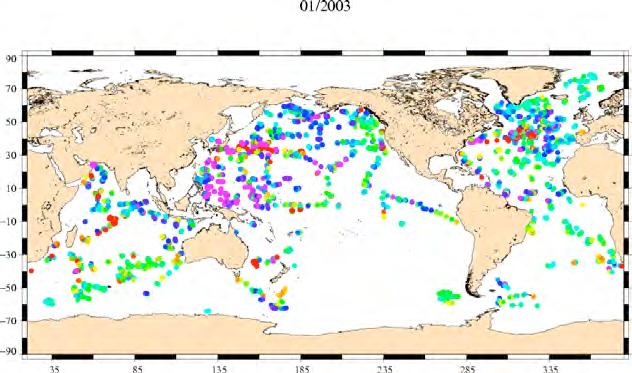
7 Argo quality control : Global results One point represents a time series at its mean position (~ 4100 floats) Correlation coefficient (DHA/SLA) : Rms of the differences (SLA-DHA) as % of SLA variance : Questionable floats can already be extracted by comparing to the neighbours % - 7 -


8 Argo quality control : Global results Comparisons with the mean representative statistics : % - 8 -

9 Argo quality control : Global results Comparisons with the mean representative statistics extraction of 111 anomalous floats % - 9 -

10 Argo quality control : Global results ftp://ftp.ifremer.fr/ifremer/argo/etc/argo-ast9-item13-altimetercomparison List of floats to be checked : DAC WMO INST-TYPE TYPE OF ANOM kma spikes meds offset meds offset meds offset incois offset coriolis spike coriolis ? coriolis offset coriolis drift bodc spike bodc spikes. The AIC monthly report for May Dacs should check the suspicious floats they are managing together with their delayed mode operators and Pis and provide appropriate corrections if needed provide feedback on the method

11 Argo quality control : Very good consistency The majority of floats! Float : r : 0.91 rms-diff : % mean-diff : cm samples :
12 Argo quality control : Representative anomalies Spike PSAL_ADJUSTED = 0.0 Float : r : 0.83 rms-diff : % mean-diff : cm samples : 95 Delayed-mode values to be qualified

13 Argo quality control : Representative anomalies Problem in the Adjusted time series : Delayed-mode value : S-offset = Real-time adjusted value : S-offset = Float : r : 0.45 rms-diff : % mean-diff : 0.20 cm samples : 147 Adjusted values in real-time to be qualified
14 Argo quality control : Representative anomalies Systematic bias of 13 cm: Float : r : 0.57 rms-diff : % mean-diff : cm samples :

15 Argo quality control : Representative anomalies Progressive drift of the salinity/pressure sensors : Float : r : 0.00 rms-diff : % mean-diff : cm samples :
16 Sea level variability : Data and Method The objective is to study the interannual variability of the sea level : total / steric Altimeter data : AVISO multi-mission combined products (1/3 grid weekly) total sea level variability Argo data : same data set suspicious floats have been separated DHA (900 m / Argo mean dynamic height) steric sea level variability [0-900] m Method : Argo data being discrete measurements in time and in space, steric sea level maps are constructed using an optimal interpolation method : 1/3 grid monthly mapping method very similar to the one used to compute the AVISO products but with specific parameter The monthly maps (total/steric) are globally averaged to produce time series of total / steric sea level


17 Sea level variability : Argo data coverage / / / / / /
18 Sea level variability : Argo data coverage From the distribution of the Argo measurements Percentage of observed ocean (= the area of the ocean reconstructed by the mapping method compared to the area of the ocean sampled by the altimeter maps) : temporal window of the study :
19 Sea level variability : Impact of the sampling Sampling experiment performed using the Altimeter maps as a proxy for the Argo data Altimeter maps subsampled at the time and position of the Argo data set Monthly maps reconstructed using the same mapping method as for the Argo date Globally averaged values compared to the one obtained from the Altimeter maps Annual and semi-annual signals removed Rms difference : 2.4 mm AVISO
20 Sea level variability : Steric seasonal signal From the Argo data sets : annual and semi-annual cycles fitted Annual cycle : - amplitude = 3.5 mm - phase = 95 Slope : 0.37 mm/year
21 Sea level variability : Total seasonal signal From the Altimeter : annual and semi-annual cycles fitted Annual cycle : - amplitude = 4.5 mm - phase = 236 Slope : 2.42 mm/year
22 Sea level variability : Total / Steric Phase shift on the seasonal signal : ocean mass annual cycle exchange of water between lands and oceans
23 Sea level variability : Total / Steric Interannual variability (annual and semi-annual cycles filtered) : Ocean mass variation from GRACE : 1.7 mm/yr Land ice contribution : - ice sheet (Greenland and Antarctica) from GRACE : 0.9 mm/yr glaciers : 1.1 mm/year 2006 (Meier et al., 2007) - Nearly 23 - closing the sea level budget Cazenave et al., 2008 :


24 Sea level variability : Steric/Total Spatial distribution : Total Large discrepancies in the Indian and South Atlantic Ocean to be further analysed Steric mm/year
25 Conclusions and Perspectives Argo/Altimeter comparisons are able to detect different kind of anomalies : spike, drift, offset... Some Argo floats should be carefully checked and reprocessed by the PIs Feedbacks from the PIs are highly welcome to improve the method The method will be activated on the full Argo floats time series on a regular basis in order to detect suspicious floats earlier than in delayed-mode Argo/Altimeter comparisons appear to be very complementary to more classical method based on comparisons with climatological fields : It works on a vertically integrated field : dynamic height It gives a very quick idea of the behavior of the time series of the float The use of contemporaneous altimeter measurements allow to have access to the mesoscale and interannual variability of the ocean The same method can also be used to quantify the impact of the delayed-mode adjusted fields (salinity, pressure) Sea level variability study will be continued : To work on the error budget on the different estimates To understand the large discrepancies between the total/steric estimates in the Indian and South Atlantic Oceans (deeper signals?) To close the sea level budget To study the vertical structure of the variability (upper layers / deeper layers)
observed with ARGO profiles
 Global heat and salt content observed with ARGO profiles F. Gaillard, E. Autret,, LPO,Brest and C. Coatanoan,, SISMER/IFREMER, Brest ARGO science wotkshop, Venice,, 15-18 18 march 2006 An overview of ARGO
French National report on Argo 2012 Present status and future plans
 French National report on Argo 2012 Present status and future plans March 2013 V. Thierry, S. Pouliquen, E. Mamaca, C. Coatanoan, S. Le Reste, C. Cabanes LPO-Report N 13/02 1. Background, organization
9th ARGO DATA MANAGEMENT MEETING. Honolulu 29 th - 31 st October 2008
 9th ARGO DATA MANAGEMENT MEETING Honolulu 29 th - 31 st October 2008 Version 0.2 14 th November 2008 9 th Argo Data Management Meeting Report 29 th 31 st October 2008 TABLE OF CONTENTS 1.! Objectives of
Argo watches the Oceans
 A Argo watches the Oceans Howard Freeland Argo Director at Institute of Ocean Sciences, Sidney, BC, Canada Tel: (250)-363-6590 Email: Howard.Freeland@pac.dfo-mpo.gc.ca Why are we doing Argo? Measurements
The Annual Cycle of Steric Height and Sea Surface Height in the Equatorial Pacific
 The Annual Cycle of Steric Height and Sea Surface Height in the Equatorial Pacific D. Roemmich, J. Gilson, F. Gasparin, and B. Cornuelle Scripps Institution of Oceanography UCSD OSTST Meeting, Boulder
Argo. 1,000m: drift approx. 9 days. Total cycle time: 10 days. Float transmits data to users via satellite. Descent to depth: 6 hours
 Float transmits data to users via satellite Total cycle time: 10 days Descent to depth: 6 hours 1,000m: drift approx. 9 days Temperature and salinity profiles are recorded during ascent: 6 hours Float
Euro-Argo Status. P.Y. Le Traon, S. Pouliquen, E. Mamaca and Euro-Argo partners. AST-13, Paris, March 2012
 Euro-Argo Status P.Y. Le Traon, S. Pouliquen, E. Mamaca and Euro-Argo partners AST-13, Paris, March 2012 Euro-Argo: A new European Research Infrastructure Coordinator: Institut Français de Recherche pour
AST-16 Meeting in Brest, France March Megan Scanderbeg
 AST-16 Meeting in Brest, France March 2015 Megan Scanderbeg Argo in flux Original Argo & enhancements Balance funding needs (which differ by country) and the need to relay information to general public
Argo Information Centre Report #6 12/12/ Active Floats 2592 set up for GTS 2660 set up for GDACs 57 grey listed active floats
 Argo Information Centre Report #6 12/12/2006 2743 Active Floats 2592 set up for GTS 2660 set up for GDACs 57 grey listed active floats 1. Implementation... 2 Table 1 - New Floats: 26... 2 Table 2 - Floats
Argo-Spain Annual Report 2017
 Argo-Spain Annual Report 2017 Present status and future plans Alberto González Santana, Pedro Vélez Belchí 1. Introduction In 2002, Argo-Spain started the Argo program through a European project where
Pacific Regional Argo Center (PARC) Progress report Argo Data Management Meeting Tianjin, Nov 2006
 Progress report Argo Data Management Meeting Tianjin, Nov 2006") Pacific Regional Argo Center (PARC) Progress report Argo Data Management Meeting Tianjin, Nov 2006 PARC Review: Participants To date, participants from JAMSTEC, JMA, IPRC, KORDI, KMA, CSIRO, and CSIO have
Pacific Regional Argo Center (PARC) Progress report Argo Data Management Meeting Tianjin, Nov 2006 PARC Review: Participants To date, participants from JAMSTEC, JMA, IPRC, KORDI, KMA, CSIRO, and CSIO have
WP2400: Sea State Bias
 Sea Level CCI Selection Meeting WP2400: Sea State Bias Ngan Tran, Jean-François Legeais (CLS) WP2400: SSB Approach developed in collaboration with D. Vandemark (UNH) and B. Chapron (IFREMER). Development
The present 5-year cycle of U.S. Argo implementation began in July 2015, and extends through June 2020.
 U.S. Argo National Report to AST-18, March 2017. Organization of U.S. Argo: The U.S. Argo Program is supported with major funding provided by the National Oceanic and Atmospheric Administration (NOAA),
Euro-Argo: The European contribution to the global Argo ocean observations network
 Euro-Argo: The European contribution to the global Argo ocean observations network Euro-Argo: A new European Research Infrastructure Claire Gourcuff, Justin Buck, Romain Cancouet, Hervé Claustre, Jari
4 th Argo Science Workshop Meeting and final round table summary
 4 th Argo Science Workshop Meeting and final round table summary P.Y. Le Traon for the ASW-4 scientific and organizing committees The 4 th Argo Science Workshop was jointly organized by Argo international
SMOS and Aquarius: SSS and Wind Effect
 SMOS and Aquarius: SSS and Wind Effect J. Boutin, X. Yin, N. Martin (LOCEAN, Paris), E. Dinnat (Chapman University/NASA/GSFC), S. Yueh (NASA/JPL) Coll. G. Reverdin (LOCEAN), G. Alory (LEGOS), F. Gaillard
Improving Sea Level Record in Arctic using Envisat Altimeter Measurements
 Improving Sea Level Record in Arctic using Envisat Altimeter Measurements P. Thibaut, JC. Poisson, D. Hoang Collecte Localisation Satellite, Toulouse, France, pthibaut@cls.fr G. Quartly, A. Kurekin Plymouth
Argo National Data Management Report (2016) India
 India") Argo National Data Management Report (2016) India 1. Status Data acquired from floats India has deployed 27 new floats (including 8 Apex-Bio Argo floats and 2 with EM software) between October 2015 and
Argo National Data Management Report (2016) India 1. Status Data acquired from floats India has deployed 27 new floats (including 8 Apex-Bio Argo floats and 2 with EM software) between October 2015 and
Argo data management report 2011 Coriolis DAC & GDAC
 Argo data management report 2011 Coriolis DAC & GDAC Data Assembly Centre and Global Data Assembly Centre Annual report September 2010 - October 2011 Version 1.0 November 7 th, 2011 Maps of the 15 590
6th ARGO DATA MANAGEMENT MEETING. Tokyo 8 th -10 th November 2005
 6th ARGO DATA MANAGEMENT MEETING Tokyo 8 th -10 th November 2005 Version 1.1 15 th December 2005 5 th Argo Data Management Meeting Report 8 th -10 th November 2005 TABLE OF CONTENTS 1. Objectives of the
Japanese Argo Program
 PICES XV Oct15, 2006 Japanese Argo Program Nobie Shikama (JAMSTEC) What is Argo? Argo is a global ocean monitoring network of 3,000 floats which measure T-S profile of upper 2,000m every 10 days and transmit
Improving Argos Doppler Location with Kalman Filtering - Advantages for Argo Floats
 Improving Argos Doppler Location with Kalman Filtering - Advantages for Argo Floats YANN BERNARD*, MATHIEU BELBEOCH** E-mails: ybernard@cls.fr, belbeoch@jcommops.org *Collecte Localisation Satellites;
Sea-state effects on Satellite Altimetry Overview of established models and recent developments
 Sea-state effects on Satellite Altimetry Overview of established models and recent developments Nelson PIRES 1*, Joana FERNANDES 1, Christine GOMMENGINGER 2 e Remko SCHARROO 3 1 DGAOT, Faculdade de Ciências,
LANDSAT 8 Level 1 Product Performance
 Réf: IDEAS-TN-10-CyclicReport LANDSAT 8 Level 1 Product Performance Cyclic Report Month/Year: May 2015 Date: 25/05/2015 Issue/Rev:1/0 1. Scope of this document On May 30, 2013, data from the Landsat 8
CRYOSAT CYCLIC REPORT
 CRYOSAT CYCLIC REPORT CYCLE #53 25TH JANUARY 2015 23RD FEBRUARY 2015 Prepared by/ préparé par CryoSat IDEAS+ Team Reference/ réference Issue/ édition 1 Revision/ révision 0 Date of issue/ date d édition
SMOS mission: a new way for monitoring Sea Surface Salinity?
 SMOS mission: a new way for monitoring Sea Surface Salinity? J. Boutin (1) (1) Laboratoire d Oceanographie et du Climat- Expérimentation et Applications Numériques (LOCEAN), PARIS, FRANCE Thanks to T.
NCEP: Environmental Modeling Center D. Behringer, NOAA/NWS/NCEP/EMC.
 U.S. Operational Applications of Argo Data Report to the 8 th Argo Steering Team Meeting James A. Cummings, Naval Research Laboratory, Monterey, California 18 February 2007 The purpose of this report is
PREDEPLOYMENT_CALIB_xxx STRING LENGTH
 Open Questions PREDEPLOYMENT_CALIB_xxx STRING LENGTH o PREDEPLOYMENT_CALIB_XXX are in the meta.nc file o PREVIOUSLY, the size was 1024 o We asked for 4096 => We don t have room to store a long calibration
ODYSSEA Global and Regional High Resolution SST products
 ODYSSEA Global and Regional High Resolution SST products Emmanuelle Autret, Jean François Piollé, Pierre Tandéo Laboratoire d'océanographie Spatiale, Cersat, Ifremer, France Context MEDSPIRATION / MARCOAST
CRYOSAT CYCLIC REPORT
 CRYOSAT CYCLIC REPORT CYCLE #49 27TH SEPTEMBER 2014 26TH OCTOBER 2014 Prepared by/ préparé par CryoSat IDEAS+ Team Reference/ réference Issue/ édition 1 Revision/ révision 0 Date of issue/ date d édition
US NATIONAL DATA MANAGEMENT REPORT. September 1 st 2015 September 1 st th ADMT Meeting. Tianjin, China STATUS
 US NATIONAL DATA MANAGEMENT REPORT September 1 st 2015 September 1 st 2016 17 th ADMT Meeting Tianjin, China STATUS US Argo Data Assembly Center at AOML The US Argo Data Assembly Center (DAC) at AOML is
CRYOSAT CYCLIC REPORT
 CRYOSAT CYCLIC REPORT CYCLE #42 1ST MARCH 2014 30TH MARCH 2014 Prepared by/ préparé par CryoSat IDEAS Team Reference/ réference Issue/ édition 1 Revision/ révision 1 Date of issue/ date d édition 17 June
STM Product Evolution for Processing Baseline 2.24
 PREPARATION AND OPERATIONS OF THE MISSION PERFORMANCE CENTRE (MPC) FOR THE COPERNICUS SENTINEL-3 MISSION Contract: 4000111836/14/I-LG Customer: ESA Document Contract No.: 4000111836/14/I-LG Project: PREPARATION
AST#12 March 2011, Buenos Aires
 AST#12 March 2011, Buenos Aires Argo is the best cooperative effort in the history of oceanography 12 nations maintain the global array and 20 more fill regional gaps 2 54% maintained by the USA Growing
Aquarius optimum interpolation analysis for global and regional studies
 Aquarius optimum interpolation analysis for global and regional studies 3 beams 390 km wide swath 84x120 km 76x94 km 96x156 km O. Melnichenko, P. Hacker, N. Maximenko, G. Lagerloef, and J. Potemra 2014
Advanced analysis of mass balance of the Greenland Ice Sheet from GRACE and surface mass balance modelling
 Advanced analysis of mass balance of the Greenland Ice Sheet from GRACE and surface mass balance modelling Jiangjun Ran, Pavel Ditmar, Roland Klees, and Miren Vizcaino Delft University of Technology, The
Remote Sensing: John Wilkin IMCS Building Room 211C ext 251. Active microwave systems (1) Satellite Altimetry
 Satellite Altimetry") Remote Sensing: John Wilkin wilkin@marine.rutgers.edu IMCS Building Room 211C 732-932-6555 ext 251 Active microwave systems (1) Satellite Altimetry Active microwave instruments Scatterometer (scattering
Remote Sensing: John Wilkin wilkin@marine.rutgers.edu IMCS Building Room 211C 732-932-6555 ext 251 Active microwave systems (1) Satellite Altimetry Active microwave instruments Scatterometer (scattering
Envisat Ocean Altimetry Performance Assessment and Cross-calibration
 Sensors 2006, 6, 100-130 sensors ISSN 1424-8220 2006 by MDPI http://www.mdpi.org/sensors Special Issue on Satellite Altimetry: New Sensors and New Application Edited by Ge Chen and Graham D. Quartly Full
Past Achievement, Future Risks and Opportunities
 Argo: Past Achievement, Future Risks and Opportunities Toshio Suga, Tohoku University and JAMSTEC, Japan On behalf of Susan Wijffels, CSIRO/ Centre for Australian Weather and Climate Research, Australia
CRYOSAT CYCLIC REPORT
 CRYOSAT CYCLIC REPORT CYCLE #36 2ND SEPTEMBER 2013 1ST OCTOBER 2013 Prepared by/ préparé par CryoSat IDEAS Team Reference/ réference Issue/ édition 1 Revision/ révision 0 Date of issue/ date d édition
A GLOBAL ASSESSMENT OF THE RA-2 PERFORMANCE OVER ALL SURFACES
 A GLOBAL ASSESSMENT OF THE RA-2 PERFORMANCE OVER ALL SURFACES Berry, P.A.M., Smith, R.G. & Freeman, J.A. EAPRS Laboratory, De Montfort University, Leicester, LE9 1BH, UK ABSTRACT The EnviSat RA-2 has collected
OBSERVATION PERFORMANCE OF A PARIS ALTIMETER IN-ORBIT DEMONSTRATOR
 OBSERVATION PERFORMANCE OF A PARIS ALTIMETER IN-ORBIT DEMONSTRATOR Salvatore D Addio, Manuel Martin-Neira Acknowledgment to: Nicolas Floury, Roberto Pietro Cerdeira TEC-ETP, ETP, Electrical Engineering
Active microwave systems (1) Satellite Altimetry
 Satellite Altimetry") Remote Sensing: John Wilkin Active microwave systems (1) Satellite Altimetry jwilkin@rutgers.edu IMCS Building Room 214C 732-932-6555 ext 251 Active microwave instruments Scatterometer (scattering from
Remote Sensing: John Wilkin Active microwave systems (1) Satellite Altimetry jwilkin@rutgers.edu IMCS Building Room 214C 732-932-6555 ext 251 Active microwave instruments Scatterometer (scattering from
CRYOSAT CYCLIC REPORT
 CRYOSAT CYCLIC REPORT CYCLE #50 27TH OCTOBER 2014 15TH NOVEMBER 2014 Prepared by/ préparé par CryoSat IDEAS+ Team Reference/ réference Issue/ édition 1 Revision/ révision 0 Date of issue/ date d édition
17th ARGO DATA MANAGEMENT MEETING
 17th ARGO DATA MANAGEMENT MEETING TIANJIN 28 th September 30 th September 2016 Version 2.0 22 nd December 2016 17 th Argo Data Management Meeting Report 28-30 September 2016 TABLE OF CONTENTS 1 Objectives
Implementation of the Instrument Only Correction
 Implementation of the Instrument Only Correction Sidharth Misra and Shannon Brown Jet Propulsion Laboratory, California Institute of Technology 03/29/2016 Copyright 2016 California Institute of Technology
Organization of European activities: status
 Organization of European activities: status P.Y. Le Traon, S. Pouliquen and Euro-Argo RI partners AST-15 Halifax, March 18, 2014 The Euro-Argo European Research Infrastructure Objective: ensure a long
 ENVISAT Microwave Radiometer Assessment Report Cycle 051 04-09-2006 09-10-2006 Prepared by : M. DEDIEU, CETP L. EYMARD, LOCEAN/IPSL E. OBLIGIS, CLS OZ. ZANIFE, CLS F. FERREIRA, CLS Checked by : Approved
ELECTROMAGNETIC PROPAGATION (ALT, TEC)
") ELECTROMAGNETIC PROPAGATION (ALT, TEC) N. Picot CNES, 18 Av Ed Belin, 31401 Toulouse, France Email : Nicolas.Picot@cnes.fr ABSTRACT For electromagnetic propagation, the ionosphere plays a key role. This
ELECTROMAGNETIC PROPAGATION (ALT, TEC) N. Picot CNES, 18 Av Ed Belin, 31401 Toulouse, France Email : Nicolas.Picot@cnes.fr ABSTRACT For electromagnetic propagation, the ionosphere plays a key role. This
progress report: Q2 2011
 Consortium Members ESA Sea level CCI Quarterly progress report: Q2 2011 Reference: Nomenclature: CLS-DOS-NT-10-322 SLCCI-QPR-006 Issue: 1. 0 Date: Jul. 4, 11 CLS-DOS-NT-10-322 SLCCI-QPR-006 V 1.0 Jul.
EFFECTS OF IONOSPHERIC SMALL-SCALE STRUCTURES ON GNSS
 EFFECTS OF IONOSPHERIC SMALL-SCALE STRUCTURES ON GNSS G. Wautelet, S. Lejeune, R. Warnant Royal Meteorological Institute of Belgium, Avenue Circulaire 3 B-8 Brussels (Belgium) e-mail: gilles.wautelet@oma.be
 ENVISAT Microwave Radiometer Assessment Report Cycle 045 07-02-2006 13-03-2006 Prepared by : M. DEDIEU, CETP L. EYMARD, LOCEAN/IPSL E. OBLIGIS, CLS OZ. ZANIFE, CLS F. FERREIRA, CLS Checked by : Approved
4 nd Bio Argo Workshop November , Bermuda. Introduction
 4 nd Bio Argo Workshop November 2 3 2015, Bermuda Introduction Between ADMT 15 to ADMT 16 some milestones AST 16 Brest Bio Argo Task Team: terms of reference accepted Move towards global implementation
Long-term Variations in Amplitudes and Phases of Harmonic Constants
 IHO Tides and Water Level Working Group 5 th Meeting Prepared by Stephen K. Gill NOAA/NOS May, 2013 This study was conducted in support of TWLWG Work Plan Item H1 The study of long term data sets for the
ENVISAT/MWR : 36.5 GHz Channel Drift Status
 CLS.DOS/NT/03.695 Issue : 1rev1 Ramonville, 10 March 2003 Nomenclature : - : 36.5 GHz Channel Drift Status PREPARED BY M. Dedieu L. Eymard C. Marimont E. Obligis N. Tran COMPANY DATE INITIALS CETP CETP
STABILITY OF GLOBAL GEODETIC RESULTS
 STABILITY OF GLOBAL GEODETIC RESULTS Prof. Thomas Herring Room 54-611; 253-5941 tah@mit.edu http://bowie.mit.edu/~tah 04/22/02 EGS G6 2002 1 Overview Motivation for talk: Anomalies in apparent positions
Marine Knowledge Infrastructure
 Marine Knowledge Infrastructure Who are you? What is your name? (Family name then forenames) This will not be published. Hall, Stephen what is your contact e-mail? sph@noc.soton.ac.uk You can either reply
ARGOS satellite system status & improvements
 PAGE 1 ARGOS satellite system status & improvements Yann Bernard CLS, Oceanography AST 14 th meeting, Wellington, New-Zealand METOP-B & SARAL satellites 2 new Argos satellites recently successfully launched!!!
6 th meeting of the. International Argo Science Team. IFREMER, Brest France
 6 th meeting of the International Argo Science Team IFREMER, Brest France March 9-11 2004 1 2 Contents 1. Welcome and introduction 1 2. Introduction to IAST-6. 1 2.1 Action items from AST-5 1 3. Status
INTERDISCIPLINARY SCIENCE AND APPLICATIONS USING SATELLITE RADAR ALTIMETRY
 NASA NASA ESA ESA JAXA NAS A INTERDISCIPLINARY SCIENCE AND APPLICATIONS USING SATELLITE RADAR ALTIMETRY C.K. SHUM EE Wave Propagation and Remote Sensing Joel Johnson November 14, 2012 Measurement Coverage:
Argo ways to use the data
 Argo ways to use the data Howard Freeland Argo Director at Institute of Ocean Sciences, Sidney, BC, Canada Tel: (250)-363-6590 Email: Howard.Freeland@pac.dfo-mpo.gc.ca Argo ways to use the data How you
Aquarius/SAC-D Mission Mission Simulators - Gary Lagerloef 6 th Science Meeting; Seattle, WA, USA July 2010
 Aquarius/SAC-D Mission Mission Simulators - Gary Lagerloef 6 th Science Meeting; Seattle, WA, USA Mission Design and Sampling Strategy Sun-synchronous exact repeat orbit 6pm ascending node Altitude 657
1. The status of implementation (major achievements and problems in 2016)
") 1. The status of implementation (major achievements and problems in 2016) - floats deployed and their performance Most of the floats deployed by Germany are operated by BSH but additional funding has been
1. The status of implementation (major achievements and problems in 2016) - floats deployed and their performance Most of the floats deployed by Germany are operated by BSH but additional funding has been
Microwave Sensors Subgroup (MSSG) Report
 Report") Microwave Sensors Subgroup (MSSG) Report Feb 17-20, 2014, ESA ESRIN, Frascati, Italy DONG, Xiaolong, MSSG Chair National Space Science Center Chinese Academy of Sciences (MiRS,NSSC,CAS) Email: dongxiaolong@mirslab.cn
Microwave Sensors Subgroup (MSSG) Report Feb 17-20, 2014, ESA ESRIN, Frascati, Italy DONG, Xiaolong, MSSG Chair National Space Science Center Chinese Academy of Sciences (MiRS,NSSC,CAS) Email: dongxiaolong@mirslab.cn
Argo in the Mediterranean and Black seas
 Argo in the Mediterranean and Black seas Pierre-Marie Poulain Istituto Nazionale di Oceanografia e di Geofisica i Sperimentale (OGS) Trieste, Italy Outline Argo float deployments and data in the Mediterranean
Microwave Sensors Subgroup (MSSG) Report
 Report") Microwave Sensors Subgroup (MSSG) Report CEOS WGCV-35 May 13-17, 2013, Shanghai, China DONG, Xiaolong, MSSG Chair CAS Key Laboratory of Microwave Remote Sensing National Space Science Center Chinese Academy
Microwave Sensors Subgroup (MSSG) Report CEOS WGCV-35 May 13-17, 2013, Shanghai, China DONG, Xiaolong, MSSG Chair CAS Key Laboratory of Microwave Remote Sensing National Space Science Center Chinese Academy
Electronic supplement
 Khosrawi et al.: Assessment of the interannual variability and impact of the QBO and upwelling on tracer-tracer distributions of N O and O 3 in the tropical lower stratosphere Electronic supplement Latitudinal
Remote Sensing: John Wilkin IMCS Building Room 211C ext 251. Active microwave systems (1) Satellite Altimetry
 Satellite Altimetry") Remote Sensing: John Wilkin wilkin@marine.rutgers.edu IMCS Building Room 211C 732-932-6555 ext 251 Active microwave systems (1) Satellite Altimetry Active microwave instruments Scatterometer (scattering
Remote Sensing: John Wilkin wilkin@marine.rutgers.edu IMCS Building Room 211C 732-932-6555 ext 251 Active microwave systems (1) Satellite Altimetry Active microwave instruments Scatterometer (scattering
S3 Product Notice Altimetry
 S3 Product Notice Altimetry Mission Sensor Product S3-A SRAL / MWR LAND L2 NRT, STC and NTC Product Notice ID Issue/Rev Date Version 1.0 Preparation S3A.PN-STM-L2L.04 13-Dec-2017 This Product Notice was
Sea state bias correction in coastal waters. D. Vandemark, S. LaBroue, R. Scharroo, V. Zlotnicki, H. Feng, N. Tran, B. Chapron, H.
 Sea state bias correction in coastal waters D. Vandemark, S. LaBroue, R. Scharroo, V. Zlotnicki, H. Feng, N. Tran, B. Chapron, H. Tolman 5-7 Feb. 2008 Coastal Altimetry Workshop 1 Overview of group consensus
Ionospheric Range Error Correction Models
 www.dlr.de Folie 1 >Ionospheric Range Error Correction Models> N. Jakowski and M.M. Hoque 27/06/2012 Ionospheric Range Error Correction Models N. Jakowski and M.M. Hoque Institute of Communications and
PARIS Ocean Altimeter
 PARIS Ocean Altimeter M. Martín-Neira, S. D Addio (TEC-ETP) European Space Agency Acknowledgment: C. Buck (TEC-ETP) N. Floury, R. Prieto (TEC-EEP) GNSS-R10 Workshop, UPC, Barcelona, 21-22 October 2010
Future of Sustained Observations
 Future of Sustained Observations OceanObs 09 identified tremendous opportunities, significant challenges Called for a framework for planning and moving forward with an enhanced global sustained ocean observing
SATELLITE OCEANOGRAPHY
 SATELLITE OCEANOGRAPHY An Introduction for Oceanographers and Remote-sensing Scientists I. S. Robinson Lecturer in Physical Oceanography Department of Oceanography University of Southampton JOHN WILEY
On the beginnings of Argo: Ingredients of an ocean observing system. Dean Roemmich Co-Chair, Argo Steering Team
 On the beginnings of Argo: Ingredients of an ocean observing system Dean Roemmich Co-Chair, Argo Steering Team Motivation Any major expansion of Argo (Deep Ocean, Biogeochemical, Boundary Currents, Coastal)
Sea Level Algorithm Selection Meeting
 ESA Climate Change Initiative Sea Level CCI project Sea Level Algorithm Selection Meeting INTRODUCTION Outline Objectives and organisation of the meeting Brief overview of the Sea Level CCI projet G. Larnicol/Y.
SEA SURFACE TEMPERATURE RETRIEVAL USING TRMM MICROWAVE IMAGER DATA IN SOUTH CHINA SEA
 SEA SURFACE TEMPERATURE RETRIEVAL USING TRMM MICROWAVE IMAGER DATA IN SOUTH CHINA SEA Mohd Ibrahim Seeni Mohd and Mohd Nadzri Md. Reba Faculty of Geoinformation Science and Engineering Universiti Teknologi
A comparison of methods to estimate vertical land motion trends from GNSS and altimetry at tide gauge stations
 Delft University of Technology A comparison of methods to estimate vertical land motion trends from GNSS and altimetry at tide gauge stations Kleinherenbrink, Marcel; Riva, Riccardo; Frederikse, Thomas
Copernicus S3 Product Notice Altimetry
 Copernicus S3 Product Notice Altimetry Mission Sensor Product S3 SRAL / MWR LAND L2 NRT, STC and NTC Product Notice ID S3A.PN-STM-L2L.08 Issue/Rev Date 14-Feb-2019 20-Mar-2019 Version 1.1 Preparation This
Shigeki Hosoda (JAMSTEC)
") Shigeki Hosoda (JAMSTEC) Motivation: After achievement of 3000 floats in the global ocean, Japan Argo community was delay to show any next plan. Also, decreasing the fund of Japan Argo (especially in JAMSTEC)
Shigeki Hosoda (JAMSTEC) Motivation: After achievement of 3000 floats in the global ocean, Japan Argo community was delay to show any next plan. Also, decreasing the fund of Japan Argo (especially in JAMSTEC)
7 th meeting of the. International Argo Science Team
 7 th meeting of the International Argo Science Team Hyderabad, India January 16-18, 2006 Contents 1. Welcome and introduction 1 2. Introduction to AST-7 1 2.1 Action items from AST-6 (2004) and Argo Exec
CNES PRIORITIES IN POLAR AND CRYOSPHERE RESEARCH
 Polar Space Task Group 3rd Session CNES PRIORITIES IN POLAR AND CRYOSPHERE RESEARCH Juliette Lambin, Steven Hosford Wednesday, May 22th, 2013 Paris, France 1 OUTLINE CNES MISSIONS FOR POLAR/CRYOSPHERE
Changes in rainfall seasonality in the tropics
 SUPPLEMENTARY INFORMATION DOI: 10.1038/NCLIMATE1907 Changes in rainfall seasonality in the tropics Xue Feng 1, Amilcare Porporato 1,2 *, and Ignacio Rodriguez-Iturbe 3 Supplementary information 1 Department
Active microwave systems (2) Satellite Altimetry * range data processing * applications
 Satellite Altimetry * range data processing * applications") Remote Sensing: John Wilkin wilkin@marine.rutgers.edu IMCS Building Room 211C 732-932-6555 ext 251 Active microwave systems (2) Satellite Altimetry * range data processing * applications Satellite Altimeters
Remote Sensing: John Wilkin wilkin@marine.rutgers.edu IMCS Building Room 211C 732-932-6555 ext 251 Active microwave systems (2) Satellite Altimetry * range data processing * applications Satellite Altimeters
Extending Argo into marginal Seas: the Mediterranean and Black Seas
 Extending Argo into marginal Seas: the Mediterranean and Black Seas Pierre-Marie Poulain Istituto Nazionale di Oceanografia e di Geofisica Sperimentale (OGS) Trieste, Italy Outline Argo float deployments
2012 Argo Canada report of activities (submitted by Denis Gilbert)
") 2012 Argo Canada report of activities (submitted by Denis Gilbert) 14 th meeting of the Argo Steering Team (AST-14) Wellington, New Zealand March 18-21, 2013 1. Status of implementation (major achievements
2012 Argo Canada report of activities (submitted by Denis Gilbert) 14 th meeting of the Argo Steering Team (AST-14) Wellington, New Zealand March 18-21, 2013 1. Status of implementation (major achievements
MINIMIZING SELECTIVE AVAILABILITY ERROR ON TOPEX GPS MEASUREMENTS. S. C. Wu*, W. I. Bertiger and J. T. Wu
 MINIMIZING SELECTIVE AVAILABILITY ERROR ON TOPEX GPS MEASUREMENTS S. C. Wu*, W. I. Bertiger and J. T. Wu Jet Propulsion Laboratory California Institute of Technology Pasadena, California 9119 Abstract*
A Combined Multi-Temporal InSAR Method: Incorporating Persistent Scatterer and Small Baseline Approaches. Andy Hooper University of Iceland
 A Combined Multi-Temporal InSAR Method: Incorporating Persistent Scatterer and Small Baseline Approaches Andy Hooper University of Iceland Time Multi-Temporal InSAR Same area imaged each time Multi-Temporal
7th ARGO DATA MANAGEMENT MEETING. Tianjin 1 st - 3 rd November 2006
 7th ARGO DATA MANAGEMENT MEETING Tianjin 1 st - 3 rd November 2006 Version 2.0 December 1 st, 2006 7 th Argo Data Management Meeting Report 1 st -3 rd November 2006 TABLE OF CONTENTS 1. Objectives of the
Status and new perspectives of the SIRGAS Reference Frame
 Status and new perspectives of the SIRGAS Reference Frame L. Sánchez DGFI, Germany C. Brunini UNLP, Argentina V. Mackern UNCuyo, UJAM, Argentina W. Martínez IGAC, Colombia R. Luz IBGE, Brazil IUGG General
Plasma effects on transionospheric propagation of radio waves II
 Plasma effects on transionospheric propagation of radio waves II R. Leitinger General remarks Reminder on (transionospheric) wave propagation Reminder of propagation effects GPS as a data source Some electron
Current Status of COMS AMV in NMSC/KMA. NMSC/KMA Eunha Sohn
 Current Status of COMS AMV in NMSC/KMA NMSC/KMA Eunha Sohn Contents AMV estimation in NMSC/KMA COMS AMV Estimation Schedule and algorithm specification Accuracy of COMS AMV Temporal accuracy variations
GNSS Ocean Reflected Signals
 GNSS Ocean Reflected Signals Per Høeg DTU Space Technical University of Denmark Content Experimental setup Instrument Measurements and observations Spectral characteristics, analysis and retrieval method
The Argo Program. Observing the Global Ocean with Profiling Floats. Oceanography Vol. 22, No.2
 NOPP SPECIAL ISSUE» Excellence in Partnering Award Winners 34 The Argo Program Observing the Global Ocean with Profiling Floats By Dean Roemmich, Gregory C. Johnson, Stephen Riser, Russ Davis, John Gilson,
Wave Information Studies Online Visualization and Validation of 30+ Year Hindcast
 Wave Information Studies Online Visualization and Validation of 30+ Year Hindcast Tyler Hesser, Bob Jensen, Al Cialone U.S. Army Engineer Research and Development Center November 10 2015 14 th International
RV Investigator CTD Processing Report
 RV Investigator CTD Processing Report Voyage #: Voyage title: IN2016_V02 SOTS: Southern Ocean Time Series automated moorings for climate and carbon cycle studies southwest of Tasmania Depart: Hobart, 1000
Validation Exercise over German Bight
 Validation Exercise over German Bight S. Dinardo 1, B. Lucas 2, L. Fenoglio 3,R. Sharoo,J. Benveniste 4 (1) SERCO/ESRIN, (2) DEIMOS/ESRIN, (3) Darmstadt University of Technology, (4) ESA/ESRIN 18/sept/2013
Progress in Refreshing the Tropical Atmosphere Ocean (TAO) Array
 Array") Progress in Refreshing the Tropical Atmosphere Ocean (TAO) Array Richard L. Crout, PhD, Dawn Petraitis, Lex LeBlanc, Landry J. Bernard, and Karen Grissom NOAA/NWS National Data Buoy Center Stennis Space
Progress in Refreshing the Tropical Atmosphere Ocean (TAO) Array Richard L. Crout, PhD, Dawn Petraitis, Lex LeBlanc, Landry J. Bernard, and Karen Grissom NOAA/NWS National Data Buoy Center Stennis Space
PROJECT FINAL REPORT
 PROJECT FINAL REPORT Grant Agreement number: 211 597 Project acronym: EURO-ARGO Project title: EURO-ARGO Funding Scheme: Global Ocean Observing Infrastructure Period covered: from January 2008 to June
Calibration of RapidScat Instrument Drift. F. Dayton Minor
 Calibration of RapidScat Instrument Drift F. Dayton Minor A thesis submitted to the faculty of Brigham Young University in partial fulfillment of the requirements for the degree of Master of Science David