ANNEX 10. (adopted on 30 May 1996) MANDATORY SHIP REPORTING SYSTEMS
|
|
|
- Colleen Oliver
- 6 years ago
- Views:
Transcription
1 MSC 66/24/Add.1 ANNEX 10 RESOLUTION MSC.52(66) (adopted on 30 May 1996) MANDATORY SHIP REPORTING SYSTEMS THE MARITIME SAFETY COMMITTEE, RECALLING Article 28(b) of the Convention on the International Maritime Organization concerning the functions of the Committee, RECALLING ALSO regulation V/8-1 of the International Convention for the Safety of Life at Sea (SOLAS), 1974, concerning the adoption by the Organization of ship reporting systems, RECALLING FURTHER resolution A.826(19) which authorizes the Committee to perform the function of adopting ship reporting systems on behalf of the Organization, TAKING INTO ACCOUNT the Guidelines and criteria for ship reporting systems adopted by resolution MSC.43(64), HAVING CONSIDERED the recommendations of the Sub-Committe e on Safety of Navigation at its forty- first session, 1. ADOPTS, in accordance with SOLAS regulation V/8-1, mandatory ship reporting systems: - "In the Torres Strait region and the Inner route of the Great Barrier Reef" described in Annex 1 to the prese nt resolution; and - "Off Ushant" described in Annex 2 to the present resolution; 2. DECIDES that the mandatory ship reporting system: - "In the Torres Strait and the Inner route of the Great Barrier Reef" will enter into force at 0000 UTC hours on 1 J anuary 1997; and - "Off Ushant" will enter into force at 0000 UTC hours on [30 November 1996]; 3. REQUESTS the Secretary-General to bring this resolution and its Annexes to the attention of Members of the Organization and Contracting Governments to the 1974 SOLAS Convention. L: \ADMIN\ LIB\ IMO RESOLUTIONS \MSC RESOLUTIONS \52(66).DOC
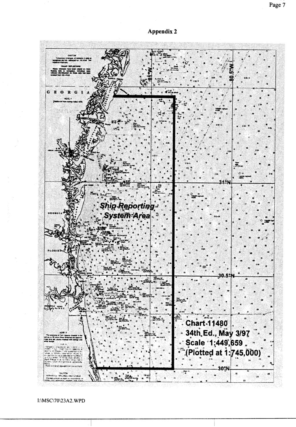
2 MSC 66/24/Add.1 ANNEX 10 Page 2 ANNEX 1 MANDATORY SHIP REPORTING SYSTEM "THE TORRES STRAIT REGION AND THE INNER ROUTE OF THE GREAT BARRIER REEF" 1 CATEGORIES OF SHIPS REQUIRED TO PARTICIPATE IN THE SYSTEM Ships of the following general categories are required to participate in the reporting system:.1 All ships of 50 m or greater in overall length;.2 All ships, regardless of length, carrying in bulk hazardous and/or potentially polluting cargo, in accordance with the definitions at resolution MSC.43(64), paragraph 1.4;.3 Ships engaged in towing or pushing where either the towing or pushing vessel or the towed or pushed vessel is a vessel prescribed within the categories in subparagraphs.1 and.2. 2 GEOGRAPHICAL COVERAGE OF THE SYSTEM AND THE NUMBER AND EDITION OF THE REFERENCE CHART USED FOR THE DELINEATION OF THE SYSTEM 2.1 The reporting system will cover the general area, as shown in the chartlet at appendix 1, covering the Torres Strait between longitude 141º 45'E and 143º45'E, centred on 10ºS l atitude, including the Endeavour Strait, and the waters of the Great Barrier Reef (GBR) between the Australian coast and the outer edge of the GBR, from the latitude of Cape York (10º40'S) southwards to 22ºS. 2.2 Charts AUS 376 (Torres/Endeavour Straits) and AUS 367, AUS (Queensland coast) provide large -scale coverage of the operational area; also international series small scale charts AUS 4602 and FORMAT AND CONTENT OF REPORT TIMES AND GEOGRAPHICAL POSITIONS FOR SUBMITTING REPORTS, AUTHORITY TO WHOM REPORTS SHOULD BE SENT AND AVAILABLE SERVICES The ship report short title "REEFREP", will be made to the ship reporting centre located at Hay Point in Queensland. Examples of the format and content of all required reports are shown at appendix 2. A ship may elect, for reasons of commercial confidentiality, to communicate that section of the REEFREP ENTRY report which provides information on cargo (line P) by non-verbal means prior to entering the system. This can be achieved by including cargo information in the AUSREP Sailing Plan (SP) message..1 Entry and Exit Reports: Ships will be required to provide a full REEFREP Position Report (PR) when passing the first designated reporting point on entering the REEFREP operational area, unless an AUSREP Sailing Plan (SP) message has been sent well in advance in which case an abbreviated REEFREP PR will suffice. When finally departing the REEFREP area, or entering a port within the area, the REEFREP L: \ADMIN\ LIB\ IMO RESOLUTIONS \MSC RESOLUTIONS \52(66).DOC
3 MSC 66/24/Add.1 ANNEX 10 Page 3 system will associate the required PR and the designated reporting point and automatically recognize this report as an exit message..2 Intermediate Position Reports: Ships transiting the operational area will also be required to provide brief position reports at defined reporting points using normal PR formats. The intermediate reporting positions will be generally about nautical miles apart. Position reports will be limited to the identity of the ship, position, any variation to the last reported speed and any further information the master considers to be of value to the system..3 Defect Reports: Ships within the reporting area suffering damage, failure or breakdown affecting the safety of the ship will be required to provide a defect report using field "?" within the prescribed PR message format. 4 INFORMATION TO BE PROVIDED TO PARTICIPATING SHIPS AND PROCEDURES TO BE FOLLOWED 4.1 The ship reporting centre will provide information to shipping on potentially conflicting traffic movements resulting from the analysis of incoming reports. 4.2 Certain sections of the route in the Torres Strait and the far northern sector of the inner route of the GBR present a particular navigational hazard in situations where large ships might be passing or overtaking, especially deeper draught ships. Wh en the ship reporting centre considers that ships are approaching such sections, any relevant traffic information held by the centre will be passed to them. Because of the extensive size of the REEFREP area it is not be intended to routinely broadcast t r a ffic information across the whole area but to advise individual ships as necessary. 4.3 Traffic information, including other advice received from ships or local maritime authorities which impacts on navigational safety will be passed to ships in relevant areas. Examples include concentrations of fishing vessels, unusual weather conditions, etc. 4.4 Normal maritime safety information (MSI) in the form of navigational warnings (AUSCOAST Warnings) will continue to be issued in the appropriate broadcasts from MRCC AUSTRALIA. The ship reporting centre will maintain details of MSI for the REEFREP area for the information of participating ships. 5 COMMUNICATION REQUIRED FOR THE SYSTEM, FREQUENCIES ON WHICH REPORTS SHOULD BE TRANSMITTED AND INFORMATION TO BE REPORTED 5.1 The system will be based on VHF voice communications and will be interactive with an interchange of data between ships and the ship reporting centre. 5.2 VHF channels 5, 18 and 19 in the international maritime mobile band have been allocated for the reporting points in the system. 5.3 Information of commercial confidentiality may be transmitted by non-verbal means. L: \ADMIN\ LIB\ IMO RESOLUTIONS \MSC RESOLUTIONS \52(66).DOC
4 MSC 66/24/Add.1 ANNEX 10 Page The language used for reports in the system will be English, using the IMO Standard Marine Communications Phrases where necessary. 5.5 Communications associated with reporting in accordance with the requirements of this system will be free of charge. 6 RULES AND REGULATIONS IN FORCE IN THE AREA OF THE SYSTEM Compulsory pilotage rules apply in the northern section of the inner route (Cape York to Cairns) and in Hydrographers Passage. Other regulations apply domestic law in accordance with the terms of international conventions. 7 SHORE-BASED FACILITIES TO SUPPORT OPERATION OF THE SYSTEM 7.1 The existing port information centre at Hay Point, on the central Queensland coast, close to the main shipping route through the inner route of the GBR and Hydrographer's Passage, has been designated as the ship reporting centre for the system. 7.2 The system will include radar coverage at certain focal areas in the Torres Strait and inner route of the GBR. Radar will be installed in the Torres Strait, in the vicinity of Cairns and in the Whitsunday Islands area. 7.3 All VHF communications and radar data will be relayed into the ship re porting centre, which will be equipped to provide a high standard of service to meet the system requirements and will be operated by trained and experienced personnel. Operator standards will be in accordance with "Guidelines on the Recruitment, Qualification and Training of Vessel Traffic Service (VTS) Operators" (MSC/Circ.578). 7.4 The hardware and software for the system is being developed. 7.5 The system will be operated to quality standards with service levels being constantly monitored. 7.6 Measures are in hand to install DGPS Broadcast Stations operating in the MF band ( khz) on Horn Island (Torres Strait) by the end of 1995 and further stations in the inner route of the GBR during 1996/98. The DGPS service will provide additional high acc uracy navigational assistance throughout the reporting area. 7.7 The REEFREP ship reporting system information will be interfaced with the AUSREP system operated by MRCC AUSTRALIA. 8 ALTERNATIVE COMMUNICATION IF THE COMMUNICATION FACILITIES OF THE SHORE-BASED AUTHORITY FAIL In the event of failure of the system VHF communications, a report from a participating ship can be passed by any of the following methods:.1 Seaphone through the commercial VHF coastal network; L: \ADMIN\ LIB\ IMO RESOLUTIONS \MSC RESOLUTIONS \52(66).DOC
5 MSC 66/24/Add.1 ANNEX 10 Page 5.2 SATCOM; and.3 HF Radio through Townsville Radio (VIT). APPENDIX 1 L: \ADMIN\ LIB\ IMO RESOLUTIONS \MSC RESOLUTIONS \52(66).DOC
6 MSC 66/24/Add.1 ANNEX 10 Page 6 PROPOSED SHIP REPORTING SYSTEM TORRES STRAIT AND GREAT BARRIER REEF AREAS L: \ADMIN\ LIB\ IMO RESOLUTIONS \MSC RESOLUTIONS \52(66).DOC
7 MSC 66/24/Add.1 ANNEX 10 Page 7 APPENDIX 2 REEFREP ENTRY (Full Report) EXAMPLE 1: Ship sailing from a port within the reporting area, routeing through the area and departing the area through Grafton Passage bound for Pusan via Jomard Entrance. Format Example REEFREP ENTRY A. Ships name and call sign A. MERIDIAN /VIPM B. Date/Time of position (UTC) B Z C. Name of Reporting Point C. TOWNSVILLE E. Course (normally various) E. VARIOUS F. Speed F. 15 G. Departed (port if outside reporting area) G. -- H. Date/Time of entry in system and point of entry (not required if advised at C) J. Pilot embarked or ordered J. NO* L. Intended route L. INNER ROUTE TO GRAFTON O. Draft O. 10 P. Cargo P. COAL Q. Defects/deficiencies (only if relevant) Q. NIL U. Ship type and length (metres) U. BULK CARRIER/250 X. Remarks X. JOINING INNER ROUTE AT BREWER Z * Pilot not mandatory for this area of the GBR. L: \ADMIN\ LIB\ IMO RESOLUTIONS \MSC RESOLUTIONS \52(66).DOC
8 MSC 66/24/Add.1 ANNEX 10 Page 8 EXAMPLE 2: Ship entering the reporting area north bound for Port Moresby using inner route and Great North East Channel. Format Example REEFREP ENTRY A. Ships name and call sign A. MERIDIAN /VIPM B. Date/Time of position (UTC) B Z C. Name of Reporting Point C. HIGH PEAK E. Course (normally various) E. VARIOUS F. Speed F. 15 G. Departed (port if outside reporting area) G. BRISBANE H. Date/Time of entry in system and point of entry (not required if advised at C) J. Pilot embarked or ordered J. PILOT EMBARKED L. Intended route L. INNER ROUTE AND GREAT NORTH EAST CHANNEL O. Draft O. 10 P. Cargo P. GENERAL CARGO Q Defects/deficiencies (only if relevant) U. Ship type and length (metres) U. RESEARCH/65 X. Remarks X. CONDUCTING RESEARCH ON PASSAGE L: \ADMIN\ LIB\ IMO RESOLUTIONS \MSC RESOLUTIONS \52(66).DOC
9 MSC 66/24/Add.1 ANNEX 10 Page 9 REEFREP REPORT EXAMPLE: Ship reporting at an intermediate reporting point within reporting area. Format Example REEFREP REPORT A. Ships name and call sign A. ENTERPRISE/VIPM B. Name of Reporting Point B. CHARLOTTE F. Speed (if change from last report) F. SPEED NOW 11.5 X. Remarks X. LARGE CONCENTRATION OF FISHING VESSELS VICINITY HANNAH ISLAND REEFREP DEFECT EXAMPLE: Ship reporting defect within reporting area. Format Example REEFREP DEFECT A. Ships name and call sign A. ENTERPRISE/VIPM B. Date/Time position B Z C. Latitude/Longitude or Reporting Point C. 1400S 14400E Q. Nature of defect/damage Q. BOTH RADARS UNSERVICEABLE IN HEAVY RAIN SQUALLS; ALSO MINOR STEERING DEFECT X. Remarks X. PROCEEDING TO ANCHOR 180 HANNAH ISLAND LT 1.0 T O EFFECT REPAIRS L: \ADMIN\ LIB\ IMO RESOLUTIONS \MSC RESOLUTIONS \52(66).DOC
10 MSC 66/24/Add.1 ANNEX 10 Page 10 EXAMPLE 2: Ship defect repaired. Format Example REEFREP DEFECT A. Ships name and call sign A. ENTERPRISE/VIPM B. Date/Time position B Z C. Latitude/Longitude or Reporting Point C. 1401S 14001E F. Speed F. 8.5 X. Remarks X. DE FECT REPAIRED, REJOINING ROUTE REEFREP EXIT EXAMPLE 1: Ship westbound reporting exit from reporting area at Torres Strait. Format Example REEFREP EXIT A. Ships name and call sign A. MITSUBISHI/XUGT K. Point of exit K. COOK I. Destination (via rout e ) I. SINGAPORE VIA LOMBOK X. Remarks X. FINAL REPORT EXAMPLE 2: Ship reporting exit from reporting area at Palm Passage. Format Example REEFREP EXIT A. Ships name and call sign A. IRON MAIDEN/RXTP K. Point of exit K. PALM I. Destination (via route) I. PUSAN VIA ROSSEL ISLAND L: \ADMIN\ LIB\ IMO RESOLUTIONS \MSC RESOLUTIONS \52(66).DOC
11 MSC 66/24/Add.1 ANNEX 10 Page 11 X. Remarks (must include FINAL REPORT) X. FINAL REPORT EXAMPLE 3: Ship reporting arrival at a port within reporting area (after transiting from another port also within the area). Format Example REEFREP EXIT A. Ships name a nd call sign A. NORTHERN STAR/CPIM K. Point of exit K. CAIRNS I. Destination (via route) if outside REEFREP area X. Remarks (must include FINAL REPORT) X. ARRIVED CAIRNS, FINAL REPORT EXAMPLE 4: Ship eastbound reporting exit from reporting area at Grea t North East Channel. Format Example REEFREP EXIT A. Ships name and call sign A. ENTERPRISE/VIPM K. Point of exit K. DARNLEY I. Destination (via route) I. PORT MORESBY DIRECT X. Remarks (must include FINAL REPORT) X. FINAL REPORT L: \ADMIN\ LIB\ IMO RESOLUTIONS \MSC RESOLUTIONS \52(66).DOC
12 MSC 66/24/Add.1 ANNEX 10 Page 12 ANNEX 2 MANDATORY SHIP REPORTING SYSTEM OFF USHANT 1 CATEGORIES OF SHIPS REQUIRED TO PARTICIPATE IN THE SYSTEM Ships of more than 300 grt are required to participate in the system. This threshold is that used within the framework of the MAREP system, recently amended with regard to the categories of ships included (IMO document SN/Circ.167, annex, page 4). 2 GEOGRAPHICAL COVERAGE OF THE SYSTEM AND THE NUMBER AND EDITION OF THE REFERENCE CHART USED FOR THE DELINEATION OF THE SYSTEM The reporting system covers a circular area 35 miles in radius centred on the Ile d Ouesant (Stiff radar tower). The TSS covers the entire area. However, the Corsen/Ouessant vessel traffic service gathers all information relating to traffic within the area for which the MRCC Corsen i s responsible, bounded as follows: - to the south: parallel 47º47.9'N (via the Pointe de Penmarc'h) - to the west: meridian 008º W - to the north: a line connecting the positions - 48º50'N - 008º00' W - 49º30'N - 004º00' W - 48º53'N - 002º20' W - 48º49' N - 001º49' W - 48º37'.5N - 001º34'W (Baie de Mont St. Michel) The reference chart which includes all the area of coverage for the system is the French chart No of the Navy Hydrographic and Oceanographic Service. 3 FORMAT AND CONTENTS OF REPORT, TIM ES AND GEOGRAPHICAL POSITIONS FOR SUBMITTING REPORT, AUTHORITY TO WHOM REPORTS SHOULD BE SENT AND AVAILABLE SERVICES The reports required from ships entering the area covered by the system are position reports similar to the MAREP POSREP type reports sent to the VTS by ships reporting within the scheme. A ship may elect, for reasons of commercial confidentiality, to communicate that section of the report which provides information on cargo by non-verbal means prior to entering the system. The information given below is derived from the format-type given in paragraph 2 of the appendix to resolution A.648(16) of IMO. L: \ADMIN\ LIB\ IMO RESOLUTIONS \MSC RESOLUTIONS \52(66).DOC
13 MSC 66/24/Add.1 ANNEX 10 Page Content The report required should include:.1 information considered to be essential: - the name of the ship, its call sign or IM O identification number, its position (letters A and C or D); - information considered necessary; - the course and speed of the ship (letters E and F). When they receive a position report message, the VTS operators attempt to correlate the position of t he ship with the information at their disposal: - radar echo at the position indicated - direction-finder readings - description of the surroundings given by the ship's watch - position in relation to other ships (in the event of heavy traffic) - course and speed. Information on course and speed are therefore additional elements allowing the VTS operators to correlate the position announced and, if necessary, to identify one ship among a group of ships; - access to the north-eastbound lane of the Off Ushant traffic separation scheme is prohibited to certain cargoes (oils, noxious liquid substances MARPOL A and B in particular). In order to allow the VTS operators to monitor application of the traffic regulations within the TSS approved by IMO, ships requiring to transit in the north-eastbound lane must confirm that they are not transporting a cargo for which passage in this area is prohibited; and.2 in addition, in accordance with the provisions of the SOLAS and MARPOL Conventions, the ships must report information relating to defects, damage, deficiencies or other limitations as well as, if necessary, information relating to pollution incidents or loss of cargo. 3.2 Recipient of report The shore-based authority is the Corsen/Ouessant vessel traffic service (voice communication sign "Ushant Traffic") installed at the CROSS CORSEN site. The Regional Centre for Surveillance and Rescue Operations - CROSS CORSEN is a service provided by the Department of Maritime Affairs, a department of the Minist ry of Equipment, Transport and Tourism. It combines the maritime rescue coordination centre (MRCC) and the VTS as well as carrying out functions for the French Administration (monitoring fishing, monitoring pollution). L: \ADMIN\ LIB\ IMO RESOLUTIONS \MSC RESOLUTIONS \52(66).DOC
14 MSC 66/24/Add.1 ANNEX 10 Page 14 The VTS broadcasts a regular information bulletin at H + 10 mn and H + 40 mn. This bulletin includes: - information on traffic - urgent warnings to mariners concerning the area - special weather bulletins In addition, a regular weather bulletin is broadcast every three hours from 01H50 UTC. This information is broadcast in French and in English on VHF channel 79 after a call on channel 16. If necessary, the VTS is capable of providing individual information to a ship, in particular with regard to positioning and navigational assista nce. 4 INFORMATION TO BE PROVIDED TO PARTICIPATING SHIPS AND PROCEDURES TO BE FOLLOWED The VTS processes the requests for anchoring made by the ships in the area for which the MRCC Corsen is responsible. Detected and identified ships are monitored by radar which in no way releases the masters from responsibility for their navigation. The vessel traffic services in the Channel inform each other of the transit of ships, in particular those having hazardous cargoes. First, the identification for a southbound ship which has reported in accordance with the MAREP recommendations to the VTS at Jobourg are transmitted to the VTS at Corsen/Ouessant which then sets up an HPA at the north-east RACON radio beacon of the Ushant traffic separation scheme. 5 C O M M UNICATION REQUIREMENTS FOR THE SYSTEM, FREQUENCIES ON WHICH REPORTS SHOULD BE TRANSMITTED AND INFORMATION TO BE REPORTED The radiocommunications equipment required for the system is that defined in the GMDSS for sea area A1. The ship reports will be made by voice on VHF radio. The channels defined are channel 13, monitored permanently by the VTS, as well as channel 79 and 80 which are also used to broadcast safety information. However, information of commercial confidentiality may be transmitted by nonverbal means. The frequencies mentioned above will be used pending modifications made necessary by the use of an automatic identification system for which the draft definition of operational standards is under review. In some cases, it could be decided to use the medium frequency band for communication with ships, according to procedures which will be specified subsequently. L: \ADMIN\ LIB\ IMO RESOLUTIONS \MSC RESOLUTIONS \52(66).DOC
15 MSC 66/24/Add.1 ANNEX 10 Page 15 6 RELEVANT RULES AND REGULATIONS IN FORCE IN THE AREA OF THE SYSTEM The international regulations for preventing collisions at sea are applicable throughout the area of coverage of the proposed system. The Off Ushant traffic separation scheme has been approved by IMO and therefore rule 10 applies (document MSC XXXVIII/22, annex 7, pages 7 and 8). In addition to the international regulatory scheme there are national regulations regarding vessel traffic and ship reporting. These are specifically: - decree No. 84/93 of the port-admiral for the Atlantic of 11 October 1993 regulating navigation in the Off Ushant TSS, the associated inshore traffic area and the fairways and waters of Fromveur, Four, Helle and Raz de Sein. Repealing a previous decree of 14 December 1978, it makes reporting mandatory for ships intending to use the north- eastbound lane of the TSS (situated in territorial waters), as well as inshore fairways. This decree repeats the provisions of the MSC document concerning the conditions for entry to the north-eastbound lane. The conditions for entry to the fairways and waterways are also specified. - joint prefe ctorial decree 326 Cherbourg/18/81 Brest of 13 May 1981 regulating navigation in the approaches to the French coast in the Channel and the Atlantic in order to prevent accidental marine pollution. This decree, concerning ships having hazardous cargoes, stipulates in particular: - for ships intending to enter French territorial waters, mandatory ship reporting with a six-hour advance warning. In addition to information concerning the identity of the ship, the report must specify the place and time of entry into French waters, the port arrived from and the destination, the cargo and the state of manoeuvrability and navigational capacities, - a mandatory 16 VHF watch while travelling through territorial waters, - navigation at less than 7 miles from t he coast is forbidden for ships of more than 1,600 gross tonnage, - mandatory reporting to the French shipping authorities of any damage occurring at less than 50 miles from the French coast. Within the area of applicability of the proposed system, the provisions of this decree apply more specifically in the following cases: - transit, via the north-eastbound lane of the TSS, of a ship having a cargo which is not prohibited in this lane but which comes under the decree, L: \ADMIN\ LIB\ IMO RESOLUTIONS \MSC RESOLUTIONS \52(66).DOC
16 MSC 66/24/Add.1 ANNEX 10 Page 16 - traffic coming from or going towards the Port de Brest with hazardous cargoes. - Decree No. 54/84 of the port-admiral for the Atlantic of 31 July 1984 regulating entry, movement and berthing of foreign ships in the internal waters of the second maritime region. In addition to these provisions of a regulatory nature, also relevant are the Franco-British MAREP recommendations regarding ships of more than 300 tons gross tonnage and in particular those facing specific difficulties. Application of these recommendations for the Ouessant area is as follows for the VTS: - for northbound traffic, taking account of the information transmitted by ships approaching the TSS, plotting and radar monitoring and sending to the Jobourg VTS of MAREP information for ships having hazardous cargoes or facing specific difficulties in order to allow this VTS to set up an arrival forecast for the ship at the Casquets TSS; - for southbound traffic, prior receipt, by the Jobourg VTS, of MAREP information concerning hazardous shipping or shipping facing specific difficulties and which have reported to Les Casquets. Plotting and radar monitoring of the ships identified. 7 SHORE-BASED FACILITIES TO SUPPORT OPERATION OF THE SYSTEM The Corsen/Ouessant vehicle traffic service is set up at the Regional Centre for surveillance and rescue operations at Corsen. This service has radar and radio facilities. 7.1 Radar facilities The surveillance radar type THOMSON TRS 3405 is installed at the Stiff tower at Ouessant. The installation includes three transmitter receivers, a main antenna and a stand-by antenna. The nominal range of the radar is 64 miles. The antenna is positioned at 110 metres above the chart zero. Technical staff are permanently on duty at the tower. Radar messages are sent to the centre at Corsen via a radio-relay system where they are processed and then used by the staff on watch. The watch is carried out using visual display screens. The operators work using synthetic radar display. Each ship detected in the area of applicability has its echo noted as an automatically referenced radar track. Additional information is collected by the operators for each track identified. The vessel traffic service is equipped with a system for processing and storing radar data that allows statistics and course calculations to be printed. A complete reorganization of the processing and display chain will be carried out in the near future. The extraction and follow-up performances of the new system will be improved. Aids for the operators will form part of the new equipment. The operator will be alerted automatically as soon as violations or unusual behaviour is detected. It is also intended to add the Lloyds file, on CD ROM, to the "ships" file. It will be possible to obtain the record of a ship's track rapidly, to print texts and courses automatically and to write messages. Other databases will be used on office-type computers. 7.2 Radiocommunications facilities L: \ADMIN\ LIB\ IMO RESOLUTIONS \MSC RESOLUTIONS \52(66).DOC
17 MSC 66/24/Add.1 ANNEX 10 Page 17 Surveillance staff use the radio equipment installed at the Stiff tower in the Corse n centre. The vessel traffic service has the use of four single-channel VHF transmitter receivers. If necessary, the VTS may, from time to time, use the VHF and MHF radio equipment belonging to the MRCC. These are VHF installations at Stiff, at the Pointe du Raz and at the Corsen site. The VTS is also equipped with VHF air and UHF installations allowing links with aircraft carrying out surveillance missions. A renovation of the equipment is being undertaken. With regard to radio facilities, it will include the installation of channel 70 digital selective calling VHF equipment at Stiff and at the Pointe du Raz. The vessel traffic service operators use VHF radio direction-finding equipment precise to within 0.5º. One is installed at the Pointe du Raz, the other at the Ihare de Creac h lighthouse. On each radio direction-finder it is possible to select two different tracks. 8 ALTERNATIVE COMMUNICATION IF THE COMMUNICATION FACILITIES OF THE SHORE-BASED AUTHORITY FAIL The vessel traffic service VH F radiocommunications equipment is installed at Ouessant. It includes four single-channel transmitter/receivers plus a multi-channel transmitter/receiver on standby. A multi-channel transmitter/receiver normally dedicated to the MRCC Corsen completes t h e installation. In the event that the radio-relay system between Stiff and Corsen breaks down, two emergency multi-channel VHF transmitter/receivers installed at the Corsen site can be used. If none of the VTS VHF equipment is operational at the Corsen Centre, it would still be possible for the naval staff on watch at Stiff to intervene, as that staff has its own radio equipment and would be able to maintain contact with the ships. It should be noted that in the event that the surveillance radar breaks d own, this watch would take over temporarily from the vessel traffic service at Corsen/Ushant, pending the arrival, by the most rapid means (helicopter), of the VTS staff on Ile d Ouessant island. A breakdown involving several of the VTS VHF radios would not remove all possibility of contact between the VTS and the ships. There is therefore no reason to provide for a specific procedure in this event. If it became necessary to establish an MHF link, in the event of a breakdown at the MHF installation a t the Corsen Centre, the inshore radio station, Le Conquet Radio, would be called upon. L: \ADMIN\ LIB\ IMO RESOLUTIONS \MSC RESOLUTIONS \52(66).DOC
18 MSC 66/24/Add.1 ANNEX 10 Page 18 1 General SUMMARY 1.1 Vessels concerned: all vessels having a gross registered tonnage equal to or exceeding 300 tons. 1.2 Area on entering which the vessels should report: - on entering a circular area 35 miles in radius centred on the Ile d Ouessant (Stiff radar tower). 1.3 Reference chart: chart No of the French Navy Hydrographic and Oceanographic Department. 1.4 Reporting format (in accordance with resolution A.648(16) on General principles for ship reporting systems and ship reporting requirements, including guidelines for reporting incidents involving dangerous goods, harmful substances and/or marine pollutants). Name of system: OUESSREP Data to be transmitted: Heading: Information A Name + call sign + IMO number C or D Position E Course F Speed P Cargo if presence on board of potentially dangerous cargoes (for vessels in the north-eastbound lane). Q Defects (if relevant) R Pollution/dangerous goods lost overboard (if relevant) In the event of defect, pollution or goods lost overboard, additional information may be requested. 1.5 Authority to whom the report should be sent: Regional Centre for Surveillance and Rescue Operations at Corsen/Ouessant (CROSS Corsen), call sign USHANT TRAFFIC. (In addition to the vessel traffic service (VTS), the Centre carries out the functions of a rescue co-ordination centre (RCC), call sign CROSS CORSEN). 1.6 Communication facilities The reports will be tra nsmitted by radio telephone in VHF on channel 13 or, in the event of failure, on channel 79, according to the information given by the Centre. It is proposed that the reports be transmitted in the future by automatic means when the relevant standards have been put in place by the Organization. L: \ADMIN\ LIB\ IMO RESOLUTIONS \MSC RESOLUTIONS \52(66).DOC
19 MSC 66/24/Add.1 ANNEX 10 Page 19 *** L: \ADMIN\ LIB\ IMO RESOLUTIONS \MSC RESOLUTIONS \52(66).DOC
20
21
22
23
24
25
26
27
28
29
30
31
32
33
34
35
36
37
38
39
40
41
42
43
44
45
46
47
48
49
50

51

52
53
54
55
56
57
58
59
60
61
62
63
64

65
66
67
68
69
70
71
72
73
74
75
76
77
78
79
80
81
82
83
84
85
86
87
88
89
90
91
92
93
94
95
96
97
98
99
100
101
102
103
104
105
106
107
108
109
110
111
112
113
114
115
116
117
118
119
120
121
122
123
124
125
126 MSC 78/26/Add.2 ANNEX 23 Page 1 ANNEX 23 RESOLUTION MSC.161(78) (adopted on 17 May 2004) AMENDMENTS TO THE EXISTING MANDATORY SHIP REPORTING SYSTEM THE TORRES STRAIT AND INNER ROUTE OF THE GREAT BARRIER REEF THE MARITIME SAFETY COMMITTEE, RECALLING Article 28(b) of the Convention on the International Maritime Organization concerning the functions of the Committee, RECALLING ALSO regulation V/11 of the International Convention for the Safety o f Life at Sea (SOLAS), 1974 concerning the adoption by the Organization of ship reporting systems, RECALLING FURTHER resolution A.858(20) which authorizes the Committee to perform the function of adopting ship reporting systems on behalf of the Organization, TAKING INTO ACCOUNT of the amendments to the existing Guidelines and criteria for ship reporting systems adopted by resolution MSC.43(64), as amended by r e s o l u t i o n M S C ( 7 3 ), HAVING CONSIDERED the recommendations of the Sub - C o m m i t t e e o n S a f e t y o f Navigation at its forty- ninth session, 1. ADOPTS, in accordance with SOLAS regulation V/11, the amendments to the existing mandatory ship reporting system the Torres strait and inner route of the Great Barrier Reef (REEFREP), as described in the Annex to the present resolution; 2. DECIDES that the said amendments to the existing mandatory ship reporting system will enter into force at 0000 hours UTC on 1 December 2004; 3. R E Q U E S T S t h e S e c r e t a r y- General to bring this resolution and its Annex to the atte ntion of Member Governments and Contracting Governments to the SOLAS Convention.
127 MSC 78/26/Add.2 ANNEX 23 Page 2 ANNEX AMENDMENTS TO EXISTING MANDATORY SHIP REPORTING SYSTEM THE TORRES STRAIT AND INNER ROUTE OF THE GREAT BARRIER REEF AMENDMENTS TO ANNEX 1 OF RESOLUTION MSC.52(66) 1 Replace sections 3, 4, 5 and 7 of resolution MSC.52(66) with the following new text and a d d a n e w s e c t i o n 9 a s f o l l o w s : 3 FORMAT AND CONTENT OF REPORT TIMES AND GEOGRAPHICAL POSITIONS FOR SUBMITTING REPORTS, AUTHORITY TO WHOM REPORTS SHOULD BE SENT AN D AVAILABLE SERVICES The ship report short title "REEFREP will be made to the REEFREP VTS centre (R E E F C E N T R E) located at Hay Point in Queensland. Examples of the format and content of all required reports are shown at appendix 2. A ship may elect, for reasons of commercial confidentiality, to communicate that section of the REEFREP ENTRY report, which provides i n f o r m a t i o n o n c a r g o ( l i n e P ) b y n o n- verbal means prior to entering the system. This can be achieved by including cargo information in the AUSREP Sailing Plan (SP) message. 3.1 Entry and exit reports Ships will be required to provide a full REEFREP Position Report (PR) at least two hours prior to entering the REEFREP area from seaward or when sailing from a port within the area. Ships will also b e e n c o u r a g e d t o p r o v i d e a p a s s a g e p l a n a s d e s c r i b e d b e l o w w h e n p r o v i d i n g a n Entry Report. However, it is recognized that at this stage in their passage, they are unlikely to have a pilot on board and are therefore unable to provide a detailed passage plan. When finally departing the REEFREP area, or entering a port within the area, the REEFREP system will associate the required PR and the designated reporting point and automatically recognize this report as an exit message. 3.2 Passage plan reports S h ips will be required to provide a passage plan, including information such as vessel details, pilot information, route/waypoint information within one hour of entering the REEFREP area. The provision of accurate passage plans is critical to the dissemination of accurate ship traffic information and can be provided by one of the following means:.1 Nominating the route using the chartlets which will be provided by pilots.2 Nominating the waypoints, or.3 Using the existing Mandatory Reporting Points as listed on the charts.
128 MSC 78/26/Add.2 ANNEX 23 Page Intermediate position reports Automated Position Reporting via Inmarsat- C will be the primary mechanism for ships to provide position reports while transiting the REEFREP region. REEFCENTRE will generally carry out APR remotely without any intervention by ships crews. However, a small proportion of vessels are fitted with first generation Inmarsat- C terminals which do not support remote programming. Masters of ships fitted with these terminals, who choose to participate, will be required to program them onboard to send position reports automatically. Instructions relating to programming of these terminals can be obtained from R E E F C E N T R E. Vessels can participate in Automated Position Reporting at any time by authorizing REEFCENTRE to download a Data Network Identifier (DNID) to the ship s Inmarsat- C terminal. Once the DNID is downloaded, REEFCENTRE is able to program the ship s Inmarsat- C terminal to transmit position reports automatically at regular intervals. Vessels can communicate authorization for DNID download either by Inmarsat- C or REEFREP VHF Voice Communication Channels as described in appendix 2. Vessels providing Intermediate Position Reports via APR must still comply with the other VHF reporting requirements prescribed in section 2.4 (Entering and Leaving the REEFREP SRS), section 2.5 (Pilotage Reports) and section 2.6 (Special Reports) of the A U S R E P a n d R E E F R E P booklet. Where a ship is unable to provide Intermediate Position Reports via APR as required by REEFCENTRE t h e y w i l l b e r e q u i r e d t o p r o v i d e b r i e f p o s i t i o n r e p o r t s a s a d v i s e d b y t h e o p e r a t o r. The VHF position reports are limited to the identity of the vessel, position, any variation to the last reported speed and course and any further information the Master considers might be of value to the system. 3.4 Defect reports The following information is to be provided when a ship within the REEFREP area suffers damage, failure or breakdown affecting the safety of the ship, makes a marked deviation from a route, course or speed previously advised or requires to report safety related information and reports of incidents involving Dangerous Goods (DG) Harmful Substances (HS) or Marine Pollutants (MP). (a) Ship name and call sign. (b) Position (latitude and longitude) and time. (c) Name of next Mandatory Reporting Point or Course if not tracking between reporting points. (d) E s t i m a t e d t i m e o f a r r i v a l ( E T A ) a t n e x t M a n d a t o r y R e p o r t i n g P o i n t o r S p e e d (ship s anticipated average speed until next report.in knots & tenths of a knot). (e) Description and details of any damage, failure or breakdown suffered: (i) collision, grounding, fire, explosion, structural failure, flooding, cargo shifting.
129 MSC 78/26/Add.2 ANNEX 23 Page 4 ( i i ) failure or breakdown of steering gear, propulsion plant, electrical generat ing system, essential shipborne navigational aids. ( f ) Details of any Safety Messages (navigational safety, abnormal weather, unserviceable aids to navigation) or DG HS MP incident reports using the recognized IMO reporting formats. 4 INFORMATION TO BE PROVIDED TO PARTICIPATING SHIPS AND PROCEDURES TO BE FOLLOWED REEFCENTRE will provide information to shipping on potentially conflicting traffic movements from the analysis of incoming position reports, passage plans and other data sources. The key informat ion to be provided to shipping includes:.1 Ship Traffic Information.2 Navigational Assistance.3 Maritime Safety Information 4.1 Ship Traffic Information: The REEFREP VTS centre will provide information to shipping on potentially conflicting traffic mo vements resulting from the analysis of incoming reports. 4.2 Certain sections of the route in the Torres Strait and the far northern sector of the inner route of the GBR present a particular navigational hazard in situations where large ships might be passing or overtaking, especially deeper draught ships. When the REEFREP VTS centre considers that ships are approaching such sections, any relevant traffic information held by the centre will be passed to them. Because of the extensive size of the REEFREP area it is not be intended to routinely broadcast traffic information across the whole area but to advise individual ships as necessary. 4.3 Traffic information, including other advice received from ships or local maritime authorities which impacts on navigational safety will be passed to ships in relevant areas. Examples include concentrations of fishing vessels, unusual weather conditions, etc. 4.4 Navigational Assistance : In circumstances where information available to REEFCENTRE may assist on- board decision making REEFREP may initiate interaction with an individual ship to provide this information. This may include circumstances where information available suggests a ship may be standing into shallow water (eg. in areas of restricted navigation where there is radar coverage) or deviating from a recommended route. The types of assistance that may be provided are described further in N A V 4 9 / I N F Maritime safety information (MSI) in the form of navigational warnings (AUSCOAST Warnings) will continue to be issued in the appropriate broadcasts from MRCC AUSTRALIA. The REEFREP VTS centre will maintain details of MSI for the REEFREP area for the information of participating ships.
130 MSC 78/26/Add.2 ANNEX 23 Page 5 5 COMMUNICATION REQUIRED FOR THE SYSTEM, FREQUENCIES ON WHICH REPORTS SHO ULD BE TRANSMITTED AND INFORMATION TO BE REPORTED 5.1 The system will be based on both Inmarsat- C communications and VHF voice communications. While the use of Inmarsat- C is expected to become the main mechanism for ships to meet their position reporting requirements and to provide other mandatory reports such a s e n t r y r e p o r t s a n d p a s s a g e p l a n s, V H F v o i c e c o m m u n i c a t i o n s p r o v i d e s a n i n t e r a c t i v e mechanism for the interchange of data between ships and the REEFREP VTS centre. 5.2 VHF channels 5, 18 and 19 in the international maritime mobile band have been allocated for the reporting points in the system. 5.3 Information of commercial confidentiality may be transmitted by non- verbal means. 5.4 The language used for reports in the system will be English, usin g t h e I M O S t a n d a r d Marine Communications Phrases where necessary. 5.5 Communications associated with reporting in accordance with the requirements of this system will be free of charge 7 SHORE-BASED FACILITIES TO SUPPORT OPERATION OF THE SYSTEM 7.1 REEFCENTRE is located at Hay Point, on the central Queensland coast. The centre is manned 24 hours per day, 365 days per year, and is equipped with a sophisticated traffic information management tool that integrates and assists in analysing all VHF communicat i o n s, radar, AIS and APR data that is relayed to REEFCENTRE. The radar coverage is provided at the key entry and exit points to Torres Strait and the Inner Route. 7.2 The VTS centre equipped to provide a high standard of service to meet the system requirements and will be operated by trained and experienced personnel. Operator standards will be in accordance with "Guidelines on Recruitment, Qualification and Training of VTS Operators" ( r e s o l u t i o n A.857(20), annex 2). 7.3 The system will be operated to quality standards with service levels being constantly monitored. 7.4 The entire area has full DGPS coverage redundancy, ensuring very high availability standards. 7.5 The REEFREP VTS centre is also interfaced with the AUSREP system operated by RCC A U S T RALIA. 9 MEASURES TO BE TAKEN IF A SHIP FAILS TO COMPLY WITH THE REQUIREMENTS OF THE SYSTEM 9.1 The primary objective of the system is to facilitate the exchange of information between the ship and the shore and so support safe navigation and the protectio n o f t h e m a r i n e environment. All means will be used to encourage and promote the full participation of ships required to submit reports under SOLAS regulation V/11. If reports are not submitted and the ship can be positively identified, then information will be passed to the relevant flag State for
131 MSC 78/26/Add.2 ANNEX 23 Page 6 investigation and possible prosecution in accordance with that State s legislation. A failure to report may also be investigated for breach of Australian laws relating to compulsory ship reporting. 2 Insert the following new appendix 3 after the existing appendix 2: APPENDIX 3 Participating in APR via Inmarsat- C APR information will only be used by the REEFREP system whilst the ship is in the REEFREP area. The DNID will remain downloaded until the Master o r c o m p a n y a d v i s e s R E E F C E N T R E that the ship is no longer a regular visitor. It is important that this information is passed during the final visit to Australia, as the DNID has to be deleted whilst the Inmarsat- C terminal is logged into the particular satellite region. A ship is deemed to be a regular visitor if it operating on the Australian coastal trade or revisiting Australia from overseas within eighteen months. Infrequent visitors will have the DNID deleted from their terminals after sending a Fina l Report. Vessels can communicate authorization for DNID download either by Inmarsat- C o r R E E F R E P VHF Voice Communication Channels as described below: i. Inmarsat** By forwarding an APR message via Inmarsat to REEFCENTRE the Master authorizes download of a DNID into the Inmarsat- C terminal, and provides the following details for each Inmarsat- C installation: Vessel Name, Callsign, Inmarsat- C Mobile Number (IMN), Manufacturer, and Model. (Example at Table 1). ID M e s s a g e t y p e REEFREP/APR// A Ship Name /Callsign A/REEF CHAMPION/VJVJ// B Primary Inmarsat-C terminal details B/ / THRANE & THRANE/3020B// ( I n m a r s a t-c Mobile Number (IMN), Manufacturer, and Model) C Secondary Inmarsat-C terminal details C/ / FURUNO/FELCOM12// ( I n m a r s a t-c Mobile Number (IMN), Manufacturer, and Model), where applicable. T a b l e 1 Inmarsat -C Data Network identifier (DNID) ** APR messages sent to REEFCENTRE using Special Access Code (SAC) 861 via P e r t h LES using Inmarsat- C a c c e s s c o d e w i l l b e r e v e r s e c harged to the SRS. While reporting to REEFREP, masters must ensure that their INMARSAT equipment remains active in the LOGIN mode (Pacific Ocean Region (POR)) at all times. ii. REEFREP VHF Voice Communication Channels
132 MSC 78/26/Add.2 ANNEX 23 Page 7 For example, at the first Reporting Point, the Master (or his representative) verbally authorizes the DNID download and provides the following details for each Inmarsat- C installation: Inmarsat- C Mobile Number (IMN), Manufacturer, and Model. e.g.: , JRC, JUE75C ***
133 ANNEX 24 R ESOLUTION MSC.162(78) (adopted on 17 May 2004) AMENDMENTS TO THE EXISTING MANDATORY SHIP REPORTING SYSTEM OFF CAPE FINISTERRE THE MARITIME SAFETY COMMITTEE, RECALLING Article 28(b) of the Convention on the International Maritime Organization c o n c e r ning the functions of the Committee, RECALLING ALSO regulation V/11 of the International Convention for the Safety of Life at Sea (SOLAS), 1974 concerning the adoption by the Organization of ship reporting systems, RECALLING FURTHER resolution A.858(20) w hich authorizes the Committee to perform the function of adopting ship reporting systems on behalf of the Organization, TAKING INTO ACCOUNT of the amendments to the existing Guidelines and criteria for ship reporting systems adopted by resolution MSC.43(64 ), a s a m e n d e d b y r e s o l u t i o n M S C ( 7 3 ), HAVING CONSIDERED the recommendations of the Sub - C o m m i t t e e o n S a f e t y o f Navigation at its forty- ninth session, 1. ADOPTS, in accordance with SOLAS regulation V/11, the amendments to t h e e x i s t i n g mandatory ship reporting system Off Cape Finisterre, as described in the Annex to the present resolution; 2. DECIDES that the said amendments to the existing mandatory ship reporting system will enter into force at 0000 hours UTC on 1 December 2004; 3. REQUESTS the Secr e t a r y- General to bring this resolution and its Annex to the attention of Member Governments and Contracting Governments to the SOLAS Convention.
134 ANNEX AMENDMENTS TO T H E EXISTING M A N D A T O R Y S H I P R E P O R T I N G SYSTEM OFF C A P E FINISTERRE AMENDMENTS TO AN NEX 3 OF RESOLUTION MSC.63(67) 1 In Annex 3 Replace paragraphs 2.1 and 2.2 with the following new text: GEOGRAPHICAL COVERAGE OF THE SYSTEM AND THE NUMBER AND EDITION OF THE REFERENCE CHART USED FOR THE DELINEATION OF THE SYSTEM 2.1 The reporting sys tem will cover the area (Appendix 1) between the coast and the following lines:.1 a bearing of 130º (T)?to Cape Villano lighthouse;.2 a bearing of 075º (T)?to Cape Finisterre lighthouse; and.3 the meridian of longitude 010º 15' W. This area includes the traffic separation scheme Off Finisterre and the associated inshore traffic zones adopted by resolution A.767(18), as amended by r e s o l u t i o n A.957(23). 2.2 The reference chart which includes all the area of coverage for the system is number 41 of the Catalogue of Nautical Charts of the Spanish Hydrographic Office, European Edition (Potsdam) published in April 1978, 6t h impression June 2002 and corrected by Notices to Mariners of November 2002, including Cape Estaca de Bares to Rio Lima. 2 Replace existing Appendix 1 chartlet with the following new chartlet: (New chartlet as attached)

135 ***
136 MSC 79/23/Add.2 ANNEX 32 Page 1 ANNEX 32 RESOLUTION MSC.190(79) (adopted o n 6 D e c e m b e r ) ADOPTION OF MANDATORY SHIP REPORTING SYSTEM IN THE WESTERN EUROPEAN PARTICULARLY SEN SITIVE SEA AREA THE MARITIME SAFETY COMMITTEE, RECALLING article 28(b) of the Convention related to the creation of the International Maritime Orga nization concerning the functions of the Committee, RECALLING ALSO regulation V/11 of the International Convention for the Safety of Life at Sea (SOLAS), 1974 concerning the adoption by the Organization of ship - r e p o r t i n g systems, RECALLING FURTHER reso l u t i o n A.858(20), which authorizes the Committee to perform the function of adopting ship- reporting systems on behalf of the Organization, TAKING INTO ACCOUNT the Guidelines and criteria for ship - reporting systems, adopted by resolution MSC.43(64), as ame n d e d b y r e s o l u t i o n MSC.111(73), HAVING CONSIDERED the recommendations of the Sub - C o m m i t t e e o n S a f e t y o f Navigation at its fiftieth session, HAVING ALSO NOTED that the Marine Environment Protection Committee, at its f i f t y- second session, endorsed the re commendations of the Sub - C o m m i t t e e o n S a f e t y o f Navigation at its fiftieth session and designated the Western European Waters as a Particularly Sensitive Sea Area (PSSA) by resolution MEPC.121(52), 1. ADOPTS, in accordance with SOLAS regulation V/11, the ship - reporting system in the Western European Particularly Sensitive Sea Area as described in the Annexes to this resolution; 2. DECIDES that this mandatory ship- reporting system will enter into force at 0000 hours UTC on 1 July 2005; 3. REQUESTS the Secr e t a r y- General to bring this resolution and its Annexe s to the attention of Contracting Governments to the SOLAS Convention and to members of the Organization who are not parties to the Convention.
137 MSC 79/23/Add.2 ANNEX 32 Page 2 ANNEX 1 DESCRIPTION OF THE MANDATORY SHIP REPORTING SYS TEM FOR THE WES T ERN EUROPEAN PARTICULARLY SENSITIVE SEA AREA The West European Tanker Reporting System (WETREP ) is established in the W e s t e r n E u r o p e a n Particularly Se nsitive Sea Area. 1 CATEGORIES OF SHIPS REQUIRED TO PARTICIPATE IN THE SYSTEM 1.1 Ships required to participate in the mandatory ship reporting system WETREP: Every kind of oil tanker of more than 600 tonnes deadweight, carrying a cargo of: heavy crude oil, meaning crude oils with a density at 15 C of higher than 900 kg/m 3 ; heavy fuel oils, meaning fuel oils with a density at 15 C of higher than 900 k g / m 3, or a kinematic viscosity at 50 C of higher than 180 mm 2 /s; bitumen and tar and their emulsions. 1.2 Pursuant to SOLAS, the mandatory ship reporting system WETREP does not apply to any warship, naval auxiliary or other vessel owned or operated by a contracting government and used, for the time being, only on government non- commercial service. 2 GEOGRAPHICAL COVERAGE OF THE SYSTEM, AND NUMBER AND EDITION OF THE REFERENCE CHART USED FOR THE DELINEATION OF THE SYSTEM 2.1 The area covered by the reporting system WETREP is defined within the following co- ordinates and are also shown in the chartlet attached at appendix 3: N u m b e r Latitude Longitude 1 ( U K ) 58 30' N UK coast 2 ( U K ) 58 30' N 000 W 3 ( U K ) 62 N 000 W 4 ( U K ) 62 N 003 W 5 (UK+ Irl) 56 30' N 012 W 6 (Irl) 54 40'40 ". 9 1 N 015 W 7 (Irl) 50 56'45 ". 3 6 N 015 W 8 (Irl+UK+F) 48 27' N ' W 9 (F) 48 27' N 008 W 10 (F+S) 44 52' N ' W 11 (S) 44 52' N 010 W 12 (S) 44 14' N ' W 13 (S) 42 55' N ' W 14 (S+P) 41 50' N ' W 15(P) 37 N ' W
138 MSC 79/23/Add.2 ANNEX 32 Page 3 16 (P) 36 20' N ' W 17(P) 36 20' N ' W 18 (P) Guadiana River mouth ' W 37 10' N 19 (B) 51 22'25" N '52".5 E (border between B and NL) 2 0 ( U K ) 52 12' N UK east coast 21 (IRL) 52 10'.3" N '.8" W 2 2 ( U K ) 52 01'.52" N '.18" W 2 3 ( U K ) 54 51'.43" N '.47" W 2 4 ( U K ) 54 40'.39" N '.34" W 2.2 The reference chart is Admiralt y Ch a r t No (World Geodetic System 1984 Da t u m (WGS 84) ). 3 FORMAT, CONTENTS OF REPORT, TIMES AND GEOGRAPHICAL POSITIONS FOR SUBMITTING REPORT. AUTHORITIES TO WHOM THE REPORTS MUST BE SENT AND AVAILABLE SERVICES 3.1 F o r m a t WETREP reports shall be sent to the nearest participating coastal or communication station listed in annex 1, appendix 1 and shall be drafted in accordance with the format as shown in appendix The format of the report described below is in accordance with resolution A.851(20) a p p e n d i x, p a r a g r a p h Contents of report The report required from participating ships contains information that is essential to achieve the objectives of the system:.1 the ship s name, call sign, IMO number/mmsi number and p o s ition are needed for establishing the identity of the ship and its initial position (letters A, B and C);.2 the s h i p s c o u r s e, s p e e d a n d d e s t i n a t i o n, are important in order to maintain track of the ship so as to be able to implement search and rescue mea sures if a report from a ship fails to appear; to be able to instigate measures for the safe navigation of the ship; and to prevent pollution in the areas where weather conditions are severe (letters E, F, G and I ). Proprietary information obtained as a r e q u i r e m e n t o f t h e mandatory ship reporting system WETREP will be protected under this system consistent with the Guidelines and Criteria for Ship Reporting Systems, as amended (resolution A.851(20));.3 the number of persons on board and other relevant information are important in relation to the allocation of resources in a search and rescue operation (letters P, T and W); and
139 MSC 79/23/Add.2 ANNEX 32 Page 4.4 in accordance with the provisions of the SOLAS and MARPOL conventions, ships will provide information on defects, damage, deficiencies or other limitations (under Q ) as well as, additional information (under X ). 3.3 Time and geographical position for submitting report Ships must report:.1 on entry into the Reporting Area as defined in paragraph 2 ; o r.2 immedia t e l y o n d e p a r t i n g f r o m a p o r t, t e r m i n a l o r a n c h o r a g e w i t h i n t h e Reporting Area; or.3 when they deviate from r o u t e i n g to their original declared destination port/terminal/anchorage or position for orders given at time of entry into Reporting Area; or.4 when deviation from planned route is necessary due to weather or equipment ma lfunction or a change in the navigational status; and.5 when finally exiting from Reporting Area Ships need not report if, while on normal passage routeing during transit of Reporting Area, the boundary of the Reporting Area is crossed on other occasions apart from the initial entry and final exit. 3.4 Shore -based authorities to whom reports are sent Upon entering the WETREP reporting area, ships will notify the co- o r d i n a t i o n c e n t r e o f the responsible authority of the Coastal State participating in the system. The vessel traffic services, RCC, coastal radio station or others facilities to whom the reports must be sent to are listed in appendix S h o uld the ship be unable to send the report to the nearest coastal radio station or other facility, the report shall be sent to the next- nearest coastal radio station or other facility as listed in appendix Reports may be sent by any modern communication form, including Inmarsat- C, t e l e f a x and e- mail as appropriate. 4 INFORMATION TO BE GIVEN TO PARTICIPATING SHIPS AND PROCEDURES TO BE FOLLOWED 4.1 If requested, coastal States can provide ships with information of importance for the safety of navigation in the ship reporting area, from broadcasting devices set up in the coastal States. 4.2 If necessary, individual information can be provided to a ship in relation to the special local conditions.
140 MSC 79/23/Add.2 ANNEX 32 Page 5 5 COMMUNICATIONS REQUIRED FOR THE SYSTEM, FREQUENCIES O N WHICH REPORTS SHOULD BE TRANSMITTED AND INFORMATION TO BE REPORTED 5.1 The vessel traffic services, RCC, coastal radio station or others facilities to whom the reports must be sent to are listed in appendix The reports required from a ship entering and navigating in the reporting area shall begin with the word WETREP and shall contain a two - letter abbreviation for identification of the report ( S a i l i n g P l a n, F inal Report or Deviation Report). Telegrams so prefixed are dispatched free of charge to ships. 5.3 Dependent on the type of report, the following information shall be included as referred t o u n d e r p a r a g r a p h 6 o f a p p e n d i x 2 : A : Ship identification (ship name, call sign, IMO identification number and MMSI Number) B : Date time group C : P o s i t i o n E : True course F : Speed G : Name of last port of call I : Name of next port of call with the ETA P : Oil cargo type(s), quantity, grade(s) and density. If those tankers carry other hazardous cargo simultaneously: the type, quantity and IMO c l a s s o f t h a t c a r g o, a s appropriate Q : To be used in cases of defects or deficiency affecting normal navigation T : Address for the communication of cargo information W : Number of persons on board X : Various information applicable for those tankers: - characteristics and estimated quantity of bunker fuel, for tankers carrying more than 5,000 tonnes of bunker fuel - navigational status, (for example, under way with engines, restricted in ability to manoeuvre, etc.) 5.4 Reports shall be in a format consistent with IMO resolution A.851(20). 5.5 Reports shall be free of charge for reporting ships.
141 MSC 79/23/Add.2 ANNEX 32 Page 6 6 RELEVANT RULES AND REGULATIONS IN FORCE IN THE AREA OF THE SYSTEM 6.1 Regulations for the Preventing Collisions at Sea The International Regulations for Prevent i n g C o l l i s i o n s a t S e a, ( C O L R E G s ), a s a m e n d e d, apply throughout the area covered by the system Traffic separation schemes and other routeing measures The following IMO adopted Traffic Separation Schemes: West of the Scilly Isles South of the Scilly Isles Off Land s End, between Seven Stones and Longships South of the Scilly Isles West of the Scilly Isles Off Ushant Off Casquets In the Strait of Dover and adjacent waters Off Fastnet Rock Off Smalls Off Tuskar Rock O f f S k e r r i e s In the North Chann e l O f f F i n i s t e r r e Off Cape Roca Off Cape S. Vicente The following IMO adopted Deep- Water Routes: Deep- water route leading to the Port of Antifer Deep- water route forming part of the north- eastbound traffic lane of the Strait of Dover and adjacent waters traffic separation scheme Deep- water route west of the Hebrides The following IMO adopted Areas to be Avoided: In the region of the Rochebonne Shelf In the English Channel and its approaches In the Dover Strait Around the F3 station within the separation scheme In the Strait of Dover and adjacent w a t e r s In the region of the Orkney Islands In the region of the Fair Isle In the region of the Shetland Islands Between the Smalls Lighthouse and Grassholme Island In the region of the Berlenga s Is lands 1 S h i p s c a r r y i n g d a n g e r o u s o r p o l l u t i n g g o o d s c o m i n g f r o m o r b o u n d f o r a p o r t w i t h i n t h e r e p o r t i n g a r e a m u s t c o m p l y w i t h t h e E u r o p e a n C o m m u n i t y D i r e c t i v e o n V e s s e l T r a f f i c M o n i t o r i n g (2002/59/EC).
142 MSC 79/23/Add.2 ANNEX 32 Page The following other IMO adopted Routeing Measures: Recommended directions of traffic flow in the English Channel Recommended routes in the Fair Isle Channel Recommendations on navigation around the United Kingdom coast The following IMO adopted M a n d a t o r y S h i p R e p o r t i n g S y s t e m s : Off "Les Casquets" and the adjacent coastal area In the Dover Strait/Pas- de- Calais Off Ushant O f f F i n i s t e r r e The following Coastal Vessel Traffic Services (VTS): Corsen VTS Dover, Channel Navigation Informatio n Service (CNIS) Finisterre VTS Gris- Nez VTS 7 SHORE-BASED FACILITIES TO SUPPORT THE OPERATION OF THE SYSTEM 7.1 The vessel traffic services, RCC, coastal radio stations or others facilities to whom the reports must be sent to are listed in appendix The vessel traffic services, RCC, coastal radio stations or others facilities that form a part of the service, will at all times be manned. 7.3 All communications facilities A l l I M O a p p r o v e d c o m m u n i c a t i o n m e t h o d s a r e a c c e p t e d a n d a v a i l a b l e a s detailed in appendix Staff training and qualification Personnel are trained according to national and international recommendations. The training of personnel comprises an overall study of the navigation safety measures, the relevant interna tional (IMO) and national provisions with respect to the safety of navigation. 8 PROCEDURES TO BE FOLLOWED IF SHORE BASED COMMUNICATIONS FAIL Should the ship be unable to send the report to the nearest coastal radio station or other facility, the report shall be sent to the next- nearest coastal radio station or other facility as listed in appendix 1.
143 MSC 79/23/Add.2 ANNEX 32 Page 8 9 MEASURES TO BE TAKEN IF A SHIP FAILS TO COMPLY WITH THE REQUIREMENTS OF THE SYSTEM The objectives of the system are to initiate SAR and measures to prevent pollution as fast and effective as possible if an emergency is reported or a report from a ship fails to appear, and it is impossible to establish communication with the ship. All means will be used to obtain the full p a r t i c i p a t i o n o f s h i p s r e q u i r e d to submit reports. If reports are not submitted and the offending ship can be positively identified, then information will be passed on to the relevant flag State Authorities for investigation and possible prosecution in accordance with national legislatio n. The mandatory ship reporting system WETREP is for the exchange of information only and does not provide any additional authority for mandating changes in the vessel s operations. This reporting system will be implemented consistent with UNCLOS, SOLAS and other relevant international instruments so that the reporting system will not provide the basis to impinge on a transiting vessel s passage through the reporting area.
144 MSC 79/23/Add.2 ANNEX 32 Page 9 Appendix 1 Vessel Traffic Services, RCC, coast radio station or other facilities to whom the reports must be submitted (Geographical positions refer to the World Geodetic System 1984 (WGS 84) ) BELGIUM Position co -o r d i n a t e s MRCC SAR Oostende 51º 1 4' N 002º 55' E Tel: Tel.: Fax: Telex: VHF : 9, 16, 67, 70 MF: 2182 MMSI: FRANCE MRCC Gris -N e z 50º 52' N 001º 35' E Tel.: Fax: Telex: I n m a r s a t-c: VHF: 16, 70 MMSI: M R C C C o r s e n 48º 25' N 004º 47' W Tel.: Fax: Telex: I n m a r s a t-c: Nil VHF: 16, 70 MMSI: IRELAND MRCC Dublin Tel: /23 Fax: e -mail: mrccdublin@irishcoastguard.ie Communications may be sent to MRCC D ublin via: MRSC Valentia (EJK) 51º 56' N 010º 21' W MRSC Malin Head (EJM) 55º 22' N 007º 21' W
145 MSC 79/23/Add.2 ANNEX 32 Page 10 PORTUGAL MRCC Lisbon 38º 40' N 009º 19' W Tel: , or (for emergency only) Fax: Telex: P. e -mail: mrcclisboa@netc.pt. SPAIN MRCC Madrid 40º 24' N 003º 43' W Tel: Fax: Telex: , e -mail: cncs@sasemar.es MRCC Finisterre 42º 42' N 008º 59' W (MMSI) Tel: Fax: Tele x: , e -mail: finister@sasemar.es VHF: 16 & 11 MF: 2182 MRCC Bilbao 43º 20'.8 N 003º 01' W (MMSI) Tel: Fax: e -mail: bilbao@sasemar.es VHF: 16 & 10 UNITED KINGDOM MRCC Falmouth Tel: +(0) Fax: +(0) Telex: I n m a r s a t-a and Inmarsat-C e -mail: falmouthcoastguard@mcga.gov.uk Sea Area A2 MF DSC Coast Stations (MMSI) MRCC Aberdeen 57º 25' N 001º 51' W MRCC Clyde 55º 58' N 004º 48' W MRCC Falmouth 50º 08' N 005º 07' W MRSC Holyhead 53º 19' N 004º 38' W MRSC Humber 54º 05' N 001º 10' W Cullercoats 55º 04' N 001º 28' W (sub-station) MRSC Milford Haven 51º 41' N 005º 03' W MRCC Shetland 60º 09' N 001º 08' W MRSC Stornoway 58º 13' N 006º 20' W
146 MSC 79/23/Add.2 ANNEX 32 Page 11 Appendix 2 Western European Ship Reporting System (WETREP) Rules for Drafting of Reports 1 Ships on voyage to and from the Western European Reporting Area shall send reports:.1 on entry into the Reporting Area; or.2 immediately on departing from a port, terminal or anchorage within the Reporting Area; or.3 when they deviate from r o u t e i n g to their original declared destination port/terminal/anchorage or position for orders given at time o f entry into Reporting Area; or.4 w h e n d e v i a t i o n f r o m p l a n n e d r o u t e i s n e c e s s a r y d u e t o w e a t h e r o r e q u i p m e n t ma lfunction or where information under entry Q is necessary ; and.5 when finally exiting from Reporting Area. 2 Ships need not report if, while on normal passage routeing during transit of Reporting Area, the boundary of the Reporting Area is crossed on other occasions apart from the initial entry and final exit. 3 Upon entering the WETREP reporting area, ships will notify the co- ordination ce n t r e o f the responsible authority of the Coastal State participating in the system. The vessel traffic services, RCC, coastal radio station or others facilities to whom the reports must be sent to are listed in appendix 1. 4 Should the ship be unable to send the report to the nearest coastal radio station or other facility, the report shall be sent to the next- nearest coastal radio station or other facility as listed in appendix 1. 5 Each report shall begin with the word WETREP and a 2- letter abbreviatio n f o r identification of the report. Messages so prefixed are dispatched free of charge to ships. 6 The reports shall be drawn up in accordance with the follo wing table. The designators A, B, C, E, F, G, I, P, T, W and X a r e m a n d a t o r y f o r a s a i l i n g p l a n r e p o r t, A, B, C, E a n d F f o r a final report, A, B, C, E, F, and I for a deviation report. The designator Q shall also be included at any time where defects including breakdown, damage, deficiencies, circumstances affecting normal navigation should occur within the reporting area.
147 MSC 79/23/Add.2 ANNEX 32 Page 12 Designator F u n c t i o n T e x t Name of system Code word WETREP Type of report: Sailing Plan Final Report Deviation Report One of the following 2- letter identifiers: SP (Sailing Plan) FR (Final Report - on f i n a l leaving the Reporting Area) containing only A, B, C, E & F DR (Deviation Report) containing only A, B, C, E, F, and I A Ship Name and call sign (ship name, call sign, IMO identification number and MMSI Number) (e.g.: NONESUCH/KTOI) B Date Time Group corresponding to the position under designator C given in A 6-digit group followed by a Z. The first 2 digits giving date of month, the next 2 digits giving hours and the last 2 digits minutes. The Z indicates that the time is give n in UTC (e.g.: Z). UTC (Co-ordinated Universal Time) C Position by latitude and longitude A 4-digit group giving latitude in degrees and minutes suffixed with N, and a 5-digit group giving longitude in degrees and minutes suffixed with W. (e.g.: 5512N 03420W). E Course True course A 3-digit group (e.g.: 083). F Speed Speed in knots A 2-digit group (e.g.: 14). G Name of last port of The name of the last port of call (e.g.: New York). call I Destination and ETA (UTC) The name of the destination followed by expected time of arriva l, expressed as under designator B. (e.g.: Milford Haven Z). P Cargo Oil cargo type(s), quantity, grade(s) and density of heavy crude oil, heavy fuel oil and bitumen and tar. If those tankers carry other hazardous cargo simultaneously: the type, quantity and IMO class of that cargo, as appropriate. Q Defect, damage, deficiency, limitations Brief details of defects including breakdown, damage, deficiencies or other circumstances affecting normal navigation. T Address for the communication of Name, telephone number and either: facsimile, address or URL. cargo information W Total number of State the number. persons on board X Various information Various information applicable for those tankers: - characteristics and estimated quantity of bunke r fuel, for tankers carrying more than 5,000 tonnes of bunker fuel, - navigational status (for example, under way with engines, at anchor, not under command, restricted in ability to manoeuvre, constrained by draught, moored, aground, etc.).
148 7 S a i l i n g Plan ( SP ) to be sent as a first report: a On entering the Reporting Area as defined in paragraph 2.1. b Immediately on departing from a port located within the Reporting Area. E x a m p l e : Name of station to which the report is being sent WETREP S P A. N O N ES U C H / K T O I B Z C N W E. 026 F. 15 G. R A S T A N N U R A H I. R O T T E R D A M Z P. 56,000 TONNES HEAVY FUEL OILS T. J. Smith, , Facsimile W. 23 X. N O N E, N O N E 8 Final Report ( FR ) to be sent: a On leaving the Reporting Area. b On arrival in a port situated within the Reporting Area. E x a m p l e : Name of station to which the report is being sent WETREP F R A. N O N E S U C H / K T O I B Z C N E E. 044 F. 16 MSC 79/23/Add.2 ANNEX 32 Page 13 9 Deviation Report ( DR ) t o b e s e n t : a When they deviate fro m r o u t e i n g t o t h e i r o r i g i n a l d e c l a r e d destination/port/terminal/anchorage or position "for orders" given at time of entry into the Reporting Area. b When deviation from planned route is necessary due to weather or equipment malfunction or a change in navigational status. E x a m p l e : Name of station to which the report is being sent WETREP F R A. N O N E S U C H / K T O I B Z C N W E. 073 F. 14 I. ROTTERDAM Z X. NONE, SATISFACTORY
149 MSC 79/23/Add.2 ANNEX 32 Page 14 Appendix 3 Chartlet
150 MSC 79/23/Add.2 ANNEX 32 Page 15 ANNEX 2 S U M M A R Y 1 Ships required to report In the reporting system WETREP, every kind of oil tanker of more than 600 tonnes deadweight, carrying a cargo of: heavy crude oil, meaning crude oils with a density at 15 C of higher than 900 k g / m 3 ; heavy fuel oils, me aning fuel oils with a density at 15 C of higher than 900 kg/m 3, o r a kinematic viscosity at 50 C of higher than 180 mm 2 /s; bitumen and tar and their emulsions. 2 Position for submitting reports Ships on voyage to and from the Western European Reporting Area shall send reports:.1 on entry into the Reporting Area; or.2 immediately on departing from a port, terminal or anchorage within the Reporting Area; or.3 when they deviate from r o u t e i n g to their original declared destination p o r t / t e r m i n a l / a nchorage or position for orders given at time of entry into the Reporting Area; or.4 w h e n d e v i a t i o n f r o m p l a n n e d r o u t e i s n e c e s s a r y d u e t o w e a t h e r o r e q u i p m e n t ma lfunction or a change in the navigational status; and.5 when finally exiting from the Re p o r t i n g A r e a. Ships need not report if, while on normal passage routeing during transit of the Reporting Area, the boundary of the Reporting Area is crossed on other occasions apart from the initial entry and final exit. 3 Reference chart U n i t e d K i n gd o m H y d r o g r a p h i c Office c h a r t N o (W o r l d G e o d e t i c S y s t e m Datum (W G S 8 4 )). 4 Reporting format System identifier: WETREP Data to be transmitted in WETREP:
151 MSC 79/23/Add.2 ANNEX 32 Page 16 A : Ship identification (ship name, call sign, IMO identification number and MMSI N u mber) B : date time group C : P o s i t i o n E : True course F : Speed G : Name of last port of call I : Name of next port of call with ETA P : Oil cargo type(s), quantity, grade(s) and density (If those tankers carry other hazardous cargo simultaneously: the type, quantity and IMO class of that cargo, as appropriate) Q : To be used in cases of defects or deficiency affecting normal navigation T : Address for the communication of cargo information W : Number of persons on board X : Various information applicable for those tankers: - characteristics and estimated quantity of bunker fuel, for tankers carrying more than 5,000 tonnes of bunker fuel - navigational status (for example, under way with engines, restricted in ability to manoeuvre, etc.) 5 Autho rity receiving the report 5.1 Upon entering the WETREP reporting area, ships will notify the coordination centre of the responsible authority of the Coastal State participating in the system. The vessel traffic s e r v i c e s, R C C, c o a s t a l r a d i o s t a t i o n o r o t hers facilities to whom the reports must be sent to are listed in appendix Should the ship be unable to send the report to the nearest coastal radio station or other facility, the report shall be sent to the next- nearest coastal radio station or other facility as listed in appendix 1. 6 C o m m u n i c a t i o n Reports may be sent by any modern communication form, including Inmarsat- C, t e l e f a x and e- mail as appropriate. ***
152 MSC 81/25/Add.2 ANNEX 29 Page 1 ANNEX 2 9 RESOLUTION M SC (81) (a dopted on 12 M a y ) MANDATORY SHIP REPORTING SYSTEM FOR THE CANARY ISLANDS THE MARITIME SAFETY COMMITTEE, RECALLING article 28 (b) of the Convention on the International Maritime Organization concerning the functions of the Committee, RECALLING ALSO regulation V/11 of the International Convention for the Safety of Life at Sea (SOLAS), 1974, in relation to the adoption of mandatory ship reporting systems by the Organization, RECALLING FURTHER resolution A.858(20) resolving that the function of adopting ship reporting systems shall be performed by the Committee on behalf of the Organization, TAKING INTO ACCOUNT the Guidelines and criteria for ship reporting s ystems, adopted by resolution MSC.43(64) and amended by resolutions MSC.111(73) and MSC.181(79), HAVING CONSIDERED the recommendation of the Sub -Committee on Safety o f N a v i g a t i o n a t i t s f i f t y- first session, 1. ADOPTS, in accordance with the provisions of SOLAS regulation V/11, the mandatory ship reporting system for the Canary Islands, as described in the Annex to the present resolution ; 2. DECIDES that this mandatory ship reporting system shall enter into force at 0000 h ours UTC on 1 December 2006; 3. REQUESTS the Secretary- General to bring this resolution and its Annex to the attention of SOLAS Contracting Governments and Members of the Organization that are not parties to the Convention.
153 MSC 81/25/Add.2 ANNEX 29 Page 2 ANNEX 1 DESCRIPTION OF THE MANDATOR Y SHIP REPORTING SYSTEM FOR THE CANARY ISLANDS A mandatory reporting system for ships in the Canary Islands (CANREP) is established in the Canary Islands. 1 Types of ship required to take part in the system 1.1 Ships required to take part in the CANREP system: Tankers of 600 tonnes deadweight and upwards, either transiting the Canary Islands or sailing to or from Canarian ports or involved in inter-island navigation, carrying the following:.1 h e a v y- grade crude oils with a density greater than 900 kg/m³ at 1 5 C ;.2 heavy fuel oils with a density greater than 900 kg/m³ at 15 C or kinematic viscosit y greater than 180 mm²/s at 50 C; and.3 bitumen, coal tar and their emulsions. 2 Geographical limits of the Canary Islands reporting area 2.1 The proposed maritime area is bounded by a polygonal line connecting points along the outer limit of the territorial sea (12 nautical miles) that surrounds the archipelago, and having the following inflection points (see chartlet in ap p e n d i x 3): Point Latitude Longitude A 28º 56 N 018º 13 W B 29º 04 N 017º 47 W C 28º 48 N 016º 04 W D 28º 22 N 015º 19 W E 28º 19 N 014º 36 W F 29º 37 N 013º 39 W G 29º 37 N 013º 19 W H 29º 17 N 013º 06 W I 27º 57 N 013º 48 W J 27º 32 N 015º 35 W K 27º 48 N 016º 45 W L 27º 48 N 017º 11 W M 27º 23 N 017º 58 W
154 MSC 81/25/Add.2 ANNEX 29 Page 3 N 27º 36 N 018º 25 W 2.2 The reference chart is No.209 of the Spanish Navy Hydrographical Institute (WGS 84 Datum). 3 Format and content of reports; time and geographical position for submitting reports; authority to which they must be sent; available services 3.1 Format CANREP reports must be sent to one of the Maritime Rescue Co-ordination Centres listed in appendix 1 and drafted in accordance with the format described in appendix The reporting format conforms with paragraph 2 of the appendix to resolution A.851(20). 3.2 Content The reports to be submitted by participating ships must contain the information needed to achieve the system s aims:.1 the ship s name, call sign, IMO or MMSI number and position are necessary in order to establish its identity and initial position (A, B and C);.2 the ship s course, speed and destination are important for monitoring its track and launching search and rescue measures should information about it fail to appear on the screen, for ensuring safe navigation, and for preventing pollution in areas where weather conditions are extreme (E, F, G and I);.3 the number of people on board, and other relevant information, are important factors when it comes to assigning the resources for a search and rescue operation (P, T and W);.4 in accordance with the relevant provisions of the SOLAS and M A R P O L Conventions, ships are required to supply information on defects, damage, deficiencies and other limitations (under Q), as well as other information (under X). 3.3 Time and geographical position for submitting reports Ships must submit a report:.1 on entering the reporting area as defined in paragraph 2; or
155 MSC 81/25/Add.2 ANNEX 29 Page 4.2 immediately after leaving a port, terminal or anchorage situated in the reporting area; or.3 when deviating from the route leading to the originally declared destination, port, terminal, anchorage or position for orders given on entry into the reporting area; or.4 when it is necessary to deviate from the planned route owing to weather conditions, damaged equipment o r a change in navigational status; and.5 on finally leaving the reporting area Ships are not required to send a report if, during normal sailing through the reporting area, they cross the area s boundary on other occasions apart from initial entry or final departure. 3.4 Land - based authorities to which reports must be sent On entering the CANREP reporting area, ships must report the fact to one of the MRCCs listed in appendix 1, according to the following criteria: (i) Ships that enter the CANREP reporting area at a position east of the meridian of longitude W should notify the Las Palmas MRCC. ( i i ) Ships that enter the reporting area at a position west of the meridian of longitude W should notify the Tenerife MRCC On leaving the CANREP reporting area, ships must report the fact to the same MRCC to which they reported on entry Reports must be completed in accordance with the format shown in appendix Reports may be sent by any means capable of being received by the media indicated in appendix 1. 4 Information to be provided to participating ships and procedures to be observed 4.1 When requested, the MRCCs listed in appendix 1 should provide ships with information vital to navigational safety in t h e s h i p s reporting area, using their broadcasting equipment. 4.2 If necessary, any ship may ask for information on its own behalf about specific local conditions.
156 MSC 81/25/Add.2 ANNEX 29 Page 5 5 Requirements regarding radiocommunications for the system, reporting frequencies and information to be reported 5.1 The Maritime Rescue Co-ordination Centres to which reports must be sent are listed in appendix The reports completed by a ship on entering and passing through the reporting area must begin with the word CANREP and include a two -letter abbreviation to indicate their type (sailing plan, final report or deviation report). Reports with these prefixes may be sent free of cost. 5.3 Depending on the type of report, the following information must be included, as described in paragraph 6 of appendix 2: A: Ship s identity (name, call sign, IMO No. and MMSI No.); B: Date and time; C: Position; E: True course; F: Speed; G: Name of last port of call; I: Name of next port of call and estimated time of arrival; P : Type(s) of cargo, quantity and IMO classification if carrying potentially dangerous goods; Q: Used in the event of defects or deficiencies that impair normal navigation; T: Address for communication of cargo information; W: Number of people on board; X: Miscellaneous information relating to tankers: - estimated quantity and characteristics of bunker fuel for tankers carrying an amount of it greater than 5,000 tonnes; - navigational status (e.g., moving under own propulsion, limited manoeuvrability, etc.). 5.4 Th e reporting format must be consistent with resolution A.851(20). 6 Regulations in force in the area covered by the system 6.1 Regulations on collision prevention The International Regulations for Preventing Collisions at Sea (C OLREG), 1972, as amended, applies throughout the area covered by the system. 7 Shore- based establishments responsible for operation of the system 7.1 The MRCCs to which these reports must be sent are listed in appendix 1.
157 MSC 81/25/Add.2 ANNEX 29 Page The MRCCs or any other establishment forming part of the service are to be manned constantly. 7.3 The training given to MRCC staff must comply with the national and international recommendations and include a general study of navigational safety measures and the relevant national and international (IMO) provisions. 7.4 All means of communication that can be received by the media indicated in Appendix 1 are acceptable. 8 Action to take in the event of a ship s non- compliance with system requirements 8.1 The system s objectives are to initiate maritime search and rescue and anti - pollution measures as quickly and effectively as possible if an emergency is reported or if a ship that is supposed to report does not and no contact can be established with it. All possible means will be deployed to obtain the participation of the ships required to send in reports. Should these fail to materialize and the offending ship can be identified beyond doubt, the competent authorities in the relevant flag State will be informed with a view to their investigating the situation and possibly starting legal proceedings under their national legislation. The CANREP mandatory ship reporting system exists only for the exchange of information, and does not confer additional powers to impose change in a ship s operations. The reporting system will be implemented in accordance with the provisions of UNCLOS, the SOLAS Convention and other relevant international instruments, and the reporting system will not constitute a basis for preventing the passage of a ship in transit through the reporting area.
158 MSC 81/25/Add.2 ANNEX 29 Page 7 APPENDIX 1 INSTALLATIONS TO WHICH REPORTS MUST BE SENT (POSITIONS SENT TO WGS 84 D A T U M ) MRCC Tenerife 28º 28 N 016º 14 W Tel.: E- mail: canrep.tenerife@sasemar.es VHF channels: 16 and 70 MF channels: 2182 Automatic identification system (AIS) MRCC Las Palmas 28º 09 N 0 15º 25 W Tel.: E- mail: canrep.laspalmas@sasemar.es VHF channels: 16 and 70 MF channels: 2182 Automatic identification system (AIS)
159 MSC 81/25/Add.2 ANNEX 29 Page 8 APPENDIX 2 MANDATORY SHIP REPORTING SYSTEM FOR THE CANARY ISLANDS (CANREP) Instructions for reports 1 Ships heading for the reporting area of the Canary Islands must send a report:.1 on entering the reporting area; or.2 immediately after leaving a port, terminal or anchorage situated in the reporting area; or.3 when deviating from the route leading to the ori ginally declared destination, port, terminal, anchorage or position for orders given on entry into the reporting area; or.4 when it is necessary to deviate from the planned route owing to weather conditions, damaged equipment or when information under Q is required; and.5 on finally leaving the reporting area. 2 Ships are not required to send a report if, during normal sailing through the reporting area, they cross the area s boundary on other occasions apart from initial entry or final departure. 3 On entering the CANREP reporting area, ships must report the fact to one of the MRCCs listed in Appendix 1, according to the following criteria: (i) Ships that enter the CANREP reporting area at a position east of the meridian of longitude W should notify the Las Palmas MRCC. ( i i ) Ships that enter the reporting area at a position west of the meridian of longitude W should notify the Tenerife MRCC. 4 On leaving the CANREP reporting area, ships must report the fact to the same MRCC to which they reported on entry. 5 Every report must begin with the word CANREP and a two -letter abbreviation enabling the type of report to be identified. Messages with this prefix will be sent free of charge and treated as URGENT.
160 MSC 81/25/Add.2 ANNEX 29 Page 9 6 Reports must be in accordance with the following table. Sections A, B, C, E, F, G, I, P, T, W and X are compulsory for sailing plans, A, B, C, E and F for final reports, and A, B, C, E, F and I for deviation reports. The Q designation is included whenever a problem arises in the reporting area, be it defects, damage, deficiencies or circumstances, that affects normal navigation.
161 MSC 81/25/Add.2 ANNEX 29 Page 10 Designator Function T e x t Name of Code word C A N R E P system Type of report: Sailing plan: Final report: Deviation report One of the following 2-letter identifiers S P FR (on finally leaving reporting area) to include only A, B, C, E and F. DR to include only A, B, C, E, F and I. A S h i p Name and call sign (Name of ship, call sign, IMO No. and MMSI No.), (e.g., NONESUCH/KTOI) B Date and time c o rresponding to position at C, expressed as UTC. C Position (latitude and longitude) A six-digit group followed by a Z. The first two digits indicate day of the month, the second two the hours and the last two the minutes. The Z indicates that the time is given in UTC (e.g., Z). A 4- digit group giving latitude in degrees and minutes, with the suffix N, and a 5 -digit group giving longitude in degrees and minutes, with the suffix W (e.g., 2836N o r W). E Course True course. A 3-digit group (e.g., 210). F Speed Speed in knots. A 2-digit group (e.g., 14). G Name of last port of call Name of the last port of call (e.g., Strait of Gibraltar) I Destination and ETA (UTC) Name of destination and date and time group as expressed in B (e.g., Cape Town Z) P Cargo Type(s) of cargo, and quantity and IMO classification if carrying potentially dangerous goods. Q Defects, damage, deficiencies, limitations. T Address for the communication of cargo information W Total number of people o n b o a r d Brief details of defects, including damage, deficiencies and other circumstances that impair normal navigation. Name, tel No. and fax, or URL. State number
162 MSC 81/25/Add.2 ANNEX 29 Page 11 X Miscellaneous Miscellaneous information concerning those tankers: Characteristics and approximate quantity of bunker fuel for tankers carrying an amount of it greater than 5,000 tonnes Navigational status (e.g., moving under own propulsion, at anchor, no steering, limited manoeuvrability, depth restriction, moored, aground, etc.)
163 MSC 81/25/Add.2 ANNEX 29 Page 12 7 The sailing plan (SP) is sent as an initial report: (a) When entering the reporting area, as defined in paragraph 2.1. (b) On leaving the last port of call located in the reporting area. Example: Name of station to which report must be sent: CANREP S P A. GO LAR STIRLING/ B Z C N01545W E. 210 F. 1 5 G. STRAIT OF GIBRALTAR I. CAPE TOWN Z P. 56,000 TONNES HEAVY FUEL OILS T. J Smith, , Fax W. 2 3 X. N O N E, N O N E 8 The final report (FR) is sent: (a) When leaving the reporting area. (b) On arrival at a port of destination located in the reporting area. Example: Name of station to which report must be sent: CANREP FR A. GOLAR STIRLING/ B Z C N01614W E. 175 F The deviation report (DR ) i s s e n t : (a) When deviating from the route leading to the originally declared destination, port, terminal, anchorage or position for orders given on entry into reporting area. (b) When it is necessary to deviate from the planned route owing to weather conditions, damage to equipment or a change in navigational status. Example: Name of station to which report must be sent: CANREP FR A. GOLAR STIRLING/ B Z C N01557W
164 E. 280 F. 1 4 I. SANTA CRUZ DE TENERIFE Z X. NONE, SATISFACTORY. MSC 81/25/Add.2 ANNEX 29 Page 13
165 MSC 81/25/Add.2 ANNEX 29 Page 14 APPENDIX 3 CHARTLET
166 MSC 81/25/Add.2 ANNEX 29 Page 15 ANNEX 2 SUMMARY 1 Types of ship required to participate in the system 1.1 Ships required to take part in the CANREP mandatory ship reporting system: Tankers of 600 tonnes deadweight and upwards, either transiting t h e C a n a r y Islands or sailing to or from Canarian ports or involved in inter-island navigation, carrying the following:.1 h e a v y- grade crude oils with a density greater than 900 kg/m³ at 15 C;.2 heavy fuel oils with a density greater than 900 kg/m³ at 15 C or kinematic viscosity greater than 180 mm²/s at 50 C; and.3 bitumen, coal tar and their emulsions. 2 Geographical position for submitting reports Ships travelling towards the Canary Island reporting area or leaving it must report:.1 on entering the reporting area; or.2 immediately after leaving a port, terminal or anchorage located in the reporting area; or.3 when deviating from the route leading to the originally declared destination, port, terminal, anchorage or position for orders given o n entry into the reporting area; or.4 when it is necessary to deviate from the planned route owing to weather conditions, damaged equipment or a change in navigational status; and.5 on finally leaving the reporting area. Reference charts The refer ence chart is No.209 of the Spanish Navy Hydrographic Institute (WGS 84 Datum ).
167 MSC 81/25/Add.2 ANNEX 29 Page 16 3 Reporting format A: Ship s identity (name, call sign, IMO No. and MMSI No.); B: Date and time; C: Position; E: True course; F: Speed; G: Name of last port of call; I: Name of next port of call and estimated time of arrival; P : Type(s) of cargo, quantity and IMO classification if carrying potentially dangerous goods; Q: Used in the event of defects or deficiencies that affect normal navigation; T: Address for communication of information on cargo; W: Number of people on board; X: Various particulars relating to tankers: - estimated quantity and characteristics of bunker fuel for tankers carrying an amount of it greater than 5,000 tonnes; - navigational status (e.g., moving under own propulsion, limited manoeuvrability, etc.). 4 Shore- based authorities to which reports must be sent 4.1 On entering the CANREP reporting area, ships must report the fact to one of the MRCCs listed in appendix 1, according to the follow ing criteria: (i) Ships entering the CANREP reporting area at a position east of the meridian of longitude W should notify the Las Palmas MRCC. ( i i ) Ships entering the reporting area at a position west of the meridian of longitude W should notify the Tenerife MRCC. 4.2 On leaving the CANREP reporting area, ships must report the fact to the same MRCC to which they reported on entry. 5 Telecommunications Reports may be sent cost -free by any means capable of being received by the media indicated in appendix 1. ***
168 MSC 82/24/Add.2 ANNEX 21 RESOLUTION MSC.229(82) ( a d o p t e d o n 5 December 2006) ADOPTION OF A NEW MANDATORY SHIP RE PORTING SYSTEM IN THE GALAPAGOS PARTICULARLY SENSITIVE SEA AREA (PSSA) (GALREP) THE MARITIME SAFETY COMMITTEE, RECALLING Article 28(b) of the Convention on the International Maritime Organization concerning the functions of the Committee, RECALLING ALSO regulation V/11 of the International Convention for the Safety of Life at Sea (SOLAS), 1974, in relation to the adoption of mandatory ship reporting systems by the Organization, RECALLING FURTHER resolution A.858(20) resolving that the function of adopting ship reporting systems shall be performed by the Committee on behalf of the Organization, TAKING INTO ACCOUNT the Guidelines and criteria for ship reporting systems, adopted by resolution MSC.43(64), as amended by resolutions MSC.111(73) and MSC.189(79), HAVING CONSIDERED the recommendations of the S ub-committee on Safety on Navigation at its fifty-second session, 1. ADOPTS, in accordance with SOLAS regulation V/11, the new mandatory ship reporting system In the G alapagos Particularly Sensitive Sea Area (PSSA) (GALREP), set out in the Annex to the present resolution; 2. DECIDES that the mandatory ship reporting system In the Galapagos Particularly Sensitive Sea Area (PSSA) (GALREP) will enter into force at 0000 hours UTC on 1 J u l y 2007; 3. REQUESTS the Secretary- General to bring this resolution and its Annex to the attention of the Member Governments and SOLAS Contracting Governments to the 1974 SOLAS Convention.
169 MSC 82/24/Add.2 ANNEX 21 Page 2 ANNEX MANDATORY SHIP REPORT I N G S Y S T E M IN THE GALAPAGOS PARTICULARLY SENSITIVE SEA AREA (PSSA) (GALREP) 1 Categories of ships required to participate in the system 1.1 All ships are required to participate in the mandatory ship reporting system. 2 Geographical coverage of the system and the number and edition of the reference chart used for delineation of the system 2.1 The oper ational area of GALREP covers the Galapagos Area to be Avoided and the Particularly Sensitive Sea Area as shown on the chartlet given in appendix The co-ordinates of the mandatory ship reporting system are as follows: Point Latitude L o n g i t u d e A N W D N W E S W F S W G S W H S W I S W J S W K S W L S W M S W L N W 2.2 The reference chart is I.O.A 20 (2nd edition 1992, updated and reprinted in 2006), issued by the Ecuadorean Navy Oceanography Institute (INOCAR), based on W G S 84 Datum. 3 Format and content of report, times and geographical posi tions for submitting reports, Authority to whom reports should be sent and available services 3.1 Reports may be sent by any modern means of communication, including Inmarsat C, telephone, fax and e -mail, and other available means as described in appendix Format The ship report shall be drafted in accordance with the format shown in app endix 3. The information requested from ships is derived form the Standard Report ing Format shown in paragraph 2 of the appendix to IMO resolution A.851(20).
170 MSC 82/24/Add.2 ANNEX 21 Page Content A full report from a ship should contain the following information: A: Ship identification (name, call sign, IMO number, MMSI number or registration number) B: Date/time group C : Position E: True course F: Speed G: Name of last port of call I: Destination and expected time of arrival P : Type(s) of oil cargo, and quantity, quality and density. If these tankers are also carrying other hazardous material, the type, quantity and IMO classification should be stated, as appropriate. Q: Used in the event of defects or deficiencies which affect normal navigation T: Address for communication of information concerning cargo W : Number of persons on board X: Miscellaneous information concerning ships: - estimated quantity and characteristics of liquid fuel - navigational status (e. g., moving under own propulsion, limited manoeuvrability, etc.) Every reporting message must begin with the word GALREP and include a two -letter prefix to enable identification, i.e., sailing plan SP, final report FR or deviation report DR. Messages using these prefixes will be cost-free to ships The reports must be written in accordance with the following table:.1 Designators A, B, C, E, F, G, I, P, T, W and X are compulsory for sailing plans;.2 Designators A, B, C, E and F must be used for final reports;.3 Designators A, B, C, E, F and I must be used for deviation reports; and.4 Designator Q is included whenever a problem arises in the reporting area, whether defects, damage, deficiencies or circumstances that affect normal navigation in the reporting area. 3.4 Geographical position for submitting reports A ship must give a full report at the following positions:.1 on entering the reporting area;.2 immediately after leaving a port or anchorage located in the Galapagos PSSA (the co-ordinates of which are at appendix 4);.3 when deviating from the route leading to the port of destination or anchorage reported originally;
171 MSC 82/24/Add.2 ANNEX 21 Page 4.4 when it is necessary to deviate from the planned route owing to weather conditions, damaged equipment or a change in navigational status; and.5 on finally leaving the reporting area. 3.5 Authority On entering the GALREP mandatory reporting area, ships must send a message to notify the Santa Cruz Maritime Rescue Sub-Centre via Puerto Ayora Radio or Baquerizo Moreno Radio. The Maritime Rescue Sub-Centres and coastal radio stations to which reports must be sent are shown in appendix If a s hip is not able to send a message to Puerto Ayora Radio, it must send one to Baquerizo Moreno Radio, in accordance with the information given in appendix 2. 4 Information to be provided to ships and procedures to be fol lowed 4.1 Ships are required to kee p a continuous listening watch in the area. 4.2 The Puerto Ayora M aritime Rescue Sub-Centre will provide ships with the information necessary for safe navigation in the reporting area as required, using the radio transmission resources available in the area. 4.3 If necessary, a specific ship may be informed individually about particular local weather conditions. 5 Communication required for the system, frequencies on which reports should be transmitted and information reported 5.1 Radiocommunications required for the system is as fol lows: The reports can be made by any modern means of communication, including Inmarsat C, telephone, fax, and , and other available means as described in appendix Information of commercial confidential nature may be transmitted by non - verbal means. 5.3 The languages of communication used in this system are Spanish or English, using IMO Standard Marine Communication Phrases, where necessary. 6 Rules and regulations in force in the area of the system 6.1 Vessel Traffic Services (VTS) Vessel traffic services are available at Puerto Ayora through Puerto Ayora Radio, which provides information for shipping in the Galapagos Particularly Sensitive Sea Area.
172 MSC 82/24/Add.2 ANNEX 21 Page SAR Plan The national maritime SAR plan establishes the Coast Guard Command as the maritime rescue co -ordination centre and DIGMER as the SAR co-ordination centre, with its headquarters under the supervision of the Director General for the Merchant Marine. The Galapagos PSSA comes under the jurisdiction of the Galapagos Archipelago administrative area, at the SAR co-ordination sub-centre for the island region, which is responsible for deploying coast guard units operating in that area The National Maritime Authority is responsible for prevention and control of pollution produced by oil and other harmful substances in Ecuador s waters and along its coasts. Given the extent of the damage that can be caused by oil spills, there is a national contingency plan to deal with them, whether at sea or along the coasts or rivers. The plan covers the mainland waters, the Galapagos island waters and t he rivers of the western region. With regards to planning, implementation and control, geographical areas have been established corresponding to the maritime section of th e island region, which includes the Galapagos PSSA, under the responsibility of the island naval operations command in co-ordination with the harbour masters offices at Puerto Ayora, Puerto Baquerizo Moreno, Puerto Villamil and Seymour, and supported by the fleet air arm, the coast guard and the Galapagos National Park. 7 Shore-based facilities to support the operation of the system 7.1 System capability The VTS, M aritime Rescue Sub-Centres, and coastal radio stations are shown in appendix 2; all have skilled personnel constantly on duty The accepted means of radiocommunication that are available are listed in appendix 2. 8 Information concerning the applicable procedures if the communication facilities of shore based Authority fail If a ship is not able to send a message to Puerto Ayora Radio, it must send one to Baquerizo Moreno Radio, in accordance with the information given in appendix 2. 9 Measures to be taken if a ship fails to comply with the requirements of the system If a ship in breach of the mandatory ship reporting system can be identified, any enforcement actions taken shall not be incompatible with international law.

173 MSC 82/24/Add.2 ANNEX 21 Page 6 APPENDIX 1 Chart of area covered by the mandatory ship reporting system PSSA Area to be Avoided PSSA Area to be Avoided
174 MSC 82/24/Add.2 ANNEX 21 Page 7 APPENDIX 2 Vessel traffic services, maritime rescue sub-centres, coastal radio stations and other establishments to which reports must be sent. ECUADOR GALAPAGOS ISLANDS SANTA CRUZ: PUERTO AYORA RADIO Name: HCY Geographical co-ordinates: S, W MRSC SAR Puerto Ayora: S, W Tel. : Fax : ayoraradio@islasantacruz.com Inmarsat -C: Inmarsat Mini M: Voice : Fax : Data : VHF channels: MHZ H -24 SIMPLEX C MHZ H -24 SIMPLEX C-70 MF channels: KHZ H-24 SIMPLEX C KHZ H-24 SIMPLEX KHZ H-24 DSC SIMPLEX MMSI: PUERTO BAQUERIZO MORENO: BAQUERIZO MORENO RADIO Name: HCW Geographical co-ordinates: S, W MRSC SAR Puerto Baquerizo Moreno: S, W Tel. : Fax : capbaq@digmer.org VHF channels : MHZ H -24 SIMPLEX C MHZ H -24 SIMPLEX C-70 MF channels: KHZ H-24 SIMPLEX C KHZ H-24 SIMPLEX KHZ H-2 4 D S C SIMPLEX MMSI:
175 MSC 82/24/Add.2 ANNEX 21 Page 8 APPENDIX 3 Designator Function Text System name Code word GALREP Type of report: Sailing plan: Final report: One of the following 2 -letter identifiers: SP FR (on finally leaving reporting area) to include only A, B, C, E and F. Deviation report DR to include only A, B, C, E, F and I. A Ship Name and call sign (Name of ship, call sign, IMO No. and MMSI No.), (e.g., TAURUS/HC4019/T ) B Date and time corresponding to position at C, expressed as UTC. C Position (latitude and longitude) A six-digit group followed by a Z. The first two digits indicate day of the month, the second two the hours and the last two the minutes. The Z indicates that the time is given in UTC (e.g., Z). A 4-digit group giving latitude in degrees and minutes, with the suffix N or S, and a 5-digit group giving longitude in degrees and minutes, with the suffix W (e.g., 0030S 08805W). E Course True course. A 3-digit group (e.g., 270). F Speed Speed in knots. A 2-digit group (e.g., 14). G Name of last port of call Name of the last port of call (e.g., Guayaquil) I Destination and ETA ( U T C) Name of destination and date and time group as expressed in B (e.g., Puerto Ayora Z) P Cargo Type(s) of oil cargo, quantity, quality and density of heavy crude, heavy fuel, asphalt and coal tar. If the ships are carrying other potentially hazardous cargoes, indicate type, quantity and IMO classification (e.g., 10,000 TN Q Defects, damage, deficiencies, limitations. DIESEL OIL). Brief details of defects, including damage, deficiencies and other circumstances that impair normal navigation. T Address for the Name, telephone no., and either fax or communication of cargo information W Total no. of people on State how many board X Miscellaneous Miscellaneous information concerning these ships: Characteristics and approximate quantity of bunker fuel for tankers carrying an amount of it greater than 5,000 tonnes. Navigational status (e.g., at anchor, moving under own propulsion, no steering, limited manoeuvrability, depth restriction, moored, aground, etc.)
176 MSC 82/24/Add.2 ANNEX 21 Page 9 APPENDIX 4 Particularly Sensitive Sea Area (PSSA) Point Latitude L o n g i t u d e A N W B N W C N W D N W E S W F S W G S W H S W I S W J S W K S W L N W ***
177 MSC 82/24/Add.2 ANNEX 21 Page 10
178 MSC 82/24/Add.2 ANNEX 22 RESOLUTION MSC.230(82) ( a d o p t e d o n 5 D e cember 2006) ADOPTION OF AMENDMENTS TO THE EXISTING MANDATORY SHIP RE PORTING SYSTEM IN THE STOREBÆLT (GREAT BELT) TRAFFIC AREA THE MARITIME SAFETY COMMITTEE, RECALLING Article 28(b) of the Convention on the International Maritime Organization concerning the functions of the Committee, RECALLING ALSO regulation V/11 of the International Convention for the Safety of Life at Sea (SOLAS), 1974, in relation to the adoption of mandatory ship reporting systems by the Organization, RECALLING FURTHER resolution A.858(20) resolving that the function of adopting ship reporting systems shall be performed by the Committee on behalf of the Organization, TAKING INTO ACCOUNT the Guidelines and criteria for ship reporting systems, adopted by resolution MSC.43(64), as amended by resolutions MSC.111(73) and MSC.189(79), HAVING CONSIDERED the recommendations of the Sub-Committee on Safety on Navigation, at its fifty-second session, 1. ADOPTS, in accordance with SOLAS regulation V/11, the amendments to the existing mandatory ship reporting system In the Great Belt Traffic Area, set out in the Annex to the present resolution; 2. DECIDES that the said amendments to the existing mandatory ship reporting system In the Storebælt (Great Belt) Tra ffic Area (BELTREP) will enter into force at 0000 hours UTC on 1 July 2007; 3. REQUESTS the Secretary- General to bring this resolution and its Annex to the attention of the Member Governments and SOLAS Contracting Governments to the 1974 SOLAS Convention.
179 MSC 82/24/Add.2 ANNEX 22 Page 2 ANNEX MANDATORY SHIP REPORT I N G S Y S T E M IN THE STOREBÆLT (GREAT BELT) TRAFFIC AREA (BELTREP) 1 Categories of ships required to participate in the system 1.1 Ships required to participate in the ship reporting system: ships with a gross tonnage of 50 and above; and all ships with an air draught of 15 m or more. 2 Geographical coverage of the system and the number and edition of the reference chart used for delineation of the system 2.1 The operational area of BELTREP covers the central and northern part of the Storebælt (Great Belt) and the Hatter Barn area north of Storebælt (Great Belt) as shown below and on the chartlet given in Appendix 1. The area includes the routeing systems in the Storebælt (Great Belt) area and at Hatter Barn Northern borderlines Fyn: '. 0 0 N, '. 0 0 E ( K o r s h a v n ) Samsø: '.00 N, '.00 E (East coast of Samsø) '.00 N, '.00 E (At sea near Marthe Flak) Sjælland: '.00 N, '.00 E (Sjællands Odde) Southern borderlines Stigsnæs: '.00 N, '.40 E (Gulf Oil s Pier) Omø: '. 4 0 N, '. 0 0 E ( Ørespids, Omø) '. 0 0 N, '.00 E (At sea South of Ørespids) Langeland E: '.00 N, '.10 E (Snøde Øre) Langeland W: '.00 N, '.70 E (South of Korsebølle Rev) Thurø Rev: '.20 N, '.00 E (Thurø Rev Light buoy) The area is divided into two sectors at latitude '.00 N; each sector has an assigned VHF channel as shown in append i x T h e r e f e r e n c e c h a r t s w h i c h i n c l u d e t h e o p e r a t i o n a l a r e a s o f B E L T R E P a r e Danish charts Nos. 112 (11th edition 2005), 128 (8th edition 2005) 141 (18th edition 2006), 142 (15th edition 2006), 143 (16th edition 2005) and 160 (6th edition 2006) (Datum: World Geodetic System 1984, WGS 84), which provide large-scale cov erage of the VTS area.
180 MSC 82/24/Add.2 ANNEX 22 Page 3 3 Format, content of reports, times and geographical posi tions for submitting reports, Authority of whom reports should be sent and available services 3.1 Reports to the VTS authority should be made using VHF voice transmissions. However ships equipped with AIS (automatic identification system) can fulfil certain reporting requirements of the system through the use of AIS approved by the Organization. 3.2 A ship must give a full report when entering the mandatory ship reporting area. The full report may be combined by voice or by non-verbal means. A ship may select, for reason of commercial confidentiality, to communicate that section of the report, which provides information on next port of call by non-verbal means prior to entering the ship reporting area. 3.3 Format The ship report shall be drafted in accordance with the format shown in a ppendix 3. The information requested from ships is derived from the Standard Report ing Format shown in paragraph 2 of the appendix to IMO resolution A.851(20). 3.4 Content A full report from a ship to the VTS Authority by voice or by non-verbal means should contain the following information: A Name of the ship, call sign and IMO identification number (if avai lable) C Position expressed in latitude and longitude I Next port of call L Route information on the intended track through the Storebælt (Great Belt) area. O Maximum present draught Q Defects and deficiencies U Deadweight tonnage and air draught A short report by voice from a ship to the VTS authority should contain the followi n g information: A Name of the ship, call sign and IMO identification number (if avai lable) C Position expressed in latitude and longitude Note: On receipt of a report, operators of the VTS Authority will establish the relation to the ship s position and the information supplied by the facilities available to them. Information on position will help operators to identify a ship. Information on current in specific parts of the VTS area will be provided to the ship. 3.5 Geographical position for submitting reports Ships entering the VTS area shall submit a full report when crossing the l i n e s m entioned in paragraph 2.1, and or on departure from a port within the VTS area Ships passing the reporting line between sector 1 and sector 2 at latitude '.00 N. shall submit a short report.
181 MSC 82/24/Add.2 ANNEX 22 Page Further reports should be made whenever there is a change in navigational status or ci rcumstance, particularly in relation to item Q of the reporting format. 3.6 Crossing traffic Recognizing that ferries crossing Samsø Bælt from Århus, Ebeltoft and Samsø to Odden and Kalundborg generally operate in according to published schedules special reporting arrangements can be made on a ship-to-ship basis. 3.7 Authority The VTS Authority for the BELTREP is Great Belt VTS. 4 Information to be provided to ships and procedures to be fol lowed 4.1 Ships are required to keep a continuous listening watch in the area. 4.2 BELTREP provides information to shipping about specific and urgent situations, which could cause conflicting traffic movements as well as other information concerning safety of navigation for instance, information about weather, current, ice, water level, navigational problems or other hazards Information of general interest to shipping in the area will be given by request or will be broadcasted by BELTREP on VHF channel as specified by the VTS operator. A broadcast will be preceded by an announcement on VHF channel 16. All ships navigating in the area should listen to the announced broadcast If necessary BELTREP can provide individual information to a ship particularly in rel ation to positioning and navigational assistance or local conditions. 4.3 If a ship needs to anchor due to breakdown, low visibility, adverse weather, changes in the indicated depth of water, etc. BELTREP can recommend suitable anchorages and place of refuge within the VTS area. The anchorages are marked on the nautical charts covering the area and are shown on the chartlet in a pp endix 1. 5 Communication required for the system, frequencies on which reports should be transmitted and information reported 5.1 Radio communications required for the system is as fol lows: The reports to the VTS authority can be made by voice on VHF radio using: In sector 1: Channel 74 In sector 2: Channel Information of commercial confidential nature may be transmitted by non - verbal means Broadcast by BELTREP and individual assistance to ships will be made on channel 10 or on any other available channel as assigned by BELTREP. 5.2 BELTREP is monitoring VHF channels 10, 11, 74 and 16.
182 MSC 82/24/Add.2 ANNEX 22 Page The language used for communication shall be English, using IMO Standard Marine Communication Phrases, where necessary. 6 Rules and regulations in force in the area of the system 5.1 Regulations for preventing collisions at sea The International Regulations for Preventing Collisions at sea are applicable througho u t the operational area of BELTREP. 5.2 Traffic separation scheme Between Korsoer and Sprogoe The Traffic separation scheme Between Korsoer and Sprogoe, situated in the narrows of the Eastern Channel between the islands of Fyn and Sjælland, has been adopted by IMO, and rule 10 of the International Regulations for Preventing Collisions at Sea therefore applies. 5.3 Traffic separation scheme At Hatter Barn The separation scheme At Hatter Barn situated north of the Storebælt (Great Belt) between the islands of Sjælland and Samsø, has been adopted by IMO, and rule 10 of the International Regulations for Preventing Collisions at Sea therefore app l i e s The minimum depth in the traffic separation scheme is 15 metres at mean sea level. Ships with a draught of more than 13 meters should use the deep-water route, which lies west of the traffic separation scheme. 5.4 The Great Belt Bridges Passage through the marked spans at the West Bridge is allowed only for ships below 1,000 tonnes deadweight and with an air draught of less than 18 metres Passage through the traffic separation scheme under the East Bridge is al lowed only for ships with an air draught of less than 65 metres. There is a recom mended speed limit of 20 knots in the traffic separation scheme. 5.5 IMO resolution MSC.138(76) IMO resolution MSC.138(76) on Recommendation on Navigation through the entrances to the Baltic Sea, adopted on 5 December 2002, recommends that ships with a draught of 11 metres or more or ships irrespective of size or draught, carrying a shipment of irradiated nuclear fuel, plutonium and high -level radioactive wastes (INF- cargoes) should use the pilotage services locally established by the coastal States. 5.6 Mandatory pilotage Harbours within the BELTREP area are covered by provisions about mandatory pilotage for certain ships bound for or coming from Danish harbours.
183 MSC 82/24/Add.2 ANNEX 22 Page 6 7 Shore based facilities to support the operation of the system System capability The control centre is situated at the Naval Regional Centre at Korsør. The VTS system comprises several remote sensor sites. The sites provide surveillance of the VTS area using a combination of radar, radio direction finding, Automatic Identification System (AIS) and electro-optic sensors. An integrated network of seven radar systems integr ated with AIS prov ides surveillance of the VTS area All the sensors mentioned will be controlled or monitored by the VTS oper ators There are five operator consoles in the control centre, one of which is intended for system maintenance and diagnostic purposes, which allows these activities to be carried out without disruption of the normal operations. The operator can from each of the consoles control and display the status of the sensors. The VTS centre will at all times be manned with a duty officer and three operators Recording equipment automatically stores information from all tracks, which can be replayed. In case of incidents the VTS authority can use records as evidence. VTS operators have access to different ship registers, pilot information and hazardous cargo data. 7.2 Radar, electro-optic facilities and other sensors Information necessary to evaluate the traffic activities within the operational area of BE LTREP is compiled via VTS area remote controlled sensors comprising: High - resolution radar systems; infra-red sensor systems; daylight TV systems; VHF communications systems; and DF systems. 7.3 Radio communication facilities Radio communication equipment in the control centre consists of six VHF radios including DSC facilities. The VHF channels used are: Channel 74 Working channel Channel 11 Working channel Channel 10 Broadcast channel and reserve channel 7.4 AIS facilities BELTREP is linked to the national shore based AIS network and can continually r eceive messages broadcast by ships with transponders to gain information on their identity and posi tion. The information is displayed as part of the VTS system and is covering the VTS area.
184 MSC 82/24/Add.2 ANNEX 22 Page Personnel qualifications and training The VTS centre is staffed with civilian person nel all experienced as officers at a competency level required in the International Convention on Standards of Training, Certification and Watchkeeping for Seafarers chapter II, section A- II/1 or A - II/ Training of personnel will meet the standards r e c ommended by IMO. Furthermore it will comprise an overall study of the navigation safety measures established in Danish waters and in particular the operational area of BELTREP including a study of relevant international and national provisions with respect to safety of navigation. The training also includes real -time training in simulators Refresher training is carried out at least every third year. 8 Information concerning the applicable procedures if the communication facilities of shore-based Auth ority fail 8.1 The system is designed with sufficient system redundancy to cope with normal equipment failure. 8.2 In the event that the radio communication system or the radar system at the VTS cent r e breaks down, the communications will be maintained via a standby VHF system. To continue the VTS operation in order to avoid collisions in the bridge area, Great Belt VTS has two options. Either to man the VTS emergency centre at Sprogø or to hand over the responsibility to the VTS Guard vessel, which at all times is stationed in the BELTREP oper ational area. 8.3 The VTS emergency centre is equipped with radar, VHF radio sets and CCTV cam eras. 8.4 The VTS Guard vessel is equipped with VHF and radars with ARPA and AIS. Fu rthermore, it is equipped with ECDIS, which displays r adar targets. 9 Measures to be taken if a ship fails to comply with the requirements of the system 9.1 The objective of the VTS Authority is to facilitate the exchange of information between the shipping and the shore in order to ensure safe passages of the bridges, support safety of navigation and protection of the marine environment. 9.2 The VTS Authority seeks to prevent collisions with the bridges crossing Storebælt (Great Belt). When a ship appears to be on a collision course with one of the bridges, the VTS guard vessel will be sent out to try to prevent such a collision. 9.3 All means will be used to encourage and promote the full participation of ships required to submit reports under SOLAS regulation V/11. If reports are not submitted and the offending ship can be positively identified, then information will be passed to the relevant Flag State Authority for investigation and possible prosecution in accordance with national legislation. Information will also be made available to Port State Control inspectors.

185 Appendix 1 MSC 82/24/Add.2 ANNEX 22 Page 8
186 MSC 82/24/Add.2 ANNEX 22 Page 9 Appendix 2 Assigned VHF channels for sectors in the mandatory reporting system IN THE STOREBÆLT (GR EAT BELT) AREA (BELTREP) Sector VHF Channel Authority receiving the report Sector 1 VHF Channel 74 Great Belt VTS Sector 2 VHF Channel 11 Great Belt VTS Appendix 3 Drafting of radio reports to the mandatory ship reporting system In the Storebælt (Great Belt) Area (BELTREP) Designator Function Information required A Ship Name of the ship, call sign and IMO identification number (if available) C Position A 4-digit group giving latitude in degrees and minutes suffixed with N and a 5 -digit group giving longitude in de grees and minutes suffixed with E I Next port of call The name of the expected des tination L R o u t e A brief description of the i ntended routed as planned by the master (see below) O Draught A 2 or 3-digit group giving the present maximum draught in metres (E.g.: 8.7 metres or 10.2 metres) Q Defects and deficiencies Details of defects and deficiencies affecting the equipment of the ship or any other ci r cumstances affecting normal navigation and manoeuvrabil i t y U Deadweight tonn age and air draught Examples of routes as given under designator L Example.1 A southbound ship with a draught of 13.2 metres: DW route at Hatter Barn Route T DW route off east coast of Langeland Example 2. A northbound ship with a draught of 5.3 metres: Route H Route T at Agersø Flak TSS at Hatter Barn Example 3. A small southbound ship: Coastal east of Fyn West Bridge Between Fyn and Langeland ***
187 MSC 82/24/Add.2 ANNEX 22 Page 10
188 MSC 82/24/Add.2 ANNEX 23 RESOLUTION MSC.231(82) ( a d o p t e d o n 5 D e c e m b e r ) ADOPTION OF AMENDMENTS TO THE EXISTING MANDATORY SHIP RE PORTING SYSTEM IN THE GULF OF FINLAND THE MARITIME SAFETY COMMITTEE, RECALLING Article 28(b) of the Convention on the International Maritime Organization concerning the functions of the Committee, RECALLING ALSO regulation V/11 of the International Convention for the Safety of Life at Sea (SOLAS), 1974, in relation to the adoption of mandatory ship reporting systems by the Organization, RECALLING FURTHER resolution A.858(20) resolving that the function of adopting ship reporting systems shall be performed by the Committee on behalf of the Organization, TAKING INTO ACCOUNT the Guidelines and criteria for ship reporting systems, adopted by resolution MSC.43(64), as amended by resolutions MSC.111(73) and MSC.189(79), HAVING CONSIDERED the recommendations of the Sub-Committee on Safety on Navigation, at its fifty-second session, 1. ADOPTS, in accordance with S OLAS regulation V/11, the amendments to the existing mandatory ship reporting system In the Gulf of Finland, set out in the Annex to the present resolution; 2. DECIDES that the said amendments to the existing mandatory ship reporting system In the Gulf of Finland Traf fic Area will enter into force at 0000 hours UTC on 1 July 2007; 3. REQUESTS the Secretary- General to bring this resolution and its Annex to the attention of the Member Governments and SOLAS Contracting Governments to the 1974 SOLAS Convention.
189 MSC 82/24/Add.2 ANNEX 23 Page 2 ANNEX AMENDMENTS TO THE EXISTING MANDATORY SHIP REPORTING SYSTEM IN THE GULF OF FINLAND Amend sub-section 1.1 to read as follows: 1.1 Ships of 300 gross tonnage and over are required to participate in the mandatory ship reporting system. S hips under 300 gross tonnage should make reports in circumstances where they:.1 are not under command or at anchor in the TSS;.2 are restricted in their ability to manoeuvre; and.3 have defective navigational aids. Amend sub-section 2.1 to read as follows: 2.1 The mandatory ship reporting system in the Gulf of Finland covers the international waters in the Gulf of Finland. In addition, Estonia and Finland have implemented mandatory ship reporting systems to their national water areas outside VTS areas. These reporting systems provide same services and make same requirements to shipping as the system operating in the international waters. The mandatory ship reporting system and the Estonian and Finnish national mandatory ship reporting systems are together refe rred as the GOFREP and their area of coverage respectively as the GOFREP area. Amend sub-section 2.2 to read as follows: 2.2 The reference charts are:.1 Finnish Maritime Administration chart 901 (2006 edition, scale 1: ), Geodetic datum is the n ational geodetic chart coordinate system (KKJ). WGS 84 latitude correction is and the longitude correction Finnish Maritime Administration charts 952 (2004 edition, scale 1: ) and 953 (2004 edition, scale 1: ). Geodetic datum for charts 952 and 953 is WGS Head Department of Navigation and Oceanography RF Ministry of Defence charts INT1213 (edition 2000, scale 1:250000). Geodetic datum of year 1942 (Pulkovo). For obtaining position in WGS 84 datum such positions should be moved 0,12' westward INT1214 (edition 2002, scale 1:250000). For obtaining position in WGS 84 datum such positions should be moved 0,14' westward..3 Estonian Maritime Administration updated charts 502, 504, 507, 509, 511 (all charts in scale 1: , WGS 84 Datum).
190 MSC 82/24/Add.2 ANNEX 23 Page 3 Borderline point by point of the Gulf of Finland ship reporting area (The co-ordinates below are in WGS 84 Datum) 1) '.30 N '.00 E 2) '.50 N '.10 E 3) '.10 N '.40 E 4) '.40 N '.10 E 5) '.00 N '.40 E 6) '.80 N '.90 E 7) '.00 N '.30 E 8) '.50 N '.10 E 9) '.30 N '.80 E 10) '.60 N '.20 E 11) '.90 N '.30 E 12) '.70 N '.00 E 13) '.90 N '.20 E 14) '.60 N '.00 E 15) '.80 N '.50 E 16) '.30 N '.30 E 17) '.80 N '.70 E 18) '.20 N '.50 E 19) '.70 N '.70 E 20) '.40 N '.50 E 21) '.00 N '.90 E 22) '.00 N '.40 E 23) '.00 N '.60 E 24) '.30 N '.90 E 25) '.50 N '.20 E 26) '.50 N '.50 E 27) '.20 N '.50 E 28) '.00 N '.00 E 29) '.90 N '.00 E 30) '.50 N '.00 E 31) '.10 N '.20 E 32) '.00 N '.00 E 33) '.00 N '.00 E 34) '.30 N '.10 E 35) '.00 N '.10 E 36) '.90 N '.20 E 37) '.60 N '.60 E 38) '.20 N '.80 E 39) '.60 N '.10 E 40) '.90 N '.20 E 41) '.00 N '.40 E 42) '.20 N '.50 E 43) '.40 N '.40 E 44) '.50 N '.90 E 45) '.70 N '.10 E 46) '.20 N '.80 E 47) '.70 N '.40 E 48) '.40 N '.90 E 49) '.10 N '.00 E 50) '.0 N '.00 E Amend section 3 to read as follows: Short report is always reported verbally on VHF. The short title for ship report is GOFREP. Vessels are urged to update their AIS information before entering the Gulf of Finland since they may fulfil the Full Report reporting requirements through the use of AIS. In cases where it is not possible to transmit the report fully with AIS additional information may be reported by other means. Amend sub-section to read as follows: A short report by voice from a ship to the shore -based Authorities should contain the following information: A Vessel s name, call sign and IMO identification. MMSI may be reported. C Geographical position by two 6-digit groups; or D Bearing and distance in nautical miles from a clearly identified landmark and E True course in three (3) digit group.
191 MSC 82/24/Add.2 ANNEX 23 Page 4 Amend sub-section to read as follows: A full report from a ship to the shore-based Authorities by voice or by non- verbal means should contain the following information: A Vessel s name, call sign and IMO identification. MMSI may be reported. C Geographical position by two 6-digit groups; or D Bearing and distance in nautical miles from a clearly identified landmark and E True course in three (3) digit group. F Speed in knots with one decimal. H Time (UTC) and point of entry into the GOFREP area. I Destination and ETA. O Vessel s present draught in metres with one decimal. P Dangerous goods on board, main classes and total quantity in metric tons with up to two decimals. The amount of classes 1 and 7, if any, shall be reported separately. *) Q Brief details of defects or restrictions of manoeuvrability. R Description of pollution or dangerous goods lost overboard. T Address for the communication of cargo information. U Ship s type and length in meters. W Total number of persons onboard. X Characteristics and estimated quantity of bunker fuel for ships carrying more than 5,000 tons of bunker and navigational status. *) In addition to designator P report, information on cargo other than dangerous goods is collected from all ships entering or leaving the ports of European Union countries in the Gulf of Finland. Ships are not required to report the information on cargo other than dangerous goods. Information is asked from ships only if it can not been obtained by other means. All VHF, telephone, radar, AIS and other relevant information will be recorded and the records stored for 30 days. Amend sub-section 3.3 to read as follows: The Gulf of Finland mandatory Ship Reporting System area is divided into three areas of monitoring responsibility with a borderline. This borderline is referred as Central Reporting Line and it consists of two parts. The western part is drawn through the midpoints of the separation zones of the traffic separation schemes off Kõpu, Hankoniemi, Porkkala and Kalbådagrund to '.15 N '.00 E. T h e e a s t e r n p a r t o f t h e C e n t r a l R e p o r t i n g L i n e i s d r a w n f r o m t h e p o i n t '. 0 N '.00 E to '. 00 N '.00 E and further through the borderline of the Russian territorial sea and the outer limit of the Finnish Exclusive Economic Zone eastwards until the point 60 08'.90 N '.00 E. From this point the Central Reporting Line continues through the limit of the Exclusive Economical Zone (EEZ) of Finland and the EEZ of Russia f u r t h e r t o t h e p o i n t '. 3 0 N '. 5 0 E t o '. 3 0 N '. 9 0 E a n d to '.00 N '.60 E.
192 MSC 82/24/Add.2 ANNEX 23 Page 5 Monitoring of the GOFREP area north of the Central Reporting Line is the responsibility of the Helsinki Traffic and, south of the Central Reporting Line in the area west of longi tude E is the monitoring area of the Tallinn Traffic and east of the longitude E south of the Central Reporting Line is the monitoring area of St. Petersburg Traffic. Thus, the vessels entering the mandatory ship reporting area north of the Central Reporting Line report to Helsinki Traffic, south of the Central Reporting Line east of longitude E report to St. Petersburg Traffic, and south of the Central Reporting Line west of longitude E or from Väinameri report to Tallinn Traffic Ships shall submit a Full Report: 1. when entering the GOFREP area from the west or from Väinameri, 2. on departure from a port or latest before entering the reporting area, 3. on departure from a port if it shall not enter the reporting area at all, 4. before departing from Russian Port areas. A Full Report on departure from a port is given to the Traffic Centre of the country whose port the vessel is departing in the Gulf of Finland traffic area Ships that are registered in domestic traffic navigating exclusively inside the inner territorial waters are not required to make a Full Report when departing from a port in the Gulf of Finland Ships shall submit a Short Report: 1. on entering the GOFREP area from the Estonian or Fi nnish VTS areas in the Gulf of Finland, 2. on crossing the Western or Väinameri Reporting Line inward-bound to Gulf of Finland, 3. on crossing the Central Reporting Line, 4. whenever there is a change in the vessel s navigational status excluding the change of s t atus when berthing or unberthing. Short Report is given on VHF when crossing the Central Reporting Line to the Traffic Centre of the country to which monitoring area the vessel is proceeding. Amend sub-section to read as follows: Each Authori t y provides information to shipping about specific and urgent situations which could cause conflicting traffic movements and other information concerning safety of navigation, for instance information about weather, ice, water level, navigational problems o r other hazards. Information is broadcast on the following frequencies when necessary or on request. Station Frequency Times Additional broadcasts i n wintertime Tallinn Main channel 61 on request or when needed on request or when needed Reserve channel 81
193 MSC 82/24/Add.2 ANNEX 23 Page 6 Helsinki Main channel 60 on request or when needed on request or when needed Reserve channel 80 St. Petersburg Main channel 74 on request or when needed on request or when needed Reserve channel 10 Amend sub-section 5.4 to read as foll ows: 5.4 The reports can be made verbally on VHF, by AIS or by facsimile as follows: Full Report in advance is to be sent by facsimile or . Short Report is to be made verbally on VHF. Full Report is made by non-verbal means (facsimile, AIS or ) or verbally on VHF. Delete sub-section 5.5. Replace term working channel with term reserve channel in sub-sections a n d Amend sub-section to read as follows: The system is managed from the Tallinn VTS Centre. There are two operator s positions with expansion capabilities and equipment for technical supervision of the systems. Amend sub-section to read as follows: VHF radio transceivers cover all the TALLINN TRAFFIC area of responsibility. The working channels are as follows: Channel 61 main channel Channel 81 reserve channel Delete sub-section Amend sub-section to read as follows: AIS facilities AIS system covers all the TALLINN TRAFFIC area of responsibility. The relevant information can be displayed at the operators working positions on the screens and database.
194 MSC 82/24/Add.2 ANNEX 23 Page 7 Ad d a new sub-section 7.2.5: Personnel qualifications and training TALLINN TRAFFIC is staffed with personnel trained according to national and international recommendations The training of the personnel comprises an overall study of the navigation safety measures, the relevant international (IMO) and national provisions with respect to safety of navigation. The training also includes thorough real-time simulations. Delete sub-section Summary of Ship reporting System in the Gulf of Finland. Amend Appendix 1 to read as follows: Designators used in the Gulf of Finland mandatory ship reporting system and the format of the reports Designator Function Information required A Ship Vessel s name, call sign and IMO identification. MMSI may be reported. C Position Geographical position by two 6 digit groups; or D Position Bearing and distance in nautical miles from a clearly identified landmark E Course True course in three (3) digit group F Speed Speed in knots with one decimal H E n t r y Time (UTC) and point of entry into the GOFREP area I Destination and ETA Destination and expected time of arrival O Draught Vessel s present draught in metres with one decimal P Cargo Dangerous goods on board, main classes and total quantity in metric tons with up to two decimals. The amount of classes 1 *) and 7, if any, shall be reported separately. Q Deficiencies Brief details of defects or restrictions of manoeuvrability R Pollution Description of pollution or dangerous goods lost overboard T Owner or agent Contact information of agent in the Gulf of Finland U Size and type Ship s type and length in meters W Persons Total number of persons onboard X Bunkers and navigational status Characteristics and estimated quantity of bunker fuel for ships carrying more than 5,000 tons of bunker and navigational status *) In addition to designator P report, information on cargo other than dangerous goods is collected from all ships entering or leaving the ports of European Union countries in the Gulf of Finland. Ships are not required to report the information on cargo other than dangerous goods. Information is asked from ships only if it can not been obtained by other means. A Short Report consists of designators A, C or D and E. Vessels may additionally be requested to report designator F.
195 MSC 82/24/Add.2 ANNEX 23 Page 8 A Full Report consists of designators A, C or D, E, I, O, P, T, U, W and X. Vessels may additional ly be requested to report designators F or H. Vessels not equipped with AIS entering the GOFREP area from the Northern Baltic or Väinameri, are recommended to give a Full Report to the relevant Traffic Centre by fax or e-m a i l at least one hour before entering the area. In any case, a Full Report shall be given prior to entering the GOFREP area. If there are any circumstances affecting normal navigation in accordance with the provisions of the SOLAS and MARPOL Conventions, the Master of the vessel in question is obliged to report designator Q or R, whichever is relevant under the prevailing circumstances. This report shall be made without delay.
196 Appendix 2 MSC 82/24/Add.2 ANNEX 23 Page 9

197 *** MSC 82/24/Add.2 ANNEX 23 Page 10
198 MSC 82/24/Add.2 ANNEX 23 Page 11
199 MSC 83/28/Add.3 ANNEX 26 RESOLUTION MSC.248(83) (adopted on 8 October 2007) ADOPTION OF A NEW SHIP REPORTING SYSTEM THE PAPAHĀNAUMOKUĀKEA MARINE NATIONAL MONUMENT PARTICULARLY SENSITIVE SEA AREA (PSSA) THE MARITIME SAFETY COMMITTEE, RECALLING Article 28(b) of the Convention on the International Maritime Organization concerning the functions of the Committee, RECALLING ALSO regulation V/11 of the International Convention for the Safety of Life at Sea, 1974 (SOLAS Convention), in relation to the adoption of ship reporting systems by the Organization, RECALLING FURTHER resolution A.858(20) resolving that the function of adopting ship reporting systems shall be performed by the Committee on behalf of the Organization, TAKING INTO ACCOUNT the guidelines and criteria for ship reporting systems adopted by resolution MSC.43(64), as amended by resolutions MSC.111(73) and MSC.189(79), HAVING CONSIDERED the recommendations of the Sub-Committee on Safety of Navigation at its fifty-third session, 1. ADOPTS, in accordance with SOLAS regulation V/11, the new ship reporting system for The Papahānaumokuākea Marine National Monument Particularly Sensitive Sea Area (PSSA); 2. DECIDES that the ship reporting system for The Papahānaumokuākea Marine National Monument Particularly Sensitive Sea Area (PSSA) (CORAL SHIPREP) will enter into force at 0000 hours UTC on 1 May 2008; and 3. REQUESTS the Secretary-General to bring this resolution and its Annex to the attention of the Member Governments and SOLAS Contracting Governments to the 1974 SOLAS Convention. Document2
200 MSC 83/28/Add.3 ANNEX 26 Page 2 ANNEX SHIP REPORTING SYSTEM FOR THE PAPAHĀNAUMOKUĀKEA MARINE NATIONAL MONUMENT PARTICULARLY SENSITIVE SEA AREA (PSSA) (CORAL SHIPREP) 1 A ship reporting system (CORAL SHIPREP) is established in The Papahānaumokuākea Marine National Monument Particularly Sensitive Sea Area (PSSA) 1 Categories of ships 1.1 Ships required to participate in the system As a condition of entry to a United States port or place, all ships 300 gross tonnage or greater, and all ships in the event of a developing emergency, and that are in transit through the reporting area are required to participate in CORAL SHIPREP, except for sovereign immune vessels which are exempt under SOLAS regulation V/ Ships recommended to participate in the system All ships 300 gross tonnage or greater, fishing vessels, and all ships in the event of a developing emergency, and that are in transit through the reporting area are recommended to participate in CORAL SHIPREP. 2 Geographical coverage of the system and the number and edition of the reference chart used for the delineation of the system 2.1 The geographical coverage of CORAL SHIPREP is depicted by the geographical positions in the appendix. 2.2 The reference charts that include the ship reporting area are United States 19016, 2007 edition, 19019, 2007 edition, and 19022, 2007 edition. These charts are based on World Geodetic System 1984 Datum (WGS-84) and astronomic datum. 3 Format, content of reports, times and geographical positions for submitting reports, authorities to whom reports should 2 be sent, available services 3.1 Format The ship report should be drafted in accordance with the format shown in paragraph 2 of the appendix to resolution A.851(20). 3.2 Content 1 2 This ship reporting system was prepared based on the in-principle approval of PSSA in question by MEPC 56 and pending the final designation of the PSSA by MEPC 57 to be held in March For those ships that are required to report the use of the word should in this annex is to be read as shall. Document2
201 MSC 83/28/Add.3 ANNEX 26 Page The report for a ship entering the system should contain the following information: System identifier: CORAL SHIPREP Document2
202 MSC 83/28/Add.3 ANNEX 26 Page 4 A B C or D E or F I L O P Q or R T U W Name of the ship, call sign, or IMO identification number Date and Time (UTC) Position Course and speed of ship Destination Intended route through the reporting area Vessel draft General categories of hazardous cargo on board Defects or deficiencies, if relevant Contact information of ship s agent or owner Ship size and type (e.g., length, tonnage, and type) Total number of persons on board The report for a ship leaving the system should contain the following information: System identifier: CORAL SHIPREP A B C or D Name of the ship, call sign, or IMO identification number Date and Time (UTC) Position A ship may elect, for reasons of commercial confidentiality, to communicate that section of the report which provides information on general categories of hazardous cargo by non-verbal means prior to entering the reporting area. 3.3 Geographical positions for submitting reports Each ship should submit a full report in accordance with paragraph as soon as it crosses the boundary to enter the ship reporting system Each ship should submit a report in accordance with paragraph as soon as it crosses the boundary to leave the ship reporting system Further reports should be made whenever there is a change in navigation status or circumstances, particularly in relation to item Q of the reporting format. 3.4 Authority to whom reports should be sent The shore-based Authority is the United States Coast Guard s Communication Area Master Station Pacific (CAMSPAC). For ships 300 gross tonnage and greater, an address to be used for reporting through INMARSAT-C will be provided in advance of implementation Document2
203 MSC 83/28/Add.3 ANNEX 26 Page 5 of this system through Notices to Mariners. In the event of a developing emergency, ships are urged to call the United States Coast Guard 14th District. Vessels unable to report in through INMARSAT-C should report to nwhi.notification@noaa.gov. 4 Information to be provided to ship and procedures to be followed 4.1 The CORAL SHIPREP shore-based Authority will provide critical alerts and information to shipping about specific and urgent situations and other information that may affect safety of navigation within the IMO-adopted Areas To Be Avoided and The Papahānaumokuākea Marine National Monument Particularly Sensitive Sea Area, as well as remind ships about the existence of the IMO-adopted Areas To Be Avoided and necessity of navigating with extreme caution through the Particularly Sensitive Sea Area Navigational warnings and emergency broadcasts will be issued as NAVTEX messages or specifically directed at GMDSS equipped vessels using INMARSAT-C. 5 Radio Communication required for the system and frequencies on which reports should be transmitted 5.1 This system will be based on INMARSAT-C and an and ships equipped with such capabilities should report through INMARSAT-C. 5.2 In the event of a developing emergency, a ship is urged to call the United States Coast Guard 14th District at to request a response and assistance. 5.3 For vessels unable to communicate through INMARSAT-C, reports should be made prior to, during, or after transiting through the reporting area to nwhi.notification@noaa.gov. 5.4 Commercially sensitive information will be kept confidential and should be transmitted prior to entry into the reporting system. Such information may be sent to nwhi.notification@noaa.gov. 5.5 The language used for reports to the system should be English, employing the IMO Standard Marine Communications Phrases, where necessary. 5.6 Communications associated with CORAL SHIPREP are, in accordance with SOLAS regulation V/11, free of charge to affected vessels. 6 Relevant rules and regulations in force in the area of the system 6.1 International actions The United States has taken appropriate action to implement the international conventions to which it is party In recognition of the fragile environment in this area and potential hazards to navigation, the IMO has adopted several Areas To Be Avoided to protect the Northwestern Hawaiian Islands and has designated the area as a Particularly Sensitive Sea Areas where mariners should navigate with extreme caution. 3 3 Pending the final decision of MEPC 57 on the designation of this PSSA. Document2
204 MSC 83/28/Add.3 ANNEX 26 Page The United States applies its laws in accordance with international law, which includes navigational rights under customary international law as reflected in the United Nations Convention on the Law of the Sea. No restrictions shall apply to or be enforced against foreign flagged vessels unless in accordance with such law. 6.2 Domestic Actions The United States has taken considerable action to ensure maritime safety and to protect the fragile environment and cultural resources and areas of cultural importance significant to Native Hawaiians in the NWHI. This area has been the subject of a variety of protective measures, including designation of this area as the Northwestern Hawaiian Islands Marine National Monument (subsequently renamed the Papahānaumokuākea Marine National Monument) in recognition of its fragility and to protect the many species of coral, fish, birds, marine mammals, and other flora and fauna, as well as to protect historical and archaeological heritage resources, including cultural resources and areas of significant importance to Native Hawaiians Regulations in this area, inter alia, prohibit taking, possessing, injuring, or disturbing any resource; altering the seabed; anchoring or deserting a vessel; and possessing fishing gear unless stowed. All of these activities may be allowed by permit; however, permits cannot be issued for such things as releasing an introduced species. Activities such as discharging or depositing any material into the Monument, or discharging or depositing any material outside the Monument that subsequently injures Monument resources, except discharges incidental to vessel use, such as approved marine sanitation device effluent, cooling water, and engine exhaust are also prohibited. The United States strictly regulates entry into the Monument and, for those vessels subject to United States jurisdiction, requires the mandatory use of vessel monitoring systems on those vessels that may be allowed into the Monument for specific purposes. 7 Shore-based facilities to support operation of the system 7.1 The shore-based Authority is the United States Coast Guard s Communications Area Master Station Pacific (CAMSPAC). CAMSPAC provides maritime distress communication services and safety and weather broadcasts to commercial and recreational mariners, and also provides secure voice communications and record message delivery services for all United States Coast Guard cutters, aircraft, and shore units. Additionally, CAMSPAC is one of the United States Coast Guard s Pacific Area s (PACAREA) Continuity of Operations sites. CAMSPAC delivers contingency and interagency communication services for Incident Commanders by deploying a state-of-the-art transportable communications center. CAMSPAC is the Operational Commander of the United States Coast Guard s Pacific Area Communications System, consisting of communication stations in Honolulu Hawaii, Kodiak Alaska, and remote facilities in Guam. There are approximately 150 people assigned to CAMSPAC. 7.2 CORAL SHIPREP will use INMARSAT-C communications equipment. A computer server handles and sorts incoming reports and sends the return message. Incoming reports are text messages that arrive via either internet or telex. When the ship reporting system server receives a report, the server sends the ship a specific return message. Area co-ordinators will monitor and update the information to the server for inclusion in the outgoing message. Document2
205 MSC 83/28/Add.3 ANNEX 26 Page 7 8 Alternative communication if the shore-based facilities fail 8.1 NAVTEX Broadcast Notice to Mariners may be used to notify mariners of the temporary failure of the system and can provide mariners with basic information necessary to navigate safely through this area. 8.2 For those ships reporting through INMARSAT-C, the standard protocol now used for such systems will be used to re-route incoming and outgoing communications through an alternative address and it is expected that this will minimize the system s downtime, though a short delay may occur. 9 Measures to be taken if a ship does not report All means will be used to encourage and promote the full participation of the ships recommended to submit reports If reports are not submitted by those ships required to report and the ship can be positively identified, appropriate action will be taken including interaction with the flag State in accordance with customary international law as reflected in the 1982 United Nations Convention on the Law of the Sea. Document2
206 MSC 83/28/Add.3 ANNEX 26 Page 8 APPENDIX GEOGRAPHICAL CO-ORDINATES SHIP REPORTING SYSTEM (Reference chart: United States (2007 edition; 19019, 2007 edition; 19022, 2007 edition.) These charts are based on World Geodetic System 1984 Datum (WGS-84) and astronomic datum.) 1 Outer Boundary Point LATITUDE LONGITUDE N W N W N W N W N W N W N W N W N W N W N W N W N W N W N W N W N W N W N W N W N W N W N W N W N W N W N W N W N W N W N W N W N W N W N W N W N W N W N W N W N W N W N W N W N W N W N W N W N W N W N W N W N W N W N W N W N W N W N W N W N W N W N W N W N W N W N W N W N W N W N W N W Document2
207 MSC 83/28/Add.3 ANNEX 26 Page N W N W N W N W N W N W N W N W N W N W N W N W N W N W N W N W N W N W N W N W N W N W N W N W N W N W N W N W 2 Inner Boundary Around Kure Atoll, Midway Atoll, and Pearl and Hermes Atoll Point LATITUDE LONGITUDE N W N W N W N W N W N W N W N W N W N W N W N W N W N W N W N W N W N W N W N W N W N W N W N W N W N W N W N W N W N W N W N W N W N W N W N W N W N W N W N W N W N W N W N W N W N W N W N W N W N W N W N W N W N W N W N W N W N W N W Document2
208 MSC 83/28/Add.3 ANNEX 26 Page N W N W N W N W N W N W N W N W N W N W N W N W N W N W N W N W N W N W N W N W N W N W N W N W N W N W N W N W N W N W N W N W N W N W N W N W 3 Inner Boundary Around Lisianski Island, Laysan Island, Maro Reef, and Raita Bank Point LATITUDE LONGITUDE N W N W N W N W N W N W N W N W N W N W N W N W N W N W N W N W N W N W N W N W N W N W N W N W N W N W N W N W N W N W N W N W N W N W N W N W N W N W N W N W N W N W N W N W N W N W N W N W N W Document2
209 MSC 83/28/Add.3 ANNEX 26 Page N W N W N W N W N W N W N W N W N W N W N W N W N W N W N W N W N W N W N W N W N W N W N W N W N W N W N W 4 Inner Boundary Around Gardner Pinnacles, French Frigate Shoals, and Necker Island Point LATITUDE LONGITUDE N W N W N W N W N W N W N W N W N W N W N W N W N W N W N W N W N W N W N W N W N W N W N W N W N W N W N W N W N W N W N W N W N W N W N W N W N W N W N W N W N W N W N W N W N W N W N W N W N W N W N W N W N W N W N W Document2
210 MSC 83/28/Add.3 ANNEX 26 Page N W N W N W N W N W N W N W N W N W N W N W N W N W N W N W N W N W N W N W N W N W N W N W N W N W N W 5 Inner Boundary Around Nihoa Island Point LATITUDE LONGITUDE N W N W N W N W N W N W N W N W N W N W N W N W N W N W N W N W N W N W N W N W N W N W N W N W N W N W N W N W N W N W N W N W N W N W N W N W N W N W N W N W N W N W N W N W N W N W N W N W N W N W N W N W N W N W N W N W N W N W N W Document2
211 MSC 83/28/Add.3 ANNEX 26 Page N W N W N W N W N W N W N W N W N W N W N W N W N W N W N W N W N W N W N W N W N W N W N W N W N W N W *** Document2
212 Document2 MSC 83/28/Add.3 ANNEX 26 Page 9
213 MSC 83/28/Add.3 ANNEX 27 Page 1 ANNEX 27 RESOLUTION MSC.249(83) (adopted on 8 October 2007) ADOPTION OF A NEW MANDATORY SHIP REPORTING SYSTEM ON THE APPROACHES TO THE POLISH PORTS IN THE GULF OF GDAŃSK THE MARITIME SAFETY COMMITTEE, RECALLING Article 28(b) of the Convention on the International Maritime Organization concerning the functions of the Committee, RECALLING ALSO regulation V/11 of the International Convention for the Safety of Life at Sea, 1974 (SOLAS Convention), in relation to the adoption of ship reporting systems by the Organization, RECALLING FURTHER resolution A.858(20) resolving that the function of adopting ship reporting systems shall be performed by the Committee on behalf of the Organization, TAKING INTO ACCOUNT the guidelines and criteria for ship reporting systems adopted by resolution MSC.43(64), as amended by resolutions MSC.111(73) and MSC.189(79), HAVING CONSIDERED the recommendations of the Sub-Committee on Safety of Navigation at its fifty-third session, 1. ADOPTS, in accordance with SOLAS regulation V/11, the new mandatory ship reporting system On the approaches to the Polish ports in the Gulf of Gdańsk ; 2. DECIDES that the ship reporting system, On the approaches to the Polish ports in the Gulf of Gdańsk (GDANREP), will enter into force at 0000 hours UTC on 1 May 2008; and 3. REQUESTS the Secretary-General to bring this resolution and its Annex to the attention of the Member Governments and SOLAS Contracting Governments to the 1974 SOLAS Convention. Document2
214 MSC 83/28/Add.3 ANNEX 27 Page 2 ANNEX MANDATORY SHIP REPORTING SYSTEM ON THE APPROACHES TO THE POLISH PORTS IN THE GULF OF GDAŃSK (GDANREP) A ship reporting system (GDANREP) is established in the Gulf of Gdańsk in the territorial and internal waters of Poland. 1 Categories of ships required to participate in the system 1.1 Ships of the following categories are required to participate in the system proceeding to or from Polish ports or passing through the reporting area between Polish ports in the Gulf of Gdańsk, or ships visiting the area: - all passenger ships as defined in Chapter 1 of 1974 SOLAS, as amended; - ships of 150 gross tonnage and above; - all vessels engaged in towing. 2 Geographical coverage of the system and the number and edition of the reference chart used for the delineation of the system 2.1 The operational area of the mandatory ship reporting system covers the territorial and internal waters of Poland in the Gulf of Gdańsk, south of parallel N, between Reporting Line and Polish coastline. 2.2 The reference chart is Polish chart No.151 (INT 1291) published by the Hydrographic Office of the Polish Navy (Edition 2004). Chart datum is World Geodetic System 1984 (WGS-84) Datum. 2.3 For the purpose of this system Reporting Line means the line joining the following geographical positions: (1) N E (2) N E (3) N E (4) N E 2.4 For the purpose of this system Reporting Points are situated at the following geographical positions: (5) N E (6) N E (8) N E (9) N E (10) N E (11) N E (12) N E Document2
215 MSC 83/28/Add.3 ANNEX 27 Page 3 3 Format, content of reports, times and geographical positions for submitting reports, authority to whom reports should be sent and available services Reports should be made using VHF voice transmissions. A ship may elect, for reasons of commercial confidentiality, to communicate, in compliance with the relevant national regulations, that section of the report which provides information on cargo by non-verbal means prior to entering the ship reporting area. 3.1 Format Designators to be used in the GDANREP area are derived from the format-type given in paragraph 2 of the appendix to resolution A.851(20). System identifier: GDANREP (SP)(PR)(FR) 3.2 Content A full report from a ship to the shore-based Authority by voice should contain the following information: Sailing Plan (SP) A C or D E and F G I O P Q or R T W X Name of the ship, call sign, IMO identification number (if applicable), MMSI number, flag Position (expressed in latitude and longitude or bearing to and distance from a landmark) Course and speed of the ship Name of last port of call Destination, ETA and ETD Maximum present draught Cargo and, if dangerous or polluting goods present on board, quantity and UN numbers and IMO hazard classes or pollution category thereof, as appropriate Defects, damage, deficiencies or other limitations (vessels towing are to report length of tow and name of object in tow) or any other circumstances affecting normal navigation in accordance with the provisions of the SOLAS and MARPOL Conventions Contact information of ship s agent or owner Total number of persons on board Miscellaneous remarks, amount and nature of bunkers if over 5000 tons, navigational status Document2
216 MSC 83/28/Add.3 ANNEX 27 Page Position Report (PR) A C or D Name of the ship, call sign, IMO identification number (or MMSI for transponder reports) Position (expressed in latitude and longitude or bearing to and distance from a landmark) Final Report (FR) A C or D Name of the ship, call sign, IMO identification number (or MMSI for transponder reports) Position (expressed in latitude and longitude or bearing to and distance from a landmark) Other Reports When an incident or accident which can affect the safety of the ship, safety of navigation or any incident giving rise to pollution, or threat of pollution, to the marine environment occurs within the ship reporting system area, the vessel(s) shall immediately report to the shore-based Authority the type, time, and location of the incident, extent of damage or pollution, and whether assistance is needed. The vessel(s) shall provide without delay any additional information related to the incident or accident as requested by the shore-based Authority, given, when appropriate, in the format-type of detailed report as given in paragraph 3 of the appendix to resolution A.851(20). Note: On receipt of a position message, the system operators will establish the relationship between the ship s position and the information supplied by the position-fixing equipment available to them. Information on course and speed will help operators to identify one ship among a group of ships. All VHF-, telephone-, radar-, AIS- and other relevant information are recorded and the records are stored for 30 days. 3.3 Times and geographical position for submitting reports Participating vessels are to report to the shore-based authorities the information required in paragraph 3.2 in the following schedule: The ship shall transmit the Sailing Plan (SP) on entry into the ship reporting system area by crossing Reporting Line The ship shall transmit the Position Report (PR) on passing the Reporting Points The ship shall transmit the Final Report (FR) when finally exiting from the ship reporting system area by crossing Reporting Line. Document2
217 MSC 83/28/Add.3 ANNEX 27 Page In the case of incidents or accidents as described in paragraph the ship(s) shall transmit the Other Report(s) immediately to the shore-based Authority. The vessel(s) shall provide any additional information related to the incident or accident as requested by the shore-based Authority. 3.4 Authority to whom reports should be sent and available services Document2 The shore-based Authority is Director of Maritime Office in Gdynia, Poland. The ships participating in the system shall transmit reports by radio to VTS Centre Gulf of Gdańsk. The authority monitors shipping within the mandatory ship reporting area of the Gulf of Gdańsk by radar and AIS. This does not relieve ship masters of their responsibility for the navigation of their ship. 4 Information to be provided to participating ships and procedures to be followed 4.1 Information provided Authority provides information to shipping about specific and urgent situations which could cause conflicting traffic movements and other information concerning safety of navigation, for instance: - information on weather conditions, ice, water level; - information on navigational conditions including navigational warnings (status of aids to navigation, presence of other ships and, if necessary, their position, etc.); - recommended route to be followed and status of areas temporarily closed for navigation Information is broadcasted by VTS Centre Gulf of Gdańsk station on the working channel or on the reserve channel, following the announcement on the working channel in the form of routine bulletins or when necessary or on request. Scheduled times of the routine weather bulletins and navigational warnings broadcasts are available in the relevant nautical publications Participating ships shall maintain listening watch on the designated VTS working channel Information broadcasts will be preceded by an announcement on VHF channel 16 on which channel it will be made. All ships navigating in the area should listen to the announced broadcast If necessary, individual information can be provided to a ship on the working channel, particularly in relation to positioning and navigational assistance or local conditions. If a ship needs to anchor due to breakdown or emergency the operator can recommend suitable anchorage in the area. 4.2 Ice routeing in winter During severe ice conditions the traffic separation schemes may be declared not valid. Mariners will be informed of the cancellation through Notices to Mariners and by
218 MSC 83/28/Add.3 ANNEX 27 Page 6 VHF broadcasts from the VTS Centre. Ships reporting to the Centre, will receive information on the recommended route through the ice and/or are requested to contact the regional ice-braking co-ordinator for further instructions. 4.3 Deviations If a ship participating in the mandatory ship reporting system fails to appear on the radar screen or fails to communicate with the authority or an emergency is reported, MRCC in the area is responsible for initiating a search for the ship in accordance with the rules laid down for the search and rescue service, including the involvement of other participating ships known to be in that particular area. 5 Radiocommunication required for the system, frequencies on which reports should be transmitted and information to be reported 5.1 The radio communications equipment required for the system is that defined in the GMDSS for sea area A Reports shall be made by voice on VHF radio using the primary VTS working channel. 5.3 When submitting reports the system identifier GDANREP can be omitted. 5.4 The voice call sign of the VTS Centre Gulf of Gdańsk is VTS Zatoka. 5.5 The VHF working channels of the VTS Centre Gulf of Gdańsk are: Primary channel 71 call and short report information Reserve channel 66 as designated by VTS Other channel 16 call and distress 5.6 Ships are required to maintain a continuous listening watch in the area on VTS working channel and to report and take any action required by the maritime Authorities to reduce risks. 5.7 Confidential information may be transmitted by other means, including electronically, in compliance with relevant national regulations. 5.8 The language used for communication shall be English or Polish, using the IMO Standard Marine Communications Phrases, where necessary. 6 Relevant rules and regulations in force in the area of the system 6.1 Regulations for Preventing Collisions at Sea The International Regulations for Preventing Collisions at Sea, 1972, as amended, are applicable throughout the reporting area. Document2
219 MSC 83/28/Add.3 ANNEX 27 Page Traffic Separation Schemes The Traffic Separation Schemes in the Gulf of Gdańsk have been adopted by IMO and rule 10 of the International Regulations for Preventing Collisions at Sea applies. 6.3 Pilotage Pilotage is mandatory in national waters under national laws. 6.4 National regulations Relevant local regulations issued under authority of Director of Maritime Office in Gdynia, including Port Regulations, are in force in the Polish internal waters and are promulgated in the nautical publications. 6.5 Dangerous and polluting cargoes Ships carrying dangerous or polluting cargoes and bound to or from any port within the ship reporting area must comply with the international and national regulations. The ship reporting system does not relieve ships masters of their responsibility to give the nationally required reports and information to any other relevant authorities. Discharges of oil and ship-generated waste is monitored by the authority. Ships causing pollution within the area can be prosecuted and fined. 7 Shore-based facilities to support operation of the system 7.1 VTS Gulf of Gdańsk is equipped with radars network, VHF communications network, VHF-DF, Automatic Identification System (AIS) facilities, hydro-meteorological sensors and information processing and retrieval system. Its functions are data collection and evaluation, provision of information, navigation assistance, and provision of maritime safety-related information to allied services. 7.2 VTS Centre maintains a continuous 24-hour watch and is manned by two operators at all times. The VTS Centre is staffed with personnel trained according to national and international recommendations. 7.3 VTS Centre shares traffic image and ship reporting data with MRCC in Gdynia and other allied services. 8 Information concerning the applicable procedures if the communication facilities of the shore-based Authority fail The system is designed with sufficient system redundancy to cope with normal equipment failure, with multiple receivers on each channel. Should a VTS Centre suffer an irretrievable breakdown and call off itself from the system until the failure is repaired, it could be relieved by one of the Harbour Master s Traffic Control, which jointly use the VTS traffic image and reporting data and is operated by the shore-based Authority. Document2
220 MSC 83/28/Add.3 ANNEX 27 Page 8 9 Description of plans for providing a response to an emergency that poses a risk to the safety of life at sea or threatens the marine environment 9.1 SAR plan The national maritime SAR plan establishes the MRCC in Gdynia, which is responsible in the event of an emergency that poses risk to the safety of life at sea and for deploying SAR units operating in the reporting area. 9.2 National contingency plan The Director of Maritime Office in Gdynia is the authority responsible for prevention and control of pollution produced by oil and other harmful substances in the reporting area waters. Given the extent of the damage that can be caused by oil spills, there is a National Contingency Plan to deal with them, upon which various authorities co-operate under operational co-ordination of MRCC. 10 Measures to be taken if a ship fails to comply with the requirements of the system 10.1 The primary objective of the system is to enhance the safe navigation and the protection of the marine environment through the exchange of information between the ship and the shore. All means will be used to encourage and promote the full participation of ships required to submit reports under SOLAS regulation V/ If reports are not submitted and the offending ship can be positively identified, then information will be passed to the relevant Flag State Authorities for investigation and possible prosecution in accordance with national legislation. Information will be passed also to Port State Control, while at the same time an investigation will be launched with a view to possible legal action being taken in accordance with national legislation. *** Document2
221 MSC 83/28/Add.3 ANNEX 28 RESOLUTION MSC.250(83) (adopted on 8 October 2007) ADOPTION OF A NEW MANDATORY SHIP REPORTING SYSTEM OFF THE SOUTH AND SOUTHWEST COAST OF ICELAND (TRANSREP) THE MARITIME SAFETY COMMITTEE, RECALLING Article 28(b) of the Convention on the International Maritime Organization concerning the functions of the Committee, RECALLING ALSO regulation V/11 of the International Convention for the Safety of Life at Sea, 1974 (SOLAS Convention), in relation to the adoption of ship reporting systems by the Organization, RECALLING FURTHER resolution A.858(20) resolving that the function of adopting ship reporting systems shall be performed by the Committee on behalf of the Organization, TAKING INTO ACCOUNT the guidelines and criteria for ship reporting systems adopted by resolution MSC.43(64), as amended by resolutions MSC.111(73) and MSC.189(79), HAVING CONSIDERED the recommendations of the Sub-Committee on Safety of Navigation at its fifty-third session, 1. ADOPTS, in accordance with SOLAS regulation V/11, the new mandatory ship reporting system Off the southwest coast of Iceland ; 2. DECIDES that the ship reporting system, Off the southwest coast of Iceland (TRANSREP), will enter into force at 0000 hours UTC on 1 July 2008; and 3. REQUESTS the Secretary-General to bring this resolution and its Annex to the attention of the Member Governments and SOLAS Contracting Governments to the 1974 SOLAS Convention. Document2
222 MSC 83/28/Add.3 ANNEX 28 Page 2 ANNEX MANDATORY SHIP REPORTING SYSTEM OFF THE SOUTH AND SOUTHWEST COAST OF ICELAND (TRANSREP) 1 Categories of ships required to participate in the system 1.1 Ships of the following categories are required to participate in the system:.1 ships calling at ports located within the eastern ATBA off the south and southwest coast of Iceland; and.2 ships of less than 5,000 gross tonnage permitted to transit the eastern ATBA south of latitude N when engaged on voyages between Icelandic ports and not carrying dangerous or noxious cargoes in bulk or in cargo tanks. Pursuant to SOLAS 1974, the mandatory ship reporting system does not apply to any warship, naval auxiliary, coast guard vessel, or other vessel owned or operated by a contracting government and used, for the time being, only on government non-commercial service. However, such ships are encouraged to participate in the reporting system. The mandatory ship reporting system does not apply to fishing vessels with fishing rights within Iceland s exclusive economic zone (EEZ) and research vessels. 2 Geographical coverage of the system and the number and edition of the reference charts used for the delineation of the system The reporting system covers the proposed ATBA (the eastern area) off the south and southwest coast of Iceland located entirely within Icelandic territorial waters, and is bounded by lines connecting the following geographical positions: (25) Dyrhólaey Light N W (24) S of Surtsey Island N W (23) S of Reykjanes Point N W (22) SW of Reykjanes Point N W (21) Húllid Passage SE part N W (20) Húllid Passage NE part N W (19) SW of Litla Sandvik N W (18) Off Sandgerdi N W (8) NW of Gardskagi Point N W (9) N of Gardskagi Point N W (17) Gardskagi Light N W (The reference chart, which includes all the area of coverage for the system is Icelandic Chart No.31, INT 1105 Dyrhólaey Snæfellsnes, (new edition June 2004) based on Datum WGS-84.) Document2
223 MSC 83/28/Add.3 ANNEX 28 Page 3 3 Format, contents of report, times and geographical positions for submitting reports, Authority to whom reports must be sent and available services The ship report, short title TRANSREP, shall be made to the shore-based Authority, Icelandic Maritime Traffic Service (MTS), located in Reykjavík. Reports should be made using VHF voice transmissions. 3.1 Format The ship report to the shore-based Authority shall be in accordance with the format shown in paragraph 5.5. The information requested from ships is derived from the standard reporting format and procedures set out in paragraph 2 of the appendix to resolution A.851(20). 3.2 Content The report required from a ship to the shore-based Authority contains only information which is essential to meet the objectives of the system: Information considered to be essential: A C or D E F G H I K L Name of ship, call sign and IMO number Position (latitude and longitude or in relation to a landmark) Course Speed Port of departure Date, time and point of entry into system Port of destination Date, time and point of exit from system or departure from a harbour within the ATBA Intended track within the ATBA In the event of defect, pollution or goods lost overboard, additional information may be requested. 3.3 Geographical position for submitting reports Ships entering the ATBA shall report to the MTS their estimated time of crossing the area limits, specified in paragraph 2, 4 hours prior to entering the area or when departing from harbours in Faxaflói Bay. Ships leaving harbours within the ATBA shall report on departure. 3.4 Authority The shore-based Authority is the Icelandic Maritime Traffic Service (MTS), which is operated by the Icelandic Coast Guard. 4 Information to be provided to ships and procedures to be followed Detected and identified ships are monitored by AIS, which in no way releases their master from his responsibility for safe navigation. Document2
224 Document2 MSC 83/28/Add.3 ANNEX 28 Page 4 Following the reception of a report, the Maritime Traffic Service can, on request, provide: - information on navigational conditions; and - information on weather conditions. 5 Radiocommunication required for the system, frequencies on which reports should be transmitted and information to be reported.1 TRANSREP will be based on VHF voice radiocommunications..2 The call to the shore-based Authority shall be made on VHF channel 70 (16)..3 However, a ship which cannot use VHF channel 70 (16) in order to transmit the reports should use MF DSC or INMARSAT..4 The language used for communication shall be English, using the IMO Standard Marine Communication Phrases, where necessary..5 Information to be reported: A Name of ship, call sign and IMO number C or D Position (latitude and longitude or in relation to a landmark) E Course F Speed G Port of departure H Date, time and point of entry into system I Port of destination K Date, time and point of exit from system or departure from a harbour within the ATBA L Intended track within the ATBA 6 Rules and regulations in force in the areas of the system Relevant laws in force include domestic legislation and regulations to implement the Convention on the International Regulations for Preventing Collisions at Sea, 1972, the International Convention for the Safety of Life at Sea, 1974, and the International Convention for the Prevention of Pollution from Ships, 73/78. 7 Shore-based facilities to support operation of the system The Icelandic Maritime Traffic Service (MTS). - The MTS is equipped with AIS covering the whole of the ATBA; - VHF, MF, HF and INMARSAT communication equipment; - Telephone, telefax and communication facilities, and - Personnel operating the system: The MTS is manned by Coast Guard personnel on a 24-hour basis. 8 Alternative communication if the communication facilities of the shore-based Authority fail TRANSREP is planned with a sufficient system redundancy to cope with normal equipment failure. ***
225 NAV 53/22 ANNEX 6 Page 1 ANNEX 29 RESOLUTION MSC.251(83) (adopted on 8 October 2007) ADOPTION OF AMENDMENTS TO THE EXISTING MANDATORY SHIP REPORTING SYSTEMS OFF USHANT, OFF LES CASQUETS AND DOVER STRAIT/PAS DE CALAIS THE MARITIME SAFETY COMMITTEE, RECALLING Article 28(b) of the Convention on the International Maritime Organization concerning the functions of the Committee, RECALLING ALSO regulation V/11 of the International Convention for the Safety of Life at Sea, 1974 (SOLAS Convention), in relation to the adoption of ship reporting systems by the Organization, RECALLING FURTHER resolution A.858(20) resolving that the function of adopting ship reporting systems shall be performed by the Committee on behalf of the Organization, TAKING INTO ACCOUNT the guidelines and criteria for ship reporting systems adopted by resolution MSC.43(64), as amended by resolutions MSC.111(73) and MSC.189(79), HAVING CONSIDERED the recommendations of the Sub-Committee on Safety of Navigation at its fifty-third session, 1. ADOPTS, in accordance with SOLAS regulation V/11, the amendments to the existing mandatory ship reporting systems Off Ushant (OUESSREP), Off Les Casquets (MANCHEREP) and Dover Strait/Pas de Calais (CALDOVREP); 2. DECIDES that the said amendments to the existing mandatory ship reporting systems, Off Ushant (OUESSREP), Off Les Casquets (MANCHEREP) and Dover Strait/Pas de Calais (CALDOVREP), will enter into force at 0000 hours UTC on 1 May 2008; and 3. REQUESTS the Secretary-General to bring this resolution and its annex to the attention of the Member Governments and SOLAS Contracting Governments to the 1974 SOLAS Convention.
226 NAV 53/22 ANNEX 6 Page 2 ANNEX AMENDMENTS TO THE EXISTING MANDATORY SHIP REPORTING SYSTEMS OFF USHANT (OUESSREP), OFF LES CASQUETS (MANCHEREP) AND IN DOVER STRAIT/PAS DE CALAIS (CALDOVREP) 1 OFF USHANT (OUESSREP) Amend paragraph 3.1 Content and paragraph 1.4 Reporting format of the SUMMARY to read as follows: (see Appendix) 2 OFF LES CASQUETS (MANCHEREP) Amend paragraph 3.1 Content to read as follows: (see Appendix) 3 IN DOVER STRAIT/PAS DE CALAIS (CALDOVREP) Amend paragraph 3.2 Content and section 4 Reporting format of the SUMMARY to read as follows: (see Appendix) The report required should include: Appendix A B C or D E F G I O P Q or R T W X Name, call sign, IMO No. (or MMSI No. for reporting by transponder); Date and time; Position in latitude and longitude or true bearing and distance from a clearly identified landmark; True course; Speed; Port of departure; Port of destination and expected time of arrival; Present draught; Cargo and, if dangerous goods are on board, IMO quantity and class; Defect, damage and/or deficiencies affecting ship s structure, cargo or equipment, or any other circumstance affecting normal navigation, in accordance with the SOLAS or MARPOL Conventions; Address for provision of information concerning a cargo of dangerous goods; Number of persons on board; Miscellaneous: - Estimated quantity of bunker fuel and characteristics for ships carrying over 5,000 tonnes bunker fuel; - Navigation conditions.
227 NAV 53/22 ANNEX 6 Page 3 ***
228 MSC 85/26/Add.1 ANNEX 16 Page 1 ANNEX 16 RESOLUTION MSC.278(85) (adopted on 1 December 2008) ADOPTION OF THE NEW MANDATORY SHIP REPORTING SYSTEM OFF THE COAST OF PORTUGAL COPREP THE MARITIME SAFETY COMMITTEE, RECALLING Article 28(b) of the Convention on the International Maritime Organization concerning the functions of the Committee, RECALLING ALSO regulation V/11 of the International Convention for the Safety of Life at Sea, 1974 (SOLAS Convention), in relation to the adoption of ship reporting systems by the Organization, RECALLING FURTHER resolution A.858(20) resolving that the function of adopting ship reporting systems shall be performed by the Committee on behalf of the Organization, TAKING INTO ACCOUNT the guidelines and criteria for ship reporting systems adopted by resolution MSC.43(64), as amended by resolutions MSC.111(73) and MSC.189(79), HAVING CONSIDERED the recommendations of the Sub-Committee on Safety of Navigation at its fifty-fourth session, 1. ADOPTS, in accordance with SOLAS regulation V/11, the new mandatory ship reporting system Off the coast of Portugal COPREP, set out in the Annex; 2. DECIDES that the mandatory ship reporting system, COPREP, will enter into force at 0000 hours UTC on 1 June 2009; and 3. REQUESTS the Secretary-General to bring this resolution and its Annex to the attention of the Member Governments and Contracting Governments to the 1974 SOLAS Convention.
229 MSC 85/26/Add.1 ANNEX 16 Page 2 ANNEX MANDATORY SHIP REPORTING SYSTEM OFF THE COAST OF PORTUGAL COPREP 1 Categories of ships required to participate in the system The following vessels are required to participate in the COPREP System: (a) (b) (c) (d) (e) (f) all vessels of 300 gross tonnage or above; all vessels carrying dangerous, hazardous and/or potentially polluting cargo; all passenger vessels; vessels engaged in towing or pushing where the combined length of the vessel and tow or pushed vessel is more than 100 m LOA; fishing vessels with an LOA of 24 m or above; and any other type of vessel is invited to voluntarily participate in the System. 2 Geographical coverage of the proposed systems and the number and edition of the reference chart used for delineation of the system 2.1 Geographical coverage of the proposed systems The Ship Reporting System area is bounded by the shore and: (a) (b) In the North: latitude 39º 45 N In the West and South: By a line joining the following geographical positions: (i) (ii) (iii) (iv) 39º 45 N 010º 14 W 38º 41 N 010º14 W 36º 30 N 009º 35 W 36º 15 N 008º 30 W (c) In the East: longitude 008º 30 W 2.2 Reference chart The reference chart is Cabo Finisterra a Casablanca, Number 21101, Catalogue of Nautical Charts of the Portuguese Hydrographic Office, 4th impression April 2002 (Note: This chart is based on WGS 84 Datum).
230 MSC 85/26/Add.1 ANNEX 16 Page 3 3 Reports and Procedures (Format and content of reports, authority to which reports should be sent) 3.1 Format The format of information required in the COPREP reports is derived from the format given in resolution A.851(20) General Principles for Ship Reporting Systems and Reporting Requirements, including guidelines for reporting incidents involving dangerous goods, harmful substances and/or marine pollutants. 3.2 Content Vessels required to participate in the System shall make a report, with the short title COPREP, to Roca Control and shall contain the following information, which is considered essential for the purpose of the System: DESIGNATOR A C D E F G H I P Q or R W X INFORMATION REQUIRED Ship s name and callsign IMO identification or MMSI number on request Position (Latitude Longitude), or Distance and bearing from a landmark True course in a three(3)-digit group Speed in knots Last port of call Time (UTC) and point of entry in the reporting sector Next port of call and ETA Hazardous cargo, IMO class or UN number and quantity Breakdown, damage and/or deficiencies affecting, the structure, cargo or equipment of the vessel or any other circumstances affecting normal navigation, in accordance with the provisions of the SOLAS and MARPOL Conventions Total number of persons on board (when requested) Miscellaneous remarks (when requested) Any vessel may elect, for reasons of commercial confidentiality, to communicate the information regarding cargo (designator P of the report), by non-verbal means prior to entering the System. 3.3 Time and geographical position for submitting reports Ships must submit a report: (a) (b) on entering the reporting area as defined in paragraph 2.1; or immediately after leaving a port, terminal or anchorage situated in the reporting area; or
231 MSC 85/26/Add.1 ANNEX 16 Page 4 (c) (d) (e) (f) (g) when deviating from the route leading to the originally declared destination, port, terminal, anchorage or position for orders given on entry into the reporting area; or when it is necessary to deviate from the planned route owing to weather conditions, damaged equipment or a change in navigational status; or when something is detected that could affect safety of navigation in the area; or on finally leaving the reporting area; or when requested by COPREP operator Ships who have submitted a voluntary report with the same designator letters prior to entering the reporting area are only required to submit a mandatory report: (a) (b) if there are any changes in previously submitted information; with designator letters A and H when entering the reporting area. 3.4 Shore-based authority The shore-based authority for COPREP mandatory ship reporting system, to which these reports should be sent, is ROCA CONTROL (identified in paragraph 7). 4 Information to be provided to the participating ship and the procedures to be followed: ROCA CONTROL is an information service. Ships are provided with information broadcasts on weather, hazards affecting the safety of navigation and other traffic in the area. These broadcasts include: (a) (b) (c) (d) (e) (f) (g) traffic information; hampered vessels such as vessels not under command or vessels restricted in their ability to manoeuvre; adverse weather conditions; weather warnings and forecast; displaced or defective aids to navigation; radar assistance; and information on local harbours.
232 MSC 85/26/Add.1 ANNEX 16 Page 5 Information is broadcast on request or whenever necessary. Information broadcasts on ROCA CONTROL VHF main channel are preceded by an announcement on VHF channel 16. Information may be more frequent on occasions of adverse weather conditions, reduced visibility and imminent incident or accident. The VTS centre is linked to MRCC LISBON and pollution control authorities in order to allow a prompt response to any emerging distress or urgent situation. 5 Communication requirements for the system, including frequencies on which reports should be transmitted and information to be reported: The communications required for the COPREP are as follows: (a) The call to the shore-based authority shall be made on the VHF channel assigned to Vessel Traffic Service in the Portuguese Coast, or by the other available means based on the following contact information: CALL: Roca Control TELEPHONE: FAX: oper.vts@imarpor.pt VHF CHANNELS Primary channels: 22 and 79 Secondary channel: 69 CALL SIGN: CSG229 MMSI: (b) (c) The language used for communication shall be Portuguese or English, using the IMO Standard Marine Communications Phrases, where necessary. Information of commercial confidentiality may be transmitted by non-verbal means. 6 Rules and regulations in force in the area of the proposed system Portugal has taken appropriate action to implement international conventions to which it is a party including, where appropriate, adopting domestic legislation and promulgating regulations through domestic law. Relevant laws in force include domestic legislation and international regulations such as: (a) International Regulations for Preventing Collisions at Sea (COLREGs), 1972, as amended; (b) International Convention for the Safety of Life at Sea (SOLAS), 1974, as amended; (c) International Convention on the Prevention of Pollution from Ships (MARPOL 73/78); and (d) Directive 2002/59/CE.
233 MSC 85/26/Add.1 ANNEX 16 Page 6 7 Shore-based facilities and personnel qualifications and training required to support the operation of the proposed system 7.1 Shore-based facilities ROCA CONTROL maintains a continuous 24-hour watch over the COPREP area. The facilities of the Roca Control are the following: (a) 8 Coastal Radars: (i) (ii) (iii) (iv) (v) Long-range SCANTER primary radars Focus of long distance sea side coverage Special high gain 21" antennas Surveillance of all the continental Portuguese Coast Video from selected radar and combined radar data available to main centre s VTS operator; (b) 8 Harbour Radars: (i) (ii) (iii) Short range primary radars (for 3 of those) Surveillance of the harbours approach area (for 5 of those) Video from selected radar and combined radar data available to main centre s VTS operator; (c) 11 AIS Sites: (i) Automatic identification of ships: IMO standards 3 types of information: ship static, dynamic and voyage (ii) (iii) (iv) Based on GPS positioning AIS position data merged with radar data at operator display (TDS) Ship identification correlated with National Maritime Ship Database;
234 MSC 85/26/Add.1 ANNEX 16 Page 7 (d) 11 Voice Radio Communication Sites: (i) (ii) (iii) (iv) VHF voice radio communication with ships and aeronautical emergency channel Complete coverage of the continental Portuguese Coast VTS operators are able to communicate within the coverage area Telephone and electronic communication between harbours and VTS control centres; (e) 11 VHF Direction Finder Sites: (i) (ii) (iii) (iv) Azimuthing of radio communication Complete coverage of the continental Portuguese Coast Data from all sites available for the VTS operators RDF data is present on operator displays (TDS); (f) 6 Meteorological Sites with: (i) (ii) Anemometer, Thermometer, Barometer, Hygrometer, Rainfall indicator, Visibility sensors Meteorological data of all sites will be presented to the VTS operators. 7.2 Personnel qualifications and training The training given to ROCA CONTROL staff complies with the national and international recommendations and include a general study of navigational safety measures and the relevant national and international (IMO) provisions/requirements to support the operation of the proposed system. 8 Alternative procedures if the communication facilities of the shore-based authority fail The system is designed to avoid, as far as possible, any irretrievable breakdown of equipment which would hinder the functioning of the services normally provided by ROCA CONTROL. The most important items of equipment and power sources are duplicated and the facilities are provided with emergency generating sets as well as with Uninterruptible Power Supply (UPS) units. A maintenance team is available 24 hours a day to attend to any breakdown. The system is also designed in such a manner that if one station fails, the adjacent station can provide the necessary coverage.
235 MSC 85/26/Add.1 ANNEX 16 Page 8 9 Actions to take in the event of emergency or ship s non-compliance with the system requirements The main objectives of the system are to improve ships safety in and off the Portuguese coast waters, support the organization of search and rescue and protect and improve the marine environment in the coast, developing the actions as fast and effective as possible if an emergency is reported or a report from a ship fails to appear, and it is impossible to establish communication with the ship. All means will be used to obtain the full participation of ships required to submit reports. The mandatory ship reporting system COPREP is for the exchange of information only and does not provide any additional authority for mandating changes in the ship s operations. This reporting system will be implemented consistent with UNCLOS, SOLAS and other relevant international instruments so that the reporting system will not constitute a basis for preventing the passage of a ship through the reporting area. Infringements of these regulations shall be punishable under Portuguese law, or reported to the ship s flag State in accordance with IMO resolution A.432(XI) Compliance with the Convention on the International Regulations for Preventing Collisions at Sea, 1972, as amended. ***
236 MSC 85/26/Add.1 ANNEX 17 Page 1 ANNEX 17 RESOLUTION MSC.279(85) (adopted on 1 December 2008) ADOPTION OF AMENDMENTS TO THE EXISTING SHIP REPORTING SYSTEM FOR THE PAPAHÂNAUMOKUÂKEA MARINE NATIONAL MONUMENT, PARTICULARLY SENSITIVE SEA AREA, CORAL SHIPREP THE MARITIME SAFETY COMMITTEE, RECALLING Article 28(b) of the Convention on the International Maritime Organization concerning the functions of the Committee, RECALLING ALSO regulation V/11 of the International Convention for the Safety of Life at Sea, 1974 (SOLAS Convention), in relation to the adoption of ship reporting systems by the Organization, RECALLING FURTHER resolution A.858(20) resolving that the function of adopting ship reporting systems shall be performed by the Committee on behalf of the Organization, TAKING INTO ACCOUNT the guidelines and criteria for ship reporting systems adopted by resolution MSC.43(64), as amended by resolutions MSC.111(73) and MSC.189(79), HAVING CONSIDERED the recommendations of the Sub-Committee on Safety of Navigation at its fifty-fourth session, 1. ADOPTS, in accordance with SOLAS regulation V/11, the amendments to the existing ship reporting system for the Papahânaumokuâkea Marine National Monument, Particularly Sensitive Sea Area, CORAL SHIPREP, as set out in the Annex; 2. DECIDES that the said amendments to the existing ship reporting system CORAL SHIPREP will enter into force at 0000 hours UTC on 1 June 2009; and 3. REQUESTS the Secretary-General to bring this resolution and its Annex to the attention of the Member Governments and Contracting Governments to the 1974 SOLAS Convention.
237 MSC 85/26/Add.1 ANNEX 17 Page 2 ANNEX AMENDMENTS TO THE EXISTING SHIP REPORTING SYSTEM FOR THE PAPAHÂNAUMOKUÂKEA MARINE NATIONAL MONUMENT, PARTICULARLY SENSITIVE SEA AREA, CORAL SHIPREP 1 Amend the Annex to resolution MSC.248(83) as follows: The reporting address given in paragraphs 3.4.1, 5.3 and 5.4 is replaced by the following: nwhi.notifications@noaa-gov. 2 Amend the appendix to resolution MSC.248(83), as follows: Ship reporting system Appendix Geographical coordinates (Reference charts: United States 19016, 2007 edition; 19019, 2007 edition; 19022, 2007 edition. These charts are based on World Geodetic Survey (WGS) 1984 and astronomic Datum.) 1 Outer Boundary The outer boundary of the CORALSHIPREP reporting area consists of lines connecting the following geographical positions: Starting at (1) N, W A rhumb line to (2) N, W Then a rhumb line to (3) N, W Then a rhumb line to (4) N, W Then a rhumb line to (5) N, W Then a rhumb line to (6) N, W Then a rhumb line to (7) N, W Then a rhumb line to (8) N, W Then a rhumb line to (9) N, W Then an arc with a nm radius centred at (21) N, W To a point (10) N, W Then a rhumb line to (11) N, W Then a rhumb line to (12) N, W Then a rhumb line to (13) N, W Then a rhumb line to (14) N, W Then a rhumb line to (15) N, W Then a rhumb line to (16) N, W Then a rhumb line to (17) N, W Then a rhumb line to (18) N, W Then a rhumb line to (19) N, W Then an arc with a nm radius centred at (20) N, W Then to point (1) N, W
238 MSC 85/26/Add.1 ANNEX 17 Page 3 2 Inner Boundary The inner boundaries of the CORAL SHIPREP SRS reporting area are coterminous with the outer boundaries of the IMO-adopted Areas To Be Avoided In the Region of the Papahânaumokuâkea Marine National Monument, which consist of the following: 1 Those areas contained within circles of radius of 50 nautical miles centred upon the following geographical positions: a. 28 o N, 178 o W (Kure Atoll) b. 28 o N, 177 o W (Midway Atoll) c N, W (Pearl and Hermes Atoll) d N, W (Lisianski Island) e N, W (Laysan Island) f N, W (Maro Reef) g N, W (Maro Reef and Raita Bank) h N, W (Gardner Pinnacles) i N, W (French Frigate Shoals) j N, W (Necker Island) k N, W (Nihoa Island). 2 Those areas contained between the following geographical coordinates: Begin Coordinates End Coordinates Latitude Longitude Latitude Longitude Area 1 Lisianski Island (N) ---> Laysan Island N W N W Area 2 Lisianski Island (S) ---> Laysan Island N W N W Gardner Pinnacles (N) ---> French Frigate Shoals N W N W Gardner Pinnacles (S) ---> French Frigate Shoals N W N W ***
239 MSC 87/26/Add.1 Annex 19, page 1 ANNEX 19 RESOLUTION MSC.300(87) (adopted on 17 May 2010) ADOPTION OF AMENDMENTS TO THE EXISTING MANDATORY SHIP REPORTING SYSTEM "IN THE STRAIT OF GIBRALTAR" (GIBREP) THE MARITIME SAFETY COMMITTEE, RECALLING Article 28(b) of the Convention on the International Maritime Organization concerning the functions of the Committee, RECALLING ALSO regulation V/11 of the International Convention for the Safety of Life at Sea, 1974 (SOLAS Convention), in relation to the adoption of ship reporting systems by the Organization, RECALLING FURTHER resolution A.858(20) resolving that the function of adopting ship reporting systems shall be performed by the Committee on behalf of the Organization, TAKING INTO ACCOUNT the Guidelines and criteria for ship reporting systems adopted by resolution MSC.43(64), as amended by resolutions MSC.111(73) and MSC.189(79), [TAKING FURTHER INTO ACCOUNT that, in addition to the existing operational Tarifa Vessel Traffic Services (VTS), the newly established Tangier Vessel Traffic Services (VTS) had also become operational with effect from 4 January 2010, HAVING CONSIDERED the recommendations of the Sub-Committee on Safety of Navigation at its fifty-fifth session, 1. ADOPTS, in accordance with SOLAS regulation V/11, the amendments to the existing mandatory ship reporting system "In the Strait of Gibraltar" (GIBREP), as given in the Annex; 2. DECIDES that the said amendments to the existing mandatory ship reporting system "In the Strait of Gibraltar" (GIBREP) will enter into force at 0000 hours UTC on 1 December 2010; 3. REQUESTS the Secretary-General to bring this resolution and its Annex to the attention of the Member Governments and Contracting Governments to the 1974 SOLAS Convention. I:\MSC\87\26-Add.1.doc
240 MSC 87/26/Add.1 Annex 19, page 2 ANNEX AMENDMENTS TO THE EXISTING MANDATORY SHIP REPORTING SYSTEM FOR THE STRAIT OF GIBRALTAR 1 Categories of ships required to participate in the system 1.1 Ships of the following general categories are required to participate in the reporting system: Exemption.1 all ships of 300 gross tonnage and over;.2 all ships, regardless of gross tonnage, carrying hazardous and/or potentially polluting cargo, as defined in paragraph 1.4 of the Guidelines and criteria for ship reporting systems (resolution MSC.43(64));.3 ships engaged in towing or pushing another vessel regardless of gross tonnage;.4 any category of vessel less than 300 gross tonnage which is using the appropriate traffic lane or separation zone in order to engage in fishing; and.5 any category of ships less than 300 gross tonnage which is using the appropriate traffic separation zone in an emergency in order to avoid immediate danger. 1.2 Recognizing that regular cross-strait ferries, including passenger high-speed craft, generally operate according to published schedules, special reporting arrangements can be made on a ship-by-ship basis, subject to the approval of both TARIFA TRAFFIC and TANGIER TRAFFIC. 2 Geographical coverage of the system and the number and edition of the reference chart used for the delineation of the system 2.1 The reporting system will cover the area (appendix) between longitudes W and W. This area includes the amended traffic separation scheme "In the Strait of Gibraltar" (IMO circular COLREG.2/Circ.58). 2.2 The reference charts which include all the area of coverage for the system are Spanish Hydrographic Office 105, French marine hydro graphic and oceanographic service (SHOM) No.7042 (INT 3150), and British Admiralty chart No Format, content of report, times and geographical positions for submitting reports, authority to whom reports should be sent, available services The ship report short title "GIBREP" shall be made to the ship reporting centres located at TARIFA and TANGIER. Report should be made using VHF voice transmissions. I:\MSC\87\26-Add.1.doc
241 MSC 87/26/Add.1 Annex 19, page Format The information requested from ships should be provided in the standard reporting format, given in paragraph 2 of the appendix to resolution A.851(20) A ship may elect, for reasons of commercial confidentiality, to communicate that section of the GIBREP ENTRY report which provides information on cargo (line P) by no-verbal means prior to entering the system. 3.2 Content The report from a ship to the VTS should contain only information which is essential to achieve the objectives of the system: A Name of the ship, call sign, IMO identification number; B Date and time of event; C or D Position in latitude and longitude or true bearing and distance from a clearly identified landmark; E True course; F Speed in knots; G Port of departure; I Port of destination and expected time of arrival; P Cargo and quantity and if dangerous goods are on board IMO classes and quantities; Q or R Defect, damage and/or deficiencies affecting the structure, cargo or equipment of the ship or any other circumstances affecting normal navigation, in accordance with the provisions of relevant IMO Conventions; T Address for provision of information concerning a cargo of dangerous goods; W Total number of persons on board; X Miscellaneous: Estimated quantity of bunker fuel and characteristics for ships carrying over 5,000 tonnes bunker fuel; Navigation conditions. Note: On receipt of a position message, operators of the VTS will establish the relation between the ship's position and the information supplied by the facilities available to them. The information on heading and speed will facilitate the VTS operator's task of identifying a ship within a group. I:\MSC\87\26-Add.1.doc
242 MSC 87/26/Add.1 Annex 19, page Geographical position for submitting report Westbound traffic should report to TARIFA TRAFFIC on the Spanish coast when crossing the meridian W (appendix) Eastbound traffic should report to TANGIER TRAFFIC on the Moroccan coast when crossing the meridian W (appendix) Reports to the nearer of the two shore stations should be made on departure from the limits of a port or anchorage within the coverage area, except vessels departing from Tangier-Med ports and its anchorage areas which should report to TANGIER TRAFFIC (appendix) Further reports should be made to the relevant shore station whenever there is a change of navigational circumstances, particularly in relation to items Q and R of the reporting format detailed in section Authority The shore-based authorities are:.1 The Maritime Rescue Co-ordination Centre, MRCC TARIFA (Call sign: TARIFA TRAFFIC) under the authority of the Spanish Government Search and Rescue and Maritime safety Division. The Division, administered by the Ministry of Development, is entrusted, among other responsibilities, with providing services relating to maritime search and rescue, vessel traffic services and assistance, and prevention and control of pollution of the marine environment; and.2 The Centre de Surveillance du Trafic Maritime de Tanger (CSTM Tanger, Call sign: TANGIER TRAFFIC) is under the authority of the Moroccan Merchant Marine Directorate. The Directorate, administered by the Ministry of Equipment and Transports, is entrusted, among other responsibilities, in cooperation with governmental bodies with providing services related to maritime search and rescue (SAR), vessel traffic services and assistance and prevention and control of pollution of the marine environment. 3.5 Services offered Both TARIFA and TANGIER Centres monitor navigation in the TSS in the Strait of Gibraltar using radar and AIS Each of them provides regular information about weather and navigational condition, this information is broadcast at and on the following times and frequencies: Station Frequency Broadcasting hours (U.T.C) Tarifa (Call sign: TARIFA TRAFFIC) Tangier (Call sign: TANGIER TRAFFIC) VHF Ch 10 00h15; 04h15; 08h15; 12h15; 16h15; 20h15 VHF Ch 69 02h15; 06h15; 10h15; 14h15; 18h15; 22h15 I:\MSC\87\26-Add.1.doc
243 MSC 87/26/Add.1 Annex 19, page Information broadcasts will be preceded by an announcement on VHF Ch 16 and broadcasts from both stations will end with a reminder about the time of the next broadcast and the VHF frequency on which it will be made When deemed necessary, navigational hazards, brought to the knowledge of any centre, could be broadcast at any time. 4 Information to be provided to participating ships and procedures to be followed In addition to the general information stated above, TARIFA TRAFFIC and TANGIER TRAFFIC could provide a particular vessel with information regarding her position, course, speed and/or the identification of the traffic in her vicinity provided that it has been brought to the knowledge of the Centre. The ship should request this additional information. 5 Radiocommunication equipment required for the system, frequencies on which report should be transmitted and information to be reported The radiocommunication equipment required for the system is that defined in the GMDSS for sea areas A1 and A2:.1 The ships reports can be made by voice on VHF radio using:.1 channel 10 for reporting to TARIFA TRAFFIC, with the channel 67 as a supplementary option; and.2 channel 69 for reporting to TANGIER TRAFFIC, with the channel 68 as a supplementary option..2 In special circumstances, the hectometric wave band may also be used for the interchange of information between the ship and the VTS;.3 Information of commercial confidentiality may be transmitted by non-verbal means. Details are as follows: TARIFA TRAFFIC Fax: tarifa@sasemar.es Inmarsat telex: TANGIER TRAFFIC Fax: tangiervts@dmm.gov.ma Inmarsat telex: The language used for reports in the system will be English, using the IMO Standard Marine Communication Phrases (SMCPs) where necessary or Spanish, French or Arabic, if appropriate..5 Communications associated with reporting in accordance with the requirements of this system will be free of charge. I:\MSC\87\26-Add.1.doc
244 MSC 87/26/Add.1 Annex 19, page 6 6 Rules and regulations in force in the area of the system 6.1 The International Regulations for Preventing Collisions at Sea (COLREG), 1972, as amended, are applicable throughout the area of coverage of the system. 6.2 The amended TSS "In the Strait of Gibraltar" has been approved by IMO and therefore rule 10 of the COLREGs applies. 7 Shore-based facilities to support operation of the system 7.1 Tarifa Traffic Tarifa Traffic has radar, communication equipments in different bands and frequencies, VHF direction finding, AIS and DSC located in local and in remote sites to enable an appropriate coverage of the area Traffic surveillance is provided by a tracking system in which the AIS and VHF direction finding are integrated. Vessel tracks are continuously recorded and can be plotted on paper Besides, the Tarifa Traffic Centre is equipped with data processing and retrieval systems, and normal communications such as telephone, fax and terminals A continuous listening watch is kept on VHF Channel 16 and on the working channels. 7.2 Tangier Traffic TANGIER VTS is an integrated system using facilities such as radars, communication equipments in different bands and frequencies, VHF direction finding, AIS and DSC located either in local site at Ras Parot and in remote site at Ras Cires in order to enable an appropriate coverage of the area TANGIER TRAFFIC system allows the simultaneous monitoring of 1,000 tracks, which can be recorded and saved. Advanced functions include alarms signalling risk scenarios, the identification of tracks infringing COLREG rules, particularly rule 10, and the monitoring of ships at anchor. All situations can be recorded, archived and replayed either on screen or in the form of printout A continuous listening watch is kept on VHF Channel 16 and on the working channels. 8 Alternative communication in case of failure of the shore-based communication facilities 8.1 The system is designed to avoid, as far as possible, any irretrievable breakdown of equipment which would hinder the functioning of the services normally provided. 8.2 The most important items of equipment and power sources are duplicated and the facilities are provided with emergency generating sets as well as with UPS units. A maintenance team, on call 24 hours a day, stands ready to repair to the extent possible any breakdowns which may occur. I:\MSC\87\26-Add.1.doc
245 MSC 87/26/Add.1 Annex 19, page If operations are jeopardized at either TARIFA TRAFFIC or TANGIER TRAFFIC, then the other centre will try to provide the service. 9 Measures to be taken if a ship fails to comply with the requirements of the system The primary objective of the system is to facilitate the exchange of information between the ship and the shore and so support safe navigation and the protection of the marine environment. All means will be used to encourage and promote the full participation of ships required to submit reports under SOLAS regulation V/11. If reports are not submitted and the offending ship can be positively identified, then information will be passed to the relevant flag State Authorities for investigation and possible prosecution in accordance with national legislation. Information will also be made available to Port State Control Officers. *** I:\MSC\87\26-Add.1.doc
246 MSC 87/26/Add.1 Annex 20, page 1 ANNEX 20 RESOLUTION MSC.301(87) (adopted on 17 May 2010) ADOPTION OF AMENDMENTS TO THE EXISTING MANDATORY SHIP REPORTING SYSTEM IN "THE WESTERN EUROPEAN PARTICULARLY SENSITIVE SEA AREA" (WETREP) (RESOLUTION MSC.190(79)) THE MARITIME SAFETY COMMITTEE, RECALLING article 28(b) of the Convention related to the creation of the International Maritime Organization concerning the functions of the Committee, RECALLING ALSO regulation V/11 of the International Convention for the Safety of Life at Sea, 1974 (SOLAS Convention), in relation to the adoption of ship reporting systems by the Organization, RECALLING FURTHER resolution A.858(20), which authorizes the Committee to perform the function of adopting ship-reporting systems on behalf of the Organization, TAKING INTO ACCOUNT the Guidelines and criteria for ship-reporting systems, adopted by resolution MSC.43(64), as amended by resolutions MSC.111(73) and MSC.189(79), HAVING NOTED that the Marine Environment Protection Committee, at its fifty-second session, endorsed the recommendations of the Sub-Committee on Safety of Navigation at its fiftieth session and designated the Western European Waters as a Particularly Sensitive Sea Area (PSSA) by resolution MEPC.121(52), HAVING CONSIDERED the recommendations of the Sub-Committee on Safety of Navigation at its fifty-fifth session, 1. ADOPTS, in accordance with SOLAS regulation V/11, the amendments to the existing ship-reporting system in the Western European Particularly Sensitive Sea Area as described in the Annex to this resolution; 2. DECIDES that the amendments to this mandatory ship-reporting system will enter into force at 0000 hours UTC on 1 December 2010; 3. REQUESTS the Secretary-General to bring this resolution and its Annex to the attention of Contracting Governments to the SOLAS Convention and to members of the Organization who are not parties to the Convention. I:\MSC\87\26-Add.1.doc
247 MSC 87/26/Add.1 Annex 20, page 2 ANNEX AMENDMENTS TO THE EXISTING MANDATORY SHIP-REPORTING SYSTEM IN THE WESTERN EUROPEAN PARTICULARLY SENSITIVE SEA AREA Annex 1 of resolution MSC.190(79): 1 In paragraph 6.2.5, under Mandatory Ship Reporting Systems, insert: "Off the coast of Portugal" 2 In paragraph 6.2.6, under Coastal Vessel Traffic Services (VTS), insert: Coast of Portugal VTS Annex 1 of resolution MSC.190(79), Appendix 1 Vessel Traffic Services, RCC, coast radio stations or other facilities to whom the reports must be submitted 3 Under PORTUGAL, entire content to be replaced by the following: PORTUGAL ROCA CONTROL 38º N 009º W Tel: Fax: oper.vts@imarpor.pt VHF: 22 & 79 MMSI: *** I:\MSC\87\26-Add.1.doc
248 MSC 88/26/Add.1 Annex 13, page 1 ANNEX 13 RESOLUTION MSC.314(88) (adopted on 29 November 2010) NEW MANDATORY SHIP REPORTING SYSTEM "IN THE SOUND BETWEEN DENMARK AND SWEDEN" (SOUNDREP) THE MARITIME SAFETY COMMITTEE, RECALLING Article 28(b) of the Convention on the International Maritime Organization concerning the functions of the Committee, RECALLING ALSO regulation V/11 of the International Convention for the Safety of Life at Sea, 1974, as amended (SOLAS Convention), in relation to the adoption of mandatory ship reporting systems by the Organization, RECALLING FURTHER resolution A.858(20), resolving that the function of adopting ship reporting systems shall be performed by the Committee on behalf of the Organization, TAKING INTO ACCOUNT the Guidelines and criteria for ship reporting systems adopted by resolution MSC.43(64), as amended by resolutions MSC.111(73) and MSC.189(79), HAVING CONSIDERED the recommendations of the Sub-Committee on Safety of Navigation, at its fifty-sixth session, 1. ADOPTS, in accordance with SOLAS regulation V/11, a new mandatory ship reporting system "In the Sound between Denmark and Sweden" (SOUNDREP), as set out in annex; 2. DECIDES that the above-mentioned new mandatory ship reporting system will enter into force at 0000 hours UTC on 1 September 2011; 3. REQUESTS the Secretary-General to bring this resolution and its annex to the attention of Contracting Governments to the SOLAS Convention and to members of the Organization. I:\MSC\88\26-Add-1.doc
249 MSC 88/26/Add.1 Annex 13, page 2 ANNEX DESCRIPTION OF THE MANDATORY SHIP REPORTING SYSTEM "IN THE SOUND BETWEEN DENMARK AND SWEDEN" (SOUNDREP) 1 Categories of ships required to participate in the system 1.1 Ships participating in the ship reporting system: Ships of 300 gross tonnage and upwards proceeding to or from ports or anchorages in the Sound or passing through the reporting area. Pursuant to SOLAS 1974 Convention, as amended, the SOUNDREP does not apply to warships, naval auxiliaries, other ships owned or operated by a Contracting Government and used, only on Government non-commercial service. However, such ships are encouraged to participate in the reporting system. 2 Geographical coverage of the system and the number and edition of the reference chart used for delineation of the system 2.1 The mandatory ship reporting system SOUNDREP is operated by Sound VTS. The call sign is "Sound Traffic". 2.2 The operational area of SOUNDREP covers the northern, central and southern part of the Sound as shown on the chartlet given in Appendix 1. The area includes the routeing systems, in the north TSS "In the Sound" and in the south TSS "Off Falsterbo", both adopted by the Organization Report and border line North Denmark: (1) N E (Rågeleje) (2) N E (At sea North of Rågeleje) Sweden: (3) N E (At sea West of Kullen) (4) N E (Kullen Light House) Report and border line South Denmark: (5) N E (Stevns Light House) (6) N E (At sea South of Stevns) Sweden: (7) N E (At sea South of Falsterbo) I:\MSC\88\26-Add-1.doc
250 MSC 88/26/Add.1 Annex 13, page Report and border line East Sweden: (7) N E (At sea South of Falsterbo) (8) N E (Fredshög) Report and border line West Denmark: (9) N E (Mandehoved) (10) N E (Aflandshage) Sector division The SOUNDREP area is divided into two sectors at latitude N; sector 1 northerly and sector 2 southerly. Each sector has an assigned VHF channel as shown in Appendix The reference charts (Datum: World Geodetic System 1984 (WGS 84)), which include the operational area of SOUNDREP, are:.1 Danish charts Nos. 102 (7th edition May 2009), 104 (5th edition Aug 2009), 131 (1st edition Nov 2008), 132 (19th edition Aug 2009) and 133 (13th edition Sep 2009); and.2 Swedish charts Nos. 921 (4th edition 2009) and 922 (22th edition 2009). 3 Format, content of reports, times and geographical positions for submitting reports, authority of whom reports should be sent and available services 3.1 Procedures of reporting The SOUNDREP report must be initiated (see paragraph 3.1.4) to Sound VTS using VHF voice transmission. However, ships can fulfil most of the reporting requirements of the reporting system by the use of non-verbal means such as AIS (Automatic Information System) class A as approved by the Organization, and by or other alternative methods, prior to entering the ship reporting area (see also paragraph 3.4.1, Note (c)). Additional details are given in Appendix 3. For contact information see Appendix The use of correct and updated AIS information can accomplish the reporting requirements for designators A (part of), B, C, E, F, I, O, P and W or other alternative methods prior to entering the ship reporting area, can accomplish the reporting requirements for designators L, T and X. Such non-verbal partly report must also state designator A (see also paragraph 3.4.1, Note (c)). Additional details are given in Appendix A ship which fulfils the reporting requirements of the SOUNDREP mandatory ship reporting system, by the use of non-verbal means, must as a minimum carry out a VHF voice transmission to communicate the name of the ship (part of designator A) and the report line of entry, to the Sound VTS when actually entering the area. The same procedure must be followed before departing a port or leaving an anchorage in the SOUNDREP area. Additional details are given in Appendix 3. I:\MSC\88\26-Add-1.doc
251 MSC 88/26/Add.1 Annex 13, page Designators U and Q, if applicable, shall at all times be given using VHF voice transmission to Sound VTS when entering the area. Additional details are given in Appendix To prevent overloading the VHF channels for reporting by verbal voice transmissions and to avoid interference with essential navigational duties, and by this hampering the safety of navigation in the area, a ship unable to accomplish the reporting requirements for designators L, T and X by or other alternative methods prior to entering the ship reporting area, can report these designators by the use of radio telephone or mobile phone to Sound VTS. Designator A must additionally be included in this part reporting. 3.2 Verbal reporting is not required when a ship is passing the SOUNDREP sector line at latitude N. However, change of VHF frequency is required according to Appendix Format The mandatory ship report shall be drafted in accordance with the format shown in Appendix 3. The information requested from ships is derived from the Standard Reporting Format shown in paragraph 2 of the Appendix to resolution A.851(20). 3.4 Content A report from a ship to the SOUNDREP by non-verbal means or by voice transmission must contain the following information: A B C E F I L O P Q T U W X Name of the ship, call sign and if available IMO identification number and MMSI No. Date and time Position expressed in latitude and longitude True course Speed Destination and ETA Route information on the intended route through the Sound Maximum present draught Cargo; and quantity and IMO class of dangerous goods, if applicable (see note (c) below) Defects and deficiencies or other limitations Contact details for the communication of cargo information (see note (c) below) Air draught when exceeding 35 metres Total number of persons on board Type and estimated quantity of bunker fuel, for ships of 1,000 gross tonnage and above Note: (a) (b) On receipt of a report, operators of the Sound VTS will establish the relation to the ship's position and the information supplied by the facilities available to them. The master of the ship must forthwith inform the Sound VTS concerned of any change to the information notified, including designator Q. I:\MSC\88\26-Add-1.doc
252 MSC 88/26/Add.1 Annex 13, page 5 (c) Information on dangerous cargo and contact details for the communication of cargo information (designator P and T of the reporting format) is only requested when such information has not been notified to the competent authority via SafeSeaNet in an European Union (EU) member State in accordance with the requirements of Article 13 (for ships leaving or entering an EU port) in Directive 2002/59/EC on establishing Community vessel traffic monitoring and information system and amended by Directive 2009/17/EC, prior to entering the operational SOUNDREP area. Additional details are given in Appendix Geographical position for submitting reports Ships entering the SOUNDREP operational area shall submit a report when crossing the entrance lines or on departure from a port or anchorage within the operational area Further reports should be made whenever there is a change in navigational status or circumstance, particularly in relation to designator Q the reporting format. 3.6 Crossing traffic Recognizing that ferries crossing between Helsingør and Helsingborg operate according to published schedules special reporting arrangements can be made on a ship to ship basis. Ferries leaving the ports Helsingør in Denmark and Helsingborg in Sweden operating according to published schedules are normally not requested to report to the Sound VTS. 3.7 Authority The VTS Authority for the SOUNDREP is Sound VTS with call sign "Sound Traffic". Additional details are given in Appendix 2. 4 Information to be provided to ships and procedures to be followed 4.1 Ships are required to keep a continuous listening watch in the area on the relevant VHF sector channel and VHF channel Sound VTS will provide information service to shipping about specific and urgent situations, which could cause conflicting traffic movements as well as other information concerning safety of navigation for instance, information about weather, current, ice, water level, navigational problems or other hazards If necessary, Sound VTS can provide individual information to a ship particularly in relation to positioning and navigational information or local conditions by using the IMO Standard Marine Communication Phrases (SMCP), section A1/6 for VTS message markers. The message markers can be of ADVICE, WARNING, INFORMATION, QUESTION, ANSWER, REQUEST and INTENTION Information of general interest to shipping in the area will be broadcast by Sound VTS on VHF channel as specified by the VTS operator or will be given on request. A broadcast will be preceded by an announcement on VHF channel 16. All ships navigating in the area should listen to the announced broadcast. I:\MSC\88\26-Add-1.doc
253 MSC 88/26/Add.1 Annex 13, page If a ship needs to anchor due to breakdown, low visibility, adverse weather, changes in the indicated depth of water, etc., Sound VTS can recommend suitable anchorages or other place of refuge within the operational area. 5 Communication required for the SOUNDREP system 5.1 The language used for communication shall be English, using IMO Standard Marine Communication Phrases, where necessary. 5.2 Details of communication and contact information are given in Appendix 2. 6 Rules, regulations and recommendation in force in the area of the system 6.1 Regulations for preventing collisions at sea The International Regulations for Preventing Collisions at Sea (COLREG) are applicable throughout the operational area of SOUNDREP. 6.2 Traffic separation scheme "In the Sound" The Traffic separation scheme "In the Sound", situated to the north in the narrows of the Sound, as adopted by the Organization, and rule 10 of the International Regulations for Preventing Collisions at Sea therefore applies. 6.3 Traffic separation scheme "Off Falsterbo" The separation scheme "Off Falsterbo" situated in the southern part of the Sound, as adopted by the Organization, and rule 10 of the International Regulations for Preventing Collisions at Sea therefore applies. 6.4 IMO Recommendation on Navigation through the entrances to the Baltic Sea The Sound SN.1/Circ.263, section 1.9 and IMO publication on Ships' Routeing, part C, on Amendments to Recommendation on Navigation through the entrances to the Baltic Sea, adopted at MSC 83 in October 2007, recommends for the Sound that loaded oil tankers with a draught of 7 metres or more, loaded chemical tankers and gas carriers, irrespective of size, and ships carrying a shipment of irradiated nuclear fuel, plutonium and high-level radioactive wastes (INF Code materials), when navigating the Sound between a line connecting Svinbådan Lighthouse and Hornbæk Harbour and a line connecting Skanör Harbour and Aflandshage should use the pilotage services established by the Governments of Denmark and Sweden. 6.5 Mandatory pilotage Harbours within the SOUNDREP area are covered by provisions about mandatory pilotage for certain ships bound for or coming from Danish and Swedish ports. 6.6 Air draught when exceeding 35 metres The navigable Drogden channel is located beside a major airport. In order to ensure safety of navigation in the dredged channel of Drogden and to reduce the risk of collision between an aircraft that serves the airport and a ship or other floating equipment, a reporting obligation has been established. Additional details are given in Appendix 3, designator U. I:\MSC\88\26-Add-1.doc
254 MSC 88/26/Add.1 Annex 13, page The safety procedure that has been established is that for all ships, including ships with a tow, with an air draught exceeding 35 metres, Sound VTS shall notify the air traffic control stating the maximum air draught of the ship or floating equipment. The notification shall be given at least 30 minutes prior to the expected time (UTC) for passage of:.1 Nordre Røse lighthouse at position N, E; and.2 light buoy No.9 at position N, E Sound VTS will transfer the information to the air traffic control. 7 Shore-based facilities to support the operation of the system 7.1 System capability The Sound VTS centre is situated at Malmö, Sweden The Sound VTS system comprises several remote sensor sites. The sites provide surveillance of the SOUNDREP area using a combination of radar and AIS. An integrated network of ten radar sensors integrated with AIS provides surveillance of the area All the sensors mentioned below will be controlled or monitored by the VTS operators Recording equipment automatically stores information from all tracks, which can be replayed. In case of incidents the VTS authority can use records as evidence. VTS operators have access to different ship registers, pilot information and hazardous cargo data An integrated database is available for the operators in handling information. 7.2 Radar and other sensors Information necessary to evaluate the traffic activities within the operational area of SOUNDREP is compiled via remote controlled sensors comprising:.1 Sensors for water level and current at Drogden and Flintrännan;.2 High-resolution radar systems; and.3 VHF communications systems including DSC call (see Appendix 2). 7.3 Radio communication equipment Redundant VHF system with DSC functionality (see Appendix 2). 7.4 AIS facilities Sound VTS is linked to both the Danish and Swedish national shore-based AIS network and can continually receive messages broadcast by ships with transponders to gain information on their identity and position. The information is displayed as part of the VTS system and is covering the ship reporting area. I:\MSC\88\26-Add-1.doc
255 MSC 88/26/Add.1 Annex 13, page Personnel qualifications and training The VTS centre is staffed with personnel all educated and experienced as officers in charge of navigational watch according to national and international requirements Training of VTS personnel will meet the standards recommended by IMO in MSC/Circ.1065 on IALA Standards for training and certification of VTS personnel (Ed. 2) Refresher training is carried out on a regular basis. 8 Information concerning the applicable procedures if the communication facilities of shore-based Authority fail 8.1 The system is designed with sufficient system redundancy to cope with normal equipment failure. 8.2 In the event of radio communication system failure at the VTS centre, communication will be maintained via a redundant standby VHF system. If the radar system or other essential equipment suffers a breakdown, information of reduced operational capability will be given by Sound VTS or as national navigational warnings. 9 Measures to be taken if a ship fails to comply with the requirements of the system 9.1 The objective of the VTS Authority is to facilitate the exchange of information between the shipping and the shore in order to ensure safe passages of the bridges, support safety of navigation and the protection of the marine environment. 9.2 All means will be used to encourage and promote the full participation of ships required to submit reports under SOLAS regulation V/11. If reports are not submitted and the offending ship can be positively identified, then information will be passed to the relevant flag State Authority for investigation and possible prosecution in accordance with national legislation. Information will also be made available to Port State Control inspectors. I:\MSC\88\26-Add-1.doc
256 MSC 88/26/Add.1 Annex 13, page 9 Appendix 1 I:\MSC\88\26-Add-1.doc
257 MSC 88/26/Add.1 Annex 13, page 10 Appendix 2 Contact information and assigned VHF channels for sectors in the mandatory ship reporting system "In the Sound between Denmark and Sweden" (SOUNDREP) SOUNDREP, radio call sign: "Sound Traffic" VHF Channels VHF Channel 73 VHF Channel 71 VHF Channel 79 VHF Channel 68 Operational use Sound VTS Sector 1 North Sound VTS Sector 2 South Sound VTS Broadcast 1, individual assistance Sound VTS Broadcast 2, individual assistance and reserve channel The Sound VTS operating SOUNDREP is located in Malmö, Sweden: H24 contact information: 1) Sound VTS is monitoring VHF channels 73, 71 and 16 continuously. 2) Duty officer phone: or, ) Fax: ) contact@soundvts.org Address: Sound VTS Hans Michelsensgata 9 Box 855 S Malmö Sweden I:\MSC\88\26-Add-1.doc
258 MSC 88/26/Add.1 Annex 13, page 11 Appendix 3 Drafting of reports to the mandatory ship reporting system "In the Sound between Denmark and Sweden" (SOUNDREP) Designator AIS Function Information required Yes, Name of the ship (VHF); call sign and if available A and Ship IMO identification number and MMSI number (AIS) VHF B Yes Date and time of event C Yes Position E Yes True course A 3-digit group A 6-digit group event giving day of month and hours and minutes in Universal Co-ordinated Time (UTC). A 5-digit group giving latitude in degrees and minutes, decimal, suffixed with N and a 6-digit group giving longitude in degrees and minutes, decimal, suffixed with E. F Yes Speed in knots and tenths of knots A 3-digit group I L Yes No Destination and ETA Route information The name of next port of call given in UN LOCODE. For details see in IMO SN/Circ.244 and; Date and time group expressed as in (B) A brief description of the intended route as planned by the master. Ships navigating in The Sound have options on deciding route in the following areas (see Appendix 1); a) Disken shoal b) Ven island c) Drogden channel d) Flintrännan channel The route information should be given coded by using the following local designators: DW Disken, west of DE Disken, east of VW Ven, west of VE Ven, east of D Drogden F Flintrännan O Yes Maximum present draught in metres See examples below. A 2-digit or 3-digit group giving the present maximum draught in metres (e.g.: 6.1 or 10.4) P Yes Cargo on board Cargo; and quantity and IMO class of dangerous goods, if applicable. (see 3.4.1, note c) I:\MSC\88\26-Add-1.doc
259 MSC 88/26/Add.1 Annex 13, page 12 Designator AIS Function Information required Q VHF Defects and deficiencies or other limitations Details of defects and deficiencies affecting the equipment of the ship or any other circumstances affecting normal navigation and manoeuvrability. T No Ship's representative and or owner Address and particulars from which detailed information on the cargo may be obtained. U VHF Ship's size Information of maximum air draught when exceeding 35 metres, required for all ships, including ships towing or other floating equipment. This information shall be given by voice transmissions when entering the SOUNDREP area, irrespectively of, if the information also is given by, e.g., AIS; details in paragraph 6.6. W Yes Total number of persons on board State number. X No Miscellaneous Type and estimated quantity of bunker fuel, for ships of 1,000 gross tonnage and above. Examples of routes as given under designator L A northbound ship leaving Malmö Port planning to sail, east of Ven, TSS In the Sound (UN LOCODE format for Malmö Port is SE MMA): L: SE MMA, VE A southbound ship in transit planning to sail TSS In the Sound, east of Disken, west of Ven, Drogden channel and TSS Off Falsterbo: L: DE, VW, D *** I:\MSC\88\26-Add-1.doc
260 MSC 88/26/Add.1 Annex 13, page 1 ANNEX 13 RESOLUTION MSC.314(88) (adopted on 29 November 2010) NEW MANDATORY SHIP REPORTING SYSTEM "IN THE SOUND BETWEEN DENMARK AND SWEDEN" (SOUNDREP) THE MARITIME SAFETY COMMITTEE, RECALLING Article 28(b) of the Convention on the International Maritime Organization concerning the functions of the Committee, RECALLING ALSO regulation V/11 of the International Convention for the Safety of Life at Sea, 1974, as amended (SOLAS Convention), in relation to the adoption of mandatory ship reporting systems by the Organization, RECALLING FURTHER resolution A.858(20), resolving that the function of adopting ship reporting systems shall be performed by the Committee on behalf of the Organization, TAKING INTO ACCOUNT the Guidelines and criteria for ship reporting systems adopted by resolution MSC.43(64), as amended by resolutions MSC.111(73) and MSC.189(79), HAVING CONSIDERED the recommendations of the Sub-Committee on Safety of Navigation, at its fifty-sixth session, 1. ADOPTS, in accordance with SOLAS regulation V/11, a new mandatory ship reporting system "In the Sound between Denmark and Sweden" (SOUNDREP), as set out in annex; 2. DECIDES that the above-mentioned new mandatory ship reporting system will enter into force at 0000 hours UTC on 1 September 2011; 3. REQUESTS the Secretary-General to bring this resolution and its annex to the attention of Contracting Governments to the SOLAS Convention and to members of the Organization. I:\MSC\88\26-Add-1.doc
261 MSC 88/26/Add.1 Annex 13, page 2 ANNEX DESCRIPTION OF THE MANDATORY SHIP REPORTING SYSTEM "IN THE SOUND BETWEEN DENMARK AND SWEDEN" (SOUNDREP) 1 Categories of ships required to participate in the system 1.1 Ships participating in the ship reporting system: Ships of 300 gross tonnage and upwards proceeding to or from ports or anchorages in the Sound or passing through the reporting area. Pursuant to SOLAS 1974 Convention, as amended, the SOUNDREP does not apply to warships, naval auxiliaries, other ships owned or operated by a Contracting Government and used, only on Government non-commercial service. However, such ships are encouraged to participate in the reporting system. 2 Geographical coverage of the system and the number and edition of the reference chart used for delineation of the system 2.1 The mandatory ship reporting system SOUNDREP is operated by Sound VTS. The call sign is "Sound Traffic". 2.2 The operational area of SOUNDREP covers the northern, central and southern part of the Sound as shown on the chartlet given in Appendix 1. The area includes the routeing systems, in the north TSS "In the Sound" and in the south TSS "Off Falsterbo", both adopted by the Organization Report and border line North Denmark: (1) N E (Rågeleje) (2) N E (At sea North of Rågeleje) Sweden: (3) N E (At sea West of Kullen) (4) N E (Kullen Light House) Report and border line South Denmark: (5) N E (Stevns Light House) (6) N E (At sea South of Stevns) Sweden: (7) N E (At sea South of Falsterbo) I:\MSC\88\26-Add-1.doc
262 MSC 88/26/Add.1 Annex 13, page Report and border line East Sweden: (7) N E (At sea South of Falsterbo) (8) N E (Fredshög) Report and border line West Denmark: (9) N E (Mandehoved) (10) N E (Aflandshage) Sector division The SOUNDREP area is divided into two sectors at latitude N; sector 1 northerly and sector 2 southerly. Each sector has an assigned VHF channel as shown in Appendix The reference charts (Datum: World Geodetic System 1984 (WGS 84)), which include the operational area of SOUNDREP, are:.1 Danish charts Nos. 102 (7th edition May 2009), 104 (5th edition Aug 2009), 131 (1st edition Nov 2008), 132 (19th edition Aug 2009) and 133 (13th edition Sep 2009); and.2 Swedish charts Nos. 921 (4th edition 2009) and 922 (22th edition 2009). 3 Format, content of reports, times and geographical positions for submitting reports, authority of whom reports should be sent and available services 3.1 Procedures of reporting The SOUNDREP report must be initiated (see paragraph 3.1.4) to Sound VTS using VHF voice transmission. However, ships can fulfil most of the reporting requirements of the reporting system by the use of non-verbal means such as AIS (Automatic Information System) class A as approved by the Organization, and by or other alternative methods, prior to entering the ship reporting area (see also paragraph 3.4.1, Note (c)). Additional details are given in Appendix 3. For contact information see Appendix The use of correct and updated AIS information can accomplish the reporting requirements for designators A (part of), B, C, E, F, I, O, P and W or other alternative methods prior to entering the ship reporting area, can accomplish the reporting requirements for designators L, T and X. Such non-verbal partly report must also state designator A (see also paragraph 3.4.1, Note (c)). Additional details are given in Appendix A ship which fulfils the reporting requirements of the SOUNDREP mandatory ship reporting system, by the use of non-verbal means, must as a minimum carry out a VHF voice transmission to communicate the name of the ship (part of designator A) and the report line of entry, to the Sound VTS when actually entering the area. The same procedure must be followed before departing a port or leaving an anchorage in the SOUNDREP area. Additional details are given in Appendix 3. I:\MSC\88\26-Add-1.doc
263 MSC 88/26/Add.1 Annex 13, page Designators U and Q, if applicable, shall at all times be given using VHF voice transmission to Sound VTS when entering the area. Additional details are given in Appendix To prevent overloading the VHF channels for reporting by verbal voice transmissions and to avoid interference with essential navigational duties, and by this hampering the safety of navigation in the area, a ship unable to accomplish the reporting requirements for designators L, T and X by or other alternative methods prior to entering the ship reporting area, can report these designators by the use of radio telephone or mobile phone to Sound VTS. Designator A must additionally be included in this part reporting. 3.2 Verbal reporting is not required when a ship is passing the SOUNDREP sector line at latitude N. However, change of VHF frequency is required according to Appendix Format The mandatory ship report shall be drafted in accordance with the format shown in Appendix 3. The information requested from ships is derived from the Standard Reporting Format shown in paragraph 2 of the Appendix to resolution A.851(20). 3.4 Content A report from a ship to the SOUNDREP by non-verbal means or by voice transmission must contain the following information: A B C E F I L O P Q T U W X Name of the ship, call sign and if available IMO identification number and MMSI No. Date and time Position expressed in latitude and longitude True course Speed Destination and ETA Route information on the intended route through the Sound Maximum present draught Cargo; and quantity and IMO class of dangerous goods, if applicable (see note (c) below) Defects and deficiencies or other limitations Contact details for the communication of cargo information (see note (c) below) Air draught when exceeding 35 metres Total number of persons on board Type and estimated quantity of bunker fuel, for ships of 1,000 gross tonnage and above Note: (a) (b) On receipt of a report, operators of the Sound VTS will establish the relation to the ship's position and the information supplied by the facilities available to them. The master of the ship must forthwith inform the Sound VTS concerned of any change to the information notified, including designator Q. I:\MSC\88\26-Add-1.doc
264 MSC 88/26/Add.1 Annex 13, page 5 (c) Information on dangerous cargo and contact details for the communication of cargo information (designator P and T of the reporting format) is only requested when such information has not been notified to the competent authority via SafeSeaNet in an European Union (EU) member State in accordance with the requirements of Article 13 (for ships leaving or entering an EU port) in Directive 2002/59/EC on establishing Community vessel traffic monitoring and information system and amended by Directive 2009/17/EC, prior to entering the operational SOUNDREP area. Additional details are given in Appendix Geographical position for submitting reports Ships entering the SOUNDREP operational area shall submit a report when crossing the entrance lines or on departure from a port or anchorage within the operational area Further reports should be made whenever there is a change in navigational status or circumstance, particularly in relation to designator Q the reporting format. 3.6 Crossing traffic Recognizing that ferries crossing between Helsingør and Helsingborg operate according to published schedules special reporting arrangements can be made on a ship to ship basis. Ferries leaving the ports Helsingør in Denmark and Helsingborg in Sweden operating according to published schedules are normally not requested to report to the Sound VTS. 3.7 Authority The VTS Authority for the SOUNDREP is Sound VTS with call sign "Sound Traffic". Additional details are given in Appendix 2. 4 Information to be provided to ships and procedures to be followed 4.1 Ships are required to keep a continuous listening watch in the area on the relevant VHF sector channel and VHF channel Sound VTS will provide information service to shipping about specific and urgent situations, which could cause conflicting traffic movements as well as other information concerning safety of navigation for instance, information about weather, current, ice, water level, navigational problems or other hazards If necessary, Sound VTS can provide individual information to a ship particularly in relation to positioning and navigational information or local conditions by using the IMO Standard Marine Communication Phrases (SMCP), section A1/6 for VTS message markers. The message markers can be of ADVICE, WARNING, INFORMATION, QUESTION, ANSWER, REQUEST and INTENTION Information of general interest to shipping in the area will be broadcast by Sound VTS on VHF channel as specified by the VTS operator or will be given on request. A broadcast will be preceded by an announcement on VHF channel 16. All ships navigating in the area should listen to the announced broadcast. I:\MSC\88\26-Add-1.doc
265 MSC 88/26/Add.1 Annex 13, page If a ship needs to anchor due to breakdown, low visibility, adverse weather, changes in the indicated depth of water, etc., Sound VTS can recommend suitable anchorages or other place of refuge within the operational area. 5 Communication required for the SOUNDREP system 5.1 The language used for communication shall be English, using IMO Standard Marine Communication Phrases, where necessary. 5.2 Details of communication and contact information are given in Appendix 2. 6 Rules, regulations and recommendation in force in the area of the system 6.1 Regulations for preventing collisions at sea The International Regulations for Preventing Collisions at Sea (COLREG) are applicable throughout the operational area of SOUNDREP. 6.2 Traffic separation scheme "In the Sound" The Traffic separation scheme "In the Sound", situated to the north in the narrows of the Sound, as adopted by the Organization, and rule 10 of the International Regulations for Preventing Collisions at Sea therefore applies. 6.3 Traffic separation scheme "Off Falsterbo" The separation scheme "Off Falsterbo" situated in the southern part of the Sound, as adopted by the Organization, and rule 10 of the International Regulations for Preventing Collisions at Sea therefore applies. 6.4 IMO Recommendation on Navigation through the entrances to the Baltic Sea The Sound SN.1/Circ.263, section 1.9 and IMO publication on Ships' Routeing, part C, on Amendments to Recommendation on Navigation through the entrances to the Baltic Sea, adopted at MSC 83 in October 2007, recommends for the Sound that loaded oil tankers with a draught of 7 metres or more, loaded chemical tankers and gas carriers, irrespective of size, and ships carrying a shipment of irradiated nuclear fuel, plutonium and high-level radioactive wastes (INF Code materials), when navigating the Sound between a line connecting Svinbådan Lighthouse and Hornbæk Harbour and a line connecting Skanör Harbour and Aflandshage should use the pilotage services established by the Governments of Denmark and Sweden. 6.5 Mandatory pilotage Harbours within the SOUNDREP area are covered by provisions about mandatory pilotage for certain ships bound for or coming from Danish and Swedish ports. 6.6 Air draught when exceeding 35 metres The navigable Drogden channel is located beside a major airport. In order to ensure safety of navigation in the dredged channel of Drogden and to reduce the risk of collision between an aircraft that serves the airport and a ship or other floating equipment, a reporting obligation has been established. Additional details are given in Appendix 3, designator U. I:\MSC\88\26-Add-1.doc
266 MSC 88/26/Add.1 Annex 13, page The safety procedure that has been established is that for all ships, including ships with a tow, with an air draught exceeding 35 metres, Sound VTS shall notify the air traffic control stating the maximum air draught of the ship or floating equipment. The notification shall be given at least 30 minutes prior to the expected time (UTC) for passage of:.1 Nordre Røse lighthouse at position N, E; and.2 light buoy No.9 at position N, E Sound VTS will transfer the information to the air traffic control. 7 Shore-based facilities to support the operation of the system 7.1 System capability The Sound VTS centre is situated at Malmö, Sweden The Sound VTS system comprises several remote sensor sites. The sites provide surveillance of the SOUNDREP area using a combination of radar and AIS. An integrated network of ten radar sensors integrated with AIS provides surveillance of the area All the sensors mentioned below will be controlled or monitored by the VTS operators Recording equipment automatically stores information from all tracks, which can be replayed. In case of incidents the VTS authority can use records as evidence. VTS operators have access to different ship registers, pilot information and hazardous cargo data An integrated database is available for the operators in handling information. 7.2 Radar and other sensors Information necessary to evaluate the traffic activities within the operational area of SOUNDREP is compiled via remote controlled sensors comprising:.1 Sensors for water level and current at Drogden and Flintrännan;.2 High-resolution radar systems; and.3 VHF communications systems including DSC call (see Appendix 2). 7.3 Radio communication equipment Redundant VHF system with DSC functionality (see Appendix 2). 7.4 AIS facilities Sound VTS is linked to both the Danish and Swedish national shore-based AIS network and can continually receive messages broadcast by ships with transponders to gain information on their identity and position. The information is displayed as part of the VTS system and is covering the ship reporting area. I:\MSC\88\26-Add-1.doc
267 MSC 88/26/Add.1 Annex 13, page Personnel qualifications and training The VTS centre is staffed with personnel all educated and experienced as officers in charge of navigational watch according to national and international requirements Training of VTS personnel will meet the standards recommended by IMO in MSC/Circ.1065 on IALA Standards for training and certification of VTS personnel (Ed. 2) Refresher training is carried out on a regular basis. 8 Information concerning the applicable procedures if the communication facilities of shore-based Authority fail 8.1 The system is designed with sufficient system redundancy to cope with normal equipment failure. 8.2 In the event of radio communication system failure at the VTS centre, communication will be maintained via a redundant standby VHF system. If the radar system or other essential equipment suffers a breakdown, information of reduced operational capability will be given by Sound VTS or as national navigational warnings. 9 Measures to be taken if a ship fails to comply with the requirements of the system 9.1 The objective of the VTS Authority is to facilitate the exchange of information between the shipping and the shore in order to ensure safe passages of the bridges, support safety of navigation and the protection of the marine environment. 9.2 All means will be used to encourage and promote the full participation of ships required to submit reports under SOLAS regulation V/11. If reports are not submitted and the offending ship can be positively identified, then information will be passed to the relevant flag State Authority for investigation and possible prosecution in accordance with national legislation. Information will also be made available to Port State Control inspectors. I:\MSC\88\26-Add-1.doc
268 MSC 88/26/Add.1 Annex 13, page 9 Appendix 1 I:\MSC\88\26-Add-1.doc
269 MSC 88/26/Add.1 Annex 13, page 10 Appendix 2 Contact information and assigned VHF channels for sectors in the mandatory ship reporting system "In the Sound between Denmark and Sweden" (SOUNDREP) SOUNDREP, radio call sign: "Sound Traffic" VHF Channels VHF Channel 73 VHF Channel 71 VHF Channel 79 VHF Channel 68 Operational use Sound VTS Sector 1 North Sound VTS Sector 2 South Sound VTS Broadcast 1, individual assistance Sound VTS Broadcast 2, individual assistance and reserve channel The Sound VTS operating SOUNDREP is located in Malmö, Sweden: H24 contact information: 1) Sound VTS is monitoring VHF channels 73, 71 and 16 continuously. 2) Duty officer phone: or, ) Fax: ) contact@soundvts.org Address: Sound VTS Hans Michelsensgata 9 Box 855 S Malmö Sweden I:\MSC\88\26-Add-1.doc
270 MSC 88/26/Add.1 Annex 13, page 11 Appendix 3 Drafting of reports to the mandatory ship reporting system "In the Sound between Denmark and Sweden" (SOUNDREP) Designator AIS Function Information required Yes, Name of the ship (VHF); call sign and if available A and Ship IMO identification number and MMSI number (AIS) VHF B Yes Date and time of event C Yes Position E Yes True course A 3-digit group A 6-digit group event giving day of month and hours and minutes in Universal Co-ordinated Time (UTC). A 5-digit group giving latitude in degrees and minutes, decimal, suffixed with N and a 6-digit group giving longitude in degrees and minutes, decimal, suffixed with E. F Yes Speed in knots and tenths of knots A 3-digit group I L Yes No Destination and ETA Route information The name of next port of call given in UN LOCODE. For details see in IMO SN/Circ.244 and; Date and time group expressed as in (B) A brief description of the intended route as planned by the master. Ships navigating in The Sound have options on deciding route in the following areas (see Appendix 1); a) Disken shoal b) Ven island c) Drogden channel d) Flintrännan channel The route information should be given coded by using the following local designators: DW Disken, west of DE Disken, east of VW Ven, west of VE Ven, east of D Drogden F Flintrännan O Yes Maximum present draught in metres See examples below. A 2-digit or 3-digit group giving the present maximum draught in metres (e.g.: 6.1 or 10.4) P Yes Cargo on board Cargo; and quantity and IMO class of dangerous goods, if applicable. (see 3.4.1, note c) I:\MSC\88\26-Add-1.doc
271 MSC 88/26/Add.1 Annex 13, page 12 Designator AIS Function Information required Q VHF Defects and deficiencies or other limitations Details of defects and deficiencies affecting the equipment of the ship or any other circumstances affecting normal navigation and manoeuvrability. T No Ship's representative and or owner Address and particulars from which detailed information on the cargo may be obtained. U VHF Ship's size Information of maximum air draught when exceeding 35 metres, required for all ships, including ships towing or other floating equipment. This information shall be given by voice transmissions when entering the SOUNDREP area, irrespectively of, if the information also is given by, e.g., AIS; details in paragraph 6.6. W Yes Total number of persons on board State number. X No Miscellaneous Type and estimated quantity of bunker fuel, for ships of 1,000 gross tonnage and above. Examples of routes as given under designator L A northbound ship leaving Malmö Port planning to sail, east of Ven, TSS In the Sound (UN LOCODE format for Malmö Port is SE MMA): L: SE MMA, VE A southbound ship in transit planning to sail TSS In the Sound, east of Disken, west of Ven, Drogden channel and TSS Off Falsterbo: L: DE, VW, D *** I:\MSC\88\26-Add-1.doc
272 MSC 88/26/Add.1 Annex 14, page 1 ANNEX 14 RESOLUTION MSC.315(88) (adopted on 29 November 2010) AMENDMENTS TO THE EXISTING MANDATORY SHIP REPORTING SYSTEM "IN THE TORRES STRAIT REGION AND THE INNER ROUTE OF THE GREAT BARRIER REEF" (REEFREP) THE MARITIME SAFETY COMMITTEE, RECALLING Article 28(b) of the Convention on the International Maritime Organization concerning the functions of the Committee, RECALLING ALSO regulation V/11 of the International Convention for the Safety of Life at Sea, 1974, as amended (SOLAS Convention), in relation to the adoption of mandatory ship reporting systems by the Organization, RECALLING FURTHER resolution A.858(20), resolving that the function of adopting ship reporting systems shall be performed by the Committee on behalf of the Organization, TAKING INTO ACCOUNT the Guidelines and criteria for ship reporting systems adopted by resolution MSC.43(64), as amended by resolutions MSC.111(73) and MSC.189(79), HAVING CONSIDERED the recommendations of the Sub-Committee on Safety of Navigation, at its fifty-sixth session, 1. ADOPTS, in accordance with SOLAS regulation V/11, the amendments to the existing mandatory ship reporting system "In the Torres Strait region and the Inner Route of the Great Barrier Reef" (REEFREP), as described in the annex of this resolution; 2. DECIDES that the amendments to this existing mandatory ship reporting system will enter into force at 0000 hours UTC on 1 July 2011; 3. REQUESTS the Secretary-General to bring this resolution and its annex to the attention of Contracting Governments to the SOLAS Convention and to members of the Organization. I:\MSC\88\26-Add-1.doc
273 MSC 88/26/Add.1 Annex 14, page 2 ANNEX AMENDMENTS TO THE EXISTING MANDATORY SHIP REPORTING SYSTEM "IN THE TORRES STRAIT REGION AND THE INNER ROUTE OF THE GREAT BARRIER REEF" (REEFREP) ANNEX 1 OF RESOLUTION MSC.52(66), AS AMENDED BY RESOLUTION MSC.161(78) 1 In Annex 1, paragraphs 2.1 and 2.2 are replaced by the following paragraphs: "2.1 The reporting system will cover the general area, as shown in the chartlet at appendix 1. The area encompasses the Torres Strait between longitudes 141º 45 E and 144º 00 E, including the Endeavour Strait, and the waters of the Great Barrier Reef (GBR) between the Australian coast and the outer edge of the GBR, from the latitude of Cape York (10º 40 S) south-eastwards to S E. From this position, the REEFREP boundary extends as follows: (a) to position S E, (b) thence to position S E, (c) (d) thence westward on latitude S to its intersection with the Queensland coastline at the low water mark, and thence generally north-westerly along the coastline to the latitude of Cape York (10º 40 S). 2.2 The REEFREP area is shown on charts AUS 4620 (1996) and AUS 4635 (2010). A series of large scale charts is provided for coastal navigation throughout the REEFREP area." 2 Appendix 1 is replaced with the following: I:\MSC\88\26-Add-1.doc

274 MSC 88/26/Add.1 Annex 14, page 3 Appendix 1 GENERAL AREA COVERED BY THE REPORTING SYSTEM *** I:\MSC\88\26-Add-1.doc
275 MSC 88/26/Add.1 Annex 15, page 1 ANNEX 15 RESOLUTION MSC.316(88) (adopted on 29 November 2010) AMENDMENTS TO THE EXISTING MANDATORY SHIP REPORTING SYSTEM "OFF THE SOUTH AND SOUTH-WEST COAST OF ICELAND" (TRANSREP) THE MARITIME SAFETY COMMITTEE, RECALLING Article 28(b) of the Convention on the International Maritime Organization concerning the functions of the Committee, RECALLING ALSO regulation V/11 of the International Convention for the Safety of Life at Sea, 1974, as amended (SOLAS Convention), in relation to the adoption of mandatory ship reporting systems by the Organization, RECALLING FURTHER resolution A.858(20), resolving that the function of adopting ship reporting systems shall be performed by the Committee on behalf of the Organization, TAKING INTO ACCOUNT the Guidelines and criteria for ship reporting systems, adopted by resolution MSC.43(64), as amended by resolutions MSC.111(73) and MSC.189(79), HAVING CONSIDERED the recommendations of the Sub-Committee on Safety of Navigation, at its fifty-sixth session, 1. ADOPTS, in accordance with SOLAS regulation V/11, the amendments to the existing mandatory ship reporting system "Off the south and south-west coast of Iceland" (TRANSREP), as described in the annex of this resolution; 2. DECIDES that the amendments to this existing mandatory ship reporting system will enter into force at 0000 hours UTC on 1 July 2011; 3. REQUESTS the Secretary-General to bring this resolution and its annex to the attention of Contracting Governments to the SOLAS Convention and to Members of the Organization. I:\MSC\88\26-Add-1.doc
276 MSC 88/26/Add.1 Annex 15, page 2 ANNEX AMENDMENTS TO THE EXISTING MANDATORY SHIP REPORTING SYSTEM "OFF THE SOUTH AND SOUTH-WEST COAST OF ICELAND" (TRANSREP) Section 1 Categories of ships required to participate in the system 1 The following paragraphs are added after the existing paragraph 1.1.2: ".3 ships of up to 20,000 gross tonnage, en route to or from Faxaflói Bay, which neither carry dangerous goods nor noxious materials in bulk or cargo tanks and which may transit the Eastern ATBA south of latitude N; and.4 passenger ships of unlimited size, which may only transit the inner route (Húllid Passage) and the Eastern ATBA during the period 1 May to 1 October." Section 2 Geographical coverage of the system and the number and edition of the reference charts used for the delineation of the system 2 The second paragraph, which refers to the reference chart, is replaced by the following paragraph: "The reference chart, which includes all the area of coverage for the system, is Icelandic chart No.31 (INT 1103) Dyrhólaey Snæfellsnes (May 2008 edition), based on datum WGS 84." *** I:\MSC\88\26-Add-1.doc
277 MSC 90/28/Add.1 Annex 20, page 1 ANNEX 20 RESOLUTION MSC.332(90) (adopted on 22 May 2012) ADOPTION OF AMENDMENTS TO THE EXISTING MANDATORY SHIP REPORTING SYSTEM "IN THE STOREBÆLT (GREAT BELT) TRAFFIC AREA (BELTREP)" THE MARITIME SAFETY COMMITTEE, RECALLING article 28 (b) of the Convention on the International Maritime Organization concerning the functions of the Committee, RECALLING ALSO regulation V/11 of the International Convention for the Safety of Life at Sea, 1974 (SOLAS Convention), in relation to the adoption of mandatory ship reporting systems by the Organization, RECALLING FURTHER resolution A.858(20) resolving that the function of adopting ship reporting systems shall be performed by the Committee on behalf of the Organization, TAKING INTO ACCOUNT the guidelines and criteria for ship reporting systems adopted by resolution MSC.43(64), as amended by resolutions MSC.111(73) and MSC.189(79), HAVING CONSIDERED the recommendations of the Sub-Committee on Safety of Navigation, at its fifty-seventh session, 1. ADOPTS, in accordance with SOLAS regulation V/11, the amendments to the existing mandatory ship reporting system "In the Storebælt (Great Belt) traffic area (BELTREP)"; 2. DECIDES that the said amended mandatory ship reporting system "In the Storebælt (Great Belt) traffic area (BELTREP)" will enter into force at 0000 hours UTC on 1 July 2013; 3. REQUESTS the Secretary-General to bring this resolution and its annex to the attention of the Member Governments and Contracting Governments to the 1974 SOLAS Convention. I:\MSC\90\28-Add-1.doc
278 MSC 90/28/Add.1 Annex 20, page 2 ANNEX MANDATORY SHIP REPORTING SYSTEM "IN THE STOREBÆLT (GREAT BELT) TRAFFIC AREA (BELTREP)" 1 Categories of ships required to participate in the system 1.1 Ships passing through or proceeding to and from ports and anchorages in the BELTREP area are required to participate in the ship reporting system as follows: ships with a gross tonnage of 50 and above; all ships with an air draught of 15 m or more; and pleasure craft with a length less than 15 m or with a gross tonnage less than 50 are exempted from participation. 2 Geographical coverage of the system and the number and edition of the reference chart used for delineation of the system 2.1 The mandatory ship reporting system BELTREP is operated by Great Belt VTS. The call sign is "Belt Traffic". 2.2 The operational area of BELTREP covers the central and northern part of the Storebælt (Great Belt) and the Hatter Barn area north of Storebælt (Great Belt) at the entrance to the Baltic Sea, as shown below and on the chartlet given in appendix 1-A. The area includes the routeing systems at Hatter Barn, in the Storebælt (Great Belt) area and Langelandsbælt, all adopted by the Organization. The BELTREP area also includes the central part of route Tango. Datum; World Geodetic System 1984 (WGS 84): Report- and borderline West (RW) Fyn: 1) N, E (Korshavn) Samsø: 2) N, E (East coast of Samsø) Report- and borderline North (RN) Samsø: 2) N, E (East coast of Samsø) 3) N, E (At sea near Marthe Flak) Sjælland: 4) N, E (Sjællands Odde) Report- and borderline South (RS) Stigsnæs: 5) N, E (Gulfhavn) Omø: 6) N, E (Ørespids, Omø) 7) N, E (At sea south of Ørespids) Langeland E: 8) N, E (Snøde Øre) Report- and borderline Southwest (RSW) Langeland W: 9) N, E (South of Korsebølle Rev) Thurø Rev: 10) N, E (Thurø Rev Light buoy) I:\MSC\90\28-Add-1.doc
279 MSC 90/28/Add.1 Annex 20, page Sector division The BELTREP area is divided into two sectors at latitude 11) N; sector 1 northerly and sector 2 southerly. Each sector has an assigned VHF channel as shown in appendix The reference charts (Datum: World Geodetic System 1984, WGS 84), which include the operational area of BELTREP, are Danish charts nos. 112 (15th edition 2010), 128 (10th edition 2009), 141 (21st edition 2010), 142 (18th edition 2010), 143 (19th edition 2009) and 160 (7th edition 2007). 3 Format, content of reports, times and geographical positions for submitting reports, authority by whom reports should be sent and available services 3.1 Procedures of reporting All BELTREP reports must be made to Great Belt VTS using VHF voice transmissions. However, ships are encouraged to fulfil certain reporting requirements of the reporting system by the use of correct and updated AIS information (Automatic Identification System) class A as approved by the Organization and by non-verbal means as or similar, prior to entering the ship reporting area. Details are given in appendix The use of correct and updated AIS information can accomplish the reporting requirements for designators A, B, C, E, F, G and I, O and W. Details are given in appendix To minimize the time reporting on the VHF radio channels and to avoid interference with essential navigational duties, ships are encouraged to forward the reporting requirements for designators L, P, T and X by or similar prior to entering the ship reporting area. Such non-verbal partial reports must also state designators A and H. Reporting designators L, P, T and X prior to entry using mobile phone is also accepted as a means of communication. Details are given in subparagraph 3.5 and appendix A ship which fulfils the reporting requirements of the BELTREP mandatory ship reporting system by the use of correct and updated AIS information and prior non-verbal means must, as a minimum, carry out a VHF voice transmission to communicate the name of the ship (part of designator A), air draught and deadweight tonnage (designator U) and the report line of entry to the Great Belt VTS when actually entering the area. The same procedure must be followed before departing a port or leaving an anchorage in the BELTREP area. Details are given in appendix Designator Q or R, if applicable, shall at all times be given using VHF voice transmission to Great Belt VTS. Details are given in appendix Verbal reporting is not required when a ship passes the BELTREP sector line at latitude N. However, sector change of VHF frequency is required according to appendix 2. I:\MSC\90\28-Add-1.doc
280 MSC 90/28/Add.1 Annex 20, page Format 3.4 Content The mandatory ship report shall be drafted in accordance with the format shown in appendix 3. The information requested from ships is derived from the Standard Reporting Format shown in paragraph 2 of the appendix to resolution A.851(20) A report from a ship to BELTREP by AIS, non-verbal means or by voice transmission or combinations thereof must contain the following information; details are given in appendix 3: A name of the ship, call sign, MMSI no. and, if available, IMO identification number; B date and time; C position expressed in latitude and longitude; E true course; F speed; G and I last port of call, destination and ETA; H date, time (UTC) and report line of entry into the BELTREP area; L route information on the intended route through the BELTREP area; O maximum present draught; P cargo and, if dangerous goods present on board, quantity and IMO class. Dangerous goods information must be summarized in total tonnes per IMO class; Q or R defects, deficiencies, limitations pollution or dangerous goods lost overboard; T address for the communication of cargo information; U air draught, deadweight tonnage; W total number of persons on board; and X type and estimated quantity of bunker fuel, for ships of 1,000 GT and above. Must be summarized in total tonnes per type. Note: a) The master of the ship must forthwith inform the Great Belt VTS concerned of any change in navigational status or in previous information notified, particularly in relation to designator Q or R. 3.5 Geographical position for submitting reports Ships entering the BELTREP operational area shall submit a report when crossing the report line or on departure from a port or anchorage within the operational area Previously forwarded reports can be submitted at any time after entering the Danish Exclusive Economic Zone (EEZ) and until in reach of VHF range of Great Belt VTS at an approximate distance of 20 NM from the BELTREP area. As the Great Belt VTS must be able to timely handle incoming prior reporting, it will not be possible to undertake pre-entry reports within the 20 NM VHF range. The reporting option is then verbal reporting by VHF when crossing the report line of entry. Details of areas are shown on the chartlet in appendix 1-B. The Danish EEZ border lines are shown in nautical charts. I:\MSC\90\28-Add-1.doc
281 MSC 90/28/Add.1 Annex 20, page Ships departing a port or leaving an anchorage within the 20 NM range of the BELTREP area or in the BELTREP area, may submit a pre-entry report for designators H, L, P, T and X if transmitted one hour before departure for enabling the Great Belt VTS to timely handle incoming prior reports. 3.6 Crossing traffic Ferries frequently cross route Tango in sector 1, including high-speed ferries. The ferries generally operate according to published schedules; special reporting arrangements can be authorized. 3.7 Authority The Admiral Danish Fleet is the VTS Authority for Great Belt VTS which operates the BELTREP system with call sign "Belt Traffic". Details in appendix 2. 4 Information to be provided to ships and procedures to be followed 4.1 Ships are required to keep a continuous listening watch in the BELTREP area on the relevant VHF sector channels and VHF channel Great Belt VTS will provide information service to ships about specific and urgent situations which could cause conflicting traffic movements as well as other information concerning safety of navigation, for instance, information about weather, current, ice, water level, navigational problems or other hazards Information of general interest to ships in the area will be broadcast by the Great Belt VTS on VHF channel as specified by the VTS operator or will be given upon request. A broadcast will be preceded by an announcement on VHF channel 16 and sector channels. All ships navigating in the area should listen to the announced broadcast If necessary, Great Belt VTS can provide individual information to a ship particularly in relation to positioning or local conditions If deemed necessary by the Great Belt VTS or upon request of a ship, navigational assistance can be provided. Great Belt VTS will inform the identifiable ship when the navigational assistance starts and subsequently terminates The following IMO Standard Marine Communication Phrases (SMCP), section A1/6, for VTS message markers can be used: ADVICE, WARNING, INFORMATION, QUESTION, ANSWER, REQUEST and INTENTION. 4.3 If a ship needs to anchor due to breakdown, low visibility, adverse weather, changes in the indicated depth of water, etc., Great Belt VTS can recommend suitable anchorages or other places of refuge within the operational area. The anchorages in the vicinity of the Storebælt (Great Belt) bridges are marked on the nautical charts covering the area and are shown on the chartlet in appendix 1-A. 5 Communication required for the BELTREP system 5.1 The language used for communication shall be English, using IMO Standard Marine Communication Phrases, when deemed necessary by Great Belt VTS. I:\MSC\90\28-Add-1.doc
282 MSC 90/28/Add.1 Annex 20, page Ship-to-ship communication of navigational intentions should be carried out on the BELTREP working channels enabling the Great Belt VTS and other ships to be kept informed. 5.3 Details of communication and contact information are given in appendix 2. 6 Rules, regulations and recommendation in force in the area of the system 6.1 Regulation for preventing collisions at sea The International Regulations for Preventing Collisions at Sea (COLREGs) are applicable throughout the operational area of BELTREP. 6.2 Traffic separation scheme "At Hatter Barn" (TSS-T5) The separation scheme, "At Hatter Barn", is situated in Samsø Bælt north of the Storebælt (Great Belt) between the islands of Sjælland and Samsø. It has been adopted by IMO and rule 10 of the International Regulations for Preventing Collisions at Sea applies The minimum depth in the traffic separation scheme is 15 metres at mean sea level. Ships with a draught of more than 13 metres should use the deep-water route "Between Hatter Rev and Hatter Barn", which lies northwest of the traffic separation scheme. 6.3 Deep-water route "Between Hatter Rev and Hatter Barn" (DW-T3) The IMO-adopted deep-water route "Between Hatter Rev and Hatter Barn" has a minimum depth of water below mean sea level of 19 metres. Ships which are not obliged by reason of their draught (13 metres or less) to use the deep-water route should use the traffic separation scheme which lies southeast of the deep-water route, where there is a minimum depth of water below mean sea level of 15 metres Ships should be aware that other ships sailing in the deep-water route can be constrained by draught and exhibit signals according to COLREGs. 6.4 Traffic separation scheme "Between Korsoer and Sprogoe" (TSS-T6) The traffic separation scheme "Between Korsoer and Sprogoe", situated in the narrows of the Eastern Channel in Storebælt (Great Belt) between the islands of Fyn and Sjælland, have been adopted by the IMO, and rule 10 of the International Regulations for Preventing Collisions at Sea applies The minimum free water depth in the northbound traffic lane is 17 metres and in the southbound traffic lane, 19 metres, both below mean sea level There is a recommended speed limit of 20 knots in the traffic separation scheme. I:\MSC\90\28-Add-1.doc
283 MSC 90/28/Add.1 Annex 20, page The Great Belt Bridges Safety regulations Passage through the marked spans at the West Bridge (a combined road and rail bridge), is allowed only for ships below 1,000 tonnes deadweight and with an air draught of less than metres. This passage has route designator BW Passage through the traffic separation scheme under the East Bridge (a suspension bridge for road traffic), is allowed only for ships with an air draught of less than metres. This passage has route designator BE and includes route T. 6.6 Deep-water route "Off the east coast of Langeland" (DW-T4) The deep-water route "Off the east coast of Langeland" has a minimum depth of water below mean sea level of 19 metres. Ships with draughts in excess of 10 metres are recommended to use the deep-water route because of navigational difficulties for such ships in following the national recommended route Hotel which lies to the east of the deep-water route Ships should be aware that other ships sailing in the deep-water route can be constrained by draught and exhibit signals according to COLREGs. 6.7 Route Hotel East of the deep-water route "Off the east coast of Langeland", the national route H is established, which has a minimum depth of 12 metres below mean sea level. Ships with a draught of 10 metres or less should follow route H. 6.8 IMO Recommendation on Navigation through the entrances to the Baltic Sea The recent amendment of the IMO Recommendation on Navigation through the entrances to the Baltic Sea was adopted by MSC in October 2007 and promulgated in SN.1/Circ.263, section 1.9 and is given in the IMO publication Ships' Routeing, Part C. It recommends, among other things, that ships with a draught of 11 metres or more navigating route T or ships, irrespective of size or draught carrying a shipment of irradiated nuclear fuel, plutonium or high-level radioactive wastes (INF-cargoes), should use the pilotage services established locally by the coastal States for passing ships Ship masters should, in due time, when planning the passage, carefully note the content as regards route Tango in the IMO Recommendation on Navigation through the entrances to the Baltic Sea. 6.9 Mandatory pilotage Harbours within the BELTREP area are covered by provisions on the subject of mandatory pilotage for certain ships bound for or coming from Danish harbours. I:\MSC\90\28-Add-1.doc
284 MSC 90/28/Add.1 Annex 20, page 8 7 Shore-based facilities to support the operation of the system 7.1 System capability The VTS centre is situated at the Naval Logistic Support Regional Centre at Korsør. The VTS system comprises several remote sensor sites. The sites provide surveillance of the VTS area using a combination of radar, radio direction finding, Automatic Identification System (AIS) and electro-optic sensors. An integrated network system of eight radar sensors integrated with AIS provides surveillance of the VTS area All the sensors mentioned will be controlled or monitored by the VTS operators There are a number of operator consoles in the control centre, one of which is intended for system maintenance and diagnostic purposes, which allows these activities to be carried out without disruption of normal operations. The operator can from each of the consoles control and display the status of the sensors. The VTS centre will, at all times, be manned with a duty officer and three operators Recording equipment automatically stores information from all tracks which can be replayed. In case of incidents, the VTS authority can use records as evidence. VTS operators have access to different ship registers, pilot information and hazardous cargo data. 7.2 Radar, electro-optic facilities and other sensors Information necessary to evaluate the traffic activities within the operational area of BELTREP is compiled via VTS area remote controlled sensors comprising: high-resolution radar systems; infra-red sensor systems; daylight TV systems; VHF communications systems; and DF systems. 7.3 Radio communication facilities Radio communication equipment in the VTS centre consists of six VHF radios, including DSC facilities. The VHF channels used are given in appendix AIS facilities BELTREP is linked to the national shore-based AIS network and can continually monitor AIS information on ships such as identity and position. The information is displayed as part of the VTS system and covers the VTS area. 7.5 Personnel qualifications and training The VTS centre is staffed with civilian personnel, all experienced, as officers at a competency level required in the International Convention on Standards of Training, Certification and Watchkeeping for Seafarers, chapter II, section A-II/1 or A-II/2. I:\MSC\90\28-Add-1.doc
285 MSC 90/28/Add.1 Annex 20, page Training of personnel will meet the standards recommended by the IMO. Furthermore, it will comprise an overall study of the navigation safety measures established in Danish waters and, in particular, the operational area of BELTREP, including a study of relevant international and national provisions with respect to safety of navigation. The training also includes real-time training in simulators Refresher training is carried out at least every third year. 8 Information concerning the applicable procedures if the communication facilities of the shore-based Authority fail 8.1 The system is designed with sufficient system redundancy to cope with normal equipment failure. 8.2 In the event that the radio communication system or the radar system at the VTS centre breaks down, communication will be maintained via a standby VHF system. To continue the VTS operation in order to avoid collisions in the bridge area, Great Belt VTS has an emergency back-up VTS centre at Sprogø covering sector 2. The VTS emergency centre is equipped with radar, VHF radio sets and CCTV cameras. 8.3 If the radar system or other essential equipment suffers a breakdown, information of reduced operational capability will be given by Great Belt VTS or broadcast as national navigational warnings. 9 Measures to be taken if a ship fails to comply with the requirements of the system 9.1 The objective of Great Belt VTS is to facilitate the exchange of information between the ship and the shore in order to ensure safe passages of the bridges, support safety of navigation and protect the marine environment. 9.2 Great Belt VTS seeks to prevent ship collisions with the bridges crossing Storebælt (Great Belt). If a ship appears to be on a collision course with one of the bridges, Great Belt VTS will arrange for an emergency stop for road and rail traffic on the bridges. 9.3 All means will be used to encourage and promote the full participation of ships required to submit reports under SOLAS regulation V/11. If reports are not submitted or contraventions are made of the safety regulations in sections and for passing the bridges and the offending ship can be positively identified, then information will be passed to the relevant flag State Authority for investigation and possible prosecution in accordance with national legislation. Information will also be made available to port State Control inspectors. I:\MSC\90\28-Add-1.doc

286 MSC 90/28/Add.1 Annex 20, page 10 Appendix 1-A I:\MSC\90\28-Add-1.doc

287 MSC 90/28/Add.1 Annex 20, page 11 Appendix 1-B Pre-entry reporting areas Danish EEZ I:\MSC\90\28-Add-1.doc
288 MSC 90/28/Add.1 Annex 20, page 12 Appendix 2 Contact information and assigned VHF channels for sectors in the mandatory ship reporting system "BELTREP" BELTREP radio call sign: "Belt Traffic" VHF Channels VHF Channel 74 VHF Channel 11 VHF Channel 10 VHF Channel 16 Operational use Great Belt VTS Sector 1 North Great Belt VTS Sector 2 South Great Belt VTS Broadcast, individual assistance, reserve channel Great Belt VTS Continuous monitoring The Great Belt VTS operating BELTREP is located in Korsør at the bridge area: H24 contact information: 1) Great Belt VTS is monitoring VHF channels 74, 11 and 16 continuously. 2) Duty officer phone: ) Fax: ) MMSI: ) beltrep@sok.dk Web page: Address: Great Belt VTS Sylowsvej 8 DK 4220 Korsør Denmark I:\MSC\90\28-Add-1.doc
289 MSC 90/28/Add.1 Annex 20, page 13 Appendix 3 Drafting of reports to the mandatory ship reporting system "BELTREP" Summary: Reporting is to be done by VHF, but can also be accomplished partly by the use of AIS and pre-entry non-verbal means as, e.g. . Correct and updated AIS information can accomplish reporting of designators A, B, C, E, F, G and I, O and W. Non-verbal means can accomplish reporting of designators (A, H), L, P, T and X. VHF must as a minimum be used for accomplishing designators A (part of) and U. The scheme below gives the optimal use of reporting combined by AIS, non-verbal and VHF Designator AIS Non-verbal (e.g. ) A Yes Yes Yes Ship B Yes - - Date and time C Yes - - Position VHF Function Information required E Yes - - True course A 3-digit group F Yes - - Speed in knots and tenths of knots A 3-digit group G and I Yes - - H - Yes - Last port of call Destination and ETA Date, time (UTC) and report line of entry into the BELTREP area 1) Name of ship: AIS, non-verb, VHF 2) MMSI number: AIS 3) Call sign: AIS and when available 4) IMO number: AIS, non-verbal A 6-digit group event giving day of month and hours and minutes in Universal Coordinated Time (UTC). A 5-digit group giving latitude in degrees and minutes, decimal, suffixed with N and a 6-digit group giving longitude in degrees and minutes, decimal, suffixed with E. The name of last port of call and next port of call; both given in UN LOCODE by AIS. For details and procedures see IMO SN/Circ.244 and htm. ETA date and time group expressed as in (B) This information is only required if reporting designators L, P, T and X are transmitted non-verbally (e.g. ) prior to entry of the BELTREP I:\MSC\90\28-Add-1.doc
290 MSC 90/28/Add.1 Annex 20, page Designator AIS Non-verbal (e.g. ) VHF Function Information required A brief description of the intended route in the BELTREP area as planned by the master and stated by coded designators as given below (see also chartlet in Appendix 1-A for references): Report lines: RN report line North RW report line West RS report line South RSW report line Southwest L - Yes - Route information in the BELTREP area Routeing systems: DW-T3 Deep-water Hatter TSS-T5 Separation At Hatter Barn Bridges: BE East bridge/route T BW West bridge Routeing system: DW-T4 Deep-water Langeland Route: RH Route Hotel O Yes - - Maximum present draught in metres P - Yes - Cargo on board Q or R - - Yes T - Yes - Defects and deficiencies Pollution or dangerous goods overboard Ship's representative and/or owner U - - Yes Ship's size Anchorage Kalundborg Fjord KAL FJ See examples below. A 2-digit or 3-digit group giving the present maximum draught in metres (e.g. 6.1 or 10.4). Cargo and, if dangerous goods present on board, quantity and IMO class. Dangerous goods information must be summarized in total tonnes per IMO class when transmitted. Q: Details of defects and deficiencies affecting the equipment of the ship or any other circumstances affecting normal navigation and manoeuvrability. R: Pollution or dangerous goods lost overboard. Address and particulars from which detailed information on the cargo may be obtained. Information of maximum air draught and deadweight tonnage, required for all ships, including ship's tow or other floating equipment. This information shall be given by voice transmissions when entering the BELTREP area, irrespective of whether the information has also been given by, e.g. non-verbal means. I:\MSC\90\28-Add-1.doc
291 Designator AIS Non-verbal (e.g. ) W Yes - - MSC 90/28/Add.1 Annex 20, page 15 VHF Function Information required Total number of persons on board X - Yes - Miscellaneous State number Type and estimated quantity of bunker fuel, for ships of 1,000 gross tonnage and above. Must be summarized in total tonnes per type when transmitted. Examples of reporting route, coded in the format as given under designator L 1) A northbound ship leaving the port of Gulfhavn planning to sail north route T via deep-water route "Between Hatter Rev and Hatter Barn" leaving at report line North (UN LOCODE format for Gulfhavn is DK GFH): L: DK GFH, BE, DW-T3, RN 2) A southbound ship in passage and planning to enter at report line North, sailing through TSS "At Hatter Barn", then route T, route H and leaving at report line South: L: RN, TSS-T5, BE, RH, RS 3) A northbound ship entering via deep-water route "Off the east coast of Langeland", route Tango, East Bridge and leaving through report line West, bound for the port of Fredericia: L: RS, DW-T4, BE, RW 4) A ship entering at report line North sailing via TSS "At Hatter Barn", route T and then anchoring in Kalundborg fjord: L: RN, TSS-T5, KAL FJ *** I:\MSC\90\28-Add-1.doc
292 MSC 91/22/Add.2 Annex 27, page 1 ANNEX 27 RESOLUTION MSC.348(91) Adopted on 28 November 2012 ADOPTION OF A NEW MANDATORY SHIP REPORTING SYSTEM "IN THE BARENTS AREA (BARENTS SRS)" THE MARITIME SAFETY COMMITTEE, RECALLING Article 28(b) of the Convention on the International Maritime Organization concerning the functions of the Committee, RECALLING ALSO regulation V/11 of the International Convention for the Safety of Life at Sea, 1974 (SOLAS Convention), in relation to the adoption of mandatory ship reporting systems by the Organization, RECALLING FURTHER resolution A.858(20) resolving that the function of adopting ship reporting systems shall be performed by the Committee on behalf of the Organization, TAKING INTO ACCOUNT the guidelines and criteria for ship reporting systems adopted by resolution MSC.43(64), as amended by resolutions MSC.111(73) and MSC.189(79), HAVING CONSIDERED the recommendations of the Sub-Committee on Safety of Navigation at its fifty-eighth regular session, 1. ADOPTS in accordance with SOLAS regulation V/11, a new mandatory ship reporting system "In the Barents Area (Barents SRS)", as set out in the annex; 2. DECIDES that the above-mentioned new mandatory ship reporting system will enter into force at 0000 hours UTC on 1 June 2013; 3. REQUESTS the Secretary-General to bring this resolution and its annex to the attention of Contracting Governments to the SOLAS Convention and to members of the Organization. I:\MSC\91\22-Add-2.doc
293 MSC 91/22/Add.2 Annex 27, page 2 ANNEX MANDATORY SHIP REPORTING SYSTEM "IN THE BARENTS AREA" (BARENTS SRS) 1 CATEGORIES OF SHIPS REQUIRED TO PARTICIPATE IN THE SYSTEM 1.1 The following categories of ships passing through or proceeding to and from ports and anchorages in the Barents SRS area are required to participate in the ship reporting system:.1 all ships with a gross tonnage of 5,000 and above;.2 all tankers;.3 all ships carrying hazardous cargoes (paragraph 1.2 refers);.4 a vessel towing when the length of the tow exceeds 200 metres; and.5 any ship not under command, restricted in their ability to manoeuvre or having defective navigational aids. 1.2 The meaning of hazardous cargoes is as follows:.1 goods classified in the International Maritime Dangerous Goods (IMDG Code);.2 substances classified in chapter 17 of the International Code for the Construction and Equipment of Ships Carrying Dangerous Chemicals in Bulk (IBC Code) and chapter 19 of the International Code for the Construction and Equipment of Ships Carrying Liquefied Gases in Bulk (IGC Code);.3 oils as defined in MARPOL Annex I;.4 noxious liquid substances as defined in MARPOL Annex II;.5 harmful substances as defined in MARPOL Annex III; and.6 radioactive materials specified in the Code for the Safe Carriage of Irradiated Nuclear Fuel, Plutonium and High-Level Radioactive Wastes in Flasks on Board Ships (INF Code). 1.3 Ships not listed above may participate in the ship reporting system (SRS) on a voluntary basis. I:\MSC\91\22-Add-2.doc
294 MSC 91/22/Add.2 Annex 27, page 3 2 GEOGRAPHICAL COVERAGE OF THE SYSTEM AND THE NUMBER AND EDITIONS OF THE REFERENCE CHART USED FOR DELINEATION OF THE SYSTEM 2.1 The geographical area covered by the reporting system Barents SRS is defined within the following coordinates and is also shown in the chartlet attached at appendix 1. Number Latitude Longitude A Norway 67º N Norwegian coast B Norway 67º N 008º E C Norway 68º N 009º E D Norway 71º N 019º E E Norway 71º N 024º E F Norway 71º N 028º E G the Russian Federation 71º N 033º E H the Russian Federation the Russian Federation coast 033º E 2.2 The reference charts, which include the operational area of Barents SRS, are: Norwegian charts No. Title Scale Datum Edition 514 Barentshavet 1: WGS From Støtt to Andenes 1: ED From Andenes to Grøtsund 1: ED Fugløybanken-Lopphavet 1: ED From Sørøya to Nordkapp 1: ED From Nordkapp to Kjølnes 1: ED From Slettnes to Grense Jakobselv 1: ED Note: Position coordinates referred to the WGS 84 Datum should be plotted direct onto these charts, as the difference between the WGS 84 and ED 50 Datum is of no practical significance at the actual scale. The geographical positions, listed in the document are given in the WGS 84 Datum Russian Federation charts No. Title Scale Datum Edition South part of Barents Sea 1: Pulkovo From North cape to Rybachyy inlet 1: Pulkovo From Rybachyy inlet to Kanin Nos 1: Pulkovo From Varde to cape Teriberskyy 1: Pulkovo From cape Tsypnavolok to cape Voroniy 1: Pulkovo From cape Kulneset to cape Tsypnavolok 1: Pulkovo Note: Position coordinates in WGS 84 datum should be moved 0.4 seconds southward and 11.3 seconds eastward to agree with these charts. I:\MSC\91\22-Add-2.doc
295 MSC 91/22/Add.2 Annex 27, page 4 3 FORMAT, CONTENT OF REPORTS, TIMES AND GEOGRAPHICAL POSITIONS FOR SUBMITTING REPORTS, AUTHORITY TO WHOM REPORTS SHOULD BE SENT AND AVAILABLE SERVICES 3.1 Procedures of reporting All Barents SRS reports must be sent to either Vardø VTS centre or Murmansk VTS centre. Ships within the Norwegian monitoring area report to Vardø VTS centre and ships within the Russian Federation monitoring area report to Murmansk VTS centre. Reports shall be given using AIS (Automatic Information System), Norwegian shiprep website, , fax, SATCom, mobile phone, VHF voice or by a combination of these communication means. Details are given in appendices 2 and The use of correct and updated AIS information can accomplish the reporting requirements for designators A, B, C, E, F, I, O and W. Details are given in appendix Format The mandatory ship report shall be drafted in accordance with the format shown in appendix 3, as well as resolution A.851(20). 3.3 Content A report from a ship to Barents SRS by AIS, non-verbal means or by voice communication or combinations thereof must contain the following information; details are given in appendix 3. A B C E F H I O P Q T W X Name of ship, call sign, IMO identification number and MMSI Date and time Position expressed in latitude and longitude True course Speed in knots Date, time (UTC) and point of entry into Barents SRS area Destination and ETA Maximum present draught Hazardous cargo, class and quantity Brief details of defects or restrictions in maneuverability Contact information (shipowner and representative) Total number of persons on board Characteristics and total quantity of bunkers in metric tonnes Note: The master of the ship must forthwith inform the Barents SRS VTS centre concerned of any change in navigational status or in previous information notified, particularly in relation to designator Q. I:\MSC\91\22-Add-2.doc
296 MSC 91/22/Add.2 Annex 27, page Proprietary information obtained as a requirement of the mandatory ship reporting system Barents SRS will be protected under this system consistent with the General Principles for ship reporting systems and ship reporting requirements, including guidelines for reporting incidents involving dangerous goods, harmful substances and/or marine pollutants (resolution A.851(20)). 3.4 Geographical position for submitting reports Ships entering the Barents SRS operational area shall submit a report when entering into the area or on departure from a port or anchorage within the operational area Reports forwarded prior to entering the area can be submitted at any time after entering the Norwegian Economic Zone or the Russian Federation Exclusive Economic Zone and until one hour before entering the Barents SRS operational area. As the Vessel Traffic Services must be able to handle incoming prior reporting, it will not be possible to undertake pre-entry reports any later than one hour prior to entering the area Ships departing a port or leaving an anchorage within the Barents SRS area, may also submit a pre-entry report for designators H, P, T, Q and X if transmitted one hour prior to departure. 3.5 Authority The Federal Agency of Maritime and River Transport and the Norwegian Coastal Administration are the VTS authorities for Murmansk VTS centre and Vardø VTS centre respectively which operate the Barents SRS Ship Reporting System. 4 INFORMATION TO BE PROVIDED TO SHIPS AND PROCEDURES TO BE FOLLOWED 4.1 Ships in the Barents SRS area are required to keep a continuous listening watch on VHF channel If requested, the VTS centre concerned shall provide ships with information about positioning, weather forecast, navigational warnings and other hazards in the ship reporting area, from broadcasting devices set up in the coastal States or by other available communication means concurred by involved participants. 4.3 If necessary, the VTS centre can provide individual information to a ship particularly in relation to positioning or local conditions. 4.4 If a ship needs to anchor due to breakdown, low visibility, adverse weather, etc., the VTS centre concerned can recommend suitable anchorages or other places of refuge within the operational area. 5 COMMUNICATION REQUIRED FOR THE BARENTS SRS SYSTEM 5.1 The language used for communication shall be English, using IMO Standard Marine Communication Phrases, when deemed necessary by the VTS centre concerned. 5.2 Details of communication and contact information are given in appendix 2. I:\MSC\91\22-Add-2.doc
297 MSC 91/22/Add.2 Annex 27, page 6 6 RULES, REGULATIONS AND RECOMMENDATIONS IN FORCE IN THE AREA OF THE SYSTEM 6.1 Regulations for preventing collisions at sea The Convention on the International Regulations for Preventing Collisions at Sea, 1972, as amended (COLREG) are applicable throughout the operational area of Barents SRS. 6.2 Traffic separation schemes The traffic separation schemes off the coast of Norway from Vardø to Røst are in the operational area of Barents SRS. They have been adopted by IMO and Rule 10 of the International Regulations for Preventing Collisions at Sea applies. 6.3 Hazardous cargo The meaning of hazardous cargo is stated in paragraph 1.2 and in resolution MSC.43(64), paragraph Ships carrying hazardous cargoes within the SRS operational area must comply with international and national regulations. The SRS does not relieve ship masters of their responsibility to provide nationally required reports and information to customs authorities Discharges of oil and ship-generated waste are monitored jointly by the Russian Federation and Norwegian Authorities. 7 SHORE-BASED FACILITIES TO SUPPORT THE OPERATION OF THE SYSTEM 7.1 Sensors, System and communication facilities Murmansk VTS centre and Vardø VTS centre are equipped with multiple source information processing and retrieval systems, VHF radio, Automatic Identification System (AIS) and Long Range Identification and Tracking (LRIT) facilities Both centres have recording equipment to store information regarding a ships transit. In case of an incident, the VTS Authority can use records as evidence Personnel qualifications and training The Murmansk VTS centre and Vardø VTS centre are both operated by trained and experienced personnel according to national requirements and recommendations by IMO Manning Murmansk VTS centre and Vardø VTS centre are both manned 24 hours per day, 365 (366) days per year. 8 INFORMATION CONCERNING THE APPLICABLE PROCEDURES IF THE COMMUNICATION FACILITIES OF THE SHORE-BASED AUTHORITY FAIL 8.1 The Murmansk VTS centre and Vardø VTS centre are both designed with sufficient system redundancy to cope with normal equipment failure. I:\MSC\91\22-Add-2.doc
298 MSC 91/22/Add.2 Annex 27, page If essential equipment suffers breakdown, and sufficient operational capability cannot be maintained by backup systems, information on reduced operational capability will be given by the affected VTS centre as needed or broadcasted as a national navigational warning. 9 MEASURES TO BE TAKEN IF A SHIP FAILS TO COMPLY WITH THE REQUIREMENTS OF THE SYSTEM 9.1 The main objective of the system is to facilitate the exchange of information between the ships and the shore in order to support safe navigation and protect the marine environment. The system will also contribute to providing information to relevant SAR authorities. 9.2 All means will be used to encourage and promote the full participation of ships required to submit reports under SOLAS regulation V/11. If reports are not submitted and the offending ship can be positively identified, then information will be passed on to the relevant flag State Authorities for investigation and possible prosecution in accordance with national legislation. The mandatory ship reporting system Barents SRS is for the exchange of information only and does not provide any additional authority for mandating changes in the vessel's operations. The reporting system will be implemented consistent with UNCLOS, SOLAS and other relevant international instruments so that the reporting system will not provide the basis to impinge on a transiting vessel's passage through the Reporting Area. I:\MSC\91\22-Add-2.doc

299 MSC 91/22/Add.2 Annex 27, page 8 Appendix 1 CHART OF THE BARENTS SRS OPERATIONAL AREA I:\MSC\91\22-Add-2.doc
300 MSC 91/22/Add.2 Annex 27, page 9 Appendix 2 CONTACT INFORMATION AND OTHER RELEVANT INFORMATION IN RELATION TO THE VTS CENTRES TO WHICH THE REPORTS MUST BE SUBMITTED 1 CONTACT INFORMATION 1.1 Murmansk VTS centre can be contacted by , VHF or fax VHF: Call "Murmansk Traffic" (channel 12) MMSI: or vts@mf-rmp.ru Fax: Vardø VTS centre can be contacted by VHF, , fax or telephone VHF: Call Norwegian Coastal Radio Station and request "NOR VTS" (channel 16) MMSI: nor.vts@kystverket.no Fax: Telephone: SUBMISSION OF REPORTS 2.1 Ships within the Russian Federation monitoring area or the Russian Federation Exclusive Economic Zone report to Murmansk VTS centre primarily by , fax and AIS, alternatively VHF or a combination of these communication means. 2.2 Ships within the Norwegian monitoring area or Norwegian Economic Zone report to Vardø VTS centre primarily by the Norwegian Ship Reporting System at website: Alternatively by AIS, , fax, telephone and VHF or a combination of these communication means. I:\MSC\91\22-Add-2.doc
301 MSC 91/22/Add.2 Annex 27, page 10 Appendix 3 DRAFTING OF REPORTS TO THE MANDATORY SHIP REPORTING SYSTEM "BARENTS SRS" Summary Reporting can be done by non-verbal means by the use of AIS and pre-entry non-verbal means as, for example, , fax or the website If a ship is unable to make use of the non-verbal means or submit a report at least one hour prior to entering the area, reporting is to be done by VHF or by telephone (if outside VHF range). Correct and updated AIS information can accomplish reporting of designators A, B, C, E, F, I, O and W. Non-verbal means can accomplish reporting of designators A, H, P, Q, T and X. The scheme below gives the preferred method of reporting combined by AIS, non-verbal means and VHF, as well as information required for each designator. Designator AIS Nonverbal VHF Function Information required A Yes Yes Yes Ship 1) Name of ship 2) MMSI number 3) Call sign and when available 4) IMO number 5) Additional contact information. B Yes Date and time A 6-digit group-giving day of month and hours and minutes in Universal Coordinated Time (UTC). C Yes Position A 5-digit group giving latitude in degrees and minutes, decimal, suffixed with N (north) and a 6-digit group giving longitude in degrees and minutes, decimal, suffixed with E (east) or W (west). E Yes True course A 3-digit group. F Yes Speed in knots and tenths of knots A 3-digit group. I:\MSC\91\22-Add-2.doc
302 MSC 91/22/Add.2 Annex 27, page 11 Designator AIS Nonverbal VHF Function Information required I Yes Destination and ETA H Yes Date, time and point of entry into the Barents SRS area O Yes Maximum present draught in metres P Yes Cargo on board Q Yes Defects and deficiencies T Yes Ship's owner and representative W Yes Total number of persons on board X Yes Miscellaneous The name of next port of call given in UN LOCODE by AIS. For details and procedures see IMO SN/Circ.244 and ervice/main.htm. ETA date and time group expressed as in (B). This information is only required if reporting designators P, T and X are transmitted non-verbally (e.g. ) prior to entry of the Barents SRS. Entry date and time expressed as in (B) and position expressed as in (C). A 2-digit or 3-digit group giving the present maximum draught in metres (e.g. 6.1 or 10.4). Cargo and, if hazardous goods present on board, quantity and IMO class (inclusive UN code). Hazardous goods information must be summarized in total tonnes per IMO class when transmitted. Q: Details of defects and deficiencies affecting the equipment of the ship or any other circumstances affecting normal navigation and manoeuvrability. Address and particulars from which detailed information on the cargo may be obtained. State number Type and estimated quantity of bunker fuel in metric tonnes. Must be summarized in total tonnes per type when transmitted. *** I:\MSC\91\22-Add-2.doc
303 MSC 94/21/Add.1 Annex 16, page 1 ANNEX 16 RESOLUTION MSC 389(94) (Adopted on 21 November 2014) AMENDMENTS TO THE EXISTING MANDATORY SHIP REPORTING SYSTEM "OFF CHENGSHAN JIAO PROMONTORY" THE MARITIME SAFETY COMMITTEE, RECALLING Article 28(b) of the Convention on the International Maritime Organization concerning the functions of the Committee, RECALLING ALSO regulation V/11 of the International Convention for the Safety of Life at Sea, 1974 (SOLAS Convention), in relation to the adoption of mandatory ship reporting systems by the Organization, RECALLING FURTHER resolution A.858(20) resolving that the function of adopting ship reporting systems shall be performed by the Committee on behalf of the Organization, TAKING INTO ACCOUNT the guidelines and criteria for ship reporting systems adopted by resolution MSC.43(64), as amended by resolutions MSC.111(73) and MSC.189(79), HAVING CONSIDERED the recommendations of the Sub-Committee on Navigation, Communication and Search and Rescue at its first regular session, 1 ADOPTS in accordance with SOLAS regulation V/11, the amended mandatory ship reporting system "Off Chengshan Jiao Promontory", as set out in the annex; 2 DECIDES that the above-mentioned amended mandatory ship reporting system will enter into force at 0000 hours UTC on 1 June 2015; 3 REQUESTS the Secretary-General to bring this resolution and its annex to the attention of Contracting Governments to the SOLAS Convention and to members of the Organization. I:\MSC\94\MSC Add-1.doc
304 MSC 94/21/Add.1 Annex 16, page 2 ANNEX MANDATORY SHIP REPORTING SYSTEM "OFF CHENGSHAN JIAO PROMONTORY" 1 Categories of ships required to participate in the system 1.1 The following ships are required to participate in the system:.1 passenger ships;.2 all oil tankers 150 gross tonnage and above, all ships carrying hazardous cargo;.3 ships of LOA more than 200 m or draft more than 12 m;.4 ships engaged in towing or pushing another ship, regardless of gross tonnage; and.5 ships are compulsory to report to VTS in circumstances where they:.1 are "not under command" or at anchor in the TSSs,.2 are "restricted in their ability to manoeuvre"; or.3 have defective navigational equipment. 1.2 The meaning of hazardous cargoes is as follows:.1 goods classified in the International Maritime Dangerous Goods (IMDG Code);.2 substances classified in chapter 17 of the International Code for the Construction and Equipment of Ships Carrying Dangerous Chemicals in Bulk (IBC Code) and chapter 19 of the International Code for the Construction and Equipment of Ships Carrying Liquefied Gases in Bulk (IGC Code);.3 oils as defined in MARPOL Annex I;.4 noxious liquid substances as defined in MARPOL Annex II;.5 harmful substances as defined in MARPOL Annex III; and.6 radioactive materials specified in the Code for the Safe Carriage of Irradiated Nuclear Fuel, Plutonium and High-level Radioactive Wastes in Flasks on Board Ships (INF Code). 2 Geographical coverage of the system and the numbers and editions of the reference charts used for the delineation of the system 2.1 The waters covered by the Ship Reporting System is the water area with the VTS Centre (geographical position is N, E) as the centre and 24 miles as the radius. I:\MSC\94\MSC Add-1.doc
305 MSC 94/21/Add.1 Annex 16, page The relevant charts are Chinese charts Nos.1305, Chart datum is World Geodetic System 1984 (WGS 84) Datum. 3 Format, reporting time and geographical positions for submitting reports, authority to whom the reports should be sent, available services 3.1 Format The format for reporting is as set forth in paragraph 2 of the appendix to Assembly resolution A.851(20) A Name of ship, call sign, and IMO number (if applicable) C or D Position (latitude and longitude or in relation to a landmark) E Course F Speed G Port of departure I Port of destination (optional) Q Defects and limitation (ships towing are to report length of tow and name of object in tow) U Overall length and gross tonnage 3.2 Content and geographical position for submitting reports Participating ships are to report the information in paragraph 3.1 when entering the ship reporting system area. Reports are not required when a participating ship leaves the area When a participating ship leaves a port that is located within the reporting area, it shall report its name, position, departure time and port of destination When a participating ship arrives at a port or anchorage within the reporting area, it shall report, on arrival at its berth, its name, position and arrival time When a traffic incident or a pollution incident occurs within the reporting area, the ship(s) shall immediately report the type, time, and location of the incident, extent of damage or pollution, and whether assistance is needed. The ship(s) shall provide any additional information related to the incident, as required by the shore-based authority. 3.3 Authority The competent authority is Weihai Maritime Safety Administration, China. The voice call sign is "Chengshan Jiao VTS Centre". 4 Information to be provided to ships and procedures to be followed 4.1 The Chengshan Jiao VTS Centre, where appropriate, will provide participating ships with information such as conflicting ship traffic, abnormal weather conditions, and maritime safety information. 4.2 Participating ships shall maintain a listening watch on the designated VTS working channel. I:\MSC\94\MSC Add-1.doc
306 MSC 94/21/Add.1 Annex 16, page 4 5 Radio communications required for the system, frequencies on which reports should be transmitted and the information to be reported. 5.1 The working channels of the Chengshan Jiao VTS Centre are: Primary-Channel 08 Secondary-Channel 09 or The language used for reports in the system will be Chinese or English. Marine communication phrases in a prescribed format will be used in all direct-printing telegraphy and radiotelephony communications. 6 Rules and regulations in force in the area of the system China has taken appropriate action to implement international conventions to which it is a party including, where appropriate, adopting domestic legislation and promulgating regulations through domestic law. Relevant laws in force include domestic legislation and regulations to implement the Convention on the International Regulations for Preventing Collisions at Sea, 1972, the International Convention for the Safety of Life at Sea, 1974, and the International Convention for the Prevention of Pollution from Ships, 1973/ Shore-based facilities to support operation of the system 7.1 Chengshan Jiao VTS Centre is comprised of radar, VHF communications, information processing and display, information transmission, recording, replay, and hydro-meteorological sensors. Its functions are data collection and evaluation, provision of information, navigation assistance, and support to allied services. 7.2 Chengshan Jiao VTS Centre maintains a continuous 24 hour watch. 8 Alternative communications if the communication facility of the shore-based authority fails Chengshan Jiao VTS Centre has built in redundancies with multiple receivers on each channel. Alternative means of ship to shore communication are by HF (SSB), telex (facsimile), , or cellular telephone. Fax: whvts@whmsa.gov.cn Mobile phone: Measures to be taken if a ship fails to comply 9.1 Appropriate measures will be taken to enforce compliance with the system, consistent with international law. I:\MSC\94\MSC Add-1.doc

307 MSC 94/21/Add.1 Annex 16, page 5 APPENDIX 1 CHARTLET BOUNDARY OF MANDATORY SHIP REPORTING SYSTEM "OFF CHENGSHAN JIAO PROMONTORY" *** I:\MSC\94\MSC Add-1.doc

308

309

310

311

312
 1 At the request of the Government of Ecuador, the attached revised information on the Maritime Traffic")
313 INTERNATIONAL MARITIME ORGANIZATION 4 ALBERT EMBANKMENT LONDON SE1 7SR Telephone: Fax: IMO E Ref. T2-OSS/2.7.1 SN.1/Circ.267/Corr.1 18 February 2008 MARITIME TRAFFIC INFORMATION SYSTEM ECUADOR INTERNATIONAL TRAFFIC (SITRAME) 1 At the request of the Government of Ecuador, the attached revised information on the Maritime Traffic Information System Ecuador International Traffic (SITRAME) is brought to the attention of Member Governments. 2 Member Governments are requested to bring the attached revised information to the attention of shipowners and masters of their ships and to encourage their participation in the system. 3 This circular revokes SN.1/Circ.267. *** I:\CIRC\SN\01\267-Corr-1.doc
314
315 SN.1/Circ.267/Corr.1 ANNEX ECUADOR NAVY DIRECTORATE FOR THE MERCHANT MARINE MARITIME TRAFFIC INFORMATION SYSTEM ECUADOR INTERNATIONAL TRAFFIC (SITRAME) 1 Introduction As a signatory to the SOLAS and SAR Conventions, Ecuador has undertaken to mobilize its available resources to assist and protect merchant ships of all nationalities which find themselves in distress in its SAR region (Figure 1). In response to the risks that terrorist acts pose to people, goods and national economies, especially in the maritime sphere, IMO introduced the new chapter XI-2 of the SOLAS Convention and the International Ship and Port Facility Security Code (ISPS Code), which came into force on 1 July This enabled the Government of Ecuador to make maritime security a matter of national policy by implementing the ISPS Code internally. The Ecuador Navy, through the Directorate for the Merchant Marine and the Coastline, has put into effect the system known as SITRAME, which uses data processing to track and control merchant ships navigating through an area of operation corresponding to Ecuador s territorial waters in accordance with national legislation (Figure 2). The larger the number of ships introduced into the system the greater its reliability and effectiveness, and consequently the safety and security of the ships that pass through the established area of operation. It is therefore mandatory for all national and foreign merchant ships to take part in the system, transmitting messages concerning their sailing plans according to an established format. The traffic control process begins when this message is received. In the Galapagos Islands, which lie within the system s area of operation, all national and international merchant shipping must comply with SITRAME and with IMO resolution MSC.229(82), which concerns the GALREP mandatory reporting system for ships entering and leaving the Galapagos Particularly Sensitive Sea Area. 2 Purpose and use 2.1 Purpose To track national and international traffic in transit through the area of operation, either requesting or leaving an Ecuadorean port and/or in innocent passage, by means of information sent by the ships themselves. I:\CIRC\SN\01\267-Corr-1.doc
316 SN.1/Circ.267/Corr.1 ANNEX Page Use In the event of a SAR incident, SITRAME enables rapid location of a ship in distress and timely assistance by ships in the vicinity. In a maritime security incident, SITRAME enables the necessary action to be taken under the ISPS Code. 3 PROCEDURE 3.1 Area of operation The system will apply in an area of operation comprising:.1 the internal waters of Ecuador;.2 the area extending westwards for 200 nm from the straight baseline, between latitudes " N and ";.3 the area extending for 200 nm around the Galapagos Islands. 3.2 General instructions SITRAME basically consists in managing the information sent by ships using four types of message format containing details of their stay at Ecuadorean ports and their passage from entering until leaving the area of operation. These four message types are: sailing plan (SP), position report (PR), deviation report (DR) and final report (FR). Transmission of a message prior to leaving an Ecuadorean port is the prerequisite for obtaining permission to leave from the harbour master office or relevant oil-terminal supervisory body. When arriving from a foreign port at an Ecuadorean port or supervised facility the requirement for obtaining free pratique for the intended destination is to send an SP, PR or FR message and/or an additional arrival information (AAI) form. 3.3 Acceptance into the system To join the system, ships must send an SP report for each voyage made inside the area of operation, or when engaged in innocent passage across that area. This acceptance, and thereby the tracking process, is triggered when the ship sends its sailing plan in the SP report, and ends when the ship sends its final report (FR) either on leaving the area of operation or on arrival in port. If a ship finds itself inside the area of operation having failed to send the SP report, it must join the system immediately by sending an SP report from its current position, and will then remain in the system, sending all the appropriate messages, until it arrives in port or leaves the area of operation, ending its participation in the system by sending a final report (FR). All the message formats have a space in which to write notes for purposes of clarification. I:\CIRC\SN\01\267-Corr-1.doc
317 SN.1/Circ.267/Corr.1 ANNEX Page Message types Sailing plan (SP) This is the basic information sent enabling a ship to join the system and its position to be estimated. It is sent in the following cases: a) when planning to leave an Ecuadorean port, at least two hours before sailing (required in order to receive sailing permission); b) when arriving from a foreign port and entering the area of operation requesting an Ecuadorean port message must be sent 72 hours before entering the port and an additional arrival information (AAI) form must be attached; and c) when a ship, arriving from a foreign port, enters the area of operation on innocent passage in this case the sailing plan is sent two hours before entering the area of responsibility. The following format is used: ID MESSAGE/SITRAME/SP// A/NAME OF SHIP/CALL SIGN/FLAG/TYPE B/PORT OF DEPARTURE/DEPARTURE DATE-TIME /MONTH/PORT FACILITY// C/PORT OF DESTINATION/ETA/MONTH/PORT FACILITY// D/POSITION LAT-LONG/DATE - TIME /MONTH// E/WAYPOINTS/LAT-LONG/ETA/MONTH// F/COURSE/SPEED// X/NOTES N.B. The AAI form is distributed by the Ministry for Maritime Security through shipping agencies and the website Examples (a) Notification of departure from an Ecuadorean port (send at least 2 hours before departure) FROM: TROPICAL LAND TO: DIGMER INFO: HARBOUR MASTER, MANTA PORT IDMES/SITRAME/SP// A/TROPICAL LAND/9HIR5/MALTA/GEN CARGO// B/MANTA/080800R/JUL/MANTA PA// C/VALPARAISO/121700R/JUL/ - // D/0058S08045W/080600R/JUL// E/1/0058S08110W/080930R/JUL// E/2/0323S08130W/081700R/JUL// F/ - /20// X/SP FROM MANTA, MANTA PORT AUTHORITY// I:\CIRC\SN\01\267-Corr-1.doc
318 SN.1/Circ.267/Corr.1 ANNEX Page 4 (b) Request for entry to an Ecuadorean port (send 72 h before arrival in port) FROM: TROPICAL LAND TO: DIGMER INFO: HARBOUR MASTER, MANTA PORT IDMES/SITRAME/SP// A/TROPICAL LAND/9HIR5/MALTA/GEN CARGO// B/VALPARAISO/080800/AUG/ - // C/MANTA/121700R/AUG/MANTA PA// D/2400S07500W/090800R/AUG// E/1/0323S08130W/120800R/AUG// E/2/0058S08110W/121530R/AUG// F/340/20// X/ FOR ARRIVAL AT ECUADOREAN PORT, ADDITIONAL INFO FORM ATTACHED// (c) Innocent passage (send two hours before entering the area) FROM: TROPICAL LAND TO: DIGMER IDMES/SITRAME/SP// A/TROPICAL LAND/9HIR5/MALTA/GEN CARGO// B/VALPARAISO/080800/AUG/ - // C/PANAMA/142300R/AUG/ - // D/0400S08200W/090600R/AUG// E/1/0323S08200W/120800R/AUG// E/2/0128N08200W/122230R/AUG// F/000/20// X/INNOCENT PASSAGE// Position report (PR) This information confirms that the ship has sailed or whether its position agrees with the sailing plan. It is sent in the following cases: a) to confirm sailing, at the start of a voyage notified in an SP message, immediately after the ship has left a port facility; b) to confirm position during transit in the area of operation message to be sent before leaving the area, unless that occurs immediately. Position reports can also be sent any time that the ship encounters an emergency. Use the following format: IDMESSAGE/SITRAME/PR// A/SHIP NAME/CALL SIGN/FLAG/TYPE// B/PORT OF DEPARTURE/DEP DATE-TIME /MONTH/PORT FACILITY// C/PORT OF DESTINATION/ETA/MONTH/PORT FACILITY// D/POSITION LAT-LONG/DATE - TIME /MONTH// E/COURSE/SPEED// X//NOTES I:\CIRC\SN\01\267-Corr-1.doc
319 SN.1/Circ.267/Corr.1 ANNEX Page 5 Examples (a) To confirm sailing from an Ecuadorean port (send immediately after sailing from port facility) FROM: TROPICAL LAND TO: DIGMER INFO: HARBOUR MASTER MANTA PORT IDMES/SITRAME/PR// A/TROPICAL LAND/9HIR5/MALTA/GEN CARGO// B/MANTA/080800R/JUL/MANTA PA// C/VALPARAISO/121700R/JUL/ - // D/0057S08046W/080815R/JUL// F/270/20// X/ CONFIRMING DEPARTURE FROM MANTA PORT// (b) To confirm position during transit (send before leaving the area, unless the leaving occurs immediately and/or there is an emergency) FROM: TROPICAL LAND TO: DIGMER INFO: HARBOUR MASTER MANTA PORT IDMES/SITRAME/PR// A/TROPICAL LAND/9HIR5/MALTA/GEN CARGO// B/MANTA/080800R/JUL/MANTA PA// C/VALPARAISO/121700R/JUL/ - // D/0212S08120W/081200R/JUL/ F/190/20// X/ CONFIRMING POSITION IN TRANSIT// Deviation report (DR) This provides the information needed to correct the route notified in the sailing plan, and is used as follows: a) when position deviates by 25 miles or more from the original route; b) when the port of destination is changed, in which case the message must be sent 12 hours before arrival. Deviation reports may also be sent for other reasons that may have caused the sailing plan to be altered. Use the following format: IDMESSAGE/SITRAME/DR// A/SHIP NAME/CALL SIGN/FLAG/TYPE// B/PORT OF DEPARTURE/DEP DATE-TIME/MONTH/PORT FACILITY// C/PORT OF DESTINATION/ETA/MONTH/PORT FACILITY// D/POSITION LAT-LONG/DATE-TIME/MONTH// E/WAYPOINTS/LAT-LONG/ETA/MONTH// F/COURSE/SPEED// X/NOTES I:\CIRC\SN\01\267-Corr-1.doc
320 SN.1/Circ.267/Corr.1 ANNEX Page 6 Examples (a) Deviation in ship s position (send when position deviates by 25 miles or more from route or for other reasons which cause original sailing plan to be altered) FROM: TROPICAL LAND TO: DIGMER INFO: HARBOUR MASTER MANTA PORT IDMES/SITRAME/DR// A/TROPICAL LAND/9HIR5/MALTA/GEN CARGO// B/VALPARAISO/080800/AUG/ - // C/MANTA/122000R/AUG/MANTA PA// D/0510S08330W/120430R/AUG// E/1/0323S08230W/12130R/AUG// E/2/0058S08110W/121830R/AUG// F/028/20// X/ROUTE CORRECTION, DEVIATION IN POS// (b) Changed port of destination (send 12 hours before arrival, in the event of changed port of destination) Final report (FR) I:\CIRC\SN\01\267-Corr-1.doc FROM: TROPICAL LAND TO: DIGMER INFO: HARBOUR MASTER MANTA PORT HARBOUR MASTER ESMERALDAS PORT IDMES/SITRAME/DR// A/TROPICAL LAND/9HIR5/MALTA/GEN CARGO// B/VALPARAISO/080800/AUG/ - // C/ESMERALDAS/122300R/AUG/ESMERALDAS PA// D/0510S08330W/120430R/AUG// E/1/0323S08230W/121400R/AUG// E/2/0050N08020W/120730R/120730R/AUG// F/028/20// X/ PORT OF DESTINATION CHANGED TO ESMERALDAS// This is the final message supplying the information that ends the ship s participation in the system. It must be sent in the following cases: a) on entering the port of destination; b) on leaving the area of operation. In these cases the report is sent one hour before arrival at either the port of destination or the point of departure from the area. Use the following format: IDMESSAGE/SITRAME/FR// A/SHIP NAME/CALL SIGN/FLAG/TYPE// B/PORT OF DEPARTURE/DEPARTURE DATE - TIME /MONTH/PORT FACILITY// C/PORT OF DESTINATION/ARRIVAL DATE - TIME /MONTH/PORT FACILITY// D/POSITION LAT-LONG/DATE - TIME /MONTH// F/COURSE/SPEED// X/NOTES//
321 SN.1/Circ.267/Corr.1 ANNEX Page 7 Examples (a) Arrival at port of destination (send one hour before arrival) FROM: TROPICAL LAND TO: DIGMER INFO: HARBOUR MASTER, MANTA PORT IDMES/SITRAME/FR// A/TROPICAL LAND/9HIR5/MALTA/GEN CARGO// B/VALPARAISO/080800/AUG/ - // C/MANTA/121700R/AUG/MANTA PA// D/0058S08110W/121600R/AUG// F/090/20// X/ CONFIRMING ARRIVAL AT MANTA, MANTA PA// (b) Arrival at point of departure from area (send one hour before arrival at this point) 3.5 Address for reports FROM: TROPICAL LAND TO: DIGMER INFO: HARBOUR MASTER, MANTA PORT IDMES/SITRAME/FR// A/TROPICAL LAND/9HIR5/MALTA/GEN CARGO// B/MANTA/080800R/JUL/MANTA PA// C/VALPARAISO/121700R/JUL/ - // D/0300S08130W/081600R/JUL// F/185/20// X/ CONFIRMING DEPARTURE FROM SITRAME AREA// Reports in this system must be addressed to the Directorate for the Merchant Marine and Coastline (the national maritime authority), at Guayaquil, through Guayaquil radio station. It should be marked for the attention of the Harbour Master or the facility supervisory body, as appropriate. 3.6 Methods of communication The following communication methods may be used to transmit messages in SITRAME: , telex and telefax, all of which offer a 24-hour service. via Internet. Ships with the appropriate equipment can send an to guayaquilradio@digmer.org or puertoayoraradio@digmer.org Telex. The public service is available to receive SITRAME messages via the following numbers: and Telefax. Likewise, the public service is available: I:\CIRC\SN\01\267-Corr-1.doc
322 SN.1/Circ.267/Corr.1 ANNEX Page 8 For more information, contact the following address: Directorate for the Merchant Marine and the Coastline (DIGMER) Elizalde 101 y Malecón Guayaquil, Ecuador Tel Ecuadorean legislation The current system is based on the following legal instruments: (a) (b) (c) (d) (e) Political Constitution of the Republic of Ecuador, published in Official Record No.1 of 11 August 1998; article 2 establishes the Ecuadorean territory, which includes the area of maritime jurisdiction; Civil Code of the Republic of Ecuador, published in the Official Record Supplement, No.1202 of 20 August 1960; article 628 establishes the area of maritime jurisdiction; International Convention for the Safety of Life at Sea (SOLAS 74), signed in London on 1 November 1974, to which the State of Ecuador became a party through Executive Decree No.858 of 10 May 1982, published in Official Record No.242 of 13 May 1982; International Convention on Search and Rescue, (SAR 79), signed in Hamburg on 1 November 1974, to which the State of Ecuador became a party through Executive Decree No.3831, published in Official Record No.904 of 30 March 1988; Code of Maritime Policy, approved by the Law Commission, published in the Official Record Supplement, No.1202 of 20 August 1960; (f) Maritime Activity Regulations, published in Official Record No.32 of 27 March 1997; (g) (h) DIGMER resolution No.244/03, entitled Issuing rules for implementing amendments to the SOLAS Convention, 1974, (12-XII-2002), in particular the International Ship and Port Facility Security Code (ISPS Code); CNNMP resolution No.016/98 on Regulations for control of maritime traffic entering the country, published in Official Record No.43 of 8 October I:\CIRC\SN\01\267-Corr-1.doc
 Search and rescue region")
323 SN.1/Circ.267/Corr.1 ANNEX Page 9 FIGURE 1 MARITIME SAR REGION (N.B. Replaces previous Figure 1) Search and rescue region I:\CIRC\SN\01\267-Corr-1.doc
 MARITIME SPACES OF ECUADOR Straight baselines Territorial sea")
324 SN.1/Circ.267/Corr.1 ANNEX Page 10 FIGURE 2 SITRAME AREA OF OPERATION (N.B. Replaces previous Figure 2) MARITIME SPACES OF ECUADOR Straight baselines Territorial sea I:\CIRC\SN\01\267-Corr-1.doc
RESOLUTION MSC.278(85) (adopted on 1 December 2008) ADOPTION OF THE NEW MANDATORY SHIP REPORTING SYSTEM "OFF THE COAST OF PORTUGAL - COPREP"
 (adopted on 1 December 2008) ADOPTION OF THE NEW MANDATORY SHIP REPORTING SYSTEM OFF THE COAST OF PORTUGAL - COPREP") MSC 85/26/Add.1 RESOLUTION MSC.278(85) SYSTEM OFF THE COAST OF PORTUGAL COPREP THE MARITIME SAFETY COMMITTEE, RECALLING Article 28 of the Convention on the International Maritime Organization concerning
MSC 85/26/Add.1 RESOLUTION MSC.278(85) SYSTEM OFF THE COAST OF PORTUGAL COPREP THE MARITIME SAFETY COMMITTEE, RECALLING Article 28 of the Convention on the International Maritime Organization concerning
RESOLUTION MSC.229(82) (adopted on 5 December 2006) ADOPTION OF A NEW MANDATORY SHIP REPORTING SYSTEM "IN THE GALAPAGOS PARTICULARLY SENSITIVE SEA
 (adopted on 5 December 2006) ADOPTION OF A NEW MANDATORY SHIP REPORTING SYSTEM IN THE GALAPAGOS PARTICULARLY SENSITIVE SEA") MSC 82/24/Add.2 RESOLUTION MSC.229(82) IN THE GALAPAGOS PARTICULARLY SENSITIVE SEA AREA (PSSA) (GALREP) THE MARITIME SAFETY COMMITTEE, RECALLING Article 28(b) of the Convention on the International Maritime
MSC 82/24/Add.2 RESOLUTION MSC.229(82) IN THE GALAPAGOS PARTICULARLY SENSITIVE SEA AREA (PSSA) (GALREP) THE MARITIME SAFETY COMMITTEE, RECALLING Article 28(b) of the Convention on the International Maritime
ROUTEING OF SHIPS, SHIP REPORTING AND RELATED MATTERS. Establishment of a Mandatory Ship Reporting System in the
 INTERNATIONAL MARITIME ORGANIZATION E SUB-COMMITTEE ON SAFETY OF NAVIGATION 48th session Agenda item 3 IMO NAV 48/3/2 11 April 2002 Original: ENGLISH ROUTEING OF SHIPS, SHIP REPORTING AND RELATED MATTERS
RESOLUTION MSC.230(82) (adopted on 5 December 2006) ADOPTION OF AMENDMENTS TO THE EXISTING MANDATORY SHIP REPORTING SYSTEM "IN THE STOREBÆLT (GREAT
 (adopted on 5 December 2006) ADOPTION OF AMENDMENTS TO THE EXISTING MANDATORY SHIP REPORTING SYSTEM IN THE STOREBÆLT (GREAT") MSC 82/24/Add.2 RESOLUTION MSC.230(82) MANDATORY SHIP REPORTING SYSTEM IN THE STOREBÆLT (GREAT BELT) TRAFFIC AREA THE MARITIME SAFETY COMMITTEE, RECALLING Article 28(b) of the Convention on the International
MSC 82/24/Add.2 RESOLUTION MSC.230(82) MANDATORY SHIP REPORTING SYSTEM IN THE STOREBÆLT (GREAT BELT) TRAFFIC AREA THE MARITIME SAFETY COMMITTEE, RECALLING Article 28(b) of the Convention on the International
RESOLUTION MSC.139(76) (adopted on 5 December 2002) MANDATORY SHIP REPORTING SYSTEMS
 (adopted on 5 December 2002) MANDATORY SHIP REPORTING SYSTEMS") MSC 76/23/Add.1 RESOLUTION MSC.139(76) THE MARITIME SAFETY COMMITTEE, RECALLING Article 28(b) of the Convention on the International Maritime Organization concerning the functions of the Committee, RECALLING
MSC 76/23/Add.1 RESOLUTION MSC.139(76) THE MARITIME SAFETY COMMITTEE, RECALLING Article 28(b) of the Convention on the International Maritime Organization concerning the functions of the Committee, RECALLING
MANDATORY SHIP REPORTING SYSTEMS
 E 4 ALBERT EMBANKMENT LONDON SE1 7SR Telephone: +44 (0)20 7735 7611 Fax: +44 (0)20 7587 3210 Ref. T2-OSS/2.7.1 7 December 2010 MANDATORY SHIP REPORTING SYSTEMS 1 The Maritime Safety Committee, at its eighty-eighth
ROUTEING OF SHIPS, SHIP REPORTING AND RELATED MATTERS. New traffic separation schemes and two-way routes in Norra Kvarken
 E SUB-COMMITTEE ON SAFETY OF NAVIGATION 57th session Agenda item 3 NAV 57/3/7 11 March 2011 Original: ENGLISH ROUTEING OF SHIPS, SHIP REPORTING AND RELATED MATTERS New traffic separation schemes and two-way
IMO RESOLUTION A.1001(25) Adopted on 29 November 2007 (Agenda item 9)
 Adopted on 29 November 2007 (Agenda item 9)") INTERNATIONAL MARITIME ORGANIZATION E IMO ASSEMBLY 25th session Agenda item 9 A 25/Res.1001 3 January 2008 Original: ENGLISH RESOLUTION A.1001(25) Adopted on 29 November 2007 (Agenda item 9) CRITERIA FOR
INTERNATIONAL MARITIME ORGANIZATION E IMO ASSEMBLY 25th session Agenda item 9 A 25/Res.1001 3 January 2008 Original: ENGLISH RESOLUTION A.1001(25) Adopted on 29 November 2007 (Agenda item 9) CRITERIA FOR
IMO MANDATORY SHIP REPORTING SYSTEMS. .1 "Off the northeastern and the southeastern coasts of the United States"; and
 INTERNATIONAL MARITIME ORGANIZATION 4 ALBERT EMBANKMENT LONDON SE1 7SR E Telephone: 0171-735 7611 Fax: 0171-587 3210 Telex: 23588 IMOLDN G IMO Ref. T2/2.07 SN/Circ.205 8 January 1999 MANDATORY SHIP REPORTING
This circular summarizes the various important aspects of the LRIT system with a view to enabling companies to ensure compliance in a timely manner.
 Luxembourg, 29/10/2008 CIRCULAR CAM 02/2008 N/Réf. : AH/63353 Subject : Long-Range Identification and Tracking of Ships (LRIT) To : All ship owners, ship operators and designated persons of Luxembourg
AMENDMENTS TO RESOLUTION A.706(17) WORLD-WIDE NAVIGATIONAL WARNING SERVICE
 WORLD-WIDE NAVIGATIONAL WARNING SERVICE") E 4 ALBERT EMBANKMENT LONDON SE1 7SR Telephone: +44 (0)20 7735 7611 Fax: +44 (0)20 7587 3210 AMENDMENTS TO RESOLUTION A.706(17) WORLD-WIDE NAVIGATIONAL WARNING SERVICE MSC.1/Circ.1288/Rev.1 24 June 2013
E 4 ALBERT EMBANKMENT LONDON SE1 7SR Telephone: +44 (0)20 7735 7611 Fax: +44 (0)20 7587 3210 AMENDMENTS TO RESOLUTION A.706(17) WORLD-WIDE NAVIGATIONAL WARNING SERVICE MSC.1/Circ.1288/Rev.1 24 June 2013
AMENDMENTS TO RESOLUTION A.705(17) PROMULGATION OF MARITIME SAFETY INFORMATION
 PROMULGATION OF MARITIME SAFETY INFORMATION") E 4 ALBERT EMBANKMENT LONDON SE1 7SR Telephone: +44 (0)20 7735 7611 Fax: +44 (0)20 7587 3210 AMENDMENTS TO RESOLUTION A.705(17) PROMULGATION OF MARITIME SAFETY INFORMATION MSC.1/Circ.1287/Rev.1 24 June
E 4 ALBERT EMBANKMENT LONDON SE1 7SR Telephone: +44 (0)20 7735 7611 Fax: +44 (0)20 7587 3210 AMENDMENTS TO RESOLUTION A.705(17) PROMULGATION OF MARITIME SAFETY INFORMATION MSC.1/Circ.1287/Rev.1 24 June
RESOLUTION MSC.332(90) (adopted on 22 May 2012) ADOPTION OF AMENDMENTS TO THE EXISTING MANDATORY SHIP REPORTING SYSTEM "IN THE STOREBÆLT (GREAT BELT)
 (adopted on 22 May 2012) ADOPTION OF AMENDMENTS TO THE EXISTING MANDATORY SHIP REPORTING SYSTEM IN THE STOREBÆLT (GREAT BELT)") ANNEX 20 MSC 90/28/Add.1 Annex 20, page 1 THE MARITIME SAFETY COMMITTEE, RECALLING article 28 (b) of the Convention on the International Maritime Organization concerning the functions of the Committee,
ANNEX 20 MSC 90/28/Add.1 Annex 20, page 1 THE MARITIME SAFETY COMMITTEE, RECALLING article 28 (b) of the Convention on the International Maritime Organization concerning the functions of the Committee,
The Future in Marine Radio Communication GMDSS. Department of Transportation United States Coast Guard
 The Future in Marine Radio Communication GMDSS Department of Transportation United States Coast Guard Do you use a Maritime Radio System? If so, the new Global Maritime Distress and Safety System (GMDSS)
REVISED QUESTIONNAIRE ON SHORE-BASED FACILITIES FOR THE GLOBAL MARITIME DISTRESS AND SAFETY SYSTEM (GMDSS)
") E 4 ALBERT EMBANKMENT LONDON SE1 7SR Telephone: +44 (0)20 7735 7611 Fax: +44 (0)20 7587 3210 MSC.1/Circ.1382/Rev.2 24 June 2013 REVISED QUESTIONNAIRE ON SHORE-BASED FACILITIES FOR THE GLOBAL MARITIME DISTRESS
E 4 ALBERT EMBANKMENT LONDON SE1 7SR Telephone: +44 (0)20 7735 7611 Fax: +44 (0)20 7587 3210 MSC.1/Circ.1382/Rev.2 24 June 2013 REVISED QUESTIONNAIRE ON SHORE-BASED FACILITIES FOR THE GLOBAL MARITIME DISTRESS
DRAFT ASSEMBLY RESOLUTION A. (26)
") DRAFT ASSEMBLY RESOLUTION A. (26) PROMULGATION OF MARITIME SAFETY INFORMATION The ASSEMBLY, RECALLING Article 15(j) of the Convention on the International Maritime Organization concerning the functions
DRAFT ASSEMBLY RESOLUTION A. (26) PROMULGATION OF MARITIME SAFETY INFORMATION The ASSEMBLY, RECALLING Article 15(j) of the Convention on the International Maritime Organization concerning the functions
ATTACHMENT E. How to Conduct a GMDSS Inspection.
 Page 1 of 7 NOTE: This document is an excerpt from The Report and Order In the Matter of Amendment of the Commission's Rules Concerning the Inspection of Radio Installations on Large Cargo and Small Passenger
ANNEX 12. RESOLUTION MSC.74(69) (adopted on 12 May 1998) ADOPTION OF NEW AND AMENDED PERFORMANCE STANDARDS
 (adopted on 12 May 1998) ADOPTION OF NEW AND AMENDED PERFORMANCE STANDARDS") RESOLUTION MSC.74(69) (adopted on 12 May 1998) ADOPTION OF NEW AND AMENDED PERFORMANCE STANDARDS THE MARITIME SAFETY COMMITTEE, RECALLING Article 28(b) of the Convention on the International Maritime Organization
RESOLUTION MSC.74(69) (adopted on 12 May 1998) ADOPTION OF NEW AND AMENDED PERFORMANCE STANDARDS THE MARITIME SAFETY COMMITTEE, RECALLING Article 28(b) of the Convention on the International Maritime Organization
RESOLUTION A.659(16) adopted on 19 October 1989 PROVISION OF RADIO SERVICES FOR THE GLOBAL MARITIME DISTRESS AND SAFETY SYSTEM
 adopted on 19 October 1989 PROVISION OF RADIO SERVICES FOR THE GLOBAL MARITIME DISTRESS AND SAFETY SYSTEM") INTERNATIONAL MARITIME ORGANIZATION RESOLUTION A.659(16) adopted on 19 October 1989 A 16/Res.659 30 November 1989 Original: ENGLISH ASSEMBLY - 16th session Agenda item 10 IMO RESOLUTION A.659(16) adopted
INTERNATIONAL MARITIME ORGANIZATION RESOLUTION A.659(16) adopted on 19 October 1989 A 16/Res.659 30 November 1989 Original: ENGLISH ASSEMBLY - 16th session Agenda item 10 IMO RESOLUTION A.659(16) adopted
Meeting 3 10 August 2011 Agenda Item 3.2. MSI Self Assessment NAVAREA X. Submitted by Australia SUMMARY
 WWNWS WWNWS3/3/2-X Meeting 3 10 August 2011 Agenda Item 3.2 MSI Self Assessment NAVAREA X Submitted by Australia SUMMARY Executive Summary: Annual report of NAVAREA X MSI activities for the period July
MARITIME SAFETY INFORMATION
 Introduction 1. Maritime Safety Information (MSI) is defined as navigational and meteorological warnings, meteorological forecasts, and other urgent safety-related messages. This information is of vital
Fisheries and Marine Resources (Automatic Identification System) Regulations
 Regulations") Fisheries and Marine Resources (Automatic Identification System) Regulations 2016 GN No. 116 of 2016 Government Gazette of Mauritius No. 47of 28 May 2016 THE FISHERIES AND MARINE RESOURCES ACT Regulations
Fisheries and Marine Resources (Automatic Identification System) Regulations 2016 GN No. 116 of 2016 Government Gazette of Mauritius No. 47of 28 May 2016 THE FISHERIES AND MARINE RESOURCES ACT Regulations
NEW AND AMENDED TRAFFIC SEPARATION SCHEMES
 E 4 ALBERT EMBANKMENT LONDON SE1 7SR Telephone: +44 (0)20 7735 7611 Fax: +44 (0)20 7587 3210 NEW AND AMENDED TRAFFIC SEPARATION SCHEMES COLREG.2/Circ.67 20 May 2016 1 The Maritime Safety Committee, at
QUESTIONNAIRE ON SHORE-BASED FACILITIES FOR THE GLOBAL MARITIME DISTRESS AND SAFETY SYSTEM (GMDSS)
") E 4 ALBERT EMBANKMENT LONDON SE1 7SR Telephone: +44 (0)20 7735 7611 Fax: +44 (0)20 7587 3210 Ref. T2-OSS/2.6 MSC.1/Circ.1382 3 December 2010 QUESTIONNAIRE ON SHORE-BASED FACILITIES FOR THE GLOBAL MARITIME
E 4 ALBERT EMBANKMENT LONDON SE1 7SR Telephone: +44 (0)20 7735 7611 Fax: +44 (0)20 7587 3210 Ref. T2-OSS/2.6 MSC.1/Circ.1382 3 December 2010 QUESTIONNAIRE ON SHORE-BASED FACILITIES FOR THE GLOBAL MARITIME
IMO. Resolution A.954(23) Adopted on 5 December 2003 (Agenda item 17) PROPER USE OF VHF CHANNELS AT SEA
 Adopted on 5 December 2003 (Agenda item 17) PROPER USE OF VHF CHANNELS AT SEA") INTERNATIONAL MARITIME ORGANIZATION E IMO ASSEMBLY 23rd session Agenda item 17 A 23/Res.954 26 February 2004 Original: ENGLISH Resolution A.954(23) Adopted on 5 December 2003 (Agenda item 17) PROPER USE
INTERNATIONAL MARITIME ORGANIZATION E IMO ASSEMBLY 23rd session Agenda item 17 A 23/Res.954 26 February 2004 Original: ENGLISH Resolution A.954(23) Adopted on 5 December 2003 (Agenda item 17) PROPER USE
IMO. Resolution A.977(24) Adopted on 1 December 2005 (Agenda item 9) SHIPS ROUTEING
 Adopted on 1 December 2005 (Agenda item 9) SHIPS ROUTEING") INTERNATIONAL MARITIME ORGANIZATION E IMO ASSEMBLY 24th session Agenda item 9 A 24/Res.977 27 January 2006 Original: ENGLISH Resolution A.977(24) Adopted on 1 December 2005 (Agenda item 9) SHIPS ROUTEING
INTERNATIONAL MARITIME ORGANIZATION E IMO ASSEMBLY 24th session Agenda item 9 A 24/Res.977 27 January 2006 Original: ENGLISH Resolution A.977(24) Adopted on 1 December 2005 (Agenda item 9) SHIPS ROUTEING
RECOMMENDATION ITU-R M.541-8*
 Rec. ITU-R M.541-8 1 RECOMMENDATION ITU-R M.541-8* OPERATIONAL PROCEDURES FOR THE USE OF DIGITAL SELECTIVE-CALLING EQUIPMENT IN THE MARITIME MOBILE SERVICE (Question ITU-R 9/8) (1978-1982-1986-1990-1992-1994-1995-1996-1997)
Procedure VHF Communication VTS and HCC Port of Rotterdam Authority Harbour Master's Division
 Procedure VHF Communication VTS and HCC Port of Rotterdam Authority Harbour Master's Division Author: B. Röhner Date: Contents 1. PROCEDURE VHF COMMUNICATION VESSEL TRAFFIC SERVICES (VTS)... 1 2. Area
Resolution A.1106(29) Adopted on 2 December 2015 (Agenda item 10)
 Adopted on 2 December 2015 (Agenda item 10)") E ASSEMBLY 29th session Agenda item 10 A 29/Res.1106 14 December 2015 Original: ENGLISH Resolution A.1106(29) Adopted on 2 December 2015 (Agenda item 10) REVISED GUIDELINES FOR THE ONBOARD OPERATIONAL
E ASSEMBLY 29th session Agenda item 10 A 29/Res.1106 14 December 2015 Original: ENGLISH Resolution A.1106(29) Adopted on 2 December 2015 (Agenda item 10) REVISED GUIDELINES FOR THE ONBOARD OPERATIONAL
RECOMMENDATION ITU-R M.825-3*, **
 Rec. ITU-R M.825-3 1 RECOMMENDATION ITU-R M.825-3*, ** CHARACTERISTICS OF A TRANSPONDER SYSTEM USING DIGITAL SELECTIVE CALLING TECHNIQUES FOR USE WITH VESSEL TRAFFIC SERVICES AND SHIP-TO-SHIP IDENTIFICATION
RULES FOR THE CONSTRUCTION AND CLASSIFICATION OF MOBILE OFFSHORE DRILLING UNITS TITLE MOBILE OFFSHORE DRILLING UNITS NAUTIC AND ELECTRONICS CHAPTERS
 PARTE II RULES FOR THE CONSTRUCTION AND CLASSIFICATION OF MOBILE OFFSHORE DRILLING UNITS TITLE MOBILE OFFSHORE DRILLING UNITS SECTION 8 NAUTIC AND ELECTRONICS CHAPTERS A B C D SCOPE TECHNICAL DOCUMENTATION
DEVELOPMENT OF A DEFINITION FOR MSPS AND CONSIDERATION FOR THE HARMONIZATION OF THE FORMAT AND STRUCTURE OF MSPS
 INTERNATIONAL HYDROGRAPHIC ORGANIZATION E IMO/IHO HARMONIZATION GROUP ON DATA MODELLING Agenda item 5 15 September 2017 ENGLISH ONLY DEVELOPMENT OF A DEFINITION FOR MSPS AND CONSIDERATION FOR THE HARMONIZATION
National Marine Electronics Association International Marine Electronics Association. Technical Bulletin
 National Marine Electronics Association International Marine Electronics Association Technical Bulletin Amendment to NMEA 0183 Version 4.10 # AT 0183 20130815 NMEA 0183 Amendment An amendment is a technical
ARTICLE 32 Operational procedures for distress communications in the global maritime distress and safety system (GMDSS) (WRC-07) Section I _ General
 (WRC-07) Section I _ General") ARTICLE 32 Operational procedures for distress communications in the global maritime distress and safety system (GMDSS) (WRC-07) Section I _ General 32.1 1 Distress communications rely on the use of terrestrial
ARTICLE 32 Operational procedures for distress communications in the global maritime distress and safety system (GMDSS) (WRC-07) Section I _ General 32.1 1 Distress communications rely on the use of terrestrial
GUIDANCE FOR THE PRESENTATION AND DISPLAY OF AIS APPLICATION-SPECIFIC MESSAGES INFORMATION
 E 4 ALBERT EMBANKMENT LONDON SE1 7SR Telephone: +44 (0)20 7735 7611 Fax: +44 (0)20 7587 3210 Ref. T2-OSS/2.7.1 SN.1/Circ.290 2 June 2010 GUIDANCE FOR THE PRESENTATION AND DISPLAY OF AIS APPLICATION-SPECIFIC
International Maritime Organization DRAFT IMO POSITION ON WRC-19 AGENDA ITEMS CONCERNING MATTERS RELATING TO MARITIME SERVICES
 2 nd ITU INTER-REGIONAL WORKSHOP ON WRC-19 PREPARATION Geneva, 20 22 November 2018 Document 12 November 2018 English only International Maritime Organization DRAFT IMO POSITION ON WRC-19 AGENDA ITEMS CONCERNING
The Role of Automatic Identification System (AIS) in Enhancing Vessel Traffic Management By Capt. Ehab Ibrahim Etman
 in Enhancing Vessel Traffic Management By Capt. Ehab Ibrahim Etman") The Role of Automatic Identification System (AIS) in Enhancing Vessel Traffic Management By Capt. Ehab Ibrahim Etman Abstract The International Maritime Organization (IMO) adopted a new requirement for
The Role of Automatic Identification System (AIS) in Enhancing Vessel Traffic Management By Capt. Ehab Ibrahim Etman Abstract The International Maritime Organization (IMO) adopted a new requirement for
RESOLUTION MSC.131(75) (adopted on 21 May 2002) MAINTENANCE OF A CONTINUOUS LISTENING WATCH ON VHF CHANNEL 16 BY SOLAS SHIPS WHILST AT SEA AFTER 1
 (adopted on 21 May 2002) MAINTENANCE OF A CONTINUOUS LISTENING WATCH ON VHF CHANNEL 16 BY SOLAS SHIPS WHILST AT SEA AFTER 1") MSC 75/24/Add.1 RESOLUTION MSC.131(75) (adopted on 21 May 2002) CHANNEL 16 BY SOLAS SHIPS WHILST AT SEA AFTER 1 FEBRUARY 1999 AND INSTALLATION OF VHF DSC FACILITIES ON THE MARITIME SAFETY COMMITTEE, RECALLING
MSC 75/24/Add.1 RESOLUTION MSC.131(75) (adopted on 21 May 2002) CHANNEL 16 BY SOLAS SHIPS WHILST AT SEA AFTER 1 FEBRUARY 1999 AND INSTALLATION OF VHF DSC FACILITIES ON THE MARITIME SAFETY COMMITTEE, RECALLING
GMDSS modernisation and e-navigation: spectrum needs
 ETSI Workshop "Future Evolution of Marine Communication", 7-8 November 2017, Sophia Antipolis, France GMDSS modernisation and e-navigation: spectrum needs Karlis Bogens BR Terrestrial Services Department
International Maritime Organization
 1st ITU Inter-regional Workshop on WRC-19 Preparation Geneva, 21-22 November 2017 Received: 9 November 2017 Document 10 November 2017 English only International Maritime Organization DRAFT IMO POSITION
Global Maritime Distress and Safety System (GMDSS)
") Global Maritime Distress and Safety System (GMDSS) Global Maritime Distress and Safety System (GMDSS) BACKGROUNG, APPLICATION, DEFINITION GMDSS (Background) SOLAS 74 Ships 1600 TRG Radio Installation Ships
Global Maritime Distress and Safety System (GMDSS) Global Maritime Distress and Safety System (GMDSS) BACKGROUNG, APPLICATION, DEFINITION GMDSS (Background) SOLAS 74 Ships 1600 TRG Radio Installation Ships
GMDSS communication systems
 GMDSS Basic Concepts A System Overview Functional requirements The GMDSS (Global Maritime Distress and Safety System) is specifically designed to automate a ship's radio distress alerting function, and,
Radio Log Book. for Canadian Flag Vessels. 1 Master s Signature. Transports Canada. Transport Canada TP 13926E MARINE SAFETY
 Transport Canada MARINE SAFETY Transports Canada TP 13926E Radio Log Book for Canadian Flag Vessels Also for use on GMDSS exempted vessels Date Commenced Date Completed 1 Instructional Guide for Keeping
GUIDELINES ON ANNUAL TESTING OF THE AUTOMATIC IDENTIFICATION SYSTEM (AIS)
") INTERNATIONAL MARITIME ORGANIZATION 4 ALBERT EMBANKMENT LONDON SE1 7SR Telephone: 020 7735 7611 Fax: 020 7587 3210 IMO E Ref. T1/10 MSC.1/Circ.1252 22 October 2007 GUIDELINES ON ANNUAL TESTING OF THE AUTOMATIC
INTERNATIONAL MARITIME ORGANIZATION 4 ALBERT EMBANKMENT LONDON SE1 7SR Telephone: 020 7735 7611 Fax: 020 7587 3210 IMO E Ref. T1/10 MSC.1/Circ.1252 22 October 2007 GUIDELINES ON ANNUAL TESTING OF THE AUTOMATIC
CONSIDERATION OF THE OUTCOME OF WRC-12 AND PREPARATION OF INITIAL ADVICE ON A DRAFT IMO POSITION ON WRC-2015 AGENDA ITEMS
 E JOINT IMO/ITU EXPERTS GROUP ON MARITIME RADIOCOMMUNICATION MATTERS 8th session Agenda item 5 IMO/ITU EG 8/5/8 5 September 2012 ENGLISH ONLY CONSIDERATION OF THE OUTCOME OF WRC-12 AND PREPARATION OF INITIAL
Class Update on Latest Ship to Ship Transfer Plan
 Class Update on Latest Ship to Ship Transfer Plan Binbin Li 17 May 2017 7th Forum on STS Best Practices - SNI, Singapore 2017 American Bureau of Shipping. All rights reserved Outline This presentation
RADIO AIDS TO MARINE NAVIGATION (Pacific and Western Arctic) CANADIAN COAST GUARD. Marine Communications and Traffic Services. Annual Edition 2007
 CANADIAN COAST GUARD. Marine Communications and Traffic Services. Annual Edition 2007") RADIO AIDS TO MARINE NAVIGATION (Pacific and Western Arctic) CANADIAN COAST GUARD Marine Communications and Traffic Services Annual Edition 2007 IMPORTANT This publication is revised on a monthly basis
RADIO AIDS TO MARINE NAVIGATION (Pacific and Western Arctic) CANADIAN COAST GUARD Marine Communications and Traffic Services Annual Edition 2007 IMPORTANT This publication is revised on a monthly basis
ITU Service Publications (maritime) and MARS (Maritime mobile Access and Retrieval System)
 and MARS (Maritime mobile Access and Retrieval System)") ITU Service Publications (maritime) and MARS (Maritime mobile Access and Retrieval System) ITU Radiocommunication Bureau Ms. Sujiva Pinnagoda pinnagoda@itu.int BR/TSD/TPR Another BR activity Radiocommunication
ITU Service Publications (maritime) and MARS (Maritime mobile Access and Retrieval System) ITU Radiocommunication Bureau Ms. Sujiva Pinnagoda pinnagoda@itu.int BR/TSD/TPR Another BR activity Radiocommunication
GLOBAL SHIP REPORTING SYSTEM AND AUTOMATIC IDENTIFICATION SYSTEM
 capt. Kresimir Baljak, dipl. ing. Faculty of Maritime Studies in Split Zrinsko-Frankopanska 38 21000 Split kbaljak@pfst.hr +385-(0)98-961-8933 capt. Pero Vidan, dipl. ing. Faculty of Maritime Studies in
Digital broadcasting systems under development within ITU-R of interest for the maritime community
 Digital broadcasting systems under development within ITU-R of interest for the maritime community Christian RISSONE ANFR rissone@anfr.fr IHO, WWNWS 5 Monaco, 2 nd October 2013 1 Background for the 500
IMO/IHO World-wide Navigational Warning Service (WWNWS)
") IMO/IHO World-wide Navigational Warning Service (WWNWS) 1 WWNWS 1972 PROPOSAL TO SET UP AN Ad Hoc IHO/IMO COMMITTEE TO DEVELOP AN INTER- NATIONALLY CO-ORDINATED SYSTEM FOR PROMULGATING LONG RANGE NAVIGATIONAL
IMO/IHO World-wide Navigational Warning Service (WWNWS) 1 WWNWS 1972 PROPOSAL TO SET UP AN Ad Hoc IHO/IMO COMMITTEE TO DEVELOP AN INTER- NATIONALLY CO-ORDINATED SYSTEM FOR PROMULGATING LONG RANGE NAVIGATIONAL
Annex 11 to Working Party 5B Chairman s Report WORKING DOCUMENT TOWARDS A PRELIMINARY DRAFT NEW REPORT ITU-R M.[SNAP]
![Annex 11 to Working Party 5B Chairman s Report WORKING DOCUMENT TOWARDS A PRELIMINARY DRAFT NEW REPORT ITU-R M.[SNAP]](/thumbs/92/108810182.jpg "Annex 11 to Working Party 5B Chairman s Report WORKING DOCUMENT TOWARDS A PRELIMINARY DRAFT NEW REPORT ITU-R M.[SNAP]") Radiocommunication Study Groups Source: Document 5B/TEMP/287 Annex 11 to Document 5B/617-E 29 November 2010 English only Annex 11 to Working Party 5B Chairman s Report WORKING DOCUMENT TOWARDS A PRELIMINARY
Radiocommunication Study Groups Source: Document 5B/TEMP/287 Annex 11 to Document 5B/617-E 29 November 2010 English only Annex 11 to Working Party 5B Chairman s Report WORKING DOCUMENT TOWARDS A PRELIMINARY
RESOLUTION MSC.21(59) (adopted on 22 May 1991)
 (adopted on 22 May 1991)") Title RESOLUTIONs / MSC Resolutions / Res.MSC.21(59) RESOLUTION MSC.21(59) (adopted on 22 May 1991) ADOPTION OF AMENDMENTS TO THE INTERNATIONAL CONVENTION ON STANDARDS OF TRAINING, CERTIFICATION AND WATCHKEEPING
Title RESOLUTIONs / MSC Resolutions / Res.MSC.21(59) RESOLUTION MSC.21(59) (adopted on 22 May 1991) ADOPTION OF AMENDMENTS TO THE INTERNATIONAL CONVENTION ON STANDARDS OF TRAINING, CERTIFICATION AND WATCHKEEPING
IMO GUIDELINES TO ADMINISTRATIONS ON REPORTING FALSE ALERTS
 INTERNATIONAL MARITIME ORGANIZATION 4 ALBERT EMBANKMENT LONDON SE1 7SR Telephone: 020 7735 7611 Fax: 020 7587 3210 Telex: 23588 IMOLDN G IMO E Ref. T2/6.04 MSC/Circ.1078 6 June 2003 GUIDELINES TO ADMINISTRATIONS
RESOLUTION MSC.112(73) (adopted on 1 December 2000) ADOPTION OF THE REVISED PERFORMANCE STANDARDS FOR SHIPBORNE GLOBAL POSITIONING SYSTEM (GPS)
 (adopted on 1 December 2000) ADOPTION OF THE REVISED PERFORMANCE STANDARDS FOR SHIPBORNE GLOBAL POSITIONING SYSTEM (GPS)") MSC 73/21/Add.3 RESOLUTION MSC.112(73) FOR SHIPBORNE GLOBAL POSITIONING SYSTEM THE MARITIME SAFETY COMMITTEE, RECALLING Article (28(b) of the Convention on the International Maritime Organization concerning
MSC 73/21/Add.3 RESOLUTION MSC.112(73) FOR SHIPBORNE GLOBAL POSITIONING SYSTEM THE MARITIME SAFETY COMMITTEE, RECALLING Article (28(b) of the Convention on the International Maritime Organization concerning
RESOLUTION MSC.233(82) (adopted on 5 December 2006) ADOPTION OF THE PERFORMANCE STANDARDS FOR SHIPBORNE GALILEO RECEIVER EQUIPMENT
 (adopted on 5 December 2006) ADOPTION OF THE PERFORMANCE STANDARDS FOR SHIPBORNE GALILEO RECEIVER EQUIPMENT") MSC 82/24/Add.2 RESOLUTION MSC.233(82) THE MARITIME SAFETY COMMITTEE, RECALLING Article 28(b) of the Convention on the International Maritime Organization concerning the functions of the Committee, RECALLING
MSC 82/24/Add.2 RESOLUTION MSC.233(82) THE MARITIME SAFETY COMMITTEE, RECALLING Article 28(b) of the Convention on the International Maritime Organization concerning the functions of the Committee, RECALLING
Universal Shipborne Automatic Identification System (AIS) Transponder
 Transponder") Universal Shipborne Automatic Identification System (AIS) Transponder What is an AIS? Picture a shipboard radar display, with overlaid electronic chart data, that includes a mark for every significant
Universal Shipborne Automatic Identification System (AIS) Transponder What is an AIS? Picture a shipboard radar display, with overlaid electronic chart data, that includes a mark for every significant
VHF / DSC - COMMUNICATION. Message by conversation on VHF
 COMUNICATIONS VHF s VHF / DSC - COMMUNICATION Non-GMDSS vessels (e.g. small vessels) Announcement & acknowledgement on VHF GMDSS vessels Announcement & acknowledgement by Digital Selective Calling (DSC)
Draft performance standards for shipborne "BeiDou" BDS receiver equipment
 IMO NAV 59 Summary Report Introduction The 59th session of the IMO Sub-Committee on Safety of Navigation (NAV 59) was held from 2nd to 6th September 2013, at the IMO headquarters in London. This briefing
COMMUNICATION SYSTEMS FOR SAFETY AND SECURITY OF SHIPS
 Journal of KONES Powertrain and Transport, Vol. 23, No. 1 2016 COMMUNICATION SYSTEMS FOR SAFETY AND SECURITY OF SHIPS Karol Korcz Gdynia Maritime University, Department of Marine Telecommunication Morska
Consolidation of Navigation Safety Regulations IMO - NCSR / MSC Updates
 Mariners Workshop - January 23 th and 24 th 2019: Consolidation of Navigation Safety Regulations IMO - NCSR / MSC Updates IMO UPDATE NCSR / MSC Sessions Outcome of the Navigation, Communications and Search
NAVIGA TIONAL VIGA WARNINGS/MSI/GMDSS N NAV NA AREA III VIII
 NAVIGATIONAL WARNINGS/MSI/GMDSS IN NAVAREA VIII 5/16/2008 1 SCOPE OF PRESENTATION 1. Introduction 2. Navarea VIII Radio Warnings 3. Indian Notices to Mariners 4. Implementation of GMDSS 5. Marine Safety
FURUNO DEEPSEA WORLD Class-A Universal AIS Automatic Identification System. The future today with FURUNO's electronics technology.
 R FURUNO DEEPSEA WORLD Class-A Universal AIS Automatic Identification System Model FA-100 The AIS improves the safety of navigation by assisting in the efficient navigation of ships, protection of the
All IMO Member States Intergovernmental organizations Non-governmental organizations in consultative status with IMO
 E 4 ALBERT EMBANKMENT LONDON SE1 7SR Telephone: +44 (0)20 7735 7611 Fax: +44 (0)20 7587 3210 9 May 2018 To: Subject: All IMO Member States Intergovernmental organizations Non-governmental organizations
CPRNW. WWNWS9/3/3/3.2 Meeting 9 20 July 2017 Agenda Item Joint MET/NAVAREA XVII and XVIII Client Survey
 CPRNW WWNWS WWNWS9/3/3/3.2 Meeting 9 20 July 2017 Agenda Item 3.3.3.2 Joint MET/NAVAREA XVII and XVIII Client Survey Submitted by Canada, NAVAREA XVII_XVIII SUMMARY Executive Summary: This document describes
OPERATIONS SEAFARER CERTIFICATION GUIDANCE NOTE SA MARITIME QUALIFICATIONS CODE SHORT RANGE CERTIFICATE (SRC)
") Page 1 of 8 Compiled by Chief Examiner Approved by Senior Radio Examiner OPERATIONS SEAFARER CERTIFICATION GUIDANCE NOTE SA MARITIME QUALIFICATIONS CODE SHORT Page 2 of 8 SHORT : OUTLINE EXAMINATION SYLLABUS
Page 1 of 8 Compiled by Chief Examiner Approved by Senior Radio Examiner OPERATIONS SEAFARER CERTIFICATION GUIDANCE NOTE SA MARITIME QUALIFICATIONS CODE SHORT Page 2 of 8 SHORT : OUTLINE EXAMINATION SYLLABUS
L AGENCE NATIONALE DES FREQUENCES (ANFR) From Titanic to satellite from Morse to digital Entry in a new era for the maritime community
 From Titanic to satellite from Morse to digital Entry in a new era for the maritime community") L AGENCE NATIONALE DES FREQUENCES (ANFR) From Titanic to satellite from Morse to digital Entry in a new era for the maritime community ITU regional seminar 6-8 June 2018 St-Petersburg, Russian Federation
L AGENCE NATIONALE DES FREQUENCES (ANFR) From Titanic to satellite from Morse to digital Entry in a new era for the maritime community ITU regional seminar 6-8 June 2018 St-Petersburg, Russian Federation
Merchant Shipping Act 57 of 1951 section 356
 MADE IN TERMS OF section 356 Government Notice 105 of 2010 (GG 4486) came into force on date of publication: 18 May 2010 The Government Notice which issues these regulations repeals the Merchant Shipping
MINIMIZING DELAYS IN SEARCH AND RESCUE RESPONSE TO DISTRESS ALERTS
 INTERNATIONAL MARITIME ORGANIZATION 4 ALBERT EMBANKMENT LONDON SE1 7SR Telephone: 020 7735 7611 Fax: 020 7587 3210 IMO E Ref. T2-OSS/1.4 MSC.1/Circ.1248 16 October 2007 MINIMIZING DELAYS IN SEARCH AND
American Marine Training Center, LLC AMTC (2682)
") American Marine Training Center, LLC www.americanmarinetc.com 1-855-344-AMTC (2682) (This is the FCC Commercial Element 7R Question Pool. It has been edited to make it more user friendly to assist as a
American Marine Training Center, LLC www.americanmarinetc.com 1-855-344-AMTC (2682) (This is the FCC Commercial Element 7R Question Pool. It has been edited to make it more user friendly to assist as a
Service instance description for the Baltic Navigational Warning Service
 Service instance description for the Baltic Navigational Warning Service 2018-01-18 Document status Authors Name Björn Andreasson Mikael Olofsson Organisation Swedish Maritime Administration Swedish Maritime
BRIEF - NAVAREA IX INTROCUCTION/BACK GROUND
 BRIEF - NAVAREA IX INTROCUCTION/BACK GROUND 1. NAVAREA IX is one of the 16 areas established through the Worldwide Navigational Warning Service (WWNWS). It consists of Northwest Arabian Sea, the Gulfand
RESOLUTION MSC.85(70) (adopted on 7 December 1998) MANDATORY SHIP REPORTING SYSTEMS
 (adopted on 7 December 1998) MANDATORY SHIP REPORTING SYSTEMS") RESOLUTION MSC.85(70) THE MARITIME SAFETY COMMITTEE, RECALLING Article 28(b) of the Convention on the International Maritime Organization concerning the functions of the Committee, RECALLING ALSO regulation
RESOLUTION MSC.85(70) THE MARITIME SAFETY COMMITTEE, RECALLING Article 28(b) of the Convention on the International Maritime Organization concerning the functions of the Committee, RECALLING ALSO regulation
IHO Colours & Symbols Maintenance Working Group (C&SMWG) 15th Meeting, BSH, Rostock, Germany, 2-4 May 2005
 15th Meeting, BSH, Rostock, Germany, 2-4 May 2005") CSMWG15-INF2 IHO Colours & Symbols Maintenance Working Group (C&SMWG) 15th Meeting, BSH, Rostock, Germany, 2-4 May 2005 Ref: HA405/004/033-01 NOTE: this is an internal document of the UKHO and is supplied
CSMWG15-INF2 IHO Colours & Symbols Maintenance Working Group (C&SMWG) 15th Meeting, BSH, Rostock, Germany, 2-4 May 2005 Ref: HA405/004/033-01 NOTE: this is an internal document of the UKHO and is supplied
WWNWS6/3/2/XVI Meeting 6 30 July 2014 Agenda Item 3.2.XVI. MSI Self Assessment NAVAREA XVI. Submitted by
 WWNWS WWNWS6/3/2/XVI Meeting 6 30 July 2014 Agenda Item 3.2.XVI MSI Self Assessment NAVAREA XVI Submitted by PERÚ - DIRECTORATE OF HYDROGRAPHY AND NAVIGATION SUMMARY Executive Summary: THIS DOCUMENT REPORTS
DRAFT RESOLUTION MSC.199(80) (adopted on 16 May 2005) ADOPTION OF AMENDMENTS TO PROVISION OF RADIO SERVICES FOR THE GLOBAL MARITIME DISTRESS AND
 (adopted on 16 May 2005) ADOPTION OF AMENDMENTS TO PROVISION OF RADIO SERVICES FOR THE GLOBAL MARITIME DISTRESS AND") MSC 80/24/Add.1 DRAFT RESOLUTION MSC.199(80) SERVICES FOR THE GLOBAL MARITIME DISTRESS AND SAFETY SYSTEM (GMDSS) (RESOLUTION A.801(19)) THE MARITIME SAFETY COMMITTEE, RECALLING Article 28(b) of the Convention
MSC 80/24/Add.1 DRAFT RESOLUTION MSC.199(80) SERVICES FOR THE GLOBAL MARITIME DISTRESS AND SAFETY SYSTEM (GMDSS) (RESOLUTION A.801(19)) THE MARITIME SAFETY COMMITTEE, RECALLING Article 28(b) of the Convention
Joint Announcement. no Official languages in area managed by the Common Nautical Authority
 Joint Announcement no. 04 2011 Official languages in area managed by the Common Nautical Authority The Dutch Governmental Harbour Master for the Western Scheldt and the Flemish Administrator General of
Automatic identification system VHF data link loading
 Report ITU-R M.2287-0 (12/2013) Automatic identification system VHF data link loading M Series Mobile, radiodetermination, amateur and related satellite services ii Rep. ITU-R M.2287-0 Foreword The role
e-navigation Progress and trends: the IHO perspective
 International Hydrographic Organization e-navigation Progress and trends: the IHO perspective Gilles Bessero Director, IHO International Hydrographic Organization Intergovernmental consultative and technical
Proposal of a New Study for the Enhancement of the Safety of Navigation in the Straits of Malacca and Singapore
 Proposal of a New Study for the Enhancement of the Safety of Navigation in the Straits of Malacca and Singapore The 8 th Co-operation Forum 5-6 October 2015 Malacca Strait Council, Japan 1 Content of Presentation
Meeting 10 8 August 2018 Agenda Item 2.1. MSI Self Assessment NAVAREA XVI. Submitted by PERÚ - DIRECTORATE OF HYDROGRAPHY AND NAVIGATION SUMMARY
 WWNWS10 WWNWS10/2/1-XVI Meeting 10 8 August 2018 Agenda Item 2.1 MSI Self Assessment NAVAREA XVI Submitted by PERÚ - DIRECTORATE OF HYDROGRAPHY AND NAVIGATION SUMMARY Executive Summary: Report of activities
COMMUNICATIONS FOR MARITIME SAFETY AND EFFICIENCY. Francis Zachariae, Secretary-General, IALA
 COMMUNICATIONS FOR MARITIME SAFETY AND EFFICIENCY Francis Zachariae, Secretary-General, IALA IALA and its Purpose Non profit, international technical association established in 1957 Two Goals aimed at
Examples of needed amendments to STCW Code. Zbigniew Szozda. Report
 Improving the Safety at Sea through Maritime Education and Training Examples of needed amendments to STCW Code Zbigniew Szozda Maritime University of Szczecin, Poland Chairman, IMO Sub-committee on Stability
CEPT/ERC/RECOMMENDATION E (Bonn 1994)
") CEPT/ERC/RECOMMENDATION 31-05 E (Bonn 1994) Page 1 HARMONISED EXAMINATION PROCEDURES FOR MARITIME RADIO OPERATOR S CERTIFICATES APPROPRIATE TO VESSELS WHICH USE THE FREQUENCIES AND TECHNIQUES OF THE GLOBAL
CEPT/ERC/RECOMMENDATION 31-05 E (Bonn 1994) Page 1 HARMONISED EXAMINATION PROCEDURES FOR MARITIME RADIO OPERATOR S CERTIFICATES APPROPRIATE TO VESSELS WHICH USE THE FREQUENCIES AND TECHNIQUES OF THE GLOBAL
WWNWS10/2/1-XV Meeting July 2018 Agenda Item 2.1. MSI Self Assessment NAVAREA XV - Chile. Submitted by Chile
 WWNWS WWNWS10/2/1-XV Meeting 10 27 July 2018 Agenda Item 2.1 MSI Self Assessment NAVAREA XV - Chile Submitted by Chile Executive Summary: Overview of activities undertaken within NAVAREA XV since WWNWS-9
REVISED INTERNATIONAL SAFETYNET MANUAL. Introductory text and Sections 1-14
 REVISED INTERNATIONAL SAFETYNET MANUAL Introductory text and Sections 1-14 1 The Maritime Safety Committee (MSC), at its eighty-seventh session (12 to 21 May 2010), noted and approved the revised International
GUIDANCE ON THE COSPAS-SARSAT INTERNATIONAL 406 MHz BEACON REGISTRATION DATABASE
 E ALBERT EMBANKMENT LONDON SE1 7SR Telephone: +44 (0)20 7735 7611 Fax: +44 (0)20 7587 3210 GUIDANCE ON THE COSPAS-SARSAT INTERNATIONAL 406 MHz BEACON REGISTRATION DATABASE MSC.1/Circ.1210/Rev.1 21 November
REVISED JOINT IMO/IHO/WMO MANUAL ON MARITIME SAFETY INFORMATION (MSI)
") INTERNATIONAL MARITIME ORGANIZATION 4 ALBERT EMBANKMENT LONDON SE1 7SR Telephone: 020 7735 7611 Fax: 020 7587 3210 IMO E Ref. T2-OSS/1.4 MSC.1/Circ.1310 8 June 2009 REVISED JOINT IMO/IHO/WMO MANUAL ON
INTERNATIONAL MARITIME ORGANIZATION 4 ALBERT EMBANKMENT LONDON SE1 7SR Telephone: 020 7735 7611 Fax: 020 7587 3210 IMO E Ref. T2-OSS/1.4 MSC.1/Circ.1310 8 June 2009 REVISED JOINT IMO/IHO/WMO MANUAL ON
DSC WATCH - Coast stations participating in MF, HF and VHF watch-keeping using digital selective calling techniques
 GRC - Greece NOTES DSC WATCH - Coast stations participating in MF, HF and VHF watch-keeping using digital selective calling techniques DC1 Also keeps permanent watch for distress and safety traffic, by
(P.27)
") (P.27) 27 7 210 120 8 * Navigation and Anchoring Prohibited Area has been changed since June, 2017. 9 Port of Osaka The Guidelines of Measures for preventing Typhoon Disaster ( Objective )
(P.27) 27 7 210 120 8 * Navigation and Anchoring Prohibited Area has been changed since June, 2017. 9 Port of Osaka The Guidelines of Measures for preventing Typhoon Disaster ( Objective )
GMDSS RADIO INSTALLATION
 Ship s name: N.R. Survey: GMDSS RADIO INSTALLATION (Res. A.1053(27)) INITIAL (Newconstruction) PERIODICAL RENEWAL Sea areas: A1 Methods of maintenance: Duplication of (Reg. IV/12-15) A1+A2 (Reg. IV/15)
MARITIME RADIO SYSTEMS FOR DISTRESS ALERTING
 Journal of KONES Powertrain and Transport, Vol. 25, No. 1 2018 MARITIME RADIO SYSTEMS FOR DISTRESS ALERTING Karol Korcz Gdynia Maritime University Department of Marine Telecommunication Morska Street 81-87,
RADIO AIDS TO MARINE NAVIGATION (Atlantic, St. Lawrence, Great Lakes, Lake Winnipeg and Eastern Arctic) CANADIAN COAST GUARD
 CANADIAN COAST GUARD") RADIO AIDS TO MARINE NAVIGATION (Atlantic, St Lawrence, Great Lakes, Lake Winnipeg and Eastern Arctic) CANADIAN COAST GUARD Marine Communications and Traffic Services Annual Edition 2006 IMPORTANT This
RADIO AIDS TO MARINE NAVIGATION (Atlantic, St Lawrence, Great Lakes, Lake Winnipeg and Eastern Arctic) CANADIAN COAST GUARD Marine Communications and Traffic Services Annual Edition 2006 IMPORTANT This
RESOLUTION MSC.363(92) (Adopted on 14 June 2013) PERFORMANCE STANDARDS FOR ELECTRONIC INCLINOMETERS
 (Adopted on 14 June 2013) PERFORMANCE STANDARDS FOR ELECTRONIC INCLINOMETERS") ANNEX 23 MSC 92/26/Add.1 Annex 23, page 1 THE MARITIME SAFETY COMMITTEE, RECALLING Article 28(b) of the Convention on the International Maritime Organization concerning the functions of the Committee,
ANNEX 23 MSC 92/26/Add.1 Annex 23, page 1 THE MARITIME SAFETY COMMITTEE, RECALLING Article 28(b) of the Convention on the International Maritime Organization concerning the functions of the Committee,
The Captains F O R U M
 The Captains F O R U M THE HUMAN-CENTRED DESIGN FORUM In December last year, the International Maritime Organization (IMO) adopted Performance Standards and approved Guidelines the combined effect of which
RESOLUTION MSC.114(73) (adopted on 1 December 2000) ADOPTION OF THE REVISED PERFORMANCE STANDARDS FOR SHIPBORNE DGPS AND DGLONASS MARITIME RADIO
 (adopted on 1 December 2000) ADOPTION OF THE REVISED PERFORMANCE STANDARDS FOR SHIPBORNE DGPS AND DGLONASS MARITIME RADIO") MSC 73/21/Add.3 RESOLUTION MSC.114(73) FOR SHIPBORNE DGPS AND DGLONASS MARITIME RADIO BEACON RECEIVER EQUIPMENT THE MARITIME SAFETY COMMITTEE, RECALLING Article (28(b) of the Convention on the International
MSC 73/21/Add.3 RESOLUTION MSC.114(73) FOR SHIPBORNE DGPS AND DGLONASS MARITIME RADIO BEACON RECEIVER EQUIPMENT THE MARITIME SAFETY COMMITTEE, RECALLING Article (28(b) of the Convention on the International
SAFETY EQUIPMENT AND PREPARATION. S/V Odette USA 5619
 SAFETY EQUIPMENT AND PREPARATION S/V Odette USA 5619 Odette5619@gmail.com COMMUNICATION PREPARATION Dedicate dock time for crew to familiarize themselves with all communication equipment: VHF: Walk through
Meeting 5 18 July 2013 Agenda Item 2.1. Submitted by IHB SUMMARY
 WWNWS WWNWS5/2/1a Meeting 5 18 July 2013 Agenda Item 2.1 Report of 8 th Meeting of IMO/ITU EG Submitted by IHB SUMMARY Executive Summary: This document provides details of the outcomes of the 8 th meeting
FOURTH SESSION OF THE SUB-COMMITTEE ON NAVIGATION, COMMUNICATIONS AND SEARCH AND RESCUE 6 to 10 March 2017
 INTERNATIONAL REGULATIONS COMMISSION BRIEF FOURTH SESSION OF THE SUB-COMMITTEE ON NAVIGATION, COMMUNICATIONS AND SEARCH AND RESCUE 6 to 10 March 2017 1 GENERAL The Sub-Committee on Navigation, Communications
MODULAR GMDSS COMMUNICATION SYSTEM DSC2 USER MANUAL. ICS Electronics Ltd
 MODULAR GMDSS COMMUNICATION SYSTEM 2 USER MANUAL ICS Electronics Ltd 2 User Manual SHIP s IDENTIFICATION SHIP s NAME :... CALL SIGN :... MARITIME MOBILE SERVICE IDENTITY (MMSI) MMSI (INDIVIDUAL) :...