Development of a GAST-D ground subsystem prototype and its performance evaluation with a long term-data set
|
|
|
- Blake Lindsey
- 5 years ago
- Views:
Transcription
 November 16, 2017 EIWAC 2017, Tokyo 1")
1 Development of a GAST-D ground subsystem prototype and its performance evaluation with a long term-data set T. Yoshihara, S. Saito, A. Kezuka, K. Hoshinoo, S. Fukushima, and S. Saitoh Electronic Navigation Research Institute (ENRI) November 16, 2017 EIWAC 2017, Tokyo 1
2 Contents Outline of CAT-III GBAS (GAST-D) Extreme high safety system International standardization and validation activities including ENRI s R&D program A Research prototype of GAST-D ground subsystem Purpose Unique points Installation of the prototype and collection of longterm data at New Ishigaki Airport Optimization of parameters in integrity monitors Performance evaluations Summary and future works November 16, 2017 EIWAC 2017, Tokyo 2
 GBAS Published in 2001 GBAS ground subsystem GNSS Satellite")
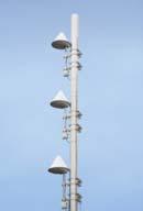
3 Ground-based Augmentation System: GBAS GNSS reference stations Four sets of ANT & Rx Data processing system Range corrections Integrity messages Anomaly detection and user protection GNSS satellite faults Propagation anomaly Ground system faults Augmentation information transmission VHF Data Broadcast ICAO SARPs for Category I (CAT-I) GBAS Published in 2001 GBAS ground subsystem GNSS Satellite Augmentation information GBAS airborne subsystem November 16, 2017 EIWAC 2017, Tokyo 3
4 Outline of CAT-III GBAS GAST-D (GBAS Approach Service Type-D) CAT-III GBAS based on ranging sources with single frequency of L1 signal To support precision approach bellow 200ft (60m) including rollout GAST-D should cover all requirements of CAT-I GBAS Decision Height 200ft (60m) CAT-I CAT-III Integrity Integrity Higher safety requirement 1-2 x x 10-9 November 16, 2017 EIWAC 2017, Tokyo 4


5 Outline of GAST-D Ionospheric anomaly: GBAS integrity risk A large spatial gradient in iono. delay: Significant positioning error CAT-I Assumption of large potential errors without detection of ionospheric anomaly by ground subsystem IFM could reduce a part of the potential error GNSS satellite CAT-III Detection of ionospheric anomaly by integrity monitors at both of ground and airborne subsystems GNSS satellite Iono. anomaly GBAS reference stations GBAS reference stations IFM (Ionosphere Field Monitor) November 16, 2017 EIWAC 2017, Tokyo 5
6 Outline of GAST-D Standardization and validation activities Development baseline SARPs International Civil Aviation Organization (ICAO) Navigation Systems Panel (NSP) working group has developed a baseline Standards and Recommended Practices (SARPs) May 2010 November 2016 Development of baseline SARPs with technical validation Operational validation with prototypes of GAST-D ground subsystem Atlantic City (US) Frankfurt (Germany) Toulouse (France) New Ishigaki (Japan) Operational validation Development of prototypes for ground / airborne subsystems The magnetic middle latitude The magnetic low latitude November 16, 2017 EIWAC 2017, Tokyo 6
7 Outline of GAST-D ENRI s program (Apr Mar. 2015) Purposes Validation of the baseline GAST-D SARPs Identification of major technical subjects and development of fundamental solutions for GAST-D ground subsystem Major subjects Development of a prototype of GAST-D ground subsystem Development of a flight experimental system including major airborne integrity monitors Validation of the GAST-D ionospheric threat model for low magnetic latitude Ionospheric threat model defines a range of each parameter such as gradient, speed, and width of ionospheric disturbances to be assumed by the system November 16, 2017 EIWAC 2017, Tokyo 7
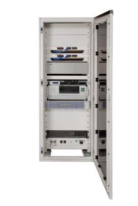
8 A prototype of GAST-D ground subsystem Development ENRI contracted with NEC corp. From Mar to Sept Total 23 meetings were held for safety design review almost every three weeks System design and its validation In compliance with the GAST-D requirements of the ICAO baseline SARPs, RTCA Do-246D and Do-253C A fundamental process of safety design and validation was done according to a guidance of SAE ARP4754 and ARP4761 Not includes software integrity assurances and redundant hardware November 16, 2017 EIWAC 2017, Tokyo 8
9 A prototype of GAST-D ground subsystem System safety design & validation System design Hardware Software Documentation FY 2011 FY2012 FY / 4 1 / 4 2 / 4 3 / 4 4 / 4 1 / 4 2 / 4 Design Manufacturing Algorithm descript Software design & coding document (ADD) Preliminary System Hardware Integration & tests Safety Assessment (PSSA) Safety design & validation System safety design FY: April to March in Japan Extraction of risks and FTA (Fault tree analysis) Quantitative risk analysis and identify key risks Risk allocations Development of mitigation methods such as integrity monitors Evaluation of remained risks November 16, 2017 EIWAC 2017, Tokyo 9
10 A prototype of GAST-D ground subsystem Integrity monitors for GAST-D Integrity monitor for GAST-D Integrity risks for the ground Iono. anomaly Satellite faults RFI Receiver faults Baseline SARPs Ionospheric spatial X Required gradient Signal deformation X Required Code Carrier Divergence (CCD) X X Required Excessive acceleration X Required Ephemeris X Required Radio frequency X - interference (RFI) Multiple receiver faults X - November 16, 2017 EIWAC 2017, Tokyo 10

 analysis Ishigaki Island Ionospheric delay map under plasma bubble events November 16, 2017 EIWAC")
11 Installation of the prototype in New Ishigaki Airport Southern part of Japan Equatorial anomaly: Nominal condition in Spring and Autumn Plasma bubble causes steep spatial gradients in ionospheric delay night time Selection of New Ishigaki airport Validation and demonstration of GAST-D concept with ground/airborne integrity monitors to detect ionospheric anomaly including flight experiments Optimization of parameters of integrity monitors under real airport condition Hazardous Misleading Information (HMI) analysis Ishigaki Island Ionospheric delay map under plasma bubble events November 16, 2017 EIWAC 2017, Tokyo 11
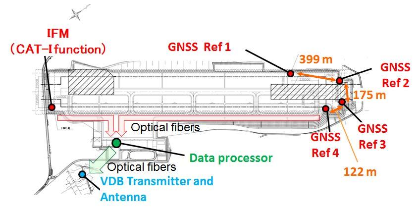
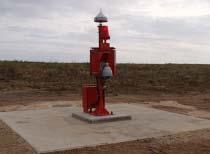
12 Installation of the prototype in New Ishigaki Airport (2) November 16, 2017 EIWAC 2017, Tokyo 12
13 Iono. delay diff. (mm) Optimization of parameters in monitors Ionospheric spatial gradient monitor Fundamental algorithm Estimation of gradient and direction A typical value from Consistency check among three baselines requirement Ref1-Ref2 baseline length Requirement of detectability: 119.7mm/km (300mm/km x 0.399km) Over bounded sigma: 9.86 mm/km Missed detection (Pmd): 10-9 Mean: [mm] Threshold: False alarm (Pffd): 2 x ~60.5 (raw): 5.33 [mm] mm/km (Inflated): 9.86 [mm] Feasibility validation Nominal condition [ S. Saito et al., Proc. of ION Pacific PNT 2015, Honolulu, HI, April 2015] November 16, 2017 EIWAC 2017, Tokyo 13
14 Optimization of parameters in monitors Signal Deformation & CCD Monitors Signal Deformation Monitor (SDM) Data on the roof of building are used for initial design and validation phase during system safety review Validation under a real airport conditions Difficulty to satisfy the requirement with low elevation angles from 5 to 10 degrees due to ground multipath Code Carrier Divergence (CCD) Monitor To detect a rapid temporary change of ionospheric delay due to disturbances Noise component increases for GPS signal with a low satellite elevation angle due to multipath and nominal ionospheric delay gradients Suggestion from the results Multipath Limiting Antenna (MLA) is needed to improve monitoring performances November 16, 2017 EIWAC 2017, Tokyo 14
15 Performance evaluations Accuracy (95% reliability) IFM data as Pseudo user Different seasons: Each one week in March and August 2014 Results of the bellow table meets the requirement Lateral: 16 meters, Vertical: 4 meters 2014 CAT-I GBAS GAST-D Accuracy of GAST-D is worse than CAT-I GBAS in both horizontal and vertical components Unit: m Horizontal Vertical Horizontal Vertical March August In GAST-D, position solution is based on carrier smoothing with a time constant of 30 seconds although it is 100 seconds in CAT-I GBAS GAST-D solution could be affected by observational errors such as multipath effects November 16, 2017 EIWAC 2017, Tokyo 15

16 Performance evaluations Availability analysis GAST-D availability Depends not only on GAST-D ground subsystem but also on airborne subsystem because of integrity monitors at the both sides to mitigate ionospheric threat GAST-D positioning analysis in offline Using our software originaly for experimental airborne GBAS equipment with airborne integrity monitors November 16, 2017 EIWAC 2017, Tokyo 16

17 Performance evaluations Availability and HMI analysis Availability result % from Stanford chart for an sample day A low rate of % for epochs with final solutions Further optimization of parameters in airborne Integrity monitors could improve the results Investigation of HMI events A larger VPL than actual positioning error Vertical Protection Level / Vertical alert limit A non-disturbed day HMI Vertical error / Vertical alert limit November 16, 2017 EIWAC 2017, Tokyo 17
18 Summary ENRI developed a prototype of GAST-D ground subsystem It is installed in the low magnetic latitude region to operationally validate the baseline GAST-D SARPs It has been continuously operated to collect a long-term data set to analyze total system performance and HMI events for future GAST-D implementation in Japan The initial and fundamental performance evaluation Integrity monitors such as Ionospheric spatial gradient, signal deformation, and CCD monitors The first performance evaluations of accuracy and availability November 16, 2017 EIWAC 2017, Tokyo 18
19 Future works Using a long-term data set Validation of the current parameter set, performance of integrity monitors, and total system performances HMI (Hazardous Misleading Information) analysis Issues on ICAO SARPs In Nov. 2016, the operational validation was completed with conclusions that the baseline SARPs covered ionospheric conditions in the middle magnetic latitude region at least It was also recognized that further work may be needed to enhance availability of GAST-D in the low magnetic latitude region, where ionospheric delay and scintillations frequently occur associated with plasma bubbles The data set is useful for investigating impacts of the ionospheric disturbances on GAST-D ground subsystem November 16, 2017 EIWAC 2017, Tokyo 19
20 Acknowledgement Authors deeply thank Japan Civil Aviation Bureau, Okinawa prefecture, Ishigaki city for their cooperation to installation and operation of ENRI s GAST-D prototype in New Insigaki airport November 16, 2017 EIWAC 2017, Tokyo 20
[EN A 78] Development of a CAT III GBAS (GAST D) ground subsystem prototype and its performance evaluation with a long term data set
![[EN A 78] Development of a CAT III GBAS (GAST D) ground subsystem prototype and its performance evaluation with a long term data set](/thumbs/96/128212036.jpg "[EN A 78] Development of a CAT III GBAS (GAST D) ground subsystem prototype and its performance evaluation with a long term data set") [EN A 78] Development of a CAT III GBAS (GAST D) ground subsystem prototype and its performance evaluation with a long term data set (EIWAC 2017) + T. Yoshihara*, S. Saito*, A. Kezuka*, K. Hoshinoo*, S.
[EN A 78] Development of a CAT III GBAS (GAST D) ground subsystem prototype and its performance evaluation with a long term data set (EIWAC 2017) + T. Yoshihara*, S. Saito*, A. Kezuka*, K. Hoshinoo*, S.
GBAS safety assessment guidance. related to anomalous ionospheric conditions
 INTERNATIONAL CIVIL AVIATION ORGANIZATION ASIA AND PACIFIC OFFICE GBAS safety assessment guidance Edition 1.0 September 2016 Adopted by APANPIRG/27 Intentionally left blank Edition 1.0 September 2016 2
[EN-107] Impact of the low latitude ionosphere disturbances on GNSS studied with a three-dimensional ionosphere model
![[EN-107] Impact of the low latitude ionosphere disturbances on GNSS studied with a three-dimensional ionosphere model](/thumbs/86/93972301.jpg "[EN-107] Impact of the low latitude ionosphere disturbances on GNSS studied with a three-dimensional ionosphere model") ENRI Int. Workshop on ATM/CNS. Tokyo, Japan (EIWAC21) [EN-17] Impact of the low latitude ionosphere disturbances on GNSS studied with a three-dimensional ionosphere model + S. Saito N. FUjii Communication
ENRI Int. Workshop on ATM/CNS. Tokyo, Japan (EIWAC21) [EN-17] Impact of the low latitude ionosphere disturbances on GNSS studied with a three-dimensional ionosphere model + S. Saito N. FUjii Communication
An Investigation of Local-Scale Spatial Gradient of Ionospheric Delay Using the Nation-Wide GPS Network Data in Japan
 An Investigation of Local-Scale Spatial Gradient of Ionospheric Delay Using the Nation-Wide GPS Network Data in Japan Takayuki Yoshihara, Takeyasu Sakai and Naoki Fujii, Electronic Navigation Research
[EN-A-008] GBAS Interoperability and Multi-Constellation / Multi-Frequency Trials
![[EN-A-008] GBAS Interoperability and Multi-Constellation / Multi-Frequency Trials](/thumbs/80/80771251.jpg "[EN-A-008] GBAS Interoperability and Multi-Constellation / Multi-Frequency Trials") ENRI Int. Workshop on ATM/CNS. Tokyo, Japan. (EIWAC 17) [EN-A-8] GBAS Interoperability and Multi-Constellation / Multi-Frequency Trials (EIWAC 17) + T. Feuerle *, M. Stanisak *, S. Saito, T. Yoshihara,
ENRI Int. Workshop on ATM/CNS. Tokyo, Japan. (EIWAC 17) [EN-A-8] GBAS Interoperability and Multi-Constellation / Multi-Frequency Trials (EIWAC 17) + T. Feuerle *, M. Stanisak *, S. Saito, T. Yoshihara,
A study of the ionospheric effect on GBAS (Ground-Based Augmentation System) using the nation-wide GPS network data in Japan
 using the nation-wide GPS network data in Japan") A study of the ionospheric effect on GBAS (Ground-Based Augmentation System) using the nation-wide GPS network data in Japan Takayuki Yoshihara, Electronic Navigation Research Institute (ENRI) Naoki Fujii,
A study of the ionospheric effect on GBAS (Ground-Based Augmentation System) using the nation-wide GPS network data in Japan Takayuki Yoshihara, Electronic Navigation Research Institute (ENRI) Naoki Fujii,
Figure 2: Maximum Ionosphere-Induced Vertical Errors at Memphis
 277 Figure 2: Maximum Ionosphere-Induced Vertical Errors at Memphis 278 Figure 3: VPL Inflation Required to Remove Unsafe Geometries 279 280 Figure 4: Nominal IPP Scenario All Surrounding IGPs are Good
Several ground-based augmentation system (GBAS) Galileo E1 and E5a Performance
 Galileo E1 and E5a Performance") » COVER STORY Galileo E1 and E5a Performance For Multi-Frequency, Multi-Constellation GBAS Analysis of new Galileo signals at an experimental ground-based augmentation system (GBAS) compares noise and
» COVER STORY Galileo E1 and E5a Performance For Multi-Frequency, Multi-Constellation GBAS Analysis of new Galileo signals at an experimental ground-based augmentation system (GBAS) compares noise and
ARAIM Fault Detection and Exclusion
 ARAIM Fault Detection and Exclusion Boris Pervan Illinois Institute of Technology Chicago, IL November 16, 2017 1 RAIM ARAIM Receiver Autonomous Integrity Monitoring (RAIM) uses redundant GNSS measurements
Prototyping Advanced RAIM for Vertical Guidance
 Prototyping Advanced RAIM for Vertical Guidance Juan Blanch, Myung Jun Choi, Todd Walter, Per Enge. Stanford University Kazushi Suzuki. NEC Corporation Abstract In the next decade, the GNSS environment
Impact of the low latitude ionosphere disturbances on GNSS studied with a three-dimensional ionosphere model
 Impact of the low latitude ionosphere disturbances on GNSS studied with a three-dimensional ionosphere model Susumu Saito and Naoki Fujii Communication, Navigation, and Surveillance Department, Electronic
Evaluation of Dual Frequency GBAS Performance using Flight Data
 Evaluation of Dual Frequency GBAS Performance using Flight Data Mihaela-Simona Circiu, Michael Felux, Patrick Remi, Lai Yi, Boubeker Belabbas, German Aerospace Center (DLR) Sam Pullen, Stanford University
Lessons Learned During the Development of GNSS Integrity Monitoring and Verification Techniques for Aviation Users
 Lessons Learned During the Development of GNSS Integrity Monitoring and Verification Techniques for Aviation Users Sam Pullen Stanford University spullen@stanford.edu ITSNT Symposium 16 November 2016 Toulouse,
Introduction to Advanced RAIM. Juan Blanch, Stanford University July 26, 2016
 Introduction to Advanced RAIM Juan Blanch, Stanford University July 26, 2016 Satellite-based Augmentation Systems Credit: Todd Walter Receiver Autonomous Integrity Monitoring (556 m Horizontal Error Bound)
International Civil Aviation Organization THE SIXTH MEETING OF IONOSPHERIC STUDIES TASK FORCE (ISTF/6) OUTCOME OF THE NSP/2 MEETING
 OUTCOME OF THE NSP/2 MEETING") ISTF/6 WP/06 Agenda Item 2 15/01/16 International Civil Aviation Organization THE SIXTH MEETING OF IONOSPHERIC STUDIES TASK FORCE (ISTF/6) Bangkok, Thailand, 19 21 January 2016 Agenda Item 2: Review of
ISTF/6 WP/06 Agenda Item 2 15/01/16 International Civil Aviation Organization THE SIXTH MEETING OF IONOSPHERIC STUDIES TASK FORCE (ISTF/6) Bangkok, Thailand, 19 21 January 2016 Agenda Item 2: Review of
GAGAN implementation and certification Programme. Presented by India
 GAGAN implementation and certification Programme Presented by India GPS Aided Geo Augmented Navigation International Civil Aviation Organization (ICAO) Member States Endorsed Global Satellite Navigation
Satellite Navigation Science and Technology for Africa. 23 March - 9 April, Air Navigation Applications (SBAS, GBAS, RAIM)
") 2025-25 Satellite Navigation Science and Technology for Africa 23 March - 9 April, 2009 Air Navigation Applications (SBAS, GBAS, RAIM) Walter Todd Stanford University Department of Applied Physics CA 94305-4090
2025-25 Satellite Navigation Science and Technology for Africa 23 March - 9 April, 2009 Air Navigation Applications (SBAS, GBAS, RAIM) Walter Todd Stanford University Department of Applied Physics CA 94305-4090
HORIZONTAL ARAIM AVAILABILITY FOR CIVIL AVIATION OPERATIONS. ARAIM Outreach event
 HORIZONTAL ARAIM AVAILABILITY FOR CIVIL AVIATION OPERATIONS ARAIM Outreach event Moses1978 copyright April 7, 2017 H-ARAIM availability for civil aviation operations 07/04/2017 1 INTRODUCTION Space Segment
Recent Progress on Aviation Integrity
 Recent Progress on Aviation Integrity for the Institute of Navigation on September 17, 2008 by Per Enge, Stanford University Acknowledgement: This work was sponsored by the FAA Satellite Navigation Office
Modernizing WAAS. Todd Walter and Per Enge, Stanford University, Patrick Reddan Zeta Associates Inc.
 Modernizing WAAS Todd Walter and Per Enge, Stanford University, Patrick Reddan Zeta Associates Inc. ABSTRACT The Wide Area Augmentation System (WAAS) became operational on July 10, 003. Currently this
Ground Based Augmentation Systems (GBAS) Introduction
 Introduction") Ground Based Augmentation Systems (GBAS) Introduction Technical and Operational Overview Andreas Lipp GBAS Implementation Workshop, ICAO EUR/NAT Paris, 18 March 2010 The European Organisation for the Safety
Ground Based Augmentation Systems (GBAS) Introduction Technical and Operational Overview Andreas Lipp GBAS Implementation Workshop, ICAO EUR/NAT Paris, 18 March 2010 The European Organisation for the Safety
Local-Area Differential GNSS Architectures Optimized to Support Unmanned Aerial Vehicles (UAVs)
") Local-Area Differential GNSS Architectures Optimized to Support Unmanned Aerial Vehicles (UAVs) Sam Pullen and Per Enge Stanford University Jiyun Lee Korea Advanced Institute of Science and Technology
Local-Area Differential GNSS Architectures Optimized to Support Unmanned Aerial Vehicles (UAVs) Sam Pullen and Per Enge Stanford University Jiyun Lee Korea Advanced Institute of Science and Technology
INTEGRITY AND CONTINUITY ANALYSIS FROM GPS JULY TO SEPTEMBER 2016 QUARTERLY REPORT
 INTEGRITY AND CONTINUITY ANALYSIS FROM GPS JULY TO SEPTEMBER 2016 QUARTERLY REPORT Name Responsibility Date Signature Prepared by M Pattinson (NSL) 07/10/16 Checked by L Banfield (NSL) 07/10/16 Authorised
Extensions to Enhance Air Traffic Management
 ENRI Int. Workshop on ATM/CNS. Tokyo, Japan. (EIWAC 2010) [EN-030] Using SBAS to Enhance GBAS User Availability: Results and Extensions to Enhance Air Traffic Management (EIWAC 2010) + Sam Pullen*, Ming
On Location at Stanford University
 Thank you for inviting me to Calgary On Location at Stanford University by Per Enge (with the help of many) May 29, 2009 With Gratitude to the Federal Aviation Administration from Misra and Enge, 2006
FAA GBAS System Development. Seminar on the Ionosphere and its Effect on GNSS Systems. Carlos A. Rodriguez GBAS Program Manager
 FAA GBAS System Development for Seminar on the Ionosphere and its Effect on GNSS Systems Santiago, Chile April 14-16, 2008 Carlos A. Rodriguez GBAS Program Manager Outline LAAS Program Background Integrity
The experimental evaluation of the EGNOS safety-of-life services for railway signalling
 Computers in Railways XII 735 The experimental evaluation of the EGNOS safety-of-life services for railway signalling A. Filip, L. Bažant & H. Mocek Railway Infrastructure Administration, LIS, Pardubice,
INTEGRITY AND CONTINUITY ANALYSIS FROM GPS JANUARY TO MARCH 2017 QUARTERLY REPORT
 INTEGRITY AND CONTINUITY ANALYSIS FROM GPS JANUARY TO MARCH 2017 QUARTERLY REPORT Name Responsibility Date Signature Prepared by M Pattinson (NSL) 11/04/17 Checked by L Banfield (NSL) 11/04/17 Authorised
GNSS Solutions: Do GNSS augmentation systems certified for aviation use,
 GNSS Solutions: WAAS Functions and Differential Biases GNSS Solutions is a regular column featuring questions and answers about technical aspects of GNSS. Readers are invited to send their questions to
Demonstrations of Multi-Constellation Advanced RAIM for Vertical Guidance using GPS and GLONASS Signals
 Demonstrations of Multi-Constellation Advanced RAIM for Vertical Guidance using GPS and GLONASS Signals Myungjun Choi, Juan Blanch, Stanford University Dennis Akos, University of Colorado Boulder Liang
Near Term Improvements to WAAS Availability
 Near Term Improvements to WAAS Availability Juan Blanch, Todd Walter, R. Eric Phelts, Per Enge Stanford University ABSTRACT Since 2003, when it was first declared operational, the Wide Area Augmentation
THE Ground-Based Augmentation System (GBAS) (known as
 (known as") JOURNAL OF AIRCRAFT Vol. 48, No. 4, July August 2011 Ionospheric Threat Mitigation by Geometry Screening in Ground-Based Augmentation Systems Jiyun Lee Korea Advanced Institute of Science and Technology,
JOURNAL OF AIRCRAFT Vol. 48, No. 4, July August 2011 Ionospheric Threat Mitigation by Geometry Screening in Ground-Based Augmentation Systems Jiyun Lee Korea Advanced Institute of Science and Technology,
INTERNATIONAL CIVIL AVIATION ORGANIZATION
 INTERNATIONAL CIVIL AVIATION ORGANIZATION AFI PLANNING AND IMPLEMENTATION REGIONAL GROUP EIGHTEENTH MEETING (APIRG/18) Kampala, Uganda (27 30 March 2012) Agenda Item 3: Performance Framework for Regional
Targeted Ephemeris Decorrelation Parameter Inflation for Improved LAAS Availability during Severe Ionosphere Anomalies
 Targeted Ephemeris Decorrelation Parameter Inflation for Improved LAAS Availability during Severe Ionosphere Anomalies Shankararaman Ramakrishnan, Jiyun Lee, Sam Pullen, and Per Enge Stanford University
Assessing & Mitigation of risks on railways operational scenarios
 R H I N O S Railway High Integrity Navigation Overlay System Assessing & Mitigation of risks on railways operational scenarios Rome, June 22 nd 2017 Anja Grosch, Ilaria Martini, Omar Garcia Crespillo (DLR)
Code-Carrier Divergence Monitoring for GAST-F GBAS
 Code-Carrier Divergence Monitoring for GAST-F GBAS Yiping Jiang, Carl Milner, Christophe Macabiau To cite this version: Yiping Jiang, Carl Milner, Christophe Macabiau. Code-Carrier Divergence Monitoring
Integrity of Satellite Navigation in the Arctic
 Integrity of Satellite Navigation in the Arctic TODD WALTER & TYLER REID STANFORD UNIVERSITY APRIL 2018 Satellite Based Augmentation Systems (SBAS) in 2018 2 SBAS Networks in 2021? 3 What is Meant by Integrity?
Performance Assessment of Dual Frequency GBAS Protection Level Algorithms using a Dual Constellation and Non-Gaussian Error Distributions
 Performance Assessment of Dual Frequency GBAS Protection Level Algorithms using a Dual Constellation and Non-Gaussian Error Distributions Patrick Rémi, German Aerospace Center (DLR) Boubeker Belabbas,
The Wide Area Augmentation System
 The Wide Area Augmentation System Stanford University http://waas.stanford.edu What is Augmentation? 2 Add to GNSS to Enhance Service Improve integrity via real time monitoring Improve availability and
Modified Ionospheric Correction Algorithm for the SBAS Based on Geometry Monitor Concept
 Modified Ionospheric Correction Algorithm for the SBAS Based on Geometry Monitor Concept Takeyasu Sakai, Keisuke Matsunaga, and Kazuaki Hoshinoo, Electronic Navigation Research Institute, Japan Todd Walter,
Current GPS Monitoring Activities in Thailand and Total Electron Content (TEC) Study at Chumphon and Bangkok, Thailand
 Study at Chumphon and Bangkok, Thailand") EIWACS 2010 The 2nd ENRI International Workshop on ATM/CNS 10-12 November, 2010, Tokyo, Japan Current GPS Monitoring Activities in Thailand and Total Electron Content (TEC) Study at Chumphon and Bangkok,
EIWACS 2010 The 2nd ENRI International Workshop on ATM/CNS 10-12 November, 2010, Tokyo, Japan Current GPS Monitoring Activities in Thailand and Total Electron Content (TEC) Study at Chumphon and Bangkok,
SENSORS SESSION. Operational GNSS Integrity. By Arne Rinnan, Nina Gundersen, Marit E. Sigmond, Jan K. Nilsen
 Author s Name Name of the Paper Session DYNAMIC POSITIONING CONFERENCE 11-12 October, 2011 SENSORS SESSION By Arne Rinnan, Nina Gundersen, Marit E. Sigmond, Jan K. Nilsen Kongsberg Seatex AS Trondheim,
System Architecture-based Design Methodology for Monitoring the Ground-based Augmentation System: Category I Integrity Risk
 doi:10.5028/jatm.2012.04025611 System Architecture-based Design Methodology for Monitoring the Ground-based Augmentation System: Category I Paulo Elias*, Osamu Saotome Instituto Tecnológico de Aeronáutica
ARAIM Integrity Support Message Parameter Validation by Online Ground Monitoring
 ARAIM Integrity Support Message Parameter Validation by Online Ground Monitoring Samer Khanafseh, Mathieu Joerger, Fang Cheng-Chan and Boris Pervan Illinois Institute of Technology, Chicago, IL ABSTRACT
SBAS solution GCC, Yemen and Iraq System baseline and performance
 SBAS solution GCC, Yemen and Iraq System baseline and performance ACAC Workshop Rabat 7 & 8 November 2017 1 2017 Thales Alenia Space PROPRIETARY C O M MINFORMATION E R C I A L I N THALES C O ALENIA N F
Methodology and Case Studies of Signal-in-Space Error Calculation
 Methodology and Case Studies of Signal-in-Space Error Calculation Top-down Meets Bottom-up Grace Xingxin Gao *, Haochen Tang *, Juan Blanch *, Jiyun Lee +, Todd Walter * and Per Enge * * Stanford University,
Position-Domain Geometry Screening to Maximize LAAS Availability in the Presence of Ionosphere Anomalies
 Position-Domain Geometry Screening to Maximize LAAS Availability in the Presence of Ionosphere Anomalies Jiyun Lee, Ming Luo, Sam Pullen, Young Shin Park and Per Enge Stanford University Mats Brenner Honeywell
The Benefits of Three Frequencies for the High Accuracy Positioning
 The Benefits of Three Frequencies for the High Accuracy Positioning Nobuaki Kubo (Tokyo University of Marine and Science Technology) Akio Yasuda (Tokyo University of Marine and Science Technology) Isao
On Location at Stanford University
 Thank you for inviting me (back) to Deutsches Zentrum für Luft- und Raumfahrt On Location at Stanford University by Per Enge (with the help of many) July 27, 2009 My thanks to the Federal Aviation Administration
Dual-Frequency Smoothing for CAT III LAAS: Performance Assessment Considering Ionosphere Anomalies
 Dual-Frequency Smoothing for CAT III LAAS: Performance Assessment Considering Ionosphere Anomalies Hiroyuki Konno, Stanford University BIOGRAPHY Hiroyuki Konno is a Ph.D. candidate in Aeronautics and Astronautics
IMPLEMENTATION OF GNSS BASED SERVICES
 International Civil Aviation Organization IMPLEMENTATION OF GNSS BASED SERVICES Julio Siu Communications, Navigation and Surveillance Regional Officer ICAO NACC Regional Office ICAO Workshop on PBN Airspace
Distributed integrity monitoring of differential GPS corrections
 Distributed integrity monitoring of differential GPS corrections by Martin Pettersson Supervised by Fredrik Gustafsson Niclas Bergman Department of Automatic Control University of Linköpings Made for Luftfartsverket
Ionospheric Corrections for GNSS
 Ionospheric Corrections for GNSS The Atmosphere and its Effect on GNSS Systems 14 to 16 April 2008 Santiago, Chile Ing. Roland Lejeune Overview Ionospheric delay corrections Core constellations GPS GALILEO
Effects of magnetic storms on GPS signals
 Effects of magnetic storms on GPS signals Andreja Sušnik Supervisor: doc.dr. Biagio Forte Outline 1. Background - GPS system - Ionosphere 2. Ionospheric Scintillations 3. Experimental data 4. Conclusions
SBAS and GBAS Integrity for Non-Aviation Users: Moving Away from "Specific Risk"
 SBAS and GBAS Integrity for Non-Aviation Users: Moving Away from "Specific Risk" Sam Pullen, Todd Walter, and Per Enge Stanford University ABSTRACT SBAS and GBAS enhance standalone GNSS navigation to meet
Prototype of Satellite-Based Augmentation System and Evaluation of the Ionospheric Correction Algorithms
 Prototype of Satellite-Based Augmentation System and Evaluation of the Ionospheric Correction Algorithms Takeyasu Sakai, Keisuke Matsunaga, and Kazuaki Hoshinoo, Electronic Navigation Research Institute,
Aviation Benefits of GNSS Augmentation
 Aviation Benefits of GNSS Augmentation Workshop on the Applications of GNSS Chisinau, Moldova 17-21 May 2010 Jeffrey Auerbach Advisor on GNSS Affairs Office of Space and Advanced Technology U.S. Department
Ionospheric delay gradient model for GBAS in the Asia-Pacific region
 GPS Solut (2017) 21:1937 1947 DOI 10.1007/s10291-017-0662-1 ORIGINAL ARTICLE Ionospheric delay gradient model for GBAS in the Asia-Pacific region Susumu Saito 1 Surendra Sunda 2 Jiyun Lee 3 Sam Pullen
SATELLITE BASED AUGMENTATION SYSTEM (SBAS) FOR AUSTRALIA
 FOR AUSTRALIA") SATELLITE BASED AUGMENTATION SYSTEM (SBAS) FOR AUSTRALIA AN AIN POSITION PAPER SUBMITTED TO VARIOUS GOVERNMENT DEPARTMENTS BY MR KYM OSLEY AM, CSC, EXEC SECRETARY AIN What are GNSS Augmentation Systems?
SATELLITE BASED AUGMENTATION SYSTEM (SBAS) FOR AUSTRALIA AN AIN POSITION PAPER SUBMITTED TO VARIOUS GOVERNMENT DEPARTMENTS BY MR KYM OSLEY AM, CSC, EXEC SECRETARY AIN What are GNSS Augmentation Systems?
Implementation of Prototype Satellite-Based Augmentation System (SBAS)
") International Global Navigation Satellite Systems Society IGNSS Symposium 2006 Holiday Inn Surfers Paradise, Australia 17 21 July 2006 Implementation of Prototype Satellite-Based Augmentation System (SBAS)
International Global Navigation Satellite Systems Society IGNSS Symposium 2006 Holiday Inn Surfers Paradise, Australia 17 21 July 2006 Implementation of Prototype Satellite-Based Augmentation System (SBAS)
Satellite-Based Augmentation System (SBAS) Integrity Services
 Integrity Services") Satellite-Based Augmentation System (SBAS) Integrity Services Presented To: Munich, Germany Date: March 8, 2010 By: Leo Eldredge, Manager GNSS Group, FAA FAA Satellite Navigation Program 2 Wide Area Augmentation
Satellite-Based Augmentation System (SBAS) Integrity Services Presented To: Munich, Germany Date: March 8, 2010 By: Leo Eldredge, Manager GNSS Group, FAA FAA Satellite Navigation Program 2 Wide Area Augmentation
On Location at Stanford University
 Thank you for inviting me (back) to Southern California On Location at Stanford University by Per Enge (with the help of many) June 30, 2009 My thanks to the Federal Aviation Administration Outline Landing
International Programmes & GNSS Monitoring
 International Programmes & GNSS Monitoring Patrizio Vanni (patrizio.vanni@enav.it) GNSS expert ICAO PBN and PANS-OPS Provisions Implementation workshop Lisbon, 26 August 2015 Participation to PBN/GNSS
GAGAN-Extension to the Gulf Region. Joint ACAC/ICAO MID Workshop on GNSS 7 th & 8 th November 2017
 GAGAN-Extension to the Gulf Region Joint ACAC/ICAO MID Workshop on GNSS 7 th & 8 th November 2017 P.N.S. KUSHWAHA EXECUTIVE DIRECTOR (CNS P) Airports Authority of India New Delhi Topics covered : 1. GAGAN
GBAS CAT II/III Operational Validation Input for Business Aircraft Flight Tests and Simulations
 GBAS CAT II/III Operational Validation Input for Business Aircraft Flight Tests and Simulations Edition SESAR 9.12. Executive Summary In order to support GBAS CAT II/III (GAST D) validation,
The Atmosphere and its Effect on GNSS Systems 14 to 16 April 2008 Santiago, Chile
 Description of a Real-Time Algorithm for Detecting Ionospheric Depletions for SBAS and the Statistics of Depletions in South America During the Peak of the Current Solar Cycle The Atmosphere and its Effect
RAIM Availability prediction
 RAIM Availability prediction Main content 一 Background & research purposes 二 Related research in China and abroad 三 Theory and arithmetic 四 RAIM systems development 五 The vision of the future 1 Background
Assessment of EGNOS performance in worst ionosphere conditions (October and November 2003 storm)
") European Navigation Conference 2005 Munich Assessment of EGNOS performance in worst ionosphere conditions (October and November 2003 storm) Authors: Cristoforo Montefusco 1, Javier Ventura-Traveset 1,
European Navigation Conference 2005 Munich Assessment of EGNOS performance in worst ionosphere conditions (October and November 2003 storm) Authors: Cristoforo Montefusco 1, Javier Ventura-Traveset 1,
Assessment of Nominal Ionosphere Spatial Decorrelation for LAAS
 Assessment of Nominal Ionosphere Spatial Decorrelation for LAAS Jiyun Lee, Sam Pullen, Seebany Datta-Barua, and Per Enge Stanford University, Stanford, California 9-8 Abstract The Local Area Augmentation
Satellite Navigation Science and Technology for Africa. 23 March - 9 April, The African Ionosphere
 2025-28 Satellite Navigation Science and Technology for Africa 23 March - 9 April, 2009 The African Ionosphere Radicella Sandro Maria Abdus Salam Intern. Centre For Theoretical Physics Aeronomy and Radiopropagation
GLOBAL POSITIONING SYSTEM (GPS) PERFORMANCE APRIL TO JUNE 2017 QUARTERLY REPORT
 PERFORMANCE APRIL TO JUNE 2017 QUARTERLY REPORT") GLOBAL POSITIONING SYSTEM (GPS) PERFORMANCE APRIL TO JUNE 2017 QUARTERLY REPORT Name Responsibility Date Signature Prepared by M Pattinson (NSL) 06/07/17 Checked by L Banfield (NSL) 06/07/17 Authorised
GLOBAL POSITIONING SYSTEM (GPS) PERFORMANCE APRIL TO JUNE 2017 QUARTERLY REPORT Name Responsibility Date Signature Prepared by M Pattinson (NSL) 06/07/17 Checked by L Banfield (NSL) 06/07/17 Authorised
GNSS for Landing Systems and Carrier Smoothing Techniques Christoph Günther, Patrick Henkel
 GNSS for Landing Systems and Carrier Smoothing Techniques Christoph Günther, Patrick Henkel Institute of Communications and Navigation Page 1 Instrument Landing System workhorse for all CAT-I III approach
GLOBAL POSITIONING SYSTEM (GPS) PERFORMANCE JANUARY TO MARCH 2016 QUARTERLY REPORT
 PERFORMANCE JANUARY TO MARCH 2016 QUARTERLY REPORT") GLOBAL POSITIONING SYSTEM (GPS) PERFORMANCE JANUARY TO MARCH 2016 QUARTERLY REPORT Name Responsibility Date Signature Prepared by M Pattinson (NSL) 22/04/16 Checked by L Banfield (NSL) 22/04/16 Authorised
GLOBAL POSITIONING SYSTEM (GPS) PERFORMANCE JANUARY TO MARCH 2016 QUARTERLY REPORT Name Responsibility Date Signature Prepared by M Pattinson (NSL) 22/04/16 Checked by L Banfield (NSL) 22/04/16 Authorised
NAVIGATION SYSTEMS PANEL (NSP) NSP Working Group meetings. Impact of ionospheric effects on SBAS L1 operations. Montreal, Canada, October, 2006
 NSP Working Group meetings. Impact of ionospheric effects on SBAS L1 operations. Montreal, Canada, October, 2006") NAVIGATION SYSTEMS PANEL (NSP) NSP Working Group meetings Agenda Item 2b: Impact of ionospheric effects on SBAS L1 operations Montreal, Canada, October, 26 WORKING PAPER CHARACTERISATION OF IONOSPHERE
NAVIGATION SYSTEMS PANEL (NSP) NSP Working Group meetings Agenda Item 2b: Impact of ionospheric effects on SBAS L1 operations Montreal, Canada, October, 26 WORKING PAPER CHARACTERISATION OF IONOSPHERE
Horizontal Advanced RAIM: Operational Benefits and Future Challenges
 Horizontal Advanced RAIM: Operational Benefits and Future Challenges International Technical Symposium on Navigation and Timing 2015 Session Air Navigation November 2015 Toulouse/France 1 ICAO ABAS augmentation
SBAS DFMC performance analysis with the SBAS DFMC Service Volume software Prototype (DSVP)
") SBAS DFMC performance analysis with the SBAS DFMC Service Volume software Prototype (DSVP) D. Salos, M. Mabilleau, Egis Avia C. Rodriguez, H. Secretan, N. Suard, CNES (French Space Agency) Email: Daniel.salos@egis.fr
SBAS DFMC performance analysis with the SBAS DFMC Service Volume software Prototype (DSVP) D. Salos, M. Mabilleau, Egis Avia C. Rodriguez, H. Secretan, N. Suard, CNES (French Space Agency) Email: Daniel.salos@egis.fr
EFFECTS OF IONOSPHERIC SMALL-SCALE STRUCTURES ON GNSS
 EFFECTS OF IONOSPHERIC SMALL-SCALE STRUCTURES ON GNSS G. Wautelet, S. Lejeune, R. Warnant Royal Meteorological Institute of Belgium, Avenue Circulaire 3 B-8 Brussels (Belgium) e-mail: gilles.wautelet@oma.be
DESIGN OF AIRPORT SURFACE MOVEMENT USING SINGLE-FREQUENCY GPS A DISSERTATION SUBMITTED TO THE DEPARTMENT OF AERONAUTICS AND ASTRONAUTICS
 DESIGN OF AIRPORT SURFACE MOVEMENT USING SINGLE-FREQUENCY GPS A DISSERTATION SUBMITTED TO THE DEPARTMENT OF AERONAUTICS AND ASTRONAUTICS AND THE COMMITTEE ON GRADUATE STUDIES OF STANFORD UNIVERSITY IN
Evaluation of Two Types of Dual-Frequency Differential GPS Techniques under Anomalous Ionosphere Conditions
 Evaluation of Two Types of Dual-Frequency Differential GPS Techniques under Anomalous Ionosphere Conditions Hiroyuki Konno, Sam Pullen, Jason Rife, and Per Enge Stanford University ABSTRACT Strong ionosphere
Status of ARAIM. S. Wallner ICG 6, Tokyo, Japan 05/09/2011. ESA UNCLASSIFIED For Official Use
 Status of ARAIM S. Wallner ICG 6, Tokyo, Japan 05/09/2011 ARAIM Concept Objectives Classical GPS RAIM for NPA used since years Evolving GNSS environment Multi-GNSS GPS/Galileo/Glonass/Compass/QZSS Dual-frequency
Enabling the LAAS Differentially Corrected Positioning Service (DCPS): Design and Requirements Alternatives
: Design and Requirements Alternatives") Enabling the LAAS Differentially Corrected Positioning Service (DCPS): Design and Requirements Alternatives Young Shin Park, Sam Pullen, and Per Enge, Stanford University BIOGRAPHIES Young Shin Park is
Enabling the LAAS Differentially Corrected Positioning Service (DCPS): Design and Requirements Alternatives Young Shin Park, Sam Pullen, and Per Enge, Stanford University BIOGRAPHIES Young Shin Park is
Ionosphere Spatial Gradient Threat for LAAS: Mitigation and Tolerable Threat Space
 Ionosphere Spatial Gradient Threat for LAAS: Mitigation and Tolerable Threat Space Ming Luo, Sam Pullen, Todd Walter, and Per Enge Stanford University ABSTRACT The ionosphere spatial gradients under etreme
GPS Modernization and Program Update
 GPS Modernization and Program Update GPS Update to ION Southern California Chapter 22 Feb 2011 Colonel Bernie Gruber Director Global Positioning Systems Directorate Contents Current Constellation Modernization
LAAS Sigma-Mean Monitor Analysis and Failure-Test Verification
 LAAS Sigma-Mean Monitor Analysis and Failure-Test Verification Jiyun Lee, Sam Pullen, Gang Xie, and Per Enge Stanford University ABSTRACT The Local Area Augmentation System (LAAS) is a ground-based differential
Ionospheric Effects on Aviation
 Ionospheric Effects on Aviation Recent experience in the observation and research of ionospheric irregularities, gradient anomalies, depletion walls, etc. in USA and Europe Stan Stankov, René Warnant,
D. Salos, M. Mabilleau (Egis) C. Rodriguez, H. Secretan, N. Suard (CNES)
 C. Rodriguez, H. Secretan, N. Suard (CNES)") ITSNT 2017 - SBAS DFMC performance analysis with the SBAS DSVP 15/11/2017 1 ITSNT 2017 15/11/2017 Toulouse S B A S DUAL- F R E Q U E N C Y M U LT I - C O N S T E L L AT I O N ( D F M C ) A N A LY S I S
ITSNT 2017 - SBAS DFMC performance analysis with the SBAS DSVP 15/11/2017 1 ITSNT 2017 15/11/2017 Toulouse S B A S DUAL- F R E Q U E N C Y M U LT I - C O N S T E L L AT I O N ( D F M C ) A N A LY S I S
GPS SIGNAL INTEGRITY DEPENDENCIES ON ATOMIC CLOCKS *
 GPS SIGNAL INTEGRITY DEPENDENCIES ON ATOMIC CLOCKS * Marc Weiss Time and Frequency Division National Institute of Standards and Technology 325 Broadway, Boulder, CO 80305, USA E-mail: mweiss@boulder.nist.gov
GLOBAL POSITIONING SYSTEM (GPS) PERFORMANCE JULY TO SEPTEMBER 2018 QUARTERLY REPORT 3
 PERFORMANCE JULY TO SEPTEMBER 2018 QUARTERLY REPORT 3") GLOBAL POSITIONING SYSTEM (GPS) PERFORMANCE JULY TO SEPTEMBER 2018 QUARTERLY REPORT 3 Name Responsibility Date Signature Prepared by M McCreadie (NSL) 24/10/2018 Checked by M Pattinson (NSL) 24/10/2018
GLOBAL POSITIONING SYSTEM (GPS) PERFORMANCE JULY TO SEPTEMBER 2018 QUARTERLY REPORT 3 Name Responsibility Date Signature Prepared by M McCreadie (NSL) 24/10/2018 Checked by M Pattinson (NSL) 24/10/2018
Extending the Reach of SBAS. Some Aspects of EGNOS Performance in Ukraine
 Extending the Reach of SBAS Some Aspects of EGNOS Performance in Ukraine Although the European Geostationary Navigation Overlay Service is primarily designed to provide benefits from a space-based augmentation
RFI Impact on Ground Based Augmentation Systems (GBAS)
") RFI Impact on Ground Based Augmentation Systems (GBAS) Nadia Sokolova SINTEF ICT, Dept. Communication Systems SINTEF ICT 1 GBAS: General Concept - improves the accuracy, provides integrity and approach
RFI Impact on Ground Based Augmentation Systems (GBAS) Nadia Sokolova SINTEF ICT, Dept. Communication Systems SINTEF ICT 1 GBAS: General Concept - improves the accuracy, provides integrity and approach
Broadcasting Data from an SBAS Reference Network over Low Rate Broadcast Channels
 Broadcasting Data from an SBAS Reference Network over Low Rate Broadcast Channels Sherman C. Lo, Per Enge Department of Aeronautics and Astronautics, Stanford University BIOGRAPHY Sherman Lo is a Ph.D.
ICAO policy on GNSS, GNSS SARPs and global GNSS developments. Jim Nagle Chief, Communication, Navigation and Surveillance Section ICAO
 ICAO policy on GNSS, GNSS SARPs and global GNSS developments Jim Nagle Chief, Communication, Navigation and Surveillance Section ICAO Presentation overview Introduction GNSS developments in ICAO ICAO policy
Performance Evaluation of the Effect of QZS (Quasi-zenith Satellite) on Precise Positioning
 on Precise Positioning") Performance Evaluation of the Effect of QZS (Quasi-zenith Satellite) on Precise Positioning Nobuaki Kubo, Tomoko Shirai, Tomoji Takasu, Akio Yasuda (TUMST) Satoshi Kogure (JAXA) Abstract The quasi-zenith
Performance Evaluation of the Effect of QZS (Quasi-zenith Satellite) on Precise Positioning Nobuaki Kubo, Tomoko Shirai, Tomoji Takasu, Akio Yasuda (TUMST) Satoshi Kogure (JAXA) Abstract The quasi-zenith
An ARAIM Demonstrator
 An ARAIM Demonstrator D. Salos, M. Mabilleau, Egis Avia N. Dahman, Airbus Deference and Space S. Feng, Imperial College of London JP. Boyero, European Commission Email: daniel.salos@egis.fr BIOGRAPHIES
Performance framework for Regional Air Navigation Planning and Implementation
 GREPECAS/16 WP/21 International Civil Aviation Organization 02/03/11 CAR/SAM Regional Planning and Implementation Group (GREPECAS) Sixteenth Meeting of the CAR/SAM Regional Planning and Implementation
Methodology and Case Studies of Signal-in-Space Error Calculation Top-down Meets Bottom-up
 Methodology and Case Studies of Signal-in-Space Error Calculation Top-down Meets Bottom-up Grace Xingxin Gao*, Haochen Tang*, Juan Blanch*, Jiyun Lee+, Todd Walter* and Per Enge* * Stanford University,
Development of Satellite Navigation for Aviation (FAA Award No. 95-G-005) Technical Description of Project and Results Stanford University June 2009
 Technical Description of Project and Results Stanford University June 2009") 1.0 Introduction Development of Satellite Navigation for Aviation (FAA Award No. 95-G-005) Technical Description of Project and Results Stanford University June 2009 This report describes the key elements
1.0 Introduction Development of Satellite Navigation for Aviation (FAA Award No. 95-G-005) Technical Description of Project and Results Stanford University June 2009 This report describes the key elements
Investigation of the Effect of Ionospheric Gradients on GPS Signals in the Context of LAAS
 Progress In Electromagnetics Research B, Vol. 57, 191 25, 214 Investigation of the Effect of Ionospheric Gradients on GPS Signals in the Context of LAAS Vemuri Satya Srinivas 1, Achanta D. Sarma 1, *,
Incorporating GLONASS into Aviation RAIM Receivers
 Incorporating GLONASS into Aviation RAIM Receivers Todd Walter, Juan Blanch, Myung Jun Choi, Tyler Reid, and Per Enge Stanford University ABSTRACT Recently the Russian government issued a mandate on the
FAA GNSS Programs & GPS Evolutionary Architecture Study (GEAS) Status
 Status") FAA GNSS Programs & GPS Evolutionary Architecture Study (GEAS) Status Presented to: By: Date: Leo Eldredge, FAA Agenda Wide Area Augmentation System (WAAS) Status Local Area Augmentation System (LAAS)
FAA GNSS Programs & GPS Evolutionary Architecture Study (GEAS) Status Presented to: By: Date: Leo Eldredge, FAA Agenda Wide Area Augmentation System (WAAS) Status Local Area Augmentation System (LAAS)