High Altitude Communications Platforms
|
|
|
- Collin Boyd
- 5 years ago
- Views:
Transcription
1
2 High Altitude Communications Platforms - new Opportunities in Air Space Management Alan C Smith ATN The ATC Data Link Conference at the Institution of Electrical Engineers, London 15th September, 2004 QINETIQ/KI/COM/PUB Noesis Inc.

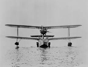
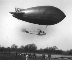
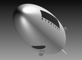
3 Airships used to get a bad press. Hindenburg
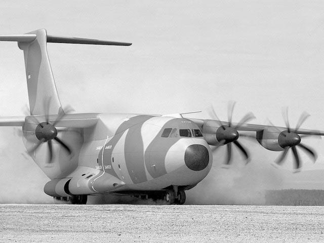

4 Aerospace Technology Has Evolved 4 Yesterday rr (C) Janes

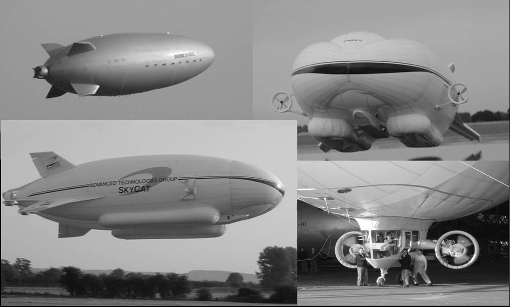
5 Lighter Than Air Technology has evolved 5 day Yesterday rr


6 High Altitude Platforms for New Services 6 Continuous all-weather remote monitoring New platform. New opportunities Up to 5 yrs on-station. 24/7 availability New comms services - relay, broadcast
7 Contents 7 1 Height, Range & Endurance 2 Payload Capabilities 3 Communications 4 Remote Monitoring 5 Summary
8 Height, Range, Endurance
9 Operational Environment 9 22,370 miles 340 miles 50 miles 186,000 ft 36,000 ft 75,000 ft
10 Area coverage 10 Coverage Diameter vs Elevation Angle Elevation Angle (deg) Earth Radius = 6,357 k m Alt.= 22 km Alt.= 20 km Alt.= 18 km Alt.= 10 km Alt.= 2 km Coverage Diameter (km)
11 Typical Monthly Wind Profiles 11 London Equatorial Altitude (feet) January March May July September November Windspeed (knots) Windspeed (knots)


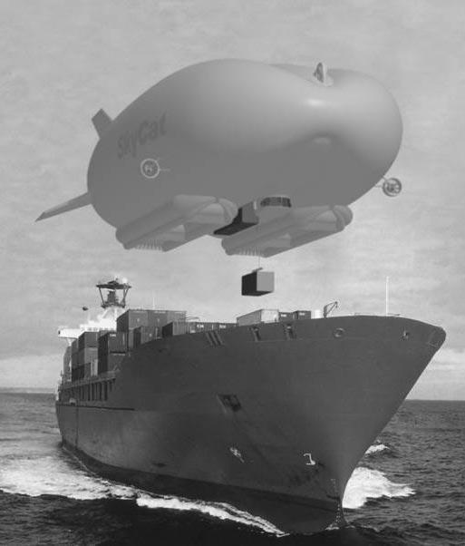
12 Lighter Than Air HAPs - Future Solutions 12 US/Korea Lockheed Japan ATG (UK)

 Heliplat - 70m wing span")

13 Fixed Wing HAPs - Future Solutions 13 Helios - 75m wingspan e - 13m wingspan (trials version) Heliplat - 70m wing span Solar powered. Circular cruise path (8km diam x 3km 99.9%) 4.8M over 3 years
14 Payload Capabilities
15 HAP Applications 15
16 Use of HAPS for Homeland Security 16 Sovereignty
 Linking through satcom and terrestrial infrastructures High Bandwidth delivery Geostationary & relocatable platform At ~ 21km altitude: ~70,000 (km) 2 & ~0.")
17 HAPs suggest New Operational Concepts 17 Ultra Long On-Station times 1-5 years depending on latitude platform under customer control Application Comms, Airspace Mgt & Navigation 365/24/7 Remote monitoring (air, land, sea) Linking through satcom and terrestrial infrastructures High Bandwidth delivery Geostationary & relocatable platform At ~ 21km altitude: ~70,000 (km) 2 & ~0.5M (km) 3 coverage.

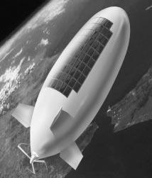
. Hull Volume - 238,000 cu.m. Length - 200.0 m.")
18 Platform Characteristics 18 Altitude - 20 km. Location - Diesel/Solar up to 60 o North or South Latitude Life - up to 5 years. Payload - up to 2,000 kg and 25 kw. Position Hold - +/-0.5 km (all 3 axis). Hull Volume - 238,000 cu.m. Length m. Diameter m. Gross Weight - 17,000 kg.

19 HAP Payload meters HACP Payload Module Noesis Inc. Payload: 2 tonnes with 25kW Payload can be mixed: Airspace Mgt + Commercial Comms + Broadcasting + Navigation + Educational + Environmental


20 Platform Launch 20 Continued expansion finally causes airship to roll to horizontal. Helium expands causing payload module to move off center and to roll airship. Airship is released allowing it to rise similar to a hot air balloon. Hangar roof opened. Weather window is established. 30,000ft 50,000ft 65,000ft Launch
21 Unique features of HAP 21 Communications -c21 km Tall Tower Remote Sensing - Continuous sensing 24 hrs a day Platform Long endurance (1-5 years) Contained within 1km 3 Above controlled airspace 2 tonne payload 25kW continuous payload power Fly to Location & relocatable (80 knots) Low vulnerability Hook-in-the-Sky
22 Communications


23 Communications Opportunities Land / Sea / Air regional comms Broadcast / Relay / Hub Broadband, Narrowband, Air-to-Air, Air-to-Ground etc 3G; interactive TV:... Secure Comms Architecture (inc narrow & steerable beams) Upgradable payload Backhaul via satcom
24 24 Platform Control Centre Commercial Comms Services Air Space Management Operations Centre Commercial Infrastructure Other Services Favourable Link budget; very small time delay (cf satcom); reconfigurable payload; shared platform

25 ATM in UK km diameter. 10 o elevation. Volume ~0.5million (km) 3

26 ITU Regions 26 Tropical zones
27 Frequency bands allocated for HAPs (ref: Karapantazis & Pavlidou) 27 Band Area Services Shared with 47 GHz Global Fixed services (u/ d) 31 GHz 12 Asian countries 27 GHz 12 Asian countries 1.9, 2.0, 2.1 Regions 1, GHz 2, 3 1.9, 2.1 GHz Fixed services (u/ -) Fixed services (-/ d) IMT-2000 Fixed & mobile; fixed satellite (uplink); radio astronomy band neighbouring Fixed & mobile; space science Fixed & mobile; fixed sat service Fixed & mobile services (IMT-2000 and PCS) Region 2 IMT-2000 Fixed & mobile services (IMT-2000 and PCS)
28 Remote Monitoring

29 European footprints o elevation. ~ 300km diameter footprint.
30 Remote observation capability 1 30 Single Frame Coverage R Martin, Las Vegas

31 Remote observation capability 2 31 Single Frame Coverage R Martin, Las Vegas
32 Summary
 * $5.")


33 Low Cost of Acquisition 33 Low Altitude Airship AT-10 * $3.1 M per vehicle AT-50 (twice lift) * $5.0 M per vehicle Low Altitude Airship (heavy lift) SkyCat 20 est. development $85 M to complete & certify High Altitude Airship est. development $200 M to complete & certify est. in production * $25 M per vehicle per launch * Figure does not include sensors or special configurations. est. in production * $20 M per vehicle
34 High Altitude Platforms 34 New platform. ~1 (km )3 positional stability at ~21km altitude up to 5 years continuous on-site operations New opportunities. Service package on a 21km tall tower Airspace management; air services Communications, Remote Monitoring of earth resources; air, land, maritime traffic; Voice; TV;... Much civil / govt interest worldwide - the HAP industry is growing Cheap & complimentary to satellite Expectation is that a Stratospheric platform will fly in next few years
35 QinetiQ
36 References 1 Lighter than Air Ships - Opportunity for the Aerospace and Aeronautics Communities, Richard J. Martin, 7th annual conf. on Unmanned Aerial Vehicles. American Institute of Engineers, Las Vegas, October 23-24, Broadband from heaven, S Karapantazis and F-N Pavlidou. IEE Communications Engineer, April/May, Acknowledgements With thanks to: Richard J. Martin, President & CEO, Noesis Inc. USA. Roger Munk, CEO & Technical Director, ATG Ltd. UK. Tim Tozer, Dept of Electronics, University of York, UK. Philip Platt, Airspace Management Dept., QinetiQ for permission to use images from their own presentations. acsmith@qinetiq.com
HIGH ALTITUDE PLATFORM STATIONS FOR AUSTRALIA
 WIRELESS BROADBAND HIGH ALTITUDE PLATFORM STATIONS FOR AUSTRALIA Les Davey, Sky Station, Australia Richard (Dick) Butler, Sky Station, Australia Richard Buchanan, Vice President Systems Integration, StratoComm
Dimov Stojče Ilčev. CNS Systems
 Stratospheric Platform Systems (SPS) Presentation by: Dimov Stojče Ilčev Durban University of Technology (DUT) Space Science Centre (SSC) CNS Systems August 2011 SPS for Mobile CNS Applications Stratospheric
Two-way satellite Internet consists of:
 1. INTRODUCTION Airborne Internet is a private, secure and reliable peer-to-peer aircraft communications network that uses the same technology as the commercial Internet. It is an implementation which
A Most Promising HAPs Technology for Next Generation Wireless Communication Systems
 Computing For Nation Development, February 25 26, 2010 Bharati Vidyapeeth s Institute of Computer Applications and Management, New Delhi A Most Promising HAPs Technology for Next Generation Wireless Communication
COMMUNICATIONS FROM HIGH ALTITUDE PLATFORMS A COMPLEMENTARY OR DISRUPTIVE TECHNOLOGY?
 COMMUNICATIONS FROM HIGH ALTITUDE PLATFORMS A COMPLEMENTARY OR DISRUPTIVE TECHNOLOGY? D. Grace 1, T. C. Tozer 1, N. E. Daly 2 Abstract With an ever increasing demand for capacity for future generation
By FaaDoOEngineers.com AIRBORNE INTERNET. Abstract
 AIRBORNE INTERNET Abstract The word on just about every Internet user's lips these days is "broadband." We have so much more data to send and download today, including audio files, video files and photos,
Public Workshop on Optimising the Use of the Radio Spectrum by the Public Sector in the EU. Applications and Technologies
 Public Workshop on Optimising the Use of the Radio Spectrum by the Public Sector in the EU Applications and Technologies John Burns, Aegis Systems Ltd 1st April 2008 0 Scope of Presentation Overview of
O3b A different approach to Ka-band satellite system design and spectrum sharing
 O3b A different approach to Ka-band satellite system design and spectrum sharing ITU Regional Seminar for RCC countries on Prospects for Use of the Ka-band by Satellite Communication Systems, Almaty, Kazakhstan
In this unit we are going to speak about satellite communications. Satellites are useful for connecting to remote areas, or when you want to
 In this unit we are going to speak about satellite communications. Satellites are useful for connecting to remote areas, or when you want to broadcast video or data with minimal infrastructure. A communications
Evolving International Regulation on Satellite Services
 Evolving International Regulation on Satellite Services Inter-Agency Meeting on Outer Space Activities 2017 Mitsuhiro Sakamoto Radiocommunication Bureau International Telecommunication Union IMPORTANCE
PEGASUS : a future tool for providing near real-time high resolution data for disaster management. Lewyckyj Nicolas
 PEGASUS : a future tool for providing near real-time high resolution data for disaster management Lewyckyj Nicolas nicolas.lewyckyj@vito.be http://www.pegasus4europe.com Overview Vito in a nutshell GI
WRC-19 Agenda Item HAPS. Ashwani Rana Head of Connectivity Policy, Facebook, South & Central Asia
 WRC-19 Agenda Item 1.14 - HAPS Ashwani Rana Head of Connectivity Policy, Facebook, South & Central Asia FA C E B O O K M I S S I O N To gi e people the po er to build community and bring the world closer
Xihua University; Chengdu, Sichuan, China: 11 Jan. 2016
 Defence Science & Technology Agency; Singapore; 5 Jan. 2016 State Radio monitoring center Testing Center (SRTC) Beijing; 8 Jan.2016 Xihua University; Chengdu, Sichuan, China: 11 Jan. 2016 ATDT Warsaw 4
Interoperability for Critical Situations
 Interoperability for Critical Situations Disaster: Relief and Management International Cooperation & Role of ICT Alexandria, Egypt, 16 April 2007 Virna Tomaselli, virna.tomaselli@selex-comms.com 16/04/2007
Helikite Presentation. March 2018 Copyright 2018 BAL Consulting. All rights reserved.
 Helikite Presentation March 2018 Copyright 2018 BAL Consulting. All rights reserved. Helikite as an ultra low cost coverage solution Height meters Line of Sight Radius km Coverage km 2 Comment total cost
Design of Wireless Communication System to Cover Specific Area by Using HAPS (SULAYMANIYAH - IRAQ AS A MODEL)
") Design of Wireless Communication System to Cover Specific Area by Using HAPS (SULAYMANIYAH - IRAQ AS A MODEL) Kanar R. Tariq, Mohammed B. Majed and Zaid A. Hamid College of Science and Technology University
Design of Wireless Communication System to Cover Specific Area by Using HAPS (SULAYMANIYAH - IRAQ AS A MODEL) Kanar R. Tariq, Mohammed B. Majed and Zaid A. Hamid College of Science and Technology University
Recommendation ITU-R SF.1843 (10/2007)
") Recommendation ITU-R SF.1843 (10/2007) Methodology for determining the power level for high altitude platform stations ground to facilitate sharing with space station receivers in the bands 47.2-47.5 GHz
Recommendation ITU-R SF.1843 (10/2007) Methodology for determining the power level for high altitude platform stations ground to facilitate sharing with space station receivers in the bands 47.2-47.5 GHz
TECHNOLOGY DEVELOPMENT FOR WIRELESS COMMUNICATIONS SYSTEM USING STRATOSPHERIC PLATFORM IN KOREA
 TECHNOLOGY DEVELOPMENT FOR WIRELESS COMMUNICATIONS SYSTEM USING STRATOSPHERIC PLATFORM IN KOREA Jong-Min Park, Bon-Jun Ku, Yang-Su Kim and Do-Seob Ahn Broadband Wireless Communication Technology Department,
Satisfying growth demands for maritime communications. Michael Carter, Sales Director Network & Data Services
 Satisfying growth demands for maritime communications Michael Carter, Sales Director Network & Data Services Overview 1. 2. Key drivers for maritime growth 3. Why Ka band? 4. satellite & coverage Planned
Satisfying growth demands for offshore communications
 Satisfying growth demands for offshore communications Michael Carter, Sales Director Network and Data Services GVF Oil & Gas Communications Europe 2014, Aberdeen Overview 1. Who we are 2. Key drivers for
INTL JOURNAL OF ELECTRONICS AND TELECOMMUNICATIONS, 2010, VOL. 56, NO. 2, PP Manuscript received May 24, 2010; revised June, 2010.
 INTL JOURNAL OF ELECTRONICS AND TELECOMMUNICATIONS, 2010, VOL. 56, NO. 2, PP. 191-196 Manuscript received May 24, 2010; revised June, 2010. 10.2478/v10177-010-0025-0 192 A. MALINOWSKI, R. J. ZIELIŃSKI
Future IMT Bands: WRC-15 & C-band Satellite Solutions for the Caribbean. David Hartshorn Secretary General GVF
 Future IMT Bands: WRC-15 & C-band Satellite Solutions for the Caribbean David Hartshorn Secretary General GVF C-Band Satellites in Service Global Distribution of 36 MHz Transponder-Equivalents (TPE) per
INTERNATIONAL JOURNAL OF PURE AND APPLIED RESEARCH IN ENGINEERING AND TECHNOLOGY
 INTERNATIONAL JOURNAL OF PURE AND APPLIED RESEARCH IN ENGINEERING AND TECHNOLOGY A PATH FOR HORIZING YOUR INNOVATIVE WORK SATELLITE COMMUNICATION AND ITS APPLICATIONS SHEETAL RAJPUT Dept. of Computer Science
EELE 5451 Satellite Communications
 EELE 5451 Satellite Communications Introduction Applications include: Communications systems, Remote sensing (detection of water pollution, monitoring of weather conditions, search and rescue operations).
39N6E KASTA-2E2 Low-Altitude 3D All-Round Surveillance Radar
 39N6E KASTA-2E2 Low-Altitude 3D All-Round Surveillance Radar The Kasta-2E2 low-altitude 3D all-round surveillance radar is designed to control airspace and to perform automatic detection, range/azimuth/altitude
RECOMMENDATION ITU-R SA.1624 *
 Rec. ITU-R SA.1624 1 RECOMMENDATION ITU-R SA.1624 * Sharing between the Earth exploration-satellite (passive) and airborne altimeters in the aeronautical radionavigation service in the band 4 200-4 400
Spectrum Sharing between High Altitude Platform and Fixed Satellite Networks in the 50/40 GHz band
 Spectrum Sharing between High Altitude Platform and Fixed Satellite Networks in the 50/40 GHz band Vasilis F. Milas, Demosthenes Vouyioukas and Prof. Philip Constantinou Mobile Radiocommunications Laboratory,
INTERNATIONAL JOURNAL OF ELECTRONICS AND COMMUNICATION ENGINEERING & TECHNOLOGY (IJECET)
") INTERNATIONAL JOURNAL OF ELECTRONICS AND COMMUNICATION ENGINEERING & TECHNOLOGY (IJECET) International Journal of Electronics and Communication Engineering & Technology (IJECET), ISSN ISSN 0976 6464(Print)
INTERNATIONAL JOURNAL OF ELECTRONICS AND COMMUNICATION ENGINEERING & TECHNOLOGY (IJECET) International Journal of Electronics and Communication Engineering & Technology (IJECET), ISSN ISSN 0976 6464(Print)
Chapter 3 Solution to Problems
 Chapter 3 Solution to Problems 1. The telemetry system of a geostationary communications satellite samples 100 sensors on the spacecraft in sequence. Each sample is transmitted to earth as an eight-bit
Delivering More for Less Where You Want It, When You Want It!
 Delivering More for Less Where You Want It, When You Want It! O3b Networks Government Solutions Military Communications and Information Systems Conference (MIlCis) 2013 O3b Networks at a Glance What we
Frequency bands and transmission directions for data relay satellite networks/systems
 Recommendation ITU-R SA.1019-1 (07/2017) Frequency bands and transmission directions for data relay satellite networks/systems SA Series Space applications and meteorology ii Rec. ITU-R SA.1019-1 Foreword
Over the Horizon Wireless Power Transmission (OTH-WPT)
") Over the Horizon Wireless Power Transmission (OTH-WPT) A Low Cost Precursor for Space Solar Power Stephen Blank, IBE Systems & NYIT Paul Jaffe, NRL Overview Background Laser SSP Concepts Laser Power Beaming
Over the Horizon Wireless Power Transmission (OTH-WPT) A Low Cost Precursor for Space Solar Power Stephen Blank, IBE Systems & NYIT Paul Jaffe, NRL Overview Background Laser SSP Concepts Laser Power Beaming
Recommendation ITU-R F (05/2011)
") Recommendation ITU-R F.1764-1 (05/011) Methodology to evaluate interference from user links in fixed service systems using high altitude platform stations to fixed wireless systems in the bands above 3
Recommendation ITU-R F.1764-1 (05/011) Methodology to evaluate interference from user links in fixed service systems using high altitude platform stations to fixed wireless systems in the bands above 3
Principal Investigator Co-Principal Investigator Co-Principal Investigator Prof. Talat Ahmad Vice-Chancellor Jamia Millia Islamia Delhi
 Subject Paper No and Title Module No and Title Module Tag Geology Remote Sensing and GIS Concepts of Global Navigation Satellite RS & GIS XXXIII Principal Investigator Co-Principal Investigator Co-Principal
Airborne demonstrators: a small step from space?
 Airborne demonstrators: a small step from space? Mick Johnson Director of CEOI With inputs from: Ray Dunster, Tony Sephton, Martin Cohen (Astrium) Brian Moyna (STFC/RAL) Paul Davey (QinetiQ) Objective
Technology and Market Trends in Millimeter Waves
 Atmospheric Attenuation vs. Altitude for US Std Conditions 100000 10000 Attenuation (db/km) 1000 100 10 1 0.1 0.01 0.001 0 ft 5000 ft 10000 ft 15000 ft 20000 ft 25000 ft 30000 ft 35000 ft 40000 ft 45000
Regional and Inter-Regional Seminar and Workshop on Search and Rescue
 Regional and Inter-Regional Seminar and Workshop on Search and Rescue Mahe, Seychelles 19-22 July 2016 1 Agenda Aireon Introduction Space-Based ADS-B Overview Aireon System Deployment Status Aireon ALERT
MEO Satellite Applications to Support Mobility
 MEO Satellite Applications to Support Mobility Colloquium on Satellite Services for Global Mobility 14 October, 2013 David Burr, Director, Product Development O3b A revolutionary solution O3b Networks
New Methods for Architecture Selection and Conceptual Design:
 New Methods for Architecture Selection and Conceptual Design: Space Systems, Policy, and Architecture Research Consortium (SSPARC) Program Overview Hugh McManus, Joyce Warmkessel, and the SSPARC team For
Feb 7, 2018 A potential new Aeronautical Mobile Satellite Route Service system in the 5 GHz band for the RPAS C2 link ICAO WRC19 Workshop, Mexico
 Feb 7, 2018 A potential new Aeronautical Mobile Satellite Route Service system in the 5 GHz band for the RPAS C2 link ICAO WRC19 Workshop, Mexico City, Mexico Command and Control (C2) link 2 RPA Command
UNMANNED AIRCRAFT SYSTEMS STUDY GROUP (UASSG)
") 04/09/12 UNMANNED AIRCRAFT SYSTEMS STUDY GROUP (UASSG) TENTH MEETING Rio de Janeiro, 24 to 28 September 2012 Agenda Item 3d: C3 SARPs Command and Control (C2) link provision, link certification and requirement
04/09/12 UNMANNED AIRCRAFT SYSTEMS STUDY GROUP (UASSG) TENTH MEETING Rio de Janeiro, 24 to 28 September 2012 Agenda Item 3d: C3 SARPs Command and Control (C2) link provision, link certification and requirement
Question 1: Do you have any comments on our approach to this review?:
 Question 1: Do you have any comments on our approach to this review?: Iridium supports Ofcom to take a long-term strategic approach to spectrum planning for space services. As operator of a global satellite
Broadband Communications and Applications from High Altitude Platforms
 Broadband Communications and Applications from High Altitude Platforms A. Mohammed and Z. Yang Department of Signal Processing, Blekinge Institute of Technology, onneby, Sweden Email: {amo, zya}@bth.se
Methodology for Coexistence of High Altitude Platform Ground Stations and Radio Relay Stations with Reduced Interference
 International Journal of Scientific & Engineering Research, Volume 3, Issue 5, May-2012 1 Methodology for Coexistence of High Altitude Platform Ground Stations and Radio Relay Stations with Reduced Interference
9/22/08. Satellite Systems. History of satellite communication. Applications. History Basics Localization Handover Routing Systems
 Satellite Systems History Basics Localization Handover Routing Systems History of satellite communication 1945 Arthur C. Clarke publishes an essay about Extra Terrestrial Relays 1957 first satellite SPUTNIK
W-Band Satellite Transmission in the WAVE Mission
 W-Band Satellite Transmission in the WAVE Mission A. Jebril, M. Lucente, M. Ruggieri, T. Rossi University of Rome-Tor Vergata, Dept. of Electronic Engineering, Via del Politecnico 1, 00133 Rome - Italy
GNSS Reflectometry and Passive Radar at DLR
 ACES and FUTURE GNSS-Based EARTH OBSERVATION and NAVIGATION 26./27. May 2008, TU München Dr. Thomas Börner, Microwaves and Radar Institute, DLR Overview GNSS Reflectometry a joined proposal of DLR and
An Introduction to Airline Communication Types
 AN INTEL COMPANY An Introduction to Airline Communication Types By Chip Downing, Senior Director, Aerospace & Defense WHEN IT MATTERS, IT RUNS ON WIND RIVER EXECUTIVE SUMMARY Today s global airliners use
Deep Space Communication The further you go, the harder it gets. D. Kanipe, Sept. 2013
 Deep Space Communication The further you go, the harder it gets D. Kanipe, Sept. 2013 Deep Space Communication Introduction Obstacles: enormous distances, S/C mass and power limits International Telecommunications
RESOLUTION 155 (WRC-15)
") ADD RESOLUTION 155 (WRC-15) Regulatory provisions related to earth stations on board unmanned aircraft which operate with geostationary-satellite networks in the fixed-satellite service in certain frequency
ADD RESOLUTION 155 (WRC-15) Regulatory provisions related to earth stations on board unmanned aircraft which operate with geostationary-satellite networks in the fixed-satellite service in certain frequency
Future use of millimetre waves outcome of WRC-15 and study priorities for WRC-19
 Presentation for the UK Spectrum Policy Forum Future use of millimetre waves outcome of WRC-15 and study priorities for WRC-19 16 December 2015 Janette Stewart Contents 2 Introduction Millimetre-wave bands
THE STUDY GROUPS OF ITU-D
 THE STUDY GROUPS OF ITU-D The ITU-D Study Groups were set up in accordance with Resolution 2 of the World Telecommunication Development Conference (WTDC) held in Buenos Aires, Argentina, in 1994. For the
ATTACHMENT A to FCC Public Notice DA
 ATTACHMENT A to FCC Public Notice DA 16-1216 Recommendations presented at October 24, 2016, Meeting of the World Radiocommunication Conference Advisory Committee Maritime Aeronautical and Radar Services
AGENDA ITEMS UNDER PREPARATION BY SOUTH AFRICA FOR THE WORLD RADIOCOMMUNICATION CONFERENCE 2012 June 2009
 AGENDA ITEMS UNDER PREPARATION BY SOUTH AFRICA FOR THE WORLD RADIOCOMMUNICATION CONFERENCE 2012 June 2009 Agenda Item 1.2 (Enhancing the international regulatory framework) CPM CHAPTER 6 FUTURE WORK PROGRAMME
BATS WIRELESS. Electronically Steered Antenna (ESA) Omni Antenna. Sector Antenna. High Gain High Mobility Hi Reliability
 Omni Antenna. Sector Antenna. High Gain High Mobility Hi Reliability") BATS WIRELESS High Gain High Mobility Hi Reliability Omni Antenna Omni antennas have been predominately used in mobile communications for their ease of use. Ease of use has provided no protection from
BATS WIRELESS High Gain High Mobility Hi Reliability Omni Antenna Omni antennas have been predominately used in mobile communications for their ease of use. Ease of use has provided no protection from
Agenda Items for WRC-19. Inter-American Telecommunication Commission (CITEL) Permanent Consultative Committee II
 Permanent Consultative Committee II") Agenda Items for WRC-19 Permanent Consultative Committee II Agenda of WRC-19 1.1 to consider an allocation of the frequency band 50-54 MHz to the amateur service in Region 1, in accordance with Resolution
Agenda Items for WRC-19 Permanent Consultative Committee II Agenda of WRC-19 1.1 to consider an allocation of the frequency band 50-54 MHz to the amateur service in Region 1, in accordance with Resolution
SATELLITES & SPECTRUM
 All wireless communication services - including TV, Mobile telephone and Internet access - whether delivered by satellite or terrestrial infrastructure, are provided using frequencies that are part of
Glossary of Satellite Terms
 Glossary of Satellite Terms Satellite Terms A-D The following terms and definitions will help familiarize you with your Satellite solution. Adaptive Coding and Modulation (ACM) Technology which automatically
SAR Interferometry Capabilities of Canada's planned SAR Satellite Constellation
 SAR Interferometry Capabilities of Canada's planned SAR Satellite Constellation Dirk Geudtner, Guy Séguin,, Ralph Girard Canadian Space Agency RADARSAT Follow-on Program CSA is in the middle of a Phase
Satellite Communications. Chapter 9
 Satellite Communications Chapter 9 Satellite-Related Terms Earth Stations antenna systems on or near earth Uplink transmission from an earth station to a satellite Downlink transmission from a satellite
Satellite Communications. Chapter 9
 Satellite Communications Chapter 9 Satellite-Related Terms Earth Stations antenna systems on or near earth Uplink transmission from an earth station to a satellite Downlink transmission from a satellite
Nigerian Communications Satellite Ltd. (NIGCOMSAT)
") OVERVIEW OF NIGERIAN SATELLITE AUGMENTATION SYSTEM COMMENCING WITH PILOT DEMONSTRATION TO VALIDATE NATIONAL WORK PLAN presented by Dr. Lawal Lasisi Salami, NIGERIAN COMMUNICATIONS SATELLITE LTD UNDER FEDERAL
OVERVIEW OF NIGERIAN SATELLITE AUGMENTATION SYSTEM COMMENCING WITH PILOT DEMONSTRATION TO VALIDATE NATIONAL WORK PLAN presented by Dr. Lawal Lasisi Salami, NIGERIAN COMMUNICATIONS SATELLITE LTD UNDER FEDERAL
Research Article Penetration Loss Measurement and Modeling for HAP Mobile Systems in Urban Environment
 Hindawi Publishing Corporation EURASIP Journal on Wireless Communications and Networking Volume 8, Article ID 54329, 7 pages doi:.1155/8/54329 Research Article Penetration Loss Measurement and Modeling
TheRoleofHigh-Altitude Platforms (HAPs) in the Global Wireless Connectivity
 in the Global Wireless Connectivity") INVITED PAPER TheRoleofHigh-Altitude Platforms (HAPs) in the Global Wireless Connectivity The role of HAPs in providing global connectivity for future communications systems and services is discussed in
INVITED PAPER TheRoleofHigh-Altitude Platforms (HAPs) in the Global Wireless Connectivity The role of HAPs in providing global connectivity for future communications systems and services is discussed in
ADS-B Xplore. Future Downstream Services: Digital Sky and Beyond. ESA ARTES Integrated Applications Promotions:
 ESA ARTES Integrated Applications Promotions: Future Downstream Services: Digital Sky and Beyond ADS-B Xplore Thales Alenia Space Deutschland Felix Böhringer, Alexander Pawlitzki ESTEC 18. May 2018 1 Background:
MMW communication for High-altitude,
 DARPA developing milimmter wave wireless communications to connect dismounted warfighters using UAVs and provide 100 Gb/s RF Backbone (100G)using High-altitude, long-endurance platforms. Modern expeditionary
WRC-15: Decisions & Implications Ethan Lavan GVF
 WRC-15: Decisions & Implications Ethan Lavan GVF Acknowledgements: SIG Who We Are Manufacturers Service Providers Operators Why We Are Involved in Spectrum Protect existing satellite spectrum Ensure adequate
S-Band: a new space for mobile communication in Europe Orazio Pulvirenti MSS Project Manager Eutelsat Innovation Team
 S-Band: a new space for mobile communication in Europe Orazio Pulvirenti MSS Project Manager Eutelsat Innovation Team Evolutions in Satellite Telecommunication Ground Segments Noordwijk, June 5 th 2008
ARTES 1 ROLLING WORKPLAN 2010
 ARTES 1 ROLLING WORKPLAN 2010 INTRODUCTION This document presents the ARTES 1 Rolling Workplan for 2010. Activities have been selected based on the ARTES Call for Ideas, consultation with participating
SAMARA Satellite communication system for Atm service
 SAMARA Satellite communication system for Atm service System & Payload Solutions for Small GEO Platforms ESTEC Noordwijk, 6th February 2009 Thales Alenia Space Italia Thales Alenia Space Espana Thales
Interferometric Cartwheel 1
 The Interferometric CartWheel A wheel of passive radar microsatellites for upgrading existing SAR projects D. Massonnet, P. Ultré-Guérard (DPI/EOT) E. Thouvenot (DTS/AE/INS/IR) Interferometric Cartwheel
ANTARES System Design Iris Public Event, 4-5 February 2013 University of Salzburg Unipark, Salzsburg
 ANTARES System Design Iris Public Event, 4-5 February 2013 University of Salzburg Unipark, Salzsburg 83230917-DOC-TAS-EN-002 Contents 2 SRD requirements and system design Performance requirements and main
Air Force Institute of Technology. A CubeSat Mission for Locating and Mapping Spot Beams of GEO Comm-Satellites
 Air Force Institute of Technology A CubeSat Mission for Locating and Mapping Spot Beams of GEO Comm-Satellites Lt. Jake LaSarge PI: Dr. Jonathan Black Dr. Brad King Dr. Gary Duke August 9, 2015 1 Outline
RECOMMENDATION ITU-R P Guide to the application of the propagation methods of Radiocommunication Study Group 3
 Rec. ITU-R P.1144-2 1 RECOMMENDATION ITU-R P.1144-2 Guide to the application of the propagation methods of Radiocommunication Study Group 3 (1995-1999-2001) The ITU Radiocommunication Assembly, considering
WRC-12 Implications for Terrestrial Services other than Mobile Broadband. John Mettrop BDT Expert. Scope
 WRC-12 Implications for Terrestrial Services other than Mobile Broadband John Mettrop BDT Expert Scope Areas addressed Aeronautical Amateur Maritime Radiodetermination Public protection & disaster relief
Stratollites set to provide persistent-image capability
 Stratollites set to provide persistent-image capability [Content preview Subscribe to Jane s Intelligence Review for full article] Persistent remote imaging of a target area is a capability previously
SATELLITE DEVELOPMENT,ISSUES AND CHALLENGES IN NEPAL
 SATELLITE DEVELOPMENT,ISSUES AND CHALLENGES IN NEPAL AUGUST 2017 BY: MANISH MALLICK (Electronics and telecommunication Engineer at Ministry of Information and Communications, Government of Nepal) OUTLINE
Satellite based communications for small unmanned aircraft.
 27 th Bristol Unmanned Systems Conference 3 rd April, 2012 Satellite based communications for small unmanned aircraft. Dr Joseph Barnard joseph.barnard@barnardmicrosystems.com Barnard Microsystems Limited
Sharing scenarios of 5G (IMT-2020) networks with the incumbent and future satellite communication systems
 networks with the incumbent and future satellite communication systems") Sharing scenarios of 5G (IMT-2020) networks with the incumbent and future satellite communication systems AGENDA Past and Present: IMT VS. FSST AGENDA 5GT Satellite Communications Future: IMT AND FSST
Sharing scenarios of 5G (IMT-2020) networks with the incumbent and future satellite communication systems AGENDA Past and Present: IMT VS. FSST AGENDA 5GT Satellite Communications Future: IMT AND FSST
TACSAT-2 Target Indicator Experiment (TIE) AIS Payload Overview
 AIS Payload Overview") TACSAT-2 Target Indicator Experiment (TIE) AIS Payload Overview 2007 Maritime Domain Awareness Forum 29 October 2007 NRL_2007-MDAF-29OCT-TIE.1 Christopher Huffine Technical Staff, Code 8120 Naval Research
TACSAT-2 Target Indicator Experiment (TIE) AIS Payload Overview 2007 Maritime Domain Awareness Forum 29 October 2007 NRL_2007-MDAF-29OCT-TIE.1 Christopher Huffine Technical Staff, Code 8120 Naval Research
Most important aerospace outcomes of the WRC-15
 Most important aerospace outcomes of the WRC-15 Attila MATAS matas@itu.int @AttilaMatas ICAO / UNOOSA Symposium 15 17 March 2016, Abu Dhabi, United Arab Emirates Head, Space Publication and Registration
1. Detect and locate potentially illegal fishing ship using satellite image, AIS data, and external sources.
 Title: Development of Microsatellite to Detect Illegal Fishing MS-SAT Primary Point of Contact (POC) & email: Dr. Ridanto Eko Poetro; ridanto@ae.itb.ac.id Co-authors: Ernest Sebastian C., Bintang A.S.W.A.M.
SBAS solution GCC, Yemen and Iraq System baseline and performance
 SBAS solution GCC, Yemen and Iraq System baseline and performance ACAC Workshop Rabat 7 & 8 November 2017 1 2017 Thales Alenia Space PROPRIETARY C O M MINFORMATION E R C I A L I N THALES C O ALENIA N F
CONSIDERATION OF THE OUTCOME OF WRC-12 AND PREPARATION OF INITIAL ADVICE ON A DRAFT IMO POSITION ON WRC-2015 AGENDA ITEMS
 E JOINT IMO/ITU EXPERTS GROUP ON MARITIME RADIOCOMMUNICATION MATTERS 8th session Agenda item 5 IMO/ITU EG 8/5/8 5 September 2012 ENGLISH ONLY CONSIDERATION OF THE OUTCOME OF WRC-12 AND PREPARATION OF INITIAL
AGENDA ITU Regional Workshop Current Trends and Best Practices of Satellite Communications Minsk, May ATDI Experience
 AGENDA ITU Regional Workshop Current Trends and Best Practices of Satellite Communications Minsk, 22-23 May 2018 ATDI Experience AGENDA ABOUT US AGENDA ASPECTS OF EFFICIENT USE OF ORBIT/SPECTRUMT ATDI
Frequency Migration Regulation ICASA Hearings. The risks of proposed migration plan on the satellite bands
 Frequency Migration Regulation ICASA Hearings The risks of proposed migration plan on the satellite bands ESOA s Satellite Operators Services Not for profit organisation 11 satellite operators 161 satellites
Satellite Mobile Broadcasting Systems
 Satellite Mobile Broadcasting Systems Riccardo De Gaudenzi ESA Technical and Quality Management Directorate November 2008 1 The Satellite Digital Mobile Broadcasting Scenario November 2008 2 US SDARS Systems
B ==================================== C
 Satellite Space Segment Communication Frequencies Frequency Band (GHz) Band Uplink Crosslink Downlink Bandwidth ==================================== C 5.9-6.4 3.7 4.2 0.5 X 7.9-8.4 7.25-7.7575 0.5 Ku 14-14.5
High-altitude platforms for wireless communications
 High-altitude platforms for wireless communications by T. C. Tozer and D. Grace The demand for high-capacity wireless services is bringing increasing challenges, especially for delivery of the last mile.
Coexistence of fixed and space services at 2 GHz
 July 2012, issue 2.0.0 4RF Application Note Coexistence of fixed and space services at 2 GHz Contents 1. Introduction 2 2. Use of 2 GHz band by space services 3 3. Coexistence options for 2 GHz space services
Airborne Satellite Communications on the Move Solutions Overview
 Airborne Satellite Communications on the Move Solutions Overview High-Speed Broadband in the Sky The connected aircraft is taking the business of commercial airline to new heights. In-flight systems are
RECOMMENDATION ITU-R SA (Question ITU-R 210/7)
") Rec. ITU-R SA.1016 1 RECOMMENDATION ITU-R SA.1016 SHARING CONSIDERATIONS RELATING TO DEEP-SPACE RESEARCH (Question ITU-R 210/7) Rec. ITU-R SA.1016 (1994) The ITU Radiocommunication Assembly, considering
Rec. ITU-R SA.1016 1 RECOMMENDATION ITU-R SA.1016 SHARING CONSIDERATIONS RELATING TO DEEP-SPACE RESEARCH (Question ITU-R 210/7) Rec. ITU-R SA.1016 (1994) The ITU Radiocommunication Assembly, considering
IPSTAR Disaster Recovery and Emergency Communications
 IPSTAR Disaster Recovery and Emergency Communications March 2009 COPYRIGHT THAICOM PLC 2009 PROPRIETARY Content Introduction 3 Advantages 4 Applications 5 Equipment 6-7 IPSTAR Enterprise Series IPSTAR
Galileo. 7th ITFS, Rome, Italy, 3-5 November Dr. Stefan Bedrich. Kayser-Threde GmbH Wolfratshauser Str Munich
 Kayser-Threde GmbH Wolfratshauser Str. 48 81379 Munich spacetech@kayser-threde.com Galileo 7th ITFS, Rome, Italy, 3-5 November 2009 Dr. Stefan Bedrich w w w. k a y s e r - t h r e d e. c o m Outline Motivation
Technical and operational characteristics for the fixed service using high altitude platform stations in the bands GHz and
 Recommendation ITU-R F.1569 (05/2002) Technical and operational characteristics for the fixed service using high altitude platform stations in the bands 27.5-28.35 GHz and 31-31.3 GHz F Series Fixed service
Earth Station and Flyaway
 2012 Page 1 3/27/2012 DEFINITIONS Earth Station- Terrestrial terminal designed for extra planetary telecommunication Satellite- Artificial Satellite is an object placed in an specific orbit to receive
Does anybody really know what 5G is? Does anybody really care?
 Does anybody really know what 5G is? Does anybody really care? Dean Mischke P.E., V.P. Finley Engineering Company, Inc. What is 5G? Salvation for Wireless Companies *Qualcomm CEO Steve Mollenkopf s keynote
WHAT PUSHED US INTO HTS SYSTEMS?
 WHAT PUSHED US INTO HTS SYSTE? Dr Hector Fenech, Director of Future Satellite Systems 16 October 2017 TRADITIONAL SATELLITES (KU-BAND, C-BAND) Traditional payloads are segmented into transponders Transponders
A Practical Introductory Guide on Using Satellite Technology for Communications
 A Practical Introductory Guide on Using Satellite Technology for Communications Executive Summary Satellites can provide global, ubiquitous and multipoint communications. Not surprisingly, satellite technology
1. Background Overview
 Technical Contributions to Spectrum Sharing Regulators Ryu Miura, Takayuki Morisaki, and Masayuki Oodo National Institute of Information and Communications Technology (NICT), 1 1. Background Overview 2