AUSTRALIAN NOTICES TO MARINERS
|
|
|
- Luke Porter
- 5 years ago
- Views:
Transcription

1 2 November 2018 Edition 22 AUSTRALIAN NOTICES TO MARINERS Notices Published fortnightly by the Australian Hydrographic Office Australian Notices to Mariners are the authority for correcting charts and publications published by the Australian Hydrographic Office covering Australia, Papua New Guinea, Solomon Islands, Australian Antarctic Territory and Timor-Leste. Commodore F.T. FREEMAN RAN Hydrographer of Australia SECTIONS. I. Australian Notices to Mariners, including blocks and notes. II. Hydrographic Reports. III. Navigational Warnings. SUPPLEMENTS. I. Tracings II. Cumulative List of Australian Notices to Mariners. III. Cumulative List of Temporary and Preliminary Australian Notices to Mariners. IV. Temporary and Preliminary Notices in force. V. Amendments to Admiralty List of Lights and Fog Signals (Vol K), Radio Signals (NP 281(2), 282, 283(2), 285, 286(4)) and Sailing Directions (NP 9, 13, 14, 15, 33, 34, 35, 36, 39, 44, 51, 60, 61, 62, 100, 136). Commonwealth of Australia 2018 This work is copyright. Apart from any use permitted under the Copyright Act 1968, no part may be reproduced by any process, adapted, communicated or commercially exploited without prior written permission from The Commonwealth represented by the Australian Hydrographic Office.
2 AHP 18 IMPORTANT NOTICE This edition of Notices to Mariners includes all significant information affecting AHO products which the AHO has become aware of since the last edition. All reasonable efforts have been made to ensure the accuracy and completeness of the information, including third party information, on which these updates are based. The AHO regards third parties from which it receives information as reliable, however the AHO cannot verify all such information and errors may therefore exist. The AHO does not accept liability for errors in third party information. GENERAL INSTRUCTIONS The substance of these notices should be inserted on the charts affected. Bearings are referred to the true compass and are reckoned clockwise from North; those relating to lights are given as seen by an observer from seaward. Positions quoted in notices relate to WGS84 which is the horizontal datum for all charts produced by the Australian Hydrographic Office. The range quoted for a light is its nominal range. Depths are with reference to the chart datum of each chart. Heights are above mean high water springs or mean higher high water, as appropriate. The capital letter (P) or (T) after the number of any notice denotes a preliminary or temporary notice respectively, which are contained separately at the end of the permanent notices. REPORTING OF DANGERS Mariners are particularly requested to notify the AUSTRALIAN HYDROGRAPHIC OFFICE, Locked Bag 8801 Wollongong, NSW 2500 (Fax , datacentre@hydro.gov.au or, alternatively by filling in and submitting the Hydrographic Notes forms located on the web site immediately on the discovery of new dangers or suspected dangers to navigation. For changes or defects in aids to navigation notify AusSAR (Fax or rccaus@amsa.gov.au). AUTHORISED USE Copies of Australian notices are available free of charge from the Australian Hydrographic Office (AHO) website ( and through the enotices ( ) service ( Individual Notices may be copied for the purpose of inserting Notice substance on official charts and publications. Paper copies may be printed by chart agents and distributed to customers on a cost recovery basis. Participating chart agents are listed on the AHO website as providing a 'Paper Notices to Mariners service ( Copies of the notices may not be sold for profit without prior written agreement.
3 NUMERICAL INDEX OF NOTICES TO MARINERS Edition No 22 Notices Aus Chart, INT Chart, ENC Cell, AHP, BA Pubs 945 Products - New Charts, New Editions, Withdrawn Charts 946 Aus Aus Aus 816, Aus 237, Aus 832, Aus 700, 816, 817, 818, 819, 821, 822, 823, 824, 825, 826, 827, 828, 829, 830, 831, 832, 833, 835, 839, 840, Aus 4621, INT Aus Aus 240, 815, Aus Aus 389, Aus Aus Aus 309, 4721, INT Aus 335, Aus 319, 4603, 4721, 4722, INT 603, 721, Aus 111, Aus 81, 332, Aus Aus 600, INT Aus 793, Aus Aus Aus 4621, 4622, 4623, 4634, INT 621, 622, 623, 634, SLB 301, (T) Aus (T) Aus (T) Aus 249, (T) Aus 249, (T) Aus (T) Aus (T) Aus 236, (T) Aus 256, (T) Aus (T) Aus 260, 261, 367, (P) Aus 240, 815, (T) Aus 386, 520, 521, 522, 523, 4620, 4621, 4622, INT 620, 621, (T) Aus 508, (T) Aus 387, (T) Aus 392, 393, 543, 666, 4622, INT (T) Aus 389, 651, 4622, INT (T) Aus 22, 309, 310, (T) Aus (T) Aus 325, 326, (T) Aus (T) Aus (T) Aus 327, (T) Aus 327, (T) Aus 328, 329, 744, 4723, 4725, INT 723, (T) Aus 328, 4723, 4725, INT 723, (T) Aus (T) Aus (T) Aus (T) Aus (T) Aus 4604, 4621, 4622, 4623, 4634, INT 604, 621, 622, 623, 634, SLB 301, November
4 NUMERICAL INDEX OF CHARTS AFFECTED Edition No 22 Aus Chart Notices Aus Chart Notices Aus (T) Aus (T) Aus (T) Aus (T) Aus Aus Aus Aus Aus (T), 995(T) Aus Aus Aus Aus Aus (T) Aus (T) Aus (T) Aus , 997(T), 998(T) Aus , 980(P) Aus Aus , 951 Aus Aus , 954, 980(P) Aus (T) Aus , 951 Aus (T), 976(T) Aus Aus Aus Aus , 971(T) Aus , 979(T) Aus , 980(P) Aus Aus (T) Aus Aus (T), 973(T) Aus Aus (T), 973(T) Aus Aus (T) Aus , 977(T) Aus (T) Aus , 953 Aus (T) Aus Aus , 986(T) Aus Aus (T) Aus Aus Aus , 951 Aus (T) Aus Aus (T) Aus , 951 Aus , 991(T), 992(T) Aus Aus (T), 993(T), 994(T) Aus Aus (T) Aus Aus Aus (T) Aus Aus Aus (T) Aus (T) Aus , 958 Aus (T) Aus (T) Aus , 969, 981(T), 999(T) Aus (T) Aus , 981(T), 984(T), 985(T), 999(T) Aus (T) Aus , 999(T) Aus , 985(T) Aus , 999(T) Aus (T) Aus , 961 Aus (T) Aus Aus (T) Aus (T), 994(T) Aus (T) Aus (T), 994(T) Aus (T) SLB , 999(T) Aus (T) SLB , 999(T) Aus (T) Aus (T) Aus Aus (T) Aus , 985(T) Aus INT Chart Notices Aus (T) INT Aus INT Aus (T) INT (T) Aus (T) INT (T) 2 November
5 INT Chart Notices INT , 969, 981(T), 999(T) INT , 981(T), 984(T), 985(T), 999(T) INT , 999(T) INT , 999(T) INT , 961 INT INT (T), 994(T) INT (T), 994(T) 2 November
6 945 AUSTRALIA - Products - New Charts, New Editions, Withdrawn Charts Australian Hydrographic Service New Charts Chart Title and Geographical limits Scale Publication Date Remarks NIL New Electronic Navigation Chart (Aus ENC) Cell Name Title Publication Date Remarks NIL New Editions and Withdrawn Charts Chart Title Scale Publication Date Remarks NIL Australian National Tides Tables 2019 (AusTides 2019) AHP No Title Recommended retail price (incl GST) AHP 114 Australian National Tides Tables 2019 (AusTides 2019) Remarks $59.95 Electronic Tides Tables (AusTides 2019) for Australia, Antarctica, Papua New Guinea, Solomon Islands and Timor-Leste. Provides tidal data for 2018 and Available from accredited distribution agents. Chart permanently withdrawn Charts listed above as withdrawn no longer meet chart carriage requirements and should be marked as "superseded" and replaced with the new chart/ new edition listed prior to passage through the area covered by the new chart. When placing orders with a chart agent between notice of forthcoming edition and its publication, mariners should advise whether their order pertains to the current edition or the new edition. For further details refer to the AHS website at for new edition and new chart stock arrival information. 946 AUSTRALIA - NEW SOUTH WALES - Newcastle - Hunter River - South Arm - Infrastructure; navaids Port Authority of New South Wales Aus 208 [806/2018] Insert accompanying block A 32 53'.35 S '.55 E Aus 208 (Hunter River (South Arm)) [806/2018] Insert accompanying block B 32 53'.13 S '.48 E 947 AUSTRALIA - NEW SOUTH WALES - Rozelle Bay - Depth Port Authority of New South Wales Aus 202 [900/2018] Insert depth, 1 9 m, enclosed by contour 33 52'.262 S '.939 E 2 November
7 948 AUSTRALIA - QUEENSLAND - Breaksea Spit - Depth northwards Geoscience Australia Aus 816 [337/2016] Insert depth, 24 4 m, and extend contour NW to enclose 24 23'.14 S '.31 E Delete depth, 42m 24 23'.0 S '.4 E Aus 818 [908/2018] Insert depth, 24 4 m, and extend contour NW to enclose 24 23'.14 S '.31 E Delete depth, 42m 24 23'.0 S '.4 E 949 AUSTRALIA - QUEENSLAND - Brisbane River - Lytton and Quarantine Reach - Infrastructure; depths Maritime Safety Queensland Aus 237 [855/2018] Insert accompanying block 27 24'.9 S '.6 E Aus 238 [808/2018] Insert accompanying block 27 24'.9 S '.6 E 950 AUSTRALIA - QUEENSLAND - Cape Flattery to Cairncross Islets - Tidal streams Australian Maritime Safety Authority Aus 832 [513/2018] Insert accompanying block 15 11'.0 S '.0 E tidal stream data, desig C 14 29'.51 S '.74 E Delete depth, 12 8 m 14 29'.7 S '.7 E Aus 835 [777/2017] Insert accompanying block 12 39'.0 S '.0 E tidal stream data, desig A 11 56'.00 S '.46 E 2 November
8 951 AUSTRALIA - QUEENSLAND - Great Barrier Reef - Ship reporting system Maritime Safety Queensland Note: Larger scale charts will be updated in due course. Aus 700 [810/2016] Insert two-way radio reporting point, orient , with magenta legend, 10 37'.00 S '.00 E Booby VHF 14 (see SRS Note) magenta legend, Endeavour VHF '.00 S '.00 E Delete radio reporting point and legend SRS (see Note) 10 36'.9 S '.1 E desig, E 10 48'.9 S '.0 E Aus 816 [948/2018] Insert magenta legend, Sandy Cape VHF '.00 S '.00 E Delete desig, Z '.0 S '.0 E Aus 817 [908/2018] Delete radio reporting point and legend SRS (see Note) 24 30'.0 S '.0 E radio reporting point and legend SRS (see Note) 24 30'.0 S '.0 E Aus 818 [948/2018] Delete radio reporting point and legend SRS (see Note) 23 54'.0 S '.0 E radio reporting point and legend SRS (see Note) 24 30'.0 S '.0 E radio reporting point and legend SRS (see Note) 24 30'.0 S '.0 E Aus 819 [239/2018] Delete radio reporting point and legend SRS (see Note) 23 54'.0 S '.0 E radio reporting point and legend SRS (see Note) 23 45'.0 S '.5 E radio reporting point and legend SRS (see Note) 23 23'.0 S '.0 E Aus 821 [498/2017] Insert magenta legend, Blossom VHF '.00 S '.50 E Delete radio reporting point and legend SRS (see Note) 20 36'.0 S '.0 E desig, U 19 44'.0 S '.5 E Aus 822 [403/2017] Delete radio reporting point and legend SRS (see Note) 21 52'.5 S '.0 E Aus 823 [810/2018] Delete radio reporting point and legend SRS (see Note) 21 08'.0 S '.0 E radio reporting point and legend SRS (see Note) 21 12'.5 S '.0 E radio reporting point and legend SRS (see Note) 21 14'.0 S '.0 E Aus 824 [810/2018] Delete radio reporting point and legend SRS (see Note) 20 12'.0 S '.5 E radio reporting point and legend SRS (see Note) 20 10'.0 S '.0 E radio reporting point and legend SRS (see Note) 20 33'.0 S '.5 E Aus 825 [436/2018] Delete radio reporting point and legend SRS (see Note) 20 12'.0 S '.5 E radio reporting point and legend SRS (see Note) 20 10'.0 S '.0 E Aus 826 [390/2018] Delete radio reporting point and legend SRS (see Note) 19 48'.0 S '.0 E radio reporting point and legend SRS (see Note) 19 16'.0 S '.0 E radio reporting point and legend SRS (see Note) 19 09'.0 S '.0 E Aus 827 [907/2018] Delete radio reporting point and legend SRS (see Note) 19 16'.0 S '.0 E radio reporting point and legend SRS (see Note) 19 09'.0 S '.0 E radio reporting point and legend SRS (see Note) 19 08'.0 S '.0 E radio reporting point and legend SRS (see Note) 19 06'.0 S '.0 E Aus 828 [478/2018] Insert magenta legend, Palm Passage VHF '.00 S '.00 E Delete radio reporting point and legend SRS (see Note) 18 29'.0 S '.0 E 2 November
9 951 AUSTRALIA - QUEENSLAND - Great Barrier Reef - Ship reporting system desig, R 18 15'.0 S '.0 E Aus 829 [512/2018] Delete radio reporting point and legend SRS (see Note) 17 35'.0 S '.0 E radio reporting point and legend SRS (see Note) 17 40'.0 S '.0 E Aus 830 [1066/2017] Insert magenta legend, Grafton Passage VHF '.00 S '.81 E Delete radio reporting point and legend SRS (see Note) 16 48'.0 S '.0 E desig, P 16 40'.0 S '.8 E Aus 831 [476/2018] Delete radio reporting point and legend SRS (see Note) 15 43'.0 S '.0 E radio reporting point and legend SRS (see Note) 15 42'.0 S '.7 E radio reporting point and legend SRS (see Note) 15 01'.0 S '.0 E Aus 832 [950/2018] Delete radio reporting point and legend SRS (see Note) 15 01'.0 S '.0 E radio reporting point and legend SRS (see Note) 14 54'.0 S '.0 E Aus 833 [387/2018] Delete radio reporting point and legend SRS (see Note) 14 08'.2 S '.0 E Aus 835 [950/2018] Delete radio reporting point and legend SRS (see Note) 12 16'.0 S '.0 E radio reporting point and legend SRS (see Note) 11 35'.2 S '.7 E Aus 839 [959/2017] Delete radio reporting point and legend SRS (see Note) 10 25'.7 S '.6 E radio reporting point and legend SRS (see Note) 10 37'.8 S '.1 E radio reporting point and legend SRS (see Note) 10 36'.2 S '.1 E radio reporting point and legend SRS (see Note) 10 55'.0 S '.0 E Aus 840 [716/2018] Insert magenta legend, Bramble VHF '.00 S '.00 E Delete radio reporting point and legend SRS (see Note) 9 23'.9 S '.0 E desig, A 9 15'.1 S '.0 E Aus 841 [823/2017] Delete radio reporting point and legend SRS (see Note) 10 25'.7 S '.6 E 952 AUSTRALIA - QUEENSLAND - Great Barrier Reef - Depths Australian Hydrographic Office Aus 4621 (INT 621) [906/2018] Insert accompanying block 14 42'.0 S '.0 E 953 AUSTRALIA - QUEENSLAND - Halifax Bay - Firing practice area Commonwealth of Australia On certain copies only Aus 828 [951/2018] Delete firing practice area limit and legend, MILITARY EXERCISE AREA (see Note), centred on 18 49'.6 S '.1 E 2 November
10 954 AUSTRALIA - QUEENSLAND - Wide Bay - Hook Point - Light; navline Maritime Safety Queensland Aus 240 [670/2018] Amend light to Fl.3s 9M 25 47'.0 S '.7 E Delete dashed and continuous line with legend, Dir 277 5, emanating from light 25 47'.0 S '.7 E Aus 815 [145/2018] Amend light to Fl.3s 9M 25 47'.0 S '.7 E Delete dashed and continuous line with legend, Dir 277 5, emanating from light 25 47'.0 S '.7 E Aus 817 [951/2018] Amend light to Fl.3s 9M 25 47'.0 S '.7 E Delete dashed and continuous line with legend, Dir 277 5, emanating from light 25 47'.0 S '.7 E 955 PAPUA NEW GUINEA - Ali Island and Seleo Island - Depths National Maritime Safety Authority PNG Aus 652 (Aitape Roads) [1064/2016] Insert depth, 19 8 m, enclosed by contour 3 08'.840 S '.584 E depth, 14 9 m, enclosed by contour 03 08'.861 S '.149 E depth, 2 3 m, and extend contour SW to enclose 03 07'.865 S '.497 E depth, 1 5 m, enclosed by contour 03 09'.361 S '.314 E depth, 4 8 m, enclosed by contour 03 09'.331 S '.512 E Delete depth, 28 6 m 03 09'.33 S '.32 E depth, 16m 03 07'.87 S '.52 E 956 PAPUA NEW GUINEA - Keresau Island - Depths Fugro Survey Pty Ltd Aus 389 [912/2018] Replace depth, 11 3 m, with depth, 6 4 m 3 24'.3 S '.5 E Aus 651 [315/2018] Insert depth, 5m, enclosed by contour 3 23'.86 S '.80 E depth, 6 7 m, semi enclosed by contour to W 3 24'.18 S '.78 E depth, 1 6 m, semi enclosed by contour to S 3 23'.50 S '.89 E Replace depth, 11 3 m, with depth, 6 4 m 3 24'.3 S '.5 E depth, 25 3 m, with depth, 18 9 m, enclosed by contour 3 24'.2 S '.3 E Delete depth, 30 8 m 3 23'.8 S '.7 E 957 AUSTRALIA - TORRES STRAIT - Bligh Entrance to Eastern Fields - ZOC diagram Australian Hydrographic Office Aus 377 [906/2018] Insert accompanying block 10 45'.0 S '.0 E 958 AUSTRALIA - TORRES STRAIT - Pandora Passage - Depths CSIRO Aus 377 [957/2018] Insert depth, 94m, and extend contour SE to enclose 9 37'.97 S '.39 E depth, 88m, enclosed by contour 9 42'.01 S '.73 E 2 November
11 959 AUSTRALIA - NORTHERN TERRITORY - Newby Shoal - Depth HMAS Mermaid Leeuwin Aus 309 [855/2017] Insert depth, 36m, enclosed by contour with legend Rep (2018) 11 47'.80 S '.00 E Aus 4721 (INT 721) [99/2018] Insert depth, 36m, with legend Rep 11 47'.8 S '.0 E Delete depth, 56m 11 48'.6 S '.1 E 960 AUSTRALIA - WESTERN AUSTRALIA - Cape Leeuwin - Traffic separation scheme lane amended Australian Maritime Safety Authority Aus 335 [149/2018] Insert magenta dashed line, between 34 10'.50 S 34 00'.00 S Delete magenta dashed line, between 34 10'.5 S 34 00'.0 S Aus 756 [149/2018] Insert magenta dashed line, between 34 10'.50 S 34 00'.00 S Delete magenta dashed line, between 34 10'.5 S 34 00'.0 S '.90 E '.00 E '.9 E '.6 E '.90 E '.00 E '.9 E '.6 E 961 AUSTRALIA - WESTERN AUSTRALIA - Cassini Island - Depth northwestwards Geoscience Australia Aus 319 [622/2018] Insert depth, 44m, enclosed by contour 13 46'.21 S '.58 E Aus 4603 (INT 603) [56/2018] Insert depth, 44m 13 46'.2 S '.6 E Delete depth, 57m 13 48'.2 S '.9 E Aus 4721 (INT 721) [959/2018] Insert depth, 44m 13 46'.2 S '.6 E Aus 4722 (INT 722) [1020/2017] Insert depth, 44m 13 46'.2 S '.6 E 962 AUSTRALIA - WESTERN AUSTRALIA - Cockburn Sound - Careening Bay - Light buoy Fremantle Ports Aus 111 [648/2017] Insert black yellow black pillar light buoy, Q, with north cardinal topmark 32 14'.376 S '.078 E Delete light beacon 32 14'.37 S '.08 E Aus 117 [917/2018] Replace light beacon with black yellow black pillar light buoy, Q, with north cardinal topmark 32 14'.38 S '.08 E 2 November
12 963 AUSTRALIA - WESTERN AUSTRALIA - Geraldton - Champion Bay - Navaids Mid West Ports Aus 81 [200/2018] Amend light beacon to Iso.3s & F.Bu 28 44'.76 S '.54 E light buoy to Fl(2)R.5s B 28 44'.06 S '.67 E light buoy to Fl(2)G.5s C 28 44'.69 S '.67 E light buoy to Fl(2)R.5s D 28 44'.66 S '.81 E light buoy to Fl(2)G.5s A 28 44'.09 S '.52 E Aus 332 [319/2018] Amend light to Iso.3s & F.Bu 28 44'.8 S '.5 E Aus 751 [319/2018] Amend light beacon to Iso.3s & F.Bu 28 44'.8 S '.5 E 964 AUSTRALIA - WESTERN AUSTRALIA - Port Walcott - ZOC Diagram Australian Hydrographic Office Aus 327 [860/2018] Insert accompanying block 21 08'.936 S '.980 E 965 SOUTHERN OCEAN - Antarctica - Mawson - Depths Royal Australian Navy Aus 600 (INT 9036) [905/2017] Insert depth, 5 5 m, and extend contour W to enclose 67 35'.692 S 62 51'.614 E Delete depth, 7 8 m 67 35'.72 S 62 51'.61 E Aus 600 (INT 9036) (Horseshoe Harbour) [905/2017] Insert depth, 13 3 m, enclosed by contour 67 35'.645 S 62 51'.639 E depth, 5 5 m, and extend contour W to enclose 67 35'.692 S 62 51'.614 E depth, 9 4 m, and extend contour SW to enclose 67 35'.728 S 62 51'.581 E Replace depth, 16 8 m, with depth, 12 5 m, and extend contour W to enclose 67 35'.85 S 62 51'.83 E Delete depth, 8 8 m 67 35'.69 S 62 51'.63 E depth, 7 8 m 67 35'.72 S 62 51'.61 E depth, 18 8 m 67 35'.73 S 62 51'.58 E 966 AUSTRALIA - TASMANIA - Abeona Head - Rock Australian Hydrographic Office On certain copies only Aus 793 [413/2017] Insert rock awash enclosed by danger circle, with legend Rep (2017) 43 30'.25 S '.33 E Aus 794 [413/2017] Insert rock awash enclosed by danger circle, with legend Rep (2017) 43 30'.25 S '.33 E 967 AUSTRALIA - TASMANIA - Devonport - ZOC diagram Australian Hydrographic Office Aus 164 [867/2018] Delete magenta dashed line, between 41 13'.81 S 41 13'.76 S '.16 E '.21 E magenta legend, B 41 13'.85 S '.20 E 2 November
13 968 AUSTRALIA - TASMANIA - Macquarie Harbour - Buoy removed Marine and Safety Tasmania Aus 177 [777/2018] Delete buoy 42 16'.9 S '.2 E 969 SOLOMON ISLANDS - Choiseul Island - Vaghoe Point - Light range amended Solomon Islands Maritime Safety Administration Notice 8/2018 Aus 4621 (INT 621) [952/2018] Amend light range to 8/6M 7 10'.2 S '.0 E Aus 4622 (INT 622) [912/2018] Amend light range to 8/6M 7 10'.2 S '.0 E Aus 4623 (INT 623) [NC 11/8/2017] Amend light range to 8/6M 7 10'.2 S '.0 E Aus 4634 (INT 634) [519/2018] Amend light range to 8/6M 7 10'.2 S '.0 E SLB 301 [249/2018] Amend light range to 8/6M 7 10'.2 S '.0 E SLB 302 [920/2018] Amend light range to 8/6M 7 10'.2 S '.0 E 2 November
14 970(T)/2018 AUSTRALIA - NEW SOUTH WALES - Ballina - Light buoy off station eastwards Manly Hydraulics Laboratory The special spherical light buoy, Fl(5)Y.20s (28 52'.18 S '.65 E), is off station and currently in position 28 58'.77 S '.48 E. Chart temporarily affected - Aus (T)/2018 AUSTRALIA - QUEENSLAND - Brisbane River - Hamilton Reach - Obstruction Maritime Safety Queensland Notice 435(T)/2018 An obstruction with least depth 4.9m, exists in position 27 26'.81 S '.68 E. Mariners are advised to navigate with caution in the area. Chart temporarily affected - Aus (T)/2018 AUSTRALIA - QUEENSLAND - Freshwater Point to Slade Islet - Light buoys Former Notice - 783(T)/2018 is cancelled Maritime Safety Queensland Notice 429(T)/2018, 430(T)/2018 Light buoys, Fl.Y.5s, exist in the following positions: 21 05'.54 S '.49 E 21 10'.35 S '.68 E 21 19'.05 S '.74 E 21 24'.90 S '.12 E. Chart temporarily affected - Aus Aus (T)/2018 AUSTRALIA - QUEENSLAND - Hay Point - Bed levelling operations Former Notice - 729(T)/2018 is cancelled Maritime Safety Queensland Notice 425(T)/2018 Vessel Pacific Tiger is conducting bed levelling operations in the DBCT berth pockets (21 14'.96 S '.32 E). The vessel will display appropriate shapes and lights, and will monitor VHF Ch 10 and Ch 16. Mariners are advised to navigate with caution in the area. Chart temporarily affected - Aus Aus (T)/2018 AUSTRALIA - QUEENSLAND - Mooloolaba - Shoaling Maritime Safety Queensland Notice 434(T)/2018 Shoaling with a least depth of 1.7m exists in position 26 40'.76 S '.92 E. Mariners are advised to navigate with caution in the area. Chart temporarily affected - Aus (T)/2018 AUSTRALIA - QUEENSLAND - Moreton Bay - Lamb Island - Light buoy; wreck Maritime Safety Queensland Notice 410(T)/2018 A wreck marked by a special light buoy, Fl.Y.2 5s, exists in position 27 37'.82 S '.23 E. Chart temporarily affected - Aus November
15 976(T)/2018 AUSTRALIA - QUEENSLAND - North Stradbroke Island - Rocky Point - Artificial reef Maritime Safety Queensland MSQ NTM 428(T)/2018 Vessel Black Panther and barge PMG 183W are conducting works to establish an artificial reef in the vicinity of position 27 24'.17 S '.69 E. The barge has deployed four anchors. Vessels will display appropriate lights and shapes, and will monitor VHF Ch 16. Mariners are advised to navigate with caution in the area. Chart temporarily affected - Aus Aus (T)/2018 AUSTRALIA - QUEENSLAND - Rattlesnake Island - Live firing Former Notice - 929(T)/2018 is cancelled Maritime Safety Queensland Notice 432(T)/2018, 433(T)/2018 Live firing activities will be conducted within a 5M radius of position 19 02'.45 S '.72 E on 21 November and 27 November Mariners are advised to navigate with caution in the area. Chart temporarily affected - Aus Aus (T)/2018 AUSTRALIA - QUEENSLAND - Rosslyn Bay - Shoaling Maritime Safety Queensland Notice 404(T)/2018 Shoaling, with least depth 1.7m, exists within the entrance channel and Rosslyn Bay boat harbour (23 09'.52 S '.27 E). Mariners are advised to navigate with caution in the area. Chart temporarily affected - Aus (T)/2018 AUSTRALIA - QUEENSLAND - Shoalwater Bay - Live firing completed Former Notice - 879(T)/2018 is cancelled Maritime Safety Queensland Notice 364(T)/2018 Cancel this notice on receipt. Chart formerly affected - Aus Aus Aus Aus (P)/2018 AUSTRALIA - QUEENSLAND - Wide Bay - Shoaling Former Notice - 473(P)/2017 is cancelled Maritime Safety Queensland Notice 164/2017 Shoaling exists in the entrance to Wide Bay Harbour (25 47'.3 S '.6 E). Charts will be updated in due course. Chart which will be affected - Aus Aus Aus (T)/2018 PAPUA NEW GUINEA - Cap Ward Hunt to Cape Cretin - Seismic survey completed Former Notice - 935(T)/2018 is cancelled Australian Maritime Safety Authority Cancel this notice on receipt. Chart formerly affected - Aus Aus Aus Aus Aus Aus 4620 (INT 620) - Aus 4621 (INT 621) - Aus 4622 (INT 622) 2 November
16 982(T)/2018 PAPUA NEW GUINEA - Isulailai Point - Light beacon relit Former Notice - 881(T)/2018 is cancelled National Maritime Safety Authority PNG Warning 17/2018 Cancel this notice on receipt. Chart formerly affected - Aus Aus (T)/2018 Fugro PAPUA NEW GUINEA - Karkar Island - Shoaling Latest survey shows shoaler depths than those charted may exist in an area bounded by the coast and the following positions: 4 31'.44 S '.06 E 4 30'.68 S '.36 E 4 31'.14 S '.42 E 4 34'.41 S '.09 E 4 38'.10 S '.33 E 4 38'.04 S '.60 E. Mariners are advised to navigate with caution in the area. Charts will be updated in due course. Chart temporarily affected - Aus Aus (T)/2018 PAPUA NEW GUINEA - Selapiu Island - Steffan Strait - Light unlit National Maritime Safety Authority PNG Warning 18/2018 The light, Fl(2)8s 13m 10M (2 42'.53 S '.86 E), is unlit. Chart temporarily affected - Aus Aus Aus Aus Aus 4622 (INT 622) 985(T)/2018 PAPUA NEW GUINEA - Unei Island - Light unlit National Maritime Safety Authority PNG Warning 18/2018 The light, Fl(4)16s 6m 9M (3 22'.69 S '.58 E), is unlit. Chart temporarily affected - Aus Aus Aus 4622 (INT 622) 986(T)/2018 AUSTRALIA - NORTHERN TERRITORY - Bathurst Island - Survey and drilling operations completed Former Notice - 414(T)/2018 is cancelled ConocoPhillips Australia Cancel this notice on receipt. Chart formerly affected - Aus 22 - Aus Aus Aus (T)/2018 HMAS Paluma TIMOR-LESTE - Dili - Light unlit The light, Fl.R.4s (8 33'.20 S '.70 E), is unlit. Chart temporarily affected - Aus November
17 988(T)/2018 AUSTRALIA - WESTERN AUSTRALIA - Bedout Island - Scientific instruments northwestwards Former Notice - 881(T)/2017 is cancelled RPS MetOcean Scientific instruments exist as follows: Position Remarks 18 41'.37 S '.51 E 6m below surface 18 50'.39 S '.89 E special pillar light buoy, Q(5)Y.20s 18 50'.40 S '.50 E 6m below surface 18 50'.66 S '.78 E 6m below surface 18 50'.78 S '.50 E special spherical light buoy, Q(5)Y.20s 19 02'.03 S '.74 E 81m below surface 19 14'.74 S '.15 E 71m below surface 19 31'.14 S '.80 E 31m below surface Chart temporarily affected - Aus Aus Aus (T)/2018 AUSTRALIA - WESTERN AUSTRALIA - Dampier - Intercourse Island - Wreck Pilbara Ports Authority Notice D11/2018 A stranded wreck exists in position 20 39'.60 S '.83 E. Chart temporarily affected - Aus (T)/2018 AUSTRALIA - WESTERN AUSTRALIA - Mandurah Estuary - Shoaling; dredging operations Former Notice - 744(T)/2018 is cancelled Department of Transport WA Notice 108/2018, 147/2018, 148/2018 Due to shoaling, the dredge Swan V is conducting dredging operations in the entrance to Mandurah Ocean Marina (32 31'.53 S '.74 E) and in the vicinity of position 32 31'.86 S '.87 E. A 50m floating pipeline, marked by special light buoys, exists from the dredge. The dredge will display appropriate lights and shapes. The dredge will monitor VHF Ch 12 and Marine 27 MHz Ch 90, and mariners must make contact prior to navigating past the dredge. Mariners are advised to navigate with caution in the area. Chart temporarily affected - Aus (T)/2018 AUSTRALIA - WESTERN AUSTRALIA - Montebello Islands - Ah Chong Island - Light unreliable Quadrant Energy The light, Mo(U)Y.15s (20 32'.86 S '.27 E), is unreliable. Chart temporarily affected - Aus Aus (T)/2018 AUSTRALIA - WESTERN AUSTRALIA - Montebello Islands - Environmental monitoring northwards Chevron Australia A vessel, ROV and an AUV are conducting environmental monitoring within a 2.7M radius of position 19 55'.78 S '.03 E. Chart temporarily affected - Aus Aus (T)/2018 AUSTRALIA - WESTERN AUSTRALIA - Muiron Islands - Oil field to be decommissioned northwestwards Woodside Energy Ltd Vessel Skandi Hercules and support vessels are conducting works associated with the decommissioning of the Enfield field (21 29'.0 S '.0 E), which includes the disconnection of the Nganhurra FPSO. Chart temporarily affected - Aus Aus Aus Aus 4723 (INT 723) - Aus 4725 (INT 725) 2 November
18 994(T)/2018 AUSTRALIA - WESTERN AUSTRALIA - North West Cape - Drill rig northwestwards moved Former Notice - 941(T)/2018 is cancelled MODU ENSCO 107 Cancel this notice on receipt. Chart formerly affected - Aus Aus 4723 (INT 723) - Aus 4725 (INT 725) 995(T)/2018 AUSTRALIA - WESTERN AUSTRALIA - Port Geographe Marina - Dredging operations Department of Transport WA Notice 144/2018 The dredge Mudlark I is conducting dredging operations at the entrance to the marina (33 37'.74 S '.38 E). A floating pipeline marked by special light buoys exists from the dredge. The dredge with display appropriate lights and shapes and will monitor VHF Ch 16 and Marine 27 MHz Ch 90. Mariners are requested to make contact before navigating past the dredge and advised to navigate with caution in the area. Chart temporarily affected - Aus (T)/2018 AUSTRALIA - TASMANIA - Crayfish Point - Buoys Marine and Safety Tasmania Notice M175/2018 Unlit buoys exist between positions 42 57'.00 S '.36 E and 42 57'.00 S '.62 E. Chart temporarily affected - Aus (T)/2018 CSIRO AUSTRALIA - TASMANIA - Macquarie Harbour - Scientific instrument A special light buoy exists in position 42 14'.53 S '.46 E. Chart temporarily affected - Aus (T)/2018 AUSTRALIA - TASMANIA - Macquarie Harbour - Marine farm works completed Former Notice - 228(T)/2018 is cancelled Marine and Safety Tasmania Notice 44/2018, 47/2018 Cancel this notice on receipt. Chart formerly affected - Aus (T)/2018 SOLOMON ISLANDS - Vaghoe Point - Light relit Former Notice - 684(T)/2017 is cancelled Solomon Islands Maritime Safety Administration Notice 8/2018 Cancel this notice on receipt. Chart formerly affected - Aus 4604 (INT 604) - Aus 4621 (INT 621) - Aus 4622 (INT 622) - Aus 4623 (INT 623) - Aus 4634 (INT 634) - SLB SLB November
19 I HYDROGRAPHIC REPORTS NIL 2 November
20 II NAVIGATION WARNINGS The Australian Hydrographic Office will no longer compile Section III of the Australian Notices to Mariners. For the most up to date navigation warnings please refer to: AMSA Navigation Warnings New Zealand Notices to Mariners (Navarea XIV warnings) 2 November


21 To accompany Australian Notice to Mariners 946/2018


22 To accompany Australian Notice to Mariners 946/2018


23 To accompany Australian Notice to Mariners 949/2018

24 To accompany Australian Notice to Mariners 949/2018


25 To accompany Australian Notice to Mariners 950/2018

26 To accompany Australian Notice to Mariners 950/2018

27 To accompany Australian Notice to Mariners 952/2018
28 To accompany Australian Notice to Mariners 957/2018

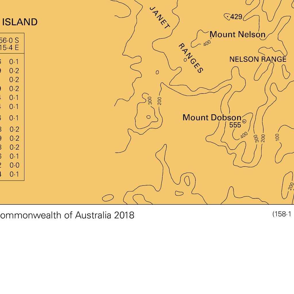
29 To accompany Australian Notice to Mariners 964/2018
NEW ZEALAND NOTICES TO MARINERS
 NEW ZEALAND NOTICES TO MARINERS Notices NZ 147-148 Published fortnightly by the New Zealand Hydrographic Authority Crown Copyright 2018. All rights reserved. Permission is not required to make analogue
NEW ZEALAND NOTICES TO MARINERS
 NEW ZEALAND NOTICES TO MARINERS Notice NZ 133 133 Published fortnightly by the New Zealand Hydrographic Authority Crown Copyright 2018. All rights reserved. Permission is not required to make analogue
NEW ZEALAND CHARTING AND NOTICES TO MARINERS
 General Information 1. In accordance with agreements between New Zealand, Australia (AUS) and the British Admiralty (BA) for reducing duplication in charting activities, New Zealand has a defined Charting
MARITIME SAFETY INFORMATION
 Introduction 1. Maritime Safety Information (MSI) is defined as navigational and meteorological warnings, meteorological forecasts, and other urgent safety-related messages. This information is of vital
The Notices to Mariners (NMs) listed below apply to the latest edition of SC5600 (17 th Edition) published on 20th July 2017.
 listed below apply to the latest edition of SC5600 (17 th Edition) published on 20th July 2017.") SC5600 The Solent and Approaches The Notices to Mariners (NMs) listed below apply to the latest edition of SC5600 (17 th Edition) published on 20th July 2017. Temporary/Preliminary NMs L2131(T)/16 ENGLAND
SC5600 The Solent and Approaches The Notices to Mariners (NMs) listed below apply to the latest edition of SC5600 (17 th Edition) published on 20th July 2017. Temporary/Preliminary NMs L2131(T)/16 ENGLAND
NEW AND AMENDED TRAFFIC SEPARATION SCHEMES
 E 4 ALBERT EMBANKMENT LONDON SE1 7SR Telephone: +44 (0)20 7735 7611 Fax: +44 (0)20 7587 3210 NEW AND AMENDED TRAFFIC SEPARATION SCHEMES COLREG.2/Circ.67 20 May 2016 1 The Maritime Safety Committee, at
NEW ZEALAND NOTICES TO MARINERS
 NEW ZEALAND NOTICES TO MARINERS Notices NZ 20-23 Published fortnightly by the New Zealand Hydrographic Authority Crown Copyright 2019. All rights reserved. Permission is not required to make analogue copies
The Notices to Mariners (NMs) listed below apply to the latest edition of SC5612 (3rd Edition) published on 28 th July 2016.
 listed below apply to the latest edition of SC5612 (3rd Edition) published on 28 th July 2016.") Admiralty Leisure Folio SC5612 Northern Ireland The Notices to Mariners (NMs) listed below apply to the latest edition of SC5612 (3rd Edition) published on 28 th July 2016. L2080(P)/14 IRISH SEA England
Admiralty Leisure Folio SC5612 Northern Ireland The Notices to Mariners (NMs) listed below apply to the latest edition of SC5612 (3rd Edition) published on 28 th July 2016. L2080(P)/14 IRISH SEA England
The Notices to Mariners (NMs) listed below apply to the latest edition of SC5622 (3 rd Edition) published on 4 th January 2018.
 listed below apply to the latest edition of SC5622 (3 rd Edition) published on 4 th January 2018.") SC5622 Ireland South Coast The Notices to Mariners (NMs) listed below apply to the latest edition of SC5622 (3 rd Edition) published on 4 th January 2018. Temporary/Preliminary NMs L3652(P)/17 IRELAND
SC5622 Ireland South Coast The Notices to Mariners (NMs) listed below apply to the latest edition of SC5622 (3 rd Edition) published on 4 th January 2018. Temporary/Preliminary NMs L3652(P)/17 IRELAND
BookletChart. Intracoastal Waterway Grassy Key to Bahia Honda Key NOAA Chart A reduced-scale NOAA nautical chart for small boaters
 BookletChart Intracoastal Waterway Grassy Key to Bahia Honda Key NOAA Chart 11453 A reduced-scale NOAA nautical chart for small boaters When possible, use the full-size NOAA chart for navigation. Published
The Notices to Mariners (NMs) listed below apply to the latest edition of SC5621 (3rd Edition) published on 16 th July 2015.
 listed below apply to the latest edition of SC5621 (3rd Edition) published on 16 th July 2015.") Admiralty Leisure Folio SC5621 Carlingford Lough to Waterford The Notices to Mariners (NMs) listed below apply to the latest edition of SC5621 (3rd Edition) published on 16 th July 2015. Temporary/Preliminary
Admiralty Leisure Folio SC5621 Carlingford Lough to Waterford The Notices to Mariners (NMs) listed below apply to the latest edition of SC5621 (3rd Edition) published on 16 th July 2015. Temporary/Preliminary
NEW ZEALAND NOTICES TO MARINERS
 NEW ZEALAND NOTICES TO MAINES Notices NZ 113 116 Published fortnightly by the New Zealand Hydrographic Authority Crown Copyright 2018. All rights reserved. Permission is not required to make analogue copies
No DECEMBER 2012 UNITED STATES OF AMERICA. Contents
 49 8 DECEMBER 2012 UNITED STATES OF AMERICA Published Weekly by the National Geospatial-Intelligence Agency Prepared Jointly with the National Ocean Service and U.S. Coast Guard Contents Section I Chart
LIST OF CORRECTIONS. 107 Chart. Belgische Kust Edition February / December Updated up to and including NMs
 LIST OF CORRECTIONS 107 Chart Belgische Kust Edition February 2018 Updated up to and including NMs 25 / 2018 6 December 2018 The last version of these corrections are available on www.vlaamsehydrografie.be
No DECEMBER 2008 UNITED STATES OF AMERICA. Contents
 52 27 DECEMBER 2008 UNITED STATES OF AMERICA Published Weekly by the National Geospatial-Intelligence Agency Prepared Jointly with the National Ocean Service and U.S. Coast Guard Contents Section I Chart
M5/M24 NAVIGATION EXERCISES AUS 252 NAME:
 M5/M24 NAVIGATION EXERCISES AUS 252 NAME: Use chart Aus 252 extract. Use the deviation card at end of this paper. EXERCISE NO. 1 CHART INFORMATION Select Chart Aus252 and answer the following. 1 Find the
BookletChart. Chesapeake Bay Pocomoke and Tangier Sounds NOAA Chart A reduced-scale NOAA nautical chart for small boaters
 BookletChart Chesapeake Bay Pocomoke and Tangier Sounds NOAA Chart 12228 A reduced-scale NOAA nautical chart for small boaters When possible, use the full-size NOAA chart for navigation. Published by the
IHO Colours & Symbols Maintenance Working Group (C&SMWG) 15th Meeting, BSH, Rostock, Germany, 2-4 May 2005
 15th Meeting, BSH, Rostock, Germany, 2-4 May 2005") CSMWG15-INF2 IHO Colours & Symbols Maintenance Working Group (C&SMWG) 15th Meeting, BSH, Rostock, Germany, 2-4 May 2005 Ref: HA405/004/033-01 NOTE: this is an internal document of the UKHO and is supplied
CSMWG15-INF2 IHO Colours & Symbols Maintenance Working Group (C&SMWG) 15th Meeting, BSH, Rostock, Germany, 2-4 May 2005 Ref: HA405/004/033-01 NOTE: this is an internal document of the UKHO and is supplied
No MAY 2010 UNITED STATES OF AMERICA. Contents
 19 8 MAY 2010 UNITED STATES OF AMERICA Published Weekly by the National Geospatial-Intelligence Agency Prepared Jointly with the National Ocean Service and U.S. Coast Guard Contents Section I Corrections............................................
BookletChart. Sacramento River Andrus Island to Sacramento NOAA Chart A reduced-scale NOAA nautical chart for small boaters
 BookletChart Sacramento River Andrus Island to Sacramento NOAA Chart 18662 A reduced-scale NOAA nautical chart for small boaters When possible, use the full-size NOAA chart for navigation. Included Area
SECTION III NM 24/15 MARINE INFORMATION
 SECTION III NM 24/15 MARINE INFORMATION NATIONAL GEOSPATIAL-INTELLIGENCE AGENCY'S (NGA) GUIDANCE ON THE PROPER DISPLAY SCALE OF DIGITAL NAUTICAL CHART (DNC) DATA The DNC portfolio was originally created
BookletChart. Approaches to Cap-Haitien and Bahia de Monti Cristi NGA Chart A reduced-scale NGA nautical chart for small boaters
 BookletChart Approaches to Cap-Haitien and Bahia de Monti Cristi NGA Chart 26142 A reduced-scale NGA nautical chart for small boaters When possible, use the full-size NGA chart or Electronic Nautical Chart
NEW ZEALAND NOTICES TO MARINERS
 NEW ZEALAND NOTICES TO MARINERS Notices NZ 29-32 Published fortnightly by the New Zealand Hydrographic Authority Crown Copyright 2019. All rights reserved. Permission is not required to make analogue copies
SECTION III NM 32/13 MARINE INFORMATION NOAA CHART NEW EDITIONS AND THEIR AVAILABILITY
 MARINE INFORMATION NOAA CHART NEW EDITIONS AND THEIR AVAILABILITY NOAA recognizes two paper nautical chart products: Print-on-Demand (POD) and traditional paper charts. - Print-on-Demand (POD) charts are
ECDIS ENC Accuracy. Contents. Introduction LOSS PREVENTION BRIEFING FOR NORTH MEMBER SHIPS / MAY Introduction... 1
 LOSS PREVENTION BRIEFING FOR NORTH MEMBER SHIPS / MAY 2017 ECDIS ENC Accuracy Contents Introduction... 1 ECDIS Specific Familiarisation... 2 IHO S-57... 2 ENC Data Source... 2 CATZOC and M_QUAL... 2 CATZOC
No OCTOBER 2016 UNITED STATES OF AMERICA. Contents
 42 15 OCTOBER 2016 UNITED STATES OF AMERICA Published Weekly by the National Geospatial-Intelligence Agency Prepared Jointly with the National Ocean Service and U.S. Coast Guard Contents Section I Chart
SECTION III NM 34/14 MARINE INFORMATION
 MARINE INFORMATION AREAS TO BE AVOIDED (OCEANOGRAPHIC MOORINGS) IN THE EQUATORIAL PACIFIC OCEAN The National Oceanic and Atmospheric Administration (NOAA) maintains various buoys in the Equatorial Pacific
2. CHARTS. 2.1 Chart projections Mercator projections. Maps which are used for marine or aeronautical navigation are called charts.
 Maps which are used for marine or aeronautical navigation are called charts. In Canadian waters, mariners are required to carry the latest editions of the paper charts, at the largest scale available (see
No MARCH 2014 UNITED STATES OF AMERICA. Contents
 10 8 MARCH 2014 UNITED STATES OF AMERICA Published Weekly by the National Geospatial-Intelligence Agency Prepared Jointly with the National Ocean Service and U.S. Coast Guard Contents Section I Chart Corrections............................................
No AUGUST 2013 UNITED STATES OF AMERICA. Contents
 35 31 AUGUST 2013 UNITED STATES OF AMERICA Published Weekly by the National Geospatial-Intelligence Agency Prepared Jointly with the National Ocean Service and U.S. Coast Guard Contents Section I Chart
SECTION III NM 17/15 MARINE INFORMATION
 SECTION III NM 17/15 MARINE INFORMATION NOAA CHART NEW EDITIONS AND THEIR AVAILABILITY NOAA produces nautical chart products to support Federal chart carriage requirements. These nautical charts are available
Notice to Mariner No. 213
 To : Attn: From: All Agents, Bunkering Companies, Coast Guard, National Transport Authority, Hydrographic Office Operations Manager Capt. Tamer Masoud Harbour Master Facsimile No.: City: Fujairah Country:
No OCTOBER 2012 UNITED STATES OF AMERICA. Contents
 41 13 OCTOBER 2012 UNITED STATES OF AMERICA Published Weekly by the National Geospatial-Intelligence Agency Prepared Jointly with the National Ocean Service and U.S. Coast Guard Contents Section I Chart
SECTION III NM 15/12 MARINE INFORMATION
 SECTION III NM 15/12 MARINE INFORMATION CHANGES TO BROADCAST OF WEATHER FORECASTS FOR THE OFFSHORE SOUTHWEST NORTH ATLANTIC, CARIBBEAN, AND GULF OF MEXICO Effective Tuesday April 03, 2012 at 2:00 pm Eastern
Ufs. No Notices to Mariners, SWEDEN Swedish Maritime Administration.
 Ufs No 528 2015-01-08 Notices to Mariners, SWEDEN Swedish Maritime Administration Editorial office Swedish Maritime Administration Ufs/BALTICO 601 78 NORRKÖPING Sweden tel: 0771 630 605 e-mail: ufs@sjofartsverket.se
SECTION III NM 39/13 MARINE INFORMATION NGA CHART NEW EDITIONS AND THEIR AVAILABILITY
 SECTION III NM 39/13 MARINE INFORMATION NGA CHART NEW EDITIONS AND THEIR AVAILABILITY NGA standard nautical hardcopy chart products are made available and distributed by three different authorized methods:
NOAA s National Ocean Service / Office of Coast Survey
 Coast Survey OCS 1807 2007 Maintains over 1000 nautical charts & 9 Coast Pilots Surveys over 3.4M SNM of oceans and lakes Conducts research and development in hydrography Thomas Jefferson Founder of The
16 Chart 1 - Symbols, Abbreviations, and Terms. Nautical Charts. John C. Kelly, 2003
 16 Chart 1 - Symbols, Abbreviations, and Terms GENERAL A. Chart Number, Title, Marginal Notes B. Positions, Distances, Directions, Compass TOPOGRAPHY C. Natural Features D. Cultural Features E. Landmarks
No FEBRUARY 2017 UNITED STATES OF AMERICA. Contents
 6 11 FEBRUARY 2017 UNITED STATES OF AMERICA Published Weekly by the National Geospatial-Intelligence Agency Prepared Jointly with the National Ocean Service and U.S. Coast Guard Contents Section I Chart
NEW ZEALAND NOTICES TO MARINERS
 NEW ZEALAND NOTICES TO MARINERS Notices NZ 24-28 Published fortnightly by the New Zealand Hydrographic Authority Crown Copyright 2019. All rights reserved. Permission is not required to make analogue copies
Notices to Mariners OSTEND NOVEMBER 11TH 2010 NR.23
 Notices to Mariners + OSTEND NOVEMBER 11TH 2010 NR.23 1 BELGIUM >23/284 BELGIAN COAST - UNDERSEA CABLE UNUSED - CHART CORRECTION The undersea cable with symbol INT1 L 30.1 and coordinates: 51 06,925 N
STANDING NOTICE TO MARINERS
 ASSOCIATED BRITISH PORTS P O BOX 1, PORT HOUSE, NORTHERN GATEWAY, HULL HU9 5PQ STANDING NOTICE TO MARINERS (No. S.H. 2) ASSOCIATED BRITISH PORTS VESSEL TRAFFIC SERVICES HUMBER HARBOUR AREA Associated British
Meeting 3 10 August 2011 Agenda Item 3.2. MSI Self Assessment NAVAREA X. Submitted by Australia SUMMARY
 WWNWS WWNWS3/3/2-X Meeting 3 10 August 2011 Agenda Item 3.2 MSI Self Assessment NAVAREA X Submitted by Australia SUMMARY Executive Summary: Annual report of NAVAREA X MSI activities for the period July
No MAY 2010 UNITED STATES OF AMERICA. Contents
 18 1 MAY 2010 UNITED STATES OF AMERICA Published Weekly by the National Geospatial-Intelligence Agency Prepared Jointly with the National Ocean Service and U.S. Coast Guard Contents Section I Corrections............................................
MEDITERRANEAN AND BLACK SEAS HYDROGRAPHIC COMMISSION
 MEDITERRANEAN AND BLACK SEAS HYDROGRAPHIC COMMISSION XVIII CONFERENCE CONTRIBITION BY MALTA Istanbul, Turkey 25-27 September 2013 1 Item 1 Hydrographic Office Transport Malta is responsible for all transport
SECTION III NM 4/16 MARINE INFORMATION
 MARINE INFORMATION NOAA CHART NEW EDITIONS AND THEIR AVAILABILITY NOAA produces nautical chart products to support Federal chart carriage requirements. These nautical charts are available as Print on Demand
GsXQ(9)15s 54 06' 23N., 3 39' 73W. GmUVQ 54 04' 92N., 3 32' 15W. GsXVQ(9)10s 54 03' 68N., 3 39' 68W.
15s 54 06' 23N., 3 39' 73W. GmUVQ 54 04' 92N., 3 32' 15W. GsXVQ(9)10s 54 03' 68N., 3 39' 68W.") Admiralty Leisure Folio SC5613 Irish Sea - Eastern Part The Notices to Mariners (NMs) listed below apply to the latest edition of SC5613 (3rd Edition) published on 21st May 2015. L3797/15 WALES West Coast
Admiralty Leisure Folio SC5613 Irish Sea - Eastern Part The Notices to Mariners (NMs) listed below apply to the latest edition of SC5613 (3rd Edition) published on 21st May 2015. L3797/15 WALES West Coast
Passages Between Acklins Island, Haiti and Caicos Islands NGA Chart A reduced-scale NGA nautical chart for small boaters
 BookletChart Passages Between Acklins Island, Haiti and Caicos Islands NGA Chart 26260 A reduced-scale NGA nautical chart for small boaters When possible, use the full-size NGA chart or Electronic Nautical
Myanmar Naval Hydrographic Centre. National Report for 13 th North Indian Ocean Hydrographic Commission Meeting
 Myanmar Naval Hydrographic Centre National Report for 13 th North Indian Ocean Hydrographic Commission Meeting Yangon, Myanmar 19 th 22 nd February 2013 CONTENT 1. Myanmar Naval Hydrographic Centre 2.
SECTION III NM 41/14 MARINE INFORMATION
 MARINE INFORMATION NOAA CHART NEW EDITIONS AND THEIR AVAILABILITY NOAA recognizes two paper nautical chart products: Print-on-Demand (POD) and traditional paper charts. - Print-on-Demand (POD) charts are
SECTION III NM 35/10 MARINE INFORMATION NOAA CHART NEW EDITIONS AND THEIR AVAILABILITY
 SECTION III NM 35/10 MARINE INFORMATION NOAA CHART NEW EDITIONS AND THEIR AVAILABILITY NOAA recognizes two paper nautical chart products: - the Print-on-Demand (POD) chart distributed by OceanGrafix (www.oceangrafix.com),
No JANUARY 2011 UNITED STATES OF AMERICA. Contents
 3 15 JANUARY 2011 UNITED STATES OF AMERICA Published Weekly by the National Geospatial-Intelligence Agency Prepared Jointly with the National Ocean Service and U.S. Coast Guard Contents Section I Corrections............................................
SECTION III NM 40/17 MARINE INFORMATION
 SECTION III NM 40/17 MARINE INFORMATION NEW EDITION OF COAST PILOT U.S. Coast Pilot 4, Atlantic Coast: Cape Henry, VA to Key West, FL, forty-ninth edition, 2017, has been issued and is ready for free download
NOTICES TO MARINERS PUBLICATION WESTERN EDITION
 Fisheries and Oceans Canada Pêches et Océans Canada VOL. 32, MONTHLY EDITION N O 09 SEPTEMBER 28, 2007 Publication Number 40063779 NOTICES TO MARINERS PUBLICATION WESTERN EDITION Published monthly by the
ADMIRALTY NOTICES TO MARINERS
 Notices 1609-1721/19 ADMIRALTY NOTICES TO MARINERS Section (1 Notice per Page) Weekly Edition 14 4 April 2019 CONTENTS I Publications List Index of Charts Affected. ADMIRALTY Notices to Mariners For information
PAPUA NEW GUINEA HYDROGRAPHIC SERVICE
 PAPUA NEW GUINEA HYDROGRAPHIC SERVICE IHO SOUTH WEST PACIFIC HYDROGRAPHIC COMMISSION (SWPHC) 9 th Meeting Port Moresby, Papua New Guinea, 10-11 March 2007 SWPHC9-01PNG 1. INTRODUCTION 9 th SOUTH WEST PACIFIC
No APRIL 2012 UNITED STATES OF AMERICA. Contents
 14 7 APRIL 2012 UNITED STATES OF AMERICA Published Weekly by the National Geospatial-Intelligence Agency Prepared Jointly with the National Ocean Service and U.S. Coast Guard Contents Section I Chart Corrections............................................
Ufs. No Notices to Mariners, SWEDEN Swedish Maritime Administration.
 Ufs No 727 2018-11-01 Notices to Mariners, SWEDEN Swedish Maritime Administration Editorial office Swedish Maritime Administration Ufs 601 78 NORRKÖPING Sweden tel: 0771 630 605 e-mail: ufs@sjofartsverket.se
Maritime Zones Act, No. 15 of 1994
 Page 1 Maritime Zones Act, No. 15 of 1994 ACT to provide for the maritime zones of the Republic; and to provide for matters connected therewith. BE IT ENACTED by the Parliament of the Republic of South
THE ELECTRONIC CHART DISPLAY AND INFORMATION SYSTEM (ECDIS) IN CHINA
 IN CHINA") International Hydrographic 'Review, Monaco, LXIX(2), September 1992 THE ELECTRONIC CHART DISPLAY AND INFORMATION SYSTEM (ECDIS) IN CHINA by The Research Group on ECDIS 1 Abstract This paper presents a
International Hydrographic 'Review, Monaco, LXIX(2), September 1992 THE ELECTRONIC CHART DISPLAY AND INFORMATION SYSTEM (ECDIS) IN CHINA by The Research Group on ECDIS 1 Abstract This paper presents a
No APRIL 2012 UNITED STATES OF AMERICA. Contents
 15 14 APRIL 2012 UNITED STATES OF AMERICA Published Weekly by the National Geospatial-Intelligence Agency Prepared Jointly with the National Ocean Service and U.S. Coast Guard Contents Section I Chart
ADMIRALTY NOTICES TO MARINERS
 Notices 5693-5813/18 ADMIRALTY NOTICES TO MARINERS Section II (1 Notice per Page) Weekly Edition 49 6 December 2018 CONTENTS I II Publications List Index of Charts Affected. ADMIRALTY Notices to Mariners
PROVIDING KNOWLEDGE AND KNOWHOW... ANYTIME, ANYWHERE LIGHT LIST. Reference Materials. Digital Edition. Captain Robert L. Figular
 PROVIDING KNOWLEDGE AND KNOWHOW... ANYTIME, ANYWHERE LIGHT LIST Reference Materials Digital Edition Captain Robert L. Figular Page intentionally left blank LIGHT LIST Atlantic Coast of North America MLS
Essentials of Navigation
 Essentials of Navigation Latitudes & Longitudes, GPS, and more For Race Officers and Mark Boat Operators by Ed Bottrell eztrap Developer Glen Haven, Nova Scotia CANADA v13 email: info@bottrell.ca Website:
BookletChart. Island of O ahu NOAA Chart A reduced-scale NOAA nautical chart for small boaters
 BookletChart Island of O ahu NOAA Chart 19357 A reduced-scale NOAA nautical chart for small boaters When possible, use the full-size NOAA chart for navigation. Included Area Published by the National Oceanic
NOTICES TO MARINERS PUBLICATION WESTERN EDITION
 NOTICES TO MARINERS PUBLICATION WESTERN EDITION MONTHLY EDITION Nº10 October 26 th, 2018 Safety First, Service Always Published Monthly by the CANADIAN COAST GUARD www.notmar.gc.ca/subscribe CONTENTS Page
SECTION III NM 50/12 MARINE INFORMATION NOAA CHART NEW EDITIONS AND THEIR AVAILABILITY
 SECTION III NM 50/12 MARINE INFORMATION NOAA CHART NEW EDITIONS AND THEIR AVAILABILITY NOAA recognizes two paper nautical chart products: - the Print-on-Demand (POD) chart distributed by OceanGrafix (www.oceangrafix.com),
The Notices to Mariners (NMs) listed below apply to the latest edition of SC5604 (7 th Edition) published on 14 th February 2013.
 listed below apply to the latest edition of SC5604 (7 th Edition) published on 14 th February 2013.") Admiralty Leisure Folio SC5604 The Channel Islands The Notices to Mariners (NMs) listed below apply to the latest edition of SC5604 (7 th Edition) published on 14 th February 2013. Temporary/Preliminary
Admiralty Leisure Folio SC5604 The Channel Islands The Notices to Mariners (NMs) listed below apply to the latest edition of SC5604 (7 th Edition) published on 14 th February 2013. Temporary/Preliminary
RADIO AIDS TO MARINE NAVIGATION (Atlantic, St. Lawrence, Great Lakes, Lake Winnipeg and Eastern Arctic) CANADIAN COAST GUARD
 CANADIAN COAST GUARD") RADIO AIDS TO MARINE NAVIGATION (Atlantic, St Lawrence, Great Lakes, Lake Winnipeg and Eastern Arctic) CANADIAN COAST GUARD Marine Communications and Traffic Services Annual Edition 2006 IMPORTANT This
RADIO AIDS TO MARINE NAVIGATION (Atlantic, St Lawrence, Great Lakes, Lake Winnipeg and Eastern Arctic) CANADIAN COAST GUARD Marine Communications and Traffic Services Annual Edition 2006 IMPORTANT This
No NOVEMBER 2011 UNITED STATES OF AMERICA. Contents
 46 12 NOVEMBER 2011 UNITED STATES OF AMERICA Published Weekly by the National Geospatial-Intelligence Agency Prepared Jointly with the National Ocean Service and U.S. Coast Guard Contents Section I Corrections............................................
National Maritime Center
 National Maritime Center Providing Credentials to Mariners (Sample Examination) Page 1 of 6 Choose the best answer to the following Multiple Choice Questions. 1. The following questions are based on Chart
SOUTH AFRICAN NOTICE TO MARINERS NOVEMBER / DECEMBER 2003 EDITION
 Notices 74-79 Supplied Gratis SOUTH AFRICAN NOTICE TO MARINERS NOVEMBER / DECEMBER 2003 EDITION PUBLISHED MONTHLY BY THE HYDROGRAPHIC OFFICE CAPE TOWN I II III IV V VI CONTENTS Explanatory Notes and Index
IMO/IHO World-wide Navigational Warning Service (WWNWS)
") IMO/IHO World-wide Navigational Warning Service (WWNWS) 1 WWNWS 1972 PROPOSAL TO SET UP AN Ad Hoc IHO/IMO COMMITTEE TO DEVELOP AN INTER- NATIONALLY CO-ORDINATED SYSTEM FOR PROMULGATING LONG RANGE NAVIGATIONAL
IMO/IHO World-wide Navigational Warning Service (WWNWS) 1 WWNWS 1972 PROPOSAL TO SET UP AN Ad Hoc IHO/IMO COMMITTEE TO DEVELOP AN INTER- NATIONALLY CO-ORDINATED SYSTEM FOR PROMULGATING LONG RANGE NAVIGATIONAL
NAVIGA TIONAL VIGA WARNINGS/MSI/GMDSS N NAV NA AREA III VIII
 NAVIGATIONAL WARNINGS/MSI/GMDSS IN NAVAREA VIII 5/16/2008 1 SCOPE OF PRESENTATION 1. Introduction 2. Navarea VIII Radio Warnings 3. Indian Notices to Mariners 4. Implementation of GMDSS 5. Marine Safety
ADMIRALTY NOTICES TO MARINERS
 Notices 4517-4642/18 ADMIRALTY NOTICES TO MARINERS Section II (1 Notice per Page) Weekly Edition 39 27 September 2018 CONTENTS I II Publications List Index of Charts Affected. ADMIRALTY Notices to Mariners
RADIO AIDS TO MARINE NAVIGATION (Pacific and Western Arctic) CANADIAN COAST GUARD. Marine Communications and Traffic Services. Annual Edition 2007
 CANADIAN COAST GUARD. Marine Communications and Traffic Services. Annual Edition 2007") RADIO AIDS TO MARINE NAVIGATION (Pacific and Western Arctic) CANADIAN COAST GUARD Marine Communications and Traffic Services Annual Edition 2007 IMPORTANT This publication is revised on a monthly basis
RADIO AIDS TO MARINE NAVIGATION (Pacific and Western Arctic) CANADIAN COAST GUARD Marine Communications and Traffic Services Annual Edition 2007 IMPORTANT This publication is revised on a monthly basis
Ufs. No Notices to Mariners, SWEDEN Swedish Maritime Administration.
 Ufs No 491 2014-04-24 Notices to Mariners, SWEDEN Swedish Maritime Administration Editorial office Swedish Maritime Administration Ufs/BALTICO 601 78 NORRKÖPING Sweden tel: 0771 630 605 e-mail: ufs@sjofartsverket.se
Western Region enavigation Sub- Committee Report
 Western Region enavigation Sub- Committee Report Western Region enavigation meeting - Jan 12 18 BC Ferries BC Coast Pilots BCIT Marine Campus Canadian Coast Guard Canadian Hydrographic Services Canadian
No JULY 2018 UNITED STATES OF AMERICA. Contents
 28 14 JULY 2018 UNITED STATES OF AMERICA Published Weekly by the National Geospatial-Intelligence Agency Prepared Jointly with the National Ocean Service and U.S. Coast Guard Contents Section I Chart Corrections............................................
CAPABILITY STATEMENT MARINE
 CAPABILITY STATEMENT MARINE Admin : 86A Southside Drive HILLARYS WA 6025 Broome: 10 Archer Street BROOME WA 6725 Darwin: 3/16 Bennett Street DARWIN NT 0800 Facilities : Port Hedland & Dampier WHO WE ARE
ROUTEING OF SHIPS, SHIP REPORTING AND RELATED MATTERS. Establishment of a Mandatory Ship Reporting System in the
 INTERNATIONAL MARITIME ORGANIZATION E SUB-COMMITTEE ON SAFETY OF NAVIGATION 48th session Agenda item 3 IMO NAV 48/3/2 11 April 2002 Original: ENGLISH ROUTEING OF SHIPS, SHIP REPORTING AND RELATED MATTERS
RESOLUTION MSC.229(82) (adopted on 5 December 2006) ADOPTION OF A NEW MANDATORY SHIP REPORTING SYSTEM "IN THE GALAPAGOS PARTICULARLY SENSITIVE SEA
 (adopted on 5 December 2006) ADOPTION OF A NEW MANDATORY SHIP REPORTING SYSTEM IN THE GALAPAGOS PARTICULARLY SENSITIVE SEA") MSC 82/24/Add.2 RESOLUTION MSC.229(82) IN THE GALAPAGOS PARTICULARLY SENSITIVE SEA AREA (PSSA) (GALREP) THE MARITIME SAFETY COMMITTEE, RECALLING Article 28(b) of the Convention on the International Maritime
MSC 82/24/Add.2 RESOLUTION MSC.229(82) IN THE GALAPAGOS PARTICULARLY SENSITIVE SEA AREA (PSSA) (GALREP) THE MARITIME SAFETY COMMITTEE, RECALLING Article 28(b) of the Convention on the International Maritime
THE PROCEDURE OF MAINTENANCE OF THE MILITARY NAVIGATIONAL HANDBOOK IN THE CONSTANT UP TO DATE STATUS. Slavko Horvat*, Radovan Solarić**
 THE PROCEDURE OF MAINTENANCE OF THE MILITARY NAVIGATIONAL HANDBOOK IN THE CONSTANT UP TO DATE STATUS Slavko Horvat*, Radovan Solarić** *Ministry of Defence, Zvonimirova 4, 10 000 Zagreb, Croatia Phone:
PFA Update 22 June 2018
 PFA COM MEETING FRIDAY 22 JUNE The PFA COM met today at the Newcastle Commercial Fishermen s Cooperative. Discussions surrounding recent issues and activities such as recent Financial Health Checks, promotional
National Maritime Center
 National Maritime Center Providing Credentials to Mariners (Sample Examination) Page 1 of 5 Choose the best answer to the following Multiple Choice Questions. 1. The following questions should be answered
Questionnaire about the Depiction of the Quality of the Data in Nautical Charts
 Questionnaire about the Depiction of the Quality of the Data in Nautical Charts Your answers to this questionnaire, to be returned to the UKHO (see details on last page), will remain anonymous unless you
Contract Specifications for Paper Hydrographic Charts, Version 1.2, July 2009
 Contract Specifications for Paper Hydrographic Charts, Version 1.2, July 2009 Note: These contract specifications have been developed from CHARTspec Version 3.1. Changes to this are detailed in the Record
BookletChart. St. Joseph and Benton Harbor NOAA Chart A reduced-scale NOAA nautical chart for small boaters
 BookletChart St. Joseph and Benton Harbor NOAA Chart 14930 A reduced-scale NOAA nautical chart for small boaters When possible, use the full-size NOAA chart for navigation. Included Area Published by the
The Impact of Climate Change on the Torres Strait and Australia s Indian Ocean Territories
 30 March 2010 The Impact of Climate Change on the Torres Strait and Australia s Indian Ocean Territories Gavin Briggs Manager Northern Australia Research Programme Summary The impact of climate change
No JULY 2013 UNITED STATES OF AMERICA. Contents
 27 6 JULY 2013 UNITED STATES OF AMERICA Published Weekly by the National Geospatial-Intelligence Agency Prepared Jointly with the National Ocean Service and U.S. Coast Guard Contents Section I Chart Corrections............................................
BRIEF - NAVAREA IX INTROCUCTION/BACK GROUND
 BRIEF - NAVAREA IX INTROCUCTION/BACK GROUND 1. NAVAREA IX is one of the 16 areas established through the Worldwide Navigational Warning Service (WWNWS). It consists of Northwest Arabian Sea, the Gulfand
HYDROGRAPHIC SURVEY STANDARDS AND DELIVERABLES
 TABLE OF CONTENTS 1. HYDROGRAPHIC SURVEY METHODOLOGY... 3 2. HYDROGRAPHIC SURVEY REFERENCE STANDARDS... 3 3. HYDROGRAPHIC SURVEY CRITERIA... 3 3.1 HYDROGRAPHIC SURVEYS OVER NON GAZETTED NAVIGABLE WATERS*:...
GPS & DGPS Made Easy
 NOTE GPS & DGPS Made Easy This booklet is intended to provide mariners with a basic understanding of the Global Positioning System (GPS) and the Differential Global Positioning System (DGPS), and to assist
BookletChart. Cap-Haitien NGA Chart A reduced-scale NGA nautical chart for small boaters
 BookletChart Cap-Haitien NGA Chart 26146 A reduced-scale NGA nautical chart for small boaters When possible, use the full-size NGA chart or Electronic Nautical Chart (ENC) for navigation. VHF Marine Radio
e-navigation Progress and trends: the IHO perspective
 International Hydrographic Organization e-navigation Progress and trends: the IHO perspective Gilles Bessero Director, IHO International Hydrographic Organization Intergovernmental consultative and technical
MANDATORY SHIP REPORTING SYSTEMS
 E 4 ALBERT EMBANKMENT LONDON SE1 7SR Telephone: +44 (0)20 7735 7611 Fax: +44 (0)20 7587 3210 Ref. T2-OSS/2.7.1 7 December 2010 MANDATORY SHIP REPORTING SYSTEMS 1 The Maritime Safety Committee, at its eighty-eighth
SPECIFICATION FOR TOPOGRAPHIC AND HYDROGRAPHIC SURVEYS OF RECLAMATION AND DREDGING WORKS
 23 August 2001 SPECIFICATION FOR TOPOGRAPHIC AND HYDROGRAPHIC SURVEYS OF RECLAMATION AND DREDGING WORKS 1.0 EXTENT OF WORKS The main survey works shall comprise of the following : a. Carry out topographic
Notices to Mariners. OSTEND MARCH 13th 2014 NR. 06
 Notices to Mariners + OSTEND MARCH 13th 2014 NR. 06 1 BELGIUM >06/099 (T) NIEUWPOORT - SEAWARD GUNNERY EXERCISES BaZ 2014-05/086 (T) is cancelled. During the period from 31/03/2014 until and including
IALA Guideline No. XXXX. The establishment of AIS as an Aid to Navigation. Edition 1.3. [Date] Working vs / Working 7.
![IALA Guideline No. XXXX. The establishment of AIS as an Aid to Navigation. Edition 1.3. [Date] Working vs / Working 7.](/thumbs/74/71399138.jpg "IALA Guideline No. XXXX. The establishment of AIS as an Aid to Navigation. Edition 1.3. [Date] Working vs / Working 7.") ANM12/Output/10 International Association of Marine Aids to Navigation and Lighthouse Authorities AISM Association of Internationale de Signalisation Maritime IALA IALA Guideline No. XXXX On The establishment
ANM12/Output/10 International Association of Marine Aids to Navigation and Lighthouse Authorities AISM Association of Internationale de Signalisation Maritime IALA IALA Guideline No. XXXX On The establishment
RF FIELD SURVEY REPORT
 RF FIELD SURVEY REPORT MANLY NATIONAL BUILDING 22 CENTRAL AVE, MANLY, NSW RFNSA #: 2095004 DATE OF SURVEY: 18TH NOVEMBER 2016 REPORT VERSION: R1 Accredited for compliance with ISO/IEC 17025 The results