ECDIS and MANTADIGITAL. PLUS
|
|
|
- Nickolas McCoy
- 5 years ago
- Views:
Transcription

1 TM MANTADIGITAL ECDIS and PLUS 2011/2012


 chart data is now available from a variety of sources.")

2 Introduction What is an ECDIS? ECDIS is an acronym for Electronic Chart Display and Information System. At its simplest, an ECDIS consists of a database of electronic charts, together with the hardware and software needed to display simultaneously the charts and the ship s own position (obtained from a GPS or another positioning sensor), and to perform navigational tasks such as route planning, route monitoring, measurement of distances on the chart, etc. One of the most important features of ECDIS that makes it a unique aid to navigation is the capability of generating alarms (anti-grounding, off route, etc.), based on input from sensors and analysis of chart information. Kelvin Hughes was one of the first Companies to receive Type Approval for its ECDIS back in Since then many advances have been made in technology and data availability. World-wide ENC (vector) chart data is now available from a variety of sources. Kelvin Hughes - A History of Innovation Kelvin Hughes is a world leader in the design and supply of marine navigation and surveillance systems. It has a highly innovative product range, which is designed to provide the most advanced navigation solutions and services available. Products include Radar sensors and display technology, voyage data recorders, electronic chart displays and highly advanced integrated bridge systems. In addition, through ChartCo, it provides a unique means of data supply to ships at sea via satellite, or internet. Kelvin Hughes is also the world s largest supplier of nautical charts and publications for commercial and leisure use. Kelvin Hughes has its headquarters in East London, and subsidiary offices in other parts of the UK, Denmark, The Netherlands, Norway, Singapore, USA, Hong Kong and China. With this global presence, Kelvin Hughes provides a first-class sales and support capability for customers world-wide. ECDIS Mandation Questions KELVIN HUGHES can answer for you What does ECDIS mandation mean to me? What ECDIS hardware do I need? What s the most cost-effective chart data solution for my ships? How can I keep my chart data up-todate? Where can I get officially recognised and approved training for my crews? If I still need paper charts, which must I carry? Chart coverage keeps changing - who can manage this for me? Managing my chart outfit is a real burden who can I trust to do it for me? What do I need as an ECDIS backup? Who can provide global installation and support for my vessels? Answers to these questions and more at


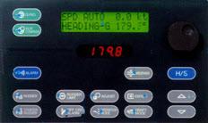
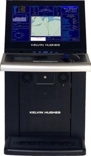
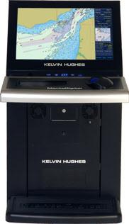
3 MantaDigital TM Philosophy Designed for ease of operation MantaDigital TM ECDIS is the latest product from Kelvin Hughes' Manta development programme. Intuitive operation and a clear display of relevant information provides the operator with a decision making tool which enhances safety and efficiency. Simplicity and ease of operation is at the heart of Kelvin Hughes' design philosophy. Multi-Function by Design From the outset, MantaDigital TM ECDIS has been designed for true multi-functionality, providing a platform for Radar, Chart Radar, ECDIS and Conning Display options. MantaDigital TM is driven by Kelvin Hughes' "common-core" processor system which is now in use throughout the Radar, ECDIS and VDR product ranges providing enhanced functionality, reliability and low cost of ownership. TM Wide-Screen ECDIS MantaDigital TM Wide-Screen ECDIS Simplicity of Operation The user interface has been designed to be intuitive to operate and provide all the tools that the navigator needs for efficient and safe navigation without the need to explore multiple levels on each menu. The Range MantaDigital TM ECDIS is available in a variety of mounting configurations to meet the needs of different vessel types and operational scenarios. It can be supplied in options ranging from a single 20" desktop retrofit system through to a fully integrated navigation system. Display options include 20" and 26" high-definition screens for pedestal, desktop and mounting into consoles. State-of-the-Art Technology Employing the latest state-of-the-art technology the MantaDigital TM ECDIS offers a vast array of advantages to the navigator, from immediate situation awareness, through to sophisticated alarm management. The MantaDigital TM ECDIS uses the same three button and trackerball interface concept that has been used successfully in Kelvin Hughes' products for over 10 years. MantaDigital TM 26" Pedestal ECDIS Network Functionality A high-speed LAN connection provides distribution of route data and interfacing with the ChartCo update service.

4 TM ECDIS Features Situation Awareness MantaDigital ECDIS provides a continuous display of ownship's navigation parameters together with a display of ownship graphic with heading, track, and route on the chart. MantaDigitalTM 26" Desktop ECDIS Route Monitoring MantaDigitalTM ECDIS provides continuous monitoring of vessel's position against its planned track. In addition, a look ahead is performed on the underlying chart data and a warning is generated if the intended vessel's track will violate pre-set safety parameters. Navigation Tools MantaDigitalTM ECDIS provides a range of tools to ease the task of electronic navigation. These include range and bearing cursors, an enlarged "spyscope" together with traditional tools for route planning. Included in these tools is manual fixing which can be used both as a training tool and operationally in the event of a sensor failure. This enables the navigator to fix the vessel's position on the electronic chart using traditional radar or visual plots and fixes. These manual fixes can be used to derive dead reckoned or estimated positions for ongoing navigation.


5 TM Maximised Chart Route Planning Routes can be planned using drag-and-drop to define the waypoints on the chart screen. Channel widths, turn radius and planned speeds for each leg can be defined. After planning, the route can be checked to see whether it violates the ships safery parameters, this must be done before the route can be activated. Both rhumb line and great circle legs can be constructed. Tools for traditional planning are also provided enabling the navigator to setup clearing ranges and bearings for each leg of a route. These are transferred to the Radar when on passage. Chart Maintenance Extensive tools are provided which simplify the orgainsation and management of chart data and permits. In conjunction with the ChartCo update service the MantaDigitalTM ECDIS is the easy solution for chart management and updates onboard your vessels. In conjunction with the ChartCo update service, the status of all cells can be automatically displayed and any required updates applied. Vessel Position Prediction To aid close quarter manoeuvering on large chart scales, the ECDIS will display the outline of the vessel graphically on the chart based on preset parameters. A forward prediction of ownship's position up to 6 minutes advanced can also be displayed to give the navigator awareness of the vessel's position during the manoeuvre. TM A single toggle action provides a maximised chart display enabling more of the chart to be displayed. A simple menu system allows the user to select the functional panels. MantaDigital Features & Options ECDIS Features


 With an optional software module Mantadigital TM ECDIS can provide fully Type Approved Track Control functionality meeting the requirements of IEC62065.")

6 TM ECDIS Features Alarm Functionality MantaDigital TM ECDIS includes an integrated alarm management system which alerts the navigator if safety parameters are contravened or if there is a failure of any ancilliary system. Alarms and warnings can also be transferred to officers' cabins or to the general alarm system. Radar Interlay (Option) As an aid to situation awareness the MantaDigital TM ECDIS can interlay radar data with the ENC chart data. This provides the navigator with instant appreciation of the current navigation situation with regard to collision and possible grounding. It also provides a excellent check on the status of position fixing aids as radar visible coastlines can be easily matched to the chart data to give an immediate integrity check. Track Control (Option) With an optional software module Mantadigital TM ECDIS can provide fully Type Approved Track Control functionality meeting the requirements of IEC In this mode the autopilot receives steering instructions from the ECDIS and performs the steering in accordance with the preset parameters in the ECDIS. The ECDIS can also transfer the data to the radar to allow the display of curved heading line, which is a feature that shows the turn to be performed by the vessel on the radar. This way the navigator can predict the turn circle and determine if the turn is in accordance with his intentions. Conning Display (Option) The Conning Display option provides a centralised real-time display of navigation parameters. These include heading track and speed together with planned routes and monitoring data. A head-up inset chart is displayed together with a depth graphic. This mode can be configured to suit a ship's individual sensors and


7 Typical Bridge Data Network Bridge Wing Port Route Planner / Bridge Wing Starboard MantaDigital TM Features /Data Network Radar 1 Conning Display Radar 2 ECDIS Chart Data Sensor Data SPEED LOG ANEMOMETER GYRO ECHO SOUNDER AUTOPILOT GPS/AIS


8 ECDIS Kelvin Hughes' Total ECDIS Solution /Internet What is ECDIS plus? ECDIS plus is a unique package from Kelvin Hughes which provides a turn-key ECDIS solution. It includes hardware supply and installation, initial chart data supply, licence management, ChartCo updates and an IMO approved training package, all backed up with support from Kelvin Hughes global service network. ECDIS plus can be tailored to individual customers requirements and can range from the supply of ECDIS hardware through to a complete package. Paper charts and digital licences can also be managed and replenished under the Outfit Management Service (OMS) Equipment The wide-screen MantaDigital TM ECDIS forms the core of ECDIS plus. This is available as a desktop, pedestal or console mounted system with screen sizes of 20 or 26. The main user interface is the tracker ball and three buttons which may optionally be mounted remotely. A standard QWERTY keyboard is also provided. Installation Service Whether for a new-build integrated bridge or a retrofit stand-alone, Kelvin Hughes is able to offer a complete installation and commissioning service world-wide. As part of ECDIS plus several standard packages are available, these can cover anything from commissioning only through to a complete install with cable laying, physical mounting of the hardware, commissioning and disposal of any redundant equipment. These installation packages are available at global locations and at fixed preagreed prices. Chart Data Chart data is the key component of any ECDIS system. To be an official ECDIS this has to be vector based ENC issued by a national hydrographic authority. ECDIS plus can be supplied with any official ENC chart data such as AVCS or PRIMAR. In addition, in ECS mode non-official or raster chart data can be displayed. The choice of suppliers will depend very much on the operating area of the vessel, Kelvin Hughes can make this choice for you to give you the most cost effective and safe coverage.


9 ECDIS Licence Management Kelvin Hughes' Total ECDIS Solution Managing electronic charts differs significantly from paper charts. Chart cells are loaded onto the ECDIS and activated using licences. Licences from different hydrographic offices may have differing validity durations, so ensuring that the appropriate charts remain available is an important task. Ships whose trading patterns change will need new cells to be activated. Licences are available for three, six or twelve month durations. Kelvin Hughes can remotely manage the licensing process as part of the Outfit Management Service. Data Updates Managing changes to the chart database is key to keeping the chart outfit up-to-date and safe and meeting the Port State Authority requirements. ChartCo provides an update via broadcast, or Internet technology. This service provides updates for paper and electronic charts and publications and includes additional services such as weather forecasting and routing and a news service. Updates can be passed directly to the ECDIS through the network or via CD. In addition Kelvin Hughes Outfit Management service can manage paper publications and charts alongside your digital data ensuring that at all times you are up-to-date, safe and meet the port state authority requirements. Training Kelvin Hughes provides a Flag State approved course based on the IMO 1.27 model. This course teaches the navigator to get the most out of their equipment and particularly familiarises the user with using traditional navigational methods on the ECDIS. The overall objective is to enhance navigational safety through safe operation and a thorough understand of the MantaDigital ECDIS. Key areas addressed by the course are: Electronic chart data and its display in an ECDIS Proper use of the ECDIS equipment ECDIS-related limitations Operation of the Kelvin Hughes ECDIS The training lasts five days and is available in the UK (South), Egypt and Singapore. Warranty and Global Service Through its service locations and a large number of authorised service partners Kelvin Hughes can provide global service and support. Standard and extended warranties are available for all equipment sales. ECDIS plus ECDIS Backup and Flag Approvals The requirements for ECDIS backup differ significantly across Flag States. As part of ECDIS plus Kelvin Hughes will advise on the requirements relating to individual vessels and will provide and manage any get-you-home paper charts that may be required. Whatever the backup requirements Kelvin Hughes will deliver and manage a least cost solution ensuring that at all times the vessel s data is up to date. "the complete picture..."
10 TM ECDIS Specifications Screen Display Type Flat Panel TFT Screen Sizes Pixel Resolution 1920 x 1200 Aspect Ratio 16:10 Display Variants Pedestal, Desktop, Console and Bridge- Wing (Internal) 26" (660mm) and 20" (510mm) diagonal active size Chart Formats AVCS The Admiralty Vector Chart Service (AVCS) brings together Electronic Navigational Charts (ENCs) from national Hydrographic offices around the world and new ENC coverage produced by UKHO in co-operation with Foreign Governments to provide comprehensive, official, global coverage. Jeppesen Primar ENC Service The Jeppesen Primar ENC Service provides a single data source that ensures that mariners are always navigating with an approved ENC where available. Unofficial data produced by Jeppesen will be used where no official coverage is available. C-MAP Unofficial vector chart data with world-wide coverage Chart Updates ChartCo Updating of charts is a simple point and click process and has been designed to facilitate the input of updates from the ChartCo service. Features Wide-screen flat panel TFT display, less weight, less volume, sharper picture and easier to mount ARPA display Route Verification Displays up to 50 ARPA target graphics and numerical data Post planning tool to check route before activation Extensive route planning and monitoring facilities inc alternate route AIS Interface Vessel Prediction The system can interface with any AIS and display up to 50 active targets Graphical prediction of vessel's future position up to 6 minutes ahead Route Monitoring Continuous monitoring of vessel position with respect to planned route Manual Fixing Astro, Radar, Visual and electronic fixing methods Track Replay The vessel's track is automatically recorded and can be saved externally. User mapping Allows navigator to add graphical annotation to the chart Range & Bearing Markers Variable range marker. Electronic bearing lines and parallel index markers provided Event Recording User events such as man overboard, can be annotated on the chart Options Radar Interlay Diplay of radar returns "interlayed" with the chart data Track Control Automatic control of the autopilot to maintain the vessel on the planned track Remote Keyboard/ Trackerball Desktop or built-in options available Chair-mounted "Ergopod" Left and right-handed control options for chair attachment Interfaces NMEA-0183 Log, Gyro, GPS, AIS, Autopilot Analogue Gyro, Log, VDR, Rudder Angle Network CAT5 Ethernet

11 Kelvin Hughes WORLD SERVICE ECDIS plus 'Turnkey' Installation Service Kelvin Hughes World Service can provide a complete ECDIS installation and commissioning service worldwide. This includes cable running, physical installation and equipment setting to work for a fixed preagreed price. This is also available as part of the ECDIS plus package. Customer Relationships Customer relationships are at the centre of any successful services business and we pride ourselves on our ability to work in partnership with our customers and suppliers. Our team who are all passionate about service excellence are at the centre of this relationship and over the last few years have developed a shared set of values for working with all our partners. Our aim is to: Place our customer at the centre of all we do Deal with mutual trust and honesty Exceed expectations, be on time and right first time Provide value, quality, and safe solutions Continually improve and innovate Adapt quickly to customer needs These values drive our team and are at the heart of what we do 24 hours every day, 365 days a year. For further information please call us on , us at service@kelvinhughes.co.uk or visit What We offer Spare Parts Sales Global Service Warranty Support Installation and Commissioning Services Management / Maintenance Contracts VDR Annual Performance Testing VDR Replay Services Compass Adjusting and Repair Operator Equipment Familiarisation and Training Dimensions & Weights / World Service Kelvin Hughes' Service/Sales Centres Kelvin Hughes' Service Agents Kelvin Hughes - Providing value, quality and safety through a world-wide team
12 TM MANTADIGITAL ECDIS Systems UK (Head Office): Kelvin Hughes Limited New North Road, Hainault, Ilford, Essex IG6 2UR T: F: ChartCo: T: F: Benelux: Kelvin Hughes (Nederland) B.V Rotterdam: T: F: China: Kelvin Hughes Shanghai Representative Office Shanghai: T: F: Southampton: Kelvin Hughes Ltd, Kilgraston House, Southampton Street Southampton SO15 2ED T: F: Far East: Kelvin Hughes (Singapore) Pte Ltd Singapore: T: F: Hong Kong: T: F: Scandinavia: A/S Kelvin Hughes Copenhagen: T: F: Århus: T: F: Norway: T: F: USA: Kelvin Hughes LLC Washington: T: F: New Orleans: T: F: / This publication is not intended to form the basis of a contract, nor does it take the place of the specification to which reference should be made for further information. Kelvin Hughes Limited reserves the right to vary any specification in detail. ECDIS KH8200 Iss4
The human touch in technology. ECDIS ECS Conning screen Ship speed info system
 The human touch in technology ECDIS ECS Conning screen Ship speed info system Alphatron ALPHACHART T ECDIS Type approved ECDIS system powered by TRANSAS The ALPHACHART T is an advanced Electronic Chart
E C D I S E LECTRONIC C HART D ISPLAY I NFORMATION S YSTEM
 e l e c t r o n i c c h a r t d i s p l a y i n f o r m a t i o n s y s t e m T R A N S A S E C D I S T R A N S A S E C D I S 3 E C D I S is a computer-based navigation information system that complies
INTEGRATED NAVIGATION SYSTEMS
 INTEGRATED NAVIGATION SYSTEMS Basic terms *integrated navigation system *control system *propulsion system *cargo system *digital processing unit *sensor *electronic circuits *sensor output *pulsed input
dkart Navigator 9010
 dkart Navigator 9010 dkart Navigator - purpose dkart Navigator is an electronic navigation chart system specially designed to facilitate all the navigational tasks of mariner's day-to-day practice. Along
LEADING THE WAY FROM SEA TO LAND SURVEILLANCE RADAR SOLUTIONS
 LEADING THE WAY FROM SEA TO LAND SURVEILLANCE RADAR SOLUTIONS SITUATIONAL INTELLIGENCE, THE WORLD OVER A Kelvin Hughes radar is the primary tool for long range threat detection. On land and at sea we provide
COMMAND-DEQ IBS Integrated Bridge System
 COMMAND-DEQ IBS Integrated Bridge System Page : 1 / 15 NAVIGATION BRIDGE 1 Navigation System 1.1 General The total Navigation System is based on «IBS» concept (Integrated Bridge System) The navigation
Simrad R5000 IMO/Solas Type Approved Radar Systems
 Simrad R5000 IMO/Solas Type Approved Radar Systems R5000 www.navico.com/commercial R5000 Radar Systems SIMRAD R5000 Radar Systems feature a modular plug & play design making it easy to create a cost effective
Is the new technology safe for navigation in coastal waters and archipelagos?
 3.35.20 Is the new technology safe for navigation in coastal waters and archipelagos? As near misses not are reported we take a look at the groundings Combat boat CB 90 (mostly) Thank you Lars-Erik! ECS
NAVAL AND COAST GUARD RADAR SYSTEMS SEE WHAT YOU ARE MISSING
 NAVAL AND COAST GUARD RADAR SYSTEMS SEE WHAT YOU ARE MISSING SITUATIONAL INTELLIGENCE, THE WORLD OVER Kelvin Hughes provides the world s navies with surface search, navigation and helicopter control radars
DYNAMIC POSITIONING SIMULATORS
 MARITIME SIMULATION SOLUTIONS DYNAMIC POSITIONING SIMULATORS www.nautissim.com info@nautissim.com NAUTIS - MARITIME SIMULATION SOLUTIONS BY VSTEP VSTEP s NAUTIS Simulators are DNV certified integrated
Transport System. Telematics. Possibility of integration of navigational information on electronic chart
 Archives of Volume 3 Transport System Issue 2 Telematics May 2010 Possibility of integration of navigational information on electronic chart H. ŚNIEGOCKI a, M. WIELIKI b a Faculty of Navigation, Gdynia
CHARTRADAR 1000 Brilliant Colour Radars with Chart Facilities
 CHARTRADAR 1000 Brilliant Colour Radars with Chart Facilities Introduction The CHARTRADAR 1000 combines the outstanding features of the RADARPILOT with the CHARTPILOT state-of-the-art ENC presentation.
Model FAR-2xx8 Model FAR-3xx0
 Model FAR-2xx8 Model FAR-3xx0 Administrerende direktør Trond Strømmen Roy Fjeldstad Area Sales Manager Advanced technologies for safe navigation The FAR-2xx8 series is a new radar series; the successor
The Pros and Cons of using ECDIS as Primary Means of Navigation
 Sections 1 2 Company introduction The PROS of Using ECDIS and ENCs 3 The CONS of Using ECDIS and ENCs 4 Why we have choose NAVTOR Company Introduction Corporate Overview. is a Ship Management Company established
Study on application in the teaching of ship maneuvering Simulator Haoran Song
 Applied Mechanics and Materials Online: 2013-02-27 ISSN: 1662-7482, Vol. 310, pp 580-583 doi:10.4028/www.scientific.net/amm.310.580 2013 Trans Tech Publications, Switzerland Study on application in the
GUIDELINES ON THE DESIGN AND USE OF PORTABLE PILOT UNITS INTERNATIONAL MARITIME PILOTS ASSOCIATION
 GUIDELINES ON THE DESIGN AND USE OF PORTABLE PILOT UNITS INTERNATIONAL MARITIME PILOTS ASSOCIATION WITH TECHNICAL INPUT FROM Comité International Radio-Maritime (CIRM) 2 FOREWORD With the increasing use
A Survey of Mariners' Opinions on Using Electronic Charts
 s i l s Note A Survey of Mariners' Opinions on Using Electronic Charts Igor Karnicnik, M.Sc., Geodetic Institute of Slovenia, Slovenia. A new component of modern shipborne navigation equipment is the Electronic
Technology evolution for future radiocommunication and navigation
 Technology evolution for future radiocommunication and navigation Frances Baskerville (Secretary General) Richard Doherty (Deputy Secretary General) CIRM Who we are and what we do What is CIRM? The Worldwide
Autonnic Research develops and manufactures unique marine electronic components, sensors and instruments which perform reliably in the harshest
 Autonnic Research develops and manufactures unique marine electronic components, sensors and instruments which perform reliably in the harshest offshore conditions. The Company Since its inception in 1963
THE ELECTRONIC CHART DISPLAY AND INFORMATION SYSTEM (ECDIS) IN CHINA
 IN CHINA") International Hydrographic 'Review, Monaco, LXIX(2), September 1992 THE ELECTRONIC CHART DISPLAY AND INFORMATION SYSTEM (ECDIS) IN CHINA by The Research Group on ECDIS 1 Abstract This paper presents a
International Hydrographic 'Review, Monaco, LXIX(2), September 1992 THE ELECTRONIC CHART DISPLAY AND INFORMATION SYSTEM (ECDIS) IN CHINA by The Research Group on ECDIS 1 Abstract This paper presents a
RADARPILOT 1000 Brilliant 12 and 16 Colour Radars
 RADARPILOT 1000 Brilliant 12 and 16 Colour Radars Introduction The RADARPILOT 1000 represents a milestone in technical performance, ease of operation, simple maintenance and future oriented sstem technolog.
Appendix: References and glossary
 Appendix: References and glossary Facts about electronic charts and carriage requirements 2nd edition 2007 V/1 CONTENTS OF SECTION 5 Appendix: References and glossary References...................................................
Universidad Nacional Experimental Marítima del Caribe Vicerrectorado Académico Cátedra de Idiomas Inglés VI. Ingeniería Marítima
 Universidad Nacional Experimental Marítima del Caribe Vicerrectorado Académico Cátedra de Idiomas Inglés VI. Ingeniería Marítima UNIT II. Navigational equipment found onboard ships. Speaking. 1. Can you
Introducing The World s First DGPS/AIS Navigation System!
 Introducing The World s First DGPS/AIS Navigation System! MX420 Navigation System: The Most Advanced DGPS/AIS Navigation Solution. MX420AIS Pioneering The Future Standards Of Navigation All navigation
TECHNICAL SPECIFICATION. VisionMaster FT Radar & Chart Radar Features CAT1 and ECAT2
 TECHNICAL SPECIFICATION VisionMaster FT Radar & Chart Radar Features CAT1 and ECAT2 The following specifications relate to release 4.1.3 series of VisionMaster FT (IEC62388 version) RADAR SYSTEM PERFORMANCE
ECDIS ENC Accuracy. Contents. Introduction LOSS PREVENTION BRIEFING FOR NORTH MEMBER SHIPS / MAY Introduction... 1
 LOSS PREVENTION BRIEFING FOR NORTH MEMBER SHIPS / MAY 2017 ECDIS ENC Accuracy Contents Introduction... 1 ECDIS Specific Familiarisation... 2 IHO S-57... 2 ENC Data Source... 2 CATZOC and M_QUAL... 2 CATZOC
Nordic Hydrographic Commission 60th Conference - Stavanger - Norway April New national ENC service for leisure craft users
 Nordic Hydrographic Commission 60th Conference - Stavanger - Norway 11-13 April 2016 New national ENC service for leisure craft users New national ENC service for leisure craft users The aim of the new
Coastal Surveillance. SCANTER Radar Solutions
 Coastal Surveillance SCANTER Radar Solutions Protecting Your Coastlines and Maritime Domain We provide radar coverage of the coastline to detect and track all types of surface vessels and air targets.
A new Modular and Open Concept for the Maritime Integrated PNT System
 A new Modular and Open Concept for the Maritime Integrated PNT System T. Noack German Aerospace Center Institute of Communications and Navigation www.dlr.de Chart 2 MTS-2012 Maritime Integrated PNT Unit
OPERATOR'S MANUAL. Electronic Chart Display and Information System (ECDIS) FEA-2107-BB FEA-2107-D FEA-2807
 FEA-2107-BB FEA-2107-D FEA-2807") OPERATOR'S MANUAL Electronic Chart Display and Information System (ECDIS) FEA-2107 FEA-2107-BB FEA-2107-D FEA-2807 MODEL FEA-2807-D Instructions for use with Autopilots: FAP-2000 PT-500A(CAT B, CAT C)
OPERATOR'S MANUAL Electronic Chart Display and Information System (ECDIS) FEA-2107 FEA-2107-BB FEA-2107-D FEA-2807 MODEL FEA-2807-D Instructions for use with Autopilots: FAP-2000 PT-500A(CAT B, CAT C)
TECHNICAL COMMITTEE 80: MARITIME NAVIGATION AND RADIOCOMMUNICATION EQUIPMENT AND SYSTEMS INTERNATIONAL ELECTROTECHNICAL COMMISSION
 TECHNICAL COMMITTEE 80: MARITIME NAVIGATION AND RADIOCOMMUNICATION EQUIPMENT AND SYSTEMS INTERNATIONAL ELECTROTECHNICAL COMMISSION IEC TECHNICAL COMMITTEE 80: MARITIME NAVIGATION AND RADIOCOMMUNICATION
New Software v2.0.3 INDEX. Model: GP1870F. 1. Wireless Solution (Model: GP1870F only) 3-3 Suppressing 0 from Point Name Indication
 3-3 Suppressing 0 from Point Name Indication") Model: GP1670F Model: GP1870F New Software v2.0.3 1. Wireless Solution (Model: GP1870F only) 1-1 Weather Information by C-Weather 1-2 Chart Plotter Link by Plan2Nav App 1-3 Important Notice on Wireless
Model: GP1670F Model: GP1870F New Software v2.0.3 1. Wireless Solution (Model: GP1870F only) 1-1 Weather Information by C-Weather 1-2 Chart Plotter Link by Plan2Nav App 1-3 Important Notice on Wireless
ANNEX 12. RESOLUTION MSC.74(69) (adopted on 12 May 1998) ADOPTION OF NEW AND AMENDED PERFORMANCE STANDARDS
 (adopted on 12 May 1998) ADOPTION OF NEW AND AMENDED PERFORMANCE STANDARDS") RESOLUTION MSC.74(69) (adopted on 12 May 1998) ADOPTION OF NEW AND AMENDED PERFORMANCE STANDARDS THE MARITIME SAFETY COMMITTEE, RECALLING Article 28(b) of the Convention on the International Maritime Organization
RESOLUTION MSC.74(69) (adopted on 12 May 1998) ADOPTION OF NEW AND AMENDED PERFORMANCE STANDARDS THE MARITIME SAFETY COMMITTEE, RECALLING Article 28(b) of the Convention on the International Maritime Organization
e-navigation Underway International February 2016 Kilyong Kim(GMT Co., Ltd.) Co-author : Seojeong Lee(Korea Maritime and Ocean University)
 Co-author : Seojeong Lee(Korea Maritime and Ocean University)") e-navigation Underway International 2016 2-4 February 2016 Kilyong Kim(GMT Co., Ltd.) Co-author : Seojeong Lee(Korea Maritime and Ocean University) Eureka R&D project From Jan 2015 to Dec 2017 15 partners
e-navigation Underway International 2016 2-4 February 2016 Kilyong Kim(GMT Co., Ltd.) Co-author : Seojeong Lee(Korea Maritime and Ocean University) Eureka R&D project From Jan 2015 to Dec 2017 15 partners
Sperry Marine Northrop Grumman
 Sperry Marine 2005 Northrop Grumman Table of Contents CHAPTER 1: CHAPTER 2: CHAPTER 3: CHAPTER 4: CHAPTER 5: CHAPTER 6: WHERE ARE YOU GOING? TRANSMITTING HEADING DEVICES DETERMINING HEADING BY SATELLITE
GUIDANCE FOR THE PRESENTATION AND DISPLAY OF AIS APPLICATION-SPECIFIC MESSAGES INFORMATION
 E 4 ALBERT EMBANKMENT LONDON SE1 7SR Telephone: +44 (0)20 7735 7611 Fax: +44 (0)20 7587 3210 Ref. T2-OSS/2.7.1 SN.1/Circ.290 2 June 2010 GUIDANCE FOR THE PRESENTATION AND DISPLAY OF AIS APPLICATION-SPECIFIC
TRANSAS AIS NETWORK VIEWER
 TRANSAS AIS NETWORK VIEWER TRANSAS AIS NETWORK VIEWER (TRAN VIEWER) The Transas AIS Network (TrAN) Viewer software is intended for the reception, display, recording and analysis of data from different
INTERNATIONAL STANDARD
 INTERNATIONAL STANDARD IEC 61174 Second edition 2001-10 Maritime navigation and radiocommunication equipment and systems Electronic chart display and information system (ECDIS) Operational and performance
10.4 Multi-Color LCD RADAR 1835/1935/1945. Model. Auto Tuning (Sensitivity)
") 10.4 Multi-Color LCD RADAR 1835/1935/1945 Auto Tuning (Sensitivity) www.furuno.com Bringing a New Level of Quality, Operability, and Reliability into Marine Radar. Furuno's new Radar series, 1835/1935/1945,
10.4 Multi-Color LCD RADAR 1835/1935/1945 Auto Tuning (Sensitivity) www.furuno.com Bringing a New Level of Quality, Operability, and Reliability into Marine Radar. Furuno's new Radar series, 1835/1935/1945,
the JHS-183 sets the next step for best choice for long range reception
 JHS-183 AIS RMS the JHS-183 sets the next step for best choice for long range reception 4.5-inch high brightness display Dual color LED backlight Displaying up to 200 AIS targets Proven transponder design
NAVIGAT Fiber-Optic Gyrocompass and Attitude Reference System. Sperry Marine. The Dynamic Solution for a Demanding Challenge
 NAVIGAT 2100 Fiber-Optic Gyrocompass and Attitude Reference System Sperry Marine The Dynamic Solution for a Demanding Challenge NAVIGAT 2100 Fiber-Optic Gyrocompass and Attitude Fiber-Optic Sensor Unit
A WINDOWS INTERFACE FOR MARITIME NAVIGATION TRAINING
 An. Şt. Univ. Ovidius Constanţa Vol. 11(1), 2003, 161 168 A WINDOWS INTERFACE FOR MARITIME NAVIGATION TRAINING Gheorghe Popescu To Professor Silviu Sburlan, at his 60 s anniversary Abstract This report
ECDIS type approval process OEM point of view
 ECDIS type approval process OEM point of view IHO ECDIS stakeholders forum Taunton 26. Sep 2012 Basis of type approval Why? IMO require compliance with the rules At installtion Flag country administration
INTERNATIONAL STANDARD
 INTERNATIONAL STANDARD IEC 61174 Edition 4.0 2015-08 colour inside Maritime navigation and radiocommunication equipment and systems Electronic chart display and information system (ECDIS) Operational and
The Impact of IT on the. Marine Navigator. Andrew Eccleston. University of Plymouth
 The Impact of IT on the Marine Navigator Andrew Eccleston University of Plymouth Marine Navigators with local connections Sir Francis Drake Sir Francis Chichester Tasksfor the Marine Navigator Navigation
NOAA s National Ocean Service / Office of Coast Survey
 Coast Survey OCS 1807 2007 Maintains over 1000 nautical charts & 9 Coast Pilots Surveys over 3.4M SNM of oceans and lakes Conducts research and development in hydrography Thomas Jefferson Founder of The
RESOLUTION MSC.278(85) (adopted on 1 December 2008) ADOPTION OF THE NEW MANDATORY SHIP REPORTING SYSTEM "OFF THE COAST OF PORTUGAL - COPREP"
 (adopted on 1 December 2008) ADOPTION OF THE NEW MANDATORY SHIP REPORTING SYSTEM OFF THE COAST OF PORTUGAL - COPREP") MSC 85/26/Add.1 RESOLUTION MSC.278(85) SYSTEM OFF THE COAST OF PORTUGAL COPREP THE MARITIME SAFETY COMMITTEE, RECALLING Article 28 of the Convention on the International Maritime Organization concerning
MSC 85/26/Add.1 RESOLUTION MSC.278(85) SYSTEM OFF THE COAST OF PORTUGAL COPREP THE MARITIME SAFETY COMMITTEE, RECALLING Article 28 of the Convention on the International Maritime Organization concerning
Newsletter Maritime Simulators, Vol
 Newsletter Maritime Simulators, Vol 2 2006 Virtual Engine Room integrated with the real engine room simulator, see section 1 Polaris Voice Recognition integrated with Polaris Ship Handling Simulator, see
Addendum 1.4_2. (Addendum to MX420 Operator s Manual)
") _2 (Addendum to MX420 ) September, 2007 Table of Contents About this document..1 MX575 Heading & Rate of Turn 2 MX575 as a D/GPS Compass only 2 MX575 as a D/GPS Compass with Navigation Functionality.....4
_2 (Addendum to MX420 ) September, 2007 Table of Contents About this document..1 MX575 Heading & Rate of Turn 2 MX575 as a D/GPS Compass only 2 MX575 as a D/GPS Compass with Navigation Functionality.....4
INTELLIGENT ENGINEERING
 INTELLIGENT ENGINEERING Leading marine design through innovation Compass Energy was established in 2004 to provide engineering services for the offshore oil and gas industry in Southeast Asia. We are an
Integrated Vessel Traffic Control System
 International Journal on Marine Navigation and Safety of Sea Transportation Volume 6 Number 3 September 2012 Integrated Vessel Traffic Control System M. Kwiatkowski, J. Popik & W. Buszka Telecommunication
Meridian Gyrocompasses
 TELEDYNE TSS WORLD LEADERS IN MARINE INSTRUMENTATION Meridian Gyrocompasses MARINE NAVIGATION SYSTEMS Highly accurate performance with low cost of ownership. The Meridian gyrocompass product range is suitable
IHO Colours & Symbols Maintenance Working Group (C&SMWG) 15th Meeting, BSH, Rostock, Germany, 2-4 May 2005
 15th Meeting, BSH, Rostock, Germany, 2-4 May 2005") CSMWG15-INF2 IHO Colours & Symbols Maintenance Working Group (C&SMWG) 15th Meeting, BSH, Rostock, Germany, 2-4 May 2005 Ref: HA405/004/033-01 NOTE: this is an internal document of the UKHO and is supplied
CSMWG15-INF2 IHO Colours & Symbols Maintenance Working Group (C&SMWG) 15th Meeting, BSH, Rostock, Germany, 2-4 May 2005 Ref: HA405/004/033-01 NOTE: this is an internal document of the UKHO and is supplied
DEEPSEA WORLD GENERAL CATALOG.
 DEEPSEA WORLD GENERAL CATALOG www.furuno.com Our mission Bringing together the most advanced navigational sensors and communications technology, Furuno provides the ability to create and implement optimal
360 compass card and digital display Performance Settle point error 0.25 secant latitude 0.10 secant latitude
 Meridian GYROCOMPASSES TECHNICAL SPECIFICATIONS Display Standard 360 compass card and digital display Surveyor Performance Settle point error 0.25 secant latitude 0.10 secant latitude Settle point repeatability
Engtek SubSea Systems
 Engtek SubSea Systems A Division of Engtek Manoeuvra Systems Pte Ltd SubSea Propulsion Technology AUV Propulsion and Maneuvering Modules Engtek SubSea Systems A Division of Engtek Manoeuvra Systems Pte
PRODUCTS AND SERVICES FOR THE MARITIME COMMUNITY. Ed Martin, Chief Customer Affairs Branch Navigation Services Division Monday, 27 October, 2008
 PRODUCTS AND SERVICES FOR THE MARITIME COMMUNITY Ed Martin, Chief Customer Affairs Branch Navigation Services Division Monday, 27 October, 2008 Coral Reef Conservation International Collaboration Marine
LD2342 USWM V1.6. LD2342 V1.4 Page 1 of 18
 LD2342 USWM V1.6 LD2342 V1.4 Page 1 of 18 GENERAL WARNINGS All Class A and Class B marine Automatic Identification System (AIS) units utilize a satellite based system such as the Global Positioning Satellite
High performance Marine Products Automatic Identification System
 www.em-trak.com High performance Marine Products Automatic Identification System High performance marine products PRODUCTS APPLICATIONS ABOUT em-trak products are engineered to provide the best performance
Analysis of the Royal Majesty Grounding Using SOL
 Analysis of the Royal Majesty Grounding Using SOL Claire Blackett The Intelligent Information Retrieval Group, University College Dublin, Ireland 3 rd Bieleschweig Workshop on Systems Engineering Overview
3D Port Creation & Simulator Builds
 3D Port Creation & Simulator Builds The technology has moved on so much, it s incredible that we can now create large and extremely accurate bespoke ports for shipping companies, and, more importantly
MARITIME SIMULATION SOLUTIONS SIMULATOR OVERVIEW
 MARITIME SIMULATION SOLUTIONS SIMULATOR OVERVIEW www.nautissim.com info@nautissim.com NAUTIS - MARITIME SIMULATION SOLUTIONS BY VSTEP NAUTIS Simulators are DNV certified integrated simulator solutions
FURUNO DEEPSEA WORLD Class-A Universal AIS Automatic Identification System. The future today with FURUNO's electronics technology.
 R FURUNO DEEPSEA WORLD Class-A Universal AIS Automatic Identification System Model FA-100 The AIS improves the safety of navigation by assisting in the efficient navigation of ships, protection of the
MARITIME AND ENERGY PRODUCT CATALOGUE NOVEMBER
 MARITIME AND ENERGY PRODUCT CATALOGUE NOVEMBER 2018 www.jotron.com Introduction Jotron offers an extensive and flexible range of safety products within GMDSS, AIS and lights. The Jotron GMDSS product
WASSP S3 MULTIBEAM FOR SURVEY & MAPPING EXPLORE IT ALL
 WASSP S3 EXPLORE IT ALL DISCOVER A NEW WORLD WITH THE LATEST INNOVATION FROM WASSP Outstanding performance, versatility and value. That s what you expect and exactly what you get with the new S3 sounder
The FA-30 delivers Real-Time AIS information to navigation systems providing critical collision avoidance information
 The FA-30 delivers Real-Time AIS information to navigation systems providing critical collision avoidance information Acquisition and tracking of traffic around your vessel is absolutely necessary for
SOLAS Compliant Navigation Systems On Naval Vessels
 SOLAS Compliant Navigation Systems On Naval Vessels D C Bradley, A Scicluna BAE Systems Australia Defence Pty Ltd, Williamstown, VIC 3016, Australia david.bradley4@baesystems.com, andrew.scicluna@baesystems.com
It is an Interconnected World. Except in the Maritime Domain In 2008 Satellite AIS (S-AIS) Changed All that!
 Changed All that!") It is an Interconnected World Except in the Maritime Domain In 2008 Satellite AIS (S-AIS) Changed All that! Background This brief is the result of that Research, which continues to this day. Makes Regional
It is an Interconnected World Except in the Maritime Domain In 2008 Satellite AIS (S-AIS) Changed All that! Background This brief is the result of that Research, which continues to this day. Makes Regional
Consilium ECDIS Going Places
 Consilium ECDIS Going Places Consilium ECDIS Electronic Chart Display and Information System Consilium ECDIS has been developed based on extensive experience of a world-class innovative engineering team
ARGUS RADAR Quick Reference Card
 ARGUS RADAR Quick Reference Card Own Ship Activated ERBL AIS Symbol ERBL 1 and 2 Helm or Antenna Position Ref. Parallel Index Status/Setup Display Presentation Transceiver Status Tuning Bar Presentation
MARITIME SIMULATION SOLUTIONS TUG SIMULATORS
 MARITIME SIMULATION SOLUTIONS TUG SIMULATORS www.nautissim.com info@nautissim.com - 2 - NAUTIS - MARITIME SIMULATION SOLUTIONS BY VSTEP NAUTIS Simulators are DNV-GL accredited integrated simulator solutions
Trunking Information Control Console
 Trunking Information Control Console One Touch Communication and Control In a TICC we can: Initiate a call in one touch Send a status in one touch Call a group of users in one touch See what type of call
Tide & Meteorological Data over AIS
 Tide & Meteorological Data over AIS E.F.Read (Ohmex Ltd) & W.S.Heaps (ABP Ltd) THSUK Hydro8 1 Background to AIS Most significant development since RADAR Positions and Timing from GPS network 12.5 Watt
COMMUNICATIONS FOR MARITIME SAFETY AND EFFICIENCY. Francis Zachariae, Secretary-General, IALA
 COMMUNICATIONS FOR MARITIME SAFETY AND EFFICIENCY Francis Zachariae, Secretary-General, IALA IALA and its Purpose Non profit, international technical association established in 1957 Two Goals aimed at
Position Cross-Checking on ECDIS in View of International Regulations Requirements and OCIMF Recommendations
 http://www.transnav.eu the International Journal on Marine Navigation and Safety of Sea Transportation Volume 10 Number 1 March 2016 DOI: 10.12716/1001.10.01.12 Position Cross-Checking on ECDIS in View
GPS & DGPS Made Easy
 NOTE GPS & DGPS Made Easy This booklet is intended to provide mariners with a basic understanding of the Global Positioning System (GPS) and the Differential Global Positioning System (DGPS), and to assist
AIS Training. AIS Technology in Digital Yacht Products Explained. Digital Yacht Ltd TEL
 AIS Training AIS Technology in Digital Yacht Products Explained Digital Yacht Ltd www.digitalyacht.co.uk TEL + 44 1179 554474 What is AIS? The Automatic Identification System (AIS) is the biggest advance
OPERATOR'S MANUAL MARINE RADAR. FCR-21x9 FCR-21x9-BB FCR-28x9. Model.
 OPERATOR'S MANUAL MARINE RADAR Model FCR-21x9 FCR-21x9-BB FCR-28x9 www.furuno.com The paper used in this manual is elemental chlorine free. FURUNO Authorized Distributor/Dealer 9-52 Ashihara-cho, Nishinomiya,
HarborGuard-Pro. Integrated Maritime Security & Surveillance System
 HarborGuard-Pro Integrated Maritime Security & Surveillance System Klein Marine Systems, Inc. 11 Klein Drive, Salem, NH, USA 03079 Web: www.kleinmarinesystems.com This technical data and software is considered
Portable Multi-Channel Recorder Model DAS240-BAT
 Data Sheet Portable Multi-Channel Recorder The DAS240-BAT measures parameters commonly found in process applications including voltage, temperature, current, resistance, frequency and pulse. It includes
HEAVY-DUTY HIGH PERFORMANCE RASTERSCAN RADARS/ARPAS
 Complying with IMO and IEC standards for installation after 1.1.1999 HEAVY-DUTY HIGH PERFORMANCE RASTERSCAN RADARS/ARPAS Models FR/FAR-28x5 series The future today with FURUNO's electronics technology.
Simulator. Demo mode. Simulator source files. 102 Simulator HDS Gen3 Operator Manual
 13 Simulator The simulation feature lets you see how the unit works in a stationary position and without being connected to sensors or other devices. Demo mode In this mode the unit automatically runs
Sikorsky S-70i BLACK HAWK Training
 Sikorsky S-70i BLACK HAWK Training Serving Government and Military Crewmembers Worldwide U.S. #15-S-0564 Updated 11/17 FlightSafety offers pilot and maintenance technician training for the complete line
The Automatic Identification System operating jointly with radar as the aid to navigation
 Scientific Journals Maritime University of Szczecin Zeszyty Naukowe Akademia Morska w Szczecinie 2013, 36(108) z. 1 pp. 156 161 2013, 36(108) z. 1 s. 156 161 ISSN 1733-8670 The Automatic Identification
KLEIN MARINE SYSTEMS, INC.
 Waterside Security System Concept Protection Requirements Constant monitoring of unattended waterside approaches to critical facilities Detect and identify vessels within the areas of interest surrounding
Situational Awareness A Missing DP Sensor output
 Situational Awareness A Missing DP Sensor output Improving Situational Awareness in Dynamically Positioned Operations Dave Sanderson, Engineering Group Manager. Abstract Guidance Marine is at the forefront
The Role of Automatic Identification System (AIS) in Enhancing Vessel Traffic Management By Capt. Ehab Ibrahim Etman
 in Enhancing Vessel Traffic Management By Capt. Ehab Ibrahim Etman") The Role of Automatic Identification System (AIS) in Enhancing Vessel Traffic Management By Capt. Ehab Ibrahim Etman Abstract The International Maritime Organization (IMO) adopted a new requirement for
The Role of Automatic Identification System (AIS) in Enhancing Vessel Traffic Management By Capt. Ehab Ibrahim Etman Abstract The International Maritime Organization (IMO) adopted a new requirement for
IS SHORE-BASED MAINTENANCE
 IS SHORE-BASED MAINTENANCE Technical Data Sheet DEFINITION & SCOPE OF SERVICE Innovation for shipping IS SBM Basic Mandatory Annual Tests 1. APT for VDR (incl. Certificate of Compliance) 2. GMDSS Safety
MARINE RADAR MARINE RADAR
 MARINE RADAR State-of-the-art Radar technology "Real-Time Radar" Relax operation and quick indication. a new Radar series from JRC incorporating the latest technology and user features. JRC JMA-5300 series
BEATTIE PAPERS ON CIVIL MARINE ELECTRONICS
 BEATTIE PAPERS ON CIVIL MARINE ELECTRONICS SUBJECT TITLE COUNTRY DISC DATE NOTES MARINE RADAR RADAR 1 Marconi Marine Radar 1946-1996 UK 10 Jan 2002 Revised 28 Oct 2001 RADAR 2 GEC AEI Marine Radar 1946-1969
UNDERWATER ACFM CRACK MICROGAUGE MODEL U31D PRODUCT INFORMATION
 TSC INSPECTION SYSTEMS UNDERWATER ACFM CRACK MICROGAUGE MODEL U31D PRODUCT INFORMATION The Model U31 Underwater ACFM Crack Microgauge represents the latest in ACFM subsea inspection technology. The new
Dynamic Sensor. JLR-31 GPS compass RMS. the JLR-31 sets a new standard of GPS compass, with its renowned high performance and new features
 GPS compass Dynamic Sensor 3D RMS the JLR-31 sets a new standard of GPS compass, with its renowned high performance and new features 5.7-inch high visibility display Roll, pitch, rate of turn and heave
FOIL-200 OPERATORS MANUAL. Furuno Finland Oy
 FOIL-200 OPERATORS MANUAL Furuno Finland Oy www.furuno.fi TABLE OF CONTENTS FOREWORD...3 SYSTEM CONFIGURATION...4 1. GRAPHICAL USER INTERFACE (GUI)...5 1.1 Operating mode selections...6 1.2 Navigational
FOREWORD. IHO S-100 Working Group
 IHO International Hydrographic Organization KHOA Korea Hydrographic and Oceanographic Agency MUCH MORE THAN JUST NAUTICAL CHARTS IHO UNIVERSAL HYDROGRAPHIC data MODEL This document was produced with the
E-BOOK / MARITIME PLOTTING STUDY USER MANUAL
 27 December, 2017 E-BOOK / MARITIME PLOTTING STUDY USER MANUAL Document Filetype: PDF 435.34 KB 0 E-BOOK / MARITIME PLOTTING STUDY USER MANUAL National Open University of Nigeria University Village Plot
IIMS TRAINING SEMINAR
 Title slide Identifying electronic equipment on today s advanced yachts? NAVIGATION EQUIPMENT non type approved 1 x Raymarine GPS ant/head 1 x Raymarine Fluxgate Compass 1 x Raymarine ST60 instruments
IS Shore Based Maintenance. Definition and Pricing
 IS Shore Based Maintenance Definition and Pricing Content 1 IS SBM Basic - Mandatory Annual Tests... 3 2 IS SBM Basic Com - Mandatory Annual Tests plus Communication Equipment... 4 3 IS SBM Nav - Mandatory
NZQA registered unit standard version 2 Page 1 of 5
 Page 1 of 5 Title Use marine radar on a restricted limits vessel Level 3 Credits 10 Purpose People credited with this unit standard are able to: relate the operating principles and conditions of marine
Cobham SATCOM Marine. Chris Insall Manager, Commercial Programmes. Hamburg, 28 th Feb Digital Ship Hamburg - 28 February 2013
 Digital Ship Hamburg - 28 February 2013 The most important thing we build is trust AEROSPACE AND SECURITY DIVISION Aerospace Communications Antenna Systems Commercial Systems SATCOM Tactical Communications
Description of Equipment:
 Annex to Marine Equipment Directive Module B Type Examination Certificate Description of Equipment: Shipborne Radar Equipment (MED Item A.1/4.34 and A.1/4.37) and Radar Equipment with Chart Option (MED