Alternative Positioning, Navigation, Timing, and Data for Korea and the World
|
|
|
- Horatio Lloyd
- 5 years ago
- Views:
Transcription


1 Shared interest in a more productive tomorrow. Alternative Positioning, Navigation, Timing, and Data for Korea and the World Prepared by: Mr. Charles Schue, President & CEO ILA40 / KIN November 17, 2011 Busan, Korea


2 Corporate Overview, USA IT C4ISR Corporate Support Services LF IM, USA, corporate headquarters includes 22,000 SF office, light industrial, laboratory, and warehouse space, facility includes 4,600 SF office and laboratory space office handles EMEA opportunities Regional offices in Boston, MA and Charleston, SC Commercial and government clients in 32 countries, including Azerbaijan, Bahrain, Egypt, England, France, Greece, Holland, India, Ireland, Southern Sudan, Taiwan, Uganda, and USA About us


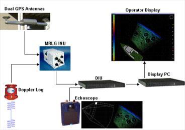


3 Representative Product Portfolio UN-100 PNT Gateway Loran, eloran, TeraNav, LFPhoenix UN-350 Radar Interface epelorus True-Bearing Transmitter UN-400 3D Sonar Survey System Low-Frequency Alternative PNT&D Solutions
4 Global LF APNT&D Motivators and Drivers Let s recognize that a homogenous, multi-modal, global backup solution is not yet available. Multiple layers of GNSS, RNSS, and their augmentations are not a truly sky free solution. Customer base is global and diverse: governments, agencies, departments, ministries, military, commercial (e.g., telecommunications). Budget constraints mean value add and future proofing are important. Renewed interest in LF is attracting technology industry and academia, and is creating jobs. LF Centers of Excellence are appearing: GLAs, CIL, KMU. Our customers are seeking local, sovereign solutions. Solutions might be improved when operating in concert with neighbor-states. Solutions may require cooperation with neighbor-states for best coverage of key assets. Ownership and control of time dissemination within the sovereign state is a key driver. A mix of technologies is the most likely near-term solution. Gradual awareness of APNT&D needs and LF capabilities through observing leader nations. Early adopters, or lighthouse customers, will gain leadership advantages, drive specifications and standards, and influence technology development.
 Interference-enabled crime fighting (car theft, illegal border crossings, toll cheating, tracking felons) Heading / Pointing (Compass) Automatic")
5 Wide-area or localized timing source (+/- 10 to 30 ns of UTC) High-profile events (Olympics) Military operations (triple canopy, jamming situations, mountainous regions) Critical infrastructure protection (ports, harbors, airports, key assets) Interference-enabled crime fighting (car theft, illegal border crossings, toll cheating, tracking felons) Heading / Pointing (Compass) Automatic Vehicle Location (AVL) services High-Value Asset Tracking Submarine communications and navigation GNSS/RNSS Interference Detection and Mitigation UAV / UAS / RPA solutions Irregular Warfare / Counterinsurgency (COIN) Operations Geo-encryption, -location, -fencing Third-Party Data Client Why LF APNT&D?
6 Disclaimer NOTE: The views represented in the following slides are those of the author, are unofficial, and have not been endorsed or approved by any government, agency, or organization. Coverage diagrams are provided purely to stimulate discussion.
7 Korea is Not Alone Current LF Nations United Kingdom Kingdom of Saudi Arabia Republic of Korea Norway Russia (Chayka) France Denmark India Japan China Germany USA (dormant) Canada (dormant) Nations Exploring LF Options United Kingdom Kingdom of Saudi Arabia Republic of Korea France / Denmark Norway India Russia (Chayka) Germany USA Canada Japan China Egypt
8 United Kingdom May year eloran contract awarded to VT Communications (now Babcock) September Business Case for Resilient PNT (eloran) Positive return on investment of 25M GBP (44.5B KRW) March Royal Academy of Engineering Report Global Navigation Space Systems: reliance and vulnerabilities Recommendation #9. The provision of a widely available PNT service as an alternative to GNSS is an essential part of the national infrastructure. It should be cost effective to incorporate in civil GNSS receivers and free to use. Ideally it should provide additional benefits, such as availability inside buildings and in GNSS blindspots. We are encouraged by progress with eloran in this context. Ongoing eloran trials

9 United Kingdom Note: Republic of Ireland eloran site selected simply as an example to show coverage possibilities.


10 Kingdom of Saudi Arabia December Pending Request for Proposal to upgrade four existing Loran-C stations to eloran. 2012/2013. Potential synchronization of Loran/eLoran service with external wide-area timing service. Afif Salwa Ash Shaykh Humayd Al Muwassam Improved coverage in Red Sea harbors with proposed new station near Masturah

11 France Considering upgrading two Loran-C stations with 21 st century technology. Adding 3-4 new stations would provide sovereign solution with comprehensive coverage of the entire nation.

12 Norway Combining Norwegian and Russian stations provides improved coverage in the Norwegian and Barentsz Seas.
 solution might look")
13 India This graph represents what a low-power (40 kw) solution might look like.
 solution might look")
14 India This graph represents what a high-power (400 kw) solution might look like.
15 Draft DHS/CTO Cooperative Research & Development Agreement (CRADA) Distributed Precise Time & Frequency (Fiber / LF) Pending DHS/US Coast Guard CRADA Littoral shipboard timing initiative Wide-area multi-modal wireless timing DOT/FAA ICAO Working Group Alternative PNT for NextGen Timing DOT/FHWA Alternative PNT for Intelligent Transportation System DHS Timing United States Pursuing elimination of a provision in the CFR that prohibits private maritime radio aids to navigation
16 Requirement: Coast Guard Authorization Act of 2010, Section 219, Supplemental Positioning System (October 2010) Not later than 180 days after date of enactment of this Act, the Secretary of the department in which the Coast Guard is operating in consultation with the Commandant of the Coast Guard shall conclude their study of whether a single, domestic system is needed as a back-up navigation system to the Global Positioning System and notify the Committee on Transportation and Infrastructure of the House of Representatives and the Committee on Commerce, Science, and Transportation of the Senate the results of such determination. Was actually due April 15, 2011 Response: An Analysis of the GPS FY2011 Report to Congress Submitted in September 2011 Currently a FOUO report United States
 is a wide-area mobile broadband")

17 United States LIGHTSQUARED! LightSquared (LTS) is a wide-area mobile broadband provider that wants to operate in two bands on either side of GNSS, including GPS and Galileo. Chart courtesy of John Deere.


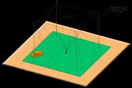
18 Korea Coverage example with two existing plus two random sites in Korea.
19 Global Organizations Supporting eloran International Association of Lighthouse Authorities (IALA) Worldwide Radio Navigation Plan International Maritime Organization (IMO) Sub Committee on Safety of Navigation International Loran Association Radio Technical Commission for Maritime Services (RTCM) SC 127 Committee: Standards for eloran Syatems Marine Receiver Minimum Performance Standards

20 Key Technologies for eloran Systems


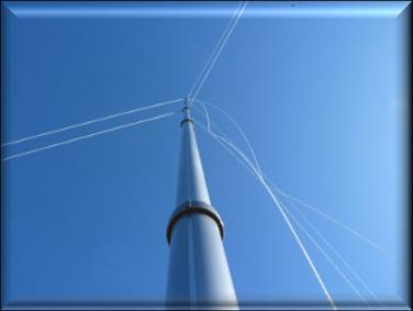
21 Evolutionary Infrastructure Goal: provide a service / Build: site (not a station) 20 th Century Loran Stations 21 st Century Loran Site


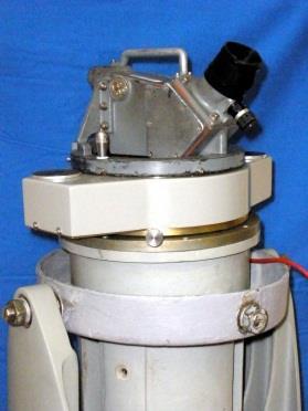
22 Revolutionary Receiver Technology Started selling in Q Available in Q3 2011
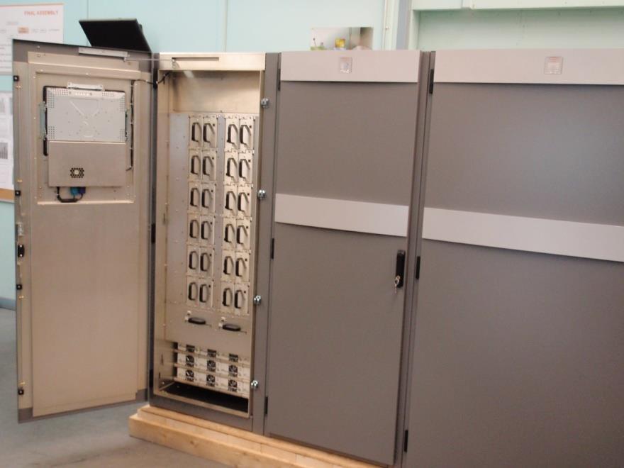
23 Revolutionary Transmitter Technology 1960 s 21 st Century 1970 s and 1990 s

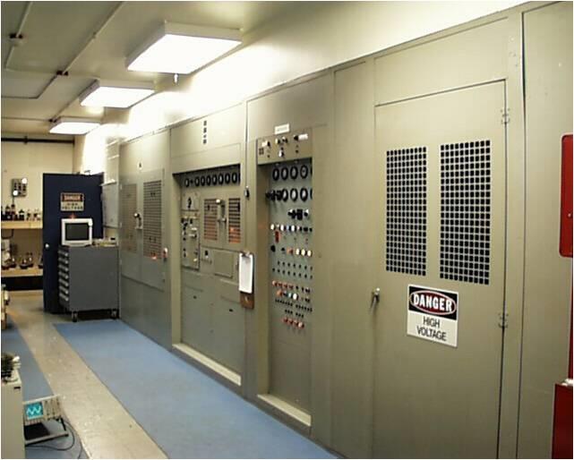
24 DC Metropolitan Operations 616 Innovation Drive Scholar Plaza, Suite USA USA
Transmission and User Requirements Technology for eloran (eloran 의송신기술및수신기기술 ) - Public Version -
 - Public Version -") Shared interest in a more productive tomorrow. Transmission and User Requirements Technology for eloran (eloran 의송신기술및수신기기술 ) - Public Version - Presented by: Mr. Charles Schue, President & CEO Mr. John
Shared interest in a more productive tomorrow. Transmission and User Requirements Technology for eloran (eloran 의송신기술및수신기기술 ) - Public Version - Presented by: Mr. Charles Schue, President & CEO Mr. John
Implementing a Wide Area High Accuracy UTC Service via eloran
 Implementing a Wide Area High Accuracy UTC Service via eloran ION PTTI, Boston, MA December 3, 2014 Dr. Gerard Offermans Overview Basis for consideration of eloran as a source of precise time, frequency,
Protection Augmentation Toughness and Alternatives of GNSS. Melaha 2016 Concord Al-Salam Hotel Cairo, April 25,2016 Refaat Rashad
 Protection Augmentation Toughness and Alternatives of GNSS Melaha 2016 Concord Al-Salam Hotel Cairo, April 25,2016 Refaat Rashad Road Map of the Presentation 1- How Good are GNSS 2- How Vulnerable are
Loran C in Europe. 34 th Annual ILA Convention and Technical Symposium October 2005 Santa Barbara
 34 th Annual ILA Convention and Technical Symposium 17-19 October 2005 Santa Barbara Loran C in Europe Jacques MANCHARD Head of the Maritime Ads to Navigation Division (Phares et Balises) Ministry of Transport,
Leadership in Resilient PNT
 www.ursanav.com www.nautelnav.com 29 November 2017 Leadership in Resilient PNT The Need for Resilient PNT Position, Navigation, and Timing, or PNT, is known as the hidden utility. Despite its widespread
U.S. Perspectives on eloran as a Timing Backup And Available Hardware. Charles Schue UrsaNav, Inc. KTN Trinity House October 8, 2012
 U.S. Perspectives on eloran as a Timing Backup And Available Hardware Charles Schue UrsaNav, Inc. KTN Trinity House October 8, 2012 Corporate Overview Chesapeake, Virginia, USA Founded in 2004 Four main
Wide Area Time distribution Via eloran. NASPI WG Meeting
 Wide Area Time distribution Via eloran NASPI WG Meeting March 22 2017 This work is supported through a Cooperative Research and Development Agreement (CRADA) with the Department of Homeland Security (DHS)
GPS Interference & Space Weather Real or Imagined Vulnerability?
 GPS Interference & Space Weather Real or Imagined Vulnerability? Prof. Charles Curry B.Eng, FIET Managing Director Chronos Technology Ltd 7 th Nov 2012 ITSF Nice, France Presentation Contents Background
02 Issue. e-navigation News. GNSS Vulnerability. Dublin Bay Digital Diamond. e-navigation. Demonstrator Update International. e-navigation.
 CORPORATE SECURITY TEAMWORK EVENTS 02 Issue e-navigation News GNSS Vulnerability Dublin Bay Digital Diamond e-navigation Demonstrator Update International e-navigation update June 2014 www.cil.ie +353
SATELLITE BASED AUGMENTATION SYSTEM (SBAS) FOR AUSTRALIA
 FOR AUSTRALIA") SATELLITE BASED AUGMENTATION SYSTEM (SBAS) FOR AUSTRALIA AN AIN POSITION PAPER SUBMITTED TO VARIOUS GOVERNMENT DEPARTMENTS BY MR KYM OSLEY AM, CSC, EXEC SECRETARY AIN What are GNSS Augmentation Systems?
SATELLITE BASED AUGMENTATION SYSTEM (SBAS) FOR AUSTRALIA AN AIN POSITION PAPER SUBMITTED TO VARIOUS GOVERNMENT DEPARTMENTS BY MR KYM OSLEY AM, CSC, EXEC SECRETARY AIN What are GNSS Augmentation Systems?
GPS Interference Detection & Mitigation
 GPS Interference Detection & Mitigation GAARDIAN GNSS AVAILABILITY ACCURACY RELIABILITY and INTEGRITY ASSESSMENT for TIMING and NAVIGATION A Technology Strategy Board funded collaboration Charles Curry,
Communications Sector. Use of Positioning, Navigation and Timing (PNT) Services
 Services") Communications Sector Use of Positioning, Navigation and Timing (PNT) Services These comments are based upon public and private assertions made by representatives of this Critical Infrastructure/Key Resource
Communications Sector Use of Positioning, Navigation and Timing (PNT) Services These comments are based upon public and private assertions made by representatives of this Critical Infrastructure/Key Resource
S a t e l l i t e T i m e a n d L o c a t i o n. N o v e m b e r John Fischer VP Advanced R&D
 STL - S a t e l l i t e T i m e a n d L o c a t i o n N o v e m b e r 2 0 1 7 John Fischer VP Advanced R&D jfischer@orolia.com 11/28/201 1 7 WHY AUGMENT GNSS? Recent UK Study Economic Input to UK of a
Market strategy update in Maritime segment. This presentation can be interpreted only together with the oral comments accompanying it
 Market strategy update in Maritime segment This presentation can be interpreted only together with the oral comments accompanying it 2 Market sub-segments and applications Recreational navigation: GNSS
The U.S. government appears
 The U.S. government appears to be closing in on a decision about whether to revive plans for an enhanced Loran (eloran) system, as a backup for the position, navigation, and timing (PNT) information provided
Design and Performance of a Low Frequency Time and Frequency Dissemination Service
 Design and Performance of a Low Frequency Time and Frequency Dissemination Service Dr. Arthur Helwig, Dr. Gerard Offermans, Chris Stout, Charles Schue, UrsaNav, Inc. BIOGRAPHIES Dr. Arthur Helwig is a
GPS & other Radio Time sources
 GPS & other Radio Time sources Anthony Flavin, MIET Chronos Technology Ltd Wireless Heritage SIG Time for Telecoms British Science Museum Friday 16th April 2018 Chronos Technology: COMPANY PROPRIETARY
Providing a Resilient Timing and UTC Service Using eloran in the United States. Charles Schue - ION PTTI Monterey, CA
 Providing a Resilient Timing and UTC Service Using eloran in the United States Charles Schue - ION PTTI Monterey, CA January 27, 2016 Motivation For a Resilient Timing and UTC Service GPS/GNSS Vulnerabilities
A Holistic Approach to Trusted, Resilient PNT: GNSS, STL and eloran
 A Holistic Approach to Trusted, Resilient PNT: GNSS, STL and eloran John Fischer, Vice President of Research & Development, Orolia Dr. Michael O Connor, CEO, Satelles Charles Schue, CEO, UrsaNav With an
RESPONSE TO THE HOUSE OF COMMONS TRANSPORT SELECT COMMITTEE INQUIRY INTO GALILEO. Memorandum submitted by The Royal Academy of Engineering
 RESPONSE TO THE HOUSE OF COMMONS TRANSPORT SELECT COMMITTEE INQUIRY INTO GALILEO Memorandum submitted by The Royal Academy of Engineering September 2004 Executive Summary The Royal Academy of Engineering
E-Navigation: Opening the door to the future
 International Association of Marine Aids to Navigation and Lighthouse Authorities E-Navigation: Opening the door to the future E-Navigation Underway North America November 2018 Secretary-General Francis
New Funding Opportunities to Support Safety of Navigation: EGNOS and Galileo
 New Funding Opportunities to Support Safety of Navigation: EGNOS and Galileo e-navigation Underway 31 January-2 February 2017 GSA 2016 The European GNSS Agency (GSA) today: Staff: about 145 Nationalities:
Information Technology Sector. Use of Positioning, Navigation and Timing (PNT) Services
 Services") Information Technology Sector Use of Positioning, Navigation and Timing (PNT) Services These comments are based upon public and private assertions made by representatives of this Critical Infrastructure/Key
Information Technology Sector Use of Positioning, Navigation and Timing (PNT) Services These comments are based upon public and private assertions made by representatives of this Critical Infrastructure/Key
GPS Jamming Quantifying the Threat
 GPS Jamming Quantifying the Threat GNSS Vulnerability Countering the Threat 13 th Feb 2013 Prof. Charles Curry B.Eng, C.Eng, FIET Managing Director Chronos Technology Ltd NPL, Teddington, London Presentation
COMMUNICATIONS FOR MARITIME SAFETY AND EFFICIENCY. Francis Zachariae, Secretary-General, IALA
 COMMUNICATIONS FOR MARITIME SAFETY AND EFFICIENCY Francis Zachariae, Secretary-General, IALA IALA and its Purpose Non profit, international technical association established in 1957 Two Goals aimed at
TECHNICAL COMMITTEE 80: MARITIME NAVIGATION AND RADIOCOMMUNICATION EQUIPMENT AND SYSTEMS INTERNATIONAL ELECTROTECHNICAL COMMISSION
 TECHNICAL COMMITTEE 80: MARITIME NAVIGATION AND RADIOCOMMUNICATION EQUIPMENT AND SYSTEMS INTERNATIONAL ELECTROTECHNICAL COMMISSION IEC TECHNICAL COMMITTEE 80: MARITIME NAVIGATION AND RADIOCOMMUNICATION
Energy Sector. Use of Positioning, Navigation and Timing (PNT) Services
 Services") Energy Sector Use of Positioning, Navigation and Timing (PNT) Services These comments are based upon public and private assertions made by representatives of this Critical Infrastructure/Key Resource sector
Energy Sector Use of Positioning, Navigation and Timing (PNT) Services These comments are based upon public and private assertions made by representatives of this Critical Infrastructure/Key Resource sector
The Politics of Resilience Speaking Truth to Power the Last 18 Months
 The Politics of Resilience Speaking Truth to Power the Last 18 Months APRIL 2017 Workshop On Synchronization & Timing a single point of failure December 2015 US increasingly at risk from disruption 2011
Geoscience & Positioning, Navigation and Timing Services for Canadians
 Geoscience & Positioning, Navigation and Timing Services for Canadians Calvin Klatt, Ph.D. Director and Chief Geodesist Natural Resources Canada / Directeur et géodésien principal Ressources naturelles
Canadian Coast Guard Review to Implement a Resilient Position, Navigation and Timing Solution for Canada. Mariners Workshop January 31 st, 2018
 Canadian Coast Guard Review to Implement a Resilient Position, Navigation and Timing Solution for Canada Mariners Workshop January 31 st, 2018 Outline Overview of GNSS use in the marine sector CCG Activities
On the Uses of High Accuracy eloran Time, Frequency, and Phase
 On the Uses of High Accuracy eloran Time, Frequency, and Phase RIN INC, Manchester, England February 25, 2015 Charles Schue President & CEO UrsaNav, Inc. Overview The Problem: We need time all the time!
European Radio Navigation Plan. Gilles LEQUEUX, European Commission Policy Development and Strategies
 European Radio Navigation Plan Gilles LEQUEUX, European Commission Policy Development and Strategies CONTEXT - BENEFITS Space Strategy for Europe Introduction of EGNSS in EU sectoral policies Better strategic
PRELIMINARY PROGRAMME
 ICG EXPERTS MEETING: GLOBAL NAVIGATION SATELLITE SYSTEMS SERVICES 14-18 December 2015 Vienna International Centre, Vienna, Austria Organized by International Committee on Global Navigation Satellite Systems
Lecture-1 CHAPTER 2 INTRODUCTION TO GPS
 Lecture-1 CHAPTER 2 INTRODUCTION TO GPS 2.1 History of GPS GPS is a global navigation satellite system (GNSS). It is the commonly used acronym of NAVSTAR (NAVigation System with Time And Ranging) GPS (Global
Note that MIFD II will also be influencing standards in the US.
 1 2 Why should the Financial Sector care? Note that MIFD II will also be influencing standards in the US. The best contingency solutions is one that includes a Resilience Triad : GPS/GNSS, eloran, and
Black Swans, White Elephants and Delivering a New National Timescale with eloran
 Black Swans, White Elephants and Delivering a New National Timescale with eloran Charles Curry BEng, CEng, FIET Managing Director Chronos Technology Ltd SFR, Paris 18 th July 2014 PNT First Experiences
CHAPTER 6 LONG RANGE NAVIGATIONAL AIDS PART I LORAN-C
 CHAPTER 6 LONG RANGE NAVIGATIONAL AIDS PART I LORAN-C 600A. Acronyms.............................................................................. 6-3 600B. Definitions.............................................................................
INTERNATIONAL CIVIL AVIATION ORGANIZATION
 EUR DOC 024 Attachment INTERNATIONAL CIVIL AVIATION ORGANIZATION EUROPEAN PRINCIPLES AND PROCEDURES FOR THE ALLOCATION OF SECONDARY SURVEILLANCE RADAR MODE S INTERROGATOR CODES (IC) 2011 ATTACHMENT MODE
Update of BeiDou Navigation Satellite System
 Update of BeiDou Navigation Satellite System 01 03 Development Plan 02 Latest Progress Recent Plans 01 03 Development Plan 02 Development Objectives Basic Principles Development Steps Latest Progress System
Coastal Surveillance. SCANTER Radar Solutions
 Coastal Surveillance SCANTER Radar Solutions Protecting Your Coastlines and Maritime Domain We provide radar coverage of the coastline to detect and track all types of surface vessels and air targets.
Navigati. GNSS Resilience. The Magazine of the Royal Institute of Navigation MAY/JUN Resilience Has A Name Its name is eloran
 Navigati MAY/JUN 2014 5.00 The Magazine of the Royal Institute of Navigation GNSS Resilience The Navigation of Navigation How we got to where we are with GNSS Resilience Has A Name Its name is eloran The
GPS Jamming and its impact on maritime navigation
 GPS Jamming and its impact on maritime navigation Dr Alan Grant Research and Development - Special Interest Group 10 th May 2010 Use of GPS in the maritime sector GPS has become the normal means for maritime
Emergency Services Sector (Law Enforcement, EMS & Incident Management) Use of Positioning, Navigation and Timing (PNT) Services
 Use of Positioning, Navigation and Timing (PNT) Services") Emergency Services Sector (Law Enforcement, EMS & Incident Management) Use of Positioning, Navigation and Timing (PNT) Services These comments are based upon public and private assertions made by representatives
Emergency Services Sector (Law Enforcement, EMS & Incident Management) Use of Positioning, Navigation and Timing (PNT) Services These comments are based upon public and private assertions made by representatives
GPS Civil Service Update & U.S. International GNSS Activities
 GPS Civil Service Update & U.S. International GNSS Activities International GNSS (IGNSS) Conference Sydney, Australia Jeffrey Auerbach Office of Space and Advanced Technology U.S. Department of State 06
Absolute Positioning by Radar
 Absolute Positioning by Radar Dr Nick Ward, Research Director General Lighthouse Authorities of UK & Ireland 14th IAIN Congress 2012, 01-03 October, 2012 - Cairo, Egypt Seamless Navigation (Challenges
Resilience through co-primary PNT solutions: GPS and eloran. By Charles Schue September 4, 2014
 1 Resilience through co-primary PNT solutions: GPS and eloran By Charles Schue September 4, 2014 Outline The Problem: Vulnerabilities The Need: Resilience The Solution: Co-Primary GPS and eloran eloran
Nigerian Communications Satellite Ltd. (NIGCOMSAT)
") OVERVIEW OF NIGERIAN SATELLITE AUGMENTATION SYSTEM COMMENCING WITH PILOT DEMONSTRATION TO VALIDATE NATIONAL WORK PLAN presented by Dr. Lawal Lasisi Salami, NIGERIAN COMMUNICATIONS SATELLITE LTD UNDER FEDERAL
OVERVIEW OF NIGERIAN SATELLITE AUGMENTATION SYSTEM COMMENCING WITH PILOT DEMONSTRATION TO VALIDATE NATIONAL WORK PLAN presented by Dr. Lawal Lasisi Salami, NIGERIAN COMMUNICATIONS SATELLITE LTD UNDER FEDERAL
European GNSS Evolution
 Ref. Ares(204)902599 - /06/204 European GNSS Evolution Hermann Ebner Galileo and EGNOS Programme Management DG Enterprise and Industry Content Introduction 2 2 Major Challenges for EGNSS Evolution 3 EGNSS
ASSEMBLY 37TH SESSION
 International Civil Aviation Organization WORKING PAPER A37-WP/195 1 22/9/10 (Information paper) ASSEMBLY 37TH SESSION TECHNICAL COMMISSION Agenda Item 35: The Global Air Traffic Management (ATM) System
السلطة البحرية االردنية Jordan Maritime Authority
 السلطة البحرية االردنية السلطة البحرية االردنية Humans have always been interested in where things are السلطة البحرية االردنية One of the basic questions have always been where I am? which leads to where
Transportation Systems Sector. Use of Positioning, Navigation and Timing (PNT) Services
 Services") Transportation Systems Sector Use of Positioning, Navigation and Timing (PNT) Services These comments are based upon public and private assertions made by representatives of this Critical Infrastructure/Key
Transportation Systems Sector Use of Positioning, Navigation and Timing (PNT) Services These comments are based upon public and private assertions made by representatives of this Critical Infrastructure/Key
Challenges and Solutions for GPS Receiver Test
 Challenges and Solutions for GPS Receiver Test Presenter: Mirin Lew January 28, 2010 Agenda GPS technology concepts GPS and GNSS overview Assisted GPS (A-GPS) Basic tests required for GPS receiver verification
10 th APEC TRANSPORTATION MINISTERIAL MEETING 7 th October 2017 Port Moresby, Papua New Guinea Ministerial Statement
 10 th APEC TRANSPORTATION MINISTERIAL MEETING 7 th October 2017 Port Moresby, Papua New Guinea Ministerial Statement 1. We, the Ministers responsible for transportation, met in Port Moresby, Papua New
Experience with Radio Navigation Satellite Service (RNSS)
") Experience with Radio Navigation Satellite Service (RNSS) International Satellite Communication Symposium International Telecommunication Union (ITU) Geneva, 13-14 June 2016 MITOME, Takahiro Co-Chair of
Experience with Radio Navigation Satellite Service (RNSS) International Satellite Communication Symposium International Telecommunication Union (ITU) Geneva, 13-14 June 2016 MITOME, Takahiro Co-Chair of
PROTECTING GPS/GNSS-RELIANT MILITARY SYSTEMS
 PROTECTING GPS/GNSS-RELIANT MILITARY SYSTEMS John Fischer VP Advanced R&D Jon Sinden Product Manager, Rugged PNT 6/21/2018 ABOUT OROLIA A world leader in assured positioning, navigation and timing (PNT)
Extreme space weather: Geomagnetic storms, GNSS disruptions and the impact on vital functions in society
 Extreme space weather: Geomagnetic storms, GNSS disruptions and the impact on vital functions in society Fredrik Marsten Eklöf FOI, Informationssystem fredrik.eklof@foi.se, 0709-277426 Global Navigation
SERVICES ENABLED BY HIGN ALTITUDE PSEUDO SATELLITES (HAPS) COMPLEMENTED BY SATELLITES : Webinar
 COMPLEMENTED BY SATELLITES : Webinar") Ref. ESA-TIAA-HO-2017-1162 SERVICES ENABLED BY HIGN ALTITUDE PSEUDO SATELLITES (HAPS) COMPLEMENTED BY SATELLITES : Webinar 15/09/2017 Rita Rinaldo, Laurence Duquerroy Downstream Business Applications Department
Ref. ESA-TIAA-HO-2017-1162 SERVICES ENABLED BY HIGN ALTITUDE PSEUDO SATELLITES (HAPS) COMPLEMENTED BY SATELLITES : Webinar 15/09/2017 Rita Rinaldo, Laurence Duquerroy Downstream Business Applications Department
ITU-R Activities Impact on ITS. Paul Najarian U.S. Dept. of Commerce National Telecommunications and Information Administration
 ITU-R Activities Impact on ITS Paul Najarian U.S. Dept. of Commerce National Telecommunications and Information Administration INTERNATIONAL TELECOMMUNICATION UNION A Specialized Agency of the United Nations
EUPOS European Position Determination System
 EUPOS European Position Determination System c/o Senate Department for Urban Development, State Berlin, Germany Umea, Sweden, 22 nd 23 rd 2011 The Geodetic Infrastructure in Europe today and tomorrow Slide
The Navigation of Navigation
 The Navigation of Navigation Professor David Last Past-President, Royal Institute of Navigation jdl@navaid.demon.co.uk Abstract Satellite navigation is an exceptionally successful technology. It benefits
USE OF THE RCDS MODE OF ECDIS (Submissions by Australia and Norway to IMO MSC/78)
") IHB File No. S3/8152 CIRCULAR LETTER 21/2004 22 March 2004 USE OF THE RCDS MODE OF ECDIS (Submissions by Australia and Norway to IMO MSC/78) Ref: 1. WEND Letter 1/2004, dated 1 st February 2004 2. IMO
IHB File No. S3/8152 CIRCULAR LETTER 21/2004 22 March 2004 USE OF THE RCDS MODE OF ECDIS (Submissions by Australia and Norway to IMO MSC/78) Ref: 1. WEND Letter 1/2004, dated 1 st February 2004 2. IMO
Report of Working Group B: Enhancement of Global Navigation Satellite Systems Services Performance
 Report of : Enhancement of Global Navigation Satellite Systems Services Performance 1. The Working Group on Enhancement of Global Navigation Satellite Systems (GNSS) Service Performance (WG-B) of the International
Operation and Development of BeiDou Navigation Satellite System
 Operation and Development of BeiDou Navigation Satellite System Jing Li IAIN 2015, 20 23 October Prague, Czech Republic 2 01 03 Plan and Policy 02 Status and Near-term Goal International Cooperation 3
Status of the European EGNOS and Galileo Programmes. Frank Udnaes Galileo policy and Infrastructure group EC DG-TREN. June 2008
 Status of the European EGNOS and Galileo Programmes Frank Udnaes Galileo policy and Infrastructure group EC DG-TREN EUROPEAN COMMISSION z June 2008 Galileo An infrastructure 30 satellite Constellation
Report of the Systems, Signals and Services Working Group (formerly Working Group A)
") ICG/WG-S/NOV2015 Report of the Systems, Signals and Services Working Group (formerly Working Group A) 1. The International Committee on Global Navigation Satellite Systems (ICG) Working Group A (WG-A)
ICG/WG-S/NOV2015 Report of the Systems, Signals and Services Working Group (formerly Working Group A) 1. The International Committee on Global Navigation Satellite Systems (ICG) Working Group A (WG-A)
Science, Technology & Innovation Indicators
 Science, Technology & Innovation Indicators Adnan Badran NASIC Conference cum Workshop on Herbal Drug Development for Socio-economic Uplift in Developing World The University of Jordan, September 6-8,
MEMORANDUM NO MAY Directives Affected. Reference (a) is temporarily augmented by this policy letter.
 is temporarily augmented by this policy letter.") U.S. Department of Commandant 2100 Second Street, S.W. Homeland Security United States Coast Guard Washington, DC 20593-0001 Staff Symbol: -1 Phone: (202) 267-2735 United States Fax: (202) 267-4394 Coast
U.S. Department of Commandant 2100 Second Street, S.W. Homeland Security United States Coast Guard Washington, DC 20593-0001 Staff Symbol: -1 Phone: (202) 267-2735 United States Fax: (202) 267-4394 Coast
MDTS 5734 : Guidance Lecture 5 : Global Positioning Systems. Gerard Leng, MDTS, NUS
 MDTS 5734 : Guidance Lecture 5 : Global Positioning Systems Question : What do we really need for trans-continental navigation? Hint below : It s not GPS!?! First London to Singapore flight by Imperial
IALA S WORK IN E-NAVIGATION. Michael Card
 IALA S WORK IN E-NAVIGATION Michael Card e-navigation origins The early work of IALA on e-navigation Multiple Initiatives EfficienSea 2 STM Validation IHO S-100 and IALA S-200 Smart Navigation VDES development
Report on GPS Jamming Trials and Criminal Use of Jammers
 Report on GPS Jamming Trials and Criminal Use of Jammers Prof. Charles Curry BEng, CEng, FIET Chronos Technology Ltd WSTS, San Jose, Tuesday 10 th March Session 2 Presentation Contents Background & Research
Update on enhanced satellite navigation services empowering innovative solutions in Smart Mobility
 Update on enhanced satellite navigation services empowering innovative solutions in Smart Mobility 8th June 2018- Technical session 1 Latest developments in innovative ITS activities Alberto Fernández
Providing a Resilient Timing and UTC Service Using eloran in the United States
 Providing a Resilient Timing and UTC Service Using eloran in the United States Gerard Offermans, Steve Bartlett, Charles Schue, UrsaNav, Inc. BIOGRAPHIES Dr. Gerard Offermans is Senior Research Scientist
GSA GNSS Technology Report Main highlights IPIN 2018
 GSA GNSS Technology Report Main highlights IPIN 2018 Justyna Redelkiewicz, European GNSS Agency 25 September 2018, Nantes The European GNSS Agency (GSA) is responsible for market development and operations
DEVELOPMENT OF A DEFINITION FOR MSPS AND CONSIDERATION FOR THE HARMONIZATION OF THE FORMAT AND STRUCTURE OF MSPS
 INTERNATIONAL HYDROGRAPHIC ORGANIZATION E IMO/IHO HARMONIZATION GROUP ON DATA MODELLING Agenda item 5 15 September 2017 ENGLISH ONLY DEVELOPMENT OF A DEFINITION FOR MSPS AND CONSIDERATION FOR THE HARMONIZATION
International Committee on Global Navigation Satellite Systems
 International Committee on Global Navigation Satellite Systems Training Course on Global Navigation Satellite Systems 14 18 January 2019, Asian Institute of Technology, Bangkok, Thailand Sharafat Gadimova
The Effect of Radio Frequency Interference on GNSS Signals and Mitigation Techniques Presented by Dr. Tarek Attia
 International Conference and Exhibition Melaha2016 GNSS WAY Ahead 25-27 April2016, Cairo, Egypt The Effect of Radio Frequency Interference on GNSS Signals and Mitigation Techniques Presented by Dr. Tarek
GPS jamming
 Page 1 of 5 GPS jamming No jam tomorrow Navigation: As the uses of satellite-positioning technology continue to grow, what can be done to stop deliberate and dangerous jamming of the signals? Mar 10th
Arctic Shipping Navigating the Legal Landscape for marine infrastructure and Off-Shore Development
 Arctic Shipping Navigating the Legal Landscape for marine infrastructure and Off-Shore Development Peter G. Pamel Partner Connecticut Maritime Association SHIPPING 2012 Hilton Stamford March 21 st, 2012
LEADING THE WAY FROM SEA TO LAND SURVEILLANCE RADAR SOLUTIONS
 LEADING THE WAY FROM SEA TO LAND SURVEILLANCE RADAR SOLUTIONS SITUATIONAL INTELLIGENCE, THE WORLD OVER A Kelvin Hughes radar is the primary tool for long range threat detection. On land and at sea we provide
Indoor Positioning and Navigation System Market Research Report- Forecast 2023
 Report Information More information from: https://www.marketresearchfuture.com/reports/1775 Indoor Positioning and Navigation System Market Research Report- Forecast 2023 Report / Search Code: MRFR/SEM/1243-CRR
ELECTRONIC BULLETIN For information only
 International Civil Aviation Organization ELECTRONIC BULLETIN For information only EB 2011/56 AN 7/5 21 November 2011 INTERFERENCE TO GLOBAL NAVIGATION SATELLITE SYSTEM (GNSS) SIGNALS 1. Aviation operations
RESOLUTION MSC.401(95) (Adopted on 8 June 2015) PERFORMANCE STANDARDS FOR MULTI-SYSTEM SHIPBORNE RADIONAVIGATION RECEIVERS
 (Adopted on 8 June 2015) PERFORMANCE STANDARDS FOR MULTI-SYSTEM SHIPBORNE RADIONAVIGATION RECEIVERS") ANNEX 17 MSC 95/22/Add.2 Annex 17, page 1 THE MARITIME SAFETY COMMITTEE, RECALLING Article 28(b) of the Convention on the International Maritime Organization concerning the functions of the Committee,
ANNEX 17 MSC 95/22/Add.2 Annex 17, page 1 THE MARITIME SAFETY COMMITTEE, RECALLING Article 28(b) of the Convention on the International Maritime Organization concerning the functions of the Committee,
GLONASS Status and Modernization
 GLONASS Status and Modernization Ekaterina Oleynik Central Research Institute of Roscosmos Federal Space Agency United Nations/Latvia Workshop on the Applications of Global Navigation Satellite Systems
GALILEO Research and Development Activities. Second Call. Area 1A. Statement of Work
 GALILEO Research and Development Activities Second Call Area 1A GNSS Introduction in the Maritime Sector Statement of Work Rue du Luxembourg, 3 B 1000 Brussels Tel +32 2 507 80 00 Fax +32 2 507 80 01 www.galileoju.com
GBAS FOR ATCO. June 2017
 GBAS FOR ATCO June 2017 Disclaimer This presentation is for information purposes only. It should not be relied on as the sole source of information, and should always be used in the context of other authoritative
General Assembly. United Nations A/AC.105/946
 United Nations A/AC.105/946 General Assembly Distr.: General 16 November 2009 Original: English Committee on the Peaceful Uses of Outer Space Report on the United Nations/Azerbaijan/United States of America/European
GPS/WAAS Program Update
 GPS/WAAS Program Update UN/Argentina Workshop on the Applications of GNSS 19-23 March 2018 Cordoba, Argentina GNSS: A Global Navigation Satellite System of Systems Global Constellations GPS (24+3) GLONASS
Update from the United States Space-Based Positioning, Navigation, and Timing Advisory Board
 Update from the United States Space-Based Positioning, Navigation, and Timing Advisory Board John W. Betz, PhD PNTAB Member Presented to ICG-12, Kyoto, Japan December 2017 Approved for Public Release;
Getting to Equal, 2016
 Getting to Equal, 2016 Listen. Learn, Lead, 2015 Career Capital, 2014 Defining Success. Your Way, 2013 The Path Forward, 2012 Reinvent Opportunity: Looking Through a New Lens, 2011 Resilience in the Face
International Committee on Global Navigation Satellite Systems (ICG)
") International Committee on Global Navigation Satellite Systems (ICG) A forum to discuss global navigation satellite systems to benefit people around the world Sharafat Gadimova United Nations Office for
International Committee on Global Navigation Satellite Systems (ICG) A forum to discuss global navigation satellite systems to benefit people around the world Sharafat Gadimova United Nations Office for
WHITE PAPER Saving Lives with Intelligent In-Vehicle Systems
 WHITE PAPER Saving Lives with Intelligent In-Vehicle Systems For more information, please visit: 2012 IEIMobile Approximately 1.2 million people die from traffic injuries and accidents each year. It has
GNSS VULNERABILITY AND CRITICAL INFRASTRUCTURE
 GNSS VULNERABILITY AND CRITICAL INFRASTRUCTURE NNF CONFERENCE 24 MAY 2012 Brynjar Hansen Senior adviser Norwegian Space Centre Lars Giske Senior adviser Norwegian Space Centre MULTI GNSS EXTERNAL COOPERATION
Footnotes to National Frequency Allocation of Japan (Column 4)
") Footnotes to National Frequency Allocation of Japan (Column 4) J1 In authorizing the use of frequencies below 8.3kHz, it shall be ensured that no harmful interference is thereby caused to the services
Footnotes to National Frequency Allocation of Japan (Column 4) J1 In authorizing the use of frequencies below 8.3kHz, it shall be ensured that no harmful interference is thereby caused to the services
Report on the United Nations/Croatia Workshop on the Applications of Global Navigation Satellite Systems
 United Nations General Assembly Distr.: General 3 September 2013 Original: English Committee on the Peaceful Uses of Outer Space Report on the United Nations/Croatia Workshop on the Applications of Global
Space and Missile Systems Center
 Space and Missile Systems Center Global Positioning Systems Directorate GPS Status & Modernization Progress: Service, Satellites, Control Segment, and Military GPS User Equipment 3 Nov 2016 Col Steve Whitney,
Satellite technology to prevent and respond in cases of maritime accidents
 United Nations International Conference on Space-based Technologies for Disaster Management "Disaster risk identification, assessment and monitoring" 23-25 October 2013, Beijing, China. Satellite technology
ESA IAP Blue Belt demonstration project:
 Page 1 ESA IAP Blue Belt demonstration project: supporting the European Maritime Safety Agency (EMSA) Blue Belt Project, by providing a service based on satellite based AIS data complementing the terrestrial
(3) How does one obtain patent protection?
 How does one obtain patent protection?") Patenting in Kenya (1) Introduction A patent gives the owner the exclusive rights to prevent others from manufacturing, using or selling the protected invention in a given country. A patent is a legally
Patenting in Kenya (1) Introduction A patent gives the owner the exclusive rights to prevent others from manufacturing, using or selling the protected invention in a given country. A patent is a legally
Automatic identification system VHF data link loading
 Report ITU-R M.2287-0 (12/2013) Automatic identification system VHF data link loading M Series Mobile, radiodetermination, amateur and related satellite services ii Rep. ITU-R M.2287-0 Foreword The role
GPS Evidence - Where s It Taking Us?
 GPS Evidence - Where s It Taking Us? Professor David Last International Communications Data & Digital Forensics Seminars 17-21 March 2014 Picture: earthobservatory.nasa. gov//ewsroom/bluemarble/ David