LBL POSITIONING AND COMMUNICATION SYSTEMS PRODUCT INFORMATION GUIDE
|
|
|
- Camron Barnett
- 5 years ago
- Views:
Transcription


1 LBL POSITIONING AND COMMUNICATION SYSTEMS PRODUCT INFORMATION GUIDE

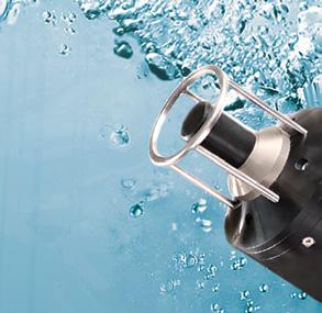
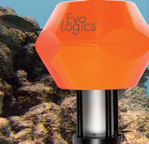
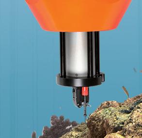
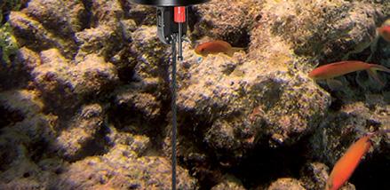
2 EvoLogics S2C LBL Underwater Positioning and Communication Systems EvoLogics LBL systems bring the benefi ts of long baseline (LBL) acoustic positioning to offshore and maritime applications that demand highly accurate results. S2C R-series underwater acoustic modems that operate as transponders, deployed around the working area in an array of geo-referenced baseline nodes, allow to track and navigate mobile targets with highest accuracy that does not depend on the depth. Combining highly accurate LBL positioning with full benefi ts of an S2C technology communication link, an S2C LBL systemdelivers an excellent all-round performance ideal for application scenarios that demand space-, energy- and cost-saving solutions. Switching between positioning and communication modes is not necessary: positioning data is calculated simultaneously with acoustic transmissions. Both features complement each other in a fully integrated positioning and communication system that opens new possibilities for a wide range of subsea applications. Full compatibility - use S2C R- and M -series modems as pingers or transponders Patented S2C (Sweep Spread Carrier) Technology - spread spectrum technology based on extensive bionic studies LBL positioning with up to 1.5 cm accuracy Simultaneous LBL positioning and data transmissions, multiple target tracking "Silent" positioning mode: targets do not transmit beacon signals and self-position with broadcasts from baseline nodes Self-adaptive algorithms for reliable performance in adverse conditions, forward error correction and data compression Advanced communication protocol with several data delivery algorithms: send and receive large volumes of data with the highest bitrate possible in current conditions; send and receive short instant messages without interrupting the main data fl ow between devices Addressing and networking: build relay chains and underwater networks with broadcasting capabilities Low power consumption and additional power-saving options APPLICATIONS Positioning of offshore equipment Track positions of offshore equipment during installation to ensure highly accurate placement at defi ned coordinates Navigation of ROVs and AUVs Simultaneously track positions of multiple ROVs or AUVs and control their missions with instant commands Cartography Locate underwater features with geo-referenced coordinates when used together with GPS or differential GPS Sensor network tracking Track drifts of moored sensors and detectors for accurate geo-referencing of their measurements Diver Tracking Monitor positions of several divers and exchange information with them during the mission MODULES AND OPTIONS AHRS (Attitude and Heading Reference System) GPS integration Integrated rechargeable battery Power-saving acoustic Wake-Up module Integrated data-logger Acoustic releases and fl oatation collars Short- mid- and long-range devices for shallow or deep water applications OEM versions available Compatible with S2C R modem and USBL solutions SENSOR INTEGRATION ADCP: Acoustic Doppler Current Profi ler SVP: Sound Velocity Profi ler CTD: Conductivity, Temperature, Depth, Pressure sensors INS: Inertial Navigation System More options upon request
3 EvoLogics LBL Communication and Positioning System: typical configuration An LBL positioning system uses an array of seafl oor mounted baseline transponders: their exact locations are known, so they are used as reference points for determining target positions. Baseline transponders reply to acoustic interrogation signals from target-mounted transceivers with their own acoustic pulses, allowing a target transceiver to calculate its position by measuring the distance between itself and each transponder of the baseline array. AHRS / GYRO DATA (optional) SiNAPS Positioning Software GNSS DATA (optional) NAVIGATION COMPUTER VESSEL TRANSCEIVER SiNAPS SERVER Local computer network MOBILE WIFI ROUTER (optional) SiNAPS CLIENTS MOBILE AUV ROV EvoLogics SiNAPS positioning software is a client-server application. SiNAPS server is installed on the navigation computer and interfaced with the vessel transceiver and other external instruments. SiNAPS server receives, processes and stores data from the transceiver and external instruments. SiNAPS client is the web-based user interface of the positioning system. It displays real-time information about the positions of the vessel and the targets, provides access to data management tools and system confi guration settings. The UI can be opened in most current web-browsers on multiple devices in the local computer network at once. Baseline transponders are either mounted in sea-fl oor stands or equipped with acoustic release mechanisms and fl otation collars for easier recovery to the surface. They are deployed around the work site and carefully calibrated prior to LBL system operation. Target transceivers are mounted on positioning targets, for example, on autonomous underwater vehicles (AUVs), remotely operated vehicles (ROVs) etc., and use acoustic signals to determine distances to baseline nodes. A GPS receiver is installed on the vessel for accurate calibration of the baseline transponder array after its deployment. During calibration, the vessel moves above the deployed baseline transponders to accurately determine their location. Coupled with a vessel transceiver, the GPS receiver provides the baseline nodes positions in real-world coordinates. Third-party or built-in AHRS sensor (Attitude and Heading Reference System) provides information about the vessel s orientation during calibration to eliminate positioning errors. The navigation computer is installed on the vessel, interfaced with the vessel transceiver and other external instruments and connected to the local computer network. EvoLogics positioning software, the SiNAPS, and the Transponder communication utility, a web-based tool to monitor and control the baseline transponders, are accessable from the navigation computer to confi gure, control and monitor the mission.
4 SPECIFICATIONS AND CONFIGURATION OPTIONS The LBL Positioning System uses S2C R-modems in baseline transponder confi guration. Standard R-Series and M-Series modems can be confi gured as target transceivers. S2CR 48/78 S2CR 42/65 S2CR 18/34 S2CR 18/34H S2CR 15/27 S2CR 12/24 S2CR 7/17 S2CR 7/17D S2CR 7/17W S2CM 48/78 S2CM 42/65 S2CM 18/34 S2CM HS OPERATING DEPTH Delrin 200 m 200 m 200 m 200 m 200 m 200 m 200 m 200 m 200 m 200 m 200 m 200 m 200 m Aluminium Alloy 2000 m 2000 m 2000 m 2000 m 2000 m 2000 m 2000 m 2000 m 2000 m not available GENERAL Stainless Steel 2000 m 2000 m 2000 m 2000 m 2000 m 2000 m 2000 m 2000 m 2000 m 2000 m 2000 m 2000 m 2000 m Titanium 2000 m 2000 m 2000 m 6000 m 6000 m 6000 m 6000 m m upon request 6000 m not available OPERATING RANGE 1000 m 1000 m 3500 m 3000 m 6000 m 6000 m 8000 m m 8000 m 1000 m 1000 m 3500 m 300 m FREQUENCY BAND khz khz khz khz khz khz 7-17 khz 7-17 khz 7-17 khz khz khz khz khz TRANSDUCER BEAM PATTERN wide - angle 100 degrees wide-angle 120 degrees directional 70 degrees directional 80 degrees wide - angle 100 degrees CONNECTION ACOUSTIC CONNECTION up to 31.2 kbit/s up to 31.2 kbit/s up to 13.9 kbit/s up to 13.9 kbit/s up to 9.2 kbit/s up to 9.2 kbit/s up to 6.9 kbit/s up to 6.9 kbit/s up to 6.9 kbit/s up to 31.2 kbit/s up to 31.2 kbit/s up to 13.9 kbit/s up to 62.5 kbit/s BIT ERROR RATE less than less than less than INTERNAL DATA BUFFER 1 MB, confi gurable 1 MB, confi gurable 1 MB, confi gurable INTERFACE 1) Ethernet or RS-232 Ethernet or RS-232 Ethernet or RS-232 INTERFACE CONNECTORS up to 4 connectors, Ethernet and serial combinations up to 4 connectors, Ethernet and serial combinations 1 connector POWER CONSUMPTION 2) Stand-by Mode 2.5 mw 2.5 mw 2.5 mw 2.5 mw 2.5 mw 2.5 mw 2.5 mw 2.5 mw 2.5 mw 2.5 mw 2.5 mw 2.5 mw 0.5 mw Listen Mode mw mw mw mw mw mw mw mw mw not available POWER Receive Mode 0.8 W 0.8 W 0.8 W 0.8 W 0.8 W 0.8 W 0.8 W 0.8 W 0.8 W 0.8 W 0.8 W 0.8 W 0.8 W Transmit Mode up to 60 W up to 40 W up to 65 W up to 65 W up to 65 W up to 57 W up to 45 W up to 65 W up to 70 W up to 55 W up to 35 W up to 55 W up to 8.5 W POWER SUPPLY OPTIONS 3) External 24 VDC (12 VDC) 24 VDC (12 VDC) 24 VDC (12 VDC) Internal Rechargeable battery 5 Ah or 10 Ah Rechargeable battery 5 Ah or 10 Ah Rechargeable battery Ah PHYSICAL HOUSING OPTIONS DIMENSIONS 4) Delrin Aluminium Alloy Stainless Steel Plastic non-magnetic corrosion-resistant housing for short-term deployments, depth rating 200 m Light metal housing for short-term deployments, depth rating 2000 m not available Robust metal, suitable for long-term deployments in harsh environments, depth rating 1000 m or 2000 m Titanium Corrosion resistant housing, suitable for long-term deployment in harsh environments, depth rating 6000 m not available Housing Total length Ø 110 x178 mm Ø 110 x178 mm Ø110 x178 mm Ø110 x218 mm 300 mm Ø 113 x 220 mm 390 mm Ø 113 x 220 mm 390 mm Ø113 x 260 mm 420 mm Ø110 x 178 mm 338 mm Ø110 x 178 mm 246 mm 300 mm WEIGHT, dry/wet Delrin 2250/400 g 2300/300 g 2245/400 g 3100/TBC g 2990/490 g 2990/490 g 4700/600 g 6200/600 g 3000/490 g 1120/330 g 1210/420 g 1265/480 g 1120/330 g MODULES AND OPTIONS WAKE-UP MODULE 5) not compatible with Ethernet The Wake Up Module turns the rest of the device on if it detects incoming acoustic signals or incoming data on one host interface. Once the device completes receiving or transmitting data, it switches itself off. 2-channel version available for R-series single-channel version only POWER SWITCH 6) not compatible with Ethernet The Power Switch allows to provide power supply to up to 4 external instruments and turn them on/off on command not available ADVANCED TIMEKEEPING MODULE Allows to accept 1 PPS input from GPS, optionally includes a Chip Scale Atomic Clock for highly precise timekeeping only available for OEM modem versions SDM VERSION Software Defi ned Modem mode: transmit/receive arbitrary waveforms and set a reference to trigger signal detection ACOUSTIC RELEASE DEVICE Baseline transponders - reliable mechanism for recovery to the surface. Also available in OEM version for system integration not available FLOATATION COLLAR Baseline transponders - fl oatation collar for fast recovery to the surface not available PRESSURE SENSOR Accurate pressure measurements not available CABLE - MOUNTED TRANSDUCER Separated transducer for easier system integration. Standard cable length 1.5 m, other upon request. OEM VERSION Version without housing: transducer and electronics for system integration OEM ACOUSTIC RELEASE DEVICE WITH ACOUSTIC RELEASE APPLICATIONS range transmissions in horizontal channels Fast short and medium range transmissions in vertical, slant and horizontal channels Medium range transmissions in horizontal channels Medium range transmissions in slant channels ong-term deployment long-term deployment depth-rated in vertical channels, depth-rated in slant channels, depth-rated range communication range communication Medium range communication High-speed short range communication and divers 1) One RS-232 Interface can be replaced with a RS-422 interface. Contact EvoLogics for more information! 2) Power consumption for RS-232 interface. Add 500 mw if an Ethernet interface is installed. Add 300 mw if the Wake-Up Module is installed. User-confi gurable Listen Mode is only available with a Wake-Up module installed. Power consumption in Listen Mode depends on Listen Mode settings. 3) 300 VDC available for 42/65 models. Contact EvoLogics for more information on external and internal power supply options! 4) S2CR 48/78, 18/34 - dimensions of a Delrin housing, other builds are slightly larger; S2CR 12/24, 7/17 - dimensions of a titanium housing, other builds are slightly smaller. Contact EvoLogics for more information on device dimensions and weights! 5) The Wake Up Module is only compatible with RS-232 interface! It is not compatible with Ethernet or RS channel Wake Up Module version reacts to incoming data on two serial interfaces. 6) The Power Switch is only compatible with RS-232 interface! It is not compatible with Ethernet or RS-422. Specifi cations subject to change without notice. EvoLogics GmbH - June 2018
5 ABOUT US EvoLogics GmbH develops underwater information and communication systems based on bionic concepts, combining cutting edge engineering with the best ideas found in nature. The advanced product features have become enabling technologies for deep water exploration and production. EvoLogics range of products offers highly reliable, fl exible and cost-effective solutions for multiple underwater communication, positioning, navigation and monitoring applications. We strive for innovation and invest our vast experience into developing, manufacturing and supporting products that deliver an excellent performance and solve the most challenging tasks. The company was founded in 2000 in Berlin, Germany, by a group of leading international scientists and maritime engineering experts. The company since focuses on developing innovative solutions for maritime and offshore industries, as well as smart robotic systems design and bionic research. EvoLogics GmbH Ackerstrasse Berlin, Germany tel.: fax: sales@evologics.de evologics.de
USBL positioning and communication SyStEmS. product information GUidE
 USBL positioning and communication SyStEmS product information GUidE evologics s2c R usbl - series underwater positioning and communication systems EvoLogics S2CR USBL is a series of combined positioning
USBL positioning and communication systems. Applications
 USBL positioning and communication systems Offering a powerful USBL transceiver functionality with full benefits of an S2C technology communication link Applications Positioning of offshore equipment >
Applications. > > Oil & Gas. > > RoVs and auvs. > > Oceanography. > > Monitoring stations. > > Seismic. > > Networks and relay chains
 Underwater acoustic Modems EvoLogics S2CR - series underwater acoustic modems provide full-duplex digital communication delivering an excellent performance, resistant to the challenges of the dynamic subsea
SONOBOT AUTONOMOUS HYDROGRAPHIC SURVEY VEHICLE PRODUCT INFORMATION GUIDE
 SONOBOT AUTONOMOUS HYDROGRAPHIC SURVEY VEHICLE PRODUCT INFORMATION GUIDE EvoLogics SONOBOT: Autonomous Surface Vehicle for Hydrographic Surveys High Precision Differential GPS for high-accuracy cartography
SONOBOT AUTONOMOUS HYDROGRAPHIC SURVEY VEHICLE PRODUCT INFORMATION GUIDE
 SONOBOT AUTONOMOUS HYDROGRAPHIC SURVEY VEHICLE PRODUCT INFORMATION GUIDE EvoLogics Sonobot an autonomous unmanned surface vehicle for hydrographic surveys High Precision Differential GPS for high-accuracy
DP Operator Course Training Manual HPR
 - Hydroacoustic Position Reference System consists of transducer(s) onboard a vessel communicating with transponder(s) placed on the seabed. The transducers are lowered beneath the hull, and when a transponder
Underwater Acoustic Communication and Positioning State of the Art and New Uses
 Underwater Acoustic Communication and Positioning State of the Art and New Uses Radio signals Work only on very short distances Salty water particularly problematic No underwater GPS Cables Too heavy,
global acoustic positioning system GAPS usbl acoustic with integrated INS positioning system Ixsea Oceano GAPS page 1
 global acoustic positioning system usbl acoustic positioning system with integrated INS positioning system page 1 THE MERGER OF INERTIAL AND UNDERWATER ACOUSTIC TECHNOLOGIES is a unique Global Acoustic
Ranger USBL Acoustic Positioning System for DP Reference and Survey
 Acoustic Positioning System for DP Reference and Survey cc 545000m N 544990m 544980m 544970m 6027910m 6027900m W 6027890m 6027880m S Contents Introduction 01 Ranger USBL System Overview 02 Ranger USBL
Construction Survey Positioning Systems Wideband Fusion LBL and USBL
 cc Construction Survey Positioning Systems Wideband Fusion LBL and USBL Contents Introduction 01 Fusion USBL 02 Fusion USBL System Specifications 05 Fusion LBL 06 Fusion LBL System Specifications 09 Precise,
Acoustics Digital, Spread Spectrum, DSP, Wideband What does this mean for Real World DP Operations? Jonathan Davis Sonardyne Inc
 Subsea Positioning & Communications Acoustics Digital, Spread Spectrum, DSP, Wideband What does this mean for Real World DP Operations? Jonathan Davis Sonardyne Inc Outline Introduction Signal Processing
New GENERATION ACOUSTIC. single solution for all underwater communication needs.
 MATS 3G // New GENERATION ACOUSTIC TELEMETRY SYSTEM MATS 3G is an underwater acoustic modem that offers a single solution for all underwater communication needs. Its state-of-the-art DSP (Digital Signal
Mean currents and turbulence, plus wave height, direction and ice tracking
 Mean currents and turbulence, plus wave height, direction and ice tracking The ADCP is designed for flexibility. It measures current profiles at up to 8 Hz sampling frequency. It can also measure direct
WORLD CLASS through people, technology and dedication WORLD CLASS through people, technology and dedication
 WORLD CLASS through people, technology and dedication WORLD CLASS through people, technology and dedication 1 2 Acoustic Positioning Systems Hydrofest Aberdeen University Wednesday 31 st March Ian Florence
NASNet DPR: NASNet as a Deepwater Acoustic DP Position Reference
 NAUTRONIX MARINE TECHNOLOGY SOLUTIONS NASNet DPR: NASNet as a Deepwater Acoustic DP Position Reference Aberdeen Houston Rio Overview Offshore positioning introduction Considerations of acoustic positioning
Applications of iusbl Technology overview
 Applications of iusbl Technology overview Tom Bennetts Project Manager Summary 1. What is iusbl and its target applications 2. Advantages of iusbl and sample data 3. Technical hurdles and Calibration methods
Positioning Small AUVs for Deeper Water Surveys Using Inverted USBL
 Positioning Small AUVs for Deeper Water Surveys Using Inverted USBL Presented at Hydro12, Rotterdam, November 2012 Dr. T.M. Hiller, thiller@teledyne.com Overview Introduction to Gavia AUV Gavia Acoustic
PHINS, An All-In-One Sensor for DP Applications
 DYNAMIC POSITIONING CONFERENCE September 28-30, 2004 Sensors PHINS, An All-In-One Sensor for DP Applications Yves PATUREL IXSea (Marly le Roi, France) ABSTRACT DP positioning sensors are mainly GPS receivers
WORLD CLASS through people, technology and dedication
 WORLD CLASS through people, technology and dedication WORLD CLASS through people, technology and dedication 1 2 Acoustic Positioning Systems Hydrofest Robert Gordon University Scott Sutherland Building
Inertial Systems. Ekinox Series TACTICAL GRADE MEMS. Motion Sensing & Navigation IMU AHRS MRU INS VG
 Ekinox Series TACTICAL GRADE MEMS Inertial Systems IMU AHRS MRU INS VG ITAR Free 0.05 RMS Motion Sensing & Navigation AEROSPACE GROUND MARINE EKINOX SERIES R&D specialists usually compromise between high
Structure Deflection Monitoring System
 Structure Deflection Monitoring System Generation II All rights reserved. This document may be distributed within receiving entity (from RTS/Seatronics) and utilized as tender documentation. However, due
Survey Sensors. 18/04/2018 Danny Wake Group Surveyor i-tech Services
 Survey Sensors 18/04/2018 Danny Wake Group Surveyor i-tech Services What do we need sensors for? For pure hydrographic surveying: Depth measurements Hazard identification Seabed composition Tides & currents
INS for life of field
 INS for life of field Mark Carter Business Development Manager : Inertial Oceanology 2012 Positioning Requirements Drilling Construction Pipe Lay IRM Decommissioning Rig DP (Dual Redundant) Site Survey
OFFSHORE ENERGY. BUYER S GUIDE HYDROlog Hydrotest Logger Range. Simply advanced
 OFFSHORE ENERGY BUYER S GUIDE HYDROlog 3000 Hydrotest Logger Range Simply advanced HYDROlog 3000 - simply advanced The HYDROlog 3000 instruments form the core of the new HYDRO 3000 range of hydrotest monitoring
MARKSMAN DP-INS DYNAMIC POSITIONING INERTIAL REFERENCE SYSTEM
 cc MARKSMAN DP-INS DYNAMIC POSITIONING INERTIAL REFERENCE SYSTEM Sonardyne s Marksman DP-INS is an advanced navigation-based Position Measuring Equipment (PME) source for dynamically positioned (DP) rigs.
Modeling and Evaluation of Bi-Static Tracking In Very Shallow Water
 Modeling and Evaluation of Bi-Static Tracking In Very Shallow Water Stewart A.L. Glegg Dept. of Ocean Engineering Florida Atlantic University Boca Raton, FL 33431 Tel: (954) 924 7241 Fax: (954) 924-7270
High Precision Acoustic Positioning HiPAP
 High Precision Acoustic Positioning HiPAP www.kongsberg.com The HiPAP Family: HiPAP 501 HiPAP 451 HiPAP 351 HiPAP 351P series HiPAP 101 Maximizing performance by providing The Full Picture Our mission
Subsea Wireless Instrumentation and Communication Systems. Ian Crowther March 2014
 Subsea Wireless Instrumentation and Communication Systems Ian Crowther March 2014 WFS Background WFS Wireless For Subsea Founded 2003 Operations in UK & USA Wireless Solutions Control and Instrumentation
CODEVINTEC. Miniature and accurate IMU, AHRS, INS/GNSS Attitude and Heading Reference Systems
 45 27 39.384 N 9 07 30.145 E Miniature and accurate IMU, AHRS, INS/GNSS Attitude and Heading Reference Systems Aerospace Land/Automotive Marine Subsea Miniature inertial sensors 0.1 Ellipse Series New
Subsea Positioning In deep water
 Subsea Positioning In deep water PETRONAS - PETRAD - INTSOK CCOP DEEPWATER SUBSEA TIE-BACK Damai Puri Resort & Spa, Kuching, Sarawak, MALAYSIA 24TH - 26TH January, 2011 Supplier to the oil & gas industry
Abstract. 1. Introduction
 IBP1572_09 REMOTE EROSION AND CORROSION MONITORING OF SUBSEA PIPELINES USING ACOUSTIC TELEMETRY AND WET-MATE CONNECTOR TECHNOLOGY Howard Painter 1, Stewart Barlow 2, Daniel Clarke 3, Dale Green 4 Copyright
Author s Name Name of the Paper Session. PDynamic. Positioning Committee. Marine Technology Society
 Author s Name Name of the Paper Session PDynamic Positioning Committee Marine Technology Society DYNAMIC POSITIONING CONFERENCE September 17-18, 2002 Acoustic Positioning Flexible Acoustic Positioning
MIMO Transceiver Systems on AUVs
 MIMO Transceiver Systems on AUVs Mohsen Badiey 107 Robinson Hall College of Marine and Earth Studies, phone: (302) 831-3687 fax: (302) 831-6521 email: badiey@udel.edu Aijun Song 114 Robinson Hall College
November Unmanned Marine and Subsea Vehicles
 November 2017 Unmanned Marine and Subsea Vehicles MTR White Papers / No. 3 Contents The Lead Photo Credit: Boss Manta Ray EvoLogics www.marinetechnologynews.com 2 The Development of WaveRadar for Ocean
Gyrocompass and motion sensor. octans. navigation and positioning
 Gyrocompass and motion sensor octans navigation and positioning the best in fog technology The technological heart of is the Fibre-Optic Gyroscope (FOG), the only truly-solid-state answer to rotation sensing.
EIS - Electronics Instrumentation Systems for Marine Applications
 Coordinating unit: Teaching unit: Academic year: Degree: ECTS credits: 2015 230 - ETSETB - Barcelona School of Telecommunications Engineering 710 - EEL - Department of Electronic Engineering MASTER'S DEGREE
Autonomous Underwater Vehicles
 Autonomous Underwater Vehicles New Autonomous Underwater Vehicle technology development at WHOI to support the growing needs of scientific, commercial and military undersea search and survey operations
Towards large scale underwater communication networks miniature, low cost, low power acoustic transceiver design
 Towards large scale underwater communication networks miniature, low cost, low power acoustic transceiver design Jeff Neasham, Senior Lecturer, School of Electrical & Electronic Engineering Outline Background.
08/10/2013. Marine Positioning Systems Surface and Underwater Positioning. egm502 seafloor mapping
 egm502 seafloor mapping lecture 8 navigation and positioning Marine Positioning Systems Surface and Underwater Positioning All observations at sea need to be related to a geographical position. To precisely
Hybrid system using both USBL and LBL for shallow waters
 OI2013 Underwater Positioning & Communication Hybrid system using both USBL and LBL for shallow waters Nicolas LARUELLE Sales Manager at OSEAN September 4th,2013 OI2013 Page 1 OVERVIEW SPECIFICATIONS PRINCIPLES
Tsunami Detection System Nick Street, Project Engineer David Mould, Presenter.
 Tsunami Detection System Nick Street, Project Engineer David Mould, Presenter Agenda 1. Need for Tsunami Detection System 2. System Overview 3. Tsunami Detection System requirements 4. Seabed Unit - Tsunameter
Real-time current profiles and directional waves for intermediate water
 Real-time current profiles and directional waves for intermediate water The AWAC 600 khz ADCP has become the standard reference technology in submerged wavemeasurement applications. Thousands of these
SeaWATCH ADCP. Self-Contained 300 khz / 600 khz / 1200 khz
 SeaWATCH ADCP Self-Contained 300 khz / 600 khz / 1200 khz The Rowe Technologies SeaWATCH product family is the most versatile self-contained Acoustic Doppler Current Profilers (ADCPs) and represent the
Hydroacoustic Aided Inertial Navigation System - HAIN A New Reference for DP
 Return to Session Directory Return to Session Directory Doug Phillips Failure is an Option DYNAMIC POSITIONING CONFERENCE October 9-10, 2007 Sensors Hydroacoustic Aided Inertial Navigation System - HAIN
Experiences with Hydrographic Data Budgets Using a Low-logistics AUV Platform. Thomas Hiller Teledyne Marine Systems
 Experiences with Hydrographic Data Budgets Using a Low-logistics AUV Platform Thomas Hiller Teledyne Marine Systems 1 Teledyne Marine Systems Strategic Business Units 2 What is the Gavia? The Gavia is
The Oil & Gas Industry Requirements for Marine Robots of the 21st century
 The Oil & Gas Industry Requirements for Marine Robots of the 21st century www.eninorge.no Laura Gallimberti 20.06.2014 1 Outline Introduction: fast technology growth Overview underwater vehicles development
Acoustic Positioning combined with Data Monitoring and Subsea Controls in a Future Field Concept
 Acoustic Positioning combined with Data Monitoring and Subsea Controls in a Future Field Concept APSG Fall Meeting 2009 Bill Gilmour VP Sales (Americas) Structure of the presentation Nautronix ADS 2 Technology
SATELLAR Digital System
 UTILITY DISTRIBUTION, SCADA TCP/IP INTEGRATED MODULAR SOLUTION DSP RADIO WITH 20 MHz TUNING RANGE LINUX OS SATELLAR Digital System For Long Range Wireless Data DIGITAL RADIO MODEM SYSTEM TCP/IP INTEGRATED
Underwater GPS User Manual
 Underwater GPS Document number W-DN-17002-2 Project Classification - Rev Prepared by Checked by Approved by Short description 1 2017-08-03 O. Skisland Initial 2 O. Skisland Minor changes References [1]
Guide to Inductive Moorings
 Guide to Inductive Moorings Real-Time Ocean Observing Systems with Inductive Modem Telemetry Technology Visit Us at sea-birdscientific.com Reach us at info@seabird.com Copyright 2016 Sea-Bird Scientific
Underwater Acoustic Communication and Modem-Based Navigation Aids
 Underwater Acoustic Communication and Modem-Based Navigation Aids Dale Green Teledyne Benthos 49 Edgerton Drive North Falmouth, MA 02556 USA Abstract. New forms of navigation aids for underwater vehicles
PRINCIPLE OF SEISMIC SURVEY
 PRINCIPLE OF SEISMIC SURVEY MARINE INSTITUTE Galway, Ireland 29th April 2016 Laurent MATTIO Contents 2 Principle of seismic survey Objective of seismic survey Acquisition chain Wave propagation Different
Underwater GPS User Manual
 Underwater GPS Document number W-DN-17002-3 Project Classification - Rev Prepared by Checked by Approved by Short description 1 2017-08-03 T. Trøite O. Skisland T. Trøite Initial 2 2017-08-04 T. Trøite
A Shallow Water Acoustic Network for Mine Countermeasures Operations with Autonomous Underwater Vehicles
 A Shallow Water Acoustic Network for Mine Countermeasures Operations with Autonomous Underwater Vehicles Lee Freitag, Matthew Grund, Chris von Alt, Roger Stokey and Thomas Austin Woods Hole Oceanographic
Kongsberg Seatex AS Pirsenteret N-7462 Trondheim Norway POSITION 303 VELOCITY 900 HEADING 910 ATTITUDE 413 HEAVE 888
 WinFrog Device Group: Device Name/Model: Device Manufacturer: Device Data String(s) Output to WinFrog: WinFrog Data String(s) Output to Device: WinFrog Data Item(s) and their RAW record: GPS SEAPATH Kongsberg
Inertial Navigation System
 Apogee Marine Series ULTIMATE ACCURACY MEMS Inertial Navigation System INS MRU AHRS ITAR Free 0.005 RMS Navigation, Motion & Heave Sensing APOGEE SERIES makes high accuracy affordable for all surveying
SPREAD SPECTRUM CHANNEL MEASUREMENT INSTRUMENT
 SPACE SPREAD SPECTRUM CHANNEL MEASUREMENT INSTRUMENT Satellite communications, earth observation, navigation and positioning and control stations indracompany.com SSCMI SPREAD SPECTRUM CHANNEL MEASUREMENT
> Product category: > Function: > User profi le: > Frequency band: 100 KHz to 6 GHz. > Related standard: ECC/REC/(02)04, EN > Related software:
04, EN > Related software:") > INSITE Free > Product category: E field narrow band measurement system with spectrum analyzer > Function: Performs in situ spot measurements, locates measurement points on a map > User profi le: Regulation
> INSITE Free > Product category: E field narrow band measurement system with spectrum analyzer > Function: Performs in situ spot measurements, locates measurement points on a map > User profi le: Regulation
Experimental Validation of the Moving Long Base-Line Navigation Concept
 Experimental Validation of the Moving Long Base-Line Navigation Concept Jérôme Vaganay (1), John J. Leonard (2), Joseph A. Curcio (2), J. Scott Willcox (1) (1) Bluefin Robotics Corporation 237 Putnam Avenue
DATAMAR 2000 MICROWAVE (26 GHz) RADAR TIDE GAUGE
 RADAR TIDE GAUGE") DATAMAR 2000 MICROWAVE (26 GHz) RADAR TIDE GAUGE BATTERY POWERED COMPACT AND STAND ALONE TIDE GAUGE WITH MICROWAVE RADAR SENSOR (26 GHz) PROVIDING EXTREMELY HIGH PRECISION AND STABILITY Level measurements
DATAMAR 2000 MICROWAVE (26 GHz) RADAR TIDE GAUGE BATTERY POWERED COMPACT AND STAND ALONE TIDE GAUGE WITH MICROWAVE RADAR SENSOR (26 GHz) PROVIDING EXTREMELY HIGH PRECISION AND STABILITY Level measurements
MINE SEARCH MISSION PLANNING FOR HIGH DEFINITION SONAR SYSTEM - SELECTION OF SPACE IMAGING EQUIPMENT FOR A SMALL AUV DOROTA ŁUKASZEWICZ, LECH ROWIŃSKI
 MINE SEARCH MISSION PLANNING FOR HIGH DEFINITION SONAR SYSTEM - SELECTION OF SPACE IMAGING EQUIPMENT FOR A SMALL AUV DOROTA ŁUKASZEWICZ, LECH ROWIŃSKI Gdansk University of Technology Faculty of Ocean Engineering
UNDERWATER SCIENCE. Single Beam Systems TECHNOLOGY FOR SUSTAINABLE FISHERIES
 UNDERWATER SCIENCE Single Beam Systems TECHNOLOGY FOR SUSTAINABLE FISHERIES SIMRAD EK SYSTEMS EK is our common name for all single beam echo sounders designed for research applications. The first EK sounder
Aquatec Solutions CUSTOM SUBSEA MEASUREMENT & COMMUNICATION SOLUTIONS
 Aquatec Solutions CUSTOM SUBSEA MEASUREMENT & COMMUNICATION SOLUTIONS Solutions Aquatec has a long history of innovation and was founded in 1990 by the current managing director as a specialist consultancy
Combined USBL and Inertial Navigation
 SENSORS Combined USBL and Inertial Navigation Mikael Bliksted Larsen Sonardyne International October 13-14, 2009 Return to Session Directory Combined USBL and Inertial Navigation - an alternative and improved
Research Vessel Technical Enhancement Committee (RVTEC) November 2009 Meeting ISS - Integrated Survey Systems
 November 2009 Meeting ISS - Integrated Survey Systems") Research Vessel Technical Enhancement Committee (RVTEC) November 2009 Meeting ISS - Integrated Survey Systems John Kiernan, P.E. SAIC - Marine Science and Technology Division ISS-2000 Integrated Survey
Research Vessel Technical Enhancement Committee (RVTEC) November 2009 Meeting ISS - Integrated Survey Systems John Kiernan, P.E. SAIC - Marine Science and Technology Division ISS-2000 Integrated Survey
MARINS Series. Very high performance inertial navigation system
 MARINS Series Very high performance inertial navigation system MARINS M-Series Very high-performance inertial navigation system MARINS M-Series is a family of state-of-the-art naval inertial navigation
Mobile Magnetic and Multi-Influence Range Advanced Degaussing and Ranging System
 Mobile Magnetic and Multi-Influence Range Advanced Degaussing and Ranging System General Introduction For many years SAM Electronics has made substantial contributions to Naval Magnetic Ranging and Treatment
Wireless Sensor Networks for Aerospace Applications
 SAE 2017 Aerospace Standards Summit th 25-26 April 2017, Cologne, Germany Wireless Sensor Networks for Aerospace Applications Dr. Bahareh Zaghari University of Southampton, UK June 9, 2017 In 1961, the
OEM PRODUCTS WIRELESS WORLD LOCAL SOLUTION
 OEM PRODUCTS 2008 www.satel.com 2 M3 The M3 is a small and light-weight radio modem designed for integration into the user s terminal equipment. The modem and transceiver are enclosed in a steel or aluminium
Product description. High Precision Acoustic Positioning system
 Product description HiPAP 350 system High Precision Acoustic Positioning system Product description 855-164557 /AA000/N/A HiPAP 350 system High Precision Acoustic Positioning system This document describes
SOLVED MEASUREMENT COMMUNICATION INSIGHT
 SEDIMENT? SOLVED MEASUREMENT COMMUNICATION INSIGHT CONTENTS Sediment? Solved. AQUAlogger 210TY SSC Converter The Acoustic Profiler AQUAscat 1000 range AQUAscat 1000R AQUAscat 1000S AQUAscat 1000LT AQUAscat
SWIMMER: Hybrid AUV/ROV concept. Alain FIDANI Innovative Projects and R&D Manager Oil&Gas Division CYBERNETIX SA, France
 SWIMMER: Hybrid AUV/ROV concept Alain FIDANI Innovative Projects and R&D Manager Oil&Gas Division CYBERNETIX SA, France CONTENT OF PRESENTATION 1. SWIMMER context and concept 2. SWIMMER background information
Inertial Systems. Ekinox 2 Series TACTICAL GRADE MEMS. Motion Sensing & Navigation IMU AHRS MRU INS VG
 Ekinox 2 Series TACTICAL GRADE MEMS Inertial Systems IMU AHRS MRU INS VG ITAR Free 0.02 RMS Motion Sensing & Navigation AEROSPACE GROUND MARINE EKINOX 2 SERIES R&D specialists usually compromise between
Smart and Networking Underwater Robots in Cooperation Meshes
 Smart and Networking Underwater Robots in Cooperation Meshes SWARMs Newsletter #1 April 2016 Fostering offshore growth Many offshore industrial operations frequently involve divers in challenging and risky
New Underwater Positioning Solution using Underwater Acoustic and Inertial technologies
 New Underwater Positioning Solution using Underwater Acoustic and Inertial technologies Hubert Pelletier Wedneday October 30th, 2013 2 ixblue SAS in a few words A 100% French independent worldwide established
1 Introduction integrated 3D sonar system for underwater inspection applications
 1 Introduction The Underwater Inspection System (UIS TM ) is an integrated 3D sonar system for underwater inspection applications, specifically port and harbor construction, maintenance, port expansion,
Inertial Systems. Ekinox 2 Series TACTICAL GRADE MEMS. Motion Sensing & Navigation IMU AHRS MRU INS VG
 Ekinox 2 Series TACTICAL GRADE MEMS Inertial Systems IMU AHRS MRU INS VG ITAR Free 0.02 RMS Motion Sensing & Navigation AEROSPACE GROUND MARINE EKINOX 2 SERIES R&D specialists usually compromise between
Uncertainty-Based Localization Solution for Under-Ice Autonomous Underwater Vehicles
 Uncertainty-Based Localization Solution for Under-Ice Autonomous Underwater Vehicles Presenter: Baozhi Chen Baozhi Chen and Dario Pompili Cyber-Physical Systems Lab ECE Department, Rutgers University baozhi_chen@cac.rutgers.edu
Solutions ADVANCED SOLUTIONS FOR SMART COMMUNICATIONS. RADIO DISPATCHER FLEET PHONE APP BRIDGE
 ADVANCED SOLUTIONS FOR SMART COMMUNICATIONS IP2AIR Bridge VHF/HF IP2AIR is an advanced solution for professional two-way radios developed by ICOM FRANCE. The IP2AIR solutions enhances your experience of
Underwater georeferenced survey using the new AQUA-METRE RTKDuo Buoy
 P.L.S.M. www.plsm.eu BP 18 78354 Jouy en Josas France Phone : +33 1 6019 3445 Fax : +33 9 7244 7213 Underwater georeferenced survey using the new AQUA-METRE RTKDuo Buoy Document ref 0128-801-002 PLSM SARL
Deep. Navigating the. High Accuracy Positioning Support for Deep Water Construction. Copyright Journal of Ocean Technology 2017
 Navigating the Deep High Accuracy Positioning Support for Deep Water Construction by Will Primavesi, Tamir Frydenrych, and Drew Nicholson ISTOCKPHOTO.COM/CHERT61 The Journal of Ocean Technology, Vol. 12,
Autonomous Underwater Vehicle Navigation.
 Autonomous Underwater Vehicle Navigation. We are aware that electromagnetic energy cannot propagate appreciable distances in the ocean except at very low frequencies. As a result, GPS-based and other such
Aquadopp Profiler 2 MHz
 Small and compact, short-range current profiling; option for PUV wave measurements The Aquadopp Profiler is a highly versatile Acoustic Doppler Current Profiler (ADCP) available in four profiling range
AccuSolar SOLAR POWERED SYSTEM
 AccuSolar SOLAR POWERED SYSTEM FLO-CORP s AccuSolar Solar Powered Level Monitoring System monitors process conditions through wireless WiFi that communicate up to 1,500 feet to a base station PC. The Solar
Outputs U8 I1. Protection class IP64 (IP67) WB25
 WB25") Analog Output Position sensor with measuring tape class IP64 (IP67) Measurement range 0... 12000 mm to 0... 25000 mm Steel measuring tape Analog output Redundant version on request Specifications Outputs
Analog Output Position sensor with measuring tape class IP64 (IP67) Measurement range 0... 12000 mm to 0... 25000 mm Steel measuring tape Analog output Redundant version on request Specifications Outputs
Subsea Control Systems
 Subsea Control Systems Simplifying Subsea Production INGENIOUS SIMPLICITY Proserv s direct hydraulic and multiplexed production subsea control systems provide control and shutdown of subsea wells together
Phased Array Velocity Sensor Operational Advantages and Data Analysis
 Phased Array Velocity Sensor Operational Advantages and Data Analysis Matt Burdyny, Omer Poroy and Dr. Peter Spain Abstract - In recent years the underwater navigation industry has expanded into more diverse
RJE INTERNATIONAL, INC. VADR VEHICLE ACOUSTIC DIRECTIONAL RECEIVER USER MANUAL REV 1.4
 RJE INTERNATIONAL, INC. VADR VEHICLE ACOUSTIC DIRECTIONAL RECEIVER USER MANUAL REV 1.4 Forward This manual is comprised of figures and text intended to provide descriptions and instructions for the deployment,
Teledyne Marine Acoustic Imagining
 RESON SeaBat high performance sonars for long range object detection and MCM applications Navigation, object avoidance & up close inspection with BlueView Greg Probst Sales Manager, Defense Teledyne Marine
Company Profile. Facilities
 Company Profile R2Sonic was founded in February 2006 by three veteran underwater acoustical engineers; Jens R. Steenstrup, Mark Chun and Kirk Hobart; with the mission to utilize their experience to bring
Raveon Technologies Corporation iot.raveon.com
 RTK Communications with Raveon LoRa Radios August 2016 Raveon Technologies Corporation 2461 Impala Drive Carlsbad, CA 92010 USA +1-760-444-5995 Raveon Technologies Corporation www.raveon.com www.ravtrack.com
SENLUTION Miniature Angular & Heading Reference System The World s Smallest Mini-AHRS
 SENLUTION Miniature Angular & Heading Reference System The World s Smallest Mini-AHRS MotionCore, the smallest size AHRS in the world, is an ultra-small form factor, highly accurate inertia system based
SUBSEA OPERATIONS SUBSEA OPERATIONS 1
 SUBSEA OPERATIONS SUBSEA OPERATIONS 1 SUBSEA OPERATIONS 2 SUBSEA OPERATIONS SUBSEA OPERATIONS 3 VISION 4 SUBSEA OPERATIONS SUBSEA OPERATIONS 5 ixblue stands as a global leader in the design and manufacturing
The KM3NeT acoustic positioning system. S. Viola INFN Laboratorio Nazionali del Sud - via Santa Sofia,62 - Catania, Italy
 S. Viola INFN Laboratorio Nazionali del Sud - via Santa Sofia,62 - Catania, Italy E-mail: sviola@lns.infn.it INFN Laboratorio Nazionali del Sud - via Santa Sofia,62 - Catania, Italy E-mail: coniglione@lns.infn.it
GPS-Aided INS Datasheet Rev. 2.6
 GPS-Aided INS 1 GPS-Aided INS The Inertial Labs Single and Dual Antenna GPS-Aided Inertial Navigation System INS is new generation of fully-integrated, combined GPS, GLONASS, GALILEO and BEIDOU navigation
Subsea UK 2014 Developments in ROV Technology
 Subsea UK 2014 Developments in ROV Technology Smarter Technologies Enable Smarter Platforms (ROVs) => Improved Offshore Operations Nick Lawson What does an ROV do? Any ROVs primary function is to provide
NEW TOUGHEST WIND SENSORS THE WORLD S 1:2
 F T 74 2 D ATA S H E E T NEW S U R FA C E M O U N T D E S I G N E D F O R I N T E G R AT I O N THE WORLD S TOUGHEST WIND SENSORS WWW.FTTECHNOLOGIES.COM 1:2 PROVEN IT LOOKS DIFFERENT BECAUSE IT IS DIFFERENT
REVOLUTIONIZING LONG RANGE CURRENT PROFILING BROADBAND SERIES TRUE INNOVATION MAKES A DIFFERENCE
 REVOLUTIONIZING LONG RANGE CURRENT PROFILING BROADBAND SERIES TRUE INNOVATION MAKES A DIFFERENCE - REVOLUTIONIZING LONG RANGE CURRENT PROFILING Nortek is pleased to introduce the Signature55, a dual frequency
Detecting acoustic emissions of ships & submarines Italian Navy conducts tests with the Autonomous Acoustic Measurement System (SARA)
") Detecting acoustic emissions of ships & submarines Italian Navy conducts tests with the Autonomous Acoustic Measurement System (SARA) This application note discusses the solution used for the detection
Detecting acoustic emissions of ships & submarines Italian Navy conducts tests with the Autonomous Acoustic Measurement System (SARA) This application note discusses the solution used for the detection
ACOUSTIC TECHNOLOGY SOLUTIONS
 ACOUSTIC TECHNOLOGY SOLUTIONS Proserv is the fresh alternative in global energy services. We are a technology-driven company providing products, services and bespoke solutions to clients across the drilling,