pingstation ICD Rev I
|
|
|
- Brooke Roberts
- 6 years ago
- Views:
Transcription

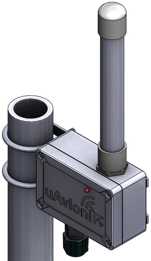
1 pingstation ICD Rev I UAV
2 1 Overview pingstation is an environmentally protected, networked dual-link ADS-B receiver. It can be configured for use in both internet connected and disconnected environments, and provides an extensible platform for collecting and processing surveillance data. A single Ethernet port provides data connectivity and power to the device using Power-over-Ethernet (PoE). The device contains a DHCP client, and accepts DHCP leases based on existing network policy. To determine the assigned device address please consult your network administrator. Surveillance data may be consumed using the methods detailed here. 2 Data Class Data is received by pingstation and undergoes processing. The received aircraft data is parsed and assembled, it may contain information derived from a number of packets. This information is JSON formatted, stateless and fully self-describing. 2.1 JSON Traffic object The pingstation delivers fields in the traffic table that are valid where field validity can be determined. This includes coordinates, altitude, heading, velocity, callsign, squawk, vertical velocity, and barometer difference. The JSON array of fields are dynamic. The JSON document consists of an array of aircraft containing the following fields: Field Name Data Type Description icaoaddress %02X%02X%02X ICAO of the aircraft trafficsource %d 0 = 1090ES 1 = UAT latdd %f Latitude expressed as decimal degrees londd %f Longitude expressed as decimal degrees altitudemm %ld Geometric altitude or barometric pressure altitude in millimeters headingde2 %d Course over ground in centi-degrees horvelocitycms %lu Horizontal velocity in centimeters/sec vervelocitycms %ld Vertical velocity in centimeters/sec with positive being up squawk %d Squawk code altitudetype %d Altitude Source UAV
3 0 = Pressure 1 = Geometric Callsign %c%c%c%c Callsign %c%c%c%c emittertype %d Category type of the emitter 0 = No aircraft type information 1 = Light (ICAO) < 15,500 lbs 2 = Small - 15,500 to 75,000 lbs 3 = Large - 75,000 to 300,000 lbs 4 = High Vortex Large (e.g., B757) 5 = Heavy (ICAO) - > 300,000 lbs 6 = Highly Maneuverable > 5G acceleration and high speed 7 = Rotorcraft 8 = (Unassigned) 9 = Glider/sailplane 10 = Lighter than air 11 = Parachutist/sky diver 12 = Ultralight/hang glider/paraglider 13 = (Unassigned) 14 = Unmanned aerial vehicle 15 = Space/trans-atmospheric vehicle 16 = (Unassigned) 17 = Surface vehicle-emergency vehicle 18 = Surface vehicle-service vehicle 19 = Point Obstacle (includes tethered balloons) 20 = Cluster Obstacle 21 = Line Obstacle = (Reserved) sequencenumber %d Auto incrementing packet sequence number pingstationguid %02x%02x%02x%02x Unique pingstation identifier %02x%02x%02x%02x utcsync %d UTC time flag timestamp %s Time packet was received at the pingstation ISO 8601 format: YYYY-MM-DDTHH:mm:ss:ffffffffZ UAV
4 A field called detail may be present containing the following data: Field Name Data Type Description Common Fields to 1090ES and UAT navintegrity %d Navigation integrity category (NIC) 0 = RC >=37.04 km (20 NM) Unknown Integrity 1 = RC < km (20 NM) RNP-10 containment radius 2 = RC < km (8 NM) RNP-4 containment radius 3 = RC < km (4 NM) RNP-2 containment radius 4 = RC < km (2 NM) RNP-1 containment radius 5 = RC < 1852 m (1 NM) RNP-0.5 containment radius 6 = RC < m (0.6 NM) RNP-0.3 containment radius 7 = RC < m (0.2 NM) RNP-0.1 containment radius 8 = RC < m (0.1 NM) RNP-0.05 containment radius 9 = RC < 75 m and VPL < 112 m e.g., SBAS, HPL, VPL 10 = RC < 25 m and VPL < 37.5 m e.g., SBAS, HPL, VPL 11 = RC < 7.5 m and VPL < 11 m e.g., GBAS, HPL, VPL 12 = (Reserved) (Reserved) 13 = (Reserved) (Reserved) 14 = (Reserved) (Reserved) 15 = (Reserved) (Reserved) navaccuracy %d Navigation accuracy category (NACv) 0 = Unknown or >= 10 m/s Unknown >= 50 feet (15.24 m) per second 1 = < 10 m/s < 50 feet (15.24 m) per second 2 = < 3 m/s < 15 feet (4.57 m) per second 3 = < 1 m/s < 5 feet (1.52 m) per second 4 = < 0.3 m/s < 1.5 feet (0.46 m) per second 5 = (Reserved) (Reserved) 6 = (Reserved) (Reserved) 7 = (Reserved) (Reserved) vervelocitysrc %d Vertical velocity source 0 = Pressure 1 = Geometric emergencystatus %d Emergency status 0 = No-Emergency 1 = General Emergency 2 = Lifeguard/Medical 3 = Min Fuel 4 = No Comm 5 = Unlawful Interference 6 = Downed Aircraft sysintegritylevel %d System Integrity Level (SIL) airgroundstate %d Airborne or ground 0 = Airborne subsonic condition 1 = Airborne supersonic condition 3 = On ground condition svheadingtype %d Track angle from heading 0 = Data Not Available 1 = True Track Angle UAV
5 2 = Magnetic Heading 3 = True Heading verticalveltype %d Vertical rate information 0 = Pressure 1 = Geometric navpostionaccuracy %d The reported State Vector has sufficient position accuracy for the intended use (NACp) 0 = EPU >= km (10 NM) 1 = EPU < km (10 NM) 2 = EPU < km (4 NM) 3 = EPU < km (2 NM) 4 = EPU < 1852 m (1NM) 5 = EPU < 926 m (0.5 NM) 6 = EPU < m (0.3 NM) 7 = EPU < m (0.1 NM) 8 = EPU < 92.6 m (0.05 NM) 9 = EPU < 30 m and VEPU < = EPU < 10 m and VEPU < = EPU < 3 m and VEPU < 4 m 12 = (Reserved) 13 = (Reserved) 14 = (Reserved) 15 = (Reserved) navvelocityaccuracy %d The least accurate velocity component being transmitted (NACv) 0 = Unknown or >= 10 m/s Unknown or >= 50 feet (15.24 m) per second 1 = < 10 m/s < 50 feet (15.24 m) per second 2 = < 3 m/s < 15 feet (4.57 m) per second 3 = < 1 m/s < 5 feet (1.52 m) per second 4 = < 0.3 m/s < 1.5 feet (0.46 m) per second 5 = (Reserved) (Reserved) 6 = (Reserved) (Reserved) 7 = (Reserved) (Reserved) navintegritybaro %d Barometer checked (NICbaro) 0 = Barometric Pressure Altitude has NOT been cross checked 1 = Barometric Pressure Altitude has been cross checked tcasacasoperating %d Aircraft is fitted with a TCAS (ACAS) computer and that computer is turned on and operating in a mode that can generate Resolution Advisory (RA) alerts tcasacasadvisory %d TCAS II or ACAS computer is currently issuing a Resolution Advisory identswactive %d Ident switch is activated atcservicesrecvd %d ATC pilot message mode setting 0 = Not receiving ATC messages 1 = Receiving ATC messages magheading %d True north or magnetic north 0 = True north 1 = Magnetic north utccoupledcondition %d Represents if the Ground Station is UTC-Coupled 0 = Ground Station is not UTC coupled 1 = Ground Station is UTC coupled 1090ES Specific Fields surveilstatus %d Surveillance status UAV
6 0 = No Condition 1 = permanent alert 2 = temp alert 3 = SPI baroaltdiffmm %ld Difference between the pressure altitude and the gnss altitude in mm UAT Specific Fields secondaryalttype %d Altitude source 0 = Pressure 1 = Geometric secondaryaltitudemm %ld Geometric altitude or barometric pressure altitude in millimeters tisbsiteid %d The tisbsiteid is unit-less and is from the a transmitted TISb UAT message signifies which uplink tower transmitted the TISb frame transmitmso &d the transmitmso is the 6bit field from the transmitted UAT message which should signify which MSO the message was transmitted in. MSO's can range from 0 to 3951 but only transmit the 6 LSB's of the actual MSO if transmitted. Received range is from addressqualifier %d Defines the type of target that delivered the data 0 = ADS-B target with ICAO 24-bit 1 = Reserved for National use 2 = TIS-B target with ICAO 24-bit address 3 = TIS-B target with track file identifier 4 = Surface Vehicle 5 = Fixed ADS-B Beacon 6 = (Reserved) 7 = (Reserved uatmopsversion %d 1 = DO-282A 2 = DO-282B callsignid %d 0 = Fightplan 1 = CallSign UAV
7 2.2 JSON Status object Periodic health and status JSON. Field Name Data Type Description pingstationguid %02x%02x%02x%02x Unique pingstation identifier %02x%02x%02x%02x pingstationversionmajor %d PINGSTATION_MAJOR_VERSION pingstationversionminor %d PINGSTATION_MINOR_VERSION pingstationversionbuild %d PINGSTATION_BUILD_VERSION timestamp %s Time packet was received at the pingstation ISO 8601 format pingstationlatdd %f Fixed station latitude expressed as decimal degrees pingstationlondd %f Fixed station longitude expressed as decimal degrees pingstationalttype %d 0 = Barometric Altitude 1 = GNSS Altitude pingstationaltmm %d Altitude in mm gpsstatus %d The communication and health status of the pingstation GPS 0 = GPS not present or functioning 1 = Not locked 2 = 2D fix 3 = 3D fix 4 = DGPS fix receiverstatus %d The communication and health status of the pingstation receiver 0 = functioning normally 1 = excessive communication errors 2 = device not transmitting UAV
8 3 Protocols 3.1 UDP The pingstation JSON data can be delivered as UDP to a specified host IP address and port number. The UDP destination and port number can be entered using the webpage interface at As aircraft data is received into the pingstation, it is timestamped and formatted before being pushed to the UDP listener as JSON. Each UDP datagram contains a single aircraft update. The aircraft JSON data will contain the optional detail object. Data will be continually streamed out to the UDP listener as aircraft updates arrive. Every 30 seconds a status object will be delivered. The data is dynamic in that only valid fields will be formatted and sent on to the UDP host. To disable UDP send functionality, enter an IP address of on the configuration webpage at REST The pingstation data can be accessed in a basic pull model using the REST protocol which will return the JSON formatted data. Data can be accessed by using the GET method to the pingstation URL (xxx.xxx.xxx.xxx). The pingstation base URL is: Example resource path are: No GET query strings are currently supported to limit returned data sets. UAV
9 3.3 AVR Mode-S Beast ASCII The pingstation supports the open standard AVR for Mode-S Beast ADS-B messages. This data will be delivered on a TCP connection. The pingstation will be listening for a TCP connection to be established on the port specified by the user. Aircraft update data will be delivered as AVR ASCII on the TCP connection as it is received into the pingstation. 4 JSON Example Sentences 4.1 Traffic Object { "aircraft": [ { "icaoaddress":"39c812", "trafficsource":0, "latdd": , "londd": , "altitudemm": , "headingde2":203, "horvelocitycms":23149, "vervelocitycms":0, "squawk":1362, "altitudetype":0, "callsign":"lea022h ", "emittertype":2, "pingstationguid":" b4f4c2e59", "utcsync":1, "timestamp":" t14:42:00.111z", "detail": { "navintegrity":8, "navaccuracy":2, "vervelocitysrc":1, "emergencystatus":0, "surveilstatus":0, "baroaltdiffmm":0, "sysintegritylevel":3, "airgroundstate":0, "svheadingtype":0, "verticalveltype":1, "navpostionaccuracy":10, "navvelocityaccuracy":2, "navintegritybaro":1, "tcasacasoperating":1, "tcasacasadvisory":0, "identswactive":0, "magheading":0, "utccoupledcondition":0 UAV
10 UAV , { "icaoaddress":"780a70", "trafficsource":0, "headingde2":289, "horvelocitycms":24127, "vervelocitycms":-32, "altitudetype":0, "emittertype":0, "pingstationguid":" b4f4c2e59", "utcsync":1, "timestamp":" t14:41:57.189z", "detail": { "navintegrity":0, "navaccuracy":2, "vervelocitysrc":0, "emergencystatus":0, "surveilstatus":0, "baroaltdiffmm":0, "sysintegritylevel":0, "airgroundstate":0, "svheadingtype":0, "verticalveltype":0, "navpostionaccuracy":0, "navvelocityaccuracy":2, "navintegritybaro":0, "tcasacasoperating":0, "tcasacasadvisory":0, "identswactive":0, "magheading":0, "utccoupledcondition":0 ] 4.2 Status Object { status : { "pingstationguid":" b4f4c2e59", "pingstationversionmajor":0, "pingstationversionminor":9, "pingstationversionbuild":4, "timestamp":" t14:42: z", "pingstationlatdd": , "pingstationlondd": , "gpsstatus":3, "receiverstatus":0
DRAFT Validation Report for the Technical Manual on the Universal Access Transceiver (UAT) Revision September 2004
 Revision September 2004") INTERNATIONAL CIVIL AVIATION ORGANIZATION DRAFT Validation Report for the Technical Manual on the Universal Access Transceiver (UAT) Revision 0.1 8 September 2004 Document # Prepared by: DD MM YYYY. Change
INTERNATIONAL CIVIL AVIATION ORGANIZATION DRAFT Validation Report for the Technical Manual on the Universal Access Transceiver (UAT) Revision 0.1 8 September 2004 Document # Prepared by: DD MM YYYY. Change
DRAFT Validation Report for the Technical Manual on the Universal Access Transceiver (UAT) Revision September 2004
 Revision September 2004") INTERNATIONAL CIVIL AVIATION ORGANIZATION DRAFT Validation Report for the Technical Manual on the Universal Access Transceiver (UAT) Revision 0.2 17 September 2004 Document # Prepared by: DD MM YYYY. Change
INTERNATIONAL CIVIL AVIATION ORGANIZATION DRAFT Validation Report for the Technical Manual on the Universal Access Transceiver (UAT) Revision 0.2 17 September 2004 Document # Prepared by: DD MM YYYY. Change
Report on the Validation of the Requirements in the Manual on the Universal Access Transceiver (UAT) Detailed Technical Specifications, Edition 1
 Detailed Technical Specifications, Edition 1") International Civil Aviation Organization 999 University Street Montreal, Quebec, Canada H3C 5H7 Report on the Validation of the Requirements in the Manual on the Universal Access Transceiver (UAT) Detailed
International Civil Aviation Organization 999 University Street Montreal, Quebec, Canada H3C 5H7 Report on the Validation of the Requirements in the Manual on the Universal Access Transceiver (UAT) Detailed
AERONAUTICAL COMMUNICATIONS PANEL (ACP) FIRST MEETING OF THE WORKING GROUP OF THE WHOLE
 FIRST MEETING OF THE WORKING GROUP OF THE WHOLE") International Civil Aviation Organization ACP-WGW01/WP08 21/06/05 WORKING PAPER AERONAUTICAL COMMUNICATIONS PANEL (ACP) FIRST MEETING OF THE WORKING GROUP OF THE WHOLE Montreal, Canada 21 29 June 2005
International Civil Aviation Organization ACP-WGW01/WP08 21/06/05 WORKING PAPER AERONAUTICAL COMMUNICATIONS PANEL (ACP) FIRST MEETING OF THE WORKING GROUP OF THE WHOLE Montreal, Canada 21 29 June 2005
ICAO Address City, Country, Code
 ICAO Address City, Country, Code UAT SWG09-WP04 Manual on detailed technical specifications for the Technical Manual on the Universal Access Transceiver (UAT) [Level 1] Revision 3.0xx 21 September 2004
U.S. Department of Transportation, Federal Aviation Administration Specification for Surveillance Data Exchange ASTERIX Part 12 Category 33
 U.S. Department of Transportation, Federal Aviation Administration Specification for Surveillance Data Exchange ASTERIX Part 12 Category 33 DOCUMENT IDENTIFIER : SPEC-0149-12, Edition 1.0 Edition Number
DATA DICTIONARY for "extflightdata.txt" http server responses Version 1.1 Date of issue: Februar 21, 2016
 DATA DICTIONARY for "etflightdata.tt" http server responses Version 1.1 Date of issue: Februar, 2016 Call conventions: http:///etflightdata.tt?&&,,,, MODE-S ICAO Anne 10
Advisory Circular. U.S. Department of Transportation Federal Aviation Administration
 U.S. Department of Transportation Federal Aviation Administration Advisory Circular Subject: Airworthiness Approval of Automatic Date: 11/07/12 AC No: 20-165A Dependent Surveillance - Broadcast (ADS-B)
DRAFT Validation Cross Reference Index. for the. UAT SARPS and Technical Manual V0.2
 DRAFT Cross Reference Index for the UAT SARPS and V0.2 Change Record Date/Version 31 March 2003, V0.1 27 May 2003, V0.2 Change Original draft presented at UAT Subgroup meeting in Montreal 31 March 4 April
An advisory circular may also include technical information that is relevant to the standards or requirements.
 Advisory Circular AC91-24 Automatic Dependent Surveillance Broadcast (ADS-B) Systems Revision 0 24 July 2018 General Civil Aviation Authority advisory circulars contain guidance and information about standards,
978 UAT (ADS-B out) INSTALLATION AND PILOT S GUIDE. Rev 1.0
 INSTALLATION AND PILOT S GUIDE. Rev 1.0") 978 UAT (ADS-B out) INSTALLATION AND PILOT S GUIDE Rev 1.0 2 Revision table Date Revision Comments Section July 22,2017 1.0 First Revision Nov 14, 2017 1.1 Adjustments by Ricardo L 8.2.4 Nov 27, 2017 1.2
978 UAT (ADS-B out) INSTALLATION AND PILOT S GUIDE Rev 1.0 2 Revision table Date Revision Comments Section July 22,2017 1.0 First Revision Nov 14, 2017 1.1 Adjustments by Ricardo L 8.2.4 Nov 27, 2017 1.2
COMPARISON OF SURVEILLANCE TECHNOLOGIES ICAO
 COMPARISON OF SURVEILLANCE TECHNOLOGIES By: M. Paydar ICAO ICAO Seminar on the Implementation of Aeronautical Surveillance and Automation Systems in the SAM Region (San Carlos de Bariloche, Argentina,
Technical Provisions for Mode S Services and Extended Squitter
 Doc 9871 AN/460 Technical Provisions for Mode S Services and Extended Squitter Notice to Users This document is an unedited advance version of an ICAO publication as approved, in principle, by the Secretary
Get Step by step directions on using your IFR6000 with ADS-B Integrity Software
 The most important thing we build is trust ADVANCED ELECTRONIC SOLUTIONS AVIATION SERVICES COMMUNICATIONS AND CONNECTIVITY MISSION SYSTEMS Get Step by step directions on using your IFR6000 with ADS-B Integrity
Study on Airworthiness Requirement for the Position Quality of ADS-B System
 Available online at www.sciencedirect.com Procedia Engineering 17 (2011 ) 415 421 The 2nd International Symposium on Aircraft Airworthiness (ISAA 2011) Study on Airworthiness Requirement for the Position
2. Radar receives and processes this request, and forwards it to Ground Datalink Processor (in our case named GRATIS)
") 1 Short Description The Traffic Information Service (TIS) provides information to the cockpit via data link that is similar to VFR radar traffic advisories normally received over voice radio. TIS is intended
1 Short Description The Traffic Information Service (TIS) provides information to the cockpit via data link that is similar to VFR radar traffic advisories normally received over voice radio. TIS is intended
AIR-TO-AIR SURVEILLANCE FOR FUTURE ATM SYSTEMS
 AIR-TO-AIR SURVEILLANCE FOR FUTURE ATM SYSTEMS Juan A. Besada, David Martin, Guillermo Frontera, Gonzalo de Miguel, Ana Bernardos GPDS-CEDITEC, Universidad Politecnica de Madrid, Madrid, Spain Abstract
GDL 90 UAT Data Link Sensor Technical Report
 Garmin AT, Inc. GDL 90 UAT Data Link Sensor Technical Report Document Revision: -- 16 January 2005 16-Jan-2005 Page 1 of 41 Rev Date Description -- 16-Jan-2005 Initial Release. MS Word 2002. Revision Log
Integration of surveillance in the ACC automation system
 Integration of surveillance in the ACC automation system ICAO Seminar on the Implementation of Aeronautical Surveillance and Automation Systems in the SAM Region San Carlos de Bariloche 6-8 Decembre 2010
10 Secondary Surveillance Radar
 10 Secondary Surveillance Radar As we have just noted, the primary radar element of the ATC Surveillance Radar System provides detection of suitable targets with good accuracy in bearing and range measurement
Final draft ETSI EN V1.3.1 ( )
") Final draft EN 302 842-3 V1.3.1 (2011-07) European Standard VHF air-ground and air-air Digital Link (VDL); Mode 4 radio equipment; Technical characteristics and methods of measurement for aeronautical
Final draft EN 302 842-3 V1.3.1 (2011-07) European Standard VHF air-ground and air-air Digital Link (VDL); Mode 4 radio equipment; Technical characteristics and methods of measurement for aeronautical
ETSI EN V1.4.1 ( )
") EUROPEAN STANDARD VHF air-ground Digital Link (VDL) Mode 4 radio equipment; Technical characteristics and methods of measurement for ground-based equipment; Part 3: Additional broadcast aspects 2 Reference
EUROPEAN STANDARD VHF air-ground Digital Link (VDL) Mode 4 radio equipment; Technical characteristics and methods of measurement for ground-based equipment; Part 3: Additional broadcast aspects 2 Reference
Final draft ETSI EN V1.3.1 ( )
") Final draft EN 301 842-3 V1.3.1 (2011-07) European Standard VHF air-ground Digital Link (VDL) Mode 4 radio equipment; Technical characteristics and methods of measurement for ground-based equipment; Part
Final draft EN 301 842-3 V1.3.1 (2011-07) European Standard VHF air-ground Digital Link (VDL) Mode 4 radio equipment; Technical characteristics and methods of measurement for ground-based equipment; Part
1090i. uavionix Ping1090i Transceiver QUICK START GUIDE
 1090i uavionix Ping1090i Transceiver QUICK START GUIDE Install 1 Install the uavionix Ping App from the Apple App Store or Google Play. Search for uavionix Ping Installer or use the QR codes below. Connect
TRX ADS-B Receiver Data Port Specification
 Page 1 of 16 Rev. 0.3 TRX-1090 - ADS-B Receiver Page 2 of 16 Rev. 0.3 Record of Revisions Date Revision Description of Change Inserted by 01 APR 2010 0.1 Initial draft JG 18 AUG 2010 0.2 new raw mode,
ADS-B and WFP Operators. Safety Advantages Security Concerns. Thomas Anthony Director U.S.C. Aviation Safety and Security Program ADS-B
 ADS-B and WFP Operators Safety Advantages Security Concerns Thomas Anthony Director U.S.C. Aviation Safety and Security Program ADS-B How can ADS-B be useful for Humanitarian Air Operation? Are there security
Automatic Dependent Surveillance. Requirements
 EUROPEAN ORGANISATION FOR THE SAFETY OF AIR NAVIGATION EUROCONTROL Automatic Dependent Surveillance Requirements SUR/ET3/ST06.3220/001 Edition : 0.65 Edition Date :31 January 200018 December 1999 Status
AV-15 PROFESSIONAL RAMP TESTER USERS MANUAL
 AV-15 PROFESSIONAL RAMP TESTER USERS MANUAL AV-15 With optional 40db RF pad Software Version 2.02 POWER The tester is supplied with (4) AA batteries uninstalled. The AV-15 can be powered by batteries or
Mode S Skills 101. OK, so you ve got four basic surveillance skills, you ve got the: ATCRBS Skills Mode S Skills TCAS Skills ADS-B skills
 Mode S Skills 101 OK, so you ve got four basic surveillance skills, you ve got the: ATCRBS Skills Mode S Skills TCAS Skills ADS-B skills Fisher Fisher Slide 1 853D ELECTRONIC SYSTEMS GROUP MODE S 101 Prepared
NMEA 2000 Parameter Group Numbers and Description as of August 2007 NMEA 2000 DB Ver
 Category General & or Mandatory ISO Acknowledgment This message is provided by ISO 11783 for a handshake mechanism between transmitting and receiving devices. This message is the possible response to acknowledge
11 Traffic-alert and Collision Avoidance System (TCAS)
") 11 Traffic-alert and Collision Avoidance System (TCAS) INSTRUMENTATION 11.1 Introduction In the early nineties the American FAA stated that civil aircraft flying in US airspace were equipped with a Traffic-alert
11 Traffic-alert and Collision Avoidance System (TCAS) INSTRUMENTATION 11.1 Introduction In the early nineties the American FAA stated that civil aircraft flying in US airspace were equipped with a Traffic-alert
2000 by UPS Aviation Technologies, Inc. All rights reserved. Printed in the U.S.A.
 No part of this document may be reproduced in any form or by any means without the express written consent of UPS Aviation Technologies, Inc. UPS Aviation Technologies, Inc., II Morrow, and Apollo are
The SBS-1 Multilateration Trials Webpages
 http://multilat.jetvision.de/ The SBS-1 Multilateration Trials Webpages 1. INTRODUCTION 2. DATA ACQUISITION 3. INERTIAL POSITION CONVERSION 4. A FIRST GLANCE ONTO TRIAL DATA 5. RECEIVER CLOCK SYNCHRONIZATION
Organización de Aviación Civil Internacional. Международная организация гражданской авиации. Ref.: AN 7/ /78 27 November 2015
 International Civil Aviation Organization Organisation de l aviation civile internationale Organización de Aviación Civil Internacional Международная организация гражданской авиации Tel.: +1 514-954-8219
NMEA2000- Par PGN. Mandatory Request, Command, or Acknowledge Group Function Receive/Transmit PGN's
 PGN Number Category Notes - Datum Local geodetic datum and datum offsets from a reference datum. T The Request / Command / Acknowledge Group type of 126208 - NMEA - Request function is defined by first
Air Traffic Management System requirements for ADS-B
 11 2012 Air Traffic Management System requirements for ADS-B by Roger Becker Presentation for ICAO SEA/BOB ADS-B WG/8 05.12.2012 ATM System Boundaries Modular Air Traffic Management System PRISMA External
SURVEILLANCE & ATM SYSTEMS :
 SURVEILLANCE & ATM SYSTEMS : The use of ADS-B data by ATM ICAO Surveillance Seminar for the NAM/CAR/SAM Port of Spain, Trinidad & Tobago 18th-20th June 2007 Introduction Surveillance is a key function
Potential co-operations between the TCAS and the ASAS
 Potential co-operations between the TCAS and the ASAS An Abeloos, Max Mulder, René van Paassen Delft University of Technology, Faculty of Aerospace Engineering, Kluyverweg 1, 2629 HS Delft, the Netherlands
Analysis of anomalies in ADS B and its GPS data
 GPS Solutions The Journal of Global Navigation Satellite Systems Springer Verlag Berlin Heidelberg 2015 10.1007/s10291 015 0453 5 Original Article Analysis of anomalies in ADS B and its GPS data (1) (2)
GTS Traffic Systems. Pilot s Guide
 GTS Traffic Systems Pilot s Guide 2014 Garmin Ltd. or its subsidiaries. All rights reserved. Garmin International, Inc., 1200 East 151st Street, Olathe, KS 66062, U.S.A. Tel: 913/397.8200 Fax: 913/397.8282
SkyEcho Installation and Pilot s Guide
 SkyEcho Installation and Pilot s Guide ECCN 7A994 Page 1 20 2017 uavionix Corporation. All rights reserved. uavionix Corporation 380 Portage Ave. Palo Alto, CA 94306 http://www.uavionix.com support@uavionix.com
: EUROCONTROL Specification. for Surveillance Data Exchange ASTERIX Part 12 Category 21 ADS-B Target Reports
 EUROCONTROL Specification for Surveillance Data Exchange ASTERIX Part 12 Category 21 ADS-B Target Reports NOTE: This edition is NOT backwards compatible to category 021 edition 2.1 or earlier DOCUMENT
GPS-Aided INS Datasheet Rev. 2.3
 GPS-Aided INS 1 The Inertial Labs Single and Dual Antenna GPS-Aided Inertial Navigation System INS is new generation of fully-integrated, combined L1 & L2 GPS, GLONASS, GALILEO and BEIDOU navigation and
GPS-Aided INS Datasheet Rev. 2.6
 GPS-Aided INS 1 GPS-Aided INS The Inertial Labs Single and Dual Antenna GPS-Aided Inertial Navigation System INS is new generation of fully-integrated, combined GPS, GLONASS, GALILEO and BEIDOU navigation
uavionix Ping2020 Transceiver
 uavionix Ping2020 Transceiver QUICK START GUIDE Install 1 Install the uavionix Ping App from the Apple App Store or Google Play. Search for uavionix Ping Installer or use the QR codes below. Connect the
Thales ADS-B Solutions an update
 www.thalesgroup.com ASECNA ADS-B workshop Dakar- 22-23 th July 2014 Thales ADS-B Solutions an update 2 / 18 Thales is by far the main supplier of ADS-B systems > 1646 3 / 18 Full range of ADS-B solutions
KMD 550/850. Traffic Avoidance Function (TCAS/TAS/TIS) Pilot s Guide Addendum. Multi-Function Display. For Software Version 01/13 or later
 Pilot s Guide Addendum. Multi-Function Display. For Software Version 01/13 or later") N B KMD 550/850 Multi-Function Display Traffic Avoidance Function (TCAS/TAS/TIS) Pilot s Guide Addendum For Software Version 01/13 or later Revision 3 Jun/2004 006-18238-0000 The information contained
N B KMD 550/850 Multi-Function Display Traffic Avoidance Function (TCAS/TAS/TIS) Pilot s Guide Addendum For Software Version 01/13 or later Revision 3 Jun/2004 006-18238-0000 The information contained
MANUFACTURER S DATA SECTION ROTORCRAFT FLIGHT MANUAL SUPPLEMENT
 MANUFACTURER S DATA SECTION OF ROTORCRAFT FLIGHT MANUAL SUPPLEMENT TO THE SIKORSKY S-76A ROTORCRAFT FLIGHT MANUAL Aircraft Serial Number: Aircraft Registration Number: This supplement must be attached
International Civil Aviation Organization
 Doc 9688 AN/952 Manual on Mode S Specific Services Approved by the Secretary General and published under his authority Second Edition 2004 International Civil Aviation Organization AMENDMENTS Amendments
ADS-B Introduction Greg Dunstone
 ADS-B Introduction Greg Dunstone Surveillance Program Lead, Airservices Australia SURVEILLANCE Basics Primary and Secondary radar Why do we need Surveillance? Why surveillance? Improved safety Reduced
Operating on the Radio Frequency of 1090 Megahertz (MHz)
") Deviation Request #107 for an ETSO approval for CS ETSO applicable to Extended Squitter Automatic Dependent Surveillance Broadcast (ADS B) and Traffic Information Service Broadcast (TIS B) Equipment Operating
Deviation Request #107 for an ETSO approval for CS ETSO applicable to Extended Squitter Automatic Dependent Surveillance Broadcast (ADS B) and Traffic Information Service Broadcast (TIS B) Equipment Operating
Exam questions: AE3-295-II
 Exam questions: AE3-295-II 1. NAVIGATION SYSTEMS (30 points) In this question we consider the DME radio beacon. [a] What does the acronym DME stand for? (3 points) DME stand for Distance Measuring Equipment
3333 value linearly interpolated and suspicious value linearly interpolated and implausible value corrected according to errata
 Table 1. Definition of the columns in the moving upper-air geometrical height level format ASCII files used for the ERA-CLIM data. Suffices.1/.2 added to flag values signify observation values obtained
HORIZONTAL ARAIM AVAILABILITY FOR CIVIL AVIATION OPERATIONS. ARAIM Outreach event
 HORIZONTAL ARAIM AVAILABILITY FOR CIVIL AVIATION OPERATIONS ARAIM Outreach event Moses1978 copyright April 7, 2017 H-ARAIM availability for civil aviation operations 07/04/2017 1 INTRODUCTION Space Segment
Generic Bathymetry Data - Interface Control Document
 Generic Bathymetry Data - Interface Control Document For WASSP Prepared by: Keith Fletcher Electronic Navigation Ltd October 15, 2013 Version 2.2 2013 by WASSP Ltd No part of this document should be reproduced
SBAS solution GCC, Yemen and Iraq System baseline and performance
 SBAS solution GCC, Yemen and Iraq System baseline and performance ACAC Workshop Rabat 7 & 8 November 2017 1 2017 Thales Alenia Space PROPRIETARY C O M MINFORMATION E R C I A L I N THALES C O ALENIA N F
Copyrighted Material - Taylor & Francis
 22 Traffic Alert and Collision Avoidance System II (TCAS II) Steve Henely Rockwell Collins 22. Introduction...22-22.2 Components...22-2 22.3 Surveillance...22-3 22. Protected Airspace...22-3 22. Collision
GPS-Aided INS Datasheet Rev. 3.0
 1 GPS-Aided INS The Inertial Labs Single and Dual Antenna GPS-Aided Inertial Navigation System INS is new generation of fully-integrated, combined GPS, GLONASS, GALILEO, QZSS, BEIDOU and L-Band navigation
GPS System Design and Control Modeling. Chua Shyan Jin, Ronald. Assoc. Prof Gerard Leng. Aeronautical Engineering Group, NUS
 GPS System Design and Control Modeling Chua Shyan Jin, Ronald Assoc. Prof Gerard Leng Aeronautical Engineering Group, NUS Abstract A GPS system for the autonomous navigation and surveillance of an airship
GPS-Aided INS Datasheet Rev. 2.7
 1 The Inertial Labs Single and Dual Antenna GPS-Aided Inertial Navigation System INS is new generation of fully-integrated, combined GPS, GLONASS, GALILEO, QZSS and BEIDOU navigation and highperformance
AIRPLANE FLIGHT MANUAL AQUILA AT01. Date of Issue A.01 Initial Issue (minor change MB-AT ) all March
 all March") 0.1 LIST OF REVISIONS AND AMENDMENTS Revision Reason for Amendment/Revision Affected Pages Date of Issue A.01 Initial Issue (minor change MB-AT01-00297) all 2009 19. March 0.2 LIST OF EFFECTIVE PAGES Page
0.1 LIST OF REVISIONS AND AMENDMENTS Revision Reason for Amendment/Revision Affected Pages Date of Issue A.01 Initial Issue (minor change MB-AT01-00297) all 2009 19. March 0.2 LIST OF EFFECTIVE PAGES Page
ADS-B SDR Workshop. David Karit Robinson TuskCon 2018
 ADS-B SDR Workshop David Karit Robinson TuskCon 2018 whoami David Robinson @nzkarit Penetration Tester at ZX Security in Wellington Enjoy SDR and physical (e.g. lock picking) Before we start If you want
Status update on the use of aircraftderived meteorological and aircraft data for real-time Wake/ATM/MET applications
 WakeNet-Europe 203 Bonneuil-sur-Marne, France May 5-6, 203 update on the use of aircraftderived meteorological and aircraft data for real-time Wake/ATM/MET applications Clark Lunsford & Dr. Edward Johnson
Comparison of Collision Avoidance Systems and Applicability to Rail Transport
 Comparison of Collision Avoidance Systems and Applicability to Rail Transport Cristina Rico García, Andreas Lehner, Thomas Strang and Matthias Röckl Institute of Communication and Navigation Page 1 Cristina
ADS-B BASED SENSE AND AVOID APPLICATIONS FOR GENERAL AVIATION/UNMANNED AIRCRAFT UNIVERSITÀ DEGLI STUDI DI NAPOLI FEDERICO II FACOLTÀ DI INGEGNERIA
 UNIVERSITÀ DEGLI STUDI DI NAPOLI FEDERICO II FACOLTÀ DI INGEGNERIA Dipartimento di Ingegneria Industriale DOTTORATO DI RICERCA IN INGEGNERIA AEROSPAZIALE NAVALE E DELLA QUALITÀ XXVII CICLO ADS-B BASED
Ron Turner Technical Lead for Surface Systems. Syracuse, NY. Sensis Air Traffic Systems - 1
 Multilateration Technology Overview Ron Turner Technical Lead for Surface Systems Sensis Corporation Syracuse, NY Sensis Air Traffic Systems - 1 Presentation Agenda Multilateration Overview Transponder
IMPLEMENTATION OF GNSS BASED SERVICES
 International Civil Aviation Organization IMPLEMENTATION OF GNSS BASED SERVICES Julio Siu Communications, Navigation and Surveillance Regional Officer ICAO NACC Regional Office ICAO Workshop on PBN Airspace
KGX 150/130 ADS -B Certified Transceivers & Receivers
 BendixKing By Honeywell 9201 -B San Mateo Blvd. NE Albuquerque, NM 87113 U.S.A. CAGE: 6PC31 Telephone: 1-505 -903-6148 Telephone: 1-855 -250-7027 (Toll Free in U.S.A.) Web site: http://www.bendixking.com
Aviation Benefits of GNSS Augmentation
 Aviation Benefits of GNSS Augmentation Workshop on the Applications of GNSS Chisinau, Moldova 17-21 May 2010 Jeffrey Auerbach Advisor on GNSS Affairs Office of Space and Advanced Technology U.S. Department
Automatic Dependent Surveillance -ADS-B
 ASECNA Workshop on ADS-B (Dakar, Senegal, 22 to 23 July 2014) Automatic Dependent Surveillance -ADS-B Presented by FX SALAMBANGA Regional Officer, CNS WACAF OUTLINE I Definition II Principles III Architecture
Reducing Test Flights Using Simulated Targets and a Carefully Chosen Set-up
 Reducing Test Flights Using Simulated Targets and a Carefully Chosen Set-up Edition: 001 Date: 18-FEB-09 Status: Released DOCUMENT DESCRIPTION Document Title Reducing Test Flights: Using Simulated Targets
400/500 Series GTS 8XX Interface. Pilot s Guide Addendum
 400/500 Series GTS 8XX Interface Pilot s Guide Addendum Copyright 2010 Garmin Ltd. or its subsidiaries. All rights reserved. This manual reflects the operation of Software version 5.03 or later for 4XX
IEFIS GPS manual Applicable to iefis G3 including Lite versions Firmware or later
 IEFIS GPS manual Applicable to iefis G3 including Lite versions Firmware 1.0.3.5 or later Page 1 Table of Contents General...3 GPS sources...3 Internal GPS...3 NMEA GPS...3 ARINC GPS...3 CAN based GPS...3
AT01 AIRPLANE FLIGHT MANUAL
 Table of Contents Supplement AVE12 1. Section 1 General AVE12 3 2. Section 2 Operating Limitations AVE12 3 3. Section 3 Emergency Procedures AVE12 3 4. Section 4 Normal Procedures AVE12 4 5. Section 5
2.017 DESIGN OF ELECTROMECHANICAL ROBOTIC SYSTEMS Fall 2009 Lab 3: GPS and Data Logging. September 28, 2009 Dr. Harrison H. Chin
 2.017 DESIGN OF ELECTROMECHANICAL ROBOTIC SYSTEMS Fall 2009 Lab 3: GPS and Data Logging September 28, 2009 Dr. Harrison H. Chin Formal Labs 1. Microcontrollers Introduction to microcontrollers Arduino
Differential GPS Positioning over Internet
 Abstract Differential GPS Positioning over Internet Y. GAO AND Z. LIU Department of Geomatics Engineering The University of Calgary 2500 University Drive N.W. Calgary, Alberta, Canada T2N 1N4 Email: gao@geomatics.ucalgary.ca
GA and NextGen How technologies like WAAS and ADS-B will change your flying! Presented By Claire Kultgen
 GA and NextGen How technologies like WAAS and ADS-B will change your flying! Presented By Claire Kultgen Overview 1. TIS 2. ADS-B FIS-B TIS-B ADS-R 3. WAAS 4. T-Routes and GPS MEAs Questions Chat Pilot
Pilot s Operating Handbook Supplement AS-21
 SECTION 9 Pilot s Operating Handbook Supplement Mode S Transponder GARMIN GTX 335 / GTX 345 This supplement is applicable and must be inserted into Section 9 of the POH when a GARMIN GTX 335 or GTX 345
ESSnet pilot AIS data. Anke Consten, Eleni Bisioti and Olav Grøndal (23 February 2017, Sofia)
") ESSnet pilot AIS data Anke Consten, Eleni Bisioti and Olav Grøndal (23 February 2017, Sofia) Overview 1. Introduction 2. Deliverables ESSnet pilot AIS data 3. Data access and handling 4. Quality of AIS
ESSnet pilot AIS data Anke Consten, Eleni Bisioti and Olav Grøndal (23 February 2017, Sofia) Overview 1. Introduction 2. Deliverables ESSnet pilot AIS data 3. Data access and handling 4. Quality of AIS
Guide to GNSS Base stations
 Guide to GNSS Base stations Outline Introduction Example of a base station (TUMSAT) Preparation for setting up a base station Procedure for setting up a base station Examples at two other universities
Regulations. Aeronautical Radio Service
 Regulations Aeronautical Radio Service Version 1.0 Issue Date: 30 December 2009 Copyright 2009 Telecommunications Regulatory Authority (TRA). All rights reserved. P O Box 26662, Abu Dhabi, United Arab
AIREON SPACE-BASED ADS-B
 AIREON SPACE-BASED ADS-B 2018 Transport Canada Delegates Conference Steve Bellingham Manager, Navigation Systems Engineering Steve.Bellingham@navcanada.ca CNS/ATM Systems Communication Navigation Surveillance
FOMA Location Information Functions Using SUPL International Roaming Location Positioning Function
 FOMA Location Information Functions Using SUPL International Roaming Location Positioning Function A-GPS SUPL International Roaming FOMA Location Information Functions Using SUPL International Roaming
FAA APPROVED AIRPLANE FLIGHT MANUAL SUPPLEMENT FOR. Trio Pro Pilot Autopilot
 Page 1 480 Ruddiman Drive TRIO AP Flight Manual Supplement North Muskegon, MI 49445 L-1006-01 Rev D FOR Trio Pro Pilot Autopilot ON Cessna 172, 175, 177, 180, 182, 185 and Piper PA28 Aircraft Document
SKYTRAQ. GPS Module MG-ST1315S. UUser s Manual Ver 1.01
 SKYTRAQ GPS Module MG-ST1315S UUser s Manual Ver 1.01 1. IntroductionT Overview Modulestek GPS module MG-ST1315S is a high sensitivity, low power consumption; compact size GPS module designed for a broad
ACAS Xu UAS Detect and Avoid Solution
 ACAS Xu UAS Detect and Avoid Solution Wes Olson 8 December, 2016 Sponsor: Neal Suchy, TCAS Program Manager, AJM-233 DISTRIBUTION STATEMENT A. Approved for public release: distribution unlimited. Legal
RECORD OF REVISIONS. Revisions to this Supplement are recorded in the following table.
 Supplement D42L AFM RECORD OF REVISIONS Revisions to this Supplement are recorded in the following table. New or amended text will be indicated by a bold black vertical line in the left hand margin of
UAT ADS-B Data Anomalies and Effect of Flight Parameters in Dropout
 1 2 3 4 5 6 7 Article UAT ADS-B Data Anomalies and Effect of Flight Parameters in Dropout Asma Tabassum 1, * and William Semke 2 1 University of North Dakota; asma.tabassum.ashraf@gmail.com 2 University
GPS with RAIM or EGNOS? The difference for (mountainous) helicopter operations. Marc Troller Skyguide / CNS expert group
 helicopter operations. Marc Troller Skyguide / CNS expert group") GPS with RAIM or EGNOS? The difference for (mountainous) helicopter operations Marc Troller Skyguide / CNS expert group 1 Motivation for Dedicated Helicopter Procedures Swiss GNSS LFN network: Mandate
GPS with RAIM or EGNOS? The difference for (mountainous) helicopter operations Marc Troller Skyguide / CNS expert group 1 Motivation for Dedicated Helicopter Procedures Swiss GNSS LFN network: Mandate
METIS Second Master Training & Seminar. Augmentation Systems Available in Egypt
 METIS Second Master Training & Seminar Augmentation Systems Available in Egypt By Eng. Ramadan Salem M. Sc. Surveying and Geodesy Email: ramadan_salem@link.net Page 1 Augmentation Systems Available in
Regional and Inter-Regional Seminar and Workshop on Search and Rescue
 Regional and Inter-Regional Seminar and Workshop on Search and Rescue Mahe, Seychelles 19-22 July 2016 1 Agenda Aireon Introduction Space-Based ADS-B Overview Aireon System Deployment Status Aireon ALERT
ICAO policy on GNSS, GNSS SARPs and global GNSS developments. Jim Nagle Chief, Communication, Navigation and Surveillance Section ICAO
 ICAO policy on GNSS, GNSS SARPs and global GNSS developments Jim Nagle Chief, Communication, Navigation and Surveillance Section ICAO Presentation overview Introduction GNSS developments in ICAO ICAO policy
EM-401. GPS ENGINE BOARD with Active Antenna PRODUCT GUIDE. Globalsat Technology Corporation (Taiwan)
") EM-401 GPS ENGINE BOARD with Active Antenna PRODUCT GUIDE Globalsat Technology Corporation (Taiwan) www.globalsat.com.tw USGlobalSat, Inc. (USA) www.usglobalsat.com Page 1 of 1 EM-401 GPS BOARD with Active
EM-401 GPS ENGINE BOARD with Active Antenna PRODUCT GUIDE Globalsat Technology Corporation (Taiwan) www.globalsat.com.tw USGlobalSat, Inc. (USA) www.usglobalsat.com Page 1 of 1 EM-401 GPS BOARD with Active
Programming with network Sockets Computer Science Department, University of Crete. Manolis Surligas October 16, 2017
 Programming with network Sockets Computer Science Department, University of Crete Manolis Surligas surligas@csd.uoc.gr October 16, 2017 Manolis Surligas (CSD, UoC) Programming with network Sockets October
QUICK START GUIDE flywithsentry.com
 QUICK START GUIDE flywithsentry.com LED INDICATORS ADS-B Receiving from multiple towers Receiving from one tower No reception Carbon Monoxide (CO) Monitor Normal Caution Danger* GPS Good fix Bad fix No
If we want to show all the subsystems in the platform, we got the following detailed block diagrams of the platform.
 Design and Development of a Networked Control System Platform for Unmanned Aerial Vehicles 1 Yücel Taş, 2 Aydın Yeşildirek, 3 Ahmet Sertbaş 1 Istanbul University, Computer Engineering Dept., Istanbul,
TCAS Functioning and Enhancements
 TCAS Functioning and Enhancements Sathyan Murugan SASTRA University Tirumalaisamudram, Thanjavur - 613 402. Tamil Nadu, India. Aniruth A.Oblah KLN College of Engineering Pottapalayam 630611, Sivagangai
Key Modules For Your Success SKYTRAQ. GPS Module MG-ST1315. UUser s Manual Ver 展得國際有限公司
 SKYTRAQ GPS Module MG-ST1315 UUser s Manual Ver 1.01 1. IntroductionT 1.1 Overview Modulestek GPS module MG-ST1315 is a high sensitivity, low power consumption; compact size GPS module designed for a broad
Applying Multisensor Information Fusion Technology to Develop an UAV Aircraft with Collision Avoidance Model
 1 Applying Multisensor Information Fusion Technology to Develop an UAV Aircraft with Collision Avoidance Model {Final Version with
AE4-393: Avionics Exam Solutions
 AE4-393: Avionics Exam Solutions 2008-01-30 1. AVIONICS GENERAL a) WAAS: Wide Area Augmentation System: an air navigation aid developed by the Federal Aviation Administration to augment the Global Positioning