FAA GNSS Programs & GPS Evolutionary Architecture Study (GEAS) Status
|
|
|
- Morgan Hudson
- 6 years ago
- Views:
Transcription
 Status Presented to: By: Date: Leo Eldredge, FAA")
1 FAA GNSS Programs & GPS Evolutionary Architecture Study (GEAS) Status Presented to: By: Date: Leo Eldredge, FAA
2 Agenda Wide Area Augmentation System (WAAS) Status Local Area Augmentation System (LAAS) Status GNSS Evolutionary Architecture Study (GEAS) Status 2
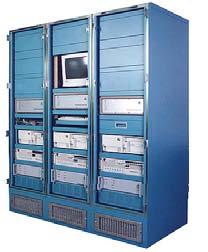
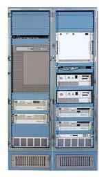
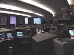
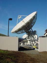
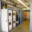
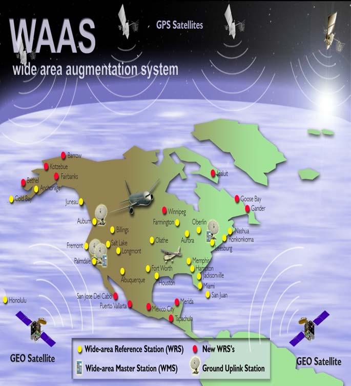
3 WAAS Architecture 38 Reference Stations 3 Master Stations 4 Ground Earth Stations 2 Geostationary Satellite Links 2 Operational Control Centers 3
4 WAAS LPV Performance GPS Standar d GPS Actual WAAS LPV-200 Standard WAAS LPV-200 Actual Horizontal 95% 36 m 2.74 m 16 m 1.08 m Vertical 95% 77 m *3.89 m 4 m 1.26 m * Use of GPS vertical not authorized for aviation without augmentation (SBAS or GBAS) WAAS Performance evaluated based on a total of 1,761 million samples (or 20,389 user days) 4
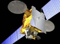
5 WAAS Enterprise Schedule FLP Segment (Phase II) FY Development Operational FOC LPV-200 Segment (Phase III) JRC Technical Refresh Operational Dual Frequency (Phase IV) JRC Technical Refresh Operational Inmarsat GEO #3 Intelsat GEO #4 PanAmSat GEO #5 TBD GEO #6 TBD Lease Extension 9/06 Launch 10/05 Launch 9/05 Operational Operational Launch 7/12 Launch 7/15 Operational Operational ~6,000 Approach Development WAAS Procedure Development
6 WAAS Phase II Status Expand LPV Service to all of CONUS and Significant Portions of Alaska, Canada, Mexico Install 13 Additional WAAS Reference Stations (WRS) 4 Alaska Complete 4 Canada Complete 5 Mexico - Complete Software Modifications - Underway Provide Redundant GEO Coverage Replace Both GEO Satellites - Complete Improve Service Reliability Add Third WAAS Master Stations (WMS) - Complete Software Improvements To Broadcast Corrections - Underway Approve LPV Service Down to 200 Feet Complete Safety Analysis to Approve WAAS Users For ILS Equivalent Service - Complete 6

 107W Operational July 2007 PanAmSat 133 W Telesat")
7 GEO Satellite Improvements Phase I IOC Inmarsat Satellites AOR-W 54W POR 178E AOR-W Moved to 142W Leases Expired July 2007 POR 178 E New AOR/W Position 142 W Original AOR/W Position 54 W Phase II New GEOs Panamsat (Galaxy XV) 133W Telesat Canada (Anik F1R) 107W Operational July 2007 PanAmSat 133 W Telesat 107 W 7

8 WAAS LPV Coverage - IOC

9 WAAS LPV Coverage - Current

10 WAAS RNP Coverage - Current
11 WAAS Program Phase III ( ) Full LPV-200 Performance Continue To Improve Service For LPV-200 Support Transition Of WAAS Maintenance And Development Capabilities To The FAA Planned WAAS Algorithm Updates For Phase III Acquisition Of Additional GEO Satellite Continued GIVE Algorithm Tuning to Maximize Availability During the Approaching Solar Maximum Conduct Planning and Engineering Analysis to Prepare for Dual Frequency Operations GPS Evolutionary Architecture Study (GEAS) 11
12 WAAS Program Phase IV ( ) Dual Frequency Operations Maintain a robust, reliable, and sustainable LPV-200 capability Support Single frequency WAAS users through end of Phase IV (2028) Implement WAAS Changes Needed for Dual Frequency (L1/L5) GPS Operations 12


13 WAAS Avionics Status Approximately 40% Of Est. 140,000 GA Aircraft Are Equipped With Garmin Receivers Total WAAS Equipped Users ~20,000 Rockwell-Collins: FAA Flight Inspection Challenger Aircraft Approval August 2007 Canadian Marconi: Contract To Integrate WAAS Sensor Into FAA Global 5000 Aircraft To Complete In 2008 Universal Avionics: Developing WAAS Enabled Capability In Dual Thread UNS-1 Flight Management System Approval Completed in October in 2007 Retro-Fit of FAA Citations Expected in

14 Instrument Approach Services GPS WAAS WAAS LAAS ½ 14
15 GPS/WAAS Approach Procedures LPVs 925 LNAV/VNAVs 1121 LNAVs 4225 LP procedure criteria under development for use at runways where obstacles prevent a vertically guided approach 15
 instrument approach procedure (As of: July 12,")
16 WAAS Approaches Today Each dot represents an airport with an LPV and/or LNAV/VNAV minima on an RNAV (GPS) instrument approach procedure (As of: July 12, 2007) 16
17 Procedure Production Goals Instrument Runways FY03 FY04 FY05 FY06 FY07 FY08 FY09 FY10 FY11 FY12 FY13 FY14 FY15 FY16 FY17 FY18 FLIGHT PLAN CUM GOAL NON-ILS RWY ENDS ILS RWY ENDS Total

18 Local Area Augmentation System (LAAS) Precision Approach For Category I, II & III Multiple Runway Coverage At An Airport Terminal Area Procedures for Arrival and Departure 18
19 LAAS Status Integrity Analysis and Prototype Development FAA GBAS prototype work under Honeywell Contract Hazardous Misleading Information (HMI) Analysis underway to validate GBAS architecture/design GBAS CAT I Approval Process System Design Approval for Honeywell architecture (SLS 4000) Planned to Complete by 2008 GBAS Avionics GBAS/LAAS Standards (MASPS / MOPS / TSO / SARPS) completed Boeing series GBAS equipped Airbus A320, A380 certification planned for 2007 CAT-III Research & Development Activities Continuing Work to Develop Requirements Compatible with Aircraft Operations and Approval Process International GBAS Cooperation International GBAS Working Group FAA Memorandum of Cooperation established with Australia, Brazil, Spain, Germany 19
20 GNSS Evolutionary Architecture Study (GEAS) Presented to: By: Date: Leo Eldredge, FAA GNSS Group October 30, 2007
21 GEAS Purpose Chartered By The FAA To Investigate Long Range Planning Considerations For WAAS Recognized That Meeting Aviation Integrity Requirements Is One Of The Most Challenging Aspects Facilitate Common Understanding Through Technical Interchange Between DoD and FAA Strategic Planning For: GPS Modernization User Equipment Standards Development WAAS Dual Frequency Upgrade 21
22 GEAS Objectives To Evaluate GNSS-Based Architectures To Provide Robust LPV-200 Service Worldwide Circa Corollary Objectives: Assess Capability Of Modernized GPS To Simplify Fault Detection And Provide An Alternate Broadcast Channel Technical Feasibility Of World Wide Autoland Interaction With National PNT Architecture Effort Coordinated By The DoD National Space Security Office (NSSO) And DoT Research & Innovative Technology (RITA) 22
23 GEAS Panel Deane Bunce (Co-Chair) FAA ATO-W Geoff Harris G-Wing/Aerospace Leo Eldredge FAA ATO-W Karl Shallberg GREI Deborah Lawrence Calvin Miles Kevin Bridges Hamza Abduselam Tom McHugh Bill Wanner David Schoonenberg Mike David Karen Van Dyke Navin Mathur FAA ATO-W FAA ATO-W FAA AVS FAA AVS FAA ATO-P FAA ATO-P NSSO NSSO RITA/Volpe GPS TAC Boris Pervan John Dobyne Karl Kovach Willie Bertiger Young Lee JP Fernow Frank Van Grass Juan Blanch Per Enge (Co-Chair) Todd Walter Pat Reddan IIT G-WIng/ARINC G-Wing/Aerospace JPL MITRE MITRE Ohio University Stanford University Stanford University Stanford University Zeta Associates 23
24 GEAS Architecture Options A Large Challenge In Providing Global Coverage is Meeting The 6 Second Time-toalarm (TTA) The GEAS Is Currently Investigating Three Architectures That Address This Problem GPS Integrity Channel (GIC) Relative RAIM (RRAIM) Absolute RAIM (ARAIM) 24
25 GNSS Integrity Channel (GIC) Avionics No RAIM/FDE Required WAAS Scenario Dual Frequency (L1/L5) Ionosphere Delay Estimation Worldwide Monitor Network Monitors External to the User Detect All SV Faults Requires Monitoring Network Capable of Continuous Monitoring of All GPS Satellites From At Least Two Locations Latency to Support Time to Alarm of 6 Seconds or Less Broadcast at High Data Rate Data Rate Comparable to Current WAAS Broadcast of 250 bps 25
26 Relative RAIM: Range Rate Residuals Avionics RRAIM Algorithms Check Residuals Between Carrier Phase Measurements and Estimated Change in Position Integrity/Correction Messages Provide Starting Point Dual Frequency (L1/L5) Ionosphere Delay Estimation Worldwide Monitor Network Provide Slow Integrity/Correction Messages Time to alarm of 60 to 600 seconds Broadcast at Slow Data Rate May Be Suitable For GPS Messages or eloran 26
27 Relative RAIM Concept Since the most recent monitored position propagate with carrier phase only Most recent monitored position with corresponding HPL and VPL ΔVPL ΔHPL Growth in HPL and VPL due to RAIM on the carrier phase-based delta position updates From Prof. van Graas, Ohio University 27
28 Absolute RAIM: Range Residuals Avionics Relies on Receiver Autonomous Integrity Monitoring as the Primary Integrity Solution Dual Frequency (L1/L5) Ionosphere Delay Estimation Worldwide Monitor Network Update error variance and mean for each SV Time to alarm of 10 minutes or more Broadcast at Low Data Rate Reliability Estimates (Prior Probability) for Each SV Used by the Avionics ARAIM Algorithms Potential to Broadcast Via GPS Message VHF Networks or eloran 28

29 Absolute RAIM Concept 29
30 GIC Preliminary Results Satellite Constellation URA / UDRE from monitor network (m) 24 minus worst case 1 SV minus worst case 1 SV minus worst case 1 SV / % 52.90% 38.00% 83.12% 76.55% 97.45% 0.7/ % 92.09% 71.65% 99.30% 95.63% 99.83% 0.35/ % 100% 100% 100% 100% 100% LPV-200 Coverage Estimates at 99.5% Availability for +/- 70 Degrees Latitude 30
31 RRAIM Preliminary Results Satellite constellation URA & UDRE from monitor network (m) 24 minus worst case 1 SV minus worst case 1 SV minus worst case 1 SV & % 70.41% 46.15% 86.55% 82.53% 97.88% 0.7 & % 98.55% 86.32% 100% 98.49% 100% 0.35 & % 98.55% 87.31% 100% 98.49% 100% LPV-200 Coverage Estimates at 99.5% Availability for +/- 70 Degrees Latitude 31
32 ARAIM Preliminary Results Satellite constellation URA from monitor network (m) 24 minus worst case 1 SV minus worst case 1 SV minus worst case 1 SV % 20.2% 12.5% 73.2% 70.5% 98.3% % 24.8% 19.3% 84.4% 79.2% 99.2% % 36.9% 25.6% 91.8% 87.0% 99.8% LPV-200 Coverage Estimates at 99.5% Availability for +/- 70 Degrees Latitude 32
33 GEAS Initial Results 30m Current GPS Commitment (21 out of 24 98%) URE NTE 30 meters Predicted URA (m) with 10-5 bound 1.0 WAAS (No RAIM) 0.7 RRAIM Slow GIC 0.35 Fast GIC (No RAIM) ARAIM Offline Monitoring 0.25 Max Bias = 1 meter #SV Constellation No Satellite Failures More (Multi-constellation) 33
34 Summary GEAS Panel Investigating Three Potential Architectures GIC RRAIM ARAIM Results Indicate Satellite Constellation Size and Quality Are Most Significant Contributors Reasonable Availability Can Be Expected From All Three Options With A 30 SV Constellation And URA Of Less Than 0.7 Meters of Less Initial Findings Will Be Documented In A Report By December
35 Questions 35
Recent Progress on Aviation Integrity
 Recent Progress on Aviation Integrity for the Institute of Navigation on September 17, 2008 by Per Enge, Stanford University Acknowledgement: This work was sponsored by the FAA Satellite Navigation Office
Wide Area Augmentation System (WAAS)
") Wide Area Augmentation System (WAAS) Ionospheric Effects Symposium By: Jason Burns Technology Evolution Lead Date: Agenda WAAS Overview Ionospheric Effects on WAAS Future Plans User Segment Update 2 WAAS
Wide Area Augmentation System (WAAS) Ionospheric Effects Symposium By: Jason Burns Technology Evolution Lead Date: Agenda WAAS Overview Ionospheric Effects on WAAS Future Plans User Segment Update 2 WAAS
Satellite-Based Augmentation System (SBAS) Integrity Services
 Integrity Services") Satellite-Based Augmentation System (SBAS) Integrity Services Presented To: Munich, Germany Date: March 8, 2010 By: Leo Eldredge, Manager GNSS Group, FAA FAA Satellite Navigation Program 2 Wide Area Augmentation
Satellite-Based Augmentation System (SBAS) Integrity Services Presented To: Munich, Germany Date: March 8, 2010 By: Leo Eldredge, Manager GNSS Group, FAA FAA Satellite Navigation Program 2 Wide Area Augmentation
Near Term Improvements to WAAS Availability
 Near Term Improvements to WAAS Availability Juan Blanch, Todd Walter, R. Eric Phelts, Per Enge Stanford University ABSTRACT Since 2003, when it was first declared operational, the Wide Area Augmentation
Aviation Benefits of GNSS Augmentation
 Aviation Benefits of GNSS Augmentation Workshop on the Applications of GNSS Chisinau, Moldova 17-21 May 2010 Jeffrey Auerbach Advisor on GNSS Affairs Office of Space and Advanced Technology U.S. Department
GPS/WAAS Program Update
 GPS/WAAS Program Update UN/Argentina Workshop on the Applications of GNSS 19-23 March 2018 Cordoba, Argentina GNSS: A Global Navigation Satellite System of Systems Global Constellations GPS (24+3) GLONASS
Horizontal Advanced RAIM: Operational Benefits and Future Challenges
 Horizontal Advanced RAIM: Operational Benefits and Future Challenges International Technical Symposium on Navigation and Timing 2015 Session Air Navigation November 2015 Toulouse/France 1 ICAO ABAS augmentation
Prototyping Advanced RAIM for Vertical Guidance
 Prototyping Advanced RAIM for Vertical Guidance Juan Blanch, Myung Jun Choi, Todd Walter, Per Enge. Stanford University Kazushi Suzuki. NEC Corporation Abstract In the next decade, the GNSS environment
HORIZONTAL ARAIM AVAILABILITY FOR CIVIL AVIATION OPERATIONS. ARAIM Outreach event
 HORIZONTAL ARAIM AVAILABILITY FOR CIVIL AVIATION OPERATIONS ARAIM Outreach event Moses1978 copyright April 7, 2017 H-ARAIM availability for civil aviation operations 07/04/2017 1 INTRODUCTION Space Segment
The Wide Area Augmentation System
 The Wide Area Augmentation System Stanford University http://waas.stanford.edu What is Augmentation? 2 Add to GNSS to Enhance Service Improve integrity via real time monitoring Improve availability and
Modernizing WAAS. Todd Walter and Per Enge, Stanford University, Patrick Reddan Zeta Associates Inc.
 Modernizing WAAS Todd Walter and Per Enge, Stanford University, Patrick Reddan Zeta Associates Inc. ABSTRACT The Wide Area Augmentation System (WAAS) became operational on July 10, 003. Currently this
Methodology and Case Studies of Signal-in-Space Error Calculation
 Methodology and Case Studies of Signal-in-Space Error Calculation Top-down Meets Bottom-up Grace Xingxin Gao *, Haochen Tang *, Juan Blanch *, Jiyun Lee +, Todd Walter * and Per Enge * * Stanford University,
The Wide Area Augmentation System (WAAS)
") The Wide Area Augmentation System (WAAS) Stanford University http://waas.stanford.edu !Aviation Metrics Outline!GPS/Aviation Timelines!The Wide-Area Augmentation System!Integrity Analyses!Comparison with
The Wide Area Augmentation System (WAAS) Stanford University http://waas.stanford.edu !Aviation Metrics Outline!GPS/Aviation Timelines!The Wide-Area Augmentation System!Integrity Analyses!Comparison with
ARAIM Fault Detection and Exclusion
 ARAIM Fault Detection and Exclusion Boris Pervan Illinois Institute of Technology Chicago, IL November 16, 2017 1 RAIM ARAIM Receiver Autonomous Integrity Monitoring (RAIM) uses redundant GNSS measurements
SBAS solution GCC, Yemen and Iraq System baseline and performance
 SBAS solution GCC, Yemen and Iraq System baseline and performance ACAC Workshop Rabat 7 & 8 November 2017 1 2017 Thales Alenia Space PROPRIETARY C O M MINFORMATION E R C I A L I N THALES C O ALENIA N F
On Location at Stanford University
 Thank you for inviting me to Calgary On Location at Stanford University by Per Enge (with the help of many) May 29, 2009 With Gratitude to the Federal Aviation Administration from Misra and Enge, 2006
Development of Satellite Navigation for Aviation (FAA Award No. 95-G-005) Technical Description of Project and Results Stanford University June 2009
 Technical Description of Project and Results Stanford University June 2009") 1.0 Introduction Development of Satellite Navigation for Aviation (FAA Award No. 95-G-005) Technical Description of Project and Results Stanford University June 2009 This report describes the key elements
1.0 Introduction Development of Satellite Navigation for Aviation (FAA Award No. 95-G-005) Technical Description of Project and Results Stanford University June 2009 This report describes the key elements
Introduction to Advanced RAIM. Juan Blanch, Stanford University July 26, 2016
 Introduction to Advanced RAIM Juan Blanch, Stanford University July 26, 2016 Satellite-based Augmentation Systems Credit: Todd Walter Receiver Autonomous Integrity Monitoring (556 m Horizontal Error Bound)
On Location at Stanford University
 Thank you for inviting me (back) to Deutsches Zentrum für Luft- und Raumfahrt On Location at Stanford University by Per Enge (with the help of many) July 27, 2009 My thanks to the Federal Aviation Administration
GA and NextGen How technologies like WAAS and ADS-B will change your flying! Presented By Claire Kultgen
 GA and NextGen How technologies like WAAS and ADS-B will change your flying! Presented By Claire Kultgen Overview 1. TIS 2. ADS-B FIS-B TIS-B ADS-R 3. WAAS 4. T-Routes and GPS MEAs Questions Chat Pilot
ELEVENTH AIR NAVIGATION CONFERENCE. Montreal, 22 September to 3 October 2003 TOOLS AND FUNCTIONS FOR GNSS RAIM/FDE AVAILABILITY DETERMINATION
 19/9/03 ELEVENTH AIR NAVIGATION CONFERENCE Montreal, 22 September to 3 October 2003 Agenda Item 6 : Aeronautical navigation issues TOOLS AND FUNCTIONS FOR GNSS RAIM/FDE AVAILABILITY DETERMINATION (Presented
IMPLEMENTATION OF GNSS BASED SERVICES
 International Civil Aviation Organization IMPLEMENTATION OF GNSS BASED SERVICES Julio Siu Communications, Navigation and Surveillance Regional Officer ICAO NACC Regional Office ICAO Workshop on PBN Airspace
Satellite Navigation Science and Technology for Africa. 23 March - 9 April, Air Navigation Applications (SBAS, GBAS, RAIM)
") 2025-25 Satellite Navigation Science and Technology for Africa 23 March - 9 April, 2009 Air Navigation Applications (SBAS, GBAS, RAIM) Walter Todd Stanford University Department of Applied Physics CA 94305-4090
2025-25 Satellite Navigation Science and Technology for Africa 23 March - 9 April, 2009 Air Navigation Applications (SBAS, GBAS, RAIM) Walter Todd Stanford University Department of Applied Physics CA 94305-4090
Analysis of a Three-Frequency GPS/WAAS Receiver to Land an Airplane
 Analysis of a Three-Frequency GPS/WAAS Receiver to Land an Airplane Shau-Shiun Jan Department of Aeronautics and Astronautics Stanford University, California 94305 BIOGRAPHY Shau-Shiun Jan is a Ph.D. candidate
What s up with WAAS?
 I N D U S T RY What s up with WAAS? There s a bright new star in the GPS constellation and pretty soon every bright pilot is going to want to use it. B Y D A L E S M I T H You probably didn t notice it
ARAIM: Utilization of Modernized GNSS for Aircraft-Based Navigation Integrity
 ARAIM: Utilization of Modernized GNSS for Aircraft-Based Navigation Integrity Alexandru (Ene) Spletter Deutsches Zentrum für Luft- und Raumfahrt (DLR), e.v. The author gratefully acknowledges the support
Radio Navigation Aids Flight Test Seminar
 Radio Navigation Aids Flight Test Seminar FLIGHT INSPECTION IN THE NEW MILLENNIUM Curt Keedy FAA Flight Inspection Policy and Standards Change, Challenge, and Opportunity CHANGES Global Positioning system
Development of a GAST-D ground subsystem prototype and its performance evaluation with a long term-data set
 Development of a GAST-D ground subsystem prototype and its performance evaluation with a long term-data set T. Yoshihara, S. Saito, A. Kezuka, K. Hoshinoo, S. Fukushima, and S. Saitoh Electronic Navigation
On Location at Stanford University
 Thank you for inviting me (back) to Southern California On Location at Stanford University by Per Enge (with the help of many) June 30, 2009 My thanks to the Federal Aviation Administration Outline Landing
Special Committee SC-159 Navigation Equipment Using the Global Navigation Satellite System (GNSS) (Version 13)
 (Version 13)") RTCA Paper No. 307-18/PMC-1839 December 13, 2018 TERMS OF REFERENCE Special Committee SC-159 Navigation Equipment Using the Global Navigation Satellite System (GNSS) (Version 13) REQUESTOR: Organization
RTCA Paper No. 307-18/PMC-1839 December 13, 2018 TERMS OF REFERENCE Special Committee SC-159 Navigation Equipment Using the Global Navigation Satellite System (GNSS) (Version 13) REQUESTOR: Organization
SATELLITE BASED AUGMENTATION SYSTEM (SBAS) FOR AUSTRALIA
 FOR AUSTRALIA") SATELLITE BASED AUGMENTATION SYSTEM (SBAS) FOR AUSTRALIA AN AIN POSITION PAPER SUBMITTED TO VARIOUS GOVERNMENT DEPARTMENTS BY MR KYM OSLEY AM, CSC, EXEC SECRETARY AIN What are GNSS Augmentation Systems?
SATELLITE BASED AUGMENTATION SYSTEM (SBAS) FOR AUSTRALIA AN AIN POSITION PAPER SUBMITTED TO VARIOUS GOVERNMENT DEPARTMENTS BY MR KYM OSLEY AM, CSC, EXEC SECRETARY AIN What are GNSS Augmentation Systems?
Ground Based Augmentation Systems (GBAS) Introduction
 Introduction") Ground Based Augmentation Systems (GBAS) Introduction Technical and Operational Overview Andreas Lipp GBAS Implementation Workshop, ICAO EUR/NAT Paris, 18 March 2010 The European Organisation for the Safety
Ground Based Augmentation Systems (GBAS) Introduction Technical and Operational Overview Andreas Lipp GBAS Implementation Workshop, ICAO EUR/NAT Paris, 18 March 2010 The European Organisation for the Safety
Special Committee SC-159 Navigation Equipment Using the Global Navigation Satellite System (GNSS) (Version 11)
 (Version 11)") RTCA Paper No. 094-18/PMC-1737 March 22, 2018 TERMS OF REFERENCE Special Committee SC-159 Navigation Equipment Using the Global Navigation Satellite System (GNSS) (Version 11) REQUESTOR: Organization Person
RTCA Paper No. 094-18/PMC-1737 March 22, 2018 TERMS OF REFERENCE Special Committee SC-159 Navigation Equipment Using the Global Navigation Satellite System (GNSS) (Version 11) REQUESTOR: Organization Person
INTERNATIONAL CIVIL AVIATION ORGANIZATION
 INTERNATIONAL CIVIL AVIATION ORGANIZATION AFI PLANNING AND IMPLEMENTATION REGIONAL GROUP EIGHTEENTH MEETING (APIRG/18) Kampala, Uganda (27 30 March 2012) Agenda Item 3: Performance Framework for Regional
Vertical Guidance Performance Analysis of the L1-L5 Dual-Frequency GPS/WAAS User Avionics Sensor
 Sensors 010, 10, 9-65; doi:10.3390/s1009 OPEN ACCESS sensors ISSN 144-80 www.mdpi.com/journal/sensors Article Vertical Guidance Performance Analysis of the L1-L5 Dual-Frequency GPS/WAAS User Avionics Sensor
Demonstrations of Multi-Constellation Advanced RAIM for Vertical Guidance using GPS and GLONASS Signals
 Demonstrations of Multi-Constellation Advanced RAIM for Vertical Guidance using GPS and GLONASS Signals Myungjun Choi, Juan Blanch, Stanford University Dennis Akos, University of Colorado Boulder Liang
Alternate Position, Navigation & Time APNT for Civil Aviation
 Alternate Position, Navigation & Time APNT for Civil Aviation For Working Group B of the International GNSS Committee Shanghai, May 2011 by Per Enge & Leo Eldredge Work supported by the Federal Aviation
GBAS FOR ATCO. June 2017
 GBAS FOR ATCO June 2017 Disclaimer This presentation is for information purposes only. It should not be relied on as the sole source of information, and should always be used in the context of other authoritative
GNSS: CNS Dependencies
 GNSS: CNS Dependencies Lendina Smaja DATM/RDS/NAV 10 March 2015 Agenda The Future Technical Environment GNSS GNSS Supporting CNS Loss of Signal Impact GNSS: CNS Dependencies 2 Original FANS CNS/ATM Concept
Status of ARAIM. S. Wallner ICG 6, Tokyo, Japan 05/09/2011. ESA UNCLASSIFIED For Official Use
 Status of ARAIM S. Wallner ICG 6, Tokyo, Japan 05/09/2011 ARAIM Concept Objectives Classical GPS RAIM for NPA used since years Evolving GNSS environment Multi-GNSS GPS/Galileo/Glonass/Compass/QZSS Dual-frequency
ICAO policy on GNSS, GNSS SARPs and global GNSS developments. Jim Nagle Chief, Communication, Navigation and Surveillance Section ICAO
 ICAO policy on GNSS, GNSS SARPs and global GNSS developments Jim Nagle Chief, Communication, Navigation and Surveillance Section ICAO Presentation overview Introduction GNSS developments in ICAO ICAO policy
Validation of Multiple Hypothesis RAIM Algorithm Using Dual-frequency GNSS Signals
 Validation of Multiple Hypothesis RAIM Algorithm Using Dual-frequency GNSS Signals Alexandru Ene, Juan Blanch, Todd Walter, J. David Powell Stanford University, Stanford CA, USA BIOGRAPHY Alexandru Ene
Methodology and Case Studies of Signal-in-Space Error Calculation Top-down Meets Bottom-up
 Methodology and Case Studies of Signal-in-Space Error Calculation Top-down Meets Bottom-up Grace Xingxin Gao*, Haochen Tang*, Juan Blanch*, Jiyun Lee+, Todd Walter* and Per Enge* * Stanford University,
Modern ARINC 743B DO-229D and DO-253C GLSSU Solutions For Retrofit
 Commercial Aviation Modern ARINC 743B DO-229D and DO-253C GLSSU Solutions For Retrofit Presented to AEEC March 2010 The Classic Retrofit Challenge Financial: Operating budget year financing ROI payback:
Matlab Simulation Toolset for SBAS Availability Analysis
 Matlab Simulation Toolset for SBAS Availability Analysis Shau-Shiun Jan, Wyant Chan, Todd Walter, Per Enge Department of Aeronautics and Astronautics Stanford University, California 94305 ABSTRACT This
Interoperability between EGNOS and WAAS: Tests Using ESTB and NSTB
 Interoperability between EGNOS and WAAS: Tests Using ESTB and NSTB Javier Ventura-Traveset, J.C. de Mateo (European Space Agency) Jorge Nieto, Ignacio García (GMV, S.A.) H. Delfour, J.M. Pieplu (ASPI)
ARAIM Integrity Support Message Parameter Validation by Online Ground Monitoring
 ARAIM Integrity Support Message Parameter Validation by Online Ground Monitoring Samer Khanafseh, Mathieu Joerger, Fang Cheng-Chan and Boris Pervan Illinois Institute of Technology, Chicago, IL ABSTRACT
Galileo & EGNOS Programmes Status
 Galileo & EGNOS Programmes Status Ugo Celestino, European Commission EURO-MEDITERRANEAN TRANSPORT FORUM GNSS WORKING GROUP 16 th October 2012 17 October, 2012 The European GNSS Programmes 2 Table of contents
GNSS-based Flight Inspection Systems
 GNSS-based Flight Inspection Systems Euiho Kim, Todd Walter, and J. David Powell Department of Aeronautics and Astronautics Stanford University Stanford, CA 94305, USA Abstract This paper presents novel
Lessons Learned During the Development of GNSS Integrity Monitoring and Verification Techniques for Aviation Users
 Lessons Learned During the Development of GNSS Integrity Monitoring and Verification Techniques for Aviation Users Sam Pullen Stanford University spullen@stanford.edu ITSNT Symposium 16 November 2016 Toulouse,
Seminar on the Ionosphere and its Effects on GNSS Systems (Project RLA/00/009 GNSS Augmentation Trials) (Santiago, Chile, April 2008) AGENDA
 (Santiago, Chile, April 2008) AGENDA") Monday, 14 April 2008 Seminar on the Ionosphere and its Effects on GNSS Systems (Project RLA/00/009 GNSS Augmentation Trials) (Santiago, Chile, 14-16 April 2008) AGENDA REGISTRATION OF PARTICIPANTS AND
Monday, 14 April 2008 Seminar on the Ionosphere and its Effects on GNSS Systems (Project RLA/00/009 GNSS Augmentation Trials) (Santiago, Chile, 14-16 April 2008) AGENDA REGISTRATION OF PARTICIPANTS AND
Satellite Selection for Multi-Constellation SBAS
 Satellite Selection for Multi-Constellation SBAS Todd Walter, Juan Blanch Stanford University Victoria Kropp University FAF Munich ABSTRACT The incorporation of multiple constellations into satellite based
GAGAN implementation and certification Programme. Presented by India
 GAGAN implementation and certification Programme Presented by India GPS Aided Geo Augmented Navigation International Civil Aviation Organization (ICAO) Member States Endorsed Global Satellite Navigation
Figure 2: Maximum Ionosphere-Induced Vertical Errors at Memphis
 277 Figure 2: Maximum Ionosphere-Induced Vertical Errors at Memphis 278 Figure 3: VPL Inflation Required to Remove Unsafe Geometries 279 280 Figure 4: Nominal IPP Scenario All Surrounding IGPs are Good
Introduction to PBN and RNP
 Introduction to PBN and RNP Rick Farnworth ATM/RDS/NAV SDM PBN workshop 19 th October 2017 Summary What is PBN? Some History The ICAO PBN Manual The Benefits of PBN Some Examples PBN Approaches PBN and
Overview of GNSS Navigation Sources, Augmentation Systems, and Applications
 Overview of GNSS Navigation Sources, Augmentation Systems, and Applications The Ionosphere and its Effects on GNSS Systems 14 to 16 April 2008 Santiago, Chile Dr. S. Vincent Massimini Global Navigation
Broadcasting Data from an SBAS Reference Network over Low Rate Broadcast Channels
 Broadcasting Data from an SBAS Reference Network over Low Rate Broadcast Channels Sherman C. Lo, Per Enge Department of Aeronautics and Astronautics, Stanford University BIOGRAPHY Sherman Lo is a Ph.D.
Alternative Positioning, Navigation & Timing (APNT) Study Update
 Study Update") Alternative Positioning, Navigation & Timing (APNT) Study Update Why APNT? The transformation of the National Airspace System (NAS) to the Next Generation Air Transportation System (NextGen) relies on
Alternative Positioning, Navigation & Timing (APNT) Study Update Why APNT? The transformation of the National Airspace System (NAS) to the Next Generation Air Transportation System (NextGen) relies on
Progress on Working Group-C Activities on Advanced RAIM
 Progress on Working Group-C Activities on Advanced RAIM Juan Blanch, Todd Walter, Per Enge. Stanford University Jason Burns, Ken Alexander Federal Aviation Administration Juan Pablo Boyero European Commission,
GPS/GNSS What is it? How Does it Work? What are its Applications?
 GPS/GNSS What is it? How Does it Work? What are its Applications? Historic Navigation Reference points in the sky used for navigation The Sun The Pole Star / North Star Southern Cross Gives Direction,
[EN A 78] Development of a CAT III GBAS (GAST D) ground subsystem prototype and its performance evaluation with a long term data set
![[EN A 78] Development of a CAT III GBAS (GAST D) ground subsystem prototype and its performance evaluation with a long term data set](/thumbs/96/128212036.jpg "[EN A 78] Development of a CAT III GBAS (GAST D) ground subsystem prototype and its performance evaluation with a long term data set") [EN A 78] Development of a CAT III GBAS (GAST D) ground subsystem prototype and its performance evaluation with a long term data set (EIWAC 2017) + T. Yoshihara*, S. Saito*, A. Kezuka*, K. Hoshinoo*, S.
[EN A 78] Development of a CAT III GBAS (GAST D) ground subsystem prototype and its performance evaluation with a long term data set (EIWAC 2017) + T. Yoshihara*, S. Saito*, A. Kezuka*, K. Hoshinoo*, S.
Final Project Report. Abstract. Document information
 Final Project Report Document information Project Title Multi-constellation GNSS Airborne Navigation Systems Project Number 09.27 Project Manager Thales Avionics Deliverable Name Final Project Report Deliverable
GNSS Spectrum Issues and New GPS L5
 Federal Aviation Administration Washington, D.C. GNSS Spectrum Issues and New GPS L5 International Civil Aviation Organization Regional Coordination Meeting Lima, Peru March 27 28, 2001 Basic GPS System!Space
SBAS DFMC performance analysis with the SBAS DFMC Service Volume software Prototype (DSVP)
") SBAS DFMC performance analysis with the SBAS DFMC Service Volume software Prototype (DSVP) D. Salos, M. Mabilleau, Egis Avia C. Rodriguez, H. Secretan, N. Suard, CNES (French Space Agency) Email: Daniel.salos@egis.fr
SBAS DFMC performance analysis with the SBAS DFMC Service Volume software Prototype (DSVP) D. Salos, M. Mabilleau, Egis Avia C. Rodriguez, H. Secretan, N. Suard, CNES (French Space Agency) Email: Daniel.salos@egis.fr
GNSS for Landing Systems and Carrier Smoothing Techniques Christoph Günther, Patrick Henkel
 GNSS for Landing Systems and Carrier Smoothing Techniques Christoph Günther, Patrick Henkel Institute of Communications and Navigation Page 1 Instrument Landing System workhorse for all CAT-I III approach
RESULTS OF THE REGIONAL SBAS TEST BED TYPE WAAS PROYECT RLA/00/009. Onofrio Smarrelli ICAO SAM CNS Lima Regional Office
 WORKSHOP / SEMINAR FOR THE IMPLEMENTATION OF NAVIGATION INFRASTRUCTURE TO SUPPORT PBN AND GNSS PRECISION APPROACH OPERATIONS IN THE NAM CAR SAM REGION (Lima, Peru 15 to 17 August 2016 ) RESULTS OF THE
The advent of multiple constellations. Satellite Selection for Aviation Users of. Multi-Constellation SBAS
 Satellite Selection for Aviation Users of Multi-Constellation SBAS The incorporation of multiple constellations into satellite-based augmentation systems may lead to cases where more satellites are in
Optimization of a Vertical Protection Level Equation for Dual Frequency SBAS
 Optimization of a Vertical Protection Level Equation for Dual Frequency SBAS Juan Blanch odd Walter Per Enge. Stanford University ABSRAC he advent of dual frequency Satellite Based Augmentation Systems
Fault Detection and Elimination for Galileo-GPS Vertical Guidance
 Fault Detection and Elimination for Galileo-GPS Vertical Guidance Alexandru Ene, Juan Blanch, J. David Powell, Stanford University BIOGRAPHY Alex Ene is a Ph.D. candidate in Aeronautical and Astronautical
Annex 10 Aeronautical Communications
 Attachment D 3.2.8.1 For Basic GNSS receivers, the receiver qualification standards require demonstration of user positioning accuracy in the presence of interference and a model of selective availability
The Use of Raw GPS for Vertical Navigation
 The Use of Raw GPS for Vertical Navigation J.D. Andrew Graham, P.Eng NAV CANADA Biography Andrew Graham is a project engineer with NAV CANADA s Satellite Navigation Program Office in Ottawa, Canada, where
REPORT OF COMMITTEE B TO THE CONFERENCE ON AGENDA ITEM 6
 1/10/03 ELEVENTH AIR NAVIGATION CONFERENCE Montreal, 22 September to 3 October 2003 REPORT OF COMMITTEE B TO THE CONFERENCE ON AGENDA ITEM 6 The attached report has been approved by Committee B for submission
CONCEPT OF OPERATIONS (CONOPS) FOR DUAL-FREQUENCY MULTI-CONSTELLATION (DFMC) GLOBAL NAVIGATION SATELLITE SYSTEM (GNSS)
 FOR DUAL-FREQUENCY MULTI-CONSTELLATION (DFMC) GLOBAL NAVIGATION SATELLITE SYSTEM (GNSS)") CONCEPT OF OPERATIONS (CONOPS) FOR DUAL-FREQUENCY MULTI-CONSTELLATION (DFMC) GLOBAL NAVIGATION SATELLITE SYSTEM (GNSS) Prepared by the ICAO Navigation Systems Panel CONOPS V6.4 Page 1 of 49 27 April 2018
CONCEPT OF OPERATIONS (CONOPS) FOR DUAL-FREQUENCY MULTI-CONSTELLATION (DFMC) GLOBAL NAVIGATION SATELLITE SYSTEM (GNSS) Prepared by the ICAO Navigation Systems Panel CONOPS V6.4 Page 1 of 49 27 April 2018
One Decade of WAAS Lessons - How Would We Have Done It Differently, If Given Another Chance
 One Decade of WAAS Lessons - How Would We Have Done It Differently, If Given Another Chance Tim Schempp, WAAS Technical Director Dr. Kenneth Kung, Sr. Principal Engineering Fellow November 18, 2011 The
Ionospheric Rates of Change
 Ionospheric Rates of Change Todd Walter and Juan Blanch Stanford University Lance de Groot and Laura Norman NovAtel Mathieu Joerger University of Arizona Abstract Predicting and bounding the ionospheric
FAA GBAS System Development. Seminar on the Ionosphere and its Effect on GNSS Systems. Carlos A. Rodriguez GBAS Program Manager
 FAA GBAS System Development for Seminar on the Ionosphere and its Effect on GNSS Systems Santiago, Chile April 14-16, 2008 Carlos A. Rodriguez GBAS Program Manager Outline LAAS Program Background Integrity
PBN Operational Approval Course
 PBN Operational Approval Course Introduction and Overview PBN Operations Approval Welcome Logistics Introductions PBN Overview 2 Instructor Bob Kennedy Attendees: 3 Course Objectives The objective of this
D. Salos, M. Mabilleau (Egis) C. Rodriguez, H. Secretan, N. Suard (CNES)
 C. Rodriguez, H. Secretan, N. Suard (CNES)") ITSNT 2017 - SBAS DFMC performance analysis with the SBAS DSVP 15/11/2017 1 ITSNT 2017 15/11/2017 Toulouse S B A S DUAL- F R E Q U E N C Y M U LT I - C O N S T E L L AT I O N ( D F M C ) A N A LY S I S
ITSNT 2017 - SBAS DFMC performance analysis with the SBAS DSVP 15/11/2017 1 ITSNT 2017 15/11/2017 Toulouse S B A S DUAL- F R E Q U E N C Y M U LT I - C O N S T E L L AT I O N ( D F M C ) A N A LY S I S
INTEGRITY AND CONTINUITY ANALYSIS FROM GPS JULY TO SEPTEMBER 2016 QUARTERLY REPORT
 INTEGRITY AND CONTINUITY ANALYSIS FROM GPS JULY TO SEPTEMBER 2016 QUARTERLY REPORT Name Responsibility Date Signature Prepared by M Pattinson (NSL) 07/10/16 Checked by L Banfield (NSL) 07/10/16 Authorised
Operational Benefits of Ground Based Augmentation Systems
 Operational Benefits of Ground Based Augmentation Systems Airline Perspective Ron Renk Manager, Flight Technologies/ 737 Pilot Flight Operations June 15, 2011 Today s Program What is GBAS? Why Continental
ICAO Global Provisions and Regional Developments related to GNSS
 ICAO Global Provisions and Regional Developments related to GNSS Mohamed Smaoui ICAO Deputy Regional Director, Middle East Office, Cairo, Egypt Rabat, Morocco, 7 8 November 2017 OUTLINE Introduction GNSS
RAIM Availability prediction
 RAIM Availability prediction Main content 一 Background & research purposes 二 Related research in China and abroad 三 Theory and arithmetic 四 RAIM systems development 五 The vision of the future 1 Background
GNSS Solutions: Do GNSS augmentation systems certified for aviation use,
 GNSS Solutions: WAAS Functions and Differential Biases GNSS Solutions is a regular column featuring questions and answers about technical aspects of GNSS. Readers are invited to send their questions to
The EU Satellite Navigation programmes status Applications for the CAP
 The EU Satellite Navigation programmes status Applications for the CAP Michaël MASTIER European Commission DG ENTR GP3 GNSS Applications, Security and International aspects GPS Workshop 2010 Montpellier
Introduc)on to GNSS Integrity & Space- Based Augmenta)on Systems
on to GNSS Integrity & Space- Based Augmenta)on Systems") Introduc)on to GNSS Integrity & Space- Based Augmenta)on Systems for GNSS Technologies Advances in a Mul)- constella)on Framework Sogei S.p.A., Roma by Per Enge April 22 & 23, 2013 History of GPS Service
Introduc)on to GNSS Integrity & Space- Based Augmenta)on Systems for GNSS Technologies Advances in a Mul)- constella)on Framework Sogei S.p.A., Roma by Per Enge April 22 & 23, 2013 History of GPS Service
Weighted RAIM for Precision Approach
 Weighted RAIM for Precision Approach Todd Walter and Per Enge Stanford University Abstract The use of differential GPS is becoming increasingly popular for real-time navigation systems. As these systems
AEEC 2013 Presentation to the Airlines and the Aviation Industry
 AEEC 2013 Presentation to the Airlines and the Aviation Industry Multi-Frequency/Multi-Constellation (MFMC) GNSS Receivers Value for Aviation and Airlines John Studenny CMC GPS Product Manager Alain Beaulieu
Ionospheric Corrections for GNSS
 Ionospheric Corrections for GNSS The Atmosphere and its Effect on GNSS Systems 14 to 16 April 2008 Santiago, Chile Ing. Roland Lejeune Overview Ionospheric delay corrections Core constellations GPS GALILEO
SDCM present status and future. GLONASS signals development.
 The Eighth Meeting of the International Committee on Global Navigation Satellite Systems, November 9 14, 2013, Dubai SDCM present status and future. GLONASS signals development. Prof. Grigory Stupak, Dr.
The experimental evaluation of the EGNOS safety-of-life services for railway signalling
 Computers in Railways XII 735 The experimental evaluation of the EGNOS safety-of-life services for railway signalling A. Filip, L. Bažant & H. Mocek Railway Infrastructure Administration, LIS, Pardubice,
Global Navigation Satellite System (GNSS) GPS Serves Over 400 Million Users Today. GPS is used throughout our society
 GPS Serves Over 400 Million Users Today. GPS is used throughout our society") Global avigation Satellite System (GSS) For freshmen at CKU AA December 10th, 2009 by Shau-Shiun Jan ICA & IAA, CKU Global avigation Satellite System (GSS) GSS (Global Positioning System, GPS) Basics Today
Global avigation Satellite System (GSS) For freshmen at CKU AA December 10th, 2009 by Shau-Shiun Jan ICA & IAA, CKU Global avigation Satellite System (GSS) GSS (Global Positioning System, GPS) Basics Today
Challenges and Methods for Integrity Assurance in Future GNSS
 Challenges and Methods for Integrity Assurance in Future GNSS Igor Mozharov Division Head, Information and Analytical Center for PNT, Central Research Institute for Machine Building, Roscosmos igor.mozharov@mcc.rsa.ru
IMPLEMENTATION OF AN SBAS-SACCSA TEST BED IN THE CAR/SAM REGIONS. (Presented by the Secretariat) SUMMARY
 SUMMARY") RLA/03/902 RCC/9 - WP/10 12/06/13 International Civil Aviation Organization South American Regional Office - Project RLA/03/902 Transition to GNSS/SBAS in the CAR/SAM Regions SACCSA Phase III Ninth Meeting
RLA/03/902 RCC/9 - WP/10 12/06/13 International Civil Aviation Organization South American Regional Office - Project RLA/03/902 Transition to GNSS/SBAS in the CAR/SAM Regions SACCSA Phase III Ninth Meeting
GPS Modernization and Program Update
 GPS Modernization and Program Update GPS Update to ION Southern California Chapter 22 Feb 2011 Colonel Bernie Gruber Director Global Positioning Systems Directorate Contents Current Constellation Modernization
Latest Evolution of RAIM Prediction Systems
 Latest Evolution of RAIM Prediction Systems SPACEKEYS is a project funded by the European Space Agency SPACEKEYS 2018. All rights reserved. Topics Rationale Requirements Objectives Results Achievements
Integrity of Satellite Navigation in the Arctic
 Integrity of Satellite Navigation in the Arctic TODD WALTER & TYLER REID STANFORD UNIVERSITY APRIL 2018 Satellite Based Augmentation Systems (SBAS) in 2018 2 SBAS Networks in 2021? 3 What is Meant by Integrity?
Extending the Reach of SBAS. Some Aspects of EGNOS Performance in Ukraine
 Extending the Reach of SBAS Some Aspects of EGNOS Performance in Ukraine Although the European Geostationary Navigation Overlay Service is primarily designed to provide benefits from a space-based augmentation
GPS with RAIM or EGNOS? The difference for (mountainous) helicopter operations. Marc Troller Skyguide / CNS expert group
 helicopter operations. Marc Troller Skyguide / CNS expert group") GPS with RAIM or EGNOS? The difference for (mountainous) helicopter operations Marc Troller Skyguide / CNS expert group 1 Motivation for Dedicated Helicopter Procedures Swiss GNSS LFN network: Mandate
GPS with RAIM or EGNOS? The difference for (mountainous) helicopter operations Marc Troller Skyguide / CNS expert group 1 Motivation for Dedicated Helicopter Procedures Swiss GNSS LFN network: Mandate
Advanced Receiver Autonomous Integrity Monitoring (ARAIM) Schemes with GNSS Time Offsets
 Schemes with GNSS Time Offsets") Advanced Receiver Autonomous Integrity Monitoring (ARAIM) Schemes with GNSS Time Offsets Abstract Yun Wu 1,2, Jinling Wang 2, Yiping Jiang 2 1 School of Geodesy and Geomatics, Wuhan University, P. R. China
Advanced Receiver Autonomous Integrity Monitoring (ARAIM) Schemes with GNSS Time Offsets Abstract Yun Wu 1,2, Jinling Wang 2, Yiping Jiang 2 1 School of Geodesy and Geomatics, Wuhan University, P. R. China
Distributed integrity monitoring of differential GPS corrections
 Distributed integrity monitoring of differential GPS corrections by Martin Pettersson Supervised by Fredrik Gustafsson Niclas Bergman Department of Automatic Control University of Linköpings Made for Luftfartsverket