NASA MOBLAS 4. Goddard Space Flight Center Greenbelt, MD
|
|
|
- Fay Harrell
- 6 years ago
- Views:
Transcription

1 Annual HPWREN Users Meeting NASA MOBLAS 4 Goddard Space Flight Center Greenbelt, MD November 19, 2008
2 Howard Donovan Engineering and Operations Manager Ron Sebeny MOBLAS 4 Acting Station Manager NASA Satellite Laser Ranging Program Goddard Space Flight Center Honeywell Technology Solutions Inc.
3 NASA SLR Network MOBLAS 4 MOBALS 5 MOBLAS 6 MOBLAS 7 MOBLAS 8 TLRS-3 TLRS-4 San Diego, California Yarragadee, Australia Hartebeesthoek, South Africa GSFC, Greenbelt, Maryland Tahiti, French Polynesia Arequipa, Peru Haleakala, Hawaii MLRS Fort Davis, Texas


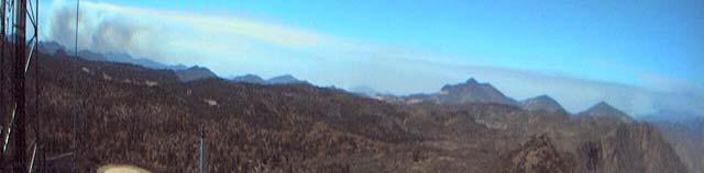


4 View from HPWREN Mt.. Laguna West
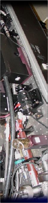
5 MOBile Laser RAnging System 4 MOBLAS 4, San Diego, CA.
6 MOBLAS 4 Nighttime Operations


7 Satellite Laser Ranging Measure Time of Flight (TOF) Time Interval Unit (TIU) High Precision Stop Watch Telescope 30 Schmidt-Cassigraine Short Pulse Laser 200 picoseconds or 0.2 X second
8 Satellite Laser Ranging Provides Precision Range Measurement ~5mm over a 6,000 km range (3,700 miles)
9 International Laser Ranging Service Provides global satellite and lunar laser ranging data and their related products to support geodetic and geophysical research activities as well as IERS products important to the maintenance of an accurate International Terrestrial Reference Frame (ITRF). The service develops the necessary global standards/specifications and encourages international adherence to its conventions.
10
11 SLR Science Contributions Tectonic Plate Motion Gravity Field Atmospheric Pressure Loading Earth Rotation International Terrestrial Reference Frame Atmospheric Refraction Model Altimeter Calibration Geocenter Determination and Monitoring Ocean Tides and Sea Level Monitoring Land and Ice Topography Solid Earth-Core/Mantle Interaction Post-Glacial Rebound Part of the International Network of Space Geodetic Observatories VLBI, GPS, DORIS and PRARE systems
12 NASA SLR Network Activities for 2008 MOBLAS 8 Tahiti, French Polynesia Return to Operations Offline for 18 months Engineering Site Visit 2 Engineers - 8 weeks total System Repair Saturable Absorber Laser Upgrade Controller Computer Upgrade UPS Replacement Oscilloscope Replacement MOBLAS 7 Greenbelt, Maryland (GSFC) Controller Computer Upgrade UPS Replacement
13 NASA SLR Network Activities for 2008 MOBLAS 6 Hartebeesthoek, South Africa 2 Engineers 8 weeks total System Repair and Upgrade High Sensitivity Laser Receiver Saturable Absorber Laser Upgrade Controller Computer Upgrade UPS Replacement Oscilloscope Upgrade
14 NASA SLR Network Activities for 2008 MOBLAS 5 Yarragadee, Australia Controller Computer Upgrade UPS Replacement Oscilloscope Upgrade MOBLAS 4 Monument Peak, California Saturable Absorber Laser Upgrade Controller Computer Upgrade UPS Replacement Oscilloscope Upgrade
15 NASA SLR Network Activities for 2008 TLRS 4 Haleakala, Hawaii UPS Replacement Oscilloscope Upgrade Controller Computer Upgrade In Progress Future Upgrade Saturable Absorber Laser Upgrade TLRS 3 Arequipa, Peru UPS Replacement Oscilloscope Upgrade Future Upgrades Controller Computer Upgrade Saturable Absorber Laser Upgrade
16 NASA SLR Network Activities for 2008 MLRS Fort Davis, Texas Future Upgrade Controller Computer Upgrade Saturable Absorber Laser Upgrade

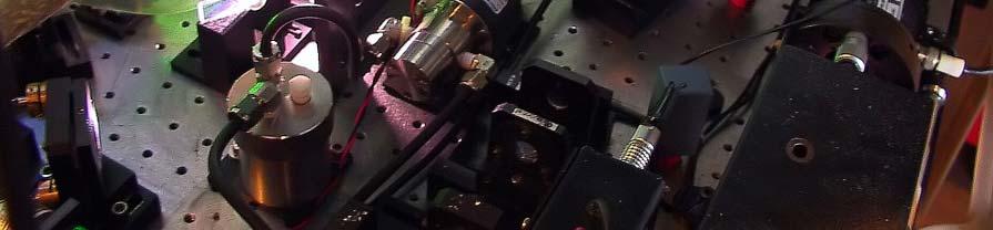
17 Saturable Absorber Upgrade - Before Flowing Dye Cell And Reservoir
18 Saturable Absorber Upgrade - After Saturable Absorber
19 Saturable Absorber Upgrade - After Saturable Absorber
20 Next Generation SLR

21 Lunar Reconnaissance Orbiter LRO LRO Mission Includes: LOLA - laser altimeter LROC - camera LAMP - Lyman alpha telescope LEND - neutron detector DIVINER - thermal radiometer CRATER - cosmic ray detector mini-rf - radar tech demo Greenbelt, MD
22 NGSLR LRO Preparation Status NGSLR Preparations Continue Completing Ground Calibration Upgrades Fine Tuning Point-Ahead Optical System Training Initial Operator 2 Additional Operators Hired Completing Training at MOBLAS 7 Will then Train at NGSLR Colocation with MOBLAS 7 MOBLAS Enhancement to Track LRO LRO Target Launch Date April 24, 2009
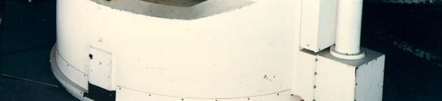
23 MOBLAS 4 Located in Mt. Laguna
24 NASA SLR Uses of the HPWREN Internet Access Hourly Data Transfer Satellite Prediction Transfer Critical Go/No-Go Operations Software Upgrades Remote Status Data Research ILRS Network Communications Emergency Electronic Mail Sustaining Engineering
25 HPWREN Valuable to NASA SLR Highly Reliable High Bandwidth Critical Safety Tool Provides Easy Internet Access to Our Remote Location Congrats and Thanx to HPWREN!
Satellite Laser Retroreflectors for GNSS Satellites: ILRS Standard
 Satellite Laser Retroreflectors for GNSS Satellites: ILRS Standard Michael Pearlman Director Central Bureau International Laser Ranging Service Harvard-Smithsonian Center for Astrophysics Cambridge MA
Co-location on Ground and in Space; GGOS Core Site
 Co-location on Ground and in Space; GGOS Core Site Michael Pearlman/CfA Harald Schuh/TUW Erricos Pavlis/UMBC Unified Analysis Workshop Zurich, Switzerland September 16 17, 2011 NRC Report Precise Geodetic
Other Space Geodetic Techniques. E. Calais Purdue University - EAS Department Civil 3273
 Other Space Geodetic Techniques E. Calais Purdue University - EAS Department Civil 3273 ecalais@purdue.edu Satellite Laser Ranging = SLR Measurement of distance (=range) between a ground station and a
Other Space Geodetic Techniques. E. Calais Purdue University - EAS Department Civil 3273
 Other Space Geodetic Techniques E. Calais Purdue University - EAS Department Civil 3273 ecalais@purdue.edu Satellite Laser Ranging Measurement of distance (=range) between a ground station and a satellite
Update on the International Terrestrial Reference Frame (ITRF)
") Update on the International Terrestrial Reference Frame (ITRF) Zuheir Altamimi Head of the IERS ITRF Product Center Institut National de l Information Géographique et Forestière IGN, France E-mail: zuheir.altamimi@ign.fr
Update on the International Terrestrial Reference Frame (ITRF) Zuheir Altamimi Head of the IERS ITRF Product Center Institut National de l Information Géographique et Forestière IGN, France E-mail: zuheir.altamimi@ign.fr
Geodetic Reference Frame Theory
 Technical Seminar Reference Frame in Practice, Geodetic Reference Frame Theory and the practical benefits of data sharing Geoffrey Blewitt University of Nevada, Reno, USA http://geodesy.unr.edu Sponsors:
IAG School on Reference Systems June 7 June 12, 2010 Aegean University, Department of Geography Mytilene, Lesvos Island, Greece SCHOOL PROGRAM
 IAG School on Reference Systems June 7 June 12, 2010 Aegean University, Department of Geography Mytilene, Lesvos Island, Greece SCHOOL PROGRAM Monday June 7 8:00-9:00 Registration 9:00-10:00 Opening Session
Coordinate time series comparison. Application to ITRF2005 height residuals time series. X. Collilieux, Zuheir Altamimi, David Coulot,
 Coordinate time series comparison. Application to ITRF2005 height residuals time series X. Collilieux, Zuheir Altamimi, David Coulot, Acknowledgement : J. Ray,T. Van Dam, P. Sillard, I. Panet 1 Outline:
Welcome Matjiesfontein Technical Workshop March 2009
 Welcome Matjiesfontein Technical Workshop 16-20 March 2009 Introduction to MOBLAS-6 Instrument Johan Bernhardt Overview MOBLAS-6: NASA Satellite Laser Ranging System in operation at HartRAO since September
NASDA S PRECISE ORBIT DETERMINATION SYSTEM
 NASDA S PRECISE ORBIT DETERMINATION SYSTEM Maki Maeda Takashi Uchimura, Akinobu Suzuki, Mikio Sawabe National Space Development Agency of Japan (NASDA) Sengen 2-1-1, Tsukuba, Ibaraki, 305-8505, JAPAN E-mail:
About compliance of GLONASS S/C retroreflectors system with the requirements of International Laser Ranging Service standard
 FEDERAL SPACE AGENCY FGUP «Science-Research Institute for Precise Instrument Engineering» About compliance of GLONASS S/C retroreflectors system with the requirements of International Laser Ranging Service
GPS for crustal deformation studies. May 7, 2009
 GPS for crustal deformation studies May 7, 2009 High precision GPS for Geodesy Use precise orbit products (e.g., IGS or JPL) Use specialized modeling software GAMIT/GLOBK GIPSY OASIS BERNESE These software
Atelier GRASP 23 octobre 2014 Salle de l Espace CNES/Paris
 Atelier GRASP 23 octobre 2014 Salle de l Espace CNES/Paris 10h00 - introduction au projet de mission GRASP (R. Biancale) 10h15 - contexte programmatique CNES (P. Ultré-Guérard) 10h30 -proposition d'instrumentation
Reference Systems: Definition and Realization Associated IAG Services IAG Reference Frame Sub-commission for Europe (EUREF)
") Reference Systems: Definition and Realization Associated IAG Services IAG Reference Frame Sub-commission for Europe (EUREF) Zuheir ALTAMIMI Laboratoire de Recherche en Géodésie Institut Géographique National
Reference Systems: Definition and Realization Associated IAG Services IAG Reference Frame Sub-commission for Europe (EUREF) Zuheir ALTAMIMI Laboratoire de Recherche en Géodésie Institut Géographique National
Passive Microwave Sensors LIDAR Remote Sensing Laser Altimetry. 28 April 2003
 Passive Microwave Sensors LIDAR Remote Sensing Laser Altimetry 28 April 2003 Outline Passive Microwave Radiometry Rayleigh-Jeans approximation Brightness temperature Emissivity and dielectric constant
CO-LOCATION: GUIDING PRINCIPLE OF THE DORIS DEPLOYMENT
 CO-LOCATION: GUIDING PRINCIPLE OF THE DORIS DEPLOYMENT IDS WORKSHOP 2016 Jérôme Saunier 1, Zuheir Altamimi 1, Xavier Collilieux 1, Bruno Garayt 1, Médéric Gravelle 2, Jean-Claude Poyard 1 1 IGN France
The Algorithm Theoretical Basis Document for the Atmospheric Delay Correction to GLAS Laser Altimeter Ranges
 NASA/TM 2012-208641 / Vol 8 ICESat (GLAS) Science Processing Software Document Series The Algorithm Theoretical Basis Document for the Atmospheric Delay Correction to GLAS Laser Altimeter Ranges Thomas
GPS Geodetic Reference System WGS 84
 GPS Geodetic Reference System WGS 84 International Committee on GNSS Working Group D Saint Petersburg, Russia 16 September 2009 Barbara Wiley National Geospatial-Intelligence Agency United States of America
Sub-system and System Level Testing and Calibration of Space Altimeters and LIDARS.
 Sub-system and System Level Testing and Calibration of Space Altimeters and LIDARS. Haris Riris, Pete Liiva, Xiaoli Sun, James Abshire Laser Remote Sensing Branch Goddard Space Flight Center, Greenbelt,
Saudi Space Geodesy (SSG): Road Map for Fundamental Station
: Road Map for Fundamental Station") 12 years Saudi Space Geodesy (SSG): Road Map for Fundamental Station Riyadh-SLR Saudi Arabia By: Attieh Alghamdi King Abdulaziz City for Science and Technology (KACST), Riyadh Saudi Arabia Presented in
12 years Saudi Space Geodesy (SSG): Road Map for Fundamental Station Riyadh-SLR Saudi Arabia By: Attieh Alghamdi King Abdulaziz City for Science and Technology (KACST), Riyadh Saudi Arabia Presented in
The Promise and Challenges of Accurate Low Latency GNSS for Environmental Monitoring and Response
 Technical Seminar Reference Frame in Practice, The Promise and Challenges of Accurate Low Latency GNSS for Environmental Monitoring and Response John LaBrecque Geohazards Focus Area Global Geodetic Observing
NGSLR's measurement of the retro-reflector array response of various LEO to GNSS satellites
 NGSLR's measurement of the retro-reflector array response of various LEO to GNSS satellites Jan McGarry Christopher Clarke, John Degnan, Howard Donovan, Benjamin Han, Julie Horvath, Thomas Zagwodzki NASA/GSFC
Current State and Future Developments of the IVS and Geodetic VLBI. H. Schuh, D. Behrend, A. Niell, B. Petrachenko, and R.
 Current State and Future Developments of the IVS and Geodetic VLBI H. Schuh, D. Behrend, A. Niell, B. Petrachenko, and R. Heinkelmann Bologna, 26-Sept-2008 Geodetic VLBI Unique technique for CRF Precession/Nutation
Remote Sensing: John Wilkin IMCS Building Room 211C ext 251. Active microwave systems (1) Satellite Altimetry
 Satellite Altimetry") Remote Sensing: John Wilkin wilkin@marine.rutgers.edu IMCS Building Room 211C 732-932-6555 ext 251 Active microwave systems (1) Satellite Altimetry Active microwave instruments Scatterometer (scattering
Remote Sensing: John Wilkin wilkin@marine.rutgers.edu IMCS Building Room 211C 732-932-6555 ext 251 Active microwave systems (1) Satellite Altimetry Active microwave instruments Scatterometer (scattering
Active microwave systems (1) Satellite Altimetry
 Satellite Altimetry") Remote Sensing: John Wilkin Active microwave systems (1) Satellite Altimetry jwilkin@rutgers.edu IMCS Building Room 214C 732-932-6555 ext 251 Active microwave instruments Scatterometer (scattering from
Remote Sensing: John Wilkin Active microwave systems (1) Satellite Altimetry jwilkin@rutgers.edu IMCS Building Room 214C 732-932-6555 ext 251 Active microwave instruments Scatterometer (scattering from
(The basics of) VLBI Basics. Pedro Elosegui MIT Haystack Observatory. With big thanks to many of you, here and out there
 VLBI Basics. Pedro Elosegui MIT Haystack Observatory. With big thanks to many of you, here and out there") (The basics of) VLBI Basics Pedro Elosegui MIT Haystack Observatory With big thanks to many of you, here and out there Some of the Points Will Cover Today Geodetic radio telescopes VLBI vs GPS concept
(The basics of) VLBI Basics Pedro Elosegui MIT Haystack Observatory With big thanks to many of you, here and out there Some of the Points Will Cover Today Geodetic radio telescopes VLBI vs GPS concept
DGFI reference frame solution as contribution to ITRF2008
 COST Action: ES0701, Vienna, Austria, November 16-17, 2010 WG2: Velocity determination / reference frame realization DGFI reference frame solution as contribution to ITRF2008 D. Angermann, M. Seitz, H.
Global IGS/GPS Contribution to ITRF
 Global IGS/GPS Contribution to ITRF R. Ferland Natural ResourcesCanada, Geodetic Survey Divin 46-61 Booth Street, Ottawa, Ontario, Canada. Tel: 1-613-99-42; Fax: 1-613-99-321. e-mail: ferland@geod.nrcan.gc.ca;
Remote sensing of the oceans Active sensing
 Remote sensing of the oceans Active sensing Gravity Sea level Ocean tides Low frequency motion Scatterometry SAR http://daac.gsfc.nasa.gov/campaign_docs/ocdst/what_is_ocean_color.html Shape of the earth
VLBI and DDOR activities at ESOC
 VLBI and DDOR activities at ESOC Claudia Flohrer 1, Mattia Mercolino 2, Erik Schönemann 1, Tim Springer 1, Joachim Feltens 1, René Zandbergen 1, Werner Enderle 1, Trevor Morley 3 1) Navigation Support
Geopotential Model Improvement Using POCM_4B Dynamic Ocean Topography Information: PGM2000A
 Geopotential Model Improvement Using POCM_4B Dynamic Ocean Topography Information: PGM2000A N. K. Pavlis, D. S. Chinn, and C. M. Cox Raytheon ITSS Corp. Greenbelt, Maryland, USA F. G. Lemoine Laboratory
MWR and DORIS Supporting Envisat s Radar Altimetry Mission
 MWR and DORIS Supporting Envisat s Radar Altimetry Mission mwr and doris J. Guijarro (MWR) Envisat Project Division, ESA Directorate of Application Programmes. ESTEC, Noordwijk, The Netherlands A. Auriol,
The realization of a 3D Reference System
 The realization of a 3D Reference System Standard techniques: topographic surveying and GNSS Observe angles and distances either between points on the Earth surface or to satellites and stars. Do not observe
A Permanent GPS Array in Crete & the Cal/Val facility for satellite radar altimeters in Gavdos
 A Permanent GPS Array in Crete & the Cal/Val facility for satellite radar altimeters in Gavdos S. P. Mertikas Technical University f Crete EUREF 2007 Symposium, 6-96 9 June 2007, London, England Laboratory
T2L2 and beyond next generation time transfer schemes
 T2L2 and beyond next generation time transfer schemes Etienne Samain Patrick Vrancken (patrick.vrancken@oca.eu) Optical Clocks Workshop for ESA Cosmic Vision, Uni Düsseldorf, March 9, 2007 Toulouse, 13
INTERDISCIPLINARY SCIENCE AND APPLICATIONS USING SATELLITE RADAR ALTIMETRY
 NASA NASA ESA ESA JAXA NAS A INTERDISCIPLINARY SCIENCE AND APPLICATIONS USING SATELLITE RADAR ALTIMETRY C.K. SHUM EE Wave Propagation and Remote Sensing Joel Johnson November 14, 2012 Measurement Coverage:
Multi-technique combination at observation level with NAPEOS
 Multi-technique combination at observation level with NAPEOS Michiel Otten, Claudia Flohrer, Tim Springer, Werner Enderle EGU General Assembly 2012 Vienna Austria 27/04/2012 Introduction Combination of
Solid Earth Timeline with a smattering of cryosphere technology
 Solid Earth Timeline with a smattering of cryosphere technology Muhammed Kabiru Hassan * Rebecca Boon Image from http://www.clipartheaven.com/show/clipart/technology_&_communication/satellites/satellite_23-gif.html
Space Situational Awareness 2015: GPS Applications in Space
 Space Situational Awareness 2015: GPS Applications in Space James J. Miller, Deputy Director Policy & Strategic Communications Division May 13, 2015 GPS Extends the Reach of NASA Networks to Enable New
Technology of Precise Orbit Determination
 Technology of Precise Orbit Determination V Seiji Katagiri V Yousuke Yamamoto (Manuscript received March 19, 2008) Since 1971, most domestic orbit determination systems have been developed by Fujitsu and
ILRS Report. Mike Pearlman Carey Noll NASA GSFC. GGOS Bureau for Networks and Observations Vienna, Austria April 20, 2016
 ILRS Report Mike Pearlman Carey Noll NASA GSFC GGOS Bureau for Networks and Observations Vienna, Austria April 20, 2016 ILRS Ground Segment (2015) New initiatives: Russia, NASA SGP, ISRO, Ny Alesund, Wettzell,
Monitoring the Earth Surface from space
 Monitoring the Earth Surface from space Picture of the surface from optical Imagery, i.e. obtained by telescopes or cameras operating in visual bandwith. Shape of the surface from radar imagery Surface
Exploration Systems Mission Directorate: New Opportunities in the President s FY2011 Budget
 National Aeronautics and Space Administration Exploration Systems Mission Directorate: New Opportunities in the President s FY2011 Budget Dr. Laurie Leshin Deputy Associate Administrator, ESMD Presentation
NETWORK 2006 REVIEW: EVOLUTION, MAINTENANCE AND COLOCATIONS
 NETWORK 2006 REVIEW: EVOLUTION, MAINTENANCE AND COLOCATIONS Hervé FAGARD (Institut Géographique National) 1 H. Fagard (IGN) Evolutions of the permanent network over six years Since the start of the renovation
GFZ Potsdam contributions to ELT
 Aces workshop, Zürich, Switzerland, 29th 30th June 2017. GFZ Potsdam contributions to ELT S. Bauer 1, L. Grunwaldt 1, E.D. Hoffman 2 1 GFZ Potsdam, Brandenburg, Germany. 2 NASA GSFC, Greenbelt, Maryland,
IGS Reference Frames: Status & Future Improvements
 IGS 2004 Workshop, 01 March 2004, Berne, Switzerland IGS Reference Frames: Status & Future Improvements Jim Ray, Bureau International des Poids et Mesures & National Geodetic Survey Danan Dong, Jet Propulsion
On the use of water color missions for lakes in 2021
 Lakes and Climate: The Role of Remote Sensing June 01-02, 2017 On the use of water color missions for lakes in 2021 Cédric G. Fichot Department of Earth and Environment 1 Overview 1. Past and still-ongoing
National Reference Systems of the RUSSIAN FEDERATION, used in GLONASS. including the user and fundamental segments
 National Reference Systems of the RUSSIAN FEDERATION, used in GLONASS. including the user and fundamental segments 8-th Meeting of the International Committee on Global Navigation Satellite Systems Dubai,
and Collaboration with Space Grants
 Goddard 2010 Internship Profile and Collaboration with Space Grants NASA/Goddard Space Flight Center Mid Atlantic Regional Space Grant Meeting Otb October 6, 2009 ABOUT GODDARD: NASA/Goddard was established
Developing An Optical Ground Station For The CHOMPTT CubeSat Mission. Tyler Ritz
 Developing An Optical Ground Station For The CHOMPTT CubeSat Mission Tyler Ritz tritz@ufl.edu Background and Motivation Application of precision time transfer to space Satellite navigation systems ( x
APPLICATIONS OF GPS. The Global Positioning System, while originally a military project, is considered a
 APPLICATIONS OF GPS Applications The Global Positioning System, while originally a military project, is considered a dual-use technology, meaning it has significant applications for both the military and
First Exam. Geographers Tools: Gathering Information. Photographs and Imagery. SPIN 2 Image of Downtown Atlanta, GA 1995 REMOTE SENSING 9/19/2016
 First Exam Geographers Tools: Gathering Information Prof. Anthony Grande Hunter College Geography Lecture design, content and presentation AFG 0616. Individual images and illustrations may be subject to
GNSS Reflectometry and Passive Radar at DLR
 ACES and FUTURE GNSS-Based EARTH OBSERVATION and NAVIGATION 26./27. May 2008, TU München Dr. Thomas Börner, Microwaves and Radar Institute, DLR Overview GNSS Reflectometry a joined proposal of DLR and
Satellite Servicing and The Spirit of Innovation
 Satellite Servicing and The Spirit of Innovation Presented to Goddard Contractors Association June 29, 2012 Frank Cepollina, Associate Director Satellite Servicing Capabilities Office Frank.J.Cepollina@nasa.gov
DORIS NETWORK STATUS REPORT
 DORIS NETWORK STATUS REPORT IDS Workshop, Ponta Delgada, Azores 24 September 2018 Jérôme Saunier, IGN - France IGN 1 THE NETWORK SERVING THE SPACE ALTIMETRY MISSIONS FOR MORE THAN 25 YEARS Overall performance
remote sensing? What are the remote sensing principles behind these Definition
 Introduction to remote sensing: Content (1/2) Definition: photogrammetry and remote sensing (PRS) Radiation sources: solar radiation (passive optical RS) earth emission (passive microwave or thermal infrared
AVHRR/3 Operational Calibration
 AVHRR/3 Operational Calibration Jörg Ackermann, Remote Sensing and Products Division 1 Workshop`Radiometric Calibration for European Missions, 30/31 Aug. 2017`,Frascati (EUM/RSP/VWG/17/936014) AVHRR/3
3/31/03. ESM 266: Introduction 1. Observations from space. Remote Sensing: The Major Source for Large-Scale Environmental Information
 Remote Sensing: The Major Source for Large-Scale Environmental Information Jeff Dozier Observations from space Sun-synchronous polar orbits Global coverage, fixed crossing, repeat sampling Typical altitude
2015 Nepal Earthquakes moved the DORIS station on Everest by a few centimeters
 2015 Nepal Earthquakes moved the DORIS station on Everest by a few centimeters Guilhem Moreaux (CLS) On 25 April, 2015, an earthquake with a magnitude of 7.8 on the Richter scale struck central Nepal approximately
First Exam: New Date. 7 Geographers Tools: Gathering Information. Photographs and Imagery REMOTE SENSING 2/23/2018. Friday, March 2, 2018.
 First Exam: New Date Friday, March 2, 2018. Combination of multiple choice questions and map interpretation. Bring a #2 pencil with eraser. Based on class lectures supplementing chapter 1. Review lecture
ULTRASTABLE OSCILLATORS FOR SPACE APPLICATIONS
 ULTRASTABLE OSCILLATORS FOR SPACE APPLICATIONS Peter Cash, Don Emmons, and Johan Welgemoed Symmetricom, Inc. Abstract The requirements for high-stability ovenized quartz oscillators have been increasing
Sea to Sky: The NASA Plankton, Aerosol, Cloud, ocean Ecosystem (PACE) mission
 mission") Sea to Sky: The NASA Plankton, Aerosol, Cloud, ocean Ecosystem (PACE) mission Jeremy Werdell PACE Project Scientist NASA Goddard Space Flight Center Robert H. Goddard Memorial Symposium 9 March 2017, Greenbelt,
Sea to Sky: The NASA Plankton, Aerosol, Cloud, ocean Ecosystem (PACE) mission Jeremy Werdell PACE Project Scientist NASA Goddard Space Flight Center Robert H. Goddard Memorial Symposium 9 March 2017, Greenbelt,
National report of Finland
 National report of Finland Matti Ollikainen, Jorma Jokela, Markku Poutanen, Ruizhi Chen and Jaakko Mäkinen, Finnish Geodetic Institute, P.O.Box 15, 02431 Masala, Finland EUREF Symposium 2006, June 14-17,
Global GPS-VLBI Hybrid Observation. Younghee Kwak
 Global GPS-VLBI Hybrid Observation Younghee Kwak Classical VLBI vs. Space Craft Tracking plane wave front stable sources curved wave front fast moving sources Plank(2013) 2/20 Space craft tracking by VieVS2tie
LE/ESSE Payload Design
 LE/ESSE4360 - Payload Design 3.2 Spacecraft Sensors Introduction to Sensors Earth, Moon, Mars, and Beyond Dr. Jinjun Shan, Professor of Space Engineering Department of Earth and Space Science and Engineering
First Exam: Thurs., Sept 28
 8 Geographers Tools: Gathering Information Prof. Anthony Grande Hunter College Geography Lecture design, content and presentation AFG 0917. Individual images and illustrations may be subject to prior copyright.
and Spectrum Protection
 Earth Remote Sensing and Spectrum Protection Steven C. Reising Microwave Systems Laboratory Colorado State University Steven.Reising@ColoState.edu Jff Jeffrey R. Piepmeieri NASA s Goddard Space Flight
Deep Space cubesats a nanosats at JPL. Tony Freeman Jet Propulsion Laboratory, California Institute of Technology
 Deep Space cubesats a nanosats at JPL Tony Freeman Jet Propulsion Laboratory, California Institute of Technology Cubesats and Nanosats at JPL Overview JPL is known for its flagship missions to explore
Strengths and weaknesses of the IGS contribution to the ITRF. Zuheir Altamimi, Xavier Collilieux, Laurent Metivier, Paul Rebischung IGN, France
 Strengths and weaknesses of the IGS contribution to the ITRF Zuheir Altamimi, Xavier Collilieux, Laurent Metivier, Paul Rebischung IGN, France 1 Outline Summary of GNSS strengths & weaknesses Extended
SSC space expertise on the ground
 SSC space expertise on the ground FMV Sensor Symposium Stockholm, September 2016 Björn Ohlson and Petrus Hyvönen Satellite Services for Surveillance & Reconnaissance Navigation Communication and Space
GPS and GNSS from the International Geosciences Perspective
 GPS and GNSS from the International Geosciences Perspective G. Beutler Astronomical Institute, University of Bern Member of IAG Executive Committee and of IGS Governing Board National Space-Based Positioning,
Remote Sensing: John Wilkin IMCS Building Room 211C ext 251. Active microwave systems (1) Satellite Altimetry
 Satellite Altimetry") Remote Sensing: John Wilkin wilkin@marine.rutgers.edu IMCS Building Room 211C 732-932-6555 ext 251 Active microwave systems (1) Satellite Altimetry Active microwave instruments Scatterometer (scattering
Remote Sensing: John Wilkin wilkin@marine.rutgers.edu IMCS Building Room 211C 732-932-6555 ext 251 Active microwave systems (1) Satellite Altimetry Active microwave instruments Scatterometer (scattering
The Global Imager (GLI)
") The Global Imager (GLI) Launch : Dec.14, 2002 Initial check out : to Apr.14, 2003 (~L+4) First image: Jan.25, 2003 Second image: Feb.6 and 7, 2003 Calibration and validation : to Dec.14, 2003(~L+4) for
The Global Imager (GLI) Launch : Dec.14, 2002 Initial check out : to Apr.14, 2003 (~L+4) First image: Jan.25, 2003 Second image: Feb.6 and 7, 2003 Calibration and validation : to Dec.14, 2003(~L+4) for
Korea s First Satellite for Satellite Laser Ranging
 1 Korea s First Satellite for Satellite Laser Ranging 1 Jun Ho Lee 1, S. B. Kim 1, K.H. Kim 1, S. H. Lee 1, Y. J. Im 1, Y. Fumin 2, C. Wanzhen 2 1 Korea Advanced Institute of Science and Technology, South
746A27 Remote Sensing and GIS
 746A27 Remote Sensing and GIS Lecture 1 Concepts of remote sensing and Basic principle of Photogrammetry Chandan Roy Guest Lecturer Department of Computer and Information Science Linköping University What
Science at NASA Goddard. Dr. Piers Sellers Science and Exploration Directorate
 Science at NASA Goddard Dr. Piers Sellers Science and Exploration Directorate Piers Sellers expurgated version Born, educated in the UK Scientist : 1982-1996 at GSFC Astronaut : 1996-2011 at JSC Bureaucrat
Industry Day of the Copernicus Sentinel-5 and Jason-CS Projects
 Industry Day of the Copernicus Sentinel-5 and Jason-CS Projects With the present announcement, the European Space Agency and Astrium GmbH Satellites (Germany) inform the EMITS Users (European Companies
Aquarius/SAC-D Mission Mission Simulators - Gary Lagerloef 6 th Science Meeting; Seattle, WA, USA July 2010
 Aquarius/SAC-D Mission Mission Simulators - Gary Lagerloef 6 th Science Meeting; Seattle, WA, USA Mission Design and Sampling Strategy Sun-synchronous exact repeat orbit 6pm ascending node Altitude 657
FLIGHT SUMMARY REPORT
 FLIGHT SUMMARY REPORT Flight Number: 97-011 Calendar/Julian Date: 23 October 1996 297 Sensor Package: Area(s) Covered: Wild-Heerbrugg RC-10 Airborne Visible and Infrared Imaging Spectrometer (AVIRIS) Southern
Ozobot Bit. Computer Science Engineering Program
 3 rd Grade Ozobot Bit Computer Science Engineering Program Post Visit Activity Resources 2018 Winter/Spring 2018 Dear Third Grade Visiting Classroom Teacher, It is hoped that you and your students enjoyed
Views on Interoperability
 Views on Interoperability International Committee on Global Navigation Satellite Systems Prague, November 10 th 14 th 2014 Navigation solutions powered by Europe INTRODUCTION The original purpose of the
Two Fundamental Properties of a Telescope
 Two Fundamental Properties of a Telescope 1. Angular Resolution smallest angle which can be seen = 1.22 / D 2. Light-Collecting Area The telescope is a photon bucket A = (D/2)2 D A Parts of the Human Eye
LASER GLONASS. Dr. Shargorodskiy Victor, dr. Kosenko Victor, dr. Chubykin Alexey, dr. Pasynkov Vladimir, dr. Sadovnikov Mikhail
 Dr. Shargorodskiy Victor, dr. Kosenko Victor, dr. Chubykin Alexey, dr. Pasynkov Vladimir, dr. Sadovnikov Mikhail Open Joint-stock Company «Research-and-Production Corporation «Precision Systems and Instruments»
TrigNet: The South African Network of Continuously Operating GNSS Base Stations
 TrigNet: The South African Network of Continuously Operating GNSS Base Stations R Wonnacott ESESA User Need Workshop Thread 2: Status of Current GNSS Applications in South Africa Somerset West 2 March
Current and Future Missions to the Moon
 Current and Future Missions to the Moon a compilation of artist renderings by: Andrew Hay Kaguya Sep 2007 - Sep 2008 Chang'e 1 Oct 2007 - Oct 2008 Chandrayaan-1 SMART-1 Sep 2003 - Sep 2006 Oct 2008 - Oct
Current Earth Orientation Parameters and Global combinations
 Current Earth Orientation Parameters and Global combinations D. Gambis C. Bizouard O. Becker, J.Y. Richard, T. Carlucci Earth Orientation Center of the IERS Observatoire de Paris +Colleagues of GRGS Main
The Geodetic Reference Antenna in Space (GRASP): A Mission to Enhance the Terrestrial Reference Frame
: A Mission to Enhance the Terrestrial Reference Frame") The Geodetic Reference Antenna in Space (GRASP): A Mission to Enhance the Terrestrial Reference Frame Yoaz Bar-Sever, R. Steven Nerem, and the GRASP Team The Most Complete Geodesy Mission Collocate all
The Geodetic Reference Antenna in Space (GRASP): A Mission to Enhance the Terrestrial Reference Frame Yoaz Bar-Sever, R. Steven Nerem, and the GRASP Team The Most Complete Geodesy Mission Collocate all
Overview of New Datums
 Overview of New Datums Scott Lokken NC Advisor NOAA s National Geodetic Survey 9/4/2015 1 New Datums are Coming in 2022! Both a new geometric and a new geopotential (vertical) datum will be released in
2. GPS Survey and Data Processing
 GEOPHYSICAL RESEARCH LETTERS, VOL. 32, L21S06, doi:10.1029/2005gl023423, 2005 2 Assessment of ICESat performance at the Salar de Uyuni, Bolivia 3 H. A. Fricker, 1 A. Borsa, 1 B. Minster, 1 C. Carabajal,
The CHOMPTT Precision Time Transfer CubeSat Mission
 The CHOMPTT Precision Time Transfer CubeSat Mission John W. Conklin*, Paul Serra, Nathan Barnwell, Seth Nydam, Maria Carrascilla, Leopoldo Caro, Norman Fitz-Coy *jwconklin@ufl.edu Background and Motivation
High Precision Realization and Applications of GPS OVERVIEW
 High Precision Realization and Applications of GPS Thomas Herring Professor of Geophysics, Massachusetts Institute of Technology, Cambridge, MA tah@mit.edu http://www-gpsg.mit.edu/~tah Feb 5, 2003 ION
A NEW WAY FOR REDUCING BIASES IN SLR TIMING. Michel Kasser and Olivier Bock, Ecole Supérieure des Géomètres et Topographes F Le Mans, France
 11 th International Workshop On Laser Ranging Instrumentation, 21-25 Sept. 1998, Deggendorf, Germany A NEW WAY FOR REDUCING BIASES IN SLR TIMING Michel Kasser and Olivier Bock, Ecole Supérieure des Géomètres
SATELLITE OCEANOGRAPHY
 SATELLITE OCEANOGRAPHY An Introduction for Oceanographers and Remote-sensing Scientists I. S. Robinson Lecturer in Physical Oceanography Department of Oceanography University of Southampton JOHN WILEY
What makes the positioning infrastructure work. Simon Kwok Chairman, Land Surveying Division Hong Kong Institute of Surveyors
 What makes the positioning infrastructure work The experience of the Hong Kong Satellite Positioning Reference Station Network Simon Kwok Chairman, Land Surveying Division Hong Kong Institute of Surveyors
KOMPSAT-2 Orbit Determination using GPS SIgnals
 Presented at GNSS 2004 The 2004 International Symposium on GNSS/GPS Sydney, Australia 6 8 December 2004 KOMPSAT-2 Orbit Determination using GPS SIgnals Dae-Won Chung KOMPSAT Systems Engineering and Integration
GPS Status and Modernization
 GPS Status and Modernization Nov 2011 Colonel Harold Martin PNT Command Lead AFSPC A3P "This briefing is for information only. No US Government commitment to sell, loan, lease, co-develop or co-produce
SCaN. Badri Younes Deputy Associate Administrator NASA Space Communications and Navigation October NASA Aeronautics and Space Administration
 NASA Aeronautics and Space Administration SCaN Badri Younes Deputy Associate Administrator NASA Space Communications and Navigation October 2017 www.nasa.gov NASA Official Use Only Enabling Human Space
Status of Free Space Optical Communications Technology at the Jet Propulsion Laboratory
 Status of Free Space Optical Communications Technology at the Jet Propulsion Laboratory National Aeronautics and Space Administration Jet Propulsion Laboratory California Institute of Technology Deep Space
AN EXPERIMENTAL STUDY OF LUNAR RECONNAISSANCE BASE FACILITATING EXPLORATION AND SETTLEMENT
 PRESENTATION ON AN EXPERIMENTAL STUDY OF LUNAR RECONNAISSANCE BASE WITH THE ROBOTIC EMPLACEMENTS DONE BY JAYASHREE SRIDHAR GRADE-12 [High School] CHENNAI INDIA FACILITATING EXPLORATION AND SETTLEMENT October
NanoRacks Customer Payloads on Orbital-ATK-9
 NanoRacks Customer Payloads on Orbital-ATK-9 NANORACKS CUBESAT DEPLOYER (INTERNATIONAL SPACE STATION) NASA ELaNa 23, CubeRRT Ohio State University, Columbus, Ohio 6U CubeRRT will be delivered by the Orbital