Ubiquitous Positioning: A Pipe Dream or Reality?
|
|
|
- Blanche Hines
- 5 years ago
- Views:
Transcription
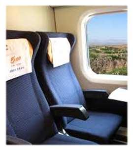
1 Ubiquitous Positioning: A Pipe Dream or Reality? Professor Terry Moore The University of What is Ubiquitous Positioning? Multi-, low-cost and robust positioning Based on single or multiple users Different types of platforms and s Autonomous or cooperative navigation Seamless transition Different s Different platforms Different algorithms When transitioning between different environments Plug-and-play concept Continuous positioning across all environments Open areas, partially obstructed, indoor 1
2 Ubiquitous Positioning The Challenges New technology More GNSS satellites More GNSS signals Communications WiFi / RFID UWB, Sparse Band Digital broadcasting Pseudolites, Locatalites Smaller, cheaper inertial s Digital mapping (outdoor & indoor) More processing power Drives new applications New applications Seamless indoor-outdoor personal navigation Intelligent Transport Systems Rail signalling & control Precision aircraft landing Ships in harbours Location-dependent billing Virtual security fences Tracking people/animals/assets Social inclusion Creates new challenges With thanks to Dr Paul Groves, UCL Ubiquitous Positioning GNSS Deadreckoning s Terrestrial radio navigation Ubiquitous Positioning Communications Featurematching s Mapping With thanks to Dr Paul Groves, UCL 2
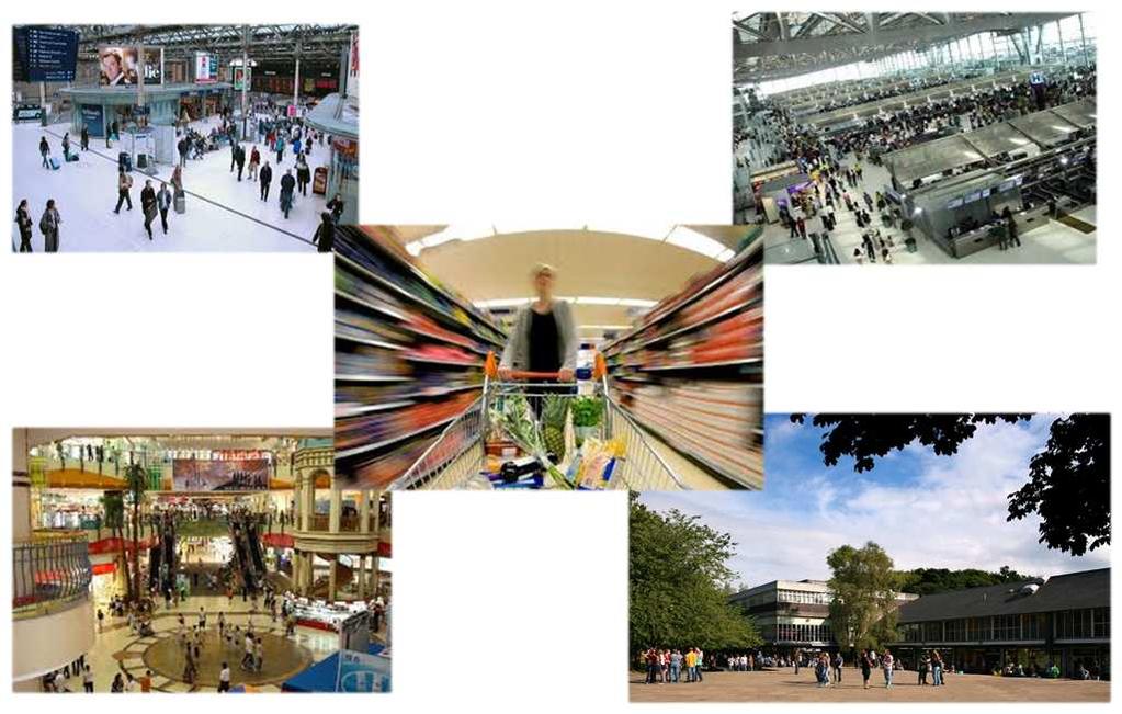


3 Application Scenarios Application Scenarios 3


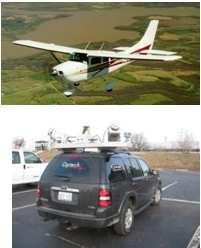
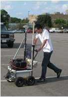
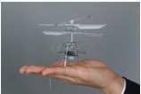
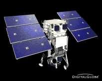
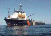


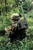
4 Transition Scenario Potential Platforms Space Air Fixed wing Helicopter UAV/UAS Land Indoor/outdoor Vehicle Autonomous Pedestrians Water Ship Autonomous Man-portable With thanks to Prof Dorota Grejner-Bzrezinska, OSU 4


 or mobile (eg")


5 Potential Technologies Space Air Fixed wing Helicopter UAV/UAS Land Indoor/outdoor Vehicle Autonomous Pedestrians Water Ship Autonomous Man-portable With thanks to Prof Dorota Grejner-Bzrezinska, OSU IMU Barometer/pressure s Navigation s Magnetometer/compass/inclinometer Odometer/step UWB/PL/WiFi/etc RF-based s Passive imaging s Active imaging s LiDAR, SAR, SONAR Infrastructure Dedicated Infrastructure RFID or proximity devices Ultra Wide Band Static (building) or mobile (eg fire-tenders) Airports, rail stations, shopping malls, universities Ad hoc Infrastructure WiFi access points Signals of opportunity Images, building information or plans No Infrastructure No existing infrastructure or destroyed Only using s carried by the user Autonomous or collaborative 5
6 Typical Smartphone Sensors GPS Microphone Wi-Fi Ambient light 3G/GPRS accelerometer Bluetooth Proximity gyro FM radio magnetometer Camera Current Positioning Methods GPS Microphone Wi-Fi Ambient light 3G/GPRS accelerometer Bluetooth Proximity gyro FM radio magnetometer Camera 6

7 Current Positioning Methods Cell-ID Wi-Fi GPS 200m Wi-Fi Fingerprinting GPS Microphone Wi-Fi Ambient light 3G/GPRS accelerometer Bluetooth Proximity gyro FM radio magnetometer Camera 7
 in view Signal strengths 1.")

8 Wi-Fi Fingerprinting Measure signal strengths to all Access Points in view Match measured signal strengths to database Requires database of: Location signal strengths to all Access Points (APs) in view Signal strengths 1. Position, ID1, SS1, ID2, SS2, ID3, SS3, Position, ID1, SS1, ID2, SS2, ID3, SS3, Position, ID1, SS1, ID2, SS2, ID3, SS3, Position, ID1, SS1, ID2, SS2, ID3, SS3, Position Signal Strength for one AP >-40dB -40 to -50dB -50 to -60dB -60 to -70dB -70 to -80dB < -80dB 8
9 Basic Wi-Fi fingerprinting Wi-Fi Fingerprinting Works better indoors where walls/ceilings/furniture will attenuate signals the most Accuracy comes from signal strength varying spatially Advanced algorithms Particle filtering How do we build databases? Skyhook use fleet of vehicles with GPS (tribe sourcing) Google use crowd sourcing But what about inside where GPS isn t working? Slow database generation using building plans Scalability? How do we keep the database up-to-date? 9
10 Inertial Navigation GPS Microphone Wi-Fi Ambient light 3G/GPRS accelerometer Bluetooth Proximity gyro FM radio magnetometer Camera 10

, Removing gravity and Double integrating")
 Better manufacturing")

11 Inertial Navigation 3 gyros and 3 accelerometers Orientation from integrating gyro output Displacement from: Rotate measurements to Earth frame (using gyros), Removing gravity and Double integrating accelerations MEMS are getting better Cheaper (higher volumes - Wii, smartphones) Better manufacturing Calibration Successful results usually from Good s Integration with GPS, magnetometers, zero velocity updates Step detection algorithms 11
12 Inertial Navigation Time (s) Horiz error (m) Computer Vision + Inertial Navigation GPS Microphone Wi-Fi Ambient light 3G/GPRS accelerometer Bluetooth Proximity gyro FM radio magnetometer Camera 12


13 Vision Aided Inertial Navigation Successive images used to compute direction camera is moving Used to correct IMU drift Vision Aided Inertial Navigation Examples... Blue (inlier correspondences) Red (outlier correspondences) 13


14 Integration Strategy INS corrections Position, Velocity, Attitude Rotation, Acceleration IMU INS Ranges, Ephemeris Image Position, Velocity PVT computation GPS Camera Kalman filter Computer Vision Translation Vision Aided Experiment GPS Power 14
15 15
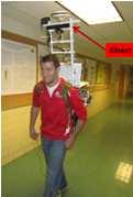
16 Position Accuracy Time (s) Horiz error (m) GPS+IMU+Vision Advantages Good position accuracy Makes use of s already on smartphones Handheld Works with or without GPS Disadvantages Needs to be initialised e.g. with GPS Problems in low light conditions Computationally expensive 16


17 Foot Mounted INS High accuracy indoor positioning system Foot mounted Inertial Measurement Unit (IMU) Zero velocity update, every step IMU <$2000 Requires initialisation on known point Novel heading algorithm used to correct heading errors Shown to consistently maintain <5m accuracy over 40 minutes Foot Mounted INS 17

18 Ubiquitous Positioning FIG & IAG Working Groups Joint between FIG WG 5.5 & IAG WG Performance characterization of positioning s and technologies for ubiquitous positioning systems Theoretical and practical evaluation of current algorithms for measurement integration Development of new measurement integration algorithms Joint Field Experiments The Ohio State University, September 2010 The University of, May Ubiquitous Positioning FIG & IAG Field Trials 18

19 Navigation Philosophy Positioning Sensor Fusion Clear synergy between GNSS and INS Focus has been on fixing GNSS to provide continuity Tailored blend of s for particular scenarios A Changed Navigation Philosophy Consider INS as the primary navigational Focus has to be on bounding the growth of INS error Flexible and adaptive blend with other s Plug and Play Research Challenges Flexible software architecture Adaptive filtering / fusion of the data Stochastic transition between different hybridisations Contact Details Professor Terry Moore Director of the NGI Building The University of Triumph Road NG7 2TU Telephone: Fax: Web: +44 (0) (0) terry.moore@nottingham.ac.uk 19
Integrated Positioning The Challenges New technology More GNSS satellites New applications Seamless indoor-outdoor More GNSS signals personal navigati
 Integrated Indoor Positioning and Navigation Professor Terry Moore Professor of Satellite Navigation Nottingham Geospatial Institute The University of Nottingham Integrated Positioning The Challenges New
The future of GNSS integrated systems
 The future of GNSS integrated systems Dorota A. Grejner-Brzezinska, Professor and Chair Department of Civil, Environmental and Geodetic Engineering President, International Association of Geodesy (IAG)
Multi-sensor Navigation Systems: Concepts, Evolution, Trends and Applications
 Multi-sensor Navigation Systems: Concepts, Evolution, Trends and Applications Dorota A. Grejner-Brzezinska Lowber B. Strange Endowed Professor and Chair Department of Civil, Environmental and Geodetic
Hardware-free Indoor Navigation for Smartphones
 Hardware-free Indoor Navigation for Smartphones 1 Navigation product line 1996-2015 1996 1998 RTK OTF solution with accuracy 1 cm 8-channel software GPS receiver 2004 2007 Program prototype of Super-sensitive
Agenda Motivation Systems and Sensors Algorithms Implementation Conclusion & Outlook
 Overview of Current Indoor Navigation Techniques and Implementation Studies FIG ww 2011 - Marrakech and Christian Lukianto HafenCity University Hamburg 21 May 2011 1 Agenda Motivation Systems and Sensors
Robust Positioning for Urban Traffic
 Robust Positioning for Urban Traffic Motivations and Activity plan for the WG 4.1.4 Dr. Laura Ruotsalainen Research Manager, Department of Navigation and positioning Finnish Geospatial Research Institute
Cooperative localization (part I) Jouni Rantakokko
 Jouni Rantakokko") Cooperative localization (part I) Jouni Rantakokko Cooperative applications / approaches Wireless sensor networks Robotics Pedestrian localization First responders Localization sensors - Small, low-cost
Cooperative localization (part I) Jouni Rantakokko Cooperative applications / approaches Wireless sensor networks Robotics Pedestrian localization First responders Localization sensors - Small, low-cost
Cooperative navigation (part II)
") Cooperative navigation (part II) An example using foot-mounted INS and UWB-transceivers Jouni Rantakokko Aim Increased accuracy during long-term operations in GNSS-challenged environments for - First responders
Cooperative navigation (part II) An example using foot-mounted INS and UWB-transceivers Jouni Rantakokko Aim Increased accuracy during long-term operations in GNSS-challenged environments for - First responders
Cooperative navigation: outline
 Positioning and Navigation in GPS-challenged Environments: Cooperative Navigation Concept Dorota A Grejner-Brzezinska, Charles K Toth, Jong-Ki Lee and Xiankun Wang Satellite Positioning and Inertial Navigation
Indoor navigation with smartphones
 Indoor navigation with smartphones REinEU2016 Conference September 22 2016 PAVEL DAVIDSON Outline Indoor navigation system for smartphone: goals and requirements WiFi based positioning Application of BLE
Integrated Navigation System
 Integrated Navigation System Adhika Lie adhika@aem.umn.edu AEM 5333: Design, Build, Model, Simulate, Test and Fly Small Uninhabited Aerial Vehicles Feb 14, 2013 1 Navigation System Where am I? Position,
LOCALIZATION WITH GPS UNAVAILABLE
 LOCALIZATION WITH GPS UNAVAILABLE ARES SWIEE MEETING - ROME, SEPT. 26 2014 TOR VERGATA UNIVERSITY Summary Introduction Technology State of art Application Scenarios vs. Technology Advanced Research in
Robust Positioning in Indoor Environments
 Presented at the FIG Congress 2018, May 6-11, 2018 in Istanbul, Turkey Robust Positioning in Indoor Environments Professor Allison Kealy RMIT University, Australia Professor Guenther Retscher Vienna University
Where Next for GNSS?
 Where Next for GNSS? Professor Terry Moore Professor of Satellite Navigation Nottingham The University of Nottingham Where Next for GNSS Back to the Future? Professor Terry Moore Professor of Satellite
Indoor Positioning 101 TECHNICAL)WHITEPAPER) SenionLab)AB) Teknikringen)7) 583)30)Linköping)Sweden)
WHITEPAPER) SenionLab)AB) Teknikringen)7) 583)30)Linköping)Sweden)") Indoor Positioning 101 TECHNICAL)WHITEPAPER) SenionLab)AB) Teknikringen)7) 583)30)Linköping)Sweden) TechnicalWhitepaper)) Satellite-based GPS positioning systems provide users with the position of their
Indoor Positioning 101 TECHNICAL)WHITEPAPER) SenionLab)AB) Teknikringen)7) 583)30)Linköping)Sweden) TechnicalWhitepaper)) Satellite-based GPS positioning systems provide users with the position of their
MOBILE COMPUTING 1/29/18. Cellular Positioning: Cell ID. Cellular Positioning - Cell ID with TA. CSE 40814/60814 Spring 2018
 MOBILE COMPUTING CSE 40814/60814 Spring 2018 Cellular Positioning: Cell ID Open-source database of cell IDs: opencellid.org Cellular Positioning - Cell ID with TA TA: Timing Advance (time a signal takes
Sponsored by. Nisarg Kothari Carnegie Mellon University April 26, 2011
 Sponsored by Nisarg Kothari Carnegie Mellon University April 26, 2011 Motivation Why indoor localization? Navigating malls, airports, office buildings Museum tours, context aware apps Augmented reality
Introduction to Mobile Sensing Technology
 Introduction to Mobile Sensing Technology Kleomenis Katevas k.katevas@qmul.ac.uk https://minoskt.github.io Image by CRCA / CNRS / University of Toulouse In this talk What is Mobile Sensing? Sensor data,
High Precision Urban and Indoor Positioning for Public Safety
 High Precision Urban and Indoor Positioning for Public Safety NextNav LLC September 6, 2012 2012 NextNav LLC Mobile Wireless Location: A Brief Background Mass-market wireless geolocation for wireless devices
Sensing and Perception: Localization and positioning. by Isaac Skog
 Sensing and Perception: Localization and positioning by Isaac Skog Outline Basic information sources and performance measurements. Motion and positioning sensors. Positioning and motion tracking technologies.
Indoor Positioning by the Fusion of Wireless Metrics and Sensors
 Indoor Positioning by the Fusion of Wireless Metrics and Sensors Asst. Prof. Dr. Özgür TAMER Dokuz Eylül University Electrical and Electronics Eng. Dept Indoor Positioning Indoor positioning systems (IPS)
CENG 5931 HW 5 Mobile Robotics Due March 5. Sensors for Mobile Robots
 CENG 5931 HW 5 Mobile Robotics Due March 5 Sensors for Mobile Robots Dr. T. L. Harman: 281 283-3774 Office D104 For reports: Read HomeworkEssayRequirements on the web site and follow instructions which
Utility of Sensor Fusion of GPS and Motion Sensor in Android Devices In GPS- Deprived Environment
 Utility of Sensor Fusion of GPS and Motion Sensor in Android Devices In GPS- Deprived Environment Amrit Karmacharya1 1 Land Management Training Center Bakhundol, Dhulikhel, Kavre, Nepal Tel:- +977-9841285489
LOCALIZZAZIONE INDOOR
 Sicurezza partecipata in Sanita : l esperienza del Progetto Europeo REFIRE LOCALIZZAZIONE Localizzazione Indoor INDOOR Prof. Federica Pascucci RADIOLABS Università degli Studi Roma Tre With the financial
Smartphone Positioning and 3D Mapping Indoors
 Smartphone Positioning and 3D Mapping Indoors Ruizhi Chen Wuhan University Oct. 4, 2018, Delft Adding a Smart LIFE to 3D People spend 80% of their time indoors When People Communicates to a Robot, We Need
A 3D Ubiquitous Multi-Platform Localization and Tracking System for Smartphones. Seyyed Mahmood Jafari Sadeghi
 A 3D Ubiquitous Multi-Platform Localization and Tracking System for Smartphones by Seyyed Mahmood Jafari Sadeghi A thesis submitted in conformity with the requirements for the degree of Doctor of Philosophy
Smart Space - An Indoor Positioning Framework
 Smart Space - An Indoor Positioning Framework Droidcon 09 Berlin, 4.11.2009 Stephan Linzner, Daniel Kersting, Dr. Christian Hoene Universität Tübingen Research Group on Interactive Communication Systems
Sensor Fusion for Navigation in Degraded Environements
 Sensor Fusion for Navigation in Degraded Environements David M. Bevly Professor Director of the GPS and Vehicle Dynamics Lab dmbevly@eng.auburn.edu (334) 844-3446 GPS and Vehicle Dynamics Lab Auburn University
Technology Challenges and Opportunities in Indoor Location. Doug Rowitch, Qualcomm, San Diego
 PAGE 1 qctconnect.com Technology Challenges and Opportunities in Indoor Location Doug Rowitch, Qualcomm, San Diego 2 nd Invitational Workshop on Opportunistic RF Localization for Future Directions, Technologies,
Senion IPS 101. An introduction to Indoor Positioning Systems
 Senion IPS 101 An introduction to Indoor Positioning Systems INTRODUCTION Indoor Positioning 101 What is Indoor Positioning Systems? 3 Where IPS is used 4 How does it work? 6 Diverse Radio Environments
GPS-Aided INS Datasheet Rev. 2.6
 GPS-Aided INS 1 GPS-Aided INS The Inertial Labs Single and Dual Antenna GPS-Aided Inertial Navigation System INS is new generation of fully-integrated, combined GPS, GLONASS, GALILEO and BEIDOU navigation
WE SPECIALIZE IN MILITARY PNT Research Education Engineering
 Defense-Focused Autonomy & Navigation Anywhere, Anytime, Using Anything WE SPECIALIZE IN MILITARY PNT Research Education Engineering RESEARCH THRUST 1 RESEARCH THRUST 2 RESEARCH THRUST 3 Autonomous & Cooperative
Pedestrian Navigation System Using. Shoe-mounted INS. By Yan Li. A thesis submitted for the degree of Master of Engineering (Research)
") Pedestrian Navigation System Using Shoe-mounted INS By Yan Li A thesis submitted for the degree of Master of Engineering (Research) Faculty of Engineering and Information Technology University of Technology,
Pedestrian Navigation System Using Shoe-mounted INS By Yan Li A thesis submitted for the degree of Master of Engineering (Research) Faculty of Engineering and Information Technology University of Technology,
Resilient and Accurate Autonomous Vehicle Navigation via Signals of Opportunity
 Resilient and Accurate Autonomous Vehicle Navigation via Signals of Opportunity Zak M. Kassas Autonomous Systems Perception, Intelligence, and Navigation (ASPIN) Laboratory University of California, Riverside
TECHNOLOGY DEVELOPMENT AREAS IN AAWA
 TECHNOLOGY DEVELOPMENT AREAS IN AAWA Technologies for realizing remote and autonomous ships exist. The task is to find the optimum way to combine them reliably and cost effecticely. Ship state definition
Implementation and Performance Evaluation of a Fast Relocation Method in a GPS/SINS/CSAC Integrated Navigation System Hardware Prototype
 This article has been accepted and published on J-STAGE in advance of copyediting. Content is final as presented. Implementation and Performance Evaluation of a Fast Relocation Method in a GPS/SINS/CSAC
Working towards scenario-based evaluations of first responder positioning systems
 Working towards scenario-based evaluations of first responder positioning systems Jouni Rantakokko, Peter Händel, Joakim Rydell, Erika Emilsson Swedish Defence Research Agency, FOI Royal Institute of Technology,
IoT Wi-Fi- based Indoor Positioning System Using Smartphones
 IoT Wi-Fi- based Indoor Positioning System Using Smartphones Author: Suyash Gupta Abstract The demand for Indoor Location Based Services (LBS) is increasing over the past years as smartphone market expands.
Some Signal Processing Techniques for Wireless Cooperative Localization and Tracking
 Some Signal Processing Techniques for Wireless Cooperative Localization and Tracking Hadi Noureddine CominLabs UEB/Supélec Rennes SCEE Supélec seminar February 20, 2014 Acknowledgments This work was performed
Real Time Indoor Tracking System using Smartphones and Wi-Fi Technology
 International Journal for Modern Trends in Science and Technology Volume: 03, Issue No: 08, August 2017 ISSN: 2455-3778 http://www.ijmtst.com Real Time Indoor Tracking System using Smartphones and Wi-Fi
NavShoe Pedestrian Inertial Navigation Technology Brief
 NavShoe Pedestrian Inertial Navigation Technology Brief Eric Foxlin Aug. 8, 2006 WPI Workshop on Precision Indoor Personnel Location and Tracking for Emergency Responders The Problem GPS doesn t work indoors
Inertial Systems. Ekinox Series TACTICAL GRADE MEMS. Motion Sensing & Navigation IMU AHRS MRU INS VG
 Ekinox Series TACTICAL GRADE MEMS Inertial Systems IMU AHRS MRU INS VG ITAR Free 0.05 RMS Motion Sensing & Navigation AEROSPACE GROUND MARINE EKINOX SERIES R&D specialists usually compromise between high
Mobile Positioning in Wireless Mobile Networks
 Mobile Positioning in Wireless Mobile Networks Peter Brída Department of Telecommunications and Multimedia Faculty of Electrical Engineering University of Žilina SLOVAKIA Outline Why Mobile Positioning?
GPS-Aided INS Datasheet Rev. 2.7
 1 The Inertial Labs Single and Dual Antenna GPS-Aided Inertial Navigation System INS is new generation of fully-integrated, combined GPS, GLONASS, GALILEO, QZSS and BEIDOU navigation and highperformance
Indoor localization using NFC and mobile sensor data corrected using neural net
 Proceedings of the 9 th International Conference on Applied Informatics Eger, Hungary, January 29 February 1, 2014. Vol. 2. pp. 163 169 doi: 10.14794/ICAI.9.2014.2.163 Indoor localization using NFC and
Seamless Navigation Demonstration Using Japanese Quasi-Zenith Satellite System (QZSS) and IMES
 and IMES") Seamless Navigation Demonstration Using Japanese Quasi-Zenith Satellite System (QZSS) and IMES ICG WG-B Application SG Meeting Munich, Germany March 12, 2012 Satellite Positioning Research and Application
Seamless Navigation Demonstration Using Japanese Quasi-Zenith Satellite System (QZSS) and IMES ICG WG-B Application SG Meeting Munich, Germany March 12, 2012 Satellite Positioning Research and Application
Improved Pedestrian Navigation Based on Drift-Reduced NavChip MEMS IMU
 Improved Pedestrian Navigation Based on Drift-Reduced NavChip MEMS IMU Eric Foxlin Aug. 3, 2009 WPI Workshop on Precision Indoor Personnel Location and Tracking for Emergency Responders Outline Summary
Future Trends in Integrated Navigation
 The PNT Boom Future Trends in Integrated Navigation PAUL D. GROVES UNIVERSITY COLLEGE LONDON (UCL) Cameras as a versatile sensor for position fixing and dead reckoning. New GNSS signals and systems that
The Seamless Localization System for Interworking in Indoor and Outdoor Environments
 W 12 The Seamless Localization System for Interworking in Indoor and Outdoor Environments Dong Myung Lee 1 1. Dept. of Computer Engineering, Tongmyong University; 428, Sinseon-ro, Namgu, Busan 48520, Republic
Inertial Doppler Radio Locator (IDRL) for DoD Test Range Applications
 for DoD Test Range Applications") INNOVATIONS IN ENGINEERING Inertial Doppler Radio Locator (IDRL) for DoD Test Range Applications This project is funded by the Test Resource Management Center (TRMC) Test and Evaluation/Science and Technology
INNOVATIONS IN ENGINEERING Inertial Doppler Radio Locator (IDRL) for DoD Test Range Applications This project is funded by the Test Resource Management Center (TRMC) Test and Evaluation/Science and Technology
PHINS, An All-In-One Sensor for DP Applications
 DYNAMIC POSITIONING CONFERENCE September 28-30, 2004 Sensors PHINS, An All-In-One Sensor for DP Applications Yves PATUREL IXSea (Marly le Roi, France) ABSTRACT DP positioning sensors are mainly GPS receivers
Recent Progress on Wearable Augmented Interaction at AIST
 Recent Progress on Wearable Augmented Interaction at AIST Takeshi Kurata 12 1 Human Interface Technology Lab University of Washington 2 AIST, Japan kurata@ieee.org Weavy The goal of the Weavy project team
Mobile and Pervasive Game Technologies. Joel Ross ICS 62 05/19/2011
 Mobile and Pervasive Game Technologies Joel Ross ICS 62 05/19/2011 jwross@uci.edu Reading Summary! Please answer the following questions: on a piece of paper: What do Ross et al. conclude about the relationship
Precision Estimation of GPS Devices in Static and Dynamic Modes
 Transporta elektronikas un telemātikas katedra RTU ETF Precision Estimation of GPS Devices in Static and Dynamic Modes A. Kluga, V. Beļinska, I. Mitrofanovs, J. Kluga Department of Transport Electronics
Satellite and Inertial Attitude. A presentation by Dan Monroe and Luke Pfister Advised by Drs. In Soo Ahn and Yufeng Lu
 Satellite and Inertial Attitude and Positioning System A presentation by Dan Monroe and Luke Pfister Advised by Drs. In Soo Ahn and Yufeng Lu Outline Project Introduction Theoretical Background Inertial
GPS-Aided INS Datasheet Rev. 3.0
 1 GPS-Aided INS The Inertial Labs Single and Dual Antenna GPS-Aided Inertial Navigation System INS is new generation of fully-integrated, combined GPS, GLONASS, GALILEO, QZSS, BEIDOU and L-Band navigation
Mobile Node Localization Focusing on Human Behavior in Pedestrian Crowds
 Title Author(s) Mobile Node Localization Focusing on Human Behavior in Pedestrian Crowds 樋口, 雄大 Citation Issue Date Text Version ETD URL https://doi.org/10.18910/34572 DOI 10.18910/34572 rights Mobile
Design of Accurate Navigation System by Integrating INS and GPS using Extended Kalman Filter
 Design of Accurate Navigation System by Integrating INS and GPS using Extended Kalman Filter Santhosh Kumar S. A 1, 1 M.Tech student, Digital Electronics and Communication Systems, PES institute of technology,
GPS-denied Pedestrian Tracking in Indoor Environments Using an IMU and Magnetic Compass
 GPS-denied Pedestrian Tracking in Indoor Environments Using an IMU and Magnetic Compass W. Todd Faulkner, Robert Alwood, David W. A. Taylor, Jane Bohlin Advanced Projects and Applications Division ENSCO,
PROTECTING GPS/GNSS-RELIANT MILITARY SYSTEMS
 PROTECTING GPS/GNSS-RELIANT MILITARY SYSTEMS John Fischer VP Advanced R&D Jon Sinden Product Manager, Rugged PNT 6/21/2018 ABOUT OROLIA A world leader in assured positioning, navigation and timing (PNT)
Wi-Fi Fingerprinting through Active Learning using Smartphones
 Wi-Fi Fingerprinting through Active Learning using Smartphones Le T. Nguyen Carnegie Mellon University Moffet Field, CA, USA le.nguyen@sv.cmu.edu Joy Zhang Carnegie Mellon University Moffet Field, CA,
FLCS V2.1. AHRS, Autopilot, Gyro Stabilized Gimbals Control, Ground Control Station
 AHRS, Autopilot, Gyro Stabilized Gimbals Control, Ground Control Station The platform provides a high performance basis for electromechanical system control. Originally designed for autonomous aerial vehicle
INTRODUCTION TO VEHICLE NAVIGATION SYSTEM LECTURE 5.1 SGU 4823 SATELLITE NAVIGATION
 INTRODUCTION TO VEHICLE NAVIGATION SYSTEM LECTURE 5.1 SGU 4823 SATELLITE NAVIGATION AzmiHassan SGU4823 SatNav 2012 1 Navigation Systems Navigation ( Localisation ) may be defined as the process of determining
Positioning in Environments where Standard GPS Fails
 Positioning in Environments where Standard GPS Fails Binghao LI, Andrew G. DEMPSTER and Chris RIZOS School of Surveying & Spatial Information Systems The University of New South Wales, Australia Outlines
GPS-Aided INS Datasheet Rev. 2.3
 GPS-Aided INS 1 The Inertial Labs Single and Dual Antenna GPS-Aided Inertial Navigation System INS is new generation of fully-integrated, combined L1 & L2 GPS, GLONASS, GALILEO and BEIDOU navigation and
Inertial Sensors. Ellipse 2 Series MINIATURE HIGH PERFORMANCE. Navigation, Motion & Heave Sensing IMU AHRS MRU INS VG
 Ellipse 2 Series MINIATURE HIGH PERFORMANCE Inertial Sensors IMU AHRS MRU INS VG ITAR Free 0.1 RMS Navigation, Motion & Heave Sensing ELLIPSE SERIES sets up new standard for miniature and cost-effective
e-navigation Underway International February 2016 Kilyong Kim(GMT Co., Ltd.) Co-author : Seojeong Lee(Korea Maritime and Ocean University)
 Co-author : Seojeong Lee(Korea Maritime and Ocean University)") e-navigation Underway International 2016 2-4 February 2016 Kilyong Kim(GMT Co., Ltd.) Co-author : Seojeong Lee(Korea Maritime and Ocean University) Eureka R&D project From Jan 2015 to Dec 2017 15 partners
e-navigation Underway International 2016 2-4 February 2016 Kilyong Kim(GMT Co., Ltd.) Co-author : Seojeong Lee(Korea Maritime and Ocean University) Eureka R&D project From Jan 2015 to Dec 2017 15 partners
Inertial Sensors. Ellipse 2 Series MINIATURE HIGH PERFORMANCE. Navigation, Motion & Heave Sensing IMU AHRS MRU INS VG
 Ellipse 2 Series MINIATURE HIGH PERFORMANCE Inertial Sensors IMU AHRS MRU INS VG ITAR Free 0.1 RMS Navigation, Motion & Heave Sensing ELLIPSE SERIES sets up new standard for miniature and cost-effective
Bringing Navigation Indoors
 Bringing Navigation Indoors Fabio Belloni Principal Researcher NRC Radio Systems Laboratory Finland Contents Why going indoors? Use cases, opportunities, and challenges Cognitive Positioning Hybrid positioning
Platform Independent Launch Vehicle Avionics
 Platform Independent Launch Vehicle Avionics Small Satellite Conference Logan, Utah August 5 th, 2014 Company Introduction Founded in 2011 The Co-Founders blend Academia and Commercial Experience ~20 Employees
Accurate Real-time Indoor Navigation
 Accurate Real-time Indoor Navigation 1 Table of Content 1 Overview... 3 2 Market... 3 3 Indoor Localisation Technologies... 4 3.1 GPS/Assisted GPS... 4 3.2 Wi-Fi Trilateration Low Accuracy... 5 3.3 Hardware
Inertial Sensors. Ellipse Series MINIATURE HIGH PERFORMANCE. Navigation, Motion & Heave Sensing IMU AHRS MRU INS VG
 Ellipse Series MINIATURE HIGH PERFORMANCE Inertial Sensors IMU AHRS MRU INS VG ITAR Free 0.1 RMS Navigation, Motion & Heave Sensing ELLIPSE SERIES sets up new standard for miniature and cost-effective
STRATEGIES FOR THE DEVELOPMENT OF THE NEXT GENERATION OF MOBILE MAPPING SYSTEMS
 STRATEGIES FOR THE DEVELOPMENT OF THE NEXT GENERATION OF MOBILE MAPPING SYSTEMS Allison Kealy 1, Günther Retscher 2 and Stephan Winter 1 1 Department of Geomatics, The University of Melbourne, Australia,
Development of Ultimate Seamless Positioning System for Global Cellular Phone Platform based on QZSS IMES
 Development of Ultimate Seamless Positioning System for Global Cellular Phone Platform based on QZSS IMES Dinesh Manandhar, Kazuki Okano, Makoto Ishii, Masahiro Asako, Hideyuki Torimoto GNSS Technologies
Utilizing Batch Processing for GNSS Signal Tracking
 Utilizing Batch Processing for GNSS Signal Tracking Andrey Soloviev Avionics Engineering Center, Ohio University Presented to: ION Alberta Section, Calgary, Canada February 27, 2007 Motivation: Outline
School of Surveying & Spatial Information Systems, UNSW, Sydney, Australia
 Development of an Unmanned Aerial Vehicle Platform Using Multisensor Navigation Technology School of Surveying & Spatial Information Systems, UNSW, Sydney, Australia Gang Sun 1,2, Jiawei Xie 1, Yong Li
Indoor Localization and Tracking using Wi-Fi Access Points
 Indoor Localization and Tracking using Wi-Fi Access Points Dubal Omkar #1,Prof. S. S. Koul *2. Department of Information Technology,Smt. Kashibai Navale college of Eng. Pune-41, India. Abstract Location
SELECTING THE OPTIMAL MOTION TRACKER FOR MEDICAL TRAINING SIMULATORS
 SELECTING THE OPTIMAL MOTION TRACKER FOR MEDICAL TRAINING SIMULATORS What 40 Years in Simulation Has Taught Us About Fidelity, Performance, Reliability and Creating a Commercially Successful Simulator.
CODEVINTEC. Miniature and accurate IMU, AHRS, INS/GNSS Attitude and Heading Reference Systems
 45 27 39.384 N 9 07 30.145 E Miniature and accurate IMU, AHRS, INS/GNSS Attitude and Heading Reference Systems Aerospace Land/Automotive Marine Subsea Miniature inertial sensors 0.1 Ellipse Series New
Indoor Positioning Systems WLAN Positioning
 Praktikum Mobile und Verteilte Systeme Indoor Positioning Systems WLAN Positioning Prof. Dr. Claudia Linnhoff-Popien Florian Dorfmeister, Chadly Marouane, Kevin Wiesner http://www.mobile.ifi.lmu.de Sommersemester
Design and Implementation of Inertial Navigation System
 Design and Implementation of Inertial Navigation System Ms. Pooja M Asangi PG Student, Digital Communicatiom Department of Telecommunication CMRIT College Bangalore, India Mrs. Sujatha S Associate Professor
User navigation and location tracking system indoor localization for smartphones Using Wi-Fi
 User navigation and location tracking system indoor localization for smartphones Using Wi-Fi Prof. Ratnaraj Kumar 1, Sanap Swati B. 2, Raut Pradnya P. 3, Pathan Abbas Y. 4 1,2,3,4 Department Of Computer
Integrating SAASM GPS and Inertial Navigation: What to Know
 Integrating SAASM GPS and Inertial Navigation: What to Know At any moment, a mission could be threatened with potentially severe consequences because of jamming and spoofing aimed at global navigation
If you want to use an inertial measurement system...
 If you want to use an inertial measurement system...... which technical data you should analyse and compare before making your decision by Dr.-Ing. E. v. Hinueber, imar Navigation GmbH Keywords: inertial
It is well known that GNSS signals
 GNSS Solutions: Multipath vs. NLOS signals GNSS Solutions is a regular column featuring questions and answers about technical aspects of GNSS. Readers are invited to send their questions to the columnist,
GALILEO AND EGNOS VALUE PROPOSITION FOR E112
 Ref. Ares(2014)1665692-22/05/2014 GALILEO AND EGNOS VALUE PROPOSITION FOR E112 Fiammetta Diani, Justyna REDELKIEWICZ European GNSS Agency (GSA) Brussels, 07/05/2014 Agenda European GNSS Agency at a glance
Acoustic INS aiding NASNet & PHINS
 NAUTRONIX MARINE TECHNOLOGY SOLUTIONS Acoustic INS aiding NASNet & PHINS Sam Hanton Aberdeen Houston Rio Positioning Options Satellites GPS, GLONASS, COMPASS Acoustics LBL, SBL, USBL Relative sensors Laser
On Attitude Estimation with Smartphones
 On Attitude Estimation with Smartphones Thibaud Michel Pierre Genevès Hassen Fourati Nabil Layaïda Université Grenoble Alpes, INRIA LIG, GIPSA-Lab, CNRS March 16 th, 2017 http://tyrex.inria.fr/mobile/benchmarks-attitude
WPI Precision Personnel Locator: Inverse Synthetic Array Reconciliation Tomography Performance. Co-authors: M. Lowe, D. Cyganski, R. J.
 WPI Precision Personnel Locator: Inverse Synthetic Array Reconciliation Tomography Performance Presented by: Andrew Cavanaugh Co-authors: M. Lowe, D. Cyganski, R. J. Duckworth Introduction 2 PPL Project
Long-term Performance Evaluation of a Foot-mounted Pedestrian Navigation Device
 Long-term Performance Evaluation of a Foot-mounted Pedestrian Navigation Device Amit K Gupta Inertial Elements GT Silicon Pvt Ltd Kanpur, India amitg@gt-silicon.com Isaac Skog Dept. of Signal Processing
Jager UAVs to Locate GPS Interference
 JIFX 16-1 2-6 November 2015 Camp Roberts, CA Jager UAVs to Locate GPS Interference Stanford GPS Research Laboratory and the Stanford Intelligent Systems Lab Principal Investigator: Sherman Lo, PhD Area
Robotic Vehicle Design
 Robotic Vehicle Design Sensors, measurements and interfacing Jim Keller July 19, 2005 Sensor Design Types Topology in system Specifications/Considerations for Selection Placement Estimators Summary Sensor
Access all areas: emerging approaches for GPS-denied operations
 Access all areas: emerging approaches for GPS-denied operations [Content preview Subscribe to Jane s International Defence Review for full article] GPS jamming and spoofing have been experienced across
CAPACITIES FOR TECHNOLOGY TRANSFER
 CAPACITIES FOR TECHNOLOGY TRANSFER The Institut de Robòtica i Informàtica Industrial (IRI) is a Joint University Research Institute of the Spanish Council for Scientific Research (CSIC) and the Technical
Mobile Security Fall 2015
 Mobile Security Fall 2015 Patrick Tague #8: Location Services 1 Class #8 Location services for mobile phones Cellular localization WiFi localization GPS / GNSS 2 Mobile Location Mobile location has become
NGA s Support for Positioning and Navigation
 NGA s Support for Positioning and Navigation PNT Symposium 6 November 2007 Barbara Wiley NATIONAL GEOSPATIAL-INTELLIGENCE AGENCY What is NGA and What Do We Do? National Geospatial-Intelligence Agency (NGA)
State of the Location Industry. Presented by Mappedin
 State of the Location Industry Presented by Mappedin 2 State of the Location Industry Table of Contents Introduction 3 Current Market Landscape 4 Determining Best in Show 5 And The Winner is... 6 Appendix
Accuracy Performance Test Methodology for Satellite Locators on Board of Trains Developments and results from the EU Project APOLO
 ID No: 459 Accuracy Performance Test Methodology for Satellite Locators on Board of Trains Developments and results from the EU Project APOLO Author: Dipl. Ing. G.Barbu, Project Manager European Rail Research
NovAtel s. Performance Analysis October Abstract. SPAN on OEM6. SPAN on OEM6. Enhancements
 NovAtel s SPAN on OEM6 Performance Analysis October 2012 Abstract SPAN, NovAtel s GNSS/INS solution, is now available on the OEM6 receiver platform. In addition to rapid GNSS signal reacquisition performance,
idocent: Indoor Digital Orientation Communication and Enabling Navigational Technology
 idocent: Indoor Digital Orientation Communication and Enabling Navigational Technology Final Proposal Team #2 Gordie Stein Matt Gottshall Jacob Donofrio Andrew Kling Facilitator: Michael Shanblatt Sponsor: