360 Imaging. Operations Manual _B
|
|
|
- Josephine Preston
- 6 years ago
- Views:
Transcription

1 360 Imaging Operations Manual _B
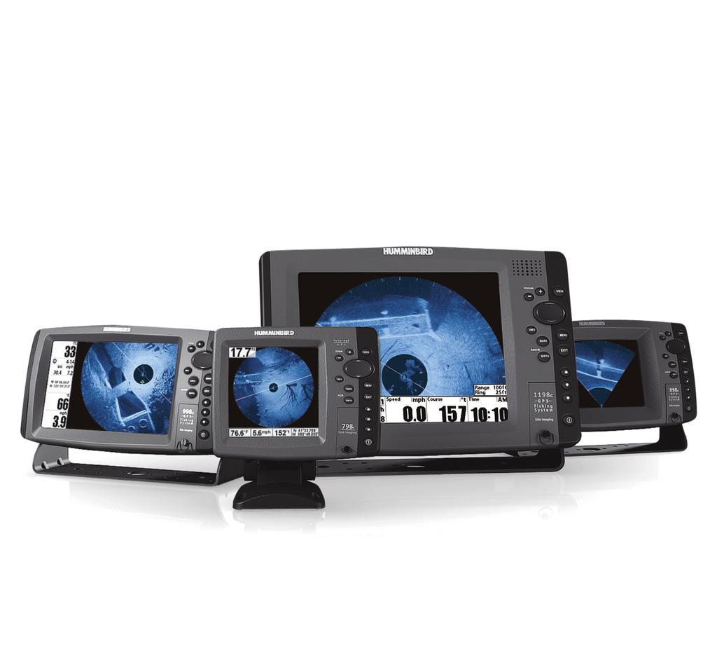
2 Thank You! Thank you for choosing Humminbird, the #1 name in marine electronics. Humminbird has built its reputation by designing and manufacturing top-quality, thoroughly reliable marine equipment. Your Humminbird accessory is designed for trouble-free use in even the harshest marine environment. In the unlikely event that your Humminbird accessory does require repairs, we offer an exclusive Service Policy. For complete details, see the separate warranty card included with your accessory. We encourage you to read this manual carefully in order to get the full benefit from all the features and applications of your Humminbird product. Contact Humminbird Customer Service at or visit our Web site at humminbird.com. WARNING! This product contains chemicals known to the State of California to cause cancer and birth defects or other reproductive harm. WARNING! This device should not be used as a navigational aid to prevent collision, grounding, boat damage, or personal injury. When the boat is moving, water depth may change too quickly to allow time for you to react. Always operate the boat at very slow speeds if you suspect shallow water or submerged objects. WARNING! The electronic chart in your Humminbird unit is an aid to navigation designed to facilitate the use of authorized government charts, not to replace them. Only official government charts and notices to mariners contain all of the current information needed for the safety of navigation, and the captain is responsible for their prudent use. WARNING! Humminbird is not responsible for the loss of data files (waypoints, routes, tracks, groups, recordings, etc.) that may occur due to direct or indirect damage to the unit s hardware or software. It is important to back up your control head s data files periodically. Data files should also be saved to your PC before restoring the unit s defaults or updating the software. See your Humminbird online account at humminbird.com and the Waypoint Management Guide on your Humminbird Manual CD for details. WARNING! Disassembly and repair of this electronic unit should only be performed by authorized service personnel. Any modification of the serial number or attempt to repair the original equipment or accessories by unauthorized individuals will void the warranty.
3 ENVIRONMENTAL COMPLIANCE STATEMENT: It is the intention of Johnson Outdoors Marine Electronics, Inc. to be a responsible corporate citizen, operating in compliance with known and applicable environmental regulations, and a good neighbor in the communities where we make or sell our products. WEEE DIRECTIVE: EU Directive 2002/96/EC Waste of Electrical and Electronic Equipment Directive (WEEE) impacts most distributors, sellers, and manufacturers of consumer electronics in the European Union. The WEEE Directive requires the producer of consumer electronics to take responsibility for the management of waste from their products to achieve environmentally responsible disposal during the product life cycle. WEEE compliance may not be required in your location for electrical & electronic equipment (EEE), nor may it be required for EEE designed and intended as fixed or temporary installation in transportation vehicles such as automobiles, aircraft, and boats. In some European Union member states, these vehicles are considered outside of the scope of the Directive, and EEE for those applications can be considered excluded from the WEEE Directive requirement. This symbol (WEEE wheelie bin) on product indicates the product must not be disposed of with other household refuse. It must be disposed of and collected for recycling and recovery of waste EEE. Johnson Outdoors Marine Electronics, Inc. will mark all EEE products in accordance with the WEEE Directive. It is our goal to comply in the collection, treatment, recovery, and environmentally sound disposal of those products; however, these requirements do vary within European Union member states. For more information about where you should dispose of your waste equipment for recycling and recovery and/or your European Union member state requirements, please contact your dealer or distributor from which your product was purchased. ROHS STATEMENT: Product designed and intended as a fixed installation or part of a system in a vessel may be considered beyond the scope of Directive 2002/95/EC of the European Parliament and of the Council of 27 January 2003 on the restriction of the use of certain hazardous substances in electrical and electronic equipment. ATTENTION INTERNATIONAL CUSTOMERS: Products sold in the U.S. are not intended for use in the international market. Humminbird international units provide international features and are designed to meet country and regional regulations. Languages, maps, time zones, units of measurement, and warranty are examples of features that are customized for Humminbird international units purchased through our authorized international distributors. To obtain a list of authorized international distributors, please visit our Web site at humminbird.com or contact Humminbird Customer Service at (334)
4 NOTE: Some features discussed in this manual require a separate purchase, and some features are only available on international models. Every effort has been made to clearly identify those features. Please read the manual carefully in order to understand the full capabilities of your model. NOTE: The illustrations in this manual may not look the same as your product, but your product will function in the same way. NOTE: To purchase accessories for your control head, visit our Web site at humminbird.com or contact Humminbird Customer Service at NOTE: The procedures and features described in this manual are subject to change without notice. This manual was written in English and may have been translated to another language. Humminbird is not responsible for incorrect translations or discrepancies between documents. NOTE: Product specifications and features are subject to change without notice. NOTE: Humminbird verifies maximum stated depth in saltwater conditions, however actual depth performance may vary due to transducer installation, water type, thermal layers, bottom composition, and slope. NOTE: For 360 Imaging troubleshooting and maintenance information, please see your 360 Imaging Installation Guide. The guide can also be downloaded from our Web site at humminbird.com. 360 Imaging, 700 Series, 800 Series, 900 Series, 1100 Series, Down Imaging, Humminbird, Side Imaging, SwitchFire, and X-Press Menu are trademarked by or registered trademarks of Johnson Outdoors Marine Electronics, Inc Johnson Outdoors Marine Electronics, Inc. All rights reserved.
5 Table of Contents Introduction 1 Important Information Imaging Sonar 2 How 360 Imaging Works 3 How GPS Works 5 How the Heading Sensor Works 6 Power on and Confirm Connections 7 Set up the Network and 360 Imaging Alarms 9 1. Select 360 Imaging on the Network Select Beams and Temperature Sources Set the Deployment Depth Set the 360 Retract Alarm Set the Deployment Alert Speed Start/Stop 360 Imaging Operation 16 Trolling Motor Mount Start Pinging Stop Pinging Transducer Deployment System Deploy the Transducer Retract the Transducer Adjust the Deployment Depth What s on the 360 Imaging Display 24 Views View /Sonar Combo View (800, 900, and 1100 Series only) i
6 Table of Contents 360/Chart Combo View (800, 900, and 1100 Series only) Side Imaging View Down Imaging View Change the 360 View Display Settings 36 Enhance the View 38 Zoom In/Out 40 Change the Sweep Speed and Range 42 Isolate a Section of the Sweep 43 Activate Quick Sweep Isolate the Sweep Area Select a Preset Display Mark and Display Waypoints (GPS Receiver/Heading Sensor Required) 47 Use the GPS Receiver/Heading Sensor with Chart Views 49 Change the Chart Orientation 51 Update the Software 52 Power Off 54 Contact Humminbird 55 ii
7 Introduction We encourage you to read this manual carefully in order to understand 360 Imaging and how to use this Humminbird advanced accessory on the water. Some of the equipment requirements and menu options depend on the type of mount you have installed. Whether you have a Transducer Deployment System or a Trolling Motor Mount, every effort has been made to clearly identify those features throughout this manual. Important Information Before you use the 360 Imaging transducer on the water, it is important to understand the following: SPEED The 360 Imaging transducer pod can be used in the water at 0 to 7 mph. The transducer pod should NOT be in the water during high speed travel. OBSTRUCTIONS Be aware of obstructions in the water that could damage the transducer pod. Also be aware of bridges or anything above the boat that could damage the Transducer Deployment System. MAINTAINING POWER The Transducer Deployment System must stay powered ON while the boat is underway to keep the pod retracted and fully stowed. POWERING OFF When the boat is at dock or in storage, the 360 Imaging transducer should be turned off to prevent draining the battery. See Power Off for more information. POD COVER The pod cover must be installed on the Transducer Deployment System for trailering and storage. See Power Off for more information. SETTING UP THE CONTROL HEAD The control head must be set up correctly to add the 360 Imaging features to the Menu System and View Rotation. See Set up the Network and 360 Imaging Alarms. 1 Introduction
8 360 Imaging Sonar The 360 Imaging transducer scans the water with razor-thin, rotating beams. These 455 khz, high-definition beams sweep a very wide area of water around and below your boat. The beams are wide from side to side but very thin from front to back. The 360 Imaging rotating beams can also be set to provide Side Imaging and Down Imaging views on the screen. See Set up the Network and 360 Imaging Alarms and Views for more information. 360 Imaging kHz kHz 360 Degree Total Coverage NOTE: The transducer s performance is affected by such factors as boat speed, wave action, bottom hardness, water conditions, and installation. Introduction 2

9 How 360 Imaging Works The 360 Imaging Transducer Deployment System deploys the transducer pod into the water, past the hull, prop, and other obstructions. The beams sweep to provide an unobstructed, 360 view of the area around and below your boat. If you have the Trolling Motor 360 Imaging, the transducer pod deploys into the water with the trolling motor. As it sweeps, the 360 Imaging transducer scans the water with its razor-thin, highdefinition beams. Visualize the 360 Imaging beams as a thin sonar wall extending 150 feet to either side of your boat. This wall rotates to create a 300-foot circle. 3 Introduction

10 360 View A B B A Sweep Line Sonar Returns B The sweep line on the 360 Imaging display reveals detailed sonar returns in real time. The historical returns remain on the display until the beams sweep again. You can use the light and dark parts of the display to interpret the objects under your boat as follows: Dark shades represent soft returns (mud, sand) or descending terrain. Light shades represent denser terrain (timber, rocks) or rising terrain. A very hard bottom may appear as white on the display. White Streaks or Clouds may represent fish on the display. Shadows: An object that is standing on the bottom will appear as a clearly defined bright shape with an adjacent dark sonar shadow. The longer the shadow, the taller the object. Fish may also cast shadows. You can use the shadow to interpret where the fish or object is located in relation to the bottom. Introduction 4

11 How GPS Works Your Humminbird uses GPS to determine your position and display it on a grid or chart. GPS uses a constellation of satellites that continually send radio signals to the earth. The GPS receiver on your boat receives signals from satellites that are visible to it. Based on time differences between each received signal, the GPS receiver determines its distance to each satellite. With distances known, the GPS receiver mathematically triangulates its own position. With 5 updates per second, the GPS receiver then calculates its velocity and bearing. GPS was originally intended for military use; however, civilians may also take advantage of its highly accurate position capabilities, typically within +/ 2.5 meters, depending on your conditions and your Humminbird model. This means that 95% of the time, the GPS receiver will read a location within +/ 2.5 meters of your actual position. Your GPS receiver also uses information from WAAS (the Wide Area Augmentation System), EGNOS (the European Geostationary Navigation Overlay Service), and MSAS (the MTSAT Satellite Augmentation System) satellites if they are available in your area. 5 Introduction
12 How the Heading Sensor Works The magnetic compass is one of the first known instruments for navigation. It relies on the earth s magnetic field to align a magnetic pointer towards North, also known as Magnetic North. With the GPS Receiver/Heading sensor installed, the control head will display the heading from the internal compass in digital format. The Heading is the direction the boat is pointing, where 000 is North, 090 is East, 180 is South, and 270 is West. Due to wind and waves, the boat is often traveling in a slightly different direction than its heading. The direction of travel, or Course Over Ground, is provided by the GPS receiver. You can use the compass Heading with the GPS Course Over Ground and Bearing to navigate a route. A compass Magnetic North is affected by the local variations in the earth s magnetic field around the globe. Nautical charts will often provide the magnetic declination, or magnetic variation, for a local area so that you can confirm that Magnetic North matches True North. If you have trailered the boat to a new location, the compass operation may also be affected by a different magnetic zone. The Humminbird control head compensates for magnetic declination and also allows you to make additional adjustments from the Menu System. Introduction 6
13 Power on and Confirm Connections All equipment should be connected and powered before you turn on the control head. CAUTION! It is important to finish all installation connections before powering on the control head. It may take up to a minute for the 360 Imaging transducer and other attached equipment to be detected by the control head. 1. Turn on the power source from the main switch. 2. On the control head, press the POWER/LIGHT key. If you are powering on a control head in a multiple-control head Ethernet network, power on the control head that is connected to the 360 Imaging transducer first. 3. When the Title screen is displayed, press the MENU key to open the Start-Up Options Menu. 4. Use the 4-WAY Cursor Control key to choose Normal, and press the RIGHT Cursor key to select it. 5. Press and hold the VIEW key. Select System > Accessory Test. Confirm that 360 Imaging and GPS + Heading Sensor are listed as Connected. It will take a minute for the equipment to be detected. 6. Press and hold the VIEW key. Select System > GPS Diagnostic View. Confirm that External GPS is displayed and the Fix Type indicates Enhanced or 3D. NOTE: If the GPS Diagnostic View or Accessory Test is not displayed in the View Rotation, press the MENU key twice to open the Main Menu. Select the Views tab > GPS Diagnostic View or Accessory Test. Change the setting for each view to Visible. 7 Power on and Confirm Connections


14 Accessory Test 360 Imaging listed as Connected GPS & Heading Sensor listed as Connected GPS Diagnostic View Fix Type should be 3D or Enhanced External GPS Detected Power on and Confirm Connections 8


15 Set up the Network and 360 Imaging Alarms This section will guide you through the following control head setup instructions. Transducer Deployment System and Trolling Motor Mount: Selecting 360 Imaging on the network Selecting the beams and temperature sources for the 2D Sonar Views, Side Imaging Views, and Down Imaging Views Transducer Deployment System only: Setting the Deployment Depth Setting the Retract Alarm Setting the Deployment Speed Alert If you have selected the 360 Imaging transducer on the network and set the Deployment Depth during the installation, the other settings in this section are optional. The depth source, temperature source, and alarms will be selected automatically based on the other connected equipment. Use this section to confirm installation settings or to change the sources and alarms to your preference. The settings will be saved after you power off the control head. Opening the Network Source Setup Dialog Box 9 Set up the Control Head

16 Selecting the 360 Imaging Transducer Press the RIGHT or LEFT Cursor keys to select a tab. Use the 4-WAY Cursor Control key to choose the transducer, and press the RIGHT Cursor key or the CHECK/INFO key to select it. 1. Select 360 Imaging on the Network When you select the 360 Imaging transducer on the network, the related views and menus will be added to the Fishing System. 1. Main Menu: Press the MENU key twice. Use the 4-WAY Cursor Control key to select the menu options and settings in the following instructions. NOTE: If a System View is displayed on the screen, you will only need to press the MENU key once to open the Main Menu. 2. Network Source Setup Dialog Box: Select the Network tab > Network Source Setup. Press the RIGHT Cursor key. 3. Select the 360 tab from the Network Source Setup dialog box. 4. Select AS 360 from the transducer list. Press the RIGHT Cursor key or the CHECK/INFO key. A checkmark will display in the box to show it is selected. 5. Do not close the dialog box. Proceed to the next section to select the other sources for the control head views. Set up the Control Head 10
17 2. Select Beams and Temperature Sources The sonar and temperature sources may be auto-populated in the Network Source Setup dialog box, but it is important to confirm that the source selections match your transducer and frequency preferences. 1. From the Network Source Setup dialog box, use the 4-WAY Cursor Control key to select a tab and choose a source. Press the CHECK/INFO key to select the source as follows: 2D Traditional Sonar: Select the 2D tab and select a 2D sonar source for the traditional sonar views. Side Imaging and Down Imaging: Select the ADV tab and select a Side Imaging/Down Imaging sonar source. Temperature Data: The 360 Imaging transducer does not provide temperature. Select a Temperature tab (T1, T2, etc.) and select a temperature source or use the default temperature source. GPS Receiver/Heading Sensor: Select the GPS tab and select the sensor that is attached to control head. The Type will be listed as Ext (externally connected). The GPS Receiver/Heading Sensor is required for the 360 Imaging configuration. 2. Close: Press the EXIT key until the dialog box is closed. 11 Set up the Control Head


 Use the 4-WAY Cursor Control key to")
18 Selecting the 2D Sonar Source for the Traditional 2D Sonar Views Press the RIGHT or LEFT Cursor keys to select a tab. Confirm Use the 4-WAY Cursor Control key to choose the transducer, and press the RIGHT Cursor key or the CHECK/INFO key to select it. Selecting the Side Imaging/Down Imaging Beam Source Press the RIGHT or LEFT Cursor keys to select a tab. 360 Imaging transducer (also available as a Side Imaging and Down Imaging source) Use the 4-WAY Cursor Control key to choose the transducer, and press the RIGHT Cursor key or the CHECK/INFO key to select it. Beam Frequency Column Select a Tab Select a Source Confirm Set up the Control Head 12

19 Notes about Selecting the Sonar and Temperature Sources on the Network In addition to the 360 Imaging transducer, you will have another Humminbird transducer connected directly to the control head and/or available in a Humminbird multiple-control head Ethernet network. The 360 Imaging transducer does not provide depth or temperature data, so they must be provided by another transducer. The sources selected in the Network Source Setup dialog box will enable the beams and related digital readout data for the 2D Sonar Views, Side Imaging Views, and Down Imaging Views. It is also important to consider the following: SIDE IMAGING AND DOWN IMAGING If there is a Side Imaging transducer connected to the control head, it will be selected automatically as the Side Imaging and Down Imaging source. You can also use the 360 Imaging transducer to provide the Side Imaging and Down Imaging beam data for the views, but AS 360 needs to be selected from the Network Source Setup dialog box for this configuration (see Select Beams and Temperature Sources in this section). BEAM AVAILABILITY The availability of the beams is determined by the type of transducer that is connected to the control head and your Humminbird model. If a connected transducer is not displayed in the Network Source Setup dialog box, select the Main Menu > Sonar tab > Transducer Select or Connected Transducer, and set the transducer type. NOTE: If the control head is not capable of displaying a certain frequency from a transducer on the network, NONE will be displayed in the beam frequency column in the Network Source Setup dialog box. NOTE: If you have questions about which transducers are compatible with your control head, and the beams and views they provide, visit our Web site at humminbird.com or contact Humminbird Customer Service at Set up the Control Head
20 3. Set the Deployment Depth (Transducer Deployment System only) The 360 Imaging transducer pod should be set to deploy past the hull, propeller, and anything else that will block the beams. NOTE: If the deployment depth was set during installation, or if you have a Trolling Motor Mount, you can skip this step. 1. Main Menu: Press the MENU key twice. If the Main Menu is already open, proceed to the next step. 2. Select the Accessories tab > 360 Sonar Settings > 360 Depth. 3. Press the RIGHT or LEFT Cursor keys to adjust the setting. (1 to 100; Default = 8) NOTE: The 360 Depth setting deploys the transducer in increments of 1% to 100%, where 100% = 29 inches (73.7 cm). Deploying the Transducer Past All Beam Obstructions Deployment Depth Set up the Control Head 14
21 WARNING! The pod should NOT be in the water during high speed travel. The pod should only be deployed when the boat is traveling between 0 to 7 mph. 4. Set the 360 Retract Alarm (Transducer Deployment System only) The 360 Imaging transducer pod should only be used when the boat is traveling 0 to 7 mph. You can set up the control head to provide an alert at a specific speed. If the set speed has been exceeded, an on-screen alert will display to retract the transducer. 1. From the Main Menu, select the Alarms tab > 360 Retract Alarm. 2. Press the RIGHT or LEFT Cursor keys to adjust the setting. (Domestic Units: 0ff,.5 to 7 mph; Default = 7 mph. International Units: 1 to 12 kph, 5 to 7 mph,.2 to 6 kts; Default = 12 kph) 5. Set the Deployment Alert Speed (Transducer Deployment System only) You can set the control head to alert you when the boat is traveling at an optimal speed for 360 Imaging. When the boat is traveling at the set speed, the control head will display an on-screen alert so you can deploy the transducer. 1. From the Main Menu, select the Accessories tab > 360 Sonar Settings > Deploy Speed. 2. Press the RIGHT or LEFT Cursor keys to adjust the speed at which the control head will display an alert (Domestic Units: 0ff,.5 to 7 mph; Default = Off. International Units: 1 to 12 kph, 5 to 7 mph,.2 to 6 kts; Default = Off) 3. Close: Press the EXIT key until the Menu System is closed. 15 Set up the Control Head
22 Start 360 Imaging Operation The menu options to start and stop operation are determined by the type of mount you have installed. See the following sections to start using the 360 Imaging transducer. Trolling Motor Mount: Start Pinging, Stop Pinging Transducer Deployment System: Deploy, Retract, Adjust the Deployment Depth Trolling Motor Mount Use the following instructions to start pinging and stop pinging with the Trolling Motor 360 Imaging. Start Pinging If you have the Trolling Motor 360 Imaging, the transducer pod deploys into the water with the trolling motor. You can then start pinging from the 360 View or from the Menu System. Start Pinging from a 360 View When a 360 View is first displayed on the screen, the control head will provide an on-screen alert to start 360 Imaging operation. 1. Press the VIEW key until a 360 View or 360 Imaging Combo View is displayed on the screen. 2. An on-screen alert will display. Press the RIGHT Cursor key to start 360 Imaging operation. Trolling Motor Mount 16

23 Start Pinging from the 360 View Start Pinging from the X-Press Menu 1. With a 360 View or 360 Imaging Combo View displayed on the screen, press the MENU key once. 2. Select Start 360 Ping, and press the RIGHT Cursor key. Start Pinging from the Power Submenu You can also start pinging from the Power submenu. 1. Press the POWER/LIGHT key. 2. Select 360 Ping, and press the RIGHT Cursor key to select On. 17 Trolling Motor Mount
24 Stop Pinging It is important to stop pinging the 360 Imaging transducer when it is not in use. Stop Pinging from the X-Press Menu 1. With a 360 View or 360 Imaging Combo View displayed on the screen, press the MENU key once. 2. Select Stop 360 Ping, and press the RIGHT Cursor key. Stop Pinging from the Power Submenu 1. Press the POWER/LIGHT key. 2. Select 360 Ping, and press the LEFT Cursor key to select Off. Trolling Motor Mount 18
25 Transducer Deployment System Use the following instructions to deploy and retract with the 360 Imaging Transducer Deployment System. Deploy the Transducer The transducer can be deployed from the Transducer Deployment System, from the Menu System, or from a 360 View. The transducer will deploy based on the 360 Depth setting (see Set up the Network and 360 Imaging Alarms: Set the Deployment Depth). Deploy from the Main Menu 1. Main Menu: Press the MENU key twice. 2. Select the Accessories tab > Deploy 360 Sonar. 3. Press the RIGHT Cursor key to deploy the transducer. Deploy from a 360 View When a 360 View is first displayed on the screen, the control head will provide an on-screen deployment alert. 1. Press the VIEW key until a 360 View or 360 Imaging Combo View is displayed on the screen. 2. An on-screen alert will display. Press the RIGHT Cursor key to deploy the transducer. 19 Transducer Deployment System
26 Deploying from the 360 View Transducer Deployment System 20
27 Deploy from the Transducer Deployment System 1. On the Transducer Deployment System, press and hold the key. Release the key when the transducer pod has reached the depth you prefer. NOTE: The depth you set manually from the key on the Transducer Deployment System will automatically update the 360 Depth menu option setting (see Adjust the Deployment Depth). Using the Keys on the Transducer Deployment System Key Deploy Key Retract 21 Transducer Deployment System
28 Retract the Transducer The transducer pod can be retracted from the control head or from the Transducer Deployment System. See the instructions below for the different options you can use. Retract from the Main Menu 1. Main Menu: Press the MENU key twice. 2. Select the Accessories tab > Retract 360 Sonar. 3. Press the RIGHT Cursor key to retract the transducer. Retract from a 360 View 1. X-Press Menu: With the 360 View or 360 Imaging Combo View displayed on the screen, press the MENU key once. 2. Select Retract 360 Sonar, and press the RIGHT Cursor key. Retract from the Transducer Deployment System 1. On the Transducer Deployment System, press and hold the key. Release the key when the transducer pod is fully stowed. If you turn off the control head, the transducer will retract after approximately 30 seconds. If the 360 Imaging transducer is on an Ethernet network, all control heads must be powered off before the transducer will retract. It will not retract if another control head on the network is using it. To power off the Transducer Deployment System, see Power Off for important information. Transducer Deployment System 22
29 Adjust the Deployment Depth If you need to adjust the deployment depth, you can access the 360 Depth menu option from the Main Menu. You can also adjust the depth from the Transducer Deployment System. Adjust the Deployment Depth from the Control Head The 360 Imaging transducer pod should be set to deploy past the hull and anything else that will block the beams. 1. Main Menu: Press the MENU key twice. 2. Select the Accessories tab > 360 Sonar Settings > 360 Depth. 3. Press the RIGHT or LEFT Cursor keys to adjust the setting. (1 to 100; Default = 8) NOTE: The 360 Depth setting deploys the transducer in increments of 1% to 100%, where 100% = 29 inches (73.7 cm). 4. Close: Press the EXIT key until the Menu System is closed. Adjust the Deployment Depth from the Transducer Deployment System 1. On the Transducer Deployment System, press and hold the key to move the pod down, or press and hold the key to move the pod up. Release the key when the transducer pod has reached the depth you prefer. NOTE: The depth you set manually from the Transducer Deployment System will automatically update the 360 Depth menu option setting. 23 Transducer Deployment System

30 What s on the 360 Imaging Display 360 Imaging uses its unique transducer to provide an unobstructed view of the water around and below your boat. The razor-thin, high-definition beams produce the detailed sonar data that you see on the display. 360 Imaging reveals a variety of recognizable features so that you can interpret the structure and bottom contour, and the following items in this illustration. A B C N D E M F G L K J I H What s on the Display 24
31 A B C D E F G H I J K L Water Column: Shows the relative depth of the water under the boat at a given time. Variations in the width of the water column show variations in the distance to the bottom as the boat passes over. Bottom Return Sweep Line: As the sweep line rotates on the view, it reveals the sonar returns from the 360 Imaging beams. Boat Icon: The boat icon can be set to hidden or visible on the view. See Change the 360 View Display Settings. White Streaks may indicate fish and a clouded area may indicate a bait ball. Topography Changes (light): The light part of the display shows where the beams are hitting hard bottom or rising terrain. Range is the 360 Range setting, and Ring is the distance between each Range Ring on the display. See Change the Sweep Speed and Range for more information. Heading: The boat s heading measured in degrees from North, where 000 is North, 090 is East, 180 is South, and 270 is West. (Heading Sensor required) Course: The current direction the boat is traveling measured in degrees from North, where 000 is North, 090 is East, 180 is South, and 270 is West. (GPS required) Speed: The measurement of the boat s progress across a given distance (GPS required). Position: The boat s current latitude/longitude location determined by GPS. Depth: The depth of the water as provided by another attached transducer (see Set up the Network and 360 Imaging Alarms). M Topography Changes (dark): Dark parts of the display indicate soft bottom (sand, mud) or descending terrain. N Structure: Possible vegetation where fish may be hiding. 25 What s on the Display


32 Views When the 360 Imaging transducer is set up on the control head, the 360 View is added to the View Rotation. Your control head might also include 360 Combo Views in the View Rotation. NOTE: The available views will depend on your control head model and the beams you ve selected in the Network Source Setup dialog box. See Set up the Network and 360 Imaging Alarms for details. View Rotation Views 26

33 Next View: Press the VIEW key to advance to the next view in the View Rotation. Press the VIEW key repeatedly until the view you want to use is displayed on the screen. Previous View: Press the EXIT key to see the previous view in the View Rotation. Press the EXIT key repeatedly until the view you want to use is displayed on the screen. Save a View: Press and hold a VIEW PRESET key to save a shortcut to the on-screen view. You can save one view on each VIEW PRESET key. Press the VIEW PRESET key to quickly return to the view at any time. Views X-Press Menu: Press and hold the VIEW key. Use the 4-WAY Cursor Control key to select a view category (Sonar, Chart, Radar, Data, System) and a view. The Views X-Press Menu allows you to quickly access a view instead of scrolling through the View Rotation. 27 Views
34 360 View The 360 View allows you to see the 360 Imaging data on the full screen. 360 X-Press Menu: Press the MENU key once. The X-Press Menu allows you to retract the transducer or stop pinging, adjust the beam range, enhance the display, and isolate the sweep area. Cursor and Zoom: Use the 4-WAY Cursor Control key to display the cursor and move it over a sonar return. Press the +ZOOM key to magnify the View. Press the EXIT key to remove the Cursor. See Zoom In/Out for more information. Mark and Display Waypoints: You can mark and display waypoints on the 360 View. See Mark and Display Waypoints. Digital Readouts: To change the readouts that are displayed on the 360 View, select the Main Menu > Setup tab > Select Readouts. Use the 4-WAY Cursor Control key to select a Readout position and set the information that will be displayed in each digital readout window. NOTE: The location and availability of the digital readouts vary by model. Also, digital readouts may change with the selected view, attached accessories, and whether or not the control head is navigating. See your control head operations manual and the Operations Summary Guide for details. NOTE: The 700 Series digital readouts cannot be changed in the 360 View. Views 28


35 360 View 360 View with the X-Press Menu Displayed 29 Views

36 360/Sonar Combo View (800, 900, and 1100 Series only) The 360/Sonar Combo View shows sonar information and 360 Imaging information in a combination split screen, where the Sonar View is displayed on the left and the 360 View is displayed on the right. Active Side: The green arrow points to the active side. Press the MENU key once and select Active Side from the X-Press Menu. Choose RIGHT or LEFT to set the active side. X-Press Menu: After you set the Active Side, press the MENU key once to open the X-Press Menu. The X-Press Menu provides menu options for the active view. Sonar: Use the 2D traditional Sonar View with the 360 View to maximize your sonar data. To see raw returns on the Sonar View, select the Main Menu > Sonar tab > SwitchFire > Max Mode. To enhance the 360 View, select the X-Press Menu > 360 Enhance. 360/Sonar Combo View Views 30

37 360/Chart Combo View (800, 900, and 1100 Series only) The 360/Chart Combo View shows chart information and 360 Imaging sonar information in a combination split screen, where the Chart View is displayed on the left and the 360 View is displayed on the right. Active Side: The green arrow points to the active side. Press the MENU key once and select Active Side from the X-Press Menu. Choose RIGHT or LEFT to set the active side. X-Press Menu: After you set the Active Side, press the MENU key once to open the X-Press Menu. The X-Press Menu provides menu options for the active view. Navigation: Use the Chart View with the 360 View to determine the position of structure and fish. To mark waypoints on the 360 View, see Mark and Display Waypoints. 360/Chart Combo View 31 Views
38 Side Imaging View If a 360 Imaging transducer or a Side Imaging transducer is connected to the control head, the Side Imaging View will be available in the View Rotation. It is also important to understand the following: SI Source: If there is a Side Imaging transducer connected to the control head, it will be selected automatically as the Side Imaging source. You can also use the 360 Imaging transducer to provide the Side Imaging beam data for the Side Imaging Views, but AS 360 needs to be selected from the Network Source Setup dialog box for this configuration (see Set up the Network and 360 Imaging Alarms). Start Side Imaging: If you are using the 360 Imaging transducer as your Side Imaging source, it must deployed or pinging, depending on the type of mount you have installed. Transducer Deployment System: Select the Main Menu > Accessories tab > Deploy 360 Sonar. Trolling Motor Mount: Press the POWER key. Select 360 Ping > On. SI Range and 360 Range: If the 360 Imaging transducer is providing data for the Side Imaging Views, the 360 Range setting and the SI Range setting will be shared. When you change the 360 Range setting, the SI Range setting will also be changed, and vice versa. More Information: See your control head operations manual and Operations Summary Guide for more information about Side Imaging. These manuals were included with your control head, or they can be downloaded from our Web site at humminbird.com. NOTE: The 360 Imaging transducer provides data for the 360 View OR the Side Imaging View. These views cannot be displayed at the same time if they are sharing the 360 Imaging transducer in a multiple-control head Ethernet network. To use the Side Imaging View on one control head, and the 360 View on a different control head, a separate Side Imaging transducer must be selected as the Side Imaging source. See Set up the Network and 360 Imaging Alarms for more information about selecting sonar sources. Views 32

39 Side Imaging View with AS 360 Selected as the SI Source The 360 Icon indicates that the beam data in the Side Imaging View is being pinged from the 360 Imaging transducer. If there is not a 360 icon on the display, a Side Imaging transducer is providing the beam data for the Side Imaging View. 33 Views
40 Down Imaging View If a 360 Imaging transducer or a Side Imaging/Down Imaging transducer is connected to the control head, the Down Imaging View will be available in the View Rotation. It is also important to understand the following: DI Source: If there is a Side Imaging/Down Imaging transducer connected to the control head, it will be automatically selected as the Down Imaging source. You can also use the 360 Imaging transducer to provide the Down Imaging beam data for the Down Imaging Views, but AS 360 needs to be selected from the Network Source Setup dialog box for this configuration (see Set up the Network and 360 Imaging Alarms). Start Down Imaging: If you are using the 360 Imaging transducer as your Side Imaging/Down Imaging source, it must deployed or pinging, depending on the type of mount you have installed. Transducer Deployment System: Select the Main Menu > Accessories tab > Deploy 360 Sonar. Trolling Motor Mount: Press the POWER key. Select 360 Ping > On. DI Range and 360 Range: If the 360 Imaging transducer is providing data for the Down Imaging Views, the 360 Range setting will affect the range of data displayed on the Down Imaging View. More Information: See your control head operations manual and Operations Summary Guide for more information about Down Imaging. These manuals were included with your control head, or they can be downloaded from our Web site at humminbird.com. NOTE: The 360 Imaging transducer provides data for the 360 View OR the Down Imaging View. These Views cannot be displayed at the same time if they are sharing the 360 Imaging transducer in a multiple-control head Ethernet network. To use the Down Imaging View on one control head, and the 360 View on a different control head, a separate Down Imaging transducer must be selected as the Down Imaging source. See Set up the Network and 360 Imaging Alarms for more information about selecting sonar sources. Views 34

41 Down Imaging View with AS 360 Selected as the DI Source The 360 Icon indicates that the beam data in the Down Imaging View is being pinged from the 360 Imaging transducer. If there is not a 360 icon on the display, a Side Imaging/Down Imaging transducer is providing the beam data for the Down Imaging View. 35 Views
42 Change the 360 View Display Settings Use the following instructions to change how the 360 View is displayed. Change the Display Settings 1. Main Menu: Press the MENU key twice. 2. Select the Accessories tab > 360 Sonar Settings. 3. Use the 4-WAY Cursor Control key to select an option from the submenu, and press the RIGHT or LEFT Cursor keys to change the menu setting, as follows: 360 Color: The palette you choose will be applied to all 360 Views in the View Rotation. (Blue, Amber 1, Amber 2, Brown, Green, Inverse, Gray, Green/Red; Default = Amber 1) 360 Range Overlay: Select On to display the range rings on the view, or select Off to hide the range rings (On, Off; Default = On) 360 Heading Offset: If the position of objects on the display are slightly different than what you observe in the environment around you, use this menu option to rotate the display and correct the alignment. See your 360 Imaging installation guide for more information. 360 Boat Icon: Select On to display the boat icon, or select Off to hide the boat icon. (On, Off; Default = On) Navigation on 360: To mark and display waypoints on the 360 View, select On. See Mark and Display Waypoints for more information. (On, Off; Default = Off) 360 Offset: The 360 Offset Icon represents the installation location of the GPS Receiver/Heading Sensor. Adjust the setting to match the distance between the 360 Imaging transducer and the GPS Receiver/Heading Sensor. See your 360 Imaging installation guide for more information. 4. Close: Press the EXIT key until the Menu System is closed. Change the Display Settings 36
 Boat Icon Waypoints 37 Change the Display")
43 Changing the Display Settings A B C D A B C D Range Rings Display Color (green) Boat Icon Waypoints 37 Change the Display Settings
44 Enhance the View 360 Enhance allows you to adjust the 360 View in four categories: Sensitivity, Contrast, Sharpness, and Contour Mode. The display will update as you adjust each category. Adjust 360 Enhance Settings 1. X-Press Menu: With the 360 View or Combo View displayed on the screen, press the MENU key once. 2. Select 360 Enhance. 3. Use the 4-WAY Cursor Control key to select and adjust the following settings: Sensitivity: Controls how much detail is shown on the display. When operating in very clear water or greater depths, increase the sensitivity to show weaker returns that may be of interest. Decrease the sensitivity to eliminate the clutter from the display that is sometimes present in murky or muddy water. (1 to 20, where Low = 1, High = 20; Default = 10) Contrast: Accents the light and dark parts of the 360 Imaging data to provide greater definition. (1 to 20; Default = 10) Sharpness: Filters the view and sharpens the edges of the 360 Imaging data. (Low, Medium, High; Default = Off) Contour Mode: Controls how the water column is displayed in the view. When Contour Mode is turned off, the water column is displayed on the view. The location of a target on the display is based on the slant range to the target. When Contour Mode is turned on, the water column is removed from the view, which allows the display to show targets at their linear horizontal distance. The location of a target may be easier to interpret when the water column is removed. (Off, On; Default = Off) Enhance the View 38

45 Adjusting the 360 Enhance Settings The Sensitivity and Contrast are set high in the above illustration. The high Sensitivity setting displays more weak returns on the display, and the high Contrast setting shows more definition between the light and dark returns. 39 Enhance the View

46 Zoom In/Out The ZOOM keys allow you to view the 360 display closer or farther away. You can also zoom in and out of a selected area based on the cursor position. Using the Cursor and ZOOM keys on the 360 View A B C D A B C D Distance to the Cursor Bearing to the Cursor Cursor Zoom Level Zoom In/Out 40
47 Zoom: Press the +ZOOM key to Zoom In and the ZOOM key to Zoom Out. (2x, 4x, 6x, 8x, 10x, 12x; Default = 2x) Select and Zoom: Use the 4-WAY Cursor Control key to move the cursor to a position on the 360 View. Press the +ZOOM key to Zoom In and the ZOOM key to Zoom Out. Press the EXIT key to remove the Cursor. 41 Zoom In/Out
48 Change the Sweep Speed and Range The 360 Imaging menu options allow you to change the sweep speed and range. The settings you use will influence how quickly the screen refreshes and how much detail is shown on the screen. Change the Sweep Speed The 360 Speed menu option allows you to adjust the speed of the sweep. When the sweep speed is slower, more detail is shown on the screen. When the sweep is faster, more information is displayed but less detail is shown. 1. X-Press Menu: With the 360 View or Combo View displayed on the screen, press the MENU key once. 2. Select 360 Speed. 3. Press the RIGHT or LEFT Cursor keys to select a sweep speed. (Slow, Fine/Fast, Standard, Coarse/Faster, Fastest; Default = Standard) Change the 360 Range 360 Range controls how far the 360 Imaging beams will ping. Select a low range number to focus on a shorter distance of the water column and see greater detail on the screen. Select a higher range number to see farther into the water and see an overview of details on the screen. For optimal performance, select 240 feet. 1. X-Press Menu: With the 360 View or Combo View displayed on the screen, press the MENU key once. 2. Select 360 Range. 3. Press the RIGHT or LEFT Cursor keys to adjust the range. (Domestic Units: 6 to 360 ft; Default = 120 ft. International Units: 2 to 120 m, 6 to 360 ft, 1 to 60 fthm; Default = 120 ft) NOTE: If the 360 Imaging transducer is providing data for the Side Imaging Views and Down Imaging Views, the 360 Range setting will control the SI Range setting. Change the Sweep Speed & Range 42

49 Isolate a Section of the Sweep There are many options to focus on a section of the sweep. You can set the sweep angle and section yourself, or you can use a preset section. Activate Quick Sweep Use Quick Sweep to focus quickly on a section of the view. When the Quick Sweep area is set, the full 360 View will continue to display on-screen, but the sweep will only cover the angle you select. 1. Set the 1st Limit: Press the CHECK/INFO key. 2. Set the 2nd Limit: Press the CHECK/INFO key. 3. Resume the full 360 Sweep: Press the CHECK/INFO key. Pressing the CHECK/INFO key to set the Angle of the Quick Sweep Set the 1st Limit Set the 2nd Limit 43 Isolate the Sweep

50 Isolate the Sweep Area Isolating the sweep area allows you to focus the sweep on a section of the water. The sweep area can be set between 10 to 360, and you can adjust it as you prefer. 1. X-Press Menu: With the 360 View or Combo View displayed on the screen, press the MENU key once. 2. Select Isolate Sweep Area. Press the RIGHT Cursor key. 3. The sweep area can be adjusted as follows: Adjust the Sweep Position: Press the RIGHT or LEFT Cursor keys. Adjust the Sweep Size: Press the UP or DOWN Cursor keys. 4. Confirm the Selection: Press the CHECK/INFO key. 5. Close: Select Resume Full Sweep from the X-Press Menu. Adjusting the Isolated Sweep Area (between the red lines) Isolate the Sweep 44

51 Using the Isolated Sweep Area 45 Isolate the Sweep

52 Select a Preset Display Use the Display menu option to choose a preset portion of the 360 Imaging sweep. NOTE: If you use Isolate Sweep Area in this mode, the view will switch to the full 360 View. 1. X-Press Menu: With the 360 View or Combo View displayed on the screen, press the MENU key once. 2. Select Display. 3. Press the RIGHT or LEFT Cursor keys to select a display option. (360, Front, Rear, Left, Right; Default = 360) 360 View with RIGHT Selected in the Display Menu Option Isolate the Sweep 46
53 Mark and Display Waypoints (GPS Receiver/Heading Sensor Required) When the Navigation on 360 menu option is turned on, you can use the following navigation functions in a 360 Imaging View: Display Waypoints as they are marked on the view. Waypoints can be marked at the boat position or cursor position. If Navigation on 360 is turned off, you can mark waypoints, but they won t be displayed on the 360 View. In a 360/Chart Combo View, you can see where your boat is positioned in relation to a waypoint on the Chart View and in relation to underwater structure in the 360 View (see Views for more information). Turn on/off Navigation in the 360 Views Turn on the Navigation on 360 menu option to mark and display waypoints on the 360 View. To hide waypoints on the 360 View, select off. 1. Main Menu: Press the MENU key twice. 2. Select the Accessories tab > 360 Sonar Settings > Navigation on Press the RIGHT or LEFT Cursor keys to select On or Off. (On, Off; Default = Off) NOTE: The GPS Receiver/Heading Sensor must be connected to the control head to enable these features on the 360 View. 47 Navigation

 NOTE: The available views are determined by your")
54 Turn on Navigation on 360 in the 360/Chart Combo View, and you can see where your boat is positioned in relation to underwater structure. Using Marked Waypoints in the 360/Chart View Move the Cursor Mark a Waypoint Start Navigation (Chart View Only) NOTE: The available views are determined by your Humminbird control head model. Navigation 48
55 Use the GPS Receiver/Heading Sensor with Chart Views When the GPS Receiver/Heading Sensor is connected to the control head, not only are the Chart Views and GPS navigation features enabled, but the control head will also receive heading data and additional features from the Heading Sensor. Heading Digital Readout: To add the Heading Digital Readout to the Chart View (1100 Series only) or the Sonar View (700, 800, 900, and 1100 Series), select the Main Menu > Setup tab > Select Readouts. Select a Readout Position and use the RIGHT or LEFT Cursor keys to select Heading. Heading Offset: To adjust the zero point of the Heading Sensor, select the Main Menu > Navigation tab > Heading Offset. Press the RIGHT or LEFT Cursor keys to adjust the setting. See the 360 Imaging Installation Guide for details. Boat Icon: When the Heading Sensor is attached, the boat icon will always be displayed as a boat shape. It will not change to a circle when the boat is stationary. Heading Line: If it is turned on, the heading line extends from the bow of the boat icon. To turn on the Heading Line, select the Main Menu > Navigation tab > Heading Line > On. North-Up Icon: If it is turned on, the North-Up Icon displays the direction of True North. It also displays the View Orientation, and the icon will change as the orientation and the data source change. To display the North-Up Icon, select the Main Menu > Navigation tab > North Up Indicator > On. See Change the Chart Orientation for more information. Pitch and Roll Digital Readouts: To add the Pitch and Roll Digital Readouts to the Chart View (1100 Series only) or the Sonar View (700, 800, 900, and 1100 Series), select the Main Menu > Setup tab > Select Readouts. Select a Readout Position and use the RIGHT or LEFT Cursor keys to select Pitch. Repeat these steps to select Roll in the next readout position. 49 Navigation
 D NOTE: For details about chartplotters and navigation, see your control head operations manual and the Waypoint Management Guide.")
56 Chart View with the GPS Receiver/Heading Sensor Attached to the Control Head A B C A B C D E E Heading Line Boat Icon North-Up Icon Heading Digital Readout (Heading Sensor Required) Course Over Ground Digital Readout (GPS Receiver Required) D NOTE: For details about chartplotters and navigation, see your control head operations manual and the Waypoint Management Guide. Operations manuals are provided on the CD included with your Humminbird control head, or you can download Humminbird manuals from our Web site at humminbird.com. Navigation 50
57 Change the Chart Orientation You can change the orientation of the Chart View. The Chart Orientation is also influenced by the GPS Receiver/Heading Sensor attached to the control head. North-Up: North is shown at the top of the display. Objects located to the north of the boat are drawn above the boat. Head Up: The boat s current heading points up, and the track rotates around the boat so that the boat always points up on the view. The heading is provided by the Heading Sensor connected to the control head. If a Heading Sensor is not connected, the heading will be calculated using the GPS receiver s COG (Course Over Ground). Course-Up: During navigation, the projected course is shown at the top of the view. Objects ahead of the boat are drawn above the boat. When the boat is not navigating, the course-up reference is provided by the COG (Course Over Ground) calculation. Select the Chart Orientation 1. Main Menu: Press the MENU key twice. 2. Select the Navigation tab > Chart Orientation. 3. Press the RIGHT or LEFT Cursor keys to select how the Chart will be displayed. (North-Up, Head Up, Course-Up; Default = North-Up) 51 Navigation
58 Update the Software Set up an online account at humminbird.com so that you will receive the latest Humminbird news and software updates for your Fishing System. WARNING! Humminbird is not responsible for the loss of data files (waypoints, routes, tracks, groups, snapshots, recordings, etc.) that may occur due to direct or indirect damage to the unit s hardware or software. It is important to back up your control head s data files periodically. Data files should also be saved to your PC before restoring the unit s defaults or updating the software. See your Humminbird online account at humminbird.com and the Waypoint Management guide. Required Equipment: Personal computer with Internet access, and a formatted SD memory card. Update the Software 1. Install a formatted SD memory card into the card reader connected to your PC. 2. Register your Fishing System: Log on to humminbird.com. Click My Account. Set up a new account or log into your current account and add the 360 Imaging accessory to your My Equipment tab. 3. Download: From My Account\My Profile\My Equipment, click the file name of the latest software update (unit name [version #]) for your control head. Read the instructions in the dialog box and click Download. Follow the on-screen instructions to save the software file directly to the SD Card. 4. Repeat step 3 to download the 360 Imaging transducer file. 5. Install the SD card with the updated software files into the control head card slot. 6. Power on your Fishing System. 7. Control Head Update: The control head will recognize the new software. Follow the dialog box instructions to confirm the software installation. Update the Software 52
59 360 Imaging Transducer Update: The software will be updated automatically. It may take up to two minutes for the software to be detected on the network, and the control head will display a dialog box to indicate that the update is in progress. 8. Restart: When the updates are completed, press and hold the POWER/LIGHT KEY to power off the control head. After the control head shuts down, press the POWER/LIGHT key to start the control head. NOTE: If you have questions about the software update process, contact Humminbird Customer Service. 53 Update the Software
60 Power Off The Transducer Deployment System is designed with software that keeps the pod fully retracted and stowed while the boat is in use. WARNING! To keep the pod retracted, the Transducer Deployment System must stay powered ON while the boat is underway. When the boat is stored or at dock, the pod must be fully retracted, and the 360 Imaging transducer must be turned off to prevent draining the battery. The pod cover must be installed for trailering and storage. 1. Power off the Control Head Press and hold the POWER/LIGHT key. CAUTION! Turning off the control head will NOT power off the 360 Imaging transducer. 2. Power off the Transducer Turn off power on the main switch, breaker, or battery switch. NOTE: Powering off the 360 Imaging transducer will be determined by the installation and power connection on your boat. 3a. Install the Pod Cover (Transducer Deployment System only) The pod cover must be installed for trailering and storage. Install the cover over the fully retracted pod. Insert the T-clips into the tracks on each side of the Transducer Deployment System. Turn each T-clip so it stays in the track. Tighten the straps. OR 3b. Check the 360 Trolling Motor Bracket (Trolling Motor 360 Imaging only) Confirm the Depth Collar Knob is fully tightened (by hand). Check the stability of the trolling motor bracket after initial use and periodically thereafter to ensure that the installation and lock remain stable. See your installation guide for details. Power Off 54


 Social Media Resources: Facebook.")
61 Contact Humminbird Contact Humminbird Customer Service in any of the following ways: Web site: humminbird.com Telephone: Direct Shipping: Humminbird Service Department 678 Humminbird Lane Eufaula, AL USA Hours of Operation: Monday - Friday 8:00 a.m. to 4:30 p.m. (Central Standard Time) Social Media Resources: Facebook.com/HumminbirdElectronics Twitter.com (@humminbirdfish) YouTube.com/humminbirdtv 55
GPS + COMPASS SENSOR INSTALLATION GUIDE
 GPS + COMPASS SENSOR INSTALLATION GUIDE 532162-1_B THANK YOU! Thank you for choosing Humminbird, the #1 name in fishfinders. Humminbird has built its reputation by designing and manufacturing top-quality,
586c HD, 596c HD, and 596c HD DI. Operations Manual EN_B. Section Title
 586c HD, 596c HD, and 596c HD DI Operations Manual 531819-2EN_B A Section Title Thank You! Thank you for choosing Humminbird, the #1 name in fishfinders. Humminbird has built its reputation by designing
CHIRP RADAR. HELIX Operations Manual EN_A
 CHIRP RADAR HELIX Operations Manual 532547-1EN_A THANK YOU! Thank you for choosing Humminbird, the #1 name in marine electronics. Humminbird has built its reputation by designing and manufacturing top
500 Series Operations Manual EN_A
 500 Series Operations Manual 531716-6EN_A Thank You! Thank you for choosing Humminbird, the #1 name in marine electronics. Humminbird has built its reputation by designing and manufacturing top-quality,
GPS Receiver _B
 GPS Receiver 531478-2_B Thank You! Thank you for choosing Humminbird, America's #1 name in Fishfinders. Humminbird has built its reputation by designing and manufacturing top-quality, thoroughly reliable
GR16 GPS Receiver Accessory Manual _B
 GR16 GPS Receiver Accessory Manual 531478-1_B Thank You! Thank you for choosing Humminbird, America's #1 name in fishfinders. Humminbird has built its reputation by designing and manufacturing top-quality,
STRIKER Series. Owner s Manual
 STRIKER Series Owner s Manual Table of Contents Introduction...1 Device Keys... 1 Contacting Garmin Product Support... 1 Selecting the Transducer Type... 1 Zooming on the STRIKER 4... 1 Panning on the
echo 100 and echo 150 owner s manual
 echo 100 and echo 150 owner s manual Introduction Introduction Warning See the Important Safety and Product Information guide in the product box for product warnings and other important information. This
LAKEMASTER GUIDE. Spend less time searching and more time fishing GETTING STARTED...3,4
 2013 user guide LAKEMASTER GUIDE Spend less time searching and more time fishing Combine innovative LakeMaster Digital GPS Maps with groundbreaking Humminbird sonar and Minn Kota i-pilot Link to easily
2017 Garmin Ltd. or its subsidiaries All rights reserved. Under the copyright laws, this manual may not be copied, in whole or in part, without the
 Owner's Manual 2017 Garmin Ltd. or its subsidiaries All rights reserved. Under the copyright laws, this manual may not be copied, in whole or in part, without the written consent of Garmin. Garmin reserves
STRIKER Series. Owner s Manual
 STRIKER Series Owner s Manual June 2016 190-01950-26 Rev. C All rights reserved. Under the copyright laws, this manual may not be copied, in whole or in part, without the written consent of Garmin. Garmin
echo 100 and echo 150 owner s manual
 echo 100 and echo 150 owner s manual 2011 Garmin Ltd. or its subsidiaries All rights reserved. Except as expressly provided herein, no part of this manual may be reproduced, copied, transmitted, disseminated,
HST-3000 TDR. What is a TDR? JDSU s HST-3000 TDR. Application Note
 Application Note HST-3000 TDR What is a TDR? A TDR is used to identify bridged taps, wet sections, load coils, shorts, opens, and splices on copper cabling. Functioning much like sonar on a submarine,
GMI 10. quick start manual
 GMI 10 quick start manual Introduction The GMI 10 allows you to quickly view important information about your boat provided by connected sensors. Connected sensors transmit data to the GMI 10 using NMEA
RLS2. Owner s Manual. Portable All-Band Radar and Laser Detector with GPS Technology
 RLS2 Owner s Manual Portable All-Band Radar and Laser Detector with GPS Technology K40 Consult Don t like to read manuals? Call our experienced K40 Consultants. We ll explain the whole thing. 800.323.5608
GPSMAP. 4000/5000 series owner s manual
 GPSMAP 4000/5000 series owner s manual 2009 Garmin Ltd. or its subsidiaries All rights reserved. Except as expressly provided herein, no part of this manual may be reproduced, copied, transmitted, disseminated,
GPSMAP 700 series owner s manual
 GPSMAP 700 series owner s manual Introduction Introduction WARNING See the Important Safety and Product Information guide in the product box for product warnings and other important information. This manual
EAN-Blending. PN: EAN-Blending 11/30/2017. SightLine Applications, Inc.
 PN: EAN-Blending 11/30/2017 SightLine Applications, Inc. Contact: Web: sightlineapplications.com Sales: sales@sightlineapplications.com Support: support@sightlineapplications.com Phone: +1 (541) 716-5137
User Manual Thank you for purchasing our product. If there are any questions, or requests, please do not hesitate to contact the dealer.
 User Manual Thank you for purchasing our product. If there are any questions, or requests, please do not hesitate to contact the dealer.. This manual may contain several technical incorrect places or printing
Q Panel General Guide
 Q Panel General Guide Contents Q Panel General Guide Welcome to Q Experience! Available applications Tech overview Overview Quick Start Applications Elements: Sidebar Sidebar: Modes Elements: Main menu
Thank You! Contact our Customer Resource Center at either or visit our web site at humminbird.com.
 Thank You! Thank you for choosing Humminbird, America's #1 name in fishfinders. Humminbird has built its reputation by designing and manufacturing top-quality, thoroughly reliable marine equipment. Your
Operator s Manual. PP016 Passive Probe
 Operator s Manual PP016 Passive Probe 2017 Teledyne LeCroy, Inc. All rights reserved. Unauthorized duplication of Teledyne LeCroy documentation materials is strictly prohibited. Customers are permitted
AQUAMAP 80/100 Series Owner s Manual
 AQUAMAP 80/100 Series Owner s Manual April 2014 190-01657-00_0B Printed in Taiwan All rights reserved. Under the copyright laws, this manual may not be copied, in whole or in part, without the written
Simulator. Demo mode. Simulator source files. 102 Simulator HDS Gen3 Operator Manual
 13 Simulator The simulation feature lets you see how the unit works in a stationary position and without being connected to sensors or other devices. Demo mode In this mode the unit automatically runs
HDS 4.1 Software Upgrade for- HDS GEN1
 HDS 4.1 Software Upgrade for- HDS GEN1 Sonar Charting Enhancements Bug Fixes Ease of Use AVAILABLE FEBRUARY 2012 Sonar performance Improved bottom tracking at high speeds Enhanced deep water (>1000 feet)
LD2342 USWM V1.6. LD2342 V1.4 Page 1 of 18
 LD2342 USWM V1.6 LD2342 V1.4 Page 1 of 18 GENERAL WARNINGS All Class A and Class B marine Automatic Identification System (AIS) units utilize a satellite based system such as the Global Positioning Satellite
X-Mag. High-Magnification Workstation User s Guide Revision A
 X-Mag High-Magnification Workstation User s Guide www.fsinspection.com 440831-001 Revision A Freedom Scientific, Inc., 11800 31st Court North, St. Petersburg, Florida 33716-1805, USA www.fsinspection.com
echomap CHIRP 40/50/70/90 Series Owner s Manual
 echomap CHIRP 40/50/70/90 Series Owner s Manual January 2016 190-01951-00_0B All rights reserved. Under the copyright laws, this manual may not be copied, in whole or in part, without the written consent
Digital Function Generator
 Digital Function Generator 13654-99 PHYWE Systeme GmbH & Co. KG Robert-Bosch-Breite 10 37079 Göttingen Germany Tel. +49 (0) 551 604-0 Fax +49 (0) 551 604-107 E-mail info@phywe.de Operating Instructions
The GPS Classroom. Jared Covili
 The GPS Classroom Jared Covili 1/17/06 2 The GPS Classroom Jared Covili jcovili@media.utah.edu (801) 585-5667 The GPS Classroom is a 2-day course that provides participants with the basic knowledge of
SRT Marine Technology. LD2342 V1.4 Page 1 of 22
 LD2342 V1.4 Page 1 of 22 LD2342 V1.4 Page 2 of 22 2 LD2342 V1.4 Page 3 of 22 GENERAL WARNINGS All marine Automatic Identification System (AIS) units utilise a satellite based system such as the Global
IG-2500 OPERATIONS GROUND CONTROL Updated Wednesday, October 02, 2002
 IG-2500 OPERATIONS GROUND CONTROL Updated Wednesday, October 02, 2002 CONVENTIONS USED IN THIS GUIDE These safety alert symbols are used to alert about hazards or hazardous situations that can result in
12. Creating a Product Mockup in Perspective
 12. Creating a Product Mockup in Perspective Lesson overview In this lesson, you ll learn how to do the following: Understand perspective drawing. Use grid presets. Adjust the perspective grid. Draw and
GPSMAP. 400/500 series. owner s manual
 GPSMAP 400/500 series owner s manual 2011 Garmin Ltd. or its subsidiaries All rights reserved. Except as expressly provided herein, no part of this manual may be reproduced, copied, transmitted, disseminated,
MATRIX 430. Entry level guidance Software version 1.03
 MATRIX 430 U S E R M A N U A L Entry level guidance Software version 1.03 GETTING STARTED 1. Power on the console. Setup machine 2. On guidance screen, press NAVIGATION AND GUIDANCE OPTIONS tab to display
ONYX Deskset HD. Portable Video Magnifier User s Guide. Freedom Scientific, Inc Revision A
 ONYX Deskset HD Portable Video Magnifier User s Guide Freedom Scientific, Inc. www.freedomscientific.com 440829-001 Revision A PUBLISHED BY Freedom Scientific 11800 31 st Court North St. Petersburg, Florida
Photoshop CS2. Step by Step Instructions Using Layers. Adobe. About Layers:
 About Layers: Layers allow you to work on one element of an image without disturbing the others. Think of layers as sheets of acetate stacked one on top of the other. You can see through transparent areas
PRODUCT MANUAL. AGD Systems Limited 2016 Doc. Ref. 932 PM ISS3 ISO ISO 9001 Registered Quality Management. Registered Environmental Management
 ISO 14001 PRODUCT MANUAL ISO 9001 Registered Quality Management 015 Registered Environmental Management 015 AGD Systems Limited 2016 Doc. Ref. 932 PM ISS3 TABLE OF CONTENTS INTRODUCTION Product & technology
Importing and processing gel images
 BioNumerics Tutorial: Importing and processing gel images 1 Aim Comprehensive tools for the processing of electrophoresis fingerprints, both from slab gels and capillary sequencers are incorporated into
Owner s Manual. Microwave Radar Blind Spots System Version 2.1
 Owner s Manual BSS2 Microwave Radar Blind Spots System Version 2.1 Table of Contents I. Items List... 2 II. Technical Specification... 3 III. Installation Diagram.... 4 IV. Wire Connection Diagram... 4
Seagrass Scar Imaging Project Report: Cockroach Bay Seagrass Scar Tracking Project
 Seagrass Scar Imaging Project Report: Cockroach Bay Seagrass Scar Tracking Project Prepared For Hillsborough County Environmental Protection Commission By Florida Center for Community Design and Research
Always there to help you. Register your product and get support at AJ7045D. Question? Contact Philips.
 Always there to help you Register your product and get support at www.philips.com/welcome Question? Contact Philips AJ7045D User Manual Contents 1 Important 3 Risk of swallowing batteries 3 2 Your clock
Windows INSTRUCTION MANUAL
 Windows E INSTRUCTION MANUAL Contents About This Manual... 3 Main Features and Structure... 4 Operation Flow... 5 System Requirements... 8 Supported Image Formats... 8 1 Installing the Software... 1-1
DXXX Series Servo Programming...9 Introduction...9 Connections HSB-9XXX Series Servo Programming...19 Introduction...19 Connections...
 DPC-11 Operation Manual Table of Contents Section 1 Introduction...2 Section 2 Installation...4 Software Installation...4 Driver Installastion...7 Section 3 Operation...9 D Series Servo Programming...9
GMR 20/40 Marine Radar Owner s Manual
 GMR 20/40 Marine Radar Owner s Manual Copyright 2005 Garmin Ltd. or its subsidiaries Garmin International, Inc. 1200 East 151 st Street, Olathe, Kansas 66062, U.S.A. Tel. 913/397.8200 or 800/800.1020 Fax
RM600 Carrier Grade E1 Radios
 Carrier Grade E1 Radios Quick Start Guide Package Contents ODU 1 IDU 1 Mast/Wall Mounting Kit 1 Outdoor Ethernet Cable (Optional) 1 External Antenna (Optional) 1 Power Supply Cable 1 Quick Start Guide
SeaTalk-SeaTalkng converter. Handbook
 SeaTalk-SeaTalkng converter Handbook Trademarks and registered trademarks Autohelm, hsb 2, RayTech Navigator, Sail Pilot, SeaTalk, SeaTalk NG, SeaTalk HS and Sportpilot are registered trademarks of Raymarine
USER MANUAL. Laser Distance Meter MODELS DT40M, DT60M, and DT100M
 USER MANUAL Laser Distance Meter MODELS DT40M, DT60M, and DT100M Contents Introduction... 3 Safety Instructions... 3 Descriptions... 4 Measurement Preparation... 6 Programming Menu... 8 Distance Measurements...
RIGGING MANUAL English
 KH7 RIGGING MANUAL English TABLE of CONTENTS SYMBOLS... 3 1. INTRODUCTION... 4 2. system components... 4 3. SAFETY information... 5 4. Product overview... 6 5. suspending a cluster... 8 6. stacking kh7
MX-2700N MX-3500N MX-3501N MX-4500N MX-4501N. Copier Guide
 MODEL: MX-2300N MX-2700N MX-3500N MX-350N MX-4500N MX-450N Copier Guide TABLE OF CONTENTS ABOUT THIS MANUAL........................ 3 MANUALS PROVIDED WITH THE MACHINE... 3 BASIC PROCEDURE FOR MAKING COPIES
Installation and Operation Manual
 NAVMAN Tracker 5507/ 5607 Installation and Operation Manual Chartplot ters w w w. n a v m a n. c o m IMPORTANT SAFETY INFORMATION Please read carefully before installation and use. DANGER! WARNING! CAUTION
DOCUMENT SCANNER INSTRUCTIONS. Space. Backup. Count Only. New File. Scanner. Feeding Option Manual Auto Semi-Auto
 E FILM F Scanner A Space Count Only New File Feeding Option Manual Auto Semi-Auto Backup DOCUMENT SCANNER INSTRUCTIONS NOTICE q Copyright 2001 by CANON ELECTRONICS INC. All rights reserved. No part of
GPSMAP 500/700 Series and echomap 50/70 Series Owner s Manual
 GPSMAP 500/700 Series and echomap 50/70 Series Owner s Manual February 2013 190-01556-00_0A Printed in Taiwan All rights reserved. Under the copyright laws, this manual may not be copied, in whole or in
X2 LASER DISTANCE METER. Operating instruction
 X2 LASER DISTANCE METER Operating instruction A B C D E F 1 Symbols 1.1 Warning notices The warning notices differ from one another concerning the type of danger through the following signs: Caution warns
CALIBRATION MANUAL. Version Author: Robbie Dowling Lloyd Laney
 Version 1.0-1012 Author: Robbie Dowling Lloyd Laney 2012 by VirTra Inc. All Rights Reserved. VirTra, the VirTra logo are either registered trademarks or trademarks of VirTra in the United States and/or
NSPL-500. AIS/VHF antenna splitter. User Manual ENGLISH.
 NSPL-500 AIS/VHF antenna splitter User Manual ENGLISH www.bandg.com www.simrad-yachting.com www.lowrance.com Preface As Navico is continuously improving this product, we retain the right to make changes
Explorer 657. Fishfinder and Chartplotter Installation and Operation Manual.
 Explorer 657 Fishfinder and Chartplotter Installation and Operation Manual www.northstarnav.com IMPORTANT SAFETY INFORMATION Please read carefully before installation and use. DANGER! WARNING! CAUTION
Brightness and Contrast Control Reference Guide
 innovation Series Scanners Brightness and Contrast Control Reference Guide A-61506 Part No. 9E3722 CAT No. 137 0337 Using the Brightness and Contrast Control This Reference Guide provides information and
GMR 21/41 marine radar. Owner s Manual
 GMR 21/41 marine radar Owner s Manual Copyright 2006 Garmin Ltd. or its subsidiaries Garmin International, Inc. 1200 East 151 st Street, Olathe, Kansas 66062, U.S.A. Tel. 913/397.8200 or 800/800.1020 Fax
Studuino Icon Programming Environment Guide
 Studuino Icon Programming Environment Guide Ver 0.9.6 4/17/2014 This manual introduces the Studuino Software environment. As the Studuino programming environment develops, these instructions may be edited
Owner s Manual GPSMAP 2106/2110
 Owner s Manual GPSMAP 2106/2110 2006 Garmin Ltd. or its subsidiaries Garmin International, Inc. 1200 East 151 st Street, Olathe, Kansas 66062, USA Tel. (913) 397.8200 or (800) 800.1020 Fax (913) 397.8282
OPERATOR'S MANUAL. GPS Navigator GP-33. Model.
 GPS Navigator Model GP-33 OPERATOR'S MANUAL www.furuno.com (Elemental Chlorine Free) The paper used in this manual is elemental chlorine free. 9-52, Ashihara-cho, Nishinomiya, 662-8580, JAPAN FURUNO Authorized
1 Symbols. 4 Foreseeable misuse Do not use the device as a laser pointer. Do not use the device in explosive or aggressive environments.
 A 1 2 B 3 G H 4 C 7 5 6 I J D 8 9 10 11 12 13 12 13 K 14 E F 1 Symbols 1.1 Warning notices The warning notices differ from one another concerning the type of danger through the following signs: Caution
Rino. 650N series. quick start manual
 Rino 650N series quick start manual Getting Started warning See the Important Safety and Product Information guide in the product box for product warnings and other important information. When using your
712B. Users Manual. RTD Calibrator. Test Equipment Depot Washington Street Melrose, MA TestEquipmentDepot.
 712B RTD Calibrator Test Equipment Depot - 800.517.8431-99 Washington Street Melrose, MA 02176 - TestEquipmentDepot.com Users Manual January 2014 2014 Fluke Corporation. All rights reserved. Specifications
Owner s Manual BL
 Owner s Manual BL00004854-200 Introduction ii About This Manual This manual contains instructions for the EF-X500, a powerful, multi-functional flash unit from FUJIFILM. When using the flash, refer to
Register your product and get support at AE2330. User manual
 Register your product and get support at www.philips.com/support AE2330 EN User manual 1 a b c f e d 2 3 + + _ + _ + + _ + _ English 1 Important Safety Important Safety Instructions a Read these instructions.
R2009/R3016 Radar system Quick Reference Card
 R2009/R3016 Radar system Quick Reference Card EN ¼¼ Note: This document covers the products: R2009 Radar system with 9 portrait display, paired with Halo, 3G, 4G or HD radar sensors. R3016 Radar system
 Register your product and get support at www.philips.com/welcome AJH5100 EN User manual Contents 1 Important 3 Safety 3 2 Your clock radio 4 Introduction 4 What's in the box 4 Overview of the main unit
Firmware Version v1.6
 Firmware Version v1.6 Revision Date March 23, 2016 Contents INTRODUCTION 3 FEATURES 4 INSTALLATION 5 BATTERIES 6 USE RECHARGEABLE BATTERIES 6 KNOW WHEN TO RECHARGE OR REPLACE YOUR BATTERIES 6 BUTTONS 7
Operation Manual. Super Wide Dynamic Color Camera
 Operation Manual Super Wide Dynamic Color Camera WDP-SB54AI 2.9mm~10.0mm Auto Iris Lens WDP-SB5460 6.0mm Fixed Lens FEATURES 1/3 DPS (Digital Pixel System) Wide Dynamic Range Sensor Digital Processing
GMR FANTOM 50/120 SERIES INSTALLATION INSTRUCTIONS
 GMR FANTOM 50/120 SERIES INSTALLATION INSTRUCTIONS Important Safety Information WARNING See the Important Safety and Product Information guide in the product box for product warnings and other important
GPSMAP. 400/500 series. owner s manual
 GPSMAP 400/500 series owner s manual 2010 11 Garmin Ltd. or its subsidiaries Garmin International, Inc. 1200 East 151st Street, Olathe, Kansas 66062, USA Tel. (913) 397.8200 or (800) 800.1020 Fax (913)
GPSMAP. 6000/7000 series owner s manual
 GPSMAP 6000/7000 series owner s manual 2010 Garmin Ltd. or its subsidiaries Garmin International, Inc. 1200 East 151 st Street, Olathe, Kansas 66062, USA Tel. (913) 397.8200 or (800) 800.1020 Fax (913)
Power Meter. Measurement Guide. for Anritsu RF and Microwave Handheld Instruments BTS Master Site Master Spectrum Master Cell Master
 Measurement Guide Power Meter for Anritsu RF and Microwave Handheld Instruments BTS Master Site Master Spectrum Master Cell Master Power Meter Option 29 High Accuracy Power Meter Option 19 Inline Peak
A510S Operation Manual
 A510S Operation Manual REV 1.1 1 Table of Contents 1 General Information 1-1 Description 1-2 Potential Operational Hazards 1-3 Technical Specifications 1-4 Instrument Overview 1-5 Function Summary 2 How
Owner s Manual GPSMAP 3006C/3010C
 Owner s Manual GPSMAP 3006C/3010C Copyright 2004, 2005, 2006 Garmin Ltd. or its subsidiaries Garmin International, Inc. 1200 East 151 st Street, Olathe, Kansas 66062, USA Tel. (913) 397.8200 or (800) 800.1020
PD-I. English Français Español Português
 PD-I English Français Español Português en fr es pt 1 2 3 4 PD-I en English...................................................... 1 fr Français.................................................... 12 es
Part No. V V
 Part No. V4109-0001 V4109-0002 EN www.vinten.com Copyright 2015 All rights reserved. Original Instructions: English All rights reserved throughout the world. No part of this document may be stored in a
SAFETY INFORMATION IMPORTANT FCC LICENSING INFORMATION
 This device complies with part 15 of the FCC Rules. Operation is subject to the following two conditions: (1) This device does not cause harmful interference, and (2) This device must accept any interference
User's Guide. Pinless Moisture/Humidity Meter with IR Thermometer + Bluetooth. Model MO297
 User's Guide 99 Washington Street Melrose, MA 02176 Phone 781-665-1400 Toll Free 1-800-517-8431 Visit us at www.testequipmentdepot.com Pinless Moisture/Humidity Meter with IR Thermometer + Bluetooth Model
Husqvarna Fleet Services Machine Sensor. Machine Sensor Please read these instructions carefully before using the device. Original instructions
 Husqvarna Fleet Services Machine Sensor Machine Sensor Please read these instructions carefully before using the device. Original instructions Safety and Regulatory Information IMPORTANT: A complete User
Wireless Pressure Station
 Wireless Pressure Station FORECAST RELATIVE PRESSURE PRESSURE HISTORY inhg -24h -18h -12h -9h- 6h -3h0 h INDOOR For online video support: http://bit.ly/laxtechtalk Model: 308-1417 DC: 111517 Table of Contents
Convey-All BTS 550 Wireless Seed Tender Remote Users Manual
 Convey-All BTS 550 Wireless Seed Tender Remote Users Manual Intercomp Co. 3839 County Road 116 Medina, MN 55340, U.S.A. (763)-476-2531 1-800-328-3336 Fax: 763-476-2613 www.intercompcompany.com Manual#
Technical Bulletin April Opticom GPS System. Vehicle connections and configuration to obtain serial GPS data for other devices
 Technical Bulletin April 2011 Opticom GPS System Vehicle connections and configuration to obtain serial GPS data for other devices Intended Use The Opticom GPS System is intended to assist authorized priority
Scanning Setup Guide for TWAIN Datasource
 Scanning Setup Guide for TWAIN Datasource Starting the Scan Validation Tool... 2 The Scan Validation Tool dialog box... 3 Using the TWAIN Datasource... 4 How do I begin?... 5 Selecting Image settings...
Explorer 660 Chartplotter and Fishfinder Installation and Operation Manual
 Explorer 660 Chartplotter and Fishfinder Installation and Operation Manual www.northstarnav.com IMPORTANT SAFETY INFORMATION Please read carefully before installation and use. DANGER! WARNING! CAUTION
TROVIS 5500 Automation System TROVIS 5578 Heating and District Heating Controller. Mounting and Operating Instructions EB 5578 EN
 TROVIS 5500 Automation System TROVIS 5578 Heating and District Heating Controller Mounting and Operating Instructions EB 5578 EN Firmware version 2.2x Edition May 2015 Definition of signal words DANGER!
Manual. Simrad NX40/45 NavStation. English Sw. 2.7
 Manual Simrad NX40/45 NavStation English Sw. 2.7 www.simrad-yachting.com A brand by Navico - Leader in Marine Electronics Warning It is your sole responsibility to install and use the instrument and transducer(s)
Black Marlin radar systems may be purchased with a flat-top radome for mounting cameras on
 SPECIFICATIONS The Black Marlin is DMT s midrange security radar system. It may be used to search and track threats from land and sea. This radar is an X- Band, pulsed- Doppler system that operates in
METAL DETECTOR INSTRUCTION GUIDE
 METAL DETECTOR INSTRUCTION GUIDE SET UP STEP 1. STEP 2. Your NATIONAL GEOGRAPHIC detector requires no assembly or tools. Simply remove the detector from the box. Press down the red UNLOCK button on both
PD 5. English Français Español
 PD 5 English Français Español en fr es 1 2 3 4 PD 5 en Original operating instructions.......................... 1 fr Mode d'emploi original............................... 12 es Manual de instrucciones
AIS 300 Installation Instructions
 Use these instructions to install the Garmin AIS 300 Automatic Identification System (AIS) Class B receiver device. Compare the contents of this package with the packing list on the box. If any pieces
GPSMAP. 400/500 series. owner s manual
 GPSMAP 400/500 series owner s manual 2010 2011 Garmin Ltd. or its subsidiaries Garmin International, Inc. 1200 East 151st Street, Olathe, Kansas 66062, USA Tel. (913) 397.8200 or (800) 800.1020 Fax (913)
User Manual. Copyright 2010 Lumos. All rights reserved
 User Manual The contents of this document may not be copied nor duplicated in any form, in whole or in part, without prior written consent from Lumos. Lumos makes no warranties as to the accuracy of the
Table of Contents. Stabila LD 320 1
 Table of Contents EN Instrument Set-up - - - - - - - - - - - - - - - - - - - - - - - Introduction- - - - - - - - - - - - - - - - - - - - - - - - - - - - - - - Overview - - - - - - - - - - - - - - - - -
Always there to help you. Register your product and get support at AE2430. User manual
 Always there to help you Register your product and get support at www.philips.com/support AE2430 User manual Contents 1 Important 2 Safety 2 Notice 3 2 Your Portable Radio 5 Introduction 5 What s in the
100S READOUTS APPLICATIONS FOR GENERAL PURPOSE REFERENCE MANUAL
 100S READOUTS FOR GENERAL PURPOSE APPLICATIONS REFERENCE MANUAL Table Of Contents General Overview... 1 Preparation... 2 Packing List... 2 Warranty Records... 2 Installing the Scales... 3 Installing the
SCP 110 Course Computer Installation Guide _B
 SCP 110 Course Computer Installation Guide 531913-2_B A Thank You! Thank you for choosing Humminbird, the #1 name in marine electronics. Humminbird has built its reputation by designing and manufacturing
TROVIS 5500 Automation System TROVIS 5578 Heating and District Heating Controller. Mounting and Operating Instructions EB 5578 EN
 TROVIS 5500 Automation System TROVIS 5578 Heating and District Heating Controller Mounting and Operating Instructions EB 5578 EN Firmware version 2.30 Edition November 2017 Definition of signal words DANGER!