Satellite and GPS technology
|
|
|
- Amice Parsons
- 6 years ago
- Views:
Transcription
 Tel: (011) 441 6163 mstrydom@srk.")
1 Satellite and GPS technology Maryna Strydom (GIS Tg SA) Tel: (011)
2 Overview General How Earth Observation Satellites work Uses of different EOS outputs How GPS work Types of GPS receivers and their different uses What influences GPS accuracy What to look out for if you implement postprocessing GPS
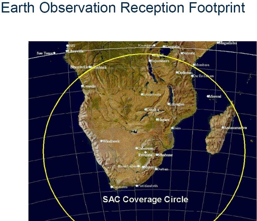
3 General info EOS s GPS s, Astological and Telecommunication satellites all are different types and they do not overlap in function There are over 2000 satellites orbiting the earth, 230+ of which SA had some involvement in SAC s mandate and only mandate is to service govt, and is govt-subsidised, so private requests gets 2 nd priority Soon: open access telemetry license with other countries, so SAC will be the only centre in SA through which to acquire satellite images No restrictions over Africa, but owner will still have ultimate control: currently no bi-lateral agreements re: any other African country
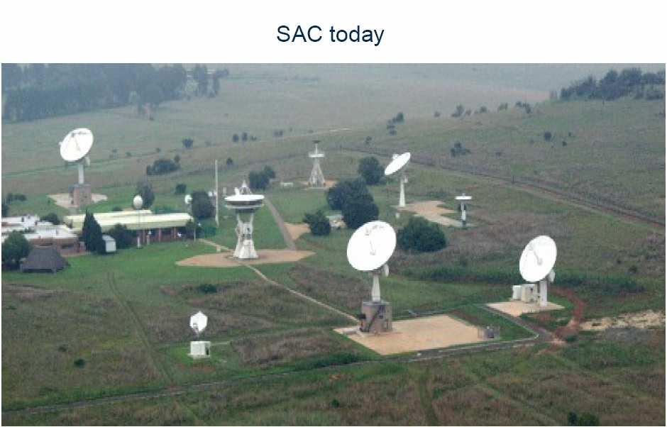
4
 Launch capabilities: micro and macro satellites (up to 40kg): est 5-10 years after SASA is established Will")
5 SA Space Agency Bill approved Dec 2007, will now become an Act. SAC will become NASA for SA Will do manufacturing of SA satellites in Stellenbosh (Denel) Launch capabilities: micro and macro satellites (up to 40kg): est 5-10 years after SASA is established Will have SA constellation by 2018, can select own resolutions: more independent, but more costly All SA-satellite data will be free for Govtagencies
6 Earth Observation Satellites (EOS) Near-Polar Geo-orbital

7 Near-Polar: simulate real-time (but there is no such thing as movementspaceobservation)
8

9 Types of EOS s Optical (Landsat; temporal revisits e.g. every 16 days: also measures e.g. water vapour and particulate matter) Radar ( ping and record info on refraction of the image: not nice to look at but can be very useful Hyperspectral (becoming more common: e.g. to id indigenous vegetation in a forest; measures CO2, SO2, PM > 2 micron, Water vapour, Ozone; daily at the same time)
10 Resolution 60cm = very high res; 30m = med res Resolution x 3 = object identification, thus 60cm res = 1.8m object identification Image catalogue > find image catalogue > space
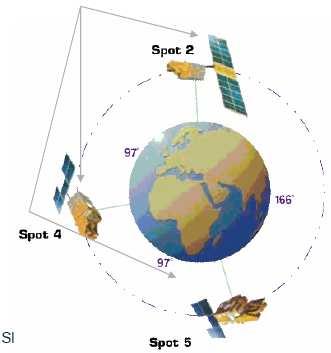
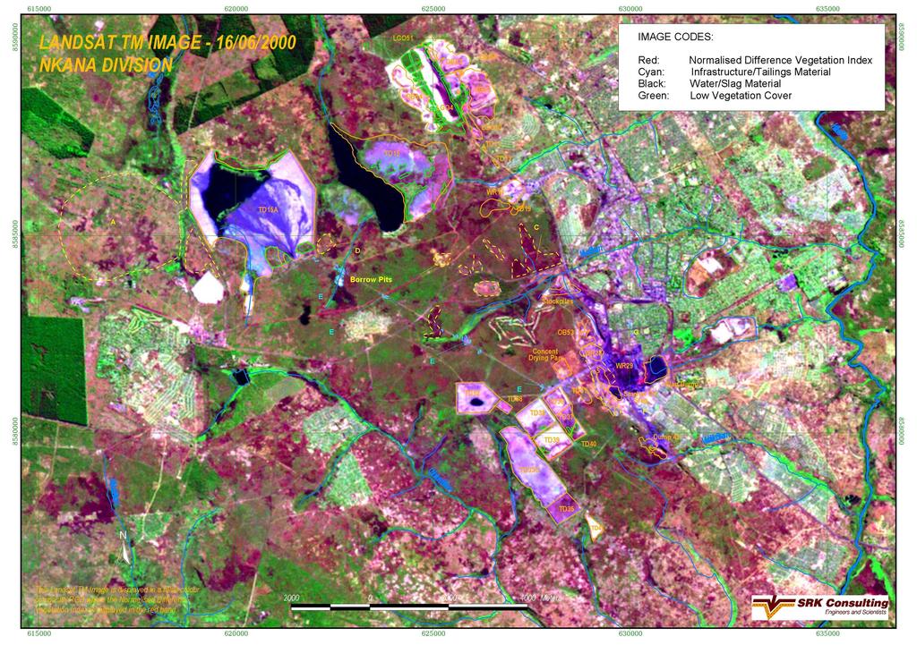
11 Satellite Name Res / Swath What is it good for Cost/Owner Details ERS2 30m Panchromatic; 100x100 km Flooding analysis ESA: Particularly expensive Direct Ingestion (D/I) Radar : cloud cover o.k. Landsat 5 (7 broke down) 30m Multispectral; 120m Thermal 180x180 km Enforcing water legislation: check who uses how much USGS (USA); Cost depends on size of area required D/I; 1986 present NOAA 1.1 km; 2000 km Vegetation, drought NOAA (USA) D/I Quickbird 60cm Panchromatic; 2.4m Multispectral 16x16km See smoke particles: for air pollution Digital Globe (USA) Distributor (D) World View 1 50cm Pan; 16x16 km Digital Globe (USA) D; Aerial photo resolution IKONOS 1m Panchromatic; 11x11 km Space Imaging (USA) D Spot 2 & 4 20m Multispectral; 10m Panchromatic Environmental applications Spot Image (France) D/I; Lens can swivel Spot 5 2.5m; All Spot: 60x60 km Change detection (2006 vs 2007); 3D; Pleiades (next version); enforcing water legislation: who uses how much Spot Image (No cost to SA Govt agencies) Entire SA covered; 2 nd version avail in March 08 TerraSAR-X Various 1m 50m; 5 km 500 km Disaster Management: while disasters occur: 24hr turnaround time Infoterra GBMH Interpretation & mapping by SAC takes 48 hrs only after download received ENVISAT Environmental Need special software tools FormoSat 2m Panchromatic 8m Multispectral; 24x24 km Every day same angle same time: Shortterm change detection Spot Image Eastern part of SA more covered than Western side Meteosat Every 15 minutes: Weather
12
13
14 Spot5 multi-spectral Spot5 natural colour
15
16 Space debris: Landsat 1; 7 etc Scheduled to have Fuel to re-enter Earth s atmosphere and land in the sea. theoretically
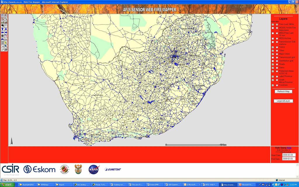
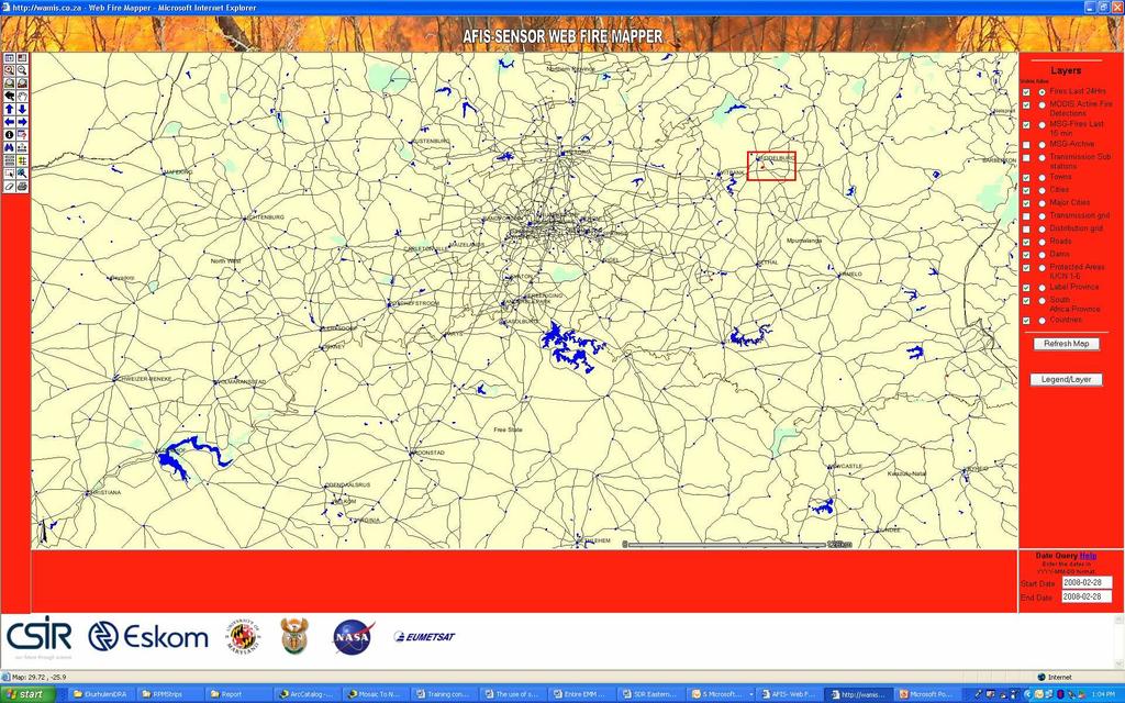
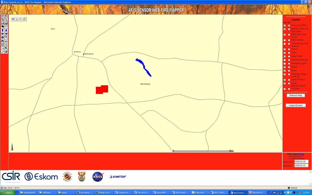
17 AFIS (Advanced Fire Information System) 1km res for veld fires Update every 15 minutes History search of fires in particular area Meraka Institute: Philip Frost; CSIR; University of Maryland
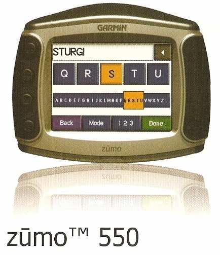
18
19
20
21
22 EOS s: conclusion Bilateral cooperation with other African countries are envisaged Want to negotiate Southern African License for SPOT 5, but not there yet International Charter on Space and Major Disasters: : Aim to provide: first satellite over an area will provide image: in next 5 10 years (need own satellite to share, to be a priority-member, else: the current turn-around time can be up to two months)

23 Global Positioning System What is GPS?? SPACE SEGMENT: 24+ Satellites orbiting Earth at 20,000km Orbital period 12 hours 3 Orbital planes at 55 degrees to Equator CONTROL SEGMENT: 4 ground monitoring stations 1 ground master control station USER SEGMENT: You and me
24 Atomic clock Space Segment Control Segment User Segment Differential GPS: Post-processing /Real-time

25 Global Positioning System: A system of radio-emitting and -receiving satellites used for determining positions on the earth. The orbiting satellites transmit signals that allow a GPS receiver anywhere on earth to calculate its own location through triangulation and trilateration (known location & orbits, accurate timing, distances). Your position is: 6 o S 39 o E

26 Post-processed Differential GPS PC Software Base Station Rover Corrected Position
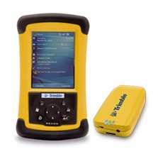
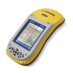
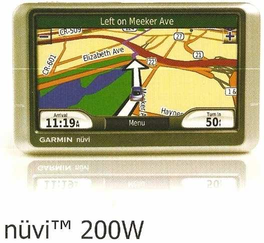
27 GPS Equipment Recreational(15m) Garmin/ Magellan/TopNav/TomTom/JNC/Trimble etc GIS/Mapping (30 cm - 5m) GIS/Mapping (1m Real-Time) (e.g. Trimble ProXRS, OmniSTAR)
28 Receivers
29 Seamless Integration into GIS PC PC Link Link with with PFO PFO USERS Web Web Services Shapefiles Coverages GIS database Geodatabases Rasters CAD CAD files files
30 Infrastructure inventory

31 Tree types Vegetation types/ ecological features Facilities inventory: Inside buildings as well Pathways/Road types
32 What influences GPS accuracy? Satellite clock error Selective availability Ionosphere and Atmospheric delays Dilution of Precision Multipathing Receiver issues Obstructions

33 Common fieldwork problems/gps set-up issues/15m vs 1m
34 Post-processing corrections
m; > 1m accuracy?")


35 What criteria can be used to select hardware and software? Hardware: Rugged: water-resistant; impact-resistant? (15)m; > 1m accuracy? Antenna-connections (to push through tree foliage/over fences/walls)? Connection to digital camera? Physical size? Battery life? RAM / SD card additional? Software: Easy to operate for non-gis and non-pc literate personnel/specialists? Data dictionary / lookup-list creation? Forced actions / users able to do own work? Easy upload and download / reporting? GIS-compatible? Bluetooth / transfer mode?
36 Lessons learned Over-the-counter GPS s usually does not allow for customised forms/lookup tables; Lookup tables need testing: do not roll out for final work immediately: first do selected sites/tests and then edit the lookup lists (data dictionaries). Get information regarding the need for e.g. capmounted antennas and pole-mounted antennas. Understand the influence that tall buildings, fences, trees can have, esp. when capturing lines/polygons (areas): include editing time afterwards.
 441 6163 mstrydom@srk.")
37 Q & A Maryna Strydom Tel: (011) mstrydom@srk.co.za
Introduction to Remote Sensing Fundamentals of Satellite Remote Sensing. Mads Olander Rasmussen
 Introduction to Remote Sensing Fundamentals of Satellite Remote Sensing Mads Olander Rasmussen (mora@dhi-gras.com) 01. Introduction to Remote Sensing DHI What is remote sensing? the art, science, and technology
9/12/2011. Training Course Remote Sensing Basic Theory & Image Processing Methods September 2011
 Training Course Remote Sensing Basic Theory & Image Processing Methods 19 23 September 2011 Popular Remote Sensing Sensors & their Selection Michiel Damen (September 2011) damen@itc.nl 1 Overview Low resolution
Remote Sensing Platforms
 Remote Sensing Platforms Remote Sensing Platforms - Introduction Allow observer and/or sensor to be above the target/phenomena of interest Two primary categories Aircraft Spacecraft Each type offers different
Module 3 Introduction to GIS. Lecture 8 GIS data acquisition
 Module 3 Introduction to GIS Lecture 8 GIS data acquisition GIS workflow Data acquisition (geospatial data input) GPS Remote sensing (satellites, UAV s) LiDAR Digitized maps Attribute Data Management Data
Lecture 6: Multispectral Earth Resource Satellites. The University at Albany Fall 2018 Geography and Planning
 Lecture 6: Multispectral Earth Resource Satellites The University at Albany Fall 2018 Geography and Planning Outline SPOT program and other moderate resolution systems High resolution satellite systems
Remote Sensing Platforms
 Types of Platforms Lighter-than-air Remote Sensing Platforms Free floating balloons Restricted by atmospheric conditions Used to acquire meteorological/atmospheric data Blimps/dirigibles Major role - news
ROLE OF SATELLITE DATA APPLICATION IN CADASTRAL MAP AND DIGITIZATION OF LAND RECORDS DR.T. RAVISANKAR GROUP HEAD (LRUMG) RSAA/NRSC/ISRO /DOS HYDERABAD
 RSAA/NRSC/ISRO /DOS HYDERABAD") ROLE OF SATELLITE DATA APPLICATION IN CADASTRAL MAP AND DIGITIZATION OF LAND RECORDS DR.T. RAVISANKAR GROUP HEAD (LRUMG) RSAA/NRSC/ISRO /DOS HYDERABAD WORKSHOP on Best Practices under National Land Records
ROLE OF SATELLITE DATA APPLICATION IN CADASTRAL MAP AND DIGITIZATION OF LAND RECORDS DR.T. RAVISANKAR GROUP HEAD (LRUMG) RSAA/NRSC/ISRO /DOS HYDERABAD WORKSHOP on Best Practices under National Land Records
WHAT IS NEXT IN EARTH OBSERVATION. SkyMed Mission
 WHAT IS NEXT IN EARTH OBSERVATION COSMO-SkyMed SkyMed Mission Paolo Ammendola Italian Space Agency Florence, Sept. 19, 2001 ammendola@asi asi.it THE NEEDS Market studies indicate that the value of the
UNOSAT Satellite Imagery and GIS Solutions for DRR and Emergency Management
 UNOSAT Satellite Imagery and GIS Solutions for DRR and Emergency Management Francesco Pisano Director, Research, Technology Applications & Knowledge Systems January 2013 Introduction to UNOSAT 2 About
Appendix D Brief GPS Overview
 Appendix D Brief GPS Overview Global Positioning System (GPS) Theory What is GPS? The Global Positioning System (GPS) is a satellite-based navigation system, providing position information, accurate to
Monitoring Natural Disasters with Small Satellites Smart Satellite Based Geospatial System for Environmental Protection
 Monitoring Natural Disasters with Small Satellites Smart Satellite Based Geospatial System for Environmental Protection Krištof Oštir, Space-SI, Slovenia Contents Natural and technological disasters Current
XSAT Ground Segment at CRISP
 XSAT Ground Segment at CRISP LIEW Soo Chin Head of Research, CRISP http://www.crisp.nus.edu.sg 5 th JPTM for Sentinel Asia Step-2, 14-16 Nov 2012, Daejeon, Korea Centre for Remote Imaging, Sensing and
Final Examination Introduction to Remote Sensing. Time: 1.5 hrs Max. Marks: 50. Section-I (50 x 1 = 50 Marks)
") Final Examination Introduction to Remote Sensing Time: 1.5 hrs Max. Marks: 50 Note: Attempt all questions. Section-I (50 x 1 = 50 Marks) 1... is the technology of acquiring information about the Earth's
Final Examination Introduction to Remote Sensing Time: 1.5 hrs Max. Marks: 50 Note: Attempt all questions. Section-I (50 x 1 = 50 Marks) 1... is the technology of acquiring information about the Earth's
Sources of Geographic Information
 Sources of Geographic Information Data properties: Spatial data, i.e. data that are associated with geographic locations Data format: digital (analog data for traditional paper maps) Data Inputs: sampled
United nation, Vienna, 9-13 February 2015
 United nation, Vienna, 9-13 February 2015 RUSSIAN FEDERAL SPACE AGENCY In the Russian Federation, the federal agency in charge of space activities is the Russian Federal Space Agency (Roscosmos) Earth
NR402 GIS Applications in Natural Resources
 NR402 GIS Applications in Natural Resources Lesson 5 GPS/GIS integration Global Positioning System (GPS)..a global navigation system that everyone can use What is GPS? How does it work? How accurate is
GEO 428: DEMs from GPS, Imagery, & Lidar Tuesday, September 11
 GEO 428: DEMs from GPS, Imagery, & Lidar Tuesday, September 11 Global Positioning Systems GPS is a technology that provides Location coordinates Elevation For any location with a decent view of the sky
GMES DA COPERNICUS
 2014 Airbus Defence and Space All rights reserved. The reproduction, distribution and utilization of this document as well as the communication of its contents to others without express authorization is
REMOTE SENSING INTERPRETATION
 REMOTE SENSING INTERPRETATION Jan Clevers Centre for Geo-Information - WU Remote Sensing --> RS Sensor at a distance EARTH OBSERVATION EM energy Earth RS is a tool; one of the sources of information! 1
The use of satellite images to forecast agricultural
 The use of satellite images to forecast agricultural Luxembourg, 12.03.2014 r. Tomasz Milewski NUTS for Poland: NUTS 1 macro-regions (grup of province, voivodships) (6), NUTS 2 - regions (province,
The studies began when the Tiros satellites (1960) provided man s first synoptic view of the Earth s weather systems.
 provided man s first synoptic view of the Earth s weather systems.") Remote sensing of the Earth from orbital altitudes was recognized in the mid-1960 s as a potential technique for obtaining information important for the effective use and conservation of natural resources.
Remote sensing of the Earth from orbital altitudes was recognized in the mid-1960 s as a potential technique for obtaining information important for the effective use and conservation of natural resources.
NON-PHOTOGRAPHIC SYSTEMS: Multispectral Scanners Medium and coarse resolution sensor comparisons: Landsat, SPOT, AVHRR and MODIS
 NON-PHOTOGRAPHIC SYSTEMS: Multispectral Scanners Medium and coarse resolution sensor comparisons: Landsat, SPOT, AVHRR and MODIS CLASSIFICATION OF NONPHOTOGRAPHIC REMOTE SENSORS PASSIVE ACTIVE DIGITAL
Sources of Geographic Information
 Sources of Geographic Information Data properties: Spatial data, i.e. data that are associated with geographic locations Data format: digital (analog data for traditional paper maps) Data Inputs: sampled
PEGASUS : a future tool for providing near real-time high resolution data for disaster management. Lewyckyj Nicolas
 PEGASUS : a future tool for providing near real-time high resolution data for disaster management Lewyckyj Nicolas nicolas.lewyckyj@vito.be http://www.pegasus4europe.com Overview Vito in a nutshell GI
Sensor resolutions from space: the tension between temporal, spectral, spatial and swath. David Bruce UniSA and ISU
 Sensor resolutions from space: the tension between temporal, spectral, spatial and swath David Bruce UniSA and ISU 1 Presentation aims 1. Briefly summarize the different types of satellite image resolutions
IKONOS High Resolution Multispectral Scanner Sensor Characteristics
 High Spatial Resolution and Hyperspectral Scanners IKONOS High Resolution Multispectral Scanner Sensor Characteristics Launch Date View Angle Orbit 24 September 1999 Vandenberg Air Force Base, California,
36. Global Positioning System
 36. Introduction to the Global Positioning System (GPS) Why do we need GPS? Position: a basic need safe sea travel, crowed skies, resource management, legal questions Positioning: a challenging job local
The Global Positioning System
 The Global Positioning System 5-1 US GPS Facts of Note DoD navigation system First launch on 22 Feb 1978, fully operational in 1994 ~$15 billion (?) invested to date 24 (+/-) Earth-orbiting satellites
GPS Milestones, cont. GPS Milestones. The Global Positioning Sytem, Part 1 10/10/2017. M. Helper, GEO 327G/386G, UT Austin 1. US GPS Facts of Note
 The Global Positioning System US GPS Facts of Note DoD navigation system First launch on 22 Feb 1978, fully operational in 1994 ~$15 billion (?) invested to date 24 (+/-) Earth-orbiting satellites (SVs)
Abstract Quickbird Vs Aerial photos in identifying man-made objects
 Abstract Quickbird Vs Aerial s in identifying man-made objects Abdullah Mah abdullah.mah@aramco.com Remote Sensing Group, emap Division Integrated Solutions Services Department (ISSD) Saudi Aramco, Dhahran
Satellite Imagery and Remote Sensing. DeeDee Whitaker SW Guilford High EES & Chemistry
 Satellite Imagery and Remote Sensing DeeDee Whitaker SW Guilford High EES & Chemistry whitakd@gcsnc.com Outline What is remote sensing? How does remote sensing work? What role does the electromagnetic
Copernicus Introduction Lisbon, Portugal 13 th & 14 th February 2014
 Copernicus Introduction Lisbon, Portugal 13 th & 14 th February 2014 Contents Introduction GMES Copernicus Six thematic areas Infrastructure Space data An introduction to Remote Sensing In-situ data Applications
ERS/ENVISAT ASAR Data Products and Services
 ERS/ENVISAT ASAR Data Products and Services Andrea Celentano Business Manager celentan@eurimage.com What is Eurimage? Founded in 1989 Current shareholders: Since 1989 Commercial Partner of the European
Satellite Imagery Characteristics, Uses and Delivery to GIS Systems. Wayne Middleton April 2014
 Satellite Imagery Characteristics, Uses and Delivery to GIS Systems Wayne Middleton April 2014 About Geoimage Founded in Brisbane 1988 Leading Independent company Specialists in satellite imagery and geospatial
DIGITALGLOBE SATELLITE IMAGERY AND CLOUD SERVICES FOR SUGARCANE MAPPING
 DIGITALGLOBE SATELLITE IMAGERY AND CLOUD SERVICES FOR SUGARCANE MAPPING PRESENTER: DILLON PANIZZOLO (TECHNICAL MANAGER) COMPANY: GEO DATA DESIGN DATE: 18 TH AUGUST 2015 SASTA Congress Sugar Cane Mapping
EO Data Today and Application Fields. Denise Petala
 EO Data Today and Application Fields Denise Petala ! IGD GROUP AE "Infotop SA, Geomet Ltd., Dynatools Ltd. "Equipment and know how in many application fields, from surveying till EO data and RS. # Leica,
Affordable space based radar for homeland security
 Changing the economics of space Affordable space based radar for homeland security Adam Baker Brent Abbott Phil Whittaker Rachel Bird Luis Gomes Summary Why Radar? However: Radar data is expensive Users
SAR Interferometry Capabilities of Canada's planned SAR Satellite Constellation
 SAR Interferometry Capabilities of Canada's planned SAR Satellite Constellation Dirk Geudtner, Guy Séguin,, Ralph Girard Canadian Space Agency RADARSAT Follow-on Program CSA is in the middle of a Phase
What is a GPS How does GPS work? GPS Segments GPS P osition Position Position Accuracy Accuracy Accuracy GPS A pplications Applications Applications
 What is GPS? What is a GPS How does GPS work? GPS Segments GPS Position Accuracy GPS Applications What is GPS? The Global Positioning System (GPS) is a precise worldwide radio-navigation system, and consists
Can Satellite Image Analysis Replace Manual Digitization?
 Can Satellite Image Analysis Replace Manual Digitization? GeoDATA London 30 th Nov 2017 LUCY KENNEDY Spottitt CEO Lucy.Kennedy@spottitt.com +44 772 594 4643 Agenda Why develop processes and services based
UNITED NATIONS UNIVERSITY Institute for Environment & Human Security (UNU-EHS) Bonn, Germany
 Bonn, Germany") UNITED NATIONS UNIVERSITY Institute for Environment & Human Security (UNU-EHS) Bonn, Germany Introduction to GPS technology Prof. Dr. Jörg Szarzynski Education Programme Director Head of Section EduSphere
UNITED NATIONS UNIVERSITY Institute for Environment & Human Security (UNU-EHS) Bonn, Germany Introduction to GPS technology Prof. Dr. Jörg Szarzynski Education Programme Director Head of Section EduSphere
An Introduction to Geomatics. Prepared by: Dr. Maher A. El-Hallaq خاص بطلبة مساق مقدمة في علم. Associate Professor of Surveying IUG
 An Introduction to Geomatics خاص بطلبة مساق مقدمة في علم الجيوماتكس Prepared by: Dr. Maher A. El-Hallaq Associate Professor of Surveying IUG 1 Airborne Imagery Dr. Maher A. El-Hallaq Associate Professor
Aral Sea profile Selection of area 24 February April May 1998
 250 km Aral Sea profile 1960 1960 1985 1986 1987 1988 1989 1990 1991 1992 1993 1994 1995 1996 1997 1998 2010? Selection of area Area of interest Kzyl-Orda Dried seabed 185 km Syrdarya river Aral Sea Salt
Overview of how remote sensing is used by the wildland fire community.
 Overview of how remote sensing is used by the wildland fire community. Presented to the ASEN 6210 Remote Sensing Seminar on 2/18/04 by: Jeff Baranyi ESRI Denver Reported by Gary Fager. Images are from
Data Sharing Issues in SE Asia
 Data Sharing Issues in SE Asia Kandasri Limpakom User Service and Business Development Office About GISTDA THEOS & Its Applications GISTDA s Data Sharing Geo-Informatics and Space Technology Development
CHAPTER 7: Multispectral Remote Sensing
 CHAPTER 7: Multispectral Remote Sensing REFERENCE: Remote Sensing of the Environment John R. Jensen (2007) Second Edition Pearson Prentice Hall Overview of How Digital Remotely Sensed Data are Transformed
9/12/2011. Training Course Remote Sensing Basic Theory & Image Processing Methods September 2011
 Training Course Remote Sensing Basic Theory & Image Processing Methods 19 23 September 2011 Introduction to Remote Sensing Michiel Damen (September 2011) damen@itc.nl 1 Overview Some definitions Remote
REMOTE SENSING. Topic 10 Fundamentals of Digital Multispectral Remote Sensing MULTISPECTRAL SCANNERS MULTISPECTRAL SCANNERS
 REMOTE SENSING Topic 10 Fundamentals of Digital Multispectral Remote Sensing Chapter 5: Lillesand and Keifer Chapter 6: Avery and Berlin MULTISPECTRAL SCANNERS Record EMR in a number of discrete portions
Using Freely Available. Remote Sensing to Create a More Powerful GIS
 Using Freely Available Government Data and Remote Sensing to Create a More Powerful GIS All rights reserved. ENVI, E3De, IAS, and IDL are trademarks of Exelis, Inc. All other marks are the property of
Introduction to the Global Positioning System
 GPS for Fire Management - 2004 Introduction to the Global Positioning System Pre-Work Pre-Work Objectives Describe at least three sources of GPS signal error, and identify ways to mitigate or reduce those
Landsat 8 Pansharpen and Mosaic Geomatica 2015 Tutorial
 Landsat 8 Pansharpen and Mosaic Geomatica 2015 Tutorial On February 11, 2013, Landsat 8 was launched adding to the constellation of Earth imaging satellites. It is the seventh satellite to reach orbit
(Refer Slide Time: 1:20)
") Introduction to Remote Sensing Dr. Arun K Saraf Department of Earth Sciences Indian Institute of Technology Roorkee Lecture 02 Development of Remote Sensing Technology & Advantages Hello! This is second
Introduction to Remote Sensing Dr. Arun K Saraf Department of Earth Sciences Indian Institute of Technology Roorkee Lecture 02 Development of Remote Sensing Technology & Advantages Hello! This is second
CALL359 JAPAN S EARTHQUAKE 2011, MARCH, 11
 CALL359 JAPAN S EARTHQUAKE 2011, MARCH, 11 PM for International Charter Dr. Masahiko Nagai JAXA - AIT 25th Meeting of the International Charter May 12 th 2011 on 2011, March, 11 at 14:46 (JST) Iwate Pref.
Debris Detection: Background, Efforts, & Lessons Learned. Peter Murphy Alaska Coordinator / Detection Lead NOAA Marine Debris Program
 Debris Detection: Background, Efforts, & Lessons Learned Peter Murphy Alaska Coordinator / Detection Lead NOAA Marine Debris Program Outline Marine Debris Issue Types Distribution Impacts NOAA Marine Debris
Introduction to KOMPSAT
 Introduction to KOMPSAT September, 2016 1 CONTENTS 01 Introduction of SIIS 02 KOMPSAT Constellation 03 New : KOMPSAT-3 50 cm 04 New : KOMPSAT-3A 2 KOMPSAT Constellation KOMPSAT series National space program
Remote Sensing for Rangeland Applications
 Remote Sensing for Rangeland Applications Jay Angerer Ecological Training June 16, 2012 Remote Sensing The term "remote sensing," first used in the United States in the 1950s by Ms. Evelyn Pruitt of the
746A27 Remote Sensing and GIS. Multi spectral, thermal and hyper spectral sensing and usage
 746A27 Remote Sensing and GIS Lecture 3 Multi spectral, thermal and hyper spectral sensing and usage Chandan Roy Guest Lecturer Department of Computer and Information Science Linköping University Multi
Application of Satellite Remote Sensing for Natural Disasters Observation
 Application of Satellite Remote Sensing for Natural Disasters Observation Prof. Krištof Oštir, Ph.D. University of Ljubljana Faculty of Civil and Geodetic Engineering Outline Earth observation current
Chapter 3 Data Acquisition in an Urban Environment
 Chapter 3 Data Acquisition in an Urban Environment - One fundamental issue : cost of data 5-10 times of HW, SW, org ware, staff training, maintenance - Another issue : different kinds of data alphanumeric
Int n r t o r d o u d c u ti t on o n to t o Remote Sensing
 Introduction to Remote Sensing Definition of Remote Sensing Remote sensing refers to the activities of recording/observing/perceiving(sensing)objects or events at far away (remote) places. In remote sensing,
9/12/2011. Training Course Remote Sensing Basic Theory & Image Processing Methods September 2011
 Training Course Remote Sensing Basic Theory & Image Processing Methods 19 23 September 2011 Remote Sensing Platforms Michiel Damen (September 2011) damen@itc.nl 1 Overview Platforms & missions aerial surveys
Line and polygon features can be created via on-screen digitizing.
 This module explains how GPS works, sources of error, and error correction using real time or post processing differential correction. Cost and accuracy of different grades of GPS units are also part of
PRINCIPLES AND FUNCTIONING OF GPS/ DGPS /ETS ER A. K. ATABUDHI, ORSAC
 PRINCIPLES AND FUNCTIONING OF GPS/ DGPS /ETS ER A. K. ATABUDHI, ORSAC GPS GPS, which stands for Global Positioning System, is the only system today able to show you your exact position on the Earth anytime,
ASSESSMENT BY ESA OF GCOS CLIMATE MONITORING PRINCIPLES FOR GMES
 Prepared by ESA Agenda Item: III.5 Discussed in WG3 ASSESSMENT BY ESA OF GCOS CLIMATE MONITORING PRINCIPLES FOR GMES The ESA Sentinel missions are being designed for the GMES services, with special emphasis
Update on Landsat Program and Landsat Data Continuity Mission
 Update on Landsat Program and Landsat Data Continuity Mission Dr. Jeffrey Masek LDCM Deputy Project Scientist NASA GSFC, Code 923 November 21, 2002 Draft LDCM Implementation Phase RFP Overview Page 1 Celebrate!
SUGAR_GIS. From a user perspective. Provides spatial distribution of a wide range of sugarcane production data in an easy to use and sensitive way.
 SUGAR_GIS From a user perspective What is Sugar_GIS? A web-based, decision support tool. Provides spatial distribution of a wide range of sugarcane production data in an easy to use and sensitive way.
Dirty REMOTE SENSING Week 2 Interpreation
 Dirty REMOTE SENSING Week 2 Interpreation Earthobservation.wordpress.com Stuart Green Stuart.Green@teagasc.ie AERIAL PHOTOGRAPHIC INTERPRETATION http://airphotos.nrcan.gc.ca/photos101/photos101_info_e.php
Introduction to Total Station and GPS
 Introduction to Total Station and GPS Dr. P. NANJUNDASWAMY Professor of Civil Engineering J S S Science and Technology University S J College of Engineering Mysuru 570 006 Introduction History GPS Overview
Status of Sentinel-1 and acquisition plans for GFOI
 Status of Sentinel-1 and acquisition plans for GFOI Frank Martin Seifert, Pierre Potin, Johannes Roeder, ESA Earth Observation Programme 5 th Space Data Coordination, ESRIN, Frascati, 24 February 2014
Geospatial Vision and Policies Korean Industry View 26 November, 2014 SI Imaging Services
 Geospatial Vision and Policies Korean Industry View 26 November, 2014 SI Imaging Services Distribution Limitation, SI Imaging Services Proprietary Data : The data contained in this document, without the
TopSat: Brief to Ground Segment Coordination. Presenter Ian Pilling. By : W.A. Levett. Co author: E.J. Baxter.
 TopSat: Brief to Ground Segment Coordination Board Presenter Ian Pilling By : W.A. Levett Co author: E.J. Baxter Contents Space Division overview The TopSat mission Overview Development Programme Launch
HyperSTREEGO A Reactive Multispectral Optical Payload for Small Satellites
 Driving Innovation in Space Optics and Optical Systems HyperSTREEGO A Reactive Multispectral Optical Payload for Small Satellites Giovanni Bianucci 1 Introduction Demand for remote sensing data is increasing
Title of presentation runs here on two lines / Arial Regular 30 pt
 Title of presentation runs here on two lines / Arial Regular 30 pt Subtitle goes here / Arial Regular 20 pt Airbus Defense and Space Geo-Intelligence PIONEERING THE FUTURE TOGETHER Name Here / Arial Regular
GPS: The Basics. Darrell R. Dean, Jr. Civil and Environmental Engineering West Virginia University. Expected Learning Outcomes for GPS
 GPS: The Basics Darrell R. Dean, Jr. Civil and Environmental Engineering West Virginia University Expected Learning Outcomes for GPS Explain the acronym GPS Name 3 important tdt dates in history of GPS
International Charter Space and Major Disasters
 International Charter Space and Major Disasters Sentinel Asia Joint Project Team Meeting July 7, 2010 Brenda Jones U.S. Geological Survey Charter Executive Secretariat Purpose An International agreement
VIETNAM ACADEMY OF SCIENCE AND TECHNOLOGY Vietnam National Satellite Center
 VIETNAM ACADEMY OF SCIENCE AND TECHNOLOGY Vietnam National Satellite Center Assoc. Prof. Dr. Pham Anh Tuan Director of Vietnam National Satellite Center CONTENTS 1. Strategy for research and application
From Proba-V to Proba-MVA
 From Proba-V to Proba-MVA Fabrizio Niro ESA Sensor Performances Products and Algorithm (SPPA) ESA UNCLASSIFIED - For Official Use Proba-V extension in the Copernicus era Proba-V was designed with the main
The Normal Baseline. Dick Gent Law of the Sea Division UK Hydrographic Office
 The Normal Baseline Dick Gent Law of the Sea Division UK Hydrographic Office 2 The normal baseline for measuring the breadth of the territorial sea is the low water line along the coast as marked on large
FORMOSAT-2, KOMPSAT-2, ASTROTERRA
 FORMOSAT-2, KOMPSAT-2, ASTROTERRA Igor Lampin, Didier Giacobbo - SPOT IMAGE S.A. GSCB Workshop, ESA/ESRIN Frascati FORMOSAT-2 Mission status F-2 is owned by Taiwan National Space Organisation (NSPO), designed
Challenges and Solutions for GPS Receiver Test
 Challenges and Solutions for GPS Receiver Test Presenter: Mirin Lew January 28, 2010 Agenda GPS technology concepts GPS and GNSS overview Assisted GPS (A-GPS) Basic tests required for GPS receiver verification
Table Satellites used for observations by members of the Disaster Charter and others (except Daichi)
") 2.1.4 Cooperation with from overseas institutions JAXA asked Sentinel Asia and, on behalf of the Cabinet Office, the Disaster Charter to carry out emergency observations immediately after the earthquake
2.1.4 Cooperation with from overseas institutions JAXA asked Sentinel Asia and, on behalf of the Cabinet Office, the Disaster Charter to carry out emergency observations immediately after the earthquake
Important Missions. weather forecasting and monitoring communication navigation military earth resource observation LANDSAT SEASAT SPOT IRS
 Fundamentals of Remote Sensing Pranjit Kr. Sarma, Ph.D. Assistant Professor Department of Geography Mangaldai College Email: prangis@gmail.com Ph. No +91 94357 04398 Remote Sensing Remote sensing is defined
GNSS Low-Cost High-Accuracy Receiver (L-CHAR)
") GNSS Low-Cost High-Accuracy Receiver (L-CHAR) Dinesh Manandhar Center for Spatial Information Science The University of Tokyo Contact Information: dinesh@iis.u-tokyo.ac.jp Slide : 1 High Accuracy Receivers
GNSS Low-Cost High-Accuracy Receiver (L-CHAR) Dinesh Manandhar Center for Spatial Information Science The University of Tokyo Contact Information: dinesh@iis.u-tokyo.ac.jp Slide : 1 High Accuracy Receivers
Image interpretation. Aliens create Indian Head with an ipod? Badlands Guardian (CBC) This feature can be found 300 KMs SE of Calgary.
 This feature can be found 300 KMs SE of Calgary.") Image interpretation Aliens create Indian Head with an ipod? Badlands Guardian (CBC) This feature can be found 300 KMs SE of Calgary. 50 1 N 110 7 W Milestones in the History of Remote Sensing 19 th century
Image interpretation Aliens create Indian Head with an ipod? Badlands Guardian (CBC) This feature can be found 300 KMs SE of Calgary. 50 1 N 110 7 W Milestones in the History of Remote Sensing 19 th century
News on Image Acquisition for Campaign 2008
 Ispra, 3-4/04/2008 CwRS KO meeting 1 News on Image Acquisition for Campaign 2008 Pär Johan Åstrand, Maria Erlandsson, annian Zhu CID Action Ispra, 3-4/04/2008 CwRS KO meeting 2 Outline of presentation
Global Positioning Systems (GPS) Trails: the achilles heel of mapping from the air / satellites
 Trails: the achilles heel of mapping from the air / satellites") Global Positioning Systems (GPS) Trails: the achilles heel of mapping from the air / satellites Google maps updated regularly by local users using GPS Also: http://openstreetmaps.org GPS applications
Global Positioning Systems (GPS) Trails: the achilles heel of mapping from the air / satellites Google maps updated regularly by local users using GPS Also: http://openstreetmaps.org GPS applications
How to access EO data
 How to access EO data PAC USF USF PDHS LRAC USCF PDCC Europe s expanding EO Capability Continuity & Evolution Wind Scatterometer (Low rate) all weather; day and night SAR Antenna (C-Band, 5.3 GHz) image
Blacksburg, VA July 24 th 30 th, 2010 Remote Sensing Page 1. A condensed overview. For our purposes
 A condensed overview George McLeod Prepared by: With support from: NSF DUE-0903270 in partnership with: Geospatial Technician Education Through Virginia s Community Colleges (GTEVCC) The art and science
Imagery Archive Works
 USDA How Satellite the Imagery USDA s Archive Satellite Imagery Archive Works A. What is the USDA Satellite Imagery Archive? B. What are the benefits of participating in the USDA Archive? C. What types
Detection and Monitoring Through Remote Sensing....The Need For A New Remote Sensing Platform
 WILDFIRES Detection and Monitoring Through Remote Sensing...The Need For A New Remote Sensing Platform Peter Kimball ASEN 5235 Atmospheric Remote Sensing 5/1/03 1. Abstract This paper investigates the
Remote sensing system Resurs-P
 Joint-stock company «Space rocket center «Progress» Remote sensing system Resurs-P Alexander N. Kirilin, Ravil N. Akhmetov, Nikolay R. Stratilatov, Alexander I. Baklanov Speaker: Maxim V. Klyushnikov October
Introduction to the Global Positioning System
 GPS for ICS - 2003 Introduction to the Global Positioning System Pre-Work Pre-Work Objectives Describe at least three sources of GPS signal error, and ways to mitigate or reduce those errors. Identify
Maximize Utilization of the performance of EOSs and strengthen. The First Steering Committee Secretariat JAXA
 Maximize Utilization of the performance of EOSs and strengthen cooperation among DPN/DAN The First Steering Committee Secretariat JAXA ALOS 2 observation is strong tool for disaster monitoring Wide area/range
NASA Missions and Products: Update. Garik Gutman, LCLUC Program Manager NASA Headquarters Washington, DC
 NASA Missions and Products: Update Garik Gutman, LCLUC Program Manager NASA Headquarters Washington, DC 1 JPSS-2 (NOAA) SLI-TBD Formulation in 2015 RBI OMPS-Limb [[TSIS-2]] [[TCTE]] Land Monitoring at
Tutorial 10 Information extraction from high resolution optical satellite sensors
 Tutorial 10 Information extraction from high resolution optical satellite sensors Karsten Jacobsen 1, Emmanuel Baltsavias 2, David Holland 3 1 University of, Nienburger Strasse 1, D-30167, Germany, jacobsen@ipi.uni-hannover.de
Remote Sensing and GIS
 Remote Sensing and GIS Atmosphere Reflected radiation, e.g. Visible Emitted radiation, e.g. Infrared Backscattered radiation, e.g. Radar (λ) Visible TIR Radar & Microwave 11/9/2017 Geo327G/386G, U Texas,
Introduction to Geographic Information Science. Last Lecture. Today s Outline. Geography 4103 / GNSS/GPS Technology
 Geography 4103 / 5103 Introduction to Geographic Information Science GNSS/GPS Technology Last Lecture Geoids Ellipsoid Datum Projection Basics Today s Outline GNSS technology How satellite based navigation
Introduction to NAVSTAR GPS
 Introduction to NAVSTAR GPS Charlie Leonard, 1999 (revised 2001, 2002) The History of GPS Feasibility studies begun in 1960 s. Pentagon appropriates funding in 1973. First satellite launched in 1978. System
Theme: ocean colour observations from the geostationary orbit
 A new IOCCG working group Theme: ocean colour observations from the geostationary orbit Today (Nov 1 st, 2008):1 st Working group meeting, with the following goals: - Members of the WG meet and know better
SOME ASPECT AND PERSPECTIVES OF IMPLEMENTATION OF THE NATIONAL POLICY IN THE FIELD OF EXPLORATION AND PEACEFUL USES OF OUTER SPACE
 SOME ASPECT AND PERSPECTIVES OF IMPLEMENTATION OF THE NATIONAL POLICY IN THE FIELD OF EXPLORATION AND PEACEFUL USES OF OUTER SPACE 1 Folie 1 NKS Raumfahrt, Dr. Adrian klein Background National Academy