Mapping road traffic conditions using high resolution satellite images
|
|
|
- Ashlie Watson
- 6 years ago
- Views:
Transcription
1 Mapping road traffic conditions using high resolution satellite images NOBIM June in Trondheim Siri Øyen Larsen, Jostein Amlien, Line Eikvil, Ragnar Bang Huseby, Hans Koren, and Rune Solberg, Norwegian Computing Center Collaborators: Norwegian Public Roads Administration (Statens Vegvesen) Norwegian Space Centre (Norsk Romsenter)
2 Outline Background Algorithm Masks Segmentation Shadow prediction Feature extraction Classification Results Conclusion
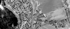
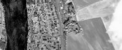
3 Background Road network maintenance and development Annual Day Traffic (ADT) statistical tools developed by NR Today: induction loops in the road expensive limited geographical coverage In the future: automated counts using high resolution satellite images?
4 Masks Road mask manual delineation automatic generation buffer mask from midline vectors rectification (manually selected reference points) Vegetation mask roadside tree canopy and vegetation between lanes NDVI + Otsu
5 Segmentation Image histogram of masked panchromatic image
6 Segmentation Segmentation of dark segments: strict threshold: Otsu [Ιmin, μ - σ] loose threshold: Otsu [Ιmin, μ -0.5σ] Segmentation of bright segments: loose threshold: Otsu [μ + σ, Ιmax ] strict threshold: μ + 3σ
7 Segmentation Segmentation thresholds


8 Segmentation examples

9 Vehicle shadows
10 Prediction of vehicle shadows A dark segment that 1) overlaps the expected shadow zone of a bright segment 2) is close in distance to the bright segment is considered to be a vehicle shadow To predict this we need a segmented image containing dark segments a segmented image containing bright segments a distance map to bright objects a structure element representing the expected shadow zone
11 Sun azimuth relative to image Direction of shadow N W local azimuth E S
12 Sun elevation Length of shadow vehicle height sun elevation shadow length
13 Predicting shadows 1 Dilate bright segments with expected shadow zone Subtract bright segments
14 Predicting shadows 2 dark segments distance to bright segments For each dark segment: otherwise if distance to bright segment is small & it overlaps an expected shadow zone vehicles expected shadow zones shadows


15 Classification Maximum likelihood multivariate Gaussian distribution general class covariance matrices Six classes: Bright car Dark car Bright truck Bright vehicle fragment Vehicle shadow Road mark - arrow
16 Region features Preclassification Rule based Area Elongation Main classification Maximum likelihood Intensity mean Gradient mean (Sobel) Intensity standard deviation Length of bounding box 1st Hu moment μ 20 + μ02 Spatial spread ( 2 ) μ 00 Post classification Rule based Distance to nearest shadow A small bright segment close to a shadow is more likely a vehicle fragment (as opposed to a road mark)
17 Illustration of features 1000 masked panchromatic image 0 length spatial spread mean intensity intensity standard deviation st Hu moment mean gradient
18 Classification results Classification rate: 70,6% Classification rate not including reject segments: 88,7% Two-class (car/no car) classification rate: 81,0% Given label Bright Dark Vehicle Road True label vehicle vehicle shadow mark SUM Bright vehicle Dark vehicle Vehicle shadow Road marking Reject SUM
19 Validation Counts from road stations: # of cars passing per hour average speed extract sub image that cover a road segment in the vicinity of the station estimate # of vehicles that should appear in the image (based on # of vehicles per hour + speed + length of road) Manual counts: two persons have independently counted vehicles in the images Automatic counts in image: using the described methods
20 Validation results Location Length of road segment (m) Time of image acquisition (UTC) Manual count in image Predicted # of vehicles in image (from inroad counts UTC) Predicted # of vehicles in image (from inroad counts UTC) Number of objects classified as vehicles Sennalandet : Kristiansund # : Kristiansund # : Østerdalen north : Eiker : Sollihøgda # : Sollihøgda # :


21 Challenges Different lighting conditions The hypothesis about the image histogram does not hold anymore


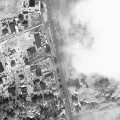
22 Challenges


23 Reject segments Heteregeneous group of segments that do not belong to any of the classes, e.g.: tree shadows other types of road marks part of bridges, signs, roundabouts, etc.
24 Conclusion The majority of vehicles that are correctly segmented are also correctly classified The segmentation routine should be improved in order to find even vehicles with low contrast Additional features and context based information should be examined in order to reject non-vehicle segments
25 The SatTrafikk project Started in 2006 with the ESA (European Space Agency) project Road Traffic Snapshot, Institute of Transport Economics (Transportøkonomisk Institutt) also involved SatTrafikk: ? Main utility: estimate Annual Day Traffic, used by Norwegian Public Roads Administration, especially useful for (country side) high ways where inroad counts are expensive Software developed by NR Funding: Norwegian Space Centre

26 Thank you for the attention!
Detection of burial mounds in high-resolution satellite images of agricultural land
 Detection of burial mounds in high-resolution satellite images of agricultural land Øivind Due Trier Section for Earth Observation, Norwegian Computing Center, Gaustadalléen 23, P.O. box 114 Blindern,
Øivind Due Trier, Siri Øyen Larsen and Rune Solberg 1. AARGnews 39 (September 2009)
") Finding burial mounds from space: automatic detection of circular soil marks and crop marks in QuickBird imagery of agricultural land in south-east Norway Øivind Due Trier, Siri Øyen Larsen and Rune Solberg
Finding burial mounds from space: automatic detection of circular soil marks and crop marks in QuickBird imagery of agricultural land in south-east Norway Øivind Due Trier, Siri Øyen Larsen and Rune Solberg
Preparing Remote Sensing Data for Natural Resources Mapping (image enhancement, rectifications )
") Preparing Remote Sensing Data for Natural Resources Mapping (image enhancement, rectifications ) Why is this important What are the major approaches Examples of digital image enhancement Follow up exercises
Preparing Remote Sensing Data for Natural Resources Mapping (image enhancement, rectifications ) Why is this important What are the major approaches Examples of digital image enhancement Follow up exercises
Automatic Vehicles Detection from High Resolution Satellite Imagery Using Morphological Neural Networks
 Automatic Vehicles Detection from High Resolution Satellite Imagery Using Morphological Neural Networks HONG ZHENG Research Center for Intelligent Image Processing and Analysis School of Electronic Information
Counting Sugar Crystals using Image Processing Techniques
 Counting Sugar Crystals using Image Processing Techniques Bill Seota, Netshiunda Emmanuel, GodsGift Uzor, Risuna Nkolele, Precious Makganoto, David Merand, Andrew Paskaramoorthy, Nouralden, Lucky Daniel
COMPATIBILITY AND INTEGRATION OF NDVI DATA OBTAINED FROM AVHRR/NOAA AND SEVIRI/MSG SENSORS
 COMPATIBILITY AND INTEGRATION OF NDVI DATA OBTAINED FROM AVHRR/NOAA AND SEVIRI/MSG SENSORS Gabriele Poli, Giulia Adembri, Maurizio Tommasini, Monica Gherardelli Department of Electronics and Telecommunication
Image Classification (Decision Rules and Classification)
") Exercise #5D Image Classification (Decision Rules and Classification) Objective Choose how pixels will be allocated to classes Learn how to evaluate the classification Once signatures have been defined
Exercise #5D Image Classification (Decision Rules and Classification) Objective Choose how pixels will be allocated to classes Learn how to evaluate the classification Once signatures have been defined
DemoSnow Snow cover mapping with optical data
 DemoSnow Snow cover mapping with optical data Norwegian Computing Center/Applied Research and Development NOTAT/NOTE SAMBA/24/02 Hans Koren Rune Solberg Oslo September 2002 Copyright Norsk Regnesentral
Towards an Automatic Road Lane Marks Extraction Based on Isodata Segmentation and Shadow Detection from Large-Scale Aerial Images
 Towards an Automatic Road Lane Marks Extraction Based on Isodata Segmentation and Shadow Detection from Key words: road marking extraction, ISODATA segmentation, shadow detection, aerial image SUMMARY
DISCRIMINANT FUNCTION CHANGE IN ERDAS IMAGINE
 DISCRIMINANT FUNCTION CHANGE IN ERDAS IMAGINE White Paper April 20, 2015 Discriminant Function Change in ERDAS IMAGINE For ERDAS IMAGINE, Hexagon Geospatial has developed a new algorithm for change detection
VALIDATION OF A SEMI-AUTOMATED CLASSIFICATION APPROACH FOR URBAN GREEN STRUCTURE
 VALIDATION OF A SEMI-AUTOMATED CLASSIFICATION APPROACH FOR URBAN GREEN STRUCTURE Øivind Due Trier a, * and Einar Lieng b a Norwegian Computing Center, Gaustadalléen 23, P.O. Box 114 Blindern, NO-0314 Oslo,
Voice Activity Detection
 Voice Activity Detection Speech Processing Tom Bäckström Aalto University October 2015 Introduction Voice activity detection (VAD) (or speech activity detection, or speech detection) refers to a class
Student: Nizar Cherkaoui. Advisor: Dr. Chia-Ling Tsai (Computer Science Dept.) Advisor: Dr. Eric Muller (Biology Dept.)
 Advisor: Dr. Eric Muller (Biology Dept.)") Student: Nizar Cherkaoui Advisor: Dr. Chia-Ling Tsai (Computer Science Dept.) Advisor: Dr. Eric Muller (Biology Dept.) Outline Introduction Foreground Extraction Blob Segmentation and Labeling Classification
Student: Nizar Cherkaoui Advisor: Dr. Chia-Ling Tsai (Computer Science Dept.) Advisor: Dr. Eric Muller (Biology Dept.) Outline Introduction Foreground Extraction Blob Segmentation and Labeling Classification
Background Subtraction Fusing Colour, Intensity and Edge Cues
 Background Subtraction Fusing Colour, Intensity and Edge Cues I. Huerta and D. Rowe and M. Viñas and M. Mozerov and J. Gonzàlez + Dept. d Informàtica, Computer Vision Centre, Edifici O. Campus UAB, 08193,
USE OF DIGITAL AERIAL IMAGES TO DETECT DAMAGES DUE TO EARTHQUAKES
 USE OF DIGITAL AERIAL IMAGES TO DETECT DAMAGES DUE TO EARTHQUAKES Fumio Yamazaki 1, Daisuke Suzuki 2 and Yoshihisa Maruyama 3 ABSTRACT : 1 Professor, Department of Urban Environment Systems, Chiba University,
The Classification of Gun s Type Using Image Recognition Theory
 International Journal of Information and Electronics Engineering, Vol. 4, No. 1, January 214 The Classification of s Type Using Image Recognition Theory M. L. Kulthon Kasemsan Abstract The research aims
Use of digital aerial camera images to detect damage to an expressway following an earthquake
 Use of digital aerial camera images to detect damage to an expressway following an earthquake Yoshihisa Maruyama & Fumio Yamazaki Department of Urban Environment Systems, Chiba University, Chiba, Japan.
Digital Image Processing
 Digital Image Processing Part 2: Image Enhancement Digital Image Processing Course Introduction in the Spatial Domain Lecture AASS Learning Systems Lab, Teknik Room T26 achim.lilienthal@tech.oru.se Course
ArcGIS Pro: What s New in Analysis
 Federal GIS Conference February 9 10, 2015 Washington, DC ArcGIS Pro: What s New in Analysis James Sullivan What is analysis? Analysis transforms raw data into information or knowledge. Spatial analysis
IMPROVEMENT IN THE DETECTION OF LAND COVER CLASSES USING THE WORLDVIEW-2 IMAGERY
 IMPROVEMENT IN THE DETECTION OF LAND COVER CLASSES USING THE WORLDVIEW-2 IMAGERY Ahmed Elsharkawy 1,2, Mohamed Elhabiby 1,3 & Naser El-Sheimy 1,4 1 Dept. of Geomatics Engineering, University of Calgary
Image Analysis based on Spectral and Spatial Grouping
 Image Analysis based on Spectral and Spatial Grouping B. Naga Jyothi 1, K.S.R. Radhika 2 and Dr. I. V.Murali Krishna 3 1 Assoc. Prof., Dept. of ECE, DMS SVHCE, Machilipatnam, A.P., India 2 Assoc. Prof.,
INDIAN VEHICLE LICENSE PLATE EXTRACTION AND SEGMENTATION
 International Journal of Computer Science and Communication Vol. 2, No. 2, July-December 2011, pp. 593-599 INDIAN VEHICLE LICENSE PLATE EXTRACTION AND SEGMENTATION Chetan Sharma 1 and Amandeep Kaur 2 1
Recognition Of Vehicle Number Plate Using MATLAB
 Recognition Of Vehicle Number Plate Using MATLAB Mr. Ami Kumar Parida 1, SH Mayuri 2,Pallabi Nayk 3,Nidhi Bharti 4 1Asst. Professor, Gandhi Institute Of Engineering and Technology, Gunupur 234Under Graduate,
Checkerboard Tracker for Camera Calibration. Andrew DeKelaita EE368
 Checkerboard Tracker for Camera Calibration Abstract Andrew DeKelaita EE368 The checkerboard extraction process is an important pre-preprocessing step in camera calibration. This project attempts to implement
VEHICLE LICENSE PLATE DETECTION ALGORITHM BASED ON STATISTICAL CHARACTERISTICS IN HSI COLOR MODEL
 VEHICLE LICENSE PLATE DETECTION ALGORITHM BASED ON STATISTICAL CHARACTERISTICS IN HSI COLOR MODEL Instructor : Dr. K. R. Rao Presented by: Prasanna Venkatesh Palani (1000660520) prasannaven.palani@mavs.uta.edu
AUTOMATIC DETECTION OF HEDGES AND ORCHARDS USING VERY HIGH SPATIAL RESOLUTION IMAGERY
 AUTOMATIC DETECTION OF HEDGES AND ORCHARDS USING VERY HIGH SPATIAL RESOLUTION IMAGERY Selim Aksoy Department of Computer Engineering, Bilkent University, Bilkent, 06800, Ankara, Turkey saksoy@cs.bilkent.edu.tr
GE 113 REMOTE SENSING
 GE 113 REMOTE SENSING Topic 8. Image Classification and Accuracy Assessment Lecturer: Engr. Jojene R. Santillan jrsantillan@carsu.edu.ph Division of Geodetic Engineering College of Engineering and Information
A Vehicular Visual Tracking System Incorporating Global Positioning System
 A Vehicular Visual Tracking System Incorporating Global Positioning System Hsien-Chou Liao and Yu-Shiang Wang Abstract Surveillance system is widely used in the traffic monitoring. The deployment of cameras
Implementation of Barcode Localization Technique using Morphological Operations
 Implementation of Barcode Localization Technique using Morphological Operations Savreet Kaur Student, Master of Technology, Department of Computer Engineering, ABSTRACT Barcode Localization is an extremely
Image Capture and Problems
 Image Capture and Problems A reasonable capture IVR Vision: Flat Part Recognition Fisher lecture 4 slide 1 Image Capture: Focus problems Focus set to one distance. Nearby distances in focus (depth of focus).
Comparing Means. Chapter 24. Case Study Gas Mileage for Classes of Vehicles. Case Study Gas Mileage for Classes of Vehicles Data collection
 Chapter 24 One-Way Analysis of Variance: Comparing Several Means BPS - 5th Ed. Chapter 24 1 Comparing Means Chapter 18: compared the means of two populations or the mean responses to two treatments in
Vision Review: Image Processing. Course web page:
 Vision Review: Image Processing Course web page: www.cis.udel.edu/~cer/arv September 7, Announcements Homework and paper presentation guidelines are up on web page Readings for next Tuesday: Chapters 6,.,
CSE 564: Scientific Visualization
 CSE 564: Scientific Visualization Lecture 5: Image Processing Klaus Mueller Stony Brook University Computer Science Department Klaus Mueller, Stony Brook 2003 Image Processing Definitions Purpose: - enhance
Vehicle License Plate Recognition System Using LoG Operator for Edge Detection and Radon Transform for Slant Correction
 Vehicle License Plate Recognition System Using LoG Operator for Edge Detection and Radon Transform for Slant Correction Jaya Gupta, Prof. Supriya Agrawal Computer Engineering Department, SVKM s NMIMS University
A Vehicular Visual Tracking System Incorporating Global Positioning System
 A Vehicular Visual Tracking System Incorporating Global Positioning System Hsien-Chou Liao and Yu-Shiang Wang Abstract Surveillance system is widely used in the traffic monitoring. The deployment of cameras
A Vehicular Visual Tracking System Incorporating Global Positioning System
 Vol:5, :6, 20 A Vehicular Visual Tracking System Incorporating Global Positioning System Hsien-Chou Liao and Yu-Shiang Wang International Science Index, Computer and Information Engineering Vol:5, :6,
Libyan Licenses Plate Recognition Using Template Matching Method
 Journal of Computer and Communications, 2016, 4, 62-71 Published Online May 2016 in SciRes. http://www.scirp.org/journal/jcc http://dx.doi.org/10.4236/jcc.2016.47009 Libyan Licenses Plate Recognition Using
Digital Image Processing 3/e
 Laboratory Projects for Digital Image Processing 3/e by Gonzalez and Woods 2008 Prentice Hall Upper Saddle River, NJ 07458 USA www.imageprocessingplace.com The following sample laboratory projects are
Exercise questions for Machine vision
 Exercise questions for Machine vision This is a collection of exercise questions. These questions are all examination alike which means that similar questions may appear at the written exam. I ve divided
Advanced Techniques for Mobile Robotics Location-Based Activity Recognition
 Advanced Techniques for Mobile Robotics Location-Based Activity Recognition Wolfram Burgard, Cyrill Stachniss, Kai Arras, Maren Bennewitz Activity Recognition Based on L. Liao, D. J. Patterson, D. Fox,
Basic Digital Image Processing. The Structure of Digital Images. An Overview of Image Processing. Image Restoration: Line Drop-outs
 Basic Digital Image Processing A Basic Introduction to Digital Image Processing ~~~~~~~~~~ Rev. Ronald J. Wasowski, C.S.C. Associate Professor of Environmental Science University of Portland Portland,
Remote sensing in archaeology from optical to lidar. Krištof Oštir ModeLTER Scientific Research Centre of the Slovenian Academy of Sciences and Arts
 Remote sensing in archaeology from optical to lidar Krištof Oštir ModeLTER Scientific Research Centre of the Slovenian Academy of Sciences and Arts Introduction Optical remote sensing Systems Search for
Morphological Image Processing Approach of Vehicle Detection for Real-Time Traffic Analysis
 Morphological Image Processing Approach of Vehicle Detection for Real-Time Traffic Analysis Prutha Y M *1, Department Of Computer Science and Engineering Affiliated to VTU Belgaum, Karnataka Rao Bahadur
Chapter 8. Using the GLM
 Chapter 8 Using the GLM This chapter presents the type of change products that can be derived from a GLM enhanced change detection procedure. One advantage to GLMs is that they model the probability of
Biometrics Final Project Report
 Andres Uribe au2158 Introduction Biometrics Final Project Report Coin Counter The main objective for the project was to build a program that could count the coins money value in a picture. The work was
Image processing for gesture recognition: from theory to practice. Michela Goffredo University Roma TRE
 Image processing for gesture recognition: from theory to practice 2 Michela Goffredo University Roma TRE goffredo@uniroma3.it Image processing At this point we have all of the basics at our disposal. We
Remote Sensing. Odyssey 7 Jun 2012 Benjamin Post
 Remote Sensing Odyssey 7 Jun 2012 Benjamin Post Definitions Applications Physics Image Processing Classifiers Ancillary Data Data Sources Related Concepts Outline Big Picture Definitions Remote Sensing
International Conference on Computer, Communication, Control and Information Technology (C 3 IT 2009) Paper Code: DSIP-024
 Paper Code: DSIP-024") Paper Code: DSIP-024 Oral 270 A NOVEL SCHEME FOR BINARIZATION OF VEHICLE IMAGES USING HIERARCHICAL HISTOGRAM EQUALIZATION TECHNIQUE Satadal Saha 1, Subhadip Basu 2 *, Mita Nasipuri 2, Dipak Kumar Basu
Paper Code: DSIP-024 Oral 270 A NOVEL SCHEME FOR BINARIZATION OF VEHICLE IMAGES USING HIERARCHICAL HISTOGRAM EQUALIZATION TECHNIQUE Satadal Saha 1, Subhadip Basu 2 *, Mita Nasipuri 2, Dipak Kumar Basu
Automated Number Plate Recognition System Using Machine learning algorithms (Kstar)
") Automated Number Plate Recognition System Using Machine learning algorithms (Kstar) Er. Dinesh Bhardwaj 1, Er. Shruti Gujral 2 1, 2 Computer Science and Engineering Department, Chandigarh University, Mohali,
Automated Number Plate Recognition System Using Machine learning algorithms (Kstar) Er. Dinesh Bhardwaj 1, Er. Shruti Gujral 2 1, 2 Computer Science and Engineering Department, Chandigarh University, Mohali,
Contents. List of Figures List of Tables. Structure of the Book How to Use this Book Online Resources Acknowledgements
 Contents List of Figures List of Tables Preface Notation Structure of the Book How to Use this Book Online Resources Acknowledgements Notational Conventions Notational Conventions for Probabilities xiii
Image Enhancement in the Spatial Domain Low and High Pass Filtering
 Image Enhancement in the Spatial Domain Low and High Pass Filtering Topics Low Pass Filtering Averaging Median Filter High Pass Filtering Edge Detection Line Detection Low Pass Filtering Low pass filters
An Evaluation of Automatic License Plate Recognition Vikas Kotagyale, Prof.S.D.Joshi
 An Evaluation of Automatic License Plate Recognition Vikas Kotagyale, Prof.S.D.Joshi Department of E&TC Engineering,PVPIT,Bavdhan,Pune ABSTRACT: In the last decades vehicle license plate recognition systems
Chapter 25. One-Way Analysis of Variance: Comparing Several Means. BPS - 5th Ed. Chapter 24 1
 Chapter 25 One-Way Analysis of Variance: Comparing Several Means BPS - 5th Ed. Chapter 24 1 Comparing Means Chapter 18: compared the means of two populations or the mean responses to two treatments in
An Improved Bernsen Algorithm Approaches For License Plate Recognition
 IOSR Journal of Electronics and Communication Engineering (IOSR-JECE) ISSN: 78-834, ISBN: 78-8735. Volume 3, Issue 4 (Sep-Oct. 01), PP 01-05 An Improved Bernsen Algorithm Approaches For License Plate Recognition
A NOVEL APPROACH FOR CHARACTER RECOGNITION OF VEHICLE NUMBER PLATES USING CLASSIFICATION
 A NOVEL APPROACH FOR CHARACTER RECOGNITION OF VEHICLE NUMBER PLATES USING CLASSIFICATION Nora Naik Assistant Professor, Dept. of Computer Engineering, Agnel Institute of Technology & Design, Goa, India
Lane Detection in Automotive
 Lane Detection in Automotive Contents Introduction... 2 Image Processing... 2 Reading an image... 3 RGB to Gray... 3 Mean and Gaussian filtering... 5 Defining our Region of Interest... 6 BirdsEyeView Transformation...
Method to acquire regions of fruit, branch and leaf from image of red apple in orchard
 Modern Physics Letters B Vol. 31, Nos. 19 21 (2017) 1740039 (7 pages) c World Scientific Publishing Company DOI: 10.1142/S0217984917400395 Method to acquire regions of fruit, branch and leaf from image
Image Processing for Mechatronics Engineering For senior undergraduate students Academic Year 2017/2018, Winter Semester
 Image Processing for Mechatronics Engineering For senior undergraduate students Academic Year 2017/2018, Winter Semester Lecture 2: Elementary Image Operations 16.09.2017 Dr. Mohammed Abdel-Megeed Salem
Traffic Sign Recognition Senior Project Final Report
 Traffic Sign Recognition Senior Project Final Report Jacob Carlson and Sean St. Onge Advisor: Dr. Thomas L. Stewart Bradley University May 12th, 2008 Abstract - Image processing has a wide range of real-world
Carmen Alonso Montes 23rd-27th November 2015
 Practical Computer Vision: Theory & Applications calonso@bcamath.org 23rd-27th November 2015 Alternative Software Alternative software to matlab Octave Available for Linux, Mac and windows For Mac and
CS/ECE 545 (Digital Image Processing) Midterm Review
 Midterm Review") CS/ECE 545 (Digital Image Processing) Midterm Review Prof Emmanuel Agu Computer Science Dept. Worcester Polytechnic Institute (WPI) Exam Overview Wednesday, March 5, 2014 in class Will cover up to lecture
CS/ECE 545 (Digital Image Processing) Midterm Review Prof Emmanuel Agu Computer Science Dept. Worcester Polytechnic Institute (WPI) Exam Overview Wednesday, March 5, 2014 in class Will cover up to lecture
A Vehicle Speed Measurement System for Nighttime with Camera
 Proceedings of the 2nd International Conference on Industrial Application Engineering 2014 A Vehicle Speed Measurement System for Nighttime with Camera Yuji Goda a,*, Lifeng Zhang a,#, Seiichi Serikawa
Acquisition of Aerial Photographs and/or Satellite Imagery
 Acquisition of Aerial Photographs and/or Satellite Imagery Acquisition of Aerial Photographs and/or Imagery From time to time there is considerable interest in the purchase of special-purpose photography
F2 - Fire 2 module: Remote Sensing Data Classification
 F2 - Fire 2 module: Remote Sensing Data Classification F2.1 Task_1: Supervised and Unsupervised classification examples of a Landsat 5 TM image from the Center of Portugal, year 2005 F2.1 Task_2: Burnt
Background Pixel Classification for Motion Detection in Video Image Sequences
 Background Pixel Classification for Motion Detection in Video Image Sequences P. Gil-Jiménez, S. Maldonado-Bascón, R. Gil-Pita, and H. Gómez-Moreno Dpto. de Teoría de la señal y Comunicaciones. Universidad
A Method of Multi-License Plate Location in Road Bayonet Image
 A Method of Multi-License Plate Location in Road Bayonet Image Ying Qian The lab of Graphics and Multimedia Chongqing University of Posts and Telecommunications Chongqing, China Zhi Li The lab of Graphics
Proceedings, 2012 International Snow Science Workshop, Anchorage, Alaska
 REMOTE-SENSING DERIVED AVALANCHE INVENTORY DATA Regula Frauenfelder (1) *, Rune Solberg (2), Siri Øyen Larsen (2), Arnt-Børre Salberg (2), Heidi Bjordal (3) (1) Norwegian Geotechnical Institute, Oslo,
Influence of Positioning Error on X-Map Estimation
 FP7 ICT-SOCRATES Influence of Positioning Error on X-Map Estimation Michaela Neuland, TUBS Outline Motivation X-map estimation approach Simulation scenario Comparison of different X-maps Position error
of Stand Development Classes
 Wang, Silva Fennica Poso, Waite 32(3) and Holopainen research articles The Use of Digitized Aerial Photographs and Local Operation for Classification... The Use of Digitized Aerial Photographs and Local
Forest mapping and monitoring in Russia using EO data: R&D activity overview
 Russian Academy of Sciences Space Research Institute (IKI) Forest mapping and monitoring in Russia using EO data: R&D activity overview Sergey Bartalev 11.09 13.09.2017, 3rd User Workshop of the GlobBiomass
SSB Debate: Model-based Inference vs. Machine Learning
 SSB Debate: Model-based nference vs. Machine Learning June 3, 2018 SSB 2018 June 3, 2018 1 / 20 Machine learning in the biological sciences SSB 2018 June 3, 2018 2 / 20 Machine learning in the biological
A Study on Single Camera Based ANPR System for Improvement of Vehicle Number Plate Recognition on Multi-lane Roads
 Invention Journal of Research Technology in Engineering & Management (IJRTEM) ISSN: 2455-3689 www.ijrtem.com Volume 2 Issue 1 ǁ January. 2018 ǁ PP 11-16 A Study on Single Camera Based ANPR System for Improvement
Interactive comment on PRACTISE Photo Rectification And ClassificaTIon SoftwarE (V.2.0) by S. Härer et al.
 by S. Härer et al.") Geosci. Model Dev. Discuss., 8, C3504 C3515, 2015 www.geosci-model-dev-discuss.net/8/c3504/2015/ Author(s) 2015. This work is distributed under the Creative Commons Attribute 3.0 License. Interactive comment
Geosci. Model Dev. Discuss., 8, C3504 C3515, 2015 www.geosci-model-dev-discuss.net/8/c3504/2015/ Author(s) 2015. This work is distributed under the Creative Commons Attribute 3.0 License. Interactive comment
COMPARITIVE STUDY OF IMAGE DENOISING ALGORITHMS IN MEDICAL AND SATELLITE IMAGES
 COMPARITIVE STUDY OF IMAGE DENOISING ALGORITHMS IN MEDICAL AND SATELLITE IMAGES Jyotsana Rastogi, Diksha Mittal, Deepanshu Singh ---------------------------------------------------------------------------------------------------------------------------------
Histogram and Its Processing
 Histogram and Its Processing 3rd Lecture on Image Processing Martina Mudrová 24 Definition What a histogram is? = vector of absolute numbers occurrence of every colour in the picture [H(1),H(2), H(c)]
Remote Sensing. The following figure is grey scale display of SPOT Panchromatic without stretching.
 Remote Sensing Objectives This unit will briefly explain display of remote sensing image, geometric correction, spatial enhancement, spectral enhancement and classification of remote sensing image. At
Image Extraction using Image Mining Technique
 IOSR Journal of Engineering (IOSRJEN) e-issn: 2250-3021, p-issn: 2278-8719 Vol. 3, Issue 9 (September. 2013), V2 PP 36-42 Image Extraction using Image Mining Technique Prof. Samir Kumar Bandyopadhyay,
Australian Journal of Basic and Applied Sciences
 AENSI Journals Australian Journal of Basic and Applied Sciences ISSN:1991-8178 Journal home page: www.ajbasweb.com Context-Based Image Segmentation of Radiography 1 W. Al-Hameed, 2 P.D. Picton, 3 Y. Mayali
DEVELOPMENT OF A NEW SOUTH AFRICAN LAND-COVER DATASET USING AUTOMATED MAPPING TECHINQUES. Mark Thompson 1
 DEVELOPMENT OF A NEW SOUTH AFRICAN LAND-COVER DATASET USING AUTOMATED MAPPING TECHINQUES. Mark Thompson 1 1 GeoTerraImage Pty Ltd, Pretoria, South Africa Abstract This talk will discuss the development
Image Filtering. Median Filtering
 Image Filtering Image filtering is used to: Remove noise Sharpen contrast Highlight contours Detect edges Other uses? Image filters can be classified as linear or nonlinear. Linear filters are also know
PROFILE BASED SUB-PIXEL-CLASSIFICATION OF HEMISPHERICAL IMAGES FOR SOLAR RADIATION ANALYSIS IN FOREST ECOSYSTEMS
 PROFILE BASED SUB-PIXEL-CLASSIFICATION OF HEMISPHERICAL IMAGES FOR SOLAR RADIATION ANALYSIS IN FOREST ECOSYSTEMS Ellen Schwalbe a, Hans-Gerd Maas a, Manuela Kenter b, Sven Wagner b a Institute of Photogrammetry
Chapter 3 Image Enhancement in the Spatial Domain. Chapter 3 Image Enhancement in the Spatial Domain
 It makes all the difference whether one sees darkness through the light or brightness through the shadows. - David Lindsay 3.1 Background 76 3.2 Some Basic Gray Level Transformations 78 3.3 Histogram Processing
IDENTIFICATION OF FISSION GAS VOIDS. Ryan Collette
 IDENTIFICATION OF FISSION GAS VOIDS Ryan Collette Introduction The Reduced Enrichment of Research and Test Reactor (RERTR) program aims to convert fuels from high to low enrichment in order to meet non-proliferation
STREAK DETECTION ALGORITHM FOR SPACE DEBRIS DETECTION ON OPTICAL IMAGES
 STREAK DETECTION ALGORITHM FOR SPACE DEBRIS DETECTION ON OPTICAL IMAGES Alessandro Vananti, Klaus Schild, Thomas Schildknecht Astronomical Institute, University of Bern, Sidlerstrasse 5, CH-3012 Bern,
COMPARISON OF INFORMATION CONTENTS OF HIGH RESOLUTION SPACE IMAGES
 COMPARISON OF INFORMATION CONTENTS OF HIGH RESOLUTION SPACE IMAGES H. Topan*, G. Büyüksalih*, K. Jacobsen ** * Karaelmas University Zonguldak, Turkey ** University of Hannover, Germany htopan@karaelmas.edu.tr,
Histogram and Its Processing
 ... 3.. 5.. 7.. 9 and Its Processing 3rd Lecture on Image Processing Martina Mudrová Definition What a histogram is? = vector of absolute numbers occurrence of every colour in the picture [H(),H(), H(c)]
Keyword: Morphological operation, template matching, license plate localization, character recognition.
 Volume 4, Issue 11, November 2014 ISSN: 2277 128X International Journal of Advanced Research in Computer Science and Software Engineering Research Paper Available online at: www.ijarcsse.com Automatic
Preprocessing and Segregating Offline Gujarati Handwritten Datasheet for Character Recognition
 Preprocessing and Segregating Offline Gujarati Handwritten Datasheet for Character Recognition Hetal R. Thaker Atmiya Institute of Technology & science, Kalawad Road, Rajkot Gujarat, India C. K. Kumbharana,
Vehicle speed and volume measurement using V2I communication
 Vehicle speed and volume measurement using VI communication Quoc Chuyen DOAN IRSEEM-ESIGELEC ITS division Saint Etienne du Rouvray 76801 - FRANCE doan@esigelec.fr Tahar BERRADIA IRSEEM-ESIGELEC ITS division
On the use of synthetic images for change detection accuracy assessment
 On the use of synthetic images for change detection accuracy assessment Hélio Radke Bittencourt 1, Daniel Capella Zanotta 2 and Thiago Bazzan 3 1 Departamento de Estatística, Pontifícia Universidade Católica
International Journal of Advance Engineering and Research Development
 Scientific Journal of Impact Factor (SJIF): 4.72 International Journal of Advance Engineering and Research Development Volume 4, Issue 10, October -2017 e-issn (O): 2348-4470 p-issn (P): 2348-6406 REVIEW
An Efficient Color Image Segmentation using Edge Detection and Thresholding Methods
 19 An Efficient Color Image Segmentation using Edge Detection and Thresholding Methods T.Arunachalam* Post Graduate Student, P.G. Dept. of Computer Science, Govt Arts College, Melur - 625 106 Email-Arunac682@gmail.com
COMPARATIVE PERFORMANCE ANALYSIS OF HAND GESTURE RECOGNITION TECHNIQUES
 International Journal of Advanced Research in Engineering and Technology (IJARET) Volume 9, Issue 3, May - June 2018, pp. 177 185, Article ID: IJARET_09_03_023 Available online at http://www.iaeme.com/ijaret/issues.asp?jtype=ijaret&vtype=9&itype=3
CHAPTER 4 LOCATING THE CENTER OF THE OPTIC DISC AND MACULA
 90 CHAPTER 4 LOCATING THE CENTER OF THE OPTIC DISC AND MACULA The objective in this chapter is to locate the centre and boundary of OD and macula in retinal images. In Diabetic Retinopathy, location of
Wheel Health Monitoring Using Onboard Sensors
 Wheel Health Monitoring Using Onboard Sensors Brad M. Hopkins, Ph.D. Project Engineer Condition Monitoring Amsted Rail Company, Inc. 1 Agenda 1. Motivation 2. Overview of Methodology 3. Application: Wheel
IMAGE PROCESSING PROJECT REPORT NUCLEUS CLASIFICATION
 ABSTRACT : The Main agenda of this project is to segment and analyze the a stack of image, where it contains nucleus, nucleolus and heterochromatin. Find the volume, Density, Area and circularity of the
Automated speed detection of moving vehicles from remote sensing images
 Safety, Reliability and Risk of Structures, Infrastructures and Engineering Systems Furuta, Frangopol & Shinozuka (eds) 2010 Taylor & Francis Group, London, ISBN 978-0-415-47557-0 Automated speed detection
Analysis of the impact of map-matching on the accuracy of propagation models
 Adv. Radio Sci., 5, 367 372, 2007 Author(s) 2007. This work is licensed under a Creative Commons License. Advances in Radio Science Analysis of the impact of map-matching on the accuracy of propagation
Automated GIS data collection and update
 Walter 267 Automated GIS data collection and update VOLKER WALTER, S tuttgart ABSTRACT This paper examines data from different sensors regarding their potential for an automatic change detection approach.
GE 113 REMOTE SENSING. Topic 7. Image Enhancement
 GE 113 REMOTE SENSING Topic 7. Image Enhancement Lecturer: Engr. Jojene R. Santillan jrsantillan@carsu.edu.ph Division of Geodetic Engineering College of Engineering and Information Technology Caraga State