Cover photo: Hooded Plover aggressive posturing by three adults including KM Orange at Point Roadknight, Geoff Gates
|
|
|
- June Matthews
- 5 years ago
- Views:
Transcription


1 1
2 Cover photo: Hooded Plover aggressive posturing by three adults including KM Orange at Point Roadknight, Geoff Gates Cited as: Maguire, G., Ekanayake, K., Cullen, M., Mead, R. and Rhodes, L. (2018). Ten years of Hooded Plover recovery on the Bellarine Peninsula and Surf Coast an overview and future recommendations. BirdLife Australia report, Carlton, Victoria.

3 Contents Executive Summary... 4 Introduction... 5 Aims of the Hooded Plover Recovery Program... 7 Program partners Aims of this report Methods Key Findings Population size and occupancy Breeding season and temporal variation in success Nest fates Breeding success rates Nest habitat Protection of nest and chick sites Threats to breeding pairs Site Descriptions and Management Recommendations Conclusions and Future Directions Acknowledgements References
4 Executive Summary The population of Hooded Plovers along the Bellarine Peninsula and Surf Coast have undergone the most significant changes of any regional population of the species across Victoria. Monitoring from 1980 onwards revealed a decline in occupation of sites along this coastline and Hooded Plover population numbers radically decreased. It was not until 2006, when significant investment in to mitigating the threats of recreation and to a lesser extent, fox predation began, that the population started to recover. Within a decade of intensive recovery effort, the breeding population has doubled from 9 to 18 breeding pairs. Through banding of the birds, we have identified that four fledglings produced locally along this coastline were recruited to the breeding population in future years and a number of these settled on historically occupied territories or established new sites that have not previously been occupied by the species as far as we are aware. Over the ten-year period, we have learnt about the breeding success of the pairs and factors influencing success. In a Victorian context, the Bellarine/Surf Coast region s Hooded Plover pairs have contributed an average of 11.2% of fledglings to the population each season of the total fledglings produced across pairs monitored as part of the Beach-nesting Birds Program (average of 131 pairs, range pairs). Over ten breeding seasons, the Bellarine/Surf Coast region has produced an average of 5.8 fledglings per season (Bellarine: 3.5, Surf Coast: 2.3), which equates to 0.50 fledglings per breeding pair. This is within the recovery target set at fledglings/breeding pair and this has been successfully met or exceeded in seven out of ten seasons. This being said, there has been high variation in hatching success and chick survival over the ten seasons, and this is suspected to be partly due to the growth in the population where young birds may have had lower success due to their inexperience and unfamiliarity with the new sites. Threats are also exceedingly high at sites and escalating over time. While many sites had similar threat profiles in terms of a dominance of walkers and dog walkers, and frequent occurrence of silver gulls, magpies and foxes, there were many sites that had distinctive profiles dominated by different beach user groups and/or threat types. With greater threat data collection over time, we will be able to explore the impact these differing threat profiles have on breeding success. Overall, signage combined with fencing of the nests had the greatest management benefit, particularly at the hatching stage where success was significantly increased. Signage combined with fencing also resulted in a greater likelihood of fledging young, however chick survival still remains a great challenge for improvement on the Bellarine/Surf Coast. Recommendations for site management and overall recovery targets for the region are provided at the end of this report. 4
5 Introduction Over 85% of Australia s population lives within 50 kms of the coast and the desire for a seachange continues to grow, as well as coastal tourism representing a 20-million-dollar investment. On the Bellarine Peninsula and Surf Coast, these pressures are intensifying due to the proximity (only 1.5 hours drive from the CBD) of this stunning coastline to Victoria s capital city, Melbourne and second largest city, Geelong. The coastline however is also home to unique and threatened wildlife, who depend on these beach, intertidal and rocky habitats for their survival. In particular, the beaches, estuaries, intertidal flats and rocky platforms between Geelong and Moggs Creek are key habitats for migratory shorebirds which depend on these areas for foraging and roosting, with high energetic requirements for making the long journey back to their breeding grounds in Northern Siberia, China and for one migratory species, the double-banded plover, New Zealand. The value of these beach habitats is even more significant for resident shorebirds which settle on distinct territories (sections of beach that are maintained over time through heated disputes!) and depend on these beach territories for all their survival needs, including breeding on these beaches. It is during the spring and summer months in particular that the beaches become critical breeding and foraging habitats, and yet it is at this time, when the weather is warmest, that the beaches are at their busiest with people recreating. There is one species of beach-nesting bird which is especially vulnerable to the impacts of this beach use, the Hooded Plover (Thinornis cucullatus). Hooded Plovers are listed as threatened in Victoria under the Flora and Fauna Guarantee Act 1988 and classified as Vulnerable according to the Advisory List of Threatened Vertebrate Fauna (DELWP 2013). Hooded Plovers (Eastern) are also listed as Vulnerable under National legislation, the Environment Protection and Biodiversity Conservation Act This listing occurred in 2015 after over a decade of detailed data collection that was able to provide evidence for the species eligibility for meeting threatened criteria. The Hooded Plovers are the most threatened of beach-nesting resident shorebirds because they are habitat specialists (Ehmke et al. 2016). They are limited to breeding exclusively on ocean beaches, including estuaries, in Victoria from early August (occasionally late July) to March (but in some locations in to April). The species also uses near coastal lakes during non-breeding months and on rare occasion, have used Lake Victoria at Point Lonsdale for nesting. Hooded Plovers make simple nest-scrapes in the sand and nest anywhere above the high-tide mark that has an expansive view of approaching threats, including the mid to upper beach, and on bare to 5
6 sparsely vegetated foredunes and dunes. Occasionally they will nest on rocky substrate but this is rare. Their well-camouflaged eggs are extremely difficult to spot, and due to their location, are at great risk of being trampled by visitors to the beach. People, unleashed dogs, horses and vehicles on beaches not only pose a direct threat of crushing, but they also disturb incubating adults, resulting in temporary nest abandonment (where the adults leave the nest so as to maximise camouflage and wait for the threat to depart the area; Weston 2000, Weston et al. 2011) which exposes the eggs to harsh temperatures, and predators such as ravens, gulls, foxes and cats (see threat reviews in Maguire 2008; Maguire et al. 2014). This is particularly true of disturbances caused by unleashed dogs, where adults spend long periods away from the nest (Weston and Elgar 2007). Furthermore, residential development and littering attract increased numbers of predators to beaches. Chicks cannot fly for 5 weeks and need to forage on the beach and intertidal rock platforms in order to survive. This places them in harm s way, and they are easily crushed or disturbed by people, dogs, horses and vehicles on the beach. If they spend too much time in hiding, they can starve to death or be exposed to harsh temperatures in the absence of brooding. The parent birds try to distract potential threats, which separates them from the chicks, meaning they are exposed to predators (Weston and Elgar 2005). In addition, vehicles and horses on beaches compact the sand, crushing the bulk of prey items in the upper sand layer that these shorebirds rely on (Schlacher et al. 2008; Taylor et al. 2012). Given the severe pressures placed on coastal breeding birds, in particular the threatened status of the Hooded Plover, BirdLife Australia embarked on a project to Promote Coexistence between Recreationists and Beach-nesting Birds in Beaches will always be popular places for recreation within Australian culture, and the best solution to a problem which is very much human generated, is to try and engage people to change their behaviours and help protect these birds so they have a future. This project has been funded over the years by the Australian Government s Natural Heritage Trust, Caring for our Country and National Landcare Programs, The State Government of Victoria, several NRM Boards throughout South Australia and CMAs throughout Victoria, The NSW Environmental Trust, and various philanthropic trusts and donors including the Hugh D. T. Williamson Foundation and the Letcombe Foundation. Local councils such as City of Greater Geelong and Committees of Coastal Management such as Barwon Coast Committee of Management Inc., have also contributed funding to developing key resources for the program and funding local workshops, events and materials. 6
7 The main aim of the Beach-nesting Birds (BNB) Program is to involve coastal communities and land managers in monitoring and protection of breeding sites to mitigate the key threats of recreation and to result in improved breeding success of the birds. In Victoria, the focus is on the Hooded Plover (while in Northern Australia, Pied Oystercatchers and Beach-stone Curlews are a key focus). Hooded Plover recovery takes an adaptive management approach to improve on-ground management and community awareness strategies over time by reviewing successes and failures annually and monitoring how threats respond to investment in mitigation. The Hooded Plover is used as a flagship for educating communities about coastal conservation issues and engaging them in improving these habitats overall. Aims of the Hooded Plover Recovery Program The national objectives of the Hooded Plover recovery program are to: 1. Improve breeding success and population resilience of Hooded Plovers through: - On-ground threat mitigation at priority sites across the species range - Research to overcome key knowledge gaps and to evaluate and adapt best practice for Hooded Plover recovery - Education to shape sustainable beach use behaviours 2. Protect and restore critical habitat so that the current (and recent historical) distribution is maintained and protected 3. Develop tools, resources, capacity and supportive policy to ensure long-term sustainability and consistent delivery of recovery actions On the Bellarine Peninsula and Surf Coast, our aims are specifically to: 1. Improve breeding success and population resilience of Hooded Plovers through the following actions: 1.1 Monitor the breeding status of all known pairs along this coastline during the breeding months (August-March). Seek to maintain monitoring of these sites over time for a comparison of site-based threat profiles and to quantify improvements in breeding success related to management. Monitoring is primarily by citizen scientists who have high skill sets, undergo training and follow strict protocols to ensure risks of disturbance are mitigated. All data are entered in to the My Beach Bird portal ( 7
8 1.2 For sites where we have been collecting threat data, seek to assess changes in the occurrence and severity of threats over time and the impact of threats on breeding outcomes; 1.3 Carry out on-ground management of vulnerable breeding sites following management directions outlined in A practical guide to managing beach-nesting birds in Australia (Maguire 2008); 1.4 Investigate the effectiveness of nest site protection (does management work) and make modifications (subject to approvals) for subsequent seasons (e.g. Weston et al. 2012; Maguire et al. 2011, 2013). Managements need to adapt to local site and beach user specifications; 1.5 Use nest cameras at sites where nests repeatedly fail to detect and identify nest predators and to determine nest fates (see Mead 2012; Weston et al. 2017). This is done following strict BirdLife Australia protocols and to a limited degree to avoid any potential for training predators to associate cameras with nests; 1.6 Carry out targeted research to overcome key knowledge gaps (e.g. sources of chick mortality) or to identify and test new threat mitigation methods; 1.7 Band a sample of Hooded Plovers from this coastline and maintain resighting database so as to track movements, dispersal and document survival rates and site fidelity (e.g. Weston et al. 2009). This will lead to better knowledge about exchange of birds between the Bellarine Peninsula/Surf Coast and other parts of Victoria, and possibly other states, enabling a better idea of what we consider (and therefore manage as) a population. Blood samples are taken and contribute to a collaborative study of population genetics carried out by Museums Victoria, Deakin University and BirdLife Australia, and; 1.8 Engage communities in Hooded Plover conservation via organised events or activities such as the biennial count; scope viewing; dogs breakfasts; school visits; craft stalls. Awareness raising and opportunities to participate are carried out with the aim of overcoming knowledge barriers (see Maguire et al. 2015) and changing beach user behaviours to promote coexistence and long-term sustainable beach use. 2. Protect and restore critical habitat so that the current distribution is maintained and protected 2.1 Maintain a distribution map and database of location of breeding pairs of Hooded Plovers over time; 2.2 Estimate population numbers of Hooded Plovers in an eastern mainland census every two years (e.g. November 2016, November 2018); 8

9 2.3 At the time of each biennial count, assess the threats to each pair in a snapshot assessment and any management in place to alleviate these threats; 2.4 Assess occurrence of threats at breeding sites from data collected during the biennial count and map sites according to threat status, and; 2.5 Advocate for protection of key sites and seek to ensure that they are managed in a way that maintains or improves current habitat values. 3. Develop tools, resources, capacity and supportive policy to ensure long-term sustainability and consistent delivery of recovery actions 3.1 Establish Friends of the Hooded Plover regional groups on the Bellarine Peninsula and Surf Coast to encourage community ownership and long-term sustainability of the program. There are three groups currently: FoHP Bellarine, FoHP Breamlea, FoHP Surf Coast; 3.2 Develop new resources and materials to support volunteers and land managers in monitoring and recovery actions for the Hooded Plover; 3.3 Hold regular meetings, workshops, training opportunities and support communications between volunteers, land managers and program coordinators so that all participants share feedback and work collaboratively toward improved recovery outcomes; 3.4 Maintain and adapt the online My Beach Bird portal to support data collection, viewing and extraction; 3.5 Work in partnership with land managers to deliver consistent on-ground recovery actions, signage and messaging, and; 3.6 Engage with local, state and federal government policy, planning and decision makers to ensure threats to Hooded Plovers and their habitat are acknowledged, and managed accordingly. Chick testing its wings at Moggs Creek, Rebecca Hosking 9
10 Program partners Hooded Plover recovery is multi-faceted and involves multiple stakeholders working together toward common aims and recovery targets. On the Bellarine Peninsula and Surf Coast, the following stakeholders participate in the program: BirdLife Australia Develop and guide strategic direction, prioritisation and coordination of the recovery of the Hooded Plover (Eastern) across the species range Define and adapt population level, regional and local priority actions for species recovery. This is often independent of current recovery actions defined by Federal and State governments as these are largely outdated and often inaccurate due to the time lag in policy updates Define and uphold best practise protocols for monitoring, management and conservation messaging. Any change to current practises must be initially approved by BirdLife Australia in addition to land manager approvals required Maintain ethics and permit approvals for monitoring, on-ground interventions and research techniques such as capture and banding of the birds, use of remote cameras, floating eggs, etc Centralised data collection operate citizen science program, standardised collection of different data (population count and breeding/threat data), training, analysis and reporting Develop, maintain and vet the national My Beach Bird database Register, induct, mentor and support volunteers/citizen scientists Provide advice, training and technical support for participants in the program including volunteers, land managers, bylaws officers and educators Run at least one workshop every season for Bellarine and Surf Coast participants to train new and existing volunteers, build capacity and adapt approach Analyse and review data to maintain an adaptive management recovery approach Engage all stakeholders in adaptive management approach through a start of season planning meeting, an end of season debrief, and regular reporting Carry out research to improve recovery efforts which includes research in to species ecology, behavioural ecology, threat ecology, social science, human behaviour and conservation investment effectiveness, and connecting researchers across Australia to advance our knowledge of Hooded Plover recovery 10
, events and biennial conference Coordinate the national mainland census of the Hooded Plover, map and report on")

11 John Murray at Black Rock 2010 Julie Riley & Grainne Maguire releasing XS Orange Feb 2015 Initiate and maintain a national network for information sharing and supporting recovery of the Hooded Plover which includes a biannual newsletter, social media (Facebook, Twitter and Instagram), events and biennial conference Coordinate the national mainland census of the Hooded Plover, map and report on findings Advocate for better habitat management, policy and planning that secure long-term protection of the species and their habitats Banding program across Victoria and South Australia for Population Viability Analysis and tackling key knowledge gaps. This includes permits, ethics approvals, banding, collection of morphometric data and genetic samples, as well as having responsibility for maintaining sightings database Emergency response action for bird injuries, entanglements or oil spill. Joint communication required between all levels of coordination to ensure timely response Develop resources for volunteers, education and awareness raising materials and events including initiating Plover Appreciation Day on September 16 each year, and apply for grants to fund local projects that improve habitat or beach user behaviours Land Management Agencies On the Victorian coast, Parks Victoria manages 76% of the Victorian population of Hooded Plovers. However, on the Bellarine Peninsula and Surf Coast, the birds predominantly occur on sites managed by local councils and Coastal Committees of Management (who report back to the Department of Environment, Land, Water and Planning DELWP). 11
12 On the Bellarine Peninsula and Surf Coast, there are some of the most active land management agencies engaged in Hooded Plover recovery from anywhere within Victoria. They are: City of Greater Geelong Barwon Coast Committee of Management Inc. Great Ocean Road Coast Committee Parks Victoria Barwon Water Borough of Queenscliffe These agencies actively: Implement and/or assist with nest protection responses Monitor breeding birds and site-based threats (a number of organisations have built this in to their work plans, making the most of their on-ground staff who are out on the beaches maintaining the area) Invest in local on-ground works that improve breeding success or habitat condition including fencing, signage, fox control and weed control Work closely with BirdLife Australia and volunteers, and provide support Host meetings and provide logistical support with venues etc for events and meetings Work with other departments to ensure the species and their habitats are considered in relevant policies, planning, communications and bylaws Mentor new staff and ensure succession planning Engage their local communities and raise awareness through events, competitions (e.g. Great Ocean Road Coast Committee and their Save the Hoodie campaign), advertisements, print media and social media Engage key stakeholder groups and work towards improved beach use behaviours. For example, Barwon Coast Committee of Management Inc. work with horse trainers in the area, educate school groups through the Barwon Estuary Heritage centre, run community days such as Meet the Neighbours, and promote Hooded Plover awareness at key community events such as Dogs Day Out, Pets Day out and Million Paws Walk. City of Greater Geelong work with new housing estates to ensure residents are educated about the values of nearby beaches and wetlands in particular responsible pet ownership 12
13 Volunteer groups In 2006, BirdLife Australia (then Birds Australia) began a Victoria-wide Hooded Plover monitoring and conservation program. The Program began with around 40 volunteers across Victoria, many who were committed to biennial counts from the 1980s onward. By 2009, volunteer numbers had grown to 400 and the Program had expanded to South Australia in collaboration with the Adelaide and Mount Lofty Ranges Natural Resources Management (NRM) Board. From 2009, BirdLife Australia developed a regional model whereby individual volunteers that were coordinated centrally by BirdLife staff from 2006 were then organised into geographic groups and regional coordinators were established. These hereby became known as Friends of the Hooded Plover groups. Below is a description of the three active BirdLife groups within the Bellarine/Surf Coast region. Friends of the Hooded Plover Bellarine Peninsula is a BirdLife Australia group, headed by Andrea Dennett. Andrea manages the Hooded Plover Volunteers Facebook page and coordinates a very active site guardian (wardening) roster during the chick phase for breeding pairs on the Bellarine Peninsula. The group undertake monitoring and assist with protection of breeding sites, in particular, volunteers (in particular John Murray) implement most site protection signage and fencing for the pairs between Point Lonsdale and Collendina. The group are very active in their local community in terms of establishing connections with local businesses, sharing information and learnings with other environment/conservation groups, participating in events (e.g. Mountain to Mouth) and speaking to the media. They also play a pivotal role each year in working with Ocean Grove Life Saving Club to manage the Rip to River event, ensuring that all active nests and chick sites have volunteers stationed nearby to protect them and working with organisers so they are well informed of the conservation zones and procedures for the day. The group works closely with land managers, Barwon Coast Committee of Management Inc. and City of Greater Geelong. Several of the volunteers are also members of Geelong Field Naturalists and BirdLife Bellarine Peninsula. Friends of the Hooded Plover Breamlea is a BirdLife Australia group, headed by Julie Riley and Jennie Turner. They are a small but active group spanning from Black Rock at Bancoora to Point Impossible (Thompsons creek estuary). The group regularly undertake monitoring and assisting with protection of breeding sites, as well as involvement in education and awareness raising events. They act as beachnesting bird guardians (wardening) on their local beaches as required, as well as assisting on the Bellarine Peninsula and at the Nudist beach (Point Impossible). The group works closely with the land managers, City of Greater Geelong and Barwon Water, in erecting signage and fencing as well as habitat protection. Julie and Jennie are very active in their small community in sharing information, 13

 rosters during the chick phase.")
 to ensure site protection is in place and adapted for the chick phase, as well as")
14 maintaining a display at the Breamlea general store, chatting to beach users, liaising with Bancoora Surf Life Saving Club, and feeding information in to local planning and policy to ensure the coastal environment is protected. Friends of the Hooded Plover Surf Coast is a BirdLife Australia group, headed by Sue Guinness. The group spans from Torquay to Moggs Creek. Many of the group s volunteers are also members of other local conservation groups such as Angair, Friends of Point Addis, and Friends of Eastern Otways. The group have very active site guardian (wardening) rosters during the chick phase. At Moggs Creek, Margaret Macdonald coordinates a guardian roster, and at Point Addis, Bronwyn Sparks coordinates a roster. Volunteers also monitor sites and liaise with land managers (Great Ocean Road Coast Committee and Parks Victoria) to ensure site protection is in place and adapted for the chick phase, as well as Surf Coast Shire around bylaws and enforcement patrols. They also maintain breeding updates at sites and play a key part in informing the local communities of Anglesea, Aireys Inlet and Moggs Creek about the birds. Volunteers and Land Managers at a Hooded Plover meeting Dec 2009 Laura Glenister, Glenda Shomaly, Andrea Dennett and Julie Riley (with Zac!) 2010 Dianne Moore and Alex Shackleton On-site assessment of future fence at Black Rock


15 Grainne checking the hoodies stay clear of equipment during estuary opening 2007 Volunteers and Deakin student at Point Lonsdale City of Greater Geelong staff proudly displaying the Hooded Plover advertisements on the local buses Volunteer guardians at Point Impossible 2015 There are other key groups who play a role in Hooded Plover conservation in the area and they are: Geelong Field Naturalists Bellarine Catchment Network and Bellarine Landcare Group Angair Friends of Eastern Otways Friends of Point Addis BirdLife Bellarine Peninsula Any volunteers from the aforementioned groups who actively participate in Hooded Plover monitoring or site protection are formally registered as part of the Friends of the Hooded Plover groups in their area due to the strict ethical protocols and permit conditions that require volunteers to have formal inductions, training and to be identifiable as Hooded Plover volunteers. Members of the above groups however also participate in events, sharing information about the birds, fundraising, media, and advocacy connected to their specific groups. 15


16 Additional Stakeholders Department of Environment, Land, Water and Planning are the responsible authority for guiding and managing Coastal Committees of Management through guidance notes and model policies. They also are responsible for regulating and enforcing regulations across particular parts of the coast, as well as setting policy around threatened species and coastal management. Corangamite Catchment Management Authority through their coastal investment program fostered the involvement of 13 th Beach Boardriders Club and funded them in the 2017/18 financial year to engage their members in Hooded Plover conservation, as well as two projects by BirdLife Australia 1) to invest in community awareness raising in the Barwon Heads community via dogs breakfast events, caravan park summer kids activities, developing new educational products for vet clinics (a poster) and real estate holiday home agents as well as new resources for volunteer training such as the site guardian online induction, and 2) to vet and analyse ten years of nest monitoring data, and produce this report. 16
17 Aims of this report The Beach-nesting Birds program has been running since 2006 in the Bellarine Peninsula/Surf Coast region and given the program has its foundations in adaptive management, it was timely that the first decade of intensive recovery effort be reviewed. The aims of this report are to: Document changes in population size and occupancy within the region over ten years Report on breeding success and explore trends in breeding parameters Compile threat profiles for each breeding site across the region (this report does not seek to review threats or their relative importance as there are extensive reviews available in Maguire 2008 and Maguire et al. 2014) Explore trends in threats over the ten-year period Assess the effectiveness of nest site protection Formulate management recommendations to address key threats identified for each site Methods Historically, volunteers on the Bellarine Peninsula and Surf Coast have been involved in biennial Hooded Plover population counts, surveying the entire ocean beach coastline in November in even years since From 2006, standardised monitoring of breeding pairs was introduced to the region when the Beach-nesting Birds program initiated. Here, citizen scientists are trained and follow strict protocols for monitoring the birds over the course of the entire breeding season (August to March). Given the small size of the population in this region and the dramatic decline of Hooded Plovers from the 1980s onwards, the entire population was selected for intensive monitoring to gain a better understanding of the breeding success of the birds and the threats impacting success. Members of local birding groups such as Geelong Field Naturalists regularly monitored the coast in the region, so that any new locations where the birds occurred were quickly detected, extending the number of sites over time that we would monitor. Figure 1 below reports on the number of active citizen scientists collecting data on the Bellarine Peninsula and Surf Coast since 2006 and the number of sighting observations reported via data sheets up until September 2012, and from then on, the online data portal, My Beach Bird. This is an underestimate of active volunteers in the region, as many report their sightings to a key volunteer or regional coordinator to enter on their behalf on the portal, and many other volunteers play roles in education, events and site guardian rostering (wardening). 17
18 During each visit to a Hooded Plover site, the observer/s thoroughly searched the length of the territory for the breeding pair. When birds were absent, a report would be submitted saying no birds sighted. If this continued for a period of time, the search area was extended to include nearby beaches. When birds were sighted, the observer/s would look for key behaviours indicative of nesting or having chicks, and experienced observer/s, would search for an active nest if there was evidence of a new nest. Each breeding attempt would be followed through time with the aim of determining the success of each attempt in particular for both the egg and chick phases. Visitation rates varied, but the ideal frequency was at least a fortnightly visit over the breeding season, and when nesting, at least a weekly visit to be able to detect the stage of failure if this occurred. Observer/s would aim to visit more frequently around estimated hatching and fledging dates to more accurately determine success or failure at the different stages / / / / / / / / / /16 Figure 1: The number of volunteers/monitors submitting data (blue) with the number of monitoring visits (red) to Hooded Plover sites, across ten breeding seasons (2006/07 to 2015/16) in the Bellarine/Surf Coast region. 18
19 In some cases, nests were not located and chick/s sightings were the first evidence of that given breeding attempt. For those situations, the median clutch size (3) was used for that breeding attempt in analyses. Fledging was assessed based on multiple criteria including: reaching 35 days post hatching and/or observed as flying independently in a sustained flight over several hundred metres, and being adult sized and average fledging appearance. Note there was one occasion at Point Roadknight where a chick did not develop at the usual rate so that it was significantly smaller than average and although it reached day 35, it disappeared shortly after but was not at the size or developmental stage to support independent flight. This chick was categorised as a failure. In the field, observer/s would simultaneously carry out a rapid threat assessment when collecting Hooded Plover data. This was a critical component of the data collection, enabling us to identify threats at sites, assess trends in these threats over time and their response to mitigation efforts, and also to be able to interpret breeding success and failure in relation to these threats. Threat assessments included observed threats present as well as prints/tracks present. The latter were critical for detection of threats that were more temporally restricted (e.g. nocturnal foxes) and/or rarer to detect due to frequency of site use in the region (e.g. vehicles and horses). An example of the data sheet is in Appendix 1. From 2010 onwards, a subset of birds were flagged with unique engraved leg flags on the upper leg, tibia. Flags were orange with black engraving, or white with black engraving, with two alpha-alpha combinations. Also on the Bellarine and Surf Coast, there were several individuals with colour band (study in the 1990s by Mike Weston) or colour flag (Phillip Island fledglings up until February 2012 when the switch to yellow with black engraving numerical flags were introduced) combinations on the lower legs, tarsi. Several of these birds were recaptured and given a single engraved flag for both ethical reasons and because the loss of a colour band/flag had meant they were no longer identifiable in the field. Banded and flagged bird sightings enabled us to better understand site movements, recognise cases of divorce and partnership changes, to identify floaters in the population and to identify disappearances of longer term individual birds (suspected to have died). All data used in this report was heavily vetted by BirdLife Australia Hooded Plover experts for accuracy and breeding summaries were generated using standardised decision-making rules including minimum sample sizes for inclusion. These are noted in the relevant sections below. 19
.")

20 Banding EH Nov 2011 EL Orange fledged Feb 2014 from Collendina Ocean Grove Key Findings Population size and occupancy Recent population counts estimate that there are between Hooded Plovers occurring along the Bellarine Peninsula and Surf Coast from Point Lonsdale to Moggs Creek (BirdLife Australia biennial population counts ). Moggs Creek is the furthermost territory to the west of this coastline, with the next suitable beaches that are occupied by Hooded Plovers occurring a few kilometres east of Skenes Creek. This next region is considered the Otways and there is little evidence of exchange of individuals between the two regions. Seven Hooded Plover sites on the Bellarine Peninsula and two sites on the Surf Coast have been monitored since the inception of the Beach-nesting Birds Program and for the purpose of this report, occupancy is only calculated from 2006/07 onwards (Figures 2 and 3). Monitoring of the additional sites was taken up over time as Hooded Plovers were sighted using these sites or establishing breeding territories. The many eyes on the ground across this region including for example, Barwon Coast Committee of Management Inc. whose staff do a vehicle run along their entire coastline at almost a daily frequency, resulted in birds being rapidly detected in new parts of this coastline, enabling us to identify when they established breeding territories at new sites. The most recent establishment of a site occurred on the Bellarine Peninsula (in the stretch between Point Lonsdale and Collendina) in the 2014/15 season. Sites occupied since 2006/07 were not always consistently occupied over the ten years (Figures 4 and 5). Only six sites on the Bellarine Peninsula (43%) and two sites on the Surf Coast 20

21 (29%) have been occupied for the entire study period, and the shortest duration of occupancy of a site has been two years. Some Hooded Plover pairs either moved to a new site or disappeared from their sites in one season and returned in the next, resulting in shorter occupancies. The Bellarine Peninsula and Surf Coast Hooded Plover population has undergone the most change in a decade of monitoring compared to other regions that are monitored across Victoria as part of the BNB program. There have been many Hooded Plover partnership changes, a high number of adult mortalities relative to other regions (in ten years, 6 known mortalities and 4 assumed mortalities based on no further resightings for at least 3 years; Table 1), and a number of young birds establishing territories at new sites or historically occupied sites (4 fledglings from the Bellarine/Surf Coast EL Orange, EH Orange, LM Orange, LY Orange and 2 fledglings from the Bass Coast PT Orange and PL Orange). The growth in this population is a positive impact of the recovery efforts that have been undertaken across Victoria since 2006, and of particular note is that four of the six young recruited to the region as breeders fledged from the Bellarine/Surf Coast region during the study period. In a review of threatened species across Australia, it was concluded that Hooded Plovers would be listed as Endangered if not for the current recovery activity (Szabo et al. 2012) and the recovery investment and success within the Bellarine/Surf Coast region is a prime example of this. Family of Hooded Plovers at Point Roadknight, Glenn Ehmke. 21
22 Table 1: Hooded Plovers that disappeared or died in the Bellarine/Surf Coast region between 2006/07 and 2015/16 breeding seasons. Bird ID Year of fate Site (breeding) Necropsy results CA Orange (Right) - Male Light green/red, Metal (bands) JD Orange (Right) - Female 2015 Collendina Point Lonsdale th Beach 29W - 31W Jan th Beach 29W - 31W Disappeared during nesting. Never resighted again. Never been resighted. This bird would have been an older bird based on the colour bands which were used in the late 1990s. Found sick on beach, and euthanised at vet. Necropsy revealed poor body condition. Suspected viral infection. Unbanded Feb th Beach 40W - 42W Found distressed on beach, easily caught by hand and taken to carer but died shortly after. KE Orange (Right) Nov 2015 Bancoora 44W - 46W Never been resighted. Aged 20 years old at disappearance (one of the oldest birds on record). PA Orange - Female Aug 2013 Nudist beach (Point Impossible) Never been resighted. PP Orange (Left) 2015 Point Roadknight Tip Never been resighted. RW Orange (Right) Dec 2014 Point Roadknight West (96W 98W) Found dead without head and autopsy revealed liver rupture. Killed by fox (or cat) attack. Unbanded Dec 2014 Point Roadknight West (96W 98W) Found very sick on the beach and died soon after rescue. It was found to have also been attacked by predator with bite marks near eye sockets (likely fox or cat). This bird and RW were killed on the same day. HE Orange (Right) - Female Jan 2015 Moggs Creek Found dead at nest, killed by fox during incubation. Partner continued incubating and raised chicks alone. It is important to clarify that the number of sites does not equate to the number of breeding pairs of Hooded Plovers within the region. For example, a single pair of Hooded Plovers occupied both the Aireys Inlet and Moggs Creek sites and over two breeding seasons they alternated between the two sites and in one season (2012/13), they laid their first clutch of eggs at Aireys Inlet before moving to Moggs Creek for their second clutch. There have also been deaths of adult birds as well as divorces, resulting in changes to pairs present at sites over time (see Site Descriptions pp ). 22


23 Figure 2: Hooded Plover breeding territories (sites) categorised according to the year they were first established, on the Bellarine Peninsula. 23


24 Figure 3: Hooded Plover breeding territories (sites) categorised according to the year they were first established, on the Surf Coast. 24
 categorised")

25 Figure 4: Hooded Plover breeding territories (sites) categorised according to the number of years occupied, on the Bellarine Peninsula. 25


26 Figure 5: Hooded Plover breeding territories (sites) categorised according to the number of years occupied, on the Surf Coast. 26
27 Breeding season and temporal variation in success Hooded Plovers have a long breeding season where some pairs can start nesting as early as August and some can lay their last clutch of eggs as late as April. The length of the season is considered an adaption to high levels of nest failure related to the naturally dynamic coastal environment, enabling pairs to have multiple nest attempts in a given season. Furthermore, the length of season will vary for pairs occupying different sites based on the suitability of those coastal sites for nesting, where high tides and storm surges can delay the start of the season due to limited availability of habitat. Given the incubation period spans 28 days and the chick phase another 35 days, the maximum success a pair can feasibly have in a season is for two successful broods. Pairs that experience failure during the chick phase will have less time in the season for repeated nesting compared with pairs that have most failures occurring during the egg phase. Typically, the average number of nests detected across the season follows a bell curve pattern where there are fewer pairs that start early in the season, working towards a peak toward the middle of the season around November - December, and then decreasing as the season winds down toward March. Across the Bellarine/Surf Coast region, very few pairs began nesting as early as August, with most pairs beginning in September and the remaining attempting their first nests in October. December was the peak time for relaying and relaying had mostly ceased by February, with one rare occasion where a pair nested in April (Figure 6). Average number of nests per season August September October November December January February March April Figure 6: The average number of Hooded Plover nests (first detected) per month (+ se) across ten breeding seasons (2006/07 to 2015/16) in the Bellarine/Surf Coast region. 27
28 Clutch size was on average 2.53 ± 0.04 eggs, and the average number of eggs per clutch did not vary significantly for most of the breeding season, with the exception of February clutches at the end of the season that had an average of 2.0 eggs per clutch. Pairs can vary greatly in their breeding effort in terms of the number of clutches (nests) laid in a season. The average number of clutches a pair has in a breeding season is 2.0 ± 0.4 (Figure 7). The highest number of nests by a given pair in a season was five. Some can have high relaying rates related to high rates of failure, while others can fail but may not relay again that season (Figure 7). We are uncertain of the factors influencing the likelihood pairs will relay, but suspect it relates to quality of the territory and energy available for egg production and parental care. 4.0 Mean number of clutches per season Figure 7: The mean number of clutches (+ se) for each Hooded Plover breeding pair across ten breeding seasons (2006/07 to 2015/16) in the Bellarine/Surf Coast region. 28
29 In terms of a temporal trend in failure and success across the season, the likelihood of failure appears to increase from September to December, with November and December representing a peak time for nest failure (Figure 8). January appears to be the best month for nest/clutch survival. Nests over January, February and March are typically just as likely to hatch than fail (Figure 8) Number of nests August September October November December January February March April Figure 8: The total number of nests that hatched (blue) or failed (red) per month across ten breeding seasons (2006/07 to 2015/16) in the Bellarine/Surf Coast region. Nest fates Determining cause of nest failure is inherently difficult based on observational only data and the best way to determine nest fate is to use remote cameras such as Scoutguard cameras mounted at the nest (Weston et al. 2017; note strict protocols must be followed for installation of cameras at Hooded Plover nests and this is done under ethics and permit approvals). Table 2 summarises the suspected fates of nests (egg phase) over the ten years, where 38% of fates were unknown for 159 nests that failed. While some fates are easier to determine than others, such as abandonment or loss to tide, it is more difficult to detect predation of nests. Nine remote cameras have been installed at Hooded Plover nests on the Bellarine/Surf Coast and of these 56% hatched and 44% were depredated (2 nests to foxes, 1 to a raven and 1 to magpie disturbance followed by abandonment). 29


30 Table 2: Suspected causes of failure of Hooded Plover nests that failed to hatch chicks in the Bellarine/Surf Coast region in the breeding seasons between 2006/07 and 2015/16. Cause of failure Percentage of nests failed Unknown 38.4 Tide 21.4 Fox 11.3 Raven or Magpie 9.4 Abandoned 5.0 Dog 3.1 Inclement weather 3.1 Human 2.5 Unviable eggs 1.3 Avian predator 0.6 Gull 0.6 Gull or Raven 0.6 Human or tide 0.6 Ibis 0.6 Tide and raven or gull 0.6 Tide or vandalism 0.6 Images from remote cameras mounted at nests. Clockwise from top left: Raven predating egg at Bancoora 44W-46W nest Oct 2011; Fox predating Black Rock nest Jan 2012; Hatched nest at Point Roadknight tip Jan 2015; Fox predating Aireys Inlet nest Dec
 involving radio-tracking of chicks provides more insight in to the sources of chick mortality.")
31 Determining chick fates is even harder, as rarely are observers present at the precise moment to observe the fate of the chicks. There have been few observations of chick fates on the Bellarine/Surf Coast and a study by Schmidt (2017) involving radio-tracking of chicks provides more insight in to the sources of chick mortality. We therefore will not attempt to speculate on causes of chick mortality in this report. Breeding success rates Breeding success of Hooded Plovers can be assessed according to a number of parameters, including hatching success (egg survival), chick survival (the number of chicks that survive to fledge) and the proportion of nests fledging young. Each of these parameters is valuable for interpreting the nesting effort of each pair and for determining the phase (egg or chick) where failure is more likely, and thus adapt management investment accordingly. However, the most powerful breeding success parameter is the fledglings produced per breeding pair because this best reflects recruitment capacity of the current population and is a proxy for future recruitment in to the breeding population. Note that survival of juveniles in their first year is estimated to be around 55% (Weston 2000). In a Victorian context, the Bellarine/Surf Coast region s Hooded Plover pairs have contributed an average of 11.2% of fledglings to the population each season (an average of 6.6% from the Bellarine and 4.6% from the Surf Coast) of the total fledglings produced across pairs monitored as part of the BNB Program (average of 131 pairs, range pairs; see Table 3). The number of fledglings produced in the Bellarine/Surf Coast region across the ten seasons has been on average 5.8 ± 0.6 per season (Bellarine: 3.5 ± 0.3, Surf Coast: 2.3 ± 0.3; Table 3). The number of fledglings has not increased proportionally with the number of breeding pairs, and high levels of variation are evident across seasons. Hooded Plover adult with three-week old chick at Point Roadknight, Glenn Ehmke 31
32 Across Victoria, the best seasons for productivity appear to be 2009/10 and 2015/16, while the worst season on record was in 2011/12 (Table 3). However, this is not mirrored in the success patterns within the Bellarine/Surf Coast region, where the best seasons for productivity were in 2007/08 and 2008/09, and the worst seasons in 2012/13 and 2011/12 (see Tables 3 and 4). The Bellarine/Surf Coast appears to have high success in the early years, followed by a marked decline and then a gradual improvement from 2013/14 onwards. In comparison to elsewhere in Victoria, one of the most plausible explanations for this is the high level of change in partnerships and the loss of ten key breeders in the area through observed and suspected mortality. It is likely the loss of many older, experienced birds and an influx of younger, inexperienced breeders has influenced the breeding outcomes, independently of recovery investment input within this region during those middle years. Over the ten seasons, the number of chicks produced per pair varied greatly, experiencing an all-time low in 2012/13 and three peaks in chick production (2006/07, 2010/11 and 2015/16; Figure 9) Average number of chicks per breeding pair Total number of chicks /07 (n=9) 2007/08 (n=9) 2008/09 (n=8) 2009/10 (n=10) 2010/11 (n=13) 2011/12 (n=12) 2012/13 (n=15) 2013/14 (n=12) 2014/15 (n=18) 2015/16 (n=16) 0 Figure 9: The average number of chicks that hatched per breeding pair (blue) and total number of chicks hatched (red line) over ten breeding seasons (n = total number of breeding pairs per season) in the Bellarine/Surf Coast region. Similarly, an all-time low in fledgling production was experienced in 2012/13, however the pattern does not closely match that of chicks produced per pair (Figures 9 and 10). There appears to be consistency at the beginning of the project period, a marked decline, and then an improvement in fledgling production over the final three seasons (Figure 10). 32
33 The average fledgling production per breeding pair occupying remote sites with no to very few anthropogenic threats in Victoria is around , and this has been set as a target for fledgling production for the rest of the population that experience high anthropogenic threats. This is the best proxy for a recovery target until a Population Viability Analysis has been carried out. Over ten breeding seasons, the Bellarine/Surf Coast region has managed to produce an average of 0.50 ± 0.06 fledglings per breeding pair value which meets the expected target, and in fact has successfully met or exceeded the target in seven out of ten seasons (Table 4) / / / / / / / / / /16 Figure 10: The total number of fledglings (blue column) and the number of pairs that produced fledglings (red line) across ten breeding seasons in the Bellarine/Surf Coast region. The number of nesting pairs of Hooded Plovers on the Bellarine/Surf Coast has doubled in the ten years of monitoring, with the highest number of breeding pairs present in the 2014/15 season (Table 4). Across the ten seasons, mean hatching success of nests was ± 4.21%, mean chick survival (the number of chicks that survived to fledge) was ± 2.64% and mean fledging success of nests (the number of nests that produced at least one fledgling) was ± 2.19% (Table 4). The best seasons were typically those that had the highest chick survival rates (above 32%), rather than hatching success rates, with the exception of 2006/07 where the higher than average hatching rate resulted in a fledgling per breeding pair value of In the two poorest seasons on the Bellarine/Surf Coast, chick survival was at the lowest levels experienced in addition to poor hatching success rates 33

34 of 30 and 33% respectively. Unlike other regions across Victoria, the hatching success rates on the Bellarine/Surf Coast appear to have high levels of fluctuation from season to season. When Hooded Plover breeding results are considered just for the Bellarine Peninsula, it is evident that the breeding pairs had very low hatching success across ten breeding seasons, however this was subject to high variation with three of the ten seasons having high hatching success (>50%; Table 5). The three worst seasons for the Bellarine were between 2010/11 and 2012/13. This was due to low hatching success, low chick survival or a combination of both. The percentage of chicks fledging has remained quite low over the ten seasons (29.12 ± 2.22%), however the targeted fledglings per breeding pair has been achieved in seven out of ten seasons, even if on the lower end of the target scale (Table 5). When Hooded Plover breeding results for the Surf Coast are considered independently, interpretation must be treated with caution due to the very small number of pairs, particularly at the beginning of the project. Hatching success is slightly higher than the Bellarine, however fluctuates dramatically from one season to the next, with five seasons having exceedingly high nest failure rates (> 60%; Table 6). The percentage of chicks fledging falls within a similar range as the Bellarine Peninsula sites, but is as low as 24.89% on average. In 2012/13, there were no fledglings produced by five breeding pairs, which was the all time low for this region. It appears as though from 2010/11 to 2014/15, there was a decline in breeding success. This correlates with the establishment of new breeding pairs in this region and may relate to the inexperience of the pairs both due to their young age and also to their unfamiliarity with the sites. The fledglings per nesting pair target has however been achieved in nine of ten seasons, but again this should be interpreted with caution due to the small sample of pairs present in the area (Table 6). The pairs using the Surf Coast account for a higher number of fledglings relative to the number of breeding pairs, in comparison to the Bellarine Peninsula. Chick only a few days old, crouching on the spot, Geoff Gates 34
35 Table 3: Number of confirmed fledglings produced by Hooded Plover pairs in different regions along the Victorian coast (based on data received; including additional pairs monitored by Phillip Island Nature Parks), for the breeding seasons between 2006/07 and 2015/16. Region 2006/ / / / / / / / / / pairs 100 pairs 96 pairs 119 pairs 123 pairs 137 pairs 148 pairs 144 pairs 156 pairs 180 pairs Far West Vic Shipwreck coast Otway coast Surf coast Bellarine Mornington Peninsula Phillip Island Bass Coast South Gippsland East Gippsland Total fledglings Total fledglings/pair Bell/SC fledglings/pair % fledglings from Surf Coast 4.5% 11.1% 5.6% 2.5% 4.4% 5.9% 0.0% 3.3% 4.5% 3.8% % fledglings from Bellarine 6.8% 8.3% 11.1% 5.0% 6.7% 5.9% 3.8% 6.6% 7.5% 4.8% % fledglings from Bell/SC 11.4% 19.4% 16.7% 7.5% 11.1% 11.8% 3.8% 9.8% 11.9% 8.6% 35
36 Table 4: Hooded Plover breeding results of the seasons between 2006/07 and 2015/16 for the Bellarine/Surf Coast region. The average and standard error across ten seasons are presented at the bottom of the table. The highlighted figures are those that have exceeded the ideally expected values for each category (percentage nests hatched > 45%, percentage nests fledged > 20%, percentage chicks fledged > 30%). Breeding Season # Nesting Pairs # Nests % nests hatched % nests fledged # Eggs # Chicks # Fledglings % of chicks fledged Fledglings/ breed pair 2006/ / / / / / / / / / Average (se) 12 (1.05) 26 (2.84) (4.21) (2.19) 63 (6.43) 22 (1.71) 6 (0.63) (2.64) 0.50 (0.06) 36
37 Table 5: Hooded Plover breeding results of the seasons between 2006/07 and 2015/16 on the Bellarine Peninsula. The average and standard error across ten seasons are presented at the bottom of the table. The highlighted figures are those that have exceeded the ideally expected values for each category (percentage nests hatched > 45%, percentage nests fledged > 20%, percentage chicks fledged > 30%). Breeding Season # Nesting Pairs # Nests % nests hatched % nests fledged # Eggs # Chicks # Fledglings % of chicks fledged Fledglings/ breed pair 2006/ / / / / / / / / / Average (se) 8 (0.64) 17 (1.90) (4.49) (2.38) 40 (4.37) 12 (1.26) 4 (0.34) (2.22) 0.43 (0.04) 37
38 Table 6: Hooded Plover breeding results of the seasons between 2006/07 and 2015/16 on the Surf Coast. The average and standard error across ten seasons are presented at the bottom of the table. Note this data should be interpreted with caution due to the low number of breeding pairs in this part of the coast. The highlighted figures are those that have exceeded the ideally expected values for each category (percentage nests hatched > 45%, percentage nests fledged > 20%, percentage chicks fledged > 30%). Breeding Season # Nesting Pairs # Nests % nests hatched % nests fledged # Eggs # Chicks # Fledglings % of chicks fledged Fledglings/ breed pair 2006/ / / / / / / / / / Average (se) 4 (0.51) 9 (1.15) (5.91) (3.58) 23 (2.59) 9 (1.02) 2 (0.37) (4.02) 0.76 (0.17) 38
39 To examine breeding success further, the hatching and fledging data for each site within the Bellarine/Surf Coast region are presented in Table 7. Six sites on the Bellarine Peninsula and two sites on the Surf Coast have had nesting recorded in all ten seasons from 2006/07 to 2015/16 (Table 8). Seven out of these eight sites are those where nesting was recorded in the first year of monitoring (Table 7). The highest number of nesting attempts within a given season was five, and there were five cases of pairs having five nests in a season. The sites where this occurred were Point Lonsdale 2W- 4W, Collendina Point Lonsdale (in two seasons), Collendina Ocean Grove and Point Addis. In each case, no fledglings were produced despite the high number of attempts (Table 7). The highest number of chicks detected at a site in one season was seven which occurred at the Point Roadknight West (96W 98W) site in the 2006/07 season and the most number of fledglings produced at a site in one season was three fledglings occurring at the 50W to Point Impossible site in the 2014/15 season (Table 7). It is rare for Hooded Plovers to successfully fledge chicks from two separate broods in the one season, however the Point Roadknight tip pair have had two fledglings from two separate broods in a given season in two breeding seasons (2010/11 and 2011/12, in both seasons Sept and Dec nests fledged 1 chick each). When reviewing the number of fledglings produced across sites over the decade, four sites on the Bellarine Peninsula (29%) have not had a single fledgling produced in the seasons they have been occupied by breeding Hooded Plovers (Figure 11). Of concern is that one of those four sites, the 13 th Beach 29W 31W site has been occupied in all ten breeding seasons, producing 18 nests and 12 chicks, yet not a single fledgling. The other sites were Pigfarm, Blue Rocks west of 42W and 13 th Beach 36W, however these have only been occupied for two, three and four seasons respectively. On the Surf Coast, there were two sites (29%) at which no fledglings were produced and one of those, the Point Addis Red Rocks Beach site had been occupied by a pair of Hooded Plovers for five breeding seasons, producing nine nests and only three chicks, of which none survived (Figure 12). Aireys Inlet is the other site that has never had a fledgling, however this has only been occupied intermittently and in conjunction with Moggs Creek, where the birds have had success. On the Bellarine Peninsula, the 50W to Point Impossible site has been the most successful, producing 0.8 fledglings/season over ten seasons (producing fledglings in 4 seasons), and Black Rock follows closely, with 0.7 fledglings/season over ten seasons (producing fledglings in 5 seasons). On the Surf Coast, the Point Roadknight Tip (95W) site has been the most successful, producing 1.2 fledglings/season (producing fledglings in 7 seasons) over ten seasons (Tables 7 and 8). The most successful site of the entire region is Point Roadknight tip which has produced 12 fledglings in a decade. 39
40 Table 7: The number of Hooded Plover nests (N), chicks (C) and fledglings (F) recorded at each site across 10 breeding seasons. Season 2006/ / / / / / / / / /16 Site Name N C F N C F N C F N C F N C F N C F N C F N C F N C F N C F Point Lonsdale 2W - 4W Point Lonsdale west of 4W Pigfarm Collendina Point Lonsdale Collendina Ocean Grove W Ocean Grove th Beach 29W - 31W th Beach 36W th Beach 40W - 42W Blue Rocks west of 42W Black Rock Bancoora 44W East Bancoora 44W - 46W W to Point Impossible Nudist Beach (Point Impossible) Point Addis Red Rocks Beach Point Roadknight Tip (95W) Point Roadknight West (96W- 98W) Guvvos Beach Aireys Inlet* Moggs Creek* Grand Total
41 Table 8: The overall breeding success of Hooded Plovers at Bellarine/Surf Coast sites across ten breeding seasons (2006/07 to 2015/16). Site # of breeding seasons # of fledglings Fledglings/ seasons monitored # of seasons that produced fledglings Point Lonsdale 2W - 4W Point Lonsdale west of 4W Pigfarm Collendina Point Lonsdale Collendina Ocean Grove W Ocean Grove th Beach 29W - 31W th Beach 36W th Beach 40W - 42W Blue Rocks west of 42W Black Rock Bancoora 44W East Bancoora 44-46W W to Point Impossible Nudist Beach (Point Impossible) Point Addis Red Rocks Beach Point Roadknight Tip Point Roadknight West Guvvos Beach Aireys Inlet* Moggs Creek*
 with their")

, on the")
42 Figure 11: Hooded Plover breeding territories (sites) with their corresponding number of fledglings ( indicating no fledglings and green circles with size representing number of fledglings), on the Bellarine Peninsula. 42
 with their")

,")
43 Figure 12: Hooded Plover breeding territories (sites) with their corresponding number of fledglings ( indicating no fledglings and green circles with size representing number of fledglings), on the Surf Coast. 43
.")
44 Nest habitat Most nests on the Bellarine/Surf Coast were on the beach itself or in the dune, with lower occurrences of foredune nests and least frequently, nests at the estuary edge or on rocky substrates (Figure 13). This mostly relates to the availability of particular habitats, but the choice between beach and dune nesting locations can often occur within the same site in a given season, where a pair nests in the dune but loses this nest to a predator, and then shifts to a beach location for nesting. A study by Mead (2012) revealed that beach and dune nests had a higher range of sources of loss compared to foredune nests, for example beach nests are most susceptible to tide while dune nests have a greater range of predators and are at risk of egg roll out. 25 Average number of nests Beach Foredune Dune Estuary Rocks Figure 13: The average number of nests (+ se) in each habitat type across ten breeding seasons (2006/07 to 2015/16) in the Bellarine/Surf Coast region. Atypical rocky nesting substrate at Aireys Inlet, Geoff Gates 44
45 Protection of nest and chick sites The on-ground management of nests and chick sites is a critical component of the Beach-nesting Birds Program and decisions on the need for management are made by trained volunteers and land managers who follow best practice protocols prescribed in the Beach-nesting Bird manual, A practical guide for managing beach-nesting birds in Australia (Maguire 2008). Management ranges from installing signs at the access point or on the beach flanking the nest/chick site, to installing signs and a fence enclosing the nest/chick site. On some sites, permanent ringlock or three- strand fencing has been installed to protect the key nesting sites based in the dunes as well as at the tip of Point Roadknight around the consistently used nest site. This management has been occurring since 2006 and over time, different levels of nest site protection have been implemented at sites according to the perceived vulnerability of those sites and the morphology of the site. Over the ten breeding seasons, the percentage of nests hatching was highest at nests where a fence was installed and the lowest where no management was implemented and where nests were fenced, the percentage of nests hatching was greater than the percentage of nests failing to hatch (Figure 14) Percentage of nests No management (n=36) Signage only (n=59) Fencing (n=167) Figure 14: The percentage of Hooded Plover nests that hatched chicks (blue) or failed (red), categorised according to level of on-ground management implemented, across ten breeding seasons (2006/07 to 2015/16) in the Bellarine/Surf Coast region. 45
46 Similar to the relationship between management intervention and hatching success, the percentage of Hooded Plover nests that fledged chicks was significantly higher for fenced sites (Figure 15). The percentage of nests failing to produce any fledglings was high across all treatments, and while it was lowest where fencing was installed, failure rates still exceeded success rates in contrast to the benefit experienced during the egg phase (Figure 15). This indicates that the greatest challenge for recovery is managing threats in the chick phase. During this phase, the configuration of fencing becomes very important so that the public do not assume the chicks stay within the fenced area, access to shelter is also important, clear and visible signage (particularly at times of low tide) and rapid management adaption in response to movement of the chicks to a different part of the territory. Wardening or being site guardians during this phase is also particularly important, as there is a real lack of awareness about the survival requirements of chicks, with most members of the public not realising they are flightless, need to roam large distances to find food and the need to access the water s edge for feeding (Maguire et al. 2015) Percentage of nests No management (n=36) Signage only (n=59) Fencing (n=167) Figure 15: The percentage of Hooded Plover nests that fledged chicks (blue) or failed (red), categorised according to level of on-ground management implemented, across ten breeding seasons (2006/07 to 2015/16) in the Bellarine/Surf Coast region. 46
47 Threats to breeding pairs This report does not seek to review threats or their relative importance as there are extensive reviews available in Maguire (2008) and Maguire et al. (2014). It has taken time to build a strong citizen science monitoring program on the Bellarine/Surf Coast. Initially, observers were more focused on recording and reporting data on the birds and their breeding stage/success, but overlooked the simultaneous assessment of threats present at the sites (Figure 16). This unfortunately has led to gaps in our knowledge, and limits our capacity to interpret trends in success and failure within the region. There are several sites for which we did not have a minimum number of threat assessments to be able to accurately interpret the data and these have been omitted from the threat summaries below. This is because threats can vary greatly in their detectability and intensity, for example, related to time of day of the sighting or day of the week. Thus in order to accurately report on threats at sites, we need to exercise caution and work only with very large sample sizes of observations. Threat data collection has been a priority for improvement in recent years and as Figure 16 below reveals, already in 2015/16 there appeared to be a strong improvement in collection of threat data Number of monitoring visits / / / / / / / / / /16 Figure 16: The number of monitoring visits where threat assessments were recorded (blue) and not recorded (red) across ten breeding seasons in the Bellarine/Surf Coast region. 47
48 When a threat assessment is carried out at a site, the type of recreational activity any people observed on the beach are engaging in is recorded. Different user groups can have varying impacts on the birds (for example if it is a mobile versus static activity, see Weston et al. 2011), and identifying the beach user groups that use each site can greatly assist with tailoring of educational messaging. In Table 9 we describe the main beach user groups for each site based on the total number of people undertaking the different recreational activities of all people observed at those sites. Typically, walkers/joggers are the dominant user group and dog walkers the second most dominant user group for most sites across the Bellarine/Surf Coast region. Point Roadknight tip was unusual in that the majority of people using this site are walkers, and 50W to Point Impossible, 13 th Beach 36W and 40-42W are unusual in that most users are dog walkers. The latter is particularly interesting given this is a dogs prohibited site. There are sites which differ markedly in their beach user group profiles. Point Lonsdale 2W-4W has the highest proportion of people sunbaking/sitting (38% of beach users), with Nudist beach (Point Impossible), 13 th beach 40W-42W, Aireys Inlet and Point Addis also having a high number of people sunbaking/sitting (16-18% of beach users). Surfers/swimmers were the primary user group at 13 th Beach 29W-31W and Aireys Inlet (39% and 35% of beach users, respectively), and were also highly represented at Point Addis and Point Lonsdale 2W-4W (20%), 13 th Beach 40W-42W (19%), 13 th Beach 36W (17%), Moggs Creek (15%), and Bancoora 44W-46W (14%). The key sites used for fishing were Blue Rocks west of 42W 42W, Black Rock and Bancoora 44W East (21%, 14% and 9% of beach users, respectively). Horse riders were observed at 13 th Beach 36W (14% of beach users; horse riding is permitted between 36W-40W) and 40W-42W (8% of beach users; horse riding is not permitted west of 40W) and small numbers at Moggs Creek, Point Impossible and Collendina. Similarly, vehicles observed on the beach were rare and mostly management vehicles, either Surf Life Saving Club vehicles or land manager vehicles (e.g. Barwon Coast Committee of Management Inc. drive along the beach to empty the bins at the base of the access stairs). Table 10 presents the frequency of occurrence of given threats for visits to sites where threat assessments were carried out. We mainly used a subset of data to generate this table, based on full threat assessments (observations and prints), however, used a combination of full and partial threat assessments for some sites where data were limited. These are denoted by an asterisk in the table. 48

49 Adult at Nudist beach (Point Impossible), Geoff Gates People, dogs and silver gulls were the most prevalent threats across sites. When dogs were detected, dogs off leash were more prevalent at sites than dogs on leash, and on average, this was in the order of 17% more dogs off leash. The only sites where proportions of dogs off and on leash were similar were Point Lonsdale 2W-4W (34 and 33% respectively), Blue Rocks west of 42W 42W (9% and 5% respectively) and Point Roadknight Tip (10% and 3% respectively). Note the latter two sites are dog prohibited areas and while dogs were detected using these sites, the levels of dog use were significantly lower than all other sites. The sites with the worst ratios of off to on leash dogs were 13 th Beach 29W-31W, Nudist beach (Point Impossible) and 50W to Point Impossible (with 27-34% more dogs off leash than on leash). Sites with the greatest occurrence of dogs off leash were Guvvos beach, 50W to Point Impossible, Nudist beach (Point Impossible), Collendina Ocean Grove, Moggs Creek, 13 th Beach 29W-31W, Pigfarm and Bancoora 44W-46W (present on 38-64% of visits). Silver gulls were most commonly present at 13 th Beach 29W-31W, Point Lonsdale 2W-4W, Collendina Point Lonsdale, Moggs Creek, Point Addis and Bancoora 44W-46W (present on 48-68% of visits). Magpies were another common threat, and were most commonly present on 13 th Beach 40W-42W, Guvvos beach, Aireys Inlet and Moggs Creek (present on 24-33% of visits). Ravens were less frequently 49
.")
50 detected at sites. They were most commonly detected at Aireys Inlet, 13 th Beach 29W-31W and 40W- 42W, and Moggs Creek (present on 10-16% of visits). Fox prints were most frequently detected at Point Addis, Black Rock, Aireys Inlet, Moggs Creek, 50W to Point Impossible, Point Roadknight West and Collendina sites (present on 10-44% of visits). Interestingly, fox prints weren t detected at 13 th Beach 29W-31W, however this may relate to the low sample of threat assessments for this site which is flagged as a note of caution in Table 10. Cat prints were very rarely detected, and these were only ever recorded at four sites: Collendina Point Lonsdale, Black Rock, Bancoora 44W-46W and 50W to Point Impossible. Many of these sites are directly adjacent to the Breamlea township where wandering domestic cats may be an issue. This indicates that greater community education around responsible cat ownership would be warranted here. There have also been opportunistic sightings of a cat at Point Roadknight tip. Point Roadknight pair with 9 day old chick, Glenn Ehmke 50
51 Table 9: The main recreational activities people were participating in when observed for each monitoring site on the Bellarine and Surf Coast from 2006/07 to 2015/16. Sites with < 28 threat assessments have not been included. Green shading indicates the most common beach user groups (>5% occurrence). Site (n = number of threat assessments) Recreational activity Percentage occurrence (total number of people) BELLARINE Point Lonsdale 2W - 4W (n=367) People sunbaking/sitting 38% (1366) Walkers/Joggers 27% (967) Surfers/Swimmers 20% (731) Dog Walkers 12% (434) People Playing Games 2% (73) People Fishing 1% (51) Vehicles (SLSC) 0.3% (11) Point Lonsdale west of 4W (n=47) Walkers/Joggers 57% (173) Dog Walkers 41% (123) Surfers/Swimmers 2% (5) Vehicles (SLSC) 0.7% (2) Pigfarm (n=43) Walkers/Joggers 49% (41) Dog Walkers 39% (33) People Fishing 6% (5) Surfers/Swimmers 6% (5) Collendina Point Lonsdale (n=270) Walkers/Joggers 52% (312) Dog Walkers 42% (252) Surfers/Swimmers 4% (26) People sunbaking/sitting 2% (9) People Fishing 0.2% (1) Collendina Ocean Grove (n=223) Walkers/Joggers 65% (1348) Dog Walkers 26% (533) People sunbaking/sitting 4% (84) Surfers/Swimmers 3% (56) People Playing Games 1% (24) Vehicles 0.7% (15) Horse Riders 0.2% (4) People Fishing 0.1% (2) 13th Beach 29W - 31W (n=119) Surfers/Swimmers 39% (155) Walkers/Joggers 35% (142) Dog Walkers 18% (70) People Playing Games 4% (15) People sunbaking/sitting 3% (10) People Fishing 2% (8) Kite surfers/hang gliders 0.2% (1) 13th Beach 36W (n=30) Dog Walkers 51% (18) Surfers/Swimmers 17% (6) Horse Riders 14% (5) Walkers/Joggers 14% (5) People sunbaking/sitting 3% (1) 51
52 Site (n = number of threat assessments) Recreational activity Percentage occurrence (total number of people) BELLARINE 13th Beach 40W - 42W (n=173) Dog Walkers 29% (82) Walkers/Joggers 21% (61) Surfers/Swimmers 19% (53) People sunbaking/sitting 17% (48) Horse Riders 8% (23) People Fishing 4% (12) People Playing Games 1% (4) Vehicles (Barwon Coast) 0.7% (2) Blue Rocks west of 42W 42W (n=56) Walkers/Joggers 42% (14) Dog Walkers 30% (10) People Fishing 21% (7) People sunbaking/sitting 3% (1) Surfers/Swimmers 3% (1) Black Rock (n=251) Walkers/Joggers 47% (230) Dog Walkers 20% (97) People Fishing 14% (71) People sunbaking/sitting 9% (46) Boot camp training 5% (27) Surfers/Swimmers 4% (22) Vehicles (trail bikes) 0.2% (1) Bancoora 44W East (n=171) Walkers/Joggers 42% (347) People Playing Games 18% (146) Dog Walkers 14% (119) People Fishing 9% (75) Surfers/Swimmers 9% (72) People sunbaking/sitting 8% (67) Vehicles (SLSC) 0.4% (3) Bancoora 44W - 46W (n=276) Walkers/Joggers 47% (531) Dog Walkers 17% (190) Surfers/Swimmers 14% (162) People sunbaking/sitting 12% (130) People Playing Games 7% (73) People Fishing 4% (39) Kite surfers/hang gliders 0.3% (3) Vehicles (SLSC) 0.1% (1) 50W to Point Impossible (n=297) Dog Walkers 41% (503) Walkers/Joggers 34% (419) Surfers/Swimmers 11% (132) People sunbaking/sitting 7% (90) People Fishing 3% (37) People Playing Games 3% (36) Horse Riders 0.4% (5) 52
53 Site (n = number of threat assessments) Recreational activity Percentage occurrence (total number of people) SURF COAST Nudist Beach (Point Impossible) (n=249) Walkers/Joggers 51% (677) Dog Walkers 25% (337) People sunbaking/sitting 18% (240) Surfers/Swimmers 5% (65) People Fishing 0.5% (7) People Playing Games 0.4% (5) Horse Riders 0.2% (2) Point Addis Red Rocks Beach (n=56) Walkers/Joggers 44% (102) Surfers/Swimmers 20% (47) Dog Walkers 17% (40) People sunbaking/sitting 16% (38) Cyclists 2% (4) People Playing Games 0.9% (2) Point Roadknight Tip (95W) (n=549) Walkers/Joggers 85% (1709) People sunbaking/sitting 4% (87) Dog Walkers 4% (83) People Fishing 4% (77) People Playing Games 2% (38) Point Roadknight West (96W - 98W) (n=555) Surfers/Swimmers 0.5% (10) Walkers/Joggers 71% (1008) Dog Walkers 15% (208) People sunbaking/sitting 6% (84) Surfers/Swimmers 4% (53) People Fishing 4% (50) People Playing Games 0.9% (13) Guvvos Beach (n=114) Walkers/Joggers 57% (1260) Dog Walkers 31% (686) Surfers/Swimmers 7% (143) People sunbaking/sitting 4% (94) People Playing Games 1% (23) People Fishing 0.3% (7) Aireys Inlet (n=61) Surfers/Swimmers 35% (207) People Playing Games 28% (162) People sunbaking/sitting 17% (98) Walkers/Joggers 15% (90) Dog Walkers 4% (24) People Fishing 1% (6) Moggs Creek (n=82) Walkers/Joggers 43% (394) Dog Walkers 24% (218) Surfers/Swimmers 15% (139) People sunbaking/sitting 11% (103) People Playing Games 2% (21) People Fishing 2% (19) Horse Riders 2% (17) Vehicles 0.3% (3) 53
54 Table 10: The main threats observed at sites across ten breeding seasons. Excludes sites with < 35 total threat assessments. Green shading highlights the most frequently detected threats (> 10%). An asterisk denotes sites where there were too few full threat assessments (observed threats plus prints/tracks) carried out so we included assessments of observed threats only in this analysis. Site (n=total number of threat % Occurrence (# threat Threat Activity assessments at site) assessments present) BELLARINE Point Lonsdale 2W - 4W (n=241) Human prints 97% (233) People observed 75% (180) Dog prints 71% (170) Dog off leash 34% (83) Dog on leash 33% (79) Silver Gulls 32% (77) Magpies 28% (68) Pacific/Kelp Gulls 12% (28) Ravens 7% (17) Fox prints 5% (12) Vehicle tracks 5% (11) Nankeen Kestrels 2% (6) Other bird of prey 1% (3) Horse prints 1% (2) Pigfarm (n=43)* Human prints 63% (27) Dog prints 63% (27) People observed 60% (26) Dog off leash 40% (17) Dog on leash 21% (9) Silver Gulls 19% (8) Magpies 12% (5) Ravens 7% (3) Pacific/Kelp Gulls 7% (3) Fox prints 5% (2) Collendina Point Lonsdale (n=143) Human prints 93% (133) Dog prints 79% (113) People observed 53% (76) Dog off leash 35% (50) Dog on leash 23% (33) Magpies 15% (21) Fox prints 11% (16) Silver Gulls 8% (11) Ravens 3% (5) Pacific/Kelp Gulls 3% (5) Nankeen Kestrels 3% (4) Horse prints 3% (4) Vehicle tracks 1% (2) Other bird of prey 1% (1) Cat prints 1% (1) 54
55 Site (n=total number of threat assessments at site) Threat Activity % Occurrence (# threat assessments present) BELLARINE Collendina Ocean Grove (n=145) Human prints 98% (142) Dog prints 87% (126) People observed 81% (118) Dog off leash 48% (69) Dog on leash 33% (48) Silver Gulls 26% (38) Pacific/Kelp Gulls 17% (24) Magpies 13% (19) Fox prints 10% (15) Vehicle tracks 6% (9) Ravens 4% (6) Horse prints 2% (3) Nankeen Kestrels 1% (2) 13th Beach 29W - 31W (n=71) Human prints 99% (70) Dog prints 92% (65) People observed 77% (55) Silver Gulls 51% (36) Dog off leash 44% (31) Magpies 24% (17) Pacific/Kelp Gulls 13% (9) Dog on leash 10% (7) Nankeen Kestrels 3% (2) Vehicle tracks 1% (1) 13th Beach 40W - 42W (n=109) Human prints 94% (103) Silver Gulls 68% (74) Dog prints 66% (72) People observed 60% (65) Horse prints 36% (39) Dog off leash 28% (31) Pacific/Kelp Gulls 28% (31) Magpies 19% (21) Ravens 12% (13) Dog on leash 8% (9) Vehicle tracks 8% (9) Nankeen Kestrels 6% (7) Fox prints 4% (4) Other bird of prey 2% (2) 55
56 Site (n=total number of threat assessments at site) Threat Activity % Occurrence (# threat assessments present) BELLARINE Blue Rocks west of 42W 42W (n=56)* Human prints 59% (33) Dog prints 43% (24) Silver Gulls 23% (13) People observed 23% (13) Magpies 13% (7) Pacific/Kelp Gulls 13% (7) Dog off leash 9% (5) Dog on leash 5% (3) Ravens 5% (3) Fox prints 2% (1) Vehicle tracks 2% (1) Horse prints 2% (1) Black Rock (n=210) Human prints 99% (207) Dog prints 66% (139) People observed 57% (119) Silver Gulls 48% (101) Dog off leash 24% (50) Fox prints 20% (42) Dog on leash 8% (16) Pacific/Kelp Gulls 7% (14) Ravens 4% (8) Vehicle tracks 3% (6) Nankeen Kestrels 2% (5) Magpies 2% (4) Other bird of prey 0.5% (1) Cat prints 0.5% (1) Horse prints 0.5% (1) Bancoora 44W East (n=146) Human prints 100% (146) People observed 73% (106) Dog prints 53% (78) Silver Gulls 52% (76) Dog off leash 25% (36) Nankeen Kestrels 14% (20) Dog on leash 13% (19) Pacific/Kelp Gulls 13% (19) Magpies 5% (7) Vehicle tracks 4% (6) Other bird of prey 3% (5) Ravens 2% (3) Fox prints 1% (2) Horse prints 1% (1) 56
57 Site (n=total number of threat assessments at site) Threat Activity % Occurrence (# threat assessments present) BELLARINE Bancoora 44W - 46W (n=220) Human prints 97% (213) People observed 77% (169) Dog prints 71% (157) Silver Gulls 54% (118) Dog off leash 38% (83) Dog on leash 17% (38) Pacific/Kelp Gulls 10% (21) Fox prints 9% (20) Ravens 6% (14) Magpies 6% (14) Nankeen Kestrels 1% (3) Vehicle tracks 1% (3) Cat prints 0.5% (1) 50W to Point Impossible (n=210) Human prints 96% (202) Dog prints 78% (164) People observed 75% (158) Dog off leash 51% (108) Silver Gulls 50% (106) Dog on leash 25% (52) Magpies 15% (32) Pacific/Kelp Gulls 13% (28) Fox prints 12% (26) Ravens 10% (21) Horse prints 5% (10) Nankeen Kestrels 3% (6) Other bird of prey 2% (5) Cat prints 1% (2) SURF COAST Nudist Beach (Point Impossible) (n=177) Human prints 99% (175) People observed 79% (140) Dog prints 73% (129) Dog off leash 51% (90) Silver Gulls 37% (65) Magpies 25% (44) Dog on leash 19% (33) Ravens 16% (28) Pacific/Kelp Gulls 10% (17) Fox prints 3% (6) Horse prints 2% (4) 57
58 Site (n=total number of threat assessments at site) Threat Activity % Occurrence (# threat assessments present) SURF COAST Point Addis Red Rocks Beach (n=45) Human prints 91% (41) Dog prints 71% (32) People observed 67% (30) Fox prints 44% (20) Dog off leash 33% (15) Magpies 33% (15) Ravens 16% (7) Dog on leash 11% (5) Pacific/Kelp Gulls 11% (5) Nankeen Kestrels 11% (5) Other bird of prey 9% (4) Silver Gulls 4% (2) Bicycle tracks 2% (1) Point Roadknight Tip (95W) (n=421) Human prints 100% (421) People observed 66% (277) Dog prints 44% (184) Silver Gulls 30% (125) Pacific/Kelp Gulls 10% (44) Dog Off Leash 10% (40) Fox prints 4% (18) Dog on leash 3% (13) Ravens 1% (5) Magpies 0.5% (1) Nankeen Kestrels 0.5% (1) Point Roadknight West (96W - 98W) (n=442) Human prints 100% (442) People observed 60% (267) Dog prints 56% (246) Dog off leash 23% (101) Silver Gulls 19% (85) Fox prints 12% (53) Dog on leash 4% (19) Pacific/Kelp Gulls 4% (18) Magpies 2% (10) Ravens 1% (5) Nankeen Kestrels 1% (4) Other bird of prey 0.5% (2) Horse prints 0.2% (1) 58
59 Site (n=total number of threat assessments at site) Threat Activity % Occurrence (# threat assessments present) SURF COAST Guvvos Beach (n=113)* People observed 82% (93) Dog off leash 64% (72) Dog on leash 53% (60) Human prints 42% (48) Dog prints 34% (38) Silver Gulls 17% (19) Fox prints 6% (7) Magpies 4% (4) Pacific/Kelp Gulls 3% (3) Nankeen Kestrels 2% (2) Ravens 1% (1) Other bird of prey 1% (1) Horse prints 1% (1) Aireys Inlet (n=41) Human prints 100% (41) People observed 68% (28) Dog prints 51% (21) Dog off leash 29% (12) Fox prints 17% (7) Dog on leash 10% (4) Silver Gulls 10% (4) Ravens 2% (1) Pacific/Kelp Gulls 2% (1) Nankeen Kestrels 2% (1) Moggs Creek (n=73) Human prints 93% (68) People observed 81% (59) Dog prints 73% (53) Dog off leash 47% (34) Dog on leash 30% (22) Silver Gulls 26% (19) Magpies 16% (12) Fox prints 16% (12) Ravens 8% (6) Horse prints 8% (6) Pacific/Kelp Gulls 5% (4) Nankeen Kestrels 1% (1) Vehicle tracks (GORCC) 1% (1) 59
60 While previous tables have explored the prevalence of threats based on the frequency of their occurrence, we also explored the intensity of threats at sites by pooling threat data across all seasons for each given site and then comparing total numbers observed relative to other sites. The total number of different types of threats observed were first standardised by the total number of threat assessments for that site in order to be comparable (Table 11). For print data (e.g. fox prints), the intensity of these threats is collected under categories and to generate intensity values for these threats, we assigned each category a value (light = 1, moderate = 2, heavy = 3) and summed the total across sightings. For horse data, categorical print data was assigned values as above and combined with actual observed number of horses. Finally, all sites were ranked (excluding sites with fewer than 35 threat assessments) for each given threat according to their intensity (1 being the highest intensity across visits). This allows the identification of threats that are more prevalent at one site relative to the other which in turn enables the implementation of targeted management responses and education/awareness raising initiatives (e.g. fox control at sites where the fox threat is more intense). This combination of the number of a particular threat detected and its occurrence revealed some interesting results (Table 11). The Guvvos Beach site was ranked first in the people, dogs off leash, and dogs on leash threat categories which reflected the site s status as a dogs allowed off leash all year site. The Collendina Ocean Grove site was ranked second in the dogs off leash and dogs on leash threat categories which suggests relatively low compliance given it is a site that only allowed dogs on leash from September to April. The Point Addis Red Rocks Beach site which is part of the Great Otway National Park managed by Parks Victoria was ranked first in the foxes threat category. For ravens and magpies threat categories, the Nudist Beach (Point Impossible) site was ranked first which suggests that their collective impact on Hooded Plover breeding success may potentially be greater compared with some other sites. Interestingly, the 50W to Point Impossible site being the most successful site on the Bellarine Peninsula in terms of Hooded Plover breeding success, was ranked within the top five for seven out of the nine threat categories. In contrast, the Point Roadknight Tip (95W) site the most successful on the Surf Coast and in the region was ranked last in dogs off leash, dogs on leash, and magpies threat categories and low in all other threat categories except in the Pacific/kelp gull threat category. It reflects the correlation between high breeding success and the low prevalence of threats at Hooded Plover breeding sites. 60
61 Table 11: The relative intensity of threats at Hooded Plover sites based on the total number of that threat observed standardised by the total number of threat assessments for that site. The sites have then been ranked for each given threat according to their intensity (1 being the highest intensity across visits). Sites with < 35 total threat assessments have not been included. The top three ranks of each threat are presented in red bold font. Foxes were ranked based on percentage of prints recorded where each level of print intensity was assigned a corresponding value (light = 1, moderate = 2, heavy = 3). Intensity of horses is presented as a combination of observed numbers and percentage of prints recorded, similar to foxes. The threat of birds of prey has been omitted due to low occurrence and sites where a particular threat was absent has not been assigned a rank for that threat. Ranks Site People Dogs off leash Dogs on leash Horses Foxes Silver gulls Pacific/kelp gulls Ravens Magpies Point Lonsdale 2W - 4W Pigfarm Collendina Point Lonsdale Collendina Ocean Grove th Beach 29W - 31W th Beach 40W - 42W Blue Rocks west of 42W Black Rock Bancoora 44W East Bancoora 44W - 46W W to Point Impossible Nudist Beach (Point Impossible) Point Addis Red Rocks Beach Point Roadknight Tip (95W) Point Roadknight West (96W- 98W) Guvvos Beach Aireys Inlet Moggs Creek
62 Table 12 provides the average number of people, dogs off leash and on leash for each site. In terms of human use, the sites with the highest rates of visitation were Point Lonsdale 2W-4W, Aireys Inlet, Collendina Ocean Grove, Guvvos Beach and Moggs Creek. Dogs off leash occurred in highest numbers on average at Guvvos Beach, Collendina to Point Lonsdale sites, Nudist Beach (Point Impossible), 50W to Point Impossible and Moggs Creek. This indicates high rates of non-compliance at sites with leash access requirements during the Hooded Plover breeding season (see also a study by Schneider 2013). While dogs on leash occurred in highest numbers at Guvvos Beach, Moggs Creek and Collendina to Point Lonsdale sites. Overall these sites appear to have the highest numbers of dogs using the sites, and this is undoubtedly linked to the fact that a number of these are designated as off leash sites: Guvvos Beach, Moggs Creek and the Nudist Beach (Point Impossible) (see Maguire et al. 2018). Table 12: The average number of people, dogs off leash and on leash at each site (± se). Sites with < 35 total threat assessments have not been included. Site name average ± s.e. people average ± s.e. dogs off leash average ± s.e. dogs on leash Point Lonsdale 2W - 4W (n=338) ± ± ± 0.07 Point Lonsdale west of 4W (n=47) 6.45 ± ± ± 0.29 Pigfarm (n=37) 2.27 ± ± ± 0.15 Collendina Point Lonsdale (n=249) 2.41 ± ± ± 0.05 Collendina Ocean Grove (n=206) ± ± ± th Beach 29W - 31W (n=107) 3.74 ± ± ± th Beach 40W - 42W (n=153) 1.86 ± ± ± 0.03 Blue Rocks west of 42W (n=45) 0.73 ± ± ± 0.04 Black Rock (n=220) 2.61 ± ± ± 0.03 Bancoora 44W East (n=171) 4.85 ± ± ± 0.09 Bancoora 44W - 46W (n=262) 4.31 ± ± ± W to Point Impossible (n=277) 4.41 ± ± ± 0.07 Nudist Beach (Point Impossible) (n=239) 5.58 ± ± ± 0.07 Point Addis Red Rocks Beach (n=56) 4.16 ± ± ± 0.10 Point Roadknight Tip (n=473) 4.24 ± ± ± 0.01 Point Roadknight West (n=485) 2.92 ± ± ± 0.02 Guvvos Beach (n=113) ± ± ± 0.50 Aireys Inlet (n=61) 9.62 ± ± ± 0.07 Moggs Creek (n=82) ± ± ± 0.39 The average numbers of off leash and on leash dogs were investigated further to detect any temporal trends across the ten breeding seasons. As there were not enough threat assessments to investigate trends at all sites, six sites were selected based on the criterion of having at least 200 threat assessments over the breeding seasons they were monitored (Figure 17). Out of the six selected sites, Point Lonsdale 2W 4W is the only site where the average number of on leash dogs has increased over 62
63 time to be greater than the average number of off leash dogs. The Black Rock site has experienced an increase in the number of on leash dogs starting from no on leash dogs in the first two seasons however, the number has fluctuated across seasons. Note this a no dogs area. Interestingly, the average number of dogs (on and off leash) is on a downward trend at almost all six sites potentially due to dog walkers finding alternative areas to exercise their dogs and learning that beaches are important habitat for birds like the Hooded Plover Point Lonsdale 2W -4W Collendina Point Lonsdale Black Rock Bancoora 44W -46W W to Point Impossible Point Roadknight Tip (95W) Figure 17: The average numbers of dogs off leash (blue) and on leash (orange) across breeding seasons, at six sites in the Bellarine/Surf Coast region. 63
64 Abundance of other threats such as ravens, magpies and birds of prey (kestrels, falcons, kites, etc.) was investigated for temporal trends and as these threats typically occur in low frequencies, data across all sites were pooled for each season (Figure 18). Raven and magpie numbers appear to fluctuate across seasons with raven numbers peaking during the 2012/13 season and magpies during the 2013/14 season. Raven and magpie abundance can be influenced by a number of different factors such as the amount of wrack and litter on beaches, proximity of site to townships, and also the abundance of berries of dune plants (e.g. Coast Beard-heath Leucopogon parviflorus, Seaberry Saltbush Rhagodia candolleana). In 2012/13, there was also a massive shearwater wreck, which may have attracted greater numbers of avian predatory and scavenger birds to the coast. Hooded Plover breeding success in the 2012/13 season was the lowest (0.13 fledglings/breeding pair) in the ten breeding seasons from 2006 to 2016, and interestingly it coincides with the highest aggregate of ravens, magpies, and birds of prey numbers. However, the breeding success and aggregate of threats do not show any clear association in any of the other breeding seasons. In fact, the second highest aggregate of threats which occurred in the 2013/14 season was a relatively productive Hooded Plover breeding season (0.50 fledglings/breeding pair). It is also interesting to note the abundance of birds of prey where numbers have risen abruptly after no records in the first six seasons. Magpie numbers show a gradual upward trend and volunteers have noted an increase in magpie numbers at some sites over the last couple of seasons (not included in the analysis of this report). Abundance of silver gulls across seasons shows a relatively similar trend to that of raven and magpie numbers (Figure 19), only that silver gulls are present in thousands (in most seasons) compared with hundreds of ravens and magpies. Again, the peak in silver gull abundance which occurred in the 2012/13 season coincided with the lowest Hooded Plover breeding success in the ten seasons monitored. However, similar to raven and magpie trends, none of the other seasons showed any clear associations between silver gull abundance and Hooded Plover breeding success. Silver gull numbers can be influenced by the amount of wrack, offal discarded by fishermen and litter on beaches, as well as the occurrence of shearwater wrecks, and they are usually found in flocks of hundreds in sites such as 13 th Beach 40W 42W (see site descriptions below). Pacific/Kelp gulls occurred in low numbers and frequencies at Bellarine/Surf Coast sites and the highest number (148 birds) was recorded in the 2012/13 breeding season. 64
65 Number of birds / / / / / / / / / /16 Figure 18: The total number of ravens (blue), magpies (yellow), and birds of prey (red) detected at Hooded Plover sites across ten breeding seasons in the Bellarine/Surf Coast region Number of Silver Gulls / / / / / / / / / /16 Figure 19: The total number of silver gulls detected at Hooded Plover sites across ten breeding seasons in the Bellarine/Surf Coast region. 65
66 Site Descriptions and Management Recommendations The following pages provide descriptions of each of the sites in this report including the geomorphology of the site, history of the pair that have occupied the site, key breeding summary statistics, key beach user groups (as per Table 9, showing only those user groups making up 5% of visitors to the sites), key threats (as per Table 10, showing only those threats present in 10% of threat assessments) and recommendations for threat mitigation at the site. Table 13 summarises the sites according to their land tenure, identifies the responsible land manager and outlines the current dog regulations for the site. Symbols used for threats are as follows: People walking People sitting/ sunbaking Surfers/swimmers Dog walker People Fishing Foxes (prints) Dogs off lead Dogs on lead Ravens Magpies Games Horse riders Silver Gulls Pacific Gulls People overall Nankeen Kestrel Hoof (horse) prints [prints included in site profiles only where no sightings of horses were made] Cats (prints) 66
67 Table 13: Land tenure, land manager, and dog regulations associated with Hooded Plover breeding territories in the Bellarine/Surf Coast region. Site name Land tenure Land manager Dog regulations Point Lonsdale 2W 4W Local Government Act 1989 Borough of Queenscliffe [the boundary of 4W is managed by City of Greater Geelong] Dogs prohibited between 9am and 8pm from 15 December to 1 March and allowed on leash at all other times Point Lonsdale west of 4W Local Government Act 1989 City of Greater Geelong Dogs allowed on leash from September to April and off leash under effective control from May to August Pigfarm Local Government Act 1989 City of Greater Geelong Dogs allowed on leash from September to April and off leash under effective control from May to August Collendina Point Lonsdale Local Government Act 1989 City of Greater Geelong Dogs allowed on leash from September to April and off leash under effective control from May to August Collendina Ocean Grove Local Government Act 1989 City of Greater Geelong Dogs allowed on leash from September to April and off leash under effective control from May to August 8W Ocean Grove 13th Beach 29W - 31W Crown Land (Reserves) Act 1978 Barwon Coast Committee of Management Inc. Crown Land (Reserves) Act 1978 Barwon Coast Committee of Management Inc. Dogs allowed off leash under effective control all year with the exception of 75 metres either side of the 7W access (total length 150 metres of beach) where dogs are prohibited 18 December to 31 January. Walkers with dogs are permitted to transit the 150 metre zone with the dog(s) on leash during this time Dogs prohibited all year (East of 30W) Dogs allowed off leash under effective control all year (West of 30W) 67
68 Site name Land tenure Land manager Dog regulations 13th Beach 36W Crown Land (Reserves) Act 1978 Barwon Coast Committee of Management Inc. Dogs allowed off leash under effective control all year with the exception of the beach between 34W and 35W where dogs are prohibited 18 December to 31 January. Walkers with dogs are permitted to transit this area (34W- 35W) with the dog(s) on leash during this time 13th Beach 40W 42W Crown Land (Reserves) Act 1978 Barwon Coast Committee of Dogs prohibited all year Management Inc. Blue Rocks west of 42W Crown Land (Reserves) Act 1978 Barwon Coast Committee of Management Inc. Dogs prohibited all year Black Rock Local Government Act 1989 Barwon Water and Dogs prohibited all year City of Greater Geelong Bancoora 44W East Local Government Act 1989 City of Greater Geelong Dogs prohibited all year Bancoora 44W - 46W Local Government Act 1989 City of Greater Geelong Dogs allowed on leash from September to April and off leash under effective control from May to August 50W to Point Impossible Local Government Act 1989 City of Greater Geelong and Great Ocean Road Coast Committee Dogs allowed on leash from September to April and off leash under effective control from May to August Nudist Beach (Point Impossible) Crown Land (Reserves) Act 1978 Great Ocean Road Coast Committee Dogs allowed off leash all year, provided they are kept under effective control Point Addis Red Rocks Beach National Parks Act 1975 Parks Victoria Dogs allowed on leash all year Point Roadknight Tip (95W) Crown Land (Reserves) Act 1978 Great Ocean Road Coast Committee Dogs prohibited all year Point Roadknight West (96W - 98W) Crown Land (Reserves) Act 1978 Great Ocean Road Coast Committee Dogs allowed off leash all year, provided they are kept under effective control Guvvos Beach National Parks Act 1975 Parks Victoria Dogs allowed off leash all year Aireys Inlet Crown Land (Reserves) Act 1978 Great Ocean Road Coast Committee Dogs prohibited all year Moggs Creek Crown Land (Reserves) Act 1978 Great Ocean Road Coast Committee Dogs allowed off leash all year, provided they are kept under effective control 68
69 Point Lonsdale 2W - 4W Managed by Borough of Queenscliffe (BOQ). Access at 4W managed by City of Greater Geelong (COGG) Access via: 2W (managed by BOQ) 3W Surf Life Saving Club (managed by BOQ) 4W Fellows Road (boundary of management between BOQ and COGG) Beach Morphology Ease of Detection Pair Identity Linear beach backed by vegetated dune with sections that are bare/sparsely vegetated and suitable for nesting. Otherwise upper beach is suitable during the breeding months. Surf Life Saving Club and swim flags lead to high density stationary recreation around 3W. Easy to moderate. At low tide the beach is wide and the birds may be harder to spot. Traditionally this pair also used the large dune blowout west of 4W but this territory is now occupied by another pair Unbanded x Unbanded [note this pair s territory used to extend ~500 m West of 4W until 2009] HY Orange (flagged here in Dec 2014) x Unbanded EL Orange (fledged Feb 2014 from Collendina Ocean Grove) x PT Orange (fledged Feb 2011 from The Oaks Bass Coast) Surveyed since Years occupied Total Eggs Total chicks Total Fledglings Years successful 2006/ / /14 Key user groups: 38% 27% 20% 12% Key threats: 75% 34% 33% 32% 28% 12% 69


70 Threat mitigation actions: Prevent crushing Minimise disturbance Prevent crushing; Minimise disturbance; Prevent predation Minimise predation Minimise predation Habitat preservation Temporary fencing around nest Temporary signage flanking nest/chick site Education and events Liaison with SLSC when birds breed near surf club SLSC follow Hooded Plover vehicle protocols Temporary signage flanking nest/chick site Temporary fencing around nest/chick site (large buffer zone) Temporary nest update signage at access points & SLSC Extend fence/signs at times of low tide in peak use periods Chick shelters Temporary banners Education and events Media Site guardians during peak beach use periods in chick phase Liaison with SLSC to assist with crowd control when birds breed near surf club or swim flags Maintain current dog regulations as minimum protection Dog regulations clearly displayed Enforcement patrols Compliance data collected Site guardians at peak beach use times during chick phase Education and events Media to encourage choosing appropriate beaches for dog walking and the need to leash dogs where permitted Investigate impact of predators using remote cameras Investigate methods of reducing predation by native birds Reduce litter Discourage feeding wildlife Investigate impact of predators using remote cameras Den searches Fox control (bait, trap, shoot, den fumigation) Avoid brush matting Control weeds such as Sea-wheat Grass, Marram Grass and Sea Spurge 16 th Dec 2007 nesting site pre-christmas 30 th Dec 2007 crowds in front of fenced area 70


71 30 th Dec 2007 Adult HP highly disturbed Jan 2008 Signage update at SLSC Jan 2008 SLSC assists with crowd control Jan 2008 Fence edge is extended at low tide Jan 2008 Extra signage in front of fenced area Dec 2012 Signage styles have varied over time 71
72 Point Lonsdale west of 4W Managed by City of Greater Geelong (COGG) Access via: 4W Fellows Rd (boundary of management between BOQ and COGG) 5W Collendina Caravan Park, Bonnyvale Rd (managed by COGG) 6W Bonnyvale Rd (managed by COGG) Beach Morphology Ease of Detection Pair Identity Linear beach with rock platforms exposed at low tide. Backed by extensive dunes and several blowouts with sparse to no vegetation, highly suitable for nesting. Difficult. Pair can be feeding on rock platforms or back in dune system, so potential to miss seeing this pair. Finding nests in this extensive habitat is also challenging and requires some historical knowledge of favourite spots. When the pair have chicks, they move them large distances on a daily basis. [note the first section of this territory used to belong to the neighbouring pair at Point Lonsdale 2W-4W who used the dune west of 4W for nesting] Unbanded x Unbanded EL Orange (fledgling from Collendina Ocean Grove Feb 2014) x PT Orange (fledgling from The Oaks Bass Coast in Feb 2011) HY Orange (flagged at 3W Dec 2014 where it was one of the resident pair) x Unbanded Surveyed Since Years occupied Total Eggs Total chicks Total Fledglings Years successful 2009/10* /16 * Note the dune West of 4W was used from 2006/07 for nesting by the pair that also used 2W-4W. From 2009, an additional pair set up territory West of 4W. Key user groups (caution low sample size): 57% 41% 72


73 Threat mitigation actions: Prevent crushing Minimise disturbance Prevent crushing; Minimise disturbance; Prevent predation Minimise predation Minimise predation Habitat preservation Temporary signage flanking nest/chick site Temporary fencing around nest where needed Temporary fence ends to symbolise chick site Education and events Review use of informal path access through dunes west of 4W and consider formalising or closing path Temporary signage flanking nest/chick site Temporary fencing around nest/chick site (large buffer zone) Temporary nest update signage at access points Chick shelters Education and events Media Site guardians during peak beach use periods in chick phase Maintain current dog regulations as minimum protection Compliance data collected Review effectiveness of regulations every two years Dog regulations clearly displayed Enforcement patrols Site guardians during peak beach use periods in chick phase Education and events Media to encourage choosing appropriate beaches for dog walking and the need to leash dogs where permitted Investigate impact of predators using remote cameras Investigate methods of reducing predation by native birds Reduce litter Discourage feeding wildlife Investigate impact of predators using remote cameras Den searches Fox control (bait, trap, shoot, den fumigation) Avoid brush matting Control weeds such as Sea-wheat Grass, Marram Grass and Sea Spurge Aug 2006 informal dune path from 4W Aug 2006 dune blowout west of 4W 73


74 Nov 2006 nesting dune west of 4W Nov 2006 nesting dune west of 4W Dec 2010 Beach habitat west of 4W, Lester Hunt 74
75 Pigfarm Managed by City of Greater Geelong (COGG) Access via: 4W Fellows Rd (boundary of management between BOQ and COGG) 5W Collendina Caravan Park, Bonnyvale Rd (managed by COGG) 6W Bonnyvale Rd (managed by COGG) Beach Morphology Ease of Detection Pair Identity Linear beach with rock platforms exposed at low tide. Backed by extensive dunes and several blowouts with sparse to no vegetation, highly suitable for nesting. Difficult. Pair can be feeding on rock platforms or in dune system or on steep face of foredune, so potential to miss seeing this pair. Finding nests in this extensive habitat is also challenging and requires some historical knowledge of favourite spots PL Orange (fledgling from The Oaks Bass Coast in Feb 2011) x Unbanded Surveyed since Years occupied Total Eggs Total chicks Total Fledglings Years successful 2014/ Key user groups (caution low sample size): 49% 39% 6% 6% Key threats (caution low sample size): 60% 40% 21% 19% 12% 75
76 Threat mitigation actions: Prevent crushing Minimise disturbance Prevent crushing; Minimise disturbance; Prevent predation Minimise predation Minimise predation Habitat preservation Temporary signage flanking nest/chick site Temporary fencing around nest where needed Temporary fence ends to symbolise chick site Education and events Temporary signage flanking nest/chick site Temporary fencing around nest/chick site (large buffer zone) Chick shelters Education and events Media Site guardians during peak beach use periods in chick phase Maintain current dog regulations as minimum protection Compliance data collected Review effectiveness of regulations every two years Dog regulations clearly displayed Enforcement patrols Site guardians during peak beach use periods in chick phase Education and events Media to encourage choosing appropriate beaches for dog walking and the need to leash dogs where permitted Investigate impact of predators using remote cameras Investigate methods of reducing predation by native birds Reduce litter Discourage feeding wildlife Investigate impact of predators using remote cameras Den searches Fox control (bait, trap, shoot, den fumigation) Avoid brush matting Control weeds such as Sea-wheat Grass, Marram Grass and Sea Spurge 76
 Beach Morphology Ease of Detection Pair Identity Linear beach with rock platforms exposed at low tide.")
77 Collendina Point Lonsdale Managed by City of Greater Geelong (COGG) Access via: 4W Fellows Rd (boundary of management between BOQ and COGG) 5W Collendina Caravan Park, Bonnyvale Rd (managed by COGG) 6W Bonnyvale Rd (managed by COGG) Beach Morphology Ease of Detection Pair Identity Linear beach with rock platforms exposed at low tide. Backed by extensive dunes and several blowouts with sparse to no vegetation, highly suitable for nesting. Difficult. Pair can be feeding on rock platforms or in dune system or on steep face of foredune, so potential to miss seeing this pair. Finding nests in this extensive habitat is also challenging and requires some historical knowledge of favourite spots. When the pair have chicks, they move them large distances on a daily basis Unbanded x Unbanded AD Orange (flagged here in Oct 2012) x Unbanded CA Orange (flagged at Collendina Ocean Grove in Mar 2011) x NZ Orange (flagged at Collendina Ocean Grove in Mar 2011) CA Orange disappeared during 2014/15 season when nesting NZ Orange x Unbanded Surveyed since Years occupied Total Eggs Total chicks Total Fledglings Years successful 2010/ / /12 Key user groups: 52% 42% Key threats: 53% 35% 23% 15% 11% 77

78 Threat mitigation actions: Prevent crushing Minimise disturbance Prevent crushing; Minimise disturbance; Prevent predation Minimise predation Minimise predation Habitat preservation Temporary signage flanking nest/chick site Temporary fencing around nest where needed Temporary fence ends to symbolise chick site Education and events Temporary signage flanking nest/chick site Temporary fencing around nest/chick site (large buffer zone) Chick shelters Education and events Media Site guardians during peak beach use periods in chick phase Maintain current dog regulations as minimum protection Compliance data collected Review effectiveness of regulations every two years Dog regulations clearly displayed Enforcement patrols Site guardians during peak beach use periods in chick phase Education and events Media to encourage choosing appropriate beaches for dog walking and the need to leash dogs where permitted Investigate impact of predators using remote cameras Investigate methods of reducing predation by native birds Reduce litter Discourage feeding wildlife Investigate impact of predators using remote cameras Den searches Fox control (bait, trap, shoot, den fumigation) Community education around responsible cat ownership Cat control when cats detected at this site Avoid brush matting Control weeds such as Sea-wheat Grass, Marram Grass and Sea Spurge Hoodie family to right of image, Lester Hunt 78
 Beach Morphology Ease of Detection Pair Identity Linear beach with rock platforms exposed at low tide.")
79 Collendina Ocean Grove Managed by City of Greater Geelong (COGG) Access via: 4W Fellows Rd (boundary of management between BOQ and COGG) 5W Collendina Caravan Park, Bonnyvale Rd (managed by COGG) 6W Bonnyvale Rd (managed by COGG) Beach Morphology Ease of Detection Pair Identity Linear beach with rock platforms exposed at low tide. Backed by extensive dunes and several blowouts with sparse to no vegetation, highly suitable for nesting. Difficult. Pair can be feeding on rock platforms or in dune system or on steep face of foredune, so potential to miss seeing this pair. Finding nests in this extensive habitat is also challenging and requires some historical knowledge of favourite spots Unbanded x Unbanded CA Orange (flagged here Mar 2011) x NZ Orange (flagged here Mar 2011) AD Orange (flagged at Collendina Pt Lonsdale as one of breeding pair in Oct 2012) x Unbanded Surveyed since Years occupied Total Eggs Total chicks Total Fledglings Years successful 2006/ / / /16 Key user groups: 65% 26% Key threats: 81% 48% 33% 26% 17% 13% 10% 79


80 Threat mitigation actions: Prevent crushing Minimise disturbance Prevent crushing; Minimise disturbance; Prevent predation Minimise predation Minimise predation Habitat preservation Temporary signage flanking nest/chick site Temporary fencing around nest where needed Temporary fence ends to symbolise chick site Education and events Temporary signage flanking nest/chick site Temporary fencing around nest/chick site (large buffer zone) Temporary nest update signage at access points Chick shelters Education and events Media Site guardians during peak beach use periods in chick phase Maintain current dog regulations as minimum protection Compliance data collected Review effectiveness of regulations every two years Dog regulations clearly displayed Enforcement patrols Site guardians during peak beach use periods in chick phase Education and events Media to encourage choosing appropriate beaches for dog walking and the need to leash dogs where permitted Investigate impact of predators using remote cameras Investigate methods of reducing predation by native birds Reduce litter Discourage feeding wildlife Investigate impact of predators using remote cameras Den searches Fox control (bait, trap, shoot, den fumigation) Also cat control when cats detected at this site Avoid brush matting Control weeds such as Sea-wheat Grass, Marram Grass and Sea Spurge Nov 2006 Nest behind stick in dune Nov 2006 Nest in dune 80


81 Nov 2006 Dune habitat Nov 2006 Signage on beach Nov 2007 View from dune nest Oct 2007 Beach habitat Sept 2011 View behind dune to Lake Victoria Sept 2011 Rocky habitat within dune Sept 2011 Dune habitat Feb 2010 Fenced chick site on beach 81
82 8W Ocean Grove Managed by Barwon Coast Committee of Management Inc. (BC) Access via: 7W Collendina 8W Ocean Grove Beach Morphology Ease of Detection Linear ocean beach habitat backed by vegetated dune. Sections of foredune with no to sparse vegetation suitable for nesting as well as upper beach. Easy due to openness of site. Unbanded x Unbanded Pair Identity Surveyed since Years occupied Total Eggs Total chicks Total Fledglings Years successful 2012/ /14 Threat mitigation actions (Too few threat assessments to describe the site s threat profile): Prevent crushing Minimise disturbance Prevent crushing; Minimise disturbance; Prevent predation Temporary signage flanking nest/chick site Temporary fencing around nest/chick site Education and events Barwon Coast follow Hooded Plover vehicle protocols Temporary signage flanking nest/chick site Temporary fencing around nest/chick site (large buffer zone) Temporary nest update signage at access points Chick shelters Banners Education and events Media Site guardians during peak beach use periods in chick phase Consider creating a flexible dog regulation where leashing is required when Hooded Plover signs are displayed Compliance data collected when birds nesting Review effectiveness of regulations Enforcement patrols when birds have nest/chicks here Site guardians during peak beach use periods in chick phase Education and events Media to encourage choosing appropriate beaches for dog walking and the need to leash dogs where permitted 82


 Avoid brush matting Control weeds such as")

83 Minimise predation Minimise predation Habitat preservation Investigate impact of predators using remote cameras Investigate methods of reducing predation by native birds Reduce litter Use rubbish bins with firmly affixed lids Discourage feeding wildlife Investigate impact of predators using remote cameras Den searches Fox control (bait, trap, den fumigation) Avoid brush matting Control weeds such as Sea-wheat Grass, Marram Grass and Sea Spurge Dec 2012 nest camera in situ Dec 2012 photo by Andrea Dennett Dec 2013 Jan 2012 View from nest 83
84 13 th Beach 29W - 31W Managed by Barwon Coast Committee of Management Inc. (BC) Access via: 29W The Bluff 30W The Hole 31W Cylinders Beach Morphology Ease of Detection Pair Identity Linear beach with rock platforms exposed at low tide. Backed by steep vegetated dunes and sections of bare dune have been brush matted due to need to protect infrastructure behind the dune (path and road). Limited places for nesting in this territory and these have reduced over time. Easy to Moderate. The pair use a large territory and feed out on rock platforms so they can be difficult to spot at times of low tide Light green/red, Metal (bands) x Unbanded Light green, Metal (has lost red band) x Unbanded Unbanded x Unbanded JD Orange (flagged here in Feb 2012) x Unbanded JD died in Jan 2014, found sick on beach, euthanased at vet. Necropsy revealed poor body condition, significant muscle wastage of pectoral muscles, liver enlarged, massive round worm burden in small intestine, suspect obstruction of bowel caused death. Suspected viral infection Unbanded x Unbanded SN Orange (Oct 2015) x CR Orange (Oct 2015) Surveyed Since Years occupied Total Eggs Total chicks Total Fledglings Years successful 2006/ Key user groups: 39% 35% 18% Key threats (caution low sample size): 77% 51% 44% 24% 13% 10% 84

 but the other, no protection (off leash);")
85 Threat mitigation actions: Prevent crushing Minimise disturbance Prevent crushing; Minimise disturbance; Prevent predation Minimise predation Minimise predation Habitat preservation Permanent dune fencing Temporary signage flanking nest/chick site Temporary fencing around nest/chick site Education and events Barwon Coast follow Hooded Plover vehicle protocols Temporary signage flanking nest/chick site Temporary fencing around nest/chick site (large buffer zone) Temporary nest update signage at access points Chick shelters (if beach wide enough) Education and events Media Site guardians during peak beach use periods in chick phase This territory spans two sets of dog regulations so that one provides maximum protection (no dogs) but the other, no protection (off leash); Consider creating a flexible dog regulation where leashing is required when HP signs are displayed for west of 30W Compliance data collected Review effectiveness of regulations every two years Dog regulations clearly displayed Enforcement patrols Site guardians during peak beach use periods in chick phase Education and events Media to encourage choosing appropriate beaches for dog walking and the need to leash dogs where permitted Investigate impact of predators using remote cameras Investigate methods of reducing predation by native birds Reduce litter Use rubbish bins with firmly affixed lids Discourage feeding wildlife Investigate impact of predators using remote cameras Den searches Fox control (bait, trap, den fumigation) Minimise brush matting Control weeds such as Sea-wheat Grass, Marram Grass and Sea Spurge Investigate coastal retreat habitat management options May 2006 Oct


86 May 2006 Rocky habitat Nov 2007 Nov 2011 Nov 2011 Paraglider passing over nest 86
87 13 th Beach 36W (pair utilised between 33W to just East of 40W) Managed by Barwon Coast Committee of Management Inc. (BC) Access via: 33W Sign post 34W Main (Surf Life Saving Club) 35W Boings 36W The Ant 37W The Ant 40W Horse access Beach Morphology Ease of Detection Pair Identity Linear beach that varies in substrate, with mostly sandy substrate with the exception of the beach around 33W which has large rocks/pebbles. The dune is steep and mostly vegetated with sections of this large territory more suitable for nesting than others. Moderate, mainly due to territory size PC Orange (flagged here Aug 2010) x Unbanded NK Orange (flagged 40W July 2010) x Unbanded PC Orange x AY Orange (flagged West of 40W Mar 2011) This pair also used Bancoora 44W East in this season NK Orange x XU Orange (flagged at 40W Oct 2015) Surveyed since Years occupied Total Eggs Total chicks Total Fledglings Years successful 2010/ Key user groups (caution low sample size): 51% 17% 14% 14% 87
88 Threat mitigation actions: Prevent crushing Minimise disturbance Prevent crushing; Minimise disturbance; Prevent predation Minimise predation Minimise predation Habitat preservation Temporary signage flanking nest/chick site Temporary fencing around nest/chick site Education and events Liaise with SLSC when nest is near the surf club Liaise with horse riders about protocols for riding (e.g. avoid times of high tide; ideally avoid chick phase) Barwon Coast follow Hooded Plover vehicle protocols Temporary signage flanking nest/chick site Temporary fencing around nest/chick site (large buffer zone) Temporary nest update signage at access points Chick shelters (where beach is wide enough) Banners Education and events Media Site guardians during peak beach use periods in chick phase Encourage 13 th Beach Boardriders Club to assist with awareness raising A flexible dog regulation where leashing is required when Hooded Plover signs are displayed is a minimum for this area Compliance data collected when birds nesting Review effectiveness of regulations Enforcement patrols when birds have nest/chicks here Site guardians during peak beach use periods in chick phase Education and events Media to encourage choosing appropriate beaches for dog walking and the need to leash dogs where permitted Investigate impact of predators using remote cameras Investigate methods of reducing predation by native birds Reduce litter Use rubbish bins with firmly affixed lids Discourage feeding wildlife Investigate impact of predators using remote cameras Den searches Fox control (bait, trap, den fumigation) Minimise brush matting Control weeds such as Sea-wheat Grass, Marram Grass and Sea Spurge Investigate coastal retreat habitat management options 88


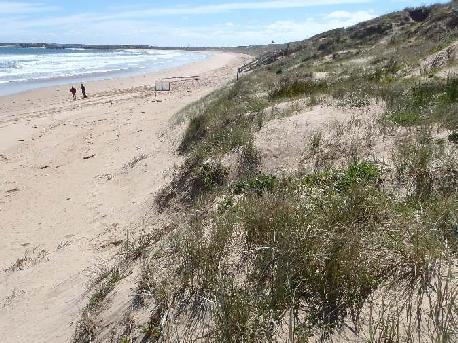
89 Feb W Feb W May W looking west May 2006 looking east toward 33W May W access May W looking west Nov 2011 looking East from 40W Nov 2011 looking West from 40W 89
 Access via: 40W Horse access 42W 13 th Beach Road Beach Morphology Ease of Detection Pair Identity Linear beach backed by low dune that is vegetated.")

90 13 th Beach 40W - 42W Managed by Barwon Coast Committee of Management Inc. (BC) Access via: 40W Horse access 42W 13 th Beach Road Beach Morphology Ease of Detection Pair Identity Linear beach backed by low dune that is vegetated. Small sections of bare dune and foredune as well as upper beach suitable for nesting. Easy. Lots of vantage points for spotting the pair from a distance. Also, this site is heavily used by red-capped plovers and migratory shorebirds such as red-necked stints, which can make initially spotting the Hooded Plovers more difficult Unbanded x Unbanded Feb 2008 one of the unbanded birds found distressed on beach, flopping over, easily caught by hand and taken to carer but died shortly after Unbanded x Unbanded , NK Orange (flagged here Jul 2010) x Unbanded NK Orange x LY Orange (fledged Feb 2014 from Point Lonsdale 4W West) PC Orange (flagged Aug 2010 as a subadult floater at 13th beach 36W) x EH Orange (fledged Nov 2011 Pt Roadknight tip) Surveyed since Years occupied Total Eggs Total chicks Total Fledglings Years successful 2006/ / /16 Key user groups: 29% 21% 19% 17% 8% Key threats: 68% 60% 36% 28% 28% 19% 12% 90

 Compliance data collected")
91 Threat mitigation actions: Prevent crushing Minimise disturbance Prevent crushing; Minimise disturbance; Prevent predation Minimise predation Minimise predation Habitat preservation Temporary signage flanking nest/chick site Temporary fencing around nest/chick site Education and events Barwon Coast follow Hooded Plover vehicle protocols Liaise with horse riders/trainers about use of this site (horse prohibited area) Enforcement of unauthorised horse access Temporary signage flanking nest/chick site Temporary fencing around nest/chick site (large buffer zone) Temporary nest update signage at access points Chick shelters Education and events Media Site guardians during peak beach use periods in chick phase Maintain current dog regulations (dog prohibited area) Compliance data collected Review effectiveness of regulations every two years Dog regulations clearly displayed Enforcement patrols [responsibility needs to be resolved here. DELWP appears to have enforcement responsibility.] Site guardians during peak beach use periods in chick phase Education and events Media to encourage choosing appropriate beaches for dog walking Investigate impact of predators using remote cameras Investigate methods of reducing predation by native birds Reduce litter Use rubbish bins with firmly affixed lids Discourage feeding wildlife Investigate impact of predators using remote cameras Den searches Fox control (bait, trap, shoot, den fumigation) Minimise brush matting Control weeds such as Sea-wheat Grass, Marram Grass and Sea Spurge Investigate coastal retreat habitat management options May W access May W access path with hoof prints 91


92 May W access paddle May W access paddle Sept 2011 new fence Sept 2011 new fence Dec 2006 Dec 2006 Dec 2007 Jan


93 Dec 2007 hundreds of gulls line the beach Horse signage 2011 May 2006 Horse prints through dune 40W west Jan 2008 Nov 2011 Nov


94 Feb 2012 May 2006 May 2014 May 2014 Sept 2011 Sept 2011 May W access looking East May 2006 rocky area west of 42W 94
 Access via: 42W 13 th Beach Rd 43W Black Rock Rd Beach Morphology Ease of Detection Pair Identity Small cove with volcanic rocks along the water s edge. Backed by flat, vegetated dune.")
95 Blue Rocks west of 42W (west of 43W) Managed by Barwon Coast Committee of Management Inc. (BC) Access via: 42W 13 th Beach Rd 43W Black Rock Rd Beach Morphology Ease of Detection Pair Identity Small cove with volcanic rocks along the water s edge. Backed by flat, vegetated dune. Suitable nesting habitat is mostly the upper to mid beach. Easy as the beach is small, although at low tide the birds can be among rocks at waterline foraging. Also, this site is heavily used by red-capped plovers and migratory shorebirds such as red-necked stints, which can make initially spotting the Hooded Plovers more difficult Unbanded x Unbanded NK Orange (flagged 40W Jul 2010) x Unbanded Surveyed since Years occupied Total Eggs Total chicks Total Fledglings Years successful 2009/ Key user groups (caution low sample size): 42% 30% 21% Key threats (caution low sample size): 23% 23% 13% 13% 95

 Compliance data collected Review effectiveness of regulations every two years Dog regulations clearly displayed Enforcement patrols [responsibility needs to be resolved here.")
96 Threat mitigation actions: Prevent crushing Minimise disturbance Prevent crushing; Minimise disturbance; Prevent predation Minimise predation Minimise predation Habitat preservation Temporary signage flanking nest/chick site Temporary fencing around nest/chick site Education and events Temporary signage flanking nest/chick site Temporary fencing around nest/chick site Temporary nest update signage at access points Consider angler specific signage Chick shelters Education and events Site guardians during peak beach use periods in chick phase Maintain current dog regulations (dog prohibited area) Compliance data collected Review effectiveness of regulations every two years Dog regulations clearly displayed Enforcement patrols [responsibility needs to be resolved here. DELWP appears to have enforcement responsibility.] Site guardians during peak beach use periods in chick phase Education and events Media to encourage choosing appropriate beaches for dog walking Investigate impact of predators using remote cameras Investigate methods of reducing predation by native birds Reduce litter Use rubbish bins with firmly affixed lids Discourage feeding wildlife Investigate impact of predators using remote cameras Den searches Fox control (bait, trap, shoot, den fumigation) Avoid brush matting Control weeds such as Sea-wheat Grass, Marram Grass and Sea Spurge May 2006 West of 43W, Blue Rocks west of 42W Mar 2011 Red-capped plover nest mid beach 96
97 Black Rock Managed by Barwon Water and City of Greater Geelong (COGG) Access via: 43W Black Rock Rd (access managed by Barwon Water) 44W Bancoora Surf Life Saving Club (access managed by COGG) Beach Morphology Ease of Detection Pair Identity Ocean beach habitat with an expansive dune system, dominated by bare sand and middens. The water s edge is lined with volcanic rock. This is a very small but highly productive territory. The pair rarely move west around the point, and less frequently now due to the presence of a new pair. Difficult, very cagey pair, well hidden, nests well camouflaged in midden. Note: in the past, Red-capped Plovers have nested in the dune and their nest may be confused with a Hooded Plover nest Unbanded x Unbanded BK Orange (flagged here in Jan 2013) x Unbanded Surveyed since Years occupied Total Eggs Total chicks Total Fledglings Years successful 2006/ / / / / /15 Key user groups: Boot camp 47% 20% 14% 9% 5% Key threats: 57% 48% 24% 20% 97
98 Threat mitigation actions: Prevent crushing Minimise disturbance Prevent crushing; Minimise disturbance; Prevent predation Minimise predation Minimise predation Habitat preservation Permanent dune fencing Temporary signage flanking nest/chick site Temporary fencing around nest/chick site Education and events Liaise with Barwon Water about active nest/chick periods Liaise with specific stakeholder groups (e.g. local footy clubs training in dunes) Liaise with The Sacred Circle worship group who use dunes for ceremonies Temporary signage flanking nest/chick site Temporary fencing around nest/chick site if outside permanent fence Temporary nest update signage at access points Consider angler specific signage Banners Education and events Site guardians during peak beach use periods in chick phase Maintain current dog regulations (dog prohibited area) Compliance data collected Review effectiveness of regulations every two years Dog regulations clearly displayed (e.g. no dog signage placed on beach near access at 44W and also at 43W Black Rock Rd access) Enforcement patrols Site guardians during peak beach use periods in chick phase Education and events Media to encourage choosing appropriate beaches for dog walking Investigate impact of predators using remote cameras Investigate methods of reducing predation by native birds Reduce litter Discourage feeding wildlife Investigate impact of predators using remote cameras Den searches Fox control (bait, trap, shoot, den fumigation) Community education around responsible cat ownership Cat control when cats detected at this site Avoid brush matting Maintain three-strand permanent dune fencing Control weeds such as Sea-wheat Grass, Marram Grass and Sea Spurge 98


99 May 2006 May 2006 May 2006 Oct 2006 Oct 2006 Oct 2006 Nov 2007 Nov


100 Mar 2008 Sept 2008 Sept 2009 Feb 2010 Dec 2009 Feb 2010 Sept 2011 Sept


101 Aug 2017 Aug 2017 BK Orange x Unbanded Aug
 Beach Morphology Ease of Detection Pair Identity Ocean beach habitat backed by expansive dunes, however these are more heavily vegetated compared to the adjacent two territories.")
102 Bancoora 44W East (Breamlea) Managed by City of Greater Geelong (COGG) Access via: 43W Black Rock Rd (access managed by Barwon Water) 44W Bancoora Surf Life Saving Club, Breamlea (access managed by COGG) Beach Morphology Ease of Detection Pair Identity Ocean beach habitat backed by expansive dunes, however these are more heavily vegetated compared to the adjacent two territories. This is a small territory, highly disturbed due to its proximity to the access point at 44W and there are limited locations, mostly on the foredune and upper beach, for nesting. The pair want to move East around to Black Rock but are pushed back by the adjacent pair. This boundary is an area of high dispute. Easy, pair highly visible, small territory. Note: be careful to avoid pushing this pair further East in to the Black rock territory as this will cause territorial disputes and if chicks are present, jeopardise the chicks lives PC Orange (flagged Aug 2010 as a subadult floater at 13th beach 36W) x AY Orange (flagged West of 40W Mar 2011) AY Orange x EJ Orange (flagged Guvvos May 2012) Surveyed since Years occupied Total Eggs Total chicks Total Fledglings Years successful 2012/ /15 Key user groups: 42% 18% 14% 9% 9% 8% Key threats: 73% 52% 25% 14% 13% 13% 102
103 Threat mitigation actions: Prevent crushing Minimise disturbance Prevent crushing; Minimise disturbance; Prevent predation Minimise predation Minimise predation Habitat preservation Temporary signage flanking nest/chick site Temporary fencing around nest/chick site Education and events Liaise with Bancoora SLSC during active nest/chick phases Site guardians during peak beach use periods especially to liaise with families playing in dunes Temporary signage flanking nest/chick site Temporary fencing around nest/chick site (large buffer zone) Temporary nest update signage at access points Consider angler specific signage Chick shelters Banners Media Education and events Site guardians during peak beach use periods in chick phase Maintain current dog regulations (dog prohibited area) Compliance data collected Review effectiveness of regulations every two years Dog regulations clearly displayed (e.g. no dog signage placed on beach near access at 44W and also at 43W Black Rock Rd access) Enforcement patrols Site guardians during peak beach use periods in chick phase Education and events Media to encourage choosing appropriate beaches for dog walking Investigate impact of predators using remote cameras Investigate methods of reducing predation by native birds Reduce litter Discourage feeding wildlife Investigate impact of predators using remote cameras Den searches Fox control (bait, trap, shoot, den fumigation) Community education around responsible cat ownership Cat control when cats detected at this site Avoid brush matting Control weeds such as Sea-wheat Grass, Marram Grass and Sea Spurge Note: While Sea Rocket (Cakile maritima) is a weed species, it is not considered a threat to the birds and is instead used as protective cover by the chicks at this site 103


104 May 2006 May 2006 May W access looking East Oct 2006 Looking west from Black Rock 2015 No dog signage 104
105 Bancoora 44W - 46W (Breamlea) Managed by City of Greater Geelong (COGG) Access via: 44W Bancoora Surf Life Saving Club, Breamlea 45W Bancoora caravan park 46W Bancoora caravan park Beach Morphology Ease of Detection Pair Identity Ocean beach with expansive open dune system, including middens, and volcanic rock lining the water s edge along sections of the territory. The birds utilise multiple areas within this large territory, predominantly nesting in the dunes. They use the rocks heavily when they have chicks as these provide great hiding refuge for the chicks. Difficult. Pair can be well hidden in rocks or deep in dune. Very cagey pair with lots of vantage points to see observers approaching flagged red/metal, green/red; 1 banded white/black, metal banded white/black, metal x Unbanded 2011 white/black, metal captured and given flag KE Orange (March). The history of this bird is: banded as a juvenile at Breamlea on 1 April Most resightings from Bellarine but also seen East at Franklin Rd Portsea, and West at Pt Addis, then to Anglesea in March 1997 where it bred and lived and was seen to March 1998, then it shifted via Franklin Rd Portsea back to Breamlea where it bred in KE Orange x Unbanded Early Dec 2012: PC Orange x AY Orange. Then return to KE Orange x LM Orange (fledged Feb 2011 from Black Rock) in Late Dec KE Orange x CP Orange (flagged here in Jul 2013) KE Orange seen until Nov 2015, then from Dec onwards CP Orange x unbanded Surveyed since Years occupied Total Eggs Total chicks Total Fledglings Years successful 2006/ / / /10 Key user groups: 47% 17% 14% 12% 7% 105
106 Key threats: 77% 54% 38% 17% 10% Threat mitigation actions: Prevent crushing Minimise disturbance Prevent crushing; Minimise disturbance; Prevent predation Minimise predation Minimise predation Permanent dune fencing Temporary signage flanking nest/chick site Temporary fencing around nest/chick site when outside permanent dune fence Education and events Site guardians during peak beach use periods especially to liaise with families playing in dunes Liaise with Bancoora SLSC during active nest/chick phases Liaise with local community to prevent using informal beach access paths through dunes SLSC follow Hooded Plover vehicle protocols Temporary signage flanking nest/chick site Temporary fencing around nest/chick site (large buffer zone) Temporary nest update signage at access points Chick shelters Banners Media Education and events Site guardians during peak beach use periods in chick phase Liaise with Breamlea Holiday Park to keep updated of active nests/chicks and encourage information sharing with guests Maintain current dog regulations as minimum protection Compliance data collected Review effectiveness of regulations every two years Dog regulations clearly displayed Enforcement patrols Site guardians during peak beach use periods in chick phase Education and events Media to encourage choosing appropriate beaches for dog walking and the need to leash dogs where permitted Investigate impact of predators using remote cameras Investigate methods of reducing predation by native birds Reduce litter Discourage feeding wildlife Investigate impact of predators using remote cameras Den searches Fox control (bait, trap, shoot, den fumigation) Community education around responsible cat ownership Cat control when cats detected at this site 106


 is a weed species, it is not")


107 Habitat preservation Avoid brush matting Maintain three-strand permanent dune fencing (45-46W) Control weeds such as Sea-wheat Grass, Marram Grass and Sea Spurge Note: While Sea Rocket (Cakile maritima) is a weed species, it is not considered a threat to the birds and is instead used as protective cover by the chicks at this site May W access point on beach May W access from carpark Oct 2006 Dec 2007 Jan 2007 Jan 2007 dune boarding was common prior to installation of a permanent fence 107


108 Jan 2007 Surf Life Saving Club vehicle tracks Sept 2007 Aug 2009 Aug 2009 nest location Dec 2009 May 2006 May 2006 May


109 Oct 2006 Jan 2008 Mar 2008 Oct 2006 nest Oct 2010 Sept 2012 Feb 2010 Aug
 Access via: 50W End of Scott St, Breamlea (access managed by COGG) 51W End of Horwood Drive, Breamlea (access managed by COGG) 52W Point Impossible Thompsons Creek (access managed by GORCC)")
110 50W to Point Impossible Co-managed by City of Greater Geelong (COGG; 50W to Eastern side of Point Impossible estuary) and Great Ocean Road Coast Committee (GORCC; Western side of Point Impossible estuary) Access via: 50W End of Scott St, Breamlea (access managed by COGG) 51W End of Horwood Drive, Breamlea (access managed by COGG) 52W Point Impossible Thompsons Creek (access managed by GORCC) Beach Morphology Ease of Detection The beach from 50W is backed by dune and in sections there are blowouts and bare to sparsely vegetated dune faces suitable for nesting. The pair also utilise the river mouth and along the river s edge toward 51W. Difficult, expansive territory and the pair can be hard to spot in amongst the large flocks of migratory shorebirds and red-capped plovers that occur around the estuary. Nests in the dunes are well hidden but nests at the estuary are easier to spot. If the pair use the dunes toward 50W for nesting, they bring their chicks to the estuary and primarily use this area during the chick phase due to opportunities for the chicks to mainly feed around the river s edge. Unbanded x Unbanded Pair Identity Surveyed since Years occupied Total Eggs Total chicks Total Fledglings Years successful 2006/ / / / /15 Key user groups: 41% 34% 11% 7% Key threats: 75% 51% 50% 25% 15% 13% 12% 10% 110
111 Threat mitigation actions: Prevent crushing Minimise disturbance Prevent crushing; Minimise disturbance; Prevent predation Minimise predation Minimise predation Habitat preservation Temporary signage flanking nest/chick site Temporary fencing around nest/chick site Education and events Liaise with local community to prevent using informal beach access paths through dunes Liaise with horse riders when active nest/chicks to outline best method of access at estuary - this is challenging given morphology of site; ideally no horse access would occur at this time. Horses are not permitted at at Breamlea/Bancoora but horses cross the estuary from the Surf Coast Shire at low tide or when the estuary is closed. Signage on western side of estuary is required Liaise with DELWP when estuary openings are planned to ensure active nest/chicks are protected Temporary signage flanking nest/chick site Temporary fencing around nest/chick site (large buffer zone) Temporary nest update signage at access points Consider temporary closure of 51W access track when active nest/chick present at estuary Chick shelters Banners Education and events Media Site guardians during peak beach use periods in chick phase Review current dog regulations as site spans the boundary of two different regulations aim for improved clarity and compliance Consider making estuary no dogs area (value to migratory shorebirds also) Compliance data collected Review effectiveness of regulations every two years Dog regulations clearly displayed Enforcement patrols Site guardians during peak beach use periods in chick phase Education and events Media to encourage choosing appropriate beaches for dog walking and the need to leash dogs where permitted Investigate impact of predators using remote cameras Investigate methods of reducing predation by native birds Reduce litter Discourage feeding wildlife Investigate impact of predators using remote cameras Den searches Fox control (bait, trap, shoot, den fumigation) Community education around responsible cat ownership Cat control when cats detected at this site Avoid brush matting Control weeds such as Sea-wheat Grass, Marram Grass and Sea Spurge 111


112 Sept 2006 nest Sept 2006 nest habitat Dec 2006 Dec 2006 Sept 2007 Jan 2007 Nov W access looking west Nov 2007 dune midden 112


113 Sept 2007 Sept 2007 tide washed nest Nov 2007 Nov 2007 Nov 2007 Nov 2007 Aug
114 Nudist Beach (Point Impossible) Managed by Great Ocean Road Coast Committee (GORCC) Access via: 53W Point Impossible 54W Surf Coast Walk 55W Torquay/Point Impossible Optional Dress Beach, The Esplanade 56W Whites beach Torquay, The Esplanade Beach Morphology Ease of Detection Pair Identity Linear beach that becomes Whites beach toward Torquay. Diverse dune habitat with important Indigenous sites: rocky ridges in sections and in others, sandy dune with sections of blowout and sparse to no vegetation that are suitable for nesting. The pair have even nested on the rocky ridge substrate in the dune system. Difficult as territory is extensive and pair can move down to Whites beach and back to Nudist section. The pair can be far in to dune and on rocky ridges, are very difficult to spot. There are no tracks to nest on rocky substrate so these can only be found by hiding and observing bird return to nest PA Orange (flagged at Bancoora 44W Sept 2010) x Unbanded PA Orange x JM Orange (flagged here May 2012) PA Orange seen at start of season in Aug 2013 but not resighted since. Within one month JM Orange was partnered with EJ Orange (flagged May 2012 at Guvvos) Surveyed since Years occupied Total Eggs Total chicks Total Fledglings Years successful 2010/ /16 Key user groups: 51% 25% 18% 5% Key threats: 79% 51% 37% 25% 19% 16% 10% 114


115 Threat mitigation actions: Prevent crushing Minimise disturbance Prevent crushing; Minimise disturbance; Prevent predation Minimise predation Minimise predation Habitat preservation Temporary signage flanking nest/chick site Temporary fencing around nest/chick site Education and events Liaise with nudists to discourage use of dunes Temporary signage flanking nest/chick site Temporary fencing around nest/chick site (large buffer zone) Temporary nest update signage at access points Chick shelters Banners Education and events Media Site guardians during peak beach use periods in chick phase Review current dog regulations are unsuitable as they provide for off leash access at all times of year. As a minimum, dog leashing needs to be sought for the core territory. Compliance data collected Review effectiveness of regulations every two years Dog regulations clearly displayed Enforcement patrols Site guardians during peak beach use periods in chick phase Education and events Media to encourage choosing appropriate beaches for dog walking and the need to leash dogs where permitted Investigate impact of predators using remote cameras Investigate methods of reducing predation by native birds Reduce litter Discourage feeding wildlife Investigate impact of predators using remote cameras Den searches Fox control (shoot, den fumigation) Avoid brush matting Control weeds such as Sea-wheat Grass, Marram Grass and Sea Spurge Sept 2011 Jan


116 Jan 2011 Jan 2011 Feb

117 Point Addis Red Rocks Beach Managed by Parks Victoria Access via: 85W Point Addis Rd Surf Coast Walk Beach Morphology Ease of Detection Pair Identity Mostly cliff backed beach. Small dune humps create some nesting availability, but this is mostly limited to the upper beach. Easy due to small size of beach, however pair may be absent and we are currently uncertain of where the pair are when they are absent. More extensive searches of the surrounds may be required to better understand whether the pair use multiple sites within the landscape Unbanded x Unbanded BL Orange (flagged at Black Rock as floater in Dec 2012) x Unbanded Surveyed since Years occupied Total Eggs Total chicks Total Fledglings Years successful 2010/ Key user groups (caution low sample size): 44% 20% 17% 16% Key threats (caution low sample size): 67% 44% 33% 33% 16% 11% 11% 11% 117
118 Threat mitigation actions: Prevent crushing Minimise disturbance Prevent crushing; Minimise disturbance; Prevent predation Minimise predation Minimise predation Habitat preservation Temporary signage flanking nest/chick site Temporary fencing around nest/chick site Education and events Raise awareness among users of Surf Coast Walk Temporary signage flanking nest/chick site Temporary fencing around nest/chick site Temporary nest update signage at access points Chick shelters Education and events Media Site guardians during peak beach use periods in chick phase Consider improving public awareness of National Parks being dogs prohibited areas by removing dog access to this site Compliance data collected Review effectiveness of regulations every two years Dog regulations clearly displayed Enforcement patrols Site guardians during peak beach use periods in chick phase Education and events Media to encourage choosing appropriate beaches for dog walking and the need to leash dogs where permitted Investigate impact of predators using remote cameras Den searches Fox control (bait, trap, den fumigation) Investigate impact of predators using remote cameras Investigate methods of reducing predation by native birds Reduce litter Discourage feeding wildlife Avoid brush matting Control weeds such as Sea-wheat Grass, Marram Grass and Sea Spurge 118


 119")
119 Oct 2010 View from access (Eastern end) Oct 2010 Nest on upper beach Oct 2010 Nest protection Jan 2012 Site protection (photo Geoff Gates) Jan 2012 Site protection (photo Geoff Gates) 119
120 Point Roadknight Tip (95W) Managed by Great Ocean Road Coast Committee (GORCC) Access via: 95W Point Roadknight beach 96W Point Roadknight back beach Beach Morphology Ease of Detection Pair Identity Rocky point that is cut off at times of high tide. The point is surrounded by rock platforms exposed at low tide that the birds use extensively for foraging. The birds utilise the sandy beach and rocky ledges for nesting. The key nesting zone has been permanently fenced with ringlock fencing. Easy. The pair have a small territory. When on the rocks foraging, they can be slightly more difficult to spot. Nests in the rocky substrate will be difficult to find due to the lack of prints flagged red/metal, dark green/light green x Unbanded Recaptured red/metal, dark green/light green (fledged 26/2/02 from Thorny Beach Phillip Island; movements around Phillip Island beaches up until 2003) and gave flag KM Orange (Jul 2010) x PP Orange (Sept 2010) KM Orange x RP Orange (flagged as a floater at Guvvos Feb 2015) Surveyed since Years occupied Total Eggs Total chicks Total Fledglings Years successful 2006/ / / / / / / /16 Key user group: Key threats: 85% 66% 30% 10% 10% 120

 Compliance data collected Review effectiveness of regulations every two years Dog regulations clearly displayed Enforcement patrols Site guardians during peak beach")
121 Threat mitigation actions: Prevent crushing Minimise disturbance Prevent crushing; Minimise disturbance; Prevent predation Minimise predation Minimise predation Habitat preservation Permanent ringlock dune and nest site fencing Temporary signage flanking nest/chick site Temporary fencing around nest/chick site Education and events Temporary signage flanking nest/chick site Temporary fencing around nest/chick site Temporary nest update signage at access points Chick shelters Education and events Media Site guardians during peak beach use periods in chick phase Maintain current dog regulations (dogs prohibited) Compliance data collected Review effectiveness of regulations every two years Dog regulations clearly displayed Enforcement patrols Site guardians during peak beach use periods in chick phase Education Media to encourage choosing appropriate beaches for dog walking Investigate impact of predators using remote cameras Investigate methods of reducing predation by native birds Reduce litter Discourage feeding wildlife Investigate impact of predators using remote cameras Den searches Fox control (shoot, den fumigation) Community education around responsible cat ownership Cat control when cats detected at this site Minimise brush matting Maintain ringlock fencing of dunes and nest site at point Control weeds such as Sea-wheat Grass, Marram Grass and Sea Spurge Sept Dec 2007 nest outside the new fence!


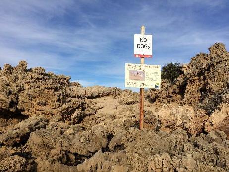

122 Nov 2008 Glenn Ehmke Sept 2009 Nov 2008 Glenn Ehmke Glenn Ehmke Aug 2017 Aug
123 Point Roadknight West (96W 98W) Managed by Great Ocean Road Coast Committee (GORCC) Access via: 95W Point Roadknight beach 96W Point Roadknight back beach 97W Melba Parade 98W Melba Parade 99W O Donohue Rd Beach Morphology Ease of Detection Pair Identity The pair most frequently use the small beach just west of 96W that has rocky outcrops at either end and is backed by vegetated dune with a single blowout. At high tide, this part of the territory is only accessible to observers via the 96W access point and involves a rock scramble. The dune is permanently fenced. At low tide, the site has extensive rock platforms. The beach between 96W and 98W is linear and backed by a steep, permanently fenced dune with occasional blowouts suitable for nesting. Moderate. The beach west of 96W is small and easy to search, however the pair can be somewhat harder to spot at low tide when out on the rock platforms. Occasionally the pair can be found at the base of 96W access or west of here using the beach, as well as the dune for nesting banded metal left x Unbanded NS Orange (flagged here Sept 2010) x Unbanded Unbanded x Unbanded RW Orange (flagged here Feb 2014) x Unbanded Dec 2014 RW Orange and Unbanded partner both killed when incubating, attacked by cat or fox LM Orange (LM fledged from Black Rock in Feb 2011) x LY Orange move onto territory in Jan 2015 (LY fledged from Point Lonsdale 4W West Feb 2014). Surveyed since Years occupied Total Eggs Total chicks Total Fledglings Years successful 2006/ / / /16 Key user groups: 71% 15% 6% 123
124 Key threats: 60% 23% 19% 12% Threat mitigation actions: Prevent crushing Minimise disturbance Prevent crushing; Minimise disturbance; Prevent predation Minimise predation Minimise predation Habitat preservation Permanent ringlock dune and nest site fencing Temporary signage flanking nest/chick site Temporary fencing around nest/chick site Education and events Temporary signage flanking nest/chick site Temporary fencing around nest/chick site Temporary nest update signage at access points Chick shelters Education and events Media Site guardians during peak beach use periods in chick phase Maintain current dog prohibition east of 96W. However, note that if birds use territory west of 96W, they occur in a dogs off leash zone. A flexible dog regulation between 96W-99W where leashing is required when Hooded Plover signs are displayed is required Compliance data collected Review effectiveness of regulations every two years Dog regulations clearly displayed Enforcement patrols Site guardians during peak beach use periods in chick phase Education Media to encourage choosing appropriate beaches for dog walking and the need to leash dogs where permitted Investigate impact of predators using remote cameras Investigate methods of reducing predation by native birds Reduce litter Discourage feeding wildlife Investigate impact of predators using remote cameras Den searches Fox control (shoot, den fumigation) Community education around responsible cat ownership Cat control when cats detected at this site Avoid brush matting Maintain permanent fencing of dunes Control weeds such as Sea-wheat Grass, Marram Grass and Sea Spurge 124


125 June 2007 Oct 2011 Jul 2018 Aug 2017 Rocky outcrop at end of territory Dec 2007 Glenn Ehmke Dec
126 Guvvos Beach Managed by Parks Victoria Access via: 99W O Donohue Rd (access managed by GORCC) 100W The Gulch Gap 101W Guvvos 102W Hutt Gully Beach Morphology Ease of Detection Pair Identity Linear beach backed by dune with sections of sparse to no vegetation on foredune that are suitable for nesting. Moderate. The pair can use multiple sites along this beach between O Donohue Rd and Hutt Gully, meaning long distances may need to be walked to find the pair EJ Orange (flagged here May 2012) x MR Orange (flagged here May 2012) Early 2014 NS Orange appeared on this territory (flagged Pt Roadknight west Sept 2010, bred at Aireys Inlet, possibly dispersed or displaced) MR Orange x NS Orange Surveyed since Years occupied Total Eggs Total chicks Total Fledglings Years successful 2012/ / /16 Key user groups: 57% 31% 7% Key threats (caution low sample size): 82% 64% 53% 17% 126

127 Threat mitigation actions: Prevent crushing Minimise disturbance Prevent crushing; Minimise disturbance; Prevent predation Minimise predation Minimise predation Habitat preservation Temporary signage flanking nest/chick site Temporary fencing around nest/chick site Education and events Temporary signage flanking nest/chick site Temporary fencing around nest/chick site Temporary nest update signage at access points Chick shelters Banners Education and events Media Site guardians during peak beach use periods in chick phase A flexible dog regulation between 99W-102W, where leashing is required when Hooded Plover signs are displayed, is a minimum requirement for this site Compliance data collected Review effectiveness of regulations every two years Flexible dog regulations clearly displayed Enforcement patrols Site guardians during peak beach use periods in chick phase Education and events (particularly focusing on surfers who leave dogs off leash on beach unattended) Media to encourage choosing appropriate beaches for dog walking and the need to leash dogs where permitted Investigate impact of predators using remote cameras Investigate methods of reducing predation by native birds Reduce litter Discourage feeding wildlife Investigate impact of predators using remote cameras Den searches Fox control (bait, trap, den fumigation) Avoid brush matting Control weeds such as Sea-wheat Grass, Marram Grass and Sea Spurge Feb 2015 Mar
128 Aireys Inlet Co-managed by Great Ocean Road Coast Committee (GORCC) and Parks Victoria Access via: 106W Inlet crescent Great Ocean Road 107W Fairhaven Surf Life Saving Club, Great Ocean Road Beach Morphology Ease of Detection Pair Identity Estuary at Aireys Inlet opens in to a small beach beneath lighthouse to the east, which is designated as Marine Park and is backed by rocky cliff and at the base of this cliff, a vegetated and eroding sandy dune face. Heading west of the river mouth towards Fairhaven and Moggs Creek, is a long linear beach backed by dune. Moderate to Difficult. The pair can move along this stretch from Aireys Inlet to Moggs Creek and thus long distances need to be covered to detect the pair NS Orange (flagged Sept 2010 at Pt Roadknight West) x 1 flagged Orange/metal, Red/White Nov Orange/metal, Red/White x HE Orange (flagged at Boags Rocks on the Mornington Peninsula, where it was a breeder, in Jan 2012) Surveyed since Years occupied Total Eggs Total chicks Total Fledglings Years successful 2011/ Key user groups: 35% 28% 17% 15% Key threats (caution low sample size): 68% 29% 17% 10% 10% 128
129 Threat mitigation actions: Prevent crushing Minimise disturbance Prevent crushing; Minimise disturbance; Prevent predation Minimise predation Minimise predation Habitat preservation Temporary signage flanking nest/chick site Temporary fencing around nest/chick site Education and events Liaise with DELWP when estuary openings are planned to ensure active nest/chicks are protected Temporary signage flanking nest/chick site Temporary fencing around nest/chick site Temporary nest update signage at access points If the pair nests on small beach below lighthouse, consider closure of this small beach during nest/chick period Chick shelters Education and events Media Site guardians during peak beach use periods in chick phase A flexible dog regulation where leashing is required when Hooded Plover signs are displayed is a minimum for this area Compliance data collected Review effectiveness of regulations every two years Flexible dog regulations clearly displayed Enforcement patrols Site guardians during peak beach use periods in chick phase Education and events Media to encourage choosing appropriate beaches for dog walking and the need to leash dogs where permitted Investigate impact of predators using remote cameras Den searches Fox control (shoot, den fumigation) Investigate impact of predators using remote cameras Investigate methods of reducing predation by native birds Reduce litter Discourage feeding wildlife Avoid brush matting Control weeds such as Sea-wheat Grass, Marram Grass and Sea Spurge 129


130 Nov 2011 Nov 2011 Nov 2011 Nov 2011 Dec 2011 Photo Georgie Beale 130
131 Moggs Creek Managed by Great Ocean Road Coast Committee (GORCC) Access via: 107W Fairhaven Surf Life Saving Club, Great Ocean Road 108W Moggs Creek, Great Ocean Road (Moggs Creek estuary) 109W Moggs Creek, Great Ocean Road Beach Morphology Ease of Detection Pair Identity Long linear beach backed by dune. Moggs Creek estuary commonly used by birds for nesting as well as upper beach and foredune along beach. Easy to Moderate. Open linear beach, but longer distances may need to be walked to detect pair who have been known to use adjacent site at Aireys Inlet NS Orange x Orange/metal, Red/White Orange/metal, Red/White x HE Orange (flagged at Boags Rocks on the Mornington Peninsula, where it was a breeder, in Jan 2012) Jan 2015 HE Orange found dead at nest, killed by fox during incubation. Partner continued incubating and raised chicks alone Orange/metal, Red/White x BL Orange (flagged Dec 2012 at Black Rock as a floater) Surveyed since Years occupied Total Eggs Total chicks Total Fledglings Years successful 2012/ / /15 Key user groups: 43% 24% 15% 11% Key threats (caution low sample size): 81% 47% 30% 26% 16% 16% 131
132 Threat mitigation actions: Prevent crushing Minimise disturbance Prevent crushing; Minimise disturbance; Prevent predation Minimise predation Minimise predation Habitat preservation Temporary signage flanking nest/chick site Temporary fencing around nest/chick site Education and events Liaise with DELWP when estuary openings are planned to ensure active nest/chicks are protected Temporary signage flanking nest/chick site Temporary fencing around nest/chick site Temporary nest update signage at access points Chick shelters Banners Education and events Media Site guardians during peak beach use periods in chick phase A flexible dog regulation where leashing is required when Hooded Plover signs are displayed is a minimum for this area Compliance data collected Review effectiveness of regulations every two years Flexible dog regulations clearly displayed Enforcement patrols Site guardians during peak beach use periods in chick phase Education and events Media to encourage choosing appropriate beaches for dog walking and the need to leash dogs where permitted Investigate impact of predators using remote cameras Investigate methods of reducing predation by native birds Reduce litter Discourage feeding wildlife Investigate impact of predators using remote cameras Den searches Fox control (shoot, den fumigation) Avoid brush matting Control weeds such as Sea-wheat Grass, Marram Grass and Sea Spurge 132


133 Dec 2012 Dec 2012 Dec 2012 Feb 2014 Feb 2015 Marg MacDonald with hoodie in bag about to be flagged, Ian McConchie 133
134 Conclusions and Future Directions The following goals for the Bellarine/Surf Coast Hooded Plover population should be aimed for over the next 10 years and reviewed annually during debriefs: 1. To maintain at least 15 breeding pairs within the Bellarine/Surf Coast region 2. To maintain and protect at least 20 breeding sites within the Bellarine/Surf Coast region 3. To achieve at least a hatching success rate of 40%, but to aim for an improvement of between 5-10% over time 4. To achieve at least a 25% chick survival rate, but to aim for an improvement of between 5-10% over time 5. To achieve at least a fledgling/breeding pair value of between , but with the aim of achieving fledglings/breeding pair over time It is critical to maintain an adaptive management approach for Hooded Plover recovery, and this should include regular reviews of the data and annual stakeholder meetings (debriefs) to track progress toward the overall targets and to adapt our approach over time with the aim of improving outcomes. One key finding of this report was the need for improvements to the monitoring program, in particular the collection and reporting of threat data. An aim for the region will be to improve the number of full threat assessments being carried out in order to achieve robust sample sizes, particularly given high levels of variation in the detectability of different threats and in the temporal and seasonal variation that particular threats would be subject to. We recommend that the individual site recommendations for management be used as a baseline for investment and that there be particular emphasis placed on reviewing the effectiveness of current dog regulations, with the aim of introducing new regulations for sites that do not have the minimum desired protection, i.e. are off leash sites. 134
135 Acknowledgements There have been many amazing people who have been part of this Program along the Bellarine Peninsula and Surf Coast over the years. The success of this Program is built on these close working relationships between all the project partners. A special thanks to the key staff within the land management agencies whom we have worked closely with in the past and present: Warren Chapman, Maddie Glynn, Brett Diehm, James Rimmer, Hayley Pickering, Bob Jordan, John Henderson, Gary McPike and Bev Wood from Barwon Coast Committee of Management Inc.; Jeanette Spittle, Rebecca Kootstra, Steve Smithyman, Bruno Preiato, David Neighbour, Gaye Jennings and Alex Shackleton from City of Greater Geelong; Georgie Beale, Mike Bodsworth, Alex McDonald, Jane Lovejoy, Rod Rau, Rose Herben, Evan Francis, Scott Hives, Hamilton Pearson, Pete Crowcroft and Hilary Bouma from Great Ocean Road Coast Committee; Jozo Majic, Shaun Barling and Kate Smallwood from Surf Coast Shire; Paul Schefferle from Aimtrue; Gary Purton and Steve Nelson from Borough of Queenscliffe; Catherine Longmore, Carlie Bronk, Emma Danby, Alicia Ivory, Mark Rodrigue, Levi Lovett and Katrina Lovett from Parks Victoria; Peter Skelton and Justin Rhodes from Barwon Water; Michael Noelker, Saul Vermeeren, Dianne Moore, Tracey Pennington, Frances Northeast and Andrew Gray from DELWP; Polly Matthews, Nick McCristal and Robert Bone from Corangamite CMA. An overwhelming thank you to our Volunteer Regional Coordinators: Andrea Dennett, Julie Riley, Jennie Turner and Sue Guinness and also to the amazing volunteers who involved in the BNB Program over the years: John Murray, Geoff Gates, Bronwyn Spark, Margaret MacDonald, Alison Watson, Jan Lierich, Rose Herben, Liz Ferguson, Deborah Evans, Carolyn Edwards, Glenda Shomaly, Lester Hunt, Felicity Thyer, Gail Chrisfield, Robin Spry, Margot Busch, Jennifer Carr, Angus Hartshorn, Denise Moore, Karen Gifford, Linda Newstead, Jane Morrow, Suzanne Hudgell, Val Willis, Michael Skinner, Janet Alexander, Mary Ebbott, David Rantall, June Thomas, Pam Maguire, Bev Holt, Ann McCaffrey, Alanna Ricardo, Dale Gordon, John Bowman, David Tytherleigh, Jane Shennan, Emily Bauch, Mike and Kaye Traynor, Charlie Stewart, Rod Brooks, Lynn Wallace, George Appleby, Kelly Thomas, Aimee Reiss, Laura Glenister, Rob Cowdell, Chris Liebhardt, Sally White, Chrissy Freestone, Gretel Lamont, Jenny Kaye, Gail and John Slykhuis, Jill and Will Smith, Rebecca Hosking, Julian White, Ian McConchie and Ellinor Campbell. Thanks also to Daryl Backwell, David Turner and Gavan Newstead for helping carry and set up fencing equipment. Special thanks to Geelong Field Naturalists, especially Craig Morley, Tom Fletcher, Barry Lingham and John Newman. We also thank and are saddened by the loss of two 135


136 very wonderful volunteers John O Reilly and Jane Danne. There are countless past and present volunteers and we hope we haven t overlooked anyone. Note this list does not include all the new volunteers who have come on board from A huge thank you to all of those people who have volunteered their time to help with Hooded Plover recovery. Left and above: nest at Black Rock, Glenn Ehmke Below: flying adult, Geoff Gates 136
137 References Ehmke, G. C., Maguire, G. S., Bird, T., Ierodiaconou, D. and Weston, M. A. (2016). An obligate high energy sandy-shore bird selects breeding habitat based on sub and super tidal habitat elements. Estuarine, Coastal and Shelf Science, 181, pp Maguire, G. S. (2008). A practical guide to managing beach-nesting birds in Australia. Birds Australia, Melbourne, Australia. Maguire, G.S., Rimmer, J.M. and Weston, M.A. (2013). Stakeholder perceptions of threatened species and their management on urban beaches. Animals 3: Maguire, G.S., Duivenvoorden, A.K., Weston, M.A. and Adams, R. (2011). Provision of artificial shelter on beaches is associated with improved shorebird fledging success. Bird Conservation International 21: Maguire, G., Cullen, M. and Mead, R. (2014). Managing the Hooded Plover in Victoria: A site by site assessment of threats and prioritisation of management investment on Parks Victoria managed land. Report to Parks Victoria. BirdLife Australia, Carlton, Victoria. Maguire, G.S., Rimmer, J.M. and Weston, M.A. (2015). Stakeholder knowledge of threatened coastal species; the case of beach-goers and the Hooded Plover Thinornis rubricollis. Journal of Coastal Conservation 19: Maguire, G.S., Miller, K.K. and Weston, M.A. (2018). Only the strictest rules apply: investigating regulation compliance on beaches to minimize invasive dog impacts on threatened shorebird populations. Chapter in Impacts of Invasive Species on Coastal Environments: Coasts in Crisis. Journal of Coastal Research, Springer. Mead, R. (2012) Clutch fate and success of the Hooded Plover (Thinornis rubricollis). Honours Thesis. Deakin University, Melbourne, Australia. Schlacher, T. A., Richardson, D. and McLean, I. (2008). Impacts of off-road vehicles (ORVs) on macrobenthic assemblages on sandy beaches. Environmental Management 41: Schneider, T.J. (2013). The use of Victoria s sandy shores by domestic dogs (Canis familiaris). Honours Thesis. Deakin University. Melbourne, Australia. Szabo, J.K., Butchart, S.H.M., Possingham, H.P., and Garnett S.T. (2012). Adapting global biodiversity indicators to the national scale: A Red List Index for Australian birds. Biological Conservation 148: Taylor, G.F., Marsden, I.F. and Hart, D.E. (2012). Management of vehicle and horse users on sand beaches: Implications for shellfish populations. Estuarine Research Report 41. University of Canterbury, New Zealand. Weston, M.A. (2000). The effect of human disturbance on the breeding biology of Hooded Plovers. Ph.D. Thesis. Victoria: University of Melbourne, Melbourne, Australia. Weston M. A. and Elgar M. A. (2005). Disturbance to brood-rearing Hooded Plover Thinornis rubricollis: responses and consequences. Bird Conservation International 15: Weston, M. A. and Elgar, M. A. (2007). Responses of incubating hooded plovers (Thinornis rubricollis) to disturbance. Journal of Coastal Research 23:
. Nest Return Times in Response to Static Versus Mobile Human Disturbance.")


138 Weston, M.A., Ehmke, G. C. and Maguire, G. S. (2009). Manage on beach or two? Movements and space-use of the threatened hooded plover (Thinornis rubricollis) in south-eastern Australia. Wildlife Research 36: Weston, M. A., Ehmke, G. C., and Maguire G. S. (2011). Nest Return Times in Response to Static Versus Mobile Human Disturbance. Journal of Wildlife Management 75(1): Weston, M.A., Dodge, F., Bunce, A., Nimmo, D.G. and Miller, K.K. (2012). Do temporary beach closures assist in the conservation of breeding shorebirds on recreational beaches? Pacific Conservation Biology 18: Weston, M.A., Ekanayake, K.B., Lomas, S., Glover, H.K., Mead, R.E., Cribbin, A., Tan, L.X.L., Whisson, D.A., Maguire, G.S. and Cardilini, A.P.A. (2017). Case studies of motion-sensing cameras to study clutch survival and fate of real and artificial ground-nests in Australia, Bird Study DOI: / Georgie Beale, Mike Weston and Glen Ewers, Sept 2010 Scott and Rose from GORCC, Sept 2011 Grainne Maguire, Alison Watson, Geoff Gates, Margaret Lacey, Margaret Macdonald, Georgie Beale, Rebecca Hosking Chick banding at Moggs Creek
BYRON BIRD BUDDIES. ANNUAL REPORT September 2015 September 2016
 BYRON BIRD BUDDIES ANNUAL REPORT September 2015 September 2016 Byron Bird Buddies (BBB) is a small, self funded community education and conservation group focusing on the preservation of habitat for resident
3 March 2015 The Director Sustainable Fisheries Section Department of the Environment GPO Box 787 CANBERRA ACT 2601
 3 March 2015 The Director Sustainable Fisheries Section Department of the Environment GPO Box 787 CANBERRA ACT 2601 SustainableFisheries@environment.gov.au Dear Director, Birdlife Australia welcomes the
30 October PIRSA Fisheries and Aquaculture Attention Commercial Fishing GPO Box 1625 Adelaide SA
 30 October 2015 PIRSA Fisheries and Aquaculture Attention Commercial Fishing GPO Box 1625 Adelaide SA 5001 annabel.jones@sa.gov.au Dear Ms Jones Birdlife Australia and the Australasian Wader Studies Group
Migratory Shorebird Conservation Action Plan
 Migratory Shorebird Conservation Action Plan The Migratory Shorebird Conservation Action Plan (MS CAP) has been developed by a broad range of stakeholders from all across the country and internationally
Piping Plovers in Jamaica Bay
 Piping Plovers in Jamaica Bay Hanem Abouelezz, Biologist Jamaica Bay Unit Gateway National Recreation Area National Park Service Threatened and Endangered Species Our mission is to reduce the risk of
Citizen Science Strategy for Eyre Peninsula DRAFT
 Citizen Science Strategy for Eyre Peninsula 1 What is citizen science? Citizen science is the practice of professional researchers engaging with the public to collect or analyse data within a cooperative
Coastal wetland at risk
 South West NRM Case Study: A Peel-Harvey Catchment Council Project Coastal wetland at risk Project Title A Component of the Peel-Harvey Catchment Council s Ramsar Initiative CC082614: Implementing the
The importance of Port Stephens for shorebirds. Alan Stuart Hunter Bird Observers Club
 The importance of Port Stephens for shorebirds Alan Stuart Hunter Bird Observers Club What we will cover tonight Migratory shorebirds their amazing story What shorebirds occur around Port Stephens? Which
Disturbance to Birds and their Habitats due to Recreational Activities Policy
 Disturbance to Birds and their Habitats due to Recreational Activities Policy Purpose This policy will equip BirdLife Australia to address and respond to disturbance to birds arising from recreational
Update on American Oystercatcher Reseach and Conservation in New Jersey
 Update on American Oystercatcher Reseach and Conservation in New Jersey - 2007 Todd Pover, New Jersey Division of Fish and Wildlife - Endangered and Nongame Species Program Tom Virzi, PhD Candidate Department
THE MERSEY GATEWAY PROJECT (MERSEY GATEWAY BRIDGE) AVIAN ECOLOGY SUMMARY PROOF OF EVIDENCE OF. Paul Oldfield
 AVIAN ECOLOGY SUMMARY PROOF OF EVIDENCE OF. Paul Oldfield") HBC/14/3S THE MERSEY GATEWAY PROJECT (MERSEY GATEWAY BRIDGE) AVIAN ECOLOGY SUMMARY PROOF OF EVIDENCE OF Paul Oldfield 1 1 DESCRIPTION OF THE BIRDLIFE IN THE UPPER MERSEY ESTUARY LOCAL WILDLIFE SITE 1.1
HBC/14/3S THE MERSEY GATEWAY PROJECT (MERSEY GATEWAY BRIDGE) AVIAN ECOLOGY SUMMARY PROOF OF EVIDENCE OF Paul Oldfield 1 1 DESCRIPTION OF THE BIRDLIFE IN THE UPPER MERSEY ESTUARY LOCAL WILDLIFE SITE 1.1
Report on the Black Headed Gull Ringing Project
 Report on the Black Headed Gull Ringing Project 2003-2007 The Cotswold Water Park Ringing Group was formed in the spring of 2003 in order to coordinate the study of birds in the CWP using ringing. One
Northampton Washlands: Frequently Asked Questions
 Northampton Washlands: Frequently Asked Questions Site Significance 1 Why is the site important for wildlife? 2 Why are over wintering birds of such high conservation importance? 3 What are the issues
NATIONAL POLICY ON OILED BIRDS AND OILED SPECIES AT RISK
 NATIONAL POLICY ON OILED BIRDS AND OILED SPECIES AT RISK January 2000 Environment Canada Canadian Wildlife Service Environnement Canada Service canadien de la faune Canada National Policy on Oiled Birds
NATIONAL PARK AUTHORITY REPORT ON PEAK DISTRICT BIRD OF PREY INITIATIVE
 NATIONAL PARK AUTHORITY REPORT ON PEAK DISTRICT BIRD OF PREY INITIATIVE 2012-2015 Background In 2011, following concerns about declining populations of several birds of prey, reported instances of known
Report on the 2010 Biennial Hooded Plover Count
 Report on the 2010 Biennial Hooded Plover Count Report by Glen Ewers, Nicolas Esbert, Mel Hardie, Kasun Ekanayake, Dr Meghan Cullen and Dr Grainne Maguire Birds Australia July 2011 2010 Biennial Hooded
DUGONGS IN ABU DHABI
 DUGONGS IN ABU DHABI 01 Worldwide there are approximately 100,000 dugongs, almost 90% live in Australian waters. The Arabian Gulf and Red Sea host an estimated 7,300 dugongs. This is the second largest
Cat Island Chain Restoration Project Brown County Port & Resource Recovery Department
 Cat Island Chain Restoration Project Brown County Port & Resource Recovery Department February 2, 2015 Fox River and Lower Green Bay Cat Island Chain - 1938 Cat Island Brown County Aerial Photography,
Progress Report 2: Strategic Planning for the Far Eastern Curlew
 Progress Report 2: Strategic Planning for the Far Eastern Curlew December 2017 Progress Report 2: Strategic Planning for the Far Eastern Curlew Project team: Amanda Lilleyman, Stephen Garnett, Hamish Campbell,
Alberta Conservation Association 2011/12 Project Summary Report
 Alberta Conservation Association 2011/12 Project Summary Report Project Name: Piping Plover Recovery Program Wildlife Program Manager: Doug Manzer Project Leader: Lance Engley Primary ACA staff on project:
threatens their survival.
 It s a Tough Life! Adapted with permission from Plover Survival: A Simulation Game. U.S. Fish and Wildlife Service. Grade Level: upper elementary/ middle school Duration: one 50-minute class period Skills:
Protecting the Endangered Mount Graham Red Squirrel
 MICUSP Version 1.0 - NRE.G1.21.1 - Natural Resources - First year Graduate - Female - Native Speaker - Research Paper 1 Abstract Protecting the Endangered Mount Graham Red Squirrel The Mount Graham red
Position Description: BirdLife Australia Great Barrier Reef Wetlands Bird Monitoring Project Coordinator
 Position Description: BirdLife Australia Great Barrier Reef Wetlands Bird Monitoring Project Coordinator The Organisation BirdLife Australia is a member-based not-for-profit company with over 10,000 members
Short-eared Owl. Title Short-eared Owl
 Short-eared Owl Title Short-eared Owl 2006-2007 Description and Summary of Results Knowledge of the population size and trends of breeding Short-eared Owls Asio flammeus in Britain is poor and, although
BirdLife Tasmania. Annual General Meeting, 8 March 2018 TASMANIA
 BirdLife Tasmania Annual General Meeting, 8 March 2018 TASMANIA BirdLife Tasmania - Annual General Meeting 2018 Agenda: Convenor s Annual Report Treasurer s Financial Report Adoption of 2017 AGM minutes
Peregrine Falcon Falco peregrinus
 Plant Composition and Density Mosaic Distance to Water Prey Populations Cliff Properties Minimum Patch Size Recommended Patch Size Home Range Photo by Christy Klinger Habitat Use Profile Habitats Used
Creating African Penguin Colonies Frequently Asked Questions
 Creating African Penguin Colonies Frequently Asked Questions General project questions 1. Why is this project happening? The need for assisted colony development has come about because the African Penguin
National Beach-nesting Birds Conference 2015
 National Beach-nesting Birds Conference 2015 May 15 16 th Point Nepean, Victoria Overview The 5 th Annual National Beach-nesting Birds Conference and Workshops were held at Point Nepean National Park on
STATUS OF SEABIRDS ON SOUTHEAST FARALLON ISLAND DURING THE 2009 BREEDING SEASON
 STATUS OF SEABIRDS ON SOUTHEAST FARALLON ISLAND DURING THE 29 BREEDING SEASON P.M. Warzybok and R.W. Bradley Marine Ecology Division PRBO Conservation Science 382 Cypress Drive #11 Petaluma, CA, 94954
Swift Parrot and Regent Honeyeater survey update - May 2012
 Swift Parrot and Regent Honeyeater survey update - May 2012 Chris Tzaros (Swift Parrot Recovery Coordinator) Dean Ingwersen (Regent Honeyeater Recovery Coordinator) Firstly, a big thank you to all who
Sea Duck Joint Venture Annual Project Summary for Endorsed Projects FY08 (October 1, 2007 to September 30, 2008)
") Sea Duck Joint Venture Annual Project Summary for Endorsed Projects FY08 (October 1, 2007 to September 30, 2008) Project Title: SDJV#16, Ducks Unlimited Canada s Common Eider Initiative (year five of a
Sea Duck Joint Venture Annual Project Summary for Endorsed Projects FY08 (October 1, 2007 to September 30, 2008) Project Title: SDJV#16, Ducks Unlimited Canada s Common Eider Initiative (year five of a
An Evaluation of the Coastal Ambassadors Course in South Australia. Mike Bossley & Kristy Watson (Adelaide & Mt Lofty NRM)
") An Evaluation of the Coastal Ambassadors Course in South Australia Mike Bossley & Kristy Watson (Adelaide & Mt Lofty NRM) A Coastal Ambassadors program was started by the Pittwater Council s Coastal Environment
An Evaluation of the Coastal Ambassadors Course in South Australia Mike Bossley & Kristy Watson (Adelaide & Mt Lofty NRM) A Coastal Ambassadors program was started by the Pittwater Council s Coastal Environment
Project description Environmental issues Beneficiaries Administrative data Read more
 LIFE Little Terns - Improving the conservation status of the little tern in the UK through targeted action at the most important colonies LIFE12 NAT/UK/000869 Project description Environmental issues Beneficiaries
Stone Curlew (Burhinus oedicnemus)
") Stone Curlew (Burhinus oedicnemus) 1 Definition The Stone Curlew is a migratory bird of dry, stony, open ground such as heathland and acid grassland. It is now largely confined to East Anglia, in particular
Stone Curlew (Burhinus oedicnemus) 1 Definition The Stone Curlew is a migratory bird of dry, stony, open ground such as heathland and acid grassland. It is now largely confined to East Anglia, in particular
REPORT Conservation biology of the endangered Madagascar plover Charadrius thoracicus,
 REPORT ON Conservation biology of the endangered Madagascar plover Charadrius thoracicus, And promoting public awareness of wetland conservation at BY Sama Zefania Malagasy League for Protection of Birds
Bolinas Lagoon Heron and Egret Nesting Summary 2015
 Bolinas Lagoon Heron and Egret Nesting Summary 2015 With Results from Heronries at Picher Canyon, Kent Island, and the Bolinas Mainland Sarah A. Millus Cypress Grove Research Center Audubon Canyon Ranch
Two Bays Whale Project Summary David Donnelly, Sue Mason, Mikala Peters and Jen McFee
 Two Bays Whale Project Summary 2018 David Donnelly, Sue Mason, Mikala Peters and Jen McFee Project Background The Two Bays Whale Project is a citizen science initiative created through collaboration between
National Park Service U.S. Department of the Interior. Haleakala National Park Makawao, Maui, Hawai'i
 National Park Service U.S. Department of the Interior Haleakala National Park Makawao, Maui, Hawai'i HAWAIIAN PETRELS NEAR THE HALEAKALÄ OBSERVATORIES: A REPORT TO K. C. ENVIRONMENTAL, CO. INC. FOR PREPARATION
National Audubon Society. Coastal Bird Conservation Program
 National Audubon Society Coastal Bird Conservation Program Coastal Bird Conservation Program This presentation contains original photos and data. For any use of this information, data, maps, or photographs
Pining for. 24 AUSTRALIAN birdlife
 Pining for Carnaby s 24 AUSTRALIAN birdlife The results of BirdLife Australia s 2014 Great Cocky Count show that Carnaby s Black-Cockatoo is on the precipice of extinction in the Perth region. Samantha
HERON AND EGRET MONITORING RESULTS AT WEST MARIN ISLAND: 2003 NESTING SEASON
 HERON AND EGRET MONITORING RESULTS AT WEST MARIN ISLAND: 2003 NESTING SEASON A Report to the San Pablo Bay National Wildlife Refuge John P. Kelly a and Binny Fischer Cypress Grove Research Center, Audubon
Easter Health-check Step by Step Guide. By Golo Maurer, BirdLife Australia Important Bird and Biodiversity Area Program Manager Last updated May 2016
 Easter Health-check Step by Step Guide By Golo Maurer, BirdLife Australia Important Bird and Biodiversity Area Program Manager Last updated May 2016 IBA Guardian This section reports on the basics for
National Fish and Wildlife Foundation Executive Summary for the American Oystercatcher Business Plan
 National Fish and Wildlife Foundation Executive Summary for the American Oystercatcher Business Plan October 26, 2008 AMOY Exec Sum Plan.indd 1 8/11/09 5:24:00 PM Colorado Native Fishes Upper Green River
Update to BWEG June 2015 on Braided River related programmes
 Update to BWEG June 2015 on Braided River related programmes Clarence River Braided River Regional Initiative (BRRI) This winter a five-year programme to trap predators of black-fronted terns begins at
ROSEATE SPOONBILL NESTING IN FLORIDA BAY ANNUAL REPORT
 ROSEATE SPOONBILL NESTING IN FLORIDA BAY ANNUAL REPORT 2009-2010 Methods Spoonbill Colony Surveys Forty of the Keys in Florida Bay have been used by Roseate Spoonbills as nesting colonies (Table 1). These
Report to the New York State Department of Environmental Conservation Common Tern (Sterna hirundo) Research and Management Oneida Lake, New York 2015
 Research and Management Oneida Lake, New York 2015") Report to the New York State Department of Environmental Conservation Common Tern (Sterna hirundo) Research and Management Oneida Lake, New York 2015 Prepared by Wynne Hannan, Student Intern Dr. Elizabeth
Report to the New York State Department of Environmental Conservation Common Tern (Sterna hirundo) Research and Management Oneida Lake, New York 2015 Prepared by Wynne Hannan, Student Intern Dr. Elizabeth
Wildlife monitoring in Cyprus. Nicolaos Kassinis Game and Fauna Service (GFS)
") Wildlife monitoring in Cyprus Nicolaos Kassinis Game and Fauna Service (GFS) Game and Fauna Service The Game and Fauna Service (GFS) of the Ministry of Interior is responsible for wildlife conservation
Wildlife monitoring in Cyprus Nicolaos Kassinis Game and Fauna Service (GFS) Game and Fauna Service The Game and Fauna Service (GFS) of the Ministry of Interior is responsible for wildlife conservation
Ruddy Turnstone. Appendix A: Birds. Arenaria interpres [M,W] New Hampshire Wildlife Action Plan Appendix A Birds-50
![Ruddy Turnstone. Appendix A: Birds. Arenaria interpres [M,W] New Hampshire Wildlife Action Plan Appendix A Birds-50](/thumbs/89/101188544.jpg "Ruddy Turnstone. Appendix A: Birds. Arenaria interpres [M,W] New Hampshire Wildlife Action Plan Appendix A Birds-50") Ruddy Turnstone Arenaria interpres [M,W] Federal Listing State Listing Global Rank State Rank Regional Status N/A N/A G5 SNR Very High Photo by Pamela Hunt Justification (Reason for Concern in NH) Populations
Ruddy Turnstone Arenaria interpres [M,W] Federal Listing State Listing Global Rank State Rank Regional Status N/A N/A G5 SNR Very High Photo by Pamela Hunt Justification (Reason for Concern in NH) Populations
LOCAL FAIRY TERN CONSERVATION STRATEGY FOR THE HOUTMAN ABROLHOS SYSTEM. J.N. Dunlop (Conservation Council WA) April 2016
 April 2016") LOCAL FAIRY TERN CONSERVATION STRATEGY FOR THE HOUTMAN ABROLHOS SYSTEM J.N. Dunlop (Conservation Council WA) April 2016 1. SPATIAL DEFINITION The Abrolhos Islands are an archipelago consisting of 192 islands
LOCAL FAIRY TERN CONSERVATION STRATEGY FOR THE HOUTMAN ABROLHOS SYSTEM J.N. Dunlop (Conservation Council WA) April 2016 1. SPATIAL DEFINITION The Abrolhos Islands are an archipelago consisting of 192 islands
EVENT CALENDAR AUTUMN 2019
 Issue 34 Autumn 2019 EVENT CALENDAR AUTUMN 2019 MARCH Saturday 2nd March - Veggie Swap Monday 4th March - Community Nursery Working Bee Monday 4th March - Bird Field Trip Thursday 7th March - Gilbert's
Antipodean wandering albatross census and population study 2017
 Antipodean wandering albatross census and population study 2017 Graeme Elliott and Kath Walker March 2017 Antipodean wandering albatross 2017 2 ABSTRACT Antipodean wandering albatrosses have been monitored
Maryland Coastal Bays Colonial Waterbird and Islands Report 2018
 Maryland Coastal s Colonial Waterbird and Islands Report 2018 THE REPORT This report provides an assessment of the current state of colonial waterbird breeding in the Coastal s of Maryland behind Ocean
Plover: a Subpopulation-Based Model of the Effects of Management on Western Snowy Plovers
 Plover: a Subpopulation-Based Model of the Effects of Management on Western Snowy Plovers Michele M. Tobias University of California, Davis, One Shields Avenue, Davis, CA 95616 mmtobias@ucdavis.edu Abstract.
AUSTRALIAN PIED OYSTERCATCHERS HAEMATOPUS LONGIROSTRIS IN THE HUNTER REGION OF NEW SOUTH WALES, AUSTRALIA
 AUSTRALIAN PIED OYSTERCATCHERS HAEMATOPUS LONGIROSTRIS IN THE HUNTER REGION OF NEW SOUTH WALES, AUSTRALIA ALAN STUART 81 Queens Rd New Lambton NSW 2305 almarosa@bigpond.com In 2008-2009, counts of Australian
Shorebird Roost Rehabilitation at Stockton Sandspit. Project Report 2016
 Shorebird Roost Rehabilitation at Stockton Sandspit Introduction Project Report 2016 Stockton Sandspit is a small but vital component of the Hunter Wetlands National Park and is regarded as one of the
COVER PAGE. Home address 5875 Brasstown Creek Road, Young Harris GA 30582
 COVER PAGE Name Dr. Olga Milenkaya (Olya) Title Assistant Professor of Biology Institution Young Harris College Division Math & Sciences Work address 1 College Street, Young Harris GA 30582 Home address
Avian Project Guidance
 SPECIES MANAGEMENT Avian Project Guidance Stakeholder Informed Introduction Avian species, commonly known as birds, are found on every continent and play important roles in the world s ecosystems and cultures.
PLAN B Natural Heritage
 City of Brantford Waterfront Master Plan Bald Eagle Habitat Management Recommendations - DRAFT Introduction In 2009, a pair of bald eagles (Haliaetus leucocephalus) attempted to nest in a large Cottonwood
The Long Point Causeway: a history and future for reptiles. Scott Gillingwater
 The Long Point Causeway: a history and future for reptiles Scott Gillingwater Environmental Effects Long Point World Biosphere Reserve UNESCO designated the Long Point World Biosphere Reserve in April
Michael Rikard/CALO/NPS Thayer Jon Jerald
 0025457 From: To: Cc: Subject: Date: Attachments: Thayer Broili Tyler Bogardus; Britta Muiznieks Mike Murray; Darrell Echols Fw: Experimental Fence Research/Demonstration for CWB Protection at Bodie Island
Bolinas Lagoon Heron and Egret Nesting Summary 2014
 Bolinas Lagoon Heron and Egret Nesting Summary 2014 With Results from Heronries at Picher Canyon, Kent Island, and the Bolinas Mainland Sarah A. Millus Cypress Grove Research Center Audubon Canyon Ranch
Effects of human activity on the foraging behavior of sanderlings Calidris alba
 0053968 Biological Conservation 109 (2003) 67 71 www.elsevier.com/locate/biocon Effects of human activity on the foraging behavior of sanderlings Calidris alba Kate Thomas*, Rikk G. Kvitek, Carrie Bretz
American Kestrel. Appendix A: Birds. Falco sparverius. New Hampshire Wildlife Action Plan Appendix A Birds-183
 American Kestrel Falco sparverius Federal Listing State Listing Global Rank State Rank Regional Status N/A SC S3 High Photo by Robert Kanter Justification (Reason for Concern in NH) The American Kestrel
Whooping Crane Eastern Partnership Five Year Strategic Plan
 Whooping Crane Eastern Partnership Five Year Strategic Plan December 2010 Compiled by the Whooping Crane Eastern Partnership Guidance Team: William Brooks U.S. Fish & Wildlife Service Rebecca Schroeder
R. Griswold Snowy Plover/Least Tern Monitoring Project 2009
 R. Griswold Snowy Plover/Least Tern Monitoring Project 2009 Identification California Least Tern Endangered 9-10 Nests in colonies Dives from air for fish Parents feed young Nesting colony can be fenced
Falcon Monitoring WHITE HILL WINDFARM
 Falcon Monitoring WHITE HILL WINDFARM Presentation overview New Zealand Falcon presence and potential effects White Hill wind farm and its ecological values Relevant consent conditions and work undertaken
STATUS OF SEABIRDS ON SOUTHEAST FARALLON ISLAND DURING THE 2010 BREEDING SEASON
 STATUS OF SEABIRDS ON SOUTHEAST FARALLON ISLAND DURING THE 2010 BREEDING SEASON P.M. Warzybok and R.W. Bradley Marine Ecology Division PRBO Conservation Science 3820 Cypress Drive #11 Petaluma, CA, 94954
MANUAL FOR BUILDING OWNERS AND CONTRACTORS ACCESSING ROOFTOPS WITH PROTECTED NESTING BIRDS
 Least Tern and chick Doug Clark MANUAL FOR BUILDING OWNERS AND CONTRACTORS ACCESSING ROOFTOPS WITH PROTECTED NESTING BIRDS WHAT PROTECTED BIRDS ARE PRESENT ON ROOFTOPS? Many of Florida s birds are at risk
PIPING PLOVER MANAGEMENT ON NOURISHED BEACHES IN AREAS OF HIGH HUMAN USE. Joseph Jannsen Coastal Resources Manager
 PIPING PLOVER MANAGEMENT ON NOURISHED BEACHES IN AREAS OF HIGH HUMAN USE Joseph Jannsen Coastal Resources Manager Comprehensive Management & Monitoring Plan Who will monitor? Level of monitoring? Who
Bird Hazard Management Plan. Patrick Port Botany Terminal
 Bird Hazard Management Plan Patrick Port Botany Terminal Table of Contents 1 Introduction... 3 2 Goals, Outcomes, Key Issues... 4 2.1 Goals... 5 3 bird hazard mitigation measures... 5 3.1 Public Recreation
California Least Tern & Western Snowy Plover Monitoring Project. Huntington State Beach Least Tern Natural Preserve A Partnership Since 2005
 California Least Tern & Western Snowy Plover Monitoring Project Huntington State Beach Least Tern Natural Preserve A Partnership Since 2005 Identification California Least Tern - CLTE Endangered 9-10 Nests
Osprey Monitoring Guide
 Audubon Society of Rhode Island Osprey Monitoring Guide Protecting Osprey Populations Through Volunteer Efforts Audubon Society of Rhode Island 12 Sanderson Road Smithfield, RI 02917 Tel: 401-949-5454
No Net Loss for Migratory Birds Sanderlings along the Ghana Coast
 No Net Loss for Migratory Birds Sanderlings along the Ghana Coast by: Andrew Cauldwell Susie Brownlie, Amalia Fernandes-Bilbao The business of sustainability Copyright 2018 by ERM Worldwide Group Limited
Mallory NSHCF Report 2016 Field Season 1. Factors influencing population decline of marine birds. on Nova Scotia s Eastern Shore Islands
 Mallory NSHCF Report 2016 Field Season 1 Project Goal: Factors influencing population decline of marine birds on Nova Scotia s Eastern Shore Islands Final Report NSHCF 2016 Season Prepared by Mark Mallory
APPENDIX A ANNUAL COMPLIANCE REPORT CONDITION REQUIREMENTS CONDITION 4.0
 APPENDIX A ANNUAL COMPLIANCE REPORT CONDITION REQUIREMENTS CONDITION 4.0 Condition 4: Migratory Birds 4.1.1 The Proponent shall carry out all phases of the Designated Project in a manner that avoids harming
ENDANGERED PLOVERS SINGING PRAISE FOR NEW NATURE TRUST LANDS
 ENDANGERED PLOVERS SINGING PRAISE FOR NEW NATURE TRUST LANDS NEWS RELEASE Embargoed until August 6 th at 10:30 am. Baccaro, N.S. (August 6) The Nova Scotia Nature Trust made yet another exciting leap forward
An example of the single species approach: Siberian Crane conservation mechanisms past and present
 An example of the single species approach: Siberian Crane conservation mechanisms past and present Crane conservation undertaken on 5 levels 1. Global (WI/IUCN Crane Specialist Group) 2. Flyway (UNEP/GEF
Rocky Reach Wildlife Forum 2017 Wildlife Monitoring Proposal FINAL
 Rocky Reach Wildlife Forum 2017 Wildlife Monitoring Proposal FINAL Background January 13, 2017 During the Rocky Reach Hydroelectric Project (Project 2145) relicensing process, the Public Utility District
Anthony Gonzon DE Division of Fish & Wildlife DNREC
 Anthony Gonzon DE Division of Fish & Wildlife DNREC Thousands of birds migrate through Delaware every Fall Fall migration Sept Nov Thousands more call Delaware home in winter Nov Mar Wide-ranging diversity
Use of Estuarine, Intertidal, and Subtidal Habitats by Seabirds Within the MLPA South Coast Study Region. Final Plan of Work.
 Use of Estuarine, Intertidal, and Subtidal Habitats by Seabirds Within the MLPA South Coast Study Region Final Plan of Work Project Leaders: Daniel P. Robinette and Jaime Jahncke (PRBO Conservation Science)
United States Department of the Interior
 United States Department of the Interior FISH AND WILDLIFE SERVICE New England Field Office 70 Commercial Street, Suite 300 Concord, Nil 03301-5087 http://www.fws. gov/newengland Environmental Division
Chatham Island oystercatcher recovery plan
 Chatham Island oystercatcher recovery plan 2001 2011 THREATENED SPECIES RECOVERY PLAN 38 Published by Department of Conservation P.O. Box 10-420 Wellington, New Zealand June 2001, Department of Conservation
Red-breasted Merganser Minnesota Conservation Summary
 Credit Jim Williams Red-breasted Merganser Minnesota Conservation Summary Audubon Minnesota Spring 2014 The Blueprint for Minnesota Bird Conservation is a project of Audubon Minnesota written by Lee A.
Least Tern (Sterna antillarum)
") Least Tern (Sterna antillarum) NMPIF level: Biodiversity Conservation Concern, Level 2 (BC2) NMPIF assessment score: 13 NM stewardship responsibility: Low NAWCP status: High Concern New Mexico BCRs: 35
Least Tern (Sterna antillarum) NMPIF level: Biodiversity Conservation Concern, Level 2 (BC2) NMPIF assessment score: 13 NM stewardship responsibility: Low NAWCP status: High Concern New Mexico BCRs: 35
THE SHY ALBATROSS (THALASSARCHE CAUTA):
:") THE SHY ALBATROSS (THALASSARCHE CAUTA): Population Trends, Environmental and Anthropogenic Drivers, and the Future for Management and Conservation Rachael Louise Alderman (B.Sc. Hons) Submitted in fulfilment
THE SHY ALBATROSS (THALASSARCHE CAUTA): Population Trends, Environmental and Anthropogenic Drivers, and the Future for Management and Conservation Rachael Louise Alderman (B.Sc. Hons) Submitted in fulfilment
Mitigating potential impacts to Brolga at proposed Victorian Wind Energy Facilities. Mark Venosta, Biosis NZWEA 2014
 Mitigating potential impacts to Brolga at proposed Victorian Wind Energy Facilities Mark Venosta, Biosis NZWEA 2014 Presentation overview: Why assess Brolga impacts? Prone to collision with power lines
Conserving Cactus Wren Populations in the Nature Reserve of Orange County
 Conserving Cactus Wren Populations in the Nature Reserve of Orange County Kristine Preston Nature Reserve of Orange County Photo Karly Moore Cactus Wren (Campylorhynchus brunneicapillus) Inhabits deserts
Lesser Sandhill Cranes, Annual Summary Homer, Alaska, Summer By Kachemak Crane Watch
 Lesser Sandhill Cranes, Annual Summary Homer, Alaska, Summer 2016 By Kachemak Crane Watch This year s Sandhill Crane season started winding down on September 7 when roughly half of Homer s cranes took
Conserving the mangrove forests.
 Conserving the mangrove forests. The mangrove forests of Pretty Pool Creek and Four Mile Creek not only lend a unique beauty to the area, they also serve an important role in the environment s ecosystem.
PART FIVE: Grassland and Field Habitat Management
 PART FIVE: Grassland and Field Habitat Management PAGE 64 15. GRASSLAND HABITAT MANAGEMENT Some of Vermont s most imperiled birds rely on the fields that many Vermonters manage as part of homes and farms.
Project Status Update
 Project Status Update Reporting cycle: 1 October 2016 to 30 June 2017 (Year 1) Date: 13 July 2017 Designated Charity: Funded initiative: Snapshot overview: headspace National Youth Mental Health Foundation
BirdLife Tasmania. Annual General Meeting, 10 March 2016
 BirdLife Tasmania Annual General Meeting, 10 March 2016 BirdLife Tasmania - Annual General Meeting 2016 Agenda: Annual Report - Convenor Annual Report - Treasurer Open discussion, questions and answers
Feldale Internal Drainage Board Biodiversity Action Plan Report Drainage Ditch Action Plan
 Feldale Internal Drainage Board Biodiversity Plan Report 04-5 Drainage Ditch Plan IDB s Partners Date Indicators Report 4 Manage ditches for biodiversity as well as for drainage Identify ditches of conservation
Prepared by Daniel Piec Natura International Polska
 Report from Study Visit in Romania on 14 to 18 September 2016 under the task F.5, part of the LIFE project Protection of rare zone birds within selected Natura 2000 areas in Lublin Province Prepared by
Birds of the Manukau Harbour. Tim Lovegrove Natural Heritage Section Auckland Regional Council
 Birds of the Manukau Harbour Tim Lovegrove Natural Heritage Section Auckland Regional Council Significance of the Manukau for shorebirds About 250,000 waders occur in NZ Up to 60,000 of these occur in
Roberts Bank Terminal 2 Project Field Studies Information Sheet
 January 2013 Port Metro Vancouver is continuing field studies in January as part of ongoing environmental and technical work for the proposed. The is a proposed new multi berth container terminal which
LOCH LEVEN NATIONAL NATURE RESERVE (NNR) Proposed Local Access Guidance
 Proposed Local Access Guidance") LOCH LEVEN NATIONAL NATURE RESERVE (NNR) Proposed Local Access Guidance Summary This paper briefly outlines the rationale behind the proposed local access guidance for Loch Leven NNR. Introduction SNH
LOCH LEVEN NATIONAL NATURE RESERVE (NNR) Proposed Local Access Guidance Summary This paper briefly outlines the rationale behind the proposed local access guidance for Loch Leven NNR. Introduction SNH
MPA Baseline Program. Annual Progress Report. Use of Estuarine, Intertidal, and Subtidal Habitats by Seabirds Within the MLPA South Coast Study Region
 MPA Baseline Program Annual Progress Report Principal Investigators - please use this form to submit your MPA Baseline Program project annual report, including an update on activities completed over the
Oregon Dunes National Recreation Area BCS Number: 47-5
 Oregon Dunes National Recreation Area BCS Number: 47-5 ***NOTE: We were unable to determine all necessary information for this site description. If you would like to contribute the needed information to
Bats and the Law An overview for planning, building and maintenance works
 Bats and the Law An overview for planning, building and maintenance works Bats and their roosts are legally protected. In most cases works can take place as long as you plan ahead and follow certain rules.