Display of e-navigation information
|
|
|
- Baldric Bond
- 6 years ago
- Views:
Transcription

1 Display of e-navigation information Where do we display all this new information? Thomas Porathe Professor, Interaction design Department of Product design Norwegian University of Science and Technology Trondheim, Norway
2 Red line The Yerkes Dodson law
3 Stress Component Effects (passing the Red line ) Stressors Coping techniques Recrute ressources ( try harder ) Remove stressors Strategic adaptation (change goals) Do nothing Selective attention ( tunnelling ) Working memory loss Preservation (confirmation bias) Coping thomas.porathe@ntnu.no
4 Stress Remediation Environmental solutions (e.g. remove noise) Personal solutions (e.g. training) Design solutions: Decluttering (attention narrowing) Organisation of information (unsystematic scanning) Move from textual to graphic presentation (faster parallel processing) Minimize need to keep info in memory Compatibility between response and mental model (Ecological Interface Design) Design of emergency procedures Avoid arbitrary symbols
5 MSPs Information items 1 IS The position, identity, intention and destination of vessels; Amendments and changes in promulgated information concerning the VTS area such as boundaries, procedures, radio frequencies, reporting points; The mandatory reporting of vessel traffic movements; Meteorological and hydrological conditions, notices to mariners, status of aids to navigation; Maneuverability limitations of vessels in the VTS area that may impose restrictions on the navigation of other vessels, or any other potential hindrances: or Any information concerning the safe navigation of the vessel. 2 NAS Risk of grounding; Vessel deviating from the recommended track or sailing plan; Vessel unsure of its position or unable to determine its position; Vessel unsure of the route to its destination; Assistance to a vessel to an anchoring position; Vessel navigational or maneuvering equipment casualty; Inclement conditions (e.g. low visibility, high winds); Potential collision between vessels; Potential collision with a fixed object or hazard; Assistance to a vessel to support the unexpected incapacity of a key member of the bridge team, on the request of the master. 3 TOS vessel movements need to be planned or prioritized to prevent congestion or dangerous situations; special transports or vessels with hazardous or polluting cargo may affect the flow of other traffic and need to be organized; an operating system of traffic clearances or sailing plans, or both, has been established; the allocation of space needs to be organized; mandatory reporting of movements in the VTS area has been established; special routes should be followed; speed limits should be observed; the VTS observes a developing situation and deems it necessary to interact and coordinate vessel traffic; nautical activities (e.g. sailing regattas) or marine works in-progress (such as dredging or submarine cable-laying) may interfere with the flow of vessel movement. 4 LPS berthing information; availability of port services; shipping schedules; meteorological and hydrological data. 5 MSI National Hydrographic Offices, for navigational warnings and chart correction data; National Meteorological Offices, for weather warnings and forecasts; Rescue Co-ordination Centres (RCCs), for shore-to-ship distress alerts; The International Ice Patrol, for Oceanic ice hazards. and 11+ more thomas.porathe@ntnu.no
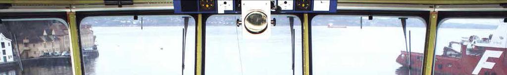

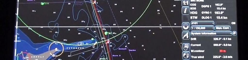
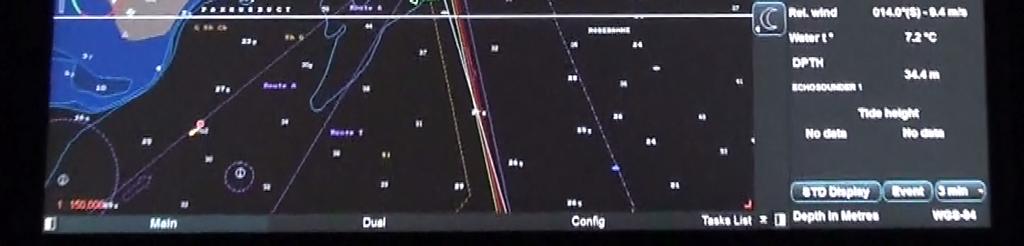
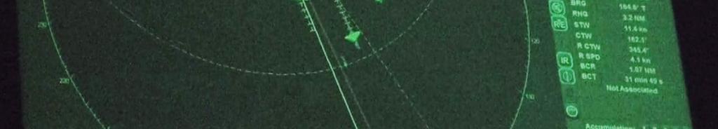
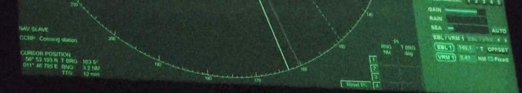
6 Integrated Navigation System (INS) M/V Kong Harlad


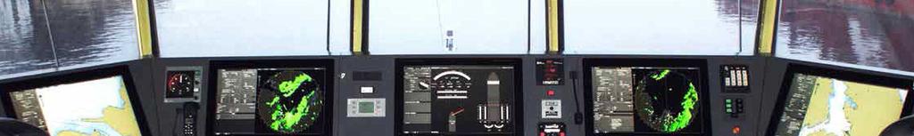
7 Back bridge 2015 P&O North Sea Ferries M/V Pride ofhull

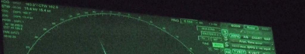
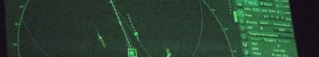
8 Worst case Unintegrated Stand Alone ECDIS
 http://thechronicleherald.")
9 Captain Jason Ikiadis, right, and First Officer Nikos Ninios on the bridge of the Azamara Journey. (Photo Eric Wynne)
10 Cognitive Resource Supply Cognitive Resources Needed Christopher D. Wickens, Justin G. Hollands, Raja Parasuraman, & Simon Banbury. (2012). Engineering Psychology & Human Performance (4th Edition). Pearsons. p. 348
11 Cognitive Resource Supply Open Sea Coastal Confined waters Berthing Cognitive Resources Needed Christopher D. Wickens, Justin G. Hollands, Raja Parasuraman, & Simon Banbury. (2012). Engineering Psychology & Human Performance (4th Edition). Pearsons. p. 348
12 Cognitive Resource Supply Open Sea Coastal Confined waters Berthing Cognitive Resources Needed Christopher D. Wickens, Justin G. Hollands, Raja Parasuraman, & Simon Banbury. (2012). Engineering Psychology & Human Performance (4th Edition). Pearsons. p. 348
13 Cognitive Resource Supply Workload overload Person 1 Person 1 Maximum Open Sea Coastal Confined waters Berthing Cognitive Resources Needed Christopher D. Wickens, Justin G. Hollands, Raja Parasuraman, & Simon Banbury. (2012). Engineering Psychology & Human Performance (4th Edition). Pearsons. p. 348
14 Cognitive Resource Supply Person 2 Maximum Workload overload Person 1 Workload overload Person 2 Person 1 Maximum Open Sea Coastal Confined waters Berthing Cognitive Resources Needed Christopher D. Wickens, Justin G. Hollands, Raja Parasuraman, & Simon Banbury. (2012). Engineering Psychology & Human Performance (4th Edition). Pearsons. p. 348
15 Contextual Control Model (COCOM), Erik Hollnagel, 2005 Control mode Number of goals Subjectively available time Evaluation of outcome Selection of action Strategic Several Abundant Elaborate Based on modes/predictions Tactical Several (limited) Adequate Detailed Based on plans/experience Opportunistic One or two (competing) Just adequate Concrete Based on habits/association Scrambled One Inadequate Rudimentary Random Hollnagel, E & Woods, D.D. (2005). Joint Cognitive Systems: Foundations of Cognitive Systems Engineering. CRC Press thomas.porathe@ntnu.no
16 Contextual Control Model (COCOM), Erik Hollnagel, 2005 Control mode Number of goals Subjectively available time Evaluation of outcome Selection of action Strategic Several Abundant Elaborate Based on modes/predictions Tactical Several (limited) Adequate Detailed Based on plans/experience Opportunistic One or two (competing) Just adequate Concrete Based on habits/association Scrambled One Inadequate Rudimentary Random Hollnagel, E & Woods, D.D. (2005). Joint Cognitive Systems: Foundations of Cognitive Systems Engineering. CRC Press thomas.porathe@ntnu.no

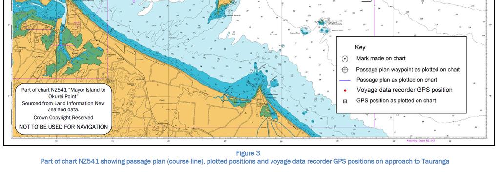
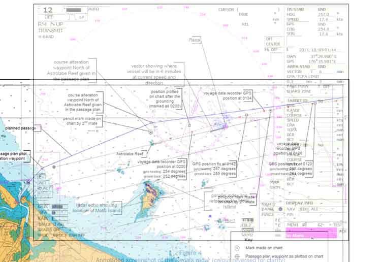
17 MV Rena, N.Z
18 MV Rena, N.Z
19
20 Contextual Control Model (COCOM) (Erik Hollnagel, 2005) Control mode Number of goals Subjectively available time Evaluation of outcome Selection of action Strategic Several Abundant Elaborate Based on modes/predictions Tactical Several (limited) Adequate Detailed Based on plans/experience Opportunistic One or two (competing) Just adequate Concrete Based on habits/association Scrambled One Inadequate Rudimentary Random Hollnagel, E & Woods, D.D. (2005). Joint Cognitive Systems: Foundations of Cognitive Systems Engineering. CRC Press thomas.porathe@ntnu.no
21 Contextual Control Model (COCOM) (Erik Hollnagel, 2005) Control mode Number of goals Subjectively available time Evaluation of outcome Selection of action Strategic Several Abundant Elaborate Based on modes/predictions Tactical Several (limited) Adequate Detailed Based on plans/experience Opportunistic One or two (competing) Just adequate Concrete Based on habits/association Scrambled One Inadequate Rudimentary Random Hollnagel, E & Woods, D.D. (2005). Joint Cognitive Systems: Foundations of Cognitive Systems Engineering. CRC Press thomas.porathe@ntnu.no


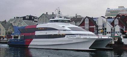
22 HSC Sleipner, 1999
23 Sleipnerolyckan i november 1999 The identical bridge on Sleipner s sister ship Draupner thomas.porathe@ntnu.no
24
25 Cognitive Resource Supply Workload overload Person 1 Workload overload Person 2 Person 2 Maximum Tactical Control mode Opportunistic Control mode Scrambled Control mode Strategic Control mode Person 1 Maximum Open Sea Strategic Control mode Coastal Tactical Control mode Confined waters Berthing Opportunistic Control mode Scrambled Control mode Cognitive Resources Needed Christopher D. Wickens, Justin G. Hollands, Raja Parasuraman, & Simon Banbury. (2012). Engineering Psychology & Human Performance (4th Edition). Pearsons. p. 348
26 Display of e-navigation information Where do we display all this new information?


 Most")
27 Strategic navigation Back bridge (Electronic table, ipad, LapTop, ) Most e-nav information


28 Electronic chart tables OSMOS project Focus group with captains Chalmers 2013
29 Strategic navigation Back bridge (Electronic table, ipad, LapTop, )
30 Strategic navigation Back bridge (Electronic table, ipad, LapTop, ) Tactical navigation Front bridge (INS) Certain e-nav information
31 ECDIS Radar
32
33
34 Strategic navigation Back bridge (Electronic table, ipad, LapTop, ) Tactical navigation Front bridge (INS)
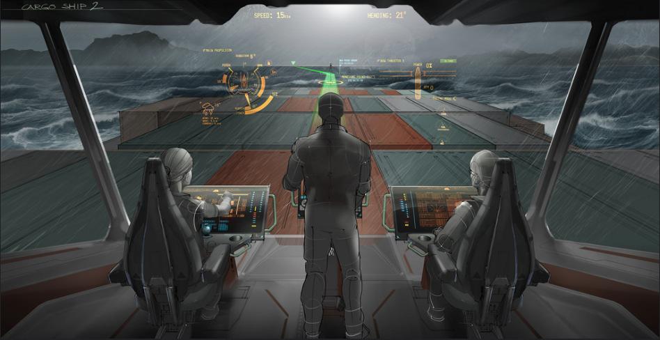
35 Strategic navigation Back bridge (Electronic table, ipad, LapTop, ) Tactical navigation Front bridge (INS) Opportunistic navigation One fused simplified display (Head-up ECDIS with radar overlay)
36 Strategic navigation Back bridge (Electronic table, ipad, LapTop, ) Tactical navigation Front bridge (INS) Opportunistic navigation One fused simplified display (Head-up ECDIS with radar overlay) Scrambled navigation (Conning, HUD, HMD, )
 Scrambled navigation")
37 Strategic navigation Back bridge (Electronic table, ipad, LapTop, ) Tactical navigation Front bridge (INS) Opportunistic navigation One fused simplified display (Head-up ECDIS with radar overlay) Scrambled navigation (Conning, HUD, HMD, )
38
 Opportunistic navigation One fused simplified")
 Most e-nav information Some e-nav information Some carefully selected")
39 Strategic navigation Back bridge (Electronic table, ipad, LapTop, ) Tactical navigation Front bridge (INS) Opportunistic navigation One fused simplified display (Head-up ECDIS with radar overlay) Scrambled navigation (Conning, HUD, HMD, ) Most e-nav information Some e-nav information Some carefully selected e-nav information
DEVELOPMENT OF A DEFINITION FOR MSPS AND CONSIDERATION FOR THE HARMONIZATION OF THE FORMAT AND STRUCTURE OF MSPS
 INTERNATIONAL HYDROGRAPHIC ORGANIZATION E IMO/IHO HARMONIZATION GROUP ON DATA MODELLING Agenda item 5 15 September 2017 ENGLISH ONLY DEVELOPMENT OF A DEFINITION FOR MSPS AND CONSIDERATION FOR THE HARMONIZATION
MARITIME SAFETY INFORMATION
 Introduction 1. Maritime Safety Information (MSI) is defined as navigational and meteorological warnings, meteorological forecasts, and other urgent safety-related messages. This information is of vital
Procedure VHF Communication VTS and HCC Port of Rotterdam Authority Harbour Master's Division
 Procedure VHF Communication VTS and HCC Port of Rotterdam Authority Harbour Master's Division Author: B. Röhner Date: Contents 1. PROCEDURE VHF COMMUNICATION VESSEL TRAFFIC SERVICES (VTS)... 1 2. Area
e-navigation Progress and trends: the IHO perspective
 International Hydrographic Organization e-navigation Progress and trends: the IHO perspective Gilles Bessero Director, IHO International Hydrographic Organization Intergovernmental consultative and technical
RESOLUTION MSC.278(85) (adopted on 1 December 2008) ADOPTION OF THE NEW MANDATORY SHIP REPORTING SYSTEM "OFF THE COAST OF PORTUGAL - COPREP"
 (adopted on 1 December 2008) ADOPTION OF THE NEW MANDATORY SHIP REPORTING SYSTEM OFF THE COAST OF PORTUGAL - COPREP") MSC 85/26/Add.1 RESOLUTION MSC.278(85) SYSTEM OFF THE COAST OF PORTUGAL COPREP THE MARITIME SAFETY COMMITTEE, RECALLING Article 28 of the Convention on the International Maritime Organization concerning
MSC 85/26/Add.1 RESOLUTION MSC.278(85) SYSTEM OFF THE COAST OF PORTUGAL COPREP THE MARITIME SAFETY COMMITTEE, RECALLING Article 28 of the Convention on the International Maritime Organization concerning
Challenges and opportunities in the e-navigation Development. Actual projects.
 Challenges and opportunities in the e-navigation Development. Actual projects. John Erik Hagen, Regional Director Oslo, September 2018 What is e-navigation? Efficient transfer of marine information and
The Pros and Cons of using ECDIS as Primary Means of Navigation
 Sections 1 2 Company introduction The PROS of Using ECDIS and ENCs 3 The CONS of Using ECDIS and ENCs 4 Why we have choose NAVTOR Company Introduction Corporate Overview. is a Ship Management Company established
The Role of Automatic Identification System (AIS) in Enhancing Vessel Traffic Management By Capt. Ehab Ibrahim Etman
 in Enhancing Vessel Traffic Management By Capt. Ehab Ibrahim Etman") The Role of Automatic Identification System (AIS) in Enhancing Vessel Traffic Management By Capt. Ehab Ibrahim Etman Abstract The International Maritime Organization (IMO) adopted a new requirement for
The Role of Automatic Identification System (AIS) in Enhancing Vessel Traffic Management By Capt. Ehab Ibrahim Etman Abstract The International Maritime Organization (IMO) adopted a new requirement for
Transport System. Telematics. Possibility of integration of navigational information on electronic chart
 Archives of Volume 3 Transport System Issue 2 Telematics May 2010 Possibility of integration of navigational information on electronic chart H. ŚNIEGOCKI a, M. WIELIKI b a Faculty of Navigation, Gdynia
AMENDMENTS TO RESOLUTION A.706(17) WORLD-WIDE NAVIGATIONAL WARNING SERVICE
 WORLD-WIDE NAVIGATIONAL WARNING SERVICE") E 4 ALBERT EMBANKMENT LONDON SE1 7SR Telephone: +44 (0)20 7735 7611 Fax: +44 (0)20 7587 3210 AMENDMENTS TO RESOLUTION A.706(17) WORLD-WIDE NAVIGATIONAL WARNING SERVICE MSC.1/Circ.1288/Rev.1 24 June 2013
E 4 ALBERT EMBANKMENT LONDON SE1 7SR Telephone: +44 (0)20 7735 7611 Fax: +44 (0)20 7587 3210 AMENDMENTS TO RESOLUTION A.706(17) WORLD-WIDE NAVIGATIONAL WARNING SERVICE MSC.1/Circ.1288/Rev.1 24 June 2013
VHF Data Exchange System (VDES)
") VHF Data Exchange System (VDES) ETSI Workshop Future Evolution of Marine Communication 7-8 November 2017 Malcolm Lyman Marketing Manager CML Microcircuits UK With acknowledgments to the members of IALA
VHF Data Exchange System (VDES) ETSI Workshop Future Evolution of Marine Communication 7-8 November 2017 Malcolm Lyman Marketing Manager CML Microcircuits UK With acknowledgments to the members of IALA
L AGENCE NATIONALE DES FREQUENCES (ANFR) From Titanic to satellite from Morse to digital Entry in a new era for the maritime community
 From Titanic to satellite from Morse to digital Entry in a new era for the maritime community") L AGENCE NATIONALE DES FREQUENCES (ANFR) From Titanic to satellite from Morse to digital Entry in a new era for the maritime community ITU regional seminar 6-8 June 2018 St-Petersburg, Russian Federation
L AGENCE NATIONALE DES FREQUENCES (ANFR) From Titanic to satellite from Morse to digital Entry in a new era for the maritime community ITU regional seminar 6-8 June 2018 St-Petersburg, Russian Federation
IMO RESOLUTION A.1001(25) Adopted on 29 November 2007 (Agenda item 9)
 Adopted on 29 November 2007 (Agenda item 9)") INTERNATIONAL MARITIME ORGANIZATION E IMO ASSEMBLY 25th session Agenda item 9 A 25/Res.1001 3 January 2008 Original: ENGLISH RESOLUTION A.1001(25) Adopted on 29 November 2007 (Agenda item 9) CRITERIA FOR
INTERNATIONAL MARITIME ORGANIZATION E IMO ASSEMBLY 25th session Agenda item 9 A 25/Res.1001 3 January 2008 Original: ENGLISH RESOLUTION A.1001(25) Adopted on 29 November 2007 (Agenda item 9) CRITERIA FOR
NAVIGA TIONAL VIGA WARNINGS/MSI/GMDSS N NAV NA AREA III VIII
 NAVIGATIONAL WARNINGS/MSI/GMDSS IN NAVAREA VIII 5/16/2008 1 SCOPE OF PRESENTATION 1. Introduction 2. Navarea VIII Radio Warnings 3. Indian Notices to Mariners 4. Implementation of GMDSS 5. Marine Safety
FOREWORD. IHO S-100 Working Group
 IHO International Hydrographic Organization KHOA Korea Hydrographic and Oceanographic Agency MUCH MORE THAN JUST NAUTICAL CHARTS IHO UNIVERSAL HYDROGRAPHIC data MODEL This document was produced with the
Augmented Reality as part of a man-machine interface in e-navigation
 Augmented Reality as part of a man-machine interface in e-navigation Stephan Procee 1 and Michael Baldauf 2 1 Maritiem Instituut Willem Barentsz, Terschelling, the Netherlands - partner in the ACCSEAS
GUIDANCE FOR THE PRESENTATION AND DISPLAY OF AIS APPLICATION-SPECIFIC MESSAGES INFORMATION
 E 4 ALBERT EMBANKMENT LONDON SE1 7SR Telephone: +44 (0)20 7735 7611 Fax: +44 (0)20 7587 3210 Ref. T2-OSS/2.7.1 SN.1/Circ.290 2 June 2010 GUIDANCE FOR THE PRESENTATION AND DISPLAY OF AIS APPLICATION-SPECIFIC
ROUTEING OF SHIPS, SHIP REPORTING AND RELATED MATTERS. New traffic separation schemes and two-way routes in Norra Kvarken
 E SUB-COMMITTEE ON SAFETY OF NAVIGATION 57th session Agenda item 3 NAV 57/3/7 11 March 2011 Original: ENGLISH ROUTEING OF SHIPS, SHIP REPORTING AND RELATED MATTERS New traffic separation schemes and two-way
IMO ACTIVITIES AFFECTING HSSC
 HSSC1-04.2A rev3 1 st HSSC MEETING Singapore, 22-24 October 2009 Paper for Consideration by HSSC IMO ACTIVITIES AFFECTING HSSC Submitted by: Executive Summary: Related Documents: IHB This paper summarizes
ECDIS ENC Accuracy. Contents. Introduction LOSS PREVENTION BRIEFING FOR NORTH MEMBER SHIPS / MAY Introduction... 1
 LOSS PREVENTION BRIEFING FOR NORTH MEMBER SHIPS / MAY 2017 ECDIS ENC Accuracy Contents Introduction... 1 ECDIS Specific Familiarisation... 2 IHO S-57... 2 ENC Data Source... 2 CATZOC and M_QUAL... 2 CATZOC
AMENDMENTS TO RESOLUTION A.705(17) PROMULGATION OF MARITIME SAFETY INFORMATION
 PROMULGATION OF MARITIME SAFETY INFORMATION") E 4 ALBERT EMBANKMENT LONDON SE1 7SR Telephone: +44 (0)20 7735 7611 Fax: +44 (0)20 7587 3210 AMENDMENTS TO RESOLUTION A.705(17) PROMULGATION OF MARITIME SAFETY INFORMATION MSC.1/Circ.1287/Rev.1 24 June
E 4 ALBERT EMBANKMENT LONDON SE1 7SR Telephone: +44 (0)20 7735 7611 Fax: +44 (0)20 7587 3210 AMENDMENTS TO RESOLUTION A.705(17) PROMULGATION OF MARITIME SAFETY INFORMATION MSC.1/Circ.1287/Rev.1 24 June
The Future in Marine Radio Communication GMDSS. Department of Transportation United States Coast Guard
 The Future in Marine Radio Communication GMDSS Department of Transportation United States Coast Guard Do you use a Maritime Radio System? If so, the new Global Maritime Distress and Safety System (GMDSS)
ROUTEING OF SHIPS, SHIP REPORTING AND RELATED MATTERS. Establishment of a Mandatory Ship Reporting System in the
 INTERNATIONAL MARITIME ORGANIZATION E SUB-COMMITTEE ON SAFETY OF NAVIGATION 48th session Agenda item 3 IMO NAV 48/3/2 11 April 2002 Original: ENGLISH ROUTEING OF SHIPS, SHIP REPORTING AND RELATED MATTERS
PROMULGATION OF MARITIME SAFETY INFORMATION UNDER THE GLOBAL MARITIME DISTRESS AND SAFETY SYSTEM ROY SOLURI DIRECTOR (AMERICAS) MARINEWORKS LTD
 MARINEWORKS LTD") PROMULGATION OF MARITIME SAFETY INFORMATION UNDER THE GLOBAL MARITIME DISTRESS AND SAFETY SYSTEM ROY SOLURI DIRECTOR (AMERICAS) MARINEWORKS LTD MARITIME SAFETY INFORMATION AS DEFINED IN THE SOLAS CONVENTION
PROMULGATION OF MARITIME SAFETY INFORMATION UNDER THE GLOBAL MARITIME DISTRESS AND SAFETY SYSTEM ROY SOLURI DIRECTOR (AMERICAS) MARINEWORKS LTD MARITIME SAFETY INFORMATION AS DEFINED IN THE SOLAS CONVENTION
RULES FOR THE CONSTRUCTION AND CLASSIFICATION OF MOBILE OFFSHORE DRILLING UNITS TITLE MOBILE OFFSHORE DRILLING UNITS NAUTIC AND ELECTRONICS CHAPTERS
 PARTE II RULES FOR THE CONSTRUCTION AND CLASSIFICATION OF MOBILE OFFSHORE DRILLING UNITS TITLE MOBILE OFFSHORE DRILLING UNITS SECTION 8 NAUTIC AND ELECTRONICS CHAPTERS A B C D SCOPE TECHNICAL DOCUMENTATION
A new Modular and Open Concept for the Maritime Integrated PNT System
 A new Modular and Open Concept for the Maritime Integrated PNT System T. Noack German Aerospace Center Institute of Communications and Navigation www.dlr.de Chart 2 MTS-2012 Maritime Integrated PNT Unit
MEDITERRANEAN AND BLACK SEAS HYDROGRAPHIC COMMISSION
 MEDITERRANEAN AND BLACK SEAS HYDROGRAPHIC COMMISSION XVIII CONFERENCE CONTRIBITION BY MALTA Istanbul, Turkey 25-27 September 2013 1 Item 1 Hydrographic Office Transport Malta is responsible for all transport
Paper for Consideration by S-100WG3. Report on S-100 Sea trial of KHOA
 S-100WG3-8.1 Paper for Consideration by S-100WG3 Report on S-100 Sea trial of KHOA Submitted by: Executive Summary: Related Documents: Related Projects: Republic of Korea (KHOA) This paper reports the
Notice to Mariner No. 213
 To : Attn: From: All Agents, Bunkering Companies, Coast Guard, National Transport Authority, Hydrographic Office Operations Manager Capt. Tamer Masoud Harbour Master Facsimile No.: City: Fujairah Country:
Proposal of a New Study for the Enhancement of the Safety of Navigation in the Straits of Malacca and Singapore
 Proposal of a New Study for the Enhancement of the Safety of Navigation in the Straits of Malacca and Singapore The 8 th Co-operation Forum 5-6 October 2015 Malacca Strait Council, Japan 1 Content of Presentation
THE ELECTRONIC CHART DISPLAY AND INFORMATION SYSTEM (ECDIS) IN CHINA
 IN CHINA") International Hydrographic 'Review, Monaco, LXIX(2), September 1992 THE ELECTRONIC CHART DISPLAY AND INFORMATION SYSTEM (ECDIS) IN CHINA by The Research Group on ECDIS 1 Abstract This paper presents a
International Hydrographic 'Review, Monaco, LXIX(2), September 1992 THE ELECTRONIC CHART DISPLAY AND INFORMATION SYSTEM (ECDIS) IN CHINA by The Research Group on ECDIS 1 Abstract This paper presents a
Is the new technology safe for navigation in coastal waters and archipelagos?
 3.35.20 Is the new technology safe for navigation in coastal waters and archipelagos? As near misses not are reported we take a look at the groundings Combat boat CB 90 (mostly) Thank you Lars-Erik! ECS
dkart Navigator 9010
 dkart Navigator 9010 dkart Navigator - purpose dkart Navigator is an electronic navigation chart system specially designed to facilitate all the navigational tasks of mariner's day-to-day practice. Along
DRAFT ASSEMBLY RESOLUTION A. (26)
") DRAFT ASSEMBLY RESOLUTION A. (26) PROMULGATION OF MARITIME SAFETY INFORMATION The ASSEMBLY, RECALLING Article 15(j) of the Convention on the International Maritime Organization concerning the functions
DRAFT ASSEMBLY RESOLUTION A. (26) PROMULGATION OF MARITIME SAFETY INFORMATION The ASSEMBLY, RECALLING Article 15(j) of the Convention on the International Maritime Organization concerning the functions
Digital broadcasting systems under development within ITU-R of interest for the maritime community
 Digital broadcasting systems under development within ITU-R of interest for the maritime community Christian RISSONE ANFR rissone@anfr.fr IHO, WWNWS 5 Monaco, 2 nd October 2013 1 Background for the 500
BookletChart. Intracoastal Waterway Grassy Key to Bahia Honda Key NOAA Chart A reduced-scale NOAA nautical chart for small boaters
 BookletChart Intracoastal Waterway Grassy Key to Bahia Honda Key NOAA Chart 11453 A reduced-scale NOAA nautical chart for small boaters When possible, use the full-size NOAA chart for navigation. Published
GMDSS communication systems
 GMDSS Basic Concepts A System Overview Functional requirements The GMDSS (Global Maritime Distress and Safety System) is specifically designed to automate a ship's radio distress alerting function, and,
DSC WATCH - Coast stations participating in MF, HF and VHF watch-keeping using digital selective calling techniques
 GRC - Greece NOTES DSC WATCH - Coast stations participating in MF, HF and VHF watch-keeping using digital selective calling techniques DC1 Also keeps permanent watch for distress and safety traffic, by
(P.27)
") (P.27) 27 7 210 120 8 * Navigation and Anchoring Prohibited Area has been changed since June, 2017. 9 Port of Osaka The Guidelines of Measures for preventing Typhoon Disaster ( Objective )
(P.27) 27 7 210 120 8 * Navigation and Anchoring Prohibited Area has been changed since June, 2017. 9 Port of Osaka The Guidelines of Measures for preventing Typhoon Disaster ( Objective )
Vessel Target Prediction Method and Dead Reckoning Position Based on SVR Seaway Model
 Original Article International Journal of Fuzzy Logic and Intelligent Systems Vol. 17, No. 4, December 2017, pp. 279-288 http://dx.doi.org/10.5391/ijfis.2017.17.4.279 ISSN(Print) 1598-2645 ISSN(Online)
E-NAVIGATION AND BEYOND
 E-NAVIGATION AND BEYOND The Work of IALA e-navigation Committee and Future CDR. Hideki NOGUCHI, Chair, IALA ENAV Committee e-navigation (ENAV) Committee Established in 2010 by merging R-NAV and AIS Committee
Korea s Strategy for e-navigation. SMART-Navigation. Presented by. Bu Young, Kim. 28 May Ministry of Oceans and Fisheries Republic of Korea
 Korea s Strategy for e-navigation SMART-Navigation Presented by Bu Young, Kim 28 May 2014 Ministry of Oceans and Fisheries Republic of Korea 1 2 3 4 5 6 1. SMART- Navigation? SMART-Navigation Korea s
United States Coast Guard Office of Navigation Systems
 United States Coast Guard Office of Navigation Systems Future of Navigation Initiatives & Operations R. David Lewald Program Analyst Navigation Systems Office of Navigation Systems U.S. Coast Guard Washington,
Global Maritime Distress and Safety System (GMDSS)
") Global Maritime Distress and Safety System (GMDSS) Global Maritime Distress and Safety System (GMDSS) BACKGROUNG, APPLICATION, DEFINITION GMDSS (Background) SOLAS 74 Ships 1600 TRG Radio Installation Ships
Global Maritime Distress and Safety System (GMDSS) Global Maritime Distress and Safety System (GMDSS) BACKGROUNG, APPLICATION, DEFINITION GMDSS (Background) SOLAS 74 Ships 1600 TRG Radio Installation Ships
Western Region enavigation Sub- Committee Report
 Western Region enavigation Sub- Committee Report Western Region enavigation meeting - Jan 12 18 BC Ferries BC Coast Pilots BCIT Marine Campus Canadian Coast Guard Canadian Hydrographic Services Canadian
GUIDELINES ON THE DESIGN AND USE OF PORTABLE PILOT UNITS INTERNATIONAL MARITIME PILOTS ASSOCIATION
 GUIDELINES ON THE DESIGN AND USE OF PORTABLE PILOT UNITS INTERNATIONAL MARITIME PILOTS ASSOCIATION WITH TECHNICAL INPUT FROM Comité International Radio-Maritime (CIRM) 2 FOREWORD With the increasing use
IALA Guideline No. XXXX. The establishment of AIS as an Aid to Navigation. Edition 1.3. [Date] Working vs / Working 7.
![IALA Guideline No. XXXX. The establishment of AIS as an Aid to Navigation. Edition 1.3. [Date] Working vs / Working 7.](/thumbs/74/71399138.jpg "IALA Guideline No. XXXX. The establishment of AIS as an Aid to Navigation. Edition 1.3. [Date] Working vs / Working 7.") ANM12/Output/10 International Association of Marine Aids to Navigation and Lighthouse Authorities AISM Association of Internationale de Signalisation Maritime IALA IALA Guideline No. XXXX On The establishment
ANM12/Output/10 International Association of Marine Aids to Navigation and Lighthouse Authorities AISM Association of Internationale de Signalisation Maritime IALA IALA Guideline No. XXXX On The establishment
RADIO AIDS TO MARINE NAVIGATION (Pacific and Western Arctic) CANADIAN COAST GUARD. Marine Communications and Traffic Services. Annual Edition 2007
 CANADIAN COAST GUARD. Marine Communications and Traffic Services. Annual Edition 2007") RADIO AIDS TO MARINE NAVIGATION (Pacific and Western Arctic) CANADIAN COAST GUARD Marine Communications and Traffic Services Annual Edition 2007 IMPORTANT This publication is revised on a monthly basis
RADIO AIDS TO MARINE NAVIGATION (Pacific and Western Arctic) CANADIAN COAST GUARD Marine Communications and Traffic Services Annual Edition 2007 IMPORTANT This publication is revised on a monthly basis
Demonstrator of a Data Processing Centre (DPC) for satellite-based AIS services
 for satellite-based AIS services") Page 1 Demonstrator of a Data Processing Centre (DPC) for satellite-based AIS services 19/20 April 2012 gfabritius@cls.fr Overview of the presentation Page 2 Introducing CLS Introducing AIS / SAT-AIS Scope
Page 1 Demonstrator of a Data Processing Centre (DPC) for satellite-based AIS services 19/20 April 2012 gfabritius@cls.fr Overview of the presentation Page 2 Introducing CLS Introducing AIS / SAT-AIS Scope
BRIEF - NAVAREA IX INTROCUCTION/BACK GROUND
 BRIEF - NAVAREA IX INTROCUCTION/BACK GROUND 1. NAVAREA IX is one of the 16 areas established through the Worldwide Navigational Warning Service (WWNWS). It consists of Northwest Arabian Sea, the Gulfand
Integration of AIS functionalities
 Integration of AIS functionalities by John O. Klepsvik FARGIS 05 March 01, 2005 WORLD CLASS through people, technology and dedication WORLD CLASS through people, technology and dedication KONGSBERG March
RESOLUTION MSC.229(82) (adopted on 5 December 2006) ADOPTION OF A NEW MANDATORY SHIP REPORTING SYSTEM "IN THE GALAPAGOS PARTICULARLY SENSITIVE SEA
 (adopted on 5 December 2006) ADOPTION OF A NEW MANDATORY SHIP REPORTING SYSTEM IN THE GALAPAGOS PARTICULARLY SENSITIVE SEA") MSC 82/24/Add.2 RESOLUTION MSC.229(82) IN THE GALAPAGOS PARTICULARLY SENSITIVE SEA AREA (PSSA) (GALREP) THE MARITIME SAFETY COMMITTEE, RECALLING Article 28(b) of the Convention on the International Maritime
MSC 82/24/Add.2 RESOLUTION MSC.229(82) IN THE GALAPAGOS PARTICULARLY SENSITIVE SEA AREA (PSSA) (GALREP) THE MARITIME SAFETY COMMITTEE, RECALLING Article 28(b) of the Convention on the International Maritime
Class Update on Latest Ship to Ship Transfer Plan
 Class Update on Latest Ship to Ship Transfer Plan Binbin Li 17 May 2017 7th Forum on STS Best Practices - SNI, Singapore 2017 American Bureau of Shipping. All rights reserved Outline This presentation
Galileo and GMES Technologies for Maritime Navigation Christoph Günther, DLR
 Galileo and GMES Technologies for Maritime Navigation Christoph Günther, DLR Institut für Kommunikation und Navigation Seite 1 Maritime Safety and Efficiency Avoidance of Collisions based on known position
MARINE ELECTRONIC HIGHWAY IN STRAITS OF MALACCA AND SINGAPORE. Development of Supporting Element for Future & Sustainable Operation
 COOPERATION FORUM UNDER THE COOPERATIVE MECHANISM ON SAFETY OF NAVIGATION AND ENVIRONMENTAL PROTECTION IN THE STRAITS OF MALACCA AND SINGAPORE 7th SESSION Agenda Item... CF 7/... 22-23 September 2014 Original.
The human touch in technology. ECDIS ECS Conning screen Ship speed info system
 The human touch in technology ECDIS ECS Conning screen Ship speed info system Alphatron ALPHACHART T ECDIS Type approved ECDIS system powered by TRANSAS The ALPHACHART T is an advanced Electronic Chart
Resolution A.1106(29) Adopted on 2 December 2015 (Agenda item 10)
 Adopted on 2 December 2015 (Agenda item 10)") E ASSEMBLY 29th session Agenda item 10 A 29/Res.1106 14 December 2015 Original: ENGLISH Resolution A.1106(29) Adopted on 2 December 2015 (Agenda item 10) REVISED GUIDELINES FOR THE ONBOARD OPERATIONAL
E ASSEMBLY 29th session Agenda item 10 A 29/Res.1106 14 December 2015 Original: ENGLISH Resolution A.1106(29) Adopted on 2 December 2015 (Agenda item 10) REVISED GUIDELINES FOR THE ONBOARD OPERATIONAL
A Study on Basic VTS Guideline based on Ship s Operator s Consciousness
 http://www.transnav.eu the International Journal on Marine Navigation and Safety of Sea Transportation Volume 11 Number 4 December 2017 DOI: 10.12716/1001.11.04.04 A Study on Basic VTS Guideline based
MARITIME COMMUNICATIONS IDENTIFYING CURRENT AND FUTURE SATELLITE REQUIREMENTS & TECHNOLOGIES
 MARITIME COMMUNICATIONS IDENTIFYING CURRENT AND FUTURE SATELLITE REQUIREMENTS & TECHNOLOGIES Simon Plass and Federico Clazzer Institute of Communications and Navigation, German Aerospace Center (DLR),
COMMUNICATION SYSTEMS FOR SAFETY AND SECURITY OF SHIPS
 Journal of KONES Powertrain and Transport, Vol. 23, No. 1 2016 COMMUNICATION SYSTEMS FOR SAFETY AND SECURITY OF SHIPS Karol Korcz Gdynia Maritime University, Department of Marine Telecommunication Morska
RESOLUTION MSC.230(82) (adopted on 5 December 2006) ADOPTION OF AMENDMENTS TO THE EXISTING MANDATORY SHIP REPORTING SYSTEM "IN THE STOREBÆLT (GREAT
 (adopted on 5 December 2006) ADOPTION OF AMENDMENTS TO THE EXISTING MANDATORY SHIP REPORTING SYSTEM IN THE STOREBÆLT (GREAT") MSC 82/24/Add.2 RESOLUTION MSC.230(82) MANDATORY SHIP REPORTING SYSTEM IN THE STOREBÆLT (GREAT BELT) TRAFFIC AREA THE MARITIME SAFETY COMMITTEE, RECALLING Article 28(b) of the Convention on the International
MSC 82/24/Add.2 RESOLUTION MSC.230(82) MANDATORY SHIP REPORTING SYSTEM IN THE STOREBÆLT (GREAT BELT) TRAFFIC AREA THE MARITIME SAFETY COMMITTEE, RECALLING Article 28(b) of the Convention on the International
PROGRESS UPDATE AND FUTURE DIRECTIONS OF THE MARINE ELECTRONIC HIGHWAY (MEH)
") PROGRESS UPDATE AND FUTURE DIRECTIONS OF THE MARINE ELECTRONIC HIGHWAY (MEH) BACKGROUND 1. The Marine Electronic Highway Demonstration Project (MEH DP) was a 4- year regional project in the Straits of
PROGRESS UPDATE AND FUTURE DIRECTIONS OF THE MARINE ELECTRONIC HIGHWAY (MEH) BACKGROUND 1. The Marine Electronic Highway Demonstration Project (MEH DP) was a 4- year regional project in the Straits of
TOWARDS A COORDINATED INTERNATIONAL RADIO NAVIGATIONAL WARNINGS SYSTEM
 Internationa! Hydrographic Review, Monaco, LIVC1) January 1977. TOWARDS A COORDINATED INTERNATIONAL RADIO NAVIGATIONAL WARNINGS SYSTEM b y Captain Hans Sc h u m an n lately Head of the Nautical Publications
CPRNW. WWNWS9/3/3/3.2 Meeting 9 20 July 2017 Agenda Item Joint MET/NAVAREA XVII and XVIII Client Survey
 CPRNW WWNWS WWNWS9/3/3/3.2 Meeting 9 20 July 2017 Agenda Item 3.3.3.2 Joint MET/NAVAREA XVII and XVIII Client Survey Submitted by Canada, NAVAREA XVII_XVIII SUMMARY Executive Summary: This document describes
Technology evolution for future radiocommunication and navigation
 Technology evolution for future radiocommunication and navigation Frances Baskerville (Secretary General) Richard Doherty (Deputy Secretary General) CIRM Who we are and what we do What is CIRM? The Worldwide
SUBMARINE CABLES, RESOURCE USE, AND ENVIRONMENTAL PROTECTION. Ambassador Satya Nandan
 SUBMARINE CABLES, RESOURCE USE, AND ENVIRONMENTAL PROTECTION Ambassador Satya Nandan CIL Workshop on Submarine Cables and Law of the Sea Singapore 14-15 December 2009 www.telegeography.com LOSC Framework
EGYPTIAN HYDROGRAPHIC DEPARTMENT THE EGYPTIAN HYDROGRAPHIC FRAMEWORK
 gvt THE EGYPTIAN HYDROGRAPHIC FRAMEWORK The roles of a national Hydrographic Service can be summarized in collecting georeferenced data through systematic surveys at sea and along the coast related to:
RESOLUTION A.659(16) adopted on 19 October 1989 PROVISION OF RADIO SERVICES FOR THE GLOBAL MARITIME DISTRESS AND SAFETY SYSTEM
 adopted on 19 October 1989 PROVISION OF RADIO SERVICES FOR THE GLOBAL MARITIME DISTRESS AND SAFETY SYSTEM") INTERNATIONAL MARITIME ORGANIZATION RESOLUTION A.659(16) adopted on 19 October 1989 A 16/Res.659 30 November 1989 Original: ENGLISH ASSEMBLY - 16th session Agenda item 10 IMO RESOLUTION A.659(16) adopted
INTERNATIONAL MARITIME ORGANIZATION RESOLUTION A.659(16) adopted on 19 October 1989 A 16/Res.659 30 November 1989 Original: ENGLISH ASSEMBLY - 16th session Agenda item 10 IMO RESOLUTION A.659(16) adopted
E C D I S E LECTRONIC C HART D ISPLAY I NFORMATION S YSTEM
 e l e c t r o n i c c h a r t d i s p l a y i n f o r m a t i o n s y s t e m T R A N S A S E C D I S T R A N S A S E C D I S 3 E C D I S is a computer-based navigation information system that complies
Maritime Communications
 Maritime Communications Strategic Sectorial Spectrum Needs Conferência sobre Gestão do Espectro: Perspectivas, Desafios e Estratégias Lisboa, 20 de setembro de 2013 RSPG Work Programme 2012 and Beyond
ITU Service Publications (maritime) and MARS (Maritime mobile Access and Retrieval System)
 and MARS (Maritime mobile Access and Retrieval System)") ITU Service Publications (maritime) and MARS (Maritime mobile Access and Retrieval System) ITU Radiocommunication Bureau Ms. Sujiva Pinnagoda pinnagoda@itu.int BR/TSD/TPR Another BR activity Radiocommunication
ITU Service Publications (maritime) and MARS (Maritime mobile Access and Retrieval System) ITU Radiocommunication Bureau Ms. Sujiva Pinnagoda pinnagoda@itu.int BR/TSD/TPR Another BR activity Radiocommunication
BookletChart. Sacramento River Andrus Island to Sacramento NOAA Chart A reduced-scale NOAA nautical chart for small boaters
 BookletChart Sacramento River Andrus Island to Sacramento NOAA Chart 18662 A reduced-scale NOAA nautical chart for small boaters When possible, use the full-size NOAA chart for navigation. Included Area
Study on application in the teaching of ship maneuvering Simulator Haoran Song
 Applied Mechanics and Materials Online: 2013-02-27 ISSN: 1662-7482, Vol. 310, pp 580-583 doi:10.4028/www.scientific.net/amm.310.580 2013 Trans Tech Publications, Switzerland Study on application in the
ANNEX ANNEX. Accompanying the document. Commission Implementing Regulation
 Ref. Ares(2018)3546601-04/07/2018 EUROPEAN COMMISSION Brussels, XXX [ ](2018) XXX draft ANNEX ANNEX Accompanying the document Commission Implementing Regulation on technical specifications for vessel tracking
Navigation Safety Management and Planning
 Coordinating unit: Teaching unit: Academic year: Degree: ECTS credits: 2018 280 - FNB - Barcelona School of Nautical Studies 742 - CEN - Department of Nautical Sciences and Engineering MASTER'S DEGREE
Sensors, Tools and the Common Operating Picture. Sensors, Tools and the Common Operating Picture 14 th April Middleburg
 Sensors, Tools and the Common Operating Picture 14 th April 2015 - Middleburg Aptomar Established in 2005 Owned by Statoil, Investinor, Proventure Seed, Verdane Capitol Have developed and control all IPR
A Survey of Mariners' Opinions on Using Electronic Charts
 s i l s Note A Survey of Mariners' Opinions on Using Electronic Charts Igor Karnicnik, M.Sc., Geodetic Institute of Slovenia, Slovenia. A new component of modern shipborne navigation equipment is the Electronic
Service instance description for the Baltic Navigational Warning Service
 Service instance description for the Baltic Navigational Warning Service 2018-01-18 Document status Authors Name Björn Andreasson Mikael Olofsson Organisation Swedish Maritime Administration Swedish Maritime
The Impact of IT on the. Marine Navigator. Andrew Eccleston. University of Plymouth
 The Impact of IT on the Marine Navigator Andrew Eccleston University of Plymouth Marine Navigators with local connections Sir Francis Drake Sir Francis Chichester Tasksfor the Marine Navigator Navigation
AMSA Case Study. Helping the MV Akademik Shokalskiy out of hot water. INMARSAT > Case study > AMSA
 AMSA Case Study Helping the MV Akademik Shokalskiy out of hot water INMARSAT > Case study > AMSA Breaking the Ice with Satellite Communications Not one of the 74 passengers and crew aboard the Russian
NZQA registered unit standard version 2 Page 1 of 5
 Page 1 of 5 Title Use marine radar on a restricted limits vessel Level 3 Credits 10 Purpose People credited with this unit standard are able to: relate the operating principles and conditions of marine
GMDSS modernisation and e-navigation: spectrum needs
 ETSI Workshop "Future Evolution of Marine Communication", 7-8 November 2017, Sophia Antipolis, France GMDSS modernisation and e-navigation: spectrum needs Karlis Bogens BR Terrestrial Services Department
A guideline for establishing feature and symbol standard management system for national HOs
 A guideline for establishing feature and symbol standard management system for national HOs Joint 26th TSMAD and 5th DIPWG Meeting Silver Spring, Maryland, USA(10-14 June 2013) Republic of Korea (ROK)
CHAPTER 66 QUARTERMASTER (QM) NAVPERS E CH-67
 NAVPERS E CH-67") CHAPTER 66 QUARTERMASTER (QM) NAVPERS 18068-66E CH-67 Updated: July 2016 TABLE OF CONTENTS QUARTERMASTER (QM) SCOPE OF RATING GENERAL INFORMATION NAVIGATION ADMINISTRATOR COMMUNICATIONS ELECTRONIC SYSTEMS
CHAPTER 66 QUARTERMASTER (QM) NAVPERS 18068-66E CH-67 Updated: July 2016 TABLE OF CONTENTS QUARTERMASTER (QM) SCOPE OF RATING GENERAL INFORMATION NAVIGATION ADMINISTRATOR COMMUNICATIONS ELECTRONIC SYSTEMS
This document describes the IMO e-navigation strategy and recommends a Danish strategy for e-navigation and associated action plan.
 Strategy and action plan for e-navigation This document describes the IMO e-navigation strategy and recommends a Danish strategy for e-navigation and associated action plan. Our reference: JKJ/MAF Case
Myanmar Naval Hydrographic Centre. National Report for 13 th North Indian Ocean Hydrographic Commission Meeting
 Myanmar Naval Hydrographic Centre National Report for 13 th North Indian Ocean Hydrographic Commission Meeting Yangon, Myanmar 19 th 22 nd February 2013 CONTENT 1. Myanmar Naval Hydrographic Centre 2.
GNSS in Maritime and Education in Egypt
 GNSS in Maritime and Education in Egypt GNSS IN MARITIME PORTS SHIPS PORTS WATERWAYS GNSS maritime applications will help to improve: navigation. Ship operations. Traffic management. Seaport operations.
JOURNAL OF MARITIME RESEARCH. The Architecture of Data Transmission in Inland Navigation
 JOURNAL OF MARITIME RESEARCH Vol XI. No. II (2014) pp 3 7 ISSN: 1697-4040, www.jmr.unican.es The Architecture of Data Transmission in Inland Navigation A. Lisaj 1,2, and P. Majzner 3 ARTICLE INFO Article
FREQUENCIES FOR DISTRESS AND SAFETY, SEARCH AND RESCUE AND EMERGENCIES
 FREQUENCIES FOR DISTRESS AND SAFETY, SEARCH AND RESCUE AND EMERGENCIES Given the global nature of travel with the potential risk of accidents the international community has agreed that the use of certain
Navigation Safey Management and Planning
 Coordinating unit: Teaching unit: Academic year: Degree: ECTS credits: 2018 280 - FNB - Barcelona School of Nautical Studies 742 - CEN - Department of Nautical Sciences and Engineering MASTER'S DEGREE
TECHNICAL COMMITTEE 80: MARITIME NAVIGATION AND RADIOCOMMUNICATION EQUIPMENT AND SYSTEMS INTERNATIONAL ELECTROTECHNICAL COMMISSION
 TECHNICAL COMMITTEE 80: MARITIME NAVIGATION AND RADIOCOMMUNICATION EQUIPMENT AND SYSTEMS INTERNATIONAL ELECTROTECHNICAL COMMISSION IEC TECHNICAL COMMITTEE 80: MARITIME NAVIGATION AND RADIOCOMMUNICATION
AIS Training. AIS Technology in Digital Yacht Products Explained. Digital Yacht Ltd TEL
 AIS Training AIS Technology in Digital Yacht Products Explained Digital Yacht Ltd www.digitalyacht.co.uk TEL + 44 1179 554474 What is AIS? The Automatic Identification System (AIS) is the biggest advance
ITU matters, including Radiocommunication ITU-R Study Group matters (Agenda item 5)
") IMO NAV 59 Agenda preview Introduction The 59th session of the IMO Sub-Committee on Safety of Navigation (NAV 59) will be held from 2nd to 6th September 2013, at the IMO headquarters in London. This briefing
IMO NAV 59 Agenda preview Introduction The 59th session of the IMO Sub-Committee on Safety of Navigation (NAV 59) will be held from 2nd to 6th September 2013, at the IMO headquarters in London. This briefing
LT Matthew Forney, NOAA Navigation Manager Alaska Region Bering Strait MaritimeSymposium. Office of Coast Survey
 NOAA LT Matthew Forney, NOAA Navigation Manager Alaska Region Bering Strait MaritimeSymposium Who is Coast Survey? First science agency of the U.S. Formed in 1807 Responsible for surveying 3.4 million
Meeting 5 18 July 2013 Agenda Item 2.1. Submitted by IHB SUMMARY
 WWNWS WWNWS5/2/1a Meeting 5 18 July 2013 Agenda Item 2.1 Report of 8 th Meeting of IMO/ITU EG Submitted by IHB SUMMARY Executive Summary: This document provides details of the outcomes of the 8 th meeting
WWNWS10/2/1-XV Meeting July 2018 Agenda Item 2.1. MSI Self Assessment NAVAREA XV - Chile. Submitted by Chile
 WWNWS WWNWS10/2/1-XV Meeting 10 27 July 2018 Agenda Item 2.1 MSI Self Assessment NAVAREA XV - Chile Submitted by Chile Executive Summary: Overview of activities undertaken within NAVAREA XV since WWNWS-9
Nautical tourism. J. Kasum 1, J. Žanić Mikuličić 2 & K. Božić Fredotović 3. Abstract. 1 Introduction
 Ravage of the Planet III 597 Nautical tourism J. Kasum 1, J. Žanić Mikuličić 2 & K. Božić Fredotović 3 1 Hydrographic Institute of the Republic of Croatia, Split, Croatia 2 Tourist Board of Municipality
PRODUCTS AND SERVICES FOR THE MARITIME COMMUNITY. Ed Martin, Chief Customer Affairs Branch Navigation Services Division Monday, 27 October, 2008
 PRODUCTS AND SERVICES FOR THE MARITIME COMMUNITY Ed Martin, Chief Customer Affairs Branch Navigation Services Division Monday, 27 October, 2008 Coral Reef Conservation International Collaboration Marine
Automatic Identification System And Its Integration On The Great Lakes And St. Lawrence Seaway
 I Automatic Identification System And Its Integration On The Great Lakes And St. Lawrence Seaway Prepared by Melissa Hopkins - 20010575 Adam Howell - 20001016 David Ingram - 20001119 Andrew Wakeham - 20010422
SIMULATORS USES FOR TRAINING OF MERCHANT VESSELS OFFICERS
 Journal of KONES Powertrain and Transport, Vol. 17, No. 3 2010 SIMULATORS USES FOR TRAINING OF MERCHANT VESSELS OFFICERS Henryk niegocki Gdynia Maritime University, Department of Navigation Jana Paw a