Moray West Offshore Transmission Infrastructure
|
|
|
- Maud Cooper
- 5 years ago
- Views:
Transcription
1 May 2017 Moray Offshore Windfarm (West) Limited 1
2 Offshore Transmission Infrastructure EIA Moray Offshore Windfarm (West) Limited May
3 Copyright Moray Offshore Windfarm (West) Limited All pre-existing rights reserved Moray Offshore Windfarm (West) Limited Liability In preparation of this document Moray Offshore Windfarm (West) Limited has made reasonable efforts to ensure that the content is accurate, up to date and complete for the purpose of scoping. Moray Offshore Windfarm (West) Limited shall have no liability for any loss, damage, injury, claim, expense, cost or other consequence arising as a result of use or reliance upon any information contained in or omitted from this document. 3
4 Table of Contents Glossary... 7 Executive Summary Acknowledgements Introduction Background The Developer Moray Firth Zone Development Strategy Definitions Policy and Legislative Context Purpose of this Document Structure Description of the Offshore Transmission Infrastructure Site Selection Offshore Transmission Infrastructure Environmental Impact Assessment (EIA) Methodology Regulations and Guidance Application of the Design Envelope Characterisation of the Existing Environment Assessment of Potential Significant Effects Cumulative Impact Assessment Inter-related and Transboundary Effects Consultation Process Physical Environment Physical Processes and Water Quality Biological Environment Benthic and Intertidal Ecology Fish and Shellfish Marine Mammals Ornithology Human Environment Commercial Fisheries Shipping and Navigation Military and Civil Aviation Landscape, Seascape and Visual Archaeology and Cultural Heritage
5 7.6 Socio-economics, Tourism and Recreation Other Human Activities Summary of EIA Scoping Scoping Conclusions Proposed Environmental Report Contents References Appendix 1 - Figures List of Figures (in main body of ) Figure Moray West Offshore Wind Farm and OfTI Anticipated Development Programme Figure Gross Value Added per head of population by district, 2015 ( ) Figure Employment quotients for key sectors by districts within the study area, List of Tables Table Moray West Key Consenting Documents Table Structure Table OSP Design Envelope Parameters Table OSP Substructure and Foundation Design Envelope Parameters Table Interconnector Cables Design Envelope Parameters Table Export Cables Design Envelope Parameters Table Magnitude of Effects Table Significance of Effects Table Potential effects on physical processes and water quality Table Proposed approach for the assessment of potential effects on physical processes and water quality Table Baseline data sources used to inform scoping of the benthic and intertidal ecology Table Potential Effects on benthic and intertidal ecology Table Proposed approach for the assessment of potential effects upon benthic and intertidal ecology Table Baseline data sources used to inform scoping of fish and shellfish Table Key spawning periods for relevant fish and shellfish receptors Table Potential effects on fish and shellfish Table Proposed approach for the assessment of potential effects on fish and shellfish ecology. 74 Table Baseline data sources used to inform scoping of marine mammals Table Marine mammal species recorded in the Moray Firth Table Designated sites for marine mammals with the potential to forage within the OfTI components Table Potential effects on marine mammals Table Proposed approach for the assessment of potential effects on marine mammals Table Relative abundance estimates from the 2011 digital imaging surveys Table Abundance estimates for key species at Moray East Offshore Wind Farm, taken from 2010 to 2012 Boat Based Survey Data Table Summary of JNCC ESAS survey data analysis for the Moray Firth, Kober et al.,
6 Table Designated sites with ornithological features with the potential to forage within the OfTI components Table Potential effects on ornithology Table Proposed approach for the assessment of potential effects on ornithology Table Baseline data sources used to inform scoping of commercial fisheries Table Average Annual Landing by port for the study area Table Potential effects on commercial fisheries Table Proposed approach for the assessment of potential effects on commercial fisheries Table Baseline data sources used to inform scoping of shipping and navigation Table Potential effects on shipping and navigation Table Proposed approach for the assessment of potential effects on shipping and navigation Table Proposed approach for the assessment of potential cumulative effects on shipping and navigation Table Baseline data sources used to inform scoping of military and civil aviation Table Reference documents used to inform scoping of military and civil aviation Table Potential effects on military and civil aviation from the Moray West OfTI Table Baseline data sources used to inform scoping of landscape, seascape and visual Table Landscape planning designations in the Study Area Table Wild Land Areas within the Study Area Table Potential effects on the landscape, seascape and visual resource Table Baseline data sources used to inform scoping of archaeology and cultural heritage Table Recorded losses and verified wreck locations within the array and Offshore Export Cable Corridor Table Potential effects on archaeology and cultural heritage Table Proposed approach for the assessment of potential effects on archaeology and cultural heritage Table Baseline data sources used to inform scoping of socio-economics, recreation and tourism Table Gross Value Added (, billion) Table Employment statistics Table Employment by sector, Table Potential effects on socio-economics, tourism and recreation Table Proposed approach for the assessment of potential effects on socio-economics, tourism and recreation Table Oil and gas licensing in the vicinity of the OfTI Table Proximity of marine disposal sites to the Moray West OfTI site Table Potential effects on other human activities Table Proposed approach for the assessment of potential effects on other human activities Table Category used to indicate level of potential effect Table Summary of potential effects
7 Glossary AA AC AD ADCP ADR AEZ AfL AIS ASACS ATC BEIS BGS BMAPA BRES CAA CAP CD CfD CFWG CIEEM CIfA COWRIE CSEMP DBA DDV DECC The Development EC EcIA EDA EDPR EDPR UK EIA EMF EMODnet EMP EPS ER ES EUNIS Offshore Export Cable Corridor FL FLO FLOWW FSA ft GBS Appropriate Assessment Aberdeen Council Air Defence Acoustic Doppler Current Profiler Air Defence Radar Archaeological Exclusion Zone Agreement for Lease Automatic Identification System Air Surveillance and Control Systems Air Traffic Control Department of Business, Energy & Industrial Strategy British Geological Survey British Marine Aggregates Producers Association Business Register and Employment Survey Civil Aviation Authority Civil Aviation Publication Chart Datum Contracts for Difference Commercial Fisheries Working Group Chartered Institute of Ecology and Environmental Management Chartered Institute for Archaeologists Collaborative Offshore Wind Research Into the Environment Clean Seas Environmental Monitoring Programme Desk Based Assessment Drop Down Video Department of Energy & Climate Change The Moray West Offshore Wind Farm and the associated Moray West OfTI European Commission Ecological Impact Assessment Eastern Development Area Energias de Portugal Renewables EDP Renewables UK Ltd Environmental Impact Assessment Electro Magnetic Field European Marine Observation and Data Network Environmental Management Plan European Protected Species Environmental Report (referred to as the Environmental Statement and the EIA Report in different pieces of EIA legislation) Environmental Statement (referred to as the Environmental Report and the EIA Report in different pieces of EIA legislation) European Nature Information System The offshore corridor between the Wind Farm Array and Landfall in which the export cables will be located Flight Level Fisheries Liaison Officer Fishing Liaison with Offshore Wind and Wet Renewables Group Formal Safety Assessment feet Gravity Base Structure 7
8 GVA GW Habitats Regulations HDPE HES HIAL HIE HMR HRA hrs HVAC IALA ICES IMO IROPI JNAPC JNCC LAT LSE MAA MAIB MARPOL MBES MC MCA MDA MESH MFV MGN MHWM MHWS MINNS MLWM MMO MOD Moray East Moray East Modified Transmission Infrastructure (TI) Moray East Offshore Wind Farm Moray East Site Moray East Wind Farm Site Moray Firth Zone Moray Firth Zone Moray West Gross Value Added Gigawatt The Conservation of (Natural Habitats &c.) and Species Regulations 1994, as amended High Density Polyethylene Historic Environment Scotland Highlands and Islands Airports Limited Highlands and Islands Enterprise Helicopter Main Route Habitat Regulations Appraisal hours High Voltage Alternating Current International Association of Lighthouse Authorities International Council for Exploration of the Sea International Maritime Organisation Imperative Reasons of Overriding Public Interest Joint Nautical Archaeology Policy Committee Joint Nature Conservation Committee Lowest Astronomical Tide Likely Significant Effect Military Aviation Authority Marine Accident Investigation Branch International Convention for the Prevention of Pollution from Ships Multi-Beam Echo Sounder Moray Council Maritime and Coastguard Agency Managed Danger Area Mapping European Seabed Habitats Motor Fishing Vessel Marine Guidance Note Mean High Water Mark Mean High Water Springs Marine Invasive Non Native Species Mean Low Water Mark Marine Management Organisation Ministry of Defence Moray Offshore Windfarm (East) Limited (known as Moray East) Offshore and onshore electricity transmission infrastructure associated with the Moray East Offshore Wind Farm The wind farm to be developed in the Moray East Site The area of the Zone in which the Moray East Offshore Wind Farm will be located, previously known as the Eastern Development Area The area of the Zone in which the Moray East Offshore Wind Farm will be located, previously known as the Eastern Development Area UK offshore wind Round 3 Zone 1 area held under a Zone Development Agreement (ZDA) by Moray Offshore Renewable Power Limited which is comprised of the Moray East Site and the Moray West Site UK offshore wind Round 3 Zone 1 area held under a Zone Development Agreement (ZDA) by Moray Offshore Renewable Power Limited which is comprised of the Moray East site and the Moray West sites Moray Offshore Windfarm (West) Limited (known as Moray West) 8
9 Moray West Offshore Transmission Infrastructure (OfTI) Moray West Offshore Wind Farm Moray West OfTI Site Moray West Onshore Transmission Infrastructure (OnTI) Moray West Site Moray Offshore Windfarm (West) Limited The Offshore Transmission Infrastructure associated with the Moray West Offshore Wind Farm The wind farm to be developed in the Moray West Site The area within which the OfTI will be located. It includes the Moray West Site, within which the OSP(s) and a portion of the export cables will be located, and the Offshore Export Cable Corridor within which the remainder of the export cables will be located The Onshore Transmission Infrastructure associated with the Moray West Offshore Wind Farm The area of the Zone in which the Moray West Offshore Wind Farm and elements of the Moray West OfTI will be located, previously known as the Western Development Area MORL Moray Offshore Renewables Limited (now known as Moray East) Moray Offshore Moray Offshore Renewable Power Limited (known as Moray Offshore) MPA Marine Protected Area MSA Minimum Safe Altitude MS-LOT Marine Scotland Licensing and Operations Team MW Megawatt NBN National Biodiversity Network NCR National Cycle Route NERL National Air Traffic Services (En-Route) PLC NLB Northern Lighthouse Board nm nautical miles NRA Navigation Risk Assessment NtM Notice to Mariners NUTS3 Nomenclature of Territorial Units for Statistics (NUTS) Level 3 O&M Operation and Maintenance Offshore Habitats Regulations Offshore Marine Conservation (Natural Habitats &c) Regulations 2007 (as amended) OfTI Offshore Transmission Infrastructure OFTO Offshore Transmission Owner ONS Office for National Statistics OnTI Onshore Transmission Infrastructure OREI Offshore Renewable Energy Installation OSP Offshore Substation Platform OSP Offshore Substation Platform OSPAR Convention for the Protection of the Marine Environment of the North-East Atlantic OSP(s) Offshore Substation Platform PAD Protocol for Archaeological Discoveries PAH Polycyclic aromatic hydrocarbons PBDE Polybrominated diphenyl ethers PCB Polychlorinated biphenyl pmczs Potential Marine Conservation Zones PMF Priority Marine Feature POL Proudman Oceanographic Laboratory (now the National Oceanography Centre, Liverpool). The Project The Development (Moray West Offshore Wind Farm and Moray West OfTI) and the Moray West OnTI PSR Primary Surveillance Radar 9
10 RAF RIAA RNLI ROV RYA SAC SAR SEA SEPA SFF SHETL SLVIA SNH SPA SSC SSS SSSI STW TCE TEL Telford, Stevenson and MacColl offshore wind farms THC TI TMZ TOPA TRA UK UKHO UKIAIP UXO VFR VMS WeBS WDA WSI WTG WW1 WW2 ZDA ZTV Royal Air Force Report to Inform Appropriate Assessment Royal National Lifeboat Institution Remotely Operated Vehicle Royal Yachting Association Special Area of Conservation Search and Rescue Strategic Environmental Assessment Scottish Environment Protection Agency Scottish Fishermen s Federation Scottish Hydro Electric Transmission Limited Seascape, Landscape and Visual Impact Assessment Scottish Natural Heritage Special Protection Area Suspended Sediment Concentration Side Scan Sonar Site of Special Scientific Interest Scottish Territorial Waters The Crown Estate (noting that as of April 2017, Crown Estate Scotland (Interim Management) was established) Threshold Environmental Limit The three consented offshore wind farms located within the Moray East Site The Highland Council Transmission Infrastructure Transponder Mandatory Zone Technical and Operational Assessment Temporary Reserved Area United Kingdom United Kingdom Hydrographic Office United Kingdom Integrated Aeronautical Information Publication Un-exploded Ordnance Visual Flight Rules Vessel Monitoring System Wetland Bird Survey Western Development Area of the Moray Firth Zone now known as the Moray West Site. Written Scheme of Investigation Wind Turbine Generator World War One World War Two Zone Development Agreement Zone of Theoretical Visibility 10
11 Executive Summary This document supports the request by Moray Offshore Windfarm (West) Limited (known as Moray West) for a Scoping Opinion from the Scottish Ministers for the development of the Moray West Offshore Transmission Infrastructure associated with the proposed Moray West Offshore Wind Farm. The Offshore Transmission Infrastructure will be comprised of one or two Offshore Substation Platforms to be located within the wind turbine array in the Moray West Site, which will transform the power generated by the turbines from medium voltage to high voltage before is it transported via offshore export cables, located within an Offshore Export Cable Corridor, to a shoreline landfall location. If two Offshore Substation Platforms are installed, they will be linked by a buried interconnector cable. The Offshore Transmission Infrastructure forms the link between the Moray West Offshore Wind Farm and the associated Onshore Transmission Infrastructure. The Offshore Transmission Infrastructure will be located within the outer Moray Firth, and the export cables will make landfall on the Moray/Aberdeenshire coastline. Under the Marine (Scotland) Act 2010 and Marine and Coastal Access Act 2009, the Offshore Transmission Infrastructure will require a Marine Licence, granted by the Scottish Ministers, to allow for the construction and the deposit of substances and structures in the sea and on the seabed. In line with the requirements of the Marine Works (Environmental Impact Assessment) (Scotland) Regulations 2017 and the Marine Works (Environmental Impact Assessment) Regulations 2007 (as amended), the application for a Marine Licence will be accompanied by an Environmental Report, which will detail the outcomes of Environmental Impact Assessment for the Offshore Transmission Infrastructure. This is intended to support engagement with the Scottish Ministers and relevant consultees in the Environmental Impact Assessment process, inviting them to provide relevant information and to comment on the proposed approach to the Environmental Impact Assessment, to ensure that a robust Environmental Report is prepared and ultimately inform the development of the Offshore Transmission Infrastructure. In that regard, the main elements of the offshore physical, biological and human environment likely to be significantly affected by the construction, operation and decommissioning of the proposed Offshore Transmission Infrastructure have been identified. This document also outlines the extent of relevant environmental studies to be undertaken as part of the Environmental Impact Assessment. A number of environmental effects are considered within this. The identification of effects within this has been based upon an understanding of the environmental conditions likely to be encountered within the Offshore Transmission Infrastructure Site, utilising information that has been gathered to inform appraisal of the Moray Firth Zone and Environmental Impact Assessment for development of the Moray East Site and its associated Offshore Transmission Infrastructure, and other publicly available desktop data sources. For several identified potential effects, further data collection and technical studies will be required in order to determine the significance of the effect. These effects have been scoped into the Environmental Impact Assessment. For other potential effects, where no likely significant effect is identified, it is proposed that they be scoped out of the Environmental Impact Assessment. 11
12 Consultees are invited to consider all of the information provided in this and to advise on whether they agree with the conclusions. Several broad questions are presented to encourage reflection on the contents of this : Are there any additional baseline data sources available that could be used to inform the Environmental Impact Assessment? Have all potential effects resulting from the Offshore Transmission Infrastructure been identified for each of the Environmental Impact Assessment topics within this? Does the reader agree with the effects to be scoped in, and out, of the Environmental Impact Assessment? For those effects scoped in, does the reader agree that the methods described are sufficient to inform a robust impact assessment? Following receipt of the Scoping Opinion from the Scottish Ministers, Environmental Impact Assessment will be undertaken and an Environmental Report will be prepared over the remainder of Moray West will continue to engage with consultees and the public during this period to discuss the detail of approaches to impact assessment, assessment outcomes and proposed design and mitigation scenarios. The Environmental Report will accompany the Marine Licence application, to be submitted early in The Moray West Offshore Wind Farm (offshore wind turbines, foundations and substructures, and interarray cables) has already been subject to a separate scoping exercise, undertaken in May 2016, and a Scoping Opinion was received in August It is currently the intention that a single Environmental Report will be produced to capture the outcomes of the Environmental Impact Assessment for both the Moray West Offshore Wind Farm and the associated Offshore Transmission Infrastructure. Applications for offshore consents for the Moray West Offshore Wind Farm and Offshore Transmission Infrastructure will be made at the same time, with applications supported by the Environmental Report. 12
13 Acknowledgements GoBe Consultants Ltd (GoBe) has produced this report on behalf of Moray Offshore Wind Farm (West) Limited). GoBe would like to thank the following people / organisations for their assistance and contributions to the preparations of this scoping report: Moray Offshore Windfarm (West) Limited; ABPmer Ltd; Anatec Ltd; Brown and May Marine Ltd; Coleman Aviation Ltd; NIRAS Consulting Ltd; OPEN Ltd; Regeneris Consulting Ltd; SMRU Consulting Ltd; and Wessex Archaeology Ltd. 13
14 1 Introduction 1.1 Background Moray Offshore Windfarm (West) Limited (known as Moray West ) is promoting the development of the Moray West Offshore Wind Farm and associated (OfTI) (referred to jointly as the Development ). The Moray West Offshore Wind Farm will be located in the outer Moray Firth (see Figure 1.1.1), approximately 22 km from the Caithness coastline. It will be comprised of an offshore array of Wind Turbines Generators (WTGs), connected to one another by subsea inter-array cables, which will in turn connect the WTGs to the Moray West OfTI, comprised of: One or two Offshore Substation Platform(s) (OSP(s)); An interconnector cable running between the two OSP(s) (if two OSPs are installed); and Offshore export cables running from OSP(s) to landfall. This considers only the OfTI elements of the Development; the Wind Farm having already been subject to the scoping process (Moray West Offshore Wind Farm Infrastructure Environmental Impact Assessment (EIA), May 2016) (see Table 1.1.1). Under the Marine (Scotland) Act 2010 and Marine and Coastal Access Act 2009, the OfTI will require a Marine Licence, granted by the Scottish Ministers, to allow for the construction and the deposit of substances and structures in the sea and on the seabed. In line with the requirements of the Marine Works (Environmental Impact Assessment) (Scotland) Regulations 2017 and the Marine Works (Environmental Impact Assessment) Regulations 2007 (as amended), the application for a Marine Licence will be accompanied by an Environmental Report (ER), which will detail the outcomes of Environmental Impact Assessment (EIA) for the OfTI. Whilst the Wind Farm and OfTI will have been subject to separate scoping exercises, Moray West currently intend to submit a single offshore ER for the proposed Development (i.e. Moray West Offshore Wind Farm and the associated Moray West OfTI) in support of applications for Section 36 Consent and Marine Licenses to enable the construction and operation of the Wind Farm and OfTI. This assumes that the Moray West OfTI would only ever be developed in conjunction with the Moray West Offshore Wind Farm. The proposed Development will make final connection to the onshore national electricity transmission system via the Moray West Onshore Transmission Infrastructure (Ontic), which will comprise onshore export cables running from the landfall to an onshore substation. The proposed Development (Wind Farm and OfTI) and the associated OnTI are jointly referred to as the Project. The proposed OnTI will be subject to a separate scoping exercise in early Summer 2017 and it is currently the intention that a separate EIA in support of an onshore planning application will be completed. To ensure that the potentially significant effects of the Project as a whole are considered, the ER for the proposed Development will take into account the effects of the Development and the OnTI (i.e. the whole Project ) where relevant and to the extent that the components and location of the OnTI are defined at the time. This approach will ensure that the Development ER contains sufficient information on the OnTI for the Scottish Ministers to make decisions on the consent applications submitted to them. This document is the EIA (referred to throughout as the ) for the Moray West OfTI and has been prepared in support of a request for an opinion from the Scottish Ministers as to the scope of the information to be provided within the ER in respect of the OfTI (the Scoping Opinion ). This document has been prepared and submitted in accordance with the aforementioned EIA Regulations. The ER for the proposed Development will be informed by responses made by statutory and non-statutory consultees to this as may be set out in the Scoping Opinion provided by the Scottish Ministers. The ER for the proposed Development is currently expected to be submitted to the Marine 14
15 Scotland Licensing and Operations Team (MS-LOT) (acting on behalf of the Scottish Ministers) in Quarter 1 of Table Moray West Key Consenting Documents Moray West Document Moray West Offshore Wind Farm, Offshore Wind Farm Infrastructure (Offshore Wind Turbines, Foundations/Substructures and Inter-Array Cables) Anticipated Date of Issue May 2016 May 2017 (this document) Moray West Onshore Transmission Infrastructure Quarter Development (Moray West Offshore Wind Farm and Offshore Transmission Infrastructure) Environmental Report Quarter Moray West Onshore Transmission Infrastructure Environmental Report Quarter The Developer Moray Offshore Windfarm (West) Limited Moray Offshore Windfarm (West) Limited is owned 100% by Moray Offshore Renewable Power Limited (referred to as Moray Offshore ). Moray Offshore holds the Zone Development Agreement (ZDA) under which it has exclusive rights to investigate and develop offshore wind farms in the Moray Firth Zone. EDPR UK Limited (EDPR UK) in turn owns 100% of Moray Offshore. Moray West will develop, consent, finance, construct, operate and maintain the Moray West Offshore Wind Farm. Moray West will likely develop, consent, finance, construct the OfTI, however, it will not own, operate or maintain the OfTI in the long term (see Section below). EDP Renovaveis (EDPR) owns 100% of EDPR UK Limited. It is a leading global renewable energy company, headquartered in Madrid, operating in markets around the globe and is continuously expanding its business to new regions making the commitment to lead in each market as well as create value for its stakeholders and shareholders. As of December 2016, EDPR manages a global portfolio of 10.4 GW spread over 11 countries, of which 5.1 GW are in Europe (2.4 GW in Spain, 1.3 GW in Portugal and 1.5 GW in the rest of Europe). Beyond Europe, EDPR manages a portfolio of 5.0 GW in North America, and the balance in Brazil. As of December 2016, EDPR had 248 MW of onshore wind developments in construction. EDPR entered the offshore wind market in 2009, when it located its global headquarters for offshore wind development in Edinburgh The UK Offshore Transmission Regulatory Regime Due to European legislation, it is not permissible for a developer to hold both a generation and transmission licence. The consequence of this is that an offshore wind farm owner cannot retain operational control of any transmission infrastructure associated with the wind farm. It is, however, permissible for the wind farm owner to construct and install transmission infrastructure assets and transfer these to an Offshore Transmission Owner (OFTO) after commissioning. Moray West may choose a process known as the OFTO generator build option which involves the wind farm developer also developing and constructing the offshore transmission infrastructure before 15
16 transferring all relevant agreements, wayleaves and consents to an appointed OFTO. The other option is an OFTO build strategy where agreements, wayleaves and consents will be transferred to the OFTO prior to construction of the transmission assets. At present it is Moray West s intention to proceed by way of the generator build option whereby they will undertake all works necessary to obtain a Marine Licence for the OfTI, which represents the standard industry approach. The OFTO infrastructure will include the OfTI, as introduced above in Section 1.1 and described in detail in Section 2, as well as the OnTI. 1.3 Moray Firth Zone Development Strategy In 2009, Moray Offshore Renewables Limited (MORL (now known as Moray Offshore Windfarm (East) Limited or Moray East )) was established as a joint venture company which was awarded, under the ZDA, the right to develop offshore wind in the Moray Firth Zone (EDPR was the lead partner in the venture and is now the sole owner). The Moray Firth Zone is located on the Smith Bank in the outer Moray Firth and covers 520 km 2 (151 nm 2 ). An initial appraisal of the Moray Firth Zone found that, at that time, as a result of other human activities, more constraints existed in the west of the Moray Firth Zone than in the east. Such activities were expected to change over time, consequently the decision was taken to divide the Moray Firth Zone into two; an eastern and a western development area, and to develop the eastern area first. These areas are referred to in this as the Moray East Site and Moray West Site respectively. In 2012 an application to the Scottish Government was made for consent to construct and operate offshore wind farms in three sites (Telford, Stevenson and MacColl wind farms) which together now make up the Moray East Site. Section 36 Consent for a total capacity of 1,116 MW was granted in March 2014 and associated Marine Licenses were awarded in September Moray East is currently undertaking work in support of new offshore consent application for development within the Moray East Site of a wind farm with refined design parameters that take advantage of recent rapid improvements in WTG, foundation and substructure technology (as described in the Moray East Offshore Windfarm Alternative Design Parameters, March 2017). Moray East intends to submit applications for a new Section 36 Consent and Marine Licence in the second half of Whilst the initial focus for development activity was the Moray East Site, following award of consent for the Telford, Stevenson and MacColl wind farms, EDPR UK initiated further investigation of the Moray West Site for offshore generation, as described in the Moray West Offshore Wind Farm Infrastructure EIA (May 2016). 1.4 Definitions The definitions listed below have been applied throughout this. They provide an update to the definitions used in the Moray West Offshore Wind Farm Infrastructure Environmental Impact Assessment (EIA) (May 2016) and reflect the recent establishment of Moray West, distinct from Moray East. Moray Firth Zone - UK offshore wind Round 3 Zone 1 area held under a Zone Development Agreement (ZDA) by Moray Offshore Renewable Power Limited which is comprised of the Moray East Site and the Moray West Site. Moray West - Moray Offshore Windfarm (West) Limited. Moray West Site - The area of the Moray Firth Zone in which the Moray West Offshore Wind Farm will be located, previously known as the Western Development Area. Moray West Offshore Wind Farm - The wind farm to be developed in the Moray West Site. 16
17 (OfTI) - The Offshore Transmission Infrastructure associated with the Moray West Offshore Wind Farm. Moray West OfTI Site - The area within which the OfTI will be located. It includes the Moray West Site, within which the OSP(s) and a portion of the export cables will be located, and the Offshore Export Cable Corridor within which the remainder of the export cables will be located. Moray West Onshore Transmission Infrastructure (OnTI) - The Onshore Transmission Infrastructure associated with the Moray West Offshore Wind Farm. The Development - The Moray West Offshore Wind Farm and the associated Moray West OfTI. The Project - The Development (Moray West Offshore Wind Farm and Moray West OfTI) and the Moray West OnTI. Moray East - Moray Offshore Windfarm (East) Limited, formerly known as MORL. Moray East Site - The area of the Moray Firth Zone in which the Moray East Offshore Wind Farm will be located, previously known as the Eastern Development Area. Moray East Offshore Wind Farm - The wind farm to be developed in the Moray East Site Moray East Modified Transmission Infrastructure (TI) - Offshore and onshore electricity transmission infrastructure associated with the Moray East Offshore Wind Farm. Telford, Stevenson and MacColl offshore wind farms - The three consented offshore wind farms proposed to be located within the Moray East Site. 1.5 Policy and Legislative Context General Policy Context The OfTI will never be developed in isolation; it will only be developed in conjunction with and to realise the benefits of the Moray West Offshore Wind Farm. The key policy drivers underpinning the need for the Moray West Offshore Wind Farm, and therefore the associated OfTI are as follows: Reduction of greenhouse gas emissions, including increasing energy generation from low carbon sources to replace high carbon energy sources such as burning coal and oil; and Delivery of energy security, including: o o Safe, affordable, reliable and preferably local energy generation for the UK market; Replacement of existing old energy generation infrastructure; o Supporting expected electricity demand whilst meeting climate change commitments; and o Relevant Policy and Legislation Securing economic opportunities from energy infrastructure. The following sections describe the policy context and legislative requirements relevant to the consenting and development of the OfTI Policy Context The key policy drivers specific to renewable energy development in Scotland, and directly relevant to the proposed Development, are summarised below. These sit within and reflect broader global, European 17
18 Union (EU) and UK Government Directives, regulations, plans and policies aimed at tackling climate change and delivering energy security Route Map for Renewable Energy in Scotland At a local level, the 2020 Route Map for Renewable Energy in Scotland (Scottish Government, 2011a) sets out how Scotland will achieve its target to meet an equivalent of 100% demand for electricity from renewable energy by 2020, as well as its target of 11% renewable heat. The 2020 Route Map is an update and extension to the Scottish Renewables Action Plan Further updates to the Route Map were published in September 2015 (Scottish Government, 2015a). This update reports on progress on development across the renewables sector and towards reaching the 2020 targets, highlighting that provisional figures showed renewable sources generated a record 49.8% of Scotland s gross electricity consumption in The 2015 update also identifies further collective actions needed to unlock Scotland s full renewable energy potential. In particular, it identifies challenges faced by developers with the Government s move from the system of Renewable Obligations to CfDs. Scotland s Offshore Wind Route Map Scotland's Offshore Wind Route Map: Developing Scotland's Offshore Wind Industry to 2020 and Beyond (Scottish Government, 2010 updated 2013a), recognises that, with 25 % of Europe's offshore wind potential, the large scale development of offshore wind represents the biggest opportunity for sustainable economic growth in Scotland. Blue Seas - Green Energy A Sectoral Marine Plan for Offshore Wind Energy in Scottish Territorial Waters This plan, produced in 2011 sets out proposals for the development of offshore wind in territorial waters (Scottish Government, 2011b). The plan identifies medium term areas of search, one of which was located in the Moray Firth. It was proposed in the plan that the medium term areas of search would be subject to further review as part of the ongoing bi-annual review of the overall plan (Scottish Government, 2011b). The Moray Firth Zone is acknowledged, though not included, in the plan, since it sits outwith territorial waters. Scotland s National Marine Plan The Scottish Government adopted its National Marine Plan in early 2015 (Scottish Government, 2015b). The purpose of the plan is to provide an overarching framework for marine activity in Scottish waters, in an aim to enable the sustainable development and use of the marine area in a way that protects and enhances the marine environment whilst promoting both existing and emerging industries. This is underpinned by a set of core general policies which apply across all existing and future development and use of the marine environment and sectoral specific policies. With respect to offshore wind, the plan emphasises the growth of the global wind industry and Scotland s contribution to this industry by becoming a key hub for the design, development and deployment of the next generation of offshore wind technologies. The plan emphasises the importance of offshore wind in achieving Scotland s targets for generating the equivalent of 100% of Scotland s own electricity demand from renewable resources by 2020 and to deliver an 80% reduction in greenhouse gas emissions by (Scottish Government, 2015b). The plan also highlights that within the Scottish marine area, there are a number of planned development sites for offshore wind. These include The Crown Estate Round 3 offshore wind zones including the Moray Firth Zone (Scottish Government, 2015b). 18
19 The core objectives and marine planning policies seek to: Moray Offshore Windfarm (West) Limited Ensure sustainable development of offshore wind in the most suitable locations; Maximise economic benefits from offshore wind by securing a competitive local supply chain in Scotland; Align marine and terrestrial planning and efficient consenting and licensing processes including, but not limited to, data sharing, engagement and timings, where possible; Align marine and terrestrial transmission grid planning and development in Scottish waters; Contribute to achieving the renewables target to generate electricity equivalent to 100% of Scotland's gross annual electricity consumption from renewable sources by 2020; Contribute to achieving the decarbonisation target of 50gCO2/kWh by 2030 (to cut carbon emissions from electricity generation by more than four-fifths); Encourage sustainable development and expansion of test and demonstration facilities for offshore wind and marine renewable energy devices; and Ensure co-ordinated government and industry-wide monitoring. Planning Scotland's Seas: Draft Sectoral Marine Plans for Offshore Renewable Energy in Scottish Waters: Consultation Paper In 2013, the Scottish Government published a consultation paper for the preparation of a draft Sectoral Marine Plan for Offshore Renewable Energy in Scottish Waters. This paper sets out proposals for adopting a marine planning approach to the development of draft Sectoral Marine Plans for Offshore Wind, Wave and Tidal Energy in Scottish Waters (Scottish Government, 2013b). The approach involves giving consideration to resources and key constraints before applying social, economic and environmental assessments to inform the development of options contained within the Draft Sectoral Marine Plans. The Moray Firth Zone is acknowledged in the draft plan. The Draft Plan for Offshore Wind Energy uses the medium term areas of search identified in the Blue Seas Green Energy plan as the starting point for identifying options for future commercial scale offshore wind development (over 100 MW) in Scottish Waters. Following more detailed appraisal and a scoping study, the initial 25 areas of search were reduced to 10. These include an area of search of the north coast of Aberdeenshire (southern Moray Firth) and an area of search of the east coast of Aberdeenshire. Results from consultation on the proposed options presented in this consultation paper were published in a Consultation Analysis Report (Scottish Government, 2014). This report summarises the key responses received from consultation on the proposed options for future commercial scale offshore wind development. The Final Plan for Offshore Wind Energy, taking the responses from consultation into account, is yet to be published. Draft Scottish Energy Strategy: The Future of Energy in Scotland In January 2017, the Scottish Government issued, for consultation, its Draft Energy Strategy for Scotland. This sets out Scotland s 2050 vision for energy which encompasses the development of a strong low carbon economy, building on the 2020 Route Map, and development of a modern, integrated clean energy system for Scotland. The focus of the strategy is on continued growth of the economy through secure, reliable and affordable energy supplies. The strategy examines Scotland s current energy mix and provides a framework for the future growth of technologies and fuels that will be required to supply Scotland s energy needs over the coming decades (Scottish Government, 2017). 19
20 Legislative Requirements Scottish Ministers are the relevant decision-makers in respect of the Marine Licence required for the OfTI. To allow the Scottish Ministers to properly consider the OfTI proposals, licence applicants are required to provide information that demonstrates compliance with the relevant legislation. Marine (Scotland) Act 2010 and Marine and Coastal Access Act 2009 The Marine and Coastal Access Act 2009 applies in the Scottish offshore area beyond 12 nm from the coastline (where the OSP(s) and a portion of the offshore export cables will be located). The Marine (Scotland) Act 2010 applies in the inshore area, in Scottish Territorial Waters (where part of the offshore export cables will be located). The Acts introduced the requirement for a Marine Licence for certain licensable activities. The Scottish Ministers are responsible for the issue of Marine Licenses in both the Scottish offshore area and Scottish Territorial Waters (STW). A Marine Licence will therefore be required for the marine licensable activities associated with the OfTI, including the deposition of cables and substructures on the seabed seaward of the mean high water springs (MHWS) mark. It is intended that the Moray West Offshore Wind Farm and associated OfTI are subject to a joint consent application process whereby Moray West will apply at the same time for a Section 36 (S36) Consent and Marine Licence for the Wind Farm and a Marine Licence for the OfTI. MS-LOT, on behalf of the Scottish Ministers, will process these consent applications together. Requirement for EIA Certain types of developments are classed as EIA Development under the requirements of the EIA Directive and the domestic regulations implementing it. The purpose of these provisions is to ensure that, in considering whether to grant consents for developments that are likely to have significant environmental effects, the consenting authorities have all the necessary environmental information on which to base their decision. It is considered that due to the nature, scale and size of the OfTI, and the fact that it will only ever be developed in tandem with the Wind Farm (which is EIA development), there is the potential for significant environmental effects and accordingly an EIA will be carried out for the OfTI. The EIA Directive has recently been amended (Directive 2014/52/EU). The legislation implementing this amended EIA Directive in Scotland and the wider-uk [came into force on 16 th May 2017]. The requirements of the EIA Directive are enacted into the relevant UK legislation for electricity generation projects requiring consent under Section 36 of the Electricity Act 1989 by the Electricity Works (Environmental Impact Assessment) (Scotland) Regulations 2017 and in relation to marine licensing by The Marine Works (Environmental Impact Assessment) (Scotland) Regulations 2017 (in Scotland within 12 nm) and The Marine Works (Environmental Impact Assessment) Regulations 2007 (as amended)(outside 12 nm). There are transitional arrangements for development (such as the Moray West Offshore Wind Farm) which have been scoped prior to the new legislation coming into force. As set out in Section 1.1. above, Moray West proposes to submit the same ER to support the application for consents for the OfTI and the applications for consent for the Moray West Offshore Wind Farm. The ER will set out the statutory process and minimum requirements for EIA under all applicable legislation (including taking into account the transitional provisions), to which Moray West will adhere. 20
21 The main stages in the EIA process, which Moray West will follow, are: Moray Offshore Windfarm (West) Limited Scoping to determine the content of the ER and the matters to be addressed by the EIA (this represents the first stage of this process); Data review involving compiling and reviewing available data and/or undertaking of baseline surveys to generate site-specific data; Assessment and design iteration whereby the likely significant effects of the Development during the construction, operation and maintenance and decommissioning stages of its life are assessed and feedback is provided to the design and engineering team(s) to modify the development in order to avoid, prevent, reduce and, where possible, offset any significant adverse effects on the environment; Assessment of the construction methodology and the final design of the Development; Identifying any residual effects and any further mitigation or compensation requirements; and Preparing the Environmental Report, reporting on the EIA. Requirement for Habitats Regulation Assessment (HRA) Council Directive 92/43/EEC on the Conservation of natural habitats and of wild fauna and flora, also known as The Habitats Directive, provides for the conservation of natural habitats and of wild flora and fauna including in offshore areas. The EC Directive on the conservation of wild birds (Birds Directive) applies to the conservation of all species of naturally occurring wild birds including in offshore areas. In the UK, sites designated as Special Areas of Conservation (SACs) and Special Protection Areas (SPAs) form part of the Natura 2000 network, delivering the requirements of the Directives. Both Directives have been transposed into Scottish Law by The Conservation (Natural Habitats &c.) Regulations 1994 (as amended) (the Habitats Regulations) and in the offshore marine area by The Offshore Marine Conservation (Natural Habitats &c) Regulations 2007 (as amended) (Offshore Habitats Regulations). The Habitats Regulations and Offshore Habitats Regulations require that wherever a project, that is not directly connected to, or necessary to the management of a Natura 2000 site, has the potential to have a likely significant effect (LSE) on the conservation objectives of the site (directly, indirectly, alone or incombination with other plans or projects) then Appropriate Assessment (an AA) must be undertaken by the competent authority. The Appropriate Assessment must be carried out before consent or authorisation can be given for the project. Habitat Regulations Appraisal (HRA) is a step by step process which determines likely significant effect (LSE) and (where appropriate) assesses adverse effects on the integrity of a European site. Where adverse effects on integrity cannot be ruled out the HRA then examines alternative solutions, and if necessary provides justification of Imperative Reasons of Overriding Public Interest (IROPI). This constitutes a four stage process as summarised below: HRA Stage 1 - Screening: Screening for LSE (alone or in-combination with other projects or plans); HRA Stage 2 - Appropriate Assessment: Assessment of implications of identified LSEs on the conservation objectives of a European site to ascertain if the proposal will adversely affect the integrity of a European site; 21
22 HRA Stage 3 Assessment of Alternatives (where it cannot be ascertained that the proposal will not adversely affect the integrity of a European site alternative solutions must be considered); and HRA Stage 4 Assessment of IROPI (where no alternatives are identified). Moray West intend to gather and present information to inform any future AA in parallel with undertaking the EIA. Moray West will prepare an HRA Screening Report, which will identify those sites and features for which there is a potential LSE. The HRA Screening Report will be issued to the competent authority (in this case MS-LOT) and other relevant stakeholders for comment. Subsequently, a Report to Inform Appropriate Assessment (RIAA)will be prepared for submission alongside the ER. The RIAA will seek to confirm the potential for LSE and assess the implications of LSE on the conservation objectives of the relevant designated sites and features. Whilst there is likely to be some repetition of information between the HRA Screening Report, RIAA and ER, it is not intended that the HRA Screening Report and RIAA form part of the EIA process or the ER and is therefore only mentioned in this for context and information. Within this, relevant Natura 2000 sites and their designated features with which the OfTI may interact, and other relevant international and national nature conservation designations are discussed under topic headings in Section 6. Figure identifies those designated sites in the vicinity of the Wind Farm and OfTI. Other Consents and Licenses The Energy Act 2004 (Safety Zones) Under Section 95 of the Energy Act 2004 where a renewable energy installation is proposed to be constructed, and the Scottish Ministers) consider it appropriate for safety reasons, designated areas may be declared as safety zones. Safety zones are intended to ensure the safety of the renewable energy installation or other installations in the vicinity during construction, operation, extension or decommissioning. Safety zones may exclude non-wind farm vessels from navigating through a designated area for a designated period. The ER will confirm the intended application of safety zones by Moray West. It is currently assumed that rolling safety/exclusion zones of 500 m will be in place around major works vessels. It is possible that installed infrastructure will have safety/exclusion zones of 50 m (or an appropriate size to incorporate infrastructure). Energy Act (2004) (Decommissioning) Sections 105 to 114 of the Energy Act 2004 require a decommissioning scheme for an offshore renewable energy installation to be approved by the Scottish Ministers. The potential effects of the decommissioning of the Development will be assessed within the EIA, and a draft Decommissioning Plan will be prepared to accompany the ER. The Crown Estate Act 1961 (Seabed Lease) The Crown Estate Commissioners are the owner of much of the foreshore and the seabed below the territorial seas of the UK under the provisions of the Crown Estate Act 1961 and are the party entitled to exercise the right to exploit areas for the production of energy from water or winds within designated areas. The Commissioners require a lease of the seabed and foreshore to be entered into for developments on the marine estate, including cable laying and construction of offshore structures. 22
23 Moray Offshore are party to a Zone Development Agreement (ZDA) for the Moray Firth Zone. Moray Offshore holds exclusive rights to develop offshore wind farms in the Zone. The Moray Firth Zone comprises both Moray East Site and Moray West Site. In March 2017 Moray West signed an Agreement for Lease (AfL) with The Crown Estate Commissioners in respect of the Moray West Site. Under the provisions of the Scotland Act 2016, The Crown Estates management functions in Scotland have been transferred to the Crown Estate Scotland (Interim Management) since April The Conservation (Natural Habitats, &c.) Regulations 1994 The Conservation of Habitats and Species Regulations 2010 (European Protected Species Licensing) Under the Habitats Regulations and the Offshore Habitats Regulations certain activities which would normally constitute an offence against European Protected Species (EPS), which are species requiring strict protection, can be carried out legally under a licence. An example of such an activity is the piling of OSP and WTG foundations, which may generate underwater noise at levels that could disturb cetaceans, which are EPS. The licenses are granted by Scottish National Heritage (SNH) or the Scottish Ministers depending on the reason for the licence application. Moray West will apply for licenses as appropriate and prior to the start of construction. Town and Country Planning (Scotland) Act 1997 Planning permission is being separately sought by Moray West for the OnTI under the Town and Country Planning (Scotland) Act As described in Section 1.1, a separate scoping exercise is being undertaken for the OnTI and it is currently intended that a separate OnTI ER will be prepared for submission with application for planning permission. The Development ER will consider the OnTI where relevant and to the extent that the details of the OnTI are known, to ensure that the effects of the Project as a whole are considered. 1.6 Purpose of this This under the EIA Regulations supports a request for a formal Scoping Opinion from the Scottish Ministers. The Scoping Opinion will contain a compilation of responses to this from key statutory and non-statutory consultees, and advice from MS-LOT on the scope of future assessment, which will help guide Moray West in progressing the Development EIA. The scoping process allows Moray West to engage with the Scottish Ministers, statutory and nonstatutory consultees in relation to the EIA process, inviting them to provide relevant information and to comment on the proposed approach to the EIA, to ensure that a robust ER is submitted in support of the applications for consents. This therefore identifies: The physical, biological and human environment which may be significantly affected by the construction, operation and decommissioning of the OfTI; and The extent of relevant environmental studies to be undertaken in relation to the OfTI component of the Development EIA. The identification and subsequent assessment of potentially significant effects will be based upon an understanding of the environmental conditions likely to be encountered within the Moray West OfTI Site. Baseline data gathered during initial appraisal of the Moray Firth Zone and data gathered to inform the original EIA for the Moray East Site will be utilised, together with baseline data gathered during more recent survey of the Moray West OfTI Site, and publicly available desktop data sources. A number of potential environmental effects are considered in this. For some identified potential effects, further data collection and/or assessment may be required in order to determine the significance of the effect. 23
24 It is the intention of Moray West that for those impacts that are unlikely to have a significant effect, these, based on an understanding of the nature of the Moray West OfTI (including mitigation and control measures adopted), will be scoped out of the Development ER (i.e. no further data collection or assessment is proposed and they will not be considered further in the EIA process). 1.7 Document Structure The is structured as shown in Table below. Table Structure Section Section 1: Introduction Section 2: Description of the OfTI Section 3: EIA Methodology Section 4: Consultation Process Section 5: Physical Environment Section 6: Biological Environment Section 7: Human Environment Section 8: Summary of EIA Scoping Section 9: Proposed Environmental Report Contents Content Introduces the OfTI in the context of the wider Project. Sets out the need for the OfTI and wider Moray West Project and provides an overview of policy and legislation most relevant to the OfTI and the purpose of the scoping report. States the purpose of the. Provides a description of each of the key components of the OfTI and outlines approaches to construction, operation and maintenance and decommissioning. Describes the assessment methodology to be adhered to in undertaking the EIA for the OfTI. Describes the consultation and engagement that will be undertaken during the consenting process. Presents the results of EIA scoping for physical environment EIA topics, clearly proposing which potential effects require further, detailed consideration in the Development ER and proposes the methods by which these will be characterised and subsequently assessed. Identifies potential effects to be scoped out of the Development ER. Presents the results of EIA scoping for biological environment EIA topics, clearly proposing which potential effects require further, detailed consideration in the Development ER, and proposes the methods by which these will be characterised and subsequently assessed. Identifies potential effects to be scoped out of the Development ER. Presents the results of EIA scoping for human environment EIA topics, clearly proposing which potential effects require further, detailed consideration in the Development ER, and proposes the methods by which these will be characterised and subsequently assessed. Identifies potential effects to be scoped out of the Development ER. Summarises the outcomes of the scoping exercise, clearly identifying which topics and impacts will be considered in detailed EIA and which are proposed to be scoped out of further assessment. Presents the intended structure and content of the ER, which will be submitted alongside applications for offshore consents for the Development. 24
25 2 Description of the Offshore Transmission Infrastructure Moray Offshore Windfarm (West) Limited This section provides a description of the OfTI associated with the proposed Moray West Offshore Wind Farm. It is based on the design information available at the time of writing and it should be noted that the detailed and refined design of the OfTI is yet to be determined. The level of detail presented below is deemed sufficient to inform EIA scoping; greater detail will be provided to inform the EIA. The OfTI will collect the energy generated by the Offshore Wind Farm (as described in the Moray West Offshore Wind Farm Infrastructure EIA, May 2016), located in the outer Moray Firth, and transfer the energy to the OnTI, which will in turn connect the offshore wind farm to the onshore national electricity transmission system. OfTI components are as follows: Up to two OSPs these are the offshore equivalent of onshore electrical substations; they collect and transform the electricity generated by WTGs before it is transmitted to shore; OSP foundations and substructures these structures, fixed to the seabed, support the topsides of the OSP(s), which sit above the surface of the sea; Interconnector cables (if required) these subsea cables connect multiple OSP(s) to one another; Offshore export cables these subsea cables transmit the electricity generated by the wind farm, from the OSP(s) to the shore; and Landfall this is the location where the subsea offshore export cables are physically brought ashore and where they connect to the onshore export cables, which form part of the OnTI. 2.1 Site Selection The Moray West OfTI Site shown in Figure was identified following a review of constraints across the offshore area. The following fundamental assumptions were made in defining the Moray West OfTI Site boundaries for the purposes of scoping: The OSP(s) could be located anywhere within the Moray West Site boundaries; The Wind Farm, via the OfTI and OnTI, will connect to the national electricity transmission system at Blackhillock in Moray; OfTI landfall will be made on the Moray/Aberdeenshire coastline (see Section below); The offshore export cable will take the shortest and most direct route to landfall; and The Offshore Export Cable Corridor will be 3 km wide. Constraints analysis did not identify any hard constraints (features through which it is not technically possible to pass) to be avoided in identifying the Moray West OfTI Site. As such the Moray West OfTI Site includes the Moray West Site, within which the OSP(s) and a portion of the offshore export cables will be located, and an Export Cable Corridor, within which the export cables will be routed from the OSP(s) to landfall, which runs direct between the southern boundary of the Moray West Site and the landfall. The corridor fans out where it meets the Moray West Site boundary to allow for the currently unknown positioning of the OSP(s), and also at landfall whilst the precise location of landfall is confirmed. It is envisaged that the Moray West OfTI Site boundaries will be somewhat refined through the iterative EIA process. Refinement will be informed by the narrowing of option for OSP locations and confirmation of a preferred landfall, and also by the results of baseline data gathering during EIA. 25
26 2.2 Offshore Transmission Infrastructure OfTI Location The OSP(s) (and interconnector cables where required) will be located within the array of wind turbines in the Moray West Site. Their precise location within the array is yet to be confirmed. Offshore export cables will run from the OSP(s), following as direct a route as possible, to the landfall, which will be located at a point between Portknockie and Portsoy on the Moray/Aberdeenshire coastline. The Offshore Export Cable Corridor has been identified, within which the export cables will be located. The corridor is shown in Figure OfTI Components The text below presents the individual components of the OfTI, summarises their key design parameters and describes how they would be installed Offshore Substation Platforms Up to two OSPs will be located within the Moray West Site. OSPs are offshore platforms containing electrical components to connect the offshore wind farm to the onshore electricity network. In terms of appearance, the most common designs use a platform consisting of a topside (box-like or deck structures) within or upon which sits the main equipment, supported above sea level on a foundation structure (see Section ). The equipment on the topside typically includes step-up transformers and associated equipment (e.g. switchgear, control instrumentation with the purpose of increasing the voltage of the electricity generated offshore for transportation to shore via the offshore export cables. The OSP(s) will be high voltage alternating current (HVAC). OSP colouring, lighting and marking requirements will be as per current relevant standards and guidance. Table presents OSP indicative design parameters. The stated topside dimensions reflect the scenario in which a single, large OSP is installed rather than two, smaller OSPs. Table OSP Design Envelope Parameters Parameter Unit / Value Maximum number 2 Type HVAC Maximum topside dimensions (length x width) 100 m x 100 m (based on a single OSP) Indicative height (max) above Lowest Astronomical Tide 70 m (LAT) Approach to Installation It is anticipated that the OSP(s) topsides will be assembled as a single unit onshore and delivered to site before being lifted and secured to the installed foundation and substructure (see Section below) OSP Foundations and Substructures The OSP(s) topsides will be fixed to a substructure and foundation. The type of substructure and foundation will be selected to suit local ground conditions and water depths. The following substructure and foundation options are being considered for the OSP(s): Gravity Base Structures (GBSs). These are steel reinforced concrete structures, either complete or in combination with steel jacket / monopile substructures (see below), that use the weight of the structure and internal ballast to provide the seabed foundation; Monopiles. These are typically cylindrical or tapered steel tubes that are driven or drilled vertically into the seabed; 26
27 Steel lattice structures, also known as jackets. These structures are constructed mainly from steel tubular members in a lattice tower, typically with 3, 4 or more legs and may be secured to the seabed using the following: o Driven or drilled pin piles, which are cylindrical steel tubes; or o Suction caissons, which are large diameter cylindrical steel caissons that penetrate into seabed sediments during installation as a result of the suction effect created by differential pressure. Single suction caissons. These consist of a monopile-type tower attached to a suction caisson (as described immediately above); and Jack ups. These are typically 3 or 4 legged steel structures integrated with the OSP(s) topside platform which can be floated to site with raised legs. Once in position the legs are lowered to the seabed and then used to lift the topside clear of the water level where it is fixed in position. Table presents indicative design parameters for each substructure and foundation option. Table OSP Substructure and Foundation Design Envelope Parameters Parameter Unit / Value GBS Maximum number of GBS 2 Maximum main column diameter below Highest 15 m Astronomical Tide (HAT) Thickness of base plate above seabed <30 m Base diameter <130 m Excavated diameter <160 m Excavated depth <5 m Gravel bed / grout diameter <140 m Base diameter with scour protection <160 m Dredge affected diameter <190 m Monopiles Maximum number of monopiles 2 Diameter of pile <15 m Maximum scour protection diameter per pile 35 m Pile penetration depth <50 m Maximum hammer energy for piling 2400 kj Jacket with pin piles Maximum number of jackets 2 Number of sides/legs Up to 8 per jacket Diameter of legs <3.5 m Maximum number of piles per jacket Up to 8 per jacket Maximum jacket base width 100 m Maximum diameter of pin piles 4 m Maximum pin pile penetration depth 60 m Maximum hammer energy for piling 2400 kj Maximum scour protection diameter per pin pile 15 m Jacket with suction caissons Maximum number of jackets 2 Maximum number of suction caissons Up to 4 per jacket Maximum suction caisson diameter 30 m Maximum suction caisson diameter with scour 50 m protection Maximum height of suction caisson above seabed 10 m 27
28 Parameter Unit / Value Maximum penetration depth 25 m Suction caissons (single) Maximum number of suction caissons 2 All caisson parameters as per those used with jackets (above) Jack Up with pin piles Maximum number of jack ups 2 Maximum number of legs 4 pre jack up Maximum number of pin piles per foundation 8 All other parameters as per Jackets with pin piles (above) Jack Up with suction caissons Maximum number of jack ups 2 Maximum number of legs 4 Maximum number of suction caissons per jack up 4 All other parameters as per Jackets with suction caissons (above) Approach to Installation The foundation(s) and substructure(s) will be fabricated at an onshore location and then transported to the Moray West OfTI Site either by being towed, using a feeder vessel or using the installation vessel itself. The foundation(s) and substructure(s) can then be installed in various different sequences: Foundation and then substructure e.g. driven piles using a template and then jacket, or seabed preparation and then GBS; Substructure and then foundation e.g. jacket and then driven piles; or Foundation and substructure combined: e.g. jacket + suction caissons, or GBS. Some seabed preparation (e.g. boulder clearance and clearance of unexploded ordnance, in addition to preparation specific to the installation of the foundation options identified above) may be required prior to the installation of substructures and foundations. Spoil may be produced during the installation of foundations, either through drilling or dredging. Spoil may be disposed of on site, or off-site at a licensed marine disposal site. Following installation of the main structures additional items such as scour protection can be installed if required. A level of structural exposure due to scour erosion can be allowed for in design, however, there are instances where this is not sufficient and protective measures against scour are required. Scour protection is generally achieved by installing material which cannot be moved by the momentum of increased flow around the structure e.g. specifically selected gravel and rock or concrete mattresses. Scour protection requirements and methods will be determined following the selection of a preferred foundation and substructure option Interconnector Cables Interconnector cables will be required in the scenario whereby two OSPs are required. The extent of the possible cabling between OSP(s) has not yet been determined and cable length will depend upon the distance between OSP(s), which will be located within the Moray West Site. The maximum voltage for inter-platform cabling will not exceed the maximum export cabling voltage and be in the region of kv. As per the export cables, any interconnector cabling would be buried to a target burial depth of 1 m where possible, and otherwise physically protected using the methods set out in Table
29 Table Interconnector Cables Design Envelope Parameters Parameter Unit / Value Voltage Range kv Cable type Three-core submarine HVAC Maximum number of cables 2 Target cable burial depth 1 m Protection method where burial not achieved Rock placement Concrete mattresses Grout bags Protective sleeves/ducting Approach to Installation Moray Offshore Windfarm (West) Limited Either of the following approaches may be applied when installing the subsea cables (i.e. both the interconnector and export cables): Lay then burial: The cable is laid and then buried in separate installation activities, sometimes using different vessels; or Simultaneous lay and burial: The cable is laid and buried simultaneously. Cables are usually ploughed or jetted into the seabed, though depending on seabed conditions may also be trenched, dredged, injected or cut into the seabed. The following are typical burial tools: Cable Burial Ploughs: buries the cable by lifting a wedge of soil, placing the cable at the base of the trench and allowing the soil to backfill behind the plough. Subsequent passes may be required with a backfill skid to move trenched material on top of the cable for full protection. Ploughs are generally towed or tracked vehicles; and Jetting Trenchers: buries the laid cable by directing water jets towards the surrounding seabed. Displaced material is suspended in the water and then resettles over the cable which will bury through dropping to the bottom of the formed trench due to its own weight. This process is controlled to ensure that sediment is not displaced too far from the cable. Jetting trenchers are commonly mounted to self-propelled Remotely Operated Vehicles (ROV). Some seabed preparation (e.g. boulder clearance by grab or plough and clearance of unexploded ordnance and other seabed obstructions) may be required prior to the installation of subsea cabling Offshore Export Cables Two HVAC export cables will transmit electricity from the OSP(s) to shore. The typical range of voltages used for these cables is kv. The cables will be installed in separate trenches, buried to a target depth of 1 m below the seabed. Where cables cannot be buried due to seabed conditions or other constraints, they will be physically protected. Spacing between the cables has yet to be determined, but will be in the region of four times water depth. Table presents indicative design parameters for the export cables. 29
30 Table Export Cables Design Envelope Parameters Parameter Unit / Value Voltage Range kv Cable type Three-core submarine HVAC Maximum number of cables 2 Maximum number of trenches 2 Maximum Offshore Export Cable Corridor length Approx. 50 km for each cable Approx. 100 km for 2 cables Distance between cables 4 x water depth, with minimum separation of 50 m Target cable burial depth 1 m Protection method where burial not achieved Rock placement Concrete mattresses Grout bags Protective sleeves/ducting Approach to Installation The approach to installation is as described for the interconnector cables (see Section ). The export cables may be required to cross existing linear infrastructure (namely existing cables). Detailed methodologies for the crossing of cables and pipelines by the export cables will be determined in collaboration with the owners of the infrastructure to be crossed. A number of techniques can be utilised, including: Pre-lay and post-lay concrete mattresses; Pre-lay and post-lay rock placement; Pre-lay steel structures; or Pre-constructed High-Density Polyethylene (HDPE) castings or other innovative approaches Landfall The exact location at which the export cables will make landfall is yet to be identified. The landfall location is expected to be on the stretch of coastline between Portknockie and Portsoy, as shown in Figure The means by which the cables will be installed at landfall will depend upon the characteristics of the selected landfall location. The export cables will be buried, and will either be installed in a trench or routed below the shoreline using other techniques, such as Horizontal Directional Drilling. The export cables will be routed to an onshore transition joint bay located above Mean High Water Springs (MHWS) where they connect to the onshore export cables, which form part of the OnTI Development Programme An indicative timeline for the development of the OfTI is provided in Figure below. It corresponds with the timeline for development of the Moray West Offshore Wind Farm (as set out in the Moray West Offshore Wind Farm Infrastructure EIA, May 2016). Award of consents for the Moray West Offshore Wind Farm and OfTI is anticipated in The date for commencement of construction, the number of construction phases and the corresponding final commissioning dates may be dependent upon the Contracts for Difference (CfD) process; the dates set out below are therefore subject to change. It is currently anticipated that a phased installation process would begin in 2022 and first generation would be expected in

31 Figure Moray West Offshore Wind Farm and OfTI Anticipated Development Programme OfTI Construction As set out in Section above, construction is currently expected to take place between 2022 and Only limited information is available at present on the nature of the construction process, since the major parameters of the Development have not yet been defined in detail. Key aspects in defining the construction methodologies (and therefore the likely construction activities) will be based on the following: Component manufacturing bases; Port(s) used as a base for the construction phase; and Vessels to be used for the offshore construction works. Decisions on these will in turn be driven by the design concepts (i.e. foundations and substructures, OSP(s) and cabling) that are ultimately selected. It is anticipated that more detail on construction duration and methods will be presented within the Development ER. For the purpose of this Scoping report, it can be assumed that the principal stages of manufacturing and transporting the various OfTI components to the Moray West OfTI Site will be as follows: Manufacture of components (including foundations, cables and OSP topsides); Transport of components to the Moray West OfTI Site; Storage and assembly of components as required at the port location(s) to be used during construction; Marine transportation of components to the Moray West OfTI Site for installation; and Movement of construction vessels to the Moray West OfTI Site. It can be assumed that the key stages associated with the installation of the OfTI are likely to be as follows: Pre-construction site investigation (i.e. geotechnical and geophysical surveys); Unexploded ordnance (UXO) surveys; Seabed preparation, including UXO removal/detonation and clearance of other seabed obstacles (e.g. boulders, scrap); Foundation installation and associated seabed preparation; 31
32 Disposal, if necessary, of any spoil excavated during installation; Installation of OSP(s); Offshore interconnector cable installation if required; and Offshore export cable installation. It should be noted that construction compounds, laydown areas and storage facilities are likely to be required at the ports used as the construction base(s). During installation, construction personnel will typically access construction vessels and installed structures via crew transfer vessels or offshore supply vessels, but to supplement access an offshore floating base (flotel vessel) may be positioned within/proximate to the Moray West Site. Such a vessel would provide accommodation for personnel and a mobile base from which to launch smaller craft OfTI Operation and Maintenance and Decommissioning Once operational, the Moray West Offshore Wind Farm and OfTI will require regular inspections, service and maintenance throughout its lifetime. It is likely that the Moray West Offshore Wind Farm, including the OfTI, will be managed, operated and maintained from an onshore facility. Onshore activities may be combined in one or more locations and will include the following: Control room for remote operation of the Moray West Offshore Wind Farm and OfTI; Port facilities where vessels, maintenance equipment, spares and consumables are stored; Onshore operations base for management of work and personnel; and Helicopter hangar and base (if required). Operation and maintenance (O&M) activities may be required at any time, 24 hours per day, 365 days per year. The majority of control activities will be undertaken remotely from shore using a control centre, however offshore access and intervention will be required to maintain and potentially repair or refit plant and equipment. Maintenance can be generally separated into three categories: Planned maintenance: This includes general inspection and testing, investigation of faults and minor fault rectification, as well as replacement of consumables. It is anticipated that these events will be undertaken during summer months as the weather is likely to be more favourable, offering an increased maintenance window. Scheduled maintenance and inspection of each OSP is likely to occur every six to twelve months. Inspections of subsea cables will be performed on a periodic basis; Unplanned maintenance: This applies to defects occurring that require rectification out-with the planned maintenance periods. The scope of such maintenance would range from small defects on non-critical systems to failure or breakdown of main components potentially requiring them to be repaired or replaced; and Periodic overhauls: These will be carried out in accordance with equipment manufacturer s warranty and specifications. These are likely to be planned for execution in periods of the year with the best access conditions. The Crown Estate Scotland lease for Moray West Offshore Wind Farm will be for 50 years, with the design life of the turbines and other components of the wind farm being of a similar order when repowering is considered. Decommissioning requirements are set out in the Energy Act 2004 and will influence all stages of design of the wind farm. This will be a key requirement under the Crown Estate Scotland lease agreement. Decommissioning will be addressed in the ER. 32
33 The OSP(s) and cables will be decommissioned following the end of their operational life. The extent of decommissioning is dependent on the type of foundations / substructures adopted for the OSP(s), and options will be assessed in conjunction with the design of the development in the ER. A Decommissioning Programme will be prepared for the Wind Farm and OfTI prior to construction, in line with the requirements of the Energy Act For the purpose of this the following has been assumed; that foundations and substructures of the OSP(s) would be removed, where practicable, with piled foundations removed to just below seabed. There is no statutory requirement for decommissioned subsea cables to be removed, though the approach to decommissioning, including cable decommissioning, will be reviewed as part of the Decommissioning Programme. It is expected that OfTI decommissioning will require similar vessels to those used in construction and take a similar period of time Environmental Management Prior to construction, a series of documents will be produced by Moray West that set out the approach to Wind Farm and OfTI construction and management of potential effects arising during construction. These will include construction method statements and programmes, and plans to manage specific elements of construction, such as piling or vessel movements. This suite of documents will include a comprehensive Environmental Management Plan (EMP), which it is anticipated will be required by consent conditions and be developed in consultation with statutory consultees and any other stakeholders as advised by MS-LOT, with a suite of complementary management plans corresponding to different aspects of the construction activity. The EMP will form part of the Moray West procedures with which all contractors will be required to comply. The documents, which will be tailored specifically to ensure compliance with the consent conditions for the Development and current environmental good practice, will include the following: A Marine Pollution Contingency Plan; An archaeological Written Scheme of Investigation; An incident reporting and non-conformance procedure; Waste management measures; A dropped objects reporting and response procedure; and Measures to prevent the introduction of marine invasive non-native species (MINNS). 33
34 3 Environmental Impact Assessment (EIA) Methodology This section presents an outline of the methodology to be employed for the Development ER. It outlines the methodology for the identification and evaluation of potential significant effects and also presents the methodology for the identification and evaluation of potential cumulative and inter-related effects. 3.1 Regulations and Guidance The impact assessment methodology draws upon a number of EIA principles, regulations and guidance documents, including: Relevant EIA regulations (see Section 1.5); Assessment of the environmental impact of offshore wind farms (OSPAR Commission, 2008); Relevant guidance issued by other government and non-governmental organisations (e.g. licensing and EIA guidance published by MS-LOT and SNH); and Receptor specific guidance documents (e.g. Ecological Impact Assessment [EcIA] guidance, Marine and Coastal, issued by the Chartered Institute of Ecology and Environmental Management[CIEEM]). 3.2 Application of the Design Envelope The Development ER will utilise the Design Envelope approach, also known as the Rochdale Envelope approach. This approach allows for a development to be assessed on the basis of design parameters that are not specific at the time of writing, but are indicated with a range of potential values. It is not possible to provide precise final details of the Development, or the way it will be built, a number of years ahead of the time it will be constructed. In the offshore wind sector, improvements in technology and construction methodologies occur frequently and information provided as part of the consent application could become rapidly outdated, resulting in an uneconomical and potentially unbuildable project. Under the Design Envelope approach, for each impact assessment the maximum adverse scenario from within the range of potential options for each development parameter will be identified, and the assessment will be undertaken on this basis. Section 2 sets out the OfTI design parameters and identifies the range of potential design values for all relevant components of the OfTI. Each of the impacts arising from the OfTI will be assessed against the Design Envelope scenario which would give rise to the greatest potential effect. For example, if several OSP substructure types remain possible, then the assessment of the OfTI will be based on the substructure type known to have the greatest effect (which may differ between EIA topics). If, after undertaking the impact assessment it is shown that no significant effect is anticipated, it can be assumed that any project parameters equal to or less than those assessed in this Design Envelope will have environmental effects of the same level or less and will therefore also have no significant effect upon the receptors for the topic under consideration. By employing the Design Envelope approach, Moray West seeks to retain a reasonable level of flexibility in design of the OfTI within certain maximum extents and ranges, all of which will be fully assessed in the Development ER. It is Moray West s intention to refine the Design Envelope throughout the EIA process as further technical, environmental and design information becomes available. 34
35 3.3 Characterisation of the Existing Environment The characterisation of the existing environment will be undertaken in order to determine the baseline conditions. This will involve the following steps: Study areas defined for each receptor based on the relevant characteristics of the receptor (e.g. mobility/range); Review available baseline information; Review potential effects that might be expected to arise from the OfTI; Determine if there is sufficient baseline data to make the EIA judgements with sufficient confidence; If further data is required, ensure baseline data gathered is targeted and directed at answering the key question and filling key data gaps; and Review baseline information gathered to ensure the environment can be sufficiently characterised in sufficient detail. Moray West has collated a significant amount of existing data from a number of sources including deskbased research, existing survey data and existing/proposed site-specific surveys and studies. The specific approach to establishing a robust baseline (upon which impacts can be assessed) is set out under each topic within this (Sections 5 to 7). 3.4 Assessment of Potential Significant Effects The approach the EIA team will take to making balanced assessments of potential significant effects will be guided by both EIA specialists and technical specialists using available data, new data (where required), experience and expert judgement. In order to provide a consistent framework and system of common tools and terms, where appropriate, a matrix approach will be used to frame and present the judgements made. However, it should be noted that for each topic of the EIA the latest guidance or best practice will be used and therefore definitions of sensitivity and magnitude of impact will be tailored to each receptor. The assessment will consider the potential for significant effects during the construction, operation and decommissioning of the OfTI Identification of Potential Significant Effects This sets out the potential environmental effects and identifies those that are proposed to be scoped in or scoped out of the EIA process; the final list of issues to be considered in the EIA process for the OfTI will be confirmed following receipt of the Scoping Opinion and through further discussions with relevant stakeholders and MS-LOT. For the purposes of the EIA, impact is used to define a change that is caused by an action. For example, the piling of foundations (action) will result in increased levels of underwater noise (impact). Impacts can be defined as direct, indirect, secondary, cumulative and inter-related. They can also be either positive or negative, although the relationship between them is not always straightforward. In addition, for certain impacts, the reversibility of an impact is relevant to its overall effect. An irreversible (permanent) impact may occur when recovery is not possible, or not possible within a reasonable timescale. In contrast, a reversible (temporary) impact is one where natural recovery is possible over a short time period, or where mitigation measures can be effective at reversing the impact. The term effect will be used in the EIA to express the consequence of an impact. Using the piling example again, the piling of foundations (action) results in increased levels of subsea noise (impact), with the potential to disturb marine mammals (effect). 35
36 3.4.2 Defining Magnitude and Sensitivity The EIA for those potential effects scoped in will describe the level of significance of the adverse and positive effects arising from the OfTI using a standard EIA methodology. The assessment process will consider the potential magnitude of the impact to the baseline conditions arising from the OfTI and the sensitivity of the particular EIA topic under consideration. Categorisation of magnitude of impact will vary for specific topics but will broadly follow the principles set out in Table below in so far as it is relevant. Table Magnitude of Effects Magnitude of Impact High Moderate Low Negligible No change Description Total loss or major alteration to key elements/features of the baseline conditions Partial loss or alteration to one or more key elements/features of the baseline conditions Minor shift away from the baseline conditions Very slight change from baseline conditions No change from baseline conditions In the case of assessing sensitivity, the specific scale of sensitivity is dependent on the topic but in general it may be defined in terms of quality, value, rarity or importance of the receptor being assessed. The ability of a receptor to adapt to change, tolerate, and/or recover from potential impacts will be key in assessing its sensitivity to the impact under consideration. The scale of sensitivity will be classed as Negligible, Low, Moderate, High or Very High. In carrying out individual assessments, a more specific scale of increasing sensitivity will be defined where this is appropriate. Guidance will also be taken from the value attributed to elements through designation or protection under law. Expert judgement is particularly important when determining the sensitivity of receptors. For instance, an Annex II species (under the Habitats Directive) would have a high value, but if it was highly tolerant of an impact or had high recoverability it would follow that the sensitivity in this instance should reflect the ecology rather than to default to the protected status taking precedence Evaluation of Significance The consideration of magnitude of potential impact and sensitivity of the receptor will determine an expression, which may be quantitative or qualitative and often informed by expert judgement, for the significance of the residual positive and negative effects. Table sets out how the interaction between magnitude (which is related to the extent of the physical change, its spatial extent, duration and frequency) and the value of the resource or the number and sensitivity of the receptor are combined to provide a judgment of significance. 36
37 Table Significance of Effects Sensitivity of Receptor Magnitude of Effect No change Negligible Low Moderate High Negligible Negligible Negligible Negligible or Minor Negligible or Minor Minor Low Negligible Negligible or Minor Negligible or Minor Minor Minor or moderate Moderate Negligible Negligible or Minor Minor Moderate Moderate or Major High Negligible Minor Minor or moderate Moderate or Major Major Very High Negligible Minor Moderate or Major Major Major A description of the approach to impact assessment and the interpretation of significance levels will be provided within each section of the ER. This approach will ensure that the definition of impacts is transparent and relevant to each topic under consideration Mitigation Where impact assessment identifies that an aspect of the OfTI is likely to give rise to significant environmental effects, mitigation measures will be considered to avoid impacts or reduce them to acceptable levels. For the purposes of the EIA, two types of mitigation have been defined and these will be identified in the ER: Embedded mitigation, consisting of mitigation measures that are identified and adopted as part of the evolution of the project design or measures otherwise incorporated as controls on the construction or operation of the project (see also Section 2.2.5); and Additional mitigation, consisting of mitigation measures that are identified as being necessary as a result of the EIA process to reduce or eliminate any effects that are predicted to be significant, which are subsequently adopted as project commitments Assessing Residual Effects Following the identification of any necessary additional mitigation measures, impacts will be re-assessed and all residual significance will be described. Where no mitigation measure is proposed, a discussion will explain why the significance cannot be reduced. 3.5 Cumulative Impact Assessment The Development EIA will include consideration of the potential effects of the Development with those arising from other relevant projects, as required under EIA law. Therefore, each EIA topic chapter of the ER will include a cumulative assessment which will consider the effects arising from the Development cumulatively with other relevant plans, projects and activities. 37
38 European Commission (EC) Guidelines for the Assessment of Indirect and Cumulative Impacts as well as Impact Interactions (1999) provide the following definition of cumulative and in combination effects, which Moray West intend to apply in EIA: "Cumulative impacts are impacts that result from incremental changes caused by other past, present or reasonably foreseeable actions together with the project". To ensure consistency across assessments across all EIA topics, a comprehensive list of relevant plans, projects and activities will be created and agreed with MS-LOT prior to EIA commencing. Plans, projects and activities which may be relevant include, but are not limited to: Offshore wind farm infrastructure; Oil infrastructure and decommissioning activities; Marine energy developments; Existing commercial fisheries, including aquaculture; MoD operations (where known); Cable and/or pipelines; Aviation activities; Shipping activities; Port redevelopments; Dredging / aggregates; and Marine disposal. Cumulative effects assessment will be carried with due regard to informative guidance, such as PINS Advice Note Seventeen: (PINS, 2015) and the Renewable UK CIA Guidelines (Renewable UK, 2013). Furthermore, the assessment will also have regard to the methods outlined within the Moray Firth Offshore Wind Developers Group (MFOWDG) discussion document Moray Firth Offshore Wind Developers Group Cumulative Impact Assessment Discussion Document (Moray East, 2012) unless otherwise agreed with MS-LOT and appropriate stakeholders. 3.6 Inter-related and Transboundary Effects The Development EIA will consider the inter-relationships between the aspects of the environment that are likely to be affected by the construction, operation and decommissioning of the Wind Farm and OfTI. To serve as an example, the separate impacts of noise and habitat loss may in combination have an effect upon a single receptor, such as marine mammals. Such consideration of inter-related effects will also include cumulative impacts. Transboundary effects relate to impacts that may arise from an activity within one country that have effects upon the environment of another country. Given the location of the OfTI and the likely key receptors, potential transboundary effects are considered unlikely and it is the intention not to consider them within the Development EIA. 38
39 4 Consultation Process Moray Offshore Windfarm (West) Limited Before a Marine Licence application is submitted to MS-LOT, informal and formal statutory consultation with key stakeholders will be undertaken to ensure that statutory consultees and other interested parties are provided with sufficient opportunity to voice any opinions that may influence decisions taken by Moray West prior to an application being made. Consultation will be undertaken to meet the statutory requirements set out in the EIA Regulations (see Section 1.5) and in line with Marine (Scotland) Act 2010, the Marine and Coastal Access Act 2009, and the Marine Licensing (Pre-application Consultation) (Scotland) Regulations As is good practice, Moray West would intend to engage with a range of statutory and non-statutory consultees, beyond the minimum statutory requirements, throughout the preparation of their consent applications in order to identify and where possible address issues raised by stakeholders in advance of submitting an application and to ensure an iterative process to the assessments. Consultation with regard to the proposed Development and associated consents application has already commenced. A series of meetings have been held with key stakeholders to introduce the Project and consenting strategy and discuss approaches to baseline data gathering and impact assessment. Issues raised during these meetings have been used to inform the specific content of this and the EIA methodologies presented herein. Such meetings will continue to inform the EIA process and Development ER. A series of public exhibitions will be held at locations around the Moray Firth, accompanied by appropriate advertisement through the local media to allow local feedback and opinion to be sought. This and feedback facilities will also be provided on the Moray West website. Details of all consultation undertaken in the pre-application phase and its outcomes will be recorded and presented as part of the Development ER. The ER will be prepared taking into the account the outcomes of consultation. Consultation will continue beyond the submission of the consents application, which will be consulted on by the Scottish Ministers. Assuming successful award of consent for the proposed Development, licence/consent condition implementation, including the development of appropriate environmental management and mitigation protocols, will generally require continuing engagement and consultation with the regulator and their statutory consultees. In addition, Moray West will continue its communications with organisations and individuals who live, work, or have an interest in the Moray Firth and its coastal communities, to keep them informed of Project progress. 39
40 5 Physical Environment 5.1 Physical Processes and Water Quality Introduction This section provides a summary of the baseline physical environmental setting for the OfTI and the potential effects identified for assessment. Potential effects are identified in relation to the construction, operation and maintenance, and decommissioning phases of the OfTI. Potential cumulative effects and anticipated potential mitigation measures are also considered. A summary of the proposed approach for the assessment of each identified potential effect is also provided Baseline Data To inform the planning and assessment of the Development, the following site-specific geophysical, benthic and metocean (meteorological and oceanographic) data have been collected. These data were also used to inform the assessments provided in the Moray East ES (2012) for the (now consented) Telford, Stevenson and MacColl offshore wind farms and associated transmission infrastructure. These data provide a robust evidence base for baseline environmental characterisation of the Wind Farm and OfTI: Metocean survey (waves, water levels, currents and suspended sediment concentration) of the Moray Firth Zone, including the Moray West Site (Partrac, 2010); Geophysical survey of the Moray Firth Zone, including the Moray West Site (Osiris Projects, 2011); Geophysical survey of the Moray East offshore export cable route (Gardline, 2011); Geophysical survey of the Moray East Modified export cable route (EMU, 2014); Benthic and sediment grab survey of the Moray East Site and Moray East Modified export cable route (EMU, 2011a, b and Partrac, 2010a); and Benthic and sediment grab survey of the Moray East Modified export cable route (EMU, 2014). Additional information has also been obtained from other sources to complement that obtained from the geophysical, geotechnical, benthic and metocean surveys described above. These additional data include: A wide range of data collected to inform the EIA of the nearby Beatrice Offshore Wind Farm, reported in the Beatrice Offshore Windfarm Limited (BOWL) Environmental Statement (BOWL, 2012); Ongoing wave data collection at the Moray Firth wave buoy, part of the Cefas Wavenet network ( Hindcast data sets for winds, waves, currents and water levels providing more than 30 years of historic site specific time-series data throughout the outer Moray Firth (ABPmer SEASTATES hindcast databases, ( Extreme storm surge predictions from the Proudman Oceanographic laboratory (POL); 40
41 UKCP09 predictions of future changes to the hydrodynamic regime due to climate change ( and British Geological Survey (BGS) 1:250,000 surface sediment maps, used to provide a more regional scale indication of the seabed material, verified using the sediment grab sample information provided by the benthic surveys for Moray East (EMU, 2011a, b and Partrac, 2010a) and Moray West (due for completion end of May 2017). Further to the additional data sets acquired, a number of key reports have also been identified which are of direct relevance to this project. These include but are not limited to: Offshore Energy Strategic Environmental Assessment - SEA 2 (DECC, 2011); SEA 5 (Balson et al., 2001; Holmes et al., 2004); JNCC Coastal Directory Series: Regional Report 3 North East Scotland; Cape Wrath to St Cyrus (Barne et al., 1996); United Kingdom Offshore Regional Reports Series: The Moray Firth (Andrews et al., 1990); and Sand banks, sand transport and offshore wind farms (Kenyon and Cooper, 2005). Collectively, the above data and reports are considered to be sufficient to inform the Physical Processes EIA baseline for the OfTI. Consideration of offshore water quality has not previously been included within the scoping reports or EIA for the Telford, Stevenson and MacColl offshore wind farms or for Beatrice Offshore Wind Farm. However, this report has relied upon a desk study and literature search on water quality within the Moray Firth has drawn upon the following sources of information: Moray Firth Partnership (2007). Mary Firth Learning Zone website [accessed April 2017]; Scottish Environment Protection Agency (SEPA) Water Framework Directive (WFD) classification data [accessed April 2017]; Scotland s Environment interactive online mapping facility [accessed April 2017]; and Marine Scotland interactive mapping facility [accessed April 2017] Existing Environment Baseline characteristics of the Moray West OfTI Site are summarised below, using a combination of the information collated and analysed via desktop studies and site specific surveys (metocean, geophysical, geotechnical and benthic) Bathymetry Water depths in the Offshore Export Cable Corridor are variable, ranging from less than 10 m CD (metres below Chart Datum) in the shallow inshore area adjacent to the Banffshire coast to approximately 95mCD in the offshore area between the proposed landfall and the boundary of the Moray West Site. These deeper areas are encountered where the Offshore Export Cable Corridor crosses the western margin of the Southern Trench, a long deep east to west orientated channel located in the southern part of the outer Moray Firth. The Southern Trench reaches depths of approximately 220mCD off the Aberdeenshire 41
42 coast to the east of the Offshore Export Cable Corridor. Within the boundary of the Moray West Site where the OSP(s) will be located, water depths are typically in the range 35 to 55 m CD, with depths increasing from east to west Water Levels The Moray West Site and Offshore Export Cable Corridor are subject to semi-diurnal tidal variations in water level. The mean spring range is approximately 3 m throughout the length of the Offshore Export Cable Corridor and within the Moray West Site. Storm surges may cause short term modification to predicted water levels and under an extreme (1 in 50- year return period) storm surge, water levels may be up to 1.25 m above predicted levels at the northern end of the Export Cable Corridor. It is probable that relative sea levels will rise in this region during the course of the 21 st Century and by 2050 (i.e. approximately the end of the project lifecycle) are likely to be around m higher than 1990 levels (Lowe et al., 2009). Climate change may be expected to slightly increase the mean water level over the lifetime of the Development; however, the tidal range about the new mean level is not likely to be measurably affected Currents Depth-averaged peak spring current speeds range between approximately 0.2 to 0.4 m/s in the Moray West Site and Offshore Export Cable Corridor. The faster speeds are found at the boundary between the Offshore Export Cable Corridor and the Moray West Site. In this area, peak flood current speeds are approximately 10% faster than adjacent peak ebb current speeds due to the influence of the Pentland Firth. Currents are relatively weaker elsewhere in the Offshore Export Cable Corridor. Peak flood currents (directed approximately south or south-south-west into the Moray Firth) occur approximately 1.5 to 2 hours before high water at Wick; peak ebb currents (directed approximately north or north-north-east out of the Moray Firth) occur approximately 4 to 4.5 hours after high water at Wick. The exact phasing of individual tides varies slightly due the higher harmonics affecting tidal water levels in the region (causing consecutive high and low waters to modulate in height and range with a corresponding effect on peak current speed). Residual tidal currents (over a period of days to weeks) are directed south-west or south-south-west into the Moray Firth. Spring tidal excursion ellipses (which show the approximate path that a package of water would follow over the course of a mean spring tide) are quite strongly rectilinear near the coast, with the major axes of the ellipses extending approximately 5 km in an east-south-east to west-north-west direction. Along much of the Offshore Export Cable Corridor they are generally rotary in nature although in the vicinity of Moray West Site they are orientated in a north-north-west to south-south-east direction, with an excursion of approximately 3km. During an extreme (1 in 50-year return period) storm surge, current speeds may be more than twice that encountered under normal peak spring tide conditions along the Offshore Export Cable Corridor. Climate change is not expected to have any effect on the local tidal current regime (currents are largely controlled by the corresponding tidal range) over the lifetime of the proposed Development Wind Climate The prevailing wind direction is from the west (247.5 to N), accounting for almost 20% of the record, and from the south (157.5 to N) and south-east (112.5 to N), together accounting for around 35% of the total record. Wind speeds are in the range 2 to 8m/s over 70% of the time and only infrequently 42
43 (less than 1% of the time) exceed 16m/s. During extreme events (return period of 1 in 10-years or more), wind speeds can peak as high as 25 or 30m/s Waves The wave regime in the outer Moray Firth includes both swell waves generated elsewhere in the North Sea and locally generated wind waves. The wave regime in the outer Moray Firth is typically characterised by fetch limited wave conditions (from the west and south-west). Longer period swell waves tend to come from offshore sectors only. The largest waves come from the more exposed offshore sectors (from north through south-east) although the southern end of the Offshore Export Cable Corridor is sheltered from south-easterly waves. Offshore wave heights during extreme events from these directional sectors may be 6 to 7m during relatively frequent (annual) events or as much as 9m for the 1 in 50-year return period condition. However, waves coming from other directions within the outer Moray Firth are generally smaller during extreme events (4 to 5m or up to 7m, respectively) due to the relatively shorter distances available for wave growth. The variable water depths along the Offshore Export Cable Corridor mean that the ability of a given wave condition to exert influence on the seabed may also be variable. However, even in those areas where water depths are 30 m CD, storm waves sufficiently large to cause water motion at the seabed are not uncommon. During a 1 in 1-year storm event, orbital currents are likely to approach 1 m/s at the northern end of the Offshore Export Cable Corridor and within the Moray West Site, in the relatively shallow (i.e. ~35 m CD) water over the crest of the Smith Bank. In the shallow water (i.e. less than 20 m CD) adjacent to the Banffshire coast, these wave induced orbital currents are expected to be even higher. Currents of this magnitude are considerably greater than tidal currents observed during peak spring tidal flows. Climate change may cause variability in the inter-annual wave climate over the lifetime of the Moray West OfTI Site; however, no clear trends are apparent from inspection of available historical records and on the basis of the modelling analyses presented in UKCP09 only small (statistically insignificant) changes are predicted throughout the lifetime of the Development (Lowe et al., 2009) Geology The offshore near-surface geology in the outer Moray Firth is composed predominantly of Cretaceous rocks whilst both Jurassic and Permo-Triassic rocks are encountered along the southern/inner margins of the Firth. An extensive blanket of Quaternary deposits is present across almost the entire Firth with sediment thicknesses of around 70m commonly observed. The Smith Bank (at the northern end of the Offshore Export Cable Corridor) is a geologically constrained feature, i.e. it is a raised hard rock feature, overlain by a relatively thin veneer of more recently deposited marine sediments. The nature of these surficial marine sediments is described in the following section. The Southern Trench (which is located between the Banffshire Coast and the Moray West Site) is an enclosed deep that cuts through both Quaternary deposits and the underlying bedrock. The exact origin of the trench is unknown although may have been driven by different processes of fluvial and/or ice marginal erosion during the Quaternary period (Brooks et al., 2012) Sedimentary Processes Seabed sediments along the Offshore Export Cable Corridor are variable, reflecting differences in both the prevailing hydrodynamic conditions and underlying geology. At both the northern end of the Offshore 43
44 Export Cable Corridor and in the vicinity of the landfall, seabed sediments generally consist of gravellysands and sandy-gravel; fine (silt and clay sized) particles are largely absent. However, seabed sediments become progressively finer in deeper water along the Offshore Export Cable Corridor, becoming relatively muddy (i.e. sandy-mud and muddy-sand) in the deepest parts, at the western end of the Southern Trench. The sediment character and distribution in these offshore sections is the result of the relatively benign tidal regime and the spatially variable effect of wave action at the seabed, depending upon the local water depth. Along much of the Offshore Export Cable Corridor, surficial marine sediments are generally thin (1 to 3 m) with the underlying glacial till very close to the surface. Across almost the entire Moray Firth an extensive blanket of Quaternary deposits (glacial tills) are present below the marine sand veneer. The thickness of this layer is commonly observed to be in excess of 100 m although is found to be less than 20 m in the vicinity of the Moray West Site. These sediments are underlain by a thick unit of firm to very hard Lower Cretaceous clay. The available evidence suggests that (bedload) material is travelling into the Firth from the north, passing along the Caithness coast and towards the inner Moray Firth. In this region, tidal currents are largely incapable of mobilising anything larger than fine sand-sized sediments and as a result, there is only limited net bedload transport of sediment due to tidal currents alone. However, in shallower areas (i.e. less than 30m mean sea level) the combination of tidal and non-tidal currents and wave induced currents during storms results in considerably higher current speeds at the bed. As a result, it is likely that the commonly present medium-sized sand is regularly mobilised during storms. During calm conditions, suspended sediment concentrations are typically very low (approximately < 5 mg/l). However, during storm events, near bed current speeds can be markedly increased due to the influence of waves stirring of the seabed. This can cause a short-term increase in suspended sediment concentration, theoretically in the order of 1,000s to 10,000s mg/l very close to the seabed, 100s or 1,000s mg/l in the lower water column but only 10s mg/l in the upper water column. Coarser sediments may be transported a short distance in the direction of ambient flow or down-slope under gravity before being re-deposited. Finer material that persists in suspension will eventually be transported in the direction of net tidal residual flow. The landfall will be located on the stretch of coastline shown in Figure (Appendix A), between Portknockie and Portsoy. The coastline in this area is generally characterised as rocky cliffs, interspersed with sandy pocket embayments (e.g. Cullen Bay and Sandend Bay). Where present, the beaches are sandy with a shallow gradient and are backed by a mixture of coastal defences, managed ground and mature vegetated sandy dunes. The beaches are constrained by rocky headlands and overly bedrock platforms. The sand which is present will be subject to redistribution by storms within the bays but (as is typical for pocket embayments) is not expected to experience any significant net loss or gain in volume over time. Climate change is not expected to have any effect on the type or distribution of sediments within the extent of, and over the lifetime, of the proposed Development Water Quality Directive 2000/60/EC of the European Parliament and of the Council establishing a framework for the Community action in the field of water policy (Water Framework Directive (WFD)) is transposed into Scottish legislation by the Water Environment and Water Services (Scotland) Act 2003, as amended (WEWSSA). The purpose of this Act is to protect the water environment by preventing deterioration; 44
45 protecting and enhancing aquatic ecosystems; promoting sustainable water use; reducing pollution and mitigating against floods and droughts. The main regulatory bodies are the Scottish Ministers and SEPA. A programme of monitoring and water classification is undertaken by SEPA (SEPA, 2017) as part of the WFD and WEWSSA requirements. The most recent classification data available from SEPA, for 2014, shows that the Moray Firth (out to 3nm) generally falls into the Good water body category (27 of 33 water bodies). Only a small section of coastal water between Findochty and Knock Head met the High category, while one water body meets the Moderate category (Rosehearty to Cairnbulg Point). The nearshore and landfall location of the Offshore Export Cable Corridor will be within the High water body category, which has had a similar classification since 2011 (with the exception of 2012 when it reduced to Good ). The Scotland s Environment website ( suggests that for 2015, the Findochty to Knock Head section is back at Good status. The future objective is to obtain High classification by 2027 and longer term. Cullen Bay is designated as a Bathing Water of Good status under the Bathing Waters (Scotland) Regulations 2008 implementing Directive 2006/7/EC (Bathing Water Directive (BWD)). There are no Shellfish Waters within the Offshore Export Cable Corridor or surrounding area. The main pressures on water quality within the Moray Firth are associated with human activities that take place within the riverine, tidal and coastal waters as opposed to offshore waters (Moray Firth Partnership, 2007). Sources of potential impacts relate to sewage, industrial discharges and diffuse discharges. Little data is available for the offshore area (over 3nm) as no specific marine water quality monitoring has been undertaken Sediment Quality Marine sediment quality can be affected by the deposition and accumulation of substances on the seabed. Substances of particular concern (for wildlife and habitats) include cadmium, mercury, lead, pesticides, polychlorinated biphenyls (PCBs), polycyclic aromatic hydrocarbons (PAHs) and brominated flame retardants (PBDEs). Inputs of selected substances to the marine environment via rivers and effluent discharges have been quantified for the OSPAR Rivers and Direct Discharges (RID) programme since Data available from Clean Seas Environmental Monitoring Programme (CSEMP) covering the period confirms that no hazardous levels of Cadmium, Lead, Mercury, PAH and PBDE have been found within the Moray Firth. Some Above Environmental Assessment Criteria levels of PCB have been found on the Smith Bank, although data is limited. Site specific benthic survey data collected as part of the Moray East ES (2012), Moray East Modified TI ES (2014) and Beatrice Offshore Wind Farm ES (2012) also found limited trace of any contaminants within the seabed sediments. Both of the site-specific surveys undertaken in 2011 (CMACS, 2012) and 2014 (Moray East, 2014) reported no significant levels of contaminants to be present within the grab samples collected, except for Arsenic and Chromium in some grab samples during These contaminants were present at levels that breached the Cefas AL1 and Canadian TEL guideline concentrations but were below the corresponding OSPAR guideline value. It can therefore be concluded that the water quality and the sediment quality within the Moray Firth is of a good environmental status. 45
46 5.1.4 Potential Effects Potential effects are identified in Table in relation to the construction, operation and maintenance, and decommissioning phases of the OfTI. Table Potential effects on physical processes and water quality Potential Effect Construction Operation Decommissioning Scoped Out Increase in suspended sediment Yes No Yes No concentrations as a result of OSP installation activities Increase in suspended sediment Yes No Yes No concentrations as a result of export cable installation activities Disturbance of coastal morphology at Yes No Yes No the landfall site Changes to hydrodynamic (wave and No Yes No No tidal) conditions due to the presence of the OSP foundations Changes to the sediment transport No Yes No No regime due to the presence of the OSP foundations Scour effects due to the presence of No Yes No No the OSP foundations Scour effects due to the exposure of No Yes No No export cables Scour effects due to cable protection No Yes No No measures Changes to water quality from sediment disturbance Changes to water quality from chemical release Changes to water quality from contaminated sediments Construction Phase Yes except for Cullen Bay Bathing Waters Yes except for Cullen Bay Bathing Waters Yes except for Cullen Bay Bathing Waters Yes Yes Yes Yes Yes Yes Yes Yes Yes except for Cullen Bay Bathing Waters During the OfTI construction phase, installation activities may involve some disturbance of the seabed or coastal sedimentary features. Certain OSP foundation types may require drilling to assist with monopile or pin pile insertion, or for the seabed to be prepared by boulder clearance, levelling or lowering. Such activities and subsequent spoil disposal may give rise to (typically short duration and localised) plumes of elevated suspended sediment concentration. Sediment returned to the seabed would result in a thickness of sediment accumulation that might also cause a change in the nature of the seabed, locally. Cables are likely to be buried into the seabed wherever possible to provide protection. Various tools are available to achieve different depths of burial in different soil types. Most tools will aim to retain the majority of soil within the trench profile to maximise protective cover, but some sediment may be ejected, resulting in (typically short duration and localised) plumes of elevated suspended sediment concentration. Sediment returned to the seabed would result in a thickness of sediment accumulation that might also cause a change in the nature of the seabed, locally. 46
47 Where the export cable makes landfall, the cable must be installed so that it remains suitably protected throughout its operational lifetime, typically achieved via burial or horizontal directional drilling (HDD). Some methods of installation (other than HDD) may require direct disturbance of the coastal morphology (e.g. creation of trenches in intertidal or other coastal areas). Such activities have the potential to impact the material of the coastline directly, to cause sediment plumes and to cause indirect effects through changes to patterns of sedimentary processes. All potential effects upon water quality are scoped out, except for landfall if this occurs within Cullen Bay. This scoping out is justified on the basis that there is limited, localised movement of small sediment loads within the Moray Firth (as described in section ), the marine water quality is of Good status with no significant contaminants present within the sediment and industry standards in terms of pollution control at sea will be adhered to (e.g. MARPOL Regulations). Potential effects upon marine water quality were also not considered significant within the Telford, Stevenson and MacColl offshore wind farms and Beatrice Offshore Wind Farm EIAs as they did not require assessment and were scoped out. Installation of export cables within Cullen Bay will require further assessment however, if Cullen Bay is the preferred landfall site. The temporary sediment mobilisation within the bays resulting from trenching or backfilling, or the drilling muds and sedimentation arising from HDD activities may be enough to affect the High status that the inshore water body at Cullen Bay currently has under the WFD Operation and Maintenance Phase During the operation and maintenance phase, up to two OSP foundations will be present which may cause local blockage of the naturally present currents and waves. Any effect is likely to be localised to the near vicinity of the individual structures (i.e. order of a few hundred metres). Changes to local patterns of current speed may have consequential effects on (local) patterns of sediment transport. A sufficiently large magnitude, extent and duration of effect on sediment transport might lead to localised effects on seabed morphology. Interaction between obstacles on the seabed and naturally present flows may also result in localised scouring of seabed sediments. Scouring of the seabed might lead to localised changes in seabed level and the texture of the seabed surface. Where the anticipated dimensions of scour are large enough to present a risk to the integrity of the foundation, scour protection might be used, which might also locally change the texture of the seabed surface. In principle, the footprints of scour and scour protection are likely to be similar. Obstacles causing scour might be presented by OSP foundations, exposed sections of cable and cable protection measures. Buried sections of cable without cable protection present no obstacle to the flow and so do not cause scour. All potential effects upon water quality are scoped out, except for landfall if this occurs within Cullen Bay. This scoping out is justified on the basis that there is limited, localised movement of small sediment loads within the Moray Firth (as described in section ), the marine water quality is of Good status with no significant contaminants present within the sediment and industry standards in terms of pollution control at sea will be adhered to (e.g. MARPOL Regulations). Potential impacts upon marine water quality were also not considered significant within the Telford, Stevenson and MacColl offshore wind farms and Beatrice Offshore Wind Farm EIAs. If export cables are buried / protected and operational in Cullen Bay (if this was the preferred landfall site) then there may be effects on the designated bathing waters if maintenance is required on any sections of buried or HDD cable, as a result of suspended sediment or drilling muds Decommissioning Phase 47
48 During the decommissioning phase, some or all of the OfTI will be removed. These activities may involve some disturbance of the seabed. The activities involved and the nature of the disturbance are considered to be similar, but likely of a lesser magnitude, than those considered in the construction phase (see Section ) Potential Cumulative Effects Cumulative effects would arise where a local receptor is sensitive to and affected by an impact associated with the OfTI and one or more impact(s) arising from another development or activity. The contributing impacts do not need to be the same and may be direct or indirect in nature. The nature of the cumulative effect may be limited to a change in magnitude, extent, duration, and / or frequency of occurrence, depending on the nature of the individual impacts and the degree to which they overlap in space and time. Cumulative effects may arise from the Development in conjunction with the following offshore wind farm projects: Consented Telford, Stevenson and MacColl wind farms and associated OfTI or the proposed Moray East Offshore Wind Farm and associated OfTI (or a combination of both); Consented and in construction Beatrice Offshore Wind Farm and associated OfTI; and Operational Beatrice Demonstrator project. And the following other marine activities: Cables, including the consented Caithness to Moray Interconnector; Oil and gas industry infrastructure, including the oil platforms and associated infrastructure in the Beatrice and Jacky oil fields, which are understood to be subject to a decommissioning programme commencing in 2017; and Other marine stakeholders in the Moray Firth, including shipping activity and port and harbour developments. Cumulative impacts are only considered likely to arise in relation to sediment disturbance and effects on the hydrodynamic (wave and tidal) regimes. Other impacts are likely to be more localised in nature and, therefore, are unlikely to overlap between developments resulting in a cumulative effect Potential Mitigation Measures The following potential mitigation measures are likely to apply: Dredging, drilling and spoil disposal are common marine activities that are subject to industry standards with a range of embedded mitigation measures to control and limit potential environmental impacts (e.g. location of spoil disposal sites and rules governing their use, etc.); Cable burial tools are normally designed to retain a large proportion of seabed sediments within or nearby to the trench which maximises the thickness of protective sediment cover over the cable. In practice, this normal design feature would limit the local volume and rate of sediment disturbance contributing to sediment plumes and deposition; Cables will be buried where possible, which will prevent the occurrence of associated scour. Scour protection will be used locally to prevent scour at a scale that presents a risk to the integrity of the infrastructure to be installed (for OSP foundations and sections of shallow, unburied, or otherwise at-risk cables); and Implementation of an Environmental Management Plan (EMP) will ensure that water quality is fully considered during construction, operation, maintenance and decommissioning 48
49 activities and that suitable pollution control measures are in place to minimise and mitigate against potential changes in water quality Proposed Approach to EIA Relevant Guidance It is proposed that the following guidance and published work will inform the Physical Processes and Water Quality assessment for the Moray West OfTI Site: Environmental impact assessment for offshore renewable energy projects. (BSI, 2015); Review of environmental data associated with post-consent monitoring of licence conditions of offshore wind farms. MMO Project No: (Fugro-Emu, 2014); 'Advice Note Seven: Environmental Impact Assessment, Preliminary Environmental Information, screening and scoping' (The Planning Inspectorate, 2015a); 'Advice Note Nine: Using the Rochdale Envelope' (The Planning Inspectorate, 2012); 'Advice Note Twelve: Transboundary Impacts ' (The Planning Inspectorate, 2015b); 'Guidelines for Data Acquisition to Support Marine Environmental Assessments of Offshore Renewable Energy Projects'. (Cefas, 2011); 'General advice on assessing potential impacts of and mitigation for human activities on Marine Conservation Zone (MCZ) features, using existing regulation and legislation' (JNCC and Natural England, 2011); 'National Policy Statement EN-1 - Overarching National Policy Statement for Energy' (DECC, 2011a); 'National Policy Statement EN-3 - National Policy Statement for Renewable Energy Infrastructure' (DECC, 2011b); Further review of sediment monitoring data. (COWRIE ScourSed-09). (ABPmer, HR Wallingford and Cefas, 2010); Coastal Process Modelling for Offshore Wind farm Environmental Impact Assessment: Best Practice Guide. ABPmer and HR Wallingford for COWRIE, 2009, [ 'Guidelines in the use of metocean data through the lifecycle of a marine renewables development' (ABPmer et al., 2008a); Review of Cabling Techniques and Environmental Effects applicable to the Offshore Wind farm Industry. Department for Business Enterprise and Regulatory Reform in association with Defra. (BERR, 2008); 'Review of Round 1 Sediment process monitoring data - lessons learnt. (Sed01)' (ABPmer et al., 2007); 'Dynamics of scour pits and scour protection - Synthesis report and recommendations. (Sed02)' (HR Wallingford et al., 2007); 'Offshore Windfarms: Guidance note for Environmental Impact Assessment in Respect of FEPA and CPA requirements'. (Cefas, 2004); and 'Potential effects of offshore wind developments on coastal processes' (ABPmer and METOC, 2002). 49
50 Assessment Method The following section describes the approach that will be used to assess the potential effects of the OfTI and their significance. The assessment will be based on a Design Envelope approach with worst case scenarios for the different elements of the OfTI being applied. The construction, operation and decommissioning of the OfTI will be considered in the context of the Wind Farm construction, operation and decommissioning. An Evidence Based Approach will be taken so far as it is possible and appropriate for the EIA of the Development. In relation to certain impact types (e.g. effects on waves, currents and sediment disturbance), this approach would initially utilise the results of the numerous studies already undertaken in relation to the impact of the Moray East, Moray East Modified TI and Beatrice Offshore Wind Farm. The evidence provided by these analogous previous studies would be considered in conjunction with results from new quantitative assessments of the Development where appropriate (although not necessarily new regional scale numerical modelling). Other impact types (e.g. impacts on sediment transport, seabed scour and impacts at the landfall) will be addressed using standard desktop assessment approaches. A number of calibrated regional scale numerical modelling tools were created to inform baseline characterisation and impact assessments in the Telford, Stevenson and MacColl offshore wind farms ES (Moray East, 2012). Provided that there is sufficient similarity in the environmental setting and the nature of the proposed activities in Moray West, these results will also be used to inform the present study using an evidence based approach. The modelling tool types developed included: Tidal model (water level, current speed and direction); Spectral wave model (wave height, period and direction); and Sediment plume dispersion. The development of these models is described in detail within the Moray East ES (2012; Appendix 3.4B Metocean and Coastal Processes Numerical Modelling). The models were previously used to quantify potential impacts in relation to waves, currents, water levels and suspended sediment dispersion and deposition, for the Telford, Stevenson and MacColl offshore wind farms alone and cumulatively with the Beatrice Offshore Wind Farm, including associated TI. If the previously undertaken modelling assessments are not considered to be sufficiently analogous for certain aspects of the Moray West Offshore Wind Farm and Moray West OfTI impact assessments, complementary quantitative analytical methods (e.g. spreadsheet based models) will be applied. These models would provide, for example, conservatively realistic estimates of the thickness of localised sediment accumulation or levels of suspended sediment concentration where the scale of effect is smaller than the resolution of the regional models (order 1 to 10s of metres and order of seconds to minutes of effect). A more detailed comparison of the environmental settings and design of the wind farm projects listed above (including any post-consent modifications to the planned designs) will be separately undertaken and reported in support of the final proposed methodologies. 50
51 Table below set out the intended approach to assessment of specific effects. Table Proposed approach for the assessment of potential effects on physical processes and water quality Potential effect: Surveys/Studies to be undertaken: Approach to impact assessment: Increase in suspended sediment concentrations as a result of OSP installation and cable burial activities To inform studies to determine the potential for changes to normal patterns and levels of suspended sediment concentration during the construction (foundation and cable installation) and operational phases of the Moray West OfTI, the following data and studies will be used: Existing & planned benthic ecology surveys; Existing Bathymetric surveys; Existing Side-scan sonar; Existing Metocean surveys: Acoustic Doppler Current Profiler (ADCP) surveys and wave buoys; Existing & planned Seabed sediment samples & particle size analysis; Existing Suspended sediment concentrations; Existing Sub-bottom geophysical survey and vibro-coring; Relevant literature; Previously undertaken assessments of similar activities for the Telford, Stevenson and MacColl offshore wind farms (if sufficiently similar see below). Potentially sensitive receptors include habitats and ecosystems sensitive to modification of the naturally present levels of suspended sediment or rates of sediment deposition (if found to be present). A more specific list of sensitive receptors will be identified for study on the basis of the benthic surveys, informed by the existing geophysical datasets. If sensitive receptors are found to be present, historical and newly collected survey data will be used to inform conceptual understanding of the potential impact. The magnitude, extent and significance of changes in the typical levels of suspended sediment concentration and their potential for re-deposition was previously assessed using numerical modelling for similar seabed preparation and cable burial activities in the nearby export cable corridor for the Telford, Stevenson and MacColl offshore wind farms. Provided that there is sufficient similarity in the environmental setting and specification of the activity causing sediment disturbance, the previously reported results would be used as the evidence base to inform assessments of direct and indirect impacts on any sensitive receptors identified in relation to the Development. Potential effect: Surveys/Studies to be undertaken: Approach to impact assessment: Disturbance of coastal morphology at the landfall site To inform studies to determine the potential for changes to coastal morphology at the landfall location during the construction (cable installation) and operational phases of the Moray West OfTI, the following data and studies will be used: Historical imagery and topographic data (if available) of the chosen landfall site; Historical descriptions and studies relating to the chosen landfall site; and Previously undertaken assessments of similar activities for other wind farms where relevant. Potentially sensitive receptors include the morphology of the coastline and any designated features in areas of special protection. The assessment will be made by an experienced geomorphologist as a desktop analysis. A conceptual understanding of coastal process at the landfall will be developed from the available data and the likely nature, magnitude and extent of potential impacts will be 51
52 considered on the basis of the proposed landfall methods. Reference will be made to any relevant and available evidence or experience from actual cable landfall activities, where the environmental setting and proposed methods are sufficiently similar. This is considered to be a standard approach for this type of assessment. Potential effect: Surveys/Studies to be undertaken: Approach to impact assessment: Changes to hydrodynamic (wave and tidal) conditions due to the presence of the OSP foundations To inform studies to determine the potential for impacts on the wave and tidal regime, the following data and studies will be used: Identification of key recreational surfing venues and identification of key port and offshore infrastructure locations if possible; Existing Bathymetric surveys; Existing Metocean surveys: ADCP surveys and wave buoys; and Previously undertaken assessments of similar activities for the Telford, Stevenson and MacColl offshore wind farm Modified TI (if sufficiently similar see below). Potentially sensitive receptors include the surfing wave climate on the south coast of the Moray Firth and the safety of nearby offshore infrastructure affected by modified wave climate. The magnitude, extent and significance of changes in waves and tidal currents due to the presence of wind farm turbine and OSP sub-structures and foundations was previously assessed using numerical modelling for the nearby wind farm array area and export cable corridor for the Telford, Stevenson and MacColl offshore wind farms and Modified TI. Provided that there is sufficient similarity in the environmental setting and specification of the activity causing sediment disturbance, the previously reported results would be used as the evidence base to inform assessments of direct and indirect impacts on any sensitive receptors identified in relation to the Development. This process will be supported by additional quantitative assessment of the implications of differences in the Moray West project design to that previously assessed. Potential effect: Surveys/Studies to be undertaken: Approach to impact assessment: Changes to the sediment transport regime due to the presence of the OSP foundations To inform studies to determine the potential for impacts on the sedimentary environment during the operational phase of the Moray West OfTI Site, the following surveys and studies will be undertaken: A more detailed review of sedimentary information including the location of potentially susceptible sedimentary features in the outer Moray Firth; Existing Bathymetric surveys; Existing Side-scan sonar; Existing and planned Benthic survey and review of key habitats present; Existing Metocean surveys: ADCP surveys and wave buoys; Existing and planned Seabed sediment samples & particle size analysis; Existing Suspended sediment concentration monitoring; and Assessment of impacts from the Moray West OfTI Site on waves and currents. Potentially sensitive receptors include the form and function of the Smith Bank surficial sediments, sediment transport pathways affecting the form and function of similar adjacent sedimentary systems, and changes to patterns of coastal sediment transport affecting coastal stability and recreational beach resource. Potential changes to the sediment transport regime are a direct consequential result of any changes to the hydrodynamic regime (waves and currents). This assessment will utilize the results of the assessment of changes to the hydrodynamic regime (Table 5.4), applying expert judgement to estimate the likely effect on the sediment transport regime. This is considered to be a standard approach for this type of assessment. 52
53 Potential effect: Surveys/Studies to be undertaken: Approach to impact assessment: Scour effects due to the presence of the OSP foundations, the exposure of export cables or cable protection measures To inform studies to determine the potential for impacts on the sedimentary environment during the operational phase of the Moray West OfTI Site, the following surveys and studies will be undertaken: A more detailed review of sedimentary information including the location of potentially susceptible sedimentary features in the outer Moray Firth; Existing Bathymetric surveys; Existing Side-scan sonar; Existing and planned Benthic survey and review of key habitats present; Existing Metocean surveys: ADCP surveys and wave buoys; and Existing and planned Seabed sediment samples & particle size analysis. Potentially sensitive receptors include loss of habitat due to sediment displacement as a result of scouring around the base of turbine foundations or alongside cable routes. The dimensions of potential seabed scouring (including depth, horizontal extent and volume) can be conservatively estimated using empirical relationships. This is considered to be a standard approach for this type of assessment. Potential effect: Surveys/Studies to be undertaken: Approach to impact assessment: Changes in water quality and WFD classification at Cullen Bay bathing waters due to construction activities at landfall Updated desk based assessment and review of water quality data collected by SEPA as part of their WFD monitoring programme. Review of 2017 benthic survey data to supplement site specific baseline. Potentially sensitive receptors include WFD water classification and recreational users within Cullen Bay due to sediment displacement as a result of export cable and landfall installation. 53
54 6 Biological Environment 6.1 Benthic and Intertidal Ecology Introduction This section describes the benthic and intertidal habitats and communities that are present within the Moray West OfTI Site and identifies the potential effects that may arise on these environments during the construction, operation and maintenance, and decommissioning stages. Where potential effects may be significant in terms of EIA, potential mitigation measure options are identified. The approach to assessing the benthic and intertidal ecology within the ER is then set out. For scoping, the study area used for the desk based study covers the Moray West OfTI Site and the wider Moray Firth. The baseline characterisation has been informed through a review of the previous surveys and EIA completed for the Telford, Stevenson and MacColl offshore wind farms and the Beatrice Offshore Wind Farm, including the for the Moray East Modified Offshore Transmission Infrastructure (TI) (Moray East, 2014a) and the ES (Moray East, 2014b). A review of the ES for Beatrice Offshore Wind Farm (Beatrice Offshore Wind Farm Ltd (BOWL), 2012) has also been undertaken. Experience gained from these previous studies, including survey methods, baseline descriptions and likely significant effects have been drawn upon. This has then been updated through a desk study / literature review of more recent, publicly available data and research Baseline Data The data sources that have been used to inform this baseline characterisation are set out in Table below. Table Baseline data sources used to inform scoping of the benthic and intertidal ecology Dataset / Date Main Content Source European Marine Observation and Data Network (EMODnet) (2017). Coltman, et al. (2008). Department of Trade and Industry (DTI), Eleftheriou et al. (2004). Scottish Government (2010). Predictive broadscale benthic habitat mapping of seabed habitat types across the Mapping European Seabed Habitats (MESH) area. Uses data collected across Europe between 2009 and 2012 and updated with additional data in The SEA 5 Environmental Report describes the SEA process, proposed offshore activities and the environment, the effects of licensing for offshore oil and gas activities, and the conclusions of the SEA. SEA carried out on the Scottish Government s draft Plan to develop wind energy in Scottish Territorial Waters (STW). The Draft Plan considers the potential for offshore wind energy development within 12 nautical miles of the coast and proposes options for the short, medium and long term. Predictive European Nature Information System (EUNIS) seabed habitats. Strategic Environmental Assessment (SEA) 5. SEA of Draft Plan for Offshore Wind Energy in Scottish Territorial Waters: Volume 1 Environmental Report. 54
55 Dataset / Date Main Content Source SNH (2017). Interactive mapping database that provides information on European and nationally designated sites. Also provides some species information where data is available. Scottish Natural Heritage (SNH) Interactive mapping. Marine Scotland (2017). Moray East (2014a). Moray East (2014b). BOWL (2010). BOWL (2012). BOWL (2015). NBN (2017). Armstrong et. al. (2015). Godfrey et al. (2014). Gill, A. B. et al. (2010). Interactive mapping database that provides information on various marine aspects, including habitats and species. Scoping and EIA data (including site specific surveys) used to characterise the benthic and intertidal ecological interests and assess effects of the proposed offshore wind development plans. Scoping and EIA data (including site specific surveys) used to characterise the benthic and intertidal ecological interests and assess effects of the proposed offshore wind development plans. Beatrice Offshore Wind Farm Pre- Construction Benthic Sampling and DDV Survey - Scope of Works Database containing information on species and habitats, including survey and research data held by various biological records centres. Literature review on the potential effects of Electromagnetic fields (EMF) and subsea noise from marine renewable energy developments on Atlantic salmon, sea trout and European eel. Marine Scotland (MS) Interactive mapping / Scotland s Marine Atlas Moray East. Beatrice Offshore Wind Farm. Beatrice Offshore Wind Farm National Biodiversity Network (NBN) database. EMF, fish and subsea noise. Although some survey data is available for the surrounding area (Moray East, 2014b and BOWL, 2012) and research has been undertaken for other offshore wind farm proposals and other developments, there is a gap in the baseline that specifically covers the Offshore Export Cable Corridor and the intertidal landfall location. It is proposed that detailed surveys will be required to inform the EIA as follows: Benthic ecology surveys along the Offshore Export Cable Corridor this will follow the previous methodology adopted for the Telford, Stevenson and MacColl offshore wind farms and the Beatrice Offshore Wind Farm and will include drop down video (DDV) surveying and grab sampling. As well as characterising the baseline along the 3km Export Cable Corridor, this will aid in assessing potential presence of reef habitat and priority marine features (PMFs); and Phase 1 Habitat Survey at the landfall site(s) botanical surveying will be required to assess the Phase 1 habitats present (such as saltmarsh or raised beach) and plant species present. This will help to inform on landfall design so as to avoid any SSSI qualifying or other important species (e.g. Annex 1, SSSI citation species or Scottish Biodiversity Lists). 55
56 6.1.3 Existing Environment A description of the existing baseline conditions is presented below. This has been split to cover benthic ecology and intertidal ecology separately Benthic Ecology Desk Study A review of the predicted EUNIS benthic habitats (EMODnet, 2017) present within the export cable corridor (Figure 6.1.1) suggests that the seabed is dominated by deep circalittoral sand and deep circalittoral mud within the deeper offshore areas. Progressing to the shallower, inshore waters, this changes to circalittoral fine sand or circalittoral muddy sand and circalittoral coarse sediment, with infralittoral coarse sediment along the coastal waters (Figure 6.1.2). An area of coarser sediment is however, predicted within the middle of the Moray West Site. The OSP(s) will be located within the Moray West Site which is located on the Smith Bank, a raised hard rock feature overlain by a relatively thin veneer of more recently deposited marine sediments. The start of the Offshore Export Cable Corridor will also be located on the edge of Smith Bank. The water depth in the Moray Firth is generally less than 80 m, with the exception of an area referred to as the Southern Trench. The trench is 10 km north of Fraserburgh, reaches at least 250 m in depth and is more than 120 km in length (Holmes et al., 2004). The Southern Trench is currently proposed as a Marine Protected Area (MPA) (see Figure 1.5.1), for which the MPA would cover an area roughly between Buckie and Fraserburgh, following the coastline round and extending out to approximately the 12 nm limit. The Southern Trench MPA proposal has been submitted to the Scottish Government for consideration but is currently delayed, with no timescale for designation available. Within the EIA, this MPA will be considered as though it was designated until further guidance is available. Burrowed mud has been recorded at a high resolution across and beyond the Southern Trench shelf sill by Marine Scotland Science (MSS) Norway lobster (Nephrops nephrops) fisheries surveys in and a MSS East Coast PMF survey in 2011 (both unpublished). Shelf deeps are also present, which is another proposed protected feature of the MPA. A study into the presence of PMFs within the Southern Trench (Hirst et al., 2012) reported the observation of two PMFs: burrowed mud and the white cluster anemone (Parazoanthus anguicomus). Sea pens with burrowing megafauna, (SS.SMu.CFiMu.SpnMeg) biotope was observed inside and outside of the Southern Trench shelf deep covering an estimated total area of km 2, although sea pens (Pennatula phosphorea) were seen in low numbers. A desk based review of the EIA for the Telford, Stevenson and MacColl offshore wind farms, the Beatrice Offshore Wind Farm and their associated TIs (including Moray East Modified TI) suggests that OSPAR Threatened and Declining (T&D) habitat of Sea-pen and burrowing megafauna communities has been found across the southern half of the Moray Firth. This habitat seems to equate to the burrowed mud MPA feature. The Beatrice Offshore Wind Farm and Moray East Modified TI EIAs, completed in 2012 and 2014, found that burrowed mud extended across the southern half of the Moray Firth and as such is likely to intersect with the export cable corridor. Maps showing the location of seapens around Scotland (Greathead et al., 2007) show both Pennatula phosphorea and Virgularia mirabilis present at various locations in the Moray Firth. A review of the current PMF list for Scotland would suggest that there is potential for the European spiny lobster (Palinurus elephas), the Ocean quahog (Arctica islandica) (both PMF species) and a mud burrowing amphipod (Maera loveni) to be present within the Export Cable Corridor. 56
57 Site Specific Surveys Moray Offshore Windfarm (West) Limited A site specific benthic survey (seabed video surveillance and grab sampling) was completed in 2014 for the Moray East Modified TI, which extended along a corridor from the Telford, Stevenson and MacColl offshore wind farms to Inverboyndie. This route is to the east of the Moray West OfTI Site. The whole length of the proposed export cable corridor was surveyed using DDV, while a total of 10 grab samples were taken. Full details of these surveys and the results are presented in Technical Appendix 4.1 A - Subtidal Benthic Ecology Characterisation Report of the Environmental Statement (Moray East, 2014b) but summarised below. A total of four biotopes were classified along the Moray East Modified TI Export Cable Corridor occurring both singularly and as twinned mosaics in some instances. The biotopes encountered included one EUNIS Level 3 Main habitat (SS.SSA), one Level 4 Biotope complex (SS.SMx.CMx), one Level 5 Biotope (SpnMeg) and one Level 6 Sub-biotope (FaAlCr.Pom). As per the findings of the Beatrice Offshore Wind Farm survey work (detailed in next paragraph), the Seapens and burrowing megafauna in circalittoral fine mud (SS.SMu.CFiMu.SpnMeg) biotope dominated across the area. During this survey, the possible presence of a PMF species, Arachnanthus sarsi, was noted. This burrowing anemone lives in a parchment-like tube and had not previously been reported on the east coast of Scotland. Other PMF species and Annex I reef was recorded as per the Beatrice Offshore Wind Farm surveys in A benthic survey was completed along the Beatrice Offshore Wind Farm offshore TI by CMACS in 2011 as part of the EIA (BOWL, 2012). Surveying covered the proposed Beatrice Offshore Export Cable Corridor located between the main array of the wind farm and Spey Bay, located to the west of Moray West s Offshore Export Cable Corridor and included 17 grab samples and 48 DDV stations. Full details of these surveys and the results are presented in Annex 22A of the Environmental Statement (BOWL, 2012) but are summarised below. Four main seabed habitat types were identified: fine rippled sand; encrusted cobble, pebbles and gravel; fine-medium sand with shell fragments; and, burrowed mud. The latter two were the most commonly encountered across the survey area. At the offshore end of the Beatrice export cable corridor on the Smith Bank, the seabed was dominated by coarse and medium sand sediments with varying quantities of shell. These sediments supported a typical suite of infaunal (burrowing) species such as the polychaete worms bivalve shells, sea urchins and small crustacean amphipods. Sponges, tube worms, sea firs and sea mats were found attached to stones, pebbles and larger fragments of shell. Within the deeper waters below the southern flank of the Smith Bank, the seabed was dominated by homogenous muddy sand sediments characterised by seapens together with mounds and depressions created by the activities of sediment dwelling marine organisms, such as the Norway lobster (Nephrops norvegicus). This habitat type (biotope SS. SMu.CFiMu.SpnMeg seapens and burrowing megafauna in circalittoral mud) has been identified as representative of the burrowed mud Scottish PMF and appears to be extensive throughout the southern half of the outer Moray Firth. Approaching the landfall of the export cable route, the seabed comprised fine and medium grade sands and gravel together with coarser, more mixed cobble, pebble and gravel substrates supporting a characteristic encrusting fauna such as tubeworms, barnacles, sea mats, algae and sea firs. Areas of dense cobbles resembled Annex I cobble reef although no Sabellaria communities were recorded along the export cable corridor (BOWL, 2012). Both of the site-specific surveys undertaken in 2011 and 2014 reported no significant levels of contaminants to be present within the grab samples collected, except for Arsenic and Chromium in some grab samples during These contaminants were present at levels that breached the Cefas AL1 and 57
58 Canadian TEL guideline concentrations but were below the corresponding OSPAR guideline value Intertidal Ecology Desk Study The intertidal study area that will be used within the EIA comprises the section of Moray / Aberdeenshire coastline (extending from mean low water mark (MLWM) to mean high water mark (MHWM)) that stretches from Portknockie to Portsoy (Figure 1.1.1). This includes beach areas at Cullen Bay, Sunnyside Beach and Sandend Bay. The remainder of the coastline primarily comprises exposed rocky shores and sea cliffs. With the exception of parts of Cullen Bay as well as Sandend Bay, the coastline is nationally designated (Cullen to Stake Ness Coast Site of Special Scientific Interest (SSSI)) with qualifying features of geology and habitats (saltmarsh, shingle, springs and lowland dry heath). The scoping report for the Moray East Modified TI (Moray East, 2014) presents a high level summary of conditions at a landfall site at either Sandend and Inverboyndie but no further information is currently available. Site Specific Surveys No specific intertidal surveys have been completed by Moray East or BOWL that include the site of the Moray West proposed landfall. As mentioned in section 6.1.2, both offshore benthic surveys and an intertidal survey will be undertaken in order to fill existing data gaps. The scope of works for the former has been discussed with key stakeholders and the latter will be consulted on in due course, with outputs informing the ER Potential Effects The potential effects that may occur during the various stages of development are outlined within Table Table Potential Effects on benthic and intertidal ecology Potential Effect Construction Operation Decommissioning Scoped Out Habitat loss / Yes Yes Yes No habitat disturbance Increased Yes No Yes No suspended sediments / sediment deposition Noise and vibration Yes No Yes No Accidental release Yes Yes Yes Yes of chemicals from infrastructure installation processes or from vessels Scouring of benthic No Yes No No habitats at OSP foundations and cable protection Creation of new substrate and habitat No Yes No No 58
59 Potential Effect Construction Operation Decommissioning Scoped Out Changes in No Yes Yes No hydrology EMF No Yes No Yes Seabed sediment No Yes No Yes heating from subsea cables Risk of introduction of Marine Invasive Non Native Species (MINNS) Yes Yes Yes No Construction Most potential effects will arise during the construction stage (and will also be very similar, but slightly less in significance, during decommissioning). The benthic and intertidal environments will be potentially impacted upon by the laying of the interconnector cables between the two OSPs, as well as by the laying of the offshore export cable from the OSP to landfall. As such the following potential effects are identified: Habitat loss and habitat disturbance from the OSP foundations (GBS, monopiling or pin piling), from legs and anchoring of construction vessels as well as along the Offshore Export Cable Corridor from laying and burying activities (via ploughing or jetting) and from landfall (trenching or HDD); Increased levels of sedimentation and deposition arising from all construction activities associated with infrastructure, cables and installation techniques; Underwater noise and vibration arising from vessel activity and from initial site clearance works, piling / drilling and other underwater activities such as laying of cable and scour protection; Release of chemicals from OSP foundation installation (e.g. grouting) or from accidental spillage / leakage from vessels; and Risk of introduction of Marine Invasive Non Native Species (MINNS) from vessels Operation and Maintenance As the infrastructure will already be installed and established during the O&M stage, the potential effects are fewer and generally less severe. The following impacts are anticipated: Habitat loss and disturbance from legs and anchoring of construction vessels and from general disturbance around the OSP foundations, scour protection repair / maintenance and other maintenance requirements; Release of chemicals from accidental spillage / leakage from vessels or other materials being used during maintenance (e.g. erosion protection / paint); Scouring of benthic habitats and changes to hydrology from repair and maintenance of infrastructure such as reburial of cables or maintenance of crossing points; Creation of new substrate and habitat due to the installation of new infrastructure or protection measures (e.g. rock armouring); EMF and the effects upon benthic invertebrates and fish; Seabed sediment heating as a result of operation of subsea cables; and Risk of introduction of Marine Invasive Non Native Species (MINNS) from vessels. 59
60 The release of chemicals can be controlled through the application of detailed management and method statements which will be prepared (and are likely to be required by consent condition requirements) and will include the Environmental Management Plan (EMP), Piling Strategy and Construction Method Statement (CMS). In addition, vessels will have to operate within the regulations of the International Convention for the Prevention of Pollution from Ships (MARPOL) and the International Maritime Organization (IMO) which aim to prevent and minimise pollution from ships - both accidental and from routine operations. As a result, it is proposed to scope this aspect out. It is proposed that the potential impacts from EMF will be scoped out. Effects of EMF emissions during the operation of the cable are considered to be not significant to benthic invertebrates with sensitivities to EMF (crustacea and Mollusca). The evidence to date, based on the power rating of cables currently used by the offshore industry, is that EMFs are unlikely to get to the upper levels of sensitivity where marine animals may be repelled. The more likely outcome is that the EMFs are in the lower range and therefore provide an attractant stimulus (Copping et al., 2016). The design of the cable and shielding of emissions through cable burial or seabed protection measures also assists to lower EMF. The distance of separation between any cable protection material and the seabed, along with the general insensitivity of benthic invertebrates based on current observations at other wind farm sites will result in a not significant effect from EMF. This conclusion is also validated through the outcomes of the Moray East and BOWL EIAs for which an EMF effect of not significant was accepted. Seabed sediment heating from subsea cables is scoped out on the basis that, where possible, all cables will be buried in the seabed and where burial is not possible, other methods to protect and cover the cables will be put in place (such as rock placement, concrete mattresses, grout bags or protective sleeves/ducting). Cables will also be insulated appropriately and to industry standards to ensure heat emissions do not influence the surrounding seabed Decommissioning The effects from decommissioning are very similar to those that will occur during construction activities and are as set out in Section Decommissioning effects are, however, anticipated to be less in terms of significance upon the benthic and intertidal ecology. The actual decommissioning methods and timescales will be set out within a Decommissioning Plan, but the usual approach proposed involves leaving all subsea structures and cables in place where this remains safe to do so, with above seabed structures removed at seabed level. This approach would result in a lower significant effect upon benthic and intertidal communities in terms of habitat disturbance and upon new habitats that have been created in areas of protection works, which would remain intact Potential Cumulative Effects Cumulatively with the Moray West OfTI Site, the consented Telford, Stevenson and MacColl offshore wind farms, the proposed Moray East (Alternative Design) Offshore Wind Farm (or a combination of both) and the consented Beatrice Offshore Wind Farm have the potential to result in cumulative effects upon benthic and intertidal ecology. The Beatrice Offshore Wind Farm and Moray East site use different offshore Export Cable Corridors and landfall sites to those proposed for the Moray West OfTI Site, and the benthic habitats would appear to be dominated by burrowed mud and fine-medium sand with shell fragments across all of these areas, as well as the wider Moray Firth, so any loss of this habitat would be less significant. All three projects have also undertaken detailed site-specific benthic surveys in order to inform on the presence of Annex I habitat, PMFs and other sensitive species / habitats and will be used to microsite cabling through least sensitive areas. Other projects that may also introduce cumulative impacts will be identified as the EIA progresses. 60
61 The decommissioning of the Beatrice Oil Field wells and infrastructure (including Beatrice Demonstrator turbines) is understood to be starting in 2017 and it is therefore considered that this decommissioning will have been completed by the time the Development is to be constructed, avoiding cumulative effects Potential Mitigation Measures Several mitigation measures that will reduce potential impacts upon the benthic and intertidal ecology have been built in to the design of the Development at an early stage to ensure that impacts are minimised or reduced as far as possible. These include: Interconnector and export cables will be suitably buried or protected by other means when burial is not practicable. This will reduce the potential for effect and exposure of electromagnetically sensitive species to the strongest EMFs; To minimise the extent of any unnecessary habitat disturbance, material displaced as a result of cable burial activities will be back filled, where possible, in order to promote recovery; and Cable specifications will be used that reduce EMF emissions as per industry standards and best practice such as the relevant IEC (International Electrotechnical Commission) specifications. For potential impacts that are considered to be significant, the following mitigation will be considered within the ER: Micrositing of the OSP(s), interconnector cables and export cables (for example within the 3km Export Cable Corridor) in order to avoid protected or the most sensitive habitats or species that may be present; A project environmental monitoring programme (PEMP) of benthic surveying (grab sampling / DDV / beam trawls) pre-, during and post-construction to validate EIA predictions of significance levels and monitor whether any significant changes are occurring within the Moray West OfTI Site. The content and timescale for any monitoring programme will be discussed with SNH and MS-LOT; and A comprehensive EMP developed in consultation with MS-LOT and SNH, which will set out the management plans and measures to be implemented during construction. This will outline controls for bio-fouling and ballast water management for all vessels in order to mitigate for the introduction and spread of marine invasive non-native species Proposed Approach to EIA Relevant Guidance It is proposed that the following guidance will inform the benthic and intertidal assessment for the Moray West OfTI Site: Institute of Ecology and Environmental Management (IEEM; now the Chartered Institute of Ecology and Environmental Management) (2010). Guidelines for Ecological Impact Assessment in Britain and Ireland. Marine and Coastal. Final Document; Centre for Environment, Fisheries and Aquaculture Science (Cefas) (2004). Offshore Wind Farms. Guidance note for Environmental Impact Assessment in respect of FEPA and CPA requirements. Version 2 - June 2004; Wyn, G. and Brazier, P. (2001). Procedural Guideline No In situ intertidal biotope recording. In Davies J., Baxter J., Bradley M., Connor D., Khan J., Murray E., Sanderson W., Turnbull C. & Vincent M Marine Monitoring Handbook, 405 pp; 61
62 SNH Advice on Marine Planning, including management of Marine Protected Areas and Scottish PMF species (Available on-line at: European Commission (2013) Interpretation Manual of European Union Habitats EUR 28 (European Commission, 2013b) (Available on-line at: _Manual_EU28.pdf); GB Non-Native Species Secretariat (NNSS) (Available on-line at: OGP/IPIECA (2010). Alien Invasive Species and the Oil and Gas Industry - Guidance for prevention and management, OGP Report Number 436 (Available on line at: l_and_gas_industry); and SNH advice on marine non-native species (Available on-line at: Assessment Method An initial scoping assessment and review of existing data sources and baseline conditions has identified the need to include benthic and intertidal ecology within any future ER, with the exception of the following potential effects, which have been scoped out: Release of chemicals during construction, operation and maintenance and decommissioning the justification for this being that with the development of control measures such as a Vessel Management Plan (VMP), the risk of chemicals being released into the marine environment is low and not signify. This potential effect was also accepted as being negligible in the previous assessments for Beatrice Offshore Wind Farm and the Moray East Site and these assessments remain valid for this project; EMF - Effects of EMF emissions during the operation of the cable are considered to be not significant to benthic invertebrates with sensitivities to EMF (crustacea and Mollusca); and Seabed sediment heating from subsea cables is scoped out on the basis that, where possible, all cables will be buried in the seabed and where burial is not possible, other methods to protect and cover the cables will be put in place. Table sets out the proposed approach to assessment of scoped-in effects. Table Proposed approach for the assessment of potential effects upon benthic and intertidal ecology Potential effect: Surveys/Studies to be undertaken: Approach to impact assessment: Habitat loss / habitat disturbance Desk based study and literature review, site specific benthic survey in 2017 and Phase 1 intertidal survey for the landfall site. Sensitive receptors will include Annex 1 and PMF habitats and species. Assess the presence of key receptors within the Moray West OfTI Site and the level of impact upon them during all stages of development. 62
63 Potential effect: Surveys/Studies to be undertaken: Approach to impact assessment: Increased suspended sediments / sediment deposition Desk based study and literature review, review of Physical Processes and Water Quality technical studies, site specific benthic survey in 2017 and Phase 1 intertidal survey for the landfall. Sensitive receptors will include Annex 1 and PMF habitats and species as well as other species that are reliant on good quality water. Assessment of the amount of suspended sediment likely to occur, and whether deposition / smothering will be significant to affect benthic and intertidal ecology. Potential effect: Surveys/Studies to be undertaken: Approach to impact assessment: Noise and vibration Site specific surveys, desk based research, emerging research as appropriate, review of Fish and Shellfish technical reporting (for benthic invertebrate data) and other benthic survey data available from neighbouring offshore wind farms as consent conditions are discharged. Sensitive receptors include hearing sensitive benthic invertebrates. Assessment of presence of key receptors, potential noise levels from various activities and resulting potential impacts. Potential effect: Surveys/Studies to be undertaken: Approach to impact assessment: Scouring of benthic habitats from OSP(s) foundations and cable protection Review of Physical Processes and Water Quality technical reporting, desk based study and literature review. Site specific benthic survey data from Identification of sensitive receptors present in areas potentially suffering scour and assessment of level of potential impact with various protection measures being proposed. Potential effect: Surveys/Studies to be undertaken: Approach to impact assessment: Creation of new substrate and habitat Desk based study and literature review. Identification of amount of new habitat to be created from OSP foundations / scour protection and from cable protection and assessment of the level of potential impact of localised increase in diversity and productivity of benthic communities. Potential effect: Surveys/Studies to be undertaken: Approach to impact assessment: Changes in hydrology Review of Physical Processes and Water Quality technical reporting, desk based study and literature review. Site specific benthic survey data from Identification of sensitive receptors present in areas potentially experiencing changes to hydrological conditions. Assessment of level of potential impact and significance. 63
64 Potential effect: Surveys/Studies to be undertaken: Approach to impact assessment: Risk of introduction of Marine Invasive Non Native Species (MINNS) Desk based study and literature review. Identification of ways in which MINNIS may be introduced. Assessment of level of potential impact and significance. Identification of measures to control and manage. The general approach for the EIA will be to use the existing benthic information, consultations and consenting outcomes that already exist for the previous EIA and pre-construction surveys that have been completed for the consented Beatrice Offshore Wind Farm, the Moray East Site and the associated TIs (including Moray East Modified TI), and build upon this established baseline characterisation, to describe the current baseline conditions linked to the Moray West Site. This will be undertaken through a desk based study to identify any new sources of information or research that has become available since the completion of the Beatrice Offshore Wind Farm and Moray East EIAs in 2012 and The benthic ecology baseline will be further established using the site-specific survey data being collected by Moray West in Data gaps in benthic baseline information and intertidal baseline information have been identified for the Export Cable Corridor. Moray West will therefore undertake site specific surveying as described below. Site-specific benthic surveying will be completed in May 2017, in accordance with the scope of works agreed in advance with MS-LOT, MSS and SNH (Moray West, 2017). The benthic data will then be available in July/August 2017 to feed into the ER and impact assessment. It is proposed that surveying includes DDV, benthic grab sampling and beam trawling and follows the methodology applied during the Beatrice Offshore Wind Farm surveys in 2011 (BOWL, 2012) and Moray East Modified TI surveys in 2014 (Moray East, 2014). This will assist with the identification of biotopes, PMFs and also with mapping of the Southern Trench which will be crossed by the Export Cable Corridor. Once the landfall site has been identified, a Phase 1 intertidal habitat survey will be completed to map the intertidal biotopes present as well as identify any Annex I habitats or species, PMFs or qualifying features of designated sites. This will follow standard methodology such as JNCC Procedural Guidelines 3-1 (Wyn and Brazier, 2001) and a biotope map will be produced, which can then be used to microsite the cable at landfall if required once exact installation methods have been agreed. Intertidal surveying will take place during the correct seasonal period to produce optimal results (e.g. timing will depend upon the type of habitat present, so will potentially differ for sandy beaches, rocky shores or where Sabellaria reefs are present). Following baseline characterisation, for each of the potential effects identified in Table and not scoped out, potentially sensitive receptors will be identified and an assessment made of the significance of effects in line with the overall methodology set out in Section 4 of this. The assessment will be based on a worst case scenario approach applied to the different elements of the OfTI. A realistic worst case scenario for benthic and intertidal receptors will be identified from the project Design Envelope. For significant effects, mitigation suggested within Section of this scoping report will be further developed or added to, to ensure that effects are minimised or reduced to an acceptable level. 6.2 Fish and Shellfish Introduction This section describes the fish and shellfish populations that are present within the Moray West OfTI Site and identifies the potential effects that may arise during construction, operation and decommissioning. Where potential effects may be significant in terms of EIA, potential mitigation measures are identified. 64
65 The proposed approach for assessing fish and shellfish within the ER is then set out. For scoping, the study area used for the desk based study covers the Moray West OfTI Site and the wider Moray Firth. The baseline characterisation has been informed through a review of the previous surveys and EIA completed for the Telford, Stevenson and MacColl offshore wind farms and the Beatrice Offshore Wind Farm, including the for the Moray East Modified TI (Moray East, 2014a) and the ES (Moray East, 2014b). A review of the ES for Beatrice Offshore Wind Farm (BOWL, 2012) has also been undertaken, along with consideration of the Moray East Alternative Design (Moray East, 2017). Knowledge gained from these previous studies has been drawn upon. This has then been updated through a desk study / literature review of more recent, publicly available data and research Baseline Data The data sources that have been used to inform this baseline characterisation are set out in Table below. The baseline draws upon the data collected from specific surveys and studies of the development area that were commissioned by Moray East and BOWL. Table Baseline data sources used to inform scoping of fish and shellfish Dataset / Date Main Content Source BOWL (2014a). Pre-construction sandeel survey technical report for the Beatrice Offshore Wind Farm. Surveying was completed during February and March 2013 with a report submitted in March Pre-construction baseline sandeel survey. BOWL (2015). BOWL (2014b) and BOWL (2016). Ellis et al. (2012). Ellis et al. (2010). International Council for Exploration of the Seas (ICES) (2006). Pre-construction cod spawning survey technical report for the Beatrice Offshore Wind Farm, Surveying was completed in February and March 2014, with a report submitted in February Pre-construction survey data for herring larvae that was gathered in 2014 and 2015 to understand spatial and temporal herring larvae distribution within the development area. Pelagic and demersal fish species spawning and nursery ground data in a regional and national context. Mapping of spawning and nursery areas of species to be considered in MPAs (Marine Conservation Zones (MCZs)). Final Report on development of derived data layers for 40 mobile species considered to be of conservation importance. An atlas of North Sea fish, including fact sheets of key species and distribution maps. Pre-construction baseline cod spawning survey. Pre-construction baseline herring larval surveys. Spawning and nursery grounds of selected fish species in UK waters. Spawning and nursery mapping dataset. Fish maps. 65
66 Dataset / Date Main Content Source Coull, K.A. et al. (1998). Fishery sensitivity maps for British Fishery Sensitivity Maps. Waters. Maps have been compiled from data collected and collated by Fisheries Research Services (FRS) and Centre for the Environment, Fisheries and Aquaculture Science (Cefas). Barne, J. H. et al. (1996). Overview of Region 3 North-east Scotland: Cape Wrath to St. Cyrus. Overview of the coastal and sea conditions. Peterborough JNCC (Coastal Directories Series). Armstrong et al. (2015). Godfrey et al. (2014). Gill, A. B. et al. (2010). Literature review on the potential effects of EMF and subsea noise from marine renewable energy developments on Atlantic salmon, sea trout and European eel. EMF, fish and subsea noise. MarLIN (2011). SNH SiteLink Interactive Website (SNH, 2017a). Moray East (2014a). Moray East (2014b). Beatrice Offshore Wind Farm Ltd (BOWL) (2010). BOWL (2012). Marine Scotland (2017). The marine life information network (MarLIN) 'evidence base' comprises a review of the effects of human activities and natural events on marine species and habitats. Most of the 'evidence base' is presented in a sensitivity assessment review but the other evidence-based resources are also available. Information on the qualifying features and conservation objectives for the River South Esk, River Tay and River Teith Special Areas of Conservation (SACs). Scoping and EIA data (including site specific surveys) used to characterise the fish, benthic and intertidal ecological interests and assess effects of the proposed WFs and OfTI. Included cod and sandeel surveys. Scoping and EIA data (including site specific surveys) used to characterise the benthic and intertidal ecological interests and assess effects of the proposed WFs and OfTI. Interactive mapping database that provides information on various marine aspects, including habitats and species. Sensitivity of marine species and habitats. Natura 2000 data and maps. Moray East. Beatrice Offshore Wind Farm. Marine Scotland (MS) Interactive mapping / Scotland s Marine Atlas. A baseline data gap has been identified for the OfTI in relation to the movements of Atlantic salmon smolts and their potential to be present and migrating through the Moray West OfTI Site. Previously data gaps were identified with understanding the distribution, ecology and behaviour of migratory species and others of conservation importance, but recent research (Armstrong et al. 2015) has provided further data that can fill these gaps in terms of adult salmon, but there is still limited knowledge regarding smolt movements. 66
67 Additional fish and shellfish data will, however, become available through the completion of the benthic surveys being proposed as part of the benthic ecology baseline characterisation (Section 6.2 of this ). The benthic surveying proposed for May 2017 includes a series of beam trawls at a number of stations, from which additional site-specific fish data will become available. Some fish / shellfish data may also arise from the drop down video (DDV) and grab sampling that form part of this benthic survey. This data from 2017 will be used to validate the baseline characterisation presented within the ER Existing Environment The Moray West Site where the OSP(s) will be located and the 3 km wide Offshore Export Cable Corridor are located within ICES Division IVa and ICES rectangles 45E6, 45E7, 44E6 and 44E7. A description of the existing baseline conditions is presented below. Desk Study A review of fish sensitivity maps (Coull et. al., 1998) relevant to the Moray West Site and the Offshore Export Cable Corridor indicates that the Moray West Site where the OSP(s) will be located is sensitive to spawning by cod (Gadus morhua), plaice (Pleuronectes platessa), lemon sole (Microstomus kitt), sprat (Sprattus sprattus) and Norway lobster (Nephrops norvegicus). Herring (Clupea harengus) spawn to the north of the Moray West Site, while whiting (Merlangius merlangus) spawn further to the east. Sandeel (Ammodytes marinus and Ammodytes tobianus) are mapped as spawning within the inner Moray Firth, including the area within the Offshore Export Cable Corridor (Figure 6.2.1). The Moray West OfTI Site is also close to a nursery area for herring, haddock (Melanogrammus aeglefinus), whiting, saithe (Pollachius virens) 1, plaice (landfall coastal area only), lemon sole, sprat and Norway lobster. Sandeel also use the inner Moray Firth and coastal area included within the Offshore Export Cable Corridor / landfall (Figure 6.2.1). The key seasonal spawning periods are set out in Table Table Key spawning periods for relevant fish and shellfish receptors Species Spawning Period (Peak Period) Distance of Moray West OfTI Site from Spawning Area (Closest Point) Cod January April (February/March) Within Plaice January March (January/February) Within Lemon sole April - September Within Sprat May August (May/June) Within Whiting February - June 2.5 km Nephrops All year (April June) Within Herring (Buchan/Shetland stock) August - September 12.3 km Sandeel November - February Within Commercially important fish, such as Norway lobster and haddock are discussed further in Section 7.1 of the (Commercial Fisheries). ICES Division IVa is noted for importance with crab, king scallop (Pecten maximus) and squid (Loligo forbesi). Scallops, lobster, Nephrops and edible crab are the principal shellfish species landed. Haddock accounts for the majority of the fish landings, with some whiting also landed. The relative importance of each species to the total landings weights varies depending on the ICES rectangle under consideration. Nephrops for example, are of greatest importance in the southern (44E6, 44E7 and 44E8) and eastern (46E8, 45E8) rectangles. Sharks and rays (elasmobranchs) constitute a very small percentage of the total landings both in the regional and in the 1 In territorial waters the focus is on juveniles. 67
68 local area. The types of fish and shellfish species found within the Moray West OfTI site depends upon the seabed sediment and the water depth. The benthic ecology within the area (Section 6.2) describes a seabed dominated by burrowed mud and other fine sand and mud sediment biotopes offshore, with coarser material and some rock appearing in the shallower coastal waters. As a result, the species noted within the desk study are typical of the species found inhabiting these biotopes. Diadromous fish species such as Atlantic salmon (Salmo salar) and European eel (Anguilla anguilla) may be present in the area, particularly adult salmon migrating to the nearby SACs, or salmon smolts migrating from the SACs into the open sea. There are two SACs close to the landfall points within the study area with migratory fish as qualifying features, the River Spey SAC and the Dornoch Firth and Morrich More SAC. There are an additional series of non-designated river systems within the Offshore Export Cable Corridor at landfall (Deskford Burn, Fordyce Burn, Durn Burn, Boyn Burn and Boyndie Burn). These river systems will all have associated salmonid populations and will have key periods for fish migration (adult and smolt) associated with them. Adult salmon migrate to rivers from the sea all year round but often have a main run period between October and February. Spawning in rivers then takes place in January / February and smolt migration is usually between April, May and June. According to Barnes et al. (1996), within the Moray Firth there are several species that migrate between fresh and salt waters, including Atlantic salmon, sea trout (Salmo trutta), sea lamprey (Petromyzon marinus), river lamprey (Lampetra fluviatilis), European eel, twaite shad (Alosa fallax) and allis shad (Allosa alosa). A review of the current PMF list for Scotland (SNH, 2017b) would suggest that there is potential for the European spiny lobster (Palinurus elephas), European eel, Atlantic salmon, sea trout, herring, cod, saithe, sandeels and whiting to be present in the Moray West development area. Further detailed baseline information from desk study and literature review is presented in Technical Appendix 4.3 A - Fish and Shellfish Ecology Technical Report and Technical Appendix 4.3 B - Salmon, Sea Trout and Fisheries Technical Report of the Moray East ES (Moray East, 2012) and Technical Appendices 04.02A and 04.02B of the Moray East Modified TI ES (Moray East, 2014), as well as within Annex 11A Fish and Shellfish Ecology Technical Report of the ES for the Beatrice Offshore Wind Farm (BOWL, 2012). Site Specific Surveys For the Moray East Site, EMU Ltd undertook a series of benthic surveys in 2011 (EMU, 2012) covering DDV and grab sampling which provided information on the habitat biotopes present. In terms of fish surveys, a sandeel survey was completed in early 2012 (Moray East, 2012) which involved a total of 114 stations being sampled across the Moray Firth zone, using two principal survey techniques: dredging and grabbing, both undertaken at night. Three species of sandeels (Ammodytidae spp.) were caught during the survey: Raitt s sandeel (Ammodytes marinus)(most abundant); Smooth sandeel (Gymnammodytes semisquamatus); and Greater sandeel (Hyperoplus lanceolatus). The survey findings suggested that there are not extensive areas supporting important sandeel populations within the Moray Firth Zone (which includes the Moray West Site). A cod survey was also completed in February and March 2013 in order to obtain further information on the spawning activity of cod within the Moray Firth Zone. The survey, which is reported within Technical Appendix 04.02A of the Moray East Modified TI ES (Moray East, 2014), comprised of otter trawls undertaken at 56 tow locations across the Moray Firth zone for a duration of 30 minutes, with an additional two tows of 1 hour duration. Cod were recorded at a total of 35 of the 58 tows in relatively low 68
69 numbers, with 23 spawning cod caught. The survey determined that significant cod spawning did not take place within the Moray Firth zone. Additional data on fish species presence was also available from the bycatch that was caught during this cod survey. Site-specific baseline benthic surveys as well as several pre-construction fish surveys have also been undertaken as part of the EIA and consenting conditions associated with the Beatrice Offshore Wind Farm. In November 2011, as part of the original EIA for the Beatrice Offshore Wind Farm, Brown and May Marine Ltd. undertook a suite of benthic surveys across the wind farm, which included beam trawling at fourteen locations within the wind farm site boundary (Brown and May Marine Ltd, 2011). Commercial species of shellfish recorded included queen scallop, common whelk, brown shrimp, edible crab and pink shrimp. Fish species recorded from bean trawls were dominated by flatfish species (plaice, dab, lemon sole, dover sole) but also included greater sandeel, lesser sandeel, megrim, haddock, red gurnard and transparent goby. No site-specific pelagic fish surveys were undertaken (otter trawling for example). Benthic surveys were also completed along the OfTI by CMACS in (Technical Appendix 22A of the ES) which involved DDV at 48 stations and 17 grab samples. No specific information was presented in this report on fish species caught as bycatch or seen on DDV. Most recently, BOWL has undertaken a series of pre-construction fish surveys within the wind farm site as part of the discharging of consent conditions. These have included species-specific surveying for sandeels (BOWL, 2014a), herring (BOWL, 2014b and BOWL, 2016) and cod (BOWL, 2015). Due to the importance of sandeels within the food chain and ecosystem in terms of the lifecycle of birds and marine mammals, additional baseline information was required on this species, along with cod, to fill a data gap on the importance of the species at a site-specific level. The technical results presented from sandeel surveys in 2014 suggest that the wind farm area (and subsequently the Moray Firth zone is not a key spawning area for sandeel and that small numbers of juvenile sandeel are present (being transported into the Moray Firth from their main spawning grounds to the west, within the inner coastal waters of the Moray Firth. The technical report presenting the data results for the cod surveys (BOWL, 2015) reported that Cod were caught in 34 out of 40 stations sampled, with a maximum of 13 individuals recorded at a single station, and a total of 47 spawning cod were caught in the survey. This demonstrated that some spawning areas for cod were present that may be important in and around the Beatrice Offshore Wind Farm (and therefore the wider area too) but there were no seasonal restrictions required for this species, except if piling was to take place during the months of February and March. The herring larvae surveys were completed every week, over an eight-week period (August and September 2014) at 25 stations. The data collected identified that the key spawning period was the first two weeks of September 2014 and that larvae were found in the north of the Beatrice Offshore Wind Farm Site. The larvae were being transported south with the tides and currents and the data confirmed that the herring larvae were originating from well-established spawning grounds located northwards around Orkney and Shetland. Additional surveying, following the same methodology, was completed in 2015 at the same sites and reported a peak spawning period of the end of August The same findings were reported of larvae being sampled in the north and having drifted south from Orkney / Shetland. This data confirmed that no seasonal restrictions were required during piling as herring did not spawn on the wind farm site. 69
70 6.2.4 Potential Effects The potential effects that may occur during the various stages of development are outlined within Table below. To avoid repetition, the potential effects of changes to fishing activity are not presented within this section but are assessed within Section 7.1 Commercial Fisheries. Table Potential effects on fish and shellfish Potential Effect Construction Operation Decommissioning Scoped Out Habitat loss / disturbance Yes Yes Yes No (particularly spawning and nursery areas) due to installation / maintenance of OSP(s), interconnector cables, export cables and associated protection works. Increase in sediment Yes No Yes No concentration/smothering due to installation of OSP(s), interconnector cables, export cables and associated protection works. Pile driving creating noise Yes No No No and vibration due to Installation of OSP foundations and noise emissions from cable laying. Changes to tides, current No Yes No Yes speeds due to presence of OSP foundations and subsea cabling with scour protection. Creation of new substrate No Yes No No materials due to presence of OSP foundations and subsea cabling with scour protection. Operational noise from No Yes No Yes electrical equipment on OSP(s), vessels and underwater maintenance activities. Seabed sediment heating No Yes No Yes from subsea cables (interconnector and export cables). EMF from subsea cables (interconnector and export cables). No Yes No Yes Construction Most potential effects upon fish and shellfish will arise during the construction stage (and will also be very similar, but to a lesser extent, during decommissioning). The fish and shellfish communities will potentially 70
71 be impacted upon by the installation of the OSP(s), laying of the interconnector cables between the two OSPs, and by the laying of the offshore export cable from the OSP to landfall. As such the following potential effects are identified: Habitat loss and habitat disturbance from the OSP foundations (GBS, monopiling or pin piling), as well as along the export cable route from laying and burying activities (via ploughing or jetting) and from landfall (trenching or HDD) this will potentially affect spawning and nursery areas, particularly for cod, plaice, lemon sole, Norway lobster, herring, whiting, sprat, sandeel, haddock and saithe; Increased levels of sedimentation and deposition / smothering arising from all construction activities associated with infrastructure, cables and installation techniques; and Underwater noise and vibration arising from vessel activity and from initial site clearance works, piling / drilling and other underwater activities such as laying of cable and scour protection Operation and Maintenance As the infrastructure will be fully installed and established for the operations and maintenance stage, the potential effects are fewer and generally less severe. The following effects are anticipated: Habitat loss and habitat disturbance from legs and anchoring of operation and maintenance vessels and from general disturbance from scour protection repair / maintenance and other maintenance requirements; Changes in hydrodynamics (tides, currents) due to the presence of OSP foundations, infrastructure and cabling / scour protection; Operational noise and vibration arising from OSP electrical equipment, vessel activity and from underwater maintenance activities; Creation of new substrate and habitat due to the presence of the new OSP foundations or protection measures (e.g. rock armouring); Seabed sediment heating from subsea cables; and EMF and the effects upon fish and shellfish. Changes to hydrodynamics are considered to be not significant as a result of the presence of two OSPs in addition to the presence of 90 turbines that are proposed for the site. A review of the Physical Processes and Water Quality section of the (Section 5.1) does not identify any significant effects upon hydrodynamics, tides and currents and the modelling undertaken in the past has incorporated the presence of OSP(s) within its calculations (as the wind farm would not be constructed without the OSP(s)). It is proposed to scope this aspect out of any future ER. Seabed sediment heating from subsea cables is scoped out on the basis that, where possible, all cables will be buried in the seabed. Where burial is not possible, other methods to protect and cover the cables will be put in place (such as rock placement, concrete mattresses, grout bags or protective sleeves/ducting). Cables will also be insulated appropriately and to industry standards to ensure heat emissions do not influence the surrounding seabed. In a similar manner, operational noise emissions from the electrical equipment on the OSP(s) will be managed through appropriate insulation and housing on the OSP(s). It is proposed that the potential effects from EMF will be scoped out due to recent research (Armstrong et al, 2015) reporting that the effects of EMF at 50Hz (like those emitted from AC cables) result in no unusual behaviour being observed in Atlantic salmon (both adult and smolt stages). Similar studies 71
72 undertaken on European eel (Orpwood et al., 2015) also found no changes in behaviour when silver eels were exposed to AC cable EMF Decommissioning The effects from decommissioning are very like those that will occur during construction activities and are set out in Section Decommissioning effects are, however, anticipated to be less in terms of significance upon the fish and shellfish populations. The actual decommissioning methods and timescales will be set out within a Decommissioning Plan, but the usual approach proposed involves leaving all subsea structures and cables in place where this remains safe to do so, with above seabed structures removed at seabed level Potential Cumulative Effects In combination with the Moray West proposals, the consented Moray East Site, the consented Moray East Modified TI, the proposed Moray East (Alternative Design) Offshore Wind Farm and the consented Beatrice Offshore Wind Farm have the potential to result in cumulative effects upon fish and shellfish ecology. These projects use different offshore Export Cable Corridors and landfall sites to those proposed for the Moray West OfTI Site. It is considered that the Moray West OfTI Site construction works will not be carried out simultaneously to the Beatrice Offshore Wind Farm, though there may be overlap with Moray East offshore construction works. Other projects that may also introduce cumulative effects will be identified as the EIA progresses. The decommissioning of the Beatrice Oil Field wells and infrastructure, including the Beatrice Demonstrator turbines, is understood to be starting in 2017 and it is therefore considered that this decommissioning will have been completed by the time the Moray West OfTI Site is to be constructed, avoiding cumulative effects Potential Mitigation Measures Several mitigation measures that will reduce potential effects upon the fish and shellfish have been built in to the design of the project at an early stage to ensure that effects are minimised or reduced as far as possible. These include: Location of the OSP(s) and layout of the interconnector cables is an iterative process and is currently being developed as part of the design which will take the most sensitive spawning and nursery areas that are present within and surrounding the development area into account; Interconnector and export cables will be suitably buried in trenches and backfilled or will be protected by other means when burial is not practicable. This will reduce the potential for effect and exposure of electromagnetically sensitive species to the strongest EMF; To minimise the extent of any unnecessary habitat disturbance, material displaced as a result of cable burial activities will be back filled, where possible, in order to promote recovery; and Cable specifications will be used that reduce EMF emissions as per industry standards and best practice such as the relevant IEC (International Electrotechnical Commission) specifications. 72
73 For potential effects that are considered to be significant, the following mitigation will be considered within the ER: Micrositing of the OSP(s), interconnector cables and export cables within the study areas (for example within the 3km Export Cable Corridor) in order to avoid the most sensitive fish and shellfish interests (such as spawning and nursery areas) that may be present; If required, a monitoring programme of fish surveys can be established through consultation with MS-LOT and SNH prior to any works commencing; and A comprehensive EMP will be put in place in consultation with MS-LOT and SNH, which will set out the management plans and measures to be implemented during construction Proposed Approach to EIA Relevant Guidance The following guidance documents will be used to inform the fish and shellfish assessment within the ER: Cefas (2004). Offshore Wind Farms: Guidance Note for Environmental Impact Assessment in Respect of Food and Environmental Protection Act (FEPA) and Coast Protection Act (CPA) Requirements: Version 2; and IEEM (Institute of Ecology and Environmental Management) (2010). Guidelines for Ecological Impact Assessment in Britain and Ireland. Marine and Coastal. Final Document, August Assessment Method An initial scoping assessment and review of existing data sources and baseline conditions has identified the need to include fish and shellfish ecology within any future ER, for the following aspects that have not been scoped out: Habitat loss / disturbance (particularly spawning and nursery areas) due to installation / maintenance of OSP(s), interconnector cables, export cables and associated protection works; Increase in sediment concentration/smothering due to installation of OSP(s), interconnector cables, export cables and associated protection works; Pile driving creating noise and vibration due to Installation of OSP foundations and noise emissions from cable laying for noise sensitive species and species that show behavioural response (avoidance) only; and Creation of new substrate materials due to presence of OSP foundations and subsea cabling with scour protection. These aspects of fish and shellfish ecology are considered to require further assessment due to the presence of spawning and nursery areas for several fish and shellfish species being present within and surrounding the Moray West OfTI Site. The extent of the potential effects upon these species requires further consideration. The presence of noise sensitive species requires further consideration. 73
74 Table below sets out the proposed approach to assessment of potential effects. Table Proposed approach for the assessment of potential effects on fish and shellfish ecology Potential effect: Surveys/Studies to be undertaken: Approach to impact assessment: Habitat loss / disturbance due to installation / maintenance of OSP(s), interconnector cables, export cables and associated protection works Desk study and literature review, review of commercial fish technical reporting, site specific benthic survey data, previous fish surveys completed for Moray East and review of BOWL pre-construction monitoring data. Review of key spawning and nursery areas and the species that will be affected. Assessment of level of impact to these species and identification of any mitigation that may be required. Potential effect: Surveys/Studies to be undertaken: Approach to impact assessment: Increase in sediment concentration/smothering due to installation of OSP(s), interconnector cables, export cables and associated protection works Review of Physical Processes and Water Quality and commercial fisheries technical reporting. Site specific benthic survey data. Review of potential changes in sediment suspension, transport and deposition that may occur and assessment of the potential effects upon spawning and nursery areas and key fish / shellfish species. Potential effect: Surveys/Studies to be undertaken: Approach to impact assessment: Pile driving creating noise and vibration due to installation of OSP foundations and noise emissions from cable laying Review of anticipated noise emissions resulting from worst case piling activities and from cable laying techniques. Review of new research if available and monitoring at nearby wind farms. Key receptors will be species sensitive to noise or hearing specialists that show behavioural response to noise (avoidance) such as herring. An assessment will be undertaken of the potential effects upon these species and the potential significance upon spawning and nursery areas, as well as on other sensitive non-commercially important species of fish and shellfish. Potential effect: Surveys/Studies to be undertaken: Approach to impact assessment: Creation of new substrate material Desk based study and literature review. Identification of amount of new habitat to be created from OSP foundations / scour protection and from cable protection and assessment of the level of potential impact of localised increase in diversity and productivity of benthic communities. The approach for the EIA will be to use the extensive amount of existing fish and shellfish information that already exists for the previous EIAs that have been completed for the consented Beatrice Offshore Wind Farm and the Moray East Site, along with reviewing the scoping responses to update the baseline characterisation and describe the current baseline conditions that are linked to the Moray West OfTI Site. This will be undertaken through a desk based study to identify any new sources of information (such as 74
75 up to date MMO landings data, MSS / ICES trawl data and BOWL pre-construction survey reports for sandeel, herring and cod surveys) or more recent research that has become available since the completion of the BOWL EIA in 2012 and Moray East EIA in 2014 (e.g. progress with EMF and effects upon fish). The fish and shellfish baseline will be further established using the site-specific benthic survey data (beam trawls) being collected in The commercial fisheries baseline characterisation will also be crossreferenced within the ER. It is not proposed to undertake any site-specific baseline fish surveys. Assessment of effects on sensitive fish receptors will be informed by a subsea noise assessment, which will be included as an appendix to the ER. The assessment will include the results of noise propagation modelling of the subsea noise likely to be generated from the Moray West OfTI Site, with a focus on noise resulting from foundation installation by piling, hammering or drilling. Subsea noise modelling was undertaken for the Moray East Site and these assessments shall be reviewed and used, where applicable, to inform the subsea noise assessment and modelling strategy for the Moray West OfTI Site. The exact scope, specification and methodology of the noise propagation modelling will be discussed with MS-LOT and SNH. It is anticipated that the subsea noise assessment will likely include: A review of the publicly available literature and studies of the effect of impulsive subsea noise on marine mammal and fish species, including an assessment of the sensitivity of fish (and marine mammals - see Section 6.3) to underwater sound, and derivation of criteria for estimating the effect to be discussed with MS-LOT and SNH; Estimation of source level noise for impact piling operations at the Development (used as a worst case design scenario); Noise propagation modelling to estimate potential impact ranges for injury to fish (and marine mammals) as a result of piling during construction within the Development area; Noise propagation modelling to estimate potential impact ranges for behavioural effects to fish (and marine mammals) as a result of piling during construction within the Development area; Consideration of subsea noise effects associated with the operation and maintenance phase and decommissioning phases of the Development; and Consideration of subsea sound propagation for concurrent piling operations at adjacent offshore wind farm developments if relevant. Following baseline characterisation, for each of the potential effects identified in Table that are not scoped out, potentially sensitive receptors will be identified and an assessment made of the significance of effects in line with the overall methodology set out in Section 4 of this. For significant effects, mitigation suggested within Section of this scoping report will be further developed or added to, to ensure that effects are minimised or reduced to an acceptable level. 6.3 Marine Mammals Introduction This section describes the existing environment and identifies the potential effects on marine mammals which may arise from the construction, operation and maintenance and decommissioning of the OfTI associated with the proposed Moray West Offshore Wind Farm. In describing baseline conditions, 75
76 identifying potential effects and developing the proposed approach to assessment, consideration has been given to the ES for the consented Telford, Stevenson and MacColl offshore wind farms (Moray East, 2012) Baseline Data Information for the marine mammal baseline characterisation is largely informed from the Moray East ES (2012), complemented with additional data that has been collected since its production. Table below lists the datasets that will inform the assessment. Table Baseline data sources used to inform scoping of marine mammals Dataset Moray East boat based preconsent surveys visual sightings of all marine mammal species Harbour seal abundance at haul-out sites Grey seal abundance at haul-out sites Geographical coverage Moray East Site plus 4 km buffer Moray Firth (and the rest of Scotland for regional context) Moray Firth (and the rest of Scotland for regional context) Source University of Aberdeen & Moray East SCOS (2016) SMRU seal count database SCOS (2016) SMRU seal count database Harbour seal telemetry East Scotland SMRU telemetry database University of Aberdeen data Grey seal telemetry (University of Aberdeen and Sea Mammal Research Unit) At sea harbour seal usage/density maps at 4x4 km grid resolution At sea harbour seal usage/density maps (SMRU) at 5x5 km grid resolution At sea grey seal usage/density maps (SMRU) at 4x4 km grid resolution At sea grey seal usage/density maps (SMRU) at 5x5 km grid resolution Passive acoustic monitoring data to inform bottlenose dolphin usage UK Moray Firth SMRU telemetry database and University of Aberdeen University of Aberdeen and SMRU Consulting Date April 2010 March s s and (2017 data currently being collected) UK Jones et al. (2013) 2013 (using data from )* Moray Firth University of Aberdeen and SMRU Consulting UK Jones et al. (2013) 2013 (using data from )* Moray Firth ECOMMAS, Thompson et al. (2014), Bailey et al. (2010), Thompson et al. (2010a), Thompson et al. (2010b), Thompson et al. (2011) and the PAM studies outlined in the Moray East ES (2012) including the Beatrice Demonstrator Study, SNH & SEERAD Studies, DECC Studies, Moray East/BOWL funded studies 2005-present 76
77 Dataset Bottlenose dolphin visual surveys incl. SAC monitoring Moray Firth Strategic regional pre-consent Marine Mammal Monitoring Programme (MMMP) which provides updated information on survival, fecundity and abundance for harbour seals and bottlenose dolphins as well as new telemetry data. Moray West pre-application baseline HiDef Aerial digital Geographical coverage Moray Firth Moray Firth Source Moray Offshore Windfarm (West) Limited Various sources including: Graham et al. (2016), Cheney et al. (2013), Cheney et al. (2014a), Cheney et al. (2014b) Graham et al. (2015), Graham et al. (2016) Date 1982-present 2014-present Moray Firth Hi-Def March March 2017 surveys * These usage maps are currently being updated by SMRU and are expected to be available in June If this data is available in time they will be used to inform the baseline Existing Environment The study area for marine mammals will include the Moray Firth as a whole which incorporates the proposed Development. To date, a total of 14 cetacean species and two pinnipeds have been recorded within the Moray Firth (Moray East ES, 2012, as adapted from Reid et al. 2003, Robinson et al. 2007, Thompson et al. 2010a), these are listed in Table below. The designated SACs for marine mammal species that are within foraging distance of the Moray Firth and the OfTI components are listed in Table below (see Figure 1.5.1). Table Marine mammal species recorded in the Moray Firth Name Harbour seal Grey seal Harbour porpoise Bottlenose dolphin Common dolphin White-beaked dolphin Minke whale Risso s dolphin White-sided dolphin Killer whale Pilot whale Humpback whale Fin whale Sperm whale Northern bottlenose whale Beluga whale Frequency of occurrence Common, all year Common, all year Common, all year Common, all year Common, seasonal Common, seasonal Common, seasonal Occasional Occasional Occasional Rare Rare Rare Rare Rare Rare Table Designated sites for marine mammals with the potential to forage within the OfTI components Species Harbour seal SAC Dornoch Firth and Morrich More SAC (Moray Firth) Sanday SAC (Orkney) 77
78 Species Grey Seal Harbour Porpoise Bottlenose Dolphin SAC Faray and Holm of Faray SAC (Orkney) Southern North Sea csac Moray Firth SAC A large amount of work was carried out to inform the baseline for the Telford, Stevenson and MacColl offshore wind farms ES (Moray East ES 2012). This included the generation of density estimates for the key species at a 4x4 km grid resolution across the Moray Firth from a variety of data sources. In addition, data has been collected since May 2014 as part of the strategic regional Pre-Construction Marine Mammal Monitoring Programme (MMMP) in respect of the BOWL and Moray East developments. As such, there is extensive data to inform the impact assessment for the OfTI. Below is a summary of the key species in the Moray Firth alongside a brief description of their occurrence in the Moray Firth Harbour seal Harbour seals haul out at several locations around the Moray Firth (Figure 6.3.1), and travel offshore to forage, typically within km from haul out sites. Telemetry tracks of tagged harbour seals tagged at the Dornoch Firth and Loch Fleet from various studies between 1989 and 2009 (Thompson et al. 1996, Thompson et al. 1997, Thompson et al. 1998, Sharples et al. 2008, Cordes et al. 2011) show tracks overlapping with both the Moray West Site and Offshore Export Cable Corridor boundaries, although recent telemetry studies (seals tagged in 2014 and 2015) have demonstrated that the majority of harbour seal activity is more coastal in nature (Graham et al. 2015). Predicted density surfaces from previous work indicate a widespread offshore distribution with considerable spatial variability in at-sea density. Density over the proposed cable corridor ranges from 0 to 6 animals per 4x4 km grid cell, with predicted numbers up to 6 animals per 4x4 km grid cell close to the coast and at the boundary between the Moray West Site and the northern end of the Offshore Export Cable Corridor (Figure 6.3.1). Haul out counts in relation to landfall corridor indicate that there are no harbour seal haul outs within the potential landfall area (Figure 6.3.2). The Dornoch Firth and Morrich More SAC for harbour seals is located 46 km from the Wind Farm boundary, and there are seven designated haul-out sites for harbour seals in the Moray Firth, which range between 29 and 85 km from the Moray West Site boundary and between 42 and 85 km from the Offshore Export Cable Corridor Grey seal Grey seals haul out at several locations around the Moray Firth (Figure 6.3.3), and travel offshore to forage, frequently to foraging locations over 100 km from haul out sites. Telemetry tracks of tagged grey seals (pups and age1+ seals tagged by SMRU between 1992 and 2008) show tracks overlapping with both the Moray West Site and Offshore Export Cable Corridor boundaries (Moray East ES 2012). Predicted density surfaces from previous work indicate a widespread offshore distribution with considerable spatial variability in at-sea density. Density over cable corridor ranges from 1 to 10 animals per grid cell (Figure 6.3.3) and haul out counts in relation to landfall corridor indicate that there are two grey seal haul outs located within the landfall corridor where eight and two grey seals were counted in the 1997 and 2005 August harbour seal moult surveys (Figure 6.3.4). There are two designated haul-out sites for grey seals in the Moray Firth, one at Dunbeath-Helmsdale and one at Dunbeath-Wick both of which are approximately 21 km from the Moray West Site boundary Harbour porpoise The North Sea Management Unit for harbour porpoise contains an estimated 227,298 animals (IAMMWG 2015). Passive acoustic monitoring indicates that harbour porpoise can be found throughout the Moray Firth (Moray East ES 2012, Appendix 4.4A Marine Mammals Baseline). Predicted density surfaces from previous work indicate a widespread offshore distribution with considerable spatial variability in at-sea density. Density over the Moray West Site ranges between 11 and 24 porpoise per 4x4 km grid cell and 78
79 over the cable corridor ranges from 0 to 24 porpoise per 4x4 km grid cell (Figure 6.3.5). Using the SCANS II data, predicted harbour porpoise densities range between and porpoise/km 2 within the Moray West Site and between and porpoise/km 2 within the Offshore Export Cable Corridor (summarised in Hammond et al. 2013) Bottlenose dolphin Bottlenose dolphins in the Coastal East Scotland Management Unit are primarily located in coastal waters and the density surface maps show estimated densities of dolphins per 4x4 km grid cell in the Moray West Site and up to 0.6 dolphins in the 4x4 km grid cells in the coastal part of the Offshore Export Cable Corridor (Figure 6.3.5). Within the Moray Firth there is a resident population estimated to contain 195 bottlenose dolphins (Cheney et al. 2013), for which a SAC has been designated. The boundary of the Moray Firth bottlenose dolphin SAC is 17 km from the Moray West Site boundary, however, it should be noted that the SAC population range extends east beyond the boundary of the SAC along the outer Moray Firth and south to the Firth of Forth, with approximately 50% of the population using the SAC in any given year (Cheney et al. 2012). Passive acoustic monitoring has shown that dolphins are detected throughout the Moray Firth and in the Moray West Site, however analysis of these data using whistle classifiers and sightings data have shown that these are unlikely to be bottlenose dolphins (Moray East ES, 2012, Appendix 4.4A Marine Mammals Baseline) Minke whale There is a single Management Unit for minke whales in the UK which is the Celtic and Greater North Seas MU containing an estimated 23,528 animals (IAMMWG 2015), which are primarily located in the northern and central North Sea, the Irish Sea and the west coast of Scotland, with increased abundance during the summer. Using the SCANS II data, predicted minke whale densities range between and whales/km 2 within the Moray West Site and between and whales/km 2 within the Offshore Export Cable Corridor (summarised in Hammond et al. 2013) Other cetacean species White-beaked and common dolphins have been recorded within the Moray Firth but in low numbers. Both species were recorded within the Moray East Site during the boat-based surveys but in insufficient numbers to make any inferences with respect to abundance or distribution Potential Effects Table below summarises the potential effects of the Moray West OfTI construction, operation and maintenance, and decommissioning on marine mammals and highlights which potential impacts are scoped into and out of assessment. The potential effects and justifications for scoping the impact in or out are described in more detail below. Reference has been made to the Moray East ES 2012 OfTI which considered the worst case scenario of eight OSPs requiring 128 x 3 m piles and up to six years of construction activity. By comparison, the Moray West OfTI considers a maximum of up to two OSPs which will require either two monopiles (<15m dimeter) or two jackets with pin piles (maximum eight pin piles per jacket, with a pin pile diameter of <4m). Table Potential effects on marine mammals Potential Effect Construction Operation Decommissioning Scoped Out Auditory Injury from pile driving Yes No No No Disturbance/Displacement Yes No Yes No Vessel Collision Yes Yes Yes No Change in prey availability Yes Yes No No 79
80 Potential Effect Construction Operation Decommissioning Scoped Out Reduction in foraging ability Yes No No No Displacement as a result of Operational No No No Yes noise Electromagnetic Fields from Interconnector and Export Cables No No No Yes Construction Phase The activity with the greatest potential to impact on marine mammals is impact pile driving during the installation of the OSP foundation(s). Underwater noise generated from pile driving during the installation of the foundation(s) of the OSP(s) has the potential to cause injury, hearing impairment (permanent threshold shift; PTS) and disturbance potentially leading to displacement and disruption of activities such as feeding and breeding. The Moray East ES (2012) assessed the risk of PTS and disturbance/displacement of marine mammals and concluded that impacts would be of minor significance for all marine mammal species assessed, given the assumption that OSP foundation installation will occur at a separate time to turbine installation. Other construction activity will also produce underwater noise with the potential to disturb marine mammals e.g. seabed preparation, cable burying methods (ploughing and jetting) and rock placement. These other activities are scoped in, but their effects on marine mammals are likely to be less than that of pile driving. The risk of collisions between marine mammals and vessels increases with increasing vessel traffic. The consequences of collisions with vessels includes physical injury and mortality. The likelihood and magnitude of the potential for this impact will take into account the conclusions of the Shipping and Navigation assessment (see Section 7.2). The Moray East ES 2012 assessed the risk of collisions with vessels and concluded that the construction and support vessels would be slow moving and would follow a predictable path, which would make it easier for marine mammals to predict vessel behaviour and avoid the shipping lane. As such, the risk of collisions for the OfTI was assessed as minor significance (and therefore not significant in EIA terms) for all marine mammal species. Impacts on marine mammals can occur as a secondary effect of any impacts of construction on prey species. Construction activities might lead to a reduction in prey availability and consequently a reduction foraging success for marine mammals. The likelihood, magnitude and consequence of this effect will be determined using the conclusions of the Fish and Shellfish assessment (see Section 6.2). Reduction in prey availability can also occur due to habitat loss from the footprint of the foundations of installed OSP(s) and cable corridor during construction. The assessment of the magnitude of this effect will therefore be considered utilising the conclusions of the Fish and Shellfish Ecology assessment (Section 6.2 above). The Moray East ES 2012 assessed the potential impacts of suspended sediment concentrations on mobile fish species which are the prey species for marine mammals. The Fish and Shellfish Ecology chapter predicted suspended sediments to have only a minor impact on fish species and so secondary impacts on marine mammals was also considered to be of minor significance (and therefore not significant in EIA terms). An increase in suspended sediment as a result of foundation installation and cable laying activities may result in a reduction in marine mammal foraging or social interactions in marine mammals. The magnitude of this potential effect will therefore be assessed utilising the conclusions of the Physical Processes assessment (see Section 5.1). The Moray East ES 2012 assessed the potential impacts of suspended sediment concentrations on marine mammals and concluded that marine mammals would be tolerant of any increases in suspended sediment, which is expected to be temporary and localised in effect. The 80
81 assessment concluded that the impacts from suspended sediment would be of negligible significance for all marine mammal species (and therefore not significant in EIA terms). Landfall activities may have the potential to cause disturbance to seals hauled out in close proximity to the landfall location. The Moray East ES (2012) considered the impact of the OfTI landfall on grey seal haul outs and identified the potential risk of corkscrew deaths from vessels equipped with ducted propellers. The assessment concluded that there were low numbers of seals at the haul out sites in the vicinity of the OfTI landfall and that given the uncertainties around the mechanisms behind corkscrew seal deaths the impact was considered to be of minor significance. In 2015 a SMRU report was released detailing evidence of observed adult male grey seal cannibalism on grey seal pups causing wounds that clearly resembled corkscrew wounds. As such, the previous corkscrew seal cases are likely all due to grey seal predation rather than as a result of interactions with vessel propellers (Brownlow et al. 2016, SCOS 2016) Operation and Maintenance Phase The risk of collisions between marine mammals and vessels increases with increasing vessel traffic. The consequences of collisions with vessels includes physical injury and mortality. The likelihood and magnitude of the potential for this impact will take into account the conclusions of the Shipping and Navigation assessment (see Section 8.2). As stated above, the Moray East ES (2012) assessed this risk as minor significance (and therefore not significant in EIA terms). Reduction in prey availability can also occur due to permanent habitat loss from the footprint of the foundations of installed OSP(s) and cable corridor. The assessment of the magnitude of this effect will therefore be considered utilising the conclusions of the Fish and Shellfish Ecology assessment (Section 6.2 above). EMF from cables has been identified as a potential factor affecting marine mammal navigation mechanisms. A review of publicly available information was undertaken for the Telford, Stevenson and MacColl offshore wind farms EIA (see Section 5.4 of Technical Appendix 7.3 A of the Moray East ES 2012 for details). This review highlighted that the potential effects of EMF generated by cabling associated with offshore wind farms on marine mammals is uncertain and suggests that effects would be unlikely. There is no evidence that EMF produced at other offshore wind farms has had any negative impacts on marine mammals. For example, harbour porpoise detections actually increased during the operational phase of the Dutch offshore wind farm Egmond aan Zee in comparison to the baseline phase (Scheidat et al. 2011), which does not suggest negative impacts from EMF. Likewise, tagged harbour and grey seals have been shown to forage at offshore wind farm structures and subsea pipelines (Russell et al. 2014) which again, does not suggest any negative impacts from EMF. Any effects of EMF on marine mammals would reduce with increasing distance from the seabed. This therefore minimises the impact on marine mammals in the water column and at the surface. Given that harbour porpoise and both species of seals are known to closely associate with offshore wind farm structures, it is therefore proposed to scope out further consideration of EMF effects upon marine mammals from the EIA for the OfTI Decommissioning Phase Underwater noise generated from decommissioning activities, particularly cutting or blasting to remove structures from the seabed, has the potential to cause injury, hearing impairment (permanent threshold shift; PTS) and disturbance potentially leading to displacement and disruption of activities such as feeding and breeding. The risk of collisions between marine mammals and vessels increases with increasing vessel traffic. The consequences of collisions with vessels includes physical injury and mortality. The likelihood and magnitude of the potential for this impact will take into account the conclusions of the Shipping and Navigation assessment (see Section 7.2). An increase in suspended sediment as a result of decommissioning and removal of subsea structures and cables may result in a reduction in marine mammal foraging or social interactions in marine mammals. The magnitude of this potential effect will therefore be assessed utilising the conclusions of the Physical 81
82 Processes assessment (see Section 5.1). As stated above, the Moray East ES (2012) assessed this effect as having negligible significance for all marine mammal species (and therefore not significant in EIA terms) Potential Cumulative Effects There is potential for the extent or magnitude of any effects identified in Section above to be cumulatively increased by the simultaneous presence of other existing or proposed activities or developments. Cumulative impacts may result from the installation and operation of other offshore wind farms in the region, including Beatrice Offshore Wind Farm, Aberdeen Offshore Wind Farm, either the Telford, Stevenson and MacColl Offshore Wind Farms or the proposed Moray East (Alternative Design) Offshore Wind Farm (or a combination of both), and other offshore wind farms in the Firths of Forth and Tay. The extent to which these cumulative effects may arise will depend upon the design and extent of the infrastructure or the timing and frequency and intensity of the activities Potential Mitigation Measures A marine mammal mitigation protocol (MMMP) will be implemented during construction to reduce risk of injury during piling. Where piling activity will take place, the MMMP will include a soft start for all piling activities alongside appropriate pre-piling measures as discussed with Marine Scotland and SNH; this may include the use of acoustic deterrent devices (ADDs). As part of a suite of construction management procedures, a management plan for vessel operations will be prepared that identifies construction and O&M vessel routes and procedures Proposed Approach to EIA The following section describes the approach that will be used to assess the potential effects of the OfTI and their significance. The assessment will be based on a Design Envelope approach with worst case scenarios for the different elements of the OfTI being applied. The construction, operation and decommissioning of the OSP(s) will be considered in the context of the Wind Farm construction, operation and decommissioning Relevant Guidance The assessment of impacts will draw on the guidance outlined in available guidance documents such as the SNH handbook on environmental impact assessment (SNH 2013) and the guidelines for ecological impact assessment in Britain And Ireland (IEEM 2010), and will include considerations such as the likelihood and magnitude of the anticipated impact, the duration of the impact and the feasibility and effectiveness of any measures designed to mitigate the impact. In addition, the assessment approach will consider the legislative requirements of the Offshore Habitats Regulations, the Habitats Regulations, and the Wildlife and Countryside Act 1981 (as amended) Assessment Method The assessment will generally rely on the description of the baseline conditions of the identified receptors as set out in the Moray East ES (2012). The baseline will be updated as necessary to take into account of revised guidance and additional baseline information. As described under Section 6.2.7, assessment of effects on sensitive marine mammal receptors will be informed by a subsea noise assessment, which will be included as an appendix to the ER. The assessment will include the results of noise propagation modelling of the subsea noise likely to be generated from the Development, with a focus on noise resulting from foundation installation by piling, hammering or drilling. 82
83 Table below sets out the proposed approach to assessment of potential effects. Table Proposed approach for the assessment of potential effects on marine mammals Potential effect: Surveys/Studies to be undertaken: Approach to impact assessment: Piling noise related effects (injury and disturbance) Desk based review will be used to confirm and/or update predicted spatial density estimates for the key species described above. Underwater noise modelling will be carried out based on the OfTI project description including the number of piled foundations, pile diameters and the expected hammer energies. Predictions of the sound produced by the piling will be combined with the quantitative density information to predict the number of marine mammals of each species likely to be affected by each impact in terms of PTS and behavioural disturbance. This will take into account published noise impact thresholds and best available data on the responses of marine mammals to noise. For the species where the magnitude of individual level impacts is sufficient that there is the potential to have a significant effect at the population level the predicted number of animals impacted will be modelled using PCoD (in conjunction with the impact assessment for WTG installation) to explore the potential consequences at the population level. Potential effect: Surveys/Studies to be undertaken: Approach to impact assessment: Vessel collision AIS surveys to assess vessel traffic. Desk based review will be used to confirm and/or update predicted spatial density estimates for the key species described above. The results from the Shipping & Navigation assessment will be used to inform an assessment on the additional risk of collisions posed by vessels used in the construction, operation and decommissioning of the OfTI over and above the normal shipping activity in the area. Potential effect: Surveys/Studies to be undertaken: Approach to impact assessment: Reduction in prey availability Desk based review will be used to confirm and/or update if the area is a known foraging location for the key species described above. The results of the Benthic Ecology and Fish and Shellfish Ecology assessments will be used to predict the likelihood and magnitude of any effect on prey availability for marine mammals. Potential effect: Surveys/Studies to be undertaken: Approach to impact assessment: Reduction in foraging ability Desk based review will be used to confirm and/or update if the area is a known foraging location for the key species described above. Desk based review will highlight the ability of marine mammals to forage in areas of poor visibility. The results of the Physical Processes assessment will be used to predict the likelihood and magnitude of this potential effect in relation to the findings of the reviews described above. 83
84 6.4 Ornithology Introduction This section describes the offshore ornithological interests that have the potential to interact with the OfTI, both offshore and in the intertidal environment. Data that is available to characterise the ornithological baseline is summarised alongside an overview of the existing environment in the vicinity of the proposed OfTI components. Potential impacts on offshore ornithological receptors are outlined for construction, operation and maintenance, and decommissioning phases respectively. Finally, detail on the proposed approach for the EIA is presented in order to assess the identified potential impacts Baseline Data Extensive offshore ornithological data collection has been undertaken in the Moray Firth (Figure 6.4.1), with those with direct overlap with Moray West OfTI components being: Moray East 2011 aerial surveys; Moray Firth Zone Surveys ; Seabird tracking study 2011; Marine Scotland Seabird Strategic Surveys ; Moray West digital aerial surveys ; and European Seabirds At Sea (ESAS) data from the Moray Firth (Kober et al., 2010). A total of six digital aerial surveys were carried out for Moray East between May and July The survey area covered a strip between the East Caithness Cliffs (ECC) and North Caithness Cliffs (NCC) Special Protection Areas (SPAs) in the north, to the Troup, Pennan and Lion s Head SPA in the Moray Coast in the south. The survey aircraft was flown along transects 2 km apart from each other, aligned in a northnortheast to south-southeast direction, and images were captured every 250 m along each transect line. Relative abundance estimates from the aerial surveys are included in Table below. These data describe the relative abundance of birds across the survey area. Table Relative abundance estimates from the 2011 digital imaging surveys Species Abundance estimate Guillemot 69,485 Razorbill 58,846 Puffin 11,780 Fulmar 21,241 Great black-backed gull 950 Kittiwake 47,765 Seven aerial surveys were undertaken over the Moray Firth Zone in 2009 (May, June, August, November and December) and 2010 (two in February). The surveys covered the entire Moray Firth Zone plus a 4 km buffer and so including a portion of the proposed Moray West OfTI Site. The key findings from these data as a whole were: The most frequently recorded bird species / species groups in this area were auks, with high numbers of fulmar, kittiwake and other gulls also recorded; Other bird species recorded within the Moray Firth site included gannet, along with very low numbers of divers, Leach s petrel, Arctic skua, great skua, and unidentified terns; and 84
85 Seasonal variations in bird numbers present within the Moray Firth site included: increasing numbers of fulmar in November compared to other months; highest numbers of gannet and kittiwake in June and August, with low numbers during the winter; and higher numbers of auks during May and June compared to the winter. A seabird tracking study was undertaken in 2011 by the Marine Biology and Ecology Research Centre, University of Plymouth at the ECC SPA. GPS loggers were attached to four key species of seabirds (fulmar, kittiwake, guillemot and razorbill). Full details of the methodology and results can be found in Technical Appendix 4.5 C of the Moray East ES The large majority of the guillemots, razorbill and kittiwakes tracks were recorded within the inner part of the Moray Firth), with a small number commuting through the western part of the Moray West Site and Offshore Export Cable Corridor areas. Fulmars travelled over a much wider area compared with the other three species, heading to more offshore foraging grounds. Additional digital aerial surveys commissioned for Moray West have been undertaken from April 2016 to March 2017 and partially overlap with the OfTI components of the project. The surveys, the approach to which was agreed with stakeholders, consisted of a series of parallel transects, each spacing km apart, aligned in a south-east to north-west orientation within the Moray West Site and 4 km buffer. The survey has been designed to allow for a 10.21% coverage of the survey area. Surveys were undertaken at a height of 550 m above sea level and data collected at a 2 cm resolution. Further surveys that do not directly overlap with OfTI components but provide important context as to the ornithological importance of the Moray firth include: Boat-based surveys of the Moray East Site and buffer ; BOWL boat-based surveys ; and Great black-backed gull and herring gull colony tracking studies A total of 28 boat-based surveys were carried out between April 2010 and March The survey area covered the Moray West Site plus a 4 km buffer (part of which overlaps with the Offshore Export Cable Corridor (see Technical Appendix 4.5 A of the Moray East ES (2012) for full details on the boat-based survey methodology). A summary of the seasonal abundance of the key species recorded, are presented in Table below. Table Abundance estimates for key species at Moray East Offshore Wind Farm, taken from 2010 to 2012 Boat Based Survey Data Species Breeding Season Non-breeding season Site Buffer Site Buffer Fulmar Gannet Great skua n/a n/a Kittiwake 1,963 1, Herring gull Great black-backed gull Arctic tern 229 1,903 n/a n/a Guillemot 6,732 6, ,021 Razorbill 1,661 1, Puffin 1,916 1,
86 Herring gulls and great black-backed gulls were tracked at ECC SPA during May and June 2014 (Archibald et al. 2014). Eleven great black-backed gulls and 10 herring gulls were caught on the nest and fitted with a 26 g remotely downloadable GPS / accelerometer tag. The results of this study showed that great backbacked gulls foraged mainly across inshore areas (maximum distance recorded from the nest was around 20 km although the vast majority of trips shorter than this). Herring gulls were also largely coastal, but foraged further to the south-east compared with great back-backed gulls, to waters north of the Cromarty. No herring gulls or great back-backed gulls were recorded within the OfTI Site. Further contextual information on seabird density in the Moray Firth can be taken from an analysis of 26 years of ESAS surveys undertaken by JNCC (Kober et al., 2010); these are summarised in Table Table Summary of JNCC ESAS survey data analysis for the Moray Firth, Kober et al., 2010 Species Season Density/km 2 Fulmar Breeding 5 16 Winter 3-7 Gannet Breeding Winter Cormorant Breeding Winter Shag Breeding Winter Arctic skua Breeding Winter Great skua Breeding Winter Kittiwake Breeding Winter Black-headed gull Winter Great black-backed gull Breeding Winter Lesser black-backed gull Breeding Winter Herring gull Breeding Winter Arctic tern Breeding Guillemot Breeding Autumn Winter Razorbill Breeding Autumn Winter Puffin Breeding Winter It is proposed that to inform EIA, and once a preferred landfall is identified, a desk study will be undertaken to identify any coastal bird assemblages of note which may occur within the proposed location of infrastructure at the landfall location, plus a 250m buffer. Primary data sources will include Wetland Bird Survey (WeBS) sourced from the British Trust for Ornithology (BTO). A review of specific core count sector data for wintering and passage waterbirds for the last five years will be undertaken, should count sectors overlap or be adjacent to the proposed landfall 86
87 location. Seabird breeding population data will be extracted from the JNCC Seabird Monitoring Programme (SMP) database. The desk study will summarise all data collected and make judgements on the likely sensitivity to potential impacts on the species and populations likely to be present in the coastal environment Existing Environment The Moray and Aberdeenshire coastlines are important areas for seabirds, supporting internationally- and nationally-important breeding populations of fulmar, shag, herring gull, kittiwake, guillemot and razorbill. The Moray and Aberdeenshire coasts are also recognised as being important sites for seaduck. Designated sites with species which have the potential to forage within the OfTI Site are presented in Table (see Figure 1.5.1). Table Designated sites with ornithological features with the potential to forage within the OfTI components Designated site Troup, Pennan & Lion s Head SPA East Caithness Cliffs SPA North Caithness Cliffs SPA Loch of Strathbeg SPA Buchan Ness to Collieston SPA Moray Firth pspa Gamrie and Pennan Coast SSSI Bullers of Buchan Coast SSSI Collieston to Whinnyfold SSSI Relevant qualifying features Guillemot Additional assemblage features: razorbill, kittiwake, herring gull, fulmar. Guillemot Herring gull Kittiwake Razorbill Additional assemblage features: fulmar, great black-backed gull. Guillemot Additional assemblage features: puffin, razorbill, kittiwake, fulmar. Sandwich tern Assemblage features: guillemot, kittiwake, herring gull, fulmar. Great northern diver, red-throated diver, Slavonian grebe, greater scaup, common eider, long-tailed duck, common scoter, velvet scoter, common goldeneye, red-breasted merganser., European shag. Gannet, guillemot, razorbill, puffin, kittiwake, fulmar. Guillemot, kittiwake Guillemot, razorbill, fulmar, kittiwake. The waters of the outer Moray Firth and the nearshore waters off the Moray and Aberdeenshire coasts are important feeding areas for seabirds and seaduck (Tasker, 1996). Of the seabirds, fulmars are widely distributed in the Offshore Export Cable Corridor throughout the year, whilst gannet, kittiwake and auk numbers peak during the summer or autumn. The surrounding coastal waters are of particular year-round importance for shags and herring gulls (DTI, 2004; DECC, 2009). For assessment of the offshore cable corridor component of the OfTI, bird density data can be referred to from the datasets and literature detailed above to provide density information of offshore and near-shore areas of the Moray Firth. Due to the nature of the potential risks posed by the construction of an offshore subsea cable the target species for the assessment will be those which may forage within the study area. This will therefore exclude species (such as geese, swans and waders) that will only occur in the study area in flight, either on migration or commuting between foraging/roosting/loafing areas. The waters of the outer Moray Firth and the nearshore waters off the Moray and Aberdeenshire coasts are important feeding areas for 87
88 seabirds and seaduck (Tasker, 1996). Of the seabirds, fulmars are widely distributed in the offshore cable route study area throughout the year, whilst gannet, kittiwake and auk numbers peak during the summer or autumn. The surrounding coastal waters are of particular year-round importance for shags and herring gulls (DTI, 2004; DECC, 2009b) Potential Effects Reference has been made to the findings of the Moray East ES (2012) in confirming the predicted effects of the OfTI on offshore ornithology. Table below presents a summary of potential impacts from OfTI components on offshore ornithology features for the construction, operation and maintenance, and decommissioning phases. Table Potential effects on ornithology Potential Effect Construction Operation Decommissioning Scoped Out Indirect effects as a consequence of prey disturbance and/or habitat loss Yes Yes Yes No Disturbance and Yes Yes Yes No displacement from vessels and construction / decommissioning and maintenance activities Barrier effects No No No Yes Collision risk No No No Yes Potential effects on intertidal ornithological interests will be determined following identification of a preferred landfall, and through the forthcoming desk study but are likely to involve the consideration of habitat loss and disturbance during construction / decommissioning and disturbance from maintenance activities during operation Construction Phase The impact of habitat loss due to construction of infrastructure and changes to physical processes may lead to changes in habitat available for birds and their prey species. The potential impact of construction on habitats, benthic organisms and fish species will be presented in the Benthic and Intertidal Ecology and Fish and Shellfish Ecology assessments (Sections 6.1 and 6.2 above respectively), the conclusions of which will be used to assess the potential (indirect) impact upon the foraging behaviour of bird species. Disturbance effects can manifest through the deterrence of birds from using suitable or preferred habitat. During construction disturbance has the potential to arise as a result of the presence of vessels and construction activity. Different species show differing sensitivities to disturbance. Assessment of birds sensitivity to disturbance will be based upon: the number of each species within the Moray West OfTI Site, the estimated proportion of the colony population within the area, their estimated sensitivities to vessel presence (Wade et al. 2016), whether their distribution over the wider area is localised or widespread, their reliance on specific habitat types, and any published information on habituation. The direct effects of construction noise on birds will not be considered, in line with the approach agreed for the MORL East EIA (through consultation with JNCC and SNH). 88
89 Operation and Maintenance Phase Moray Offshore Windfarm (West) Limited The physical presence of OfTI components in the operational phase, in addition to ongoing maintenance activities may impact upon the availability of prey species. The potential impact of maintenance on habitats, benthic organisms and fish species and also increased noise on prey resources will again be assessed based on the conclusions of the Benthic Ecology and Fish and Shellfish assessments. Disturbance during the operational phase may be initiated by vessels and other maintenance activities to OfTI components. Bird species density, distribution and behavioural data will be collated to inform likely population densities across different parts of the Moray West OfTI Site in different seasons. Collision risk and barrier effects to seabirds are considered relevant to the Wind Farm only and not to the OfTI components of the Development. These effects will be considered within the Development ER in relation to the Wind Farm only Decommissioning Phase Potential impacts during the decommissioning phase are expected to be similar (although likely lower) to those predicted for the construction phase Potential Cumulative Effects There is foreseeable potential for the extent or magnitude of any effects identified for the Development alone to be cumulatively increased by the simultaneous presence of other existing or proposed activities or developments. It is expected that the assessment will focus on both interactions with other wind farm developments and with other activities in the Moray Firth. The extent to which these cumulative effects may arise will depend upon the design and extent of the infrastructure or the frequency and intensity of the activities Potential Mitigation Measures Potential mitigation measures for impacts to seabirds include the following which will be considered where deemed relevant: Micro-siting of the cable to avoid sensitive habitats; and Use of standard vessel routes and procedures Proposed Approach to EIA The following section describes the approach that will be used to assess the potential impacts of the Moray West OfTI and their significance. The assessment will be based on a Design Envelope approach with worst case scenarios for the different elements of the Moray West OfTI being applied. The construction, operation and maintenance, and decommissioning of the OSP(s) will be considered in the context of the Wind Farm construction, operation and decommissioning Relevant Guidance It is proposed that the following guidance and published work will inform the Offshore Ornithology assessment for the Moray West OfTI Site: SNH (2013). A handbook on environmental impact assessment: Guidance for Competent Authorities, Consultees and others involved in the Environmental Impact Assessment Process in Scotland; 89
90 IEEM. (2010) Guidelines for Ecological Impact Assessment in Britain and Ireland: Marine and Coastal; JNCC et al. (2017). Interim Displacement Advice Note Advice on how to present assessment information on the extent and potential consequences of seabird displacement from Offshore Wind Farm (OWF) developments; Maclean et al. (2009). A Review of Assessment Methodologies for Offshore Windfarms; Furness, R.W.,2015. Non-breeding season populations of seabirds in UK waters: Population sizes for Biologically Defined Minimum Population Scales (BDMPS); Speakman, J., Gray, H. & Furness, L. (2009). University of Aberdeen report on effects of offshore wind farms on the energy demands on seabirds. DECC. URN 09D/800; King et al. (2009). Developing guidance on ornithological cumulative impact assessment for offshore windfarm developers; SOSS-05: Assessing the risk of offshore wind farm development to migratory birds designated as features of UK Special Protection Areas (and other Annex 1 species); JNCC (2015). Seabird Displacement Impacts from Offshore Wind Farms: report of the MROG Workshop, 6-7th May 2015; Thaxter et al. (2012). Seabird Foraging Ranges as a Preliminary Tool for Identifying Candidate Marine Protected Areas; and Wade et al. (2016). Incorporating data uncertainty when estimating potential vulnerability of Scottish seabirds to marine renewable energy developments Assessment Method Table below sets out the intended approach to assessment of specific effects. Table Proposed approach for the assessment of potential effects on ornithology Potential effect: Surveys/Studies to be undertaken: Indirect effects on habitat / prey species (construction/decommissioning & operation and maintenance) To determine the potential for habitat loss and impacts to prey, seabird density and distribution data will be used from the existing information highlighted in Section below. The results of the Benthic Ecology and Fish and Shellfish Ecology assessments will be used to predict the likelihood and magnitude of any effect on habitat / prey availability for offshore ornithology. Further literature study of bird species foraging behaviour and changes to marine trophic web associated with subsea cables will provide further contextual information. 90
91 Approach to impact assessment: The potential for bird species foraging or loafing within the Moray West OfTI Site will be determined by assessing the distribution, density and behaviour data of birds and relating this to literature accounts of species foraging habitats and the density and distribution of prey species. The potential effect of construction and operational maintenance on habitats and prey species will be determined using available information on these topics. These assessments will be used to assess the potential effect upon the distribution and foraging behaviour of seabird species. The potential for effects will also be assessed with regard to the biological season relevant to key bird species so that varying levels of effect can be assigned. Potential effect: Surveys/Studies to be undertaken: Approach to impact assessment: Disturbance and displacement (construction & operation and maintenance) To determine the potential for disturbance impacts on seabird species foraging or loafing within the Moray West OfTI Site, the available data on species abundance and distribution (see Section above) combined with a desk-literature review of disturbance on birds arising from power cable construction, maintenance and decommissioning activities. Bird species density, distribution and behavioural data will be collated to inform likely population densities across different parts of the OfTI study area in different biological seasons. The impact of the anticipated construction, maintenance and decommissioning activities will be assessed in relation to these baseline data. The potential for impacts will also again be assessed with regard to the time of year so that levels of impact may be assumed with regard to different seasonal patterns of use. 91
92 7 Human Environment 7.1 Commercial Fisheries Introduction This section describes the existing environment and identifies the potential effects on commercial fisheries which may arise from the construction, operation and maintenance and decommissioning of the Moray West OfTI. The commercial fisheries scoping exercise outlines all the receptors that will be considered during the EIA, the plans for assessing the existing environment and the potential impacts on receptors. Options for mitigation measures are also identified Baseline Data The OfTI is located within International Council for the Exploration of the Sea (ICES) rectangles 44E6, 44E7, 45E6 and 45E7. These four ICES rectangles will be used to define the study area and are located within ICES Division IVa (northern North Sea). Fisheries data are recorded, collated and analysed by ICES rectangles within each division. ICES rectangles are the smallest spatial unit available for the collation of fisheries data and will therefore be used to describe fishing activity throughout the report. In addition to the data sources made available from the relevant statutory organisations, consultation will be undertaken with the relevant commercial fisheries stakeholders. Consultation is of particular importance as smaller vessels are underrepresented in many of the available datasets. A programme of consultation will be undertaken with relevant stakeholders and other interested parties on a national, regional and local level to ensure all aspects of fishing activity are assessed. The key data sources that have been accessed for the commercial fisheries baseline establishment and assessment are provided in Table below. Table Baseline data sources used to inform scoping of commercial fisheries Dataset / Technical Report UK Marine Management Organisation (MMO) Fisheries Statistics (landings values and fishing effort data) UK MMO Surveillance Sightings UK MMO Satellite Tracking Vessel Monitoring Systems (VMS) Data Marine Scotland VMS Data Geographical Coverage Source Date UK vessel landings into UK and European ports. Non-UK vessel landing into UK ports. Analysis possible by vessel length, fishing ports, ICES rectangle. Sightings of vessels (all nationalities) by gear type recorded in UK waters on surveillance fly overs Aggregated VMS pings recorded in 0.05 by 0.05 degrees grid from UK vessels only in European waters Aggregated VMS separated by gear type or fishery to show relative value Marine Management Organisation (MMO) 2017 Marine Management Organisation (MMO) 2017 Marine Management Organisation (MMO) Marine Scotland
93 Dataset / Technical Report Beatrice Offshore Wind Farm Environmental Statement (ES) Moray East ES (2012) Geographical Coverage Source Date Coverage of national, regional and local data Coverage of national, regional and local data BOWL, Moray East, Moray East Modified TI ES (2014) Moray West offshore wind farm Moray West Offshore Wind Farm Scoping Opinion Coverage of national, regional and local data Coverage of national regional and local data Coverage of national, regional and local stakeholder responses, Moray East, Moray West, Moray West, It is proposed to undertake consultation with a range of commercial fisheries stakeholders to inform the ER including Scottish Fishermen s Federation (SFF), Moray Firth Inshore Fishermen s Group and local fishing skippers. In addition, data from the proposed AIS and radar survey, designed to inform the Shipping and Navigation assessments, will be considered in relation to commercial fisheries activity Existing Environment Within the four relevant ICES rectangles there are no historic rights held by non UK countries between the 6-12nm limits. Therefore, activity is primarily characterised by the UK fishing fleet, with only occasional activity from other nationalities. Key species in the area, as identified in the ES for the Moray East and BOWL developments are Nephrops, king scallops, squid, whitefish (including haddock, monkfish and cod) and crustaceans (including lobsters, edible crabs and velvet crabs) (Moray East, 2012; BOWL, 2012). Landings data obtained from the MMO (MMO, 2016) provides landing values averaged over 5 years ( ), which indicate an average of 2,178,066 for 44E6, 3,973,846 for 44E7, 2,342,154 for 45E7 and 1,359,192 for 45E6 (Figure and Figure 7.1.2). Within 45E7 in which the eastern part of the Development is located scallops represent the highest value followed by haddock. The most popular fishing method used (boat dredging) corresponds with the value of scallops landed, as does the second most popular method of bottom otter trawls, that principally target haddock. Within the inshore area, 45E6, pots (creels) are the most valuable method primarily targeting lobster, and to a lesser extent edible crab. The majority of landings in 44E6 and 44E7 are of Nephrops and squid targeted with bottom otter trawls. Total landing values by port for the four ICES rectangles that make up the study area are shown in Table Fraserburgh has the highest landings values, followed by the local ports of Buckie and Burghead. The majority of landings into Wick, Lybster, Helmsdale and Brora come from 45E6, whilst the highest landings for Macduff and Buckie are recorded in 44E7. For Burghead and Cromarty, the highest landings occur from 44E6. For the EIA, this data will be broken down further by length classes, landings into local ports, and percentage share of the national landings. 93
94 Table Average Annual Landing by port for the study area Port 44E6 44E7 45E6 45E7 Grand Total Fraserburgh 494,593 2,660, ,883 1,038,528 4,326,888 Buckie 448, , , ,503 1,988,291 Burghead 728,857 15, , ,405 Wick 4,292 2, , , ,898 Peterhead 22, ,340 23, , ,035 Macduff 49, ,952 15,286 92, ,961 Lybster , ,574 Helmsdale 4, , ,261 Cromarty 132, , ,543 Brora 26, ,291 1, , Potential Effects Potential effects on commercial fishing activities from the Moray West OfTI have been considered on a specific fleet by fleet basis. Each impact has been assessed for the construction, operation and decommissioning of the project. The effects assessed are in line with those suggested in Cefas Guidance note for Environmental Impact Assessment in respect to FEPA and CPA requirements (version 2) (Cefas, 2004) and Department of Energy and Climate Change (DECC) National Policy Statement for Renewable Energy infrastructure - EN-3 (DECC, 2011). Additional sources of guidance include Best Practice Guidance for Fishing Industry Financial and Economic Impact Assessments (Seafish, 2009) and Seaplan, Options for Cooperation between Commercial Fishing and Offshore Wind Energy Industries: A Review of Relevant Tools and Best Practise as suggested in Marine Scotland's scoping response. Potential cumulative effects have been assessed taking account of other relevant offshore developments and infrastructure (identified in Section 7.1.5). The potential effects assessed are listed in Table below, along with an indication of whether the effect is to be scoped in or scoped out. Table Potential effects on commercial fisheries Potential Effect Construction Operation Decommissioning Scoped Out Indirect effects Yes Yes Yes No from impacts on commercially exploited species Indirect effects Yes Yes Yes No from Impacts on recreationally exploited species Loss of or restricted Yes Yes Yes No access to traditional fishing grounds Displacement of Yes Yes Yes No fishing activity Loss of or damage to fishing gear No Yes Yes No 94
95 Potential Effect Construction Operation Decommissioning Scoped Out Increased collision Yes Yes Yes No risk (to be covered by Navigational Risk Assessment (NRA)) Increased steaming times Yes Yes Yes No Construction Phase The following potential effects are identified. Indirect effects from impacts on commercially exploited species: There is the potential for temporary displacement of sensitive fish species from the area of the construction works as a result of, for example, underwater noise associated with piling activities (finfish) or from physical disturbance of the seabed (which would be most likely to impact upon benthic and demersal fish and shellfish). This displacement could have an indirect impact on the fisheries operating in the area. Indirect effects from impacts on recreational species: It is recognised that there may be potential for effects on migrating fish species such as salmon and sea trout, which have significant socioeconomic importance as recreational fish species and this will be assessed within the commercial fisheries assessment. A review of research into salmon ecology and migratory movements will be undertaken as part of the natural fisheries and shellfish assessment, which will inform the assessment from a commercial perspective. Loss of or restricted access to traditional fishing grounds: During the construction phase, it is expected that 500m safety zones will be established around construction works to prevent incidents. During installation of the offshore export cables, fishermen will be advised to maintain a safe distance from the offshore cable laying vessel. Displacement of fishing activity: Displacement during the construction period may lead to increased use of other areas outside of the Moray West OfTI Site. Increased collision risk: Navigational safety issues will be covered by the NRA as part of the impact assessment for Shipping and Navigation (Section 7.2 below) and will be discussed with relevant stakeholders, including appropriate commercial fisheries representatives. Increased steaming times: The construction of the Wind Farm and OfTI and the associated construction vessels (including safety zones) in the area will potentially exclude the passage of fishing boats in some areas. This has the potential to slightly increase steaming times to reach fishing grounds. It is proposed that all of these potential impacts are scoped in to the Development EIA as further assessment is required Operation and Maintenance Phase The following potential effects are identified. Indirect effects from impacts on commercially and recreationally exploited species: monitoring studies conducted in existing offshore wind farms in the North Sea, such as Horns Rev in Denmark (DTU Aqua, 2011) indicate that there have been minor or no changes to the abundance, distribution or observed behaviour of the fish resource at the sites that could be related to the construction or operation of the wind farms, with any changes recorded being considered to be indistinguishable from natural variability. 95
96 Loss of or restricted access to traditional fishing grounds: Due to the physical footprint of the OfTI, some seabed which was previously able to be fished will become inaccessible. This area is likely be very small and is expected to be restricted to the area of the OSP foundations themselves, as fishing can potentially take place over buried export cables. During maintenance works a temporary 500 m safety zone may be required around certain activities. Further discussion will be undertaken with relevant stakeholders during the pre-application consultation process to establish appropriate operating procedures and seek to address any outstanding concerns from the fishing industry. Displacement of fishing activity: Whilst this potential impact will be considered within the EIA; given the nature of the OfTI there is not expected to be any significant effects of loss of fishing area during the operational phase. Loss of or damage to fishing gear: Cables are expected to be buried or protected by rock placement or mattressing. We anticipate that it will be a requirement of the Marine Licence that any large items of equipment lost overboard during construction works which are potential snagging hazards are located and recovered. Therefore, whilst this risk will be considered, it is likely that existing measures can be used to limit its significance. Increased collision risk: Navigational safety issues will be covered by the NRA as part of the impact assessment for Shipping and Navigation (Section 7.2 below) and will be discussed with the relevant stakeholders. Increased steaming times: During the operational phase, it is not anticipated that there will be significant restrictions on vessel access. For certain maintenance activities there may need to be restrictions in some areas (e.g. around temporary safety zones for O&M vessels). The impact on steaming times to reach fishing grounds will be assessed in the EIA but is expected to be minimal and short term Decommissioning Phase The potential impacts associated with decommissioning are likely to be similar to those during the construction phase. Foundations are likely to be removed at or below the seabed and cables are likely to be left in-situ (where they are buried) to avoid disturbance to the seabed. The exact approach will be reviewed and a Decommissioning Plan will be developed and approved by the Regulatory Authorities to ensure that any hazards to fishing activities are identified and either removed or marked clearly on charts, which will mitigate the risk Potential Cumulative Effects Interactions with other wind farms: Cumulative effects from the Development and other wind farms within the region (consented Telford, Stevenson and MacColl offshore wind farm or proposed Moray East Offshore Wind Farm (or a combination of both) and the consented Beatrice Offshore Wind Farm) are possible and will be considered as part of the EIA where consultation with the fishing industry confirms that such interactions are a concern. Given the scale of fishing effort and landings values for the Scottish registered vessels, there is clearly potential for cumulative impacts upon this receptor and so this is scoped in. Interactions with other activities: Cumulative effects upon commercial fisheries may occur between the Development and other activities or developments in the region. The cumulative effects assessment will consider dredging and marine disposal, potential port and harbor development, oil and gas activity and subsea cables. 96
97 7.1.6 Potential Mitigation Measures Moray West is committed to working with the fishing industry and has appointed a Fisheries Liaison Officer (FLO). Following the continued involvement of Moray East in the Moray Firth Commercial Fisheries Working Group (CFWG), Moray West would envisage joining the group as well. Moray West will apply a suite of standard mitigation measures, including: Preparation of a management plan for vessel operations that identifies Moray West vessel routes and procedures; Preparation of construction method statements that confirm the details of installation works, their location and duration; Application of construction safety zones and use of guard vessels; Timely issue of Notices to Mariners (NtMs), Kingfisher and other navigational warnings to the fishing industry; Provision to the UK Hydrographic Office (UKHO) of information on the progress and completion of the Moray West OfTI Site construction, operation and decommissioning activities and confirmation of the final location of all installed infrastructure; and Burial of all cables where possible and cable protection measures applied in areas where burial is not possible. Should additional mitigation and monitoring options be necessary in addition to those embedded within the project design, these will be explored, developed and discussed with the relevant commercial fisheries stakeholders, regulators and other interested parties. Potential sources of guidance are outlined below: COWRIE options and opportunities for marine fisheries mitigation associated with wind farms (Blyth-Skyrme, 2010); MMO Review of environmental data associated with post-consent monitoring of licence conditions of offshore wind farms (MMO, 2014); and Fishing Liaison with Offshore Wind and Wet Renewables Group (FLOWW) Best Practice Guidance for Offshore Renewables Developments: Recommendations for Fisheries Liaison (FLOWW, 2014) Proposed Approach to EIA The following section describes the approach that will be used to assess the potential effects of the OfTI and their significance. The assessment will be based on a Design Envelope approach with worst case scenarios for the different elements of the OfTI being applied. Table below identifies the potential effects and associated assessments methods. The potential effects will be separately assessed on a local, regional and national scale. Table Proposed approach for the assessment of potential effects on commercial fisheries Potential effect: Surveys/Studies to be undertaken: Indirect effects from impacts on commercially and recreationally fished species Commercial fisheries and recreational stakeholder consultation and review of the conclusions of the Fish and Shellfish Ecology assessment. 97
98 Approach to impact assessment: Provide evidence of the major commercial and recreational fish and shellfish species in the area and a consideration of the consequence to these fisheries from any direct effects (from the Project alone and cumulatively with other activities) on their target species. Potential effect: Surveys/Studies to be undertaken: Approach to impact assessment: Loss of or restricted access to traditional fishing grounds Stakeholder consultation. To assess the extent that activities will impact on local regional, national and transboundary fishing. Assess whether stakeholders are able to return to traditional fishing grounds at some or all of the development stages outlined. Potential effect: Surveys/Studies to be undertaken: Approach to impact assessment: Displacement of fishing activities Stakeholder consultation and technical reporting. Assess the levels of fishing activity within the development area and where this is likely to be displaced to for each phase of the development. Potential effect: Surveys/Studies to be undertaken: Approach to impact assessment: Loss of or damage to fishing gear Stakeholder consultation and technical reporting. Assessment of construction and cable protection techniques and the level of possible interaction with commercial fishing gear. Potential effect: Surveys/Studies to be undertaken: Approach to impact assessment: Increased collision risk Review of navigation risk assessment and technical reporting. Commercial fishing activities will be assessed (both alone and cumulatively) as part of the NRA for Shipping and Navigation (Section 7.2) Potential effect: Surveys/Studies to be undertaken: Approach to impact assessment: Increased steaming times Stakeholder consultation and provision of technical reporting. Consideration of the location of commercial fishing grounds in relation to the development and if navigation rights are restricted. 7.2 Shipping and Navigation Introduction This section identifies the potential effects to shipping and navigation receptors resulting from the construction, operation, and decommissioning of the Moray West OfTI. A baseline assessment has been undertaken, the results of which have been used to identify the potential effects to shipping and navigation, with an initial set of potential mitigation measures outlined and the approach to the impact assessment presented Baseline Data The baseline characteristics have been established largely based on a review of the relevant data sources used to inform the Moray East Modified TI ES (2014), and are listed in Table below. Data sets have 98
99 been considered within five nautical miles (nm) of the Offshore Export Cable Corridor to keep the analysis site specific, however, where appropriate and to capture the OSP(s), a wider geographical area has been considered, and relevant data sources used to inform the EIA for the Telford, Stevenson and MacColl offshore wind farms (Moray East ES, 2012) have been identified. A high level review of each data set has been undertaken to obtain an understanding of the shipping and navigation baseline, to inform EIA scoping. Table Baseline data sources used to inform scoping of shipping and navigation Dataset / technical report Geographical Coverage Source Date Marine Traffic Survey Data (Automatic Identification System (AIS) and Radar) Moray East Site, Moray West Site and surrounding area Vessel Surveys April to July 2010 (38 days) Nov 2010 to Jan 2011 (31 days) Marine Traffic Data (AIS only) Moray East Modified TI and surrounding area Coastal Receivers July and December 2013 (56 days) Fishing Surveillance Sighting 5nm buffer of Offshore Marine Scotland Data Export Cable Corridor Fishing satellite monitoring data 5nm buffer of Offshore Export Cable Corridor Marine Scotland 2009 Admiralty Navigational Charts Admiralty Sailing Directions North Coast of Scotland Pilot NP52 Moray Firth Area United Kingdom Hydrographic Office (UKHO) 2017 Moray Firth Area UKHO 2009 Marine Incident Data Moray Firth Area Marine Accident Investigation Branch (MAIB) Royal National Lifeboat Institution (RNLI) 2005 to to 2014 Existing marine traffic data which has been considered as part of this is summarised below. AIS and Radar survey data collected by the Gargano survey vessel between April and July 2010; AIS and Radar survey data collected by the Chartwell survey vessel between November 2010 and January 2011; and AIS data collected by coastal receivers during July and December It should be noted while the existing marine traffic data is suitable for the purposes of the initial assessment used to inform this, collection of a minimum of 28 days of up-to-date marine traffic data (a combination of 14 days AIS and radar summer survey and 28 days existing AIS winter data within the Moray West Site as agreed with the MCA) for the Development (inclusive of the OfTI) will be assessed as part of the Navigation Risk Assessment (NRA), which will feed into the Development EIA. The primary input to the OfTI NRA (which will form part of the Development NRA) will be AIS marine traffic survey, which will be site specific to the Moray West OfTI. AIS is required to be fitted aboard all vessels engaged in international voyages of 300 gross registered tonnage and upwards, cargo ships of 500 gross registered tonnage upwards not engaged in international voyages, and all passenger ships (carrying 12 or more passengers) irrespective of size, built on, or after the 1 st July As of the 31 st May 2014, all fishing vessels of length 15m and above have also been required to broadcast. It is therefore likely that AIS data will under-represent smaller fishing vessels and recreational vessels; however, it is noted that some such vessels choose to broadcast via AIS voluntarily 99
100 due to the safety benefits. Up to date fishing surveillance sightings and satellite monitoring data, as gathered to inform the Commercial Fisheries assessment (Section 7.1 above), will provide a long term picture of fisheries activity. Consultation will also be undertaken with local fishing and recreational stakeholders Existing Environment The following sections describe the key features of the baseline environment relevant to shipping and navigation Navigational Features The navigational features described below are illustrated in Figure The Pilot Book (UKHO, 2009) and Admiralty navigational charts were used to identify the anchorage areas relevant to the Moray West OfTI Site. The Cullen Bay preferred anchorage is located within the Offshore Export Cable Corridor, offering anchorage in depths of 9 to 11m over sand. The pilot book also states that temporary refuge for small vessels unable to enter Cullen Harbour in strong winds is available in Port Long, a rocky cove in the west of the Bay. Vessels awaiting entrance to Portsoy can anchor in the position indicated in depths of approximately 12m. There is one spoil ground within the study area, located approximately one nautical mile north of Buckie, and half a nautical mile west of the Offshore Export Cable Corridor. The Beatrice Oil Field intersects the northern edge of the study area. There are four platforms associated with this field, three of which lie within the study area boundaries (AD, AP, and C). One main export pipeline leaves the central Beatrice complex to a landfall at Old Shandwick, as does a cable providing power to the platforms, with landfall at Dunbeath. Neither are within the Offshore Export Cable Corridor, however they do intersect the Moray West Site. Decommissioning of this infrastructure is expected to commence in The Beatrice Demonstrator Wind Farm, consisting of two turbines, is located in close proximity to the Beatrice Oil Field (located within the Moray West Site). It has been operational since 2007, and decommissioning plans are ongoing. The turbines provide power to the Beatrice A platform via a short cable connection Marine Traffic Data The existing marine traffic survey data shows that commercial traffic consisting mainly of cargo vessels and tankers associated with the Cromarty Firth ports (Nigg Bay and Invergordon), and Inverness intersect the Offshore Export Cable Corridor and surrounding study area. The intersecting routes operate between mainland Europe, and other ports in the UK. Some passenger vessel movements also occur within summer months, mainly from larger cruise vessels. Recreational activity was observed to be largely coastal within the existing data, however recreational vessels were recorded further offshore on seasonal cruising routes, including within both the Moray East Site and Moray West Site. A review of the satellite monitoring and surveillance sightings data showed the vast majority of fishing vessels in the area were UK-registered, with demersal activity (dredging and trawling) occurring within the Offshore Export Cable Corridor. The existing marine traffic survey data showed that active fishing activity occurred within the Offshore Export Cable Corridor. The marine traffic survey data also showed vessels anchoring within and outside of Cullen Bay. The NRA 100
101 will include an anchoring assessment of up to date marine traffic survey data to ensure that all relevant anchoring activity is captured and reflected within the EIA Incident Data The MAIB and RNLI incident data recorded a total of three vessel collisions within 5nm of the Offshore Export Cable Corridor between 2001 and 2010, however it is noted that two of these occurred within Buckie harbour. An incident of anchor dragging was also recorded within Cullen Bay (located in the Export Cable Corridor). Further analysis of these, and all other relevant incidents in the area of interest will be undertaken within the Development NRA Potential Effects The potential effects arising from the construction, operation, and decommissioning of the OfTI are presented in Table below. Effects per phase are then discussed in the proceeding sub-sections, including justification for scoping in/out at this stage. It is noted that upon the undertaking of an NRA, a more detailed review of the available data may identify additional impacts. Any such effects will be considered in the EIA. Table Potential effects on shipping and navigation Potential Effect Construction Operation Decommissioning Scoped Out Vessels/structures associated with the OfTI causing deviation to established vessel routes and displacement of recreational activity Yes Yes Yes No considered as part of the wider Development Vessels/structures associated with the OfTI increasing the risk of a vessel-tovessel collision Surface structures (OSP(s)) creating a vessel-to-structure allision risk Risk of interaction with vessel anchors and displacement of anchoring activity Vessels/structures associated with the OfTI displacing fishing activity and risk of gear snagging Yes Yes Yes No considered as part of the wider Development Yes Yes Yes No allision risk of OSP(s) will be considered as part of the wider Development Yes Yes Yes No Yes Yes Yes No 101
102 Potential Effect Construction Operation Decommissioning Scoped Out Reduction in under No Yes Yes No keel clearance resulting from laid cable and associated protection Electromagnetic interference with vessel navigational equipment No Yes No Yes Construction Phase The following potential effects are identified. Route Deviation: The laying of cable and associated vessel presence has the potential to temporarily displace traffic on established routes while the work is underway. The marine traffic routeing data shows that the majority of regular traffic within the study area is commercial (cargo and tanker). As the activity will be temporary, and limited to a small geographical area moving along the Offshore Export Cable Corridor from one end to the other, it is considered that there is ample sea room for passing vessels to safely deviate around the active work at a safe distance. It is assumed that through effective promulgation of information, any affected vessels will be aware of the activity in advance, and passage plan accordingly with only a limited impact to journey time. As the OSP(s) will be internal to the array, there will be no additional route deviations to those resulting from the construction of the WTGs. The OSP(s) in isolation would have negligible impacts on vessels routeing. Similarly, displacement of recreational activity is considered unlikely to be significant, as there will be ample sea room for safe deviation, and recreational users should be aware of the work via effective promulgation of information. The OSP(s) in isolation would have negligible effect recreational activity. This impact will be considered in combination with the corresponding risks arising from the WTGs, (and vessel activity associated with the WTGs). Increase in Vessel-to-Vessel Collision Risk: The vessel presence associated with laying the cable will increase the risk of a vessel-to-vessel collision. This includes both a collision between a third party vessel and a vessel associated with the laying of the cable, and a collision between two third party vessels resulting from route deviation. As discussed in the previous impact (route deviation), there is considered to be ample sea room for third party vessels to safely deviate around the works. The nature of cable laying means that the associated vessels are likely to be restricted in their ability to manoeuvre, and therefore if a third party vessel were to be on a collision course, there may be little opportunity to initiate avoidance manoeuvres. However, standard mitigations including promulgation of information and minimum safe passing distances will be in place to mitigate this risk. This impact will be considered in combination with the corresponding risks arising from the WTGs, (and vessel activity associated with the WTGs). The OSP(s) in isolation would have negligible effect on vessel to vessel collision risk. Increase in Vessel-to-Structure Allision Risk: As the OSP(s) will be located internally within the array, the risk shall be considered in combination with the WTGs (noting that the majority of allision risk will be from the periphery turbines). This impact has therefore been scoped in on the basis that it will assessed incombination with the WTGs. 102
103 There is considered to be no allision risk arising from the cables. Moray Offshore Windfarm (West) Limited Risk of Interaction with Vessel Anchors and Displacement of Anchoring Activity: The presence of subsea cabling creates a risk of interaction with vessel anchors. This could include a vessel anchoring over the cable in an emergency, a vessel anchoring over the cable unaware of its presence, or a vessel anchoring at a safe distance, but subsequently dragging anchor over the cable. During the construction phase, cable protection may not yet be fully implemented (for example, the cable may be laid in its trench, prior to the trench being filled), and there is therefore an increased risk of damage should anchor interaction occur. Smaller vessels may be at risk of snagging the cable, and losing stability, however the most likely scenario is that an anchor interaction will result in damage to the cable. Depending on the final cable route position, the presence of vessels associated with laying the cable may displace vessels from areas of regular anchoring (noting that Cullen Bay anchorage is within the Offshore Export Cable Corridor). It is noted that, as vessels should not anchor over subsea cables, this impact will not be temporary, though the affected area may decrease once the associated vessels are no longer present. A wider anchoring assessment within the NRA will determine the extent and positions of anchoring activity within the Offshore Export Cable Corridor, which combined with a better understanding of the route position, will allow this impact to be assessed. It is assumed that the baseline anchoring activity will be taken into account prior to the route being finalised. Displacement of Fishing Activity and Risk of Gear Snagging: The baseline assessment showed that fishing activity does occur within the Offshore Export Cable Corridor (Sections 7.1 and above), however further data assessment will be required as part of the NRA. The vessel presence associated with the laying of the cable may displace this fishing activity, and it is noted that the presence of the cable itself may cause permanent displacement, as fishing over cables is not advised. However, due to the limited penetration of fishing gear, once the cable protection is implemented, interaction between fishing gear and the cables is unlikely, assuming the protection is monitored and maintained. It is noted that previous experience suggests some vessels may continue to fish over installed cables. As with vessel anchors, the consequences of an interaction between fishing gear and subsea cables have the potential to be more severe prior to implementation of cable protection. As a worst case, a snagging could lead to a loss of stability of the vessel with a risk of capsize, however a more likely scenario is damage to, or loss of the gear, and damage to the cable. As previously discussed, the presence of the cable should dissuade fishing activity to some extent, however previous experience suggests some vessels may continue to fish over installed cables. The baseline assessment identified both dredging and demersal trawling occurring within the Offshore Export Cable Corridor, both of which have the potential for cable interaction Operation and Maintenance Phase The following potential effects are identified. Route Deviation: The OfTI infrastructure will cause negligible levels of impact upon vessel routeing and recreational activity during normal operations, as the OSP(s) are internal within the array, and there will be no deviations caused by the cables directly. However, as vessels associated with the OfTI may cause temporary deviations, this impact will be considered in combination with the corresponding risks arising from the WTGs, (and vessel activity associated with the WTGs). The OSP(s) in isolation would have negligible impacts on vessels routeing. Increase in Vessel-to-Vessel Collision Risk: The presence of vessels associated with cable maintenance/monitoring create a vessel-to-vessel collision risk, particularly as the vessels required for 103
104 such operations are likely to be restricted in their ability to manoeuvre. It is noted that this is a temporary impact, and only a limited geographical area is likely to be affected at any given time. This impact will be considered in combination with the corresponding risks arising from the WTGs, (and vessel activity associated with the WTGs). It is noted that as the OSP(s) are internal within the array, they will not contribute to route deviation, and as such will not impact upon vessel-to-vessel collision risk. Similarly, the cables will have negligible impact upon the vessel-to-vessel collision risk. The OSP(s) in isolation will have negligible impact on vessel to vessel collision risk. Increase in Vessel-to-Structure Allision Risk: As the OSP(s) will be located internally within the array, the risk shall be considered in combination with the WTGs (noting that the majority of allision risk will be from the periphery turbines). This impact has therefore been scoped in on the basis that it will be assessed in combination with the WTGs. Risk of Interaction with Vessel Anchors and Displacement of Anchoring Activity: During the operational phase, as all agreed cable protection will be installed (e.g. cable burial, rock dumping, mattresses etc.), monitored and maintained, any interaction between anchors and cables should be limited, particularly as the charted presence of the cables should dissuade anchoring from occurring in areas that could lead to interaction. The charted presence of the cables should dissuade anchoring near the cable route. Therefore, if the cable is laid in proximity to any areas of known anchoring, permanent displacement of the anchorage users will occur and de-designation of the anchorage area may be required. It is noted that during periods of maintenance/monitoring, the associated vessel presence may cause further, temporary displacement. As previously discussed, it is assumed that the baseline anchoring activity will be considered prior to finalisation of the cable route. It is noted that in areas where the cable is unable to be buried sufficiently and/or becomes exposed then it will be at risk from vessel anchors. Displacement of Fishing Activity and Risk of Gear Snagging: As discussed in the Commercial Fisheries Assessment (Section 7.1 above), the physical footprint of the OfTI is likely to lead to a loss of previously accessible fishing grounds. However, as this area is likely to be small, and largely associated with the OSP foundations, there is not expected to be a significant impact upon pre-existing fishing activity from the OfTI. It is noted that during periods of maintenance/monitoring, the associated vessel presence may lead to additional, temporary displacement. The charted presence of the cables should dissuade fishing activity to some extent, however previous experience suggests some vessels may continue to fish over installed cables, and there is therefore still a snagging risk during the operation and maintenance phase. It is noted that penetration of fishing gear is limited, and that this will therefore not necessarily lead to cable interaction, assuming the cable is suitably monitored and maintained. The baseline assessment identified both dredging and demersal trawling occurring within the Offshore Export Cable Corridor, both of which have the potential for cable interaction. Reduction in Under Keel Clearance: The cable, and associated protection, may lead to a reduction in under keel clearance. A high level review of the charted water depths suggests that under keel clearance will not be significantly affected by the installation of the OfTI, however it will be ensured that the relevant policy guidance (MCA, 2014) is followed. 104
105 Electromagnetic Interference with Vessel Navigational Equipment: The presence of subsea cabling has the potential to cause interference with magnetic compasses used for navigation. This impact is only likely to affect small vessels relying on magnetic compasses as a primary means of navigation in the absence of more sophisticated equipment on board. Mitigations of burial or protection, plus increased water depth reduce this impact to acceptable levels and this impact is therefore scoped out of the OfTI assessment Decommissioning Phase It is assumed that impacts during the decommissioning phase will broadly be similar to those of the construction phase, due to the associated vessel presence required. It should be noted that post decommissioning, any structures left in-situ, or cables left in place may cause similar impacts to some of those identified for the operation and maintenance phase, namely route deviation, allision risk, and anchor/fishing gear interaction with the cables. Embedded mitigation requires that any such infrastructure left in-situ should be clearly marked on Admiralty Charts to ensure vessels are aware of the hazard. It is also assumed that suitable risk assessments will be undertaken pre-finalisation of the decommissioning plan, including a protection/burial assessment of any cables left in situ Potential Cumulative Effects Interactions with other wind farms: Cumulative effects from the development of the Moray West OfTI and other wind farms within the regional area (consented Telford, Stevenson and MacColl offshore wind farm or proposed Moray East Offshore Wind Farm (or a combination of both) and the consented Beatrice Offshore Wind Farm) are possible and will be considered as part of the EIA. The increased vessel presence associated with the Moray West OfTI Site is unlikely to increase route displacement impacts and collision risk when considered cumulatively with the vessels associated with the other wind farms, and the presence of the other wind farms themselves. The addition of other export cables within the Moray Firth will also not increase the risk of anchor interaction, under keel clearance or a fishing gear snagging to significant cumulative levels given the limited geographical area. Interactions with other activities: The effects of increased vessel presence associated with the Moray West OfTI Site must be considered cumulatively with other activities, including oil and gas vessel presence associated with the existing installations in the Moray Firth, and the Nigg Energy Park in the Cromarty Firth Potential Mitigation Measures Embedded (or industry standard) mitigation measures to be implemented are listed below. Further mitigation measures will be identified within the EIA where necessary to bring the risks down to As Low As Reasonably Practicable (ALARP). Promulgation of information (including Notice to Mariners, Kingfisher Bulletins); Safety zones around active construction at OSP(s); Use of guard vessels; Compliance from all vessels with international maritime regulations as adopted by flag state, including the Internal Convention for the Prevention of Collisions at Sea (COLREGS) (IMO 1972); Provision of the positions of all OSP(s) and cables to Clyde Cruising Club, for inclusion in the Clyde Cruising Club Sailing Directions and Anchorages ; 105
106 Cables and OSP(s) marked on Admiralty Navigational Charts; Cable protection via burial, or by other means where required burial depth cannot be reached; and Suitable lighting and marking of OSP(s) and export cable marker boards, following consultation with MCA and the Northern Lighthouse Board (NLB) Proposed Approach to EIA This section sets out the approach that will be used to assess the potential impacts of the OfTI and their significance. The assessment will be based on a Design Envelope approach with worst case scenarios for the different elements of the OfTI being applied Relevant Guidance The impact assessment within the NRA will be primarily based on the following relevant guidance: Maritime and Coastguard Agency (MCA) Marine Guidance Note (MGN) 543: Offshore Renewable Energy Installations (OREIs) - Guidance on UK Navigational Practice, Safety and Emergency Response Issues (MCA, 2016); Guidance Notes: Applying for Safety Zones around OREIs (Department for Business, Energy and Industrial Strategy (BEIS) 2011); International Association of Lighthouse Authorities (IALA) Recommendations O-139 (The Marking of Man-Made Offshore Structures, Edition 2) (IALA, 2013); International Maritime Organisation (IMO, 2002) Guidelines for Formal Safety Assessment (FSA); MCA MGN 372 (M+F) Guidance to Mariners Operating in the Vicinity of UK OREIs (MCA, 2008); and MCA Under Keel Clearance Policy Paper Guidance To Developers in Assessing Minimum Water Depth over Tidal Devices (MCA, 2014) Assessment Method Tables to below set out the intended approach to assessment of potential effects during the construction / operation phases. Table Proposed approach for the assessment of potential effects on shipping and navigation Potential effect: Surveys/Studies to be undertaken: Approach to impact assessment: Route deviation and Increase of vessel to vessel collision risk Marine Traffic Survey Data The assessment of marine traffic data shall be used to identify the likely route deviations resulting from the Moray West Project. This will be used to assess the collision risk pre and post wind farm, allowing the increase in collision frequency to be estimated. This will feed into a significance assessment as per the IMO FSA process, taking embedded mitigation into account. Additional mitigation measures will then be identified as necessary to reduce the risk to ALARP levels. The FSA within the NRA will then be used to inform the EIA. It is noted that route deviations will be estimated based on the Development as a whole. Potential effect: Surveys/Studies to be undertaken: Increase of vessel to structure allision risk Marine Traffic Survey Data 106
107 Approach to impact assessment: The assessment of marine traffic data shall be used to identify the allision risk associated with the development of the OSP(s) and other surface infrastructure within the Moray West OfTI Site. This will feed into a significance assessment as per the IMO FSA process, taking embedded mitigation into account. Additional mitigation measures will then be identified as necessary to reduce the risk to ALARP levels. The FSA within the NRA will then be used to inform the EIA. It is noted that the allision risk will be estimated based on the Development as a whole. Potential effect: Surveys/Studies to be undertaken: Approach to impact assessment: Risk of Interaction with Vessel Anchors and Displacement of Anchoring Activity Marine Traffic Survey Data The assessment of marine traffic data shall be used to identify the level of anchoring activity within the Moray West OfTI Site. This assessment along with consultation and expert opinion will be used to identify the level of significance as per the IMO FSA process, taking embedded mitigation into account. Additional mitigation measures will then be identified as necessary to reduce the risk to ALARP levels. The FSA within the NRA will then be used to inform the EIA. Potential effect: Surveys/Studies to be undertaken: Approach to impact assessment: Displacement of Fishing Activity and Risk of Gear Snagging Marine Traffic Survey Data and sightings/satellite data The assessment of marine traffic data and satellite/sightings data will be used to identify the level of fishing activity within the Moray West OfTI Site. This assessment along with consultation and the commercial fisheries chapter will be used to identify the level of significance as per the IMO FSA process, taking embedded mitigation into account. Additional mitigation measures will then be identified as necessary to reduce the risk to ALARP levels. The FSA within the NRA will then be used to inform the EIA. Potential effect: Surveys/Studies to be undertaken: Approach to impact assessment: Reduction in Under Keel Clearance Marine Traffic Survey Data The assessment of marine traffic data shall be used to identify the draughts of vessels crossing the Moray West OfTI Site. This assessment along with consultation and local knowledge of non AIS vessel movements will be used to identify any areas where the effect of a reduction in water depth may be significant. Table Proposed approach for the assessment of potential cumulative effects on shipping and navigation Potential effect: Surveys/Studies to be undertaken: Approach to impact assessment: Cumulative route deviation and increase of vessel to vessel collision risk Marine Traffic Survey Data The assessment of marine traffic data shall be used to assess the likely cumulative route deviations resulting from Moray West when considered against other developments within the Moray Firth. This will be used to estimate the cumulative increase in vessel to vessel collision risk. 107
108 Potential effect: Surveys/Studies to be undertaken: Approach to impact assessment: Cumulative allision risk Marine Traffic Survey Data The assessment of marine traffic data shall be used to assess the likely increase in allision risk resulting from Moray West when considered against other developments within the Moray Firth. 7.3 Military and Civil Aviation Introduction This section covers the potential impacts on military and civil aviation receptors resulting from the construction, operation, and decommissioning of the Moray West OfTI. A baseline assessment has been undertaken, the results of which have been used to identify the potential effects on military and civil aviation together with any potential mitigation measures Baseline Data The baseline characteristics have been established following review of the relevant data sources used in the Moray East ES (2012) and the Moray East Modified TI ES (2014, and by reference to the relevant aviation guidance and legislation; these are listed in Tables and below. Aviation receptors have been identified over a large geographical area beyond the Offshore Export Cable Corridor and Moray West Site within which the OSP(s) will be located, in order to ensure that all relevant aviation stakeholders and receptors are identified. A high level review of each data set has been undertaken to obtain a clear understanding of potential effects from the OfTI on military and civil aviation, to inform scoping of the EIA. Table Baseline data sources used to inform scoping of military and civil aviation Dataset Technical and Operational Assessment (TOPA) Pre-Application Consultation Request Moray Firth TMZ Airspace Change Proposal Geographical Coverage Moray East Site Moray East Site Moray East Site Source National Air Traffic Services (En-Route) PLC (NERL) Ministry of Defence (MoD) Moray East (and subsequent decision letter from Civil Aviation Authority (CAA)) Date March 2012 March 2012 July 2015 Table Reference documents used to inform scoping of military and civil aviation Dataset Civil Aviation Publication (CAP) Air Navigation: The Order and the Regulations CAP 670 Air Traffic Services Safety Requirements CAP 764 CAA Policy and Guidelines on Wind Turbines Geographical Source Date Coverage UK-wide CAA October 2016 UK-wide CAA May 2014 UK-wide CAA February 2016 CAP 774: The UK Flight UK-wide CAA February
109 Dataset Information Services United Kingdom Integrated Aeronautical Information Publication (UKIAIP) Military Aviation Authority (MAA): MAA Regulatory Publication 3000 Series: Air Traffic Management Regulations MAA: Manual of Military Air Traffic Management Marine Guidance Note (MGN) 543: Offshore Renewable Energy Installations (OREIs) - Guidance on UK Navigational Practice, Safety and Emergency Response Issues Geographical Coverage Source Date UK-wide CAA To date (updated monthly) UK-wide MoD November 2016 UK-wide MoD October 2016 UK-wide Maritime and Coastguard Agency (MCA) 2016 To inform the EIA process, a full consultation will be undertaken with all aviation stakeholders but, other than this, it is not proposed that any surveys or studies are required other than desk-based data collection Existing Environment The airspace environment within which the OfTI will be situated is utilised by numerous military and civil aviation stakeholders. The aviation receptors are the same as those previously identified in the ES for both the Moray East ES (2012) and the Moray East Modified TI ES2014 and the Moray West Wind Farm Scoping Report (Moray West, 2016) Military Aviation In terms of military aviation, Royal Air Force (RAF) Lossiemouth is located to the west of the town of Lossiemouth in Moray. Located at RAF Lossiemouth is an Air Traffic Control (ATC) Primary Surveillance Radar (PSR) which is used to provide navigational services to aircraft inbound to and outbound from the airfield; and to military and civilian aircraft operating over the Moray Firth Civil Aviation Regarding civil aviation, NERL operate a PSR at Allanshill, west of Fraserburgh. This is used to support civilian ATC and en-route operations to helicopters and fixed wing aircraft operating to the north and north east of Aberdeen. Highland and Islands Airports Ltd (HIAL) also operate an airport at Wick to the north-east of the Moray West Site and a PSR at Inverness to the west of the Moray West Site Airspace Structure The Moray West Site is situated in an area of Class G uncontrolled airspace which is established from the surface up to Flight Level (FL) 195 (approximately 19,500 ft). Class C controlled airspace is established above FL 195. In Class G airspace, the following applies: Class G uncontrolled airspace - any aircraft can operate in this area of uncontrolled airspace without any mandatory requirement to be in communication with or receive a radar service from any ATC unit. Pilots of aircraft operating under Visual Flight Rules (VFR) in Class G airspace are ultimately responsible for seeing and avoiding other aircraft and obstructions. In the area of the Moray West OfTI, the Class G uncontrolled airspace is sub-divided into areas with the 109
110 following aviation stakeholder responsibility: RAF Lossiemouth ATC uses their PSR to provide services to aircraft inbound to and outbound from the airfield, and to military aircraft operating over the Moray Firth, including over the OfTI area. In addition, RAF Lossiemouth is responsible for navigational services to transitory civil and military aircraft operating within a 40 nm radius of the airfield, up to 9,500 ft, from Monday to Friday between 0900 and 1700 hrs; Helicopter Main Route (HMR) X-Ray, which crosses the Moray West OfTI Site, is used by helicopters transiting between Aberdeen, via Wick to the Atlantic Rim offshore installations west of the Shetland Islands. HMR X-Ray is established between 1,500 ft and FL 55 (approximately 5,500 ft). Navigational services for aircraft operating on this route are provided by Aberdeen Airport, using a radar feed from NERL Allanshill, and RAF Lossiemouth when aircraft are operating at low altitudes due to better Lossiemouth coverage. These helicopters normally fly at 1,500 ft or above however, in some weather conditions, they may wish to fly at less than 1,500 ft. Obstacle clearance from tall structures could then become an issue; Helicopters are used to access the Beatrice oil platforms. When weather conditions preclude visual flight, helicopters operating to and from these platforms carry out instrument approach procedures. CAA guidance in CAP 764 recommends an obstacle-free zone of 6 nm around the platforms in order to protect these procedures; Advisory Route W4D follows the same route as HMR X-Ray between Aberdeen and Wick but extends from FL 55 up to FL 185. Advisory Routes provide a degree of protection to aircraft using them, but unlike fully controlled airspace, do not provide separation against all other aircraft. W4D is predominantly used by scheduled passenger services between Wick and Aberdeen Airports and by aircraft on transatlantic flights between the UK/Europe and North America; and Above 9,500 ft, the responsibility for the provision of navigation services lies with NERL and the military service providers based at the NERL Centre at Prestwick, Ayrshire. In the Class C controlled airspace (i.e. above FL 195) all aircraft must be in receipt of an air traffic service from NERL or a separate authorised military service provider. Temporary Reserved Area (TRA) 008B is established above the Moray West Site from FL 195 up to FL 245. Promulgated activity within the TRA 008B includes air combat and training exercises and supersonic flight. MoD Air Surveillance and Control Systems (ASACS) are located at RAF Buchan. This supports UK Air Defence (AD) operations and training. ASACS units using radar data supplied from the Buchan Air Defence Radar (ADR) are responsible for navigation services and support to aircraft activity within TRA 008B during promulgated activity times. D712D within the Northern Managed Danger Area (MDA) complex is established from FL 245 up to FL 660. Distinct areas within the Northern MDA are activated when required. Promulgated activity within the Northern MDA includes air combat and training exercises and supersonic flight. ASACS units using radar data supplied from the Buchan ADR are responsible for navigation services and support to aircraft activity within the Northern MDA when active. Outside the times that TRA 008B and the Northern MDA are active, NERL is responsible for the provision of navigation services to aircraft in transit above FL 195 over the Moray West Site. It should also be noted that the CAA has approved a Transponder Mandatory Zone (TMZ) to be 110
111 implemented over the BOWL and Moray East Sites in two phases the first phase will be implemented over the BOWL site prior to BOWL commencing operation (estimated to be 2018) and then over the Moray East Site prior to Moray East commencing operation Potential Effects Given the close proximity of the Moray East Site, the aviation stakeholders that may be affected by the Moray West OfTI are the same as those identified in the ES for the Telford, Stevenson and MacColl offshore wind farms (Moray East ES, 2012; ES Chapter 8.3). The impact assessment identified the following aviation receptors: NERL - Allanshill PSR supporting civil ATC and en-route operations; MoD ASACS Buchan ADR supporting UK AD operations and training; MoD ATC RAF Lossiemouth PSR used to provide navigational services to aircraft inbound to and outbound from the airfield, and to military aircraft operating over the Moray Firth; HIAL Wick Airport regarding potential effects on aircraft flight patterns and procedures; HMR X-Ray used by helicopters transiting between Aberdeen, via Wick to the Atlantic Rim offshore installations west of the Shetland Islands; Helicopter Approach Procedures to offshore platforms; and Minimum Safe Altitude (MSA), which is the lowest altitude set in areas to ensure separation between aircraft and known obstacles. In the case of the Moray West OfTI, the interconnector cables and offshore export cables are subsea structures and, as such, will have no impact on aviation operations. The only potential impact on aviation is the presence of the 70m high OSP(s). As the OSP(s) could be located anywhere within the Moray West Site, it is possible that they could be within 6 nm of the Beatrice oil and gas installations and potentially impact on Instrument Flight Procedures to these installations in poor weather. However, in the Moray West Wind Farm (Moray West, 2016), it was explained that decommissioning of the Beatrice Oil Field is currently anticipated to commence in 2017 and complete in It was also understood from Ithaca Energy that preparatory works for decommissioning of the Jacky Platform were to commence in the summer of 2016 with removal of the platform expected to take place in Therefore, any adverse effect on aviation operations at offshore installations in close proximity of the Moray West Site is no longer considered an issue. That apart, the OSP(s) will need to be lit in accordance with CAA guidelines. As a result, there will be no reason for an objection from any aviation stakeholders although they will need to be consulted as to the type of aviation lighting to be installed. A summary of the potential effects on military and civil aviation is provided in Table below. Table Potential effects on military and civil aviation from the Moray West OfTI Potential Effect Construction Operation Decommissioning Scoped Out Degradation of No No No Yes NERL Allanshill PSR Degradation of RAF Lossiemouth PSR No No No Yes 111
112 Potential Effect Construction Operation Decommissioning Scoped Out Degradation of No No No Yes ASACS Buchan ADR Effects on Wick No No No Yes operations at Wick Airport Effects on operation No No No Yes of HMR X-Ray Effects on No No No Yes operations at offshore installations Increase in Minimum Safe Altitude No No No Yes Construction Phase The will be no impacts on military and civil aviation during the OfTI construction phase Operation and Maintenance Phase The will be no impacts on military and civil aviation during the OfTI operation and maintenance phase Decommissioning Phase The will be no impacts on military and civil aviation during the OfTI decommissioning phase Potential Cumulative Effects As no adverse effects on aviation are expected, and as the OSP(s) will be located within the Moray West turbine array, no potential cumulative impacts are expected to arise from the OfTI in isolation Potential Mitigation Measures With the exception of aviation lighting, no other potential mitigation measures are required. In terms of lighting, there is no statutory requirement for OSP(s) up to a height of 70 m to be lit however, certain aviation stakeholders may request appropriate aviation lighting to be installed. Consultation with the relevant aviation stakeholders will confirm the lighting requirement although this will not be finalised until a final turbine layout, including locations of the OSP(s), is known. There will also be a requirement to ensure that aviation charts are updated and that aviation safety stakeholders are notified Proposed Approach to EIA As identified in Table above all potential effects from the Moray West OfTI are proposed to be scoped out of the assessment. Notwithstanding this, as identified in Section above, further dialogue will be required to ensure the lighting of OSP(s) is acceptable for relevant stakeholders. Therefore, in order to determine the requirement for, and nature of, any aviation lighting to be installed, consultation with the relevant aviation stakeholders (CAA, MoD, MCA (for Search and Rescue (SAR)) and Moray Firth helicopters operators will be required. 112
113 7.4 Landscape, Seascape and Visual Introduction The following section presents the proposed approach to the assessment of potential effects of the OfTI with respect to seascape and landscape character and visual receptors. In developing the proposed approach consideration has been given to the work completed for the Moray East ES (2012) and the Moray East Modified TI ES (2014) including landscape, coastal and seascape characterisation studies; baseline assessment of viewpoints and visual receptors; baseline photographs; the outcome from the impact assessment in terms of key sensitive receptors and any additional information provided during the determination period. Where new data have become available to inform the baseline for the assessment and new impact assessment methodologies and guidance are available these have been recognised and considered where appropriate. Information will also be drawn from the ES for the proposed wind farm consent application for the Moray East Offshore Wind Farm (Alternative Design) ES (2017), which is currently being prepared. The assessment of the Landscape, Seascape and Visual impacts of the OfTI will be included in the SLVIA chapter of the offshore ER for the Development. The effects of the OfTI would occur in the context of the construction, operation and decommissioning of the Moray West Offshore Wind Farm and not in isolation. The SLVIA will be based on a Design Envelope approach with a worst case scenario for the OSPs, which will be discussed with MS, SNH, The Highland Council (THC), Moray Council (MC) and Aberdeenshire Council (AC). The OSPs would be located within the Moray West Site boundary. The subsea export cables would be located within the Offshore Export Cable Corridor north from MHWS to the Moray West Site and the Moray West Site itself. The interconnector cables will be located below sea level within the Moray West Site Baseline Data Table below details the data sources and technical reports that will be used to inform the impact assessment. Table Baseline data sources used to inform scoping of landscape, seascape and visual Dataset / technical report Moray East ES 2012 Chapters 5, 8 and 11 plus SLVIA Figures Moray East Modified Transmission Infrastructure ES (2014) SLVIA (Volume 2, chapter 5, Section 5.3 and Volume 4 SLVIA Figures. Main content SLVIA baseline and impacts of consented Telford, Stevenson and MacColl wind farms SLVIA baseline and impacts of consented Telford, Stevenson and MacColl wind farm Transmission Infrastructure Geographical coverage 50 km radius study area around Moray East Site SLVIA and OnTI study areas Source Date Moray East 2012 Moray East
114 Dataset / technical report Coastal character area assessment and data. Moray East ES 2012 Chapter 5, Section and in Table of Chapter 8. Photography (where suitable) from the Moray East ES (2012) Moray East Offshore Windfarm (Alternative Design) EIA (2017) Beatrice Offshore Wind Farm Environmental Statement BOWL Development Specification and Layout Plan The Highland Council, Moray Council and Aberdeenshire Council Local Development Plans Historic Environment Scotland Inventory of Gardens and Designed Landscapes SNH Landscape character data set and Landscape Character Assessments for Caithness and Sutherland and Moray Moray Wind Energy Landscape Capacity Study Strategic Landscape Capacity Assessment for Wind Energy in Aberdeenshire Main content Definition and descriptions of Coastal Character Areas Viewpoint photographs SLVIA impacts of Moray East SLVIA impacts of BOWL Details of construction stage layout of turbines and turbine dimensions Landscape Planning Designations and policy protection List, plans and descriptions of gardens and designed landscapes included in the Inventory Definition and description of landscape character areas, types and units Landscape character information Landscape character information Geographical coverage Consented Telford, Stevenson and MacColl wind farms SLVIA Study Area Viewpoints used in the Moray East ES km radius study area around Moray East Site 50 km radius study area around BOWL Source Date Moray East (OPEN) 2012 EDPR/OPEN Moray East 2017 BOWL 2012 BOWL BOWL November 2016 Planning Authority boundaries Scotland Caithness and Sutherland and Moray The Highland Council, Moray Council and Aberdeenshire Council Historic Environments Scotland SNH 2016, 2015 and 2012 respectively various various Moray Alison Grant and Carol Anderson, Landscape Architects 2012 Aberdeenshire Ironside Farrar
115 Dataset / technical report An Assessment of the Sensitivity and Capacity of the Scottish Seascape in Relation to Wind Farms Visibility Frequency Analysis report from Wick Airport weather station, based on hourly data from 01/01/2002 to 31/12/2011 Planning portals of The Highland Council, Moray Council and Aberdeenshire Council Raster and DTM mapping and Seazone Bathymetry Data Coastal Character Assessment Orkney and Caithness A9 Berriedale Braes Improvement Scheme Main content Identification and analysis of Seascape Units at a strategic scale Information about the range and frequency of visibility out to sea from Wick Airport Updated status of cumulative wind farm applications Mapping of surface features, landform and sea depths Coastal Character Area definition and descriptions Details of approved improvements Moray Offshore Windfarm (West) Limited Geographical Source Date coverage Scotland SNH 2005 Moray Firth/Wick Met Office 2012 The Highland Council area, Moray Council area, Aberdeenshire Council area The Highland Council, Moray Council, Aberdeenshire Council UK Ordnance Survey various Orkney and Caithness SNH 2016 Scottish Government Search to be undertaken 2017 It is not considered necessary to obtain more recent data from the Wick Airport weather station as it is considered unlikely that this will have altered substantially and therefore the assumptions made would remain the same as for the Moray East ES Cumulative wind farm data will be gathered from the various council planning portals at an appropriate time and the projects to be included in the SLVIA impact assessment will be discussed with MS, SNH, THC, MC and AC. New photography relevant to the impacts of the Moray West OfTI will be taken in Summer / Autumn Existing Environment The Study Area for the SLVIA, shown in Figure 7.4.1, covers an area within a 50km radius of the Moray West Site. Whilst it is considered that the impacts of the OfTI will be more localised than those of the Wind Farm, this area provides a consistent starting point for describing the existing environment. The key seascape, landscape and visual receptors are considered to occur along or near to the Highland (Caithness, Sutherland and Ross and Cromarty), Moray and Aberdeenshire coasts. The coastline is generally rural in character with a predominantly agricultural landuse and a strong association with the sea. There are numerous settlements along the coastline and these are connected by roads, rail and other routes that generally run close to or on the coast. 115
116 Development context The OfTI would not arise in isolation and would only ever occur in the context of the Moray West Offshore Wind Farm. Of key importance to the seascape, landscape and visual resource baseline is that the Beatrice Offshore Wind Farm is consented and started construction in April It will therefore be considered as part of the baseline within the SLVIA for the Moray West OfTI. Once operational it will have an influence on the views obtained from the receptors that would also be affected by the Moray West OfTI. Therefore, the operational (and under construction) scenario (where BOWL is assumed to be operational) (Figure 7.4.2) along with other operational onshore and offshore wind farms, is considered to form the baseline to which the Moray West OfTI would be added. In addition, the Moray West Offshore Wind Farm could occur within the context of either the consented Telford, Stevenson and MacColl offshore wind farms, or the proposed Moray East (Alternative Design) Offshore Wind Farm or a combination of the two (Figure 7.4.2). Such scenarios will be considered in the cumulative assessment Landscape and coastal character The SLVIA Study Area includes the coast between Duncansby Head and Ballintore in Highland, and extends up to approximately 30 km inland. It encompasses the Flat Peatlands and the Moorland Slopes and Hills landscape types of Caithness and Sutherland, which define the inland extent of visibility of the sea. The Highland section of coastline is within Seascape Unit 7 East Caithness and Sutherland, and is defined mainly by Seascape Character Type 2: Rocky Coastline with Open Sea Views, with smaller sections of Type 1: Remote High Cliffs and Type 3: Deposition Coastline with Open Sea Views. Seascape Units and Seascape Character Types are illustrated on Figure 7.4.3) The Moray West Site within which the OSPs will be located, lies approximately 22km from the Caithness Coast with the closest point located near Lybster. The Offshore Export Cable Corridor lies at greater distances. The south-western extents of the Study Area include the area to the north of the Dornoch Firth. This stretch of coast corresponds with the Seascape Unit 6: Moray Firth and with Seascape Character Type 2: Rocky Coastline with Open Sea Views and Type 4: Outer Firths. The closest point of this coastline is at Tarbat Ness where the Moray West Site lies at a distance of approximately 36.5km. The Offshore Export Cable Corridor lies at a greater distance. The southern part of the Study Area includes the Morayshire and Aberdeenshire coast between Culbin Forest and Forres in the west and Bamff in the east. Lossiemouth is approximately 31.5km from the closest point on this coast to the Moray West Site, where the OSPs will be located. The landfall for the export cables will be located on this coast between Cullen Bay and Sandend Bay with the export cables extending northwards, away from the coast, to the Wind Farm. This coastline is within the North Aberdeenshire / Morayshire Coast Seascape Unit 5. This coastline is defined mainly by Seascape Character Type 2: Rocky Coastline with Open Sea Views, Type 3: Deposition Coastline with Open Sea Views and Type 4: Outer Firths. Coastal Character Areas that correspond with the coastlines of the Study Area were mostly defined and described within the Moray East ES (2012) Chapter 5.4 SLVIA. Further coastal characterisation work will be undertaken as part of the baseline assessment for the areas in Ross and Cromarty and west of Lossiemouth as needed to inform the SLVIA Landscape planning designations and wild land areas Within the Study Area there are a number of landscape planning designations that heighten the sensitivity of the seascape, landscape and visual environment and receptors as listed in Table below. 116
117 Table Landscape planning designations in the Study Area Moray Offshore Windfarm (West) Limited Designating Authority Scottish Natural Heritage Historic Environment Scotland The Highland Council Moray Council Aberdeenshire Council Designation Dornoch Firth National Scenic Area Dunbeath Castle Garden and Designed Landscape (GDL) Dunrobin Castle GDL House of the Geanies GDL Innes House GDL Cullen House GDL Gordon Castle (Bog of Gight) GDL Grant Park and Clunie Hill GDL Flow Country and Berriedale Coast Special Landscape Area (SLA) Loch Fleet, Loch Brora and Glen Loth SLA Ben Griam and Loch nan Clar SLA Duncansby Head SLA Moray Area of Great Landscape Value (AGLV) centred on Hill of the Wangie Moray AGLV around the Spey Valley North Aberdeenshire Coast SLA SNH has defined Wild Land Areas. Those lying within the Study Area are as shown in Table Table Wild Land Areas within the Study Area Wild Land Area 35. Ben Klibreck- Armine Forest 36. Causeymire-Knockfin Flows 39. East Halladale Flows Visual receptors There are a number of visual receptors, consisting of settlements, routes and features/attractions in the SLVIA Study Area that require consideration in the assessment of the OfTI as views from them may be affected as a result of the Development. Settlements The SLVIA Study Area covers a large part of the east Highland and the Morayshire and Aberdeenshire Coasts. Settlement along the Highland coast consists predominantly of scattered farms and crofts, with occasional small towns and villages such as Helmsdale, Dunbeath, Lybster, Keiss, Brora, Golspie, Dornoch, Portmahomack and Balintore. Wick is the largest settlement in the Highland part of the SLVIA Study Area; the town straddles the River Wick and extends along both sides of Wick Bay. It lies at a distance of approximately 27.5km from the Moray West Site boundary. Dunbeath in Caithness is the closest small settlement to the Moray West Site boundary at a distance of approximately 22km. Lybster lies at a slightly greater distance (22.85km). Along the southern coast of the Moray Firth, the closest settlement to the Moray West Site boundary is Lossiemouth in Moray at a distance of 31.5km. The areas to the south of the Study Area covering the Morayshire and Aberdeenshire coasts contain a substantial amount of development, the main settlements include Forres, Elgin, Lossiemouth, Buckie, Cullen and Banff, with smaller settlements at Findhorn, Kinloss, Portgordon, Findochty, Portknockie, Sandend, Portsoy and Whitehills located within the sheltered bays along this coast. Roads There are numerous road corridors traversing the SLVIA Study Area, many of which are associated with 117
118 urban development, while others provide access to the wider countryside. The main road corridors within the Highland part of the Study Area are the A9(T), A99, A882, A836 and A897, with minor roads connecting the more remote parts of the Study Area including the B870, B874 and B876. The main road corridors within the Morayshire/Aberdeenshire part of the Study Area are the A98, A96, A941 and A942. Within the Study Area coastal sections of the A9, the A99 and the A936 between Kirkstyle in the north and Kirkton in the south-west form part of the North Coast 500 (NC500). This idea was created in 2014 by the North Highland Initiative to promote tourism within the north Highlands. It is described on the associated website ( as: Bringing together a route of just over 500 miles of stunning coastal scenery, the route path naturally follows the main roads across the coastal edges of the North Highlands taking in the villages and towns of places like Ullapool, Durness, John O'Groats, Dornoch and Inverness. The closest main road to the Moray West Site boundary is the A9 and the A99 where the routes run near the coast between Berriedale and Ulbster. This stretch of the route is located approximately 22.5km northwest of the Moray West Site boundary at its closest point. To the south of the Study Area the A941 and A942 road corridors are located at minimum distances of approximately 31.5km and 38.5km respectively from the Moray West Site boundary with other road corridors in Moray and Aberdeenshire located at greater distances. The A9 Berriedale Braes Improvement Scheme has been approved and will be considered as a potential future receptor. Railways The SLVIA Study Area includes one main railway line, running between Inverness to Wick and Thurso. The line follows the coast between Golspie, Brora and Helmsdale before turning inland to a route along Strath of Kildonan. The line re-enters the Study Area near Halkirk, where it branches north to Thurso and south east to Wick. The railway line is located at approximately 27.5km from the Moray West Site boundary at its closest point, but is generally located at longer distances. Within Moray/Aberdeenshire a railway line runs east from Forres through Elgin before turning south towards the crossing of the River Spey where it exits the Study Area. Long distance routes National Cycle Route 1 (NCR1) traverses the northern part of the Study Area, running along the north Caithness coast between John O Groats and Thurso. The coastline and settlements of Moray are linked by a waymarked coastal walking trail, the Moray Coast trail, of approximately 80km between Findhorn and Cullen. The Moray Trail takes in landscapes from rugged cliffs, caves and sheltered coves to fishertown harbours and sweeping stretches of sandy beaches. The Moray Firth is one of 12 national tourist routes, designed to provide the travelling holidaymaker with an alternative to the main trunk roads and motorways. The route has been selected because it is attractive in its own right but also to offer a variety of things to see and do on the way to a main destination. Attractions and Visitor Facilities Tourism and recreation in the area are addressed in Chapter 5.5: Socio-economics. There are features and resources of interest to visitors in the Study Area; John o' Groats is popular with tourists because it is one end of the longest distance between two inhabited points on the British mainland. Some of the coastal villages and harbours provide attractive locations to stay for tourist visitors, including Keiss, Dunbeath, Brora, Helmsdale, Golpsie, Portmahomack and Dornoch. The natural and historic environment of the Highland coast provides extensive interest to visitors. The Highland landscape, and particularly the 118
119 coastline, is rich with the remains of human occupation from the pre-historic era to the present day, and there are numerous sites where this history is interpreted for visitors. The underlying geology, harsh climate and long history of human occupation have shaped the distinctive natural heritage. The landscape incorporates both common and rare habitats and species, and Highland provides a stronghold for many once common breeding species of interest. The Moray coastline has a string of sandy beaches and accessible coastal settlements such as Buckie, Lossiemouth, Findochty, Portknockie, Burghead, Findhorn and Cullen, have long been popular for family holidays. For walkers, there are extensive coastal walks in the Study Area, taking in cliffs, arches and stacks as well as sand and dunes. Viewpoints The proposed viewpoints will be as per those to be used for the assessment of the Moray West Offshore Wind Farm. A viewpoint will also be included along the coast between Findochty and Portsoy to illustrate the location of where the OfTI approaches the landfall. The assessment of SL&V effect of the OfTI, as part of the whole project to be assessed, is informed by a series of viewpoints (Figure 7.4.4, which will be discussed with MS, SNH, THC, MC and AC. These will largely be similar to those agreed for the Moray East ES (2012), but with less concentration of viewpoints in the north-west of the Study Area where the Moray West Offshore Wind Farm and its OSPs would be less visible than the Moray East Wind Farm and its OSPs. In some cases viewpoints would be re-sited e.g. around Wick and Keiss, in order to gain visibility of the Moray West Offshore Wind Farm and OfTI. Alternative viewpoints would be included to take account of the more southerly location of the Moray West Site and its corresponding study area. Suggested locations are as follows: Brora (Parking area off Salt Street); Tarbat Ness Lighthouse; and Burghead (Forteath Street) Potential Effects Table below sets out the effects to be assessed in the SLVIA. The assessment of the potential impacts considers the Moray West OfTI within the context of the Moray West Offshore Wind Farm construction, operation and decommissioning. Reference has been made to the findings of the Moray East ES (2012) and the Moray East Modified Transmission Infrastructure ES (2014) SLVIAs in determining which assessments of the Moray West OfTI should be undertaken. The OfTI assessed in the 2012 ES included up to eight OSPs and found the following: In the assessment of the magnitude of change on the seascape, landscape and landscape planning designations during construction, operation and decommissioning the findings were of mediumlow, low or negligible/no change level; and In the assessment of the magnitude of change that the OSPs would have on each viewpoint during construction, operation and decommissioning the findings were of a medium-low, low or negligible/no change level. The effects were summarised as follows: The effect on the Seascape, Landscape and Visual receptors from the offshore transmission infrastructure (OfTI) has been assessed as being not significant. 119
120 During construction and decommissioning the effects will be temporary and arise from the cable laying vessels and construction equipment. During operation, the effects will be from the offshore substation platforms, viewed at long distances offshore in the context of the proposed three offshore wind farm sites. The Moray East Modified Transmission Infrastructure application included two AC OSPs. These were of the same size as the AC OSPs as considered in the Moray East ES (2012) and those to be included in the Moray West OfTI. The effects of the offshore elements of this application were summarised in the Moray East Modified Transmission Infrastructure ES (2014) (Volume 2, Chapter 5, Section 5.3) as follows: No significant effects have been identified on the seascape/landscape and visual receptors in relation to the OSPs or the modified offshore export cable route construction. and No significant effects have been identified on the seascape/landscape and visual receptors in relation to the operation of the OSPs and the modified offshore export cable route. Table Potential effects on the landscape, seascape and visual resource Potential Effect Construction Operation Decommissioning Scoped Out Physical alteration of the Coastal Character Areas through which the export cable crosses Effect during construction of export cable through this area. Construction of other elements of the Moray West OfTI would not physically alter character. Cable route passes underground through this area and will not be apparent. Removal of above ground features and cables will introduce very limited change. No Change in view from landscape character type receptors Construction of Moray West OfTI in the context of the Moray West Offshore Wind Farm may be visible as part of wider context of landscape character type receptors. Export as well as interconnector cables located below sea/ground level and will have no effect. OSPs at a long distance and in immediate context of the Moray West Offshore Wind Farm. Decommissioning in context of the Moray West Offshore Wind Farm. No Change in view from Coastal Character Area receptors Construction of OfTI in the context of the Moray West Offshore Wind Farm may be visible as part of wider context of the coastal character area receptors. Export and interconnector cables located below sea/ground level and will have no effect. OSPs at a long distance and in immediate context of the Moray West Offshore Wind Farm. Decommissioning in context of the Moray West Offshore Wind Farm. No 120
121 Potential Effect Construction Operation Decommissioning Scoped Out Change in view from Landscape Planning Designations Decommissioning in context of the Moray West Offshore Wind Farm. No Change in view from Wild Land Areas Construction of cable route at shore may physically alter area within landscape planning designation. Moray West OfTI in the context of the Moray West Offshore Wind Farm may be visible as part of wider context of a landscape planning designation. Construction of OfTI in the context of the Moray West Offshore Wind Farm may be visible as part of wider context of the Wild Land Areas. Export and interconnector cables located below sea/ground level and will have no effect. OSPs at a long distance and in immediate context of the Moray West Offshore Wind Farm. Export and interconnector cables located below sea/ground level and will have no effect. OSPs at a long distance and in immediate context of the Moray West Offshore Wind Farm. Decommissioning in context of the Moray West Offshore Wind Farm. No Change in views obtained by visual receptors and at viewpoints Construction of OfTI in the context of the Moray West Offshore Wind Farm may be visible as part of views from visual receptors and viewpoints. Export and interconnector cables located below sea/ground level and will have no effect. OSPs at a long distance and in immediate context of the Moray West Offshore Wind Farm. Decommissioning in context of the Moray West Offshore Wind Farm. No Construction Phase The key impacts on the seascape, landscape and visual resource of the Moray West OfTI will occur during the construction phase of the Development and are as follows: Short term, localised effects on the physical landscape of the Coastal Character Area and views from coastal visual and character receptors of the sub-sea/below ground laying of the offshore cables. This will occur due to views of HDD drilling/trenching below the mean high water springs (MHWS) on the coast which may last for several months and views of cable laying vessels along the routes of the export cable and interconnector cable; and Short term effects on distant views from coastal, visual and character receptors of the OSPs 121
122 being constructed in the immediate context of the Moray West Offshore Wind Farm and other offshore wind farms Operation and Maintenance Phase The impacts on the seascape, landscape and visual resource of the Moray West OfTI that will occur during the operational phase of the project are as follows: Long term effects on distant views, from coastal, visual and character receptors, of the OSPs in the immediate context of the Moray West Offshore Wind Farm Decommissioning Phase The impacts on the seascape, landscape and visual resource of the Moray West OfTI that will occur during the decommissioning phase are as follows: Short term effects on distant views from coastal, visual and character receptors of the OSPs being decommissioned in the immediate context of the Moray West Offshore Wind Farm, also being decommissioned; and If required, the under-ground/sub-sea cables being removed closer to the shore by vessels Potential Cumulative Effects It is assumed that the Beatrice Offshore Wind Farm (BOWL) will be operational prior to the construction of the Development and therefore construction effects of this development would not overlap but would occur sequentially. It is possible that the construction of the Moray East Offshore Wind Farm (Alternative Design Parameters) or the Telford, Stevenson and MacColl (or a combination of the two) may overlap with the construction of the Moray West OfTI in the context of the Moray West Onshore Wind Farm. It is therefore anticipated that cumulative effects on the seascape, landscape and visual resource during construction could occur and this will be included in the SLVIA. It is assumed that the operation of the Moray West OfTI would not arise in isolation and would only ever occur in the context of the Moray West Offshore Wind Farm. The Moray West Offshore Wind Farm could occur in the context of either the consented Telford, Stevenson and MacColl wind farms or the Moray East Offshore Wind Farm Alternative Design Parameters if consented (or a combination of the two). These developments would also be considered in the cumulative assessment as part of alternative consented scenarios. The Beatrice Offshore Wind Farm is consented and started construction in April 2017 and will therefore be considered as part of the baseline within the SLVIA for the Wind Farm. Once operational it will have an influence on the views obtained from the receptors that would also be affected by the Moray West Offshore Wind Farm. Therefore, the operational (and under construction) scenario (where BOWL is assumed to be operational) along with other operational onshore and offshore wind farms, is considered to form the baseline to which the Moray West Offshore Wind Farm and Moray West OfTI would be added. Turbine co-ordinates received from BOWL will be used to inform this assessment. Minor changes due to potential future micro-siting of these locations is unlikely to alter the effect of the Development. It is assumed that the two Beatrice Demonstrator turbines would be removed prior to the Moray West Offshore Wind Farm and Moray West OfTI being constructed Potential Mitigation Measures Alongside the assessment, options for mitigation of the identified potential significant effects which are 122
123 predicted to arise from the Development will be considered, and practical measures agreed to avoid, reduce or off-set these effects. The SLVIA will identify measures for avoiding or reducing the level of significance of potential effects. These measures will potentially include: measures embedded into the design; and measures additional to these which would further reduce long term seascape, landscape and visual effects. Potential embedded mitigation measures for effects on the seascape, landscape and visual resource include the site selection for development, e.g. locating at distance from the coast and the realisation of design objectives for the development, achieved through alterations to layout and design, which are considered as part of the identification of the SLVIA worst case scenarios. Mitigation options will be discussed with MS, SNH, THC, MC and AC Proposed Approach to EIA The following section describes the approach that will be used to assess the potential impacts of the OfTI and their significance. The SLVIA will be based on a Design Envelope approach with worst case scenarios for the different elements of the OfTI being discussed with MS, SNH, THC, MC and AC. The construction, operation and decommissioning of the OfTI will be considered in the context of the Moray West Offshore Wind Farm construction, operation and decommissioning Relevant Guidance The following guidance will be used to inform the SLVIA for the Moray West OfTI: DTI. (2005). Guidance on the Assessment of the Impact of Offshore Wind farms: Seascape and Visual Impact Report; Landscape Institute and IEMA. (2013). Guidelines for Landscape and Visual Impact Assessment: Third Edition; Landscape Institute. (2011) Use of Photography and Photomontage in Landscape and Visual Impact Assessment, Note 01/11; SNH. (2012). Assessing the Cumulative Impact of Onshore Wind Energy Developments; SNH. (2017). Visual Representation of Wind Farms (Version 2.2); SNH. (2014). Siting and designing wind farms in the landscape - Version 2; The Highland Council (2016). Visualisation Standards for Wind Energy Developments; Civil Aviation Authority (CAA). (August 2010). Policy Statement - The Lighting of Wind Turbine Generators in United Kingdom Territorial Waters; Met Office. (2012). Met Office Visibility Frequency Analysis report from Wick Airport weather station, based on hourly data from 01/01/2002 to 31/12/2011; and Met Office. (2010). National Meteorological Library and Archive Fact Sheet 17 Weather Observations Over Land Assessment Criteria The significance of effects will be assessed through a combination of two considerations; (i) the sensitivity of the landscape element, landscape character receptor, view or visual receptor, and (ii) the magnitude of change that will result from the introduction of the proposed wind farm. 123
124 Sensitivity is an expression of the ability of a landscape element, landscape character receptor, view or visual receptor to accommodate the proposed development, and is dependent on baseline characteristics including its susceptibility to change, value, quality, importance, the nature of the viewer, and existing character. Magnitude of change is an expression of the scale of the change on landscape elements, landscape character receptors and visual receptors that will result from the proposed development. Geographical extent and duration/reversibility will also be taken into account Assessment Method The SLVIA for the OfTI will generally rely on the description of the baseline seascape, landscape and visual conditions of the identified receptors as set out in the Moray East ES The baseline will be updated as necessary to take into account of revised guidance, definition of valued landscapes or new development that has arisen. This and additional baseline information will be gathered through desk study and fieldwork with the different extents of the SLVIA Study Area being taken into account. Visualisations illustrating the OSPs in the context of the Moray West Offshore Wind Farm will be prepared to inform the assessment. THC and SNH currently have different guidance for visualisations, which results in a large amount of visual material being prepared. In considering the effects of an offshore wind farm a wide context is generally necessary in order for the majority of people to understand where the proposed development sits within the seascape. In order to avoid the preparation of two sets of similar information and taking into account that the majority of views are distant and out to sea with little or no landscape context, the format for the visualisations is proposed as follows, in line with the Moray East ES (2012): 90 degree field of view baseline views and cumulative wirelines (in accordance with SNH s visualisation standards); Further increments of 90 degree field of view baseline views and cumulative wirelines (in accordance with SNH s visualisation standards); For a selection of key viewpoints 53.5 degree field of view wirelines (to SNH s standards); For a selection of key viewpoints 53.5 degree field of view assumed baseline photography with the under construction BOWL development added as a photomontage to illustrate the assumed baseline (to SNH s standards); For a selection of key viewpoints 53.5 degree field of view photomontage (to SNH s standards) Single frame views (50mm and 75mm images to THC visualisation standards) from a selection of key viewpoints located within Highland (to be discussed with THC); and Cylindrically projected panoramic cumulative photomontages from a selection of key viewpoints located within Highland (to be discussed with THC for use in its panoramic viewer). The viewpoints and the visualisations needed to illustrate the proposed (whole project) changes in these would be discussed with MS, SNH, THC, MC and AC. The baseline views and visualisations will be used to inform the assessment of the effects of the OfTI on the seascape, landscape and visual resource. This will be undertaken through desk and field work. 7.5 Archaeology and Cultural Heritage Introduction This section describes the known archaeology and cultural heritage baseline receptors of relevance to the Moray West OfTI, and considers potential effects resulting during construction, operation, and decommissioning phases of the Moray West OfTI. Reference is made to the baseline data gathered to 124
125 inform the Moray West Offshore Wind Farm Infrastructure EIA (2016), and the Moray East ES (2012) Baseline Data Table below details the data sources and technical reports that will be used to inform the impact assessment. Table Baseline data sources used to inform scoping of archaeology and cultural heritage Dataset Geographical coverage Source Date Geophysical survey (Osiris Projects) Moray Firth Zone- Not Offshore Export Cable Corridor. 20% of total area of Moray West array Moray East ES, 2012 May July 2010 development area Geotechnical survey (Fugro) Moray Firth Zone- Not Offshore Export Cable Corridor Moray East 2012 ES, 2012 UKHO data request Moray Firth Zone and Offshore Export Cable Corridor UKHO for this report 2017 Historic Environment Scotland (HES) data request Moray Firth Zone and Offshore Export Cable Corridor HES for this report The geophysical surveys conducted by Osiris Projects (2011) on the overall Moray Firth Zone (covering both the Moray West and Moray East Offshore Wind Farm sites) involved bathymetry, side-scan sonar (SSS), Multi-Beam Echo Sounder (MBES) and magnetometry of the seabed which gave 100% coverage of the Moray East Site and 20% coverage of the Moray West Site. It is noted that the coverage of the Moray West Site is not full, but the available data will be archaeologically assessed to inform the Development EIA. Further geophysical survey, to provide data for the remainder of the Moray West Offshore Wind Farm (within which the OSP(s) will be located) and the export cable route, will be undertaken postconsent. This data will also be archaeologically assessed and will inform the detailed design of the Development and planning of site-specific mitigation and construction management measures. Data requests from the UKHO for charted wrecks and obstructions and from HES for recorded archaeological receptors were made for this scoping report in April 2017, and form the most up-to-date listing of known maritime and aviation archaeology receptors within the Moray West Site and Offshore Export Cable Corridor. The UKHO dataset was noted to only include multiples of the HES dataset and so only the HES dataset will be used Existing Environment As shown in Figure in Appendix A, the Offshore Export Cable Corridor contains 129 recorded losses, only two of which have a known verified location. This number includes wooden trading vessels, aircraft, fishing boats and steel steamships, as well as one submarine. The wreck of U-77 (CANMORE ), a German submarine sunk after being rammed by a ship in 1916 while minelaying is located in the northern part of the Offshore Export Cable Corridor. This is also close to the recorded location of a ditched aircraft which went down in 1966 (CANMORE ), although the position could not be verified by surveys in 1986 or Within the centre section of the Offshore Export Cable Corridor, a single obstruction identified as possible wreckage (CANMORE ) was reported by a local fisherman in No further details are available. Further south in the Offshore Export Cable Corridor, the wooden MFV Mayflower (CANMORE ) has been located by survey in 1973 following its sinking due to a collision. It was most recently surveyed by HMS Fox in 1987 and therefore is a known and located wreck, which will require an Archaeological
126 Exclusion Zone (AEZ). Close to this known wreck is a reported wreck position of an unidentified craft (CANMORE ) reported by a diver, although this has not been verified by other surveys. Within the widened Offshore Export Cable Corridor as it approaches the shore an area of wreck debris (CANMORE ), although unverified, was reported by a local fishing skipper. The wreck of a steel steamship from 1943 is also reported. This wreck location is unverified. Regarding potential cultural heritage resources, a large number of wrecks and aircraft crashes have been provisionally given generic coordinates to the SW of a grid, indicating these wrecks are known to have been lost but their positioning is unknown or very unreliable. These comprise seven wooden 19 th Century trading ships, three wooden fishing boats, six post-war aircraft (three Blackburn Buccaneers, one Hawker Hunter, one Dayjet and one Sea Vixen), 24 WW aircraft (eight Fairey Barracuda, three Fairey Swordfish, three Hawker Ospreys, two Boulton Paul Defiants, two unidentified German aircraft, one Armstrong Whitley, one Bristol Blenheim, one Hawker Hurricane, two Blackburn Darts and one Blackburn Ripon) and three WW1/inter-war biplanes (one Fairey IIIF, one Westland Walrus and a Parnell Panther). As the Offshore Export Cable Corridor approaches shore, the density of reported losses increases, with a larger number of small fishing boats. Two, the Fair Chance a wooden lugger of eight tons (CANMORE ) and the James and Annie a wooden lugger of three tons (CANMORE ) are located approximately 60m offshore in the western portion of the Offshore Export Cable Corridor, while the 1790 wreck of the Earl of Findlater and Seafield is located a similar distance offshore in the eastern portion of the Offshore Export Cable Corridor. All three of these are unverified locations and will be investigated as part of any subsequent geophysical surveys across the remainder of the Moray West Site. In the eastern nearshore section of the Offshore Export Cable Corridor there are 22 reported losses, with fourteen wooden schooners or sloops reported wrecked, two coal ships and six wooden fishing boats. These are recorded losses, rather than confirmed wreck locations and are therefore arbitrary. In the centre, nearshore section of the Offshore Export Cable Corridor there are 22 reported losses, with five wooden fishing vessels (two of these are different records for the same vessel), fifteen wooden ships of ketch/brig type (two of these are different records for the same vessel) and one 1974 fishing boat. A recorded loss of an Avro Anson aircraft in 1939 (CANMORE ) is also noted to have crashed in Cullen Bay, but has no confirmed location. The known wreck of a steam ship (CANMORE ) is located within Cullen Bay and is known from two large steel boilers which have been reported. This is a confirmed wreck location, with the others being arbitrary and unverified. The western section contains 25 reported losses, with nine further offshore and the remaining predominately within the two small harbours of Findochty and Portknockie. Twelve of these are wooden trading vessels of schooner/sloop rig, while 13 are wooden fishing vessels, generally small and from the late 19 th century. None of them are located verified wrecks and so the locations are arbitrary. Table Recorded losses and verified wreck locations within the array and Offshore Export Cable Corridor Recorded Loss Verified wreck Steel steamship 1 1 Aircraft 35 Wooden fishing boat 33 1 Wooden trading ship 57 Submarine 1 Totals
127 7.5.4 Potential Effects The Moray West OfTI will have the potential to affect archaeological features in three ways, as shown in Table Based on the restricted marine geophysical survey data coverage (Section above) it is not possible at this stage to recommend scoping out potential effects. Table Potential effects on archaeology and cultural heritage Potential Effect Construction Operation Decommissioning Scoped Out Contamination, Yes No No No damage or loss of archaeological remains in or on the seabed De-stabilisation of Yes No No No sites through changed sedimentary regimes Indirect effect due to changes to the setting of designated cultural heritage receptors No Yes No No Construction Phase The Construction Phase has the potential to impact archaeology and cultural heritage in the following ways: Contamination, damage or loss of archaeological remains in or on the seabed; and De-stabilisation of sites through changed sedimentary regimes Operation and Maintenance Phase The Operation and Maintenance Phase has the potential to impact archaeology and cultural heritage in the following way: Indirect effect due to changes to the setting of designated cultural heritage receptors Decommissioning Phase It is considered that impacts that may occur during decommissioning will already have been fully mitigated against during the Construction and Operation phases if the footprint of Decommissioning is the same as these earlier phases, and are therefore suggested not to be considered for marine archaeology and cultural heritage receptors Potential Cumulative Effects There is foreseeable potential for the extent or magnitude of any effects identified in Section above to be cumulatively increased by the simultaneous presence of other existing or proposed activities or developments. The cumulative effects of the Development for archaeology and cultural heritage are primarily based on its interaction with the nearby Beatrice Offshore Wind Farm (consented and in construction) and either the consented Telford, Stevenson and MacColl Offshore Wind Farms or proposed Moray East Offshore 127
128 Wind Farm Alternative Design Parameters (or a combination of both). Cumulative effects will be assessed in EIA Potential Mitigation Measures Mitigation for the Moray West OfTI will comprise of a range of embedded mitigation and other mitigation measures to minimise environmental effects from the Development, as follows: A Development-specific Written Scheme of Investigation (WSI) will be prepared, in consultation with Historic Environment Scotland, once the layout of the OfTI (and the Moray West Offshore Wind Farm WTGs) and infrastructure is established. This document will be incorporated into the Environmental Management Plan (EMP). The WSI will set out the design and implementation of a programme of detailed mitigation works. This will comply with guidance current at the time of its development (presently The Crown Estate 2010); Mitigation strategies for known shipwreck sites will include maintenance of appropriate buffer zones between Development infrastructure including OSP(s) and cables; Analysis of pre-construction survey data will be undertaken to refine the identified potential marine archaeology assets at infrastructure locations. Appropriate micro-siting allowance for identified assets will be agreed in consultation with HES; Both the micro-siting allowance and exclusion zones will be detailed in the WSI described above. This will reduce any potential impacts on marine archaeology; The WSI will include a Protocol for Archaeological Discoveries (PAD) which will be prepared in consultation with HES. This will mitigate the risk of damage to any previously unrecorded archaeological remains; and Mitigation relating to effects of the OfTI on the setting of cultural heritage receptors will be as per SVLIA mitigation Proposed Approach to EIA The following section describes the approach that will be used to assess the potential impacts of the OfTI and their significance. The assessment will be based on a Design Envelope approach with worst case scenarios for the different elements of the Moray West OfTI being applied Relevant Guidance The following guidance will inform EIA: The Code of Practice for Seabed Developers (The Joint Nautical Archaeology Policy Committee, 2008); Collaborative Offshore Wind Research Into the Environment (Cowrie), Historic Environment Guidance for the Renewable Energy Sector (Wessex Archaeology, 2007); COWRIE Guidance for Assessment of Cumulative Impact on the Historic Environment from Offshore Renewable Energy (Oxford Archaeology, 2008); Offshore Geotechnical Investigations and Historic Environment Analysis: Guidance for the Renewable Energy Sector (Leather & Gribble/COWRIE 2011); Managing Change in the Historic Environment: Setting (HES, 2016); Historic Environment Scotland Policy Statement (HES, 2016); Standard and Guidance for Desk Based Assessment (Chartered Institute for Archaeologists, revised 2014); 128
129 Article 303 of the United Nations Convention on the Law of the Sea (UNCLOS); Article 2.ii. The European Convention on the Protection of Archaeological Heritage (revised) (The Valetta Convention); Scottish Government (2014). Scottish Planning Policy; Scotland s Marine Plan (The Scottish Government 2016); BMAPA & English Heritage (2003) Marine Aggregate Dredging and the Historic Environment. Guidance Note; Protocol for Archaeological Discoveries: Offshore Renewables Projects (The Crown Estate 2014); and The Crown Estate (2010) Round 3 Offshore Renewables Projects Model Clauses for Archaeological Written Schemes of Investigation Assessment Method Table below sets out the intended approach to assessment of specific effects. Table Proposed approach for the assessment of potential effects on archaeology and cultural heritage Potential effect: Surveys/Studies to be undertaken: Approach to impact assessment: Contamination, damage or loss of archaeological remains in or on the seabed Data collection of known and potential archaeological and cultural heritage receptors through a desk-based assessment (DBA). Identify and locate known and potential archaeological receptors in and on seabed. Assess how the construction of the OfTI may affect these receptors (both alone and cumulatively). Where relevant consider the recommendation of appropriate AEZs, micro-siting or recording to minimise or remove direct effects. Potential effect: Surveys/Studies to be undertaken: Approach to impact assessment: De-stabilisation of sites through changed sedimentary regimes Data collection of known and potential archaeological and cultural heritage receptors through a desk-based assessment (DBA). Note that effect on sediment regimes can be larger than just the footprint of individual infrastructure elements. Identify and locate known and potential archaeological receptors in and on seabed. Assess how the construction of the OfTI may affect these receptors (both alone and cumulatively). Where relevant consider the recommendation of appropriate AEZs, micrositing or recording to minimise or remove direct effects. Potential effect: Surveys/Studies to be undertaken: Indirect effect due to changes to the setting of designated cultural heritage receptors Data collection of known archaeological receptors that may have their setting affected by Development through DBA and communication with SVLIA consultants. ZTV analysis and Cumulative ZTV analysis with identified cumulative developments. 129
130 Approach to impact assessment: Identify and locate known and potential archaeological receptors within ZTV. Assess how the operation of the OfTI may affect these receptors (both alone and cumulatively). Follow mitigation put forward by SLVIA Section. 7.6 Socio-economics, Tourism and Recreation Introduction The section covers the potential socio-economic, tourism and recreation effects arising from the OfTI. It makes recommendations on whether the effects should be scoped in or out of EIA. The potential effects of the OfTI scoped into the EIA will be considered within the context of the Moray West Offshore Wind Farm and presented in the Development ER. Table below details the data sources and technical reports that will be used to inform the impact assessment. These will be used to identify baseline conditions in the Study Area, which will cover the Highlands, Moray, Aberdeenshire and Aberdeen City local authority districts, including socio-economic characteristics, and opportunities or challenges relevant to the construction and operation of the OfTI. The collection of National and local research on local economic sector strengths and opportunities (including that specific to the offshore wind sector such as engineering, construction and marine activities), as well as tourism and recreational assets is on-going. This will include research undertaken by Highlands and Islands Enterprise (HIE), Scottish Enterprise, local authorities, tourism and other sector bodies. Table Baseline data sources used to inform scoping of socio-economics, recreation and tourism Dataset / technical report Main Content Source Date Sub-national Gross Value Added (GVA) Current position and trends in the following for zones of influence: Total GVA; GVA in sectors of interest; GVA per head; and GVA per worker. Office of National Statistics (ONS) Business Register Employment Survey (BRES) and Annual Business Inquiry (ABI) ONS UK Business Counts Current position and trends in: Total employment (Full Time Equivalent (FTEs) employees); Sectoral mix; and Employment in relevant sectors: (i) energy sector (ii) construction and manufacturing sectors relevant to offshore wind (iii) tourism Current position and trends in total stock of businesses, including size and sector breakdown ONS (ABI) (BRES) ONS
131 Dataset / technical report Main Content Source Date Employment Forecasts Projected changes in: Total employment Availability of forecasts will need (or similar period) (FTEs); and Sectoral mix. Also provides historic data for range of economic and labour market indicators to be determined in due course Mid-Year Population Estimates Current position and trends in total and working age population in zones of influence ONS Sub-national Population Projections Census of Population Claimant Count Census of Population Local tourism surveys Recreational Activity Economic studies (e.g. local authority level research and assessments) Ports and Harbours Infrastructure Existing Environment Projected total and working age population in zones of influence Range of variables on the workforce status, skills and occupational engagement of workers in relevant local authority area; also commuting patterns into and out of the zones of influence Claiming of various out of work benefits, including the Jobseekers Allowance Range of variables on the workforce status, skills and occupational engagement of workers in relevant local authority area; also commuting patterns into and out of the zones of influence Estimates of volume and value for tourism areas as a whole and local authority districts Data on use of offshore and related onshore recreational resources in or close to cable corridor A range of research and specific assessments on economic and supply chain and skills strengths Literature on the nature and range of facilities, assets and use ONS ONS 2011 ONS (Department for Work and Pensions, 2017) ONS 2011 Availability to be determined Availability to be determined Availability to be determined Specific to each location Latest available Latest available Latest available Latest available Drawing on the datasets identified above, baseline characteristics are briefly described below Economic Performance 131
132 This subsection examines performance and trends within economic wealth contribution, productivity and sectors driving growth in Scotland and where possible, draws out the local picture for the districts within the study area: Moray, Highland, Aberdeen City and Aberdeenshire. The economy of Scotland contributed around 127.3bn in GVA to the UK economy in 2015, representing just under 8% of all UK output, and a growth of 17% since Scotland s economic performance show s a clear upward trajectory and in 2011, GVA output surpassed its pre-recession peak. The lowest geographical level of GVA data is available at NUTS3, which provides data for the districts of Moray, Aberdeen City, Aberdeenshire and Highland. Together, the local Study Area accounts for 20% of Scotland s GVA output in 2015, with Aberdeen City accounting for just under 9% of Scotland s GVA output. All districts in the Study Area, except Moray, outperformed Scotland as a whole in experiencing a significant growth in output between 2010 and Growth in GVA has been highest in Aberdeenshire which expanded by 42% between 2010 and Table Gross Value Added (, billion) 2010 % of Scotland 2015 % of Scotland % change 2010 to 2015 Scotland % % 17% 3.2% - Aberdeen City 9.8 9% % 11% 2.1% - Aberdeenshire 5.1 5% 7.3 6% 42% 7.3% - Highland 4.3 4% 5.3 4% 23% 4.2% - Moray 1.8 2% 2.0 2% 7% 1.3% Source: Office for National Statistics (2016a) Compound Annual Growth Rate 2010 to 2015 Productivity, as measured by GVA per head of population is equivalent to 23,685 in Scotland. A comparison with national productivity levels shows a 7.5% gap with the UK as a whole. Productivity within the local impact districts has been relatively higher than Scotland in Aberdeen City and Aberdeenshire by 98% and 17% respectively, while productivity has been relatively lower than Scotland in Highland and Moray by 5% and 13% respectively. 132
 Moray Offshore Windfarm (West) Limited Source: Office for National Statistics (2016a) Looking at the GVA composition of four relevant")
133 Figure Gross Value Added per head of population by district, 2015 ( ) Moray Offshore Windfarm (West) Limited Source: Office for National Statistics (2016a) Looking at the GVA composition of four relevant key sectors: Manufacturing, Construction, Energy and Tourism, shows that together, they account for 28% of Scotland s GVA output in 2015 with the manufacturing sector accounting for 11% alone. Manufacturing is particularly concentrated in Moray and Aberdeenshire where it accounts for 18% and 27% of each districts GVA output respectively, while the Energy sector is relatively more active in Aberdeen City where it accounts for 17% of the district s GVA output. Aberdeen is a focus for the offshore oil and gas sector and the associated supply chain. Although the associated sectors still account for much economic activity and employment, this has fallen as a result of the fall in the oil price and reduction in new development Employment This subsection examines performance and trends within employment in Scotland and districts within the local study area, and highlights the current employment picture within the key relevant sectors. The number of employees in Scotland stands at 2.44 million in 2015, an increase of 113,000 since 2010 (5%). Together, the local Study Area accounts for 17% of Scotland s employment, with Aberdeen City accounting for 7%. Despite only accounting for 4% of Scotland s employment, Aberdeenshire has experienced a significant growth in overall employment compared to other districts in the Study Area and Scotland as a whole. Table Employment statistics 2010 % of Scotland 2015 % of Scotland % change 2010 to 2015 Scotland 2,330, % 2,443, % 5% 1.0% - Aberdeen City 172,700 7% 179,400 7% 4% 0.8% - Aberdeenshire 87,900 4% 102,500 4% 17% 3.1% - Highland 100,200 4% 108,400 4% 8% 1.6% - Moray 32,400 1% 34,000 1% 5% 1.0% Source: Office for National Statistics (2016b) Compound Annual Growth Rate 2010 to
134 Employment by sector shows that cumulatively the four key relevant sectors account for 26% of Scotland s employment with the Tourism sector accounting for the most at 10% of Scotland s employment. The data shows that in terms of absolute employment: Manufacturing is concentrated in Aberdeenshire; Engineering is equally concentrated in Aberdeenshire and Aberdeen City; Construction in concentrated in Highland and Aberdeenshire; Energy is significantly more concentrated in Aberdeen City; and The Tourism sector is concentrated in Highland and Aberdeen City. Table Employment by sector, 2015 Employment % of Scotland Manufacturing 114,500 5% Engineering 64,600 3% Construction 129,800 5% Energy 72,200 3% Tourism 244,700 10% Total 625,700 26% Source: Office for National Statistics (2016b) The relative strength of each sector within the study districts can be analysed through employment quotients shown in Figure below. Employment quotients are a measure of how more or less concentrated an industry is in a local economy compared to nationally, where an employment quotient of 1 corresponds to the national position. Figure Employment quotients for key sectors by districts within the study area, Manufacturing Engineering Construction Energy Tourism Moray Highland Aberdeen City Aberdeenshire Scotland Source: Office for National Statistics (2016b) Tourism and Recreation This section considers the volume and value of the visitor economy as well as recreation and leisure activities on the seascape of the local Study Area. This will be used to help inform the assessment of the OfTI on the tourism and recreation water based activities during the construction and operational phases. 134
135 The tourism sector has been identified as a priority industry by the Scottish Government, Scottish Enterprise as well as HIEI. According to Visit Scotland (2016), the sector contributes in the region of 5 billion of expenditure and employs around 217,000 people in businesses across Scotland. In 2015, Scotland attracted around 15 million trips. Some 12 million of these were from within the UK (5.8 million were from within Scotland). These visitors spent 64 million nights in Scotland with an associated expenditure of over 5 billion (Visit Scotland, 2016). According to VisitScotland descriptions, East of Inverness and Nairn, Moray includes the coastline east toward Buckie. Lossiemouth on the coast, and towns such as Forres, Elgin and Keith inland are amongst the significant locations. The closest land to the proposed wind farm site is the east Caithness coast. Easter Ross is also developing its potential as a stopping-point for cruise ships, Helmsdale is identified as a fishing village while Fraserburgh beach is considered to be an important surfing location. Data is available from the Royal Yachting Association and the UK Atlas of Recreational Boating (Royal Yachting Association, 2009) which identifies cruising and sailing routes around the Moray Firth. There is one cruising route that passes through the wind farm sites. The general sailing areas are more than 50 km from the Moray West Site within the inner Moray Firth area. There is no racing area identified. In terms of surfing, there are three locations on the east Caithness coast, north of Wick at Keiss, Ackergill and Sinclair s Bay. There are also a number of sites on the Moray coast, although these are beyond 50 km from the Moray West Site although may be much closer to the proposed cable route. Surfers Against Sewage have been quoted by Marine Scotland (2011) as stating that: surfing is popular on the south side of the Moray Firth but rarely undertaken on beaches along the northern Moray Firth. There is little information on the general extent and quality of water sports resources and facilities. Desk based research identifies a number of marine tours and boat cruises in Findhorn and Buckie. The Royal Findhorn Yacht Club organises races for dinghies and offers sailing and racing every weekend from April through to October. Moray, Cullen and Sandend all have surf schools offering lessons, equipment hire and activities such as coastal rowing, kayaking, paddle boarding and sailing. The Caithness Kayak Club organises sea kayaking Ackergill during the summer. Located in Buckie, Flyboard Scotland offers lessons in Flyboarding and hire of Flyboarding equipment. Portsoy hosts the annual weekend Scottish Traditional Boat Festival which brings together boats, music, crafts and food attracting over 16,000 people Potential Effects The summary of potential effects to be assessed within EIA is set out in Table below. The supporting analysis follows the table below. Table Potential effects on socio-economics, tourism and recreation Potential Effect Construction Operation Decommissioning Scoped Out Direct and Indirect Yes No No No employment creation in the construction Direct and Indirect GVA creation in the construction Yes No No No 135
136 Potential Effect Construction Operation Decommissioning Scoped Out Change in demand Yes No No No for housing and local services associated with influx of labour Access to and Yes No No No enjoyment of watersports activity Economic activity onshore supported by local watersports activity Yes No No No Construction Phase As a major investment, the construction, operation and decommissioning of the Development has the potential to create substantial economic benefits. Although the scoping only covers the OfTI, this can represent around a fifth of the total construction costs for an offshore wind farm (varying depending on the scale, location and design of the scheme). The effects arise through the expenditure in the supply chain in the impact areas associated with the design and construction activity. This supports direct and indirect employment and GVA (a measure of wealth creation). The potential scale of this activity will depend on the nature of the procurement of this activity, including the presence of suppliers in the impact areas and the ports which are used during the construction process. Ports and or harbours will be required during the construction phase, requiring deepwater ports with facilities for pre-assembly (e.g. site office, laydown areas, warehouses etc.), with the potential for these to be within the local Study Area. Whilst the approach to procurement and the selection of the construction ports cannot be determined at the current time, the presence of a significant manufacturing, construction and marine sector (and the associated infrastructure and skills sets) in and around Aberdeen, Inverness and the wider Highlands area means that this potential effect should be scoped into the assessment. The construction of the offshore infrastructure has the potential to draw in workers from outside the local impact area, including from other parts of the UK and overseas. This will depend on both the extent to which suppliers are based outside the area and the extent to which they source workers locally (effects described above). Subject to this, there may be an increase in the demand for housing and associated social and retail services, with the potential for significant effects on the receptor depending on the scale and nature of demand given the scale and nature of the local communities. There is the potential for Moray West to use an offshore floating base (flotel vessel) positioned within the site, which will reduce the demand for temporary accommodation on land. Whilst final decisions which will influence the effect on the receptor have not yet been taken (construction ports, procurement routes and suppliers), any assessment would need to consider the joint demand for housing and potential implication for local services, from both the construction of the Wind Farm and the construction of the Moray West OfTI. For this reason, the demand for housing receptor has been scoped in. The construction of the offshore export cable infrastructure in particular has the potential to effect leisure sailing and other watersports activity such as surfing, diving and kayaking. This may impact both in terms of the disruption to the times and areas in which these watersports activities can take place and the associated changes in economic activity and benefit which they support onshore in the local visitor economy. Vessel survey data (see Section 7.2: Shipping and Navigation, above) suggests that the majority of the volume of movements of leisure craft are much more modest, and this is reinforced by desk-based research undertaken to date, which suggests that the incidence of surfing, kayaking and diving is restricted 136
137 to particular locations (such as Fraserburgh for surfing for example) and depends very much on local wave and sea conditions. Whilst the potential for disruption to water-based recreation and leisure activities within the Offshore Export Cable Corridor is limited, until a preferred landfall location has been identified, potential effects on this receptor remain scoped into the Development EIA Operation and Maintenance Phase Once operational, the Development will require regular inspections, service and maintenance throughout its lifetime. The majority of control activities will be undertaken remotely from shore using a control centre, however offshore access and intervention will be required to maintain and potentially repair or refit plant and equipment. The operation and maintenance activity associated specifically with the Moray West OfTI will support economic activity both directly and the associated supply chain, with some levels of employment being generated. However, this is expected to be modest compared to the operations and maintenance activity for the main offshore generating facilities (i.e. the Moray West Offshore Wind Farm). For these reasons it is scoped out of assessment. Unlike during the construction phase, the operations and maintenance activity will be relatively intermittent and spread across a large area. It is not expected that there would be much potential for disruption of the limited offshore recreational watersports activity which currently occurs. This potential effect, and the associated visitor economy effect, have therefore been scoped out Decommissioning Phase The decommissioning of OfTI will be reviewed and set out in more detail as part of the decommissioning plan. Whilst the decommissioning may lead to the same types of socio-economic, recreational and tourism effects as for the construction of the Moray West Offshore Wind Farm, it is not possible to determine whether these should be scoped in or out of the ES at time. The reason for this is that decommissioning processes and technology, the economic activity they support and the nature of the economies in the Study Areas may change substantially Potential Cumulative Effects The assessment of potential cumulative socio-economic, recreation and tourism effects of the Moray West OfTI will take account of: The construction, operation and decommissioning of other wind farms in the proximity to Moray West Development. This will include the Beatrice Offshore Wind Farm and the Telford, Stevenson and MacColl offshore wind farm projects or the proposed Moray East (Alternative Design) Offshore Wind Farm (or a combination of both) and associated TI. These schemes will be at different stages of construction and operation, leading to a different mix of economic and labour market impacts in the Study Area; and The interaction with other relevant activities offshore and onshore activities, which may generate large scale requirements for labour and services which overlap with the requirements for this Project. These are likely to be major construction and engineering projects Potential Mitigation Measures Many of the socio-economic effects will be positive in their nature (e.g. job and wealth creation) and therefore will not require mitigation. The Moray West OfTI is being developed as part of a series of projects to develop offshore wind in the Moray Firth, and the developers have established ongoing 137
138 engagement with local economic agencies in order to allow local enterprises to take advantage of the opportunities arising from development The requirement for specific mitigation measures associated with other socio-economic effects will be explored as part of the assessment process Proposed Approach to EIA The following section describes the approach that will be used to assess the potential impacts of the Moray West OfTI and their significance. The assessment will be based on a Design Envelope approach with worst case scenarios for the different elements of the OfTI being defined. The construction, operation and decommissioning of the OfTI will be considered in the context of the Wind Farm construction, operation and decommissioning Relevant Guidance There is no specific guidance on the approach to assessing the socio-economic impact of major infrastructure projects or specifically offshore wind farm. The UK Government s Greenbook (Appraisal and Evaluation in Central Government. HM Treasury, 2011) provides a helpful guide to socio-economic appraisal techniques for various types of projects. The following reports and guidance will also be drawn on in an appropriate manner to inform the assessment: Guide to an Offshore Windfarm (The Crown Estate, 2012); Offshore Wind Cost Reduction Pathways Study (The Crown Estate, 2012); Cost Reduction Monitoring Framework (Offshore Wind Programme Board, 2016); Strategic Review of UK East Coast Staging and Construction Facilities (Offshore Wind Industry Council, 2016); UK Offshore Wind: Charting the Right Course: Building the Offshore Wind Supply Chain (BWEA, 2009); Analysis of the Employment Effects of the Operation and Maintenance of Offshore Wind Parks in the UK. A Report for Vestas Offshore (Oxford Economics, 2010); Working for a Greener Britain: Vol 2 Future Employment and Skills in the UK Wind and Marine Industries (RenewableUK, 2011a); Offshore Wind. Forecasts of future costs and benefits (RenewableUK, 2011b); Economic and Community Benefit Study Final Report (Scottish Government, 2009); and Tourist Attitude Towards Wind Farms (Scottish Renewables and British Wind Energy Association, 2002) Assessment Method Table below sets out the intended approach to assessment of specific effects. 138
139 Table Proposed approach for the assessment of potential effects on socio-economics, tourism and recreation Potential effects: Direct and Indirect employment creation in the construction; Direct and Indirect GVA creation in the construction Access to and enjoyment of watersports activities Economic activity onshore supported by local watersports activity Surveys/Studies to be undertaken: No specific surveys are proposed. However, the following information will be used in the assessment, drawn from a combination of Moray East ES (2012), the baseline assessment and benchmark data for offshore sector in the UK: Construction costs by type of activity Procurement and geographical sourcing assumptions Use of construction ports Measures adopted to promote the maximisation of economic benefits. The assessment will also draw on a detailed analysis of the nature of the business base and workforce skills and capacity for the Study Area, matching this against the procurement approach, likely geographical spread of suppliers, supply chain opportunities and skill needs of the offshore wind sector. It may be necessary to use scenarios to account for aspects of uncertainty for some of these assumptions. Approach to impact assessment: The information noted above will be used within an economic impact model developed specifically for the Moray West Offshore Wind Farm. The model will include Input-output tables specific for Scotland. The total values for the construction programme are key inputs into the economic impact model; it is this injection of expenditure which drives the employment and GVA impacts that the assessment is seeking to measure. 7.7 Other Human Activities Introduction The analysis of the scope for local workers to access the employment opportunities will be based on an analysis of the construction programme, the nature of the activity which will occur locally and the types of skills required, matched against the capacity and capability of the workforce in the Study Area. Evidence of significance of the recreation receptors will be sought by a combination of internet searches and communication with special interest groups and resource managers. Effects are expected to be temporary but may be direct or indirect; standalone or cumulative; and beneficial or adverse. A simple matrix combining sensitivity and magnitude of change would be used to assign a level of significance ranging from negligible to high. However, it is important to appreciate that this process is no more than a structured tool and that the final evaluation would involve the exercise of professional judgement. 139
140 This section identifies the infrastructure (e.g. offshore wind farms, oil platforms, subsea pipelines and cables) and other users (e.g. oil and gas operators, wind farm developers) of relevance to the Moray West OfTI and considers the potential effects of the construction, operation and maintenance, and decommissioning of the OfTI components on these receptors. The potential effects of the OfTI upon Other Human Activities that are scoped into the EIA will be considered within the context of the Moray West Offshore Wind Farm being present and will be included within the offshore ES for the Moray West Development Baseline Data Information on the baseline characteristics has been derived mostly from the previous EIA work undertaken for the consented Moray East projects (Moray East ES, 2012) supplemented by desk-based study. Given the proximity of the Moray East and Moray West developments, there is potential for similar potential effects to occur and so the findings of the EIA for the Telford, Stevenson and MacColl offshore wind farms have been used to fully inform this scoping exercise. A study area of 10km around the Moray West OfTI Site has been applied for the purposes of scoping. The following data and guidance has been used to inform the Other Human Activities scoping assessment: Marine Scotland National Marine Plan Interactive [accessed May 2017]; Marine Scotland Current Licensing and [accessed May 2017]; KIS-ORCA Interactive Map [accessed May 2017]; Oil and Gas Authority Offshore Interactive Map [accessed May 2017]; Telegeography s subsea cable online maps [accessed May 2017]; The Crown Estate [accessed May 2017]; The European Network of Transmission System Operators for Electricity (Entsoe) data [accessed May 2017]; and UK Offshore Energy Strategic Environmental Assessment 3 (OESEA3) ESEA3_A1h_Other_users.pdf [accessed May 2017]. It is considered that sufficient data is available in order to fully inform this scoping exercise and no data gaps are identified. However, as the EIA progresses, active dialogue will be maintained with all relevant stakeholders to ensure that any future changes to the baseline environment are identified Existing Environment The following Other Human Activities have been identified within the study area: Offshore wind farms; Offshore oil infrastructure; Subsea cables and pipelines; 140
141 Marine disposal and dredging; and Telecommunications. A description of the existing baseline conditions is presented below Offshore Wind Farms Beatrice Wind Farm Demonstrator Project Moray Offshore Windfarm (West) Limited The Beatrice Wind Farm Demonstrator Project is located within the Beatrice Oil Field, north-west of the Moray West Site (see Figure 7.7.1). This small wind farm was developed in 2007 in a joint venture between Scottish and Southern Energy (SSE) and Talisman Energy and comprises two 5 MW wind turbines. All electricity generated by these two turbines is fed to a nearby oil platform. It is understood that these turbines will be decommissioned at the same time as the Beatrice Oil Field infrastructure, with decommissioning work to begin in Beatrice Offshore Wind Farm In 2014, BOWL was granted consents to develop the Beatrice Offshore Wind Farm in Scottish Territorial Waters. The BOWL lease area lies adjacent to the extreme north-east corner boundary of the Moray West Site (see Figure 7.7.1) approximately 13.5 km from the Caithness Coast in the Outer Moray Firth. The Beatrice Offshore Wind Farm will comprise 84 WTGs with a total capacity of 588 MW (BOWL, 2015; Moray West 2016). The Moray West OfTI Site comprises two OSPs, located within the Moray West Site, and an Offshore Export Cable Corridor that runs from the OSP(s) to landfall near Portgordon on the Moray coastline. Project construction is currently underway as of April 2017 (BOWL, 2017; Moray West 2016). It is expected that the Beatrice Offshore Wind Farm will be fully commissioned in 2019 before the construction of the Moray West OfTI Site commences. Moray Offshore and BOWL have agreed to maintain a separation distance between their developments, based on a distance of five times the installed wind turbine rotor diameter from their mutual boundaries. Telford, Stevenson and MacColl Offshore Wind Farms In 2014 Moray East was awarded consents to develop the Telford, Stevenson and MacColl offshore wind farms with a total maximum capacity of 1,116 MW. The development would comprise up to 186 WTGs with a rating between 6 and 8 MW and is located immediately to the east of the Moray West Site. Consent for the Moray East Modified TI associated with these projects was also granted in The TI would comprise two OSPs and export cables running from the OSP(s) to landfall at Inverboyndie Bay on the Aberdeenshire coast. Moray East are currently bidding for a CfD allocation, which would enable development of the Moray East Site. Development timelines are subject to CfD award. Moray East Offshore Wind Farm (Alternative Design) Moray East are in the process of preparing a consent application for the Moray East Offshore Wind Farm, to be located within the same area as the Telford, Stevenson and MacColl offshore wind farms. The application represents an update to the design of the consented Telford, Stevenson and MacColl offshore wind farms, seeking to take advantage of technological improvements in the offshore wind sector since submission of the applications for Telford, Stevenson and MacColl offshore wind farms. Moray East Offshore Wind Farm has a proposed maximum capacity of 1,116 MW and would utilise the alreadyconsented Modified Transmission Infrastructure. 141
142 The proposed wind farm has been through EIA Scoping and Moray East are seeking to submit applications for development consents in Summer As per the Telford, Stevenson and MacColl projects, development timelines are subject to CfD award Offshore Oil and Gas Data available from the Oil and Gas Authority shows that the Moray West Site is within an area surrounded by oil and gas activity (Figure 7.7.2). To the immediate north of Moray West is the Beatrice Oil Field, where production has now ceased. To the north east and east, there are some relinquished licensing blocks (Blocks 12/21b, 12/23, 12/26b, 12/29 ad 12/29b). These recently included the 26th licensing round in 2010 and the 28th licensing round in Further offshore to the east is the indicative boundary for the 30 th Round of Oil and Gas leasing. To the west, within the inner Moray Firth, there is an area of blocks with environmental and Ministry of Defence restrictions. Several well locations are scattered in and around the Development Area. Table below lists the known extant licenses within the vicinity of the Moray West Site (DECC, 2016b). Table Oil and gas licensing in the vicinity of the OfTI Licence Reference Block/Quad Operator Licence Type / Round Number Expiry Date Extant / Producing Licenses P187 (Beatrice) 11/30a Repsol Sinopec Traditional / 4 March 2018 Resources UK Ltd P1031 (Beatrice) 11/25a Repsol Sinopec Traditional / 4 March 2018 Resources UK Ltd P /21a Repsol Sinopec Traditional / 26 August 2037 Resources UK Ltd P1392 (Jacky) 12/21c Ithaca Energy UK Ltd Traditional / 23 December 2031 P /29a Highland Petroleum Traditional / 28 November 2040 Ltd P /30 Maersk Oil North Sea UK Ltd Traditional /28 September 2016 Relinquished Licenses P982 12/26a Repsol Sinopec - December 2016 Resources UK Ltd P /26b Suncor Energy 26 December 2015 P /27 Suncor Energy 26 December 2015 P /21b Sendero Petroleum 26 February 2038 Ltd P /23 Reach Energy Limited - November 2016 P /29 Highland Petroleum - December 2040 Limited P /16b First Oil Expro Ltd 26 December 2014 P /17b First Oil Expro Ltd 26 December 2014 Supplementary Blocks Offered (2016) Not yet available 12/28 Oil & Gas Authority still receiving applications for consideration 28 th Round Provision Block Awards Not yet available 11/30b Statoil Traditional Not yet agreed Not yet available 12/21d Suncor Energy Traditional Not yet agreed Not yet available 18/1 Suncor Energy Traditional Not yet agreed Not yet available 18/2 Suncor Energy Traditional Not yet agreed Not yet available 12/26c Suncor Energy Traditional Not yet agreed 142
143 Suncor Energy have been awarded licenses within the 28th licensing round for blocks 12/21d, 18/1 and 18/2. Block 12/21d lies within the existing Beatrice Oil Field and therefore has potential for cumulative effects with the Moray West OfTI Site. It is anticipated that Block 18/2 will not have an effect on the Moray West Wind Farm as it lies outwith the Moray West Site, however, the Offshore Export Cable Corridor extends through block 18/1 and hence there is potential for this to have a significant effect. Suncor Energy carried out exploration activity in the inner Moray Firth in 2015 in order to assess the Niobe field (Blocks 12/26b and 12/27). Following exploration activities in 2015 this licence has since been surrendered on 01/12/2016 (DECC, 2016b). Infrastructure currently exists on Block 11/30a (the Beatrice Oil Field) and Block 12/21c (the Jacky Platform) (See Figure 7.7.2). The Beatrice Field commenced production in 1981 and is currently owned by Talisman Energy and operated by Ithaca Energy, while the Jacky Platform commenced production in 2009 and is currently owned and operated by Ithaca Energy. The Beatrice Field includes three platforms: Beatrice Alpha, Beatrice Bravo and Beatrice Charlie. There is also a mid-line structure between Beatrice Alpha and the Jacky Platform which was installed in All infrastructure is located to the north-west of the Moray West Site. The platform distances from the Moray West Site boundary is as follows: Jacky Platform 2870m outwith the boundary; Beatrice Alpha (p) Platform 246m within boundary; Beatrice Alpha (d) Platform 275m within boundary; Beatrice Bravo Platform 1228m outwith boundary; and Beatrice Charlie Platform 204m outwith the boundary. From discussions with SNH and other statutory consultees, Moray West understands that decommissioning of the Beatrice Oil Field is currently anticipated to commence in 2017 and be completed by It is also understood from Ithaca Energy that preparatory works for decommissioning of the Jacky Platform commenced in the summer of 2016 with removal of the platform expected to take place in 2017 subject to receiving consent. Progression of this decommission works will be updated throughout the EIA as information becomes available. As shown in Figure 7.7.2, there are 45 well heads within the Moray West Site, 12 plugged and abandoned, 29 completed and 4 suspended wells. One completed well, operated by Talisman, intersects the Offshore Export Cable Corridor at its extreme north-western corner Subsea Cables and Pipelines There are no existing subsea cables within the Moray West Site or Offshore Export Cable Corridor, the closest being the SHEFA-2, a Faroese telecommunications cable between the Faroes Islands and Banff, which is located offshore to the east of the Moray West OfTI Site. The Beatrice Offshore Wind Farm consented export cable will intersect the centre of the Moray West Site and the export cable corridor as shown in Figure It is understood that the Beatrice Offshore Wind Farm export cable will be fully installed by The consented Caithness-Moray HVDC cable, being developed by Scottish and Southern Electricity Networks (SSEN) Transmission, that will span the Moray Firth is due to be installed by the end of The cable runs from Noss on the Caithness coastline to a landfall close to Portgordon on the Moray coastline. The cable will intersect the Moray West OfTI Site. 143
144 Oil and gas extracted from the Beatrice Oil Field is exported to shore via an installed pipeline (see Figure 7.7.1). This pipeline crosses the north-west corner of the Moray West Site and runs to shore at Nigg in the Cromarty Firth Marine Disposal, Dumping and Dredging Dredging and disposal activity within the Moray Firth is sporadic and associated with maintenance dredging in local ports and harbours and coastal marine disposal sites (see Figure 7.7.2). Activities are undertaken some distance from the Moray West OfTI Site (see Table below). The closest open marine disposal site to the development is Buckie at a distance of 2km from the Offshore Export Cable Corridor. Helmsdale is the closest marine disposal site to the Moray West Site, at a distance of 24.5 km. Table Proximity of marine disposal sites to the Moray West OfTI site Licensed Disposal Distance from Offshore Export Cable Distance from Moray West site (km) Site Corridor (km) Burghead Buckie Helmsdale Macduff Lossiemouth Telecommunications An initial screening exercise of potential effects of wind farm development in the Moray Firth Zone on telecommunications was undertaken in 2009 (Pager Power, 2009). It was concluded that development would not interfere with existing microwave links, scanning telemetry or non-aviation radar and would not cause TV or radio interference. Further to this, in April 2013, the BBC Wind Farm Assessment Tool was used to determine effects on TV reception from the Telford, Stevenson and MacColl offshore wind farms. It was concluded that no homes would be affected. No further baseline information is currently available Potential Effects The potential effects that may occur during the various stages of the Moray West OfTI development are outlined within Table below. Table Potential effects on other human activities Potential Effect Construction Operation Decommissioning Scoped Out Effects on other Yes Yes Yes No Offshore Wind Farms Effects on oil Yes Yes Yes No operations and structures Effects on subsea Yes No Yes No cables and pipelines Effects on disposal, No No No Yes dredging and dumping activity Effect on telecommunications No No No Yes 144
145 Effects on Dredging and Disposal Activity Moray Offshore Windfarm (West) Limited Moray West propose that potential effects upon dredging and marine disposal activities are scoped out due to the distance of the Moray West OfTI site from any dredging and marine disposal sites (with the nearest disposal sites being 2 km and 24.5 km away in distance). As such there would be no connectivity between the Moray West OfTI and these activities, so no pathway for potential effects. Effects on Telecommunications The results of studies to date indicate that wind farm development within the Moray Firth Zone will not adversely impact telecommunications. As there are no telecommunication assets connected to the Moray West OfTI Site and no pathways for potential effects Moray West proposes that telecommunications is scoped out of any future ER, however if any new telecommunications are identified within the Moray West OfTI Site, through consultations or installation of new communications, then this would be reassessed as part of the EIA Construction Phase Effects on Offshore Wind Farms The Beatrice Demonstrator Turbines are located in the north-west of the Moray West Site. It is Moray West s understanding that the Beatrice Demonstrator turbines will be decommissioned at the same time as the Beatrice Oil Field. As such, the demonstrator turbines will not be affected by the construction of the Moray West OfTI Site. The OfTI is directly adjacent to the consented Beatrice Offshore Wind Farm. It is considered unlikely, given the anticipated construction programme for the Beatrice Offshore Wind Farm, that the construction of the Moray West OfTI Site would coincide. It is possible that construction activity associated with the Moray East Site and Moray West OfTI site could overlap. The EIA for the Telford, Stevenson and MacColl offshore wind farms (Moray East ES, 2012) identified that the interaction of other human activities with other offshore wind farms that may be constructed simultaneously alongside the Moray East Site would have no cumulative significant effect upon other human activities and this is considered to still be the position with the Moray West OfTI Site as no new marine infrastructure or other activities have been identified as present since the Moray East assessment was undertaken. Effects on Oil Operations and Structures Currently the Beatrice Field and Jacky Platform border the Moray West Site boundary. It is understood that a decommissioning programme will commence in 2017 with a view to full decommissioning of all oil and gas infrastructure by It is also understood that the associated well heads will be plugged and abandoned and the oil pipeline will be plugged and left in situ. Moray West will factor all relevant in-situ infrastructure into the layout and design of the Moray West OfTI in order to avoid interaction with existing infrastructure. Oil and gas licence blocks overlapping the Moray West Site have been awarded to several operators (see Table above). Moray West will seek to engage with all licence holders in order to understand their exploration plans. Effects on Subsea Cables and Pipelines It is anticipated that the Beatrice Offshore Wind Farm export cable and Caithness-Moray HVDC cable will be fully installed prior to construction of the Moray West OfTI. As is standard, Moray West would seek to 145
146 enter into proximity and crossing agreements in respect of the Moray West OfTI, informed by accepted industry practice and adapted to meet the conditions in the Moray Firth Operation and Maintenance Phase Effects on Offshore Wind Farms Activity associated with the operation and maintenance of the OfTI will be significantly reduced relative to the construction / decommissioning phases. Agreed separation distances between the Beatrice and Moray West Wind Farm sites and proximity/crossing agreements will ensure that maintenance of the OfTI does not disrupt operation of either the Beatrice or Moray East developments. Effects on Oil Operations and Structures The intentions of current oil and gas licence holders are unknown. Should licence holders seek to commence block exploration, any survey or investigation will be spatially restricted by the presence of the installed OSP(s) (within the WTG array) and export cable. In order to manage this risk, Moray West are committed to ongoing consultation and coordination with operators Decommissioning Phase It is anticipated that decommissioning effects will be to be similar in nature and magnitude to those described for the construction phase Potential Cumulative Effects The projects that will be included within the future cumulative effects assessment are identified above as they are intrinsically linked to the current baseline conditions and considerations that are associated with other human activities. These include other offshore wind farms, existing oil infrastructure and future exploration plans, and subsea cables Proposed Mitigation Measures Embedded mitigation will be applied, whereby the design and layout of the Moray West OfTI will accommodate existing infrastructure, such as oil pipelines and wells, and subsea cables. Where existing infrastructure can be avoided, it will be, and separation distances will be discussed. Where this is not possible, Moray West will seek to enter into other proximity and crossing agreements with the relevant operators prior to construction. As described above, Moray West will also commit to undertaking pre-construction UXO surveys. The requirement for and feasibility of additional measures will be dependent on the significance of the effects on infrastructure and other users and will be consulted upon with statutory consultees and stakeholders throughout the EIA process Proposed Approach to EIA Relevant Guidance The following guidance will be considered in developing the design of the OfTI and undertaking impact assessment: European Subsea Cables UK Association (ESCA) Guideline No 6, The Proximity of Offshore Renewable Energy Installations and Submarine Cable Infrastructure in UK Waters (ESCA, 2016); The International Cable Protection Committee (ICPC) has issued a series of recommendations for marine cables, specifically: 146
147 o Recommendation No.2. Recommended Routing and Reporting Criteria for Cables in Proximity to Others (ICPC, 2015); o Recommendation No.3. Criteria to be Applied to Proposed Crossings Submarine Cables and/or Pipelines (ICPC, 2014); o Recommendation No.13. The Proximity of Offshore Renewable Wind Energy Installations and Submarine Cable Infrastructure in National Waters (ICPC, 2013); Oil and Gas UKOP115, - Pipeline Crossing Agreement and Proximity Agreement Pack (Oil and Gas UK, 2015); and TCE Guidance: Offshore wind farms and electricity export cables crossing agreements (TCE, 2012) Assessment Method Table below presents the approach that will be used to assess the potential effects of the Moray West OfTI and their significance. The assessment will be based on a Design Envelope approach with worst case scenarios for the different elements of the Moray West OfTI being applied. The construction, operation and decommissioning of the OSP(s) will be considered in the context of the Wind Farm construction, operation and decommissioning. Table Proposed approach for the assessment of potential effects on other human activities Potential effect: Surveys/Studies to be undertaken: Approach to impact assessment: Effects on other offshore wind farms In order to determine the potential for effect, available information from the relevant offshore wind farm developments will be analysed. This will include construction programmes and cabling proposals. The available project information will be used to determine the likelihood of conflicting construction operations and an assessment of risk due to the existence of additional infrastructure. Potential effect: Surveys/Studies to be undertaken: Approach to impact assessment: Effects on oil operations and structures In order to determine the potential for effects available information from oil and gas licence owners will be utilised. Primary data will be available through ongoing consultation with all owners and operators. The available project information will be used to determine the likelihood of conflicting construction / decommissioning operations and an interpretation of risk due to the existence of additional infrastructure and the potential for further exploration. Potential effect: Surveys/Studies to be undertaken: Approach to impact assessment: Effects on subsea cables and pipelines In order to determine the potential for effects available information from the relevant cable and pipeline owners will be utilised. Primary data will be available through ongoing consultation with all owners and operators. The available information will be used to determine the likelihood of conflicting construction operations and an interpretation of risk due to the existence of additional infrastructure. 147
148 8 Summary of EIA Scoping 8.1 Scoping Conclusions Table below provides a high-level summary of the potential effects identified for all physical, biological and human environment receptors as set out within Sections 5 to 7. The purpose of this summary table is to indicate simply where potential effects that may result from the OfTI are proposed to be scoped in, or out, of the Development EIA. Potential effects have been scoped in or out based on analysis of likely significant effects. Table shows the categories that have been used to indicate the level of potential effect. Table Category used to indicate level of potential effect - Potentially significant effects identified. Effect to be assessed in EIA. 0 No likely significant effect. Effect scoped out of EIA. + Potentially significant positive effects identified. Effect to be assessed in EIA. Table Summary of potential effects Potential Effect Construction Operation Decommissioning Physical Processes and Water Quality Increase in suspended sediment concentrations as a result of OSP installation activities Increase in suspended sediment concentrations as a result of export cable installation activities Disturbance of coastal morphology at the landfall site Changes to hydrodynamic (wave and tidal) conditions due to the presence of the OSP 0-0 foundations Changes to the sediment transport regime due to the presence of the OSP foundations 0-0 Scour effects due to the presence of the OSP foundations 0-0 Scour effects due to the exposure of export cables 0-0 Scour effects due to cable protection measures 0-0 Changes to water quality from sediment disturbance Changes to water quality from chemical release Changes to water quality from contaminated sediments Benthic and Intertidal Ecology Habitat loss / habitat disturbance Increased suspended sediments / sediment deposition Noise and vibration Accidental release of chemicals from infrastructure installation processes or from vessels Scouring of benthic habitats at OSP foundations and cable protection 0-0 Creation of new substrate and habitat 0-0 Changes in hydrology EMF 0-0 Seabed sediment heating from subsea cables
149 Potential Effect Construction Operation Decommissioning Risk of introduction of Marine Invasive Non Native Species (MINNS) Fish and Shellfish Ecology Habitat loss / disturbance (particularly spawning and nursery areas) due to installation / maintenance of OSPs, interconnector cables, export cables and associated protection works. Increase in sediment concentration/smothering due to installation of OSPs, interconnector cables, export cables and associated protection works Pile driving creating noise and vibration due to Installation of OSP foundations and noise emissions from cable laying Changes to tides, current speeds due to presence of OSP foundations and subsea cabling with 0-0 scour protection Creation of new substrate materials due to presence of OSP foundations and subsea cabling 0-0 with scour protection Operational noise from electrical equipment on OSPs, vessels and underwater maintenance 0-0 activities. Seabed sediment heating from subsea cables (interconnector and export cables) 0-0 EMF from subsea cables (interconnector and export cables) 0-0 Marine Mammals Auditory injury from pile driving Disturbance / displacement Vessel collision Reduction in prey availability Reduction in foraging ability Displacement as a result of operational noise Electromagnetic fields from interconnector and export cables Ornithology Indirect effects as a consequence of prey disturbance and/or habitat loss Disturbance and displacement from vessels and construction / maintenance activities Barrier effects Collision risk Commercial Fisheries Impacts on commercially exploited species Impacts on recreationally exploited species Loss of or restricted access to traditional fishing grounds Displacement of fishing activity Loss of or damage to fishing gear Increased collision risk (to be covered by Navigational Risk Assessment) Increased steaming times Shipping and Navigation 149
150 Potential Effect Construction Operation Decommissioning Vessels associated with the OfTI causing deviation to established vessel routes and displacement of recreational activity Vessels associated with the OfTI increasing the risk of a vessel-to-vessel collision Surface structures (OSPs) creating a vessel-tostructure allision risk Risk of interaction with vessel anchors and displacement of anchoring activity Vessels associated with the OfTI displacing fishing activity and risk of gear snagging Reduction in under keel clearance resulting from laid cable and associated protection 0-0 Electromagnetic interference with vessel navigational equipment 0-0 Military and Civil Aviation Degradation of NERL Allanshill PSR Degradation of RAF Lossiemouth PSR Degradation of ASACS Buchan ADR Effects on Wick operations at Wick Airport Effects on operation of HMR X-Ray Effects on operations at offshore installations Increase in Minimum Safe Altitude Landscape, Seascape and Visual Physical alteration of the Coastal Character Areas through which the export cable crosses Change in view from landscape character type receptors Change in view from Coastal Character Area receptors Change in view from Landscape Planning Designations Change in view from Wild Land Areas Change in views obtained by visual receptors and at viewpoints Archaeology and Cultural Heritage Contamination, damage or loss of archaeological remains in or on the seabed De-stabilisation of sites through changed sedimentary regimes Indirect effect due to changes to the setting of designated cultural heritage receptors 0-0 Socioeconomics, Tourism and Recreation Direct and Indirect employment creation in the construction Direct and Indirect GVA creation in the construction Change in demand for housing and local services associated with influx of labour Access to and enjoyment of watersports activity Economic activity onshore supported by local water sports activity Other Human Activities Effects on other offshore wind farms Effects on oil operations and structures
151 Potential Effect Construction Operation Decommissioning Effects on subsea cables and pipelines Effects on dredging and dispersal activity Effect on tele-communications
152 9 Proposed Environmental Report Contents The Development ER will comprise of four volumes and these volumes are likely to be presented in the following format: Volume 1 Non-Technical Summary A simple, non-technical document describing the Development, the potential significant effects which could result from the proposed development, and the mitigation measures that have been identified. Volume 2 Environmental Impact Assessment Chapter 1 Project Background (Introduction, Policy and Legislation Summary (note that a separate Planning Statement will accompany the applications), Approach to EIA (including Scoping Responses Gap Analysis) and Stakeholder Consultation will be presented in this section. The qualifications and experience of all companies and persons involved in collating, assessing or presenting technical information within the ES will be included within this section). Chapter 2 Project Details (Site Selection and Alternatives will be presented in this section together with the Project Description). Chapter 3 Physical Environment 3.1 Physical Processes and Water Quality (covering bathymetry, water levels, currents, wind climate, waves, geology, sedimentary processes, water quality and sediment quality). Chapter 4 Biological Environment 4.1 Benthic and Intertidal Ecology 4.2 Fish and Shellfish Ecology 4.3 Marine Mammals 4.4 Ornithology Chapter 5 Human Environment 5.1 Commercial Fisheries 5.2 Shipping and Navigation 5.3 Landscape, Seascape and Visual 5.4 Archaeology and Cultural Heritage 5.5 Socioeconomics, Tourism and Recreation 5.6 Other Human Activities Chapter 6 Summary 6.1 Summary Chapter Cumulative assessments and whole project (i.e. Development with OnTI) assessments will be presented within each discipline section. Volume 3 Figures / SLVIA Photomontages and Visualisations Volume 4 - Technical Appendices 152
153 It is anticipated that each EIA discipline chapter will be structured accordingly: Moray Offshore Windfarm (West) Limited Introduction Introduces the topic under discussion and sets out the consultation carried out, the baseline and relevant legislation, policy and guidance; Summary Summary table of all impact assessment outputs; Design Envelope parameters Sets out the realistic worst case scenario in terms of the Development parameters relevant to the EIA discipline being assessed; EIA Methodology Description of the impact assessment methodology utilised; Impact Assessment Assessment of the likely significant effects arising from the Development; Proposed Monitoring and Mitigation Description of proposed mitigation measures during construction, operation and decommissioning phases, based upon likely significant effects; Cumulative Impact Assessment Assessment of the likely significant cumulative effects arising as a result of interactions between the Development and other existing and reasonably foreseeable projects and activities; and Whole Project Assessment Assessment of the Project as a whole including the Development and the OnTI. The ER will be made available in hard copy and electronic copy. 153
154 References Sections 1 to 4: Introductory Sections CIEEM (2010). Guidelines for Ecological Impact Assessment in the United Kingdom. Available at: Marine Scotland (2013). Pre-Application Consultation Guidance. Available at: Marine Scotland (2015). Guidance for Marine Licence Applicants, version 2. Available at: Moray East Environmental Statement (2012). Moray East Offshore Windfarm Alternative Design Parameters (March 2017). Moray Firth Offshore Wind Developers Group Cumulative Impact Assessment Discussion Document (2012). Moray West Offshore Wind Farm Infrastructure Environmental Impact Assessment (May 2016). OSPAR, OSPAR Guidance on Environmental Considerations for Offshore Wind-Farm Development. Reference Number Planning Inspectorate (PINS) (2015), Advice Note Seventeen: Cumulative Effects Assessment Relevant to Nationally Significant Infrastructure Projects. Available at: 17V4.pdf Renewable UK (2013). Cumulative Impact Assessment Guidelines: Guiding Principles for Cumulative Impacts Assessment in Offshore Wind Farms, June Scottish Government (2011a) Routemap for Renewable Energy in Scotland. Available at: Scottish Government (2011b). Blue Seas - Green Energy A Sectoral Marine Plan for Offshore Wind Energy in Scottish Territorial Waters Part A The Plan. Available at: Scottish Government (2013a). Scotland's Offshore Wind Route Map - Developing Scotland's Offshore Wind Industry to 2020 and Beyond. Available at: Scottish Government (2013b). Planning Scotland's Seas: Draft Sectoral Marine Plans for Offshore Renewable Energy in Scottish Waters: Consultation Paper available at: Scottish Government (2014) Planning Scotland's Seas: Sectoral Marine Plans for Offshore Wind, Wave and Tidal Energy in Scottish Waters. Consultation Analysis Report. Available at: Scottish Government (2015a) Routemap For Renewable Energy In Scotland Update Available at: Scottish Government (2015b). Scotland's National Marine Plan. Available at: 154
155 Scottish Government (2017). Draft Scottish Energy Strategy: The Future of Energy in Scotland. Available at: Scottish Natural Heritage (2013). A Handbook on Environmental Impact Assessment. Section 5: Physical Environment Physical Processes and Water Quality Adams JA, Martin JHA (1986). The hydrography and plankton of the Moray Firth. Proceedings of the Royal Society Edinburgh. 91B, Andrews, I.J., Long, D., Richards, P.C., Thomson, A.R., Brown, S., Chesher, J.A. and McCormac, M. (1990). United Kingdom offshore regional report: The Geology of the Moray Firth. London: HMSO for the British Geological Survey. Balson P., Butcher A., Holmes R., Johnson H., Lewis M., Musson R. (2001). Strategic Environmental Assessment - SEA2 Technical Report 008 Geology Barne, J.H., Robson, C.F., Kaznowska, S.S., Doody, J.P., Davidson, N.C., and Buck, A.L. (Eds.) (1996). Coasts and Seas of the United Kingdom. Region 3: North-east Scotland: Cape Wrath to St. Cyrus. Coastal directory series, Joint Nature Conservation Committee, Peterborough, England. Beatrice Offshore Windfarm Limited (BOWL) (2012). Beatrice Offshore Wind Farm Environmental Statement. Brooks, A.J. Kenyon, N.H. Leslie, A., Long, D. & Gordon, J.E. (2012). Characterising Scotland's marine environment to define search locations for new Marine Protected Areas. Part 2: The identification of key geodiversity areas in Scottish waters (2nd interim report). Scottish Natural Heritage Commissioned Report No.431. CMACS (2012). Beatrice Offshore Wind Farm Cable Route Benthic Technical Report. Report to BOWL. February Connor, D.W., Gilliland, P.M., Golding, N., Robinson, P., Todd, D. & Verling, E. (2006) UKSeaMap: the mapping of seabed and water column features of UK seas. Joint Nature Conservation Committee, Peterborough. EMU (2011a). Sediment grab survey of the Moray Firth Round 3 Zone - various reports. EMU (2011b). Sediment grab survey of the (original) Moray Firth Round 3 Zone OFTO cable route - various reports. EMU (2014). Sediment grab survey of the (modified) Moray Firth Round 3 Zone OFTO cable route - various reports. European Commission (2006). Directive 2006/7/EC of the European Parliament and of the Council of 15 February 2006 concerning the management of bathing water quality and repealing Directive 76/160/EEC. Gardline (2011). Moray Firth Round 3 Zone OFTO cable route geophysical survey - various reports. Holmes R., Bulat J., Henni P., Holt J., James C., Kenyon N., Leslie A., Long D., Musson R., Pearson S., Stewart H. (2004). DTI Strategic Environmental Assessment Area 5 (SEA5): Seabed and superficial geology and processes. British Geological Survey Report CR/04/064N. 155
156 Kenyon, N.H. and Cooper, W.S. (2005). Sand banks, sand transport and offshore wind farms. DTI SEA 6 Technical Report. Lowe, J.A. et al. (2009). UK Climate Projections science report: Marine and coastal projections. Available at: [accessed April 2017] Moray Firth Partnership (2007). Mary Firth Learning Zone website. Available at: [accessed April 2017]. Moray East Environmental Statement (2012). Moray East Modified Transmission Infrastructure Environmental Statement (2014). Chapter 4.1, Technical Appendix 4.1 A - Subtidal Benthic Ecology Characterisation. Osiris Projects (2011) Geophysical survey of the Moray Firth Round 3 Zone. Partrac (2010). Metocean survey of the Moray Firth Round 3 Zone - various reports. Scottish Environment Protection Agency (SEPA) Water Framework Directive (WFD) classification data. Available at: [accessed April 2017]. Section 6: Biological Environment Benthic and Intertidal Ecology Armstrong, J.D., Hunter, D-C., Fryer, R.J., Rycroft, P. & Orpwood, J.E. (2015). Scottish Marine and Freshwater Science Volume 6 Number 9 Behavioural Responses of Atlantic Salmon to Mains Frequency Magnetic Fields. BOWL (2010). Beatrice Offshore Wind Farm Ltd. Environmental. March BOWL (2012). Beatrice Offshore Wind Farm. Environmental Statement. April Chapter 10. BOWL (2015). Beatrice Offshore Wind Farm. Pre-construction Benthic Sampling and DDV Survey - Scope of Works. Centre for Marine and Coastal Studies (CMACS), Centre for Intelligent Monitoring Systems, Applied Ecology Research Group and EConnect Ltd. (2003). A Baseline Assessment of Electromagnetic fields generated by Offshore Windfarm Cables. Report to COWRIE. J2733/V1/ CMACS (2012). Beatrice Offshore Wind Farm Cable Route Benthic Technical Report. Report to BOWL. February Coltman, N., Golding, N. and Verling, E. (2008). Developing a broadscale predictive EUNIS habitat map for the MESH study area. Copping, A., Sather, N., Hanna, L., Whiting, J., Zydlewski, G., Staines, G., Gill, A., Hutchison, I., O Hagan, A., Simas, T., Bald, J., Sparling C., Wood, J., and Masden, E. (2016). Annex IV 2016 State of the Science Report: Environmental Effects of Marine Renewable Energy Development Around the World. DTI (2004). Strategic Environment Assessment 5 - Offshore Oil and Gas Licensing. September Eleftheriou, A., Basford D.J. and Moore, C. (2004). Report for the Department of Trade and Industry. Synthesis of information on the benthos of Area SEA 5. Final Draft, 1 May European Marine Observation and Data Network (EMODnet) (2017). EMODnet Seabed Habitats interactive map. Available at : [accessed April 2017]. 156
157 Gill, A.B., Gloyne-Phillips, I., Neal, K.J. & Kimber, J.A. (2005). COWRIE 1.5 Electromagnetic Fields Review. The potential effects of electromagnetic fields generated by sub-sea power cables associated with offshore wind farm developments on electrically and magnetically sensitive marine organisms a review. Report to COWRIE. Gill, A. B. and Bartlett, M. (2010). Literature review on the potential effects of electromagnetic fields and subsea noise from marine renewable energy developments on Atlantic salmon, sea trout and European eel. Scottish Natural Heritage, Commissioned Report No Available at: Godfrey, J.D., Stewart, D.C., Middlemas, S.J. & Armstrong, J.D. (2014). Depth use and movements of homing Atlantic salmon (Salmo salar) in Scottish coastal waters in relation to marine renewable energy development. Scottish Marine and Freshwater Science Vol 05, No 18. Greathead, C.F., Donnan, D.W., Mair, J.M. & Saunders, G.R. (2007). The sea pens Virgularia mirabilis, Pennatula phosphorea and Funiculina quadrangularis: distribution and conservation issues in Scottish waters. Journal of the Marine Biological Association, 87, Hirst, N.E., Clark, L. & Sanderson, W.G. (2012). The distribution of selected MPA search features and Priority Marine Features off the NE coast of Scotland. Scottish Natural Heritage Commissioned Report No pp. Malcolm, I., Godfrey, J. and Youngson, A.F. (2010). Review of migratory routes and behaviour of Atlantic salmon, sea trout and European eel in Scotland s coastal environment: implications for the development of marine renewables. Scottish Marine and Freshwater Science Report, 1(14). Available at: Marine Scotland (2017). Interactive mapping facility. [accessed April 2017]. Moray East Modified Transmission Infrastructure : Offshore substations, Offshore export cables, Onshore export cables & Onshore substations (2014a). Moray East Modified Transmission Infrastructure Environmental Statement (2014b). Chapter 4.1, Technical Appendix 4.1 A - Subtidal Benthic Ecology Characterisation Report and Technical Appendix 4.5 A Intertidal Ecology Characterisation. Moray West (2017). Moray West Offshore Wind Farm. Benthic Survey. Proposed Scope of Works. March Moray Offshore Windfarm (East) Ltd. (2017). Moray East Offshore Wind Farm. Alternative Design Parameters. March National Biodiversity Network (NBN) (2017). Available at: [accessed April 2017]. Orpwood, J.E., Fryer, R.J., Rycroft, P. & Armstrong, J.D (2015). Scottish Marine and Freshwater Science Vol 6 No 8. Effects of AC Magnetic Fields (MFs) on Swimming Activity in European Eels Anguilla. Scottish Government (2010). SEA of Draft Plan for Offshore Wind Energy in Scottish Territorial Waters: Volume 1. Environmental Report. Scottish Natural Heritage (SNH) (2017). Available at: [accessed ]. 157
158 Wyn, G. and Brazier, P. (2001). Procedural Guideline No In situ intertidal biotope recording. In Davies J., Baxter J., Bradley M., Connor D., Khan J., Murray E., Sanderson W., Turnbull C. & Vincent M Marine Monitoring Handbook, 405 pp. Fish and Shellfish Ecology Armstrong, J.D., Hunter, D-C., Fryer, R.J., Rycroft, P. & Orpwood, J.E. (2015). Scottish Marine and Freshwater Science Volume 6 Number 9 Behavioural Responses of Atlantic Salmon to Mains Frequency Magnetic Fields. Barne, J.H., Robson, C.F., Kaznowska, S.S., Doody, J.P., & Davidson, N.C., eds. (1996). Coasts and seas of the United Kingdom. Region 3 North-east Scotland: Cape Wrath to St. Cyrus. Peterborough, Joint Nature Conservation Committee. (Coastal Directories Series.). Beatrice Offshore Wind Farm Ltd (BOWL) (2010). Beatrice Offshore Wind Farm. Environmental Scoping Report. March BOWL (2012). Beatrice Offshore Wind Farm. Environmental Statement. April Chapter 11. BOWL (2014a). Beatrice Offshore Wind Farm. Pre-construction Baseline Sandeel Survey Technical Report. March BOWL (2014b). Beatrice Offshore Wind Farm. Pre-construction Baseline Herring Larval Survey- Technical Report. December BOWL (2015). Beatrice Offshore Wind Farm. Pre-construction Baseline Cod Spawning Survey Technical Report. March BOWL (2016). Beatrice Offshore Wind Farm. Pre-construction Baseline Herring Larval Survey - Technical Report. January Brown and May Marine Ltd. (2011). Annex 11A Fish and Shellfish Ecology Technical Report of the Environmental Statement for the Beatrice Offshore Wind Farm. Coull, K.A., Johnstone, R., and S.I. Rogers. (1998). Fisheries Sensitivity Maps in British Waters. Published and distributed by UKOOA Ltd. Ellis, J. R., Milligan, S., Readdy, L., South, A., Taylor,N. and Brown, M. (2010). Mapping spawning and nursery areas of species to be considered in Marine Protected Areas (Marine Conservation Zones). Report No 1: Final Report on development of derived data layers for 40 mobile species considered to be of conservation importance. Project Code: MB5301. Available at: [Accessed April 2017]. Ellis, J. R., Milligan, S. P., Readdy, L., Taylor, N. and Brown, M.J. (2012). Spawning and nursery grounds of selected fish species in UK waters. Sci. Ser. Tech. Rep., Cefas, Lowestoft, 147: 56 pp. Gill, A. B. and Bartlett, M. (2010). Literature review on the potential effects of electromagnetic fields and subsea noise from marine renewable energy developments on Atlantic salmon, sea trout and European eel. Scottish Natural Heritage, Commissioned Report No Available at: Godfrey, J.D., Stewart, D.C., Middlemas, S.J. & Armstrong, J.D. (2014). Depth use and movements of homing Atlantic salmon (Salmo salar) in Scottish coastal waters in relation to marine renewable energy development. Scottish Marine and Freshwater Science Vol 05, No 18. International Council for Exploration of the Seas (ICES) (2006). ICES (2006a). ICES CIEM ICES Fish Map Herring. Available at: 158
159 MarLIN (2011). Sensitivity of marine species and habitats. Available at: [accessed April 2017]. Marine Scotland (2017). Interactive mapping facility. Available at: [accessed April 2017]. Moray East Modified Transmission Infrastructure : Offshore substations, Offshore export cables, Onshore export cables & Onshore substations (2014a). Moray East Modified Transmission Infrastructure Environmental Statement (2014b). Chapter 4.3, Technical Appendix 4.3 A - Fish and Shellfish Ecology Technical Report, Technical Appendix 4.3 B - Salmon, Sea Trout and Fisheries Technical Report and Technical Appendix 4.3 C Sandeel Survey Moray Offshore Windfarm (East) Ltd. (2017). Moray East Offshore Wind Farm. Alternative Design Parameters. March Orpwood, J.E., Fryer, R.J., Rycroft, P. & Armstrong, J.D (2015). Scottish Marine and Freshwater Science Vol 6 No 8. Effects of AC Magnetic Fields (MFs) on Swimming Activity in European Eels Anguilla. Scottish Natural Heritage (SNH) (2017a). Available at: [accessed ]. Scottish Natural Heritage (2017b). Priority Marine Features in Scotland s seas (April 2017). Marine Mammals Bailey, H., B. Senior, D. Simmons, J. Rusin, G. Picken, and P. M. Thompson Assessing underwater noise levels during pile-driving at an offshore windfarm and its potential effects on marine mammals. Marine pollution bulletin 60: Brownlow, A., J. Onoufriou, A. Bishop, N. Davison, and D. Thompson Corkscrew Seals: Grey Seal (Halichoerus grypus) Infanticide and Cannibalism May Indicate the Cause of Spiral Lacerations in Seals. PLoS One 11:e Cheney, B., R. Corkrey, J. W. Durban, K. Grellier, P. S. Hammond, V. Islas-Villanueva, V. M. Janik, S. M. Lusseau, K. M. Parsons, and N. J. Quick. 2014a. Long-term trends in the use of a protected area by small cetaceans in relation to changes in population status. Global Ecology and Conservation. Cheney, B., R. Corkrey, N. J. Quick, V. M. Janik, V. Islas-Villanueva, P. S. Hammond, and P. M. Thompson Site Condition Monitoring of bottlenose dolphins within the Moray Firth Special Area of Conservation: Scottish Natural Heritage Commissioned Report No.512. Cheney, B., I. M. Graham, T. R. Barton, P. S. Hammond, and P. M. Thompson. 2014b. Site Condition Monitoring of bottlenose dolphins within the Moray Firth Special Area of Conservation: Scottish Natural Heritage Commissioned Report No Cheney, B., P. M. Thompson, S. N. Ingram, P. S. Hammond, P. T. Stevick, J. W. Durban, R. M. Culloch, S. H. Elwen, L. Mandleberg, V. M. Janik, N. J. Quick, V. Islas-Villanueva, K. P. Robinson, M. Costa, S. M. Eisfeld, A. Walters, C. Phillips, C. R. Weir, P. G. Evans, P. Anderwald, R. J. Reid, J. B. Reid, and B. Wilson Integrating multiple data sources to assess the distribution and abundance of bottlenose dolphins Tursiops truncatus in Scottish waters. Mammal Review 43: Cordes, L. S., C. D. Duck, B. L. Mackey, A. J. Hall, and P. M. Thompson Long-term patterns in harbour seal site-use and the consequences for managing protected areas. Animal Conservation 14:
160 Graham, I. M., B. Cheney, R. C. Hewitt, L. S. Cordes, G. D. Hastie, D. J. F. Russell, M. Arso Civil, P. S. Hammond, and P. M. Thompson Strategic Regional Pre-Construction Marine Mammal Monitoring Programme Annual Report University of Aberdeen. Graham, I. M., B. Cheney, R. C. Hewitt, G. D. Hastie, and P. M. Thompson Strategic Regional Pre- Construction Marine Mammal Monitoring Programme Annual Report University of Aberdeen. Hammond, P. S., K. MacLeod, P. Berggren, D. L. Borchers, L. Burt, A. Cañadas, G. Desportes, G. P. Donovan, A. Gilles, D. Gillespie, J. Gordon, L. Hiby, I. Kuklik, R. Leaper, K. Lehnert, M. Leopold, P. Lovell, N. Øien, C. G. M. Paxton, V. Ridoux, E. Rogan, F. Samarra, M. Scheidat, M. Sequeira, U. Siebert, H. Skov, R. Swift, M. L. Tasker, J. Teilmann, O. Van Canneyt, and J. A. Vázquez Cetacean abundance and distribution in European Atlantic shelf waters to inform conservation and management. Biological Conservation 164: IAMMWG Management Units for cetaceans in UK waters. JNCC Report 547, ISSN IEEM Guidelines For Ecological Impact Assessment In Britain And Ireland Marine And Coastal Guidelines For Ecological Impact Assessment In The United Kingdom. Winchester: Chartered Institute of Ecology and Environmental Management. Jones, E., B. McConnell, C. Sparling, and J. Matthiopoulos Marine mammal scientific support research programme MMSS/001/11, Grey and harbour seal density maps. Moray East Environmental Statement Technical Appendix 4.4 A Marine Mammals Baseline. Reid, J. B., P. G. Evans, and S. P. Northridge Atlas of cetacean distribution in north-west European waters. Joint Nature Conservation Committee. Robinson, K. P., N. Baumgartner, S. M. Eisfeld, N. M. Clark, R. M. Culloch, G. N. Haskins, L. Zapponi, A. R. Whaley, J. S. Weare, and M. J. Tetley The summer distribution and occurrence of cetaceans in the coastal waters of the outer southern Moray Firth in northeast Scotland (UK). Lutra 50:19. Russell, D. J., S. M. Brasseur, D. Thompson, G. D. Hastie, V. M. Janik, G. Aarts, B. T. McClintock, J. Matthiopoulos, S. E. Moss, and B. McConnell Marine mammals trace anthropogenic structures at sea. Current Biology 24:R638-R639. Scheidat, M., J. Tougaard, S. Brasseur, J. Carstensen, T. van Polanen Petel, J. Teilmann, and P. Reijnders Harbour porpoises (Phocoena phocoena) and wind farms: a case study in the Dutch North Sea. Environmental Research Letters 6:1-10. SCOS Scientific Advice on Matters Related to the Management of Seal Populations: Sharples, R. J., J. Matthiopoulos, and P. S. Hammond Distribution and movements of harbour seals around the coast of Britain: Outer Hebrides, Shetland, Orkney, the Moray Firth, St Andrews Bay, The Wash and the Thames. Sea Mammal Research Unit, University of St Andrews: 65 pp. SNH A handbook on environmental impact assessment: Guidance for Competent Authorities, Consultees and others involved in the Environmental Impact Assessment Process in Scotland. Thompson, P., K. Brookes, B. Cheney, H. Bates, N. Richardson, and T. Barton Assessing the potential impact of oil and gas exploration operations on cetaceans in the Moray Firth. Second year report to DECC, Scottish Government, COWRIE and Oil & Gas UK. Thompson, P., K. Brookes, B. Cheney, A. Cândido, H. Bates, N. Richardson, and T. R. Barton. 2010a. Assessing the potential impacts of oil and gas exploration operations on cetaceans in the Moray Firth. First year report to DECC, Scottish Government, COWRIE and Oil & Gas UK. 160
161 Thompson, P., B. McConnell, and D. Tollit Comparative distribution, movements and diet of harbour and grey seals from the Moray Firth, NE Scotland. Oceanographic Literature Review 6:622. Thompson, P. M., K. L. Brookes, and L. S. Cordes Integrating passive acoustic and visual data to model spatial patterns of occurrence in coastal dolphins. ICES Journal of Marine Science:11. Thompson, P. M., D. Lusseau, T. Barton, D. Simmons, J. Rusin, and H. Bailey. 2010b. Assessing the responses of coastal cetaceans to the construction of offshore wind turbines. Marine pollution bulletin 60: Thompson, P. M., A. Mackay, D. J. Tollit, S. Enderby, and P. S. Hammond The influence of body size and sex on the characteristics of harbour seal foraging trips. Canadian journal of zoology 76: Thompson, P. M., D. J. Tollit, D. Wood, H. M. Corpe, P. S. Hammond, and A. Mackay Estimating harbour seal abundance and status in an estuarine habitat in north-east Scotland. Journal of Applied Ecology 34: Ornithology DECC (2009). UK Offshore Energy Strategic Environmental Assessment:Future Leasing for Offshore Wind Farms and Licensing for Offshore Oil and Gas Storage, Environmental Report. January DTI (2004). Strategic Environmental Assessment of parts of the northern and central North Sea to the east of the Scottish mainland, Orkney and Shetland SEA 5. Consultation document. Report to the Department of Trade and Industry. Furness, R.W.,(2015). Non-breeding season populations of seabirds in UK waters: Population sizes for Biologically Defined Minimum Population Scales (BDMPS). Natural England Commissioned Reports, Number 164. Available at < Accessed 23 March IEEM. (2010) Guidelines for Ecological Impact Assessment in Britain and Ireland: Marine and Coastal. Winchester, UK. JNCC (2015). Seabird Displacement Impacts from Offshore Wind Farms: report of the MROG Workshop, 6-7th May JNCC Report No 568. JNCC Peterborough. JNCC Seabird Monitoring Programme (SMP) database. Available at: JNCC. (2017). Interim Displacement Advice Note Advice on how to present assessment information on the extent and potential consequences of seabird displacement from Offshore Wind Farm (OWF) developments. Natural Resources Wales (NRW), Department of Agriculture, Environment and Rural Affairs / Northern Ireland Environment Agency (DAERA/NIEA), Natural England (NE), Scottish Natural Heritage (SNH) and Joint Nature Conservation Committee (JNCC). King S., Prior A., Maclean I. and Norman T. (2009). Developing guidance on ornithological cumulative impact assessment for offshore windfarm developers. COWRIE. Kober, K., Webb, A., Win, I., Lewis, M., O'Brien, S., Wilson, L.J. and Reid, J.B., An analysis of the numbers and distribution of seabirds within the British Fishery Limit aimed at identifying areas that qualify as possible marine SPAs. Peterborough: JNCC. 161
162 Maclean I.M.D, Wright L.J., Showler D.A. and Rehfisch M.M. (2009). A Review of Assessment Methodologies for Offshore Windfarms. BTO Report commissioned by Cowrie Ltd. COWRIE METH Moray West Offshore Wind Farm Infrastructure Environmental Impact Assessment (May 2016). SNH (2013). A handbook on environmental impact assessment: Guidance for Competent Authorities, Consultees and others involved in the Environmental Impact Assessment Process in Scotland. Scottish Natural Heritage. SOSS-05: Assessing the risk of offshore wind farm development to migratory birds designated as features of UK Special Protection Areas (and other Annex 1 species). Speakman, J., Gray, H. & Furness, L. (2009). University of Aberdeen report on effects of offshore wind farms on the energy demands on seabirds. DECC. URN 09D/800. Tasker ML (1996). Seabirds. In: JH Barne, CF Robson, SS Kaznowska, JP Doody & NC Davidson Eds. Coasts and seas of the United Kingdom. Region 3 north-east Scotland: Cape Wrath to St Cyrus. Joint Nature Conservation Committee, Peterborough, UK, pp Thaxter, C.B., Lascelles, B., Sugar, K., Cook, A.S.C.P., Roos, S., Bolton, M., Langston, R.H.W. and Burton, N.H.K. (2012). Seabird Foraging Ranges as a Preliminary Tool for Identifying Candidate Marine Protected Areas. Biological Conservation 156, pp Wade, H.M., Masden, E.A, Jackson, A.C., and Furness, R.W. (2016). Incoporating data uncertainty when estimating potential vulnerability of Scottish seabirds to marine renewable energy developments. Marine Policy 70: Section 7: Human Environment Commercial Fisheries Marine Management Organisation(MMO) (2017). Fisheries Statistics (Landings values and fishing effort data) Marine Management Organisation (MMO) (2017). Fisheries Statistics (surveillance sightings) Marine Management Organisation (MMO) (2017). Fisheries Statistics (Vessel Monitoring System (VMS)) Marine Scotland (MS) (2013). Fisheries Statistics ((Vessel Monitoring System (VMS)) BOWL (2012). Beatrice offshore Wind Farm Environmental Statement commercial fisheries. Brown & May Marine Limited, DECC (2011). National Policy Statement for Renewable Energy Infrastructure (EN 3) HMSO. Cefas (2004). Guidance note for Environmental Impact Assessment in respect of FEPA and CPA requirements Version 2 - June Leonhard, S.B., Stenberg, C. & Støttrup, J. (Eds.) (2011). Effect of the Horns Rev 1 Offshore Wind Farm on Fish Communities. Follow-up Seven Years after Construction. DTU Aqua, Orbicon, DHI, NaturFocus. Report commissioned by The Environmental Group through contract with Vattenfall Vindkraft A/S. Moray East Environmental Statement (2012). Technical Appendix Commercial Fisheries Technical Report. Brown & May Marine Limited,
163 Shipping and Navigation BEIS (2011). Guidance Notes: Applying for Safety Zones around Offshore Renewable Energy Installations. BEIS IALA (2013). Recommendations O-139 (The Marking of Man-Made Offshore Structures, Edition 2). IALA IMO (1972). Internal Regulations for the Prevention of Collisions at Sea IMO (2002). Guidelines for Formal Safety Assessment MCA (2008). MGN 372 (M+F) Guidance to Mariners Operating in the Vicinity of UK OREIs MCA (2014). Under Keel Clearance Policy Paper Guidance to Developers in Assessing -Minimum Water Depth over Tidal Devices MCA (2016). MGN 543: OREIs - Guidance on UK Navigational Practice, Safety and Emergency Response Issues Moray East Modified Transmission Infrastructure Environmental Statement (2014). RYA (2010). UK Coastal Atlas of Recreational Boating UKHO (2009). Admiralty Sailing Directions North Coast of Scotland Pilot NP Military and Civil Aviation CAA (2014). CAP 670 Air Traffic Services Safety Requirements. CAA (2015). CAP 774: The UK Flight Information Services. CAA (2016a). CAP Air Navigation: The Order and the Regulations. CAA (2016b). CAP 764 CAA Policy and Guidelines on Wind Turbines. CAA. United Kingdom Integrated Aeronautical Information Publication (UKIAIP). MCA (2016). Marine Guidance Note (MGN) 543: Offshore Renewable Energy Installations (OREIs) - Guidance on UK Navigational Practice, Safety and Emergency Response Issues. MoD (2012). Pre-Application Consultation Request for the Moray East Site. MoD (2016a). Military Aviation Authority (MAA): MAA Regulatory Publication 3000 Series: Air Traffic Management Regulations. MoD (2016b). MAA: Manual of Military Air Traffic Management. Moray East (2015). Moray Firth TMZ Airspace Change Proposal. NERL (2012). Technical and Operational Assessment for the Moray East Site. Landscape, Seascape and Visual Countryside Commission for Scotland. (1970 and 1977). Beaches of Caithness and Beaches of Northeast Scotland. CCW. (2001). Guide to Best Practice in Seascape Assessment. DTI. (2005). Guidance on the Assessment of the Impact of Offshore Wind farms: Seascape and Visual Impact Report. Landscape Institute and IEMA. (2013). Guidelines for Landscape and Visual Impact Assessment: Third Edition. 163
164 Landscape Institute. (2011). Use of Photography and Photomontage in Landscape and Visual Impact Assessment, Note 01/11. Met Office. (2010). National Meteorological Library and Archive Fact sheet 17 - Weather Observations Over Land Met Office. (2012). Met Office Visibility Frequency Analysis report from Wick Airport weather station, based on hourly data from 01/01/2002 to 31/12/2011 SNH. (1997). Banff and Buchan LCA. SNH. (1998). Caithness and Sutherland LCA. SNH. (1998). Moray and Nairn LCA. SNH. (2005). An Assessment of the Sensitivity and Capacity of the Scottish Seascape in Relation to Wind Farms. SNH. (2008). Guidance on Landscape/Seascape Capacity for Aquaculture. SNH. (2012). Assessing the Cumulative Impact of Onshore Wind Energy Developments. SNH. (2017). Visual Representation of Wind Farms (Version 2.2). SNH. (2014). Siting and designing wind farms in the landscape - Version 2. SNH. (2007 with note of 2014). Assessing the Impacts on Wild Land Interim Guidance Note. SNH. (2017) Consultation on draft guidance: Assessing impacts on Wild Land Areas technical guidance. SNH. ( ). Table of Wild Land Areas 2014 with Descriptions of Wild Land Areas The Highland Council. (2016). Visualisation Standards for Wind Energy Developments. Moray East ES. (2012). Chapters 5, 8 and 11 plus SLVIA Figures. Moray East Modified Transmission Infrastructure ES. (2014). SLVIA (Volume 2, chapter 5, Section 5.3 and Volume 4 SLVIA Figures. Moray East. (2012). Photography (where suitable) from the Moray East ES. Moray East. (2017). Moray East Offshore Windfarm (Alternative Design) ES. BOWL. (2012) Beatrice Offshore Wind Farm Environmental Statement. BOWL (2016). Development Specification and Layout Plan. The Highland Council. (2016). Local Development Plan. Moray Council. (2015). Local Development Plan. Aberdeenshire Council. (2017) Local Development Plan. Historic Environment Scotland Inventory of Gardens and Designed Landscapes. SNH Landscape character data set and Landscape Character Assessments for Caithness and Sutherland and Moray. Alison Grant and Carol Anderson, Landscape Architects. (2012). Moray Wind Energy Landscape Capacity Study. Ironside Farrar. (2014). Strategic Landscape Capacity Assessment for Wind Energy in Aberdeenshire. 164
165 SNH. (2005) An Assessment of the Sensitivity and Capacity of the Scottish Seascape in Relation to Wind Farms. Planning portals of The Highland Council, Moray Council and Aberdeenshire Council. Raster and DTM mapping and Seazone Bathymetry Data. Scottish Government. A9 Berriedale Braes Improvement Scheme. Archaeology and Cultural Heritage BMAPA and English Heritage (2003). Marine Aggregate Dredging and the Historic Environment. Available at: pdf Chartered Institute for Archaeologists (1994, revised 2014). Standard and Guidance for Archaeological Desk-based Assessment. Chartered Institute for Archaeologists. Available at: Gribble, J. and Leather, S. for EMU Ltd. (2011). Offshore Geotechnical Investigations and Historic Environment Analysis: Guidance for the Renewable Energy Sector. Commissioned by COWRIE Ltd (project reference GEOARCH-09). Headland Archaeology (2011). Moray Offshore Wind Farm Archaeology and Cultural Heritage Baseline Technical Report. Historic Environment Scotland (2016). Managing Change in the Historic Environment: Setting. Available at: Historic Environment Scotland (2016). Historic Environment Scotland Policy Statement. Available at: Moray East Environmental Statement (2012). Moray West Offshore Wind Farm Infrastructure Environmental Impact Assessment (May 2016). Osiris Projects (2011). Telford, Stevenson and MacColl Offshore Wind Farm Geophysical Survey Report, Volume 2A. Oxford Archaeology (2008). Guidance for Assessment of Cumulative Impact on the Historic Environment from Offshore Renewable Energy. Commissioned by COWRIE Ltd (Project reference CIARCH ). Joint Nautical Archaeology Policy Committee (2008). JNAPC Code of Practice for Seabed Development. Available at: The Crown Estate (2010). Model Clauses for Archaeological Schemes of Investigation Offshore Renewables Projects. The Crown Estate (2014). Protocol for Archaeological Discoveries: Offshore Renewables Projects. The Scottish Government (2016) National Marine Plan. Available at: Wessex Archaeology (2007). Historic Environment Guidance for the Offshore Renewable Energy Sector. Commissioned by COWRIE Ltd. (Project reference ARCH 11-05). Available at: 165
166 Socio-economics, Tourism and Recreation BWEA (2009), UK Offshore Wind: Charting the Right Course: Building the Offshore Wind Supply Chain. Marine Scotland (2011), Economic Assessment of the Short Term Options for Offshore Wind Energy in Scottish territorial Waters: Costs and Benefits to Other Marine Users and Interests. Office for National Statistics (2016a), Regional Gross Value Added (income approach). Office for National Statistics (2016b), Business Register and Employment Survey. Offshore Wind Industry Council (2016), Strategic Review of UK East Coast Staging and Construction Facilities. Offshore Wind Programme Board (2016), Cost Reduction Monitoring Framework. Oxford Economics (2010), Analysis of the Employment Effects of the Operation and Maintenance of Offshore Wind Parks in the UK. A Report for Vestas Offshore. RenewableUK (2011a), Working for a Greener Britain: Vol 2 Future Employment and Skills in the UK Wind and Marine Industries. RenewableUK (2011b), Offshore Wind. Forecasts of future costs and benefits. Royal Yachting Association (2009), The UK Atlas of Recreational Boating. Scottish Government (2009), Economic and Community Benefit Study Final Report. Scottish Renewables and British Wind Energy Association (2002), Tourist Attitude Towards Wind Farms. The Crown Estate (2012), Guide to an Offshore Windfarm. The Crown Estate (2012), Offshore Wind Cost Reduction Pathways Study. VisitScotland (2016), Scotland: The key facts on tourism in Moray East Environmental Statement (2012). Other Human Activities BOWL (2016). Beatrice Offshore Wind Farm Development Specification and Layout Plan, November Available at: European Subsea Cables UK Association (ESCA) Guideline No 6, The Proximity of Offshore Renewable Energy Installations and Submarine Cable Infrastructure in UK Waters (ESCA, 2016). ICPC (2013). Recommendation No.13. The Proximity of Offshore Renewable Wind Energy Installations and Submarine Cable Infrastructure in National Waters. ICPC (2014). Recommendation No.3. Criteria to be Applied to Proposed Crossings Submarine Cables and/or Pipelines. ICPC (2015). Recommendation No.2. Recommended Routing and Reporting Criteria for Cables in Proximity to Others. KIS-ORCA Interactive Map. Available at: Marine Scotland Current Licensing. Available at: and 166
167 Marine Scotland National Marine Plan Interactive. Available at: Moray East Environmental Statement (2012). Moray Offshore Windfarm (West) Limited Moray East Modified Transmission Infrastructure Environmental Statement (2014). Moray East Offshore Windfarm Alternative Design Parameters (March 2017). Moray Firth Offshore Wind Developers Group Cumulative Impact Assessment Discussion Document (2012). Moray West Offshore Wind Farm Infrastructure Environmental Impact Assessment (May 2016). Oil and Gas Authority Offshore Interactive Map. Available at: Oil and Gas UK (2015). Pipeline Crossing Agreement and Proximity Agreement Pack. TCE (2012). Offshore wind farms and electricity export cables crossing agreements. Telegeography s subsea cable online maps. Available at: The Crown Estate. Available at: The European Network of Transmission System Operators for Electricity (Entsoe) data. Available at: UK Offshore Energy Strategic Environmental Assessment 3 (OESEA3). Available at: _Other_users.pdf 167
168 Appendix 1 - Figures [This page is left intentionally blank] 168

![SeaZone Solutions, 2017, [L052015.0003, 012009.001] 6380000 6400000 6420000 6440000 6400000 3 40'0"W 0 0.](/docs-images/92/110951690/images/169-15.jpg "5 1 2 3 4 5 Kilometers 460000 3 20'0\"W 480000 57 40'0\"N 6400000 3 0'0\"W 500000 2 40'0\"W 520000 2 20'0\"W 540000 58 0'0\"N 57 40'0\"N 6380000 6400000 6420000")

169 KEY Contains OS data Crown Copyright and database right 2017 Moray Offshore Windfarm (West) Limited This document is the property of contractors and sub-contractors and shall not be reproduced nor transmitted without prior written approval. SeaZone Solutions, 2017, [L , ] '0"W Kilometers '0"W '0"N '0"W '0"W '0"W '0"N 57 40'0"N Moray West Site Offshore Export Cable Corridor Bathymetry (Metres) <=500 <=100 <=50 <=20 <=10 >=0 Horizontal Scale: 1:500,000 A4 Chart 0 5,000 10,000 Meters Geodetic Parameters: WGS84 UTM Zone 30N Produced: RC Reviewed: SM Approved: SM Date: 19/05/2017 Revision: B REF: PPW0090-GOE-MAP-002 Figure 1.1.1: Moray West Site and Export Cable Corridor Moray Offshore Windfarm (West) Ltd
170 KEY Moray West Site Contains OS data Crown Copyright and database right 2017 Moray Offshore Windfarm (West) Limited This document is the property of contractors and sub-contractors and shall not be reproduced nor transmitted without prior written approval. SeaZone Solutions, 2017, [L , ] '0"W '0"W '0"W '0"W '0"W '0"W '0"W '0"N 58 0'0"N 57 40'0"N Offshore Export Cable Corridor Proposed Special Protection Area Special Protection Area Special Area of Conservation Site of Special Scientific Interest Ramsar Site Nature Conservation Marine Protected Area Proposal Bathymetry (Metres) <=500 <=100 <=50 <=20 <=10 >=0 Horizontal Scale: 1:600,000 A4 Chart 0 5,000 10,000 Meters Geodetic Parameters: WGS84 UTM Zone 30N Produced: RC Reviewed: SM Approved: SM Date: 19/05/2017 Revision: B REF: PPW0090-GOE-MAP-002 Figure 1.5.1: Designated Sites Moray Offshore Windfarm (West) Ltd
171 '0"N 2 20'0"W KEY Offshore Export Cable Corridor Moray West Site Predicted EUNIS Seabed Habitats A3.1: Atlantic and mediterranean high energy infralittoral rock A3.2: Atlantic and mediterranean moderate energy infralittoral rock A3.3: Atlantic and mediterranean low energy infralittoral rock A3: Infralittoral rock and other hard substrata A4.1: Atlantic and mediterranean high energy circalittoral rock A4.2: Atlantic and mediterranean moderate energy circalittoral rock A5.13: Infralittoral coarse sediment A5.14: Circalittoral coarse sediment A5.15: Deep circalittoral coarse sediment A5.23 or A5.24: Infralittoral fine sand or infralittoral muddy sand A5.25 or A5.26: Circalittoral fine sand or circalittoral muddy sand A5.27: Deep circalittoral sand A5.37: Deep circalittoral mud A5.45: Deep circalittoral mixed sediments Na Horizontal Scale: 1:350,000 A4 Chart 0 5,000 10,000 Meters Geodetic Parameters: WGS84 UTM Zone 30N Produced: RC Reviewed: SM Approved: SM Date: 19/05/2017 Revision: C REF: PPW0090-GOE-MAP-003 Figure 6.1.1: Predicted EUNIS Seabed Habitats Moray Offshore Windfarm (West) Ltd Moray Offshore Windfarm (West) Limited This document is the property of contractors and sub-contractors and shall not be reproduced nor transmitted without prior written approval. Information contained here has been derived from data that is made available under the European Marine Observation Data Network(EMODnet) Seabed Habitats project( funded by the European Commission s Directorate-General for Maritime Affairs and Fisheries (DG MARE). Service Layer Credits: Contains OS data Crown Copyright and database right '0"W '0"W '0"W


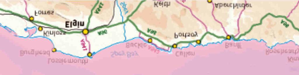
172 KEY 58 0'0"N 58 0'0"N Offshore Export Cable Corridor Moray Offshore Windfarm (West) Limited This document is the property of contractors and sub-contractors and shall not be reproduced nor transmitted without prior written approval. Coull et all (1998) Marine Scotland Fisheries Sensitivity Maps Contains OS data Crown Copyright and database right '0"W '0"W '0"W '0"W '0"W '0"W '0"W '0"W '0"W 57 40'0"N '0"N 57 40'0"N 2 20'0"W '0"W '0"W '0"W '0"W '0"W '0"W '0"W '0"W '0"W '0"N 57 40'0"N 2 20'0"W '0"N Moray West Site Herring Spawning Grounds Whiting Spawning Grounds Sprat Spawning Grounds Plaice Spawning Grounds Sandeel Spawning Grounds Nephrops Spawning Grounds Cod Spawning Grounds Lemon Sole Spawning Grounds Horizontal Scale: 1:900,000 A4 Chart 0 10,000 20,000 Meters Geodetic Parameters: WGS84 UTM Zone 30N Produced: RC Reviewed: SM Approved: SM Date: 19/05/2017 Revision: C REF: PPW0090-GOE-MAP-0004 Figure 6.2.1: Spawning Grounds Moray Offshore Windfarm (West) Ltd

 Limited 2017.")


173 KEY 58 0'0"N 58 0'0"N Offshore Export Cable Corridor Contains OS data Crown Copyright and database right 2017 Moray Offshore Windfarm (West) Limited This document is the property of contractors and sub-contractors and shall not be reproduced nor transmitted without prior written approval. Coull et all (1998) Marine Scotland Fisheries Sensitivity Maps '0"W '0"W '0"W '0"W '0"W '0"W '0"W '0"W '0"W 57 40'0"N '0"N 57 40'0"N 2 20'0"W '0"W '0"W '0"W '0"W '0"W '0"W '0"W '0"W '0"W '0"N 57 40'0"N 2 20'0"W '0"N Moray West Site Sand Eel Nursery Grounds Sprat Nursery Grounds Herring Nursery Grounds Nephrops Nursery Grounds Plaice Nursery Grounds Lemon Sole Nursery Grounds Whiting Nursery Grounds Horizontal Scale: 1:900,000 A4 Chart 0 10,000 20,000 Meters Geodetic Parameters: WGS84 UTM Zone 30N Produced: RC Reviewed: SM Approved: SM Date: 19/05/2017 Revision: C REF: PPW0090-GOE-MAP-0005 Figure 6.2.2: Nursery Grounds Moray Offshore Windfarm (West) Ltd
174 KEY SeaZone Solutions, 2017, [L , ] Contains OS data Crown Copyright and database right Moray Offshore Windfarm (West) Limited This document is the property of contractors and sub-contractors and shall not be reproduced nor transmitted without prior written approval '0"W '0"W '0"W '0"N 57 30'0"N Offshore Export Cable Corridor Moray West Site Harbour Seal Counts >100 Bathymetry (meters) >10000 <=10000 <=5000 <=1000 <=500 <=100 <=50 <=20 <=10 >=0 Horizontal Scale: 1:750,000 A4 Chart 0 5,000 10,000 20,000 Meters Geodetic Parameters: WGS84 UTM Zone 30N Produced: RP Reviewed: RC Approved: SM Date: 23/05/2017 Revision: C REF: PPW0090-GOE-MAP006 Figure Harbour Seal August Haul Out Counts Moray Offshore Windfarm (West) Ltd
175 KEY Contains OS data Crown Copyright and database right Moray Offshore Windfarm (West) Limited This document is the property of contractors and sub-contractors and shall not be reproduced nor transmitted without prior written approval '0"W '0"W '0"W '0"N 57 30'0"N Offshore Export Cable Corridor Moray West Site Harbour Seal Density >6 Horizontal Scale: 1:750,000 A4 Chart 0 5,000 10,000 20,000 Meters Geodetic Parameters: WGS84 UTM Zone 30N Produced: RP Reviewed: RC Approved: SM Date: 23/05/2017 Revision: C REF: PPW0090-GOE-MAP007 Figure Harbour Seal Predicted Density (#/4x4km) Moray Offshore Windfarm (West) Ltd
176 KEY SeaZone Solutions, 2017, [L , ] Contains OS data Crown Copyright and database right Moray Offshore Windfarm (West) Limited This document is the property of contractors and sub-contractors and shall not be reproduced nor transmitted without prior written approval Offshore Export Cable Corridor Moray West Site Grey Seal Counts >100 Bathymetry (meters) >10000 <=10000 <=5000 <=1000 <=500 <=100 <=50 <=20 <=10 >=0 Horizontal Scale: 1:750,000 A4 Chart 0 5,000 10,000 20,000 Meters Geodetic Parameters: WGS84 UTM Zone 30N Produced: RP Reviewed: RC Approved: SM Date: 23/05/2017 Revision: C REF: PPW0090-GOE-MAP008 Figure Grey Seal August Haul Out Count Moray Offshore Windfarm (West) Ltd
177 '0"N KEY Moray West Site Moray Offshore Windfarm (West) Limited This document is the property of contractors and sub-contractors and shall not be reproduced nor transmitted without prior written approval. Contains OS data Crown Copyright and database right '0"W '0"W '0"W '0"W '0"W '0"W '0"W '0"W '0"W '0"W '0"N 58 0'0"N 57 40'0"N 57 20'0"N '0"W Offshore Export Cable Corridor 4 km Grid At-sea Usage of Grey Seals >50 Horizontal Scale: 1:1,000,000 A4 Chart 0 8,200 16,400 Meters Geodetic Parameters: WGS84 UTM Zone 30N Produced: RC Reviewed: SM Approved: SM Date: 19/05/2017 Revision: C REF: PPW0090-GOE-MAP-009 Figure 6.3.4: Grey Seal Density Moray Offshore Windfarm (West) Ltd
178 Contains OS data Crown Copyright and database right Moray Offshore Windfarm (West) Limited This document is the property of contractors and sub-contractors and shall not be reproduced nor transmitted without prior written approval '0"W '0"W '0"W '0"N 57 30'0"N KEY Offshore Export Cable Corridor Moray West Site Harbour Porpoise Density Horizontal Scale: 1:750,000 A4 Chart 0 5,000 10,000 20,000 Meters Geodetic Parameters: WGS84 UTM Zone 30N Produced: RP Reviewed: RC Approved: SM Date: 23/05/2017 Revision: C REF: PPW0090-GOE-MAP010 Moray Offshore Windfarm (West) Ltd Figure Harbour Porpoise Predicted Density (#/4x4km)
179 KEY Contains OS data Crown Copyright and database right Moray Offshore Windfarm (West) Limited This document is the property of contractors and sub-contractors and shall not be reproduced nor transmitted without prior written approval '0"W '0"W '0"W '0"N 57 30'0"N Offshore Export Cable Corridor Moray West Site Bottlenose Dolphin Density >1.00 Horizontal Scale: 1:750,000 A4 Chart 0 5,000 10,000 20,000 Meters Geodetic Parameters: WGS84 UTM Zone 30N Produced: RP Reviewed: RC Approved: SM Date: 23/05/2017 Revision: C REF: PPW0090-GOE-MAP011 Moray Offshore Windfarm (West) Ltd Figure Bottlenose Dolphin Predicted Density (#/4x4km)
180 Moray Offshore Windfarm (West) Limited This document is the property of contractors and sub-contractors and shall not be reproduced nor transmitted without prior written approval. SeaZone Solutions, 2017, [L , ] Contains OS data Crown Copyright and database right '0"W '0"W '0"W '0"W 58 20'0"N 57 30'0"N KEY Moray West Site Moray West Offshore Export Cable Corridor Moray West Aerial Surveys Autumn 2010 and Spring 2011!( Migration Surveys 2011 Tagging Surveys (Fulmar,!( Kittiwake, Guillemot and Razorbill) 2014 Great Black-backed Gull!( and Herring Gull Tagging Special Protection Area North Caithness Cliffs SPA East Caithness Cliffs SPA Troup, Pennan and Lion's Head SPA Ornithological Surveys MORL Boat-based Surveys (4 km Boundary) A4 Chart Horizontal Scale: 1:800, ,000 20,000 Meters Geodetic Parameters: WGS84 UTM Zone 30N Produced: HAZ Reviewed: SM Approved: RC Date: 19/05/2017 BOWL Boat-based Surveys BOWL Pre-construction Aerial Survey 2015 Moray East 2011 Aerial Marine Scotland Strategic Seabird Surveys TCE 2009 Aerial Surveys Bathymetry (metres) <=500 <=100 <=50 <=20 <=10 >=0 Revision: C REF: PPW0090-GOE-MAP-012 Figure Existing Datasets Moray Offshore Windfarm (West) Ltd
181 Offshore Export Cable Corridor Moray West Site E8 5,354,704 Study Area Landings ( ) by Species E7 1,588, E6 3,874,993 Key '0"N Haddock Nephrops '0"N Scallops E6 1,359,192 45E8 2,686,303 45E7 2,342,154 Squid Lobsters Mackerel 58 0'0"N Monks or Anglers Edible Crabs Cod Whiting Other species Horizontal Scale: 1:900, '0"N 10,000 Geodetic Parameters: A4 Chart Meters WGS84 UTM Zone 30N Revision: C REF: PPW0090-GOE-MAP '0"W Figure UK Landings ( ) by Species (Average ) 1 20'0"W 1 40'0"W 2 0'0"W 2 40'0"W 3 0'0"W 3 20'0"W 3 40'0"W 4 0'0"W E8 4,193,300 44E7 3,973, '0"W E6 2,178,066 20,000 Produced: TD Reviewed: RC Approved: SM Date: 19/05/ Moray Offshore Windfarm (West) Limited This document is the property of contractors and sub-contractors and shall not be reproduced nor transmitted without prior written approval. SeaZone Solutions, 2017 [L , ] Contains OS Data Crown Copyright and Database Right (2017) Moray Offshore Windfarm (West) Ltd
182 '0"N 46E8 5,354,704 46E7 1,588,092 Offshore Export Cable Corridor Moray West Site E6 3,874, Key Study Area Bottom otter trawls Landings ( ) by Method Pots Boat dredges '0"N Scottish seines E8 2,686,303 45E7 2,342,154 Bottom pair trawls Nephrops trawls Seinenets (not specified) Handlines and pole lines '0"N E6 1,359,192 Midwater otter trawls Otter twin trawls Other gear Horizontal Scale: 1:900, '0"N 10,000 Geodetic Parameters: WGS84 UTM Zone 30N Revision: C REF: PPW0090-GOE-MAP '0"W Figure UK Landings ( ) by Method (Average ) 1 20'0"W 1 40'0"W 2 0'0"W 2 40'0"W 3 0'0"W 3 20'0"W 3 40'0"W 4 0'0"W E8 4,193,300 44E7 3,973, '0"W E6 2,178,066 A4 Chart 20,000 Meters Produced: TD Reviewed: RC Approved: SM Date: 19/05/ Moray Offshore Windfarm (West) Limited This document is the property of contractors and sub-contractors and shall not be reproduced nor transmitted without prior written approval. SeaZone Solutions, 2017 [L , ] Contains OS Data Crown Copyright and Database Right (2017) Moray Offshore Windfarm (West) Ltd
183 '0"N KEY Moray Offshore Renewables Moray West Site SeaZone Solutions, 2017, [L , ] Moray Offshore Windfarm (West) Limited This document is the property of contractors and sub-contractors and shall not be reproduced nor transmitted without prior written approval '0"W '0"W " "! " " 3 0'0"W ÎÎ Î 2 40'0"W '0"N 57 40'0"N Moray East Site Offshore Export Cable Corridor (Moray West) Offshore Export Cable Corridor (Moray East) Beatrice Offshore Windfarm Beatrice Cable Corridor Beatrice Site Oil and Gas Platforms " Beatrice A (AD and AP) " Beatrice B " Beatrice C " Jacky Wind Farm! Beatrice Demonstrator Turbine Subsea Pipeline and Cable Pipeline Anchorages Î Î Subsea Cable Cullen Bay Port Long Î Portsoy Dredging Spoil Ground Horizontal Scale: 1:400,000 A4 Chart 0 5,000 10,000 Meters Geodetic Parameters: WGS84 UTM Zone 30N Produced: DS Reviewed: RC Approved: SM Date: 22/05/2017 Revision: A REF: PPW0090-GOE-MAP-015 Figure Navigational Features Moray Offshore Windfarm (West) Ltd Offshore Transmission Infrastructure
184 '0"N KEY Moray West Site Offshore Export Cable Corridor 10km Distance Radii Contains Ordnance Survey data Crown copyright and database right SeaZone Solutions, 2017, [L , ] Moray Offshore Windfarm (West) Limited This document is the property of contractors and sub-contractors and shall not be reproduced nor transmitted without prior written approval '0"W '0"W '0"W '0"W '0"W '0"W '0"W '0"N 58 0'0"N 57 40'0"N km SLVIA Study Area Boundary Bathymetry (m) >10000 Horizontal Scale: 1:650,000 A4 Chart 0 10,000 20,000 Meters Produced: LA Reviewed: RC Approved: SM <=10000 <=5000 <=1000 <=500 Geodetic Parameters: WGS84 UTM Zone 30N Date: 19/05/2017 <=100 <=50 <=20 <=10 >=0 Revision: F REF: PPW0090-GOE-MAP-016 Figure SLVIA Study Area Moray Offshore Windfarm (West) Ltd
185 '0"N KEY Moray West Site Offshore Export Cable Corridor Moray East Site Contains Ordnance Survey data Crown copyright and database right SeaZone Solutions, 2017, [L , ] Moray Offshore Windfarm (West) Limited This document is the property of contractors and sub-contractors and shall not be reproduced nor transmitted without prior written approval '0"W '0"W '0"W '0"W '0"W '0"W '0"W '0"N 58 0'0"N 57 40'0"N Beatrice Site 10km Distance Radii 50km SLVIA Study Area Boundary Bathymetry (m) >10000 Horizontal Scale: 1:650,000 A4 Chart 0 10,000 20,000 Meters Geodetic Parameters: WGS84 UTM Zone 30N Produced: LA Reviewed: RC Approved: SM <=10000 <=5000 <=1000 <=500 Date: 19/05/2017 <=100 <=50 <=20 <=10 >=0 Revision: F REF: PPW0090-GOE-MAP-017 Figure Development Areas Moray Offshore Windfarm (West) Ltd
186 '0"N ! KEY Moray West Site Offshore Export Cable Corridor 10km Distance Radii Copyright Scottish Natural Heritage. Contains Ordnance Survey data Crown copyright and database right SeaZone Solutions, 2017, [L , ] Moray Offshore Windfarm (West) Limited This document is the property of contractors and sub-contractors and shall not be reproduced nor transmitted without prior written approval '0"W ! 3 40'0"W Seascape Unit: Moray Firth! 3 20'0"W Seascape Unit: East Caithness & Sutherland Seascape Unit: North Aberdeenshire/Morayshire Coast 3 0'0"W '0"W ! 2 20'0"W '0"W '0"N 58 0'0"N 57 40'0"N km SLVIA Study Area Boundary Seascape Character Types: Coast <=500 >=0 Horizontal Scale: 1:650,000 A4 Chart 0 10,000 20,000 Meters Geodetic Parameters: WGS84 UTM Zone 30N Produced: LA Reviewed: RC Approved: SM Date: 19/05/2017 Coastal Island Deposition Coastline, Open Views Deposition Coasts of Islands Developed Inner Firths Enclosed Bays, Islands and Headlands Kyles and Sea Lochs Less Developed Inner Firths Low Rocky Island Coasts Narrow Coastal Shelf Outer Firth with Islands Outer Firths Remote High Cliffs Rocky Coastline / Open Sea Views Sounds, Narrows and Islands Bathymetry (m) >10000 <=10000 <=5000 <=1000 <=100 <=50 <=20 <=10 Revision: F REF: PPW0090-GOE-MAP-018 Figure National Seascape Types and Units Moray Offshore Windfarm (West) Ltd
187 '0"N 1 2 Moray West Site KEY 10km Distance Radii 50km SLVIA Study Area Boundary Offshore Export Cable Corridor Preliminary Viewpoint Location '0"N '0"N Duncansby Head Keiss Wick Sarclet Whaligoe steps Minor Road Lybster Latheron Dunbeath Morven Berriedale Navidale Brora Tarbat Ness Lighthouse Brughead Lossiemouth Harbour Buckie Bin Hill Portnockie Cullen Findlater Castle Sandend Portsoy Ferry Route (Kirkwall to Aberdeen) Bathymetry (m) 14 >10000 <=100 <=10000 <=50 <=5000 <=20 <=1000 <=10 <=500 >=0 Horizontal Scale: 1:480, , Geodetic Parameters: '0"W 3 20'0"W 3 0'0"W 2 40'0"W 2 20'0"W 2 0'0"W '0"W ,000 Meters WGS84 UTM Zone 30N Revision: F REF: PPW0090-GOE-MAP '0"N A3 Chart Produced: LA Reviewed: RC Approved: SM Date: 19/05/ Contains Ordnance Survey data Crown copyright and database right SeaZone Solutions, 2017, [L , ] Moray Offshore Windfarm (West) Limited This document is the property of contractors and sub-contractors and shall not be reproduced nor transmitted without prior written approval. 3 Figure Preliminary Viewpoint Locations Moray Offshore Windfarm (West) Ltd
 <=1000 <=500 transmitted without prior written approval. 6420000 321470!( 321469!(!(!(!(!(!(!(!(!(!(!(!(!(!(!(!(!(!(!(!(!(!(!(!(!(!(!(!(!(!( 208777, 208849, 248110, 298308")

![Contains Ordnance Survey dat[l052015.0003, 012009.001] a Crown copyright and database right 2017. Moray Offshore Windfarm (West) Limited 2017.](/docs-images/92/110951690/images/188-16.jpg "This document is the property of contractors and sub-contractors and shall not be reproduced nor 6400000 0 1,000 2,000 Meters 209580 209475 310578 272542209376 329560 310248!(!(!(!( 310251 310550!(!(!( 310250310573!")
188 !( !( KEY Moray West Site !(!( Offshore Export Cable Corridor!( HES dataset !( Bathymetry (metres) <=1000 <=500 transmitted without prior written approval !( !(!(!(!(!(!(!(!(!(!(!(!(!(!(!(!(!(!(!(!(!(!(!(!(!(!(!(!(!(!( , , , , , , , , , , , , , , , , , , , , , , , , , , , !(!(!(!(!(!(!(!(!(!(!(!(!(!(!(!(!(!(!(!(!(!(!(!(!(!(!(!(!(!( '0"N <=100 <=50 <=20 <=10 >=0 SeaZone Solutions, Contains Ordnance Survey dat[l , ] a Crown copyright and database right Moray Offshore Windfarm (West) Limited This document is the property of contractors and sub-contractors and shall not be reproduced nor ,000 2,000 Meters !(!(!(!( !(!(!( !( !(!(!(!( !( !(!(!(!(!(!( !(!(!(!(!( !(!( !( !( ,000 2,000 Meters 3 40'0"W !( !(!(!(!(!( !( !(!( !(!(!(!( '0"W '0"W !( !( !(!( !(!( !(!(!(!(!(!(!(!(!(!(!(!(!(!(!(!(!(!(!(!(!(!(!(!(!(!(!(!(!(!(!(!(!(!(!(!(!(!(!(!( 2 40'0"W '0"N Horizontal Scale: 1:400,000 A4 Chart 0 5,000 10,000 Meters Geodetic Parameters: WGS84 UTM Zone 30N Produced: KJF Reviewed: RC Approved: SM Date: 19/05/2017 Revision: E PPW0090-GOE-MAP-020 Figure Record Losses within Array and Export Cable Corridor Moray Offshore Windfarm (West) Ltd
Prepared by: Anatec Limited Presented to: The Crown Estate (TCE) Date: 25 th June 2012 Revision No.: 00
 Date: 25 th June 2012 Revision No.: 00") Strategic assessment of impacts on navigation of shipping and related effects on other marine activities arising from the development of Offshore Wind Farms in the UK REZ Prepared by: Anatec Limited Presented
Strategic assessment of impacts on navigation of shipping and related effects on other marine activities arising from the development of Offshore Wind Farms in the UK REZ Prepared by: Anatec Limited Presented
Proposed Marwick Head Wave Farm Request for a Scoping Opinion December 2012
 Proposed Marwick Head Wave Farm Request for a Scoping Opinion December 2012 This page is intentionally blank CONTENTS CONTENTS I EXECUTIVE SUMMARY 1 1. INTRODUCTION 4 1.1. BACKGROUND 4 1.2. DOCUMENT PURPOSE
National Grid s commitments when undertaking works in the UK. Our stakeholder, community and amenity policy
 National Grid s commitments when undertaking works in the UK Our stakeholder, community and amenity policy Introduction This document describes the ten commitments we have made to the way we carry out
Western Isles HVDC Link Consultation
 Western Isles HVDC Link Consultation Western Isles HVDC Link Consultation Who we are We are Scottish and Southern Electricity Networks, operating under licence as Scottish Hydro Electric Transmission Plc
PORT OF POOLE DEVELOPING FOR THE FUTURE
 PORT OF POOLE DEVELOPING FOR THE FUTURE Nick Clarke & Kim Moore INTRODUCTION Masterplan the benefits EIA & SEA (Strategic Environmental ) Changes in Marine Licensing. PORT DEVELOPMENT PROCESS Development
AN OVERVIEW OF THE STATE OF MARINE SPATIAL PLANNING IN THE MEDITERRANEAN COUNTRIES MALTA REPORT
 AN OVERVIEW OF THE STATE OF MARINE SPATIAL PLANNING IN THE MEDITERRANEAN COUNTRIES MALTA REPORT Malta Environment & Planning Authority May 2007 AN OVERVIEW OF THE STATE OF MARINE SPATIAL PLANNING IN THE
East Anglia TWO and East Anglia ONE North. Summary and Approach to Site Selection
 East Anglia TWO and East Anglia ONE North Summary and Approach to Site Selection 1 Introduction ScottishPower Renewables (SPR) has recently concluded work in order to inform our onshore site selection
Possible new marine Special Areas of Conservation and Special Protection Areas in Wales
 Possible new marine Special Areas of Conservation and Special Protection Areas in Wales Photo credit - PGH Evans / Seawatch Foundation // February 2015 www.naturalresourceswales.gov.uk This leaflet provides
PROPOSALS FOR AQUIND INTERCONNECTOR
 PROPOSALS FOR AQUIND INTERCONNECTOR Introduction AQUIND Limited is the developer of AQUIND Interconnector, a new underground and subsea electric power transmission link that will connect the UK and French
Vattenfall Wind Power Ltd. Thanet Extension Offshore Wind Farm Preliminary Environmental Information Report Volume 1 Chapter 1: Introduction
 Vattenfall Wind Power Ltd Thanet Extension Offshore Wind Farm Preliminary Environmental Information Report Volume 1 Chapter 1: Introduction Vattenfall Wind Power Ltd Thanet Extension Offshore Wind Farm
Contents: Part 1 Response to questions about the draft Marine Plans Part 2 Response to questions about the Sustainability Appraisal exercise
 Marine Planning Team Marine Management Organisation Response submitted through on-line questionnaire Response submitted: 8 th October 2013 Our ref: MMO/marine planning Your ref: Telephone: 07798 653897
Seagreen Wind Energy Limited C/o SSE Renewables 1 Waterloo Street Glasgow G2 6AY
 Date: 30 th March 2018 Ref: A4MR-SEAG-Z-LGL810-SLE-548 Dr. Nicola Bain Marine Renewables Section Leader Licensing Operations Team Marine Scotland Marine Laboratory 375 Victoria Road Aberdeen AB11 9DB Seagreen
Aedán Smith Head of Planning, RSPB Scotland
 The RSPB s vision for offshore wind Challenges and opportunities Aedán Smith Head of Planning, RSPB Scotland This group of self-serving and Illinformed individuals fought us harder than any other group.
PROPOSALS FOR AQUIND INTERCONNECTOR
 PROPOSALS FOR AQUIND INTERCONNECTOR Get in touch To find out more about AQUIND Interconnector, please visit our consultation website at https://aquindconsultation.co.uk If you have any questions, you can
Orkney Electricity Network Reinforcement Stakeholder Consultation Response. August 2014
 Orkney Electricity Network Reinforcement August 2014 Introduction In February 2014 Scottish and Southern Energy Power Distribution 1 (SSEPD) undertook a stakeholder consultation Connecting Orkney: Electricity
BAY OF SKAILL SUBSTATION - ORKNEY CAITHNESS CONNECTION
 BAY OF SKAILL SUBSTATION - ORKNEY CAITHNESS CONNECTION Helping to secure a Renewable Future: Orkney Caithness Connection Scottish Hydro Electric Transmission Plc Scottish Hydro Electric Transmission Plc
Empire Wind Offshore Wind Farm OCS-A 0512
 Empire Wind Offshore Wind Farm OCS-A 0512 Fisheries Liaison & Outline Classification: Open Status: Draft Expiry date: 28-07-04 Page 1 of 13 Title: Empire Wind Fisheries Liaison & Outline Document no. :
FORT CUMBERLAND, EASTNEY, PORTSMOUTH PO4 9LD Telephone Facsimile
 Offshore Energy SEA 2 Scoping The Department of Energy and Climate Change 4th Floor Atholl House 86-88 Guild Street Aberdeen AB11 6AR Our ref: DECC/SEA offshore 15 th April 2010 Dear Sir/Madam UK Offshore
An Overview of the Role and Work of the European Subsea Cables Association (ESCA)
") An Overview of the Role and Work of the European Subsea Cables Association (ESCA) What is ESCA and how is it relevant to You and the broader Subsea Cable Sector? www.escaeu.org ESCA is THE Independent
An Overview of the Role and Work of the European Subsea Cables Association (ESCA) What is ESCA and how is it relevant to You and the broader Subsea Cable Sector? www.escaeu.org ESCA is THE Independent
The offshore wind puzzle getting the pieces right
 ENERGY The offshore wind puzzle getting the pieces right FOWIND workshop Paul Reynolds 09/09/14 1 SAFER, SMARTER, GREENER World s largest dedicated renewable energy consultancy 2 Content & Key messages
ABERDEEN HARBOUR EXPANSION PROJECT November Volume 2: Environmental Statement
 ABERDEEN HARBOUR EXPANSION PROJECT November 2015 Volume 2: Environmental Statement Chapter 23: OTHER USERS 23. OTHER USERS 23.1 Introduction This chapter assesses the potential effects on other users
Neart na Gaoithe Offshore Wind Farm. Project Update 2018
 Neart na Gaoithe Offshore Wind Farm Project Update 2018 1 2 Figure 1: Location of proposed Neart na Gaoithe Offshore Wind Farm Contents Neart na Gaoithe Offshore Wind Farm 2 Key Components of an Offshore
ORKNEY CAITHNESS CONNECTION
 Helping to secure a Renewable Future: Orkney Caithness Connection - 132kV Scottish Hydro Electric Transmission Limited Scottish Hydro Electric Transmission Limited (SHETL) is part of SSE plc and is the
RURAL ECONOMY AND CONNECTIVITY COMMITTEE SALMON FARMING IN SCOTLAND SUBMISSION FROM ANNE-MICHELLE SLATER. School of Law, University of Aberdeen
 RURAL ECONOMY AND CONNECTIVITY COMMITTEE SALMON FARMING IN SCOTLAND SUBMISSION FROM ANNE-MICHELLE SLATER School of Law, University of Aberdeen In Aquaculture Law and Policy Global, Regional and National
Transmission Innovation Strategy
 Transmission Innovation Strategy Contents 1 Value-Driven Innovation 2 Our Network Vision 3 Our Stakeholders 4 Principal Business Drivers 5 Delivering Innovation Our interpretation of Innovation: We see
Shetland HVDC Link Project. Consultation, August 2016
 Shetland HVDC Link Project Consultation, August 2016 Welcome Welcome to this public exhibition on Scottish Hydro Electric (SHE) Transmission's proposed Shetland HVDC Link (the Project) between Shetland
Galloper Wind Farm Limited. Galloper Wind Farm Project Environmental Statement Chapter 1 Introduction October 2011 Document Reference 5.2.
 Galloper Wind Farm Limited Galloper Wind Farm Project Environmental Statement Chapter 1 Introduction October 2011 Document Reference 5.2.1 Document title Galloper Wind Farm Project Environmental Statement
Environmental Audit Committee Inquiry on 25 Year Environment Plan
 Environmental Audit Committee Inquiry on 25 Year Environment Plan Written Evidence submitted by Honor Frost Foundation (HFF) Steering Committee on Underwater Cultural Heritage 1. The HFF Steering Committee
Written Comment: Sydney Basin and Orpheus Graben Areas
 December 23, 2015 Written Comment: Sydney Basin and Orpheus Graben Areas Based on the draft Strategic Environmental Assessment 202 Brownlow Ave. Suite A305, Cambridge 1 Dartmouth, NS B3B 1T5 (902) 425-4774
Repsol E&P T&T Ltd is one of the upstream Repsol YPF Group of companies currently operating in more than 20 countries around the world.
 1 INTRODUCTION 1.1 Background Repsol E&P T&T Ltd is one of the upstream Repsol YPF Group of companies currently operating in more than 20 countries around the world. Repsol E&P has become one of the major
An Introduction to KIS-ORCA
 An Introduction to KIS-ORCA The KIS-ORCA project is the gold standard of its type and so much more than just a website. By being part of KIS- ORCA you are demonstrating that you are doing all that is reasonably
Transmission Innovation Strategy
 1 Transmission Innovation Strategy 2 Contents 1. Value-Driven Innovation 2 2. Our Network Vision 3 3. Our Stakeholders 4 4. Principal Business Drivers 4 5. Delivering Innovation 5 Our interpretation of
ENVIRONMENTAL ASSESSMENT (EA) PROCESS
 PROCESS") ENVIRONMENTAL ASSESSMENT (EA) PROCESS THE PROJECT Emera Newfoundland & Labrador (ENL) is seeking environmental regulatory approvals to construct and operate the Maritime Link Transmission Project between
ENVIRONMENTAL ASSESSMENT (EA) PROCESS THE PROJECT Emera Newfoundland & Labrador (ENL) is seeking environmental regulatory approvals to construct and operate the Maritime Link Transmission Project between
Arctic Shipping Navigating the Legal Landscape for marine infrastructure and Off-Shore Development
 Arctic Shipping Navigating the Legal Landscape for marine infrastructure and Off-Shore Development Peter G. Pamel Partner Connecticut Maritime Association SHIPPING 2012 Hilton Stamford March 21 st, 2012
Emerging Subsea Networks
 FIBRE-TO-PLATFORM CONNECTIVITY, WORKING IN THE 500m ZONE Andrew Lloyd (Global Marine Systems Limited) Email: andrew.lloyd@globalmarinesystems.com Global Marine Systems Ltd, New Saxon House, 1 Winsford
The Marine Plan for the Isle of Man. Dr Peter McEvoy Marine Spatial Planning Project Officer Isle of Man Government
 The Marine Plan for the Isle of Man Dr Peter McEvoy Marine Spatial Planning Project Officer Isle of Man Government Irish Sea Maritime Forum, 2 nd Annual Conference, Glasgow 21 st May 2013 Aims of the project
SCOPE OF SERVICES FOR STAGE 1 TECHNICAL ASSESSMENT TO DETERMINE THE COMPATIBILITY OF THE DEVELOPMENT OF AN ELECTRICITY INTERCONNECTOR FACILITY WITH
 SCOPE OF SERVICES FOR STAGE 1 TECHNICAL ASSESSMENT TO DETERMINE THE COMPATIBILITY OF THE DEVELOPMENT OF AN ELECTRICITY INTERCONNECTOR FACILITY WITH AIRFIELD OPERATIONS AT DAEDALUS AIRFIELD, LEE_ON_THE_SOLENT
Wylfa Nuclear Power Station
 Wylfa Nuclear Power Station Environmental Statement Pre-Application Opinion. February 2013 Crown copyright 2011 First published February 2013 You may reuse this information (excluding logos) free of charge
Introductory remarks
 Introductory remarks This document is a draft of a permit for Gaz System to construct a natural gas pipeline on the Danish continental shelf in the Baltic Sea. It should be emphasised that it has not yet
Coastal Virginia Offshore Wind partnership with Orsted. February 2018 Update
 Coastal Virginia Offshore Wind partnership with Orsted February 2018 Update 1 Coastal Virginia Offshore Wind Project: Lease Update Research and Commercial Lease Areas Phase 1 CVOW Lease Area (2,135 acres)
Draft Myanmar Environmental Impact Assessment (EIA) Procedures: Comments 1 on aspects relevant to Offshore Oil and Gas Exploration and Production
 Procedures: Comments 1 on aspects relevant to Offshore Oil and Gas Exploration and Production") Draft Myanmar Environmental Impact Assessment (EIA) Procedures: Comments 1 on aspects relevant to Offshore Oil and Gas Exploration and Production Appropriate EIA phasing for Petroleum E&P Activities According
Draft Myanmar Environmental Impact Assessment (EIA) Procedures: Comments 1 on aspects relevant to Offshore Oil and Gas Exploration and Production Appropriate EIA phasing for Petroleum E&P Activities According
SUSTAINABLE GROWTH AGREEMENT STIRLING COUNCIL AND SCOTTISH ENVIRONMENT PROTECTION AGENCY
 SUSTAINABLE GROWTH AGREEMENT STIRLING COUNCIL AND SCOTTISH ENVIRONMENT PROTECTION AGENCY 27 AUGUST 2018 Sustainable Growth Agreement Stirling Council and Scottish Environment Protection Agency 3 OUR JOINT
Founding Manifesto Friends of Floating Offshore Wind 18 May 2016
 Founding Manifesto Friends of Floating Offshore Wind 18 May 2016 Members: Pilot Offshore Renewables Hexicon RES Offshore IDEOL Floating Power Plant Glosten PelaStar Principle Power Inc. Atkins ACS Cobra
Post Consent Monitoring What is happening? Jim Mckie Marine Scotland, Marine Laboratory, Aberdeen
 Post Consent Monitoring What is happening? Jim Mckie Marine Scotland, Marine Laboratory, Aberdeen Today s presentation Consented Projects Specific issues and questions Opportunities for collaboration Protocol
Marine planning and aquaculture. Stacey Clarke
 Marine planning and aquaculture Stacey Clarke Contents Background to marine planning Implementation of plans and tools Aquaculture in English marine plans Aquaculture in other plans Summary The Marine
RV Investigator Voyage Deliverables
 Voyage Deliverables April 2016 CONTENTS 1. Purpose... 1 2. Background... 1 3. Marine National Facility (MNF)... 1 4.... 1 4.1. MNF Granted Voyages (GV)... 2 4.2. MNF User-Funded Voyages (UFV)... 2 5. Governance...
Cyprus Presidency of the Council of the European Union
 Cyprus Presidency of the Council of the European Union Declaration of the European Ministers responsible for the Integrated Maritime Policy and the European Commission, on a Marine and Maritime Agenda
EurOCEAN The Galway Declaration
 Celebrating European Marine Science Building the European Research Area Communicating Marine Science Galway (Ireland) 10 th 13 th May 2004. EurOCEAN 2004. The Galway Declaration To ensure that recognition
PD 6900:2015. Environmental impact assessment for offshore renewable energy projects Guide
 Environmental impact assessment for offshore renewable energy projects Guide Publishing and copyright information The BSI copyright notice displayed in this document indicates when the document was last
Please send your responses by to: This consultation closes on Friday, 8 April 2016.
 CONSULTATION OF STAKEHOLDERS ON POTENTIAL PRIORITIES FOR RESEARCH AND INNOVATION IN THE 2018-2020 WORK PROGRAMME OF HORIZON 2020 SOCIETAL CHALLENGE 5 'CLIMATE ACTION, ENVIRONMENT, RESOURCE EFFICIENCY AND
CHAPTER TWENTY COOPERATION. The objective of this Chapter is to facilitate the establishment of close cooperation aimed, inter alia, at:
 CHAPTER TWENTY COOPERATION ARTICLE 20.1: OBJECTIVE The objective of this Chapter is to facilitate the establishment of close cooperation aimed, inter alia, at: strengthening the capacities of the Parties
Marine Scotland Science: Oil and gas survey work. Peter Hayes Offshore Energy Environmental Advice Group
 Marine Scotland Science: Oil and gas survey work Peter Hayes Offshore Energy Environmental Advice Group SCOTTISH GOVERNMENT Overview Background to MS/MSS Oil and gas involvement Offshore Monitoring Scale
Offshore Renewables Institute
 Offshore Renewables Institute Introducing the Offshore Renewables Institute (ORI) About Us We bring together experts and expertise from across a broad university partnership: the University of Dundee;
Integrated Marine Data and Information System
 imardis Integrated Marine Data and Information System David Mills Graham Worley, Thomas Prebble, Gwyn Roberts, Cathy Blakey http://www.imardis.org Introduction Lessons learnt in SEACAMS 1 Collaborative
Model project plan for Borssele (Innovation) Wind Farm Site V
 Wind Farm Site V") Model project plan for Borssele (Innovation) Wind Farm Site V Tips on how to draft your application: This project plan should be used to give a description of the project for which you are applying for
Model project plan for Borssele (Innovation) Wind Farm Site V Tips on how to draft your application: This project plan should be used to give a description of the project for which you are applying for
Marine Knowledge Infrastructure
 Marine Knowledge Infrastructure Who are you? What is your name? (Family name then forenames) This will not be published. Hall, Stephen what is your contact e-mail? sph@noc.soton.ac.uk You can either reply
Marine Renewable-energy Application
 Marine Renewable-energy Application OFFICE USE ONLY Date Received: Application #: Time Received: Date of Complete Application: Received by: Processed by: Type of Application Permit (unconnected) Permit
Tidal Energy. Transmission & Distribution Network. Wind Energy. Offshore Substation. Onshore Substation. Tidal Stream Energy.
 Offshore Renewables Tidal Energy Transmission & Distribution Network Offshore Substation Wind Energy Onshore Substation Tidal Stream Energy Consumer Atkins in Offshore Renewables The offshore wind journey
Appendix 8. Potential Consultees
 Local Authorities Dorset County Council Bournemouth Borough Council Poole Borough Council Purbeck District Council West Dorset District Council Weymouth and Portland Borough Council Town and Parish Councils
The Kendoon to Tongland 132kV Reinforcement Project. Underground Cable Study: Our Approach
 The Kendoon to Tongland 132kV Reinforcement Project Underground Cable Study: Our Approach November 2018 Kendoon to Tongland Reinforcement (KTR) Project SP Energy Networks November 2018 This note provides
Marine Institute Job Description
 Marine Institute Job Description Position Contract Service Group Location Temporary Scientific and Technical Officer (STO) Test Site Support Temporary Specified Purpose Contract for up to two years (FORESEA
Goal: Effective Decision Making
 Goal: Effective Decision Making Objective 1. Enhance inter-agency coordination Focus on aspects of governmental decision-making (NEPA and other existing siting/regulatory programs) related to marine energy
Draft of the Spatial Offshore Grid Plan for the German Exclusive Economic Zone of the Baltic Sea 2016/2017. unofficial translation
 Draft of the Spatial Offshore Grid Plan for the German Exclusive Economic Zone of the Baltic Sea 2016/2017 unofficial translation Hamburg, June 2017 Content 1 THE SPATIAL OFFSHORE GRID PLAN... 1 1.1 Legal
THE BLUEMED INITIATIVE AND ITS STRATEGIC RESEARCH AGENDA
 THE BLUEMED INITIATIVE AND ITS STRATEGIC RESEARCH AGENDA Pierpaolo Campostrini CORILA Managing Director & IT Delegation Horizon2020 SC2 committee & ExCom of the Management Board of JPI Oceans BLUEMED ad
REPORT OF DIRECTOR OF CITY OPERATIONS AGENDA ITEM: 7 PORTFOLIO: TRANSPORT, PLANNING & SUSTAINABILITY (COUNCILLOR RAMESH PATEL)
") CITY OF CARDIFF COUNCIL CYNGOR DINAS CAERDYDD CABINET MEETING: 14 JULY 2016 CARDIFF STATUE AND MONUMENT PROTOCOL REPORT OF DIRECTOR OF CITY OPERATIONS AGENDA ITEM: 7 PORTFOLIO: TRANSPORT, PLANNING & SUSTAINABILITY
CITY OF CARDIFF COUNCIL CYNGOR DINAS CAERDYDD CABINET MEETING: 14 JULY 2016 CARDIFF STATUE AND MONUMENT PROTOCOL REPORT OF DIRECTOR OF CITY OPERATIONS AGENDA ITEM: 7 PORTFOLIO: TRANSPORT, PLANNING & SUSTAINABILITY
UK offshore wind industry progress to cost reduction
 UK offshore wind industry progress to cost reduction Mike Newman, Innovation manager 30 September 2015 Agenda 1. Introduction to ORE Catapult 2. Cost Reduction Monitoring Framework (CRMF) 2014 3. CRMF
Draft Potential Conditions
 Draft Potential Conditions The following potential conditions in relation to the Shelburne Basin Venture Exploration Drilling Project (the Designated Project) are being considered by the Canadian Environmental
FORTH CROSSING BILL OBJECTION 88 RSPB SCOTLAND FORTH REPLACEMENT CROSSING: ENVIRONMENTAL STATEMENT
 FORTH CROSSING BILL OBJECTION 88 RSPB SCOTLAND FORTH REPLACEMENT CROSSING: ENVIRONMENTAL STATEMENT We refer to the above document which has been produced by Jacobs Arup on behalf of Transport Scotland.
Marine Institute Job Description
 Position Contract Service Group Location Marine Institute Job Description Scientific and Technical Officer (STO) Ocean Energy Temporary Specified Purpose Contract up to 31 st 2017 Ocean Science and Information
PAPUA NEW GUINEA HYDROGRAPHIC SERVICE
 PAPUA NEW GUINEA HYDROGRAPHIC SERVICE IHO SOUTH WEST PACIFIC HYDROGRAPHIC COMMISSION (SWPHC) 9 th Meeting Port Moresby, Papua New Guinea, 10-11 March 2007 SWPHC9-01PNG 1. INTRODUCTION 9 th SOUTH WEST PACIFIC
Offshore Renewable Energy Catapult
 Offshore Renewable Energy 7 s s: A long-term vision for innovation & growth The centres have been set up to make real changes to the way innovation happens in the UK to make things faster, less risky and
Marine Institute Job Description
 Marine Institute Job Description 02-02-2015 Position Contract Service Group Location Scientific & Technical Officer, Hydrographic Data Processor (INFOMAR) Temporary Specified Purpose, up to end 2018 (INFOMAR
Wind Energy Technology Roadmap
 Wind Energy Technology Roadmap Making Wind the most competitive energy source Nicolas Fichaux, TPWind Secretariat 1 TPWind involvement in SET-Plan process SRA / MDS Programme Report / Communication Hearings
Environmental Designations in Dorset. Dr Annabel King, Senior Ecologist, DCC
 Environmental Designations in Dorset Dr Annabel King, Senior Ecologist, DCC Annabel.king@dorsetcc.gov.uk 07779 428 378 Underlying legislation Bern Convention (Convention on the Conservation of European
(EC) ), 11(8) 347/ /2009, (EC)
 ), 11(8) 347/ /2009, (EC)") ENTSOs consistent and interlinked electricity and gas model in accordance with Article 11(8) of Regulation (EU) No 347/2013 of the European Parliament and of the Council of 17 April 2013 21 December 2016
ENTSOs consistent and interlinked electricity and gas model in accordance with Article 11(8) of Regulation (EU) No 347/2013 of the European Parliament and of the Council of 17 April 2013 21 December 2016
Driving Cost Reductions in Offshore Wind THE LEANWIND PROJECT FINAL PUBLICATION
 Driving Cost Reductions in Offshore Wind THE LEANWIND PROJECT FINAL PUBLICATION This project has received funding from the European Union s Co-funded by the Intelligent Energy Europe Seventh Programme
EIA FOR EXPLORATION DRILLING WITHIN BLOCK ER236, OFFSHORE OF THE EAST COAST OF SOUTH AFRICA. Background Information Document. Purpose of this Document
 Background Information Document EIA FOR EXPLORATION DRILLING WITHIN BLOCK ER236, OFFSHORE OF THE EAST COAST OF SOUTH AFRICA Purpose of this Document Eni South Africa BV (Eni), and Sasol Africa Limited
Developing the MAREMAP Toolbox to allow the Marine Renewable Energy sector to access NERC data. September 2013
 Developing the MAREMAP Toolbox to allow the Marine Renewable Energy sector to access NERC data September 2013 Executive Summary The Marine Environmental Mapping Programme (MAREMAP) is a collaboration between
For personal use only
 Company Announcement, October 11 th, 2017 First of Three Key Studies Approved: Kvanefjeld Maritime Safety Study The Danish Maritime Authority acting on behalf of the Government of Greenland has now approved
A New Marine Protected Areas Act
 Submission to the Minister of Conservation, the Minister for the Environment, and the Minister for Primary Industries Dr Jan Wright Parliamentary Commissioner for the Environment 11 March 2016 Contents
Marine Institute, Oranmore, Co. Galway
 Position Contract Service Group Location Marine Institute Job Description Temporary Scientific & Technical Officer (STO) Nephrops UWTV Surveys and Demersal Stock Assessment Temporary specified purpose
HSE and Quality. Sisimiut, 10th December FING: Arctic Region Oil & Gas Seminar in Training and Education
 HSE and Quality Sisimiut, 10th December 2013 FING: Arctic Region Oil & Gas Seminar in Training and Education 1 Arctic Issues Above ground challenges FING: Arctic Region Oil & Gas Seminar in Training and
Blue growth. Stijn Billiet. DG Maritime Affairs and Fisheries
 Blue growth Stijn Billiet DG Maritime Affairs and Fisheries Overview The EU's blue economy is already significant 550 billion EUR Gross Value Added (4% of the EU economy), 5 million jobs EU is global market
Offshore wind. A new journey, a proven track record
 Offshore wind A new journey, a proven track record Petrofac is a leading provider of services to the international energy industry. We support our customers to unlock the potential of their assets; on
-PILOT & Industry development -Decommissioning. Audrey Banner Head of Offshore Decommissioning Unit, DECC
 -PILOT & Industry development -Decommissioning Audrey Banner Head of Offshore Decommissioning Unit, DECC PILOT Joint Industry/Government Strategic Forum Membership includes; 8 members of the board of Oil
Who we are. What is the difference between Transmission and Distribution? Overview of Transmission projects. Our responsibilities
 Who we are We are Scottish and Southern Electricity Networks, operating under license as Scottish Hydro Electric Transmission plc (SHE Transmission) for the transmission of electricity in the north of
GOVERNING BODY MEETING in Public 25 April 2018 Agenda Item 3.2
 GOVERNING BODY MEETING in Public 25 April 2018 Paper Title Paper Author(s) Jerry Hawker Accountable Officer NHS Eastern Cheshire CCG The Future of CCG Commissioning in Cheshire Alison Lee Accountable Officer
The INTERREG IV(a) Fostering Long Term Initiatives in Ports project Newhaven Port and Properties Ltd cross border workshop
 Fostering Long Term Initiatives in Ports project Newhaven Port and Properties Ltd cross border workshop") The INTERREG IV(a) Fostering Long Term Initiatives in Ports project Newhaven Port and Properties Ltd cross border workshop PORT PLANNING AND DEVELOPMENT FOR A SUSTAINABLE FUTURE PLANIFICATION, GESTION
The INTERREG IV(a) Fostering Long Term Initiatives in Ports project Newhaven Port and Properties Ltd cross border workshop PORT PLANNING AND DEVELOPMENT FOR A SUSTAINABLE FUTURE PLANIFICATION, GESTION
Office for Nuclear Regulation
 Office for Nuclear Regulation Redgrave Court Merton Road Bootle Merseyside L20 7HS www.hse.gov.uk/nuclear PROJECT ASSESSMENT REPORT Report Identifier: ONR-Policy-all-PAR-11-001 Revision: 2 Project: Implementation
Marine Institute Job Description
 Marine Institute Job Description Position Contract Service Group Location Temporary Scientific & Technical Officer (STO), Hydrographic Data Processor (INFOMAR) Temporary specified purpose contract for
North East England: Offshore wind market opportunities
 North East England: Offshore wind market opportunities 1 UK overview The UK offshore wind programme is the largest in the world, and is expected to form around half of the European market in the next 10
Joint - Jobs, Enterprise and Innovation. Opening Statement. Brian Hogan Marine Survey Office. Date: 21 September 2017
 Joint - Jobs, Enterprise and Innovation Opening Statement Brian Hogan Marine Survey Office Date: 21 September 2017 I thank the Chairman and Committee Members for inviting me here today. The issues which
Chapter 1 Introduction
 Chapter 1 Introduction TABLE OF CONTENTS 1 INTRODUCTION...1-2 1.1 General...1-2 1.2 Background to the SCP...1-2 1.3 Rationale for SCPX...1-3 1.4 SCP Operator: SCPC and BP relationship...1-5 1.5 ESIA Process...1-5
Government Policy Statement on Gas Governance
 Government Policy Statement on Gas Governance Hon David Parker Minister of Energy April 2008 Introduction The New Zealand Energy Strategy ( NZES ) sets out the Government s vision of a sustainable, low
Environmental and non-technical impacts of lean principles applied to offshore wind farms
 Environmental and non-technical impacts of lean principles applied to offshore wind farms 28 th September 2016 Mihaela DRAGAN Environment & Planning Analyst, WindEurope Project supported within the Ocean
TKI Wind op Zee. Program
 TKI Wind op Zee Program 2018-2019 Version: Final version Date: December 2017 Table of Contents 1. INTRODUCTION 3 2. TOPICS HIGHLIGHTED DURING THE TKI WIND OP ZEE PROGRAMME 5 TOPIC 1 COST REDUCTION AND
Westray South. SSE Renewables the offshore developer. Our core purpose is to provide the energy people need in a reliable and sustainable way.
 SSE Renewables the offshore developer SSE Renewables (SSER) is the renewable energy development division of SSE plc. We are responsible for the development of all marine energy projects as well as the
The BLUEMED Initiative: RESEARCH AND INNOVATION INITIATIVE FOR BLUE JOBS AND GROWTH IN THE MEDITERRANEAN
 Maritime Spatial Planning in the, an occasion for Blue Growth Rome, 27 th February 2017 The BLUEMED Initiative: RESEARCH AND INNOVATION INITIATIVE FOR BLUE JOBS AND GROWTH IN THE MEDITERRANEAN Enrico Brugnoli,
Kinsale Area Gas Fields Decommissioning Project Information Leaflet
 Kinsale Area s Decommissioning Project Information Leaflet About Kinsale Energy PSE Kinsale Energy Limited has been operating a number of gas fields in the Celtic Sea, off the County Cork coast, since
Policy Research Corporation
 Policy Research Corporation SOUND SOLUTIONS BASED ON SCIENTIFIC RESEARCH The role of Maritime Clusters to enhance the strength and development of maritime sectors Country report Denmark INTRODUCTION TO